
Days 10 & 11 of Lupe’s 2nd Summer of 2021 Dingo Vacation to Wyoming!
7-1-21, 7:00 AM, Holmes Cave trailhead 5 miles NW of Togwotee Pass (MP 20.7 of Hwy 287/26) – About ready to head out. Despite yesterday’s long trek to North Breccia Cliffs (11,240 ft.), Lupe had already been awake and alert when SPHP came to this morning. SPHP, on the other paw, was still feeling the effects, but no worries. This was going to be a rest day! Lupe didn’t have that far to go, and the RAV4 would get her there.
Hitting Hwy 287/26, SPHP turned R. Only 3 miles NW was a L turn onto USFS Road No. 30100, which was narrow, but in great shape. Quickly crossing Blackrock Creek, No. 30100 then went 7 or 8 miles SW through the forest, eventually reaching a signed intersection with No. 30160.
Sticking with No. 30100, SPHP turned L. The road wound downhill for a mile before reaching the South Fork of Spread Creek. After following this stream S for 2 miles, No. 30100 turned sharply L to cross it. Not the way to go!
Another road continued straight S from here. No signage, but this was USFS Road No. 30250, and was the way to go. During the next 4 miles, No. 30250 made a sharp turn to the R (W), climbed steeply, then leveled out and became quite stony along some stretches before reaching the E end of Leidy Lake.
SPHP parked the RAV4 at a nice flat spot near the dam, and that’s where it remained the rest of the day, most of the time with a snoozing Dingo inside. Lupe ventured out occasionally to cool off in Leidy Creek, go for walks along Leidy Lake, or chase her squeaker ball. In the afternoon, the sky clouded up. Thunder rumbled for 2 hours, culminating in a brief rain shower, but that was it for excitement. Evening came, and so did the mosquitoes.
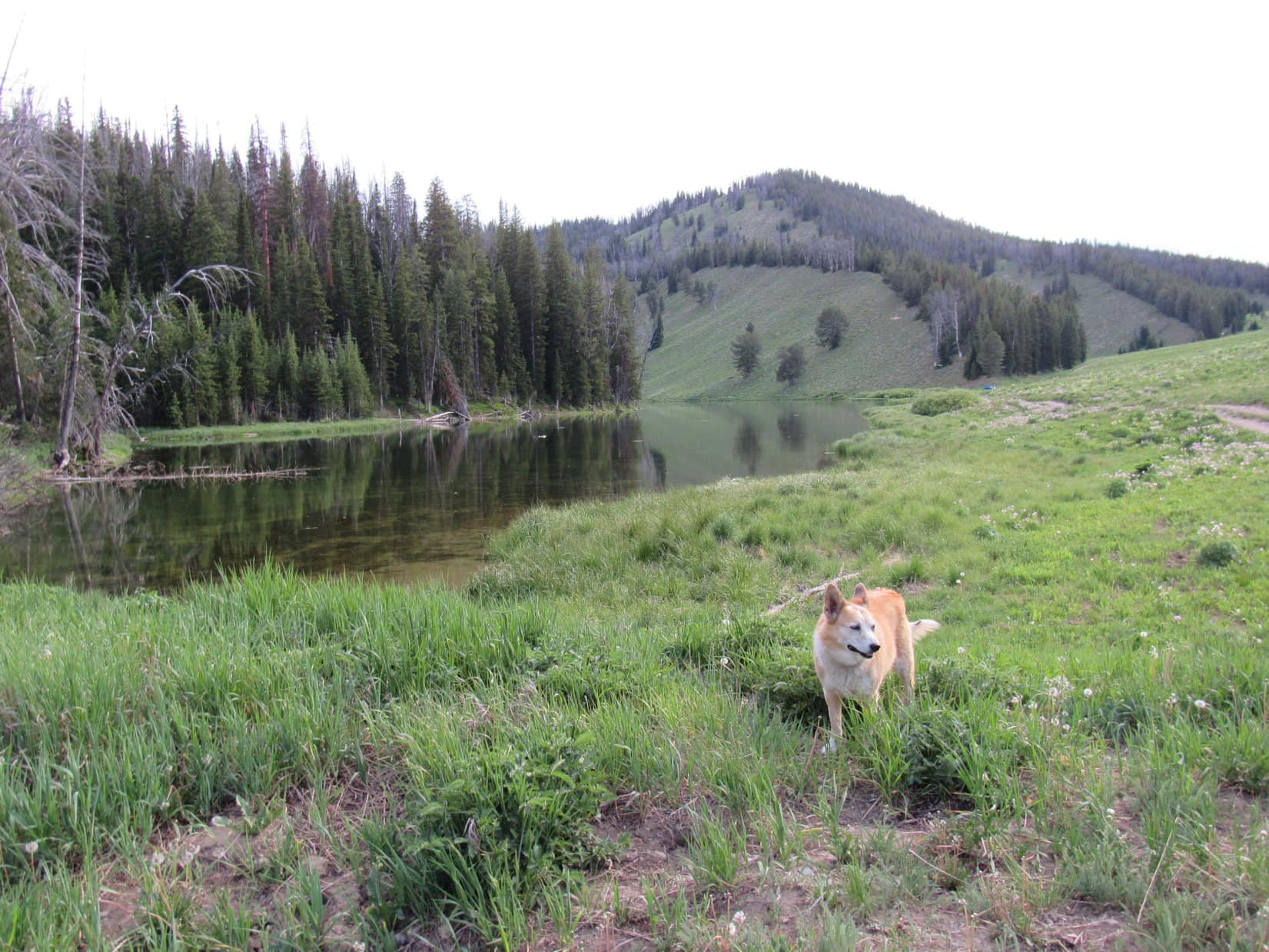
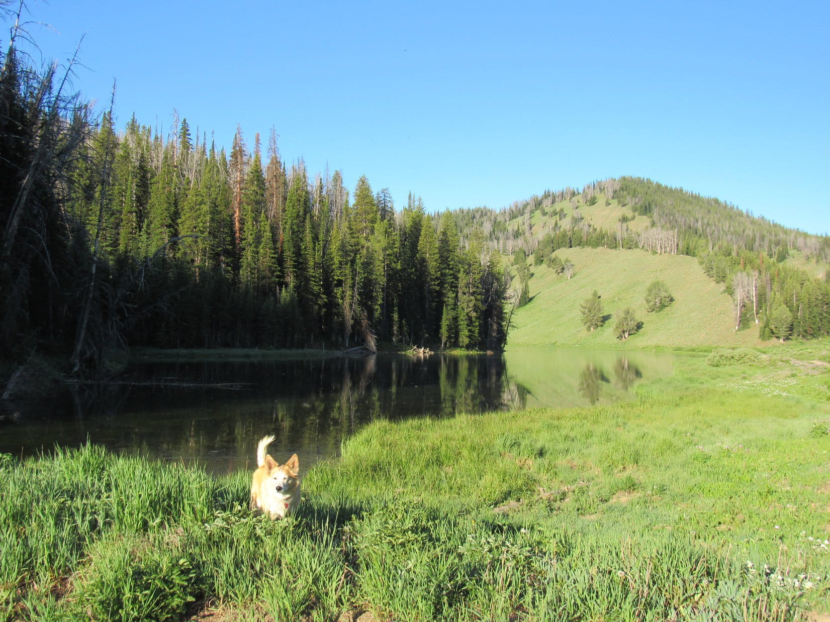
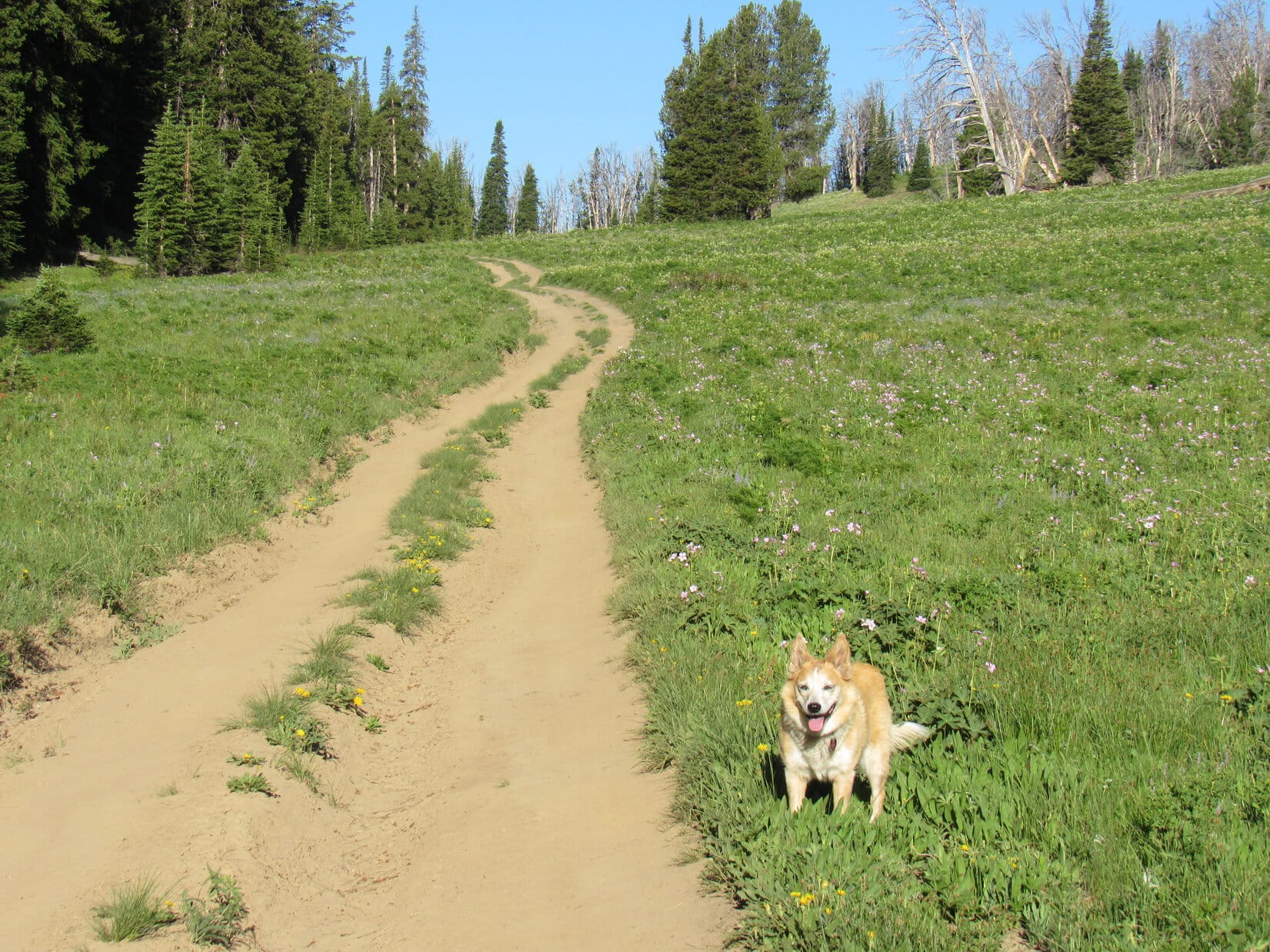
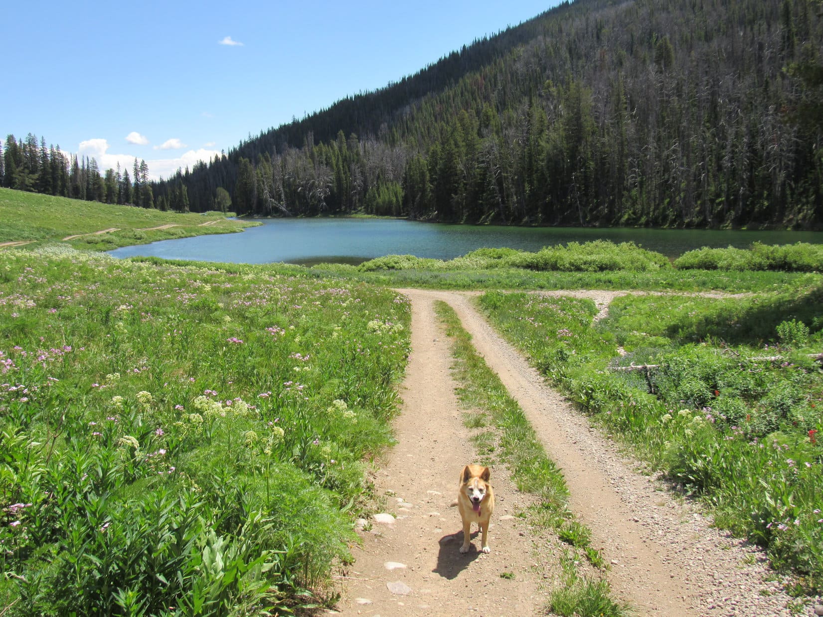
7-2-21, 7:09 AM, 56ºF, Leidy Lake – Not a cloud in the sky this morning! Sunny and bright. Loopster stood next to Leidy Lake squinting in the sunshine. She’d be doing a lot of that today. As soon as SPHP was ready, the Carolina Dog headed W on USFS Road No. 30250, which ran along the N shore of Leidy Lake.
Leidy Lake wasn’t very big. Lupe was soon past it. The road continued W, beginning a steady climb up a long valley through a meadow full of pink wildflowers. Mount Leidy was already visible off to the WNW.
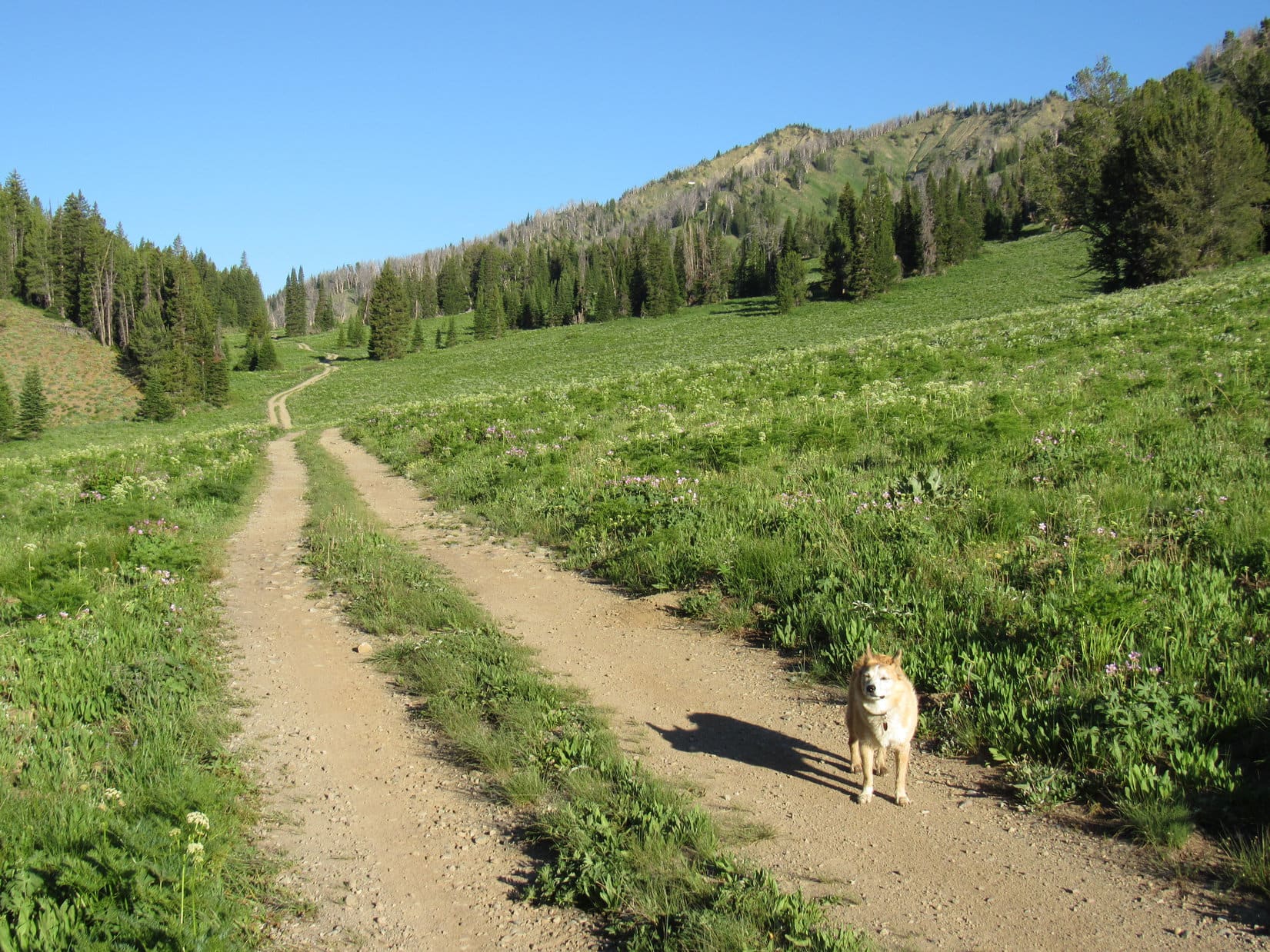
1.3 miles from the Leidy Lake dam, Lupe reached Pass 9176. USFS Road No. 30250 ended here. Could have driven the RAV4 this far easily enough. The road hadn’t been bad, and there was plenty of room to park up at the pass. There were also some trees providing shade. Lupe took advantage of it, while SPHP paused to apply some sunscreen.
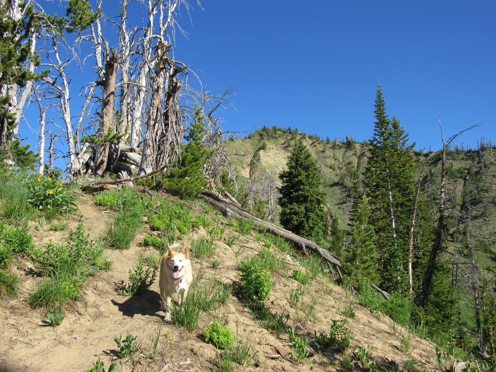
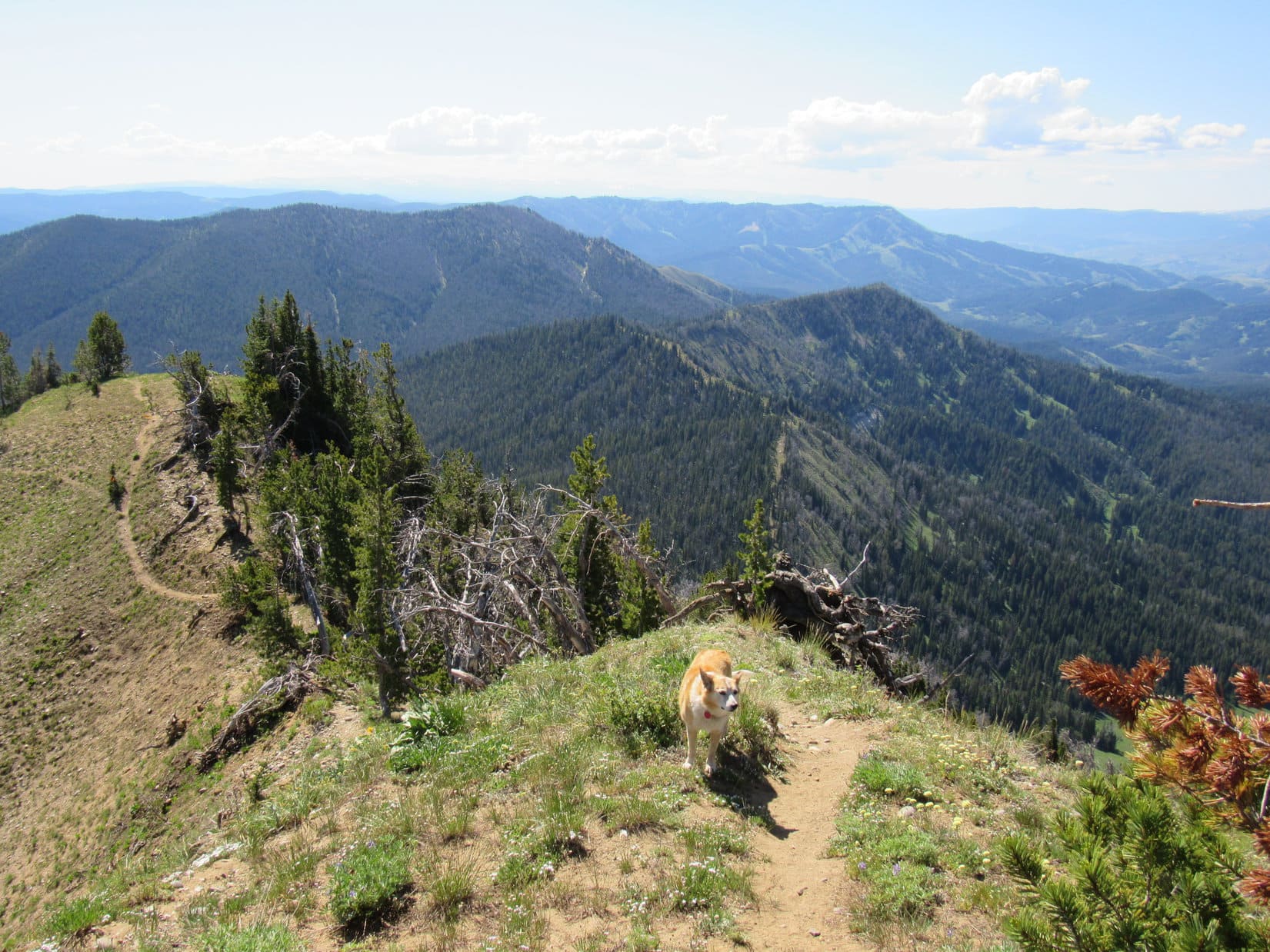
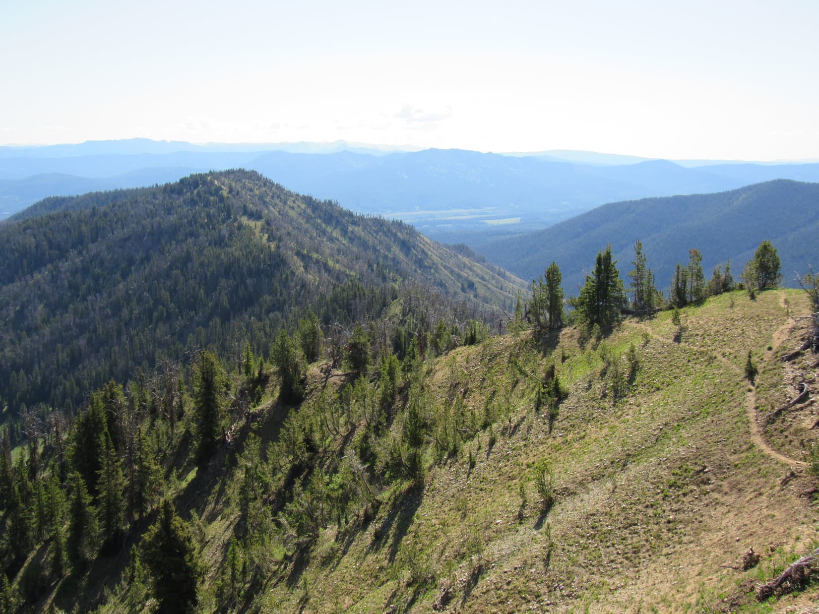
Two trails left Pass 9176 heading S or SW. No signage indicating where they might go. Didn’t matter. Lupe didn’t need to take them. All she had to do was start climbing the slope on the N side of the pass. A use trail going that way led up into the trees.
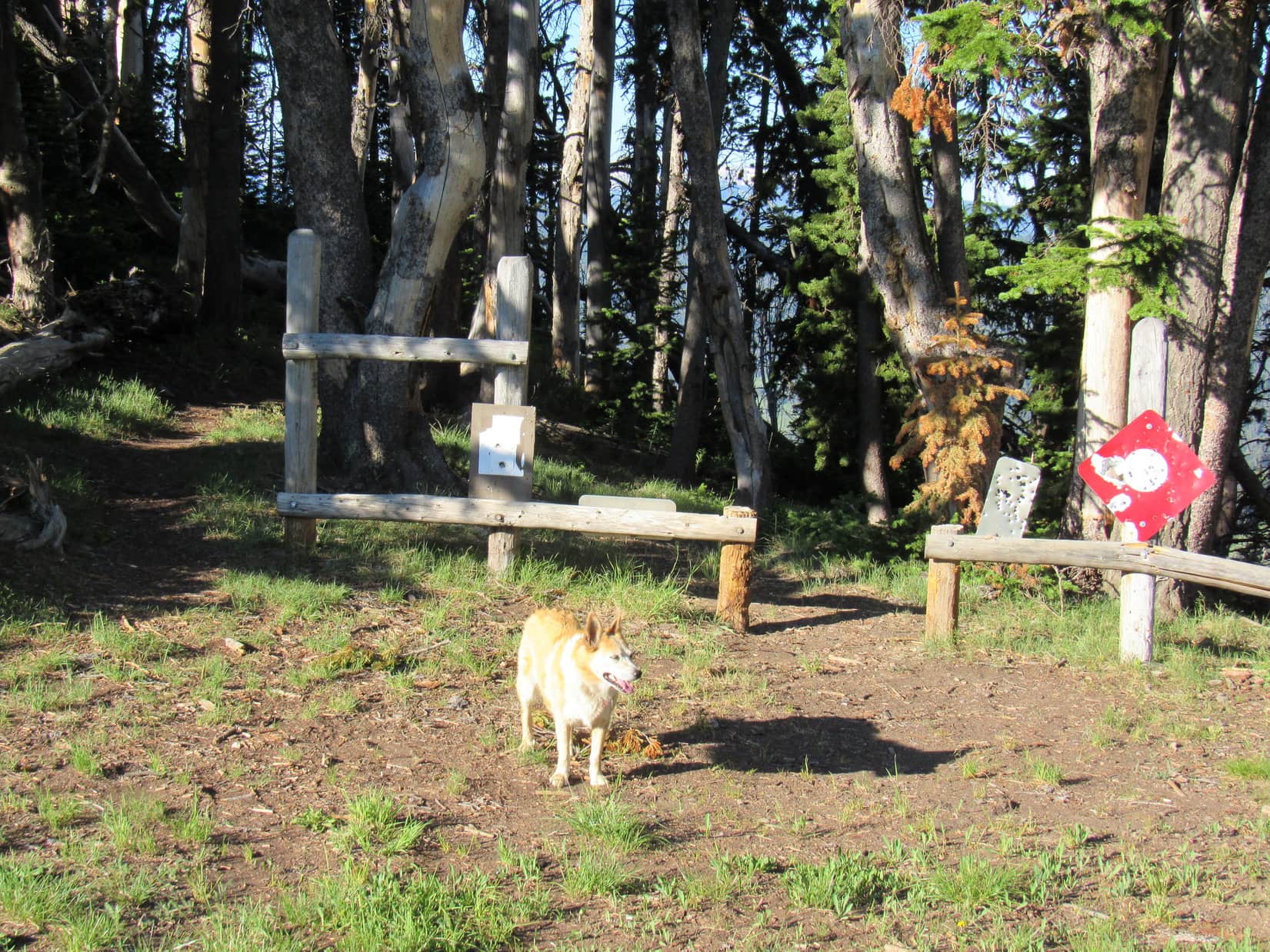
The climb was fairly steep from almost the very start. Looper roamed a forest that was sunnier and more open than expected, passing lots of big yellow wildflowers growing in clearings. Although many trees in this forest were dead, nearly all were still standing.

Early on, Lupe came to a view of big mountains to the S. She continued to get glimpses of them, and Wyoming’s fabled Teton Range off to the W, as she worked her way higher.
The SE ridge Lupe was following was broad for a long way. The soil was noticeably odd, consisting of a powdery loose dirt with rounded rocks of modest size mixed in. The wildflowers must have liked it. Lupe passed many of them.

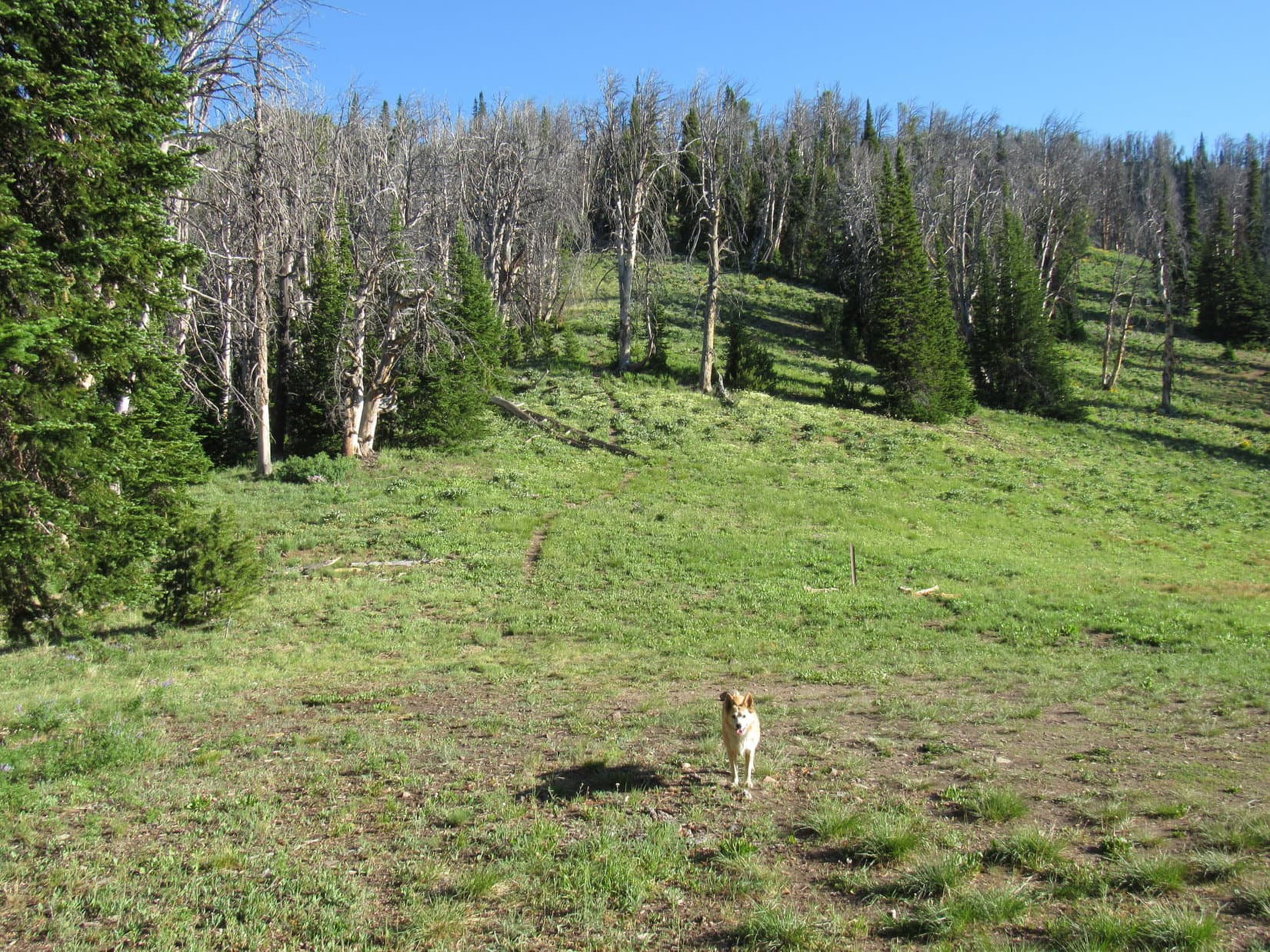
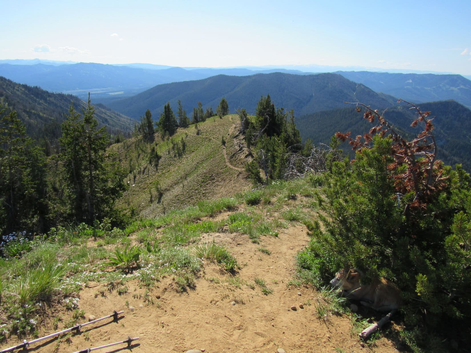
Two thirds of the way up, the ridge narrowed to a skinny edge. The trail dropped over to the W side, losing minor elevation before proceeding higher again at a more gradual pace as it traversed a very steep slope. Soon the trail swept around a ravine and began angling up to a higher ridge toward the W.
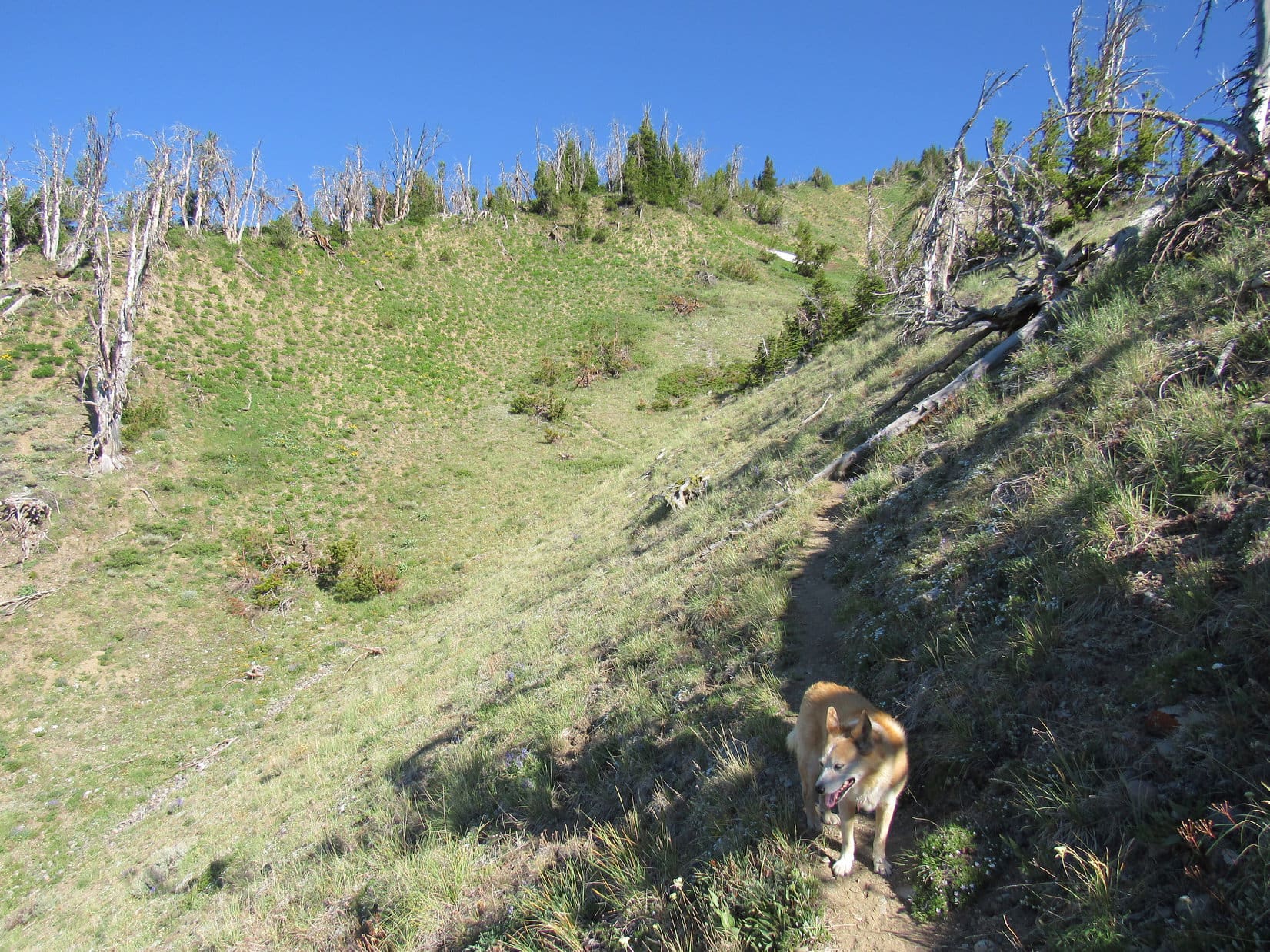
Despite a few level spots, the next ridge was both narrow and generally even steeper. In some places, short, almost vertical chutes of packed dirt provided little traction. SPHP clung to trees or bushes for support. Stumps and branches in the way were additional obstacles.

Lupe kept climbing. The summit came back into view. Almost there!
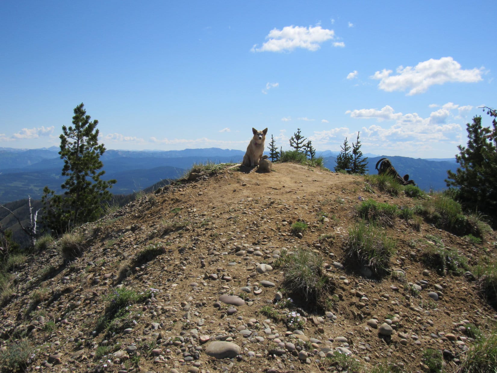
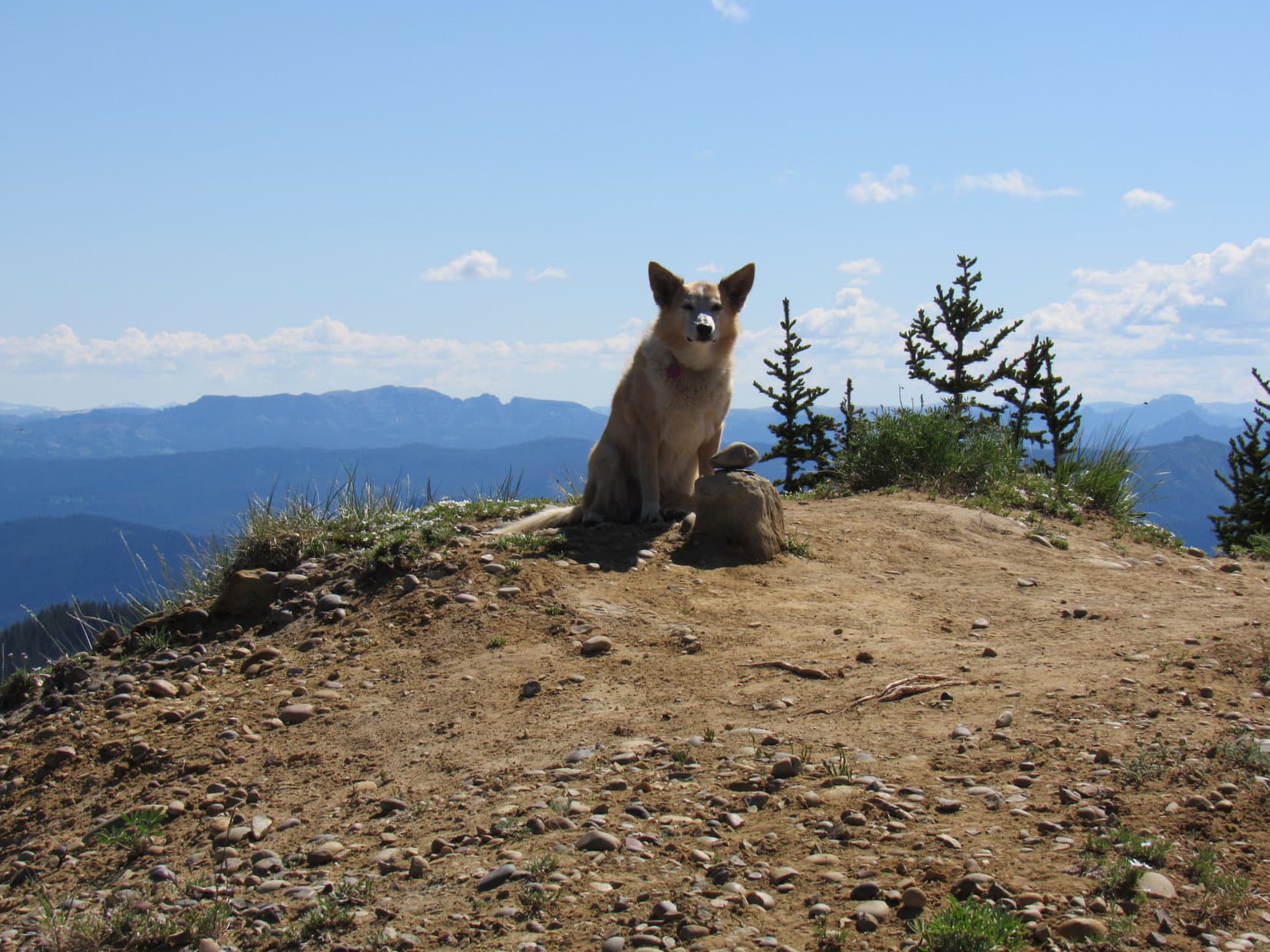
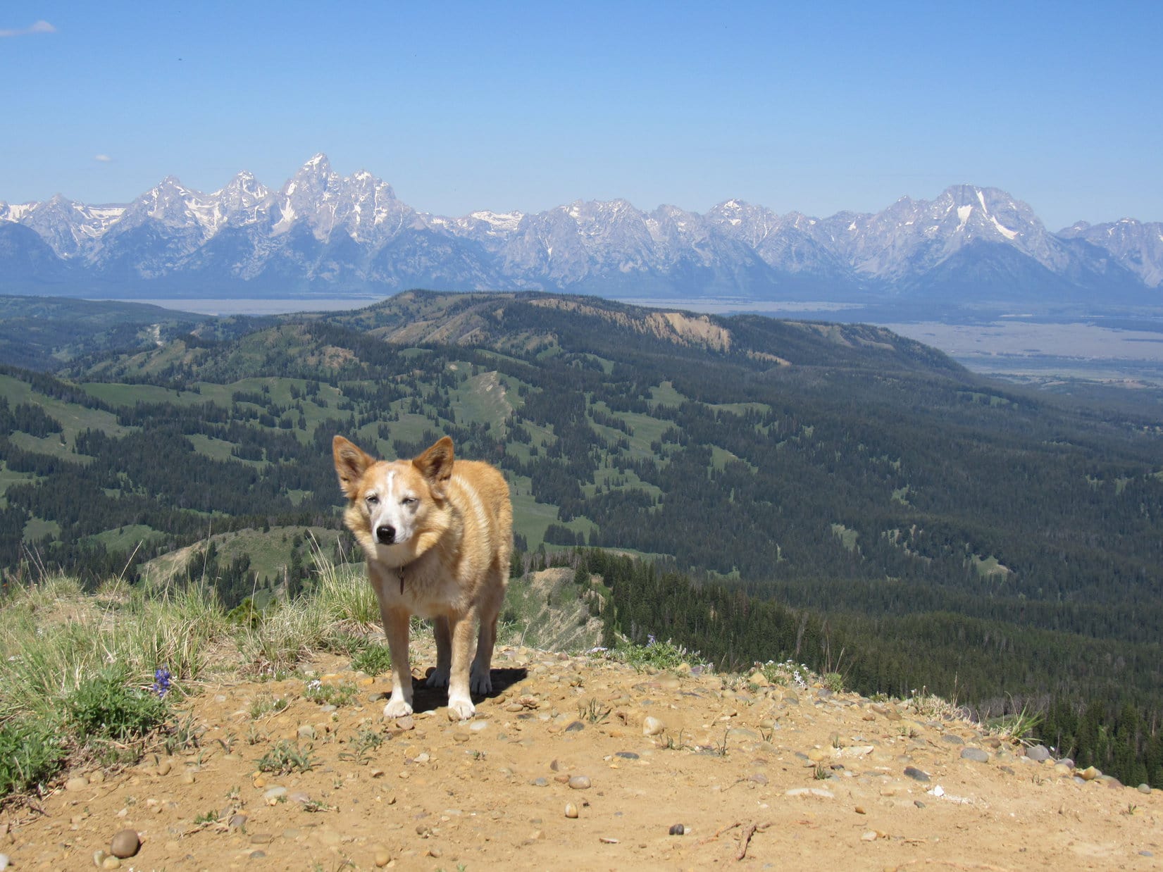
Well, not quite! Lupe arrived at the apparent summit only to find that it was a false one. However, the true summit was now in sight only 200 feet farther NW. Crossing a minor saddle, a final short climb and the American Dingo was there!

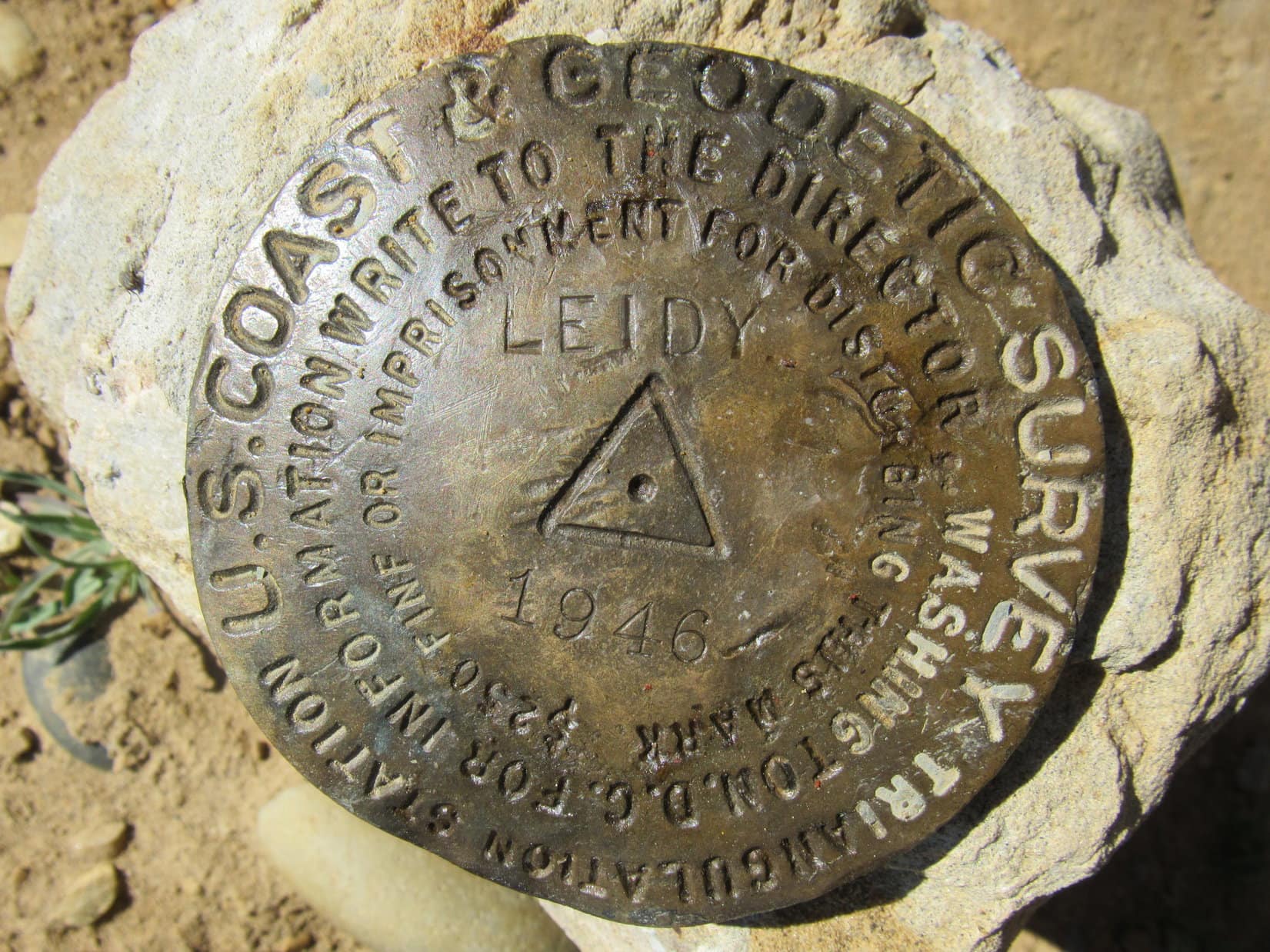
Mount Leidy’s true summit encompassed a small region no more than 15 feet across, and in most places less. A short wing sloped away to the SE, the way Lupe had come up, and a similar one extended out to the W. Along the N edge, near the high point at the intersection of these wings, sat a single stone with a smaller one perched on top. Hidden beneath the smaller stone was the Leidy survey benchmark.
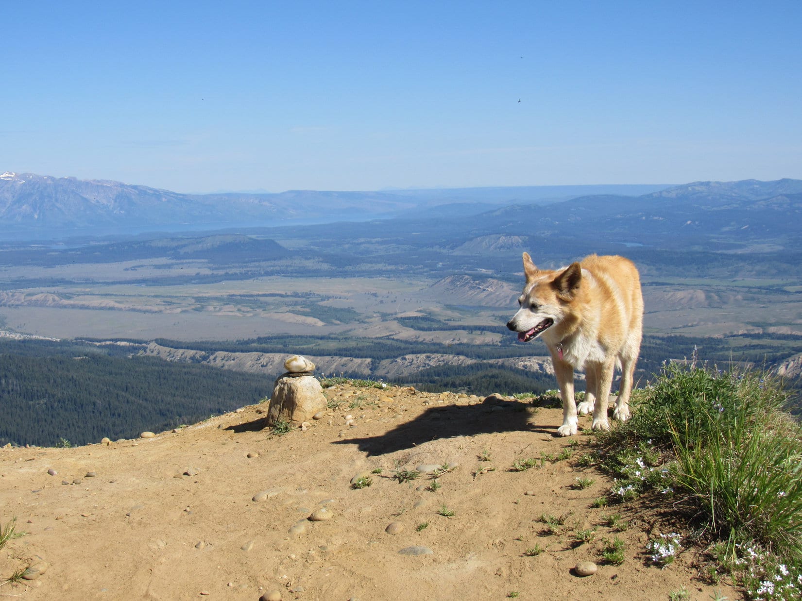
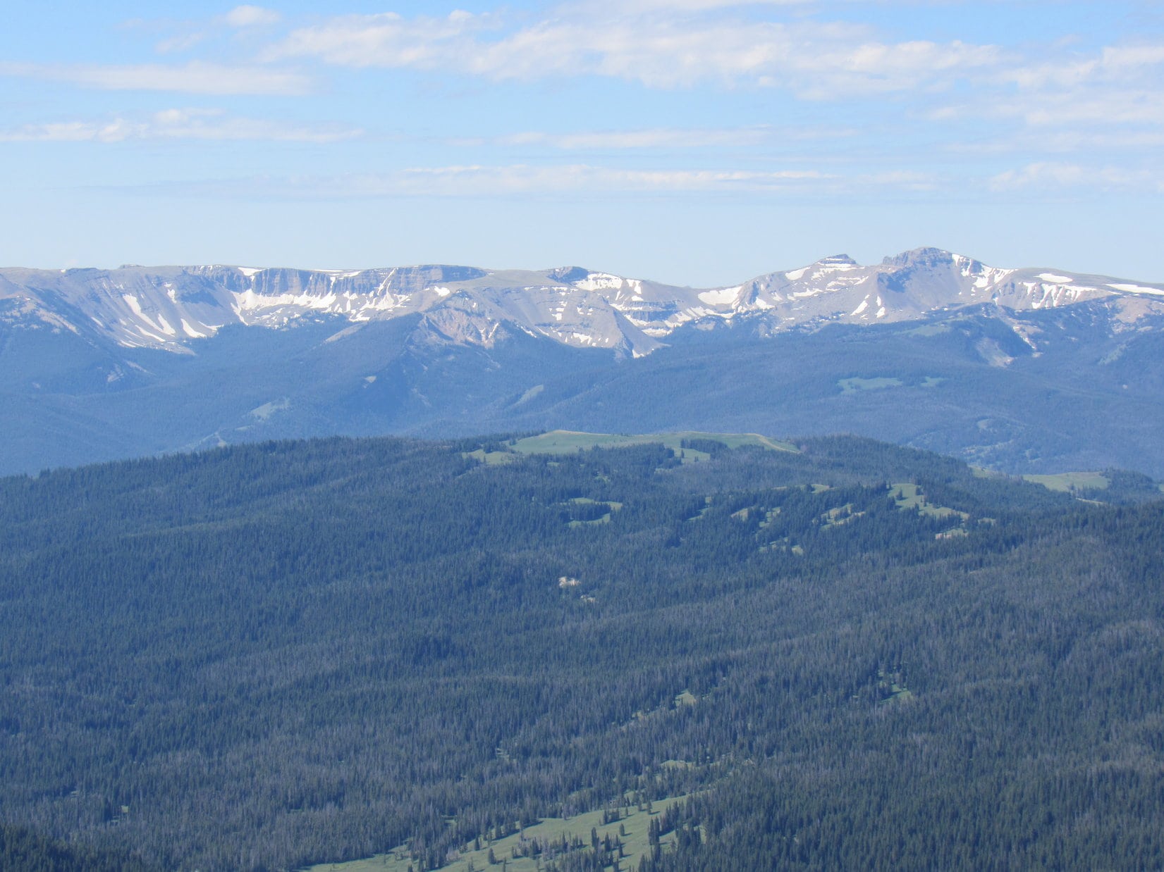
Far to the ENE was a long blue ridge of particular interest. Took SPHP a moment or two to be sure, but it had to be, didn’t it?
Hey, Looper! Look at that! Isn’t that North Breccia Cliffs (11,240 ft.) where we were just 2 days ago?
If you say so, SPHP! Think I’ll go lay in the shade, if you don’t mind.
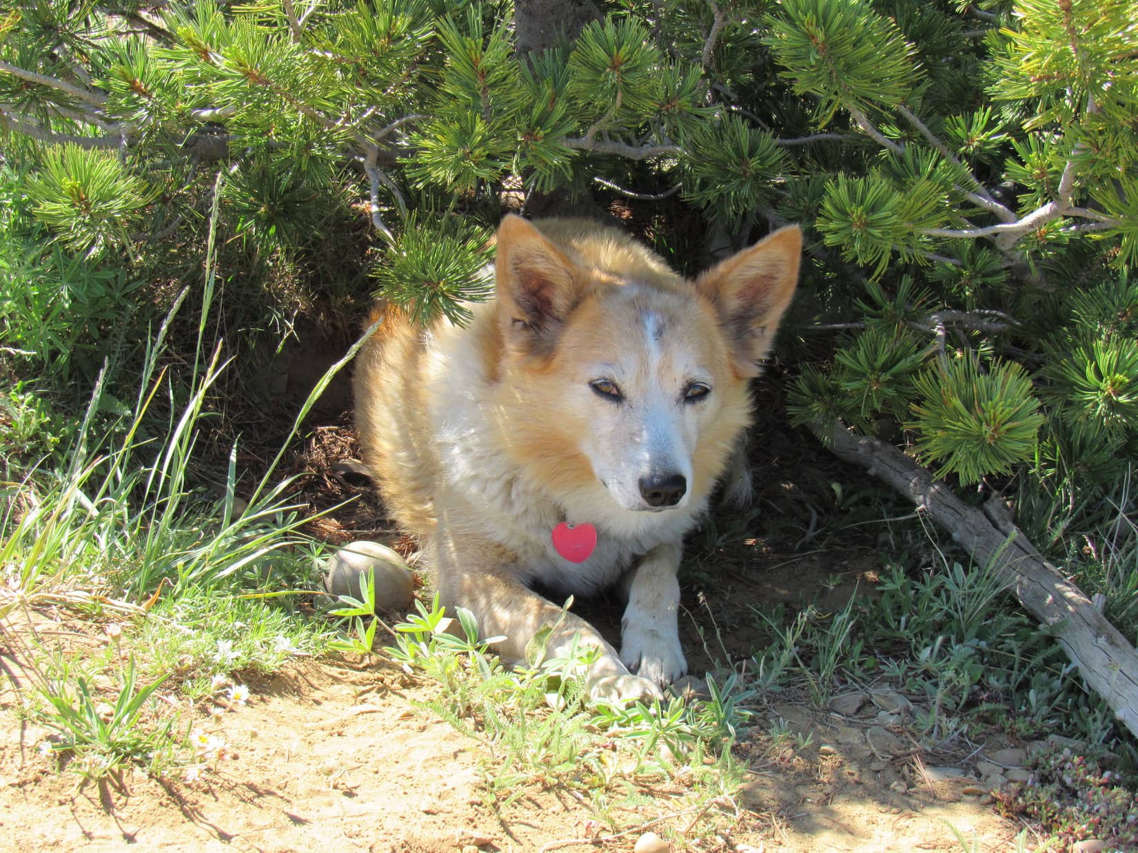
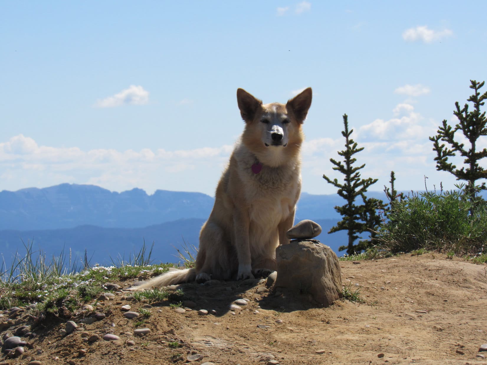
Cloudy only near the horizons, Mount Leidy (10,326 ft.) was baking in the early July sun. Warm alright, and with scarcely a breeze. Actually felt pretty comfortable to SPHP, but Lupe was hot. She quickly sought out the shade of a few small trees or bushes along the summit’s edge.
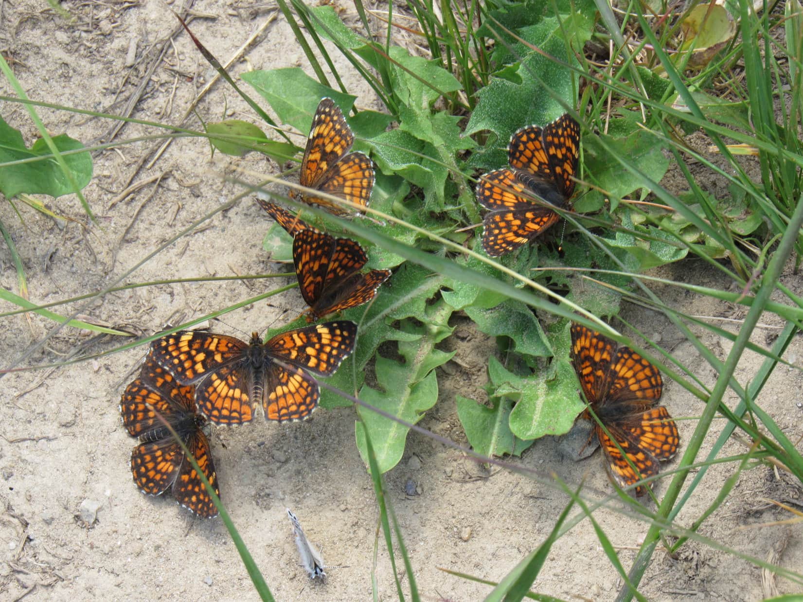
The air was humming with flies and bees of various sizes. Loop hid out snapping away at them. Butterflies performed wild acrobatics, chasing each other in groups of 6-8. The whole place seemed alive and happy that it was summertime.
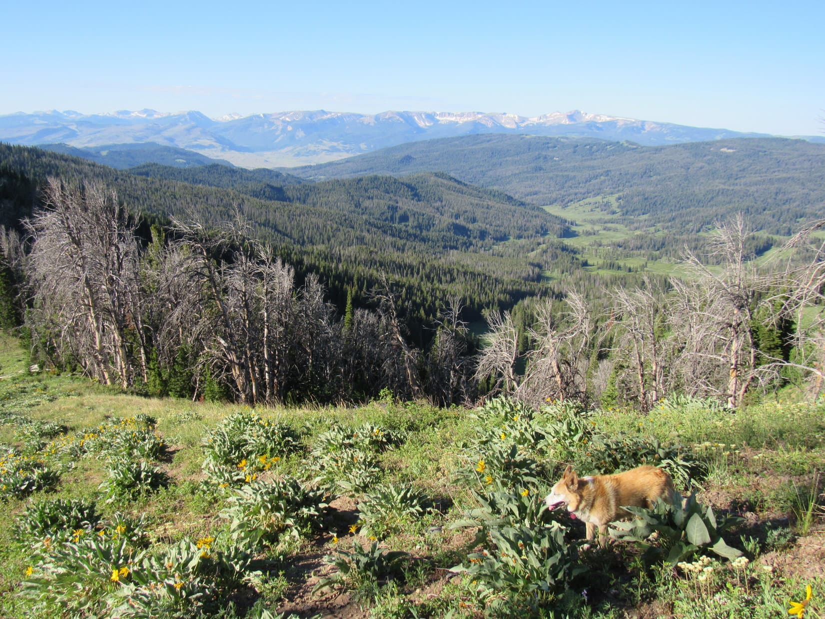
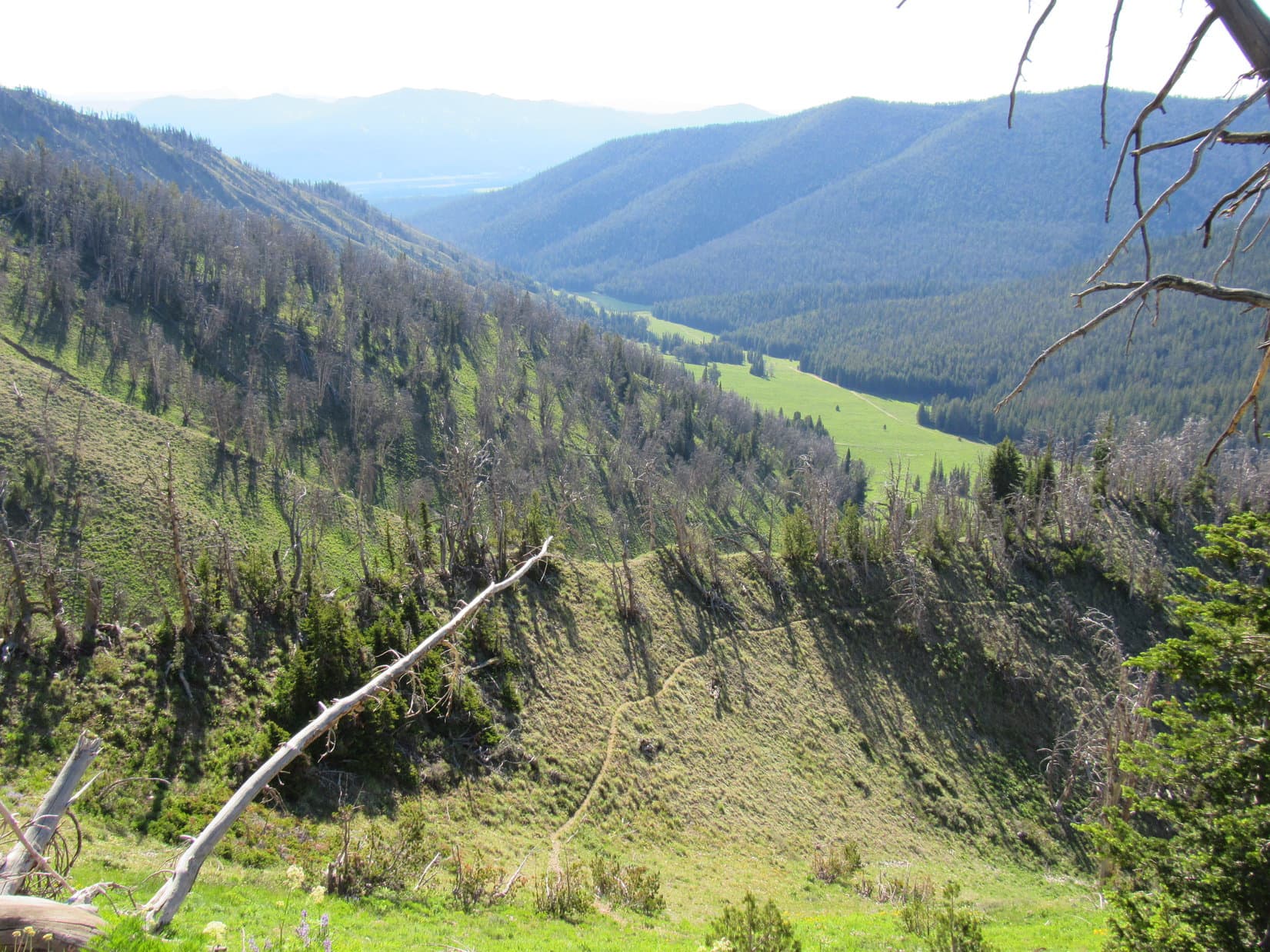
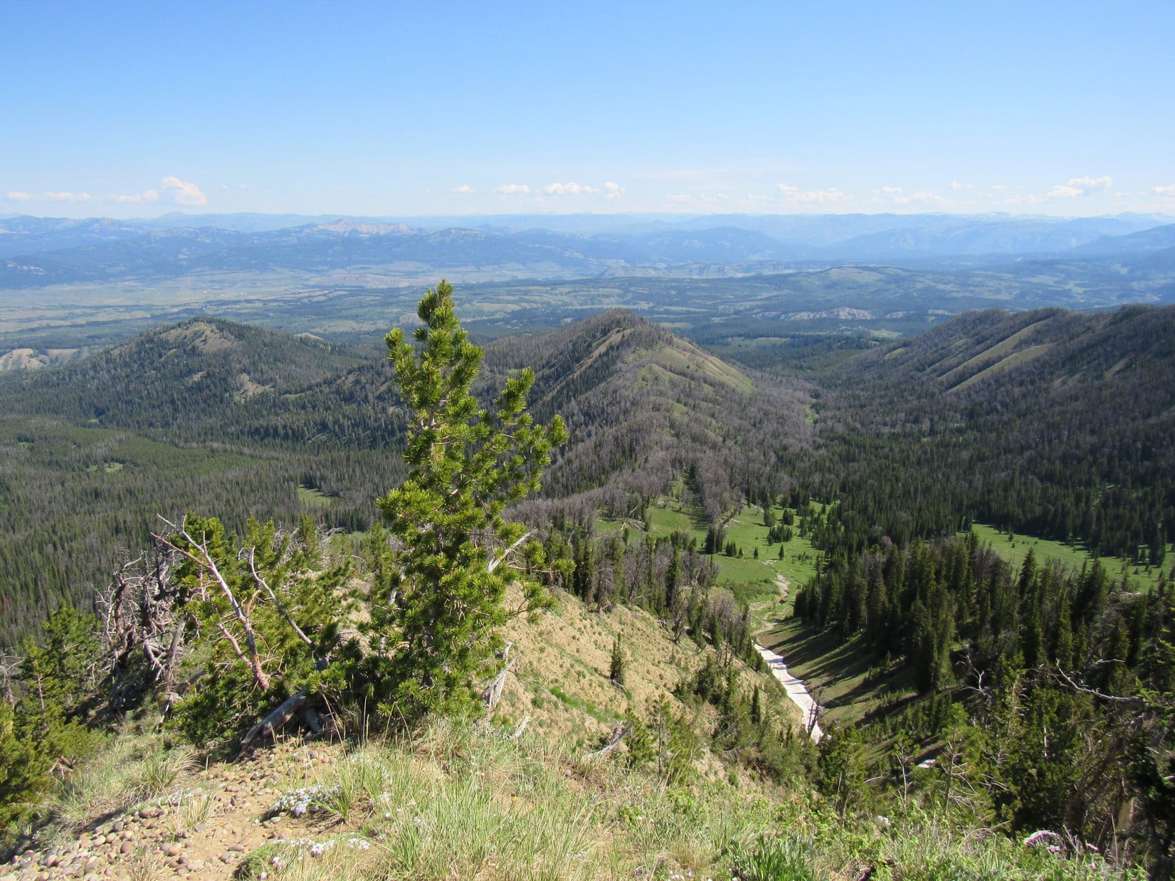
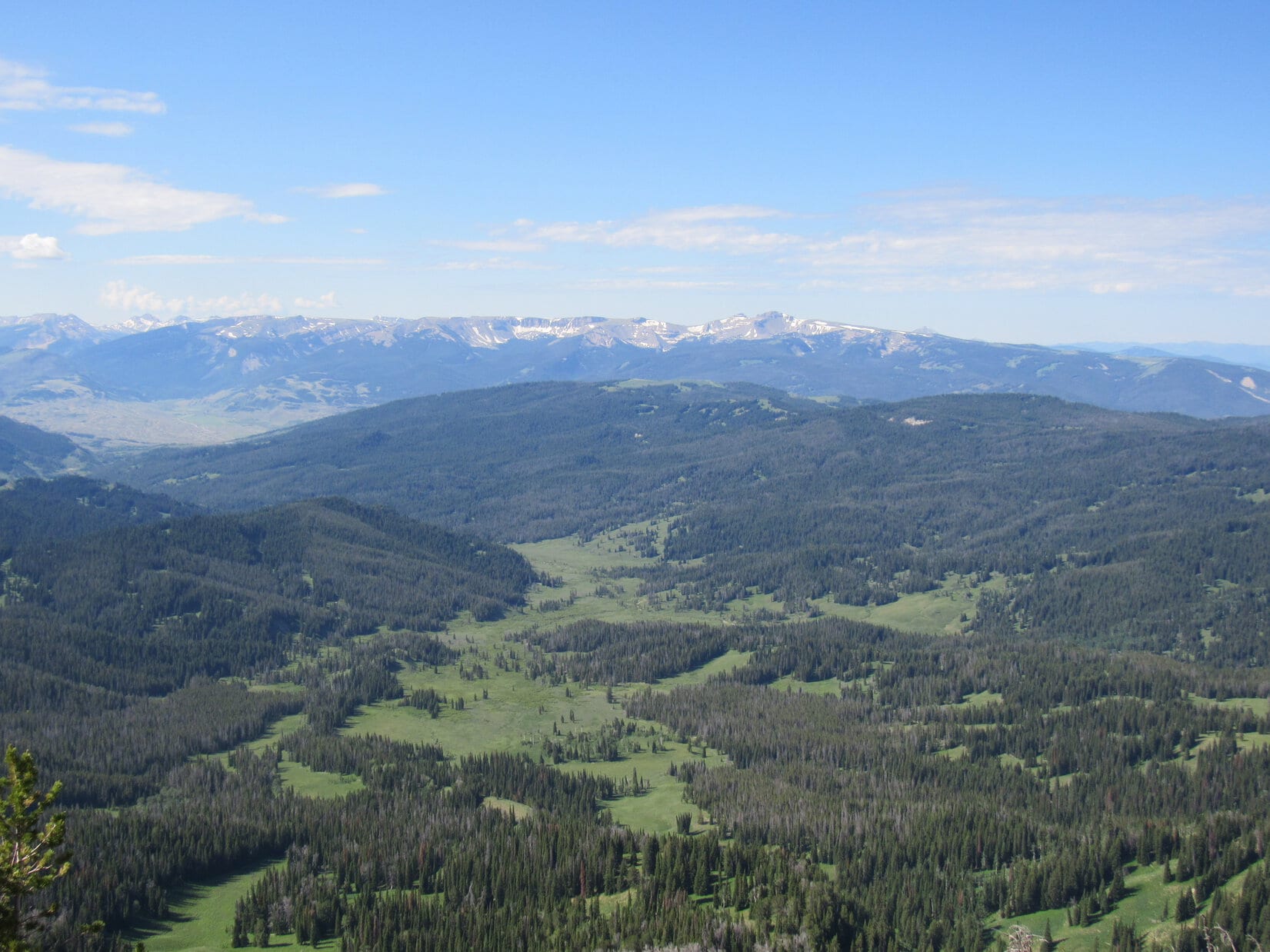
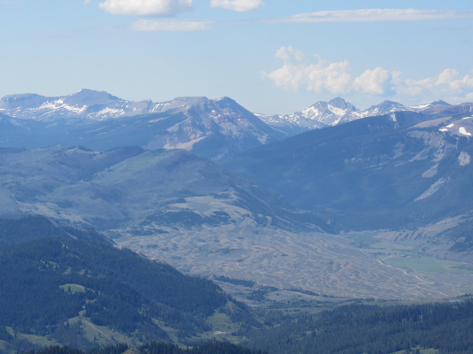
Water and a shared chocolate coconut bar. SPHP had a fruit cup, too. The views were tremendous, although the air was sort of hazy. Smoke? Humidity? Hard to say, but it seemed more like smoke. Far to the SE, the Wind River Range was scarcely discernable.
The terrain to the N was all much lower. Peak 10195 was only a mile E. To the S was the line of high peaks that Lupe had seen on the way up.
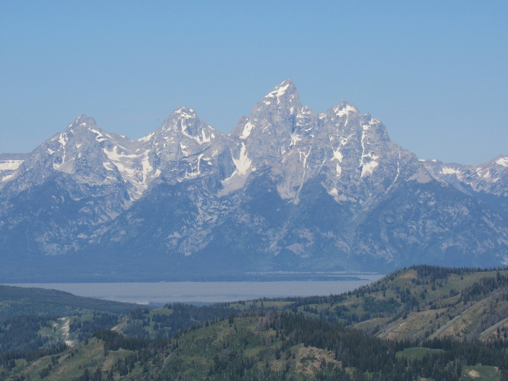
The real treat that Mount Leidy is famous for was off to the W, though, a tremendous view of the Tetons! The entire range was on display with soaring Grand Teton (13,770 ft.) and the more massive, but lower Mount Moran (12,605 ft.) standing out as particularly recognizable.
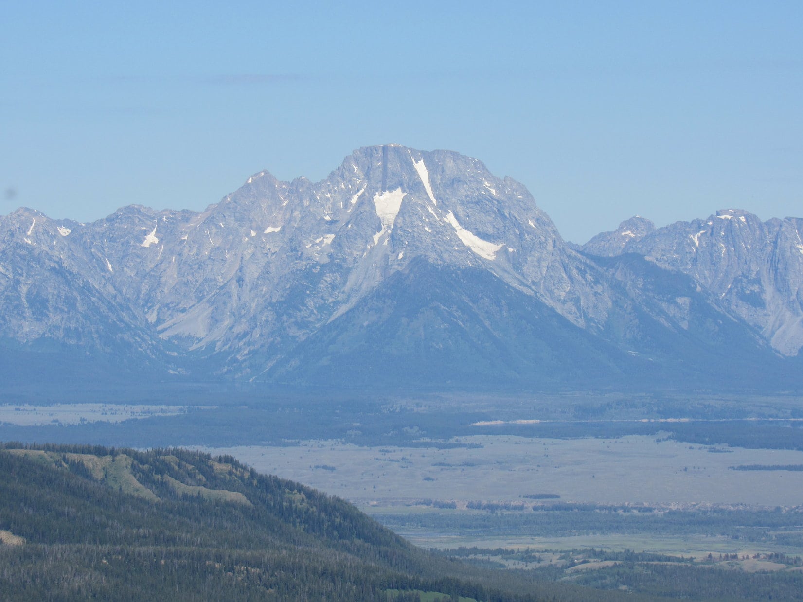
Completing the scene, Jackson Lake was visible to the NW, although it was a little hard to see due to the haze.
A very pleasant hour shot by. Suddenly, sadly, it was time to go.
Onward! Puppy, ho!
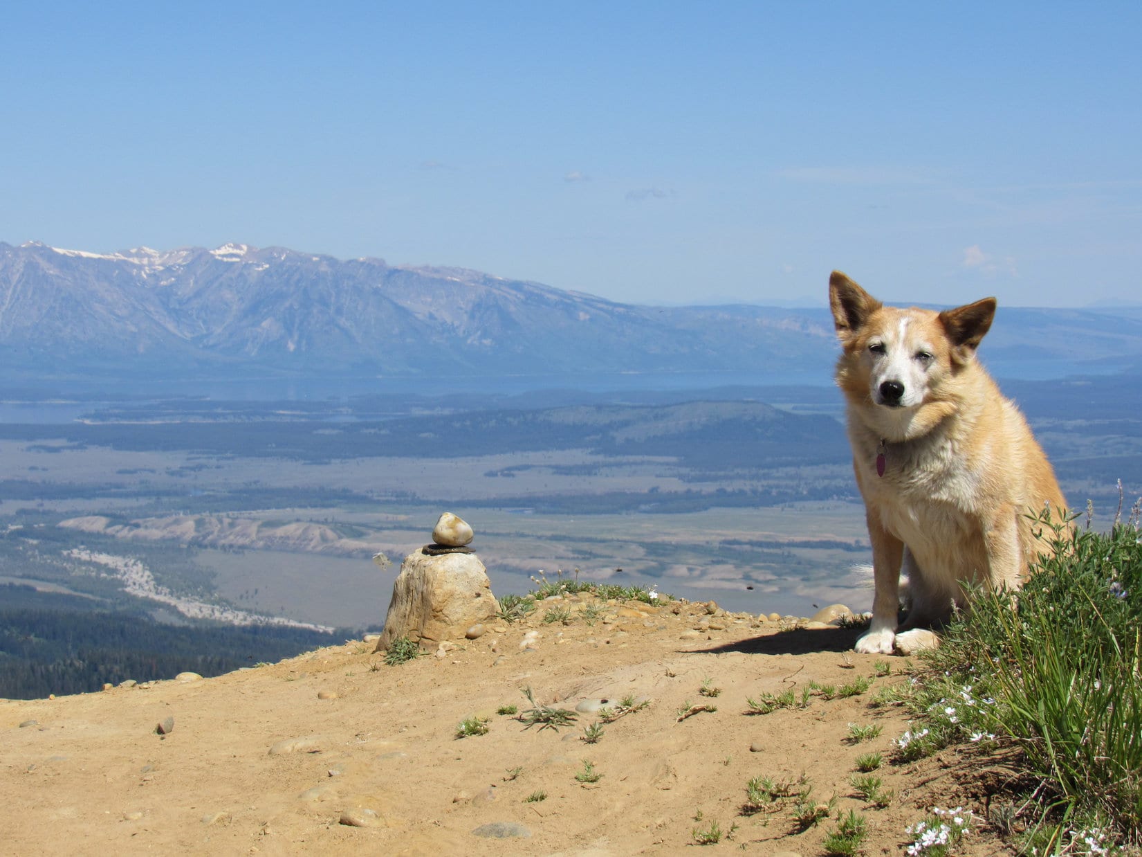
One thing that had not been visible from Mount Leidy’s true summit was Leidy Lake. However, it was easily seen from the false summit. Lupe and SPHP paused for a moment to admire the scene.

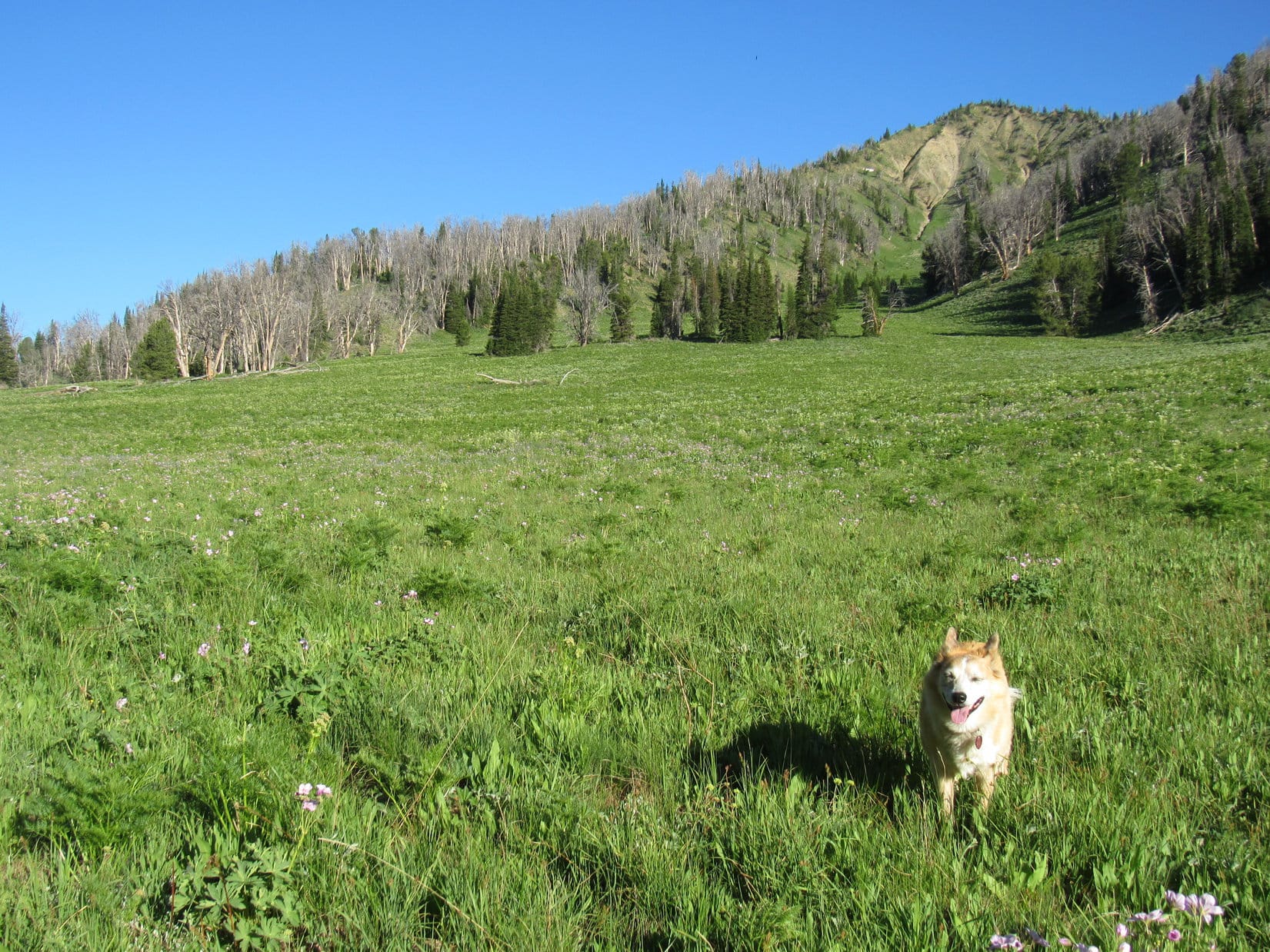
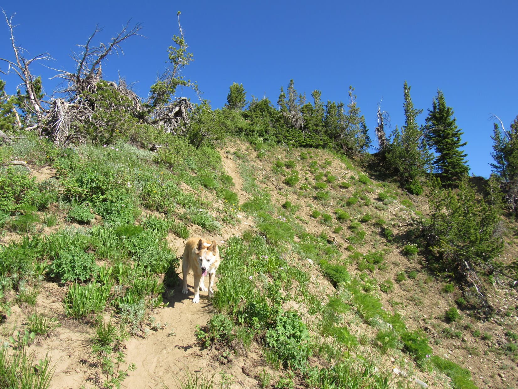
Then it was down the mountain the same way Lupe had come up. A bit of caution was required in some spots, but soon there was nothing to worry about except sniffing the exotic wildflowers. The American Dingo arrived back at Leidy Lake to find a butterfly convention underway near the RAV4. (12:29 PM, 67ºF)

Still early. Mount Leidy had been a quick, easy peak with lots of scenic reward for effort expended. The view of the Tetons alone had made it all very worthwhile!
The Tetons weren’t where Lupe was headed next, though. The afternoon got spent on a beautiful drive over Union Pass NW of the Wind River Range. At exactly 5:00 PM, as raindrops began sprinkling beneath a dark gray sky, Loop arrived at the Kinky Creek trailhead. Half an hour later, a near cloudburst poured buckets for 40 minutes before easing up.
Well, that ought to clear the air for the Carolina Dog’s next adventure! In the meantime, sweet dreams of warm breezes, dancing butterflies, and buzzing bees on magnificent Mount Leidy.
Links:
Next Adventure Prior Adventure
Want more Lupe adventures? Choose from Lupe’s Summer of 2021 Dingo Vacations to New Mexico, Wyoming & the West Coast Adventure Index, Dingo Vacations Adventure Index or Master Adventure Index. Or subscribe free to new Lupe adventures.
I enjoy each of your reports because I’m 76 and can’t do as much hiking or birding anymore, mostly because I want to exhibit low carbon footprint living. As Lupe grows older you may have to become a birder to give her more rest!
That exotic flower is silky phacelia:
https://www.fs.fed.us/wildflowers/plant-of-the-week/phacelia_sericea.shtml
Hi, Phil! Hope you had a Merry Christmas! Glad you enjoy my posts.
Thank you for educating SPHP by providing the link with all the great information on the silky phacelia! SPHP thought the scientific name for it was purplus flowerus!
I only saw one silky phacelia on Mount Leidy. It was way up on the upper ridge and really stood out. So beautiful!