Black Hills, SD Expedition No. 239 – Silver Peak & Nugget Gulch Peak (11-4-18)

Start – 8:59 AM, 31°F, 0.5 mile S of Silver City along USFS Road No. 251

The more SPHP thought about it, the more it seemed like driving a little farther S would have been better.  November now, and the first day back on Standard Time.  Even though the clock said Lupe had gotten off to a reasonably early start, she actually had one less hour of daylight to look forward to than she would have had only yesterday at this hour.

Consequently, maybe Loop wasn’t going to be able to get to all of her planned peakbagging objectives?  Yeah, driving farther would have been more efficient.  Besides, the road hike on USFS Road No. 251 was a bit dull.  Luckily the valley widened out.  Lupe was perfectly happy roaming some off-road flat ground next to a dry creekbed.

Lupe was happy roaming this flat ground next to a dry creekbed. Photo looks S.

Before long the American Dingo reached a junction with a side road marked No. 251.1K.  This far up Nugget Gulch the creek had a little water in it.  Lupe crossed No. 251.1K and continued upstream.

Upstream of USFS Road No. 251.1K. The creek had a little water here.

More than 0.5 mile from the G6 was a more important intersection.  USFS Road No. 251 continued S up East Nugget Gulch.  Lupe made a R turn onto USFS Road No. 249 instead.  As a more primitive road, No. 249 had a pleasant remote feel.

Starting up USFS Road No. 249. Photo looks SW.

No. 249 winds its way W, then SW up the main part of Nugget Gulch.  Lupe had hardly gotten started when she came to a ford.  By the side of the road, right next to the creek, Lupe discovered a terribly interesting something or other.

Looks like deer guts to me, Looper!  Just leave ’em alone!

What do you think of this, SPHP? Most intriguing, wouldn’t you say? Quite a find!
Oh, yes Loop! Simply lovely! Let’s, uh, keep going.

On the way up Nugget Gulch, No. 249 crossed the stream bed half a dozen times.  The first two fords had enough water to persuade SPHP to utilize a few stepping stones.  The rest of the crossings were bone dry.

Nugget Gulch became narrower and deeper.  The road hugged a hillside above the stream course.   SPHP stuck with the road, since it was easier than trying to stay down close to the intermittent stream.  For the most part, Loop did, too.

At one point the creek’s maximum flow was revealed where it went over exposed bedrock.  Lupe left the road briefly for a closer look.

Why, this has got to be the prettiest spot in all of Nugget Gulch!

After nearly a mile on USFS Road No. 249, Lupe came to an intersection with No. 249.3B.  Silver Peak (5,810 ft.) was now 0.67 mile due N.  The Carolina Dog left the main road, slipped around a closed metal barrier, and began following No. 249.3B up a valley.

The road appeared to be permanently closed to vehicle traffic.  Looper trotted along through tall, dry grass.  No. 249.3B was the quickest, easiest way up Silver Peak.  The road wound around a bit at first, but eventually straightened as it headed NNW.  As Lupe got higher, small trees grew on the old roadbed.

In the tall, dry grass on abandoned USFS Road No. 249.3B.
Higher up small trees were growing on the old roadbed.

Near the upper end of the valley Lupe reached an area where the forest had sustained tremendous damage.  Years ago, pine bark beetles had killed hundreds, perhaps thousands of trees.  Deadfall timber littered the whole region.  Many dead trees had fallen across No. 249.3B.  The pace of advance slowed as negotiating the deadfall became an issue.

The road faded, then disappeared.  Lupe climbed N up a steep slope.  SPHP followed, simply choosing whatever route avoided the deadfall as much as possible.  So many trees had fallen that the remaining forest was comparatively open.  The general layout of the terrain was easy to see.  Silver Peak’s W ridge was only a little higher.

Loop made it up onto the W ridge.  She turned E toward Silver Peak.  The going wasn’t any easier up here.  The narrow ridgeline was clogged with deadfall, too.  Fortunately, the summit wasn’t much farther.

Oh, yeah?  The top of the mountain wasn’t as close as SPHP thought.  The first high point Lupe came to was a false summit.  The true summit was now in sight, but so was another stretch of deadfall infested ridge.  No matter.  Puppy ho!

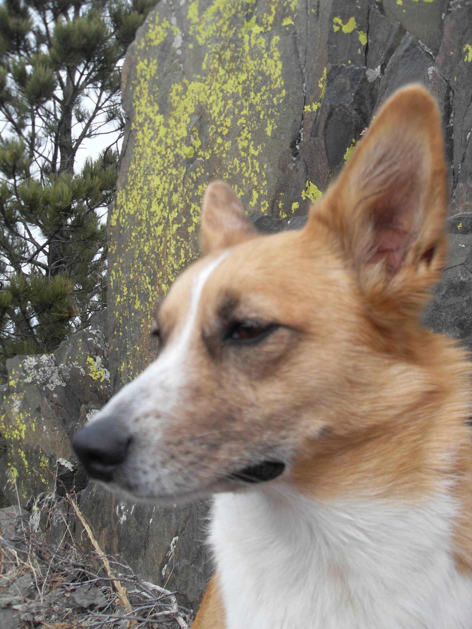
Took longer than it should have, but the Carolina Dog made it to the top of Silver Peak (5,810 ft.).  The difficulties she had encountered really hadn’t been a surprise – this was Loop’s 3rd ascent.  Deadfall had been an issue each time.  The passing years hadn’t improved the situation.

Success! Lupe stands perched upon Silver Peak‘s summit cairn. Photo looks W.

After getting up on the summit cairn to claim another successful ascent of Silver Peak, Lupe laid down next to it.  The cairn appeared little changed since the last time she had been here nearly 3 years ago.

Taking it easy on Silver Peak. This was Lupe’s 3rd ascent.

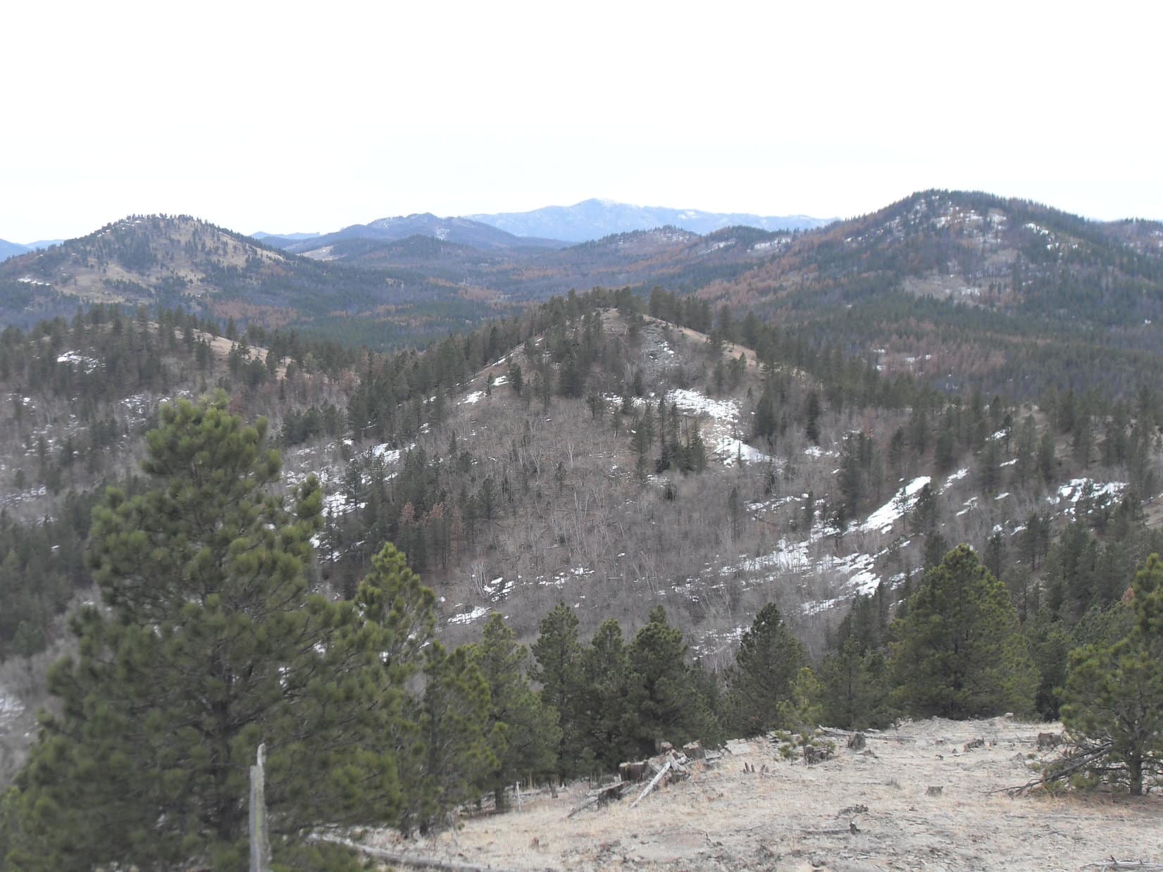
In a way, it didn’t seem fair.  With all the damage sustained by the forest, Loopster ought to have enjoyed some nice clear views from Silver Peak.  However, the summit area hadn’t been hit quite as hard by the pine bark beetles as some of the rest of the territory she had come through.  Plenty of partial views and glimpses, but in every direction at least one or two trees still stood to mar the scenes.

To the extent that there was one, the best view was toward Silver City and Peak 5707.

Silver City (down by the red roofs) and Peak 5707 (L) from Silver Peak. Lupe had been to Peak 5707 for the first time nearly a month ago. Photo looks NE.

It had been sunny earlier, but the sky had turned gray.  The temperature was still in the low 40’s °F.  A 10 mph SW breeze made it seem cooler than that.  Lupe still had two peaks to go.  15 minutes spent relaxing on Silver Peak was about the extent of it.  Lupe and SPHP left to start picking a way back down the W ridge.

The views were actually better from the W ridge.  Before leaving it, Loop paused at a rocky high point.  Far to the NNW Custer Peak (6,804 ft.) sported a dusting of new snow.  Black Elk Peak (7,231 ft.) was on the horizon to the S.  Lupe’s next peakbagging objective was much closer in the same direction.  She could see a long ridge that would take her to Nugget Gulch Peak (6,000 ft.).

At a more scenic spot along Silver Peak‘s W ridge. Photo looks SW.
Custer Peak was sporting a dusting of new snow. Photo looks NNW with lots of help from the telephoto lens.
Black Elk Peak in the distance (Center L). Nugget Gulch Peak is in the vicinity of the first much closer high point immediately to the R. Photo looks S.

Lupe retraced her whole route back down USFS Road No. 249.3B.  Upon reaching No. 249 again, she took it S, but only for 200 yards.  Off to the L was a side road that led to a small clearing where a sign indicated this was USFS Road No. 675.1.  At the far side of the clearing several stones blocked the road.

Stones couldn’t stop Lupe.  She went right on by, following No. 675.1 as it climbed a short distance E up onto a level spot where the road divided.  Neither branch was marked, but going straight would have taken Looper into Middle Nugget Gulch.  Instead, she took the fork to the R (S) that curved higher.  After another short climb, this road leveled out and faded away in a forest that looked groomed.

After a couple of quick climbs, Lupe reaches a groomed forest. Photo looks SW.

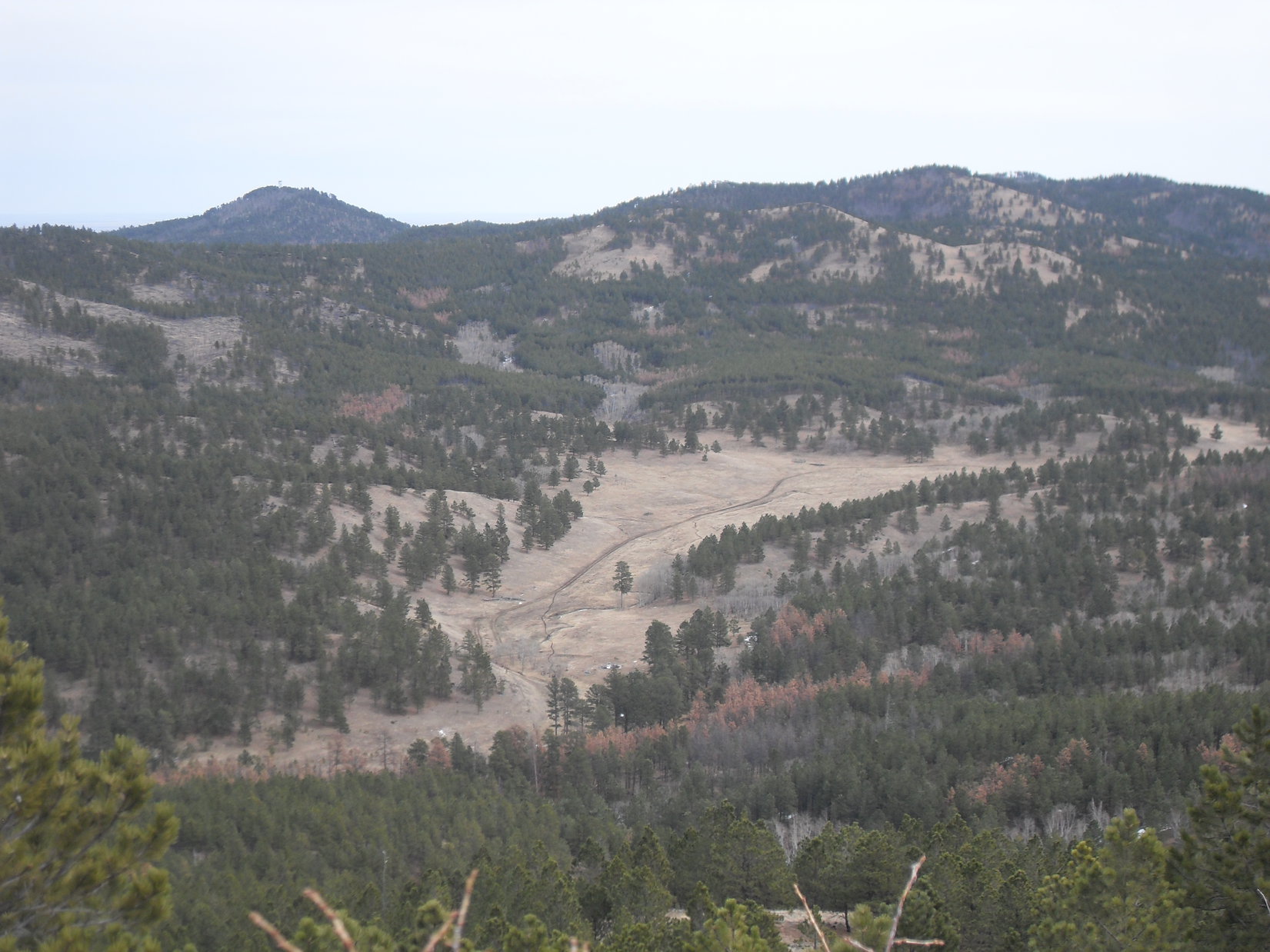
Ahead small pines grew where the road used to be.  Lupe took this route SW until she got close to the next hill.  A longer and considerably steeper climb up this hill ended as Loop emerged from the forest at the N end of a level field.  From here the Carolina Dog had a good view back N toward Silver Peak.

Silver Peak from the field. Photo looks N.

Stones had been arranged to form a fire ring here.  SPHP picked Lupe treasures out of a long extinguished campfire.  The field continued 100 yards S past a few young pines to another unidentified road.

The grassy level field extended 100 yards S to another road. Lupe would follow this road R along the side of the forested high ground seen ahead. Photo looks SSW.

By now it was clear that Lupe had succeeded in getting up onto the N end of the ridge leading S to Nugget Gulch Peak.  However, the summit was still out of sight more than a mile away.  Since the unidentified road was going in roughly the right direction, Lupe followed it SW.  The road gained elevation slowly staying 50 to 75 feet below the ridgeline.

After 0.2 mile, Loop arrived at a junction.  A marker indicated she had been following ATV Trail No. 6803.  She had just reached No. 6800.

Loop on ATV Trail No. 6803. The junction with No. 6800 is dead ahead. Photo looks SSW.

Lupe could go E or W on ATV Trail No. 6800.  Without a clue as to which choice was better, SPHP led her E.  No. 6800 climbed up to a minor pass, then turned S.  The road now began to lose elevation.  Lupe followed it a little farther.  Up ahead she could see a line on a hillside indicating the presence of a higher road.

On ATV Trail No. 6800. A higher road is on the hillside ahead. Lupe left No. 6800 near here to climb up to a saddle off to the R. Photo looks S.

Losing elevation was the wrong thing to do.  Lupe left No. 6800.  She climbed toward a saddle she could see ahead on the R.  Upon arrival, Lupe found the saddle was mostly grassland.  Another road was right over the crest on the other (W) side.

Lupe arrives up on the grassy saddle to discover another road on the other side. Photo looks SE.

An 80 foot high hill sat immediately NW of the saddle.  This hill was in the wrong direction, but from below it looked like the top might be open enough to be able to get some views.  Since it wouldn’t take long to check out, Lupe and SPHP climbed the hill.  There were views, but none that were particularly helpful.

Looking S from the top of the 80 foot hill. The views from here weren’t really helpful. Lupe needed to get over to the hill on the R, but she already knew that.

The American Dingo returned to the saddle.  She went down to the road W of the crest, and followed it 150 feet to a junction with the road she had detected the presence of earlier.

The road W of the crest went downhill from here.  So Lupe tried the side road going E.  The side road soon curved S.  Looked like it wasn’t going to gain any elevation either.  Hmm.

No choice.  Lupe abandoned all roads and started climbing.  She worked her way S up a steep hillside.  The hill was rocky near the top.  Once she was up, Loop found herself on a fairly narrow ridge.  This ridge would inevitably bring her to Nugget Gulch Peak, if followed far enough S.  Still no sign of the summit yet, though.

Lupe and SPHP struck out along the ridge.  Most of it was forested.  Some parts were a slow-going jumble of rock and deadfall.  Loop pressed on climbing from one slightly higher point to the next.  Rinse and repeat.

Following the ridge S. Photo looks S.

Time was slipping away.  Occasionally Looper caught glimpses of what was ahead.  After a while, SPHP became convinced the next high point she was coming to was either the summit of Nugget Gulch Peak, or High Point 5953, if she hadn’t gone over it already.

When Lupe got there, she discovered a patch of open ground offering views to the S and SW.  A higher point was to the S.  Surely that must be Nugget Gulch Peak?  SPHP would have bet money that Lupe was now at High Point 5953.  Woulda won, too!

So here we are at High Point 5953! Not a bad view, but looks like weather might be on the way. Photo looks SW.
Nugget Gulch Peak (Center) from High Point 5953. Peak 6043 is straight up from Lupe. Old Bald Peak (6,130 ft.) and Peak 6167 are clustered together on the R. Photo looks S.

15 minute break.  SPHP wanted to check the map.  Lupe didn’t mind, she was ready for water and Taste of the Wild.

Still 0.25 mile to Nugget Gulch Peak.  The sky had been cloudy for hours.  Colder now.  Looked like rain or snow showers to the SW, but a long way off.  Looper and SPHP sat huddled together watching.  Seemed like the showers were coming this way.

Looking down into Middle Nugget Gulch from High Point 5953. Photo looks ESE.
Approaching snow showers. Photo looks SW with lots of help from the telephoto lens.

A shot rang out, spooking the American Dingo.  A hunter!  Not far away either.  After waiting a few minutes to see if anyone would appear, Loop and SPHP stole away from High Point 5953.

Looking back from halfway to Nugget Gulch Peak, someone in a bright orange cap was standing on High Point 5953.  SPHP waved.  Whoever it was waved back.  Lupe pressed on.  Hunters and their guns scare her.

Getting there! Nugget Gulch Peak dead ahead. Photo looks S.
Some slow going, but within minutes of the summit. Photo looks S.

Lupe reached Nugget Gulch Peak (6,000 ft.) as tiny snowflakes began sailing by.  They never amounted to much, but along with the brooding sky and cold breeze contributed to a sense of isolation.  It felt late in the day, late in the season.  Winter was coming.  Not quite yet, but soon.

Lupe reaches the summit of Nugget Gulch Peak.

The absolute summit was treeless, featuring a few medium-sized rocks among thorny bushes.  Lupe had been here once before, years ago, but SPHP couldn’t remember exactly when.  Although trees grew N of the summit, the S slope was grass and stones.

From the summit rocks, Lupe could see a long way in most directions.

Loop on the highest rocks. Photo looks NE.
Middle Nugget Gulch from Nugget Gulch Peak. Scruton Mountain (5,922 ft.) (L) is in the clouds. Photo looks ESE.
Looking back at High Point 5953 (R). Photo looks NNW.

Lupe had one more peakbagging objective.  Peak 6043 was in view 1.5+ miles to the SSE.

Peak 6043 (L) was Lupe’s next objective. Old Bald Peak is on the R. Black Elk Peak (Center) on the far horizon. Photo looks S.

It really wasn’t all that late in the day, but with this weather it would get dark mighty early.  On a clear, bright day the Carolina Dog might have continued on.  SPHP thought about it, but decided Silver Peak had chewed up too much time.  Best to head back to the G6.

What’s the verdict, SPHP? Lupe next to the summit rocks on Nugget Gulch Peak with more snow showers on the way. Photo looks SW.
Guess this is it folks! We’re going to have to save Peak 6043 (L) behind me for another time. Sorry ’bout that! Photo looks S.

15 or 20 minutes on Nugget Gulch Peak, then it was time to call it a day.  Lupe lingered another couple of minutes at the summit before joining SPHP heading down the S slope.  At the first minor high point, Loopster paused briefly for a final look around before ducking under a fence and heading W down a long grassy slope.

Final moments poised atop Nugget Gulch Peak. Photo looks NNE.
Starting down. Photo looks SW.
A last look back toward the summit. Photo looks NNE.
On the way down the W slope. Photo looks N.

Lupe reached USFS Road No. 249 again near Pass 5606.  She was 2 miles farther S than where she had left it hours ago.  It was several degrees warmer down here than Nugget Gulch Peak had been.  A light rain fell.

Lupe reaches Pass 5606 along USFS Road No. 249. Photo looks NNW.

Close to 4 miles back to the G6 from here.  The plan was to follow No. 249 all the way back to No. 251, but when Lupe came to a side road on the R and saw that it was ATV Trail No. 6800 again, she took it instead.

Exploring another section of ATV Trail No. 6800 late in the day. Photo looks NNE.

No. 6800 stayed higher than USFS Road No. 249.  In fact, Lupe was gaining elevation.  As SPHP suspected, she eventually arrived at the grassy saddle SE of the 80 foot hill.  So that mystery was solved.  Clearly the road was going to loop all the way around the W side of the 80 foot hill back to the junction with ATV Trail No. 6803.

Taking No. 6803 became the new plan, but shortly before Loop got that far another ATV trail split off heading N.  Hmm.  Lupe took this side road, but it dead-ended.  In fading light Loop and SPHP descended a steep, mostly open slope to the W.  At the bottom was No. 249 again.

No more adventures!  Still 3 miles to go.  Stick with the known road!

The light rain never quit.  A black night fell.  Cold and soaking wet, Lupe trudged at SPHP’s heels.  Every step homeward bound.  (6:09 PM, 37°F)

Nugget Gulch Peak, Black Hills of South Dakota, 11-4-18

Links:

Next Black Hills Expedition                     Prior Black Hills Expedition

Want more Lupe adventures?  Check out Lupe’s Black Hills, SD & WY Expeditions Adventure Index, Master Adventure Index, or subscribe free to new Lupe adventures!

Black Hills, SD Expedition No. 81 – Peak 6070 & Nugget Gulch Peak (3-30-14)

Off like a shot, running and bounding everywhere!  Guess she did like being here.  For some reason, Lupe hadn’t seemed too fired up about going “hiking in the mountains” this morning when SPHP had suggested it.  Good thing her enthusiasm had returned.  The G6 was parked at the junction of Hwy 385 and USFS Road No. 710 several miles S of Pactola Reservoir (8:20 AM, 40°F).  Lupe was in for a long day.

Lupe was here a week ago on Expedition No. 80.  She had followed No. 710 nearly a mile W up a draw to some beautiful open ground with great views to the S, ultimately reaching New Year’s Eve Peak (Peak 6046) for the first time from the E.  Today the plan was to go much farther.  Lupe would explore a side road, No. 710.1A.  Her intended destination was Old Bald Peak (6,130 ft.).

Cool, overcast, and a little breezy – conditions were great for a day in the hills.  The snow that had been here a week ago was nearly gone.  SPHP set out following damp, mushy, muddy No. 710.  Lupe dashed, bounded, and sniffed her way through the forest nearby.

The road gained elevation slowly over the 0.33 mile W to the junction with No. 710.1A .  Lupe took No. 710.1A as planned.  It initially went NE, before looping around the E end of the ridge N of Peak 5800.   Once around the end of the ridge, the road turned NW heading up into the Clear Creek valley.

A mile up Clear Creek valley, No. 710.1A turned S.  Lupe left it continuing NW on a less-traveled side road.  The side road climbed more steeply.  Lupe stuck with it, and after 0.25 mile arrived at a saddle where she had a view to the W.  Less than 0.5 mile to the N, she could see the Seth Bullock lookout tower on Scruton Mountain (5,922 ft.).  Lupe was already almost as high.

SPHP realized the Carolina Dog was now N of New Year’s Eve Peak (Peak 6046), which is higher yet.  Lupe left the side road and began climbing SW up a ridge.  Well before she reached the top of New Year’s Eve Peak, another road appeared.  This road was nearly level and headed W.  Lupe followed it.  Soon the new road curved around to the S, taking Lupe along the W slope of Peak 6046.

A lengthy stretch of the road was covered with deadfall timber.  Progress was slow until SPHP managed to get past it all.  Thankfully, someone had cleared the deadfall off the rest of the road.  Lupe and SPHP made rapid progress to the E end of the saddle W of Peak 6046.  Once again, Lupe left the road.  She traveled W across the saddle.  On the other side, she began exploring the hills to the W and NW.

The American Dingo climbed up to the top of the highest point in this vicinity for a look around.  Lupe was higher than Scruton Mountain now, and about as high as New Year’s Eve Peak (Peak 6046), which she could still see to the E.  Farther away, Harney Peak (7,242 ft.) and Five Points (6,221 ft.) were in view off to the S.

Lupe was now clearly higher than Scruton Mountain (R). The Seth Bullock lookout tower can be seen on top. Photo looks NE.
Harney Peak (L of Center), is the highest point on the horizon. Five Points (R) is noticeably closer. Photo looks S.

Lupe could see several more high points along the big ridge she was on off to the NW.  The Carolina Dog stayed on the ridge, continuing her explorations of the area going first W and then NNW.  She visited a number of high spots before reaching the last big one to the N.  After crossing a small open field, she climbed to the top of this last big high point.

(Note:  Lupe had reached Peak 6070, a mile NW of Peak 6046.)

A narrow, rocky spine of the mountain projected out to the S.  Lupe followed it beyond the forest to a point where she had a terrific panoramic view.  She saw Harney Peak and Five Points again.  SPHP recognized Lupe’s objective, Old Bald Peak, off to the SW.

Bright yellow-green lichens clung to the sharp rocks of the S spine of Peak 6070.
Lupe on the S spine of Peak 6070.
Happy Dingo on Peak 6070.
Looking SSW.
Harney Peak is seen L of Center. Five Points is on the R, and False North Point is on the far R. Between them in the distance is Sylvan Hill (7,000 ft.) Photo looks S from Peak 6070.
SPHP finally recognized Old Bald Peak (6,130 ft.) (R), Lupe’s original objective, from Peak 6070. Photo looks SW.

The S spine of Peak 6070 was rather breezy, but the views were awesome.  Lupe and SPHP took a break here.  Lupe had water and Taste of the Wild, plus half of SPHP’s cheese sandwich.  SPHP had the rest of the sandwich and an apple.

While pondering the views during this rest stop, SPHP noticed a line of hills off to the NW.  A look at the map showed these hills were located between West Nugget Gulch and Middle Nugget Gulch.  The highest point, Nugget Gulch Peak (6,000 ft.), was practically treeless.  It would provide a 360° view.

Lupe had been to Old Bald Peak before.  Once, she had also traveled through West Nugget Gulch on USFS Road No. 249.  However, she had never explored the hills between West Nugget Gulch and Middle Nugget Gulch.  She had never been in Middle Nugget Gulch, either.  Maybe it was time for Lupe to explore the Nugget Gulch Range?

By the time Lupe’s rest break was over, it was decided.  Old Bald Peak was out.  Lupe was pressing on to the Nugget Gulch Range!

Lupe’s last photo on the rocky S spine of Peak 6070 after her rest break here. Photo looks N.

The S end of the Nugget Gulch Range was 1.5 miles due W.  To get over there, Lupe would have to lose considerable elevation.  She wound up going to the minor high point N of Peak 6070 before finally turning sharply SSW.  Now she lost elevation rapidly, but still managed to lose as little as possible by reaching the valley W of Peak 6070 at the saddle leading to the S end of a line of smaller hills to the NW.

USFS Road No. 244 crossed this saddle going N/S.  Lupe simply went W across it, since she had hardly started her trek W to the Nugget Gulch Range.  She went SW through the forest around the S end of the line of small hills to the NW.  This was rocky ground.  SPHP managed to stumble and fall on all the loose rock.  SPHP’s right arm took the brunt of the blow.

Lupe came running to provide comfort and support.  A Carolina Dog’s love and encouragement is a great help.  Within a few minutes SPHP felt much better and was able to continue, no worse for the wear.

Once W of the line of small hills, Lupe came to a part of the forest which was nearly level.  She lost elevation only gradually, enjoyed an easy romp, and eventually emerged from the forest at the E side of a wide grassy field in Middle Nugget Gulch.  The first big hill at the S end of the Nugget Gulch Range was on the other side.  Lupe and SPHP headed right for it.

Lupe crossed a dirt road and small dry creek bed in the field.  By the time she reached the trees on the far side, she was gaining elevation again.  The slope steepened as she made her ascent of the big hill.  When she reached the top, another somewhat higher hill was in view to the NW.

SPHP had hoped Lupe would have a relatively easy time going NW along the ridgeline to the highest point at Nugget Gulch Peak.  Instead, she came to several hills in succession.  A steep and substantial drop came right after climbing each one.  All the lost elevation had to be immediately regained on the way up the next hill in the series.

Lupe and SPHP tried skirting along the E slopes to avoid having to go all the way to the top of each hill.  Unfortunately, this maneuver wasn’t terribly helpful.  The steep hillsides, scattered deadfall timber, and slippery patches of snow made progress as slow as before.

Only the last part of the journey was easy.  A long ridge rose gradually to the high point of the Nugget Gulch Range.  Lupe wasn’t as high as she had been back at Peak 6070 earlier, but at least she was back up at 6,000 feet when she finally arrived at Nugget Gulch Peak (6,000 ft.).  The mountaintop was covered with small rocks and low bushes.

Lupe arrives at the Nugget Gulch Peak after a long trek over and around the series of hills to the S. The little summit area was covered with small rocks and low bushes. Lupe had 360° views from here. Photo looks NNE.

Lupe did have 360° views from Nugget Gulch Peak.  She could see Silver Peak (5,810 ft.) to the N.  Old Bald Peak was now due S, and Harney Peak was still visible much farther S.  Lupe had a bird’s eye view of Middle Nugget Gulch far below.  Scruton Mountain was straight E beyond it.

Looking S from Nugget Gulch Peak. Harney Peak (7,242 ft.) is the distant peak at (Center). Five Points (6,221 ft.) is the not quite as distant mountain that breaks the ridgeline leading to Harney Peak L of Center. Old Bald Peak (6,130 ft.) is the highest hill on the R. Some of the hills Lupe traversed to get here are in the foreground.

Lupe and SPHP were both getting tired by now.  Another rest break was in order.  The last of the provisions were consumed, except for some pieces of chocolate oatmeal cookie that the Carolina Dog stashed, burying them with her nose.  Carolina Dogs are smart that way.  They plan ahead in case of an emergency or tough times to come.

Lupe had a terrific view of Middle Nugget Gulch far below. Scruton Mountain (5,922 ft.) is on the L. Peak 6070 is the 2nd ridge on the R. Photo looks E.

The rest break did some good.  Lupe was ready to continue.  She left Nugget Gulch Peak still going N.  She quickly encountered a rock formation almost as high.  At first, SPHP wasn’t certain if Lupe could get beyond it, but with a little care, she did.  Once past the rock formation, a short ridge led to another somewhat lower high point.

Lupe was still S of High Point 5953 when she left the ridge to drop down into Middle Nugget Gulch.  Her steep descent followed a forested side ridge going NE.  Middle Nugget Gulch was narrow and forested where Loop reached the valley floor.  She found a single track trail, and began following it S up the gulch.

Middle Nugget Gulch began to widen out.  The single track trail became a dirt road.  As Lupe reached more open land, she found a cabin nearby in the trees.  SPHP was surprised to see it.  The cabin proved to be abandoned and in a state of disrepair.

The abandoned cabin Lupe came across in Middle Nugget Gulch.

Continuing S up the now broad valley, Lupe and SPHP stayed close to the forest along the W side of the big field.  The creek had a little water in it in some places.  In other spots the creek bed was just damp.  Lupe was delighted to see a big snow bank near the edge of the forest.  It was the first big patch of snow she’d come to in a while.  Lupe thrashed around on it, eating snow and cooling off.

Loopster enjoying the snow bank.

After climbing so many hills and mountains earlier in the day, it was great to have an easy route up Middle Nugget Gulch.  A little beyond the S end of the big field, Lupe re-entered the forest and reached an intersection.

It had already been a fairly long day, and the G6 was still miles away.  SPHP should have had Lupe take the road to the SE (L).  It led to Horse Creek Road, and was the quickest route back to the G6.  However, there was territory to the SW that Lupe hadn’t explored before.  The easy trek up Middle Nugget Gulch had restored some energy.  Lupe and SPHP took the road leading SW (R).

A little later on, Lupe reached another intersection where she turned S (L) on USFS Road No. 249.  This road wasn’t steep, but climbed steadily.  Deer kept Lupe entertained for a while, but the road went on and on.  Lupe passed E of Old Bald Peak.  She was well to the SSE of it by the time the road finally reached a pass.  A short distance S of the pass, Lupe reached an intersection with USFS Road No. 530 where No. 249 ended.

Another mile S on No. 530 finally brought Lupe to a place where she could leave the road and go over a small saddle to the E.  She was now 3 miles from where she’d left Middle Nugget Gulch, but no closer to the G6.  Lupe was tired.  She begged SPHP to stop.  Frequent short rest breaks became the order of the day.

E of the saddle, Lupe eventually found USFS Road No. 669.  After nearly 2 miles, it finally brought her to Horse Creek Road.  Another mile E on Horse Creek Road was followed by a road-less trek, and another big climb to the top of the ridge to the N.  Here, Lupe reached USFS Road No. 710 again.  By now it was dark and raining.

Lupe had perked up at various points along the way, but she was Dingo-tired.  At least the last mile E on No. 710 was downhill.  A dark, wet, muddy trek ended at the G6 (8:12 PM, 41°F) nearly 12 hours after Lupe had left it.  The cold, wet Carolina Dog leaped in without any encouragement or the slightest hesitation.  She curled up on the passenger side front seat, heaved a giant Dingo sigh, and closed her eyes.

At home, SPHP dried Lupe off on the bed with a towel.  Although she must have been famished, she managed to come downstairs only long enough to drink a little milk and have a little Alpo.  She didn’t finish either before returning to bed.  SPHP made spaghetti and brought her some, but the bleary-eyed American Dingo was too exhausted to touch it.  SPHP left it in a bowl on the bed near her.

When SPHP woke up the next morning, a storm was going on with a howling N wind and snow.  If it had been snowing harder, it would have been a genuine blizzard.  Lupe still snoozed, not moving a muscle.

Someone had been up in the night, though.  The spaghetti was gone.

Looking NNW back down Middle Nugget during Lupe’s return from the Nugget Gulch Range.

Links:

Next Black Hills Expedition           Prior Black Hills Expedition

Want more Lupe adventures?  Choose from Lupe’s Black Hills Expeditions Adventure Index or Master Adventure Index.  Or subscribe free to new Lupe Adventures.