Black Hills, SD Expedition No. 249 – Centennial Trail No. 89: Big Pine to Iron Creek Horse Camp (4-20-19)

Start – 7:47 AM, 61°F, Big Pine trailhead of Centennial Trail No. 89 near Horsethief Lake, Hwy 244

Hard to believe more than 4 months had already flown by since Lupe had last been on Centennial Trail No. 89!  Even harder to believe that the last time she’d done this particular section of it was more than 7 years ago.  Lupe hadn’t even been 15 months old back on Expedition No. 10.  Not likely she remembered any of it now.  Going from the Big Pine trailhead to the Iron Creek Horse Camp was going to seem like a whole brand new experience.

Today we’ll be heading S from Big Pine through the Black Elk Wilderness to the Iron Creek Horse Camp. Almost 9 miles one way!

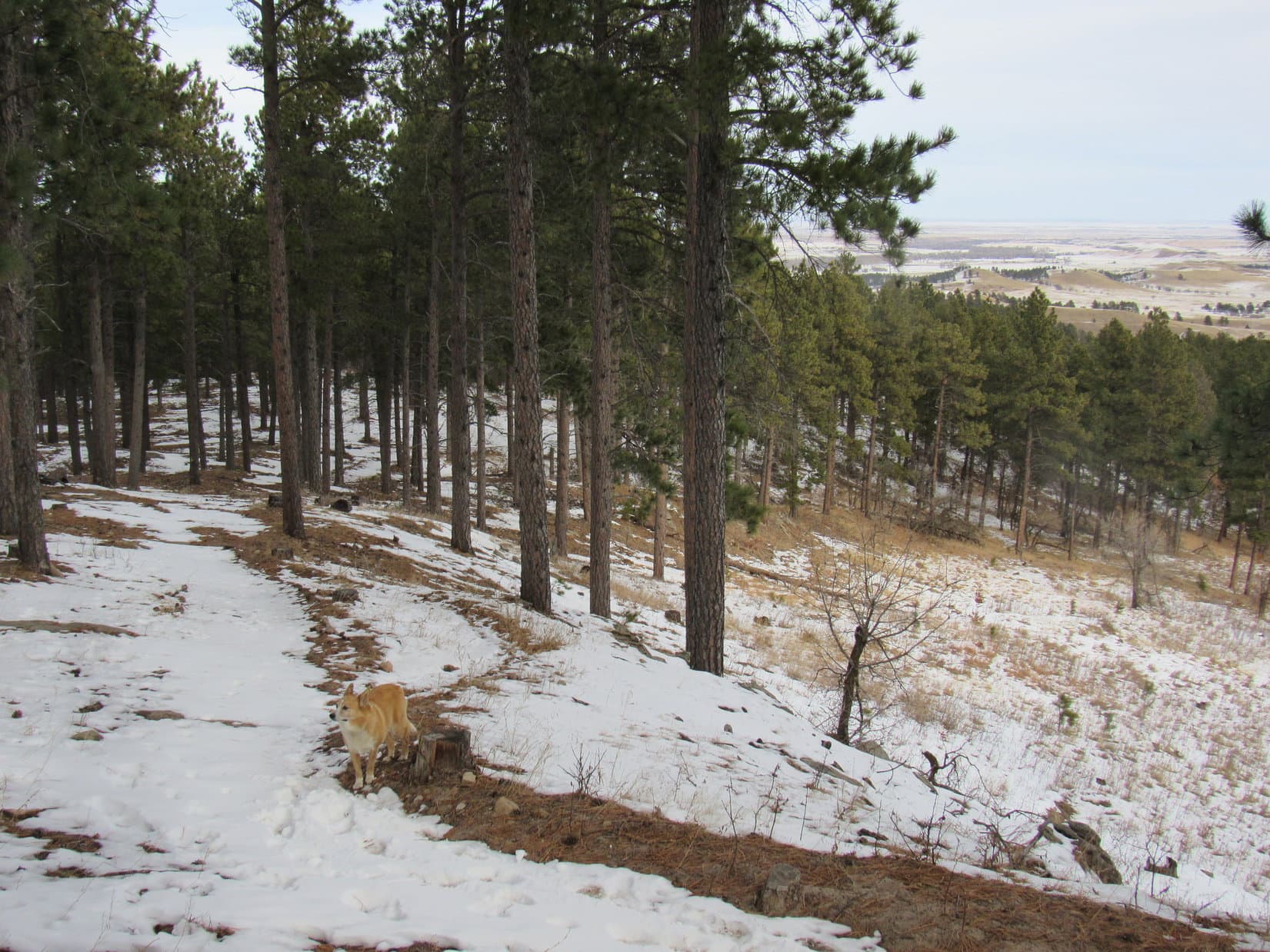
In any event, Loopster was all fired up!  As soon as SPHP was ready, she crossed Hwy 244 and hit the trail.  Centennial Trail No. 89 wound WSW through typical pine forest.  Most of the time Lupe was gaining elevation gradually.  She passed by some rock formations fairly early on.

Rock formations not far from the Big Pine trailhead.

After 0.75 mile, Lupe came to a junction with Willow Creek Rushmore Trail No. 5.  A map of the local trail system was here, plus a registration station for the Black Elk Wilderness.  SPHP registered for Lupe, and she continued on.

At the junction with Trail No. 5. Centennial Trail No. 89 continues on past the map.
Map at the junction with Trail No. 5.

Leaving the junction, Centennial Trail No. 89 climbed steadily.  0.25 mile brought Lupe to a sign at the edge of the Black Elk Wilderness.  Beyond this sign, the trail made a couple of switchbacks up to a minor pass.  On both sides of a wide path, the forest was tightly packed with dog hair pines, so SPHP brilliantly named this pass Dog Hair Pass.

Dog Hair Pass was the first significant high point of the day.  Lupe had gained 261 feet of elevation since leaving the Big Pine trailhead.

At the start of the Black Elk Wilderness.
Here we are at Dog Hair Pass!

From Dog Hair Pass, Centennial Trail No. 89 gradually descended S into a remote valley.  Dead trees had fallen across the trail in some places.  At one point, a tiny stream trickled right on the trail.  Lupe began getting glimpses of big rock formations, especially toward the E.  The Carolina Dog eventually came to a larger stream.  This was Pine Creek.

Some deadfall here due to an old pine bark beetle infestation, but it’s not too bad.
A tiny stream is flowing right over this stretch of trail.
Lots of big rock formations around, but most are fairly well hidden by the forest.
This must be Pine Creek!
Pine Creek.

After crossing Pine Creek, Centennial Trail No. 89 followed the stream E.  Lupe saw more rock formations.  She crossed a little tributary stream.  The trail then curved N.  A wall of rock appeared on the other side of Pine Creek shortly before Lupe came to a larger tributary.

A rock formation with a hollow spot underneath.
Crossing a small tributary of Pine Creek.
This wall of rock appeared shortly before Loop reached a larger tributary.

This larger tributary was as far downstream as Centennial Trail No. 89 was going to follow Pine Creek, and the first significant low point.  Lupe had lost nearly 240 feet of elevation since leaving Dog Hair Pass.  Her net elevation gain to this point was only about 21 feet.  As the crow flies, she hadn’t actually gotten very far from the trailhead yet, either, less than a mile, due to the circuitous route the trail had taken.

Lupe crossed the larger tributary of Pine Creek.  Centennial Trail No. 89 started climbing again following the tributary upstream.

At the first significant low point in the Pine Creek valley. Centennial Trail No. 89 follows this tributary upstream from here.

Staying N of the creek, the trail climbed E at a fairly good clip for a little way.  The creek then turned S, and Centennial Trail No. 89 did, too.  The valley leveled out for 0.25 mile or more.  Lupe crossed the tributary of Pine Creek twice along in here.  After the second crossing, the trail immediately left the stream behind and climbed E up a long slope to the next minor pass.

This second pass was also a significant high point along the trail, and was also heavily forested with a bunch of dog hair pines.  However, SPHP didn’t think naming every pass Dog Hair Pass No. 1, No. 2, etc. was such a good idea.  Quite cleverly, with hardly any mental effort at all, SPHP came up with Short Pine Pass as a suitable designation.  No doubt Lupe was impressed, but she didn’t actually say so.

Lupe had gained 280 feet of elevation on the way from the low point at Pine Creek up to Short Pine Pass, bringing her net elevation gain to 301 feet.

At the first of two crossings of the tributary after leaving Pine Creek.
Looking back after leaving the tributary behind.
Short Pine Pass.

From Short Pine Pass, Centennial Trail No. 89 wound down into a ravine where the tops of trees killed by pine bark beetles had been snapped off in high winds.  This did open up the views a bit.  Lupe could see larger rock formations off to the SE now.

Bigger rock formations SE of Short Pines Pass.

The American Dingo was coming to an area she had been to many times before, a short section of Centennial Trail No. 89 that is shared with Horsethief Lake Trail No. 14.

At the junction with Horsethief Lake Trail No. 14.
Turn L at this junction with Horsethief Lake Trail No. 14 to stay on Centennial Trail No. 89.

Upon reaching Horsethief Lake Trail No. 14, Lupe turned L (NE).  Two minutes on the shared trail brought her to where the trails divided again.  To the L, Horsethief Lake Trail No. 14 went straight to Horsethief Lake and Hwy 244, a major shortcut back to the Big Pine trailhead.

Going to Horsethief Lake would have completed a nice loop, but that wasn’t the plan.  Loopster went R, sticking with Centennial Trail No. 89.  Almost immediately after making the turn, she came to a small stream.  This little stream was the 2nd significant low point.  Lupe was about 190 feet lower here than at Short Pines Pass, reducing her net elevation gain to 111 feet.

At the next trail junction, only a couple of minutes from the first one. Horsethief Lake Trail No. 14 goes off to the L. Centennial Trail No. 89 bends around to the R.
Go around this bend to the R to stick with Centennial Trail No. 89!
Centennial Trail No. 89 crosses this tiny creek right after leaving Horsethief Lake Trail No. 14.

The trail now began climbing steadily again.  Not too long after crossing the tiny creek, Lupe passed by a very tall granite spire.  Beyond the spire, the trail led SE up a long valley.  Near the upper end, Lupe came to a few mild switchbacks before reaching a 3rd significant high point.  Since the trees were bigger here, but not enormous, SPHP designated this spot Medium Pines Pass.

Near the tall granite spire.
Welcome to Medium Pines Pass, at 5,500 feet the highest point on Centennial Trail No. 89 between Big Pine and the Iron Creek Horse Camp!

Medium Pines Pass is the highest point along Centennial Trail No. 89 between Big Pine and the Iron Creek Horse Camp.  Lupe was now at 5,500 feet, a gain of 310 feet from the little creek near the last junction with Horsethief Lake Tail No. 14, and 421 feet higher than the Big Pine trailhead where she’d started out.

Beyond Medium Pines Pass, the trail continued SE on a steady descent into the next valley.  Large rock formations capped hills to the E.  Lupe came to a big granite boulder right next to the trail.  She got up onto it for a better look.

SE of Medium Pines Pass.
On the granite boulder.
Granite formations capping hills E of the trail.

Past the boulder, a long set of stairs wound deeper into the valley.  Below the stairs, the trail continued lower, but not as steeply.  Looper came to another tiny stream, which she promptly plopped herself into to cool off.  After crossing this stream, the trail followed it lower for a while before unexpectedly curving away to the W, climbing perhaps 150 feet to yet another pass.

Rock formations visible E of the trail before it curved away to Deadfall Pass.

Deadfall Pass was the 4th high point Lupe had come to, but didn’t seem as significant as the others.  The trail was soon descending again, but at an easy pace interspersed with flat stretches.  Lupe had been going SW on the way over Deadfall Pass, but beyond it the trail gradually curved around to the SE again while winding along forested slopes.  More tiny streams appeared, so small they were almost certainly seasonal.

Eventually the trail turned NE, and dropped down to a larger stream, which was often heard, but seldom seen.  Impressive granite formations were in this area, especially to the N.  Lupe came to a small pond.

Crossing Deadfall Pass.
Another tiny stream. The trail crossed several along in here.
A nice flat section.
Near the little pond.
This pond might be seasonal, but seemed deep enough to be around most of the time.

A short distance past the pond, the trail bent around to the S.  It wasn’t much farther to another intersection.  A sign indicated Lupe had reached a spur trail leading to Mount Rushmore.

The trail on the L is a spur coming in from Mount Rushmore. Lupe kept going straight on the R past the mossy log.

Ignoring the spur to Mount Rushmore, Lupe kept heading S.  She was still going down the same valley Centennial Trail No. 89 had been in for a while now.  The stream in this valley had grown in size, but was still small enough to easily step or leap over as the trail crossed it twice.

Crossing the stream S of the spur to Mount Rushmore.

The second crossing came just before Lupe reached a confluence with another even bigger creek.  Since this confluence wasn’t too far off the trail, Lupe went over to have a look at it.  She was now at 4,860 feet, the lowest point she would come to today, having lost 640 feet since leaving Medium Pines Pass.  The Carolina Dog had made it to Grizzly Bear Creek.

At the confluence of the stream Lupe had been following with Grizzly Bear Creek.

Returning to Centennial Trail No. 89, Lupe continued S.  100 feet brought her to a ford.  This ford was no more than a couple of feet deep, but far too wide to leap over.  Not anxious to get wet feet, SPHP looked for a drier way across.  A few boulders 40 feet upstream did the trick.

More than 4 hours had shot by since Lupe left the Big Pine trailhead.  Grizzly Bear Creek was a beautiful spot to take a little break.  Once over the stream, Lupe and SPHP relaxed for a bit on a big rock.

Grizzly Bear Creek.
Don’t want to get your paws wet crossing Grizzly Bear Creek? Cross it here! This is a nice rock to rest on, too, once you’re over.

The rest break next to Grizzly Bear Creek was pleasant, but couldn’t be allowed to drag on too long.  The Carolina Dog was soon on her way S again.  Centennial Trail No. 89 climbed gradually at first, but before long Grizzly Bear Creek veered off to the W.  Lupe found herself going up a side canyon on one of the most aggressive climbs of the day.

By the time Lupe reached Rushmore Pass, she was 320 feet higher than the low point she had just left at Grizzly Bear Creek.  Up at the pass, the trail briefly curved E and entered a 40 foot wide clearing.

The clearing at Rushmore Pass.

Not much could be seen from the clearing, but a hill NE of it provided a view.  Temporarily leaving the trail, Lupe scrambled up to some rocks from which Mount Rushmore (5,725 ft.) was in sight.

Mount Rushmore (R). Photo looks N.
Another look with help from the telephoto lens.
Only Washington and Lincoln are visible from this angle. Photo looks N.

From Rushmore Pass, Centennial Trail No. 89 continued S, once again steadily losing elevation.  After a while, Loopster came to a big granite formation on the L (E) partly surrounded by a swamp.  SPHP had little recollection of what Lupe had seen so far today from back when she had been here 7 years ago, but this rock did seem vaguely familiar.  The area seemed more overgrown than what SPHP recalled, but was probably the same spot.

This rock deserved a name!  How about Forgotten Rock?  Sounded better than Dimly Remembered Rock.

Forgotten Rock! Don’t worry, there isn’t going to be a test. You can forget it, too!

The trail went on and on.  From Forgotten Rock, Lupe followed a small stream uphill, crossing the stream twice before it disappeared.  A spindly forest grew at another minor pass where there was a small sunny spot.  SPHP dubbed this one Nowhere Pass.  Nowhere Pass turned out to be hardly a pass at all.  A little farther on, Lupe reached South Deadfall Pass, which was slightly higher.

Another descent, but a minor one.  The trail curved to the R and crossed “Muck Creek”.  Centennial Trail No. 89 climbed again.  At last Lupe came to a place she had been to less than 2.5 years ago, an intersection with Centennial Bypass Trail No. 89B.  Lupe had accidentally come this way from Iron Mountain (5,446 ft.) on Expedition No. 184 while looking for Peak 5688.

Nowhere Pass.
South Deadfall Pass.
Ever feel like you’ve been in a rut? Lupe S of South Deadfall Pass.
Here we are at lovely “Muck Creek”!
Oh, I remember this spot! SPHP missed a turn and I wound up here on Expedition No. 184. Not going this way today!

Bypassing Centennial Bypass Trail No. 89B, a short trek brought Loop to yet another pass.  Bypass Pass seemed like a silly, but appropriate name.  How many of these goofy passes were there going to be anyway?  Even SPHP was starting to lose track of them all.

A splendid fungus on a dead tree.
Bypass Pass.

Centennial Trail No. 89 continued S from Bypass Pass on a long gentle decline.  Having been here so recently, SPHP knew exactly where Lupe was going to come out – Confusion Point!

Confusion Point was another trail intersection, but an unmarked one.  Way back on Expedition No. 10, SPHP hadn’t known which way to go.  Now it was understood that Confusion Point was one end of another short section of shared trail, this time with Grizzly Creek Trail No. 7.  When Lupe got to Confusion Point, SPHP had her turn L (E) toward a huge granite spire.

Loop at Confusion Point.

The shared section of trail began heading E toward the spire.  It quickly curved SE revealing a wide passage between massive walls of granite.  Grizzly Creek Trail No. 7 went through that passage, but Centennial Trail No. 89 split off to the R, resuming its course S.  A sign was present, but not terribly conspicuous.  It would have been easy to miss this turn, if Lupe hadn’t been here before.

Grizzly Creek Trail No. 7 goes straight on through the wide passage ahead. Centennial Trail No. 89 splits off to the R just beyond Lupe.
Centennial Trail No. 89 right after it leaves Grizzly Creek Trail No. 7.
The not so conspicuous sign.

Lupe had made tremendous progress!  Only 1.25 miles left to the Iron Creek Horse Camp!

Leaving Grizzly Creek Trail No. 7 behind, Lupe climbed 50 or 60 feet in a fairly short distance.  At the high point, newly nicknamed Confusion Pass, there was a rock formation immediately to the R of Centennial Trail No. 89.  Loop got up onto it.  She had a good view of some of the big granite formations she had just gone by, and could see Black Elk Peak (7,231 ft.), the highest mountain in South Dakota, too.

Rock formations in the Confusion Pass region.
There’s Black Elk Peak (Center)! Photo looks NW.

Another descent began from Confusion Pass.  Lupe came to a low area where a stream wound through a grassy field.  Out in the middle sat a big rock formation.  This was it!  This was the rock formation that SPHP had been thinking of earlier at Forgotten Rock.  No wonder Forgotten Rock hadn’t looked quite the same!  It wasn’t.

Forgotten Rock could keep its name.  SPHP truly hadn’t remembered it at all.  The rock Lupe was at now could be Memory Rock, since there had at least been some recollection of it.  Yeah, that made sense!

There’s Memory Rock! Guess a few brain cells are still functioning.
At Memory Rock less than a mile from the Iron Creek Horse Camp. Forgotten Rock is considerably farther N.

Centennial Trail No. 89 climbed again.  Off to the NW were glimpses of higher mountains, but no clear views.  Making short forays off-trail, Lupe had better luck seeing some lesser, but still interesting formations much closer by.

Rugged territory by Black Hills standards to the NW.
Closer pinnacles.
Same view with help from the telephoto lens.

The trail dropped again, but Lupe didn’t have an awful lot farther to go.  She came to another good-sized stream.  Iron Creek!  Possible to rock hop it today, but just barely.

We’ve finally made it to Iron Creek!
Looking back after crossing Iron Creek.

The trail made one more 75 foot climb before descending to a road.  Lupe had made it all the way through the Black Elk Wilderness!  She passed a brand new Black Elk Wilderness sign on the way down.  More maps were posted at the road.

Good job! We’ve made it all the way through the Black Elk Wilderness! Spiffy new sign, aye?
Map display by the side of the road.
Black Elk Wilderness map.

After a quick look at the maps, Lupe and SPHP followed the road down to a bridge over Iron Creek.  On the other side of the bridge, Lupe came to the Iron Creek Horse Camp.  This early in the season, the horse camp was closed.  Lupe and SPHP took a stroll around the loop anyway.  No people, and sadly for Lupe, no horses.

At the far end of the loop, Lupe passed the start of Norbeck Trail No. 3, most of which goes through the SW part of the Black Elk Wilderness.  The highlight of the whole horse camp tour was a bright orange bird which flitted by, came to rest in a tree for 20 seconds, then flitted away.  SPHP had never seen a bird like it before.

Success! Lupe reaches the Iron Creek Horse Camp.
Iron Creek Horse Camp would be even better with horses!
This bright orange bird was striking, but Lupe would have been more impressed with a bright orange squirrel.

And that was it.  8 hours after leaving the Big Pine trailhead, Lupe set out from Iron Creek Horse Camp, this time heading N on Centennial Trail No. 89.  Already 4:00 PM!  SPHP was certain the American Dingo wouldn’t get back until well after dark.

However, Lupe had an option.  Instead of repeating the entire trudge over all those countless passes on Centennial Trail No. 89, at Confusion Point she could take Grizzly Creek Trail No. 7 instead.  This maneuver worked out perfectly!  The Carolina Dog saw territory she had never seen before.  Grizzly Creek Trail No. 7 was easy, too!  Much straighter, with far less up and down than Centennial Trail No. 89.

The first of many tiny cattail ponds along Grizzly Creek Trail No. 7.
Exploring Grizzly Creek Trail No. 7.
Evening draws nigh.

Lupe made rapid progress.  When she reached the S end of Horsethief Lake Trail No. 14, she took it all the way to Horsethief Lake.  Arriving at the lake before dark, a short stroll through the campground to Hwy 244 was all that remained to return to the Big Pine trailhead.  (7:28 PM, 59°F)

Even though Lupe had climbed to 5,660 feet on Horsethief Trail No. 14, she’d made it all the way back to Big Pine in only 3.5 hours!  No stars, no moon, no long march in the dark.

That was OK!  Lupe had explored all of Centennial Trail No. 89 between Big Pine and the Iron Mountain Horse Camp.  In 11.5 hours, she’d made a big figure 8 through the heart of the Black Elk Wilderness.  It had all been fun!  What sounded like fun now, though, was a ride home to her Alpo and a long snooze.

Evening at Horsethief Lake, Black Hills of South Dakota 4-20-18

Notes:  Big Pine trailhead and the Iron Creek Horse Camp are at roughly the same elevation.  Estimated total elevation gain (and loss) going from Big Pine to Iron Creek Horse Camp on Centennial Trail No. 89 is 1,781 feet.  Elevation gain (and loss) via Lupe’s return route on the Grizzly Creek and Horsethief Lake trails was only 964 feet.  Total gain (loss) of 2,745 feet round trip.

Links:

Next Black Hills Expedition                 Prior Black Hills Expedition

Next Trail Section North

Black Hills, SD Expedition No. 130 – Centennial Trail No. 89: Samelius to Big Pine & Horsethief Lake (5-23-15)

Next Trail Section South

Black Hills, SD Expedition No. 272 – Centennial Trail No. 89: Iron Creek Horse Camp to Badger Hole (4-1-21)

Centennial Trail No. 89 Brochure & Map

Want more Lupe adventures?  Check out Lupe’s Black Hills, SD & WY Expeditions Adventure Index, Master Adventure Index, or subscribe free to new Lupe adventures!

Black Hills, SD Expedition No. 241 – Centennial Trail No. 89: Alkali Creek to Fort Meade (12-10-18)

10:11 AM, 35°F – Gates close at dusk?  Ridiculous!  That’s what the sign said, though.  The Alkali Creek trailhead for Centennial Trail No. 89 was huge and totally empty, but days are really short in December.  SPHP wasn’t at all certain Lupe would be back before dusk, rendering the trailhead useless.

SPHP found a place to park along Horse Soldier Road.  Lupe trotted back to the trailhead.  Alkali Creek was the official starting point for today’s Black Hills expedition.  Lupe was going to explore Centennial Trail No. 89 all the way N to the Fort Meade trailhead.  At only 4.0 miles one way, this is one of the shortest segments between trailheads of the entire 111 mile long Centennial Trail.

Gates close at dusk? Lupe near the entrance to the useless Alkali Creek trailhead. She might or might not be back by dusk! Photo looks E.
Loop at the official starting point for Black Hills, SD Expedition No. 241. Photo looks NW.

Lupe was anxious to get going!  SPHP took only a quick peek at the posted trail map.  It showed a surprisingly complex trail system in the area.  Loop had no patience for it.  Leaving the trailhead, the Carolina Dog crossed Horse Soldier Road.  She picked up Centennial Trail No. 89 in a field on the other side.

Loop gets underway N of the Alkali Creek trailhead. Photo looks NE.

As Lupe sniffed along, the trail gradually curved N.  Soon Bear Butte came into view.  The summit of Bear Butte (4,422 ft.) is the official N end of Centennial Trail No. 89.  Lupe wasn’t going that far today.

Bear Butte (L) starts coming into view as the trail curves N. Photo looks NNE.

0.33 mile from the trailhead, Looper reached a junction at the top of a small rise.  Centennial Trail No. 89 went W (L) here passing through a barbed wire fence.  The other trail continued N through a long field.

Centennial Trail No. 89 goes W (L) here. Another route continues N through the long field seen ahead. Photo looks N.
From this gate Centennial Trail No. 89 heads W into the forest. Photo looks W.

Beyond the fence, Centennial Trail No. 89 headed W toward a forested ridge Lupe had seen from the trailhead.  Before reaching the trees, the Carolina Dog paused for the best view of Bear Butte yet.

Bear Butte. Photo looks NNE with help from the telephoto lens.

Once in the forest, Centennial Trail No. 89 wound NW up the E side of the ridge.  The steepest part came near the beginning.  Even here, the trail wasn’t bad at all.  Lupe climbed through a forest of scrub oak and Ponderosa pines.

Loop rounds a bend early on the way up the ridge. Photo looks SE.
Even along the steepest part of the ridge, the trail was quite easy. Photo looks N.
Lupe had a good view from this rock. Photo looks SE.
Heading W up a minor ravine.

Higher up, the slope of the terrain was more gradual.  The trail trended SW for a while.

Higher up the terrain sloped more gradually. Photo looks SW.
Getting close to the top of the ridge. Photo looks SW.

The ridge the trail was climbing is 0.75 mile long N/S.  The W face of the ridge is much steeper than the E slope.  Nearing the top of the ridge line, Centennial Trail No. 89 brought Loop very close to the S end of the ridge.  Naturally, she stopped to check out the view.  To the S, she could see I-90 and the Black Hills National Cemetery.

Loop at the S end of the ridgeline. Photo looks S.
Looking S along I-90 with help from the telephoto lens.
Zoomed in on part of the Black Hills National Cemetery.

Peak 4027 is the high point of the entire ridge Lupe was on.  It was only 200 yards N of the extreme S end.  Centennial Trail No. 89 headed right for it.  The summit proved to be spacious and gently rounded.  Flanked by pines to the W and N, the whole area was grassy and open.

Approaching Peak 4027, summit of the entire ridge Lupe had climbed. Photo looks N.

Centennial Trail No. 89 didn’t go quite all the way up Peak 4027.  Instead it swept around the E side of the spacious summit.  Lupe had a great view of the prairies of western South Dakota.

Looking E over the prairies from Peak 4027.

Loopster wasn’t about to bypass the true summit of Peak 4027!  She left Centennial Trail No. 89 to tramp through the snow looking for it.  There wasn’t any definite absolute high point, but she explored enough ground to be satisfied with her ascent.

On Peak 4027. This high ground near a small stand of big pines seemed to be the true summit as far as it could be determined. Photo looks NE.

The scenic highlight from Peak 4027 was Bear Butte rising dramatically like a miniature volcano from the surrounding prairie.  Trees blocked any views of the main body of the Black Hills to the W.

Bear Butte is the scenic highlight from Peak 4027. Lupe is standing on a stump. Photo looks NNE.

Lupe returned to Centennial Trail No. 89.  The trail continued N along Peak 4027’s long N ridge.  Most of the ridge was forested.  What it lacked in views, it made up in squirrels.  Looper had a grand time barking and searching for them.

Back on Centennial Trail No. 89, still close to Peak 4027. Photo looks NW.
Forest hid the views, but provided a home for squirrels and deer as Lupe continued N. Photo looks N.

Nearly 0.5 mile N of Peak 4027, Lupe came to another grassy area.  She was approaching High Point 3983 on the topo map.

Approaching High Point 3983. Photo looks N.

At High Point 3983 Lupe reached a fork in the trail.  A large post stood next to the fork.  Centennial Trail No. 89 stayed to the L.

Lupe at the fork in the trail near High Point 3983. Centennial Trail No. 89 continues N passing L of the high ground. Photo looks N.

Beyond High Point 3983 the trail went NNW still following the ridgeline.

Back in the forest NNW of High Point 3983. Photo looks N.

0.25 mile from High Point 3983, Lupe finally reached the N end of the ridge.  From rock outcroppings along the edge, the Carolina Dog could see Sturgis, SD to the NW.  Peak 3950 and Crook Mountain (4,930 ft.) were in view, too.

At the N end of the 0.75 mile long ridge. Peak 3950 (Center) is the hill beyond Lupe. Photo looks NNW.
Sturgis, SD from the N end of the ridge. Crook Mountain is in the distance on the L. Photo looks NW.

Leaving the mountain’s main ridgeline, Centennial Trail No. 89 began a long gradual descent.  After a switchback or two, Lupe found herself traveling NNE.

On the descent. Photo looks NE.

The trail curled clear around to the SW as it entered a large draw.

Lupe spots a squirrel as Centennial Trail No. 89 enters a large draw. Photo looks SW.

The draw drained NE.  The trail turned NE again, too.  More snow was down here.  The draw brought Lupe back to Horse Soldier Road.

Down in the snowy draw. Photo looks ENE.
Lupe reaches Horse Soldier Road again. Photo looks NE.

Centennial Trail No. 89 crossed Horse Soldier Road, but where it went on the other side wasn’t completely clear.  Lupe searched for a marker.  She found an icy pond off to the NW, but no markers.  SPHP finally realized the correct route was the obvious one.  Lupe followed a frozen road NE.

Heading NE after crossing Horse Soldier Road.

Having crossed Horse Soldier Road, the first part of Lupe’s journey to the Fort Meade trailhead was over.  Until now, she had been up in the forest on the long ridge that was all part of Peak 4027.  The remaining trek was lower territory.  The trail was about to make several forays E toward the prairie, each time turning W again to re-enter the forest.

Following the frozen road, the American Dingo headed NE out into the grasslands.  Centennial Trail No. 89 left the road near the end of a bare ridge, and climbed up onto it.  Although this ridge was much lower than the forested ridge where Peak 4027 and High Point 3963 were, Loopster enjoyed unbroken panoramas.

Going up the first low ridge. The much higher forested ridge Lupe had just left is in the background. Photo looks SW.
Bear Butte from the first low ridge. Photo looks NNE.
View to the SE.
Looking back. The Alkali Creek trailhead (Center) is way over at the base of the forested hills beyond the snowy grasslands. Photo looks S.

Fort Meade was already in sight only 0.5 mile to the N.  The way the trail was going to wind around, Lupe still had a lot farther than that to go to get to the Fort Meade trailhead.

There’s Fort Meade! Photo looks NNW with help from the telephoto lens.

Now that Lupe was up on the ridge, the trail turned back to the WSW.

Having made it up onto the ridge, the trail heads back toward the Black Hills. Photo looks WSW.

The single track became a dirt road as Lupe drew near the forest again.  For at least a little way, this was still Centennial Trail No. 89.  However, when no more markers appeared, SPHP began to suspect the trail had disappeared somewhere into the forest on the N side of the ridge.

As Lupe got close to the forest again, the single track was evolving into a dirt road. Photo looks W.
For at least some distance, Centennial Trail No. 89 followed the road. Photo looks W.

Lupe wasn’t far from Horse Soldier Road again when she spotted some still green pine slash snaking through the grass N of the snowy road.  Upon inspection, it was evident this slash had been deliberately placed on a trail.  Maybe Centennial Trail No. 89 had been re-routed?  Perhaps this was an officially discouraged shortcut?

See the green slash? Maybe this is the way back to Centennial Trail No. 89? Photo looks N.

Lupe and SPHP followed the slash N down a snowy slope.  Before long the slash led to another trail that was unobstructed.  Continuing N, Lupe spotted a Centennial Trail No. 89 marker on a tree.  Exactly where she’d lost the trail in the first place still wasn’t clear, but at least she was back on it again.

Back on Centennial Trail No. 89 again! See the marker on the tree on the L? Photo looks N.

The single track went virtually all the way back to Horse Soldier Road, but did not connect to it.  Instead, right next to the road and a bit below it, the trail skirted around the W end of a forested ravine.

Heading NW on the S side of a ravine.

Once N of the ravine, the trail turned E again.  Lupe was on the side of a fairly steep slope.

On the N side of the ravine now. Photo looks W.

The trail left the ravine going N along the E side of a hill.  Lupe could see white headstones.  Fort Meade National Cemetery was up on the hill.  This small cemetery was established in 1878 by surviving members of General Custer’s 7th cavalry.

Fort Meade National Cemetery came into view. Photo looks NW.

After skirting the E and N sides of the cemetery, Centennial Trail No. 89 went around the W end of a much larger ravine.  Again the trail turned NE following another ridge out toward the prairie.

Heading for the next ridge N of the cemetery. Photo looks N.
Looking ENE along the ridge N of Fort Meade National Cemetery.

The trail went partway down the NE end of the ridge.  Lupe enjoyed some nice views along in here.

Nearing the E end of the last ridge. Photo looks ENE.

Once more, the trail looped back around to the W and returned to the forest.  Lupe climbed a little, then descended into a valley filled with snow.  All these winding loops the trail had made had chewed up a lot of time.  Never high in December, the sun was sinking toward the horizon.

The sun was already sinking when Lupe reached this snowy valley. Photo looks SW.

The valley floor was flat and fairly wide.  A private home sat a little N of the trail.  As Lupe went past it, the trail turned SW.  There were tons of footprints in the snow, but Loop hadn’t seen anyone all day.

The far SW end of the valley was narrower.  An odd stone building stood near the trail.  Beyond it, Lupe could see Horse Soldier Road again.  She dropped by the building to sniff around a bit, but discovered nothing of interest.  The building looked like it had been abandoned for a long time.

Approaching the stone building. Photo looks W.
Checking out the strange stone building.

The Carolina Dog pressed on.  The trail headed N climbing a small hill.  Lupe reached a minor pass.  At the end of a short spur trail sat another oddity – a large stone fireplace.

This stone fireplace stood at the end of a short spur trail. Photo looks N.

A wooden fence enclosed the ground around the fireplace.  No signs or plaques explained how or why the fireplace came to be here.  Lupe left it just as mystified as she’d arrived.

Beyond the minor pass, Centennial Trail No. 89 made a long sweeping curve SW down into a snowy field.  By the time the trail straightened out again, Looper was heading N.  This was the final stretch.  The Fort Meade trailhead was just ahead.

On the big curve leading to the final stretch. Photo looks NW.
Almost there! Bear Butte (R) comes into view again. Photo looks NNE.
Made it! Looper stands at the entrance to the Fort Meade trailhead. Photo looks N.
At the information display. Photo looks W.

Lupe had made it!  She had traveled the entire length of Centennial Trail No. 89 between the Alkali Creek and Fort Meade trailheads.  It had been a pleasant, mostly easy trek offering a variety of terrain, scenes, and complete solitude.

SPHP had hoped Lupe would have time to climb Peak 3950 on the way back to the G6, but the sun was already way too low for that.  Even just retracing her entire route would take longer than desired.  Time for a shortcut!  Lupe and SPHP left the Fort Meade trailhead heading S on Horse Soldier Road.

The road was icy.  After getting past the Fort Meade National Cemetery, a trail left the road heading S.  A post said this was Trail No. 10.  The trail looked like a shortcut that might lead down to the icy pond Lupe had seen earlier.  Why not explore it?

About to leave Horse Soldier Road to venture down Trail No. 10. The end of Peak 4027’s long N ridge is seen on the R. Photo looks S.

Trail No. 10 went E along a steep slope with southern exposure.  Sure enough, after 0.5 mile the American Dingo came to the frozen pond.

Looking down on the frozen pond from Trail No. 10. Photo looks SE.
By the frozen pond. Photo looks SW.

Horse Soldier Road and Centennial Trail No. 89 were close to the pond.  Lupe crossed the road.  Enough daylight remained to retrace the rest of the trail.  Lupe completed a second ascent of Peak 4027 before dark.

Bear Butte from the same stump on Peak 4027 that Lupe had been on before. Photo looks NNE.

Light was fading by the time Lupe made it down off Peak 4027.  It was dusk when she went past the Alkali Creek trailhead.

Gates still open!  Could have parked there!  Oh, well.  A cold N breeze blew as Lupe and SPHP trudged along Horse Creek Road in silence.  Didn’t matter.  Not much farther to the G6 anyway.  (4:49 PM, 33°F)

Bear Butte from Centennial Trail No. 89, 12-10-18

Notes – Horse Soldier Road goes from I-90 Exit 34 near the Alkali Creek trailhead to Hwy 34/79 a mile E of Sturgis near the Fort Meade trailhead.  This road is also known as the National Back Country Byway or Cemetery Drive (N part) or Old Stone Road (S part).

Links:

Next Black Hills Expedition                  Prior Black Hills Expedition

Next Trail Section North:

Black Hills, SD Expedition No. 149 – Centennial Trail No. 89: Fort Meade to Bear Butte Lake (12-19-15)

Next Trail Section South:

Black Hills, SD Expedition No. 274 – Centennial Trail No. 89: Elk Creek to Alkali Creek (4-10-21)

Centennial Trail Map & Brochure

Fort Meade Recreation Area

Bear Butte State Park

Want more Lupe adventures?  Check out Lupe’s Black Hills, SD & WY Expeditions Adventure Index, Master Adventure Index, or subscribe free to new Lupe adventures!