9-16-22 – Mournful eyes stared reproachfully at SPHP. Laying listlessly on the hallway carpet, the Carolina Dog wore an expression of complete and utter boredom. Back only yesterday from weeks of adventures, and already a clear-cut case of post Dingo Vacation depression!
Great to be home again, aye, Loopster?
I wish we were still in Alaska, SPHP!
Yeah, me too, Looper. Getting kind of chilly up there by now, though! Every single day can’t be another grand adventure, you know. Most of the time, life just isn’t that scintillating. But you really can’t complain. We had an awesome summer!
I can complain if I want to, SPHP, because it’s all over and done with now. You could make things better, though!
Better? Like how?
We could go on a Black Hills expedition!
Oh, we will, Loop, but not yet. Got a lot of unpacking, cleaning, yard work, bills to pay, and other catching up to do here first. Gonna be a while!
Whoooeee! Don’t all those chores sound delightful? Have fun, SPHP! And feel free to start without me.
Sheesh! Spoiled Dingo! Actually, we are going to be having fun before too much longer. I’m checking email. Listen to this! Your Aunt Andrea says that she and Uncle Joe will be coming up from Colorado with Cousins Dusty and Laddie on the 21st. That’s only 5 days from now!
Really, truly? Finally! Some good news! Uncle Joe, Dusty, and Laddie will bring us some action. They’ll want to go up in the hills! I can hardly wait!
Finally? We’ve scarcely been back 24 hours! My sincere apologies for any dreariness you’ve had to put up with during this extended period of the Dingo entertainment committee’s failure to live up to your exacting standards.
Oh, I’m sorry, SPHP. We did have a wonderful summer, didn’t we? It’s just hard to readjust to the same old routine of waiting days, sometimes weeks, for the next adventure. Know what I mean? …. Why, SPHP, whatever’s wrong? Are you OK?
No. There’s a second email, Loop. I just saw it.
Bad news? They aren’t coming?
Much worse than that, Loop. They’re still coming, but your Cousin Dusty won’t be with them. Dusty passed away yesterday morning while we were driving home across Montana.
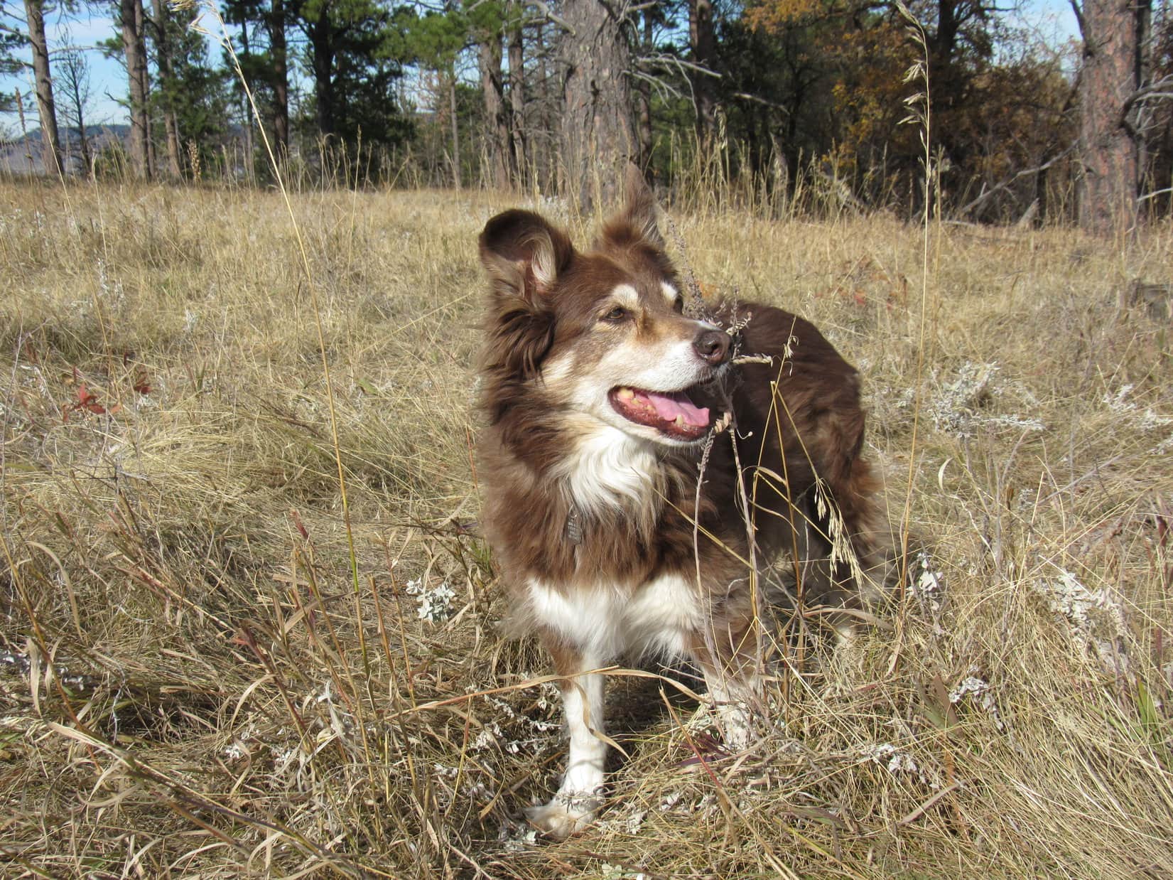
The terrible, sad news was a shock, but not an entirely unexpected one. On June 10th, Cousin Dusty had turned sweet 16, admittedly an event that isn’t nearly as sweet for canines as it is for humans. Dusty had been slowing down the last couple of years, starting to suffer from hearing loss, dogaracts, weakness in her hind legs, and decreasing energy. Early in 2020, several months before Dusty turned 15, she’d had a large tumor removed. Happily, the incision had healed completely with no apparent recurrence of the tumor.
The last time Lupe and SPHP had seen Dusty was back in April. She’d been doing pretty well for her age then. Dusty had clearly enjoyed being in the Black Hills again, and had even led the pack most of the way to Gimlet Pond and back.
Cousin Dusty is dead, SPHP? That’s horrible! Say it isn’t so!
Afraid it is, Lupe. We won’t ever see Dusty again. All we have now are the memories of how wonderful and what a great friend she always was.
Memories aren’t the same as seeing her, SPHP! What happened?
You mean how did she die? I don’t know, Loop. The email doesn’t say. I’ll have to call your Uncle Joe or Aunt Andrea to find out.
SPHP eventually reached Andrea on the phone. The heart-wrenching story of Dusty’s demise was short and simple. Dusty had been fine only 2 days ago on September 14th, but then something had transpired that night. The next morning when Joe and Andrea got up, Dusty was still alive, but in critical condition. They rushed her to the vet, but there was nothing to be done. Dusty had suffered a severely crippling stroke or seizure of some sort. It was the end.
Knowing what happened doesn’t really help, does it, SPHP? It’s still awful to lose Cousin Dusty!
Yes, it’s dreadful, Loop. But don’t you think there’s at least some comfort in knowing that Dusty didn’t have to suffer long? The suddenness is a shock, but a mercy, too.
I guess so, SPHP, but I wish Cousin Dusty was still alive and coming to see us like always.
Me too, Looper! Dusty was the best ever, wasn’t she?
No denying that, SPHP! We always had such good times together. I know Dusty has appeared on my blog fairly often since she made so many trips up to the Black Hills, but would you be willing to gather up some of the best photos and tell about Dusty again? That way we’ll always have something beautiful to remember her by.
Great idea, Lupe! I’ll do it.
COUSIN DUSTY
An Australian Shepherd/Border Collie mix, Dusty was born on or about June 10, 2006 on an elk ranch in Colorado. Literally so dirty when Uncle Joe and Aunt Andrea first saw her that they requested she be cleaned up before taking her home, they named their newly acquired adorable puppy Dusty. She was 3 months old.
The rest of her life, Dusty lived in Arvada, Colorado. Although Arvada is part of the Denver metropolitan area, Joe and Andrea’s house backs onto 100 acres of undeveloped land along Ralston Creek. Dusty enjoyed daily walks around the 100 acres, or on the bike path that follows the creek.
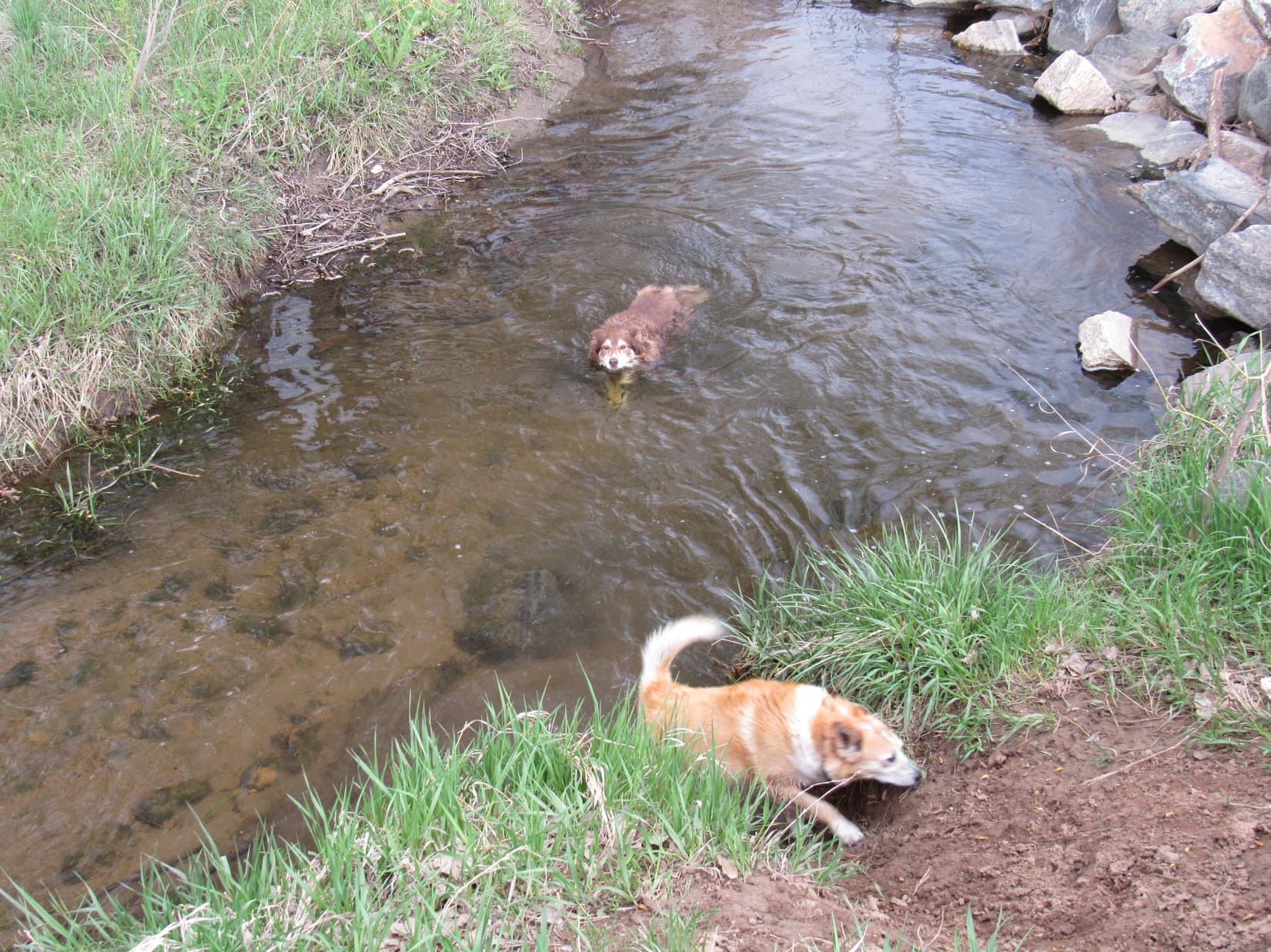
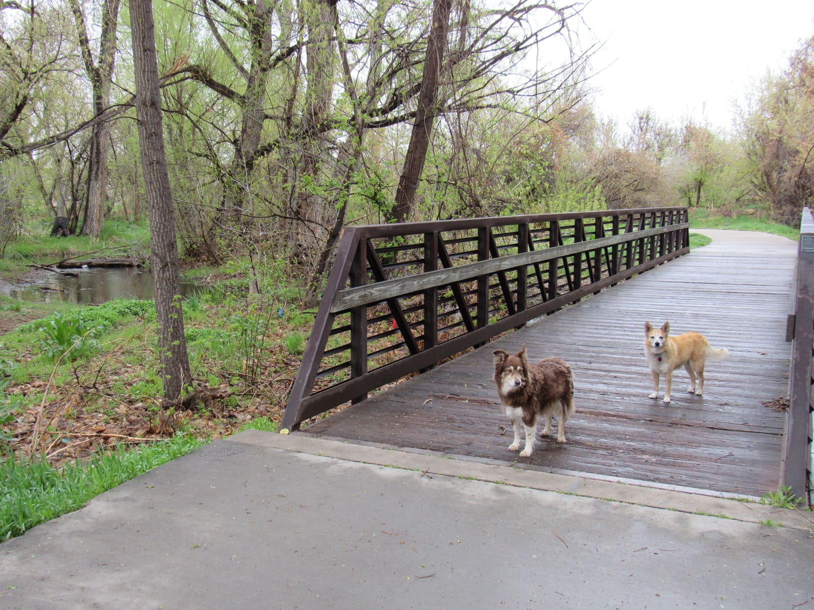
Arriving at Hotel Dusty, Arvada, Colorado 11-5-15Dusty & Lupe in the part of the 100 acre field right behind Dusty’s house, 11-5-15.Dusty, Andrea & Lupe in the 100 acre field, Arvada, Colorado on 12-28-17.Cousin Dusty, 100 acre field 12-28-17Dusty swimming in Ralston Creek, while Lupe decides maybe not, 5-8-21.With Dusty at the Jungle Bridge over Ralston Creek, Arvada, Colorado 5-11-21.
Dusty’s favorite activities included fetching ridiculously large sticks, catching Frisbees mid-air, and especially chasing tennis balls. Exhibiting tremendous speed and agility, and eager for the fun to continue beyond most anyone else’s endurance, she tirelessly plunked tennis balls and Frisbees at one’s feet as many times as you were willing to launch them for her. During walks around the 100 acres, Dusty almost always sought out a stick, the bigger, the better, then repeatedly trotted ahead to drop it where the stick could be tossed again as soon as you came to it.
Dusty awaits the tossing of an unusually small stick. Lupe never cared about the stick. Instead, she insisted on trying to herd Dusty as soon as it launched. Always focused on the stick, Dusty never objected to this rude treatment. 100 acre field 12-28-17
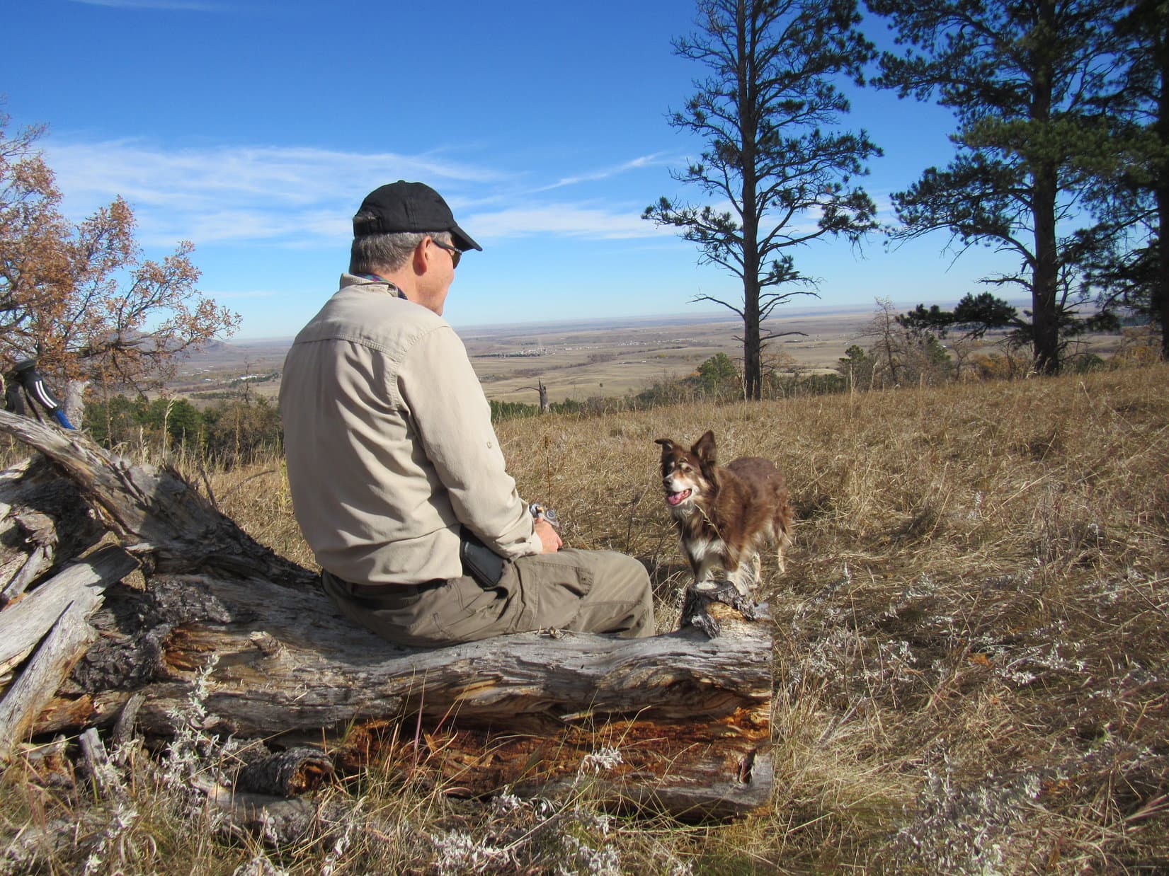
Unlike Lupe, Cousin Dusty did not like traveling. Perhaps she always felt a little car sick? She rarely displayed the slightest interest in looking out the window, preferring to curl up on the floor behind the front seats for however long it took to get to a destination. Most of Dusty’s travels were local, of course. Uncle Joe often took her to various parks, or up into the Rockies. Spacious White Ranch Park was a frequently visited favorite due to its numerous trails, scenic vistas, and proximity to home.
Dusty, Joe & Lupe on the Rawhide trail, White Ranch Park, 11-8-15.Lupe and Dusty at a trail junction in upper White Ranch Park, 11-8-15.Entering lower White Ranch Park 12-30-17Joe and Dusty heading up the Belcher Hill trail, White Ranch Park 12-30-17Exploring White Ranch Park 12-30-17Dusty on the Shorthorn trail, White Ranch Park 12-30-17Taking a break on a boulder, White Ranch Park 12-30-17North Table Mountain from White Ranch Park on a day of crazy temperature swings. 12-30-17
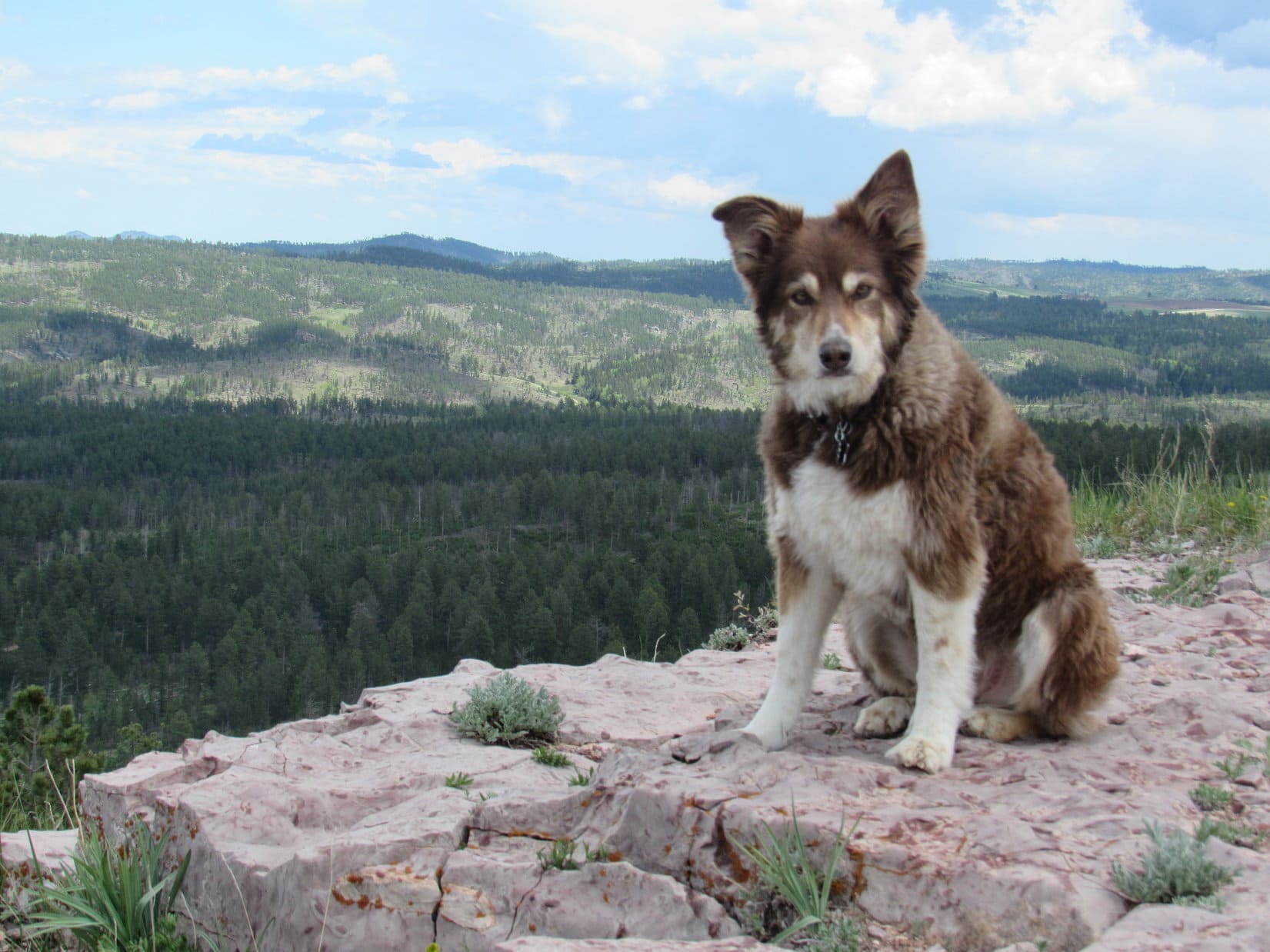
Dusty’s longer trips were frequently to Grandma and Grandpa’s house on the edge of Spring Creek canyon in the Black Hills. Dusty had been coming to the Black Hills over long weekends 2 or 3 times a year before Lupe was even born.
Lupe’s arrival was an immediate boon for Dusty. Before Lupe came along, Dusty was generally confined in the basement when staying at Grandma and Grandpa’s house. Lupe never met Grandpa. He was gone when Lupe first started coming to see Grandma on a regular basis in early 2011. Only 2 months old, little Lupe charmed Grandma with her floppy-tipped ears, freckled paws, curly tail, and friendly disposition.
And that spelled the instant demise of Dusty’s basement confinements! Since Lupe was always granted the run of the house, the next time Dusty appeared, she was, too, which made her Black Hills visits a lot more fun!
From the very start, Dusty and Lupe always got along together. Their only arguments, which were rare, were over food. Food was sometimes a problem for Dusty and SPHP, too, but not due to any mutual dispute. Used to spoiling Lupe, SPHP often shared human food with Dusty.
Not a problem, as far as Dusty was concerned! She was all for it, and came to expect great things from SPHP. Pleading, hopeful eyes under the dinner table generally achieved the desired delicious results. However, this smuggling of tasty tidbits sometimes got SPHP in trouble. Human food for dogs was a no-no in Joe and Andrea’s household. Though guilty, SPHP was never really remorseful, other than over simply being caught. SPHP was Dusty’s trusted partner in crime.
Cousin Dusty sometimes committed food crimes of her own. Like Lupe, Dusty loved chocolate. Andrea and Joe eventually learned to stash wrapped boxes of chocolates intended as Christmas presents in places Dusty couldn’t get to. More than once they had returned home to find that Dusty had sniffed out chocolates under the tree. The result was not pretty. You wouldn’t feel all that great, either, if you consumed 5% of your body weight in chocolates, wrappers and all, in one sitting.
Yes, it’s SPHP’s considered opinion that chocolate in sufficient quantities is poisonous to humans and canines alike! Ahh, but what a way to go!
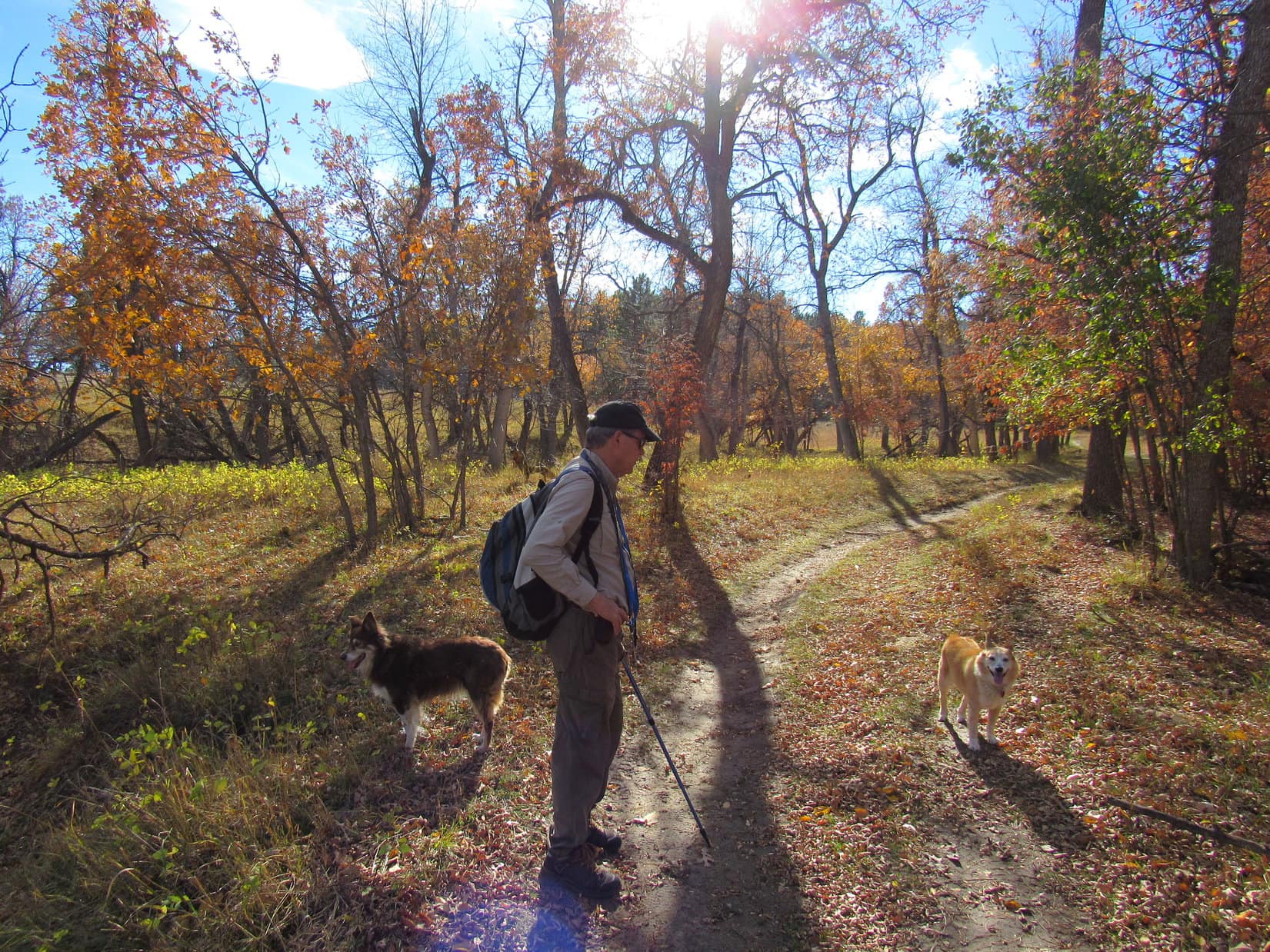
As the years went by, Lupe occasionally visited Dusty at her home in Arvada, but far more often, it was Dusty who came to the Black Hills. Either way, there were always long walks, and mountain adventures. Dusty and Uncle Joe enthusiastically joined Lupe and SPHP on numerous Black Hills expeditions. At Grandma’s house, there were balls and flying discs to chase, countless journeys to the cul-de-sac and back, and every once in a while, a trek down into Spring Creek canyon.
In Arvada, Lupe always got to stay in Hotel Dusty’s luxurious Cowboy room, participate in jaunts around the 100 acre field, and up Ralston Creek. A White Ranch Park visit was almost a requirement. Sometimes there were other destinations, too. One hike up North Table Mountain(6,570 ft.) was particularly memorable when ordinarily mild-mannered Dusty swam in a muddy pond up on the plateau, and emerged looking ready to go completely feral and join the coyotes.
On rare occasions, when Cousin Mark was around to play the piano, Dusty and Lupe would howl a most charming duet.
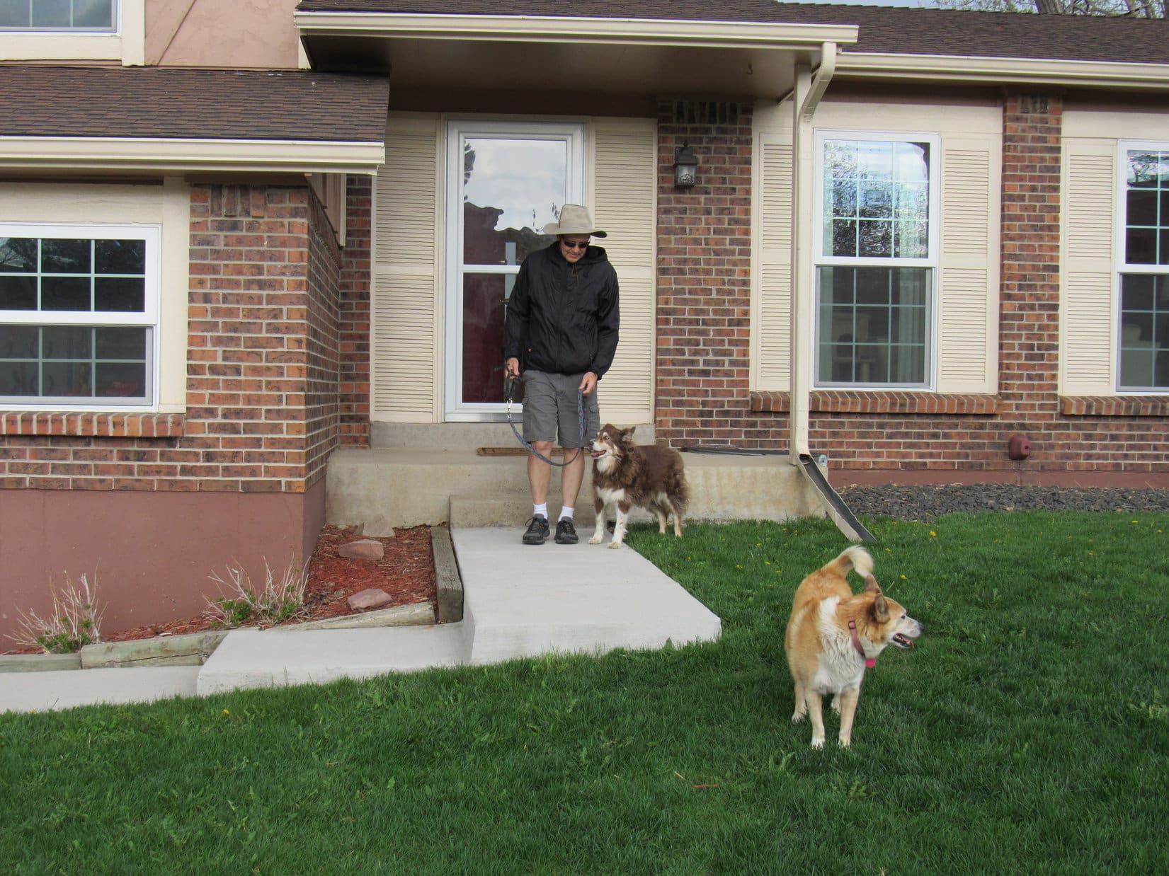
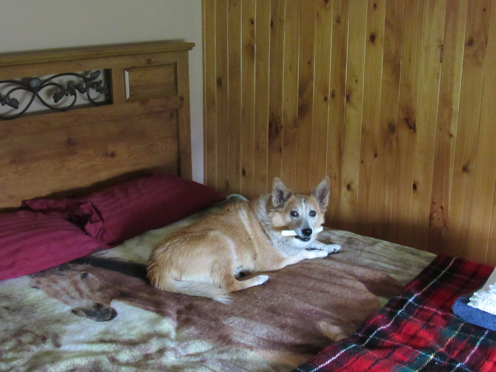
Uncle Joe & Dusty welcome Lupe to 5+ star Hotel Dusty, Arvada, Colorado 5-8-21.An earlier visit to the luxurious Cowboy Room at Hotel Dusty. 12-29-17Back in the lap of luxury on 5-9-21.
COUSIN DUSTY in the Black Hills
Most of the adventures Lupe and SPHP shared with Dusty (& Uncle Joe) occurred during Dusty’s frequent visits to the Black Hills. Highlights from many of the Black Hills, SD Expeditions they participated in follow in chronological order:
Black Hills, SD ExpeditionNo. 55 (4-20-13) – Dusty on Flume Trail No. 50.Black Hills, SD ExpeditionNo. 93(9-1-14) – Together on Mount Warner(5,889 ft.).Black Hills, SD ExpeditionNo. 94 (9-2-14) – Joe & Dusty on Harney Peak(7,231 ft.).Black Hills, SD ExpeditionNo. 94 (9-2-14) – Joe & Dusty on Harney Peak(7,231 ft.).Black Hills, SD ExpeditionNo. 111 (12-24-14) – Centennial Trail No. 89, the Ponderosa Hike. Bear Butte(4,422 ft.) (Center) in the background.Black Hills, SD ExpeditionNo. 129 (5-22-15) – Centennial Trail No. 89: Dusty with Lupe on a ridge SW ofBear Butte(4,422 ft.).Black Hills, SD ExpeditionNo. 130 (5-23-15) – Together at Horsethief Lake.Black Hills, SD ExpeditionNo. 137 (9-7-15) – Swimming in Sylvan Lake. Dusty was a great swimmer!Black Hills, SD ExpeditionNo. 137 (9-7-15) – On the way to Harney Peak again.Black Hills, SD ExpeditionNo. 137 (9-7-15) – On the Harney Peak(7,231 ft.) lookout viewing platform.Black Hills, SD ExpeditionNo. 137 (9-7-15) – Harney Peak. Dusty’s 2nd ascent.Black Hills, SD ExpeditionNo. 137 (9-7-15) – Dusty relaxing on Harney Peak.Black Hills, SD ExpeditionNo. 137 (9-7-15) – Joe and Dusty on the way to the Cathedral Spires(6,840 ft.) (L) and Little Devils Tower(6,960 ft.) (R).Black Hills, SD ExpeditionNo. 137 (9-7-15) – 2nd swim of the day in Sylvan Lake.Black Hills, SD ExpeditionNo. 169 (4-22-16) – The gang on Boulder Hill(5,331 ft). Silver Mountain(5,405 ft.) in the background. Boulder Hill was such a hit that everyone returned again the next day.Black Hills, SD ExpeditionNo.169 (4-22-16) – Joe & Dusty start the descent.Black Hills, SD ExpeditionNo. 169 (4-23-16) – Taking a break along Flume Trail No. 50.Black Hills, SD ExpeditionNo. 169 (4-23-16) – Climbing Boulder Hill a 2nd time.Black Hills, SD ExpeditionNo. 169 (4-23-16) – Joe & Dusty return to the summit.Black Hills, SD ExpeditionNo. 169 (4-23-16) – Silver Mountain (L) and Harney Peak (R) from Boulder Hill.
Uncle Joe is a ham radio operator (call sign AA0Q). Starting in July, 2016, Joe transmitted from several different Black Hills peaks in connection with the Summits on the Air program. Response was always terrific, overwhelming, in fact.
Dusty and Lupe always enjoyed hanging out on whatever mountain while Joe did his transmitting. Sadly, the Summits on the Air website eventually changed. For some reason, Joe lost the ability to log in, putting an end to this sensation.
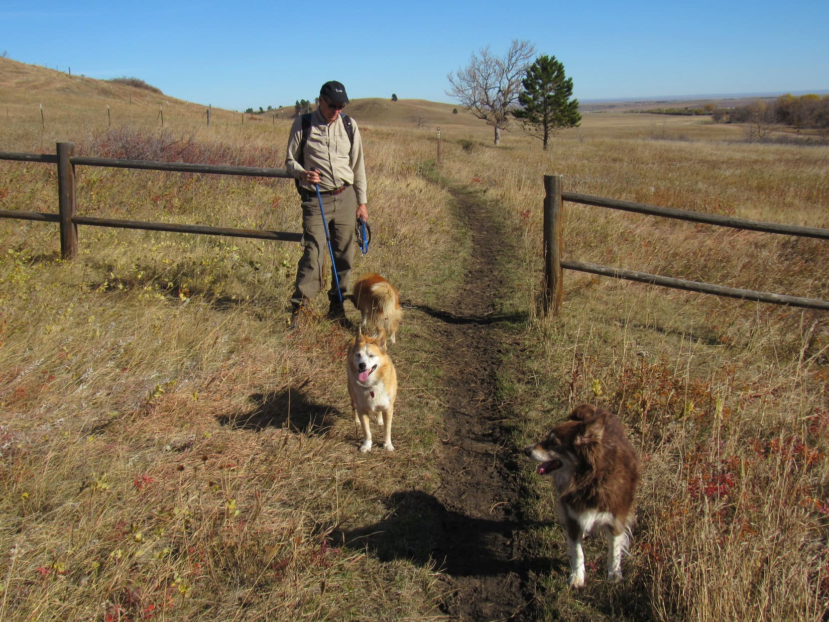
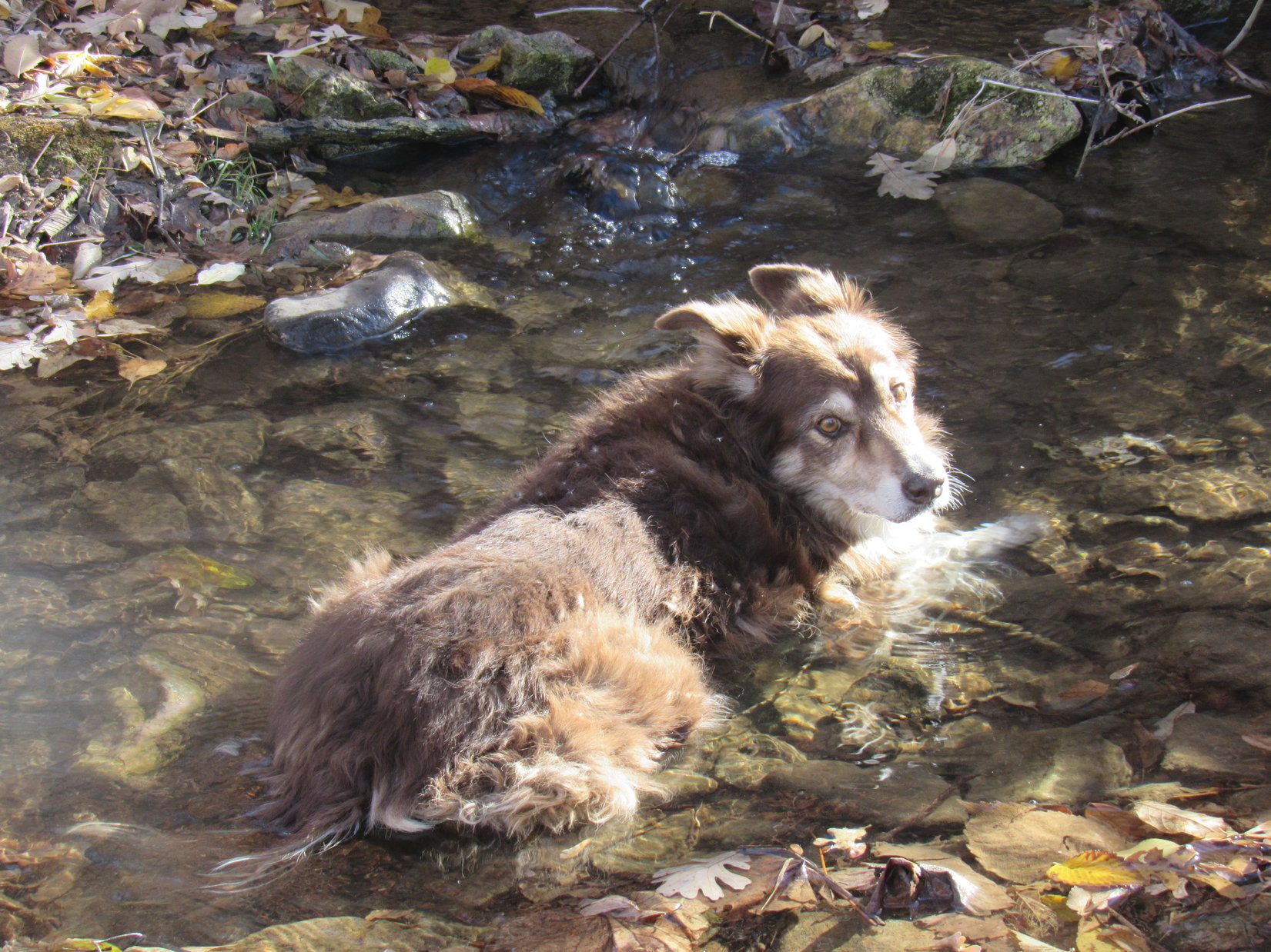
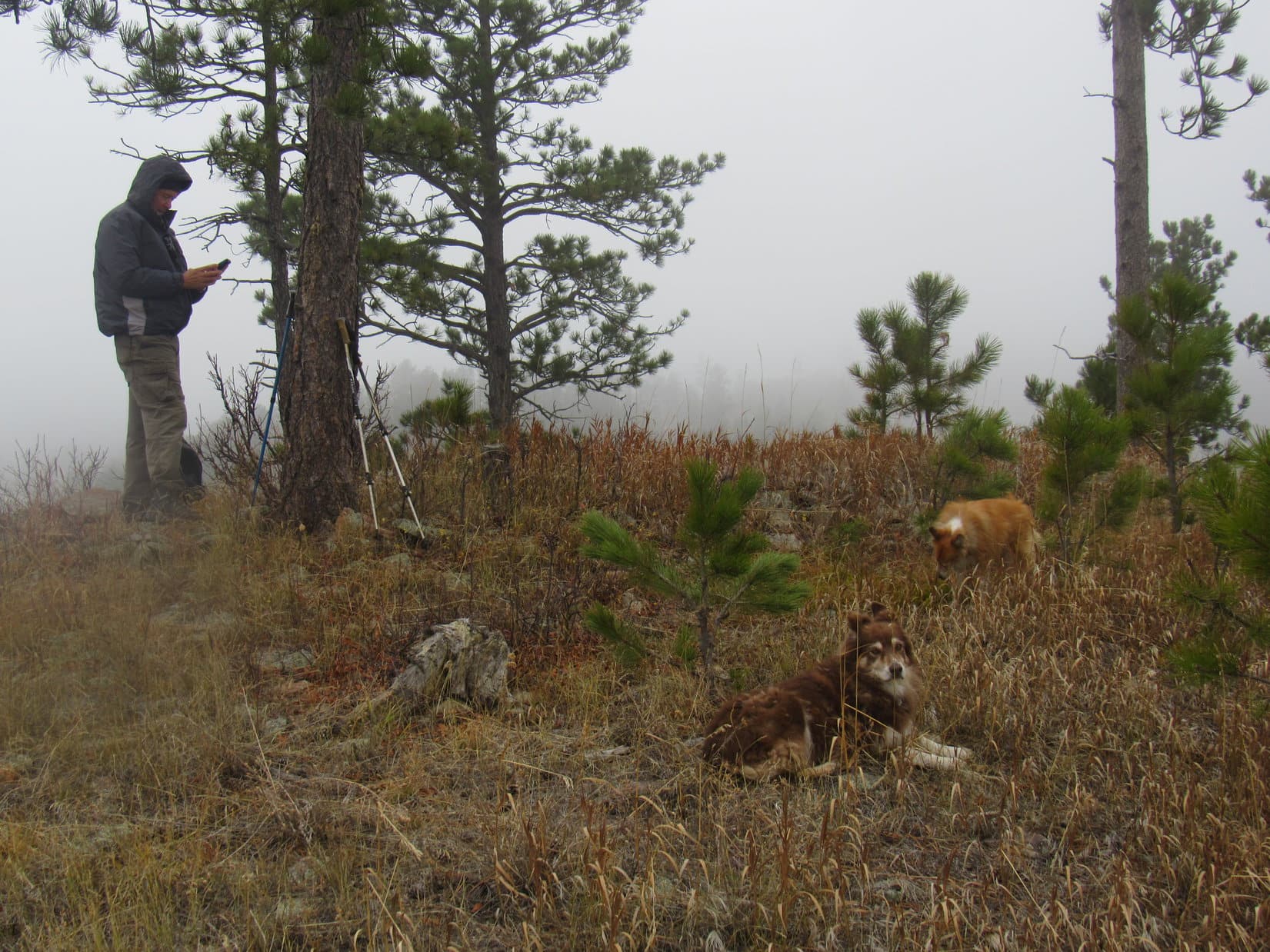
Black Hills, SD ExpeditionNo. 174(a) (7-2-16) – Dusty & Lupe on the Custer Peak(6,804 ft.) fire lookout tower balcony. First Summits on the Air peak.Black Hills, SD ExpeditionNo. 174(a) (7-2-16) – Relaxing on Custer Peak.Black Hills, SD ExpeditionNo. 174(a) (7-2-16) – Dusty, Joe & Lupe below the Custer Peak lookout tower. Photo looks SE.Black Hills, SD ExpeditionNo. 174(a) (7-2-16) – Together by the flag on Custer Peak.Black Hills, SD ExpeditionNo. 174(b) (7-4-16) – Back on Boulder Hill(5,331 ft.) for a 3rd time in 2016 to set up for Summits on the Air!Black Hills, SD ExpeditionNo. 174(b) (7-4-16) – AA0Q transmitting for Summits on the Air from Boulder Hill, with Dusty looking on.Black Hills, SD ExpeditionNo. 174(b) (7-4-16) – AA0Q and Dusty on Boulder Hill after another grand Summits on the Air success! Silver Mountain (L) and Harney Peak (R).Black Hills, SD ExpeditionNo. 201 (4-22-17) – Dusty & AA0Q during another highly successful Summits on the Air event, this time from Silver Mountain(5,404 ft.).Black Hills, SD ExpeditionNo. 201 – Summits on the Air is serious business!Black Hills, SD ExpeditionNo. 201 (4-22-17) – Dusty, Joe & Lupe checking out Silver Mountain’s W ridge.Black Hills, SD ExpeditionNo. 201 (4-22-17) – Dusty’s 4th ascent of Boulder Hill, exactly a year after her 1st!Black Hills, SD ExpeditionNo. 201 (4-22-17) – On Boulder Hill and loving it!Black Hills, SD ExpeditionNo. 231 (5-25-18) – Fetching a stick from Deerfield Reservoir.Black Hills, SD ExpeditionNo. 231 (5-25-18) – Emerging triumphant!Black Hills, SD ExpeditionNo. 231 (5-25-18) – Climbing Hat Mountain(6,779 ft).Black Hills, SD ExpeditionNo. 231 (5-25-18) – On the Hat Mountain summit plateau.Black Hills, SD ExpeditionNo. 231 (5-25-18) – View from the top.Black Hills, SD ExpeditionNo. 231 (5-25-18) – Dusty on Hat Mountain. Nearly 12 now.Black Hills, SD ExpeditionNo. 231 (5-25-18) – Happy bunch on Hat Mountain.Black Hills, SD ExpeditionNo. 231 (5-25-18) – Back at Deerfield Reservoir.Black Hills, SD ExpeditionNo. 232 (5-26-18) – On Flag Mountain(6,937 ft.) for what turned out to be AA0Q’s final Summits on the Air transmission.Black Hills, SD ExpeditionNo. 232 (5-26-18) – Relaxing on Flag Mountain.Black Hills, SD ExpeditionNo. 232 (5-26-18) – Exploring the Dragon Caves.Black Hills, SD ExpeditionNo. 232 (5-26-18) – Dusty checking for dragons.Black Hills, SD ExpeditionNo. 232 (5-26-18) – Exploring Ditch Creek.Black Hills, SD ExpeditionNo. 232 (5-26-18) – Swimming in Deerfield Reservoir.Black Hills, SD ExpeditionNo. 232 (5-26-18) – Dusty and her prize. Deerfield Reservoir.Black Hills, SD ExpeditionNo. 243 (12-22-18) – Dusty, Joe, Mark & Lupe on the way to Peak 5917.Black Hills, SD ExpeditionNo. 243 (12-22-18) – Mark & Dusty lead the ascent.Black Hills, SD ExpeditionNo. 243 (12-22-18) – Peak5917 summit.Black Hills, SD ExpeditionNo. 243 (12-22-18) – Dusty with Joe and Lupe with Mark at Pistol Point.Black Hills, SD ExpeditionNo. 243 (12-22-18) – Dusty started shivering in the wind at Pistol Point. Time to head back!Black Hills, SD ExpeditionNo. 243 (12-22-18) – Dusty having a good time now that she’s low enough to be out of the worst of the wind. Peak5800 (L).Cousin Dusty arrives at Hotel Lupe on 4-23-21. Her first Black Hills trip since the onset of Covid 19. Grandma sold her house on Spring Creek Canyon 5-1-20.Black Hills, SD ExpeditionNo. 277 (4-23-21) – Deerfield Trail No. 40 near Silver City.Black Hills, SD ExpeditionNo. 277 (4-23-21) – With Cousin Dusty by Rapid Creek.Black Hills, SD ExpeditionNo. 277 (4-23-21) -Dusty resting on the snow.Black Hills, SD ExpeditionNo. 277 (4-24-21) – Setting out for Peak 5520.Black Hills, SD ExpeditionNo. 277 (4-24-21) – Getting close to the top.Black Hills, SD ExpeditionNo. 277 (4-24-21) – Peak5520 summit.Black Hills, SD ExpeditionNo. 277 (4-24-21) – Cousin Dusty still peakbagging in the Black Hills at 14 years, 10.5 months!Black Hills, SD ExpeditionNo. 277 (4-24-21) – Always together! Peak 5520.Black Hills, SD ExpeditionNo. 277 (4-24-21) – Visiting the Gold Mountain Mine near Lowden Mountain(6,055 ft.).Black Hills, SD ExpeditionNo. 277 (4-24-21) – Dusty at the Gold Mountain Mine.Black Hills, SD ExpeditionNo. 277 (4-24-21) – Taking a dip in the pond near the mine. Union Hill(6,120 ft.) (Center) in the background.Busy Rib Hide time at Grandma’s apartment later in the day. 4-24-21Black Hills, SD ExpeditionNo. 281 (10-29-21) – Centennial Trail No. 89 near the start of Uncle Joe’s favorite “Ponderosa Hike”. New Cousin Laddie now part of the pack, too!Black Hills, SD ExpeditionNo. 281 (10-29-21) – Cousin Dusty looking good at nearly 15.5 on Peak4027.Black Hills, SD ExpeditionNo. 281 (10-29-21) – Joe & Dusty confer on Peak 4027.Black Hills, SD ExpeditionNo. 281 (10-29-21) – Taking a break on a ridge overlooking Fort Meade before heading back.Black Hills, SD ExpeditionNo. 281 (10-29-21) – A beautiful fall day.Black Hills, SD ExpeditionNo. 281 (10-29-21) – Cooling off in Alkali Creek at day’s end.Black Hills, SD ExpeditionNo. 282 (10-30-21) – In the fog on Peak5261. Dusty’s last Black Hills summit.Black Hills, SD ExpeditionNo. 301 (4-16-22) – Back at Sylvan Lake.Black Hills, SD ExpeditionNo. 301 (4-16-22) – Heading up the steps near the dam.Black Hills, SD ExpeditionNo. 301 (4-16-22) – Joe trying to help Dusty up slick ice.Black Hills, SD ExpeditionNo. 301 (4-16-22) – At the S end of Sylvan Lake.Black Hills, SD ExpeditionNo. 301 (4-16-22) – Little Devils Tower Trail No. 4.Black Hills, SD ExpeditionNo. 301 (4-16-22) – Hunting for buffalo Custer State Park.Black Hills, SD ExpeditionNo. 301 (4-16-22) – Found some!Black Hills, SD ExpeditionNo. 301 (4-16-22)Black Hills, SD ExpeditionNo. 302 (4-18-22) – Cousin Dusty at 15 years, 10 months leading the way to Gimlet Pond on her last Black Hills Expedition.Black Hills, SD ExpeditionNo. 302 (4-18-22) – Enjoying Gimlet Creek.Black Hills, SD ExpeditionNo. 302 (4-18-22) – Wading in Gimlet Pond.Black Hills, SD ExpeditionNo. 302 (4-18-22) – Dusty, Laddie, and Joe relaxing on the hill overlooking Gimlet Pond.Black Hills, SD ExpeditionNo. 302 (4-18-22) – Exploring a bit farther up Gimlet Creek.Black Hills, SD ExpeditionNo. 302 (4-18-22) – Trail’s end for Cousin Dusty’s Black Hills adventures. Heading back for the last time, still leading the way.
Tennis balls, enormous sticks, flying discs, smuggled tidbits, contraband chocolates, long walks, countless mountain adventures, swims in lakes and streams! Through it all, Dusty’s disposition was always cheerful and loving. Ever eager to join in the next big event, she was a faithful, gentle, true friend and companion.
What so recently was, is no more, a happy life completed. Still hard to believe, and even harder to accept. Cousin Dusty will be forever missed by Lupe, SPHP, and her family – Uncle Joe, Aunt Andrea, Cousins Matt, Ryan, and Mark.
Joyful times with Cousin Dusty at White Ranch Park, Colorado 11-8-15
8:40 AM, USFS Road No. 297 – Oh, it was on, and Lupe was excited! After a quick weather-shortened introductory jaunt with new friend Dennis Stewart out to a couple of peaks of the limestone plateau country yesterday, the weather was much improved. “Stewy” was ready to hit it hard today. Time permitting, 7 of the 14 highest named peaks in South Dakota were on his agenda, and the American Dingo had every intention of getting high with him at each one.
Starting the day in the Negro Creek valley along USFS Road No. 297. Photo looks NNE.
With that many peaks to visit, even though none of them were all that hard to get to, there wasn’t going to be a lot of time for dilly-dallying. Within minutes of when SPHP parked the RAV4 at a wide spot along USFS Road No. 297, everyone was ready.
Medicine Mountain(6,878 ft.) was first. Although actually the lowest peak Dennis would be climbing today, it was the steepest and involved the most elevation gain from the starting point, a little over 900 feet.
Dennis and Loop about to set out for Medicine Mountain (L of Center). Photo looks W.
An old jeep trail going W from No. 297 got things off to an easy start. Less than 100 feet of elevation gain led to USFS Road No. 297.3F, which wasn’t much help, since 3F ran almost horizontally N/S along the E slope instead of toward the summit. Crossing the road to head straight up the mountain, No. 297.3F was encountered a second time 200 feet higher, but the situation was no different here.
Coming up the jeep trail. Photo looks ENE.Dennis checks his GPS after reaching USFS Road No. 297.3F. Photo looks SSW.And checks it again after reaching No. 297.3F a second time. Photo looks N.
After crossing No. 297.3F the second time, that was it for roads. The rest of the way up was merely a fairly steep trudge higher. A little deadfall and a few scattered boulders to contend with, but otherwise a romp through open pine forest.
Loop squinting in weak sunshine for the first time in the last couple of days as she heads up Medicine Mountain’s E slope. Photo looks W.Stewy coming up the E slope. Photo looks E.Loop posing for Dennis on a rock. Photo looks NW.Starting to get close to the top. Photo looks WNW.
The last 100+ feet of elevation gain was steepest. Dennis preferred to go directly up the E face. However, Medicine Mountain(6,878 ft.) has two summits, the S one being the true summit. Looper hadn’t been here in nearly 5 years, but SPHP was pretty certain that by angling NW toward the saddle between the two summits, the Carolina Dog could pick up a use trail that would get her to the top.
A little longer, but the Lazy Dingo route worked out perfectly. While Dennis proved his mettle against the mountain, Lupe came to a nicely rounded clearing up at the saddle, easily sniffed out the use trail, and was there in time to greet Dennis as he reached the summit.
On the grassy saddle between the N and S summits. Photo looks SSW.Up on Medicine Mountain’s S summit. Photo looks S.
9:34 AM, Medicine Mountain(6,878 ft.) – The true summit was a rock tucked in at the base of a small birch tree that was slightly higher than others nearby. After the required summit shot, a short rest break was in order. Lupe shared a chocolate coconut bar with SPHP, and drank some water. Dennis opened a can of cashews, and enjoyed a few while sitting on a big rock, offering some cashews to SPHP, too.
Getting to be a beautiful day! Partly cloudy with blue sky and sunshine. As everyone relaxed, the big view was toward the SE, where several of the highest peaks in South Dakota were visible on the horizon.
Dennis had already been to Black Elk Peak(7,231 ft.), South Dakota’s high point, many years ago back when it was still officially Harney Peak, and wouldn’t be returning on this trip. SPHP pointed out two others, Little Devils Tower(6,960 ft.) and Sylvan Hill(7,000 ft.), that were on his current itinerary.
Looper near Medicine Mountain’s true summit, the rock (R of Center) beneath the birch tree. Photo looks NW.Black Elk Peak (far L), Little Devils Tower (L), and Sylvan Hill (L of Center) all on the horizon. Photo looks SE.Two peakbagging nuts, plus a can of nuts, on Medicine Mountain.
The view NW was of more immediate interest. Dennis’ next 3 objectives, Odakota Mountain(7,200 ft.), Green Mountain(7,164 ft.) and Copper Mountain(6,920 ft.) were in sight. In fact, all of the other peaks Dennis intended to climb today were visible from Medicine Mountain, since Bear Mountain(7,166 ft.) was also in view off to the SSW.
Green Mountain (L of Center) and Copper Mountain (R of Center). Photo looks NW.
The views were sweet, and Medicine Mountain had been a decent climb, but with so much left to do today, less than half an hour went by before it was already Onward, puppy ho! time. One mountain down, six to go!
10:49 AM, junction of Sixmile Road and USFS Road No. 297.3O – Next up, Copper Mountain(6,920 ft.)! Crossing Sixmile Road, Lupe looked for a spot where an old road once headed N. A little deadfall to contend with, but this open lane made what would otherwise have been an annoying, and needlessly difficult task contending with a thick forest of young pines, a simple one.
Before long, the lane opened onto a big clearing. At the far end, another lane was visible. Following these lanes was the secret to getting to the summit of Copper Mountain without undue aggravation.
At the clearing with the next open lane (R) in sight on the ridge ahead. Photo looks N.
According to the topo map, Copper Mountain’s summit was 0.33 mile due N of where the RAV4 was parked. However, as everyone was getting close to that region, where it was impossible to see much of anything due to all the young pines, SPHP surprised Dennis by insisting that the true summit was actually well off to the E near a line of cliffs.
Trusting the map, Stewy was skeptical to say the least. However, since there was nothing to be seen here, and SPHP assured him that not only was the true summit E, but that the best views by far were available from the cliffs over that way, Dennis went along with the detour.
By now, the wide open lanes were gone, but it was still possible to follow narrower ones through the trees until the terrain began to rise. Soon the forest began opening up as the ground became rockier.
Upon reaching the limestone platform along the E edge of the mountain, Dennis set his GPS unit on what appeared to be the highest rock, and took a reading. After wavering around, it settled in at about 6,946 feet.
Lupe on the rock where Dennis took his GPS elevation reading. Photo looks SE.
After gathering this data point, everyone headed SE to the cliffs at end of the platform where the big views were. A cairn Looper hadn’t seen here before, now sat on the highest rocks along the S edge.
Dennis didn’t bother with another GPS reading, since it seemed unlikely to yield a significantly different result. Instead, several minutes were spent exploring the rocks along the cliff edge while taking in the views. Medicine Mountain stood out 2.25 miles SE, with some of Dennis’ higher objectives well beyond it in the distance.
Sylvan Hill (far L) on the horizon, Medicine Mountain (L of Center). Photo looks SE.Loop and Dennis at the far SE end of Copper Mountain. Photo looks SE.L to R beyond Dennis: Black Elk Peak, Peak6920,Little Devils Tower. Sylvan Hill (R). Photo looks SE with help from the telephoto lens.Loopster and Dennis over by the cairn. Photo looks WNW.On Copper Mountain.
Time to head back! Not to the RAV4, but to the region shown on the topo map as Copper Mountain’s summit. Returning to the rock where Dennis had taken the elevation reading, everyone then went WNW, first down a slope, then gradually higher through deadfall and dense young pines tall enough to hide what was ahead.
The terrain flattened out. Dennis reported that, according to the map, this was Copper Mountain’s summit. Laying the GPS unit on a log about a foot above the ground, another elevation reading was taken. In just a moment it would be clear whether SPHP or the topo map was correct about the location of Copper Mountain’s true summit. After bouncing around a bit, the reading settled out at 6,947 ft.
One foot higher than the rock back E! Except that here the GPS unit was a foot above the ground, resting on the log instead of a rock. Within the limits of the GPS unit’s accuracy, it was a tie.
Hmm. Well, so be it. There were no views here at the W summit except of the thick stand of pines in all directions. SPHP didn’t even bother to take a photo, although Stewy did.
12:11 PM – Less than a mile W of where the RAV4 had been parked near Copper Mountain, SPHP turned S off Sixmile Road onto USFS Road No. 693. 0.125 mile, and No. 693 turned SW. After yesterday’s precipitation, the road was pretty soft here, with a couple of ruts in it.
SPHP parked the RAV4. The top of Odakota Mountain(7,200 ft.) was only 0.4 mile SE. Somewhat more than that following the road, but still within easy reach.
Striking out for Odakota Mountain along USFS Road No. 693. Photo looks SW.
After a jog to the W, the road turned SE, climbing gradually all the time. Halfway to the summit, No. 693 topped out and curved SW toward Long Draw. Abandoning the road, Lupe traveled ESE through a gently sloping field toward a small pillar of limestone near the trees. Coming to a fence a little beyond the pillar, she ducked under it, then followed it S.
Heading for Odakota Mountain’s summit after leaving No. 693. Photo looks ESE.
SPHP’s intention had originally been to go farther E in order to approach Odakota’s summit ridge near the NE end, which past experience had shown to be the easiest route up. The problem coming up from the SW had always been that the barbed wire fence, which ran right by the SW end of the ridge, was broken down and dangerous due to a huge jumble of deadfall that had collapsed upon it.
However, Dennis had left USFS Road No. 693 before SPHP, getting a head start following a jeep trail trail toward the SW end of the summit ridge. Hoping to intercept him, Lupe continued S along the fence all the way to the end of the ridge. Amazingly, since the last time the American Dingo was here more than 4.5 years ago, someone had removed the deadfall and repaired the fence.
Stewy had already made his way up to the summit. A 20 foot climb got Lupe up onto the flat ridge, which was still full of deadfall. Going 200 feet NE, Loop found Dennis where a tall, skinny white rock cairn had once stood. The white rocks were still here, but now all tumbled over. Dennis was busily setting up his tripod and resurrecting the cairn in preparation for his traditional summit selfie.
On the lovely summit of South Dakota’s 2nd highest mountain. Photo looks SW.Dennis rebuilding the cairn.
12:35 PM, Odakota Mountain(7,200 ft.) – Poor Odakota Mountain! South Dakota’s second highest peak was a mess. Surviving pines and a crop of new ones grew among what remained of a forest devastated by pine bark beetles 10 years ago. No views from the cairn, although both Bear Mountain(7,166 ft.) and a pond down by the old Boy Scout camp could be seen to the S from a little farther SW along the summit ridge.
Certainly not much up here to make Dennis want to hang around. After getting a group selfie shot, he packed up his camera and tripod, and took the easy way down off the NE end of the ridge. Meanwhile, Lupe and SPHP went to take a quick look at the view of Bear Mountain and the Boy Scout pond. It was actually a little better than the last time Loop had been here, since more trees had fallen over.
Bear Mountain (R) and the Boy Scout pond (L of Center). Photo looks SSE.
Turning around to leave and catch up with Dennis, SPHP saw something Lupe had never noticed on Odakota Mountain before. Back in the trees, only 25 feet from where Stewy had rebuilt the cairn, there was a sign.
Going over to check it out, the sign said “Odakota Mountain High Point 7,198 feet”. Below it, a round marker set in concrete was stamped “Odakota High Point”. There was also another white rock cairn.
Lupe at the now apparently official Odakota Mountain high point. Photo looks N.
The sign must have been here a while. Some of the paint was peeling. Odd that Lupe had never seen it before, but maybe a few years out in the weather was sufficient to get the peeling process underway? This spot really wasn’t discernably higher than where the first cairn was, or most of Odakota’s summit ridge, but the sign and marker were exactly the sort of thing Dennis would be interested in.
SPHP started yelling. Fortunately, Dennis hadn’t gotten too far away yet.
All official now!Glancing back at Odakota Mountain’s summit ridge from the barbed wire fence after starting back to the RAV4. Photo looks SE.
1:35 PM, junction of Sixmile Road and a faint road – Started out looking like the right spot, but the farther up the faint road Lupe went, the less familiar it all seemed. SPHP must not have driven far enough W to get to Windmill Draw. This was the wrong place. Instead of going a long way up a gentle grassy valley, the faint road merged into an unmarked USFS road near the trees.
It didn’t help when the USFS road played out shortly thereafter. SPHP hadn’t even brought a topo map.
Well, no matter. Green Mountain(7,164 ft.) had to be less than a couple of miles away. Lupe would find it! To SPHP’s recollection, all she had to do was find the E edge of the limestone plateau and follow it N.
On the faint road, setting out for Green Mountain. Photo looks N.
Going through open forest, the terrain kept rising. Eventually there was a lot of deadfall. The E edge of the limestone plateau didn’t materialize. Lupe had never come this way before. Consulting his GPS, Dennis led the way in a direction that seemed 90 degrees off kilter to SPHP.
Lupe finally reached a flat region up on a broad ridge. There was a ton of deadfall up here. A higher hill to the N didn’t look right. None of the terrain looked right. Was this the edge of the limestone plateau? SPHP was expecting a much sharper drop-off, something more cliff-like. No sign of the limestone pillar Lupe used to get up on over by the hill.
Frequently consulting his GPS, Dennis led the way along what appeared to be the only plausible route. Circling along the upper W slope of a big bowl, Lupe leapt over one fallen log after another. An unfamiliar road finally provided relief, leading to a gate near a large, flat clearing.
Still following his GPS, Dennis crossed the clearing. Continuing a little way into the forest, he arrived at a cairn.
Stewy setting up for another group summit selfie.
2:26 PM – Lupe had never seen a cairn on Green Mountain(7,164 ft.) before, but again, it had been more than 4.5 years since she’d been here. Furthermore, this boring spot in the forest did resemble the featureless region SPHP recalled as being all that could be found in the way of a high point where the summit was supposed to be.
As soon as Stewy had his summit selfies, it would be easy to figure out if this was the same place Lupe had been to several times before. If it was, the limestone pillar she used to get up on had to be along the edge of the mountain somewhere near the clearing.
Summit shots taken, everyone headed back there.
Oh, yeah! This was the right place, alright. Going over to the edge of the clearing, slightly down the slope beyond it, there was Lupe’s pillar.
In the clearing 200 feet SE of the cairn. Top of the pillar (Center) is visible next to Dennis, who is partly behind a tree. Photo looks SE.Lupe’s Green Mountain limestone pillar (L). Photo looks SE.
After the long, tedious bushwhack through the trackless deadfall-laden forest, and disappointing cairn in the middle of nowhere buried in trees summit, Dennis brightened immediately at the sight of the big sweeping view to the E and SE, and that taunting limestone pillar. If a Carolina Dog could do it, Stewy could, too! The peakbagger in him took over.
Dennis stakes his claim to Green Mountain’s limestone pillar. Black Elk Peak (L), Copper Mountain (Center), Sylvan Hill (R of Center), Medicine Mountain (R), in front of Stewy. Photo looks SE.
SPHP wasn’t getting up there, but sent a personal representative. Since Lupe hadn’t brought her Dingo wings, SPHP had to give her a boost.
Carefully, carefully! Dennis getting off the pillar.Lupe’s turn. Gillette Prairie (L). Photo looks E.Oh, it’s good to be back on the Green Mountain pillar again!Another angle. Photo looks SE.Part of Copper Mountain (far L), Sylvan Hill (L), Medicine Mountain (Center) with help from the telephoto lens.
A short break was taken before starting back to the RAV4. Dennis was in the habit of texting a photo to family and friends from each summit, and sent out the one of him standing on the pillar. He often got quick, but brief responses. In this case, the most common response was “jump”!
SPHP had to laugh. Always nice to know you’re loved.
A final look at Green Mountain’s limestone pillar (L). Photo looks NNE.
4:26 PM – Four down, three to go! Unfortunately, Green Mountain had taken up more time than expected, in part due to SPHP’s error in not parking far enough W at the start of Windmill Draw. Would have been much more of a road hike from there, instead of a bushwhack through deadfall-laden forest.
Couldn’t be helped. Done is done. Happily, Bear Mountain(7,166 ft.), the next objective, was a mere drive-up to a lookout tower. Shortly after turning onto USFS Road No. 293, SPHP was astonished by the amount of logging that had gone on since Lupe had last been here.
In fact, it was still ongoing. 0.5 mile from the summit, a log truck being actively loaded completely blocked the road. Apparently, this was going to take a while. Pulling off the road, SPHP parked the RAV4. Everyone leapt out. After circling past the log truck, the road hike began.
The RAV4 parked a little way off USFS Road No. 293. Photo looks W.Past the log truck on USFS Road No. 293. Photo looks W.Approaching the Bear Mountain fire lookout tower. Photo looks E.By the tower. Photo looks SSW.
Lupe had once paid a visit to the ranger at the top of the tower. On a clear day, it was possible to see Laramie Peak(10,272 ft.) in Wyoming. Unfortunately, the tower wasn’t open for the season yet. A sign said it was closed to the public.
A survey benchmark and another sign showing the elevation were at the base of the tower, but there wasn’t a view from here without actually climbing the tower. However, Lupe knew there was a nice view from a small limestone outcropping a short distance SE.
At the base of the tower. Photo looks SW.The Bear Mountain survey benchmark.Loop and Dennis on the limestone outcropping SE of the tower. Photo looks ENE.Elkhorn Mountain(6,381 ft.) (far L), Black Elk Peak (L), Little Devils Tower (Center), and Sylvan Hill (R) from the viewpoint.
5:58 PM, Needles Highway No. 87, Little Devils Tower trailhead – Upon reaching the RAV4 after Bear Mountain, Dennis faced a choice. 5 of 7 complete, but delays had chewed up enough time so that climbing both remaining peaks wasn’t going to be possible unless Dennis wanted to be out after dark, which he didn’t.
Sylvan Hill(7,000 ft.) or Little Devils Tower(6,920 ft.)? SPHP spoke of the differences in what would be involved, since the nature of the routes was so different. Either one had fabulous views.
Really wasn’t a monumental decision. Dennis could climb whichever peak he didn’t get to today tomorrow. In the end, Stewy chose Little Devils Tower as his last summit with Lupe.
Sweet! A great choice! (Both would have been.) 700 feet of elevation gain along a maintained trail that went past scenic granite formations, followed by a fun scramble to the top.
Map posted at the trailhead.
Little Devils Tower Trail No. 4 was nearly level as it started up a valley. Lupe was soon passing the first granite formations. The views improved steadily as the trail gradually steepened.
Little Devils Tower Trail No. 4. Photo looks NE.Big granite formations in a side valley.Approaching some spires. Photo looks NNE.
After more than a mile, Little Devils Tower Trail No. 4 topped out on a ridge near the Cathedral Spires(6,840 ft.). From here, a spur trail split off to the L, heading N. Taking this spur, Little Devils Tower’s massive granite summit quickly came into view.
On the spur trail. Little Devils Tower (R). Photo looks N.
At first, the spur trail was level, or nearly so, but as Lupe got close to the granite, it turned NE and began to climb.
The spur trail starts getting interesting. Photo looks NE.Dennis on the way up. Photo looks SW.
The spur trail soon topped out at a high spot tucked between huge rock walls. However, this wasn’t the end. Blue arrows painted on the rocks marked the route from here, which now turned NW through a narrow slot in the granite. The first part of the slot was so steep that Loopster needed a boost from SPHP to get up to where she could continue under her own power.
Climbing the slot after an initial boost. Photo looks NW.Dennis emerging from the slot. Photo looks SE.
Above the slot, minor variations in the route were possible. All involved scrambling up the granite. A little exposure in spots, but not much. The route wound along the granite to a final brief push higher.
Dennis leading the way during the scramble up the granite. Photo looks N.
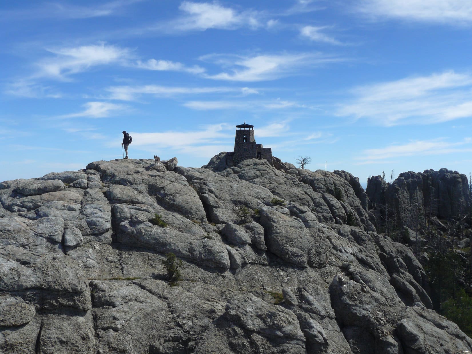
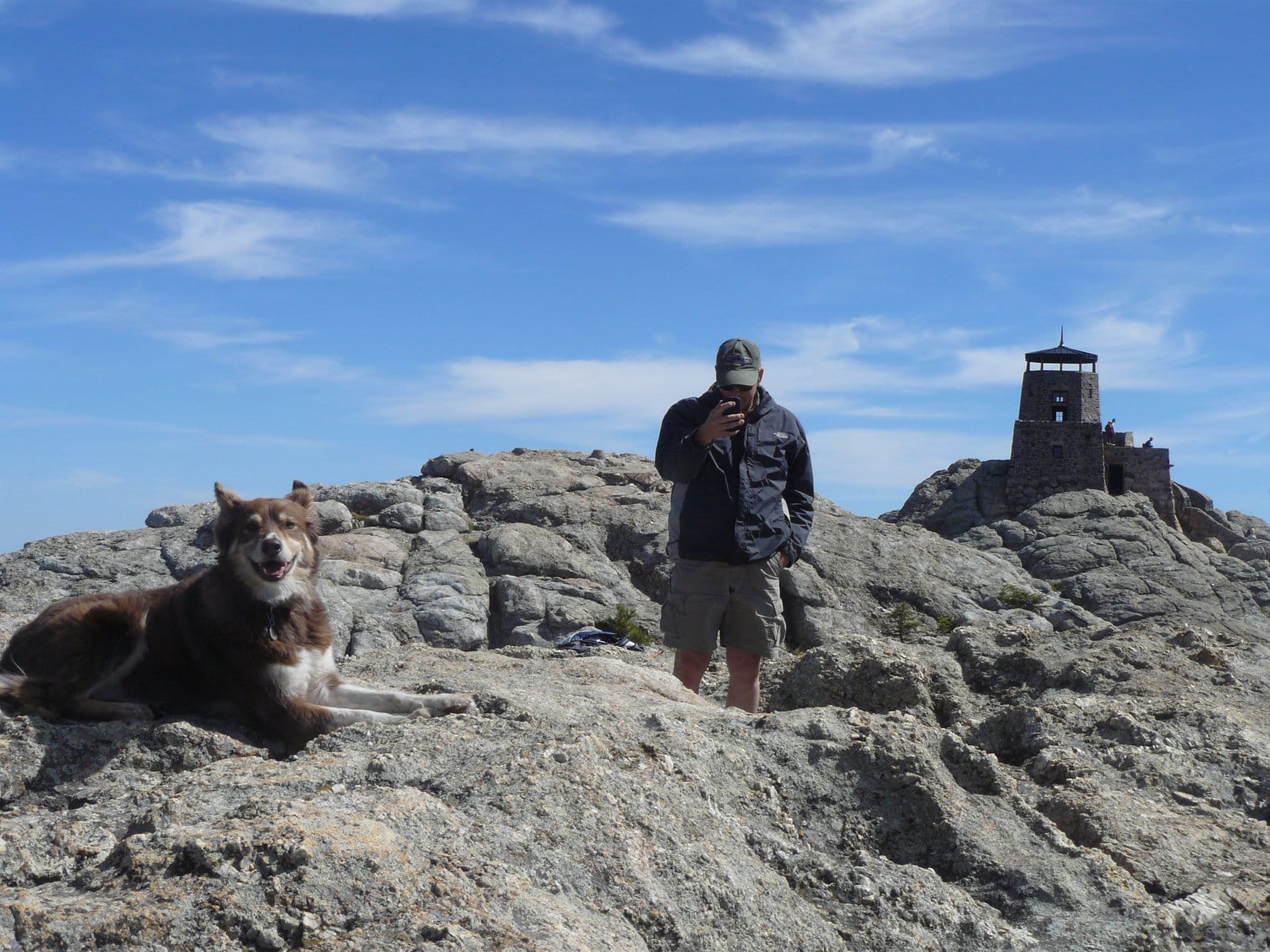
6:55 PM, Little Devils Tower(6,960 ft.) – Suddenly, Lupe was there! The summit region was a roomy collection of large granite outcroppings and boulders that didn’t vary an awful lot in elevation. There was even a flat area of packed dirt with a bit of vegetation.
The views were incredible! Little Devils Tower is right in the heart of the most rugged part of the Black Hills. While Dennis climbed up onto the highest boulder to tag the true summit, Loopster had a look around. Highlights included Black Elk Peak(7,231 ft.) a little more than a mile NNE, and the magnificent Cathedral Spires(6,840 ft.) only 0.25 mile SE.
Black Elk Peak (R) from Little Devils Tower. Photo looks N.The Cathedral Spires, also known locally as the Needles. Photo looks SE.
Dennis made it up onto the true summit boulder. Lupe needed another boost from SPHP to join him.
Stewy over at the high point. Photo looks S.Loop and Dennis together at the true summit. Photo looks S.
6 of 7 complete, but Little Devils Tower was definitely going to be it. The sun was already low. Sylvan Hill wasn’t happening today.
That was alright. Kind of took the pressure off. Lupe, Dennis, and SPHP could all linger for a while in the beautiful evening light.
Black Elk Peak from Little Devils Tower. Photo looks NNE.Cathedral Spires (L and Center) in the evening light. Photo looks SE.Dennis relaxing at the true summit. Photo looks SSW.Texting a photo before departure.
Over all too soon! Before long, Stewy was at the end of the scramble lower, about to descend from the slot to the spur trail.
Descending the slot. Blue arrow (R).
So, Little Devils Tower was a happy ending to a fabulous day! Dennis pronounced it easily his favorite peak in the Black Hills. Sometime he was going to have to bring his wife, Geri, up here.
Lupe hopes to welcome her to the beautiful Black Hills on that great day.
With Stewy on Little Devils Tower, Black Hills of South Dakota 5-5-22
Note: Dennis did climb Sylvan Hill the next day before heading to Nebraska to continue his peakbagging adventures. Among his greatest goals are (1) climb the 10 highest named peaks in all of the 48 contiguous US states, (2) climb the 10 highest named county high points in each state, (3) visit every state park with his wife, Geri, (4) float the length of rivers in all states that have a river of the same name. At 73, he realizes these are tall orders.
Before departing, Dennis gave Lupe and SPHP an autographed copy of his book 23 Nights Working for the US Treasury Department, which tells of his experiences working for the US government’s most feared agency, the IRS.
Who was that on the phone, SPHP? The fanatic again?
Yup! He’s run into 3 feet of snow on the road to Crooks Tower(7,137 ft.), so he’s got a much longer hike ahead of him than expected. Going to be running late. Won’t arrive here until sometime this evening now.
The “fanatic” was Dennis Stewart, aka “Stewy”. Neither Lupe nor SPHP knew Dennis, but that was about to change. He was a man on a mission, many missions, actually. Dennis’ purpose on this particular trip was to climb the 10 highest named peaks, plus the 10 highest named county high points, of both South Dakota and Nebraska.
Fanatic wasn’t an unfair label. Dennis owned the tallest indoor climbing wall in the Midwest – 32 feet high, more than 500 square feet of surface area, with an 11 foot overhang – a feature incorporated into his private home! At the tender age of 73, Dennis was still working on so many peakbagging lists that he knew there was no way he would ever come close to completing many of them.
No doubt about it, Loop. Dennis is our kind of fanatic!
After reaching the Black Hills region earlier today, Dennis had already been to both Terry Peak(7,064 ft.) and White Tail Peak(6,962 ft.). Tomorrow, Lupe and SPHP were going to join him on his quest.
At least, that was the plan. Dennis was not only a prolific peakbagger, but a runner, too. At one point in his life, Dennis had helped set a world record in the 2 mile relay as a member of the University of Kansas track team. In 2019, Dennis had won the 800 meter in the Huntsman World Championship in his age category.
Worrisome, actually.
If Dennis takes off running up all the mountains tomorrow, feel free to run right along with him, Loopster. You know me. Not even going to try to keep up.
5-4-22, 9:24 AM, Flag Mountain – Dennis had reassuringly promised not to run up any mountains, although it would have been fine if he did. SPHP had no intention of slowing him down. Flag Mountain(6,937 ft.) wasn’t going to be a problem in any case. A simple drive up. After SPHP parked the RAV4 at the end of USFS Road No. 416, a set of stone steps was all that had to be managed to reach what was left of the old fire lookout tower up top.
The only real issue was the weather. Although Flag Mountain normally offered sweeping views of a huge swath of territory E of the edge of the limestone plateau country, Lupe wasn’t going to get to show off her Black Hills to Dennis here today. Foggy and snowing!
Loop and Dennis arriving at the end of USFS Road No. 416.Heading up the stone steps.On the summit ridge near the remnant of the fire lookout station. Photo looks E.
While Dennis searched for the survey benchmark shown on the map out along the W end of the summit ridge, Lupe got up on what was left of the lookout tower foundation wall. Unfortunately, no hint of the usual grand view was to be seen.
Dennis searching for the survey benchmark. Photo looks W.Looper up on the wall.
Dennis found no sign of the survey benchmark. Loopster had been to Flag Mountain on half a dozen prior occasions. SPHP kind of thought that she actually had seen the benchmark somewhere up here before, but couldn’t find it, either.
Stewy had a routine he went through at each mountain he visited. It was interesting to see how he operated. Verbal notes, some of which were based on his phone’s GPS, were taken by speaking into a portable recorder. Date, time, distance traveled, elevation gain, exact location and elevation, weather and route conditions, what views were present, and anything else Dennis felt might be of interest were all mentioned. This data would eventually serve as the basis of written records and a trip report which he would post online.
Since he usually traveled alone, Dennis also had a separate camera and tripod he could use to take a decent selfie at each summit.
Lupe and Stewy on Flag Mountain, their first Black Hills summit together.
Given the weather, there wasn’t much reason to linger. As snowflakes continued to fall, everyone headed back down to the RAV4.
Down by the RAV4 again. Photo looks SW.
Since tomorrow’s forecast was much better, and Dennis had already spent the last 4 days since leaving home peakbagging, he was inclined to call it a day. After all, why climb mountains in this soup, and not get to see much of anything? In the meantime, he could relax in comfort while catching up on some of his record-keeping.
Made perfect sense, except for two things. The next peak on Dennis’ list was Crows Nest Peak(7,048 ft.). Although not all that far from Flag Mountain, Crows Nest wasn’t anywhere near the other Black Hills peaks Dennis still needed to tag. A quick visit to Crows Nest while in the area made sense from the standpoint of efficiency alone.
Furthermore, Dennis wouldn’t miss out on a thing by making the jaunt up Crows Nest today. At over 7,000 feet, Crows Nest Peak was certainly among the highest points of the entire Black Hills range, but incredibly misleadingly named. The surrounding territory was gently rolling and mostly forested. No distant views of, or from, the summit even on the best of days.
Lupe’s local expert advice was to climb Crows Nest today. Stewy was willing to give it a shot.
5-4-22, 10:23 AM, Boles Canyon Road and USFS Road No. 117.5K – Lupe was happy! She sniffed around while Dennis finished getting ready. Although remote Crows Nest Peak was a favorite place, the Carolina Dog hadn’t been here since the day of her Mighty Dingo Missile Launch nearly 4 years ago. This time, Loop was looking forward to an easy, and less painful, mile long romp up to the red dirt pond near the summit.
USFS Road 117.5K from Boles Canyon Road. Photo looks N.
A faint road took off to the SE through open territory from here. Within just a few minutes, Dennis was ready to go. Lupe, Stewy, and SPHP set off along the faint road, heading for the trees.
The faint road (Center beyond Lupe) serving as the start of the route to Crows Nest Peak. Photo looks SE.Stewy and Lupe about to set out. Photo looks SE.
Upon reaching the forest, the faint road merged into USFS Road No. 266. After passing through a gate in a barbed wire fence, the steepest part of the trek was ahead. Nothing too difficult, culminating in a snowy stretch near the top.
On USFS Road No. 266, looking back toward Boles Canyon Road. Photo looks NW.On the snowy stretch. Photo looks SE.Getting near the top. Photo looks SE.
The snowy stretch ended and the road flattened out, becoming a sloppy mess as Lupe entered a clearing that had been logged off years ago. No. 266 began angling E across the clearing. Before long, it would lead to a side spur that went N up to the red dirt pond near the Crows Nest Peak summit, but there was little benefit to traipsing through the mud.
Abandoning the road, everyone headed NE, cutting across the clearing. Lupe was soon in an aspen forest, hopping over deadfall and winding around bushes, as she worked her way up a slope.
In the clearing where No. 266 leveled out. Photo looks E.Among the aspens.
As the terrain flattened out again, Lupe reached the spur that came up from No. 266. The red dirt pond was just around the next bend.
Dennis and Loop across the red dirt pond. Photo looks SW.
The Crows Nest Peak survey benchmark was only 300 feet E of the pond, tucked away deeper into the forest. Looper led Dennis right to it. The surrounding terrain was so flat that, as far as could be determined, this really was the mighty true summit of Crows Nest Peak(7,048 ft.).
Dennis and Lupe on the death-defying summit of Crows Nest Peak! Survey benchmark in front of Lupe. Photo looks ESE.The “Crow 1912” survey benchmark.
While Dennis set about documenting the ascent, SPHP noticed a wooden post roughly 50 feet E of the survey marker. Going over to check it out, Lupe discovered directional survey marker No. 2 only a few feet away.
Stewy setting up for a selfie.Photographing the survey benchmark.The “Crow No. 2 1912” directional marker.
Having found the No. 2 directional marker, before departing an effort was made to locate the No. 1 marker. Lupe, Stewy, and SPHP fanned out through the forest. However, a 5 or 10 minute search yielded no results.
Well, Dennis was satisfied. He’d done what he needed to do here. Soon everyone was traipsing back past the red dirt pond again.
This was it for the day. Not much effort had been required, but it had been a pleasant introductory outing with Stewy. Lupe and SPHP had very much enjoyed being back in the limestone plateau country again.
About to head down USFS Road No. 266. Photo looks NW.Near the end, with the RAV4 in sight. Photo looks NNW.
And the good news, of course, was that Expedition No. 303 was merely a warm-up for more ambitious adventures with Stewy tomorrow!
With Dennis “Stewy” Stewart on Crows Nest Peak, Black Hills of South Dakota 5-4-22