The Summit & the Headquarters National Recreation Trail to the Leg Benchmark & Pole Mountain, Laramie Mountains, WY (5-29-16)

Lupe’s luck was about to change!  Five long days of unrelenting Dingo boredom while SPHP helped clean out the house in Laramie, Wyoming were over.  Lupe was in the G6, speeding SE on I-80 toward The Summit for her first taste of peakbagging fun on this whole trip.  She was finally going to get to play in the mountains, and the excited Carolina Dog could hardly wait.

At Exit 323, SPHP turned off I-80.  A few minutes later, SPHP parked the G6 at a long pullout on the E side of Old Hwy 30, close to the start of USFS Road No. 724 (7:43 AM, 53°F).  The hike up No. 724 to the top of The Summit (8,880 ft.) was trivial, less than 0.25 mile long with an elevation gain of only 70 feet.

Nevertheless, Lupe was joyous!  Being outside exploring anything new was so much better than moping around being ignored back at the old house.  SPHP was almost equally glad.  SPHP had been allergic to the dusty air in the old house, which had been locked up for many years.  Breathing easier already, SPHP was looking forward to several great days of freedom in the Laramie Mountains.

The top of The Summit was a huge, round, flat, forested area.  A variety of small buildings and large towers were scattered across the landscape.  No one was around.  Lupe and SPHP wandered among the pines and towers looking for the highest point on the mountain.  The trees hid the views for the most part, but there was a view of Turtle Rock (8,600 ft.) from the SE edge of the big hill.

Lupe reaches the biggest tower on The Summit (8,880 ft.) in the Laramie Mountains of Wyoming. Photo looks SW.
Looking SE toward Turtle Rock (8,600 ft.) from The Summit. Taken with the telephoto lens.

There were also partial views to the S and SW where it was possible to see much higher snow-capped peaks.  They were far away – probably in Colorado.  SPHP looked around for a clear view of them, but couldn’t find one.  Toward the E central part of the summit area, Lupe came across a big rock that appeared to be the highest point on The Summit.

Lupe perches on the summit rock of The Summit. Photo looks N.

Lupe on the highest rock on The Summit, Laramie Mountains, WY 5-29-16

A better view of what most of the top of The Summit looked like. Photo looks S.
Two more of the towers on The Summit. These were only a little way NW of the highest rock on the hill. Photo looks NW.

Climbing The Summit was a quick and easy start to Lupe’s day, but just made Lupe and SPHP eager to explore more scenic, less developed peaks.  Lupe headed back down USFS Road No. 724 to the G6.

As Lupe and SPHP neared the G6 again, SPHP decided to continue on past it up a dirt road on the E side of Old Hwy 30.  The dirt road led straight to a big dirt parking lot.  From the S end of the parking lot was a much better view of some of the distant snow-capped peaks Lupe had only glimpsed from up on The Summit.

E of The Summit and practically right next to the E side of Old Hwy 30 was a big dirt parking lot with this great view of snow-capped peaks far away to the S in Colorado. Photo taken with the telephoto lens.
E of The Summit, and practically right next to the E side of Old Hwy 30, was a big dirt parking lot with this great view of snow-capped peaks far away to the S in Colorado. Photo taken with the telephoto lens.

The huge snowy mountains were gorgeous and inspiring, but they were far away.  Besides, there was clearly still way too much snow up on the high peaks for Lupe adventures.  In another 6 weeks, the story would be different, but not yet.  Lupe and SPHP returned to the G6 (8:19 AM, 50°F).

SPHP had a couple of nearby peakbagging goals in mind for Lupe – the Leg Benchmark (9,055 ft.) and Pole Mountain (9,040 ft.).  SPHP hoped Lupe could reach them from the Headquarters National Recreation Trail.  The Summit trailhead at the W end of the trail was less than a mile away.

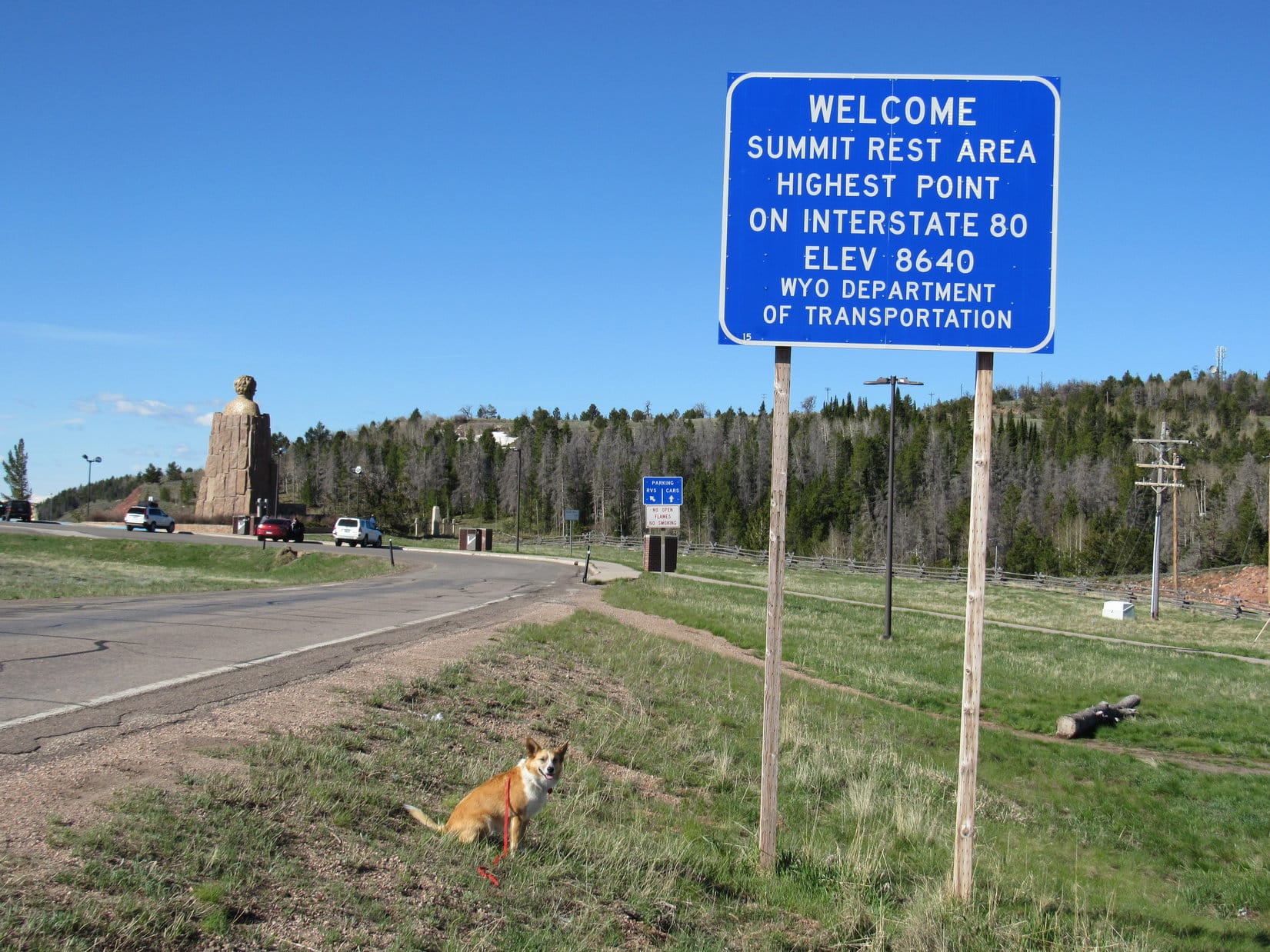
Lupe and SPHP hopped in the G6, crossed I-80, and drove to the trailhead.  A sign said a fee was required to park there.  Just over the hill, though, along I-80 was a huge rest stop with free parking.  So SPHP drove to the rest stop to park the G6 (8:29 AM, 50°F).  Lupe took up peakbagging interstate highways – a sign said this rest area was the highest point on I-80!

Lupe takes up peakbagging interstate highways at The Summit rest stop at Exit 323 in Wyoming.
Lupe takes up peakbagging interstate highways at The Summit rest area at Exit 323 in Wyoming.
Abe Lincoln glowers down on I-80 from The Summit rest area at Exit 323 in Wyoming.

Lupe and SPHP headed for the Summit trailhead of the Headquarters National Recreation Trail, where Lupe started her quest to climb the Leg Benchmark and Pole Mountain.

Lupe at the start of the W end of the Headquarters National Recreation Trail. Photo looks NNE.
Lupe at the start of the W end of the Headquarters National Recreation Trail. Photo looks NE.

Lupe hadn’t gone very far, when she made a great discovery.  A huge, deliciously cold snowbank covered a fairly long stretch of the trail.  Lupe frolicked on it, and got cooled off.  Lupe eventually came to a few more scattered snowbanks along the trail, but none anywhere near the size of this first one.

This big snowbank near the W end of the Headquarters National Recreation Trail made for one very happy Carolina Dog! Photo looks NE.

The Headquarters National Recreation Trail was fun and easy.  The trail headed generally E winding its way through a pine and aspen forest.  There was some up and down along the way, but nothing too drastic.  Lupe netted a few hundred feet of elevation gain, but that was about it.

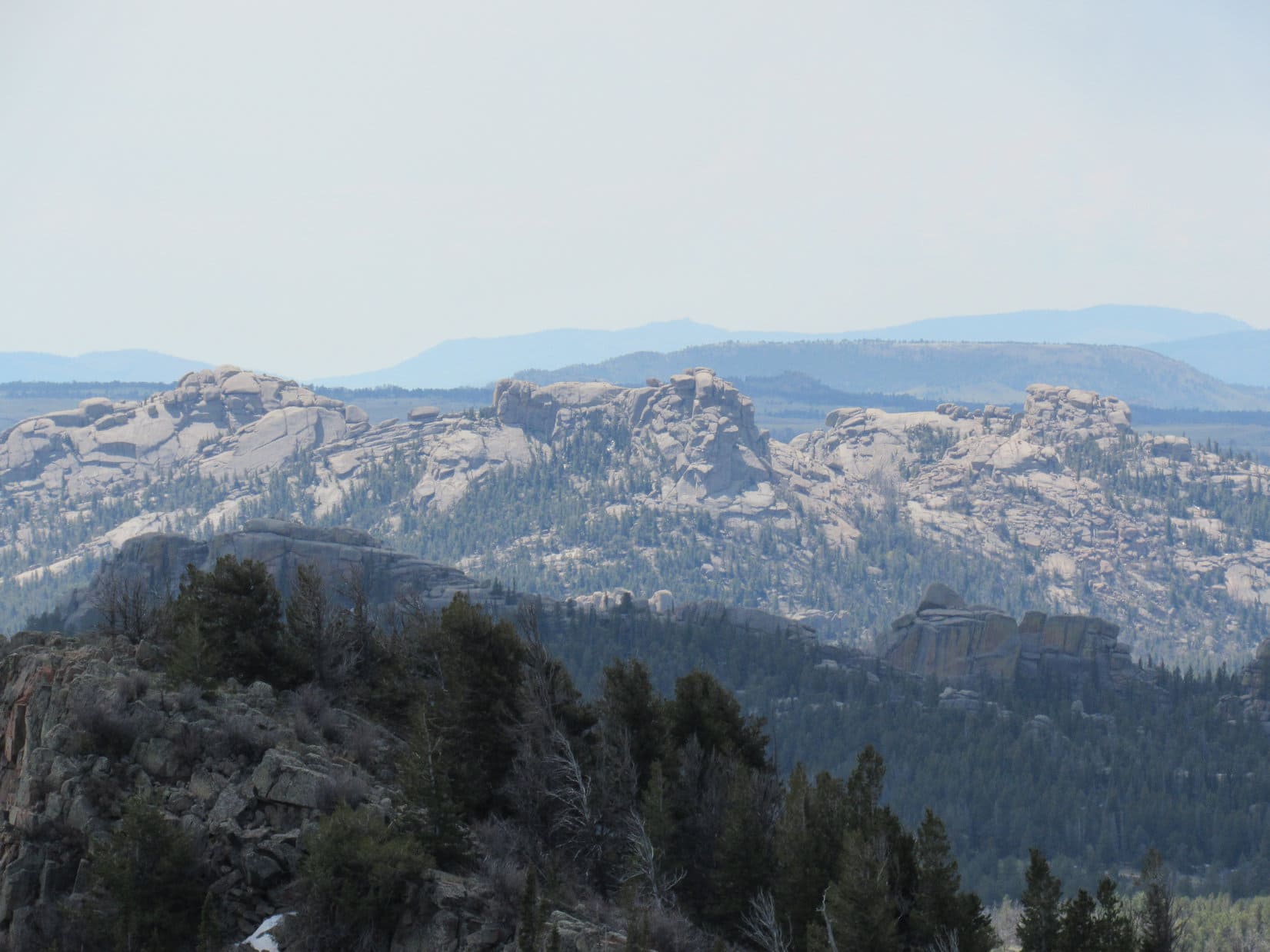
After a little while, Lupe came to a sign where the trail divided.  To the left was Cardiac Bypass.  To the right was a Scenic Overlook.  Lupe and SPHP took the Cardiac Bypass.  Almost immediately it became clear that there was a viewpoint a little higher up a short distance off the trail.  Lupe and SPHP left the trail to check out the view.Lupe on the Headquarters National Recreation Trail, Laramie Mountains, WY 5-29-16The view was splendid!  The Summit, which Lupe had climbed only a short while ago, was visible to the W.  Far beyond The Summit, Medicine Bow Peak (12,013 ft.) could be seen in the Snowy Range.  Several other high snowy mountain ranges were spread out across the far S and SW horizons.

Lupe at the viewpoint a little off the Cardiac Bypass of the Headquarters National Recreation Trail. The Summit is the hill on the L. Snowy Medicine Bow Peak is seen on the horizon on the R. Photo looks W.
Lupe at the viewpoint a little off the Cardiac Bypass of the Headquarters National Recreation Trail. The Summit is the hill on the L. Snowy Medicine Bow Peak is seen on the far horizon on the R. Photo looks W.
Medicine Bow Peak (12,013 ft.) (Center) using the telephoto lens. Lupe climbed Medicine Bow Peak and other nearby peaks on her Summer of 2015 Dingo Vacation. Photo looks W.

SPHP knew the Headquarters National Recreation Trail did not go directly to either of Lupe’s two peakbagging goals, the Leg Benchmark and Pole Mountain.  The trail gets closest to the Leg Benchmark, but passes to the W of it.

After Lupe had followed the trail some distance, SPHP became anxious to figure out just where Lupe should leave the trail to start climbing the Leg Benchmark.  When a rocky high point appeared on the N side of the trail, Lupe and SPHP climbed up to see what lay ahead.

Lupe climbed this rock formation N of the trail. SPHP hoped to see the Leg Benchmark from here. Photo looks N.
American Dingo scout, Lupe, near the top of the rock formation.
Beyond Lupe is a first look at the long high ridge of the Leg Benchmark. Photo looks ESE.

The long high ridge of the Leg Benchmark was in view, but still a little way off.  Lupe and SPHP returned to the Headquarters National Recreational Trail and continued E.

Crocuses were blooming along the trail. In the Black Hills, crocuses started blooming in April.
Crocuses were blooming along the trail.

Before long, the trail started to gradually lose elevation.  Lupe came to a three-way intersection.  To the right (S), the National Headquarters Recreation Trail continued toward Browns Landing.  To the left (NE) the Summit Loop Trail headed up a hill.

Lupe had come to several trail intersections before, including at least a couple that were marked as part of the Summit Loop Trail.  SPHP didn’t really know where the Summit Loop Trail went, but Lupe did need to gain some elevation going NE up to the ridgeline, before turning SE toward the Leg Benchmark.  Lupe and SPHP took the Summit Loop Trail.

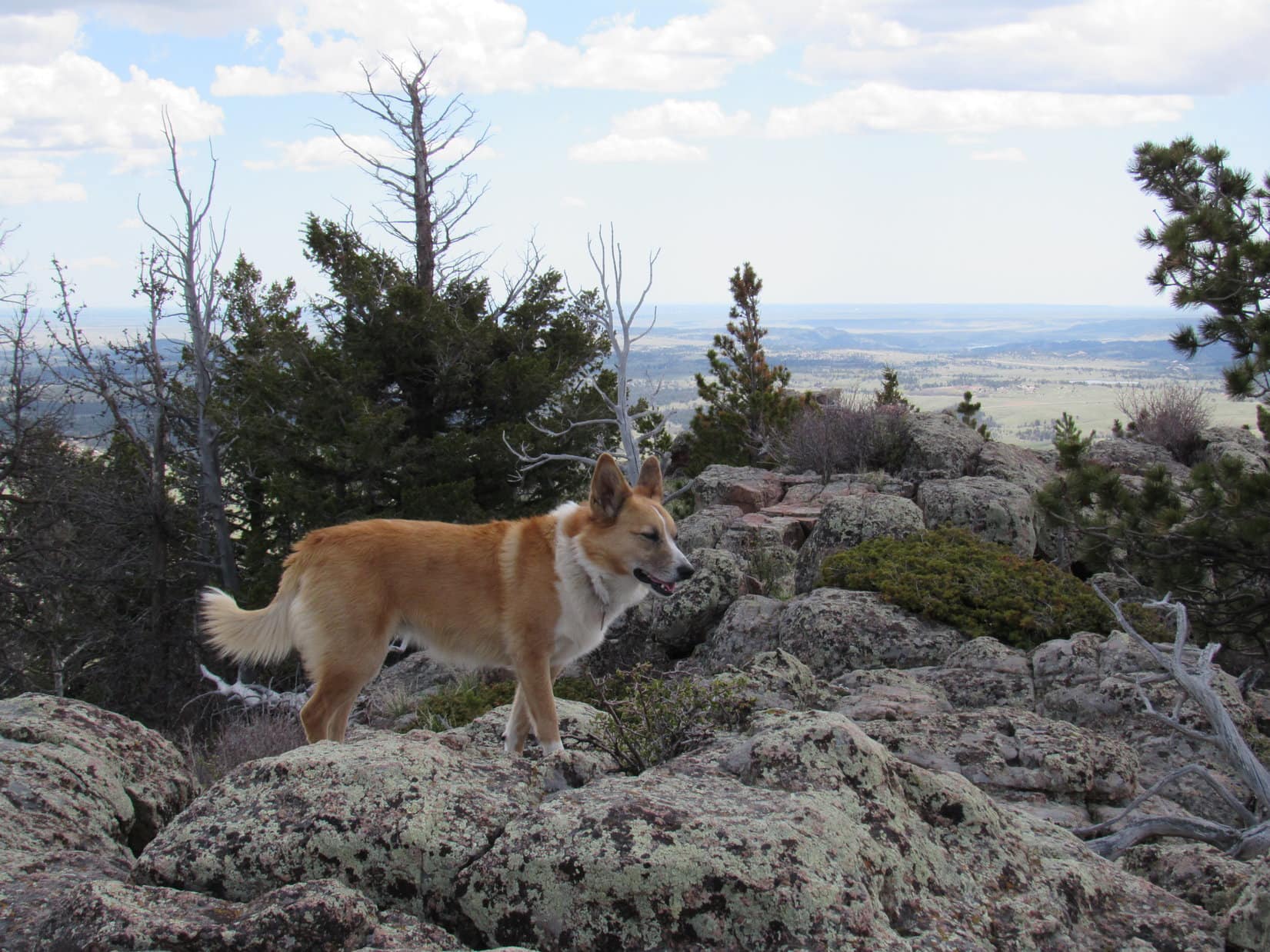
The Summit Loop Trail climbed steadily.  When it reached the ridgeline, there was a little open ground where the trail bent around to the NW.  Lupe and SPHP left the trail heading SE and entered the forest again.  Lupe went up and over one forested rise, down across a shallow saddle, and then began her ascent of the Leg Benchmark ridge from the NW.  She soon reached another high rock formation where she could get a better view of what lay ahead.

Pole Mountain finally came into view at this high point along Lupe's route to the Leg Benchmark. Photo looks SE.
Pole Mountain finally came into view at this high point along Lupe’s route to the Leg Benchmark. Photo looks SE.
Lupe having fun near the rocks of a high point on the way to the Leg Benchmark. Photo looks SE.

Lupe reached a few false summits along the way, but SPHP knew she was getting close.   When Lupe started coming to survey benchmarks, SPHP knew she had arrived.  Lupe found four survey benchmarks altogether!  The third one, which was on the very highest rock, actually said “Pole” instead of “Leg”.

Lupe had made it to the Leg Benchmark (9,055 ft.)!  It hadn’t been nearly as hard as SPHP had feared.  Lupe’s next goal, Pole Mountain, was in clear view to the ESE.  There was a lot more to see from the Leg Benchmark, too.  At least four distant snow-covered mountain ranges were visible on the far horizon from the S around to the W.

Lupe and SPHP stopped for a nice long break up at the Leg Benchmark.  It was a great place to be!  The Leg Benchmark seemed to be the dominant high point of these mountains.

Lupe at the last false summit. The true summit where the Leg Benchmark is located is in view just ahead. Photo looks SE.
This was the first benchmark Lupe came to on her way to the Leg Benchmark. This one was perhaps 40 feet away from the true summit.
The 2nd survey benchmark Lupe found.
The survey benchmark at the true summit. This was the third one Lupe found, and actually said Pole instead of Leg. Nearby Lupe found a fourth benchmark, but SPHP didn't take a picture of it.
The survey benchmark at the true summit. This was the third one Lupe found, and actually said Pole instead of Leg. Nearby Lupe found a fourth benchmark, but SPHP didn’t take a picture of it.
Lupe stands on the highest rock of the Leg Benchmark. Photo looks NNW.
Lupe still at the highest point of the Leg Benchmark ridge. Photo looks SE along the ridgeline.
Lupe still on the highest point of the Leg Benchmark ridge. Photo looks SE along the ridgeline.
Pole Mountain (9,040 ft.) from Leg Benchmark. The 4th benchmark Lupe found on Leg Benchmark is seen on the rock on the far R. Photo looks ESE.
Pole Mountain (9,040 ft.) from Leg Benchmark. The 4th survey benchmark Lupe found on Leg Benchmark is seen near the edge of the rock on the far R. Photo looks ESE.

When the leisurely rest break was over, Lupe and SPHP set off continuing SE along the Leg Benchmark ridgeline.  The ridge went on for quite a distance, with only modest elevation loss.  Gradually the forested slope to the NE became less steep, and it wasn’t as far down to the saddle between Leg Benchmark and Pole Mountain.

The saddle over to Pole Mountain had been clearly visible from up on top of Leg Benchmark.  Most of it was flat, open terrain that would be easy to cross.  Lupe followed the Leg Benchmark ridgeline down to where it looked like a straight shot over the saddle to Pole Mountain.  Then Lupe and SPHP turned NE, leaving the ridge and plunging down into the forest.

Lupe SE of the Leg Benchmark summit before she left the ridgeline. The nearby grassland is part of Browns Landing. Turtle Rock (8,600 ft.) is the rocky three-pronged peak seen in the distance L of Center. Photo looks S.
Turtle Rock (8,600 ft.). Photo looks S using the telephoto lens.

The slope wasn’t bad going down off the ridge.  Near the bottom, Lupe was delighted to encounter a wide band of snowdrifts 2 or 3 feet high still melting in the shade of the trees.  Lupe had fun cooling off on the snow before leaving the forest.  As soon as she left the trees, Pole Mountain was directly ahead to the ENE across the open ground of the saddle.

The W face of Pole Mountain features a long, massive rock outcropping.  Clearly, Lupe and SPHP couldn’t climb that!  In fact, SPHP wasn’t entirely certain Lupe would be able to find any way to the top.  However, it did look like the situation would be more promising farther E along the S face.  Lupe and SPHP crossed the flat, open saddle and started climbing.  As Lupe climbed, she worked her way E across the S side of the mountain.

The top of Pole Mountain (9,040 ft.) was quite rocky, but Lupe did find an easy way up about midway along the S slope.  The summit ridge extended 200 feet in a NW/SE direction.  The highest point was toward the middle, but somewhat closer to the NW end, not far at all from where Lupe came up.  Lupe and SPHP went to check out the true summit and NW end of the mountain first.

Lupe atop the NW end of the Pole Mountain summit ridge. Leg Benchmark is the high point (R of Center) on the ridge seen in the background. Photo looks WNW.
The Leg Benchmark (9,055 ft.) summit from Pole Mountain. Photo looks WNW using the telephoto lens.
Lupe stands on the true summit of Pole Mountain (9,040 ft.). Photo looks SE along the summit ridge.

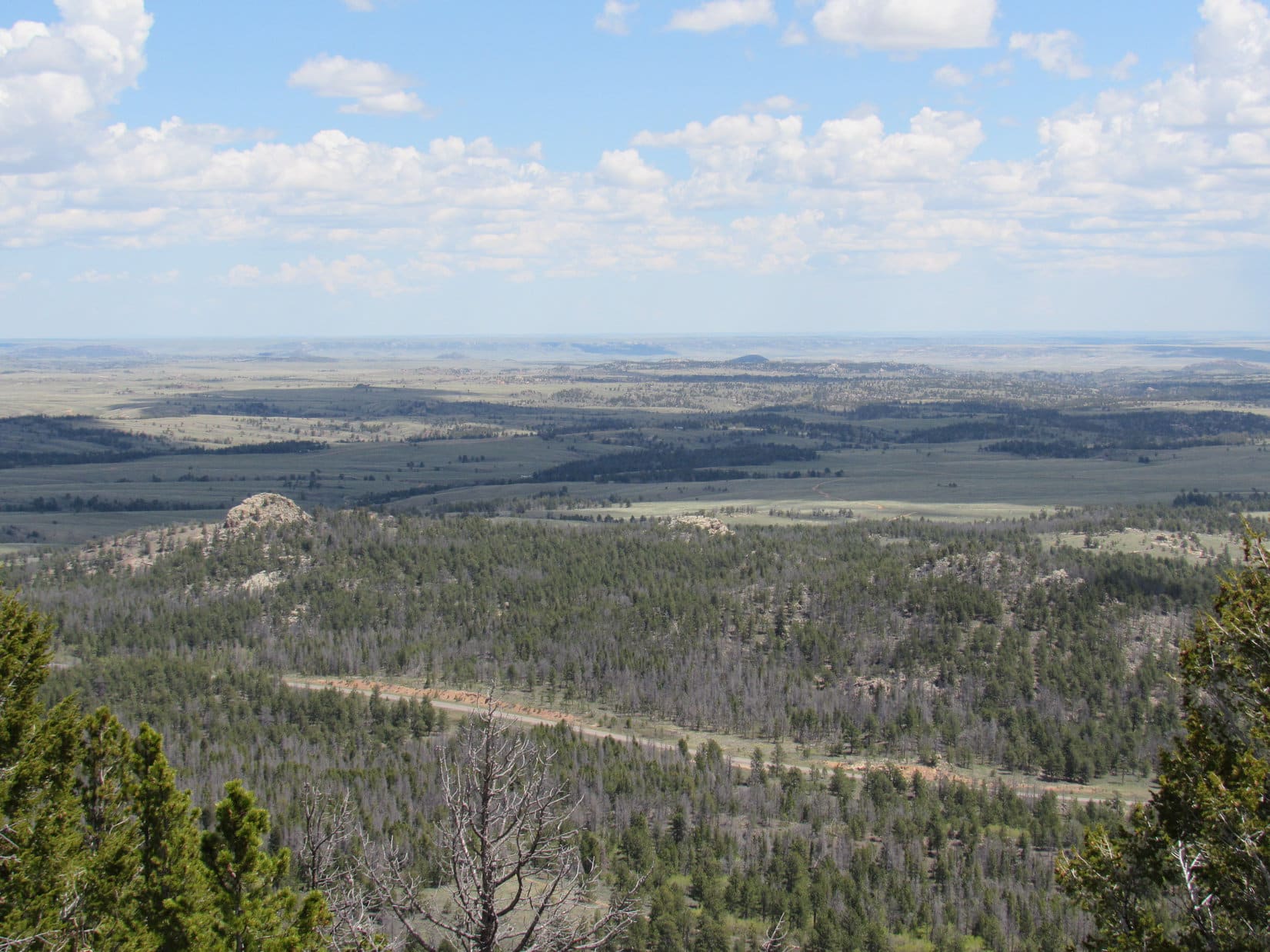
The view of the Leg Benchmark ridge from the NW end of Pole Mountain was great!  After spending a little time there appreciating the fine view, Lupe went to check out the SE end of the summit ridge.  Although a bit lower, the SE end of the summit featured a panoramic view of high plains extending far off to the E.

Lupe farther SE along the summit ridge of Pole Mountain, near where she climbed up. Photo looks SE.
A huge area of high prairie was visible all around to the E of Pole Mountain. This photo looks NE toward Bisbee Hill (8,480 ft.) (L) and Markley Hill (R), both of which Lupe climbed the next day.
A huge area of high prairie was visible E of Pole Mountain. This photo looks NE toward Bisbee Hill (8,480 ft.) (L) and Markley Hill (8,520 ft.) (R), both of which Lupe climbed the next day.

As beautiful as the panorama to the E was, it was hard not to focus on the distant snow-capped peaks of Colorado to the SW.  Rain showers were starting to develop in that direction, too.

Lupe on a rocky ledge near the SE end of the Pole Mountain summit. Distant snow-capped peaks of Colorado and light rain showers were in view beyond her. Photo looks SW.
Lupe on a rock ledge near the SE end of the Pole Mountain summit. Distant snow-capped peaks in Colorado and light rain showers were in view beyond her. Photo looks SW.
Using the telephoto lens, the high snowy mountains in Colorado looked impressive and forbidding. Photo looks SW.

After a pleasant stay, the time came for Lupe to leave Pole Mountain.  The Carolina Dog went back down the same S slope where she had come up, and crossed the grassy saddle over to the start of the forest covering the long Leg Benchmark ridge.  She then climbed through the forest up to the ridgeline, and made a second ascent all the way to the true summit of Leg Benchmark.

Lupe among the snowdrifts at the base of the Leg Benchmark ridge. Photo looks WSW.
Lupe returns to the top of Leg Benchmark for her 2nd ascent of the day. Pole Mountain, where she had just been, is seen beyond her. Photo looks ESE.

Lupe and SPHP enjoyed one more rest break up on Leg Benchmark.  It was a great place, and it seemed like a shame to leave it, but Lupe had plenty more to do in the Laramie Mountains before the day was done.  Lupe and SPHP left Leg Benchmark for the final time, and began the trek back to the G6.

Lupe returned to the Headquarters National Recreation Trail.  The American Dingo retraced her earlier route along it.  She did make one change, however.  Instead of taking the Cardiac Bypass, she took the trail to the Scenic Overlook.  The Cardiac Bypass wasn’t all that much shorter, and the Scenic Overlook trail loops right back to it after providing some of the very best views Lupe found anywhere along the Headquarters National Recreation Trail.

By 1:58 PM (68°F), Lupe and SPHP were back at the G6.  Lupe had already had a wonderful day in the Laramie Mountains, but it was still relatively early.  A happy Carolina Dog jumped in the G6.  Then Lupe and SPHP headed N looking for the next adventure.

Lupe relaxes up on Leg Benchmark during her final ascent of the mountain.

Links:

Next Adventure

Want more Lupe adventures?  Choose from Lupe’s 2016 Laramie Mountains, WY Adventure IndexDingo Vacations Adventure Index or Master Adventure Index.  Or subscribe free to new Lupe adventures.

Shell Falls, Porcupine Falls & Bald Mountain in the Bighorn Mountains, WY (8-9-12)

Day 2 of Lupe’s 2012 Dingo Vacation to the West Coast.

Lupe was doing somersaults.  A squirrel was chattering away in a tree somewhere outside Lupe’s “tiny house”.  Lupe was desperate to go bark at it.  She was hurling herself repeatedly against the screen door of the tent, not realizing it was zipped shut.  She couldn’t get out.  The crazy Carolina Dog was going paws over head, and doing a complete somersault each time she charged the fabric.  The whole tent shook.  SPHP and Lanis woke up.

Lanis, SPHP and Lupe were camped at Shell Creek in the Bighorn Mountains of Wyoming.  It was morning, and clearly time to get up to relieve the American Dingo’s anxiety.  After breakfast, Lanis, Lupe and SPHP took a short walk along Shell Creek.  Returning from the walk, it was time to leave Shell Creek campground.  Someone else had reservations for Site No. 11 tonight.

Lupe runs along a trail next to Shell Creek.
Lupe busy at Shell Creek.

Lupe at Shell Creek, Bighorn Mountains, WY 8-8-12Shell Creek, Bighorn Mountains, WY

Shell Creek, Bighorn Mountains, WY
Lanis and Lupe's "tiny house" at Shell Creek.
Lanis and Lupe’s “tiny house” at Shell Creek.
Lanis' Honda Element was a great vehicle for Lupe's first ever Dingo Vacation. There was lots of cargo space and lots of doors for easy access to everything, including this set of double doors. Lupe had a great time riding in the Element.
Lanis’ Honda Element was a great vehicle for Lupe’s first ever Dingo Vacation. There was lots of cargo space.  Plenty of doors, including this set of double doors, provided easy access to everything. Lupe had a great time riding in the Element.

Where to next?  Shell Falls was relatively close by farther down Shell Canyon.  About a mile upstream of Shell Falls, there were also some smaller waterfalls just off Hwy 14 where Lupe could go wading.  Lupe went to visit both Shell Falls, and the smaller falls.

Lupe and Lanis visit Shell Falls in the Bighorn Mountains.
Below the falls.
The gorge below Shell Falls.

Below Shell Falls, Bighorn Mountains, WY 8-9-15

Shell Creek cascades down a series of smaller waterfalls about a mile upstream of Shell Falls.

Waterfall in Shell Canyon, Bighorn Mountains, WY 8-9-15

Lanis and Lupe at the smaller waterfalls in Shell Canyon.

After visiting Shell Falls and the other smaller waterfalls in Shell Canyon, there was a debate over what to do next.  Should Lupe return to Shell Creek campground to see if another site had opened up?

In the end, Lupe wound up going to Burgess Junction instead.  Lanis went into the store and bought ice cream bars again, just like he’d done the previous day at Spotted Horse.  Lupe liked this new ice cream bar tradition.  She sacrificed any concerns over her own health, to help make sure SPHP didn’t get fat.

Lupe, Lanis and SPHP headed W on Hwy 14A.  There were two more waterfalls that would be worth seeing.  One was Bucking Mule Falls.  The other was Porcupine Falls.  Both were miles N of the highway along gravel roads, but they were in the same general area.  Since SPHP had seen Bucking Mule Falls once before, Porcupine Falls was chosen as Lupe’s destination.

The trail to Porcupine Falls wasn’t very long, but it was steep.  Shortly after leaving the trailhead, it went steeply downhill most of the way.  Porcupine Falls poured through a narrow gap in a rock wall into a big pool below.  It was very pretty and dramatic looking gushing out between the high cliffs.

Porcupine Falls in the Bighorn Mountains, WY.
Lanis relaxes at Porcupine Falls.

After seeing Porcupine Falls, and spending some time sniffing around the edges of the big pool below it, Lupe led everyone back up the trail to the Honda Element.  Now that the trail was going steeply uphill, it didn’t seem nearly so short as before.

Once everyone was back at the Element, the consensus was that it was time to eat and secure a campsite.  Bucking Mule Falls would have to wait for another day.  Lupe went back to Hwy 14A.  At the Bald Mountain campground, once again, Site 11 was the best one available.  Lanis and SPHP pitched the tent and made dinner.  After dinner, Lupe, Lanis and SPHP started climbing Bald Mountain.  It was a really easy climb up a long grassy slope SE of the campground.

Lupe snoops around on her way up Bald Mountain. Photo looks NW toward Medicine Mountain, where the Bighorn Medicine Wheel is located.
Lupe snoops around on her way to climb Bald Mountain. Photo looks NW toward Medicine Mountain (9,962 ft.), where the Bighorn Medicine Wheel is located.  The Bald Mountain campground, where Lupe would spend the night, is at the closest clump of forest at the right edge of this photo.

When Lupe was about halfway up Bald Mountain (10,042 ft.), it started becoming apparent that a rainstorm was coming.  A line of showers that had been quite some distance away to the W was moving in.  By the time Lupe was near the top, rain showers were all around to the S, W & N.  Now and then, there was some lightning off in these directions, too.

Within just a few minutes of when Lupe, Lanis and SPHP reached the top of Bald Mountain, the storm hit.  A chill wind blew fiercely, and there was a cold stinging rain.  The downpour was much harder than expected.  With absolutely no cover on Bald Mountain, Lupe, Lanis and SPHP all got soaking wet.  The storm wasn’t a big one, though, and would soon pass.  SPHP expected to be able to just tough it out.

Suddenly there was a flash of lightning relatively close by, followed by the roar of thunder.  There’s no toughing out lightning.  Lupe, Lanis and SPHP all hastily abandoned the summit of Bald Mountain.  Fifteen minutes later, the storm had blown on by.  There was still light rain, but nothing of consequence.  The rain had dampened everyone’s spirits, though.  Lupe, Lanis and SPHP continued on down back to the campground.

After setting up Lupe’s “tiny house”, SPHP had thrown everything needed for the night into the tent.  Unfortunately, SPHP had not put the rain cover on the tent.  Most things were now damp.  Lanis’ sleeping bag was just plain soaking wet.  Lanis was not amused.  Lupe and SPHP spent the night in the tent.  Fortunately, there were still some dry blankets in the Honda Element.  Lanis spent the night in the Element huddled under them, running the heater now and then to keep warm.Medicine Mountain from Bald Mountain, Bighorn Mountains, WY 8-9-12Shell Falls is located 14 miles E of Greybull, WY in Shell Canyon.  A parking lot and visitor center are right next to the N side of the highway.  Shell Falls is a quick scenic stop for travelers on their way W to Yellowstone National Park.

Porcupine Falls and Bucking Mule Falls are located N of Hwy 14A (E of Lovell, WY) toward the W side of the Bighorn Mountain Range.  Gravel roads lead to the trailheads.  The 0.5 mile hike to Porcupine Falls leads to a large pool at the base of the falls.  The trail to Bucking Mule Falls leads 1.5 miles to a scenic overlook from which the falls can be viewed from a distance.

Directions to Porcupine Falls and Bucking Mule Falls:  E of Bald Mountain campground, there are two roads going N from Hwy 14A.  (The first road is just E of the turn to Bald Mountain campground, the second is 2 miles farther E.)  Both roads lead in just a few miles to an intersection with Devil’s Canyon Road.  Take Devil’s Canyon Road W 4 miles to the Porcupine Falls trailhead, or 7 miles to the Bucking Mule Falls trailhead.

Advisory: Online information on the Bucking Mule Falls National Recreation Trail indicates that the trail to the scenic overlook of the falls is part of a much longer 15 mile trail.  Continuing on beyond the viewpoint, the trail drops steeply 2,000 feet in 2 miles into Devil’s Canyon.  One online trip report dating from July, 2013 said there were 5 miles of trail down in Devil’s Canyon choked with dead trees.  In some places the trees had fallen 3 and 4 deep across the trail.  Lupe recommends checking for current information on the trail’s condition before continuing beyond the overlook.

Lupe returned to Bald Mountain on the first day of her 2013 Dingo Vacation to the Beartooths and Canadian Rockies.  Click the red link to view Lupe’s post about her return visit.

Shell Falls
Shell Falls

Links:

Next Adventure                   Prior Adventure

Bucking Mule Falls, Porcupine Falls & Duncum Mountain, Bighorn Range, Wyoming (6-14-18)

Want more Lupe adventures?  Choose from Lupe’s 2012 West Coast Adventure IndexDingo Vacations Adventure Index or Master Adventure Index.  Or subscribe free to new Lupe adventures.