After climbing Flat Top Mountain(12,354 ft.) the previous day, August 22nd was a rest and repositioning day for Lupe. SPHP drove down to Leadville, CO. The very dusty G6 got taken to a car wash. SPHP got cleaned up, too. Lupe dined on roasted chicken from Safeway and an ice cream bar. She seemed quite content to spend a significant portion of the day snoozing in the G6.
Later in the day, there was a scouting trip down to a couple of trailheads in the Halfmoon Creek area SW of Leadville. (The gravel roads were fine, but very washboardy. It was Saturday, and the place was simply overrun with people and vehicles.) Lupe also visited Turquoise Lake.
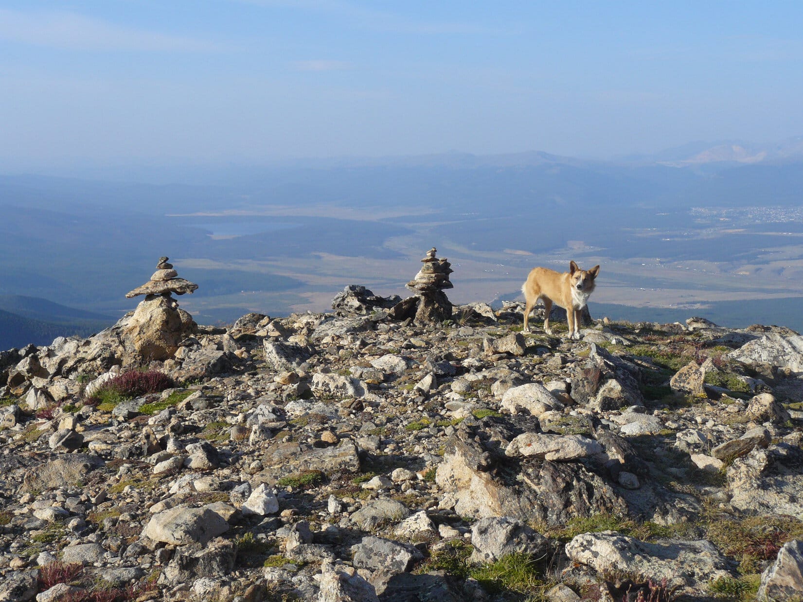
Mount Massive from Turquoise Lake near Leadville, CO.
August 23rd, Day 15 of Lupe’s great Summer of 2015 Dingo Vacation, began as a complete disappointment. SPHP had planned for Lupe to get an early start on climbing Mount Elbert(14,433 ft.), the highest mountain in Colorado. (Only Mt. Whitney(14,498 ft.) in California is higher in the 48 contiguous United States.) When morning came, however, Mount Elbert was nowhere to be seen. The sky was completely overcast. Mount Elbert was lost in the clouds.
There was no point in Lupe climbing Mount Elbert just to see fog. A leisurely breakfast ensued. After a little while, though, it looked like there wasn’t as much fog as there had been. The trend continued. Suddenly SPHP realized the clouds were going to simply dissipate. It wasn’t going to be foggy for long. It was going to be a gorgeous day!
Lupe got a late start. It was Sunday. The weekend crowds were still here. The Mount Elbert trailhead was absolutely totally and completely full. Apparently SPHP had been the only one deterred by the early morning fog. It was 10:12 AM (54°F) by the time SPHP parked the G6 at a little pullout along USFS Road No. 110 in the Halfmoon Creek area. Lupe had to trot 0.25 mile along No. 110 just to get to the trailhead.
Mount Elbert from Road No. 110, which leads to the Halfmoon Creek area trailhead NE of Mount Elbert. Although the clouds had dissipated, there was still a smoky haze from distant wildfires. Photo looks SW.Mount Massive(14,421 ft.) is the 3rd highest mountain in the 48 contiguous United States, and only 12 feet lower than Mount Elbert. Mount Massive is just 5 miles NNW of Mount Elbert.Mount Elbert from the NE. SPHP managed to park the G6 closer to the TH than shown here. This was just a rare viewpoint at an opening in the forest along No. 110.
The first part of the climb up Mount Elbert was all in the forest, so there really weren’t any views. From the Mount Elbert TH, a short spur trail (0.50 mile?) leads up to the Colorado Trail. Lupe followed a somewhat longer segment of the Colorado Trail S to an intersection with the Mount Elbert Trail No. 1184.
Although the topo map on Peakbagger.com doesn’t show the Mount Elbert Trail No. 1184 going all the way up to the summit, it actually does. The trail works its way up the NE ridge and gets heavy use. Its route is unmistakable, except when covered with snow.
Other than a portion of the Colorado Trail which was close to level, Lupe’s entire route to Mount Elbert was a steady climb. Some parts were steeper than others, especially approaching the summit, but it was nearly all just going up.
Even though the Mount Elbert TH parking lot was full, at first there weren’t too many other people and dogs around. Only Lupe, SPHP and a few other stragglers were starting up the mountain this late in the day.
After a couple of hours, Lupe and SPHP started meeting the early birds coming back down the mountain. Some had started up in darkness as early as 4:00 AM. By the time Lupe reached tree line, a flood of people and dogs were coming down the trail. Not all had made it to the summit of Mount Elbert, but most of them had. There were social opportunities galore for Lupe, who sniffed the many dogs, and allowed herself to be petted by some of the friendlier people.
The passing parade included lots of dogs wearing backpacks. (American Dingoes don’t go in for that kind of drudgery, they bring human porters.) Some wore booties on their paws. (Carolina Dogs climb rocky mountains regularly, and aren’t a bunch of greenhorn tenderpaws.) There were large dogs and small ones representing a great variety of breeds.
The people were almost as varied as the dogs. Children under 10 years old had made it to the summit. There were tall, short, thin, and fat people. There were a few clearly in their 70’s. There were quite a number of nationalities and languages represented. The most unusual people, though, were three who came down the mountain riding unicycles. SPHP greatly regrets not having the presence of mind to take a couple of pictures of the unicyclists. The whole concept seemed suicidal, but there they were, having a great time.
In fact, everyone was having a good time. The weather was great. Only the ever-present smoke haze from distant wildfires dimmed the marvelous views above tree line.
Trail No. 1184 above tree line.Lupe climbing Mount Elbert. She is already well above tree line here. This photo shows the steepest part of the climb up Mt. Elbert on Trail No. 1184. Once up on the ridge ahead, the rest of the way to the summit is just an easy stroll gaining the final bit of elevation gradually. Photo looks WSW.Lupe gains the ridgeline. The summit is now in view. The rest of the way is easy, with spectacular views all along the way.
Only near the summit were there any difficulties at all climbing Mount Elbert. Near the very end, the trail climbed pretty steeply to reach the ridgeline that was the final leg to the summit. Many people reported being a bit scared of the loose rock and slippery hard-packed ground on the steep trail.
When Lupe and SPHP got there, it was as they said, but not anything Lupe hadn’t encountered many times before on other mountains. It was really more of a problem going down than going up. Taking it slowly and cautiously was all that was required. Of course, that applied only to SPHP. The Dingo romped around as usual, confident of her footing every inch of the way.
After gaining nearly 4,500 feet of elevation, Lupe was there – the summit of the highest mountain in Colorado, the state most famous for its high peaks. Lupe stood surveying the world from the top of Mount Elbert.
Lupe on the summit of Mount Elbert. SPHP believes the high mountain near the center of this photo is La Plata Peak(14,336 ft.). Photo looks SSW.A hiker holds up a rather nice Mount Elbert sign designed like a Colorado state license plate to commemorate the occasion. The sign had the elevation and numbers 8 and 15 on it for August, 2015. SPHP has no idea who produced and brought that sign up. Whoever did was kind enough to leave the sign there for everyone’s use. No doubt it eventually made a nice souvenir for someone.Mount Elbert – South Peak(14,134 ft.) is shown here on the left. It is an unranked peak connected to Mount Elbert by a ridge. The Black Cloud Trail No. 1480, an alternate route up Mount Elbert from the S, crosses Mount Elbert – South Peak on its way to Mount Elbert. La Plata Peak (R), 6 miles away to the SSW, is also in this photo.Mt. Cosgriff(13,588 ft.) (L) is another unranked peak. It is connected to Mount Elbert – South Peak (R) by a continuation of the same ridge from Mount Elbert. Photo looks S.Mount Massive(14,421 ft.) dominates the view to the NNW.Looking W at the upper South Fork of Halfmoon Creek basin. SPHP believes the peaks in the foreground are Casco Peak(13,908 ft.) (L of Center), Frasco Peak(13,876 ft.) (R of Center), and French Mountain(13,940 ft.) (Far R.).
Since the weather turned out to be perfect, there was a huge advantage to Lupe’s late start up Mount Elbert. By the time she reached the summit, there were fewer than a dozen people there. Most of those soon left. In the end, there was only one other group on Mount Elbert. There were two brothers and an uncle. They were waiting for a brother-in-law, who was still struggling up the mountain on the South Mount Elbert Trail No. 1481 (which actually approaches Mount Elbert from the E).
The brother-in-law was thinking about giving up, but the rest of the family was in contact via smart phones. They urged him onward. He came into view below, and was eventually greeted by the family as he approached the summit.
Two brothers and an uncle greet a brother-in-law as he reaches the NE end of the summit area.
When all four men reached the summit, Lupe joined them for a photo op. This was the brother-in-law’s first trip up Mount Elbert, but the rest of the family had made multiple trips up the mountain. The brother in the blue jacket and jaunty blue hat had been here six times.
Lupe with new friends on Mount Elbert. Photo looks NNW towards Mount Massive.From Left to Right: Carlos Holguin, Jose Holguin, Edgar Flores, Luis Holguin. Edgar, of course, is the brother-in-law savoring his first ascent of Mount Elbert. Luis is Carlos and Jose’s uncle. Lupe is the Carolina Dog, but you knew that already.
Lupe and SPHP remained up on Mount Elbert for a while longer after Edgar’s arrival. No one else came up the mountain. It looked like Edgar was going to be the last man up this day. SPHP was curious about a high mountain off to the SE far beyond the Twin Lakes. No one knew its name.
No one knew the name of the high mountain to the SE far beyond Twin Lakes.
By climbing Mount Elbert, both Lupe and SPHP set personal records for the highest mountain ever climbed. Unless Lupe and SPHP make it out to Mount Whitney in California some day, it’s likely Mount Elbert is the highest mountain Lupe and SPHP will ever climb.
Prior to Lupe’s great Summer of 2015 Dingo Vacation, Lupe’s personal best was Lonesome Mountain (11,399 ft.) on 8-3-14 in Montana, which she climbed during her 2014 Dingo Vacation. She had already set new records three more times during her 2015 Dingo Vacation: Medicine Bow Peak (12,013 ft.) on 8-10-15) in Wyoming, Mount Zirkel (12,180 ft.) on 8-17-15 in Colorado, and Flat Top Mountain (12,354 ft.) on 8-21-15 in Colorado.
SPHP hadn’t set a new record for highest mountain climbed in years. Until this day with Lupe on Mount Elbert, Cloud Peak(13,167 ft.) in Wyoming, a peak SPHP has climbed twice, was the highest mountain SPHP ever stood on.
So seeing the world from up on Mount Elbert was kind of a big deal. Before Lupe headed down, SPHP took a few extra photos of the view from the top of Colorado.
Mount Elbert – South Peak and the ridge leading to it from Mount Elbert.Twin Lakes from Mount Elbert. Photo looks SE.Mount Massive from Mount Elbert. Photo looks NNW.The view NW of Mt. Elbert.Looking NE along the summit.
And then it was time to start down. It turned out that Edgar Flores was not going to be the last one to reach the summit of Mount Elbert this beautiful day. Lupe met several small groups of people still heading up on her way down. Maybe they were going to enjoy sunset on Mount Elbert. They certainly could have. The weather was ideal. It hadn’t even been breezy on top.
The big crowds that had been present on the trail earlier in the day were gone. Nearly the entire trek down Mount Elbert, Lupe and SPHP were alone.
Lupe sniffs around still near the summit. The junction of Trails No. 1184 (straight ahead) and No. 1481 (heads to the right) is shown here. Lupe will go back down No. 1184, the same way she came up. No. 1184 is the N or NE route up Mount Elbert. No. 1481 is known as the South Mount Elbert Trail, even though it actually approaches the mountain from the E.Even though the climb up Mount Elbert doesn’t feature any dangerous parts, if you wanted to, you could still manage to fall off the mountain. This look down a steep slope to the N was taken while Lupe was still close to the summit.Mount Massive from Mount Elbert.
It was getting pretty dark by the time Lupe reached the G6 again at 8:19 PM (50°F). She wasn’t going to climb any mountains higher than Mount Elbert on the rest of her Summer of 2015 Dingo Vacation, or maybe ever. That doesn’t mean Lupe’s adventures are over though! She encourages you to subscribe to The (Mostly) True Adventures of Lupe for news of more Dingo Adventures coming soon!
Lupe on her way down Mount Elbert, 8-23-15. Turquoise Lake is seen far below at left center. Leadville, CO is near the right edge. Lupe, the American Dingo will be seen on more lofty peaks in the American West very soon!
Lupe didn’t show up at the Stillwater TH until 1:49 PM on 8-21-15, Day 13 of her Summer of 2015 Dingo Vacation. Lupe and SPHP had both spent the morning recovering from Lupe’s big adventures the previous day going to the Devil’s Causeway, Peak 12,008, the Rio Blanco County High Point and Orno Peak. Now Lupe was setting out from the same TH, but in a new direction – she was going to climb Flat Top Mountain(12,354 ft.).
It had been breezy all day, even down in the valley. The breeze whipped up waves on the Stillwater Reservoir. To get to Flat Top Mountain, Lupe was going to follow Trail No. 1122. The trail went across the Stillwater Reservoir dam, dropped down a bit to cross a valley, and then climbed up a ridge to the S to a pass. From the pass, Lupe would leave the trail and climb the long, reasonably gentle SW slope leading to the summit of Flat Top Mountain.
The breeze whipped up waves on the Stillwater Reservoir. Lupe isn’t a big fan of wind.Lupe on the Stillwater Reservoir dam. Her peakbagging destination is Flat Top Mountain, seen here to the SE.
SPHP stopped to register Lupe’s trip into the Flat Tops Wilderness Area at the registry station along Trail No. 1122. Although there were quite a few pages in the registry book, they all seemed to be completely filled in already.
SPHP flipped back to the first page to start looking for room to place an entry, and received a bit of a shock. For there, in big bold handwriting in the margin on page one, was a name SPHP recognized. Furthermore, the entry bore today’s date, 8-21-15, noted Flat Top Mountain as the destination, described the party as 1 person and 1 dog, and concluded with “Out!”
Beth Lakin had already climbed Flat Top Mountain earlier in the day with her black lab, Sprocket! Lupe and SPHP didn’t really know Beth and Sprocket at all, but SPHP recognized the name.It all started in early May, 2014, when SPHP happened across the website Peakbagger.com. Peakbagger.com is a site for people (and American Dingoes!) interested in mountains, and like recording data about their hikes and climbs. The site has a large database on mountains worldwide including locations, elevations, various maps, photos and trip reports submitted by users, etc. Registration for a Peakbagger.com account is free, so SPHP registered an account for Lupe. Click here to visit Lupe’s homepage on Peakbagger.com.
In general, anyone can view data submitted by registered account holders on Peakbagger.com – including what mountains they’ve climbed, trip reports they’ve submitted, etc. One day in September or October, 2014, SPHP happened to click on Beth Lakin’s account on Peakbagger.com. Her homepage had a link to her blog at 3UpAdventures.com. Beth blogs about her adventures in life with her black lab, Sprocket.
Beth is a prolific and talented blogger, likes climbing mountains with Sprocket (who is close to the same age as Lupe), and has an incredibly wide variety of interests and adventures. She is a member of Columbia Sportswear’s #Omniten program. During the #OmniGames in early 2014, Beth won a place on a Columbia Sportswear sponsored trip later that year to the nation of Jordan in the Middle East (click the Jordan link to see the video on that trip). She is also an ambassador for other company brands.
SPHP first became interested in blogging while reading 3UpAdventures. It’s fair to say that The (Mostly) True Adventures of Lupe at least partially owes its existence to Beth Lakin, Sprocket and 3UpAdventures.com. Check on what Beth & Sprocket are up to any time from The (Mostly) True Adventures of Lupe by using the drop down menu under the category “Favorite Blogs”.
So, by now, SPHP had been a regular reader of Beth’s 3UpAdventures blog for nearly a year. As Lupe climbed Trail No. 1122 up to the pass, SPHP thought how fun it would be for Lupe to meet Beth and Sprocket. It was Friday, so they were probably around for the weekend. SPHP knew one of Beth’s climbing priorities has been to climb as many county high points in Colorado as possible. SPHP guessed Beth and Sprocket might be heading for the Rio Blanco County HighPoint tomorrow, the same Rio Blanco County High Point that Lupe had been to just yesterday.
About the time Lupe was reaching the pass on Trail No. 1122, SPHP suddenly realized the weather was deteriorating. While SPHP had been thinking about Beth & Sprocket, a squall line had approached out of the W. For a few minutes, a combination of rain and little tiny snowballs fell out of the sky. Then the squall line headed E. The weather cleared, but another bigger squall line was visible off to the W. It was still far off, but headed this way.
Lupe at the pass. Photo looks N towards the Stillwater Reservoir.
Lupe needed to make fast tracks up Flat Top Mountain! She left Trail No. 1122 and started heading NE up the long ridge to the summit. Along the way, she arrived at an intermediate high point called Flat Top Mountain West(11,685 ft.), a minor peakbagging goal. There was still a big climb left up to the main summit.
Lupe now above the pass and climbing Flat Top Mountain. Photo looks SSW at the country S of the pass. SPHP isn’t sure if the lake seen in the distance is Hooper or Keener Lake.Looking W from intermediate high point Flat Top Mountain West. The next squall line is approaching!Looking N from Flat Top Mountain West. Amazing how much smoke haze there still is even after the little rain and snow shower of the 1st squall line.Lupe still has a bit of a climb left. Photo looks NE.
As Lupe climbed the rest of the way up Flat Top Mountain, SPHP kept an eye on the still approaching 2nd squall line to the W. It spread out and became a long inescapable wall of rain heading straight for Lupe. However, there was no sign of any lightning or thunder. Lupe could keep going, but she and SPHP might just have to grin and bear it for a while at the top. It looked like the squall would hit right about the time Lupe got there.
The luck of the Dingo held. As the squall line, which had been strengthening, drew closer, it changed and started to dissipate. Lupe reached the top of Flat Top Mountain. The squall hit, but it was only a shadow of its former self just 10 minutes earlier. The wind blew pretty hard, but the rain was lighter than expected. For 10 minutes, the top of Flat Top Mountain wasn’t a great place to be. And then it was again.
Lupe at the big summit cairn on Flat Top Mountain. Yamcolo Reservoir is visible below off to the NE.The U.S. Geological Survey Benchmark.Looking SE toward the summit cairn. Flat Top Mountain at 12,354 feet was a new personal record for Lupe! Her previous highest mountain summit was Mount Zirkel(12,180 ft.), which she had climbed just 4 days before on 8-17-15.They could have named it Flat & Rocky Top!A look back to the WNW at Stillwater Reservoir where Lupe started this trek.
Climbing 12,354 foot Flat Top Mountain set a new personal elevation record for Lupe! Flat Top Mountain broke the record of 12,180 feet she had achieved by climbing Mount Zirkel(12,180 ft.) just 4 days earlier on 8-17-15. Although Flat Top Mountain was higher, Mount Zirkel had been more of a challenge.
It was time to head back down the mountain. On the way, Lupe took time for more photos near Flat Top Mountain West and a few other points.
Lupe starts down. Trail No. 1122 is way down at the pass at the base of the big ridge with snow on it. Stillwater Reservoir is seen at the extreme right. Photo looks SW.Bear Lake (L) and Yamcolo (R) reservoirs. Photo looks NE.Yes! Lupe was over there the day before! Peak 12,008 (L ridge), the Rio Blanco County High Point(12,027 ft.) (center), and Orno Peak(12,133 ft.) (end of ridge on R).Stillwater Reservoir. Photo looks NW.Lupe pauses to sniff the air on her way down the mountain.
Lupe reached the G6 down at the Stillwater TH at 7:36 PM (52°F). Her adventure to Flat Top Mountain was over, but a new adventure was about to begin. Lupe and SPHP were going to look for Beth & Sprocket! SPHP knew Beth would likely be driving an easily recognizable vehicle – her red 1977 Jeep Cherokee FSJ. There couldn’t be too many of those hiding out around the campgrounds and trailheads between Stillwater Reservoir and Yampa!
So the search began, but it didn’t go well. There was no vehicle around that even slightly resembled a 1977 Jeep Cherokee FSJ. The FSJ was the only clue Lupe and SPHP had to go by. There was no telling where Beth & Sprocket might be, or if they were really still even in the area – it made sense, but was only a hunch.
The light faded fast. Night was coming on. Soon the stars would be out. Lupe and SPHP returned to where the G6 had been parked the prior two nights. And then, there it was. Parked in the exact same spot, was a red 1977 Jeep Cherokee FSJ!
Beth & Sprocket’s 1977 Jeep Cherokee FSJ. This photo was taken the next morning.
SPHP wound up startling poor Beth out of a deep sleep. After introducing Lupe, SPHP piteously pled to be allowed to take a picture of Lupe with Beth & Sprocket. Despite any annoyance Beth may have felt, she very graciously consented. SPHP seldom takes pictures of Lupe in the mountains at night, and at first could not remember how to use the flash. In a few minutes, the problem was solved and the prized picture was taken.
At first, Sprocket seemed puzzled by the whole turn of events. Why are we getting up? Why is this Dingo here? What is going on? Beth allowed SPHP to give Sprocket a few Cheesy Barkin’ Beggin’ Strips. Although it was still all rather confusing, Sprocket clearly hoped events would continue along this trend. Beth permitted SPHP to stretch Sprocket’s quota by one more Cheesy Barkin’ Beggin’ Strip.
Beth and SPHP had an amiable chat. Beth and Sprocket were indeed planning to head up to the Rio Blanco County High Point in the morning. On August 8th, they had been to Mount Zirkel. Had Lupe been there? SPHP confirmed that Lupe had climbed Mount Zirkel, too, on the 17th. And so it went for a little while. Soon it was time to let Beth & Sprocket get back to sleep.
It had been a great day! Lupe climbed Flat Top Mountain setting a new personal elevation record. She saw beautiful places she had never been to before along the way. She met Beth Lakin, whose 3UpAdventures had at least in part inspired The (Mostly) True Adventures of Lupe. She sniffed with the tall, dark and handsome Sprocket. She had her souvenir photo with Beth & Sprocket, the Celebrity Adventuring & Blogging Duo of 3UpAdventures.com – both as awesome and friendly in real life as they are on the internet.
Lupe with Beth & Sprocket of 3UpAdventures in the Flat Top Mountains, Colorado 8-21-15
After a long day and late night return from Big Marvine Peak (11,879 ft.) in the Flat Tops Wilderness Area on 8-18-15, a day of rest was in order for both Lupe and SPHP. Lupe spent the morning enjoying a ride in the G6 from the Trappers Lake area back E over Ripple Creek and Dunckley passes along the Flat Tops Scenic Byway. Lupe got to see a hawk flying over the road with a gopher in its talons along the way.
Near Phippsburg, Lupe and SPHP turned S to Yampa. Lupe spent a little time in Yampa, and then headed SW along Hwy 7. Seven miles from Yampa, the pavement ended where Hwy 7 became USFS Road No. 900. Lupe explored the area by G6, coming first to the Yamcolo Reservoir. Next was the Bear Lake Reservoir, and finally, at the end of the road, the Stillwater Reservoir.
Lupe reaches the Yamcolo Reservoir SW of Yampa, CO. Photo looks SW.The Stillwater Reservoir at the end of USFS Road No. 900. Photo looks SW.Bear Lake Reservoir and Flat Top Mountain(12,354 ft.). Photo looks S.
Lupe spent the rest of the 19th resting and recuperating from Big Marvine. The 20th was going to be another big day! Lupe was ready even before the 20th arrived. She kept wanting to go exploring in the night. Finally dawn came. Day 12 of Lupe’s great Summer of 2015 Dingo Vacation was here!
At 7:39 AM (36°F, clear and calm), Lupe and SPHP left the Stillwater TH on Trail No. 1119. Well above Stillwater Reservoir’s NW shore, the trail headed SW paralleling the reservoir for about half its length. There it reached a junction with Trail No. 1120, which continued on to the SW. Trail No. 1119 turned NW and started to climb. Lupe’s first objective for the day was the Devil’s Causeway. She left Stillwater Reservoir behind, staying on Trail No. 1119 as it climbed up towards the E end of the Devil’s Causeway.
Lupe started out on Trail No. 1119 above the NW shore of Stillwater Reservoir. Although there wasn’t a cloud in the sky, the smoke haze that persisted throughout nearly all of Lupe’s time in Colorado was evident here again today. Photo looks S.The Devil’s Causeway is a portion of the high ridge seen here from the SE. Trail No. 1119 climbs up to the lowest part of the saddle just to the right of the ridge.
Lupe along Trail No. 1119 on her way up to the Devil’s Causeway.
Once Trail No. 1119 reaches the saddle or pass just to the NE of the Devil’s Causeway, it continues NW on over the ridge. A separate trail heads SW up to the Devil’s Causeway itself.
The trail up to the NE end of the Devil’s Causeway. Photo looks SW.
The Devil’s Causeway is simply a high, relatively flat, narrow ridge connecting two large areas of high ground. However, the Devil’s Causeway has one special characteristic: the connecting ridge becomes very, as in terrifyingly, narrow. On both sides there are sheer drops of hundreds of feet. One section of the Devil’s Causeway narrows to as little as 4 feet wide. Along this short section, much of the soil has eroded away to expose a line of uneven boulders and large rocks as the only way across.
What could be more fun? Lupe and SPHP headed up to take a look.
Lupe near the NE end of the Devil’s Causeway. While narrow, most of the Causeway isn’t so scary at all, but there is that one very narrow section seen a little ways up ahead. That’s a bit different. Photo looks SW.
Well, some things are just Darwinian by their very natures. Carolina Dogs are survivors. They aren’t going to fail this simple test! Lupe had a good look at the Devil’s Causeway. It was very worth seeing, but not really worth crossing. Lupe turned around. Lupe and SPHP took a break back at the high point of the trail with a view to the N towards her next peakbagging goal, Peak 12,008.
Peak 12,008, Lupe’s 1st peakbagging goal of the day, is the big ridge on the right. Pyramid Peak is seen in the distance to the left. Looking N from high point at NE end of the Devil’s Causeway.The highest point on Peak 12,008 (big ridge) is 4 miles N.A look WNW at another ridge connected to the other (SW) end of the Devil’s Causeway. Causeway Lake is seen below.Flat Top Mountain (highest point in distance on L) and Stillwater Reservoir from the pass just NE of Devil’s Causeway. Trail No. 1119 is seen below along with Little Causeway Lake. Photo looks SE.
After the break enjoying the scenery from the high point at the NE end of the Devil’s Causeway, it was time for Lupe to head N to the high point of the huge broad ridge which is Peak 12,008. The high point was 4 miles away near the N end of the ridge. Lupe headed back down to the pass, crossed Trail No. 1119 and headed N.
After going about 0.5 mile N, Lupe came over a rise and saw a large flock of sheep ahead. A big white Livestock Protection Dog, just like the two Lupe had seen near Mount Zirkel a few days before, was on duty. The Livestock Protection Dog started barking, but was outnumbered and approached Lupe and SPHP warily.
The Livestock Protection Dog sounds the alarm, and warily approaches intruders Lupe & SPHP.
Lupe liked the looks of the whole setup. She was suddenly seized with the desire to go into the sheepherding business herself. She was most anxious to get started right away. Only the leash prevented her from doing so.
Sly dingo Lupe is seized with the desire to go into the sheepherding business on Peak 12,008! You can see that Dingo mind at work!
Lupe was reluctant to leave her newly adopted flock. She played Moses, parting the sheep into W and E flocks as she passed through heading N. A great deal of baaing went on as sheep fled in one direction or the other. The white Livestock Protection Dog followed Lupe barking from a safe distance to make certain Lupe wasn’t really going into the sheepherding business, or intending to put on sheep’s clothing and sneak back.
Once the sheep had been left behind, Lupe came to Dead Mexican Gulch. To stay on the high ground, Lupe had to head over to the E side of Peak 12,008, where something most intriguing was in the ground. For a few minutes, Lupe tried her luck in the earth excavating business.
Lupe reaches Dead Mexican Gulch, which forced her around to the high ground to the E.Looking N at the W end of Dead Mexican Gulch.Lupe goes into the earth excavation business on Peak 12,008.
Disappointingly, Lupe’s mining operations yielded no tangible results, although her enthusiasm was not dimmed. From the E side of Peak 12,008 on a high point just N of Dead Mexican Gulch, there were some big views.
Looking N along the E edge of Peak 12,008 from a point just N of Dead Mexican Gulch. The upper end of the Mandall Creek basin is seen below.Peering over the E edge of Peak 12,008 down at Slide Mandall Lake.Orno Peak, Lupe’s final peakbagging goal this day, is seen at the far end of the distant ridge from the E edge of Peak 12,008. Photo looks NE.
From Dead Mexican Gulch, it was still nearly 2 miles N to the highest point on Peak 12,008. Lupe and SPHP proceeded N looking for it. The terrain gained elevation ever more slowly. Along the way, Lupe came to a big cairn. It didn’t seem to be the summit, though, so Lupe continued on and eventually reached the N end of Peak 12,008. From there she saw another peakbagging goal, the high point of Rio Blanco County.
Lupe reached this large post while looking for the summit on Peak 12,008. It didn’t seem to be at the summit. Flat Top Mountain is seen in the distance beyond the post. Photo looks S.At the N end of Peak 12,008, Lupe sees the Rio Blanco County High Point, the high ridge to the N seen here.Looking E along the N edge of Peak 12,008. Mandall Pass is seen toward the left. Orno Peak to the E barely juts up above the ridge on the other side of Mandall Pass. This same ridge connects to the Rio Blanco County High Point farther W than shown in this photo.
The views from the N end of Peak 12,008 were great, but where was the summit? Lupe and SPHP headed SE trying to find the highest ground. The Browns Peak (11,722 ft.) effect came into play again. Although Lupe seemed to be climbing continuously, everywhere Lupe went looked lower than where she had just been, and lower than practically everywhere else too.
Eventually Lupe found something. A little post was leaning sadly from a small cairn of rocks. About a foot away was a coffee can. SPHP opened it up. Inside was a small glass jar with a very rusty top. Nevertheless, it opened right up when SPHP twisted the lid. Inside were 3 pieces of paper, one of them a piece of a map. Buried treasure?! Lupe certainly hoped so! She was ready to put her earth excavating skills right back to work.
Alas, the map and both of the other two pieces of paper proved to be a simple registry. There were about 20 entries between all 3 pieces of paper. The latest entry was from 2014. The oldest was from 2001. The coffee can also contained a pencil. Amazingly, the tip of the pencil was still pretty sharp. SPHP added Lupe to the registry on the piece of paper with the most recent entries. A little notebook that would have served as a greatly improved new registry was sadly back at the G6.
SPHP put all of the pieces of paper back in the little glass jar, and put the lid back on. The jar and the pencil went back in the French Market coffee can. SPHP straightened up the little post, and propped it up better with more rocks. After a few photos of Lupe at the little cairn, which SPHP now regarded as the summit of Peak 12,008, SPHP decided to put some more rocks around the coffee can to better hold it in place.
The French Market coffee can registry container on Peak 12,008.The little summit post, cairn and coffee can registry container as restored by SPHP.Yeah, there’s a reason these mountains are called the Flat Tops.Lupe didn’t mind resting while SPHP fiddled around with things at the little summit cairn on Peak 12,008. By the time this photo was taken, SPHP had added more rocks around the coffee can.
After all this, Lupe and SPHP were satisfied that Lupe had reached the summit of Peak 12,008. Her first peakbagging goal of the day was met. Her next peakbagging goal was the Rio Blanco County High Point(12,027 ft.), which lay on the other (N) side of Mandall Pass.
It proved easy to go NE down into Mandall Pass. The only bad part of it was the wind. Although the day had started out with no wind at all back down at the Stillwater Reservoir, once Lupe had gotten up on Peak 12,008, there had been a constant W breeze. Down in Mandall Pass, the wind was really blowing. Lupe headed N from Mandall Pass up to the Rio Blanco County High Point. She found a cairn, big cliffs, and big views there.
Lupe pauses as she starts down into Mandall Pass from Peak 12,008 to take a look NW at Pyramid Peak(11,532 ft.).The Rio Blanco County High Point. Photo looks NNW. From here, Lupe went NW to the two high points shown at the left side of the photo. Although they look higher from this angle, they were actually lower.Looking ESE from the Rio Blanco County High Point at Orno Peak, the highest point in the distance.
From the cairn on the Rio Blanco County High Point, two other high points could be seen a bit farther NW along the ridge. They looked to be about as high as where the cairn was. It appeared they might even be a bit higher. Lupe went over to both of them to investigate and make certain she really had successfully completed her 2nd peakbagging goal of the day.
Lupe at the 2nd high point furthest to the NW of the Rio Blanco County High Point. The summit cairn to the SE is barely visible, but clearly higher.
Looking back at the summit cairn from both of the two high points to the NW, it was very clear that the cairn was really at the true Rio Blanco County High Point. Lupe had successfully completed her 2nd peakbagging goal!
The sun was high in the sky. There was plenty of time for Lupe to do more. Orno Peak(12,133 ft.) was the 3rd peakbagging goal SPHP had in mind for Lupe, but the first sight of Orno Peak from Peak 12,008 had made SPHP wonder if she could actually climb it. The S slope looked very steep. More importantly, it wasn’t clear if the E end of the long ridge leading to Orno Peak from the W could be safely traversed.
The view of the N slope of Orno Peak from the Rio Blanco County High Point was more encouraging. The N slope was steep, but definitely friendlier than the S slope. Maybe there was a way.
Only one way to find out! Lupe headed ESE along the big ridge from the Rio Blanco County High Point. Orno Peak was more than two miles away. SPHP was certain Lupe could safely at least get close to it.
Looking down on Mandall Pass from the N while Lupe was on her way to Orno Peak. Peak 12,008, where Lupe had already been, is the high flat ridge on the other side.A look back to the WNW at the Rio Blanco County High Point.Getting closer to Orno Peak. Photo looks ESE.
Not far from Orno Peak, the broad ridge leading to it ended. Only a much narrower ridge continued on to the peak. SPHP could see Orno Peak had two blocks of rock near the summit. The first block was smaller, closer and a little lower. The second block a bit farther to the E was the true summit.
It looked like Lupe would have no problem getting up on the first block. A trail headed toward it. However, cliffs could be seen around the second block, and a small cliff might be on the other side of the first block. From a distance, without binoculars, it was hard to tell if Lupe could get safely past the first block and climb the second one. Was there a safe way up to the second block and true summit?
Lupe at the end of the broad ridge. Orno Peak is now just a short distance to the E along a much narrower ridge.
Lupe followed the path along the narrow ridge up to the first block of rocks. SPHP had intended for her to climb it, but it looked really easy to just go around the N side of it instead.
Heading around the N side of the first block of rocks at the top of Orno Peak.
When Lupe got around the first block of rocks, the second one was in view just ahead. SPHP was happy with what was there. It was going to be easy for Lupe to climb up on the second block to reach the summit of Orno Peak! In just a few minutes she was there. A cairn near the E end of the second block marked the summit.
Lupe nears the second block of rock and true summit of Orno Peak.Lupe reaches the summit of Orno Peak! Photo looks E.
Of course, there were fabulous views all around from Orno Peak. The annoying ever-present smoke haze marred the views to some extent, but they were still very impressive.
Looking W from the summit of Orno Peak. The smaller and lower first block of rock Lupe went around to get to the summit is in view directly ahead. The Rio Blanco County High Point is in the distance on the right. The high broad ridge of Peak 12,008 is in the distance at center left.In the distance from left to right: Peak 12,008, Rio Blanco County HP, Pyramid Peak. Photo looks NW.Mandall Creek basin from Orno Peak. Peak 12,008 is the long, high ridge beyond the basin. Photo looks SW.Looking E.
Even though the sun was still well up in the sky and there were hours of daylight left, Lupe was a very long way from the G6 at Orno Peak. It was soon time to start back. Lupe could have simply retraced her route, but instead she was going to head down into Mandall Creek basin from Mandall Pass. This would add some miles to the already long return trip, but also let Lupe explore new territory.
The view as Lupe heads down to Mandall Pass. Photo looks S.Lupe at Mandall Pass. Photo looks S towards Mandall Creek basin. Flat Top Mountain(12,354 ft.) is in the distance just L of center.Mandall Creek basin from Mandall Pass.
The upper portion of Mandall Creek basin was very beautiful. There were small lakes and streams. Lupe had fun all day racing around up on the barren high ridges at 12,000 feet, but she had even more fun down in Mandall Creek basin. Why, there were trees down here! Trees meant squirrels! The basin echoed with the happy barking of a Carolina Dog. Except for the squirrels themselves, no one was around to care.
The trail down to USFS Road No. 900 at the Mandall Creek TH was a bit hard to follow. It hardly existed at all in the upper basin, but it didn’t really matter there, because there was still lots of open ground. Farther down where it was all forested, a better trail would have helped. Lupe came to a place on a steep hillside where the trail had collapsed. Maybe SPHP hadn’t found the official trail, or the best route, but Lupe eventually did arrive at the Mandall Creek TH.
By now the sun was down. Twilight was setting in. It was still 3 miles uphill along USFS Road to the Stillwater TH where the G6 was parked. SPHP figured no one would be headed up to the TH at the end of the road at this time of day, so it wouldn’t be possible to hitch a ride. No one did come along. Lupe and SPHP marched in silence up the road as the light faded.
It had been an exhilarating, but very long day. The fun was over. The road hike was dull. Lupe wanted to stop, curl up, and go to sleep. SPHP permitted several short rest stops along the road. When it grew so dark the flashlight came out, Lupe was more willing to continue onward. Nearly 14 hours after she had left, Lupe returned to the G6 at 9:31 PM (39°F). Maybe her next adventure tomorrow could be a bit less fanatical? SPHP agreed.
Lupe in the beautiful upper Mandall Creek basin. Photo looks NNW towards Mandall Pass.


 It was getting pretty dark by the time Lupe reached the G6 again at 8:19 PM (50°F). She wasn’t going to climb any mountains higher than Mount Elbert on the rest of her Summer of 2015 Dingo Vacation, or maybe ever. That doesn’t mean Lupe’s adventures are over though! She encourages you to subscribe to The (Mostly) True Adventures of Lupe for news of more Dingo Adventures coming soon!