Glacier National Park, Montana (8-17-12)

Days 9 & 10 of Lupe’s 2012 Dingo Vacation to the West Coast.

On the morning of 8-16-12, Lupe woke up not in Lanis’ Honda Element or in her “tiny house” (tent), but on a comfy soft bed in a motel in Bozeman, MT.  Ahhh!  This was the life American Dingoes were meant to live!  Lupe was clearly enjoying motel life.

Of course, the soft life lasted only until Lanis woke up.  Then it was time to get back to the other life American Dingoes were meant to live – exploring and adventuring in the big, wide world!  For Lupe, it was going to be a pretty passive day of exploring from a pile of blankets and pillows in the back of the Element, though.  Day 9 of Lupe’s 2012 Dingo Vacation was spent traveling.

From Bozeman, Lupe, Lanis and SPHP went to Helena, and then on to Flathead Lake and Kalispell.  By evening, Lupe’s tiny house was set up at Whitefish State Park in Whitefish, MT.  The state park was quite a popular place.  There were lots of other campers around.  It was a pretty spot, but felt more like being in a small community than a wilderness experience.

Whitefish State Park featured a scenic lake where people were boating.  The lake even had a small dog beach where Lupe could sniff around and wade in the water.  Whitefish State Park had another interesting feature.  It was situated right next to the railroad tracks.  Trains rumbled by regularly during the night, each event causing Lupe some excitement, and SPHP some trouble trying to keep her from rousing the neighbors.

The next morning, Lupe, Lanis and SPHP left Whitefish State Park, and headed for Glacier National Park.  To be certain to have a place to stay for the night, Lupe’s tiny house got set up almost right away at the Sprague Creek Campground on the E shore of Lake McDonald.

Lake McDonald from the Sprague Creek campground.

Lake McDonald, Glacier NP, 8-17-15
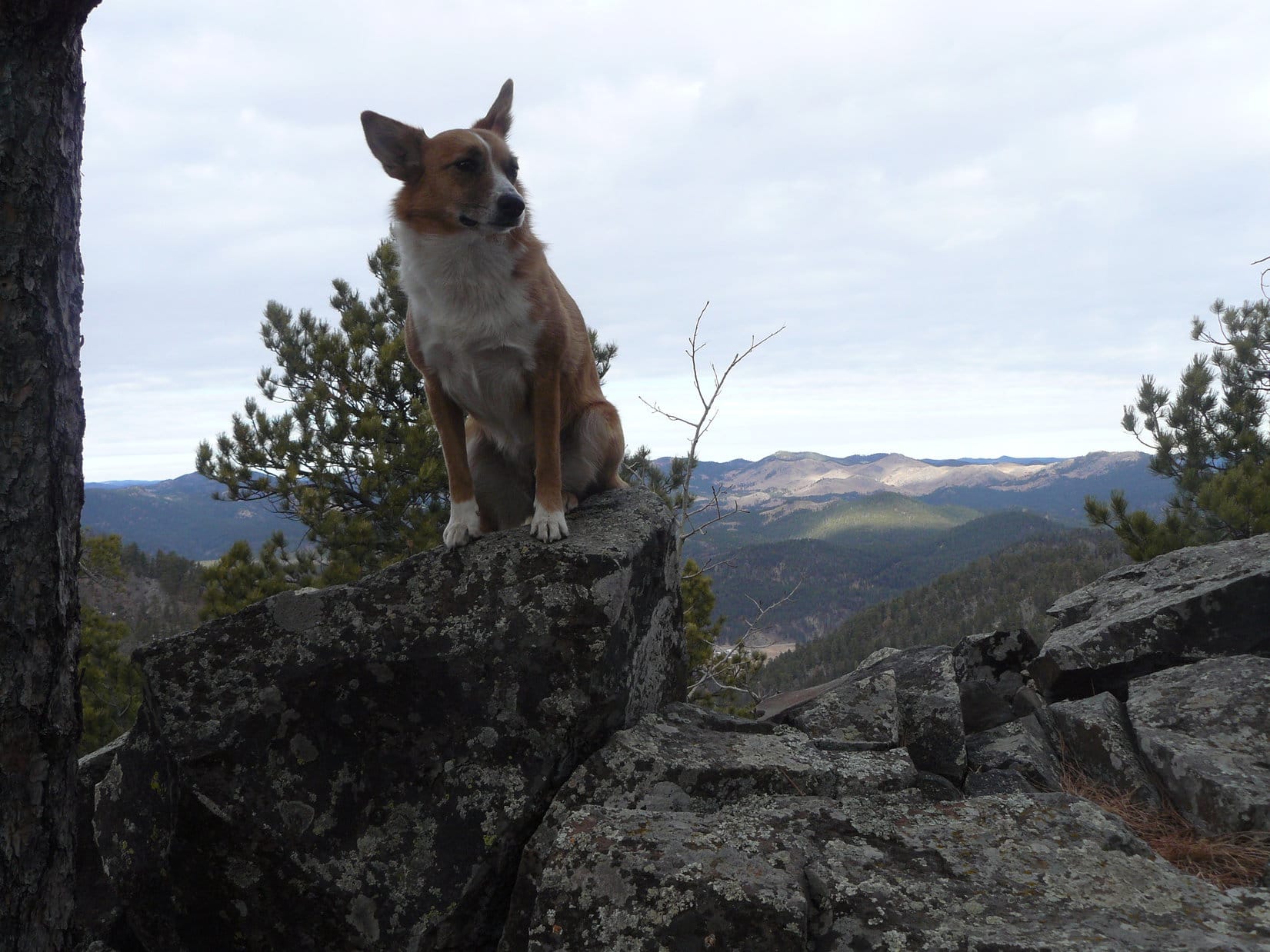
Once the tent was set up, Lupe, Lanis and SPHP drove E on the famous Going-to-the-Sun Road.  Lanis parked the Element at one of the higher viewpoint turnouts for a chance to take some photos.

Lupe and Lanis along Going-to-the-Sun Road in Glacier National Park.
Looking WSW from Going-to-the-Sun Road.
Heavens Peak (R) from Going-to-the-Sun Road.
Heavens Peak (8,987 ft.) (R) from Going-to-the-Sun Road.
SPHP believes the mountain toward the R may be Mount Cannon.
SPHP believes the mountain toward the R may be Mount Cannon (8,952 ft.).

The intention was to stop up at Logan Pass to explore some trails, but when Lupe got there, the parking lots were completely full.  Lanis had to continue driving E beyond the pass.  Down at Saint Mary Lake, SPHP had Lanis stop to check out the prices on the boat tours.

It was $23.75 per person for the standard 1.5 hour boat tour on Saint Mary Lake, but the last tour of the day at 6:30 PM was a shorter 1.0 hour tour for only $16.00.  Best of all, Lupe could ride along for free!  Lupe had never been on a boat before in her entire life.  Instantly, the plan became for Lupe to return at 6:30 PM for a spectacularly beautiful introduction to getting her sea legs!

There was still a lot time left in the day before then, though.  Lupe, Lanis and SPHP went on to the Many Glacier Hotel on Swiftcurrent Lake.  Lots of beautiful trails into the backcountry leave from the Swiftcurrent Lake area.  Lanis and SPHP were looking forward to doing some exploring with Lupe!

Lupe and Lanis arrive near the Many Glacier Hotel at Swiftcurrent Lake.
Many Glacier Hotel
Many Glacier Hotel

Before hitting any of the trails, it was time for lunch.  Lanis went in to the Many Glacier Hotel to buy a couple of box lunches containing hamburgers and French fries.  Lupe got to share, too, of course.  American Dingoes love hamburgers!  They will gladly pay you Tuesday for a hamburger today!  Lupe, Lanis and SPHP ate the lunches down by dazzling Swiftcurrent Lake.

Lupe at Swiftcurrent Lake. It was pretty sunny and hot out. The sensible Carolina Dog liked staying in the shade, while digesting a sizable portion of Lanis' and SPHP's hamburgers.
Lupe at Swiftcurrent Lake. It was pretty sunny and hot out. The sensible Carolina Dog liked staying in the shade, while digesting a sizable portion of Lanis’ and SPHP’s hamburgers.
Swiftcurrent Lake
Swiftcurrent Lake

Swiftcurrent Lake, Glacier NP, 8-17-15After lunch, which didn’t take long with a Carolina Dog helping, Lupe, Lanis and SPHP drove around to the opposite side of Swiftcurrent Lake.  The plan was to spend the afternoon exploring the trail up to Iceberg Lake with Lupe.

Swiftcurrent Lake and the Many Glacier Hotel from the opposite side of the lake.

Swiftcurrent Lake & Many Glacier Hotel, Glacier NP, 8-17-12Disappointment awaited Lupe at the trailhead, though.  Park regulations prohibited dogs (even American Dingoes) from going on any trails into the backcountry.  Even on a leash, Lupe couldn’t go to Iceberg Lake, or pretty much anywhere else in Glacier National Park.  It was just like Yellowstone National Park!

The light finally dawned on SPHP.  It was going to be the same at every U.S. National Park!  Dogs weren’t going to be welcome at any of them.  Regulations were going to prevent Lupe from really experiencing or fully enjoying any of the National Parks that SPHP had planned to take her to on her Dingo Vacation.  All she would be able to do would be sit in the Honda Element, or be on a leash in parking lots and campgrounds.

There was nothing that could be done about it, either.  It was a major blow.  Glacier National Park is full of trails that look so promising on the maps.  Lupe, Lanis and SPHP had been looking forward to exploring some of them.  Now it seemed the only alternative was to avoid U. S. National Parks.  It wouldn’t be fair or safe to leave Lupe stuck alone in the Element while Lanis and SPHP spent long hours away in the mountains.

Well, at least Lupe could still get her first ever boat ride on Saint Mary Lake in Glacier National Park.  There was still time to kill before then, though.  Lupe, Lanis and SPHP drove E out of Glacier National Park intending to take a look at Duck Lake on the Blackfeet Indian Reservation.  The road to Duck Lake proved to be dusty and full of rocks.  Lanis very reasonably wanted to avoid subjecting the Element to it.  Lupe got close enough to see Duck Lake from a distance, but that was about it.

Duck Lake E of Glacier National Park on the Blackfeet Indian Reservation. Lupe never got all the way to the lake. The mountains in Glacier National Park are seen in the distance to the W.

After Lupe’s rather pointless glimpse of Duck Lake, Lupe, Lanis and SPHP went to the little community of St. Mary at a highway junction just E of the Glacier National Park Entrance.  Lupe and SPHP stayed in the Element, while Lanis went in to kill a little time checking out the merchandise in an upscale tourist shop.

At least it was a very nice looking building, but apparently even upscale tourist shops aren’t above selling such delicacies as Moose Poo.  Naturally, Lanis was intrigued even before entering the shop.

SPHP hoped Lanis wasn't really going to stock up on Moose Poo! Even chocolate-covered Moose Poo didn't sound very appealing. On the other hand, you can't get Moose Poo just anywhere. Right now was Lanis' big Moose Poo opportunity!
SPHP hoped Lanis wasn’t really going to stock up on Moose Poo! Even chocolate-covered Moose Poo didn’t sound very appealing. On the other hand, you can’t get Moose Poo just anywhere. Right now was Lanis’ big Moose Poo opportunity!

Lanis eventually returned with a humongous soft drink, but Moose Poo-less.  There was still some time to go before the 6:30 PM Saint Mary Lake boat tour.  Lupe, Lanis and SPHP went over to the lake, anyway.  SPHP bought the boat tour tickets.  Lupe and SPHP then went on a little stroll along the lake shore.  Finally, it was Saint Mary Lake tour time!

The boat tour dock at Saint Mary Lake.

There were quite a few people on the tour, but the boat wasn’t entirely full.  Once underway, Lupe wasn’t quite sure what to do with herself.  Cruising on a lake was something she had never experienced before.  She liked it, but seemed to want to get out there and explore the lake, perhaps without the aid of a boat.  She threatened to leap overboard on several occasions.  SPHP had to keep Lupe on the leash and hang on to her.

It was great time relaxing on the beautiful lake listening to the tour guide, who was also the captain of the ship.  The views were magnificent, the people friendly, and price was quite reasonable.  Lupe and SPHP highly recommend the evening cruise on Saint Mary Lake!

Lupe on her first ever boat ride on Saint Mary Lake in Glacier National Park.
Wild Goose Island in Saint Mary Lake.

It was only 7:30 PM and still light out, when Lupe returned from the boat tour having earned her sea legs.  Lupe, Lanis, and SPHP returned to Logan Pass.  The visitor center was closed.  Most of the crowds were gone.  There were plenty of places to park now, even though a large section of the parking lot was cordoned off for people who were setting up telescopes to view the expected Perseid Meteor shower after dark.

SPHP stayed with Lupe at the parking lot while Lanis took a stroll along the Hidden Lake trail.  After a little while, SPHP noticed a trail across Going-to-the-Sun Road that didn’t have the usual no pets sign.  Lupe and SPHP started crossing the road to take a look at the view from over there, and see if the trail looked promising.  Instantly, a ranger came running over to make certain Lupe wasn’t going to set a single paw on the trail.

SPHP asked the ranger if there were any trails at all in Glacier National Park where dogs could go?  The ranger said the only exception to the no pets policy was the Trail of the Cedars nature trail.  Dogs could go there, but it was miles away close to Avalanche Creek.  (Not true, as it turned out the next day!  Sadly, there were no pets signs there, too.)

Lanis returned.  SPHP was disappointed to learn he hadn’t gone far enough to get to the Hidden Lake viewpoint, but Lanis was happy with what he’d seen.  He did have some photos of the Logan Pass area.

Clements Mountain and the Hidden Lake trail at Logan Pass. The trail leads to the L of Clements Mountain where there is a viewpoint overlooking Hidden Lake. Lanis didn't go that far.
Clements Mountain (8,760 ft.) and the Hidden Lake trail at Logan Pass. The trail leads to the L of Clements Mountain where there is a viewpoint overlooking Hidden Lake. Lanis didn’t go that far.
Logan Pass, Glacier National Park
Mountains N of Logan Pass. Lupe wasn't allowed to set a single paw on a trail heading off in this direction.
Mountains N of Logan Pass. Lupe wasn’t allowed to set a single paw on a trail heading off in this direction.

As the sun set behind the mountains, Lupe, Lanis and SPHP returned to the Sprague Creek campground at Lake McDonald for the night.  Glacier National Park was gorgeous, and Lupe did have a good time on her first boat ride ever on Saint Mary Lake.  However, since Lupe couldn’t explore the trails in the park, it was clear Lupe’s stay was going to be short.  SPHP resolved to at least take Lupe to the Trail of the Cedars nature trail the next morning.

Links:

Next Adventure                          Prior Adventure

Want more Lupe adventures?  Choose from Lupe’s 2012 West Coast Adventure IndexDingo Vacations Adventure Index or Master Adventure Index.  Or subscribe free to new Lupe adventures.

Black Hills, SD Expedition No. 110 – Samelius & Hardesty Peaks, Mount Warner (12-20-14)

At 9:38 AM (38°F), SPHP parked the G6 at the Samelius Trailhead of Centennial Trail No. 89 near Hwy 16, about 3 miles W of the Keystone “Y”.  The skies were overcast, but no precipitation and a forecast high of 50°F on nearly the shortest day of the year had brought Lupe and SPHP out to do a little peakbagging.

Lupe’s first two peakbagging goals, Samelius Peak (5,856 ft.) and Hardesty Peak (5,562 ft.) were both less than a mile from the trailhead, although Lupe’s proposed route might take her a little farther than that to reach Hardesty Peak.  Lupe set out heading N on Centennial Trail No. 89 up a mostly forested little valley.

The trail gained elevation at an easy pace at first, but became a little steeper as it went on.  About 0.5 mile from the trailhead, Lupe reached a saddle area NNW of Samelius Peak.  It was time to leave the trail, and start up the mountain.

Lupe and SPHP had been up on Mount Warner (5,889 ft.), less than a mile to the N, before on several occasions.  Having seen Samelius Peak from Mount Warner, SPHP was expecting Lupe might encounter some pretty steep climbs up boulder fields near the top of Samelius Peak, since the mountain had looked pretty rocky.  The climb really wasn’t bad at all, though.  Lupe encountered some deadfall timber, some rock outcroppings, and snow that made it slick in some places, but even SPHP was able to maneuver around most of the obstacles without much difficulty.

On the way up, Lupe came to two high points.  The first one was just a rocky spot in the forest.  Lupe only had to lose a little elevation to resume her climb up the NNW slope of the mountain.  At the second high point, an exposed rocky ledge jutted out toward the W.  The ledge seemed quite high, and offered some pretty good views.  Lupe and SPHP went out on the ledge for a look around.

Lupe out on the rocky ledge at the 2nd high point on the way up Samelius Peak. Photo looks W.

Lupe SW of summit of Samelias Peak, 12-20-14This ledge provided the most open panoramic views from anywhere Lupe went on Samelius Peak, and wasn’t too far below the summit.  When Lupe arrived at the summit, there were enough trees around to partially obstruct the views in most directions.  The summit area wasn’t terribly large, but Lupe found several spots to pose for photos.

Lupe sits on top of the highest rock on Samelius Peak to claim her first peakbagging success of Black Hills, SD Expedition No. 110!
Looking NW from Samelius Peak.
Looking SW toward Harney Peak (7,242 ft.) from Samelius Peak.

Harney Peak from Samelias PeakLupe’s next peakbagging goal was Hardesty Peak, but where was it?  It was supposed to be just 0.5 mile to the SE, but SPHP didn’t see it.  Time to check the maps again.  Of course, Hardesty Peak was there all along.  SPHP had assumed the two mountains were about the same elevation, but Hardesty Peak at only 5,562 ft. was actually almost 300 ft. lower than Samelius Peak.  That puny hill to the SE that could only be seen from the E end of the Samelius Peak summit area was it!

Lupe and SPHP left Samelius Peak heading down on the NE side of a ridge that led SE toward Hardesty Peak.  At first the going was rather steep, then it became rather rocky.  After Lupe had lost a fair amount of elevation, a long line of large boulders appeared ahead.  The area to the NE of the boulders dropped off very steeply.  However, there was a little saddle area at the start of the line of boulders where Lupe could cross over to the SW side of the ridge.

Lupe and SPHP headed for the little saddle.  It took SPHP a little while to get there due to the rockiness of the area.  Once there, Lupe and SPHP went to investigate a nearby high point just to the E of the little saddle.  There was a nice view of Boulder Hill (5,331 ft.) and Silver Mountain (5,405 ft.) off to the NE.

Lupe on the high point E of the little saddle on the way from Samelius Peak to Hardesty Peak.
Looking NE toward Boulder Hill (L) and Silver Mountain (R).

Lupe still needed to lose more elevation to reach the saddle between Samelius and Hardesty Peaks.  She left the high point E of the little saddle heading SSE down the mountain.  This area was thinly forested, quite steep, and covered with pine needles and a fair amount of loose rock.  Lupe had a great time sniffing around this way and that.  Rocks slid down the slopes as SPHP came down.  SPHP threw many of them back up, so they were higher than before.

It was kind of slow going, but it wasn’t hard to find a way down.  Near the bottom of the slope, there was a boulder field to be traversed, and beyond the boulder field was an area that was a jumble of deadfall timber.  SPHP picked a way through it all, while Lupe continued exploring the forest.  It turned out that Lupe and SPHP had come down a bit S of the saddle area.  Lupe had to turn N and regain about 40 feet of elevation to get to the saddle.

From the saddle, the climb up Hardesty Peak was similar to Lupe’s climb up Samelius Peak, except that she didn’t have to gain nearly as much elevation.  Lupe soon reached the summit of Hardesty Peak.  She paused to take a look around from the rocks at the very top.

Lupe surveys the situation from up on Hardesty Peak. Samelius Peak, where she had just been, is looming large on the L. Right behind her neck is Mount Warner.
Mt. Warner from Hardesty Peak. Photo looks N.

The summit area on Hardesty Peak is a fairly long E/W trending ridge.  The forested ridge is wide enough to walk along easily.  It was easy to see there wasn’t any higher ground to the W of where Lupe had come up, but the forest hid the rest of the ridge to the E.  Lupe and SPHP wanted to make certain she had reached the actual true summit, so Lupe went E exploring the ridge.

Lupe and SPHP went far enough E to verify that Lupe had reached the true summit back where the summit photos were taken.  She had.  Near the E end of the ridge, Lupe found a rather nice view looking NNW between Samelius Peak and Mount Warner.  Some higher hills could be seen in the distance.  There was even a faint glimpse of Custer Peak (6,804 ft.) beyond the high hills.

Looking NNW from Hardesty Peak between Samelius Peak (L) and Mount Warner (R).

Lupe and SPHP left Hardesty Peak near the E end of the summit ridge, heading back down toward the saddle over to Samelius Peak.  From the saddle, SPHP tried to lead Lupe N looking for Centennial Trail No. 89.  Lupe crossed a couple of small ridges, but the terrain kept forcing Lupe farther E until she reached the bottom of a gulch.

Lupe turned NW to go up the little valley on its E side.  Lupe and SPHP had been in this area several times before, but going down the valley.  Things just looked different going up it.  SPHP kept expecting Lupe would find Centennial Trail No. 89 at any time, but she kept going without coming across it.  SPHP stopped to check the maps again.  They provided no further clues.  It couldn’t be too much farther.

Before long, Lupe came to a road heading ESE.  Lupe and SPHP followed it.  SPHP thought maybe Centennial Trail No. 89 was still higher up the side of the mountain, but within just a few minutes, the road led past a rocky little hillside that SPHP remembered from Lupe’s prior expeditions.  The road was Centennial Trail No. 89.  That was good news!

Centennial Trail No. 89 wound around the SE end of Mount Warner, leaving the road and becoming a single track trail along the way.  It turned NW going up a small valley to a saddle.  Instead of going over the saddle, the trail started a climb up the mountain to the S, switchbacking a little bit on the way up.  Eventually the trail turned W, and passed to the S of a rock outcropping where SPHP remembered there was a view to the N.  Lupe and SPHP went to the edge of the rock formation to take a look.

Lupe on her way up Mount Warner. Here she is at a rock outcropping N of Centennial Trail No. 89. Photo looks NNE toward the Blue Wing arm of Sheridan Lake (a little piece of which is visible on the L) and Calumet Ridge.

From the rock outcropping, Lupe could see part of Sheridan Lake and Calumet Ridge (5,601 ft.) off to the NNE.  From here, it wasn’t too much farther along Centennial Trail No. 89 up to the top of Mount Warner.  On the way, Lupe started hearing gunfire coming from way off somewhere in the direction of Calumet Ridge.  By the time Lupe reached the top of Mount Warner, she was one nervous Carolina Dog.

SPHP wanted to get a photo of Lupe up on the highest rocks on Mount Warner, but Lupe really just wanted to be close to SPHP.  The gunfire was just too unnerving.  Half a dozen times SPHP persuaded her to get up on the highest rocks, but each time SPHP backed off to take the photo, Lupe would hear more gunfire within a few seconds and jump down to follow SPHP.

Finally, it worked.  A brief lull in someone’s target practice restored the American Dingo’s confidence.  Lupe stayed up there for her summit photo on Mount Warner.  Good doggie!  After one quick photo, SPHP didn’t make her stay up there any longer.  She was glad it was over with, and jumped down as soon as SPHP said it was OK.

Lupe on Mount Warner, her third peakbagging success of the day! Lupe had been here before on prior Black Hills Expeditions. This was her 4th ascent of Mount Warner.

There was still some time left in the day.  Originally, SPHP had thought maybe Lupe should do some exploring toward Calumet Ridge, but with all the gunfire in that direction, that just wasn’t going to work.  Instead, Lupe and SPHP left Mount Warner continuing NW on Centennial Trail No. 89.

The trail gradually lost elevation following a ridgeline, but eventually turned to start heading down the NE side of the ridge on its way down to Sheridan Lake.  Instead of going that way, Lupe and SPHP left the trail and started down the SW side of the ridge.  It was steep, but not as steep as going down Samelius Peak had been.

Lupe lost a lot of elevation.  Finally things started leveling out.  Somewhere along the way, she crossed Joe Dollar Gulch.  Lupe came to a maze of little roads in the forest.  She followed them S or SW.  SPHP led her onto roads heading SE a time or two when the opportunity presented itself.  SPHP was hoping to find a road going up a little gulch just S of Joe Dollar Gulch, but it didn’t happen.

Lupe and SPHP had a nice time just wandering the back roads.  Lupe trotted ahead, leaving the road here and there to investigate interesting smells in the forest.  Lupe crossed a saddle shown just to the E of High Point 5157 on the Peakbagger.com topo maps.  During the last part of her journey, the sound of traffic on Hwy 16 wasn’t far off to the S.  When SPHP saw the little tunnel that Centennial Trail No. 89 passes through under Hwy 16, SPHP knew Lupe was almost back to the Samelius trailhead.

The sun was down and the light was fading, when Lupe reached the trailhead again.  There was a bunch of trash around.  SPHP spent a little time picking it up while Lupe sniffed around.  At 4:38 PM (37°F), when Lupe and SPHP finally got into the G6 to head home, it was practically dark out.  Climbing Samelius and Hardesty Peaks had been fun.  The big loop up to Mount Warner and beyond, and then down and around to the SW was a nice bonus.

Tomorrow would be the shortest day of the year.  Christmas was almost here.  Nearing home, Lupe and SPHP admired the cheerful, colorful Christmas lights.  2014 was fast drawing to a close, but Black Hills, SD Expedition No. 110 wouldn’t be Lupe’s last of 2014.  SPHP was glad.  When you’re lucky enough to have a Carolina Dog, you just don’t want the good times to ever end.

Happy Lupe on Hardesty Peak.

Note:  SPHP isn’t certain of the correct spelling for Samelius Peak.  The sign at the trailhead on Centennial Trail No. 89 says Samelius, as do SPHP’s old USFS maps.  The Peakbagger.com maps and records show it as Samelias Peak.

Links:

Next Black Hills Expedition                 Prior Black Hills Expedition

Want more Lupe adventures?  Choose from Lupe’s Black Hills Expeditions Adventure Index or Master Adventure Index.  Or subscribe free to new Lupe adventures.