The Washakie County High Point, Bighorn Mountains, Wyoming (7-18-16)

Huge sigh!  One of many at long intervals.  Dejected, Lupe lay bored on the floor.  Sometimes she stared out the window.  Sometimes just out into space.  After a promising start with a trip to the Laramie Mountains in Wyoming in late May, Lupe had returned to the Black Hills on June 1st expecting great things from the summer of 2016.  Instead, June immediately turned hot – too hot for her Black Hills expeditions.  June shot by, and Lupe didn’t get to go anywhere in the hills.

Early July started out a little better, with two short Summits on the Air outings (Custer Peak & Boulder Hill) with Joe and Dusty.  Then it was back to laying on the floor, forlorn and disappointed day after day.  The middle of July came and went.  Still Dullsville.

Lupe didn’t realize it yet, but great things were in the works.  Preparations for her fabulous Summer of 2016 Dingo Vacation were nearing completion.  Lupe would soon be on her way much farther than she had ever been before to visit beautiful places and climb some spectacular peaks!

One mountain on the list, however, wasn’t that far away.  Cloud Peak (13,167 ft.), the tallest mountain in the Bighorn range of north central Wyoming, was easily the highest peak Lupe would attempt to climb this year.  For Lupe and SPHP, Cloud Peak meant a 3 day/2 night backpacking trip.

Why not take Lupe to the Bighorns even before the start of her summer of 2016 Dingo Vacation?  Getting Cloud Peak out of the way beforehand would free up several days on her summer of 2016 Dingo Vacation she could use to climb much more distant peaks she might never otherwise have a chance to attempt.  It was a good idea, and high time for some action anyway.

SPHP checked the weather forecasts.  Starting July 18th, 4 consecutive days of 100°F heat with little or no chance of rain were coming to Buffalo, WY.  Perfect for adventuring in the high country, where it would be considerably cooler!  Much to her surprise and delight, Lupe was on the road headed for the Bighorns before dawn.

Lupe was already on her way to the Bighorn Mountains when the sun rose on July 18th.

Only a few hours later, Lupe was in the Bighorns!  Before tackling Cloud Peak, though, SPHP had a couple of other easier peakbagging objectives in mind for Lupe.  The first one was really easy – the Washakie County High Point (9,600 ft.).  At 9:48 AM (66°F), SPHP parked the G6 just S of Hwy 16 along USFS Road No. 25.  This intersection is in Washakie County only a short distance W of the Johnson County line.

Finally back in action! Lupe arrives in the glorious Bighorn Mountains of north central Wyoming. Here she is S of Hwy 16 ready for an easy trek to the Washakie County High Point. Two of the three possible high points are in the forest on the low hill beyond her. Photo looks SSW.

The only thing time consuming or unusual about the Washakie County High Point is that there are three candidates for the actual highest point.  Two of them are about 0.25 mile S of Hwy 16 on a low forested ridge.  The third candidate is about the same distance N of Hwy 16.  Lupe and SPHP headed across the field toward the S candidates first.  As a guide, SPHP had a copy of a trip report by Edward Earl dated July 30, 2002.

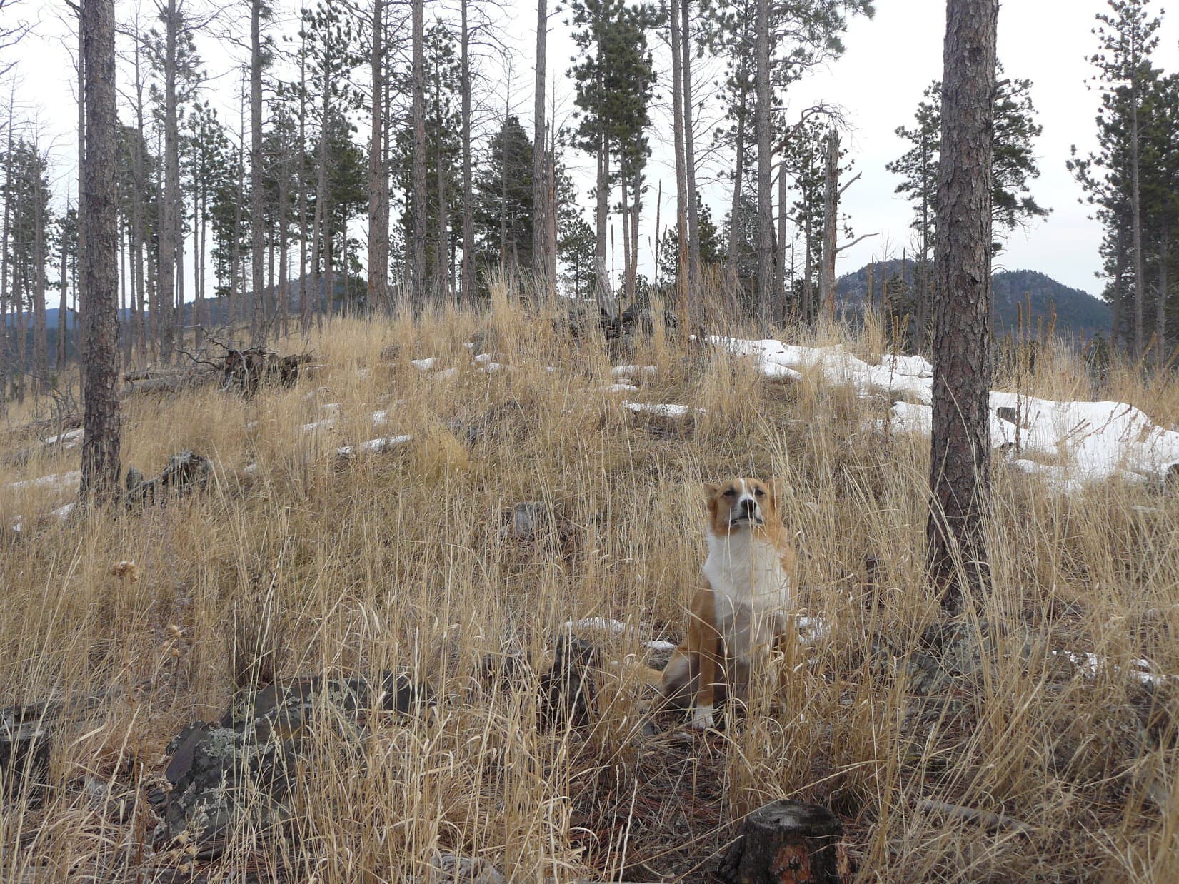
At the edge of the forest was a barbed wire fence.  The lower part of the fence was a wire mesh which Lupe could not get through.  Lupe and SPHP followed the fence W until Lupe reached a gate with orange posts where she was able to get by.  After that, Lupe sniffed around exploring the forest while making the climb to the first of the high points.

Lupe next to the summit cairn of the first of the Washakie County High Points she reached S of Hwy 16. This high point is NW of the other high point S of Hwy 16. Photo looks NW.
Another view looking NW toward the Washakie County High Point. (Still looking at part of the NW high point of the 2 candidates S of Hwy 16.)

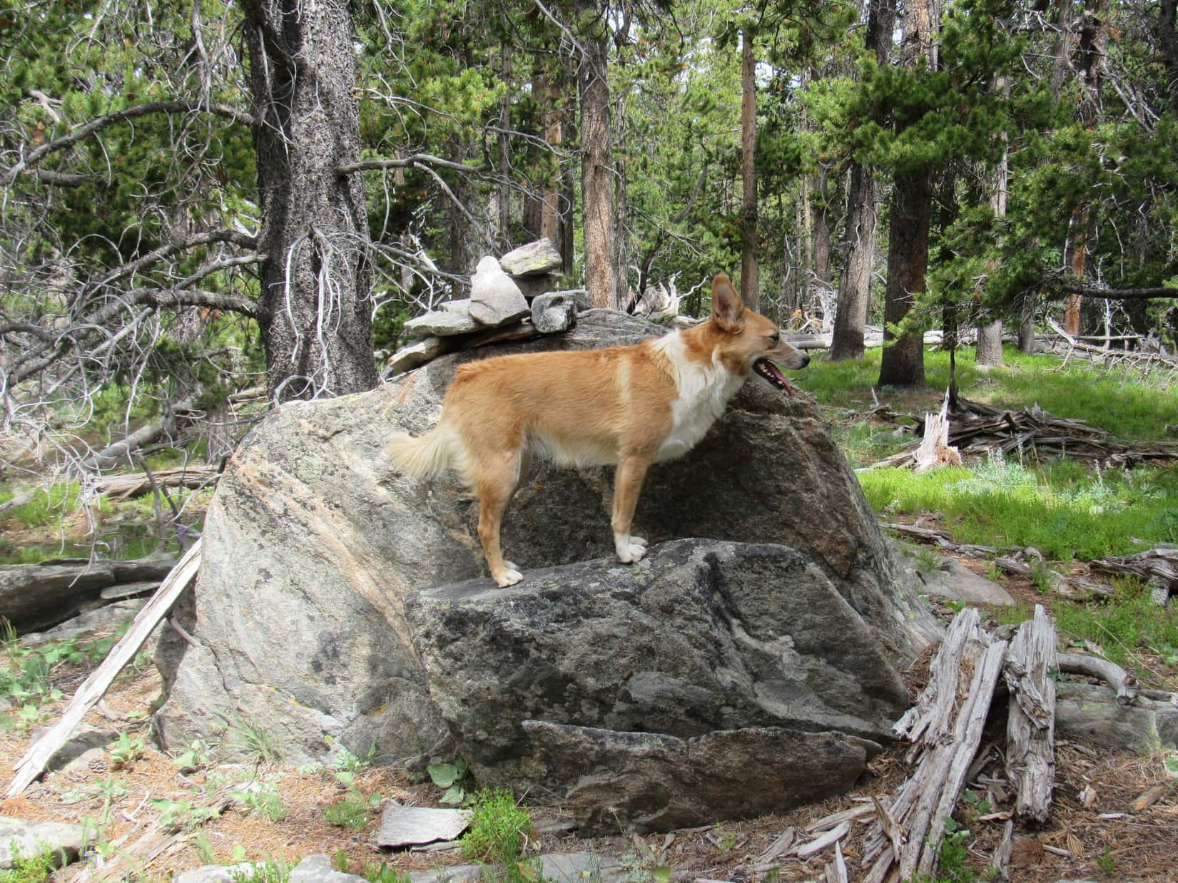
Lupe visited the two Washakie County High Point candidates S of Hwy 16.  Both were very rocky.  They were only a few minutes walk apart, but due to the forest, not really visible from each other.  Neither had much in the way of views, although there were partial views to the S and E from the SE high point.  The most open views were actually from a lower rock outcropping a bit to the S of the area between the two high points.

Before visiting the Washakie County High Point candidate S of Hwy 16 that was the farthest SE, Lupe found this lower rock outcropping nearby, which actually offered the best views. Photo looks SSW.
Lupe at the SE candidate for Washakie County High Point S of Hwy 16. Photo looks SE.
The SE candidate of the 2 high points S of Hwy 16 was a line of slanting boulders. Photo looks WNW in the general direction of the NW high point, which could not be seen from here due to the forest, although it is only a few minutes walk away.
Another view of the SE high point candidate. Photo looks SE.
Still at the SE high point candidate. Although it wasn't possible to see the NW candidate from here, it was possible to catch a glimpse of both from some of the territory between them. Photo looks NW.
Still at the SE high point candidate. Although it wasn’t possible to see the NW candidate from here, it was possible to catch a glimpse of both from some of the territory between them. Photo looks NW.

Edward Earl’s trip report mentioned a cairn at both high point candidates S of Hwy 16, but Lupe only saw a cairn at the NW high point.  After visiting both of the S candidates, Lupe headed NE through the forest until she reached USFS Road No. 25 near a cattle guard providing an opening in the fence line.  Lupe is an expert at crossing cattle guards, which present no obstacle to her at all.

Lupe and SPHP proceeded across Hwy 16 a few hundred feet E of the Hwy 16/USFS Road No. 25 intersection.  Shortly after re-entering the forest N of the highway, Lupe came to another barbed wire fence.  It had 5 wires, and the lowest wire was dangerously close to the ground for Lupe.  SPHP lifted Lupe over the fence.  Lupe then continued N, once again up a gentle forested slope while looking for her final objective – the third and last Washakie County High Point candidate.

Edward Earl’s trip report mentioned a small summit, with perhaps 20′ of prominence just E of the Johnson County line in Johnson County.  Lupe came to a pile of boulders that looked likely to be this small summit.

When Lupe found this pile of boulders N of Hwy 16, SPHP figured it must be the 20' high summit mentioned in Edward Earl's trip report. Photo looks NNE.
When Lupe found this pile of boulders N of Hwy 16, SPHP figured it must be the 20′ high summit mentioned in Edward Earl’s trip report. Photo looks NNE.
Up on top of the 20' high summit. Photo looks S.
Up on top of the 20′ high summit. Photo looks S.

According to Edward Earl, the 3rd Washakie County High Point candidate was located on a small E/W running ridge 50 to 80 yards to the W of the small summit.  Only 100 feet W of the small summit there was supposed to be a 4 foot high boulder with a cairn on it and a log leaning against it.  Mr. Earl thought the true high point was 50 to 100 feet farther W of this boulder.

It sounded pretty easy to find.  Lupe and SPHP headed W from the small summit looking for the 4 foot high boulder and E/W ridge.  However, Lupe had no luck.  She went well beyond 100 feet without seeing the 4 foot high boulder.  There didn’t seem to be any sign of the E/W ridge either.  The forest in this area was all on gently sloping terrain.  A 4 foot high boulder or a ridge of any significant size should have been easy to spot.  Lupe and SPHP circled around the area several times, but found nothing of interest.

Puzzling.  Lupe and SPHP returned to the small summit with all the boulders.  Was it possible this wasn’t the summit Edward Earl had mentioned?  A short distance to the N, the forest sloped up toward higher ground.  Well, Loop, let’s go check it out.  I can’t think of anything else reasonable to try.

After going a little farther N, Lupe and SPHP arrived up on a ridge that was definitely higher than the small summit.  This ridge seem to go roughly E/W, although it was N of the small summit, not W of it.  Maybe Lupe was too far E?  Lupe and SPHP headed W along the ridge.  Lupe hadn’t gone too far, when there was a break in the ridge.  Not far away on the other side of the break was a small hill or continuation of the ridge.  Lupe headed for it.

Lupe arrives up on the W side of the break in the ridgeline. Was this actually the small summit Edward Earl had mentioned? Lupe did have to climb about 20 feet to get up here. Or was this rock with a cairn on it the 4 foot high rock? Was the rotting tree beyond it the log that had been leaning against the rock? Photo looks N.

On the W side of the break, Lupe did have to climb up about 20 feet to get up on a little hill from which the ridge continued on in an E/W direction.  Perhaps this was the small summit Edward Earl had mentioned?  There was another possibility, too.  The hill featured a rock several feet high with a cairn on it.  A rotting tree to the N of it might have been the log leaning against the 4 foot high boulder?

SPHP wasn’t completely certain where Lupe was in relation to Edward Earl’s directions, but this area did seem to fit the general description.  It seemed clear that Lupe should continue exploring farther W along the ridge for at least a few hundred feet in any case.  If this was Mr. Earl’s small summit, Lupe should find a four foot high boulder about 100 feet to the W.  If not, Lupe should still cross the 3rd high point candidate somewhere along the way.  Lupe and SPHP headed W.

Lo, and behold!  There it was!  Roughly 100 feet away Lupe did find a 4 foot high boulder with a cairn on it!  It was sitting off by itself in the forest, like a true landmark.  SPHP felt 90% certain this had to be the boulder Edward Earl was referring to.

Nice job, Lupe! This must be Edward Earl's 4 foot high boulder with a cairn on it. The final Washakie County High Point candidate is close by to the W!
Nice job, Lupe! This must be Edward Earl’s 4 foot high boulder with a cairn on it. The final Washakie County High Point candidate is close by to the W!

Since Mr. Earl thought the actual Washakie County High Point candidate was a point along the ridge 50 to 100 feet to the W of this boulder, Lupe and SPHP wandered over in that direction.  The ridge sloped gradually down toward the W, so the actual high point candidate was simply located along the ridge wherever the Washakie and Johnson County border crossed it.

There was no fence or other indication where the county line was.  Lupe went far enough to make certain she had crossed the third Washakie County High Point candidate somewhere along the way.  She then returned to the area about 80 feet W of the boulder.  Smile, Lupe!  As far as I’m concerned, you’ve done it and can claim another peakbagging success.  Congratulations on visiting all three candidates for the Washakie County, Wyoming High Point!

Lupe at the approximate location of the Washakie County High Point candidate N of Hwy 16, roughly 80 feet W of the 4 foot boulder. Although it was only a trivial peakbagging success, Lupe had visited all three Washakie County High Point candidates. Searching for this last one had been rather fun. Photo looks N.

Well, that really hadn’t been hard at all.  By 11:48 AM, Lupe was back at the G6.  Still plenty of time left in the day for another, more scenic and challenging adventure!  Hazelton Pyramid (10,534 ft.) was close at hand to the SE.  Lupe’s fun in the Bighorn Mountains was just beginning!

Hazelton Pyramid, Lupe's next Bighorn Mountains adventure as seen from the SE Washakie County High Point S of Hwy 16. Photo taken looking SE using the telephoto lens.
Hazelton Pyramid, Lupe’s next Bighorn Mountains adventure as seen from the SE Washakie County High Point S of Hwy 16. Photo taken looking SE using the telephoto lens.

Links:

Next Adventure

Want more Lupe adventures?  Choose from Lupe’s 2016 Bighorn Mountains, WY Adventure Index, Dingo Vacations Adventure Index or Master Adventure Index.  Or subscribe free to new Lupe Adventures.

Black Hills, SD Expedition No. 107 – Lowden Mountain & Union Hill (12-6-14)

A warmish forecast on a day in early December meant an opportunity for Lupe to go on one of her Black Hills Expeditions.  SPHP parked the G6 at Newton Lake (just a pond, really) along Deerfield Road a few miles NW of Hill City.  It was 9:46 AM, but still only 32°F.  The sky was all overcast.  It didn’t look threatening at all, but maybe things weren’t going to warm up as much as advertised.

Well, it didn’t really matter.  Conditions were good enough, and Lupe was already here.  There was no way the American Dingo was going to let SPHP back out now!  Lupe and SPHP crossed Deerfield Road, and got on the Mickelson Trail heading SE for Burnt Fork Road.  Almost immediately, though, SPHP decided it would be more fun to just cut through the forest instead.  Lupe and SPHP left the trail to plunge NE into the forest.

It wasn’t far at all to Burnt Fork Road, but Lupe came to a fence.  SPHP decided to just follow the fence N, staying on the W side of it.  Union Hill (6,120 ft.), Lupe’s first peakbagging goal of the day, was to the NE.  By heading N a little bit, maybe Lupe could find a route that avoided crossing the fence line.

Lupe wasn’t concerned about the route to Union Hill.  She was looking for a route to squirrels.  She soon found one, too!  A whole lot of barking commenced.  To Lupe’s surprise, her barking was answered – not by the squirrel, but by a couple of dogs who must have lived nearby.  One of them, a big black and white dog, made an appearance at the edge of a clearing to the E.

The black and white dog approached Lupe warily.  One can’t be too careful when dealing with a Carolina Dog, you know!  Lupe and the black and white dog had a good sniff.  The black and white dog seemed friendly, but was suspicious of SPHP.  When SPHP tried to get close, the black and white dog slunk off barking and growling.

Lupe had come to an old road on the W side of the clearing.  Lupe and SPHP followed it N, and soon came to an intersection.  A marker showed that Lupe had been on USFS Road No. 389.1Q.  The other road SPHP recognized as No. 389.1B, which ran E/W here just to the S of Lowden Mountain (6,055 ft.).  SPHP had intended for Lupe to climb Lowden Mountain, but only after climbing Union Hill first.

However, with Lowden Mountain so close already, the plan changed.  Union Hill could wait.  Lupe and SPHP started climbing up the S slope of Lowden Mountain.  The first half of the climb was steepest, but really not bad.  About halfway up, Lupe started coming to rock outcroppings, but they were pretty easily traversed or avoided.  The second half of the climb gained elevation more gradually.  Lupe had to go farther N than SPHP expected, but it wasn’t too long before Lupe was at the summit.

Lupe on the very summit of Lowden Mountain. Photo looks SW.

The very highest part of the mountain was in a relatively small area.  Pine trees blocked the view in most directions.  However, a little way to the E was a mostly bare ridge offering wide open views.  Union Hill was on display about 1.25 miles almost straight E.

My, oh my, Lupe! What a big pink tongue you have! "The better to lick you with, my dear!" Union Hill is the rounded hill seen just above Lupe's head. Photo looks E from Lowden Mountain.
My, oh my, Lupe! What a big pink tongue you have! “The better to lick you with, my dear!” Union Hill is the rounded hill seen just above Lupe’s ear. Photo looks E from Lowden Mountain.

This was actually Lupe’s 3rd time at the summit of Lowden Mountain.  Way back on Black Hills, SD Expedition No. 54 on 4-6-13, Lupe had climbed Lowden Mountain twice on the same day.  SPHP remembered that by going down a bit to the NW of the summit, it was possible to reach a very rocky high ridge that extended out the W.  Lupe and SPHP left the summit to go over and check out the views from the rocky ridge.  The best views were to the WNW and S.

Lupe on the rocky ridge WNW of the summit of Lowden Mountain. The closest hill is Smith Mountain, which Lupe had climbed for the 1st time just 8 days earlier on Black Hills, SD Expedition No. 106. Photo looks S.
Lupe on the rocky ridge WNW of the summit of Lowden Mountain. The closest hill is Smith Mountain (5,897 ft.), which Lupe had climbed for the 1st time just 8 days earlier on Black Hills, SD Expedition No. 106. Photo looks S.

Lupe left Lowden Mountain going down the steep N slope.  For some reason there wasn’t any snow until Lupe had lost quite a bit of elevation.  Lupe and SPHP angled toward the NE as Lupe descended.  When she reached a forest of quite young pines, there was plenty of snow around.  The young Ponderosa pines were growing very tightly packed together, making the going a little difficult for SPHP.

By the time Lupe was out of the thick stand of young trees, she was so far down the mountain that the terrain was leveling out fast.  Lupe came to USFS Road No. 389.1K, which wound around, but generally made its way NNE.  No. 389.1K led Lupe to USFS Road No. 389.1A, where SPHP stopped to check the maps.  The maps showed a bewildering maze of roads in this area.  Lupe had gone so far N that Union Hill was now off to the SE.

The partially restored ruins of the old Gold Mountain mine weren’t too far away to the E.  Lupe had seen them once before back on Black Hills, SD Expedition No. 54, but it would be fun to see them again on the way to Union Hill.  As SPHP put the maps away, SPHP suddenly realized that one of the water bottles SPHP always carries was missing.  It must have fallen out of the pocket of the backpack somewhere along the way.

It was only a water bottle, but Lupe would go back to look for it.  Not until she climbed Union Hill first, though.  Sheesh!  It looked like Lupe was going to make a tradition out of climbing Lowden Mountain twice each time she came here.  Oh, well.  In the meantime, onward to Gold Mountain mine!

The roads were snowy and slippery.  It was actually easier just heading ENE through the forest.  Lupe lost elevation as she went, and soon came to a rather snowy little valley with a small creek flowing SE in it.  She stayed on the N side of the valley where the ground was snow-free due to the southern exposure.  The creek flowed down to a snow-filled meadow.  The ruins of the old Gold Mountain mine sat up on a hillside to the N of the meadow.

Lupe reaches the ruins of the old Gold Mountain mine. Photo looks N.

The Gold Mountain mine was first claimed in the late 1870’s, and actively worked until 1942.  It is one of the few old mines still standing in the Black Hills.  SPHP remembered that there was an old boiler or kiln up on the hill.  Lupe and SPHP went up the hill to see if it was still there.

It was.  So was a bunny!  The bunny saw Lupe coming, made a mad dash for the S end of the kiln, and hopped inside.  The kiln immediately became an item of great interest to Lupe.  She circled around it sniffing carefully, but the bunny was safe inside.  SPHP suddenly seemed to remember from Expedition No. 54 that there was broken glass scattered somewhere around this area.  Lupe had best just leave the kiln and bunny alone, before something tragic happened.

Lupe sniffs around the old furnace or kiln at Gold Mountain mine. She knows there is a bunny inside! This is going to be tough, even for an American Dingo! After all, how many bunnies have a stone and iron fortress to protect them?
Looking W at the Gold Mountain mine.

Lupe and SPHP left Gold Mountain mine.  A short road led SE down a hill, passed to the N of a little frozen pond, and met up with Burnt Fork Road (USFS Road No. 389).  Lupe turned S on Burnt Fork Road, following it less than 0.5 mile to a primitive road coming steeply down a side valley from the E.  Lupe turned E on this road and started gaining elevation.

A little stream flowed near the primitive road.  Lupe had a great time exploring the woods along the stream.  In some places, the stream had frozen, creating huge ice flows right on the road.  SPHP had a less great time trying to get up the slippery ice flows.  The primitive road led to a better road which came in from the N and turned ESE.  Lupe continued ESE on this better road up to a snowy saddle.

By the time the better road reached the snowy saddle, it wasn’t better any more.  In fact, it had almost disappeared.  However, on the other side of the saddle, it looked like it got better again.  It turned ENE down into a bigger snowy valley filled with aspens.  Lupe wasn’t going that way.  The saddle was due N of Union Hill.  After a short rest break, Lupe and SPHP climbed the N slope.  It was snowy and fairly steep, but soon Lupe was at the summit cairn.

Lupe at the summit cairn and post on Union Hill. Photo looks SSE toward Harney Peak (7,242 ft.), which can be seen between the trees.
Harney Peak from Union Hill with help from the telephoto lens.

The top of Union Hill was a long, broad, gently sloping ridge.  It was mostly grassy and thinly forested.  Lupe and SPHP went over toward the W end of the ridge to see what kind of view there might be back toward Lowden Mountain.  The W end of Union Hill was more thickly forested, but there was one spot from which there was a relatively clear view of Lowden Mountain.

Lowden Mountain is the closest hill. Photo looks W from Union Hill.

Lupe and SPHP returned to the summit of Union Hill on the way to do a little exploring of the E end of the summit ridge.  Lupe agreed to pose for one more photo W of the summit, but she looked a bit stiff trying to hold her head up above the tall grass.

Just W of the summit cairn on Union Hill. Lupe seemed to be taking this photo rather seriously as she tries to hold her head above the tall grass. Photo looks E.

Lupe soon discovered that a road leads up near the top of Union Hill from the E.  Lupe and SPHP followed the road for a little while after it turned NE.  When it started bending SE, Lupe headed N into the forest.  She followed a forested ridge to a little high point.  Off to the W was the big snowy valley Lupe and SPHP had seen from the saddle N of Union Hill.  Lupe and SPHP turned W and went down into it.

Lupe in the snowy aspen-filled valley NNE of Union Hill. Photo looks SSW back toward the summit.

Down in the snowy valley, Lupe and SPHP went NW until Lupe found the road that had continued E over the saddle just N of Union Hill.  Lupe and SPHP followed it N until it reached an intersection.  SPHP was surprised.  Lupe had been here before!

Back on Black Hills, SD Expedition No. 82, Lupe and SPHP had come looking for Lowden Mountain from the Marshall Gulch area to the NE.  Lupe had reached this intersection, but SPHP had been a bit turned around, and gave up on finding the mountain.  Lupe had made it this far, though.  If SPHP had persisted in heading just a little farther SW, Lowden Mountain would have come into view.  Instead, Lupe and SPHP had gone N from this intersection, and eventually circled back E.

The roads at the intersection were variously marked with USFS Road No. 389 or 254.  The markers didn’t really make any sense when compared with SPHP’s maps, but SPHP knew which way to go without any markers.   Lupe and SPHP left the intersection heading N again, but this time looking for a road to the W.

Lupe soon found one.  The road going W went over a little rise, slowly curved SW and gradually lost elevation.  Lupe sniffed around in the forest, while SPHP enjoyed an easy hike.  The area seemed pretty remote and secluded.  Eventually, it dawned on SPHP that this road was going to come out back at the upper end of the primitive road with the frozen stream.

And it did!  Lupe had gone clear around High Point 5921 N of Union Hill.  Lupe and SPHP followed the primitive road W back down to Burnt Fork Road.  The Carolina Dog then turned N and followed Burnt Fork Road to the road to the old Gold Mountain mine.  Instead of returning to the mine, Lupe stayed on a lower branch of the road.  It went right past the frozen pond.

Lupe at the frozen pond SE of the Gold Mountain Mine. Photo looks SW.

It was time to start the search for the lost water bottle.  Lupe and SPHP returned to where SPHP had first noticed it was missing near USFS Road No. 389.1A.  The plan now was just to retrace Lupe’s route from earlier in the day until she came across the water bottle.  It seemed easy enough.

However, it was harder than SPHP anticipated.  Lupe and SPHP followed USFS Road No. 389.1K going SSW back toward Lowden Mountain.  At first, SPHP wasn’t finding any of SPHP’s old footprints or Lupe’s paw prints.  Lupe already had a good start on the climb up Lowden Mountain, by the time SPHP saw tracks in the snow.

Once the tracks were found, it was pretty easy to follow them up the N face of Lowden Mountain, at least until the snow ended.  By then, it wasn’t that much farther up to the rocky W ridge, so Lupe and SPHP went there first to look for the water bottle.  No luck.  Lupe climbed up to the top of Lowden Mountain, completing her second ascent of the day.  SPHP was really expecting to find the water bottle at the summit.  It was nowhere to be found.

Since it wasn’t at the summit, the chances of finding the water bottle were now not very good.  Lupe might still find it somewhere on the way back to the G6, but success seemed unlikely.  Well, too bad, but it wasn’t exactly the end of the world.  Lupe and SPHP stuck around at the top of Lowden Mountain for a little while enjoying the views again.

Looking E toward Union Hill. Lupe could now say she'd been there!
Looking E toward Union Hill. Lupe could now say she’d been there!
Looking W.
Looking W.
Lupe had some Taste of the Wild at the summit of Lowden Mountain. Her little silver bowl is next to her.
Harney Peak (7,242 ft.) from Lowden Mountain. Photo looks SSE.
Union Hill (Center). Burnt Fork Road can be seen in the valley. Photo looks E.

On the way back to the G6, Lupe and SPHP went back down the S side of Lowden Mountain again.  There wasn’t much snow on this side of the mountain.  Although SPHP saw tracks from earlier in the day a few times, most of the time there weren’t any tracks to follow.  Going down, the terrain looked different than it had coming up.  Unsurprisingly, SPHP did not find the lost water bottle.

The last chance to find it was along USFS Road No. 389.1Q S of Lowden Mountain, where Lupe had met the skittish black and white dog.  SPHP kept watching for the water bottle, but neither SPHP nor Lupe came across it.  Well, that was that.  No telling where it had been lost.

At 4:53 PM (38°F), Lupe and SPHP were back at the G6.  It was almost dark out.  A full moon would be rising soon.  Tonight, somewhere around Lowden Mountain, a water bottle bathed in moonlight was going to freeze and crack.  SPHP had a much better fate in store – a long comfy snooze with a warm, soft, Alpo-stuffed American Dingo!

Smith Mountain from the S slope of Lowden Mountain just after sunset.

Links:

Next Black Hills Adventure                      Prior Black Hills Adventure

Want more Lupe adventures?  Choose from Lupe’s Black Hills Expeditions Adventure Index or Master Adventure Index.  Or subscribe free to new Lupe adventures.