Black Hills, SD Expedition No. 207 – Peak 6720, Medicine Mountain, Peak 6680 & Copper Mountain (6-3-17)

Start 10:06 AM, 67°F, USFS Road No. 304 near the lower end of Tree Draw, about 4 miles S of Deerfield Road

Well, this was it!  Lupe trotted happily along the road leading up Tree Draw.  At least there was some shade.  It was already warm out.  Only a few little white clouds dotted the sunny blue sky.  Lupe’s pink tongue dangled so far out of her mouth, it looked like it ought to belong to a considerably larger Dingo.

Lupe was destined to spend a good deal of the day panting.  Summer was here!  Due to the heat, Expedition No. 207 would be her last Black Hills Expedition until cooler weather arrives in the fall.

Miss Enormous Pink Tongue on the way up Tree Draw on her last Black Hills expedition until cooler weather comes in the fall. Photo looks WNW.
At least the trees in Tree Draw provided some welcome shade. Photo looks WSW.

The road went W for 0.5 mile, then turned S for 0.375 mile.  Lupe was now approaching the upper end of Tree Draw.  The road angled SW and started climbing more steeply.  It faded away entirely at a barbed wire fence.  Lupe ducked under the fence, and quickly reached a minor pass.  This was the saddle NNW of Peak 6720, her first peakbagging destination for the day.

A broad, gently rounded ridge led SSE up to the top of the mountain.  On the way, Lupe dodged scattered deadfall timber.  Near the summit, the deadfall was worse and had fallen over the barbed wire fence, which unfortunately came up here, too.  SPHP lifted Lupe over the dangerous downed fence.

At the saddle on the ridge above Tree Draw. Lupe followed this broad ridge right on up to the top of Peak 6720, which is dead ahead. Photo looks SSE.

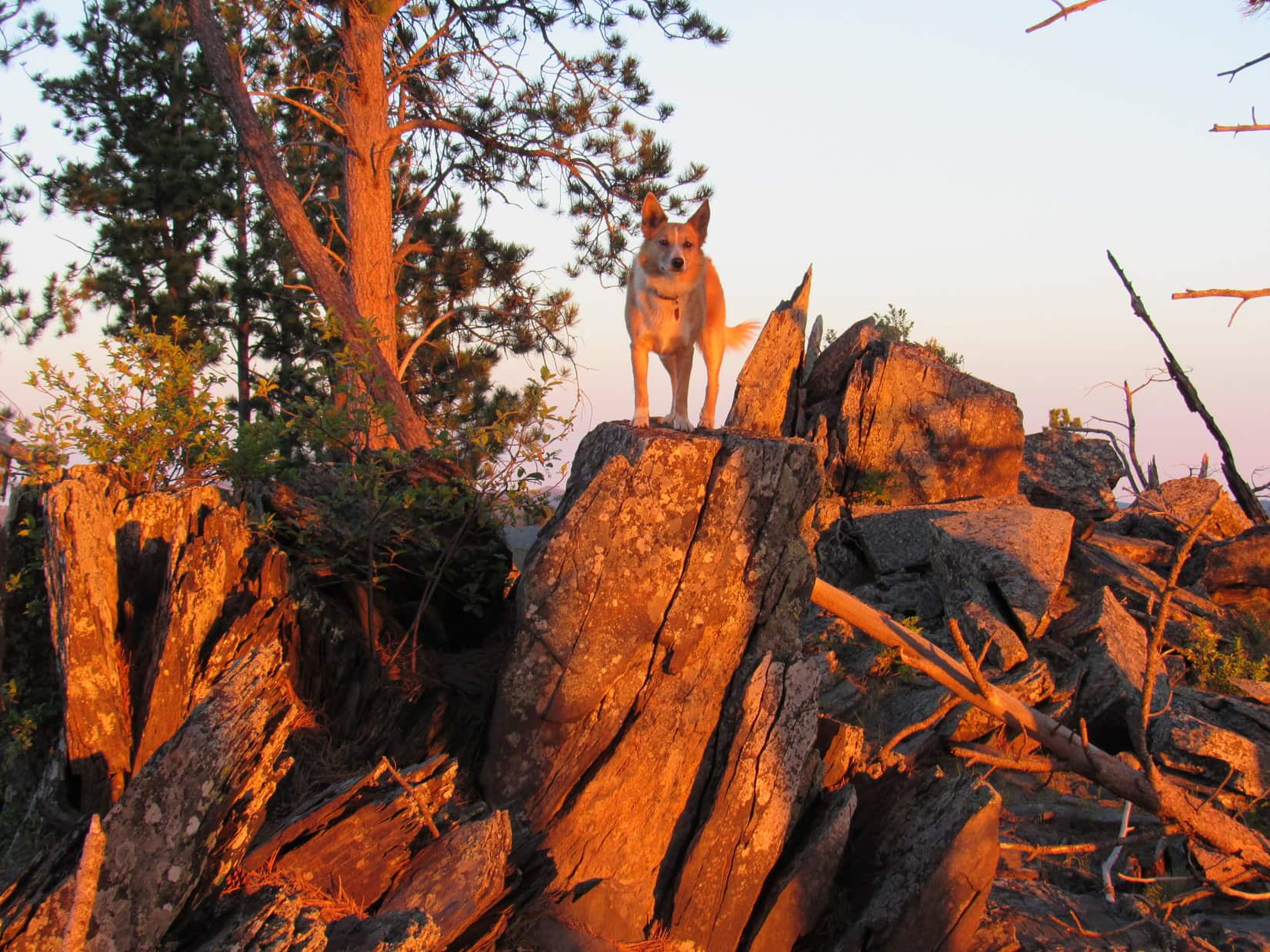
At the N end of the first sizable rock outcropping she came to, Lupe reached the true summit of Peak 6720.

Lupe on the true summit of Peak 6720. Photo looks NW.
Astride the highest rock formation at the N end of the summit ridge. Photo looks NNW.
Dingo on the Rocks.

The summit ridge sloped gradually down toward the SSE.  Beyond a gap of relatively level ground were more rock formations.  Lupe left the true summit to explore them, too.

Lupe went over to explore slightly lower rock formations farther along the ridge. Photo looks SSE.
The rock layers along the spine of Peak 6720 were tilted nearly straight up. A jumble of loose rocks lay scattered immediately below the highest ones. Photo looks SSE.

Fewer trees grew around the rock formations S of the true summit.  Lupe enjoyed better views from here, even though she wasn’t quite as high on the mountain as before.  She could see Sylvan Hill (7,000 ft.) off to the SE where she’d been only a week ago on Expedition No. 206.

Lupe liked scrambling around on the rocks strung out along the spine of Peak 6720. Here she’s at the top of the S high point. Sylvan Hill (7,000 ft.) where she had been only a week ago on Expedition No. 206 is seen on the horizon right behind her. Photo looks SSE.
Loopster enjoying being up on the S high point. Why not? The views were terrific! Photo looks SE.

Looking NNW back along the jagged spine of Peak 6720.
Black Elk Peak (7,231 ft.) (R of Center) from Peak 6720 with help from the telephoto lens. Photo looks SE.
Sylvan Hill (7,000 ft.) (L) and Peak 6733 (highest point on the far ridge on the R) from Peak 6720.  Lupe had been to both on Expedition No. 206.  Photo looks SSE.

It hadn’t taken long to get to Peak 6720, so Lupe wasn’t ready for much of a break yet.  She remained on the summit ridge only 20 minutes.  That was long enough to get a drink, scramble around on the rocks some, and see the views.

Medicine Mountain (6,878 ft.), 2 miles to the SSW, was next on the Carolina Dog’s peakbagging agenda.  Lupe left Peak 6720 heading straight on down the SW slope.  Progress was slow at first.  SPHP had to navigate a band of loose rock directly below the spine of the mountain.  This was followed by a much longer band of deadfall timber.  The deadfall was considerably worse here than on the way Lupe had gone up.

Loose rocks and deadfall were left behind, though, well before Lupe reached the floor of the valley to the W.  A dirt road in the valley headed straight for Medicine Mountain.

Leaving Peak 6720 behind. Photo looks back to the NE.
Down in the valley on the dirt road leading straight for Medicine Mountain (6,878 ft.). Photo looks SSW.

Loop had about a mile to go to reach USFS Road No. 297 down by Negro Creek, but the dirt road she was on veered off onto the W (R) slope of the valley after only half that distance.  The Carolina Dog left the road to remain in the valley instead.  Following an old cow path, she went around the E side of a large fenced area on the valley floor.

When a spring and small creek appeared, Lupe made good use of them.

In the lower part of the valley. Photo looks WSW.

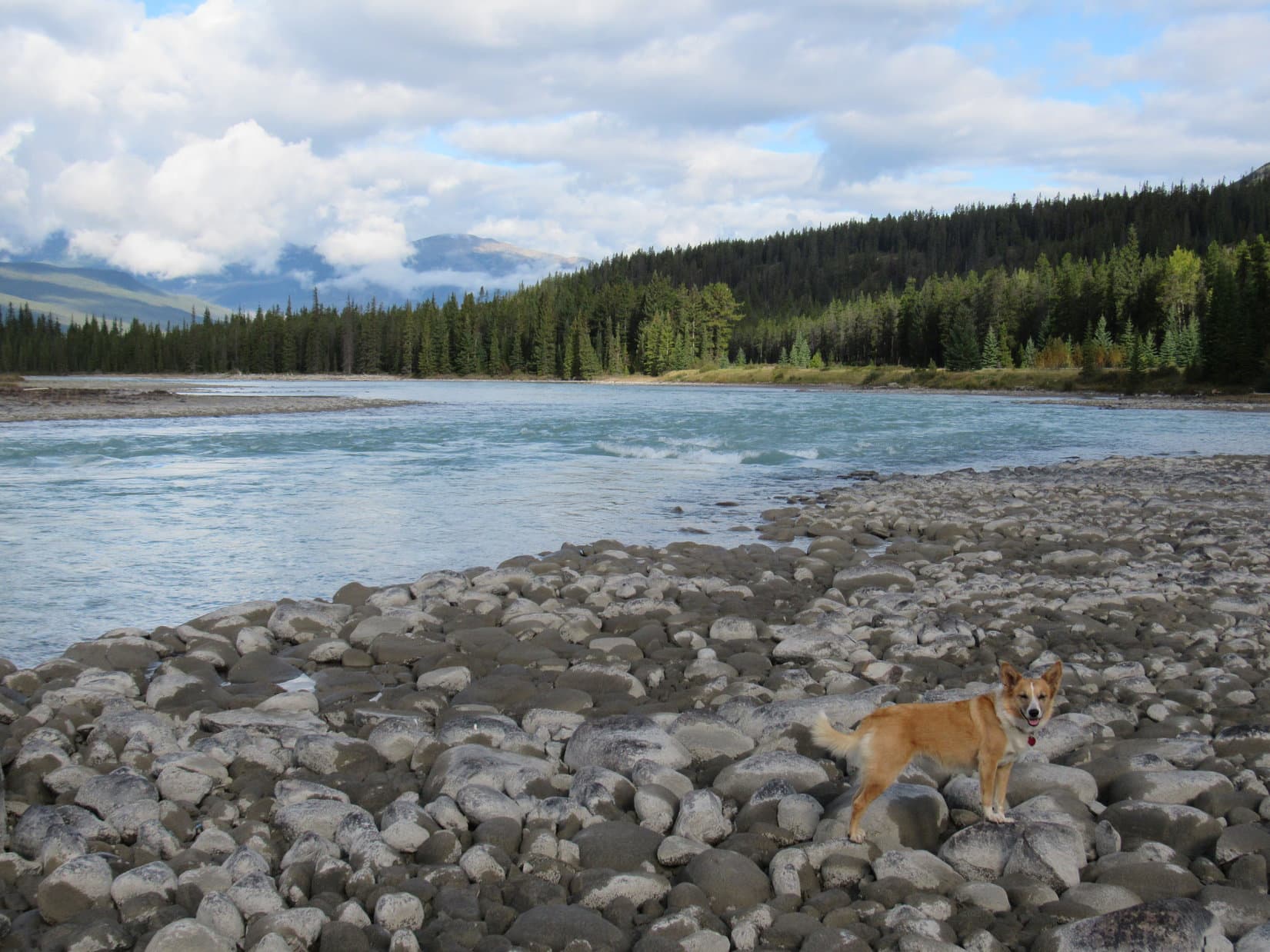
Lupe reached USFS Road No. 297.  She was halfway from Peak 6720 to Medicine Mountain.  Negro Creek, a small stream, but much larger than the tiny tributary in the valley she’d just come through, was flowing through an interestingly shaped pond on the other (SW) side of the road.  The pond was home to a family of Canadian geese.

Negro Creek flows through this interestingly shaped pond N of Medicine Mountain (Center).  Photo looks S.
A family of Canadian geese made the pond on Negro Creek their home.

Lupe and SPHP trudged S on USFS Road No. 297 far enough to get past a barbed wire fence before leaving the road to cross Negro Creek.  While SPHP jumped across, Lupe hopped right in the creek and laid down.  She then got up, and strolled up and down the creek a few times while drinking the cold water.  When the Carolina Dog felt sufficiently refreshed, she leapt out of the creek to start climbing Medicine Mountain.

The day was hot.  At least, it was hot for climbing mountains.  Despite her revitalizing dip in Negro Creek, Lupe’s tongue was soon hanging out again.  The heat sapped SPHP’s energy.  Most of the mountain was forested, but Lupe came to a few sunny fields on the way up, too.  Lupe and SPHP made numerous short rest stops in shady places.

Lupe explored the forest while SPHP kept chugging slowly up Medicine Mountain.  There wasn’t much deadfall until almost to the top.  Lupe arrived at the base of a narrow rock outcropping after coming up the N ridge.  The outcropping looked only 20 feet high.  A route existed where SPHP might be able to scramble directly up.

No problem with the little scramble, but the first 20 feet led only to a false summit. However, Lupe didn’t have much more to go.   Loop and SPHP worked a little higher along the E side of a rocky ledge, while proceeding S.  In a couple of minutes, Lupe was at the top of Medicine Mountain’s N summit.  A line of rocks of roughly equal elevation along the ledge provided terrific views to the N.

This time, break first – then views.  Lupe had water and Taste of the Wild.  An apple, as usual, for SPHP.  Lupe curled up in the shade of a tree, surrounded by delicate white wildflowers.  Medicine Mountain was a busy place.  Flies buzzed, bees hummed, butterflies chased each other in dizzying circles.

A variety of butterflies chased each other in dizzying circles. This one landed briefly to take a break with Lupe.
Relaxing in the shade among the wildflowers.

After a 10 minute rest, Loop and SPHP were ready for a look around.  From the rocks of the N ledge, Lupe could see in every direction except S.  The best views were toward the N & W.

After her break, Lupe went out on the rocks of the N ledge for a look around. She could see Odakota Mountain (7,200 ft.) (L) the 2nd highest in all of South Dakota. Green Mountain (7,164 ft.) is the high point in the distance to the R of Lupe. Photo looks NW.
The view to the NNW. Green Mountain (7,164 ft.) again in sunlight on the far L. Copper Mountain (6,920 ft.) is the ridge L of Center.
Peak 6680 is the lower hill to the L of Lupe. Looper would be going there next after leaving Medicine Mountain. Photo looks W.
Gillette Prairie, an area of grasslands within the Black Hills, is in view on the R.  Distant ridges along the E edge of the high limestone plateau country lie beyond it. The closest ridge on the L is Copper Mountain (6,920 ft.). Lupe hoped to get there, too, before her day was over. Photo looks NNW.
Odakota Mountain (R of Center) and Peak 6680 (L). Photo looks WNW.

So far, Lupe had only made it to the lower N summit of Medicine Mountain.  If she wanted to see the views to the S and complete her peakbagging goal, she would have to go to the mountain’s true summit.  A saddle with considerable deadfall timber led over to the higher S summit, which wasn’t far off.  Lupe could be there in minutes.

Lupe ready to head for Medicine Mountain’s S summit (Center). Photo looks S.

Once she was across the saddle, Lupe found a short, faint trail leading up the NW side of the S summit.  The highest point on Medicine Mountain (6,878 ft.) proved to be occupied by a young aspen tree.

The young aspen tree on the right sprawled out over all the very highest rocks on Medicine Mountain. As far as Lupe was concerned, this was close enough. Photo looks NW
Odakota Mountain (7,200 ft.) (L) from the true summit of Medicine Mountain. Photo looks WNW.

The best views from the S summit were toward the rugged country around Black Elk Peak (7,231 ft.) to the SE.

Black Elk Peak (7,231 ft.) (Center) and Sylvan Hill (7,000 ft.) (R).
Black Elk Peak (straight up from Lupe) with help from the telephoto lens. Photo looks SE.

Looper could see a long way to the S.

Looking S from Medicine Mountain’s true summit. Atlantic Hill (6,393 ft.) is the bump on the horizon straight up from Lupe. Northeast Cicero Peak (6,240 ft.) is the highest point far off at Center L. Photo looks S.

Lupe spent a little while near the true summit of Medicine Mountain.  However, if she wanted to have enough time to actually get to Peak 6680 and Copper Mountain, she couldn’t dilly dally too long.  Disappointingly, a little sniffing around revealed no medicine on Medicine Mountain, so Lupe moved on.  She took the faint path leading back to the saddle, and began a descent down the mountain’s W slope.

The W slope was moderately steep and full of deadfall timber.  Lupe was nearly down to a huge field in the next valley before she was out of it.  She continued W across the field, and headed for a saddle ESE of Peak 6680.  The saddle and much of the rest of the way up were covered with a forest of dense young pines 10 to 15 feet high.

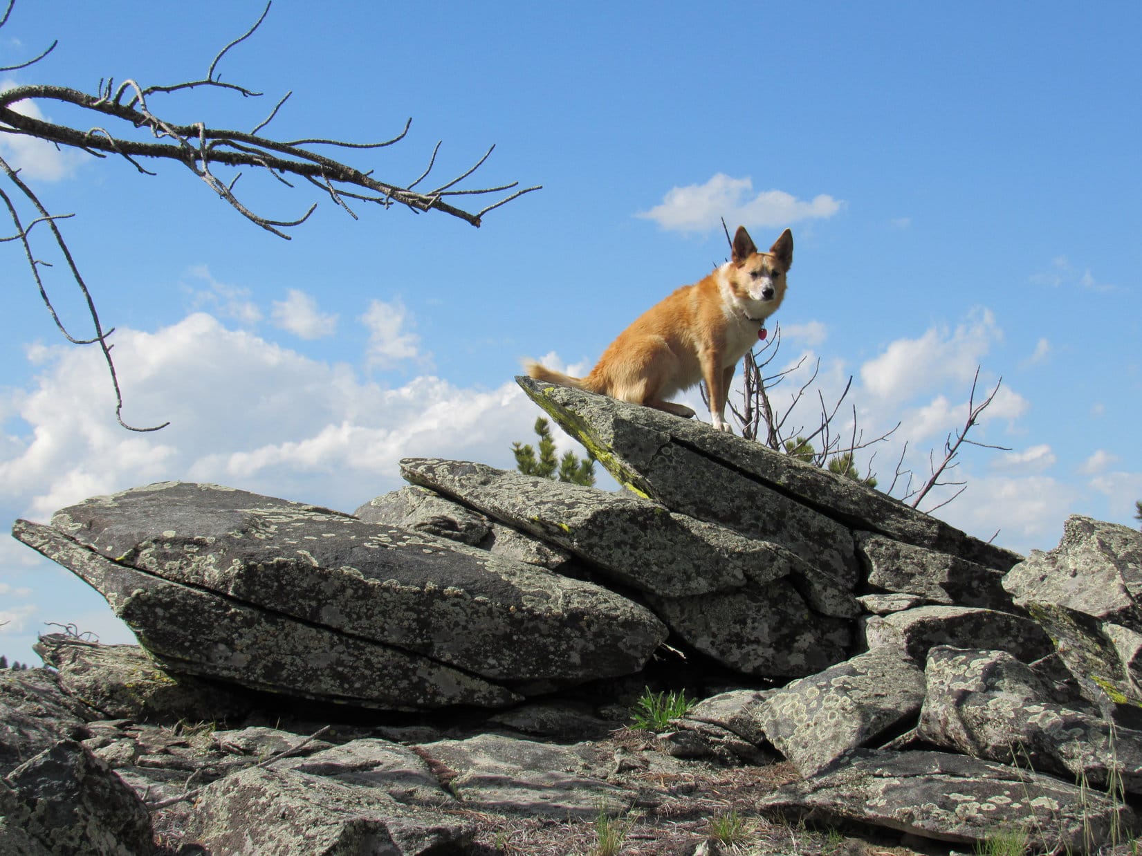
The young pine forest would have been difficult to travel through, but fortunately, a series of lanes free of trees existed by which it was possible to weave up the mountain mostly unhindered.  As Lupe approached the summit of Peak 6680, she came to an older forest and started seeing rock outcroppings.

Lupe saw a great many wild irises on Expedition No. 207. She found these on the W slope of Medicine Mountain on her way to Peak 6680.
Approaching Peak 6680‘s summit ridge from the ESE.

Lupe had been to Peak 6680 once before, way back on Expedition No. 96 on 9-20-14.  It had been so long ago, SPHP couldn’t remember what the summit was like.  Lupe rediscovered a 150 foot long summit ridge oriented E/W with large rocks scattered along the N edge where the slope below was steepest.  This whole ridge was forested, but a few spots offered Loop glimpses of distant views.

The rocks at the far E and W ends of Peak 6680’s summit ridge seemed to be the two highest points on the mountain. Here Lupe is at the E high point. Medicine Mountain (6,878 ft.) can be glimpsed beyond Lupe. Farther away, Sylvan Hill (7,000 ft.) is in view on the R. Photo looks E.
Lupe out on a slightly lower ledge near the E high point. Odakota Mountain (7,200 ft.) in view beyond her. Photo looks NW.
Medicine Mountain (6,878 ft.) with help from the telephoto lens. Photo looks E.

Lupe had come up at the E end of Peak 6680’s summit ridge.  The ridge was roughly level, but with slightly higher points at each end.  Lupe could see a rock at the far W end which looked like it might be the true summit.

Naturally, the American Dingo had to go check it out.

Looking W along the summit ridge from near the E end. The rock that is the high point at the far W end can be seen between the trees straight up from Lupe’s nose.
Up on the highest rock at the W end of the ridge. This might have been the true summit of Peak 6680, but it was hard to tell for sure. In any case, Lupe had already been to the E high point, so she was here to claim another peakbagging success! Photo looks N.
Not a bad perch!

Although it wasn’t really clear if the E or W high point was the true summit of Peak 6680, Lupe had now been to both.  She could now claim peakbagging successes at 3 different mountains today.  SPHP was pretty certain she still had time to get to Copper Mountain, too.

Copper Mountain was 2 miles due N.  Loop wasted no time getting started.  She went E back a little beyond the rocks at Peak 6680’s E high point, before turning N.  She traveled down to a very wide saddle leading to the long S ridge that would take her to Copper Mountain.  It was a bushwhack all the way through the forest until she came to a dirt road upon attaining the S ridge.

Now Lupe and SPHP could make good time.  The dirt road followed the top of the ridge to Sixmile Road (USFS Road No. 301), a major gravel road.  Lupe crossed No. 301 continuing N before eventually turning E.  The sun was getting low, but would still be up for another hour or so, when Lupe reached the cliffs at the SE end of Copper Mountain (6,920 ft.).

The last time Lupe had been here was 14 months ago, when she’d first met her mountaineering friend Jobe Wymore.  Jobe had used Lupe’s Black Hills scouting services, and come all the way from the west coast to visit Odakota Mountain.  Lupe and SPHP had then gone with Jobe all the way to the Wildcat Hills of Nebraska.

Fun times, and it was fun to think about them again now!  Neither Lupe nor SPHP had ever met a real mountaineer before.  Jobe had turned out to be such a great guy with so many interesting tales to tell!  Lupe hadn’t seen Jobe since that day, but it was possible she was going to see him again on one of her 2017 Dingo Vacations this summer!

Medicine Mountain is the conical peak on the R. Photo looks SE.
Looking SW at Odakota Mountain (7,200 ft.) from Copper Mountain. Jobe Wymore had come all the way from the W coast to peak bag Odakota Mountain, because it is the 2nd highest in South Dakota. (Jobe had already climbed the highest mountains in all 50 states.)  After Odakota, Lupe had also brought Jobe here to Copper Mountain where the views are better.
Lupe at the far SE end of the cliffs on Copper Mountain. Black Elk Peak (7,231 ft.) is on the L. Medicine Mountain (6,878 ft.) is on the R. Negro Creek with the pond where the Canadian geese live is in the valley with the green grass seen near Lupe’s head. Photo looks SE.
A closer look with the telephoto lens at the Negro Creek valley. Photo looks SE.
Looking N across Copper Mountain’s summit area from the high point at the edge of the cliffs.
Looking N across Gillette Prairie. Terry Peak (7,064 ft.) (L) and Custer Peak (6,804 ft.) (Center) are faint on the far horizon.

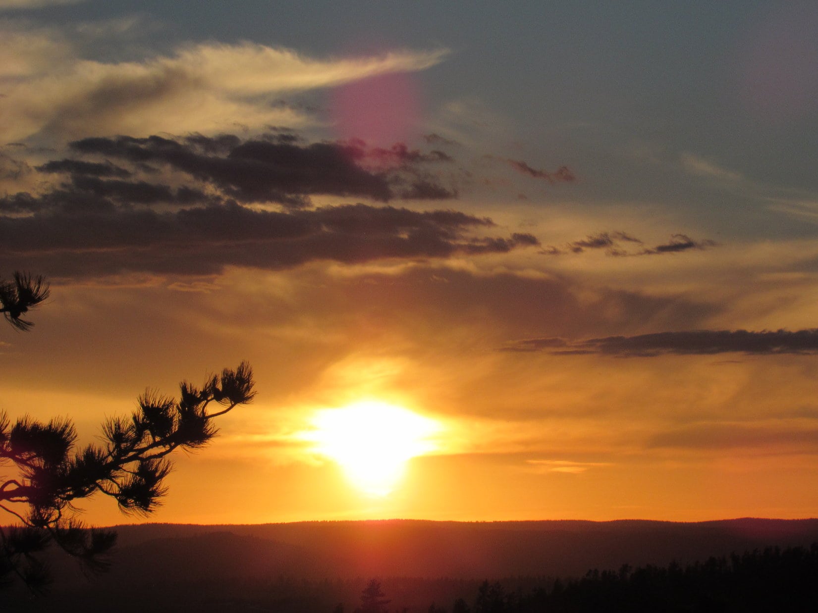
The evening views from Copper Mountain were beautiful.  Lupe and SPHP stayed a little while admiring them, talking about Jobe, and remembering.  The sun was getting lower, though, and Lupe had a bit of a bushwhack ahead of her to get back to the saddle above Tree Draw near Peak 6720.

Lupe’s return trip went fine.  The heat of the day was gone.  Lupe and SPHP were both energized.  Lupe saw many deer, a few squirrels, and one giant deer (elk) on the way.  She had a blast!  She made such good progress, she even had time for a quick side trek back up to the top of Peak 6720 to see the sun set.

Expedition No. 207 marked the end of Lupe’s Black Hills expeditions for a while.  The first of her splendid Summer of 2017 Dingo Vacations full of more distant adventures would be starting soon!  (9:11 PM, 52°F)

On the tippy top of Peak 6720 again at sunset.
Expedition No. 207 nears its conclusion.
On the jagged spine of Peak 6720.

Links:

Next Black Hills Expedition                      Prior Black Hills Expedition

Want more Lupe adventures?  Check out her Black Hills, SD & WY Expeditions Adventure Index, Master Adventure Index, or subscribe free to new Lupe adventures!

Parker Ridge & the Saskatchewan Glacier, Banff National Park, Canada (9-6-16)

Day 39 of Lupe’s Summer of 2016 Dingo Vacation to the Canadian Rockies, Yukon & Alaska

6:20 AM on this beautiful early September morning found Lupe already on the road, heading SE on Yellowhead Highway No. 16.  Ever since leaving Alaska, Lupe had made her 450 mile daily quota or a little more.  Today she didn’t need to go so far.  She could spent part of the day visiting some favorite places in the Canadian Rockies.

Lupe’s first stop came before mid-morning when she reached her favorite picnic ground in Jasper National Park.  For some unknown reason, there’s no signage for this great picnic area right along the E bank of the mighty Athabasca River.  It’s located 5 or 6 miles S of Athabasca Falls along the W side of Icefields Parkway Hwy 93.

The Athabasca River was much lower than Lupe had ever seen it before, but until today she had never been here this late in the season.  Previously, the river had always come right up to the bank at the edge of the picnic ground.  Now a wide expanse of riverbed was exposed beyond the bank.  Lupe went down to the riverbed, and trotted over rounded stones to the water’s edge.

Lupe had never seen the Athabasca River so low before. She went way out across exposed riverbed to this boulder. Photo looks upstream (SE).
Loop at the Athabasca River near her favorite picnic ground.

Every other time Lupe had seen the Athabasca River, it had been a light gray color, running high, and full of silt.  Now the river was a beautiful blue.

When the Athabasca River is running higher, it is a light gray color and full of silt. Today the river was running low and a beautiful blue. Photo looks downstream (NW).

Time for a late breakfast.  After checking out the river, Lupe returned to the picnic ground.  While SPHP heated up soup and Swiss Miss, Lupe had a fine time barking at squirrels in the trees.  When breakfast was ready, Lupe helped SPHP devour the soup.  She didn’t get any Swiss Miss.

Lupe got to spend nearly 2 hours at the picnic ground.  She took short walks through the forest along the river with SPHP, barked at squirrels, and returned to the Athabasca River.

Looking upstream again toward Mount Christie (10,236 ft.). Photo looks S.
Happy times at the Athabasca River in Jasper National Park! Mount Christie in the background. Lupe’s still keeping a sharp eye out for squirrels up in the trees on the riverbank. Photo looks S.

Late in the morning, another vehicle pulled in to the picnic ground.  No doubt more would be coming as lunch time approached.  Lupe and SPHP hit the road again.  Icefields Parkway Hwy 93 through the majestic Canadian Rockies is always a spectacular drive.

Lupe and SPHP enjoyed the scenery, passing by many gorgeous places Lupe had explored on her 2013 and 2014 Dingo Vacations.  Lupe didn’t stop again, however, until she reached the trailhead for Parker Ridge (7,612 ft.).  By now it was early afternoon, and the trailhead parking lot was packed.  SPHP had to wait for a parking spot to open up.

Parker Ridge is Lupe and SPHP’s favorite short day hike in the Canadian Rockies.  A well-traveled trail switchbacks up the side of the ridge.  On the other side is a tremendous view of the huge U-shaped valley carved long ago by the Saskatchewan Glacier.  The glacier can still be seen in the upper part of the valley flowing down from the Columbia Icefield.  The trail gains over 800 feet of elevation on its way to the ridgeline.

The Parker Ridge Trail was very busy, but the glorious view of the Saskatchewan Glacier from the other side of the ridge made dealing with the crowd totally worthwhile.

Once over the ridgeline, Lupe had fantastic views of the Saskatchewan Glacier. Photo looks SW.
The Saskatchewan Glacier from Parker Ridge. Photo looks SW using the telephoto lens.

The way the terrain is configured, Lupe’s view of the Saskatchewan Glacier actually improved as she followed the trail on the other side of Parker Ridge away from the glacier.  More of the toe of the glacier could be seen from here.

The farther Lupe followed the trail away from the Saskatchewan Glacier, the more she could see of the glacier’s toe and the pond below it. Photo looks SW.
Looking W along Parker Ridge. On the other side of these mountains is Jasper National Park and another impressive glacier. The Athabasca Glacier can be seen from Icefields Parkway Hwy 93, but for a truly amazing view of it, Lupe recommends taking the trail to Wilcox Pass.
The Saskatchewan Glacier flows down from the Columbia Icefield, the largest icefield in North America’s Rocky Mountains.

Saskatchewan Glacier from Parker Ridge using the telephoto lens. Photo looks SW.
An even closer look at the toe of the Saskatchewan Glacier through the telephoto lens.
Across the huge valley carved by the Saskatchewan Glacier, Lupe saw high peaks and impressive snowfields. Photo looks SSW.

Lupe followed the Parker Ridge trail far enough away from the Saskatchewan Glacier to where she could see its entire toe.

Lupe with a view of the entire toe of the Saskatchewan Glacier from Parker Ridge.
A close-up showing the entire toe of the glacier.

Several groups of people had gone this far along the trail, too.  Everyone was hanging around enjoying the glacier view.  After several minutes, Lupe realized people and Carolina Dogs weren’t the only ones interested in being here.  A mountain sheep wandered up the steep side of Parker Ridge from the valley below, likely more interested in finding something to eat than the grand view.

After all, mountain sheep are so used to splendid scenery they pretty much take it for granted.  A good meal can be harder to come by.

A mountain sheep wandered up to the Parker Ridge trail from the deep valley below. The sheep seemed used to people, but rather alarmed to be confronted with the presence of an American Dingo!
When the mountain sheep saw Lupe, it hesitated before coming any farther up. Lupe and the mountain sheep were both extremely interested in each other, but for different reasons.
For mountain sheep in the Canadian Rockies, spectacular scenery is easy to come by. Photo looks ESE from close to the end of the Parker Ridge trail.

For a few minutes, Lupe and the mountain sheep had a stare down.  Lupe was a very good American Dingo.  She did not bark or lunge at the sheep.  She wouldn’t have gotten anywhere anyway, since she was on her leash.

Lupe and the mountain sheep stared each other down for several minutes before the sheep decided it was safe to come farther on up Parker Ridge.

When Lupe didn’t do anything except stare in rapt attention, the mountain sheep decided maybe it was safe to come farther on up Parker Ridge.  It turned out this sheep was an advance scout.  Several more mountain sheep suddenly made their appearance.

The first mountain sheep was only a scout. When the scout decided it was OK to advance despite Lupe’s presence, the rest of the flock started appearing. Six sheep ultimately came into view.

A total of six mountain sheep came up onto Parker Ridge from below.  Lupe still didn’t bark, but the sight of all these mountain sheep wandering around nearby was almost more than she could bear.  The Carolina Dog was trembling with excitement from nose to tail.  She kept glancing up at SPHP pleading to be turned loose.  She was absolutely 110% certain fresh mutton would taste better than the soup she’d had for breakfast.

This situation wasn’t going to be sustainable.  To Lupe’s enormous disappointment, SPHP insisted that she head back away from the mountain sheep.  She was most reluctant to comply, but in the end, she had no choice.  Parker Ridge had certainly been an exciting adventure, but oh, how much better it might have been!

Lupe on Parker Ridge on the way back to the G6. Mount Wilcox (9,462 ft.) is in view at Center. To the R is Wilcox Pass, where there are tremendous views of the nearby Athabasca Glacier. Photo looks NW.

Lupe and SPHP returned to the G6 (3:48 PM, 48°F).  Lupe continued S on Icefields Parkway Hwy 93.  Her biggest adventure for the day up on Parker Ridge was over, but she still had some fun ahead of her.  Overcome with drowsiness from the gorgeous, relaxing drive, SPHP eventually parked the G6 at Lupe’s favorite picnic ground in Banff National Park on the SE side of Bow Lake.

After an hour’s nap, Lupe got to go see wonderful Bow Lake.

Lupe at beautiful Bow Lake. Photo looks W from near the picnic ground.
The red roof of the Num Ti Jah Lodge is in view at the foot of Mount Jimmy Simpson (9,731 ft.) across Bow Lake. Photo looks NW.
Looking S along the shore.
On a path at the picnic ground. No one else was around. Lupe and SPHP had the whole place to themselves.

The picnic ground was completely deserted, even though it was dinnertime.  After a good look at Bow Lake, SPHP prepared dinner at a table near the shore.  At this late stage of Lupe’s Summer of 2016 Dingo Vacation, supplies were almost completely exhausted.  Lupe and SPHP shared the last of the soup and sardines.

Good thing Lupe was well on her way home!  Swiss Miss and tea was all that remained to sustain SPHP, though Lupe still had some Taste of the Wild and Alpo in reserve.

By the time this feast was over it was 7:00 PM, but there was still light in the sky.  Lupe and SPHP drove over to the Num Ti Jah Lodge at the N end of the lake.  Lupe went down to the shore and saw a curious thing.  A piece of wood was swimming around as if it were alive!

Near Num Ti Jah Lodge, Lupe saw a curious sight. A piece of wood was swimming around in Bow Lake as if it were alive!

Lupe had spotted a beaver!  The beaver paddled around near the shore completely unconcerned by Lupe’s presence.  Lupe wasn’t really certain why that piece of wood seemed so lively, but finally lost interest in it since it never came out of the water where it could be properly sniffed and inspected.

The beaver paid Lupe no attention. Since it never left the lake, Lupe eventually lost interest in it.
The beaver had a short stick it was gnawing the tender thin bark off of.
After a few minutes, the stick didn’t have much bark left. The beaver looked quite satisfied with this treat.
After a few minutes, the lively piece of wood (seen beyond Lupe) swam away. Photo looks SSE across Bow Lake. Part of the Crowfoot Glacier is in view R of Center beyond the opposite shore.
Lupe, the beaver, Bow Lake & the Crowfoot Glacier.

The beaver eventually swam away farther out into the lake.  Lupe never did figure out what made that floating piece of wood so much livelier than any other she’d ever encountered.

Off to the SW, part of Bow Glacier and Bow Glacier Falls were in view.  A trail that Lupe took once before on her Summer of 2013 Dingo Vacation goes all the way to the base of Bow Glacier Falls.  It would be dark long before Lupe could do that again, but there was still time to follow the trail partway along the N shore of Bow Lake.

Beyond Bow Lake, part of the Bow Glacier and Bow Glacier Falls were in view. Photo looks SW.
Bow Glacier & Bow Glacier Falls using the telephoto lens. Photo looks SW.
Too bad there wasn’t time to take the trail all the way to Bow Glacier Falls again, but it would be dark before Lupe could get there. It’s a great, easy, scenic hike with a good trail and very little elevation gain along the way. Lupe highly recommends it!
Num Ti Jah Lodge is at the N end of Bow Lake. The trail to Bow Glacier Falls starts here. Photo looks N.
This hefty, wooden bridge crosses a small creek entering Bow Lake near Num Ti Jah Lodge. Photo looks SSE.
Bow Glacier flows down from the Wapta Icefield. Another small lake exists out of sight below Bow Glacier above the falls. Neither the small upper lake, nor the glacier are visible from the base of Bow Glacier Falls. However, a distant view of both, plus part of the enormous Wapta Icefield can be seen from Cirque Peak (9,820 ft.). Photo looks SW.

Lupe and SPHP only took the trail to Bow Glacier Falls along the N shore of Bow Lake for 20 minutes.  Lupe hadn’t even made it to the end of the lake yet when the time came to turn around.  Darkness was coming, maybe rain, too.  The sky was clouding up.

Lupe on the trail to Bow Glacier Falls. She would have to turn around in another 10 minutes due to oncoming darkness. Crowfoot Mountain is on the L.
Clouds were rolling in and starting to hide the mountains. The sky looked increasingly like rain was a possibility. Photo looks SSW using the telephoto lens toward a peak S of Bow Glacier.
Bow Glacier & Bow Glacier Falls through the telephoto lens from the point of Lupe’s farthest advance along the trail.
The upper portion of Bow Glacier Falls with the telephoto lens cranked up.

On the way back to the Num Ti Jah Lodge, a gentle steady rain did start falling.  The lodge was lit up and looked inviting when Lupe returned.  The soggy Carolina Dog couldn’t go in, though.  She had to return to the G6.

Num Ti Jah Lodge was lit up and looked inviting when Lupe returned in the rain from the Bow Glacier Falls trail. The soggy Carolina Dog couldn’t go in, though. Back to the G6!

Around 8:30 PM, SPHP parked the G6 for the final time.  The steady rain was coming down harder.  The temperature was only 38°F.  Maybe Lupe was going to get snowed in overnight in the Canadian Rockies?  It sure seemed like a possibility.

Lupe had only made 250 miles today, but that was OK.  She’d spent a lovely day in the Canadian Rockies.  Maybe it wasn’t the most spectacular day she’d ever spent here, but she’d seen many beautiful sights, gone to some favorite places, and had several pleasant, relaxing outings.

Lupe’s only regret was that with supplies running desperately low, SPHP hadn’t allowed her to secure a great new supply of fresh mountain sheep mutton!

Sigh … Carolina Dogs try to be man’s best friend.  They really do.  Humans are hard to understand, though.  Sometimes they don’t have any sense at all.Note:  The Parker Ridge trailhead is located at a pullout right along the southbound side of Icefields Parkway Hwy 93 several miles S of Sunwapta Pass, the border between Banff & Jasper National Parks.

Links :

Next Adventure                       Prior Adventure

Parker Ridge & the Saskatchewan Glacier, The Icefield Centre & the Athabasca Glacier (7-23-13)

Bow Lake & the Trail to Bow Glacier Falls (7-25-13)

Cirque Peak, Banff National Park, Canada (7-24-14)

Parker Ridge Trail, Banff National Park, Canada (7-29-14)

Want more Lupe adventures?  Choose from Lupe’s 2016 Canadian Rockies, Yukon & Alaska Adventure Index, Dingo Vacations Adventure Index or Master Adventure Index.  Or subscribe free to New Lupe Adventures.