Start: Hwy 87/89, 0.25 mile NW of Sylvan Lake Lodge, 9:46 AM, 46°F
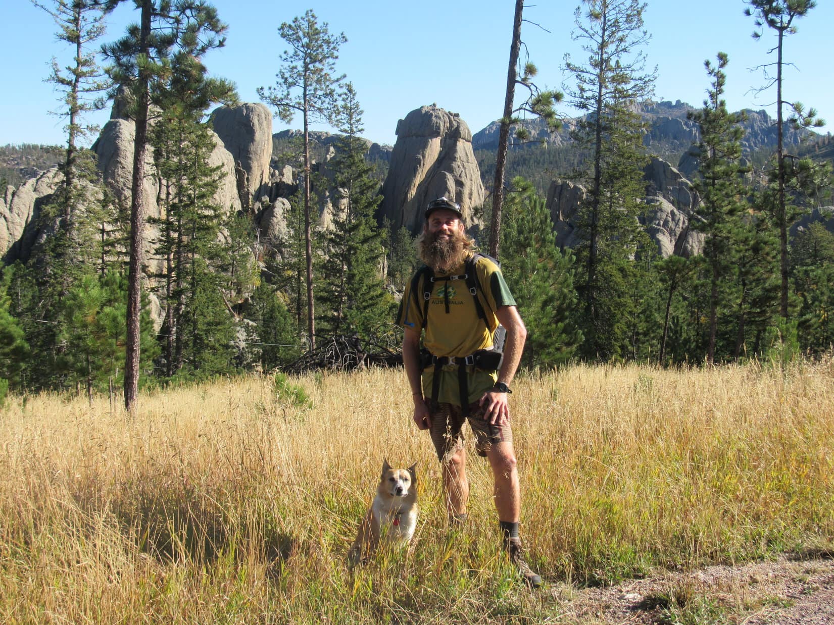
Wonder of wonders! Australian adventurer Luke Hall was actually here – in Lupe’s Black Hills of South Dakota! He’d arrived yesterday afternoon only a few weeks from the end of a 6 month trip exploring the western United States.
During his recent travels, Luke had scrambled up many notable mountain peaks, including Mt. Whitney(14,498 ft.) in California and Mt. Elbert(14,433 ft.) in Colorado, the two highest mountains in the lower 48 states. He’d spent a lot of time along the Pacific coast, and visited a great many national parks – Yosemite, Death Valley, Sequoia, King’s Canyon, Grand Canyon, Zion, Bryce, Mesa Verde, Mt. St. Helens, Mt. Rainier, Rocky Mountain – the list went on and on.
Surfing, swimming, backpacking, mountain biking, climbing – Luke had been a busy guy in 2017, but that was perfectly normal for him. In previous years, he’d explored western Canada, 10 different countries in South America, wandered through much of Europe, and toured Morocco and Egypt. He spent 2 years living and working in London, England, and another 2 years in Banff, Canada. Maybe it wasn’t so surprising that Luke had finally landed in the remote Black Hills of South Dakota after all? He did get around!
Fittingly enough, Lupe and SPHP had first met Luke Hall over a year ago on Gunsight Mountain(6,441 ft.) in Alaska. Now Luke was here to join Lupe on one of her Black Hills, SD expeditions. He had already dropped by Mt. Rushmore(5,725 ft.) on his way in, so Black Elk Peak(7,231 ft.), the highest mountain in South Dakota, seemed like a good destination. For Luke it would be an easy day, but maybe he wouldn’t mind dialing it down a notch after 5+ solid months of more strenuous adventures?
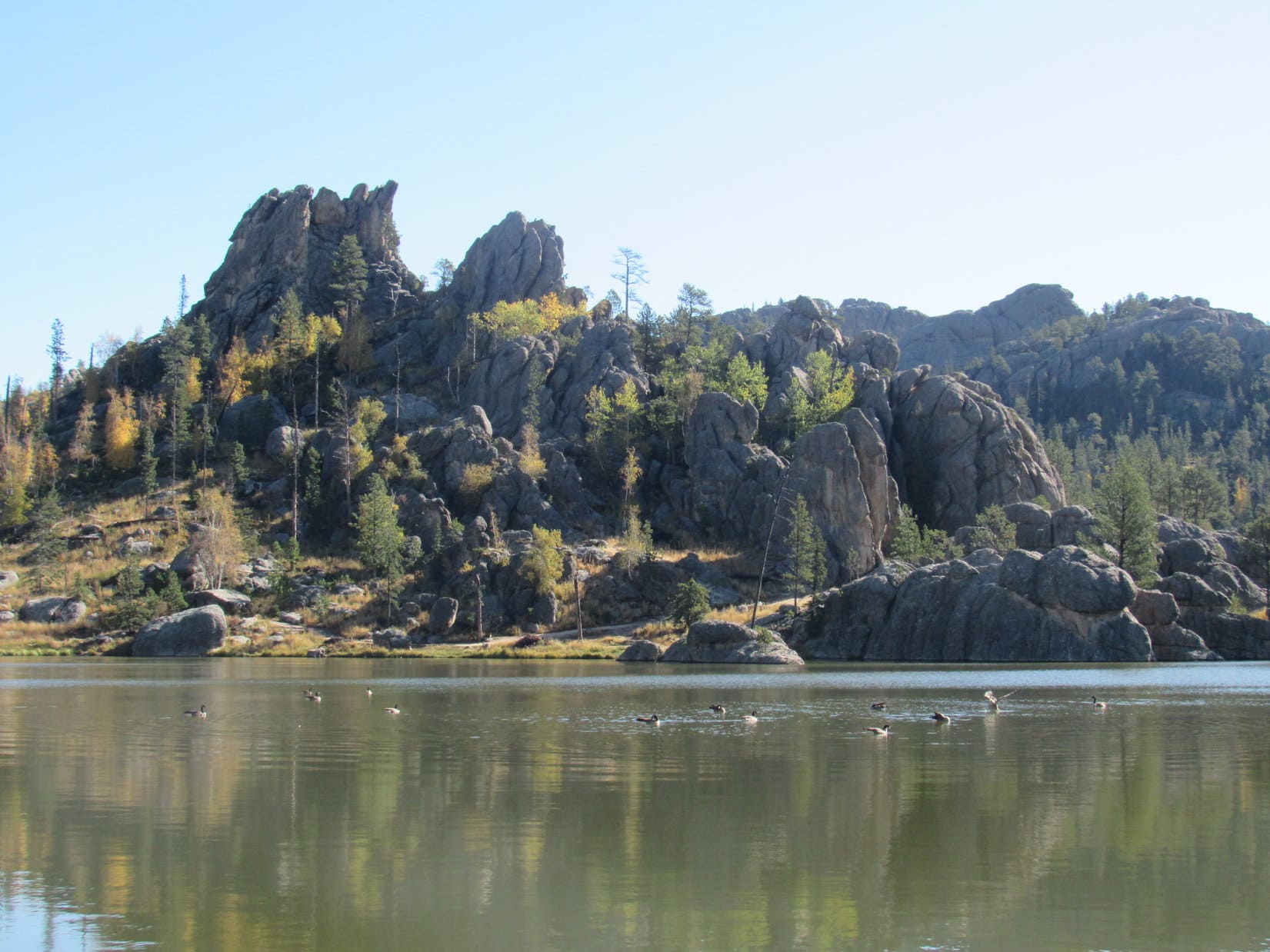
It was a lovely bright, clear day as Lupe, Luke and SPHP set out. First stop along the way was Sylvan Lake.
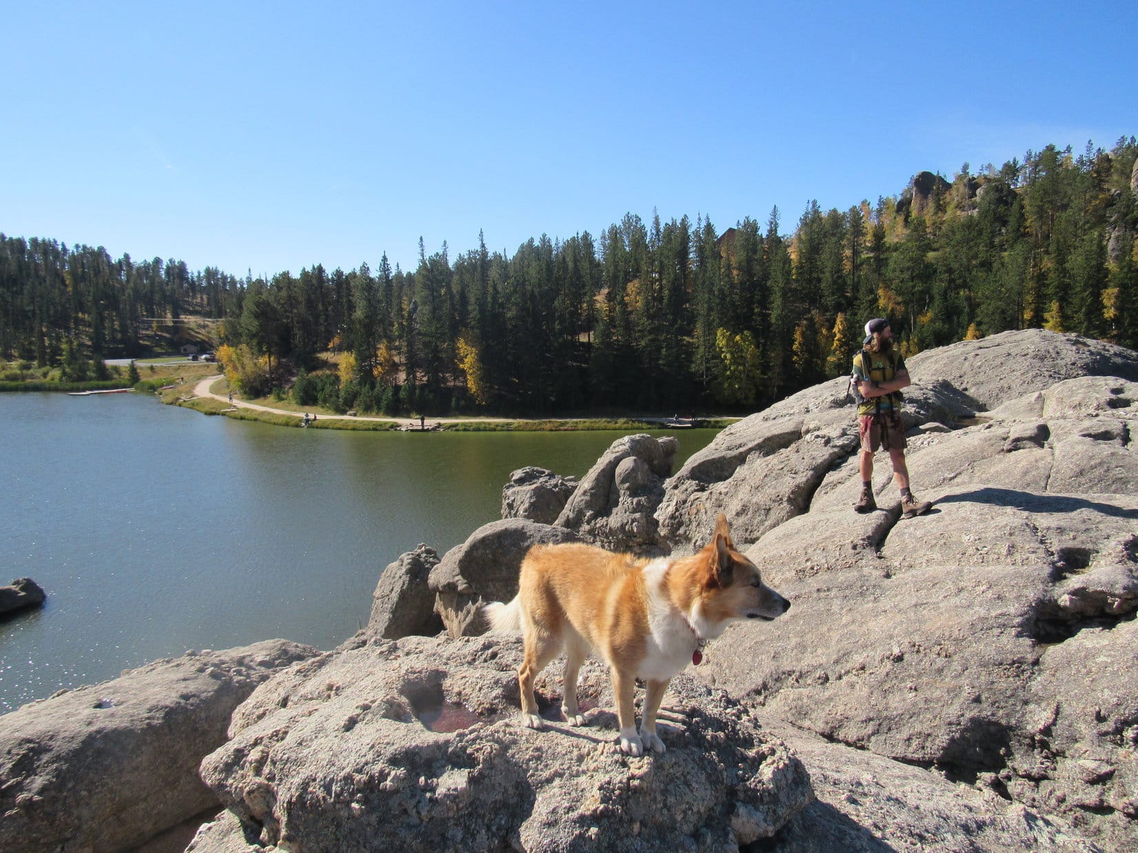
Lupe and Luke together again in the Black Hills for the first time since meeting over a year ago on Gunsight Mountain(6,441 ft.) in Alaska. Black Elk Peak, the highest mountain in South Dakota was today’s ultimate destination. Photo looks E.Only 10 or 15 minutes after setting out, Luke and Lupe reach the NW shore of Sylvan Lake.The small dam creating Sylvan Lake, which features a short walkway with a railing, is seen beyond Luke. Photo looks N.Looking NE across the lake.A few ducks were out on the calm water.
After a look at Sylvan Lake from the NW shore, Lupe, Luke & SPHP followed a trail that goes all the way around the lake back down below the dam. Lupe led Luke around to the NE & E sides of the lake.
Looking SW from the rock formations along the N shore.Sylvan Lake is located at the far NW corner of Custer State Park. Though small, the lake nestles among scenic granite formations. It’s a popular destination for tourists and locals alike with a swimming beach and picnic ground. Paddle boat rentals, a convenience store and Sylvan Lake Lodge are all nearby. Photo looks W.Lupe showing her buddy Luke around Sylvan Lake. Photo looks WNW.Loopster and Luke on a large granite formation that extends out into Sylvan Lake from the E shore. Photo looks SW.Looking NNW at the N half of Sylvan Lake.
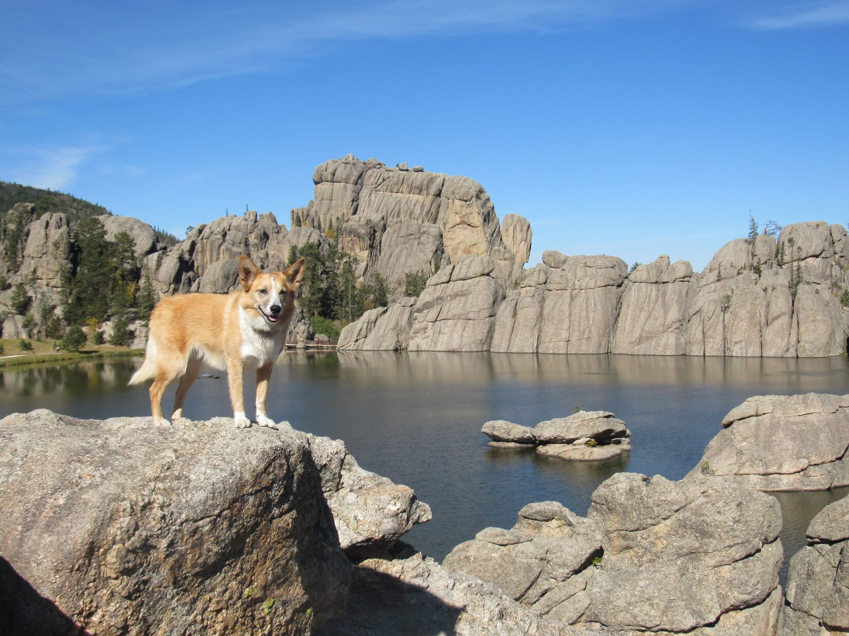
Trail No. 9 from Sylvan Lake is the most direct and popular route to Black Elk Peak, but Lupe had another trail in mind. She led Luke past the picnic ground at the SE end of the lake, and took Trail No. 4 to the Little Devil’s Tower trailhead instead.
Taking Trail No. 4 was a longer route to Black Elk Peak, but had the advantage of giving Luke a chance to climb Little Devil’s Tower(6,960 ft.) along the way, and get a close look at the Cathedral Spires(6,840 ft.), too.
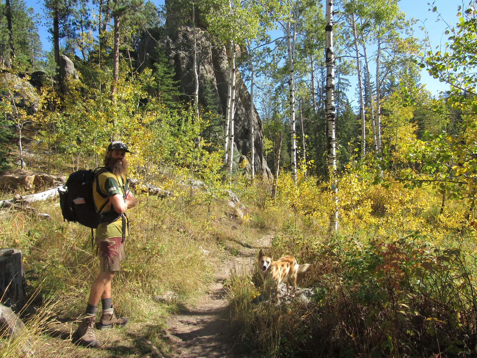
Luke & Lupe along Trail No. 4 to Little Devil’s Tower.A 0.25 mile long spur trail off Trail No. 4 leads to the summit of Little Devil’s Tower. Here Lupe is near the spur trail with a view of the Cathedral Spires. Photo looks E.Luke & Looper on the way to Little Devil’s Tower. Cathedral Spires in the background. Photo looks E.
A 0.25 mile long spur trail leads from Trail No. 4 to the summit of Little Devil’s Tower. The end of the route involves a quick, easy scramble up the granite. Even small children can make it with a little supervision and an occasional boost.
Luke & Loop nearing the top of Little Devil’s Tower. Photo looks N.
Luke, Lupe and SPHP quickly arrived at the summit of Little Devil’s Tower(6,960 ft.). There were cliffs around, especially to the N, but they were of no concern. Although a bit rough, the uneven granite summit area is quite roomy.
The 360° views from Little Devil’s Tower are among the best in the Black Hills, with Black Elk Peak(7,231 ft.) to the NNW and the Cathedral Spires(6,840 ft.) to the SE being the most eye-catching.
Luke and Loopster arrive at the uneven granite summit of Little Devil’s Tower. Photo looks ESE.Another view with some of the Cathedral Spires (also known as the Needles) in the background. Photo looks ESE.Lupe with the Cathedral Spires in the background. This was Lupe’s 5th ascent of Little Devil’s Tower. Photo looks SE.Although the day had started out clear and bright, quite a few clouds were around by the time Lupe reached the top of Little Devil’s Tower. A chill breeze was blowing out of the S, too. Photo looks SE.Looking NNW toward Black Elk Peak. For those with insufficient time to climb Black Elk Peak, the shorter trip on Trail No. 4 up to the top of Little Devil’s Tower can provide similarly striking views of the Black Hills.Sylvan Hill(7,000 ft.) is the long ridge 2.5 miles away with the high point poking up just R of Center. Photo looks WSW.
At first, no one else was around up on Little Devil’s Tower. It wasn’t long, though, before a couple appeared. Bryan and Rene Jobo from Franklin, Tennessee joined Lupe, Luke and SPHP at the summit.
Rene and Bryan were on vacation in the Black Hills, and apparently having a good time relaxing and hitting some of the area’s highlights. Bryan, Rene, Luke and SPHP were soon chatting pleasantly. Lupe got involved posing for photos.
Australian adventurer Luke Hall poses with Bryan & Rene Jobo from Franklin, TN up on Little Devil’s Tower. Photo looks SE.Despite a cool SW breeze, Lupe wasn’t about to get left out. Here she poses with Bryan & Rene, too.In addition to posing with an American Dingo up on Little Devil’s Tower while in the Black Hills, Bryan & Rene were looking forward to attending the Custer State Park annual buffalo roundup in a couple more days. Lupe would have loved to go to help herd buffalo around, too. Unfortunately, SPHP never seems to think that a huge buffalo herd will appreciate a noisy Dingo, so Lupe has never gotten to go.
Bryan and Rene stayed chatting with Luke and SPHP for a while, but didn’t have time to accompany Lupe all the way to Black Elk Peak. They had other adventures in mind to press on toward. Soon after Bryan and Rene said good-bye; Luke, Lupe and SPHP resumed the trek to Black Elk Peak.
Luke near the Cathedral Spires on the way back to Trail No. 4 to resume the trek to Black Elk Peak. Photo looks E.
Trail No. 4 went N past some of the Cathedral Spires, and eventually linked up with a short section of Trail No. 3, which led in turn to Trail No. 9. Near the end of a spur trail off Trail No. 9, a metal stairway hidden in a narrow opening in the granite spiraled up to a rock stairway leading to the old fire lookout tower on Black Elk Peak(7,231 ft.).
Luke reaches the old fire lookout tower at the summit of Black Elk Peak. Photo looks N.Until August 11, 2016 when the U.S. Board of Geographic Names voted unanimously in favor of the name Black Elk Peak, the highest mountain in South Dakota had been known as Harney Peak. Luke poses by a plaque at the lookout tower which has not been updated yet. In May, 2015, the South Dakota State Board of Geographic Names had proposed renaming the mountain Hinhan Kaga (Making of Owls), but that recommendation was never enacted. Lupe would have preferred Squirrel Mountain, or at least Chipmunk Mountain, but, oh well!Looking ENE from the Black Elk Peak summit. The most distant big square block of granite at Center is the back side of Mt. Rushmore.
Upon arrival at South Dakota’s highest point, Luke, Lupe and SPHP spent a few minutes out on the fire lookout tower’s W facing observation deck taking in the views. The wind had shifted to the NW by now, though, and was even colder than at Little Devil’s Tower.
View to the NNW from the fire lookout tower observation deck on Black Elk Peak.
Even Lupe was soon ready to retreat back into the lookout tower. The tower wasn’t very large inside, but Luke enjoyed exploring the winding passage down to the basement. An open doorway led out to a massive granite shoulder of the mountain immediately W of the tower. Everyone enjoyed a break in the shelter of a few pines growing out of the rock.
After snacks and water, it was time for photos from various points on the granite near the lookout tower.
Luke and Lupe NW of the fire lookout tower. The tower was last staffed in 1967. Made of stone, it has held up remarkably well during the ensuing 50 years, despite the efforts of any huffing and puffing big, bad Dingoes. Photo looks SE.Luke & Lupe up on rocks N of the tower. Photo looks NE.Adventure buddies Lupe and LukeLupe on Black Elk Peak. This was her 7th visit to the mountain. Her last visit was over 2 years ago on 9-7-15. Back then the mountain was still officially Harney Peak, as it had been since 1896. Photo looks W.Helicopters giving tours of the Mt. Rushmore area often make a pass around Black Elk Peak. Lupe loves barking at helicopters! She’s spotted one now!The view to the SE.Cathedral Spires (L) and Little Devil’s Tower (R) are in view beyond Lupe & Luke. Photo looks S.Black Elk Peak was Luke’s 3rd US State high point after Mt. Whitney in California and Mt. Elbert in Colorado. Photo looks S.
All too soon, it was time to depart. On the way back to the G6, Lupe, Luke and SPHP followed Trail No. 9 all way to Sylvan Lake. The sun was sinking, but down out of the wind the evening was pleasant.
Starting down. Sylvan Hill is seen in the distance. Photo looks SW.On Trail No. 9 before the junction leading to Little Devil’s Tower (R). On the return trip Luke & Lupe stuck with Trail No. 9 all the way, the most direct route back to Sylvan Lake. Photo looks SSW.Little Devil’s Tower from Trail No. 9. Luke & Loopster had been up there only a few hours ago! Photo looks SW.A view to the NW from Trail No. 9.Loop & Luke at the last big viewpoint along Trail No. 9 on the way to Sylvan Lake. Photo looks NNE.Australian adventurer extraordinaire Luke Hall presents the Black Hills of South Dakota!Looper takes a break on a lovely bench provided by the Highpointers Foundation. This bench is along Trail No. 9 at the first good viewpoint toward Black Elk Peak (formerly Harney Peak) on the way up from Sylvan Lake.
The light was fading fast by the time Lupe reached the G6 again at 6:45 PM (upper 50’s °F). Climbing mountains with Luke, and getting to show off her Black Hills home territory had been great fun!
The fun wasn’t over yet, though. There would be pizza and beer with Luke at home. (What, no beer for the faithful, peakbagging Carolina Dog!? No fair!) Even better, Luke was sticking around for a while. Another adventure was in store tomorrow.
It just doesn’t get any better than that!
Adventurer Luke Hall originally hails from Sydney, Australia. Lupe & SPHP were thrilled that he took the time to come pay a visit to the beautiful Black Hills of western South Dakota!Adventuring buddies Luke & Lupe on Black Elk Peak, 9-26-17
Day 1 of Lupe’s 2017 Dingo Vacation to the Laramie Range, Wyoming & Beyond
Nine months gone. Practically an eternity! Late in the evening, Lupe laid sad-faced and bored on the even sadder-looking old couch clawed up by 4 cats who no longer lived here. Did she ever even think anymore about those glorious days of her last and greatest 2016 Dingo Vacation when she’d gone all the way to the Canadian Rockies, Yukon & Alaska?
If so, you couldn’t tell it. Of course, maybe she was thinking of those times, and how long ago and far away it all seemed was what was making her sad. Loopster heaved a sigh, staring vacantly over the edge of the couch. She looked like she had lost her last friend.
Forlorn Lupe.
She hadn’t, of course. She’d been on lots of Black Hills expeditions full of adventures with SPHP over the last nine months. Fun times, but not the same as hitting the open road for days on end spent exploring exciting, beautiful, distant lands.
While Loop moped on the couch, SPHP was not idle. A warm, fragrant breeze stirred the air. Late spring by the calendar. Early summer by SPHP’s reckoning.
Better enjoy lounging around like that while you still can!
Lupe’s eyes shifted to watch SPHP busily checking equipment and supplies. Her expression didn’t change.
You’ll see, soon enough!
Promises, promises. Nothing fun happened. Dullsville.
The next morning SPHP was up early. Shower, breakfast, and then back and forth packing all this stuff into the G6. Lupe began to realize something really was up. A glimmer of hope in her eyes grew rapidly to increasing anticipation.
Mountain climbing season, Loopster! It’s here! You ready?
Was she ever! Only a few hours later, Lupe was in Wyoming, whizzing along in the G6 headed for her first adventure of her first Dingo Vacation of 2017. Had the mood ever changed from last night! Looper was ready to let the good times roll!
Lupe returns to the great state of Wyoming at the start of her first Dingo Vacation of 2017. Oh yeah, this is gonna be good!
Lupe was headed for the Laramie Mountains in SE Wyoming. Only 8 days into June, it was still weeks early to head up into some of the higher Wyoming ranges for mountain climbing, since there would still be too much snow on the peaks. However, with the exception of Laramie Peak(10,272 ft.), the highest mountains of the Laramie Range top out only a little over 9,000 ft. There might still be some snow around in early June, but not enough to be a problem.
By early afternoon, Lupe reached Douglas, Wyoming. SPHP drove S from there on Hwy 94. The highway eventually turned to gravel and became County Road No. 5. A mile N of Esterbrook, SPHP had planned to let Lupe tag Prairie Dog Hill(6,400 ft.) as her first peak “climbed” in the Laramie Range this year. It wasn’t even really a climb at all, since County Road No. 5 goes almost right over the high point. Pathetically easy.
However, when Lupe arrived at Prairie Dog Hill, a cattle drive was in progress right on the road. Lupe was almost out of her mind with delight! She bounded from window to window of the G6 in a foaming-at-the-mouth barking frenzy. She was eager to get out and help drive some cattle herself! Not such a good idea. The cowboys might have an issue with that. SPHP drove on, turning E at Esterbrook on USFS Road No. 633.
No. 633 wound N & E for several miles. Shortly after passing Esterbrook Campground, the road began to lose elevation and turned S. Lupe’s first real peakbagging objective, Black Mountain(7,960 ft.), came into view.
Black Mountain (L) comes into view from USFS Road No. 633. Laramie Peak, the highest mountain of the Laramie Range is seen in the distance on the R. Photo looks SSW.Black Mountain (Center) was Lupe’s first real peakbagging goal of her 2017 Dingo Vacation to the Laramie Range & Beyond. Photo looks SSW.
Black Mountain was still 9 or 10 miles SSW from where it first came into view. On the way there, Lupe stopped by Horseshoe Creek, which flowed right along USFS Road No. 633 for a couple of miles.
Lupe stops by scenic Horseshoe Creek on the way to Black Mountain. She would later spend the night at the pullout off USFS Road No. 633 seen beyond her.
Looking for USFS Road No. 667, SPHP turned off No. 633 at Camp Laramie Peak, a Boy Scout camp at Harris Park. Lupe and SPHP made inquiry at the main office on how to find No. 667 to Black Mountain.
Lupe stopped at Camp Laramie Peak to inquire about how to find USFS Road No. 667 to Black Mountain. She was a good deal more enthusiastic about how this day was going than the boy outside the Boy Scout camp’s main office.
Camp Laramie Peak was just opening up for the summer season. Councilors were already here, but the first Boy Scouts were just beginning to arrive. Fortunately, an official was available who told SPHP that USFS Road No. 667 (unmarked) to Laramie Peak went right through the camp. He pointed out a road that went S down a little hill.
The road would quickly deteriorate to a high-clearance proposition – it wasn’t going to be G6 friendly at all. This was known in advance from the topo map where No. 667 was marked 4WD. The intention all along had been to ditch the G6 somewhere, and follow the road on paw and foot. Fortunately, SPHP was free to park the G6 at Camp Laramie Peak at a small parking area near the main office.
It turned out that USFS Road No. 667 (a 4WD road) to Black Mountain goes right through Camp Laramie Peak. The officials at the camp said SPHP was free to park the G6 at a small lot not far from the main office, so Lupe’s trek up Black Mountain started right here.
At 3:08 PM (79°F), Lupe and SPHP set off. There had been one caveat mentioned at the office about taking USFS Road No. 667. The road went through Boy Scout property for the first half mile or so. Leaving the road was not permitted. No trespassing on Boy Scout land! Seemed like an odd demand from an organization dedicated in part to promoting the outdoors, but another official reiterated this rule as Lupe and SPHP ambled along the road through the camp.
Whatever, no problem. SPHP adhered rigidly to this restriction. The American Dingo, having spent most of the day cooped up in the G6, was somewhat less diligent. Lupe had a fun time roaming and exploring the forest not too far from the road.
After dipping down through camp, No. 667 crossed a small stream and then began to wind W climbing steadily. Bluebells were growing in profusion in the forests and fields. It was a pretty day, a bit warm, and Lupe was off to a good start. She was beyond forbidden Boy Scout territory in a jiffy. A mile from camp, she arrived at a minor saddle near large rock formations.
Loopster among the bluebells.
About a mile from Camp Laramie Peak, Lupe reached these large rock formations at a minor saddle. Photo looks NNE.
Still hidden from view more than a mile N of the minor saddle was Peak7320, another mountain SPHP hoped Lupe would get a chance to climb. First things first, though! The road turned due S from the saddle and climbed more steeply than before. Lupe followed it, continuing toward Black Mountain.
No. 667 soon turned SW and leveled out for a little way. Peak 7320 now came into view back to the N. The mountain was capped by a huge knob of solid rock. Lupe might not be able to get to the top, even if there was time enough later on for an attempt.
Peak7320 from USFS Road No. 667 on the way to Black Mountain. Photo looks N.
Off to the SW, the summit of Black Mountain had come into view, too. It was a little hard to recognize at first, but got easier to discern as Lupe continued along the road. A fire lookout tower was perched way up on the highest rocks.
The summit of Black Mountain (far L) came into view here, but it was still so far off, it was hard to recognize at first. Photo looks SW.Getting closer! The fire lookout tower on the summit (Center) is now discernable. Photo looks SW.The fire lookout tower at the summit (R of Center) with help from the telephoto lens. Photo looks SW.
No. 667 soon began to climb again fairly steeply. Before long, it made one big jog to the NW before turning sharply S. Once it made the turn, the road started leveling out. Lupe was still gaining elevation, but at an easy pace. The Carolina Dog now enjoyed a pleasant journey S to the summit along the big N ridge.
The views were increasingly beautiful! Albany Peak(7720 ft.) could be seen to the SSE. A little farther on, Laramie Peak(10,272 ft.) came into view to the SW.
Albany Peak is seen straight up from Lupe on the L. Photo looks SE.Laramie Peak, the highest mountain of the entire Laramie Range, comes into view. Photo looks SW.Lupe traveling the big N ridge. The summit is in view, still a little way off. Photo looks S.
Lupe continued S along No. 667 until it curled around a big rock formation, and suddenly ended at the base of the massive stone knob the fire lookout station was perched on. A steep metal stairway was the only way up.
Lupe arrives at the end of USFS Road No. 667. She did not like the steep stairway leading to the fire lookout station. Photo looks ESE.
The American Dingo didn’t like the look of those stairs! She stayed at the bottom, while SPHP climbed the first longest section. SPHP had to plead with her to follow. She finally did come up, but not until SPHP was about ready to go down and get her.
A metal platform turned 90°, and led in a few feet to a 2nd shorter flight of stairs. SPHP climbed this 2nd set, only to turn around and see Lupe running back down the 1st flight all the way to the bottom again. SPHP returned to the top of the 1st flight to resume pleading and coaxing. Looper finally relented. This time she made it all the way to the fire lookout station to claim her peakbagging success!
Despite the long, scary metal stairway, Lupe makes it to the fire lookout station on Black Mountain(7,960 ft.) to claim her peakbagging success! Photo looks S.
The day had been warm and the air calm all the way up the mountain. Even down at the base of the metal stairway, there hadn’t been much of a breeze. However, up at the fire lookout tower, it was considerably cooler. An annoyingly strong gusty wind was blowing out of the SSE. The last bit of elevation gain had made a surprising difference!
It was so windy, Loopster wanted to take shelter in the lookout tower. She was most disappointed that it was padlocked shut, and no one was around to let her in. The views were splendid in every direction. Somewhat reluctantly, the Carolina Dog cooperated with taking photos. She preferred to spend her time on the N side of the tower out of the wind.
Lupe and SPHP made several forays around the tower to check out the views, returning frequently to the N side for breaks from the wind.
Of course, the most impressive view from Black Mountain was toward Laramie Peak(10,272 ft.), the highest mountain in the entire Laramie Range. Photo looks SW with help from the telephoto lens.Looper checks out the view of Laramie Peak. Photo looks SSW.The view to the N.Another look to the N.Albany Peak(7,720 ft.) (L) from Black Mountain. County Road No. 71 down in the Cottonwood Creek valley is seen in the foreground. Photo looks SSE.Another look at Albany Peak a little later on with help from the telephoto lens. Photo looks SE.Haystack Peaks are seen in the foreground on the R. Beyond them in the distance is Bear Head Mountain (8,359 ft.). Photo looks SSW.Another look SSW, this time with more help from the telephoto lens. Haystack Peaks are in the foreground. Bear Head Mountain in the distance.Laramie Peak (R) dominates Haystack Peaks (L foreground) and Bear Head Mountain (L distant). Photo looks SW.The view to the NW. USFS Road No. 667 is seen below.
Lupe spent a good 30 minutes up at the summit of Black Mountain(7,960 ft.). Before leaving, the Carolina Dog and SPHP took a longer break out of the wind on the N side of the lookout tower. Lupe had water and Taste of the Wild. Then it was time for one last look at Laramie Peak from the top, and a final stroll around the lookout tower.
A last look at Laramie Peak from the Black Mountain fire lookout tower. Photo looks SW.After half an hour up at the windy fire lookout tower on Black Mountain, Lupe waits on the sheltered N side of it for the signal from SPHP that it’s OK to start down and get out of the wind once and for all. Photo looks S.
In her eagerness to get out of the wind, Lupe showed no fear of the long metal stairway leading down to USFS Road No. 667. She raced to the bottom in nothing flat. It was still a little breezy back down at the road, but nothing compared to the gusty wind up at the tower.
SW of the lookout tower were some great viewpoints where Laramie Peak was on display. Lupe took a little time to sniff around and explore this area.
Laramie Peak from SW of the lookout tower. Photo looks SW.Looking NE back up at the fire lookout tower.
When Lupe was satisfied with her explorations of the summit area, she headed back N along USFS Road No. 667. She would retrace her route up following the road all the way back to Camp Laramie Peak.
Bluebells on the way back.
Although SPHP had hoped Lupe would have time to take a crack at Peak 7320 on the way down, the sun was starting to get low. Since it looked like there wouldn’t be sufficient daylight to summit and get back to the road before dark, Lupe never made the attempt.
Peak 7320 (Center) seen a little before sunset on the way down Black Mountain. Unfortunately, Lupe wouldn’t have enough daylight to climb it and find her way back to the road before dark. Photo looks N.
It was 9:11 PM (52 °F) when Lupe reached Camp Laramie Peak again. In fading light, she was treated to a ride S in the G6 down the Cottonwood Creek valley on County Road No. 71. SPHP wanted to check out potential access routes to Albany Peak. Maybe Lupe could climb it tomorrow?
There proved to be numerous homes on private property along County Road No. 71. “No Trespassing” signs were posted all over the place. SPHP found one possible access point, but it wasn’t clear if this route went across private property or not. From Black Mountain, Lupe had seen a very large rock formation at the top of Albany Peak. Maybe she couldn’t even get to the top of the mountain, even if there was access?
Reluctantly, SPHP decided Lupe should skip Albany Peak, at least on this trip. SPHP drove N again, as Lupe barked enthusiastically at antelope grazing in the fields at dusk. It was dark by the time Lupe stopped at a pullout along USFS Road No. 633 near Horseshoe Creek for the night.
Sunset in the Laramie Range of Wyoming.
Only 24 hours ago, Lupe had been bored and despondent on the tattered old couch back home. Yet today she’d had a blast traveling to Wyoming and climbing Black Mountain. The lucky American Dingo’s summer of 2017 adventures had only just begun!


 The light was fading fast by the time Lupe reached the G6 again at 6:45 PM (upper 50’s °F). Climbing mountains with Luke, and getting to show off her Black Hills home territory had been great fun!