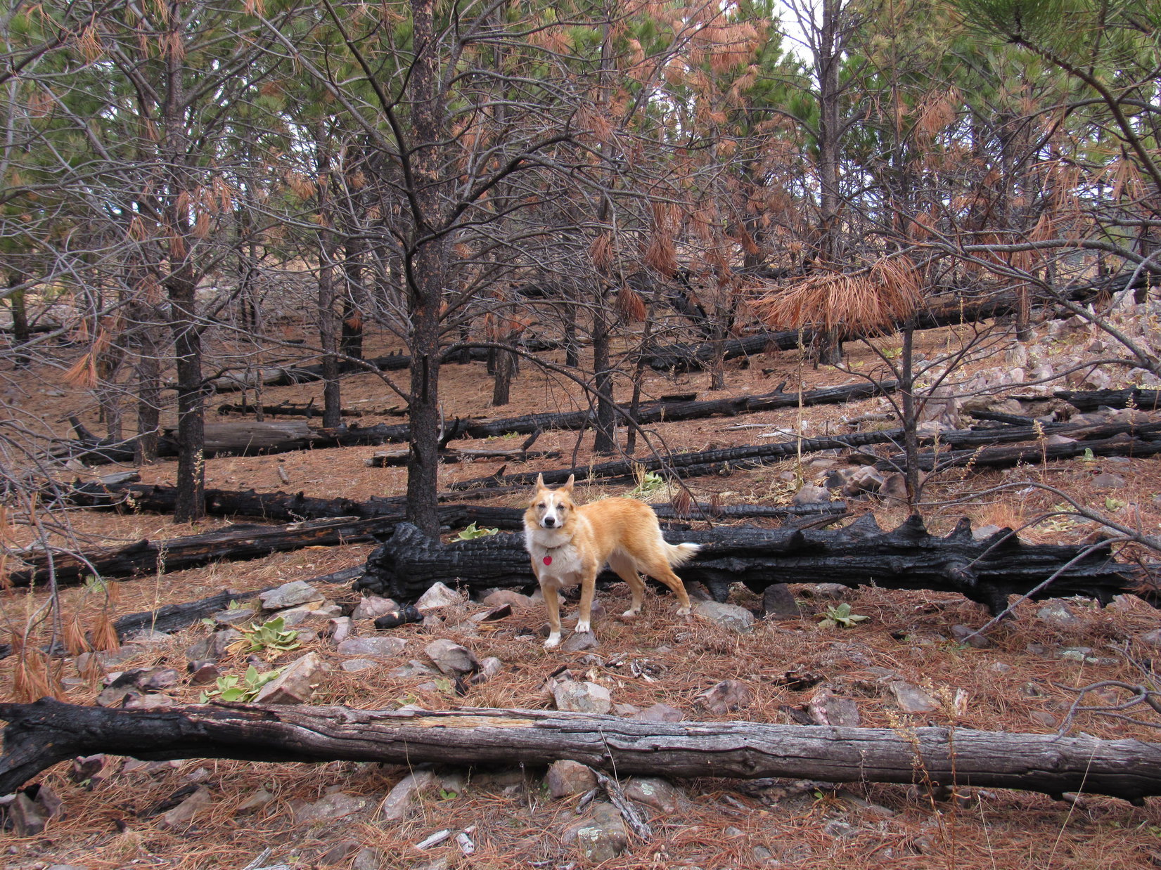
Day 3 of Lupe’s 2017 Dingo Vacation to the Wind River Range, Wyoming & Select Peaks in Montana
Lupe hadn’t seen the stars all night. In the wee hours, SPHP woke to the sound of raindrops on her “tiny house”. Not good. The rain cover had been lost years ago. If it rained hard at all, everything would get soaking wet. Lupe wanted out to sniff around in the darkness. SPHP unzipped the door and let her go.
The Carolina Dog returned before too long, content to lay down on her red sleeping bag again. SPHP folded it over her for warmth. Light rain continued intermittently for hours. A gray dawn finally heralded the new day. Everything was damp. Better get going nonetheless.

After a brief bite to eat, it was time to find out what fate had in store.
May as well leave things here while we do a quick reconnaissance, Loop. This might all be over before we even get started.
Over! Last night, you said you had a plan!
Yes, two plans actually. The first one is no doubt doomed from the start. We’ll know for certain in a few minutes. The second plan might well suffer the same fate. Maybe, though, it will leave us with some hope, at least for a while.
Oh! Doesn’t sound too good. Are we going back soon, then?
Yes, Looper, if neither plan works, we won’t have any choice. Our Wind River Peak dreams will be kaput. Come on! Let’s go down to the river, and get this over with.
The Middle Popo Agie River was only a couple minutes away from the tiny house. Surprisingly, the river had actually dropped an inch or two overnight. It wasn’t enough, not nearly enough. Plan A was a failure. Lupe would still have to traipse 80 feet or more through a shallow lake just to get to the river channel where the ford was. No way! The river was way out of its banks, and far too dangerous.
That was Plan A, SPHP? You’re kidding, right? You knew the river would still be flooding!
Of course, but yeah, hoping that the river had gone down enough to ford it was Plan A. We at least had to come and take another look, didn’t we? Thought maybe it would look more possible this morning than when I was tired last night. It doesn’t. Let’s go check out Plan B.
Plan B had better be a doozie compared to Plan A!
Lupe had spent the night camped only 0.25 mile away from the intersection of Trails No. 707 & 706 up in Tayo Park. From there, she would have had two possible routes to Wind River Peak (13,192 ft.). She could have taken No. 706 N to Deep Creek Lakes, or No. 707 W to Tayo Lake.
The original idea was to make a nice loop up via Deep Creek Lakes and down by Tayo Lake. SPHP had seen trip reports where others had done it that way. However, the Wind River Range still had tons of snow in the high country. Snow melt was flooding the Middle Popo Agie River. Loop couldn’t even get to the ford on Trail No. 707, never mind across the river.
Lupe and SPHP returned to her tiny house, then took a shortcut S to Middle Fork Trail No. 700. On the way, Lupe could see Tayo Creek on the opposite side of the valley roaring down a hillside to join forces with the Middle Popo Agie River only a little upstream of the ford. That sight was what had given SPHP hope yesterday evening. Maybe Loopster wasn’t totally thwarted yet in her efforts to get to Wind River Peak?


Lupe reached Middle Fork Trail No. 700 a little S of where she’d left it yesterday evening to take Trail No. 707 to the flooding Middle Popo Agie River. A small wooden sign along No. 700 read simply “Tayo Park”.
Hey, Loop, look at that! We’re already at Tayo Park! Lower Tayo Park, that is. The topo map only shows Tayo Park on the other side of the Middle Popo Agie River 120 feet higher than where we are now. Guess there’s an Upper and a Lower Tayo Park? At least now we can say you did make it to Lower Tayo Park, if not the upper one.
Nothing’s really changed, though? We’re no better off than we were?
Not yet, sweet Dingo! We’ll know soon if there’s any hope of improvement.
Lupe and SPHP followed Middle Fork Trail No. 700 going S toward Sweetwater Gap. The Middle Popo Agie River snaked through flooded Lower Tayo Park just W of the trail.

The S end of Lower Tayo Park was only 0.2 mile away. When Lupe got to it, SPHP led her off Trail No. 700 over to the Middle Popo Agie River.
Hey, you’re in luck Looper! It’s on! Let’s go back and get the tiny house and rest of the gear.
Plan B is going to work?
Well, at least at the start. We’ll just have to see how far we can get. No guarantees at all.
So what is Plan B exactly?
Divide and conquer.
Meaning?
Meaning we’re coming back to cross the Middle Popo Agie right here. Most of the flow at the ford comes from Tayo Creek, which is actually by far the larger of the 2 streams above their confluence in Lower Tayo Park. After crossing the Middle Popo Agie, we’ll still be on the wrong side of Tayo Creek. You will have to keep following it upstream until either there’s a way across, or some impassable obstacle blocks the way forward. The farther we can make it upstream, the more tributaries we’ll get by, the smaller Tayo Creek will be, and the better our chances of reaching the trail again somewhere.
So in the meantime, we’re going to let the waters divide, and conquer them one smaller stream at a time?
Precisely, dear Dingo!
So there won’t be a trail?
Nope, a total bushwhack for miles, probably.
Oh, I love bushwhacks, SPHP! Plan B sounds like a great adventure!
Doesn’t it, though?
What are we waiting for? Let’s run!
Lupe streaked back to Trail No. 700. Of course, SPHP was much slower, so Loop had to keep returning to bark encouragement. It wasn’t too long, though, before SPHP had retrieved the tiny house and all the gear. Once again, Lupe stood on the E bank of the Middle Popo Agie River at the S end of Lower Tayo Park.

The Middle Popo Agie River was still a good-sized, fast flowing stream, but much smaller here than farther downstream where Tayo Creek added its torrential flow. SPHP forded the river first. Loop followed close behind. The waters were still pretty deep for her, but she managed to get across without any help. Plan B was underway!
Loop headed N along the W side of Lower Tayo Park. The whole bottom of the valley was a bog or worse. Lupe climbed a little up onto drier ground along the valley’s edge. She passed over a small forested ridge and came to a field on the other side, much of which also proved to be boggy. Loop crossed the wet field, and again climbed to drier ground in the forest.
The roar of Tayo Creek could be heard ahead. Lupe continued climbing steadily through open forest toward the noise. The terrain wasn’t bad at all. Mosquitoes were, though. Those miserable blood suckers were awful again today. 0.25 mile N of where Lupe had crossed the Middle Popo Agie, she reached a rock where she could see Tayo Creek rushing down a narrow channel below a steep bank. A small island was surrounded by whitewater.

Somewhere not too far away on the other side of Tayo Creek was Trail No. 707 to Upper Tayo Park. As fully expected, Lupe had no way to cross the raging stream yet. Lupe and SPHP turned W staying in the forest and following Tayo Creek upstream.
After gaining only a little over 100 feet of elevation, the terrain began to level out. Lupe had reached the S side of Upper Tayo Park. The surface of Tayo Creek was calm here, though ripples showed the water was still moving fast. A bog full of bushes prevented the Carolina Dog from getting anywhere close to the creek, which looked deep. On the far side, the bog extended hundreds of feet beyond the stream.

The American Dingo continued WSW following Tayo Creek. Beyond Upper Tayo Park, she started gaining elevation again. Tayo Creek reverted to a whitewater torrent. Though most of the ground in the open forest was dry, Lupe and SPHP crossed many snowdrifts. Despite the mosquitoes, Loop was having a fantastic time! Squirrels were everywhere! The Carolina Dog’s incessant yipping and yapping echoed through the valley.
SPHP’s promise, recently made back at Jack Squirrel Peak (8,942 ft.) in the Laramie Range, to bring Loop to higher mountains where there would be squirrels galore was being fulfilled!

Tayo Creek was becoming even more wild as Lupe continued upstream. SPHP feared it would eventually flow right up against cliffs, or other obstacles on the S side of the valley that Lupe couldn’t get past. So far, though, it hadn’t. Instead of finding herself blocked, Lupe discovered a lovely waterfall.

Lupe came to two separate waterfalls on Tayo Creek. They weren’t far apart. The lower falls were the largest. Staying in the forest, the American Dingo had no problem continuing upstream beyond them.


Loop didn’t have to travel very far beyond the waterfalls before the valley began to open up more. The American Dingo could now see some of the high country ahead.

Loop had been making good progress. SPHP realized that the valley opening up meant the Carolina Dog was fast approaching Poison Lake. If she couldn’t get around it, Poison Lake would spell the end of Plan B’s success.
Poison Lake! You never said anything about a Poison Lake, SPHP!
Oh, don’t worry about it Loopster. I can’t imagine it’s actually poisonous.
Ridiculous humans! Then why on earth would it be called Poison Lake?
How should I know? Someone once had a poor experience, I suppose.
Well thanks so much for the heads up, SPHP! Think I’ll just keep eating snow and drinking from these smaller streams, if you don’t mind.
Suit yourself, Loop. I think you could drink gallons from Poison Lake and be none the worse for the wear, though.
Lupe went over the crest of a little saddle, and there it was. Charmingly named Poison Lake, dead ahead! Loop went right on down to the shore, but did not wet her whistle. The view was reassuring. Yeah, Loopster shouldn’t have any problem getting around the S side of the lake. That was welcome news! Poison Lake had been a potentially serious obstacle.


Lupe headed S through the forest close to the E shore of the lake. The steepest terrain was near the SE end of Poison Lake. Lupe had to climb some distance above the shoreline. She came upon a big rock platform with a great view of the lake. Loop could even see Wind River Peak from here!
The sky was finally clearing. The day was brighter, more cheerful, and pleasantly warm. The mosquitoes, which had been bad until now, were less troublesome on the big rock. Plan B was going well, much better than SPHP had feared. Time for a break to celebrate Lupe’s success in reaching this lovely spot!
Lupe and SPHP lingered on the big rock overlooking Poison Lake for close to half an hour, enjoying the views and successful execution of Plan B to this point.


When break time was over, Lupe and SPHP continued the rest of the way around the S side of Poison Lake to the W shore. Lupe then began following Tayo Creek farther upstream. SPHP had hoped Loop would find a way across the stream beyond Poison Lake, but those hopes were quickly dashed.
The whole valley was boggy anywhere near Tayo Creek. The creek was smooth surfaced again as it flowed through nearly level terrain. The stream was so wide, it was hard to tell where Poison Lake ended and Tayo Creek began.


Eventually Tayo Creek narrowed down enough so it was clear Loop was beyond Poison Lake. She finally came to a place where relatively dry ground went almost all the way to the creek’s edge. Loop and SPHP both made it onto a big white rock where it was possible to peer down into the water.
Good heavens! The water was very clear, but remarkably deep. It was easily over SPHP’s head, and perhaps twice that depth.

Since crossing Tayo Creek was still totally out of the question, Lupe pressed on. She had to stay quite a distance from the stream channel due to surrounding bogs. Looper traveled mostly in the forest or along its edge. The Carolina Dog was making progress, but even the hillsides were soaking wet now. Rivulets of snow melt ran down every ravine, and pooled in every low spot.
Often it was advantageous to travel over huge snowdrifts at the forest’s edge. Usually the drifts held even SPHP’s weight. For Lupe, they were Dingo super highways. As SPHP marched onward, Lupe dashed about the forest in a relentless search for the next squirrel to annoy, frequently enjoying success.
Nearly a mile from Poison Lake, Lupe finally reached a major obstacle. A stream much larger than any other tributaries of Tayo Creek she had come to so far cascaded down rocky rapids from the S. This had to be the stream from Mountain Sheep Lake.

Crossing the tributary from Mountain Sheep Lake was an absolute necessity. Success would be a huge step forward in the divide and conquer plan. Failure meant defeat plain and simple – Lupe would have to turn back without ever having reached Wind River Peak.
Loop had reached the tributary at a bad spot. It didn’t look safe to cross here. The search began for a better place. The American Dingo needed to find one fast. The map showed that Mountain Sheep Lake probably wasn’t any more than 0.1 mile away. If Lupe reached the lake without finding a decent ford, it was all over.
The luck of the Dingo was with her! Going upstream, Lupe soon came to a place where the rocks were smaller. The creek spread out widely and evenly without deep spots. She could do this!

Lupe had no problem fording the stream from Mountain Sheep Lake all by herself. This success was a huge boost to her chances of reaching Wind River Peak. Once across, Loop and SPHP turned NW. Tayo Lake wasn’t much more than 1.5 miles away now!
Before long, Lupe could see a signpost sticking up out of a snowbank ahead. She’d reached a trail junction! Both trails were hidden beneath the snow, but one sign pointing W was for Trail No. 705 to Coon Lake. The other sign was for Trail No. 707 to Tayo Lake!

Beyond the snowbank, Lupe found the actual trail to Tayo Lake. She quickly lost it again beneath more snow, and was almost immediately confronted with another big stream. This was the tributary of Tayo Creek coming down from Crow Lake to the W. After searching around in a bog not far from the trail intersection, Lupe found a way across this relatively large stream, too. More progress!
A steady climb NW through the forest began as Loop forged ahead looking for the trail to Tayo Lake. It took a while to find it again. Even once it was found, it was hard to keep it that way. The trail was a fairly minor single track here. It kept disappearing beneath more snow, or disguising itself as a small stream.

About 0.5 mile from the trail intersection, the terrain leveled out. Trail No. 707 hardly existed here, but cairns showed Lupe was still on the right track. She was getting close to the final big creek crossing. Fording Tayo Creek could be delayed no longer.


Trail No. 707 was nowhere in sight when Lupe reached Tayo Creek again. A cairn on the opposite N shore showed that this was the ford, though. The creek was greatly reduced from the torrent it had been miles downstream. Divide and conquer had worked! SPHP waded across.

Even though Tayo Creek was greatly reduced, the water was still over Lupe’s head by the S bank where she reached it. An icy plunge into the swift stream was still intimidating. SPHP encouraged her to come, but Looper sat forlornly on the far bank looking worried.

Poor Loopster was afraid. How many scary, icy river crossings did she have to make in a single day, anyway? SPHP decided to go help her, and turned around momentarily to drop the backpack. Even more afraid of being abandoned than she was of Tayo Creek, Loop plunged in and crossed all by herself. What a trooper!
Lupe’s climb resumed up a forested hill. Once again, the terrain soon leveled out. Up ahead, beyond a boggy plain, Loop saw a snowy saddle. That saddle was where Tayo Creek flows out of Tayo Lake. Lupe was almost there!


After crossing the bog, Lupe started climbing. She stayed NE of the snowy saddle following avalanche tracks through a stunted forest. Views behind her improved rapidly as Loop gained elevation. The view of Mt. Nystrom (12,356 ft.) was particularly impressive.


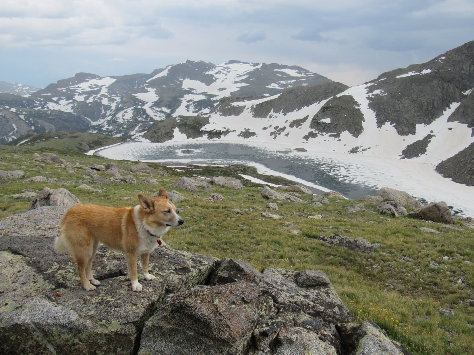
Finally, 250 feet above the boggy plain, Lupe saw her objective – Tayo Lake! Plan B – Divide & Conquer had worked! Despite what SPHP had thought were poor odds, Lupe had made it. She was really here!
Tayo Lake was absolutely gorgeous! A layer of snow and ice floated on most of its surface. Impressive rock walls guarded the S and W shores. Two miles N, and nearly 2,500 feet higher, Wind River Peak (13,192 ft.) beckoned. Tomorrow Lupe would have a chance to climb it. For the first time, her prospects for success suddenly seemed bright!


To the N & E of Tayo Lake, a long, broad ridge rose steadily toward the NW. Parts of the ridge were covered with stunted forests, but most of it was open ground. To further improve the chances of a successful ascent of Wind River Peak tomorrow, Lupe and SPHP started up the ridge.
From the broad ridge, Lupe could soon see a large waterfall plunging into a canyon to the E.


Lupe climbed more than 400 feet above Tayo Lake to a flat part of the ridge straight N of the lake. Although the afternoon had been mostly sunny, rain showers were now threatening. SPHP didn’t put up Lupe’s “tiny house” right away. Instead, Lupe and SPHP took a tour of the ridge to see the sights. An even higher mini-Tayo Lake, Lake 11,145, was in view to the W.


It was early evening and had been another long day. Lupe and SPHP were weary. Both curled up together beside a big rock where there was a grand view of Tayo Lake 400 feet below. The rock had an overhang offering partial protection from any rain showers. Drowsiness set in. Before long, Lupe and SPHP were completely out it.
The nap was helpful. When it was over, the sky was clearer. Lupe and SPHP set off to the N on top of the ridge looking for a place to pitch Lupe’s “tiny house”. A good spot was hard to find. Although it looked grassy, the ridge was actually rather rocky and dotted with boulders. Finally Lupe came to a place at around 11,250 feet elevation where the ground was lumpy, but not rocky. This would do.
SPHP put up the tiny house. Lupe had a great view of Lake 11,145 to the W from here. She could see Wind River Peak to the N. It was supposed to be more than 2,000 feet higher, but didn’t look that high. No doubt that was an illusion. Tayo Lake wasn’t in sight, but a 500 or 600 foot stroll to the S was all it took for a grand view.


What a day it had been! Lupe had tons of fun racing around the woods barking at squirrels. She had forded 4 major streams, countless small creeks, crossed numerous soggy bogs and huge snow drifts, climbed on rocks, and traveled many a mile. Divide and Conquer had worked! The Carolina Dog was now in position for an ascent of Wind River Peak tomorrow.
She’d had hardly anything to eat all day, though. Part of a Cliff bar and a single bowl of Taste of the Wild. Didn’t matter. Lupe was too tired to eat. The sun wasn’t down quite yet, but Loop was ready to go inside her “tiny house” and curl up on her sleeping bag.
Outside, clouds were gathering. A few raindrops struck the tiny house. SPHP pulled some of her sleeping bag over the exhausted Carolina Dog.
So far, so good, Loopster. You did great again today, sweet Dingo! Just hope we don’t get drenched tonight.
Lupe didn’t hear it. She was already in Dingo dreamland still barking happily at all those lovely squirrels.

Related Links:
Wind River Peak, Wyoming – Part 3: Tayo Lake to the Summit (7-11-17)
Want more Lupe adventures? Choose from Lupe’s 2017 Wind River Range in Wyoming & Select Peaks in Montana Adventure Index, Dingo Vacations Adventure Index or Master Adventure Index. Or subscribe free to new Lupe adventures.