Black Hills, SD Expedition No. 89 – Sylvan Hill, the Custer County High Point (5-17-14)

On the S side of Hwy 87/89 a little less than 0.5 mile from where the road reaches Sylvan Lake Lodge (if heading into Custer State Park toward Sylvan Lake), there is a little dirt parking area where a small power line crosses the road.  SPHP parked the G6 here at 4:58 PM (51°F).  It was already quite late in the day to start one of Lupe’s Black Hills, SD Expeditions, but her only peakbagging objective was just 0.5 mile to the W.

Lupe and SPHP took off heading W downhill through the forest, quickly arriving at a larger parking area only a few hundred feet away.  Lupe’s ascent of Sylvan Hill (7,000 ft.) (shown as Sylvan Peak on SPHP’s old USFS map) would start from here.  Very conveniently, a grassy road climbed off to the WNW from the lower parking area.  Lupe and SPHP followed it, going around a locked gate near the bottom.

The grassy road switchbacked part way up the mountain to arrive at a low sod-covered structure mostly buried into the hillside.  It would have been easy to simply step onto the sod roof from the uphill bank, but Lupe and SPHP did not get on it.

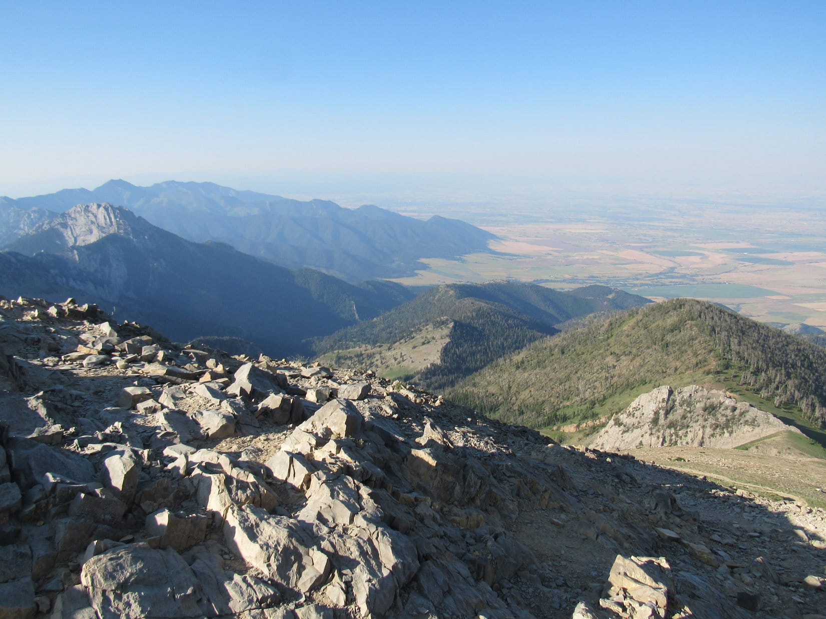
The grassy road had ultimately gone more S than W to get to this point, so although Lupe had gained some elevation, she really wasn’t much closer to Sylvan Hill, yet.  However, there were already some pretty decent views off to the SE from the sod-covered structure.   Lupe and SPHP took a few minutes to appreciate the scene.  Then it was time for Lupe to begin the real work of finding and climbing Sylvan Hill.

Lupe and SPHP started climbing WNW up a steep forested slope.  Lupe had no problems maneuvering, but as the terrain became progressively steeper, SPHP had to take some care (and a few breathers) along the way.  A big rock formation came into view up above.  Near its base, Lupe discovered a section of old roadbed laboriously made of rocks.  From the roadbed, SPHP discovered there was no practical way over or around the rock formation.

Back down Lupe and SPHP went.  Lupe really didn’t have to lose all that much elevation, but it took SPHP a while, simply because the terrain was so steep.  As soon as it was possible to go SW around the rocks, Lupe and SPHP did so.  Lupe resumed her climb heading WNW again.  The climb became less steep, and Lupe arrived at a saddle W of the big rock formation.

SPHP had originally thought the first big rock formation might actually be the summit of Sylvan Peak, but by now it was very clear that it was not.  Lupe and SPHP climbed W from the saddle toward another higher saddle.  This wasn’t nearly as steep a climb as the first one was, but it did get steeper near the top.  Lupe arrived up on the higher saddle between two smaller, but still substantial, rock formations.  They were separated by only a few hundred feet.

At the second saddle, Lupe was already higher than any of the rocks of the first big rock formation, which could be seen below to the E.  SPHP still wasn’t certain where the summit of Sylvan Hill was.  Since the rock formation at the S end of the second saddle looked like it was probably highest, Lupe went there first.

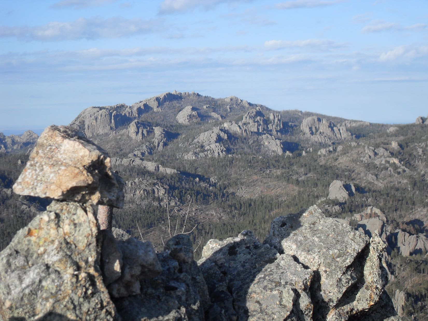
Lupe and SPHP climbed up a cleft in the rocks, arriving up on a shelf of granite very near the top of the S rock formation.  (This was likely high point 6849 on the Peakbagger.com topo map.)  From the granite shelf, Lupe could see the summit of Sylvan Hill, still 0.25 mile off to the NW.  Lupe could also see Harney Peak (7,242 ft.) to the NE.

From what may well have been High Point 6829, Lupe got her first look at the summit of Sylvan Hill (7,000 ft.) (Center) still 0.25 mile away to the NW.
From what may well have been High Point 6829, Lupe got her first look at the summit of Sylvan Hill (7,000 ft.) (Center), still 0.25 mile away to the NW.
Lupe on a granite shelf on High Point 6829(?). Harney Peak (7,242 ft.) (L of Center) is in view on the horizon. The G6 was parked back down near the section of Hwy 87/89 seen just above Lupe's head. Photo looks ENE.
Lupe on a granite shelf on High Point 6829(?). Harney Peak (7,242 ft.) (L of Center) is in view on the horizon. The G6 was parked back down near the section of Hwy 87/89 seen just above Lupe’s ear. Photo looks ENE.

Lupe and SPHP scrambled back down off the granite shelf.  Now that SPHP was certain of the direction to the summit of Sylvan Hill, there was no need for Lupe to climb the rock formation at the N end of the second saddle.  Lupe and SPHP skirted it to the SW.  From here on, the terrain was hilly, but not difficult.  The main obstacle was the huge amount of deadfall timber.  Pine bark beetles had killed much of the pine forest, which was in terrible condition.

Picking a way through the deadfall was very time consuming, but Lupe and SPHP made slow, steady progress toward Sylvan Hill.  Lupe came to one more high point on the way, climbing most of the way up it before skirting around the SW side of the highest part.  Lupe and SPHP tried to maintain elevation as much as possible, but Lupe had to lose a little before completing her ascent of Sylvan Hill (7,000 ft.).

Loop reaches the summit of Sylvan Hill. The views were fantastic, among the very best from any point in the Black Hills! Photo looks SE.

Fortunately, there was an easy way up the last little stretch to the top from the W.  When Lupe arrived at the summit, SPHP was very impressed!  Sylvan Hill offered 360° views, which had to be among the best anywhere in the Black Hills.  A great deal of the central and southern Black Hills was on display, but the most spectacular view was undoubtedly the rugged terrain leading up to Harney Peak to the NE.

Lupe on Sylvan Hill. Photo is taken from the W, the direction Lupe came up the last short climb to the top.
Harney Peak from Sylvan Hill. Little Devils Tower (6,960 ft.) is seen just L of the summit cairn. Photo looks NE.
Harney Peak from Sylvan Hill. Little Devils Tower (6,960 ft.) is also seen just L of the top rock of the summit cairn. Photo looks NE.

The summit area on Sylvan Hill wasn’t very large, but there was room to sit down comfortably enough on small grassy areas.  Since the evening was so gorgeous, and the scene so magnificent in every direction, Lupe and SPHP took a very long break.  Lupe loved the views!  She spent a lot of time surveying the Black Hills from her lofty vantage point.

Lupe squints in the slanting rays of the evening sun. Photo looks NNE.
Harney Peak with a bit of help from the telephoto lens. The summit cairn of Sylvan Hill is seen on the L. Photo looks NE.

As it always does, the faintly sad moment when it is time to leave the mountain arrived.  Although Lupe’s return trip to the G6 followed basically the same route she had taken getting to Sylvan Hill, it went faster.  SPHP did a better job of avoiding some of the worst of the deadfall timber, and Lupe did not bother returning to the granite shelf at the S end of the second (higher) saddle.

SPHP did make one mistake that took a little extra time.  SPHP failed to lead Lupe down close enough to the first big rock formation.  Lupe and SPHP wound up going down a large drainage that headed S.  SPHP soon realized Lupe was still too far W.  The drainage was not going to take Lupe back to the sod-covered structure.  Lupe had to climb back up to the NE, before she was able to go over a ridge and head more to the ESE.

The bushwhacking was done when Lupe reached the low sod-covered structure again.  From there, it was an easy trek down the switchbacks of the grassy road.  At 7:56 PM (46°F), Lupe was back at the G6.  Despite all of SPHP’s navigation errors, the blasted deadfall timber, and the long, lingering stay on top of the mountain, the trek to Sylvan Hill had taken only 3 hours.

Lupe really wasn’t tired.  For many miles on the way home, she stared eagerly out the windows of the G6, hoping to see deer to bark at.  She wasn’t disappointed, either!  Life in the Black Hills is just great, if you’re a Carolina Dog!  SPHP thinks it’s pretty great, too.Lupe on Sylvan Hill, 5-17-14

Links:

Next Black Hills Adventure                  Prior Black Hills Adventure

Black Hills, SD Expedition No. 206 – Sylvan Hill & Peak 6733 (5-27-17)

Want more Lupe adventures?  Choose from Lupe’s Black Hills Expeditions Adventure Index or Master Adventure Index.  Or subscribe free to new Lupe adventures.

Naya Nuki Peak & Sacagawea Peak, Montana with Mountaineer Jobe Wymore (7-21-17)

Day 14 of Lupe’s 2017 Dingo Vacation to the Wind River Range, Wyoming & Select Peaks in Montana

Shortly before 6:00 AM, Lupe spotted Jobe’s silver Rubicon coming up Fairy Lake Road.  Mr. Wymore was right on time, as usual.  Loop and SPHP hitched a ride with Jobe the remaining two miles to the trailhead near the Fairy Lake campground.

It was the first time the Carolina Dog had ever been in Jobe’s Rubicon.  As expected after yesterday’s adventure at Mount Powell (10,168 ft.), the Grateful Dead were playing on the stereo.

Loop next to Jobe’s silver Rubicon at the Fairy Lake campground trailhead.

Lupe caught only a glimpse of Fairy Lake before leaving the trailhead.  The trail to Sacagawea Peak (9,650 ft.) started out winding up through forest in a generally SW direction.  Loop gained elevation steadily, and was soon above most of the trees.  A red sun had just cleared mountains on the E horizon.

A red sun had just cleared mountains to the E when Lupe got above treeline not far from the start of the trail up Mount Sacagawea.

The trail was good and well-traveled.  It continued SW up into a large U-shaped valley where only scattered stands of trees grew.  The rocky slopes surrounding the valley glowed in the early morning sunlight.

Rock formations of the lower N slopes of Sacagawea Peak glow beautifully in early morning sunlight. Photo looks S.
Approaching the large U-shaped valley. Photo looks SW.
Jobe & Lupe enter the U-shaped valley. The trail to Sacagawea Peak passes through the length of this valley, ultimately switchbacking up the slope at the far end to the saddle above. Photo looks SW.

Jobe was in fine form again today, regaling SPHP with tales of peakbagging adventures, and the incredible exploits and habits of some of the mountaineers he had become acquainted with over the years.

Time flew by.  The saddle at the end of the U-shaped valley was only a mile from the trailhead as the crow flies, perhaps 1.5 miles as the trail went.  The day seemed like it had hardly even begun, when Lupe started switchbacking her way up the slope below the saddle.

Jobe pauses partway up the steep slope below the saddle to scan the terrain above. Meanwhile, Lupe roams around blending in pretty well with the mountainside. She’s visible just above Jobe’s hiking poles. Photo looks WNW.

A cool W breeze was blowing up at the saddle when Lupe, Jobe & SPHP arrived.  Trails went in several directions from here.  Sacagawea Peak was in view less than 0.5 mile to the SE.  A trail led up the mountain’s NW ridge.

From the saddle, Sacagawea Peak (L) is visible less than 0.5 mile away. Lupe poses by the trail up the NW ridge, while Jobe puts on a windbreaker. Photo looks SE.

The trail up Sacagawea Peak’s NW ridge was great.  Lupe gained elevation rapidly.  A couple hundred feet below Sacagawea’s summit she came to an unexpected intersection.  A fainter, but still easily discernible trail continued SE across the rocky upper SW slopes of a long ridge, destined for a high point at the far end.

That high point, a little less than 0.5 mile away, was Naya Nuki Peak (9,581 ft.).  Naya Nuki didn’t look hard to get to at all.  The trail to it was fairly level, neither gaining nor losing significant elevation on the way.  Jobe wondered if Lupe would like to go to Naya Nuki first before hitting Sacagawea?

Sure, why not?  It looked easy.

Temporary change of plans. Instead of climbing Sacagawea Peak, Jobe & Lupe head for Naya Nuki Peak (Center). Photo looks SE.

Getting to Naya Nuki was easy, too!  Twenty minutes later, Lupe, Jobe and SPHP were at the summit.  Again today, the air was hazy with smoke from forest fires out W.  Little could be seen toward far horizons, but views closer by of the Bridger Range were only partially impaired and still grand.

Success! Lupe reaches the summit of Naya Nuki Peak in the Bridger Range. Jobe is off by the summit cairn. Photo looks NNW.
Sacagawea Peak (L) from Naya Nuki Peak. Photo looks NNW.
Looking S along the spine of the Bridger Range. Ross Peak (9,004 ft.) is in sunshine on the R.
Lupe astride Naya Nuki Peak’s summit cairn. Sacagawea Peak is on the L. Photo looks NNW.
Yes, I made it. It was pretty easy, too!
Jobe’s turn at the S end of Naya Nuki‘s summit ridge. Ross Peak (Center) in sunshine. Photo looks S.

After 15 minutes enjoying the views up on Naya Nuki Peak, it was time to head back to tag Sacagawea Peak, which after all was still the day’s primary objective.

Jobe starts back toward Sacagawea Peak (L), while Lupe returns to urge SPHP onward. Photo looks NNW.

Half an hour after leaving Naya Nuki, everyone was at the summit of Sacagawea Peak (9,650 ft.).  Jobe and SPHP signed the summit registry.  SPHP made sure Lupe’s name was on it, too.

Lupe and Jobe at the summit of Sacagawea Peak. Photo looks NNW.
A closer look at Loop & Jobe on Sacagawea’s summit. Sacagawea Peak has 2 main peakbagging claims to fame. It has 3,930 ft. of prominence, and is the highest point in Montana’s Bridger Range. The mountain is named after Sacagawea, the Shoshone woman who served as an interpreter for the Lewis & Clark Expedition in the early 1800’s.

With 3,930 feet of prominence, the views from Sacagawea Peak were tremendous, despite being partially impaired by the hazy conditions.

Naya Nuki Peak, where Lupe, Jobe & SPHP had just come from is on the L. Ross Peak is farther away on the R. Photo looks SE.
Ross Peak (9,004 ft.) (R) from Sacagawea Peak. Photo looks SSE.
Looking S. Ross Peak on the L.
Looking down Sacagawea Peak‘s rough NE ridge. Fairy Lake is hidden from view in the valley beyond this ridge. High Point 8650 is at far L on the more distant forested ridge. Photo looks NE.

Views of the mountains to the N, formed of layers of rock uplifted to very steeply inclined positions, were particularly impressive.  Some of the exposed bands were quite colorful.  Differences in color and how the rock had eroded away produced a near vertically striped effect.

View to the NW along the spine of the Bridger Range from Sacagawea Peak.
The summit of Pomp Peak (9,562 ft.) is the rounded high point slightly L of Center just past the eroded rock bands.  When Sacagawea gave birth to a son, members of the Lewis & Clark expedition gave him the nickname “Little Pomp” or “Pompy”. The peak beyond Pomp Peak with the large snowbank on it is Hardscrabble Peak (9,575 ft.). Photo looks NW.
Pomp Peak (Center) with Hardscrabble Peak the next one beyond it slightly to the R. The saddle to Pomp Peak is seen below on the L. This is the same saddle Lupe had climbed up to on the way up from the trailhead near Fairy Lake. Photo looks NW.

Although Lupe, Jobe and SPHP remained only 15 minutes or so up on Sacagawea Peak, the Carolina Dog tried to sneak in a quick Dingo nap.  Unfortunately, the summit offered little in the way of amenities.

Loop tries to sneak in a quick Dingo nap, but Sacagawea’s summit wasn’t particularly comfortable. Naya Nuki Peak (9,581 ft.) (Center) is in the background. Photo looks SE.

Less than 3 hours had gone by since Lupe had left the trailhead when she, Jobe and SPHP left Sacagawea Peak’s summit and started down.

Jobe & Lupe in the lead on the way down. Naya Nuki Peak is on the L. Photo looks SSE.
Looking S down Dry Canyon. Ross Peak on the L.

Jobe had asked SPHP earlier if Lupe would like to climb Pomp Peak (9,562 ft.) and possibly Hardscrabble Peak (9,575 ft.)?  Jobe didn’t intend to climb either of them, but was willing to wait for Lupe at the saddle, if she and SPHP wanted to do more.  Naya Nuki and Sacagawea hadn’t taken all that long.  Since Loop had gotten off to such an early start this morning, there was still plenty of time left in the day.

SPHP had seriously considered Jobe’s generous offer, but concluded Lupe really shouldn’t accept for several reasons.  First of all, Loop and SPHP were now tagging along with Jobe on a trip he had planned.  It really wasn’t right to make him wait.  Secondly, a trail that could be seen going up Pomp Peak from the saddle appeared to vanish high up on a steep slope above cliffs.  Maybe Pomp Peak was more dangerous terrain than Loop and SPHP were used to?

Both of those considerations were important, but the third and final reason was the real clincher.  The original purpose in joining Jobe on this Dingo Vacation had been to climb as far up Crazy Peak (11,209 ft.) with him as possible.  Crazy Peak was on a ton of peakbagging lists, and one of only two peaks remaining on the EPIC list which Jobe hadn’t climbed yet.  Looper wanted to be there, at the summit if at all possible, to congratulate Jobe when he got it.

Crazy Peak was not a trivial climb, however.  The completely off-trail route Jobe intended to take up the SE ridge would be 5 or 6 miles long, involve 4,300 feet of elevation gain, and might well border on the edge of what Lupe and SPHP were capable of doing.  And the attempt on Crazy Peak was tomorrow!

So in the end, SPHP declined Jobe’s kind offer on Lupe’s behalf.  It was simply more important to be as rested as possible for Crazy Peak than to tag Pomp or Hardscrabble.  Once at the saddle, instead of continuing on to tackle Pomp Peak, the American Dingo took the trail down into the U-shaped valley leading back to the trailhead.

Jobe on the way back down to the saddle. Pomp Peak is in the background. SPHP turned down Jobe’s kind offer to wait for Lupe while she climbed Pomp Peak. It was more important to rest up for Crazy Peak tomorrow!
The U-shaped valley N of Sacagawea Peak from the saddle. Photo looks NE.

Jobe gave Lupe and SPHP another ride in his Rubicon back to the G6.  Much later in the day, he rendezvoused with the Carolina Dog again at the Big Timber picnic ground E of Crazy Peak.  Lupe spent the evening relaxing and listening in, while Jobe and SPHP chatted until dusk.  What she thought of the wide variety of fascinating tales Jobe related, she never really said.

Related Links:

To the Wildcat Hills of Nebraska with Mountaineer Jobe Wymore (4-2-16)

Mount Powell, Montana with Mountaineer Jobe Wymore (7-20-17)

Crazy Peak, Montana – On the Verge of EPIC with Mountaineer Jobe Wymore (7-22-17)

Notes:

On the way down the U-shaped valley on the way back to the trailhead, Lupe passed by a wedding party on its way up to Sacagawea Peak for the happy occasion.  Not all events on the mountain have been so cheerful.

On 8-15-15, friends and family of prolific peakbagger Edward Earl climbed Sacagawea Peak to scatter some of his ashes.  Edward had passed away on 6-19-15 trying to cross the Jago River following an unsuccessful attempt on Mount Isto (8,976 ft.) in the Brooks Range in remote NE Alaska.  Only a little over 3 years before, Edward had climbed the mountain to scatter his mother’s ashes.

Lupe has succeeded in reaching the summits of a number of peaks aided by excellent detailed directions contained in trip reports written by Edward Earl, but sadly never got to meet him.

Want more Lupe adventures?  Choose from Lupe’s 2017 Wind River Range in Wyoming & Select Peaks in Montana Adventure IndexDingo Vacations Adventure Index or Master Adventure Index.  Or subscribe free to new Lupe adventures.