Black Hills, SD Expedition No. 224 – Peak 6167 & Old Bald Peak (3-24-18)

Start – 11:52 AM, 52°F, intersection of USFS Road No. 243 & Horse Creek Road

That last stretch of Horse Creek Road had been a muddy mess, but the G6 made it through.  Lupe was at the start of USFS Road No. 243 again for the first time since … well, SPHP couldn’t remember since when.  Whenever it was, it sure seemed like a long time ago now.

Lupe finally had a nice sunny, sort of warm day for late March.  Right away, she was clearly happy with the situation.  Due at least in part to more wintry weather than normal, the Carolina Dog hadn’t been on a proper Black Hills expedition in nearly 2 months.  She was long overdue and looking forward to finally enjoying a romp in the hills.

Today’s peakbagging goal was Old Bald Peak (6,130 ft.) in the E central hills.  Lupe had been there twice before, most recently well over 2 years ago on SPHP’s birthday.  That wasn’t the most important thing about Old Bald Peak, however.

Old Bald Peak has the distinction of being Lupe’s very first peakbagging goal ever.  Way back on 1-29-12 (Expedition No. 3!) when the Carolina Dog was only 13.5 months old, Lupe and SPHP had set out to find Old Bald Peak.  Loop had started from Horse Creek Road that day, too, but from considerably farther away than where she was now.  SPHP hadn’t been able to find the mountain, so her first peakbagging attempt had been officially unsuccessful, although she’d made it to the top of several other hills that day.

Finding the mountain wouldn’t be a problem today.  Getting to Old Bald Peak from here would be cake.  As a new twist on things, Lupe would also visit nearby Peak 6167, a slightly higher hill S of Old Bald Peak on the way.  Looper had never been to Peak 6167 before.

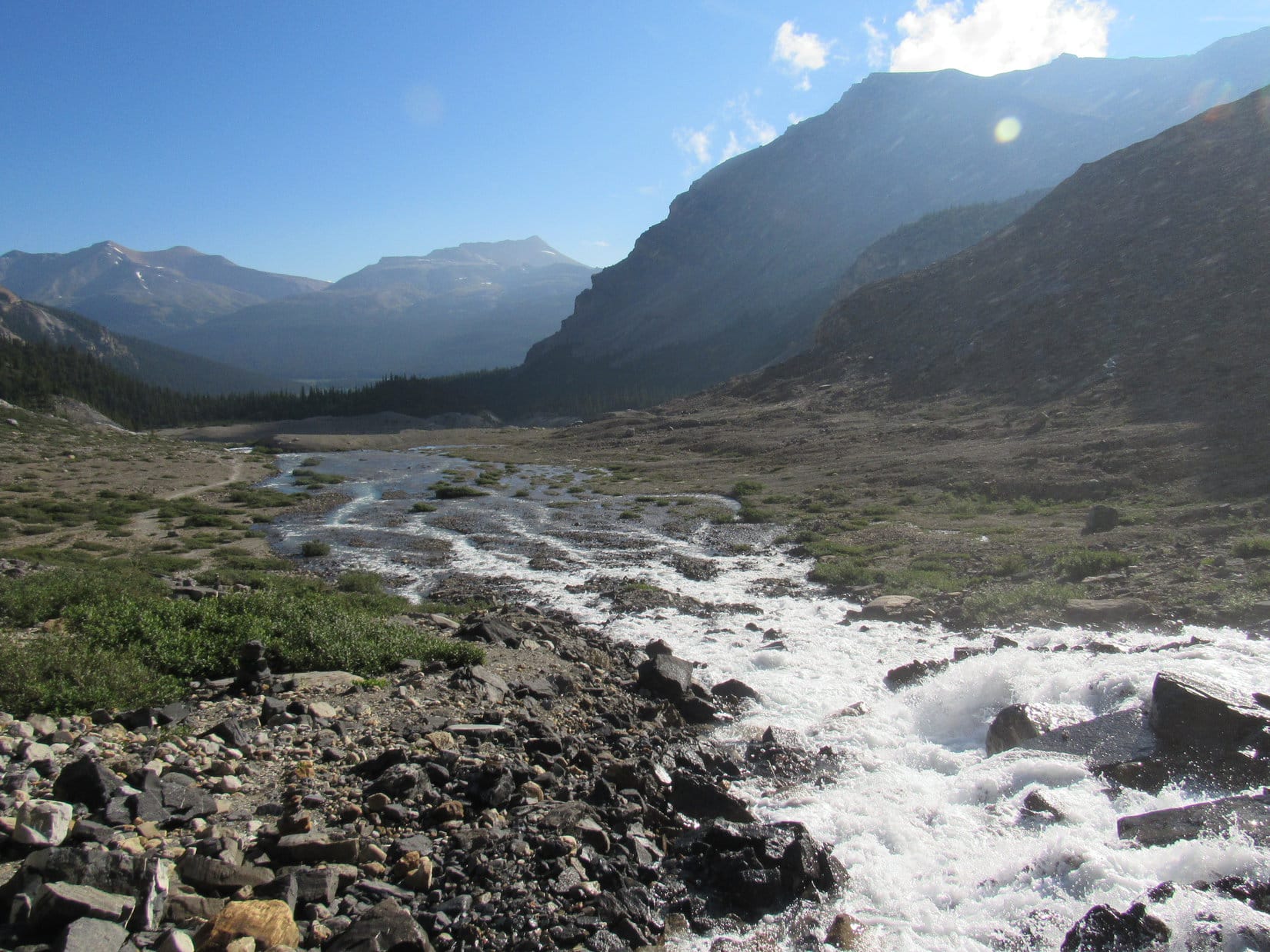
A cheerful American Dingo set out following USFS Road No. 243 going SSW up a long draw.  The road was partially covered by melting snow and ice, and partly by muddy rivulets of snow melt making the road rather mucky.

A cheerful American Dingo sets off on USFS Road No. 243 on her way to Old Bald Peak. Photo looks SW.
SPHP was surprised at how little snow was actually up in the hills. The road was snowier than anywhere else. Of course, Lupe loved the snow! Photo looks SW.

After more than 0.5 mile, the draw Lupe was going up split.  So did the road.  An unmarked side road continued SSW.  Loop stuck with No. 243, which turned WSW here.  Nothing else changed much.  The road was still snowy, and Lupe continued gaining elevation steadily.

After another 0.5 mile, Loop reached a saddle at the end of the draw.  A fence and a cattle guard were here.  On the other side of the saddle, Lupe came to a junction with USFS Road No. 249.  A second junction was only 100 feet away to the SW.  Loop and SPHP went over there.  No signage of any help, but SPHP was already certain where Lupe was.  USFS Road No. 249 continued S from here down Marshall Gulch.  USFS Road No. 530 headed W, and would soon turn NW on the way down Spruce Gulch.

Loopster didn’t need to take any road from here.  She was excited and pleased when SPHP encouraged her to leave the roads heading N into open forest.  Roaming the Black Hills National Forest off any road or trail is usually Lupe’s favorite thing to do.

After going N only a short way, Lupe turned WNW to climb a mostly forested hill.  Deadfall timber was on the slope, and attempts to avoid the deadfall as much as possible greatly influenced the choice of routes.  This hill was only a little over 200 feet higher than where Lupe had left USFS Road No. 249.  Loop soon arrived at the summit.

The top of this first hill was rather rocky.  Bushes and trees made moving around the summit more of a chore than it should have been.  Lupe did get quite a nice clear view from a large rock outcropping toward the SW.  The higher hills Loop could see off to the SW looked like they still had quite a bit of snow.

Lupe reaches the top of the first hill she climbed today. She is 0.25 mile WNW of the area where USFS Roads No. 243, 249 & 530 meet, and more than a mile SSE of Old Bald Peak. Photo looks SSW.
Loopster stands on the best viewpoint from this first hill. She could see a lot of Black Hills territory off to the S and W from here. Photo looks SW.
From another vantage point, it was possible to catch this glimpse of territory to the E. Peak 5800 is in the distance on the L. Photo looks E.

After taking a short break on this first hill, Lupe and SPHP continued on.  Peak 6167 was only 0.75 mile to the NNW from here.  Right away, Lupe had to lose 150 feet of elevation.  Losing the elevation was the hardest part of the whole journey to Peak 6167.  The ridge Loop was following was rocky, full of trees and bushes, and even some snow on this N slope.

Once she had lost the elevation, Lupe had an easier time continuing N.  She was starting to gain elevation again following a much broadened ridge compared to where she’d come down.  It wasn’t long before Looper saw something that really excited her.  A herd of 7 or 8 giant deers (elk) had heard Lupe and SPHP coming, and were running off through the forest.

Lupe dashed off to see where the giant deers were going, but they had a big head start.  She couldn’t begin to catch up with them.  Nevertheless, she came back to SPHP panting hard, but with a big smile.

With all the excitement over, Lupe and SPHP continued on and were soon in position to begin an ascent of Peak 6167’s SSE ridge.  Parts of the ridge had so much deadfall timber, Loop sometimes had to down climb a bit to get around it.  She always stayed E of the ridgeline then.  This went on until the American Dingo was practically at the top of the mountain.

The summit of Peak 6167 was unusual.  Pine trees ringed most of a 100 foot long summit ridge, which was oriented NNW/SSE.  Two rows of slate stuck up on either side of this ridge separated by a grassy lane 10 to 20 feet wide.  The row of slate to the E was nearly vertical, and featured the highest rock on the mountain, which stood 5 feet above the grass.  Most of the W row of slate jutted out of the ground at only a 30° angle.

The first chunk of slate Lupe came to was also unusual.  It was standing nearly vertical despite being part of the much more sharply angled W row.  Lupe had no trouble hopping up on top of it.  She would have been at the absolute true summit of the mountain, if not for smaller rocks 20 feet away that stuck up a foot higher along the E spine of slate.

Lupe reaches the summit of Peak 6167 for the first time ever. Photo looks NNW.
Loop balances on the highest rock big enough for her to stand on up on Peak 6167. She’s only a foot lower than the true summit here. The true summit is the highest rock seen on the R.
Well, I made it. Satisfied, SPHP? …. Yeah, Looper, that was great! You can hop on down again, if you like.
Lupe stands near the E spine of slate sticking up out of the summit of Peak 6167. The rock she had just been perched on is seen beyond her on the R. This is a good look at the grassy lane along the summit ridge. Photo looks SSE.
Looper near the highest rock (L) on Peak 6167. The top of this rock was way too small for her to stand on, but SPHP lifted the Carolina Dog up so she could put her paw on top to claim her latest peakbagging success. Photo looks SSE.

Not much could be seen from the summit.  Trees blocked the views in nearly every direction.  However, from some of the slanty pieces of slate along the W side of the grassy lane, Looper did have a fairly good view off toward the SW.

Looper stands on one of the slanty pieces of slate along the W spine of Peak 6167’s summit ridge. She has the best view from the summit area from here. Photo looks SW.
Still looks pretty snowy in the high country, doesn’t it SPHP? Photo looks SW.

After photos from the summit area, Loop and SPHP headed a little back toward the S.  Just before Lupe had reached the summit, she had come to a flat, grassy area with views in that direction.  She had been able to see Black Elk Peak (7,231 ft.), the highest mountain in South Dakota.  Black Elk Peak is always an attraction.

Lupe at the S end of Peak 6167’s summit ridge. The big rock she had first got up on here is seen on the R. Photo looks S.
You coming to see Black Elk Peak, SPHP? ….. Be right there, Looper!
There it is folks, the highest mountain in South Dakota! Black Elk Peak (7,231 ft.) is on the L. Sylvan Hill (7,000 ft.) is on the R. Photo looks S.

From this same flat, grassy area, the American Dingo could also see Boulder Hill (5,331 ft.) and a sliver of Sheridan Lake.

Boulder Hill (L) and part of Sheridan Lake (R). Photo looks SE.

Lupe had now seen about what there was to see from Peak 6167.  It was time to press on to Old Bald Peak, which was now less than 0.4 mile to the N.  An abandoned road curls up Peak 6167 from the W clear around to the E side of the mountain.  Lupe hadn’t come up this road, but she started her journey N to Old Bald Mountain along it.

The abandoned road was full of snow.  Lupe followed the snow all the way down to where the road curled W around the N side of Peak 6167.

Lupe hadn’t come up this abandoned road leading to the top of Peak 6167, but she started her journey to Old Bald Peak going down it. Photo looks NNW.

Old Bald Peak hadn’t been visible from the summit of Peak 6167 due to the forest, but Lupe got a fairly good look at it on her way down the abandoned road.

Lupe gets a good look at Old Bald Peak, her next peakbagging objective, from the snowy abandoned road. Photo looks N.

Old Bald Peak (6,130 ft.) is only 37 feet lower than Peak 6167, but Lupe would have to lose nearly 200 feet of elevation on her way over there.  Naturally, the vast majority of this elevation had to be regained.

Once Lupe left the road at the N end of Peak 6167, her route down to the saddle leading to Old Bald Peak was fairly steep.  Looper was soon down, however, and beginning her climb back to the summit of Old Bald Peak for the first time in exactly 2 years, 4 months.

Lupe makes it back to the summit of Old Bald Peak for the first time in 2 years and 4 months. This was the first time she had ever climbed the mountain from the S. Photo looks S.
This was Lupe’s 3rd successful ascent of Old Bald Peak. She seemed pensive about it. Perhaps she was remembering that very first time way back on Expedition No. 3 when SPHP hadn’t been able to find the way here on a winter day?

The big views from the summits of the hills Lupe had climbed today all seemed to be off to the SW.  Old Bald Peak was no exception.  Once again forest blocked the views in virtually all other directions.  The scene may have been a bit repetitious, but the snowy high country off to the SW was still beautiful!

Just think, SPHP! A few more weeks and all that snow will melt. We will be able to go exploring way up in the western Black Hills high country again! Photo looks SW.

Peak 6167 couldn’t be seen from the top of Old Bald Peak.  Should have taken a photo of it on the way up.  Lupe and SPHP went far enough back down Old Bald Peak’s S slope to find a spot with a halfway decent look at Peak 6167.

Hey, SPHP, there’s Black Elk Peak (R of Center) off in the distance again! Photo looks S.
Looking back at Peak 6167 from the S slopes of Old Bald Peak. The abandoned road Lupe had come down on the way over here is clearly visible. Photo looks S.

After getting the photo of Peak 6167, Loopster and SPHP returned to the summit of Old Bald Peak.  Lupe’s peakbagging for the day was complete.  5 minutes were spent in contemplation before continuing on.

The peakbagging might be over, but for Lupe the best part of the day was still ahead.  From Old Bald Peak, Loopster and SPHP wandered N through the quiet forest for a long way.  It was a fun time in parts of the forest Lupe had been to before, but not for more than 2 years.  Lupe saw many deer.  She ran sniffing and exploring in places hardly anyone ever comes to.

Lupe starts down the easy N slope of Old Bald Peak. She was anticipating a good time re-exploring parts of the forest she hadn’t been to in years. Photo looks NNW.
On the way down Old Bald Peak’s N ridge.  Custer Peak (6,804 ft.) is the bump on the horizon on the R. Photo looks NNW.

The wandering was a good time.  SPHP enjoyed it, too.  Lupe eventually made it down to USFS Road No. 249 again, well N of Old Bald Peak.  The rest of the way back to the G6 was a road trek, but a pleasant and still fondly remembered one.  Lupe followed USFS Roads No. 249, No. 677, and No. 675 to No. 244, which became Horse Creek Road.

After a long absence, it had been great to get out in the hills again!  Best of all, spring was finally here.  Maybe it was still early yet, but Lupe’s 2018 adventures would soon be heating up right along with the weather.  (4:47 PM, 46°F)

In an aspen forest N of Old Bald Peak at the onset of Spring.

Links:

Next Black Hills Expedition                    Prior Black Hills Expedition

Want more Lupe adventures?  Check out her Black Hills, SD & WY Expeditions Adventure Index, Master Adventure Index, or subscribe free to new Lupe adventures!

Bow Glacier Falls, Banff National Park, Canada (8-2-17)

Part 1 of Day 3 of Lupe’s 2017 Dingo Vacation to the Yukon & Alaska!

August, yet Banff was quiet and cool.  Low clouds hid the mountains.  Only a few people were wandering about this early in the normally bustling tourist town.  Summer had vanished.  It felt a little like fall with winter on the way.  Lupe & SPHP left Banff heading W on Trans-Canada Hwy 1.  (5:44 AM, 52°F)

Not until Lupe was well N of Lake Louise on Icefields Parkway Hwy 93 did the clouds begin to dissipate.  The sky was clear by the time she reached the picnic ground at Bow Lake.

Lupe by a small stream that flows into Bow Lake near the picnic ground along the E shore. Photo looks WNW.

After 2 days spent almost entirely on the road, Lupe needed to get out of the G6 and do something active for a while.  The Canadian Rockies are a perfect place for that!  One of the most beautiful short day hikes was right here at Bow Lake.  With the sun out now, the morning would warm up fast.  It was still early enough for Lupe to beat the hordes of tourists certain to appear before too long.

SPHP drove over to the N side of Bow Lake, parking the G6 at Simpson’s Num-Ti-Jah Lodge (7:16 AM).  The big gravel parking lot at the trailhead for Bow Glacier Falls was practically empty, but would be overflowing soon enough on a day like this.  Before hitting the trail, Lupe went down to the N shore of Bow Lake.  Wisps of fog lingered over the smooth, still waters.  Lupe could see Bow Peak (9,318 ft.) and part of the Crowfoot Glacier across the lake.

Before hitting the trail to Bow Glacier Falls, Lupe went down to the N shore of Bow Lake near Num-Ti-Jah Lodge. She could see Bow Peak (L) and part of the Crowfoot Glacier (R) beyond the far shore. Photo looks SE.

Bow Glacier Falls, Lupe’s ultimate destination, was already in view to the SW.  From a distance like this, Lupe could even see part of the Bow Glacier, an arm of the massive Wapta Icefield, above the falls.

From the shore of Bow Lake near the Num-Ti-Jah lodge, Lupe could already see Bow Glacier Falls (Center, in shadow) and Bow Glacier above it. Photo looks SW.
Bow Glacier & Bow Glacier Falls with help from the telephoto lens. Photo looks SW.

On her way to the trail, Lupe passed by Simpson’s Num-Ti-Jah lodge with its distinctive red roof.

Simpson’s Num-Ti-Jah Lodge is located along the N shore of beautiful Bow Lake, just off Icefields Parkway Hwy 93.
Loop near Num-Ti-Jah lodge with its distinctive red roof.

The first part of the trek to Bow Glacier Falls went W right along the N shore of Bow Lake.  The easy, level trail gradually turned SW.  The views were stunning from the very start.

The Bow Glacier Falls trail started out from Num-Ti-Jah lodge with this gorgeous view of Crowfoot Mountain (10,023 ft.) (R) across Bow Lake. Part of the Crowfoot Glacier is visible on the L. Photo looks SSE.
Lupe sets out on the Bow Glacier Falls trail. The easy hike to spectacular Bow Glacier Falls (R) is one of the most popular short day hikes in the Canadian Rockies.
Looking SE across Bow Lake. Bow Peak (9,318 ft.) (Center) and Crowfoot Mountain (R) are in view.
The sharp peak a bit L of Center is Saint Nicholas Peak (9,639 ft.). Mount Olive (10,256 ft.) is on the far L. Photo looks SW.
Wildflowers, Bow Lake, Saint Nicholas Peak & Mount Olive from the Bow Glacier Falls trail. Photo looks SW.
Loop a little farther along the trail with Bow Lake & Crowfoot Mountain in the background. Photo looks SSE.
Getting close to the W end of Bow Lake. Photo looks SSW.

By the time Lupe reached the W end of Bow Lake, Bow Glacier Falls had sunk out of sight behind a forested ridge.  The trail now went SSW following a swift glacier-fed stream.  The stream was braided where it flowed into Bow Lake.

Looking back toward Bow Lake from the braided stream. Cirque Peak (9,820 ft.) (L) looms high in the distance. Lupe had climbed Cirque Peak back on 7-27-14. Cirque Peak had been a great adventure, too, with an awesome view of Bow Lake and the Wapta Icefield above Bow Glacier Falls! Photo looks NE.

Following the stream was super easy.  The trail stayed close to the W bank, but never crossed the river.  In some places cairns marked the way, but they weren’t needed, since it was always obvious where the trail was headed.  Other than one short stretch where the stream forced the trail into the forest, the terrain was level the entire way to a set of stairs at the base of a forested ridge.

Lupe heads up the valley. The trail followed the W side of the gorgeous stream, never crossing it or venturing far from it. Photo looks SSW.
Looking downstream back toward Bow Lake, a slice of which is now barely visible. Photo looks NNE.
Another look downstream from only slightly farther on. Lupe had gotten an early enough start so she had the whole Bow Glacier Falls trail all to herself. She saw no one else at all the whole way to the falls. Photo looks NNE.
Looking upstream now. The trail eventually climbs over the low forested ridge ahead. In fact, it can be seen starting up the ridge a little L of Center. Photo looks SSW.
Loop getting close to the steps (Center) at the base of the forested ridge where the Bow Glacier Falls trail starts up over it. The stream flows down through a narrow gorge just to the L of the stairs. Photo looks SSW.
Lupe visits the downstream end of the narrow gorge the stream flows through on the way to Bow Lake. Photo looks SW.

The only steep section of the whole Bow Glacier Falls trail began with the stairs at the base of the forested ridge.  During this climb, which didn’t take Looper long, the stream was only occasionally in sight.  It could always be heard, though, rushing in a roaring torrent through a deep, narrow chasm nearby.

Once up on the forested ridge, Lupe had a panoramic view of what lay ahead from a bare spot along the edge of the far side.  Below her, two pale blue glacial streams joined forces to form the larger stream that disappeared immediately into the chasm.  One of these smaller streams flowed down from snowfields hidden in an intriguing, mysterious valley to the S.  The other stream came from Bow Glacier Falls, which was now in sight again at the far end of a large rocky amphitheater to the SW.

At the end of the climb up the forested ridge, Lupe reached this barren high spot with a view of what lay ahead. Two streams could be seen coming together just before plunging down into the narrow chasm. The stream at Center flows down from snowfields in the mysterious valley to the S. The other stream (R) comes from Bow Glacier Falls. Photo looks S.
From the barren spot on the forested ridge, Bow Glacier Falls was in view again at the far end of a rocky amphitheater. Photo looks SW.
Bow Glacier Falls from the bare spot on the forested ridge with help from the telephoto lens. Photo looks SW.
Another look from the same spot.
Looking from the bare spot on the forested ridge into the intriguing valley to the S with lots of help from the telephoto lens. A trail could be seen going up this valley, but SPHP didn’t see how Lupe could get over to it. Mount Olive is on the R. Photo looks S.

Continuing on, Lupe lost a little elevation as the trail descended the other side of the forested ridge into the lower end of the amphitheater below Bow Glacier Falls.  Once in the amphitheater, it was a simple matter to follow the trail up toward the base of the falls.

The Bow Glacial Falls trail became braided and ultimately disintegrated before actually reaching the falls, but the waterfall was always in sight directly ahead.  The rest of the way, Loop sniffed and explored her way among rocks and two inch deep streams that trickled everywhere.

Beyond the forested ridge, the Bow Glacier Falls trail winds its way up toward the base of the falls. Photo looks SW.
Looper on her way through the rocky amphitheater to the base of the falls. Even though the trail eventually disintegrated, Bow Glacier Falls was always in sight all the rest of the way. Photo looks SW.
Getting close!
This was Lupe’s 2nd visit to Bow Glacier Falls. She had also come here on her 2013 Dingo Vacation to the Canadian Rockies.
Bow Glacier Falls, Banff National Park, Alberta, Canada 8-2-17

An hour and twenty minutes after leaving Num-Ti-Jah lodge at Bow Lake, Lupe arrived at the base of the falls.  Not a soul was around.  Due to her early morning start, Looper hadn’t seen anyone else on the whole trail.  The coveted solitude wasn’t likely to last long.  The Bow Glacier Falls trail is so accessible, easy, and scenic from start to finish that it is one of the most popular short day hikes in the Canadian Rockies.

Due to her early morning start, Lupe arrived in time to enjoy Bow Glacier Falls all by herself. She hadn’t seen a soul on the whole trail, and no one had beat her here. Photo looks SW.

Of course, the first thing to do was to climb up next to the falls about as high as seemed reasonably safe.

Lupe next to Bow Glacier Falls. The roar of the rushing waters was tremendous!
An American Dingo poses dramatically at the base of Bow Glacier Falls.
Another look including the top of the falls.
Zoomed in on Looper.

Bow Glacier Falls was spectacular, but the views back down the valley were amazing, too!

The views back down the valley from Bow Glacier Falls were amazing! Observation Peak (L) and Cirque Peak (Center) are in the distance. Photo looks NE.

Lupe and SPHP scrambled around a bit more to get a little higher.  The terrain wasn’t that difficult, but some of the rocks were very slick with water trickling down over them.  Loopster did manage to get somewhat higher than before.  The difference in elevation was enough so the Carolina Dog could now see the W end of Bow Lake.

By scrambling around a bit, Lupe managed to get a little higher than before. She could have gone even farther, but SPHP decided this was good enough. Most of the rocks higher up were wet and slippery.
Lupe as far up as she went at Bow Glacier Falls. She climbed up here a couple of times during her nearly hour long visit. From this high up, she could see the N end of Bow Lake down the valley.
Climbing a little higher had brought the N end of Bow Lake (Center) into view. Observation Peak (L) and Cirque Peak (R) are seen in the distance. Photo looks NE.
Lupe stands on a ledge next to a precariously constructed cairn. Lupe and SPHP took a 30 minute break on this ledge.

Lupe climbed about as far up as the Carolina Dog could reasonably go.  Most of rocks above her were wet and slippery.  SPHP decided she had gone far enough.  Bow Glacier Falls flows down from an unseen upper lake located below Bow Glacier.  It would have been great fun to get up above the falls to see the upper lake and the glacier, but a solid line of cliffs ruled out any possibility of doing that.

Amid the grandeur of the Canadian Rockies, Lupe and SPHP took a 30 minute break on the dry parts of a rock ledge.  The day had warmed up nicely.  Lupe didn’t have a care in the world.  SPHP filled 3 water bottles with water from the Bow Glacier which had tumbled over the falls.  Lupe munched Taste of the Wild, and enjoyed being petted.

The glorious solitude lasted longer than SPHP expected it would, but inevitably people were seen coming up the trail.  The time had arrived to think about moving on.

Lupe perched for a final time back at the high point of her journey to Bow Glacier Falls.
All told, Lupe and SPHP enjoyed an incredible 50 minutes of solitude at Bow Glacier Falls.

After 50 minutes of glorious solitude at Bow Glacier Falls, Lupe and SPHP started down.  Lupe paused along the edge of the falls once or twice for photos, then it was time to hit the trail.  People were getting close.

Loop begins her descent.
Final moments at gorgeous Bow Glacier Falls.

A hiker in one of the first groups Lupe passed on her way down told SPHP that a side trail existed that went all the way up Mount Jimmy Simpson (9,731 ft.). The side trail left the main trail down at the forested ridge, and wasn’t hard to find. That sounded great!  SPHP was interested immediately.  Lupe should do that today, right now!

Loop on the way through the rocky amphitheater heading back down to the forested ridge. Observation Peak (10,413 ft.) (L) and Cirque Peak (R). Photo looks NE.
Mount Jimmy Simpson from near the forested ridge. A hiker had told SPHP that a side trail to the top of Mount Jimmy Simpson left the Bow Glacier Falls trail at the forested ridge, and that it would be easy to find. Lupe and SPHP spent half an hour looking for it, but managed not to find it. All the side trails seemed to dead end in the forest.

Searching for the trail up Mount Jimmy Simpson, Lupe and SPHP tried several side trails on or near the forested ridge.  None went far.  They all quickly faded away in dense forest on steep slopes.  Hmm.  The hiker had said the correct side trail was easy to find.  Easy perhaps, if one knew exactly where to look.

By now, throngs of hikers were heading up to Bow Glacier Falls.  SPHP asked some of them if they knew anything about a trail to Mount Jimmy Simpson?  No one, not even experienced professional guides leading large groups, had a clue.  Few had even heard of Mount Jimmy Simpson.  Disappointed, SPHP gave up on the idea.

Lupe remained cheerful, however.  The trek to Bow Glacier Falls had been perfect!  The scenery was stunning the entire way, and she’d had a lot of fun sniffing around and getting some exercise.  Now on on the way back, she was getting to see and do it all over again.

Loopster back at the bare spot on the forested ridge where she had a great view of the mysterious valley to the S. The lighting was better now than earlier in the day, but she still couldn’t see what was hidden around that tantalizing corner at the far end of the valley. Photo looks S.
Getting close to the stairs leading to the lower valley. Photo looks NNE.
Cirque Peak (9,820 ft.) (Center) on the way back to Bow Lake. Photo looks NE.

Before noon, Lupe was back at Num-Ti-Jah lodge.  Even with almost an hour spent relaxing near the falls, and the failed search for the side trail to Mount Jimmy Simpson, the whole trek to Bow Glacier Falls and back had taken only a little over 4 hours.

The trail to Bow Glacier Falls had been a grand time.  The American Dingo had enjoyed a wonderful needed break from the G6, and seen a favorite part of the glorious Canadian Rockies again.  She was now ready to continue the long journey N on the way to her next adventure.

Looking back at Bow Glacier Falls, now far in the distance, from Bow Lake shortly before reaching Num-Ti-Jah lodge and the G6 again.

Related Links:

Bow Lake & the Trail to Bow Glacier Falls, Banff National Park, Canada (7-25-13)

Cirque Peak, Banff National Park, Canada (7-27-14)

Want more Lupe adventures?  Choose from Lupe’s 2017 Dingo Vacation to the Yukon & Alaska Adventure IndexDingo Vacations Adventure Index or Master Adventure Index.  Or subscribe free to new Lupe adventures.