
Day 3 of Lupe’s 3rd Summer of 2020 Dingo Vacation to Wyoming & Montana!
8:05 AM, Island Lake campground off Beartooth Hwy No. 212 – Jobe Wymore was early, 55 minutes early. Even so, despite waiting an hour for a pilot car to get her through road construction, Lupe had beaten him to Island Lake. Only by 10 minutes, though. It was super seeing Jobe again for the first time since November, 2018! Great things were in the works!
Turned out Jobe had already been on an adventure. Yesterday he’d climbed Mount Wood (12,660 ft.) with another friend, an opportunity that had sort of popped up out of the blue. In a rush, Jobe had thrown everything into his Rubicon, driven straight out from Washington State, and trotted up Mount Wood. Or maybe slogged up. Mount Wood was not for the faint-hearted – more than 6,000 feet of relentless elevation gain in the rugged Beartooth Mountains.
Congratulations were in order, of course! Jobe and his friend had made it to the top. However, the upshot of it all was that Jobe had tried calling SPHP yesterday, and had left a message when he didn’t get an answer. The message, eminently reasonable, had requested a one day delay to rest up before taking on Castle Mountain (12,612 ft.) with Lupe. Early this morning, when he still hadn’t heard from SPHP, Jobe had driven all the way up from his motel in Red Lodge, keeping to the originally agreed upon schedule.
A guilt trip SPHP richly deserved! Could have checked for messages on the way through Cody yesterday, but 110% confident Jobe would be here, SPHP hadn’t bothered. Poor Jobe! All worn out already, yet committed to setting out on a multi-day backpacking adventure with Loop.
SPHP felt terrible. Well, not terrible, but guilty. Actually, it was more or less a good thing. Jobe was so much stronger and faster than SPHP that the exhausting day on Mount Wood only served to even things up a bit. Come to think of it, this was great news! Jobe wasn’t angry, actually rather cheerful and matter of fact about it, and now SPHP would stand some chance of not falling incredibly far behind. Jobe’s sad tale was just a friendly reminder that maybe in the future, ya know it might not hurt to check that pesky old flip phone once in a while.
Over at the Island Lake trailhead, Jobe and SPHP chatted during last minute preparations while Lupe sniffed about. Jobe always made SPHP laugh. He had many mountain and other tales to tell, and was always handing out free samples of this or that new product he’d tried and liked. SPHP never did anything different, so Jobe was usually able to conjure up some unimagined miracle.
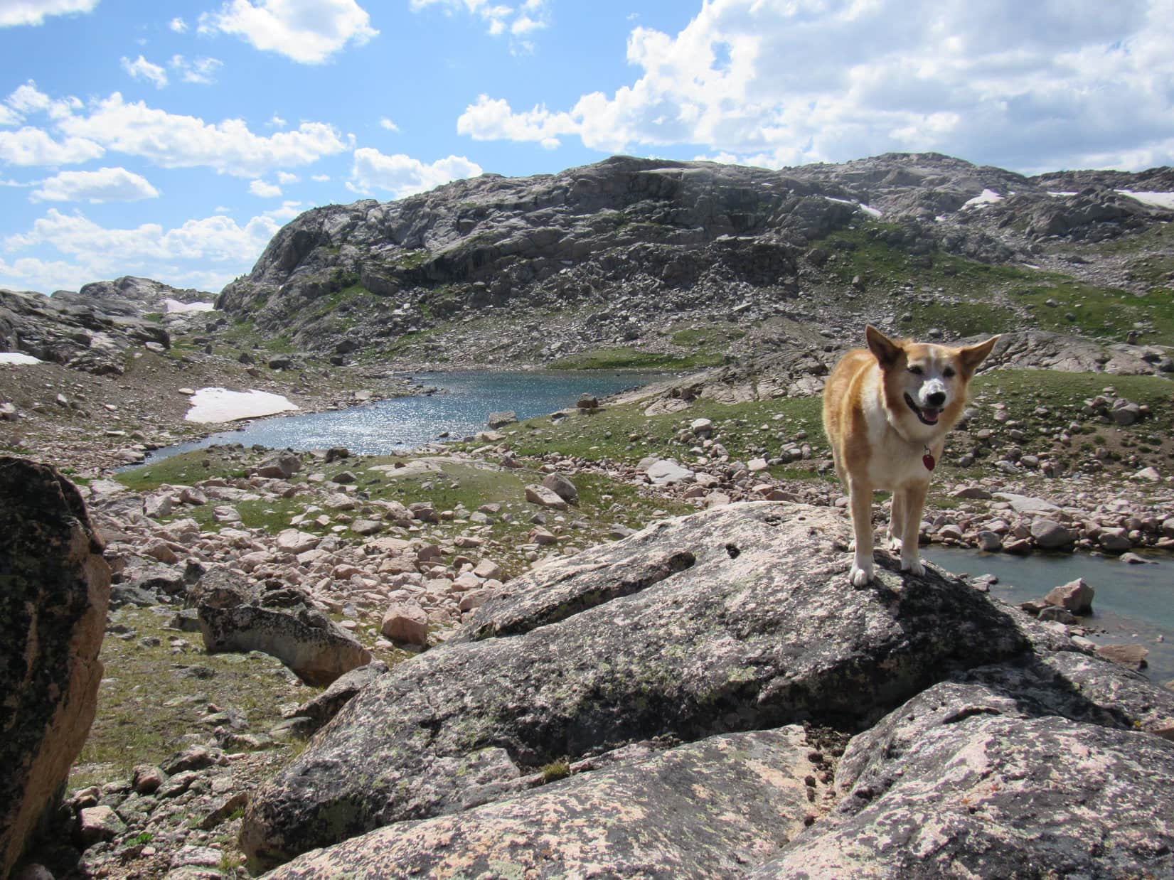
8:51 AM, Beartooth Mountains, Wyoming – It was on! Jobe Wymore and Lupe stood poised by the shore of Island Lake, ready to start for Castle Mountain. A bluebird morning with a light breeze! Optimism reigned as everyone set out on the Beartooth Highlakes Trail after rock hopping Island Lake’s outlet stream. The trail led N, sticking close to the W shore.


The trail was level or close to it. Island Lake and Night Lake were soon left behind. Jobe expounded upon interesting topics. This was familiar much-loved territory, although Lupe hadn’t been here in years. She was quite happy trotting along sniffing here and there, while listening in on the conversation.
State Line Peak (11,360 ft.), part of the enormous Beartooth Plateau ridge, was nearly always in sight. Lonesome Mountain (11,399 ft.) could often be seen off by itself to the NNW, as well. After Night Lake, the trail passed smaller lakes and crossed a little stream.
Almost before SPHP realized it, a new sign appeared pointing out the R turn to Becker Lake. The sign made things easier than they used to be. When Loop had been here years ago, this turn had been easy to miss.


The Becker Lake trail passed part of Flake Lake on the R, and a couple of ponds on the L, before descending a small hill to a stream ford between Mutt & Jeff Lakes. The water was a couple of feet deep, but stones and a tiny bushy island made it possible to rock hop the entire thing.
Next came a boulder field that had to be traversed along the NW shore of Jeff Lake, beyond which the trail crossed a soft, damp region before starting up the first significant slope of the day. Gaining nearly 200 feet of elevation, Loop came to a half-dried up tarn in a narrow pass.


From the pass, the trail headed N staying E of Becker Lake. This region was forested, and at first, since the trail was well above and back from the lake, it wasn’t even in sight. However, the forest soon began to give way to meadows with only scattered stands of conifers. Before long, the American Dingo was getting glimpses of Becker Lake.
Becker Lake was nearly a mile long. By the time Lupe was approaching the N end, the views were really opening up.


Less than 0.5 mile N of Becker Lake, Lupe entered Montana. Wyoming left behind, the trail went up a valley on the E side of a stream bound for Becker Lake from Albino Lake, which wasn’t in view yet. Wildflowers flourished here, and Lonesome Mountain (11,399 ft.), which Loop had once climbed, was looming large.

 The S end of Albino Lake was 0.6 mile N of the Montana border. When Lupe, Jobe & SPHP got there, it was necessary to cross the outlet stream. Although the stream was wide, this was no problem at all. The entire stream was full of rocks sticking up above the water. Rock hopping it was a cinch almost anywhere one chose.
Once across the stream, the trail wound over to the W side of Albino Lake, where it turned N again. For more than 0.5 mile, Lupe was in the scenic region between Lonesome Mountain to the W and Albino Lake to the E. Beyond the lake, it was only another 0.25 mile up to Pass 10340. From here, Jasper Lake was now in view.


From Pass 10340, the trail headed NW down to a valley between Jasper Lake and Golden Lake. SPHP warned Jobe about the sizable stream flowing down to Golden from Jasper.
Years ago, Lupe had gone beyond Jasper Lake twice. The stream had been so high both times that it had been impossible to rock hop. The first time, Loop and SPHP had wound up fording it near Golden Lake, both getting soaking wet paws in the process. The second time, the whole issue had been avoided by circling around the E side of Jasper Lake where the flow was divided into a number of smaller inlet streams. Worked, but this had been a somewhat tedious route.
Despite having climbed Mount Wood yesterday, Jobe sped on down the trail for a look at the Jasper Lake outlet stream situation himself. Lupe and SPHP trudged after him.
Heh, no worries! Upon reaching the stream, Jobe must have thought SPHP was nuts. Either it was running considerably lower now than when Lupe and SPHP had been here before, or someone had rearranged a bunch of rocks. A nice long string was now conveniently situated for relatively easy rock hopping all the way across. Whatever! Nothing wrong with good news, is there?


Somewhere N of the outlet stream along the W side of Jasper Lake, the trail veered off to the W destined for Arrowhead Lake and myriad other lakes beyond. Never saw exactly where that happened. Didn’t matter. Not the way Lupe and Jobe needed to go.
Castle Mountain (12,612 ft.) was still 5.5 miles NNW as the crow flies. Today’s goal was to get at least as far N as Two Bits Lake, which was only another mile plus from Jasper Lake. Jasper Lake had been a long, but relatively easy march with good trails the whole way and less than 1,000 feet of elevation gain. However, from here on there would be no trails. Ahead was a wilderness of rock.
For the time being, that was no big deal, since Lupe had already been to Two Bits Lake and even Donelson Lake before. Slower going was in the cards, but success was assured at least that far. Loop, Jobe and SPHP pressed on, heading NNW from Jasper Lake toward the last pass before Triskel Lake and Two Bits Lake.


Progress was actually decent until the Pass 10380 region was reached. Here, avoiding fields of talus as much as possible became the priority. No way to avoid it all. A lot of bouldering went on, with intermittent spurts on better ground keeping it all from getting too discouraging. Staying to the W, several unnamed tarns were bypassed.


Once over Pass 10380, the terrain eventually became easier to deal with. Triskel Lake came into view, and everyone headed down that way first. Not quite 4:00 PM yet, but maybe after lugging heavy packs for 7 straight hours this was good enough? Jobe was ready to call it, and Lupe and SPHP sure had no objections.

Where to camp became the question. Wandering N toward higher ground while scouting out the area, the region somewhat closer to Two Bits Lake than Triskel Lake seemed to be the place to be. Jobe assembled his tent before deciding on a precise location. The breeze caught it, and Jobe was running around flying that tent almost like it was a kite, while still trying to find an acceptable spot.
So funny! Jobe was hilarious! So this is how guys with vast experience do it? SPHP laughed, but Jobe did get it all under control. He ultimately picked a little grassy ledge overlooking the stream running down from Two Bits Lake to Triskel Lake for his tent kite. Barely enough room for it. Jobe better not thrash around much in his sleep, or he’d be a goner.
Dinnertime! Always on the cutting edge, Jobe had fancy freeze-dried stuff to prepare. Thai something or other. Sort of spicy. While Jobe turned wilderness chef, Loop and SPHP wandered off looking for a place to pitch her tiny house, finally settling on a soft spot near a tarn over a little hill SE of Jobe’s abode.


After dinner, Jobe came looking for Loop and SPHP. Finally spotting the tiny house, he then provided entertainment with his commentary for more than half an hour. Good times! Well before sunset, Jobe was ready to hit the hay. SPHP knew Jobe was an early riser, and he’d had two long days in the mountains in a row, although today couldn’t have begun to compare with Mount Wood.
The sun was still well up when Jobe retired to his tent kite. A gorgeous evening! Even though Lupe and SPHP were both tired, too, there was something Loopster absolutely had to do. 7 years since the last time she’d seen Two Bits Lake, and it was only a short stroll away. Better go take a look!


This first day out had gone well, but then that was to be expected. Been this far before. The only thing that had worried SPHP at all to this point was what the outlet stream from Jasper Lake might be like, and it had turned out to be cake.
SPHP had convinced Jobe to take this Lupe route to Castle Mountain. It wasn’t the usual one, and it was important that it worked. Jobe had come a long way to get Castle Mountain done. Among other incredibly challenging peak lists, Jobe had been working the Western Contiguous USA County Highpoints list for many years. 414 peaks, and he was only missing a few! Mount Wood had been one of them. Now Castle needed to fall!
Tomorrow was going to be different, a journey into the unknown. Lupe had never been beyond Donelson Lake. To even make an attempt on Castle Mountain, Jobe would have to be able to get to Flat Rock Lake. From there, others had proven a route up Castle.
Only 2 mystery miles from Donelson Lake to Flat Rock Lake. The topo map didn’t look too bad. Would the Lupe route go? No guarantees. Anything could happen, but SPHP felt confident it would.

Links:
Next Adventure Prior Adventure
The Journey to Two Bits Lake, Beartooth Mountains (7-12-13)
Sky Pilot Lake, Beartooth Mountains of Montana (7-17-13)
Want more Lupe adventures? Choose from Lupe’s Summer of 2020 Dingo Vacations to Wyoming, Utah & Montana Adventure Index, Dingo Vacations Adventure Index or Master Adventure Index. Or subscribe free to new Lupe adventures.


