5:30 AM. Daylight already. Lupe was wide awake. Soon SPHP was, too. It was August 1, 2013, Day 23 of Lupe’s 2013 Dingo Vacation to the Beartooths & Canada. This was to be Lupe’s last full day in Canada. Yesterday she had already started heading S from the Mount Robson area to begin the trip back home. Before leaving Canada, Lupe and SPHP still had a few places to go and things to see. It was good to be up early!
Shortly after 6:00 AM, SPHP was parking the G6 at the Peyto Lake parking lot near Bow Pass on the Icefields Parkway Highway No. 93. Although the Peyto Lake observation deck at the end of a short paved path is a very popular tourist destination, no one else was around this early in the day. The G6 was the only vehicle in the parking lot. It wouldn’t stay that way for very long. Lupe and SPHP took the short path to see Peyto Lake.
Peyto Lake in Banff National Park from the observation deck at Bow Pass. Mountains along the Mistaya River valley stretch out as far as the eye can see. Peyto Lake is named after Ebenezer “Wild Bill” Peyto, a legendary early hunter, trapper, prospector, guide & outfitter in the Canadian Rockies. Photo looks NW.
There used to be a lookout tower at Bow Summit. After admiring the view of Peyto Lake and the Mistaya River valley from the observation deck, Lupe and SPHP went in search of the old fire lookout service road. SPHP had brought along the following note summarizing instructions on how to get to Bow Summit from research done online:
“From the Peyto Lake overlook, take the right hand of two paved trails leading uphill. After 100 meters, there will be a 3 way junction at an interpretive sign. Continue on the middle branch angling uphill to the left of the sign (this is part of the upper nature trail). In a few minutes, the paved nature trail will continue on to the right, but continue straight on the old fire lookout service road.”
Soon Lupe was trotting happily on up the road to the old fire lookout. It was a gorgeous morning with views to match. After gaining 760 feet of elevation, Lupe and SPHP reached the end of the road at Bow Summit. There were wonderful views to the N back toward the Mistaya River valley and Waterfowl Lakes. The best views to the S toward Bow Lake and beyond were a little farther on.
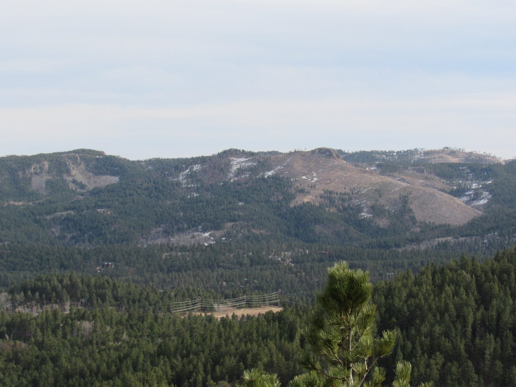
Mountains along the Mistaya River valley, Banff National Park, Alberta, Canada from Bow Summit.Looking NNW from Bow Summit at mountains along the Mistaya River valley.
The views at Bow Summit were wonderful, amazing and incredible. It was hard not to feel sad that Lupe had to leave Canada. The views weren’t the only thing that were amazing and incredible, though. Amazing and incredible swarms of not-so-wonderful mosquitoes started plaguing Lupe and SPHP within just a minute or two of arriving at Bow Summit.
Although Lupe doesn’t like strong winds, a good stiff breeze would have been welcome. As it was, Lupe and SPHP tired very quickly of serving as local blood banks. The mosquitoes had been only a minor annoyance while moving on the way up, but they were intolerable staying put in any one place. Definitely time to be moving on. Two hours after leaving the G6, Lupe and SPHP were back at the now bustling Peyto Lake parking lot.
After Bow Summit, Lupe went on one more outing in the Canadian Rockies. Near the high point on Hwy 93 heading W toward Kootenay National Park in British Columbia, there was a trailhead for Boom Lake. The trail was only 5.1 km to Boom Lake, which was perfect for the limited time Lupe had to spend.
At the trailhead parking lot, Lupe met a skinny 7 month old black lab puppy named Geeko. Lupe and Geeko played with each other in the parking lot, and each time they met along the trail.
SPHP met a Canadian biologist from Winnipeg along the way. When SPHP learned the biologist had hiked more than 2,000 km of trails in the Canadian Rockies, SPHP asked for recommendations on day hikes. The biologist recommended a trail quite near by, which goes to the Stanley Glacier. Lupe didn’t have time to check it out this trip, but SPHP hopes some day she will.
By the time Lupe and SPHP reached Boom Lake, it was raining and foggy. It looked like a beautiful spot, but Lupe would have to return under better conditions to explore further and get some photos worthy of the area. Lupe had fun, but she was a rather soggy doggie by the time she completed the trek back to the G6.
Lupe and SPHP enjoyed a wonderful drive through scenic Kootenay National Park, but made no more stops until reaching Radium Hot Springs. Lupe had to wait in the G6 at Radium Hot Springs, while SPHP went in to get cleaned up and bask in the warm mineral waters.
After so many days exploring the Canadian Rockies, Lupe was fine with spending a little time chillin’ in the G6 while it rained outside and SPHP went to the Radium Hot Springs.
SPHP returned from the Radium Hot Springs clean and refreshed. Cleanliness always boosts SPHP’s spirits, especially while traveling. It was time to get serious about making some progress getting home! Lupe was in for a good time – after all, the cows and horses in Montana alone were going to provide at least 500 miles of frenzied Dingo barking pleasure!
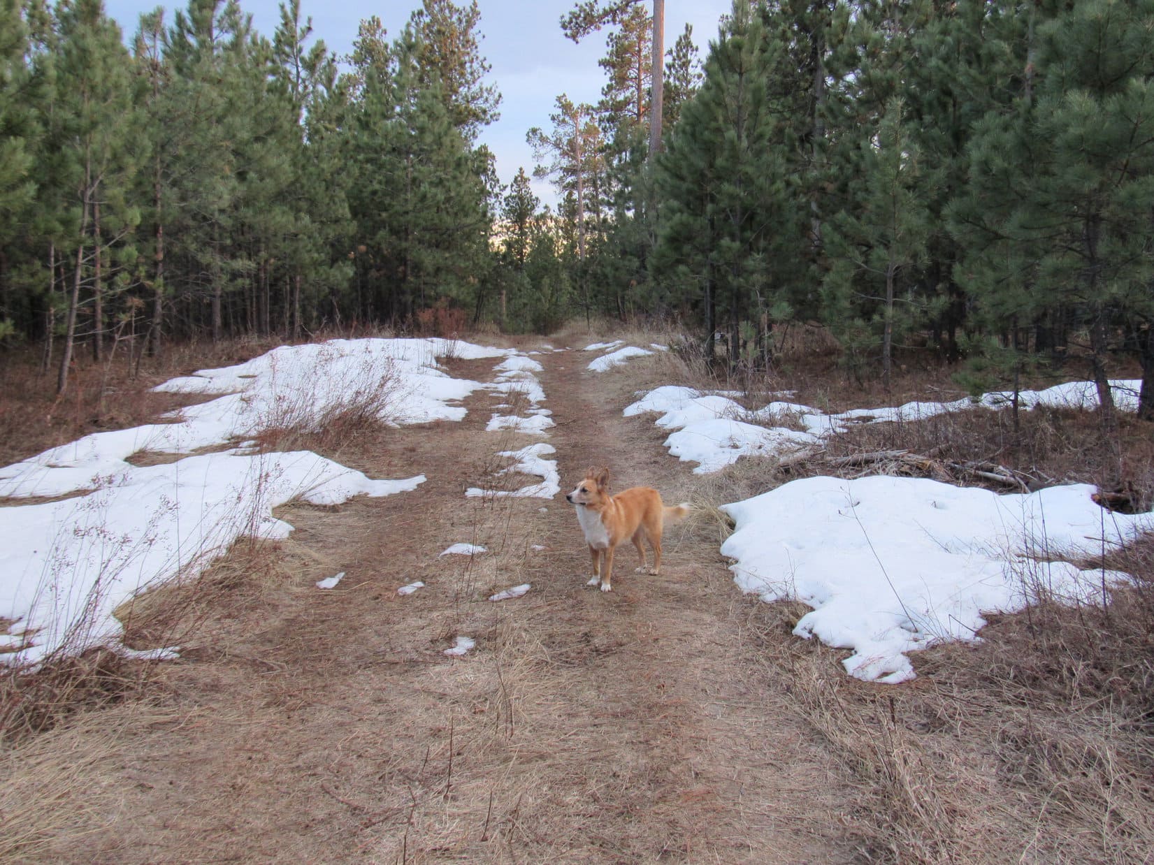
Well, it happened again, and at the exact same spot. Lupe was on her way to Mount Theodore Roosevelt, but the G6 wasn’t going to make it to the parking lot near the summit. Even though temperatures have been way above normal in the Black Hills for weeks, snow and ice covered the road ahead. The G6 would probably make it through OK, but probably wasn’t good enough. Fortunately, there was a spot next to the road where SPHP could park (8:11 AM, 55°F).
Nearly a year ago, Lupe had come to Mount Theodore Roosevelt(5,680 ft.) on Black Hills, SD Expedition No. 123. Back then, the snow was considerably deeper. A red car had been abandoned on the road, high centered and incapable of moving. Even though conditions were better now, they weren’t good enough. SPHP didn’t want to chance it. No harm in using paws and feet to go the extra 0.33 mile to the parking lot.
Lupe, freshly damp from rolling in the snow. Photo looks S from the ridge close to where the G6 was parked.High clearance vehicles would have no problem, but the G6 wasn’t really made for this.
Along the way, Lupe came to a rare Mountain Dew colored snowfield. There was even a plastic Mountain Dew bottle laying right there, left by the original artist. The green snow looked kind of strange. They say “Don’t you eat that yellow snow!” What about green snow? Green snow isn’t natural. Lupe and SPHP just let it be.
Lupe at the greenish Mountain Dew snowfield. The Mountain Dew bottle is to her left, abandoned there by the original artist.
Lupe made it to the parking lot 0.25 mile from the summit of Mount Theodore Roosevelt. A trail goes to the Friendship Tower at the top of the mountain. Two plaques telling about the Friendship Tower were at the start of the trail. The Friendship Tower was built in 1919 through the efforts of Seth Bullock to commemorate the life and death of his personal friend Theodore Roosevelt.Not far from the parking lot, the trail divides and makes a loop. Lupe and SPHP took the SW part of the loop, which features a nice view of Deer Mountain(6,652 ft.) and Terry Peak(7,064 ft.) to the SW.
Lupe along the trail.Deer Mountain (snowy peak at far L) and Terry Peak (far R) from the trail to the Friendship Tower on Mount Theodore Roosevelt.
A couple was just leaving the Friendship Tower as Lupe and SPHP approached. They stopped to chat briefly with SPHP. They commented on what a nice day it was, and then pointed at a discarded plastic water bottle on the snow. What a shame it is that people have the energy to bring stuff up here, but don’t bother to take it with them when they leave! SPHP agreed.
The couple then left empty-handed on their way back to their truck, leaving the water bottle behind. Hmmm! It wasn’t their fault the water bottle was there, of course. They weren’t the problem, but then again, they weren’t the solution, either. SPHP resolved to pick the water bottle up, if it was still there later in the day when Lupe returned. No sense carting it all over the mountains.
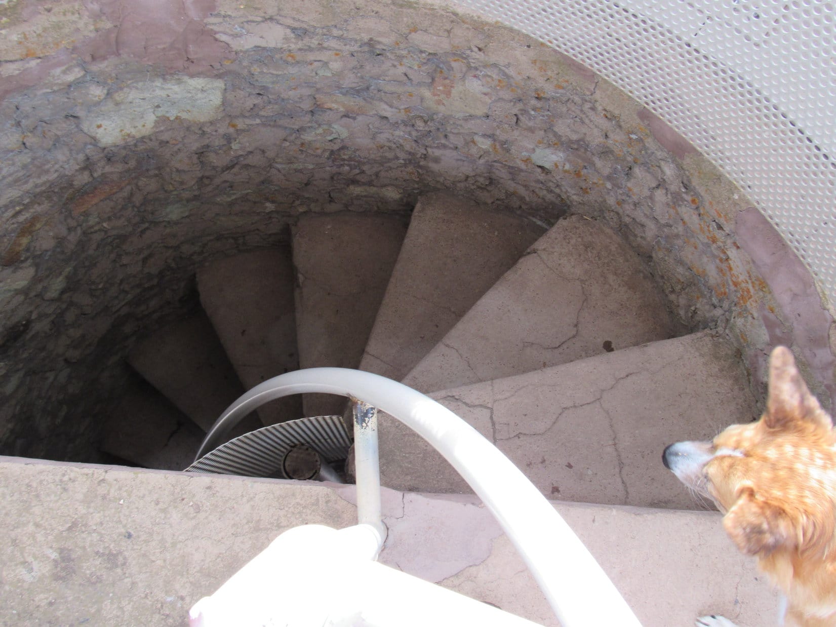
Lupe and SPHP climbed up the steep, narrow circular staircase to the top of the Friendship Tower.
About to enter the Friendship Tower.Lupe at the top. She is sitting on the grate over the stairway, where she can see without risking a fall. In the distance, Bear Butte is seen beyond Crook Mountain. Lupe had been to Crook Mountain just a week earlier on Black Hills, SD Expedition No. 160.Lupe looks back down the steep, narrow circular stairwell.Custer Peak(6,804 ft.) (L of Center) from the Friendship Tower. Photo looks S.Bear Butte(4,422 ft.) (in distance on L) and Crook Mountain(4,930 ft.) (long forested ridge at Center) from the Friendship Tower. Taken with the telephoto lens. Photo looks ENE.Spearfish Peak(5,800 ft.) (L) using the telephoto lens. Photo looks NW.
Even from the top of the Friendship Tower, the forest blocked the views in some directions, but there were great views in many others. At first, SPHP didn’t see Lupe’s next peakbagging objectives, Polo Peak(5,410 ft.) and Green Mountain(5,325 ft.). They were supposed to be practically due N and just a couple miles away, but where were they? SPHP saw nothing that looked right.
SPHP brought out the USFS map to try to figure it out, lining up known peaks with Mount Theodore Roosevelt. There they were! SPHP had been looking for Polo Peak and Green Mountain twisted around on directions by nearly 45°. SPHP had been looking NW instead of N. It still didn’t seem quite right, but the map insisted it was, and the map knew best.
Now that SPHP knew where Polo Peak and Green Mountain were, Lupe headed back down.
Leaving the Friendship Tower.
Lupe and SPHP followed a short path NW to the edge of Mount Theodore Roosevelt. The path led to a wooden viewing platform with a grand view to the NW and N. A field of boulders covered the NW side of the mountain just below the platform. Lupe needed to go N, so she circled over in that direction, but the boulder field extended over that way, too.
Lupe near the top of Mt. Roosevelt. Polo Peak is the thinly forested hill at center. Green Mountain is the heavily forested hill just beyond Polo Peak and slightly to the R. Photo looks N.
Lupe had to go down the boulder field to get to Polo Peak. The rocks were only of modest size. Even some of the larger ones were loose and tippy. It wasn’t hard going down, just a little slow. Below the boulders, Lupe came to a fairly large snow field. The snow was up to 2 feet deep in a few places, but only 1 foot deep on average.
Aspens were growing thickly at the lower end of the snow field. Below the aspens, Lupe entered a Ponderosa Pine forest. The N slopes of Mount Theodore Roosevelt are quite steep, but Lupe was able to follow a spine of the mountain that remained walkable for SPHP. Lupe was losing elevation as fast as SPHP could go. The going was steepest as Lupe neared the bottom of Polo Gulch.
Lupe on her way down the N slopes of Mount Theodore Roosevelt. She is getting closer to Polo Peak, seen in the background. Photo looks N.
Lupe found a dirt road at the base of the steep slopes down in Polo Gulch. On the other side of the road was a 15 foot embankment leading down to a level area full of aspens, a few pines, and a great many leafless bushes and brambles. Lupe and SPHP could hear running water. A brief struggle through the nearly 2 foot deep snow and thick underbrush brought Lupe to Polo Creek.
Lupe reaches Polo Creek. Melting snow had Polo Creek flowing right along at a good clip on this very warm early March day. This part of Polo Creek may well be just a seasonal stream.
Polo Creek was in the sunlight where the snow had already melted. SPHP thought Lupe might be thirsty by now, but she wasn’t. She had been busy eating snow. Lupe and SPHP crossed the stream. Lupe climbed a 40 foot embankment on the other side. It wasn’t too steep, but there was a lot of underbrush in the forest. Even after Lupe reached flatter ground above Polo Creek, SPHP had to wind around through the dense vegetation.
Before Lupe could begin her climb up Polo Peak, it looked like she might have to lose some elevation again traversing a small valley up ahead. It turned out she didn’t have to. Instead, Lupe came to another dirt road. Lupe and SPHP followed it, since the road was so much easier than going through the forest. The road headed NE gaining elevation slowly, but steadily.
Before long, Lupe came to a very steep side road that went N. A sign said this road was closed to motor vehicles to encourage re-vegetation. Lupe and SPHP followed it. The road started down in the forest, but as Lupe gained elevation, the forest thinned and finally gave way to scattered stands of pines. Lupe entered sunny meadows with big views.
Lupe reaches the meadows on the S end of Polo Peak. Terry Peak (Center) is seen in the distance. Photo looks SW.
The top of Polo Peak is rounded and grassy. As Lupe neared the end of her climb, the terrain became progressively less steep and more level. The road gradually faded away. Here and there, small rock outcroppings rose above the open ground.
Shortly before reaching the summit of Polo Peak, Lupe came to this rock outcropping. In the background are Mount Theodore Roosevelt (L), Deer Mountain (snowy peak on the far horizon R of Center), and Terry Peak (R). Photo looks SSW.Lupe reaches the summit of Polo Peak! Photo looks SSW.Looking W from the summit.
Polo Peak was sunny and warm. The brilliant sunshine made Lupe squint whenever she looked S. From the summit, Lupe and SPHP continued N. It was a very easy stroll on gently sloping terrain. Lupe was heading toward Green Mountain, her next peakbagging goal.
Spearfish Peak(5,800 ft.) (L) and Crow Peak(5,787 ft.) (R) from near the N end of Polo Peak. Photo looks NW using the telephoto lens.Lupe reaches the N end of Polo Peak. Green Mountain is seen beyond her. Photo looks N.
Green Mountain is only 0.5 mile from the N end of Polo Peak. The entire territory between the mountains is forested. Lupe went down the N slope of Polo Peak staying a bit toward the W. She crossed the saddle over to Green Mountain and started climbing again.
SPHP wasn’t certain Lupe would find any views up on Green Mountain. From the S, it looked much more heavily forested than Polo Peak had been. There was only one little opening visible among the trees near the top that had given SPHP at least a little hope that Lupe might find a view in some direction.
As Lupe neared the summit, it became clear that the top of Green Mountain was not completely hidden in a shady forest as SPHP expected. Beyond the band of trees around the S end, the summit was flat and almost completely bare. Lupe had sweeping, unobstructed 180° views to the N.
Part of the flat, bare top of Green Mountain. Although fringed with trees toward the S, most of the summit area was like this.Lookout Peak(4,478 ft.) near Spearfish, SD from Green Mountain. Photo looks NW using the telephoto lens.Elkhorn Peak(4,524 ft.) is the big barren hill at Center. Photo looks NE from Green Mountain using the telephoto lens.Bear Butte(4,422 ft.) using the telephoto lens. Photo looks ENE.Crow Peak(5,787 ft.) using the telephoto lens. Photo looks WNW.
The glorious views from the flat, barren expanse on top of Green Mountain were surprising. Green Mountain had another surprise, too. Someone had used rocks to spell out names and other words. Not all of them were still legible, but SPHP could make out the following: Dannette, Trussell, Mexico, Seiler.
Green Mountain, with its sweeping views, was a great place to take a break. Lupe wasn’t terribly hungry yet, but she was thirsty. After a big drink, she rested on the ground near SPHP, panting in the warm sun. Meanwhile, SPHP ate an apple while enjoying the incredible views extending far out onto the prairie beyond the Black Hills.
After a while, the time came for Lupe to leave. She paused for a photo at the summit before heading out.
Lupe at the very summit of Green Mountain before starting her trek back to Polo Peak and Mount Theodore Roosevelt (both seen on the L). Terry Peak is seen on the horizon on the R. Photo looks SSW.
Lupe and SPHP took essentially the same route back to Polo Peak and Mount Theodore Roosevelt. There was plenty of time, so Lupe stopped for a few photos along the way.
Although most of Green Mountain is rounded, there was a rather large craggy rock formation Lupe had to go by part way down the S slope. Lupe is seen here standing on a small portion of it. (It was easy to just go around these rocks.) Photo looks SE.After summiting Polo Peak for a 2nd time, Lupe continued S to this jagged rock formation with a view toward Mount Theodore Roosevelt. Photo looks S.Even though it was still early March, Lupe found one of the first signs of spring in the Black Hills on the sunny S side of Polo Peak. Bees were busy gathering nectar from these Pasque flowers (also called crocus). The Pasque is the state flower of South Dakota.
When Lupe got back to Mount Theodore Roosevelt, people were coming and going between the Friendship Tower and the viewing platform to the NW. At least a dozen people came and went. Lupe cooled off on the snow, while waiting for the crowds to leave.
SPHP hadn’t forgotten the discarded water bottle. It was still there, plus a rusty beer can and some other trash near a picnic table. SPHP picked it all up and put it in the backpack. SPHP ate the last apple seated at the picnic table. When everyone else had left, Lupe and SPHP returned to the top of the tower.
Lupe cools her jets on the snow near the Friendship Tower on Mount Theodore Roosevelt.Lupe in the Friendship Tower.
On the way back to the G6, Lupe and SPHP reached the greenish Mountain Dew snowfield again. SPHP had been picking up trash alongside the road and added the plastic Mountain Dew bottle to the collection.
Even though it was still early, Lupe must have figured Expedition No. 161 was over when she arrived back at the G6 (3:07 PM, 66°F), but SPHP had a surprise in store for her. She was going to climb one more mountain today, one she had seen from Green Mountain.
SPHP drove Lupe to Elkhorn Mountain. Lupe did seem surprised when SPHP parked the G6 again (3:30 PM, 76°F). At first, she wasn’t sure if she was supposed to get out, or not. When SPHP encouraged her, she jumped out ready for action.
Elkhorn Mountain looks like just a big rounded hill. SPHP hadn’t appreciated how BIG it really was. It took considerably longer to get to the top than anticipated. Between the heat and the elevation gain, Lupe and SPHP went through the rest of the water supply.
Up above the forest, Elkhorn Mountain really was beautiful in the slanting rays of the late afternoon sun. Some of the taller grass glowed an amazing orange. The 360° views were wonderful. A bit of a breeze helped counter the heat. Lupe found what appeared to be a grave shortly before reaching the summit.
Lupe came to this gravesite very close to the summit of Elkhorn Mountain. There was no sign, marker or plaque telling who might be buried here. Photo looks WSW.
Lupe and SPHP spent a bit of time at the summit of Elkhorn Mountain. It was a beautiful way to end the day, with a pleasant stroll back down to the G6 ahead. When Lupe got back to the G6 (5:10 PM, 76°F), her peakbagging exploits on Expedition No. 161 were over, but SPHP still had a task in mind.
There was still time to return to the junction of Crook Mountain Road (USFS Road No. 176) and USFS Road No. 176.1A. This was where the G6 had been parked a week ago at the start of Lupe’s Black Hills, SD Expedition No. 160 to Crook Mountain(4,930 ft.) and Whitewood Peak(5,140 ft.). The intersection had been strewn with all kinds of trash. SPHP didn’t have anything to put it all in back then, but now had 2 garbage bags in the trunk of the G6.
Lupe barked enthusiastically at many deer, cows and horses on the way to USFS Road No. 176.1A. Once there, though, she had to stay in the G6 while SPHP gathered up the trash. There was broken glass around, and SPHP couldn’t be certain it had all been found. It only took a little more than 1 overflowing garbage bag to hold all the trash SPHP could find. It was almost dark out by the time Expedition No. 161 was really, truly over, and the American Dingo was on her way home.
Lupe at the summit of Elkhorn Peak. Photo looks W.
For those possibly interested in the surprising tale of Theodore Roosevelt’s last great adventure exploring Brazil after losing the 1912 U.S. Presidential election, Lupe recommends The River of Doubt – Theodore Roosevelt’s Darkest Journey by Candice Millard.
Note: Lupe Treasures gathered for disposal or recycling on Black Hills, SD Expedition No. 161 included: 57 aluminum cans, 15 glass bottles, 3 large plastic cups, 27 plastic bottles, 17 cigarette butts, a tin of Copenhagen snuff, part of a tailpipe, beer cartons, plastic bags, broken glass and assorted miscellaneous trash.
Pathetic and disgusting! There were beer cans, bottles, boxes and other trash scattered around the forest near the intersection. SPHP had a couple extra plastic Wal-Mart bags in the backpack, but they weren’t nearly enough to tote away all this mess. That would easily require a full size garbage sack or two.
It was all going to have to wait. SPHP would save the Wal-Mart bags for what Lupe found during her explorations. If there was any room left, SPHP might gather up some of this stuff when Lupe returned at the end of the day. Lupe would be willing to curl up in the G6 for a rest then. While SPHP collected Lupe Treasures, she would need to be in the G6 so she didn’t get hurt. There was broken glass around, too.
The G6 was parked at the intersection of Crook Mountain Road (USFS Road No. 176) and No. 176.1A (9:54 AM, 55°F). Lupe had two peakbagging goals ahead of her, Crook Mountain(4,930 ft.) and Whitewood Peak(5,140 ft.). It was going to be another unseasonably warm day, close to record-setting again, in a winter that had hardly even been winter. Only early March, and already SPHP was hoping it wasn’t going to be too hot!
Lupe and SPHP took off on up No. 376.1A. There were a few patches of snow and ice, but nothing too major. Clearly, there had been much more snow not too long ago. The road was quite soft. In some places, it was just a mucky red dirt mess. No. 176.1A headed SW for a little way, then turned N.
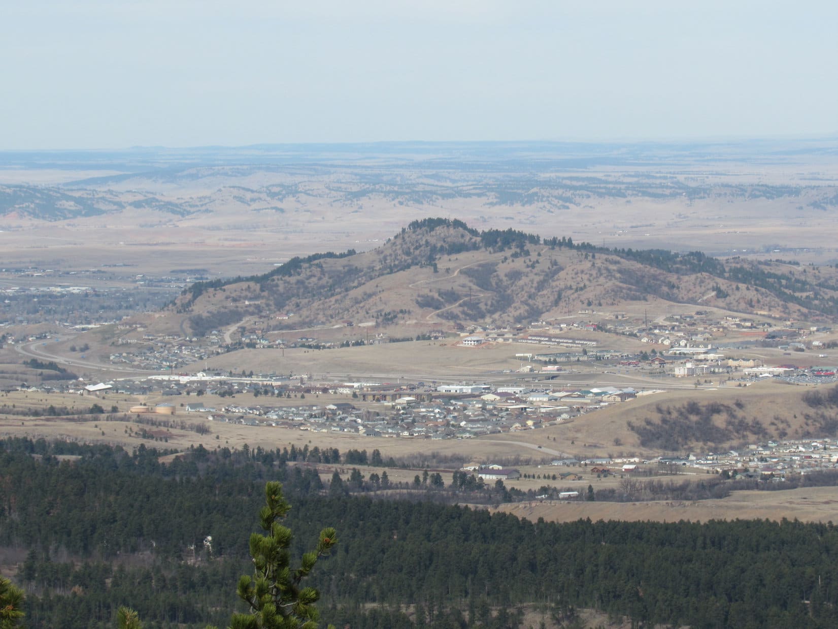
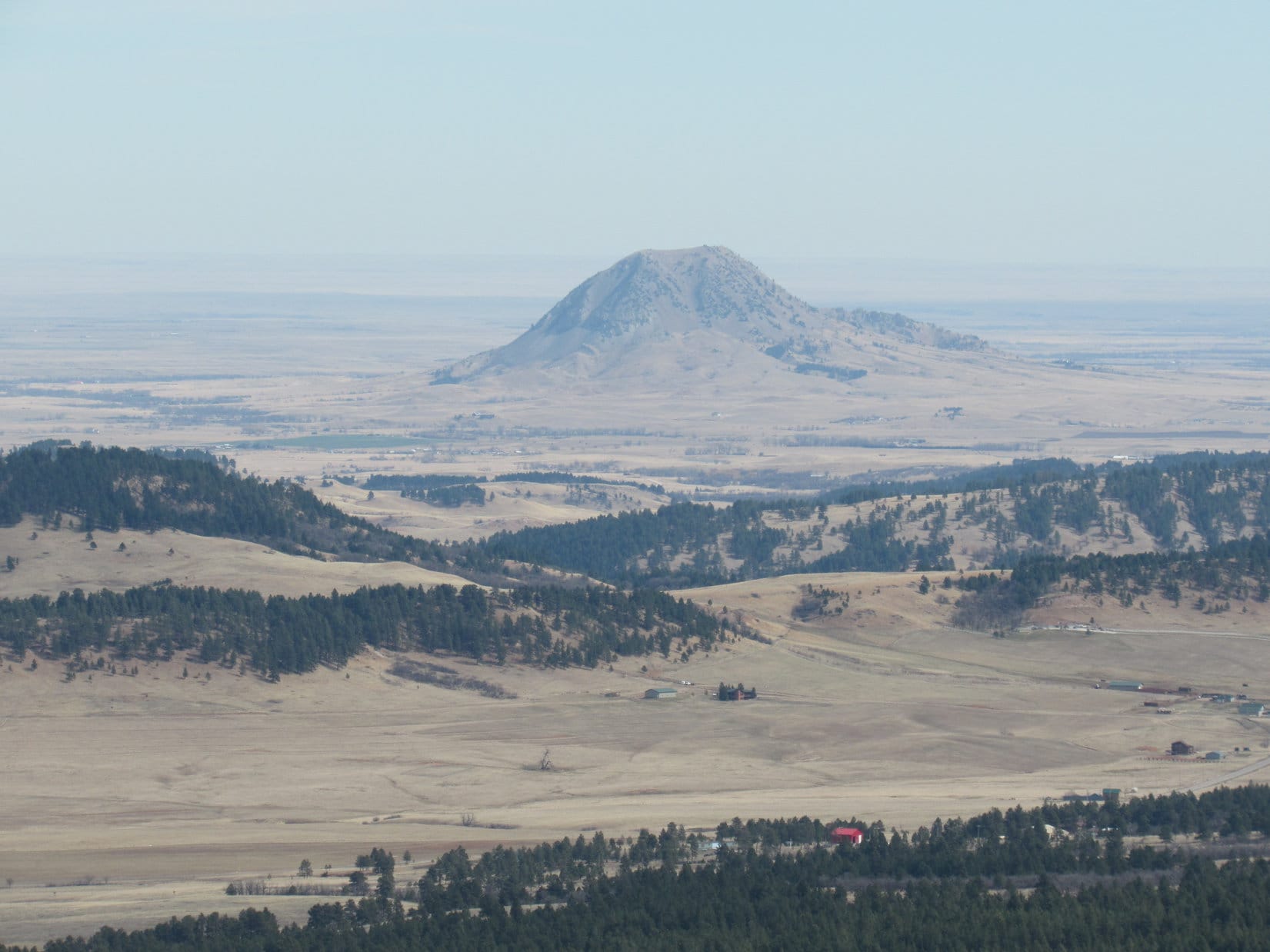
Lupe had fun romping in the forest, but other than trees, there wasn’t much to see until No. 176.1A had gained a fair amount of elevation, and was starting to level out up on the E slopes of Crook Mountain. Bear Butte(4,422 ft.) came into view rising up out on the prairie NE of Sturgis, SD.
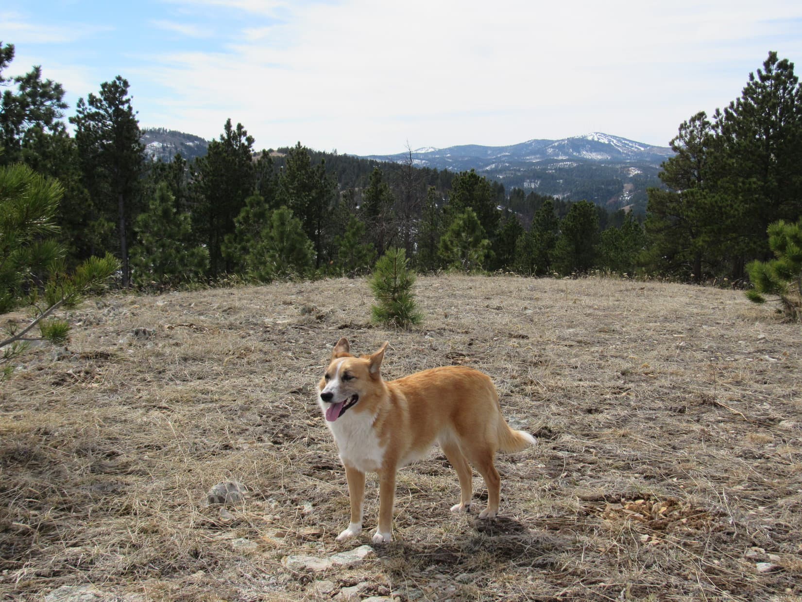
Bear Butte NE of Sturgis, SD looks like a small volcano, but according to geologists, it never actually erupted. Photo looks ENE from USFS Road No. 176.1A on the E side of Crook Mountain. Taken using the telephoto lens.On a day of record breaking heat in early March, Lupe kept cool rolling around in patches of snow still remaining in shady spots. Meanwhile, SPHP was shedding layers down to a T-shirt.Without using the telephoto lens, Bear Butte looks quite some distance away. It is about 11 or 12 miles ENE of Crook Mountain.
Lupe and SPHP followed No. 176.1A as it wound around the E and then N side of Crook Mountain. The road was fairly level much of the way, gaining elevation very slowly. There were glimpses of lower hills and the prairie off to the NE, but there were enough trees along the road so there were seldom any really open views. There was quite a bit more snow on the road on the shady N side of the mountain, much to Lupe’s delight.
Lupe loved the snowy road on the N side of Crook Mountain.
When Lupe was far enough around the N side of the mountain so that SPHP was starting to get glimpses of Crow Peak(5,787 ft.) off to the WNW, it was time to leave the road and start climbing the rest of the way up Crook Mountain.
The climb wasn’t the hard part about getting to the top of Crook Mountain. The problem was more one of finding the true summit. The mountain is pretty broad and level on top for about 0.5 mile N/S with a hook over to the E at the N end. It is also all forested, so it is hard to see very far. The topo map shows that there is a fairly large area contained within the 4,920 ft. contour toward the NW end.
Lupe’s explorations on Crook Mountain agreed with the topo map. There was a pretty big area that was all about the same elevation toward the NW. This was the highest part of the mountain, but not by much. Lupe had her choice of little bumps and hillocks to declare the true summit. No one spot looked clearly higher than all the rest. With a flat, forested top, it wasn’t surprising there weren’t any views.
Lupe astride the receding glacier at the pinnacle of Crook Mountain. Well, OK, it was just a patch of snow, but this was the top of the mountain.The best view at the summit of Crook Mountain was of Lupe herself. The Carolina Dog was looking pretty fine!
An unmarked dirt road went right over the highest part of Crook Mountain. A bit farther N, one end of it turned E, while the other end went S. Lupe and SPHP left the summit of Crook Mountain heading S along the road. The road lost elevation gradually, and eventually came to a 4-way intersection. None of the roads were marked, but Lupe’s next peakbagging goal was to the WSW, so Lupe and SPHP turned W.
As Lupe got toward the W side of Crook Mountain, there started to be bits of distant views toward the S and SW. Although the forest wasn’t as dense as it had been at the summit, there still weren’t any nice open views. Before Lupe lost too much elevation, SPHP wanted to get at least some kind of a look off to the W, hoping it would be possible to spot Whitewood Peak. At a small clearing, SPHP saw a mountain ahead that might be it.
Was that forested peak toward the L Whitewood Peak? SPHP wasn’t certain, but it seemed to be the most likely candidate from what little Lupe could see from Crook Mountain.
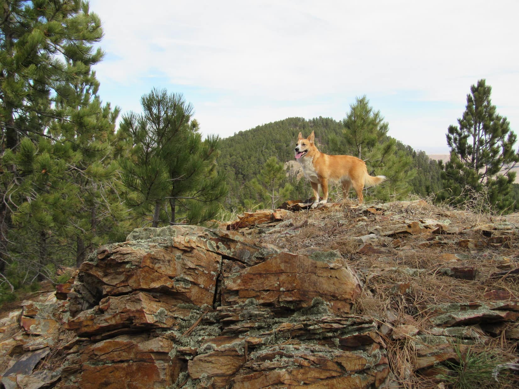
Lupe and SPHP continued SW, sometimes on roads and sometimes off them. Lupe lost quite a lot of elevation before coming to a fork in a road, where the branch going NW was marked No. 542.1F. She took the other branch, which went SW. Lupe had hardly left the fork behind, when she came to a nifty little rock outcropping suitable for an American Dingo display.
Lupe on the American Dingo display rock.
Lupe continued on. The road gradually turned W and then NW, as it went around the SW side of a big field. Going N was a problem. The farther Lupe went N, the more elevation she would have to lose to cross Sandy Creek in the valley just to the W. Lupe and SPHP doubled back a little before leaving the road to go down a steep slope to the bottom of the valley.
Sandy Creek wasn’t very big, but there was flow in it. Lupe was quite happy to come across Sandy Creek. It was the only stream she came to all day. She hopped in for a drink and cooled off in a deep little Dingo-sized pool.
Lupe cools off in Sandy Creek.Near the Dingo swimming hole on Sandy Creek.
After Lupe was all refreshed, Lupe and SPHP crossed Sandy Creek and started going W up the other side of the valley. Lupe came to a couple of roads. She followed them for only short distances, before leaving them to climb even higher directly up the slope. She eventually got high enough to reach a road that SPHP suspected was USFS Road No. 699. Lupe and SPHP followed No. 699 for quite a long way.
Eventually, Lupe came to a fork in No. 699, too. One branch went SW (L) and was marked No. 699.1D. The other branch was unmarked. It circled around a thinly forested knob a few acres in size. Since there weren’t many trees on the knob, it was possible to get a halfway decent look around. Lupe was now much closer to the mountain that SPHP thought was probably Whitewood Peak.
Lupe near USFS Road No. 699.1D. She was definitely getting closer to the mountain SPHP suspected was Whitewood Peak. Photo looks NW.
Lupe and SPHP took the little circle route around the knob just to see what could be seen, then Lupe headed SW up No. 699.1D. The road climbed steadily. An unusually colorful little rock just a few inches wide was laying on the road, and caught SPHP’s attention.
The interestingly colored rock on USFS Road No. 699.1D.
A little farther on, there was a rock outcropping that featured much larger colorful rocks. Lupe and SPHP stopped here for a little break. SPHP had a few chocolate chip cookies. Lupe took a piece of one, but she must not have been too hungry. She buried it for future use, pushing grass and dirt over it with her nose.
As SPHP looked around from the colorful rocks rest stop, there was a peak to the WSW that looked higher than the peak SPHP had thought was Whitewood Peak. Maybe this was the real Whitewood Peak? SPHP studied the topo maps some more, but was having a hard time reconciling what was in view with what the maps showed.
The way the terrain was, Lupe would reach the new Whitewood Peak candidate before she reached the original one. Maybe the situation would become clearer up there?
Lupe at the pretty rocks rest stop along USFS Road No. 699.1D. She has part of a chocolate chip cookie stashed here in case of a future emergency. The new possible Whitewood Peak candidate is seen beyond Lupe.
After the break, Lupe trotted onward continuing SW up No. 699.1D. SPHP trudged along behind her. The road was getting quite high up on the hill it was climbing and leveled off. It bent S and then curled around to the NW, ending at a little viewpoint. Lupe was now S of the mountain SPHP had originally thought was Whitewood Peak, and not too far E of the new candidate.
The original Whitewood Peak candidate from the viewpoint at the end of USFS Road No. 699.1D. Photo looks N.
The view from the end of No. 699.1D made SPHP again suspect that the original Whitewood Peak candidate was the real one. It was still hard to tell for certain, though. Lupe had to go down into a sizable ravine before climbing up the new Whitewood Peak candidate. There was a dangerous downed barbed wire fence just to the S. SPHP also saw homes nearby in the forest, and signs indicating that Lupe was just N of private property.
Lupe went directly W staying on USFS land. She lost elevation going down into the ravine, and then had to start climbing. On the other side of the ravine she found a narrow ATV trail that went very steeply up the mountain, staying just N of the dangerous barbed wire fence line. SPHP had to keep stopping to pant for more oxygen, but eventually made it to the top.
Nope, this wasn’t Whitewood Peak. It was hard to get a clear view through the forest, but SPHP could see enough to know that the original Whitewood Peak candidate was definitely higher than where Lupe was now. After a few more minutes spent studying the topo maps, things were starting to make sense. Yeah, SPHP was virtually certain the original Whitewood Peak candidate was the real deal.
Very conveniently, the narrow ATV trail continued on to the W. To stay on high ground, Lupe and SPHP needed to circle around in that direction before turning N and then NE. Lupe and SPHP pressed onward. The terrain was much more level along in here. It was really easy going, thanks to the presence of the ATV trail.
The ATV trail divided a few times, and then faded to the point where Lupe lost it for a short while. By then she wasn’t far from the mountain. Lupe entered a clearing on the ridge approaching the peak. There she found a marker right out in the open. It was a USGS benchmark! The benchmark said Whitewood Peak, and had an arrow stamped into it pointing directly toward the mountain.
There was no doubt now! Lupe was about to climb Whitewood Peak. She was almost there!
Whitewood Peak from the SSW. Getting really close.Lupe near the USGS benchmark in the clearing SSW of Whitewood Peak.No doubt now! Lupe is on her way up Whitewood Peak.
The final climb up Whitewood Peak was sort of steep, but it wasn’t too long. There were some clearings near the top providing some of the best views Lupe had seen all day. Lupe found a second USGS benchmark at the top of the mountain.
The USGS marker at the top of Whitewood Peak.
The top of Whitewood Peak was rocky, but they were all small rocks. The flattish area at the summit was only the size of a modest room in a house. In most directions the ground dropped off pretty steeply. There were clear views to the SE and S, and some pretty clear ones to the W. Whitewood Peak would have had a commanding view off to the N and NE, but the forest blocked views in those directions.
Before SPHP even bothered taking any pictures, it was time for a break – a longer one than before. This time Lupe helped SPHP eat chocolate chip cookies. She had a little Taste of the Wild. SPHP munched an apple. SPHP sat there so long without stirring that Lupe fell asleep. It was beautiful out. Only a light breeze stirred. The temperature was perfect, maybe close to 60°F, upper 50’s anyway. SPHP saw other mountains Lupe had visited, and remembered being there with her.
Well, it was a long trek back. The time at the top always seems so short compared to the time spent getting there. SPHP took a final look around. Lupe woke up and smiled for the camera.
Lupe wakes up after a Dingo nap on Whitewood Peak. Photo looks N.Crook Mountain from Whitewood Peak. Photo looks ENE.Pillar Peak(5,469 ft.) (just R of Center) and Bear Den Mountain(5,642 ft.) (R). Lupe has been to both of them. Photo looks SSE.Deer Mountain(6,652 ft.) (L) and Terry Peak(7,064 ft.) (R) are both downhill ski resorts. Photo looks SW.Mt. Theodore Roosevelt(5,680 ft.). Photo looks W.Polo Peak(5,410 ft.) (L) and Spearfish Peak(5,800 ft.) (R in distance). Photo looks W.
As far as Sandy Creek, Lupe and SPHP went back much the same way they had come up to Whitewood Peak, although now that SPHP had a better grasp of the road system, Lupe was able to stick to the roads almost all the time and avoid all the bushwhacking.
Lupe licks a little snow for moisture on the way back from Whitewood Peak.
However, upon reaching Sandy Creek, Lupe did things a bit differently. She followed a road upstream, instead of just crossing the creek and heading directly for Crook Mountain. The creek didn’t go too much farther upstream before it was reduced to a trickle. There was a spot where there were a lot of Lupe Treasures down by the little stream. SPHP picked them all up.
Oddly, SPHP found a completely intact Miller Lite Beer, in a 16 ounce can. Less than a week ago, SPHP had found a completely intact beer on Lupe’s way back from Eagle Mountain(5,254 ft.), though that one had only been an 8 ounce can. Despite all the many hundreds of Lupe Treasures gathered over the past few years, those were the only two that were intact. SPHP also found a machete saw.
The machete saw collected from the headwaters of Sandy Creek.
For a while the road went E, but it eventually turned SE. That was the wrong direction. Before returning to the G6, Lupe was going to climb Crook Mountain for a second time, just for fun. Lupe and SPHP took an old overgrown trail E and then turned NE. There didn’t seem to be any roads going N up Crook Mountain.
It seemed like a much longer, tougher climb than the first time, but Lupe eventually made it back to the summit of Crook Mountain. The sun was only minutes from setting, but there was still sunlight on some of the tree tops.
Lupe returns to the summit of Crook Mountain a second time near the end of the day.Lupe on the road at the summit of Crook Mountain. Photo looks S.
Lupe’s explorations still weren’t quite done. She followed the road at the top of Crook Mountain N. It quickly turned E, and eventually went very steeply down the E side of the mountain. It became more of a jeep trail than a road – narrow, rocky and rutted, but there were some great views of the lights of Sturgis starting to shine as twilight came on.
Eventually the jeep trail met up with No. 176.1A, the road Lupe had started out on in the morning. Before she even got that far, Lupe heard the roar of a large truck. The truck was somewhere way down below, probably not too far from the G6. It sounded like it might be stuck in the mud, or going over rough terrain. Suddenly, there was gunfire. Several volleys of 8 or 10 shots. Lupe was alarmed. There hadn’t been any gunfire all day up until now.
SPHP wondered what was going on. It was getting almost dark. People wouldn’t be likely to start target practice this time of day. Maybe it was poachers? The gunfire continued sporadically. Lupe begged SPHP to stop and hide. SPHP kept encouraging her to keep on going. She would get to the safety of the G6 before long.
The road was still a muddy, mucky mess. Maybe even worse than in the morning. SPHP tried to walk on grass at the side of the road, or on snow and ice whenever possible. The gunfire gradually slowed down to just an occasional shot or two, but each one echoed loudly through the forest. The source couldn’t be too far away. Lupe kept jumping up on SPHP with muddy paws. Don’t humans know anything? It was imperative to find a place to hide!
It was almost completely dark now. A final shot rang out. Terrified Lupe gave up on SPHP and raced ahead, bolting out of sight into the night. SPHP yelled, but she didn’t come back.
She hadn’t gone far, though. Around a bend, and there she was waiting impatiently next to the G6. She was anxious to get in. There would be no dilly dallying around sniffing the air and looking at the stars tonight! The Carolina Dog had had enough of adventures. Expedition No. 160 was done, done, done! Goodbye, Crook Mountain! Goodbye, Whitewood Peak! Time to go home (6:20 PM, 47°F).


 Lupe and SPHP followed No. 176.1A as it wound around the E and then N side of Crook Mountain. The road was fairly level much of the way, gaining elevation very slowly. There were glimpses of lower hills and the prairie off to the NE, but there were enough trees along the road so there were seldom any really open views. There was quite a bit more snow on the road on the shady N side of the mountain, much to Lupe’s delight.