Black Hills, SD Expedition No. 258 – Spearfish Peak & Little Crow Peak (11-19-20)

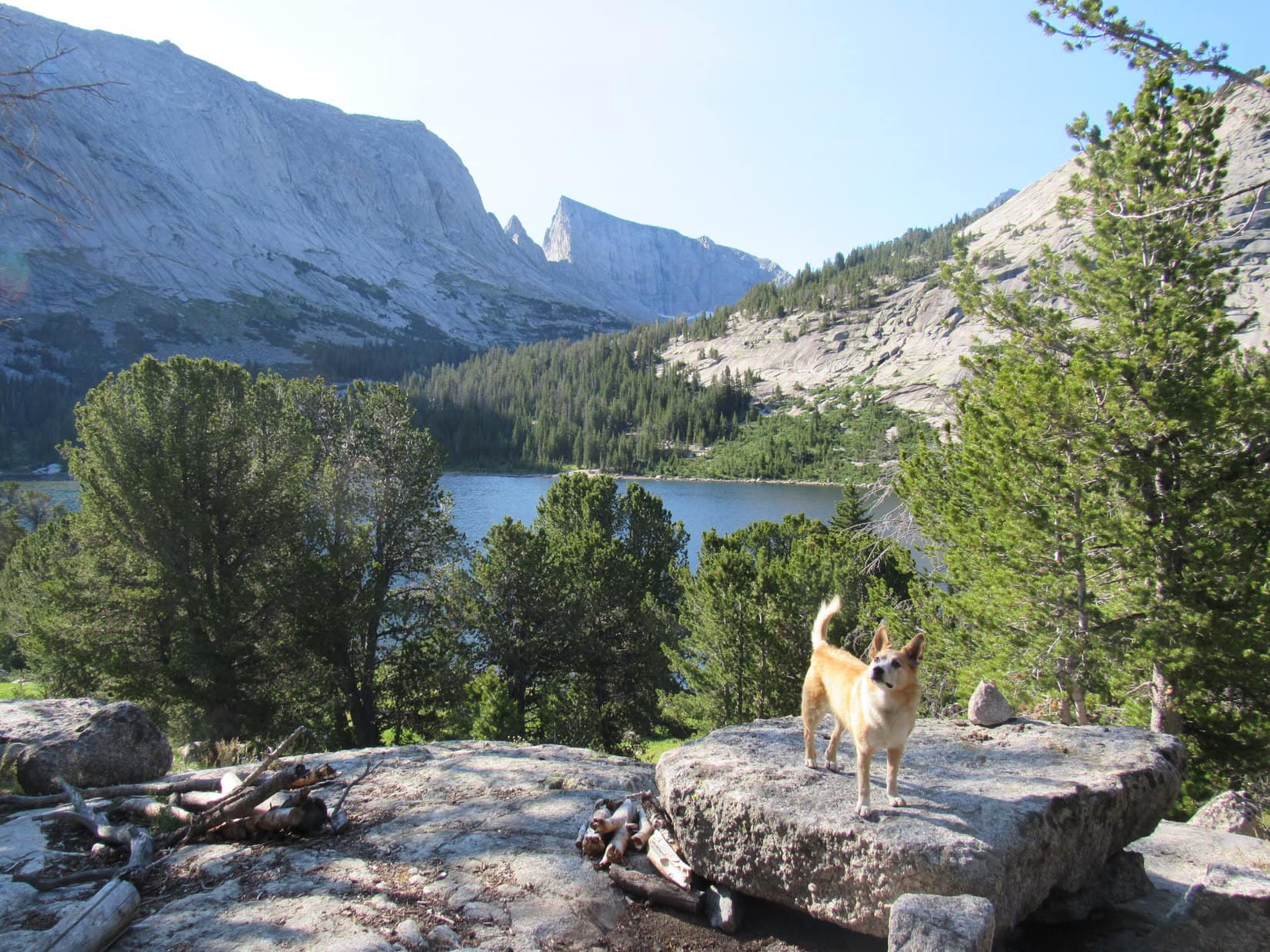
8:52 AM, 43ºF, Devil’s Bathtub (Cleopatra) trailhead in Spearfish Canyon – Sort of a late start, especially for this time of year when the days are so short, but Lupe ought to have plenty of time to get to the Devil’s Bathtub, a popular Black Hills destination accessible from Spearfish Canyon.  Last year she had been here and made it up Squaw Creek far enough to get to some beautiful pools past scenic cliffs, but it hadn’t seemed quite right.  Sure enough, a little research later on had proven that the American Dingo hadn’t gone far enough to actually reach the Devil’s Bathtub.  Now Loop was back to correct that mistake.

A 0.25 mile downstream jaunt along Spearfish Creek got Loopster to Cleopatra Place, a short road with a bridge over to some private homes and cabins on the E side of the river.  Just past the bridge, the start of the Devil’s Bathtub trail was on the R.  Certain of success this time around, Loop and SPHP started up Squaw Creek.

At the start of the Devil’s Bathtub trail.

In the narrow side canyon that Squaw Creek flows through on its way to join up with Spearfish Creek, the trail was soon criss-crossing Squaw Creek multiple times.  Expected, but what SPHP hadn’t anticipated was that there was still some snow and ice way down here along the shaded creek.  The frozen stuff had melted days ago almost everywhere else.

One of the early Squaw Creek crossings.

The first couple of crossings weren’t bad, but as Lupe continued up the valley, she kept coming to more snow and ice.  Not enough to support her weight, but enough to make everything slippery.  Even where it had all melted, the rocks were damp and slick.  Rock hopping was risky, and SPHP really didn’t want to wade through it all getting freezing wet paws.

A spur trail NE of the stream led steeply up to higher ground.  Hoping the spur might make it possible to skip some of the stream crossings, SPHP encouraged Loop to try it.  Worked, but not a great solution.  The short climb was tricky due to half-frozen mud.  Once the trail leveled out, Lupe then had to cross a skinny, damp section on a treacherously steep slope, only to promptly get forced all the way back down to creek level again.

On the level part of the spur trail.

The next stream ford was easier, but the one after it was much worse.  After successfully negotiating it only to immediately discover another one lying in wait that wasn’t any better, SPHP had had it.

Keep coming, SPHP! This one isn’t bad at all.

Hang on, Looper!

What’cha thinking, SPHP?

I’m thinking this isn’t going to work.  We already know from your trek up here last year that we still have a bunch of stream crossings to go.  Sooner or later, I’m going to wind up falling in the creek, or at least getting my paws soaking wet.  Not a thrilling prospect in November, even though you might be fine with it.

So what are you saying?  We’re done already?  We’ve hardly started!

How about a change of plans?  I say let’s skip the Devil’s Bathtub, and come back sometime when either the creek is solidly frozen over, or its just plain hot out.  That’s when everyone else comes up here, so they can use the Devil’s Bathtub as a swimming hole.

Fine with me, SPHP, but what do you want to do instead?

Little Crow Peak (5,885 ft.) isn’t far away.  Spearfish Peak (5,800 ft.) might even be within range.  We haven’t been to either one in more than 4.5 years.  Want to do that?

Sure!  Which way from here, then?

We’ll have to go back to the start if we can’t climb our way out of here.  Let’s give that a shot first.  Right on up that slope!  Onward!  Puppy, ho!

Climbing out of the Squaw Creek valley.

Loopster powered up, while SPHP thrashed around on the steep slope.  Managed to get up it, though.  Maybe 100 feet above Squaw Creek, Lupe came to an old road covered with pine needles.

We’re in luck, SPHP!  This ought to make things easier.  Which way now?

Not entirely certain, Loop.  Probably L.  The topo map doesn’t even show this road.  Say, maybe we can get to the Devil’s Bathtub after all, if we just follow it up Squaw Creek valley?  Wanna try that?

You’re a truly flexible planner, SPHP.  Devil’s Bathtub it is, again!  Head R then?

Yup.  Do it, Dingo!

Back on track for the Devil’s Bathtub! We’re going this way!

Well, shucks.  It didn’t work.  After going around a corner, chunks of the road were missing, haven fallen into the valley at one time or another.  The road became a mostly one track trail traversing some perilously steep slopes.  SPHP called another halt.

What now, SPHP?

Beginning to think this route is going to totally play out somewhere up ahead, Loop.  Probably just a big waste of time.

So, you want to go back the way we came?

Yes, but stick with this road.  Good chance it will tie in with USFS Road No. 186 before too long.  No. 186 will get us up to the Little Crow Peak region.  Same route that got us up there years ago.

Went fine for a little way, but we’re turning back again here.

Going NW back past where Lupe had originally reached this old pine needle covered road, it eventually did tie into another more substantial road.  SPHP didn’t recognize it as USFS Road No. 186, but maybe it was?  Almost had to be according to the map, although nothing looked familiar as the Carolina Dog took it higher.

At the junction with a more substantial rocky road that Loop followed higher.

Before long, Loop came to a single short switchback after which the road headed E up a narrow side canyon, climbing steadily at a pretty good clip.  This went on for perhaps 0.75 mile or more.  The terrain looked like it was about to level out a bit when Lupe reached a broken down gate in a fence line where the valley broadened out somewhat.

This gate seemed faintly familiar.  Immediately beyond it, the road branched.  Looper stayed to the L (NE), continuing up the valley.  She’d already gained a lot of elevation.  For the first time, a distant view was beginning to open up behind her.

On the way up the long non-descript valley.
At the broken gate, which seemed vaguely familiar. Photo looks E.
Starting to get a bit of a view. Photo looks WSW.

The road finally did level off.  The Carolina Dog had climbed completely out of Spearfish Canyon and its off-shoots.  This area also seemed vaguely familiar.  SPHP was fairly certain Loop had been here before.  If so, Little Crow Peak was only 0.5 mile off to the WNW.  Instead of going back to climb it, though, Lupe continued NE.

Late morning.  Sunny and crisp.  A thin layer of snow brightened the road ahead.  Felt good to be out and on the move, listening to the pines sighing in a light breeze.  Looper didn’t get much farther before coming to a landmark that SPHP recognized for sure.  At a spot where the road divided, remnants of an ancient battered bus sat quietly rusting away, just as it had been the last time Lupe had been here.

The road finally flattened out, providing a beautiful, easy trek ahead. Photo looks ENE.
By the battered bus.

The road continuing NE looked destined to go downhill.  Instead of going that way, Lupe turned due E on a rockier road that went uphill.  It wasn’t a big climb.  The road soon leveled out.  A little downhill stretch, and at the top of the next hill the American Dingo reached Carbonate Camp.

On the way to Carbonate Camp at the top of the next rise. Photo looks E.

Next to nothing left of the old ghost town.  A wooden sign nailed to a big Ponderosa pine tree said “Carbonate Camp Cemetery”.  Wooden boards marked 5 gravesites.  Although leaning, the decaying boards were still standing, but that was all that was still here.  2 of the graves were N of the road, the other 3 were S.

Noon hour.  Lupe and SPHP paused to relax for a few minutes by the 3 graves S of the road, and share a chocolate coconut bar.  With an eager Dingo in on the deal, the little bar vanished in seconds.  Loop followed that up with a Taste of the Wild chaser while SPHP munched an apple.

The new Carbonate Camp Cemetery sign. The old one that had been here 4.5 years ago had been misspelled.
1 of 5 wooden grave markers is visible just to the R of the sign. Not really much left here to desecrate. Photo looks E.
3 grave markers S of the road. About all remains of Carbonate Camp! Photo looks W.

E of Carbonate Camp, the road forked again, both branches heading downhill.  Lupe took the main road as it curled L around to the N, then NW.  Hmm.  Maybe this route actually went back to the ancient bus?  In any case, it wasn’t the right way.

Marching back up to the fork, Loop took a very rocky road NE down a steep hill.  Before she reached the bottom of a deep ravine, she came to such a badly eroded section that this road would have been impassable to virtually any vehicle, although it wasn’t a bad hiking trail.

From this first ravine, the road headed due E again, going up and down over several smaller hills.  0.5 mile E of Carbonate Camp, Lupe arrived at a frozen pond tucked away in the shadows of upper Rubicon Gulch.

Starting down into the first ravine E of Carbonate Camp. Photo looks E.
By the frozen pond in upper Rubicon Gulch. Photo looks WSW.

A number of roads intersected down here in Rubicon Gulch.  One going S led over to a gated-off area owned by a mining operation.  One went NW down Rubicon Gulch, and another continued straight E up a steep slope.

Without hesitation, the Carolina Dog took yet another road that climbed NE, then N up to the top of the next ridge.  The terrain leveled out as Lupe reached a big overhead power line.  After going under the power line, she passed a cute little cabin on the R (E).

The little cabin N of Rubicon Gulch.

Spearfish Peak (5,800 ft.) was still 2 miles N of here.  A little more than that the way the road went.  After 1:30 PM.  SPHP was now regretting the ridiculous decision not to climb Little Crow Peak first.  With sunset only a bit after 4:00 PM, if Loopster went on to Spearfish Peak it was probably going to be dark by the time she could get back to Little Crow.

Should have been evident all along!  Nothing to do about it now, though, except pick up the pace.  Might still work out.  Lupe continued N past some more private property.  Soon she was passing under the power line again, with a glimpse of Spearfish Peak in the distance.

Spearfish Peak (R) from the power line. Lupe did not go down the road seen on the R. Photo looks NNW.

From the power line, the road swung W a little way going up over a small hill in the process, then down again before turning N once more to climb a larger hill.  Meanwhile, the sky had clouded up, turning a sad gray.  The air felt colder.  Except for the dark green of the pines, and the snow white bark of leafless, shivering aspens, everything along the road was brown, tan, or beige, the somber colors of death.

Approaching Spearfish Peak (Center) on USFS Road No. 220. Photo looks N.

One of those afternoons with a late fall feel, as if the icy hand of winter was near, plotting to steal in without warning and seize the entire world in its eternal frozen grip.  An afternoon for brooding and dark thoughts.

Yet Lupe was doing fine, trotting happily along, sometimes venturing into the brush for a quick sniff before returning to the road.  She was making good progress.  Crow Peak (5,787 ft.), the big one, not the little one, came into sight off to the NW.  As Loop drew near Spearfish Peak, Bear Butte (4,422 ft.) could be seen looking small and insignificant out on the plains beyond the rest of the Black Hills.  It was still bathed in sunlight.  Clearly, winter was in no position to back up its idle threats.  At least, not yet.

Crow Peak (L of Center). Photo looks NW with help from the telephoto lens.
Getting close to Spearfish Peak. Photo looks NNW.
Bear Butte (Center). Photo looks ENE with help from the telephoto lens.

The road returned to the power line before getting to Spearfish Peak.  USFS Road No. 220 soon veered off to the R (NE) heading downhill.  Lupe stuck with the power line, and quickly came to another fork.  This time she took the L (NW) branch, a short road that ended near the trees.  An ATV trail continued up Spearfish Peak’s SE ridge, but soon gave out as well, reduced to a single track trail that wound the rest of the way up to the summit.

Lupe took the road to the L here, which leads to a trail to the summit. Photo looks NW.
On the single track trail, getting close to the top. Photo looks N.

Aspens, pines and deadfall!  The top of Spearfish Peak was sort of a mess, and didn’t provide much in the way of views.  The true summit was a big gray rock with a brass survey benchmark fastened to it a foot or two below the high point.  Just W of this rock sat a large gray box sporting a solar panel and a small, thin antenna.

True summit of Spearfish Peak. Survey benchmark visible lower R. Photo looks NW.
The “Spear” survey benchmark.
True summit and survey benchmark (R). Photo looks N.
Kind of a mess due to the deadfall, but not too bad. Lupe still on the true summit. Photo looks ENE.

Despite the fairly dense forest, a few narrowly restricted distant views existed.  Terry Peak (7,064 ft.) and Custer Peak (6,804 ft.) could both be seen off to the S, but not from any point where Lupe could get into the picture.  A glimpse of Little Crow Peak (5,885 ft.) and part of Spearfish Canyon was available from a spot a little W of the true summit.

Terry Peak (Center). Photo looks S with help from the telephoto lens.
Little Crow Peak (Center). Photo looks SW.

There was a need for speed, if Lupe still hoped to climb Little Crow Peak today.  Even so, SPHP allowed her to linger up on Spearfish Peak for nearly half an hour.  No sense in coming all this way, and not getting to savor the moment, at least to some degree.  The last chocolate coconut bar vanished along with the last apple.  The Taste of the Wild supply took a major hit, too.

Minutes came and went at breakneck speed.  Suddenly Lupe was poised again atop the true summit of Spearfish Peak (5,800 ft.).  A last photo, and Onward!  Puppy, ho!

Final moments atop Spearfish Peak. Photo looks NE.

On the way back by the same route, Bear Butte was still in sunshine as Lupe started the trek S from Spearfish Peak.  That didn’t stop winter from taking a shot.  Overhead, the sky darkened.  Several times snow granules massed for the attack, but they were tiny and didn’t have the numbers to accomplish anything.  Plunging to earth like minuscule white meteors, they melted and were gone.

Bear Butte again. Photo looks ENE with lots of help from the telephoto lens.
Little Crow Peak (R of Center) from 1.25 miles S of Spearfish Peak. Photo looks SW.

3:57 PM, 0.6 mile ESE of Little Crow Peak –  Still light out, but the sun was close to the horizon when Lupe reached a grassy road that veered off to the R (NW) 250 yards after passing the ancient bus.  This long forgotten road, which left USFS Road No. 186 before it started back down into Spearfish Canyon, wound its way WNW toward Little Crow Peak.

Without it, Loopster would never have gotten to the SE slope in time to race up as fast as SPHP could struggle through the thick underbrush of a mixed pine and aspen forest.

On the grassy road leading to Little Crow Peak (Center). Photo looks W.
Among the aspens.

The climb wasn’t a big one, maybe 200 feet of elevation gain, but when Lupe reached the first rocks at what had appeared to be the top, the view was confusing.  300 feet off to the N or NE was a clearly higher rock formation.  It seemed like Lupe had come up the S or even the SW slope, when SPHP had been pretty sure she’d been climbing from the SE.

At the first rock formation reached near the apparent summit (Center) of Little Crow Peak. Photo looks NNE?

No time to worry about an explanation for that now.  Light was fading, and the view was distressing for another reason.  SPHP remembered that Little Crow Peak had been somewhat of a mess due to deadfall when Loop had been here before, but it was really bad now.  As fast as possible, which wasn’t fast at all, Lupe and SPHP struggled through the maze toward the apparent summit.

The sun had just vanished when the Carolina Dog got there, the horizon still lit up with a lingering orange glow.

The sun is gone as Lupe reaches the second high point. Photo looks WSW.
Afterglow.

Egads!  This wasn’t the true summit either.  Another rock formation a good 10 feet higher could now be seen 300 feet farther N.  Worse yet, the deadfall between here and there was absolutely horrendous.  The light was going fast as Loop and SPHP clambered carefully over or under the obstacle course.  No going around anything, that just wasn’t possible.

This had better be the summit!  The light was fading so fast that Lupe was going to have to retreat soon.  Too many steep slopes that dropped hundreds of feet into oblivion in too many directions to risk not being able to find the way back to the grassy road.

4:36 PM, summit of Little Crow Peak –  Yup!  This was it!  Still light enough to tell that the intrepid American Dingo actually had reached the true summit of Little Crow Peak (5,885 ft.).  Lupe was now poised atop the highest rock.  The camera was very light sensitive, but it was getting so dark that photos now looked fuzzy.

Made it! At the true summit of Little Crow Peak. Photo looks W.

The true summit of Little Crow Peak, perhaps due to being reached in a frantic rush in the nick of time, seemed like a cool place.  Destroyed by pine bark beetles, the forest was completely shattered to the S and W, opening up the views.  Elsewhere, the surviving forest was still thick enough, and now dark enough, to hide whatever was out there.

Really was a shame that Lupe hadn’t climbed Little Crow Peak earlier.  5 minutes to enjoy her success, and that was it.  Gotta get out of here!

Cement Ridge (6,674 ft.) on the horizon beyond Lupe’s head. Photo looks SW with help from the telephoto lens.
Final moments atop Little Crow Peak. Photo looks SW.

Leaving the summit, Lupe found a short ramp to the S that enabled her to skip a lot of the worst of the deadfall.  However, she needed to go E to get back down to the grassy road.  Stars were appearing, the last of the light almost gone.  The sky was still somewhat light, but the forest and ground were virtually invisible.

The descent became one of confusion and constant second-guessing.  The flashlight had to come out.  Everywhere the mountain dropped away.  SPHP decided Loop was too far S, then too far N.  Nerve-wracking for a while, but at last the slope wasn’t so steep.  Must be on track.  Sure enough, the grassy road appeared ahead.

Still a couple of miles to go, but the rest would be easy.  Loopster could follow old USFS Road No. 186 all the way back down to Cleopatra Place at the start of the Devil’s Bathtub trail without having to return to Squaw Creek.  Cross the bridge over Spearfish Creek, and she’d be 0.25 mile from the trailhead and the G6.

Success assured, stars glittering in the now clearing night sky, Looper sniffed ahead, sometimes revealed by the weak beam of the flashlight, sometimes cloaked in the black void.  (End 7:00 PM, 31ºF)

Little Crow Peak, Black Hills of South Dakota 11-19-20

Links:

Next Black Hills Expedition                    Prior Black Hills Expedition

Black Hills, SD Expedition No. 171 – Little Crow Peak & Spearfish Peak (5-7-16)

Want more Lupe adventures?  Check out Lupe’s Black Hills, SD & WY Expeditions Adventure Index, Master Adventure Index, or subscribe free to new Lupe adventures!

East Temple Peak, Wind River Range, Wyoming – Part 2: Deep Lake to the Summit (7-19-20)

Days 10 & 11 of Lupe’s 2nd Summer of 2020 Dingo Vacation to Wyoming & Utah!

7-19-20, 8:52 AM – Lupe and SPHP had both sleep hard.  Feeling better, and no heavy pack today!  The Carolina Dog stood poised atop the flat rock outcropping 15 feet E of her tiny house.  2.5 miles to the SE, the sharp prow of East Temple Peak (12,600 ft.) and its catastrophic cliffs soared into the cloudless blue above and beyond Clear Lake and the massive shadowed stone wall of Haystack Mountain (11,978 ft.).

2,600 feet of elevation gain to go.

C’mon, Looper, we’re late!  Let’s hit it!  Puppy, ho!

East Temple Peak (Center), Haystack Mountain (L), and Clear Lake (foreground). Photo looks SE.

Angling ESE down a forested slope, Lupe soon picked up Little Sandy trail No. 98.  The trail went through a meadow before entering another stretch of forest still shadowed by Haystack Mountain.  Loop caught only tree-broken glimpses of the E end of Clear Lake as the trail swung S and began to climb.

The American Dingo hadn’t gotten too far S of Clear Lake, when she came to an interesting and beautiful region.  A crystal clear stream swept over large areas of exposed bedrock, and sometimes ran in secret courses beneath huge slabs of granite.  A series of small waterfalls poured into rippling pools where every rock on the bottom stood out, magnified in watery relief.

Wow! Doesn’t this look spiffy! Photo looks S.
Bunion Mountain (11,905 ft.) (L), War Bonnet Peak (12,369 ft.) (Center), and Haystack Mountain (R). Photo looks NW back toward Clear Lake.

The amazing region went on and on!  No sign of any official trail here, but so what?  That didn’t matter in the least.  Traveling S up the bedrock, sometimes on this side of the splendid stream, and sometimes on the other, was fun and incredibly scenic.  Wherever enough soil existed to support them, Looper did have to manuever around or through clumps of bushes and stands of trees, but these obstacles only slowed progress temporarily.

Following the stream higher. Haystack Mountain (L). Photo looks SE.

The summit of Temple Peak (12,972 ft.) appeared ahead.  15 minutes later, Lupe was thrilled when she looked back and saw the familiar enormous stretched-gumdrop cone of iconic Pingora Peak (11,884 ft.), and jagged knife-edge ridge of Wolf’s Head (12,160 ft.), both part of the Wind River range’s famous Cirque of the Towers.

That’s the top of Temple Peak (12,972 ft.) (Center) up ahead! Photo looks S.
And there’s Pingora Peak (Center) way over by the Cirque of the Towers! Photo looks NW.
War Bonnet Peak ( far L), Wolf’s Head (L), Bollinger Peak (L of Center) and Pingora Peak (Center). Photo looks NW with help from the telephoto lens.

More and more of both East Temple Peak and Temple Peak kept coming into view.  Eventually Loopster was high enough to see Peak 11390, a sort of Mini-Pingora Peak which appeared sandwiched between them.  In reality, Mini-Pingora was actually a high point along a ridge of solid rock extending NNW from East Temple Peak.

One waterfall after another plunged into sparkling pools.  The stream flowed over such huge areas of worn bedrock that it spread out until it wasn’t even 0.50 inch deep.  Lupe finally came to a spot where a ledge of rock 6 to 8 foot high sat above a 100 foot wide stream less than 0.25 inch deep.

East Temple Peak (L) and Temple Peak (Center) with Mini-Pingora between them. Photo looks S.
The stream spreads out. Temple Peak (Center). Photo looks S.
Wildflowers growing in a spot with some soil.
Easiest 100 foot wide stream ford ever!

After finding a way up the ledge, Lupe didn’t have much further to go to get to Deep Lake.  Clear Lake had certainly been beautiful, but Deep Lake made a much deeper impression.

On the far shore, flanked by East Temple’s smooth towering cliff wall on the L, and Temple Peak’s jagged precipices on the R, Mini-Pingora ruled over Deep Lake like an enthroned mountain God.  Below Mini-P’s granite stare, the sacred waters of Deep Lake filled the closely guarded valley to the point where the outlet stream overflowed a plain of bedrock strewn with large boulders at the N end, where the American Dingo now stood.

Shangri-la, SPHP!

Holy moley, Looper!  The old boy was right yesterday!  I should have drug everything up here last night, exhausted or not.  Huge mistake!  We could have been here all this time.

Why haven’t we ever come here before?

I had no idea.  Never heard anyone talk about this secret spot.

Deep Lake. Mini-P (Center), East Temple Peak (L), Temple Peak (R). Photo looks S.
East Temple Peak (Center) from Deep Lake. Mini-P (R) and Steeple Peak (12,040 ft.) (L). Photo looks SE.

Nearly 11:00 AM.  Sadly, with so much farther to go, Lupe couldn’t linger long at Deep Lake.  A short stay enjoying the magnificent scene from the area near the outlet stream, and she was on her way again.  Exploring SW beyond the exposed bedrock, the Carolina Dog rediscovered the trail, which headed S traversing the bush-covered slope W of the lake.  Profusions of wildflowers filled openings among the bushes.

W of Deep Lake. The trail eventually curves R of Mini-Pingora (Center) toward Temple Peak (R). Photo looks SSE.
Among the Indian paintbrush near Deep Lake. Steeple Peak (L), East Temple Peak (Center) and Mini-Pingora (R). Photo looks SE.

Approaching the S end of Deep Lake, the trail began to climb, eventually turning SW as it went over a broad minor pass.  This pass was a region of open ground and boulders with scattered clumps of stunted conifers and bushes.  Temple Lake soon came into view, its S end nestled at the base of Temple Peak (12,972 ft.).

On the SW side of the pass, Loop came to a trail junction.  Two different branches of Little Sandy trail No. 98 converged here.  SE of Temple Lake, and 900 feet higher, Lupe could now see the major pass she needed to get to along the ridge connecting East Temple and Temple Peaks.  The combined trail turned toward it.

Crossing the minor pass. Temple Peak (L). Photo looks S.
Temple Lake comes into view. The pass between East Temple Peak (L, not shown) and Temple Peak (Center) is on the L. Photo looks S.

As the American Dingo journeyed SSE toward the major pass, SPHP kept expecting the trail to go down to the E shore of Temple Lake, but it didn’t.  Instead, the path went on and on staying well above the lake.

This valley was another spectacular region.  Temple Lake was long, with N and S halves connected by a narrow channel.  The entire W shoreline hugged an enormous rocky ridge leading to Temple Peak.  Temple Peak itself was a formidable mountain.

As Loop got closer to the S end of Temple Lake, a trail could be seen on the steep slope going up to the major pass.  Expecting the trail Lupe was on to connect to it, SPHP was perplexed when the path suddenly turned clearly and very steeply up the slope to the L (E) instead.  Could this be right?  Didn’t seem like it, but maybe this was only a temporary blip higher?

Lupe started to climb.  Already fabulous views improved, but the trail did not level out.  Instead, it continued higher and higher, finally fading completely away in very steep rocky terrain.  Pausing to gasp for air, SPHP checked the maps.  Sure enough, this was all wrong!  Really not too surprising.  Must have missed a turn.  The trail should have gone down to Temple Lake.

Reluctant to lose hundreds of feet of hard won elevation, SPHP simply encouraged Loopster to keep going.  Maybe she could still work her way over to the pass?  If this slope got much steeper, though, retreating would soon be the only viable choice.

Approaching Temple Peak (Center) before the trail turned higher. Photo looks S.
A Cheval Peak (11,763 ft.) (L of Center). Warrior Peaks (12,406 ft.) and War Bonnet Peak (12,369 ft.) (both R) in the distance. Photo looks back to the NW.
Temple Lake again from a little higher up. Photo looks NW.

Heading for the pass didn’t work.  Lupe never got there, but she didn’t stop climbing.  Really steep for a long way.  It kept looking like she would top out pretty soon, but she didn’t.  A small half-frozen lake appeared in a cirque way above, and W of, the S end of Temple Lake.

Loopster (L) never quite made it to the pass (R). Photo looks S.
A half-frozen lake (Center) came into view N of Temple Peak. S end of Temple Lake (R). Photo looks WSW.

By the time the terrain leveled out somewhat, Lupe was already higher than the pass she had been heading for.  She could now glimpse portions of a couple of the Frozen Lakes in a rocky plain beyond the pass.  To the NE, a somewhat grassy slope led toward a talus-laden ridge way above the pass.

While this next slope was plenty steep, it wasn’t nearly as steep as what Loop had just come up.  Getting to the ridgeline wouldn’t be the end of things, though.  The topo map made it clear that what could be seen from here was only a false summit.  Looper was still 0.67 mile from the top of East Temple Peak.

Gazing over the pass between East Temple Peak and Temple Peak. Parts of a couple of the Frozen Lakes (L) are in sight. Photo looks S.
The next slope along the broad ridge leading to the summit. Photo looks NE.
Heading higher! Photo looks N.

Up, up, and away!  Wherever possible, Lupe followed lanes of vegetation higher, but she was often forced to scramble among the talus, too. Above the first rise was another one quite similar to it, except that the upper lip of this second long slope boasted several distinct rock formations.

Below rock formations at the top of the second rise. Photo looks NNE.

SPHP’s progress up these two slopes was almost as slow and exhausting as on the very steep slope coming up from Temple Lake.  Loopster had plenty of time to sniff around while waiting for SPHP to catch up, but at last she scrambled up past one of the rock formations at the top of the second rise.

Ahead was a much flatter region with a fair amount of greenery dotted with many boulders.  This area was quite broad, and rose more gently along the NW side.  Toward the E was a long talus ridge which sloped up toward the apparent summit, a large mound of talus to the N.

In the flatter region above the second slope. Photo looks W.

The trek across the plain over to the base of the mound was easy.  Lupe discovered a snow bank melting in the shade of a huge boulder.  The talus the mound consisted of was very large, and exploring the resulting maze was slow and difficult.  At one point, SPHP had to squeeze through a talus tunnel to get any farther.  At another, Loop needed to be hoisted up an otherwise impossible leap.

Despite the progress the Carolina Dog was making, SPHP’s belief that she was nearing the top was repeatedly disappointed.  One after another, false summits appeared, always another 40 or 50 feet higher.

On the snowbank at the base of the talus mound.
Approaching an apparent top.

Looper finally got high enough to see that she wasn’t actually close to the true summit yet at all.  Rocky, but flatter and easier terrain led over to a second talus hill farther N along the narrowing top of East Temple Peak.  By now it was clear that Lupe could have saved a lot of time and effort.  If she had only stayed farther W, she would have completely avoided the huge talus mound she’d just climbed.

The true summit appears ahead. Photo looks N.

Before heading for the true summit, Loop wandered over toward the NW edge.  Not too close, due to the sheer cliffs, but close enough to see Big Sandy Lake which she’d been to yesterday, and Clear Lake where she’d started out from this morning.  She also had a tremendous view of a sea of jagged peaks extending as far as she could see along the length of the Wind River range.  Only a few looked any higher than where Lupe was right now.

Lake 10821 (far L), Big Sandy Lake (L) and Clear Lake (Center). Photo looks NW.

The mound of talus leading to the true summit wasn’t nearly as large as the first mound Lupe had climbed, so it didn’t take too long to get to the top.  At the high point, two large light-colored boulders were just about equally high.  Lupe leapt up onto the one closest to the E edge, the top of the other boulder being perhaps too small for comfort.

Heading for the true summit. Photo looks NE.
On the true summit of East Temple Peak. Photo looks E.
Another look. Lupe at the true summit. Photo looks NNW.

The views from East Temple Peak (12,600 ft.) were awesome!  Less than 1.5 miles due E was another, even higher peak Lupe had been to 3 years ago, titan of the SE Wind River Range, mighty Wind River Peak (13,192 ft.)Mount Nystrom (12,356 ft.) to the SSE was also impressive.

Wind River Peak (R), giant of the SE end of the Wind River Range. Photo looks E.
Looking N.
Mount Nystrom (Center). Photo looks SSE.

To the S were glimpses of Independent Mountain (11,653 ft.) beyond the Frozen Lakes, and Little Sandy Lake beyond Little Sandy Lake Buttress (11,427 ft.).  Much of Temple Lake was in sight to the WNW, and beyond Schiestler Peak (11,624 ft.), the entire Laturio Mountain (11,342 ft.) ridge was on display.  Bunion Mountain (11,905 ft.) stood out a little farther N.

Little Sandy Lake and Little Sandy Lake Buttress (far L). Frozen Lakes and Independent Mountain (R beyond the near ridge). Photo looks S.
Temple Lake (L), Miller Lake (R) and Lake 10281 (far R). Laturio Mountain (R) beyond Schiestler Peak. Bunion Mountain (far R). Photo looks WNW.

And, of course, only a mile to the SW was a grand view of the fearsome cliffs of Temple Peak (11,972 ft.).

Temple Peak (L of Center). Photo looks SW.

The true summit was a small, bouldery area.  Not difficult to get to, but rather cramped.  Lupe didn’t remained perched on the highest rock for long.  Another high point only modestly lower could be seen off to the N, closer to the most amazing views of all from East Temple Peak, which were of all the many rugged peaks stretching away to the NW along the spine of the Wind River range.

Heading over to this next high point, Lupe found a metal tube hidden among small rocks beneath an overhanging boulder.  The outside of the tube was stamped “Chicago Mountaineering Club 25th Anniversary 1940 – 1965”.  SPHP managed to open the tube, but sadly all the papers inside were soaking wet.  Nothing but garbage at this point.  Putting the cap back on, SPHP returned the tube to its lofty hiding place.

At the next high point N of the true summit. The metal tube was hidden among the small rocks to the R of Loop. Photo looks NE.
The Chicago Mountaineering Club 25th anniversary tube.

There was more!  Beyond the metal tube high point, the narrow prow of East Temple Peak extended a little farther N.  A big flat rock led to other rocks beyond it where a small cairn sat near the very end.  The prow even went a bit farther than this, but big cracks among the rocks near calamitous cliffs meant the Carolina Dog was done.  The little cairn was as far as she was going.

From here, the vertical E face of Haystack Mountain (11,978 ft.) could be seen to the NNW, hundreds of feet lower, looking as though that half of the mountain had suffered a catastrophic collapse.  Beyond Haystack, Big Sandy Mountain (12,416 ft.), Dog Tooth Peak (12,488 ft.), and Mitchell Peak (12,482 ft.) stretched away along a giant ridge.  Lizard Head Peak (12,842 ft.) soared higher yet beyond Dog Tooth.

On the big flat rock leading to the prow of East Temple Peak. Photo looks N.
By the cairn nearly at the end of the prow, as far as Lupe was going. E face of Haystack Mountain (in shade R of Center). Dog Tooth and Lizard Head lined up beyond it. Dog Tooth flanked by Mitchell Peak (L) and Big Sandy Mountain (R) on same ridgeline. Photo looks NNW.

Focusing a little more toward the NW, the Cirque of the Towers was in view.  Cylindrical Pingora Peak (11,884 ft.) looked much lower.  SPHP didn’t dare let Loopster get close enough to the edge to peer down on Mini-Pingora (11,390 ft.) and Deep Lake, but part of Big Sandy Lake was in sight.

Lake 10281 (L) and Big Sandy Lake (Center). Pingora Peak (straight up from Lupe). Photo looks NW.
War Bonnet Peak (L), Wolf’s Head (in sunlight L of Center), Bollinger Peak (in shadow at Center), and Pingora Peak (R of Center). Photo looks NW with lots of help from the telephoto lens.

East Temple Peak was an incredible vantage point!  More than an hour went by, as SPHP surveyed the views and Lupe relaxed.  The American Dingo devoured an entire can of Alpo.  Finally, lengthening shadows could be ignored no longer.  It was time.

Lupe returned to the N high point where the Chicago Mountaineering Club tube was hidden.  Although she got close again, she never did go back to the true summit.  Instead, Loop passed W of both it, and the huge mound of talus she had climbed on the way up, making much faster progress on easier terrain.

Starting back. Metal tube HP (L). True summit (R). Photo looks S.
Passing the metal tube HP again. Photo looks NE.
Temple Peak (Center) from East Temple Peak. Photo looks SW.
Near the true summit (R) again. Photo looks S.

After crossing the relatively flat plain, Loop reached the edge of the huge slope leading down to the pass.  Starting from rock formations along the W end, she worked her way lower, trying to avoid fields of talus as much as possible.

Nearing the end of the upper flat region. Loop started down near the L side of the rock formations ahead. Temple Peak (Center). Photo looks SW.
Glancing back after starting down. Photo looks N.

By the time Lupe was approaching the pass, the sun was just about down.  The pass was a jumble of rock.  The Carolina Dog didn’t go all the way down to it until she was close to the N edge, ready to begin the next steep 900 foot descent down to Temple Lake.

Near the pass between Temple Peak (L) and East Temple Peak (R) (both unseen). Temple Lake (Center). Photo looks NW.

A stream trickled down from the pass.  Lupe found the trail she had seen earlier in the day, and started N along it.  Progress was fast at first, but slowed considerably as the trail steepened.  Light was fading as Looper passed a long snowbank near the bottom of the slope.  It was almost gone by the time she reached Temple Lake.

At Temple Lake. Photo looks NW.

SPHP had assumed that by getting back to the trail and reaching Temple Lake before the night grew completely black, that Lupe would have an easy time the rest of the way back at least as far as Deep Lake.  Nothing more than sticking with the trail would be involved.  Wrong!  Down by the lake, the trail soon vanished, and could not be found again even with the help of SPHP’s small flashlight.

Heading N over a stony region so close to the E shore of Temple Lake that standing water was often seen between the rocks, Lupe sniffed in vain.  No trail!  Before long, it became apparent that the Carolina Dog was approaching a boulder field beyond which a dark ridge extended W far enough to create a choke point along the shoreline.  To get past this ridge, Loopster would either have to wade through the lake, or find a way over the ridge.

Overhead, stars were now brilliant in the night sky, but the valley was pitch black.  Wading into the obsidian depths of Temple Lake was not an option.  Way too scary!  Forced to climb a steep slope, Lupe managed to get beyond the ridge, but found no trail continuing N up here.  Instead, Loopster reached a point where she couldn’t climb any higher.  After crossing a marsh, the terrain forced her all the way back down to the shoreline again.

In the dark, confusion reigned.  Where was the trail?  Why was this so blankety-blank difficult?  Consulting the map provided no clues.  Looked perfectly simple!  Follow the non-existent trail, which couldn’t be too far from the lake, and no more than 100 feet above it.

Continuing N next to the lake, the whole scenario repeated itself.  Once again, the American Dingo was forced to climb a steep slope, found no trail, and made it past another ridge.  Once again, the terrain returned her to the shoreline, but this time the ground was firmer and drier.  It began to slope gently up toward the NE, the direction where the minor pass to Deep Lake had to be.

Late.  Weariness setting in.  The slope was easy, but SPHP was now just dragging.  Often glancing up at SPHP, as if uncertain what this was all leading to, Lupe looked worried.  Some indeterminable distance ahead, slightly off to the R, a strange phenomena appeared.  A glow!  Faint, ever so faint.  A lone firefly?  Didn’t make any sense.  No fireflies in Wyoming, are there?  Maybe it was something bigger, but much farther away than it looked?

As Lupe headed toward the tiny beacon, it soon became increasingly clear that whatever it was was close.  Reaching the source, SPHP picked up a tiny glowing plastic candle flame mounted on a round white base.  A little black switch on the bottom turned it on or off.

SPHP slumped to the ground.

Let’s rest here for a bit, Loopster.  I’m about out of gas, and my paws are getting awfully sore.  These new boots are doing a number on them.  No rush now that the light’s gone, anyway.  What do you make of this little flame?

Probably dropped by one of Mini-P’s acolytes during some dark mountain ceremony!  This whole region is a sacred temple, isn’t it?

It is!  Seems a little strange that Mini-P’s acolytes use battery-operated flames, though.  And even stranger yet that we’ve happened upon it while the battery still has some juice.  Think I’ll keep it, just as a souvenir of our journey to East Temple Peak.

I don’t know, SPHP!  Maybe you should leave it alone?  Why risk the wrath of Mini-P?  Stealing it might bring a curse upon us!

Turning the tiny candle flame off, SPHP tossed it in the pack.

Curse, schmurse!  I’m not afraid of any dark mountain curse, not when I’ve got an American Dingo on my side!

Go ahead and tempt fate!  You’ll see, SPHP!

The return soon continued.  Only 100 feet from where the tiny flame was found, Lupe came across the trail.

Hah!  Some curse!  We are in possession of Mini-P’s good luck charm, Looper!  Smooth sailing from here on.

The Carolina Dog made no reply.  Sniffing on into the night, she quickly came to the intersection where Little Sandy trail No. 98 divided.  Staying toward the R (NE), Lupe and SPHP headed over the gentle pass leading to Deep Lake.

The descent to Deep Lake was surprisingly longer, steeper, and rockier than SPHP remembered, but the trail was easy to follow even in the dark.  Loop eventually reached the boulder-strewn bedrock plain where the outlet stream exited the N end of Deep Lake.

On the way down to Clear Lake, the exposed bedrock was much harder to follow than expected.  Somehow, SPHP kept winding up thrashing around in bushes and bogs, usually E of where the stream turned out to be.  Lupe kept coming across trails, though, and repeatedly ran across the bedrock again.  Still, it had already been dark for hours by the time she reached the N side of Clear Lake.

After getting past the clearing Loopster had gone through shortly after reaching the trail as she set out this morning, SPHP led the Carolina Dog up the slope to the N toward the hidden location of her tiny house.

Oh, joy!  The tiny house was so well hidden, SPHP couldn’t find it!  Multiple forays up the slope followed by retreats clear down to the trail, and back and forth as far as the W end of Clear Lake, before returning E revealed nothing.  Again and again, SPHP searched the slope for stands of dead trees and rock outcroppings, both known to be present near the tiny house, but never came across the right ones.

Come on, Loop!  Help me!  Where is it?  Find the tiny house!

I can’t, SPHP!  It’s the curse of Mini-P!

Maybe it was.  Finding the tiny house had never been an issue before.  Leading Lupe over to a meadow on the S side of the trail, SPHP laid down, pulling the Dingo close.  Miss Hot Paws was like an oven, but a small one.

Stars glittered overhead.  All else was infinite blackness.  Using the pack as a pillow, SPHP tried to sleep.  Inside the boots purchased for this Dingo Vacation, SPHP’s swollen paws throbbed, painfully constricted.  Unable to shift much lest the Carolina Dog feel disturbed and insist upon wandering off, SPHP could feel the curse of Mini-P taking over.

Connected to the subterranean power of Mini-P’s anger, the cold earth became a basilisk.  No staring into its eyes, but its mere touch sent icy fingers creeping inwards.  Racing blood turned to sludge.  Joints stiffened and ached.  SPHP needed to move, but couldn’t.  Teeth chattered.

Oh, Loopster!  Too bad you aren’t inflatable!  You need to be bigger, like 5 times as big, so I can suck more heat out of you.  How do you stay so warm?

Well, I’m not inflatable.  Guess you’ll just have to use your precious stolen sacred candle flame, SPHP!

Sleep was impossible.  In the solidifying grasp of Mini-P, SPHP watched the movement of stars.  Or were they myriad tiny candle flames held forth by a timeless procession of dark acolytes?

How long this went on was hard to say.  Eyes glazed.  SPHP’s shuddering finally induced Lupe to leave.  The cold hard ground was intolerable without her.  SPHP staggered up.  Hobbling across the trail over to the N slope, the search for the tiny house resumed.

Same thing.  Nada.

The candle stars were dying.  One by one they faded away, then began to die en masse.  The dim outlines of Haystack Mountain and East Temple Peak were now discernable.  An idea!  Getting the camera out, SPHP compared the mountain outlines now visible with the first photo of the day, the one facing the same way where Lupe had been standing on the rock outcropping near the tiny house.

Nearly identical!  Maybe a bit more to the W?  Swinging the flashlight beam 30 feet over that way, there stood Lupe, the rock outcropping and faintly reflective fabric of the tiny house beyond her.  The curse of Mini-P was broken!  Dawn came on as Lupe and SPHP crawled into the tiny house and cozy warmth of the sleeping bags.

7-20-20, late morning N of Clear Lake – Hot!  Not a cloud in the sky.  Lupe still snoozed while bleary-eyed SPHP took off socks to examine painful paws.  Good!  Not as bad as they felt.  The R one was worst.  A generous application of anti-bacterial cream on the sore spots, and SPHP let them rest in the open air.

The plan had been for Lupe to climb another couple of peaks today.  Too funny!  Not going anywhere, except back to the Big Sandy trailhead, and even that not until later.  Simply not enough food along to spend a whole day resting, and still climb those peaks tomorrow.

A little after mid-afternoon, the paws were feeling good enough to give it a go.  SPHP slowly packed up the tiny house, Loopster lingering inside as long as possible before being evicted.  The heavy backpack didn’t feel good, but wasn’t as heavy as it had been on the way in.  Lupe and SPHP returned to the trail, starting the long journey back.

Uneventful.  Lupe didn’t take the side route to Diamond and V Lakes this time, although maybe she should have.  After reaching Big Sandy Lake, SPHP simply kept plodding steadily SW along Big Sandy trail No. 99, more interested in how far it was to the trailhead than the scenery.

The sun had just set when the American Dingo reached the trailhead at the Big Sandy Opening.  Too late to go anywhere else.  Tonight, after a good meal, Lupe would bask in the soft comfort of the G6.

And twitching paws would reveal the moment when the Carolina Dog set off again, wandering among waterfalls and glistening pools, past a deep lake overflowing with sacred waters where flowers bloomed and a mountain god reigned, on up steep talus-covered slopes, to the prow of a mighty mountain sailing an ocean of jagged peaks, while tiny candle flames began glowing and reeling in the black sky above.

East Temple Peak, Wind River Range, Wyoming 7-19-20

Links:

Next Adventure                           Prior Adventure

East Temple Peak, Wind River Range, Wyoming (7-18-20) – Part 1: Big Sandy Opening to Clear Lake

Big Sandy to Jackass Pass & Cirque of the Towers, Wind River Range, WY (9-1-15)

Want more Lupe adventures?  Choose from Lupe’s Summer of 2020 Dingo Vacations to Wyoming, Utah & Montana Adventure IndexDingo Vacations Adventure Index or Master Adventure Index.  Or subscribe free to new Lupe adventures.