Black Hills, SD Expedition No. 263 – Erskine Cave, Ice Cave & Stagebarn Ridge (1-29-21)

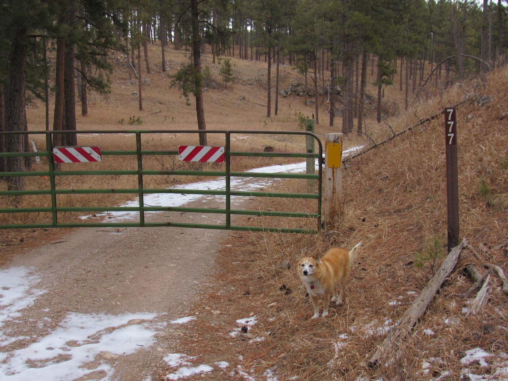
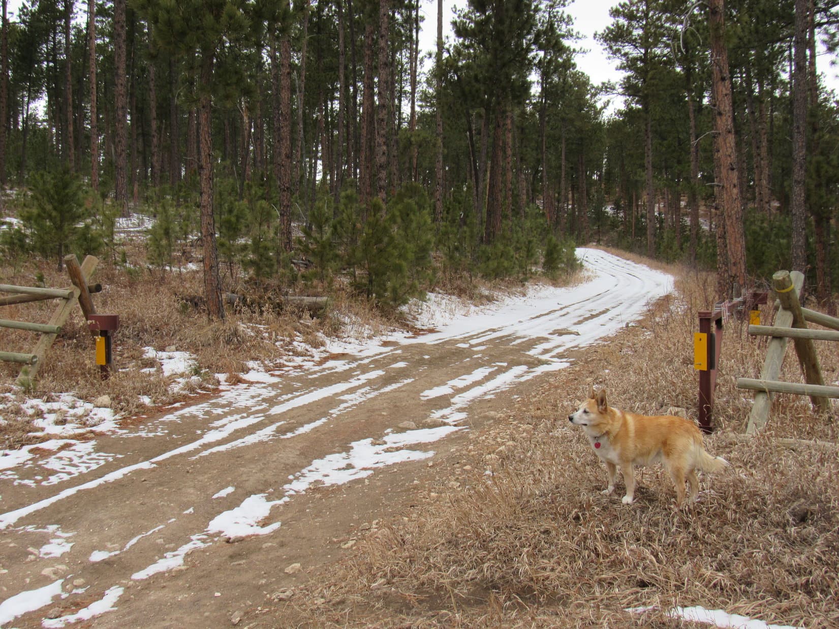
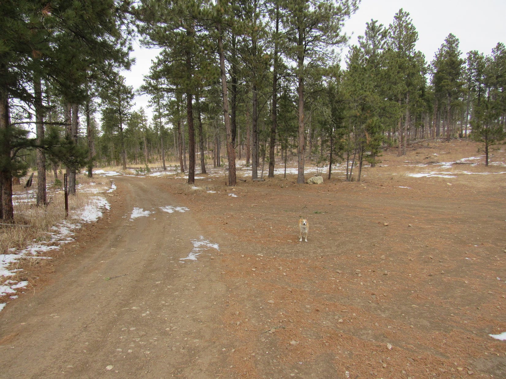
8:54 AM, 45ºF, Rolling Hills Road 1.75 miles N of Nemo Road at the start of USFS Road No. 777 –  Not a ray of sunshine anywhere, but pretty warm out for the end of January.  With only a skiff of snow on the ground and a leaden sky, it felt more like late fall than the depths of winter.  Good day for a mood march, and the locked gate over USFS Road No. 777 meant there ought to be plenty of solitude.

Loopster was fired up for it!  Anxious to get going, she led the way on the first 0.125 mile down No. 777 to the junction with No. 771.1A (3 miles E of Steamboat Rock on the topo map).  The intersection was marked with not one, but two brown wands.  One saying No. 777.1A as expected, the other saying TR8282.

At the start of USFS Road No. 777 off Rolling Hills Road. Photo looks N.
At the S end of USFS Road No. 777.1A, also part of TR8282, Photo looks NW.

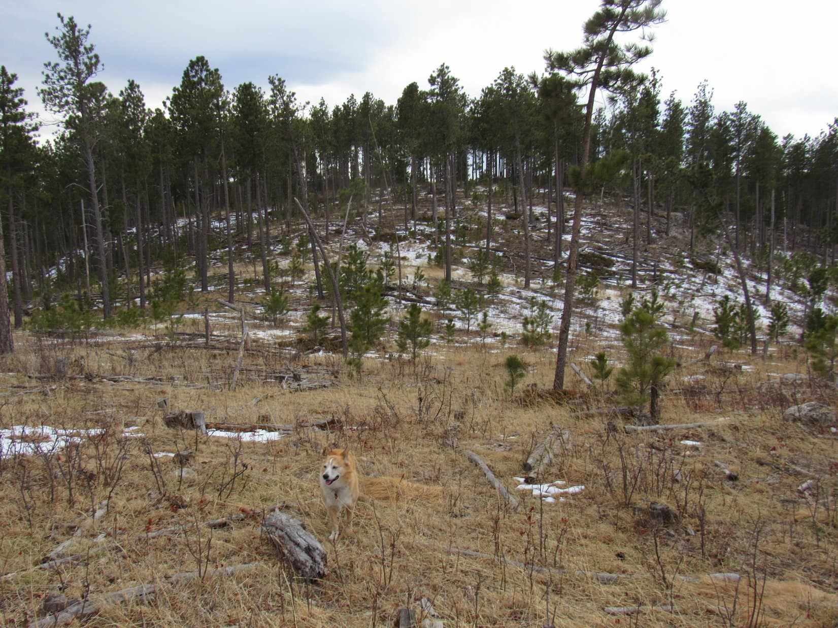
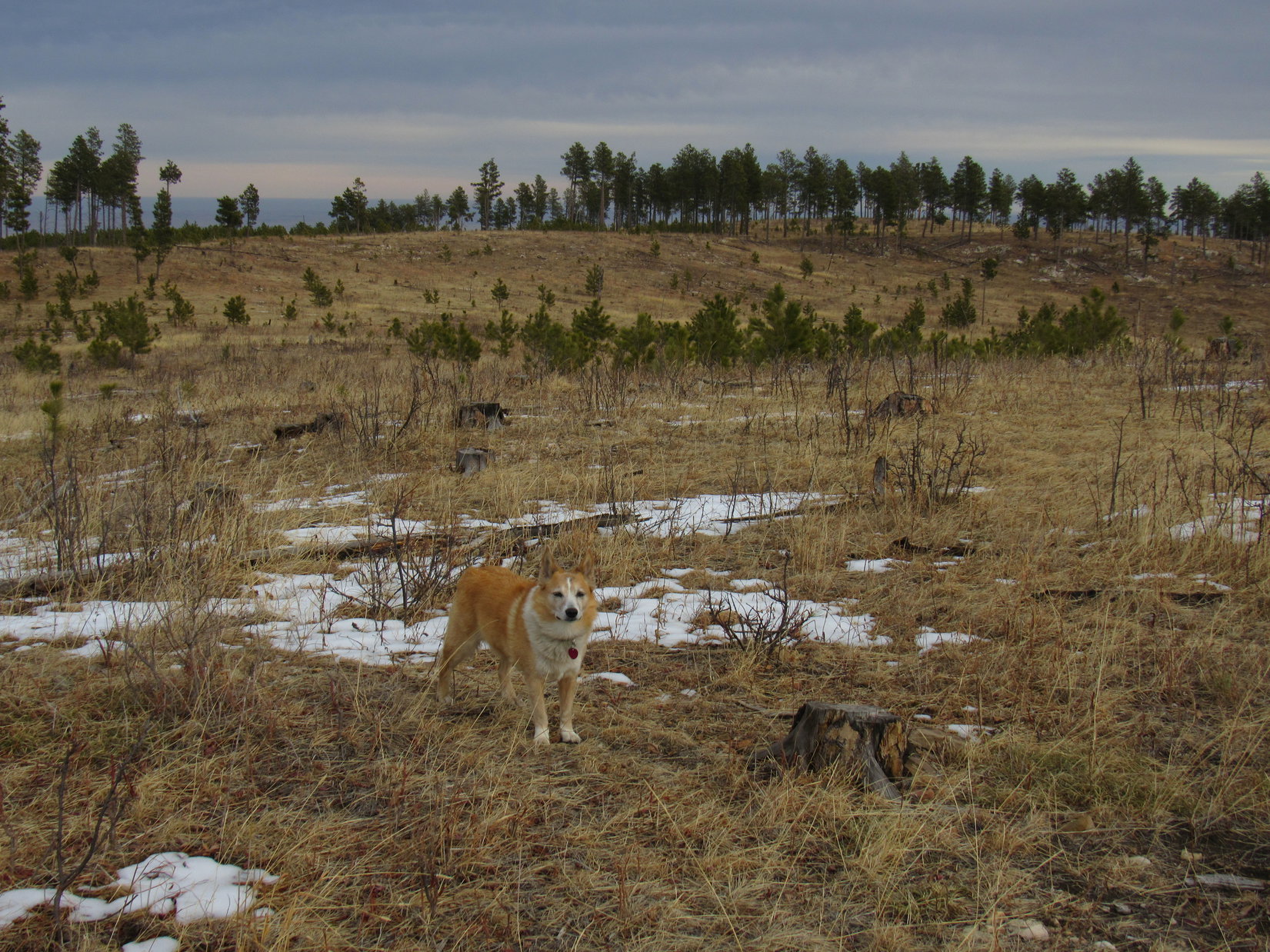
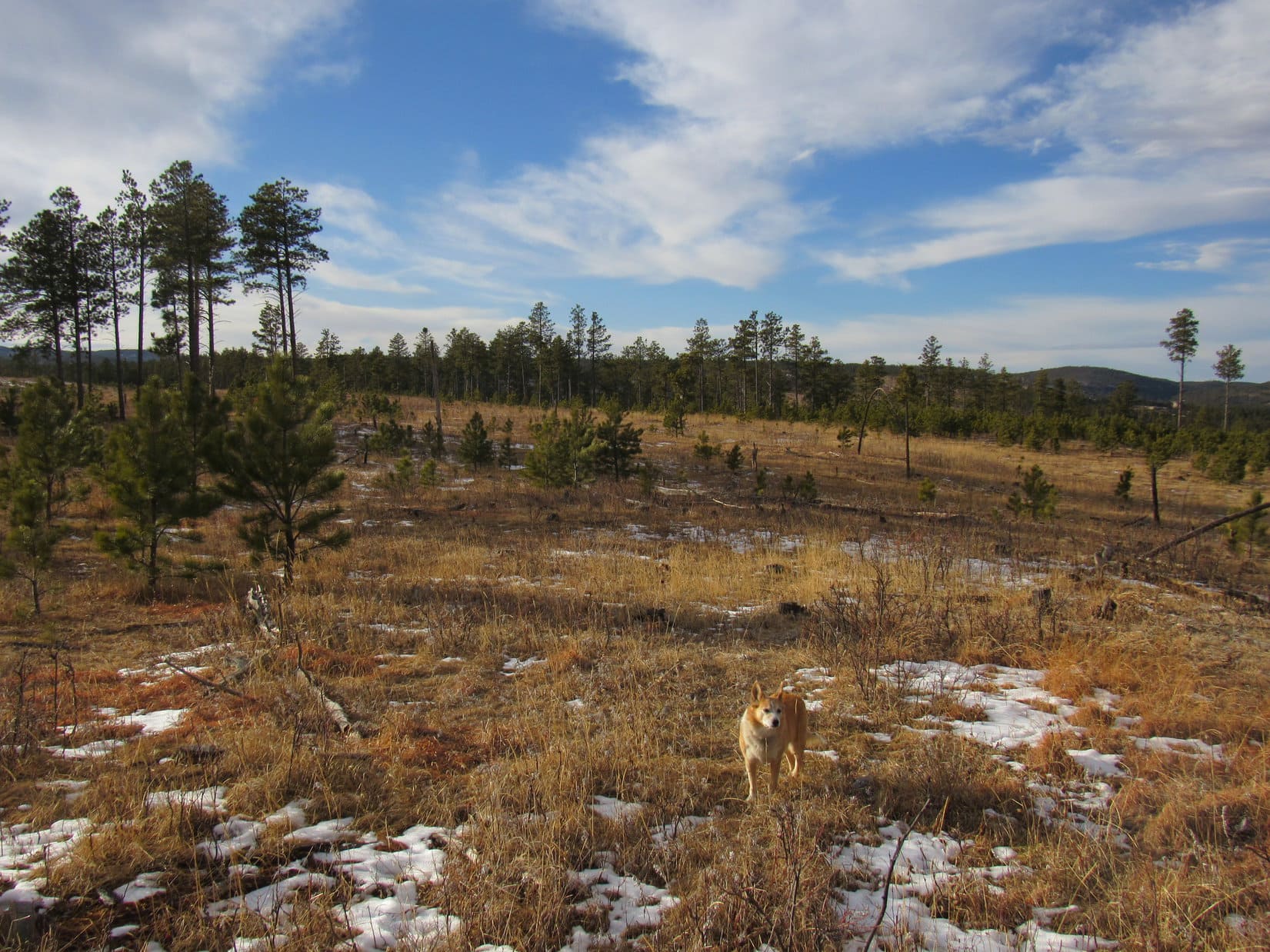
No. 777.1A headed NW up a shallow valley hemmed in by rolling hills.  The hills were all forested with Ponderosa pines that had been thinned during logging operations at some point, so it was possible to see much of the terrain.  Lupe kept an eye out for deer, but didn’t notice any yet.

After 0.2 mile, the American Dingo came to a fork in the road.  Seemed that No. 777.1A was over and done with already.  USFS Road No. 777.1B, marked with a wand, angled off to the R.  Another wand indicated that USFS Road No. 527 went to the L.  Taking No. 527, Lupe went on.

At the start of USFS Road No. 527. Photo looks WNW.

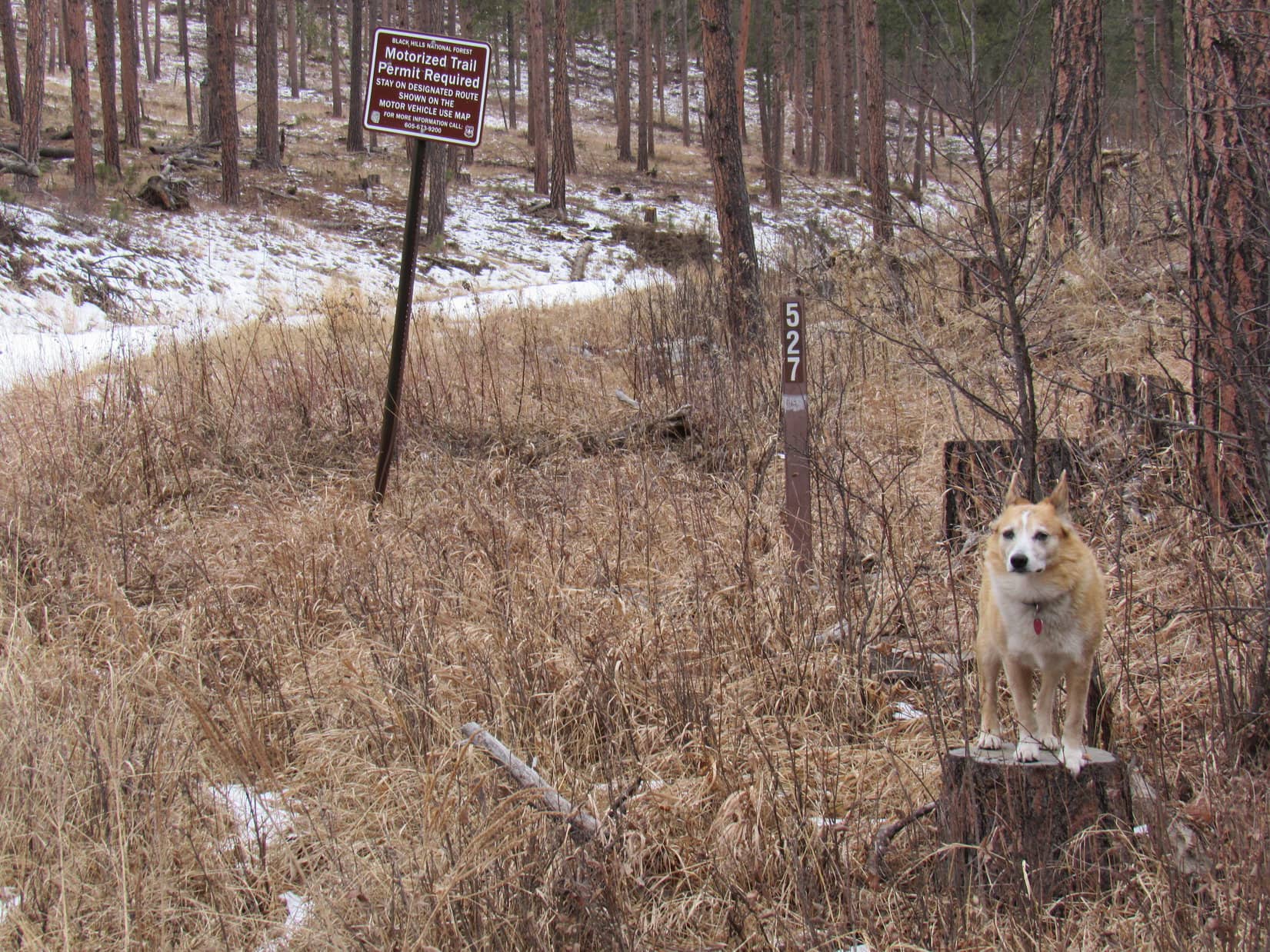
No. 527 continued NW up the shallow valley.  A sad breeze sighed in the pines, but it wasn’t windy in the valley.  Another 0.2 mile, and another road veered off to the R.  This one only had a wand saying the road was closed.  The trek went on.  A grassy road, also to the R, looked interesting, but Lupe skipped it, too.

No. 527 continues up the valley. Photo looks NW.
The grassy road. Intriguing, but Lupe didn’t take it.

The valley narrowed, and No. 527 steepened a bit.  A rougher, somewhat larger ridge featuring numerous minor rock outcroppings was on the R.  Just beyond this ridge, the road leveled out.  No. 527 was split in several places due to deep depressions worn into the original route.  Yet another unmarked road veered off to the R, disappearing into the forest.

Beyond the flat region, No. 527 resumed its climb.  Partway up this slope Lupe came to an open gate.  After going through the gate, she continued higher, but the road soon leveled out again.  SPHP could now see a rock formation off to the NE, a high point several hundred feet away.  Leaving the road, SPHP led Looper toward it.

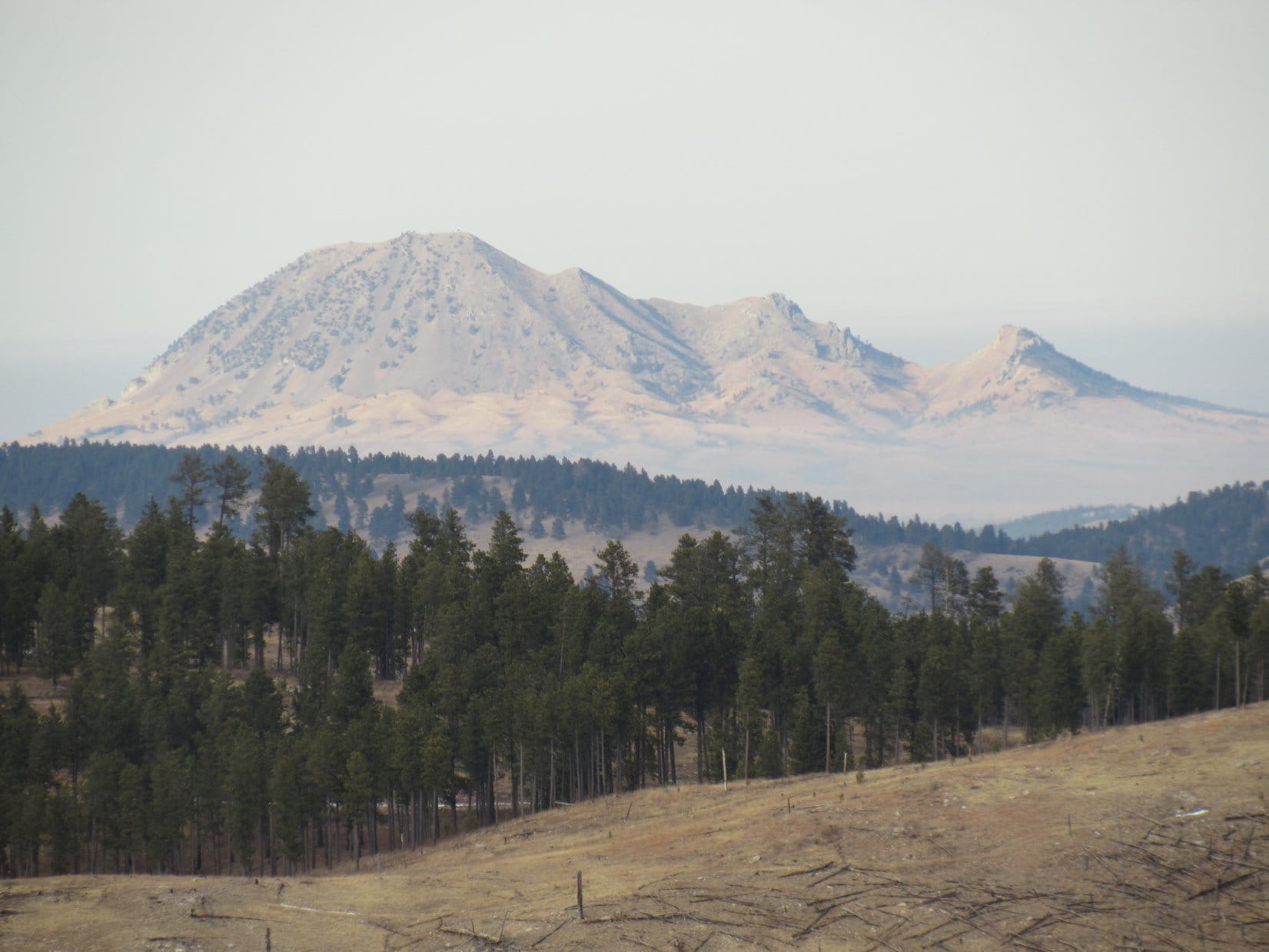
The rock formation wasn’t all that big.  Upon arriving, the Carolina Dog easily climbed to the top.  Way off to the NW, Lupe could see the summit of Custer Peak (6,804 ft.).

At the open gate.
On the rock formation.

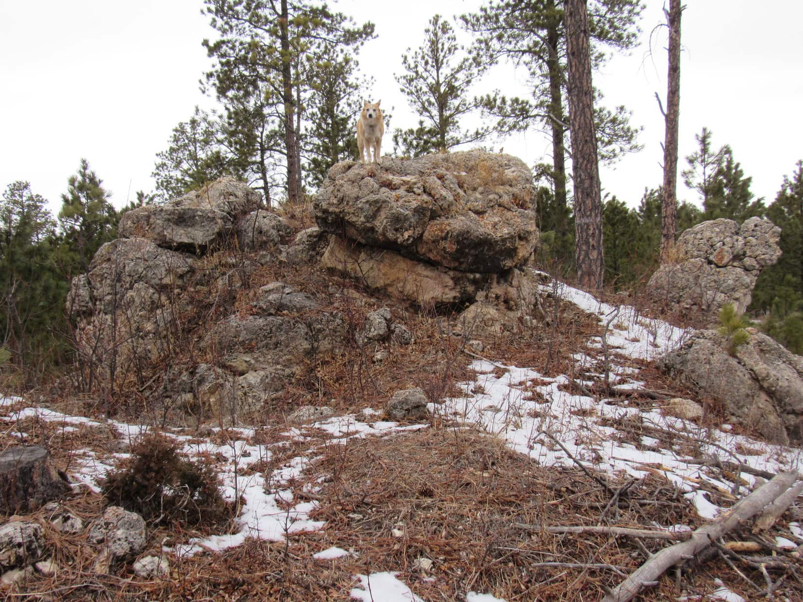
SPHP searched around the rock formation.

Naw, not what we’re looking for, Looper.

Doesn’t surprise me, SPHP.  This isn’t much of a mountain!

Oh, we’re not climbing mountains today, Loopster!  We’re in search of two caves.  I thought Erskine Cave might be over here, but it’s been so long since I’ve been there, I don’t really remember what the area around it looks like.

Caves!  Why are we looking for caves, SPHP?

We’re just doing one of our old style expeditions today, Loop.  Remember the days way back before we got so wrapped up in peakbagging?  We used to wander here and there up gulches and valleys, seeing whatever there was to see.  Felt like doing that today.  I’ve thought for a long time that we ought to go find Erskine Cave and Ice Cave just for fun!  So here we are.

I’ve got news for you, SPHP!  American Dingoes enjoy climbing mountains, and wandering hither and yon is fine, too, but we’re really not all that keen on subterranean adventures.  Remember the Dragon Caves?  Spooky!  Enough to make your hackles stand on end!  You took me dragon hunting!  We must have been nuts!  We were lucky the dragon didn’t return while we were in there.  Took that huge risk, and we never did find the dragon’s treasure, or any damsels in distress!

No reason to worry about dragons at Erskine Cave or Ice Cave, Loop.  They’re both way to small for a dragon to fit inside.  Besides, I’ve read that the USFS has blocked off the entrances.  Don’t think we can go inside either cave anymore, at least not very far.

We can’t go in?  Seems kind of pointless to even go looking for these caves, if that’s the case.  Can’t say I’m terribly disappointed, though.

Well, who knows if it’s true, or not?  We’ll go take a look.  Even if it turns out the entrances really are blocked, still fun just to try to find the caves.  Something different, a break from peakbagging!

You’re off your rocker, SPHP!  Maybe I’ll see some deers while you search for your goofy caves?  Sounds like a deer will be the high point of the day.

I guess caves are apt to be low points, being underground and all, Looper,  although I seem to remember the entrances to both caves being up on hillsides.  Anyway, Erskine Cave doesn’t appear to be around here.  Maybe we haven’t gone far enough yet?  C’mon, let’s keep going!

Returning to No. 527, Lupe continued NW.  Felt like she was getting pretty high as the road climbed out of what remained of the valley.  Near the edge of a big clearing No. 527 reached a broad flat region.  Shortly after Lupe entered this clearing, the first side road she’d seen to the L appeared.  A wand said this was TR8281.  This point was about 1.5 miles from where Lupe had first turned NW on USFS Road No. 777.1A.

Toward the far end of the clearing stood a forest of tall pines on the R (E).  As No. 527 took Lupe past these pines, a wooden pole fence was visible 150 feet back in among the trees.  No signs.  However, a faint remnant of a road partially covered with slash led toward the fence.

Hmm.  A little odd.  This might be it!  Lupe went to investigate.

It does look like there’s some kind of a depression beyond this fence!

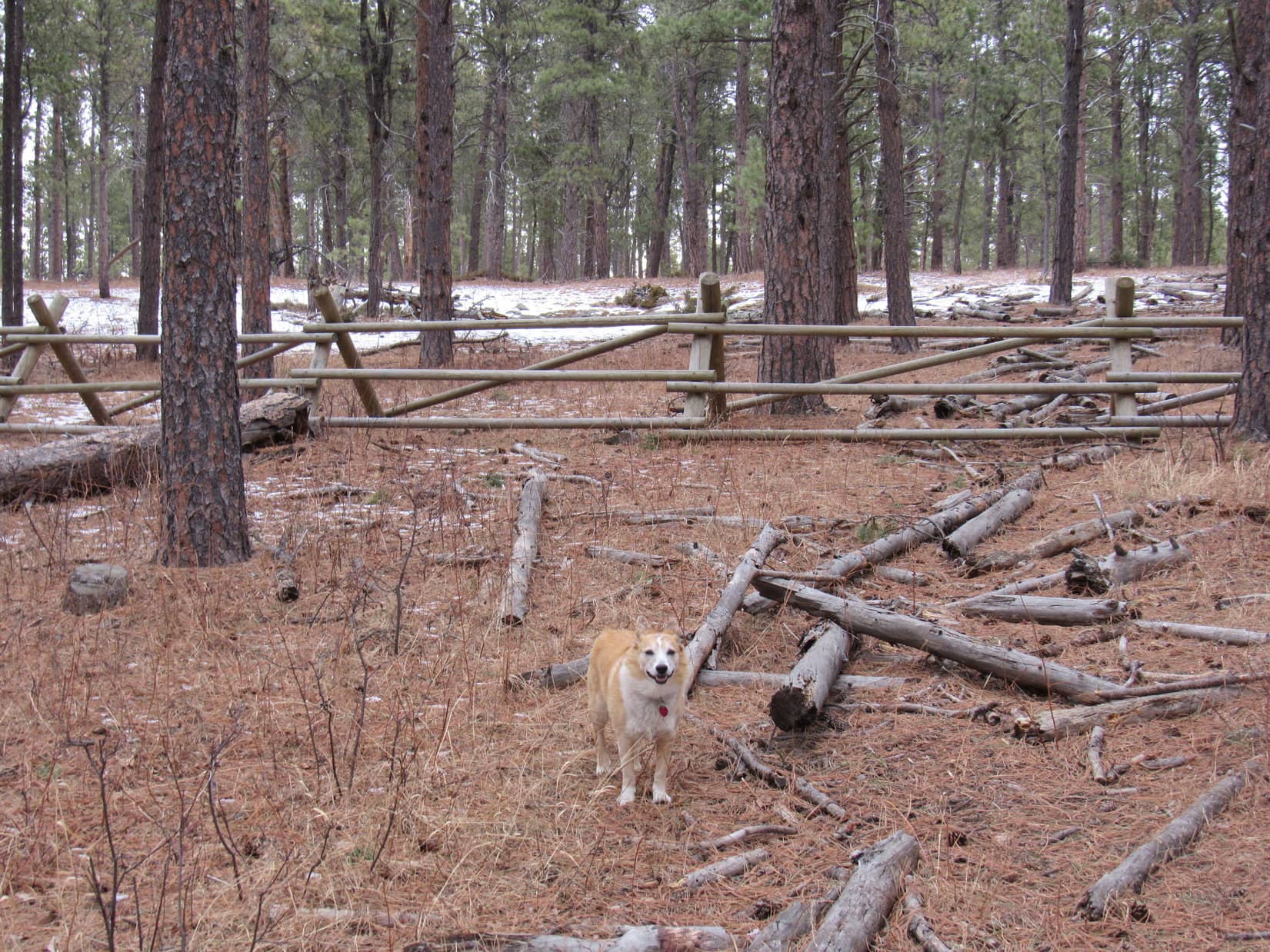
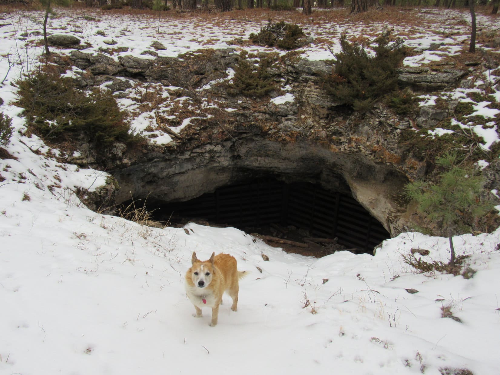
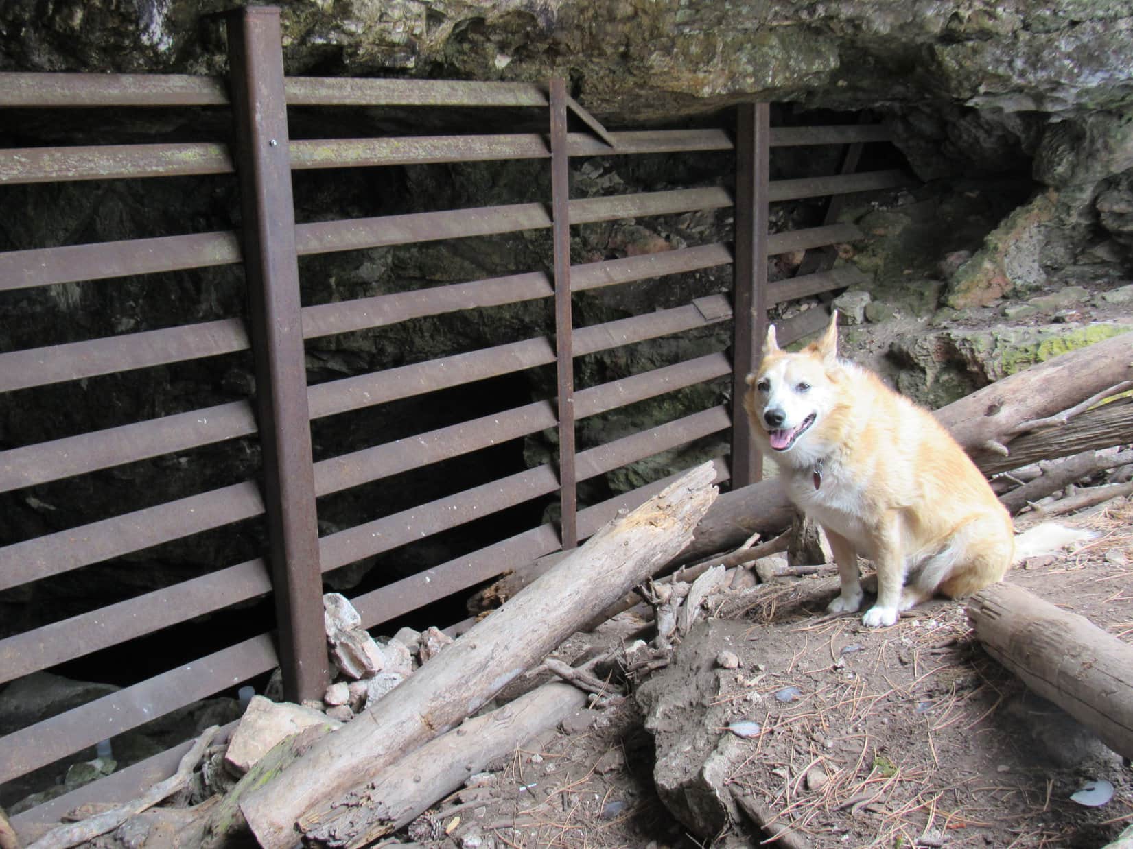
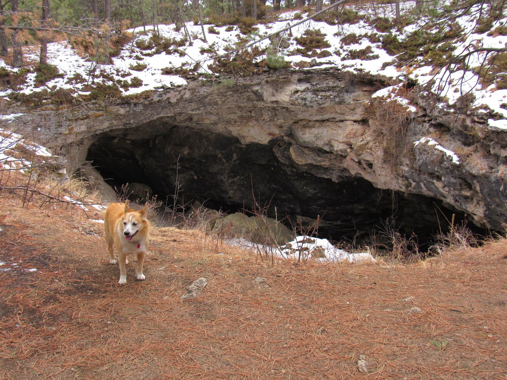
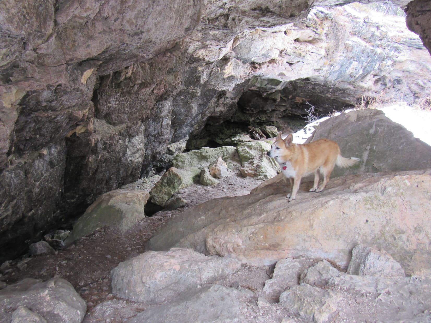
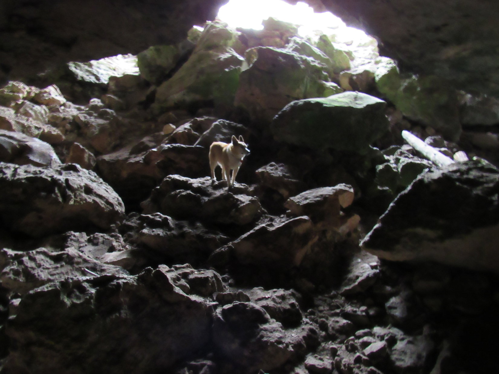
The fence formed a semi-circle convex toward the W.  A depression could be seen 50 feet on the other side.  As Lupe got closer, no doubt remained.

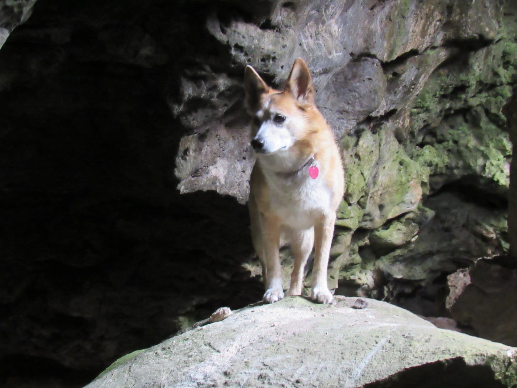
Ah-ha!  Found it, Loop!  You’ve reached Erskine Cave!

By the entrance to Erskine Cave. Photo looks ENE.

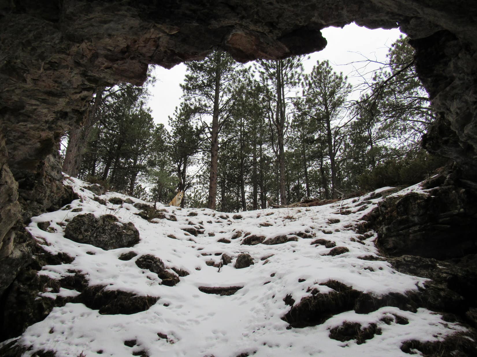
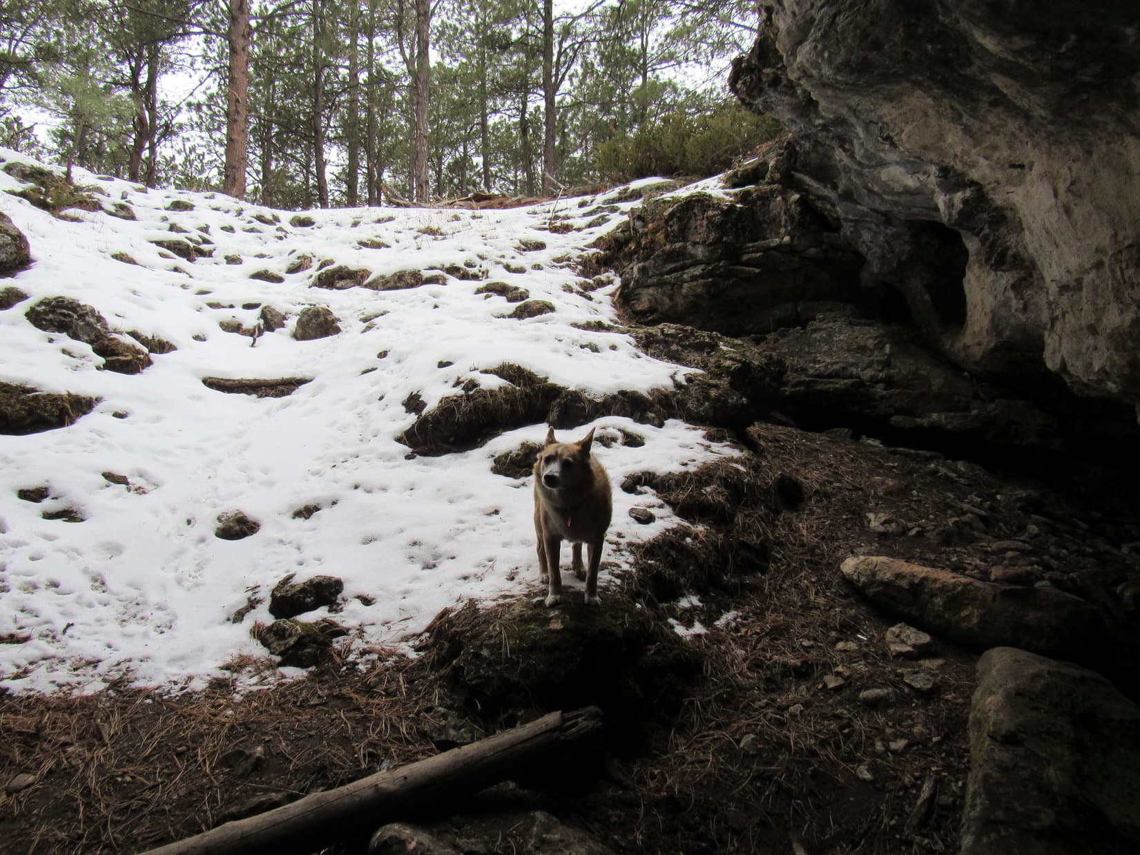
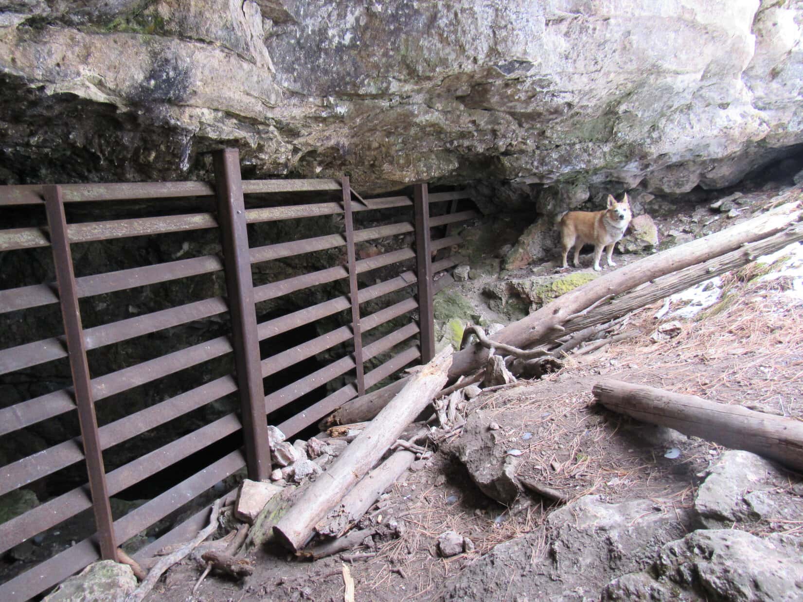
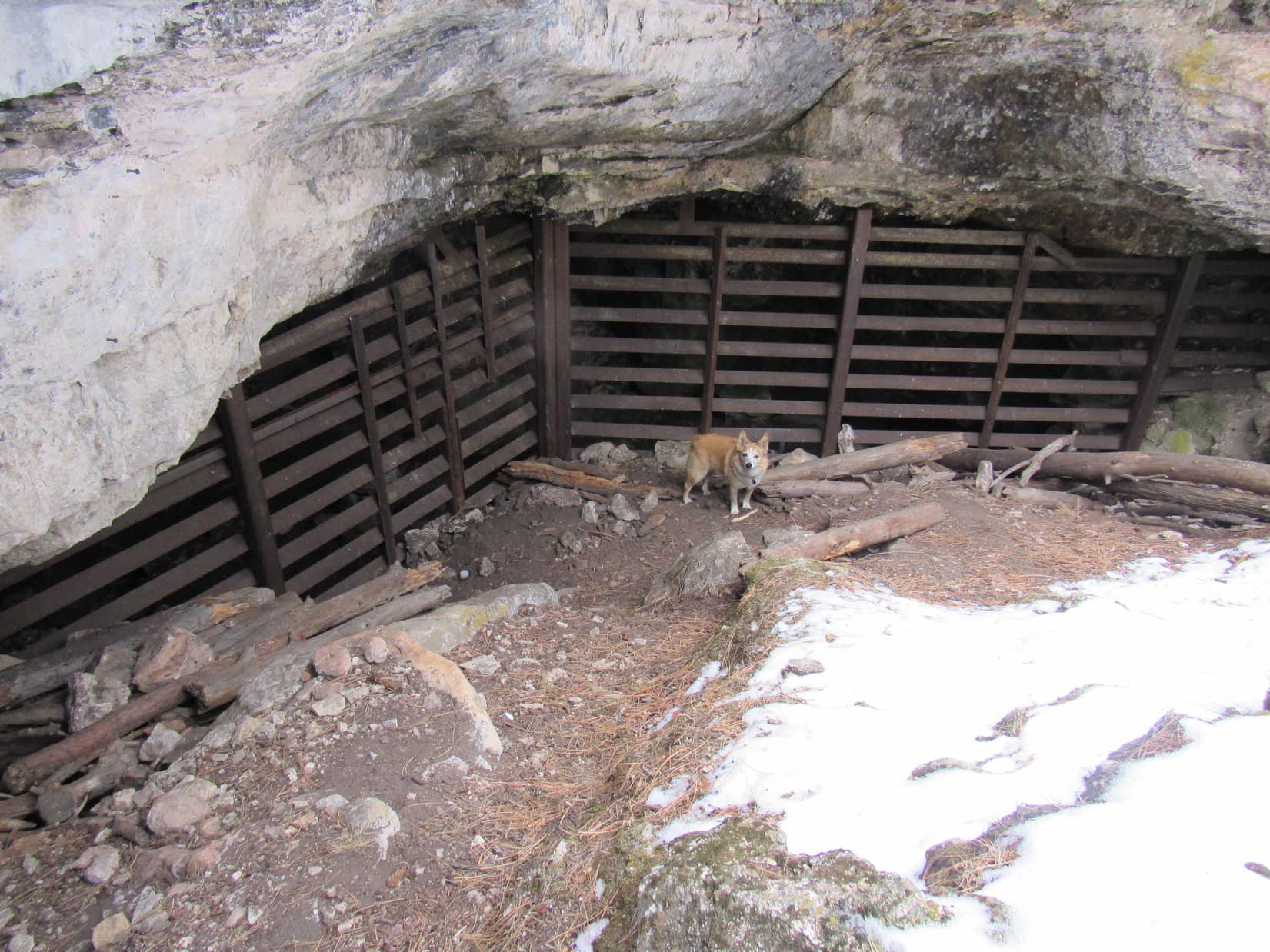
Peering into the depression, a steep, snowy slope went 25 or 30 feet down to a fence closing off the cave entrance.

Peering into the maw of Erskine Cave.

So, this is it, huh?  That’s great, SPHP!  You go first!  I’ll stay up here and guard the entrance.

Alrighty, I will!

The snowy slope was slick, but not so steep that SPHP couldn’t get down there in one piece.

Loop guards the entrance while SPHP conducts an initial investigation.

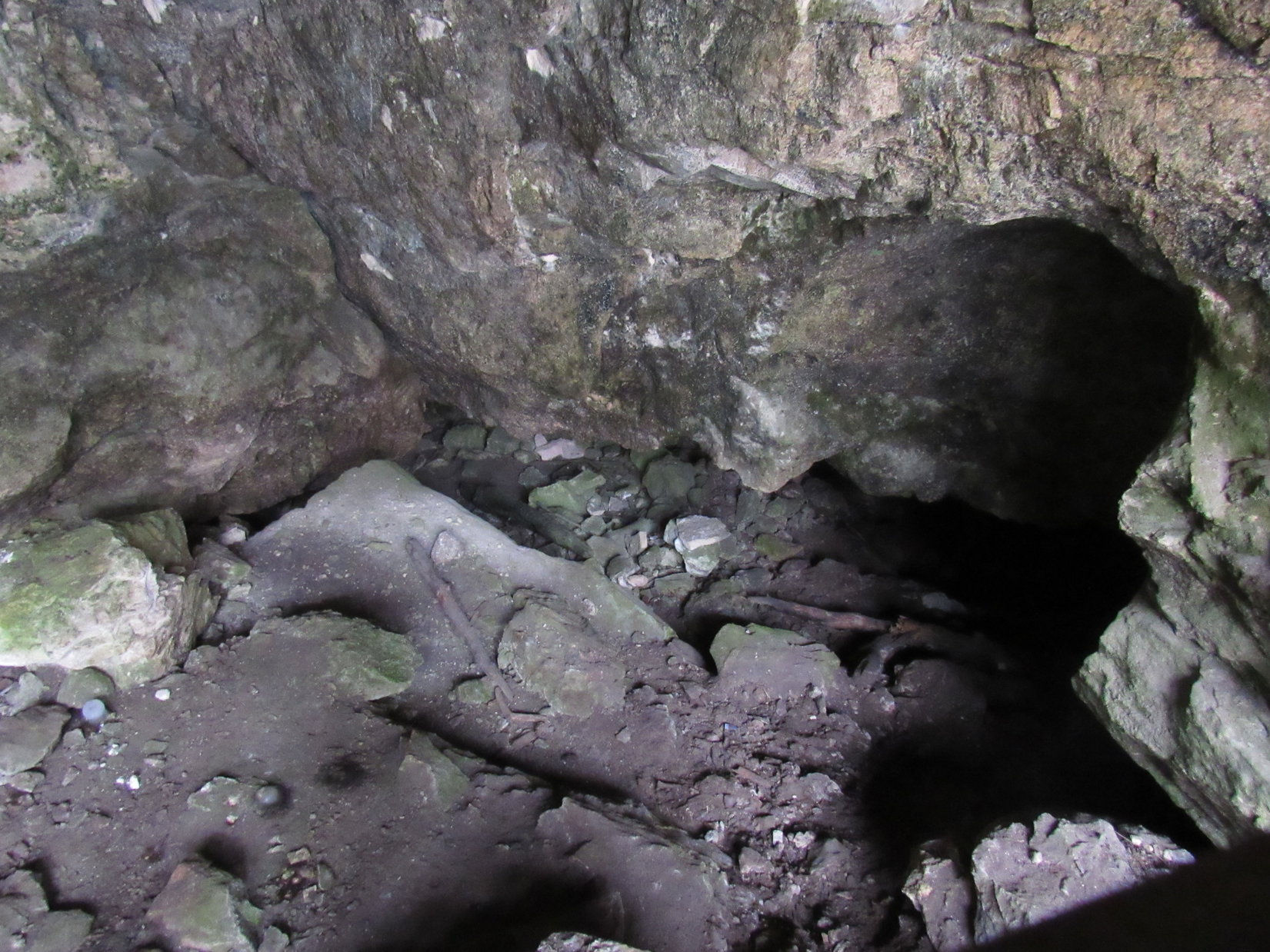
The fence turned out to be metal.  Possible to peer in between the bars and see a little more of the cave, but that was about it.  Even if the entrance hadn’t been blocked, SPHP hadn’t come prepared to do any spelunking.  Still, it was kind of cool just being at the mysterious entrance.

So what’s it like down there, SPHP?  Can you see anything interesting?

Just a metal fence, and beyond it a little of the cave entrance.  Come on down, and see it yourself, Loop.  Nothing to worry about!

Are you sure this is smart, SPHP? This opening is big enough for a dragon!
By the metal fence blocking the entrance.
Hey, this is pretty cool! Sort of makes you wonder what’s down there doesn’t it?
Looking between the metal bars a few feet deeper into Erskine Cave.

Did you say you’ve been into Erskine Cave before, SPHP?

Yes!  Several times, Looper, but long before you were ever even around.  It wasn’t blocked off back then.  Anyone could go inside.

Really!  What’s down there?  What’s it like?

Hah!  Been so long ago, I can barely remember, Loop.  I do remember a tight spot close to the beginning that has to be crawled through.  You even crawl up at one point.  It then opens up after that for a while, but I don’t remember for sure if it gets large enough to stand up.  I think it did.

How far in did you go?

Maybe a few hundred feet?  Can’t really say any more.  It was very cool, though.  Toward the end, you crawl quite some distance, but it eventually gets too tight to go any farther.  Not a place for claustrophobics, that’s for sure!  I do remember it goes a lot farther in than Ice Cave does.

Were there any side passages, or just one long cave?

Yes, I believe there were side passages, but they played out pretty quickly.  I only remember one sort of long route.

Was it full of bats?

Nope, never saw any bats at all.

Was it dark?

What kind of a question is that, silly Dingo?  Black as Death, if your light went out!  Always carried a flashlight with extra batteries, plus tied a strong string to a rock near the entrance and unraveled it while exploring, just in case something bad happened.  Happily, never actually had to use it.  Anyway, no more questions.  We’re done here.  So, if you will just stay another minute or two, I’ll get your picture from partway up, OK?

Posing at the entrance of Erskine Cave before moving on.

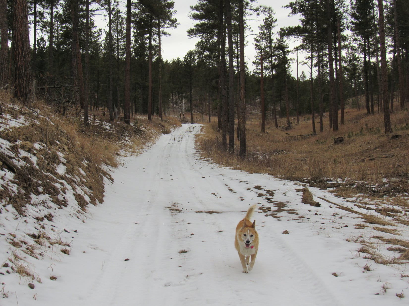
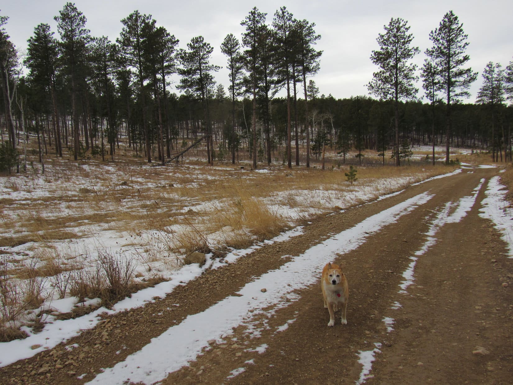
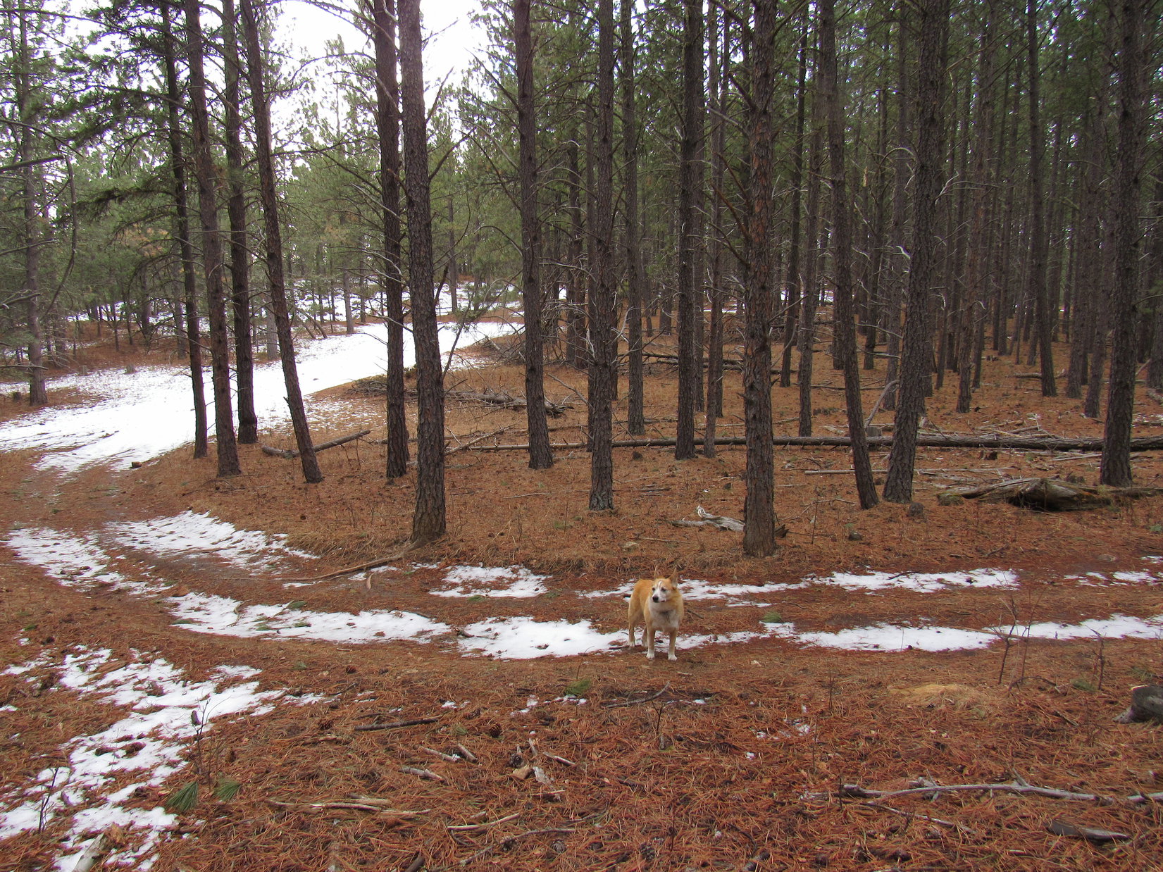
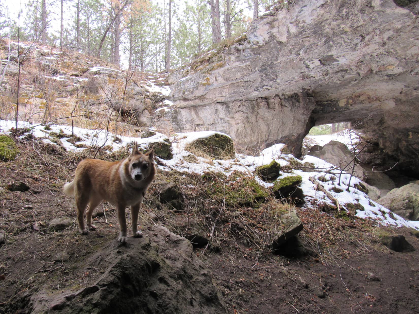
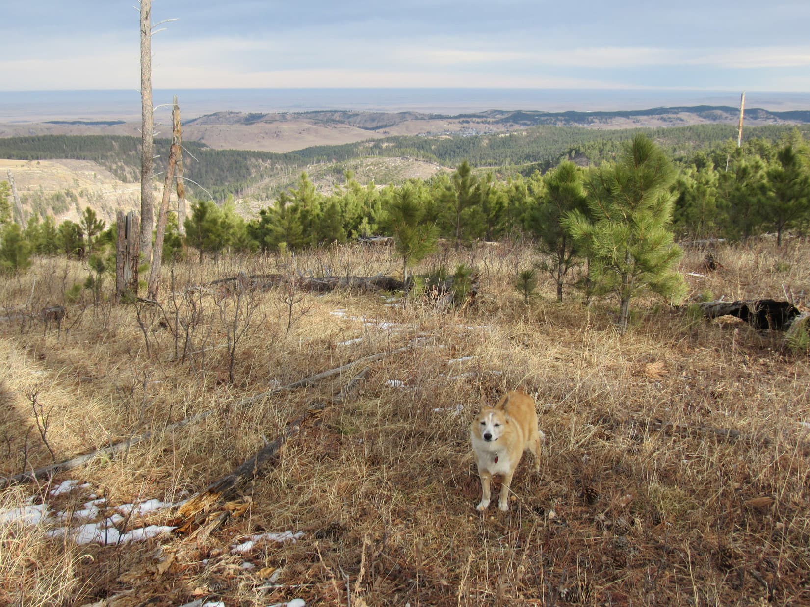
Returning to USFS Road No. 257, Lupe kept going.  The road was flat at first, then climbed gently heading due N between a dense forest on the L (W), and a shattered one on the R (E).  0.33 mile from Erskine Cave, Lupe came to another open gate, a less elaborate one in a barbed wire fence.  A few hundred feet farther and No. 527 reached its high point.

Back on USFS Road No. 527 (aka TR8282) after leaving Erskine Cave. Photo looks NW.
At the second open gate Lupe came to. High point of USFS Road No. 527 just ahead.

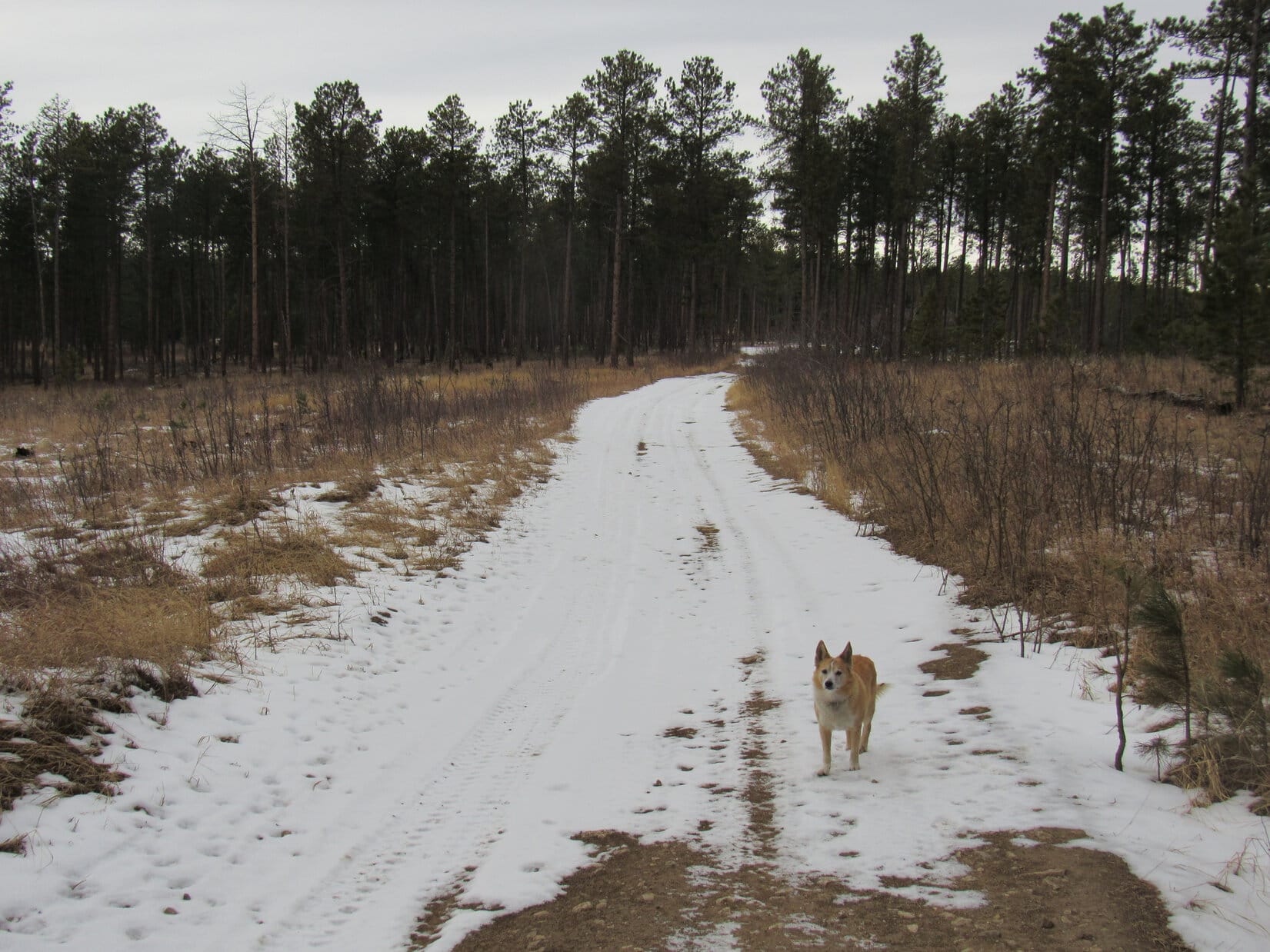
0.25 mile after starting downhill, Lupe came to a 4-way intersection at a big flat open saddle.  TR8285 went SE, and a blocked road went NE.  Lupe simply stuck with USFS Road No. 527 (TR8282) as it now went down a scenic valley.  Another 0.50 mile brought Loop to a T intersection with USFS Road No. 144.2B, which was marked as TR8283.

At the 4-way junction saddle. Loop continued down to the L. Photo looks N.
Heading down the next valley on USFS Road No. 527 (TR8282). Photo looks WNW.
Approaching the T intersection with USFS Road No. 144.2B.

Which way to the Ice Cave, SPHP?  That’s where we’re going next, isn’t it?

Yup!  Go R, Loop!

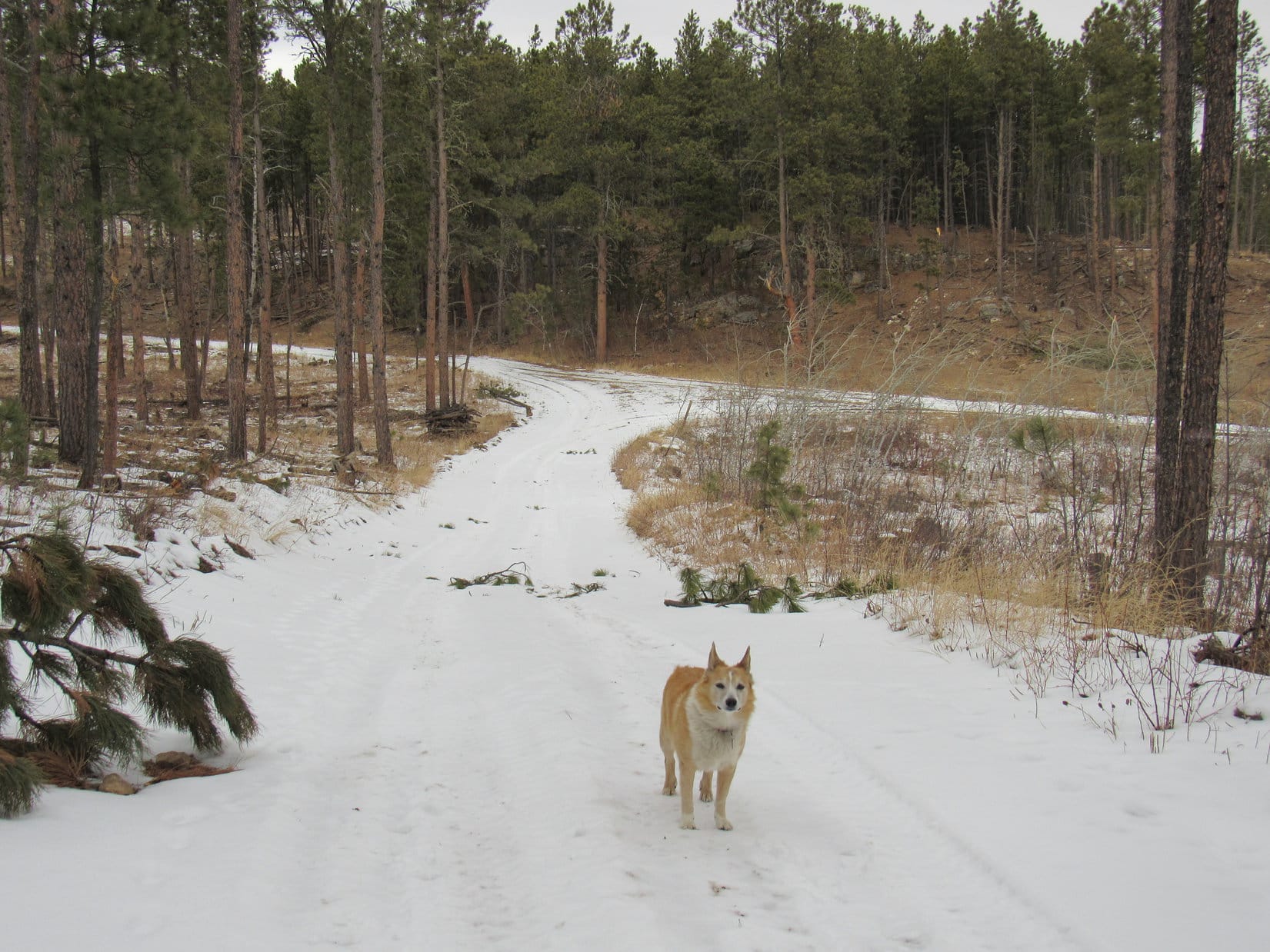
No. 144.2B went downhill a bit then climbed 40 or 50 feet going around the N side of a hill.  Once past the high point, the road wound ENE as Lupe descended into yet another valley.

Looper had already seen a number of deer in the forest, but now topped that with a coyote sighting.  Seeing a coyote was very exciting!  Lupe would have gone over to have a sniff with it, but the coyote was far away.  Already aware of SPHP, the coyote quickly disappeared in tall grass.  All the American Dingo could do was stand on the road whining about how deliberately unfriendly the wild dog had been.

You’re killing my social life, SPHP!

Yeah, join the club!  One of my strong points.

Heading E on USFS Road No. 144.2B (TR8283).

After a mile or so, a yellow and gray cliff appeared ahead.  A fork in the road came into sight below it.  A tiny pond shown on the topo map near this junction (Point 4497) turned out not to exist.

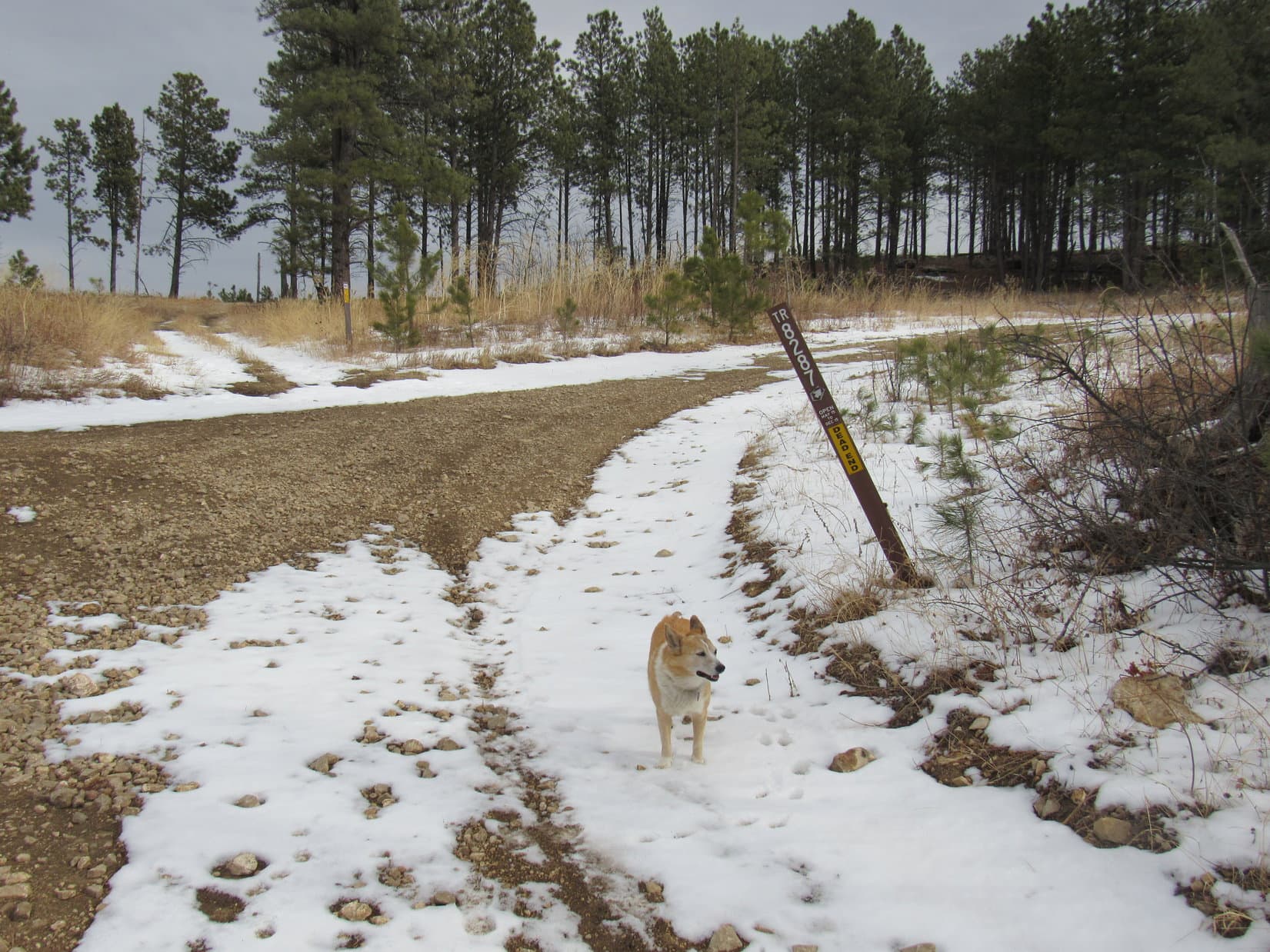
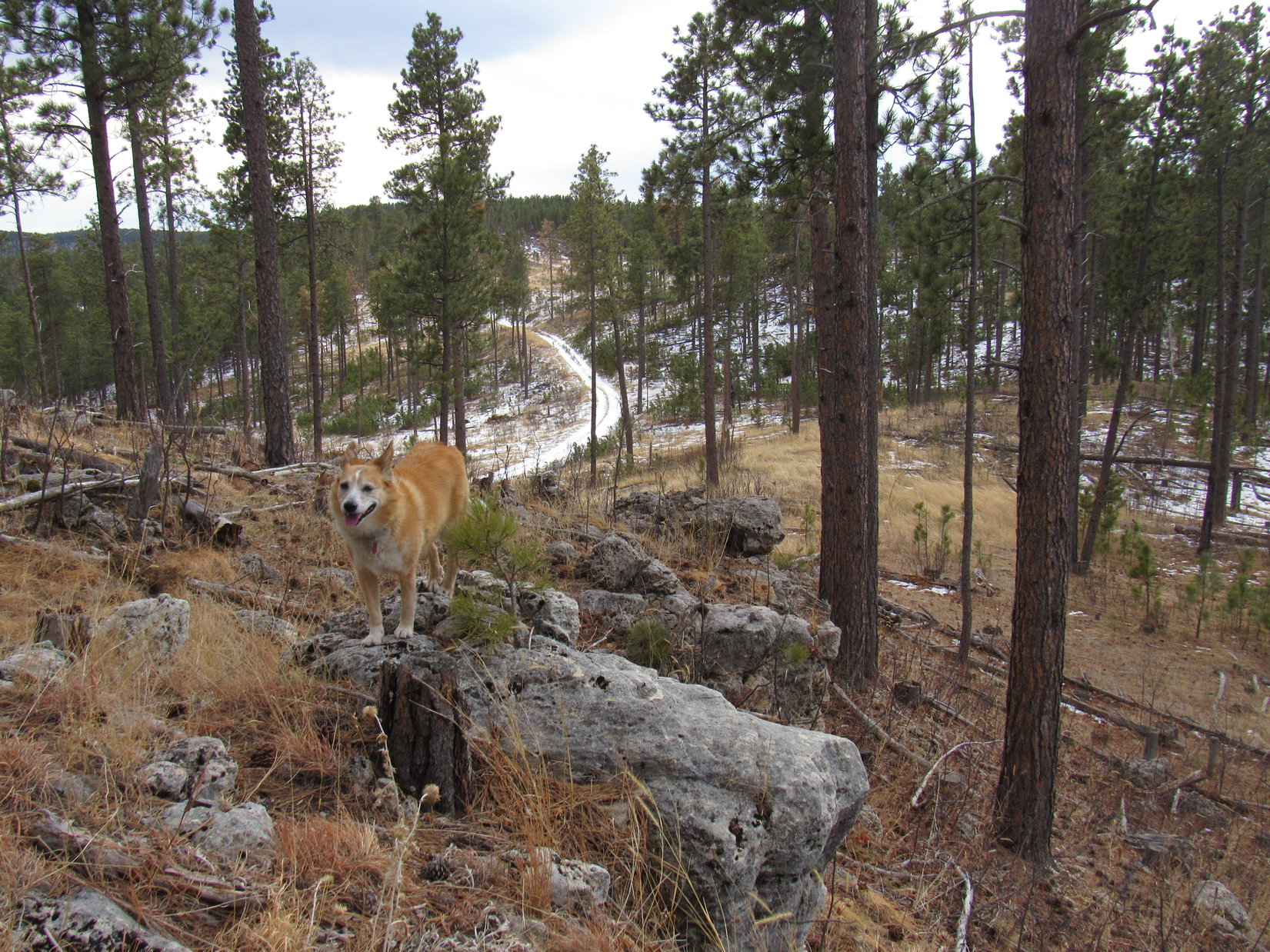
Upon reaching the fork, Lupe took the road marked as TR8287.  It curved off to the L, heading up onto Stagebarn Ridge.  The other branch, which went R continuing down the valley, was marked TR8284.

Approaching the fork at Point 4497. TR8287 goes straight before curving L. TR8284 goes R. Photo looks ESE.

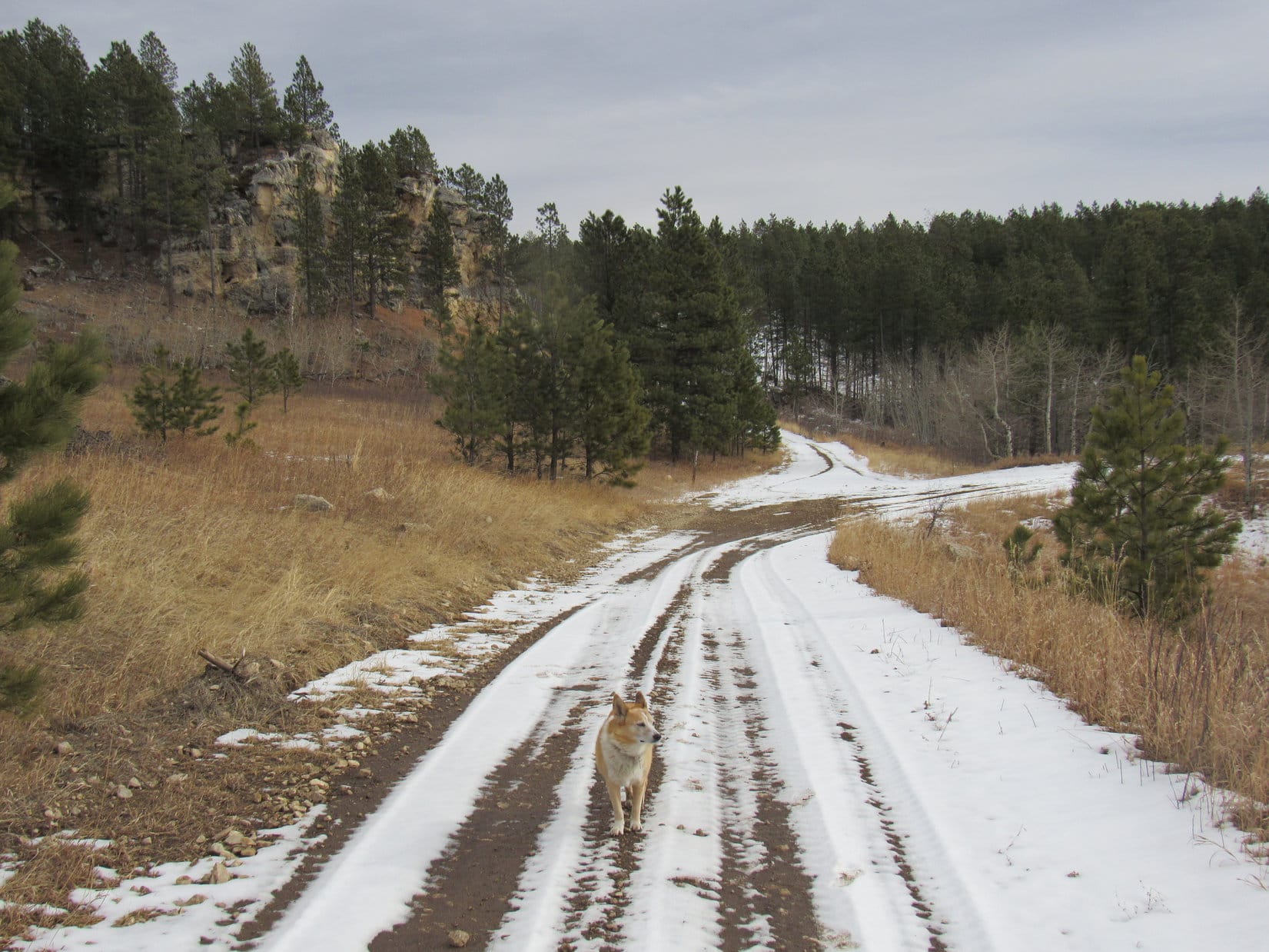
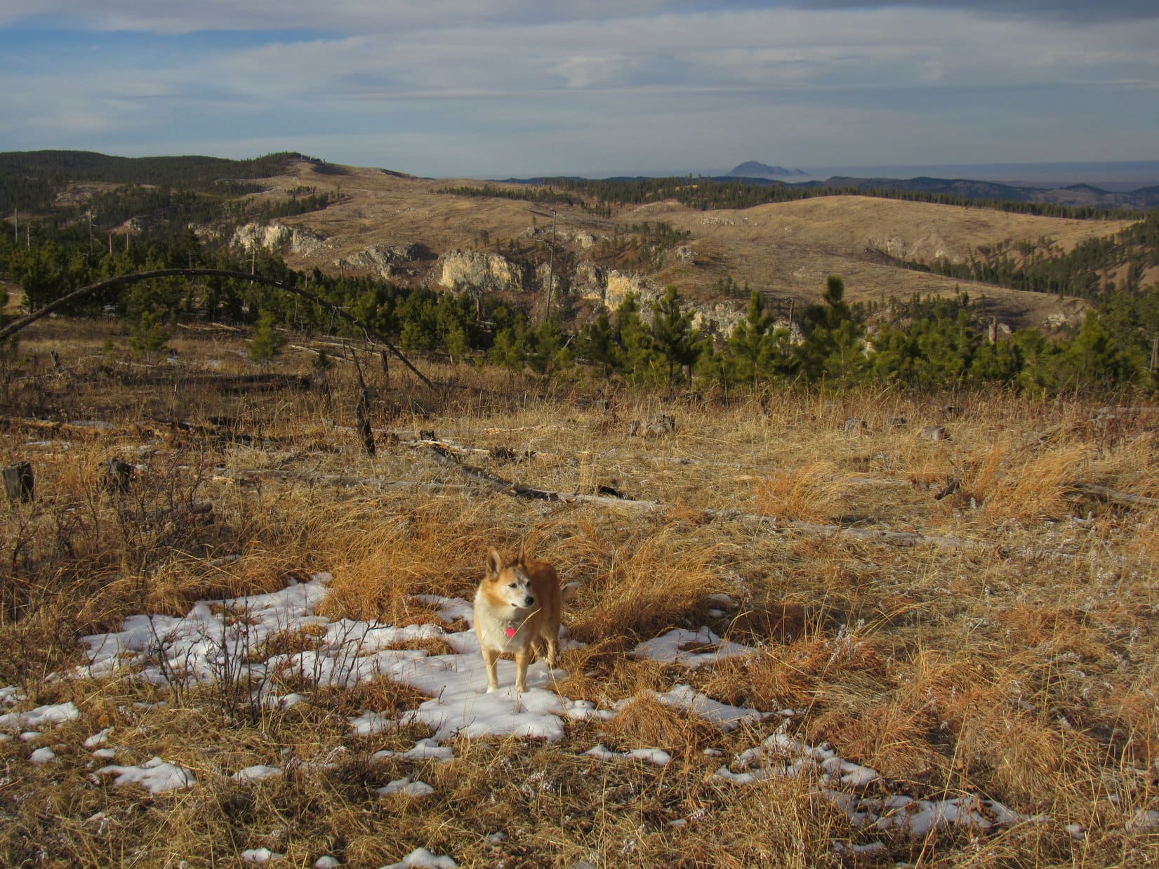
TR8287 curved up past the gray and yellow cliff.  As Lupe got close to the top of Stagebarn Ridge, she came to another junction.  TR8286 headed NW from here, but Loop stuck with TR8287, which now curved R (SE) heading up to a higher part of the ridge.  The road soon topped out.  Off to the E was the first big distant view of the day, a panorama looking over Stagebarn Canyon all the way to the prairies beyond the Black Hills.

At the junction with TR8286, which went off to the L, and TR8287, which Loop kept following to the R. Photo looks E.
Stagebarn Canyon from Stagebarn Ridge. Photo looks E.

Stagebarn Ridge was enormous and lower toward the SE where the road was heading.  Lupe hadn’t gotten far beyond the road’s high point when SPHP paused to check the map.

What’s it say, SPHP?

Looks like we’re about 0.5 mile N of the Ice Cave now.  We need to leave the road here to go search for it.

This road doesn’t go to the cave?

Nope.  Just continues SE down a draw and dead ends.

About to leave TR8287 to head into the trees. Photo looks S.

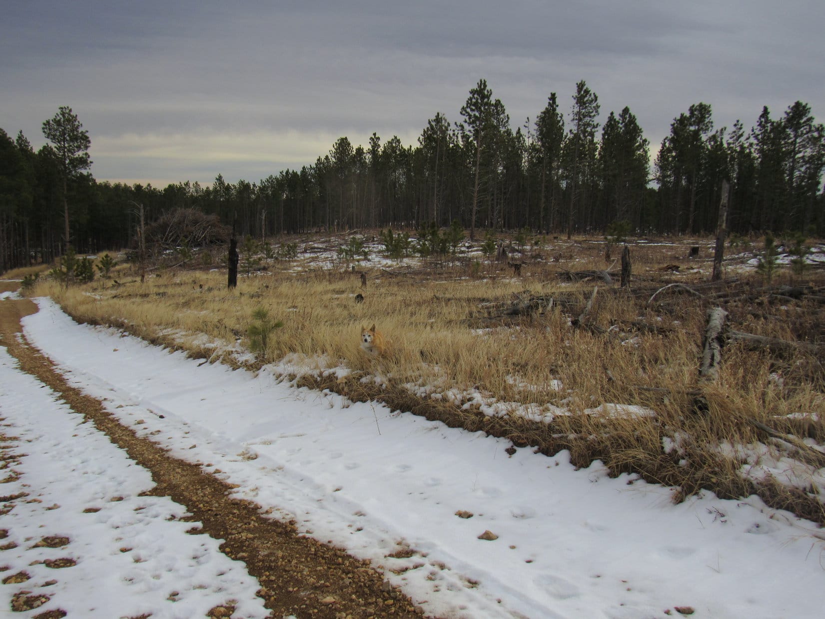
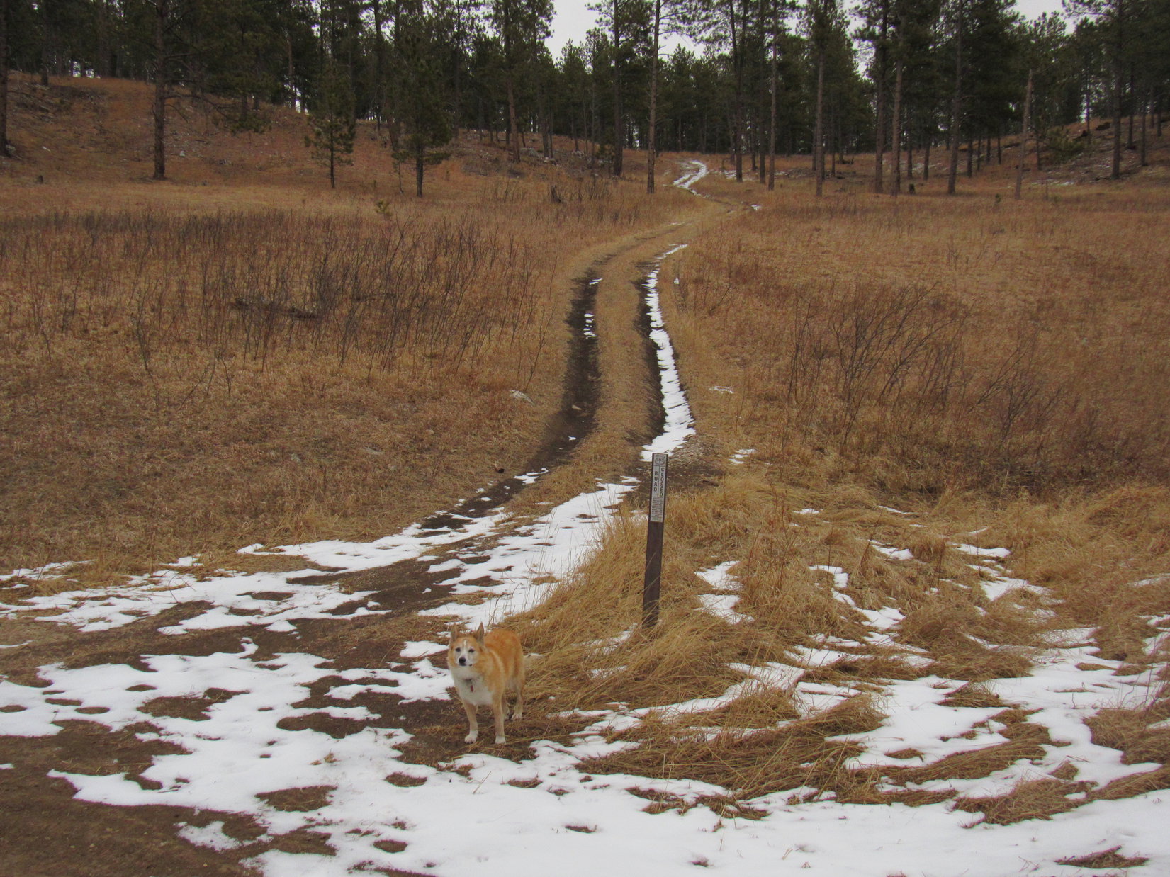
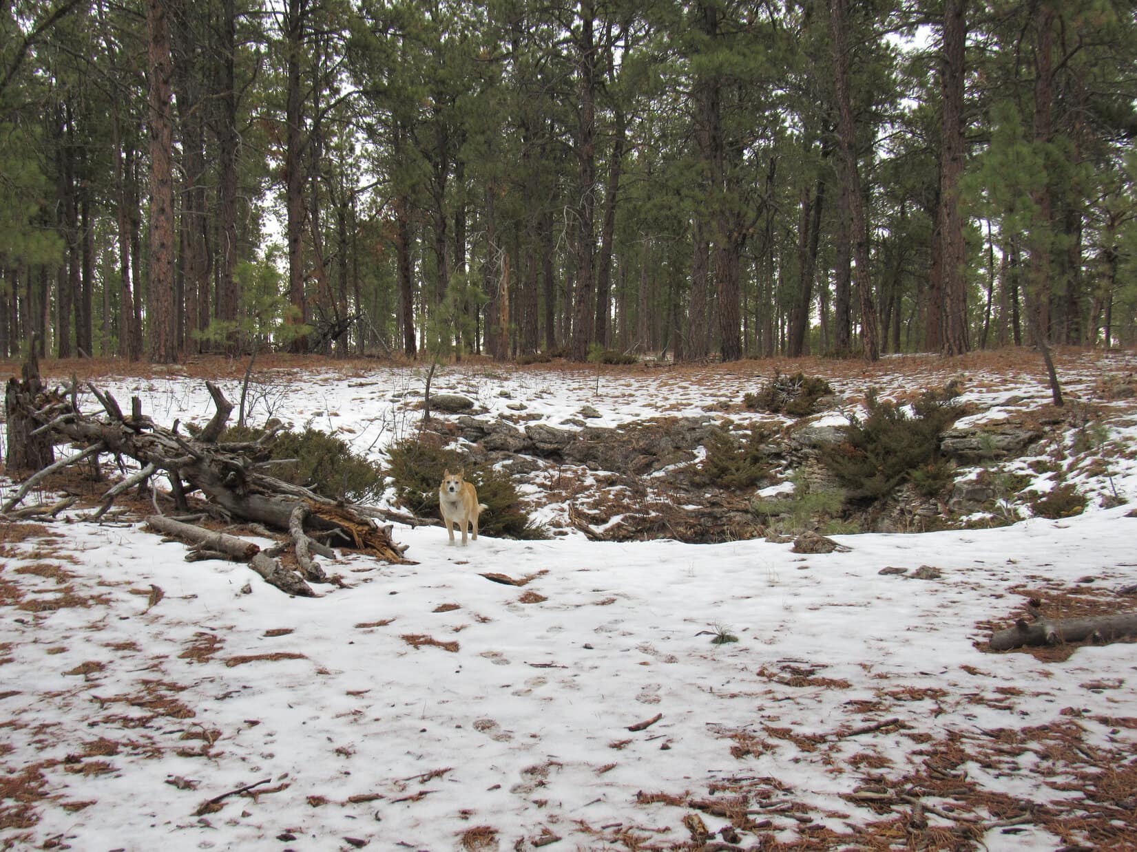
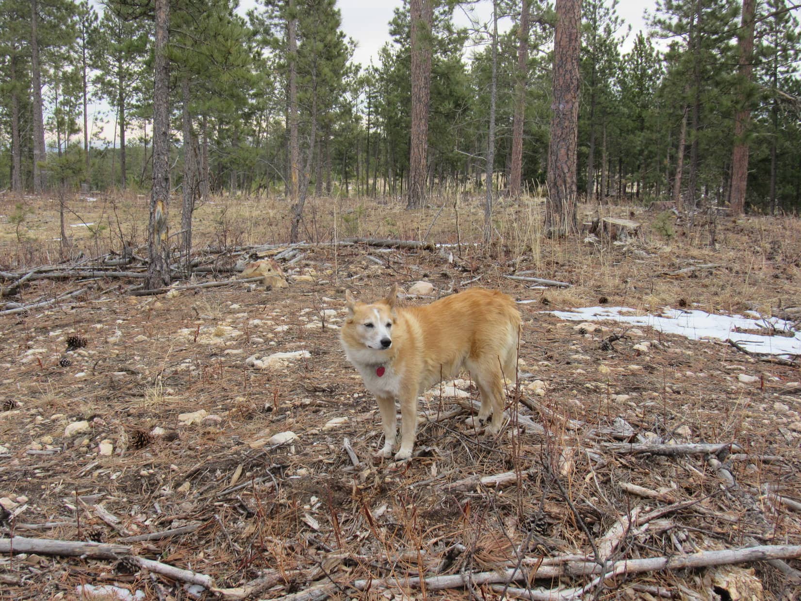
Leaving TR8287, Lupe crossed a small field and entered the forest.  This part of Stagebarn Ridge was a series of non-descript minor ups and downs.  The forest had been thinned, so it was relatively open territory, but plenty of slash had been left on the ground by the loggers.  SPHP stumbled along, as Lupe watched for squirrels or deer.

At a minor high point while searching for Ice Cave. Photo looks S.

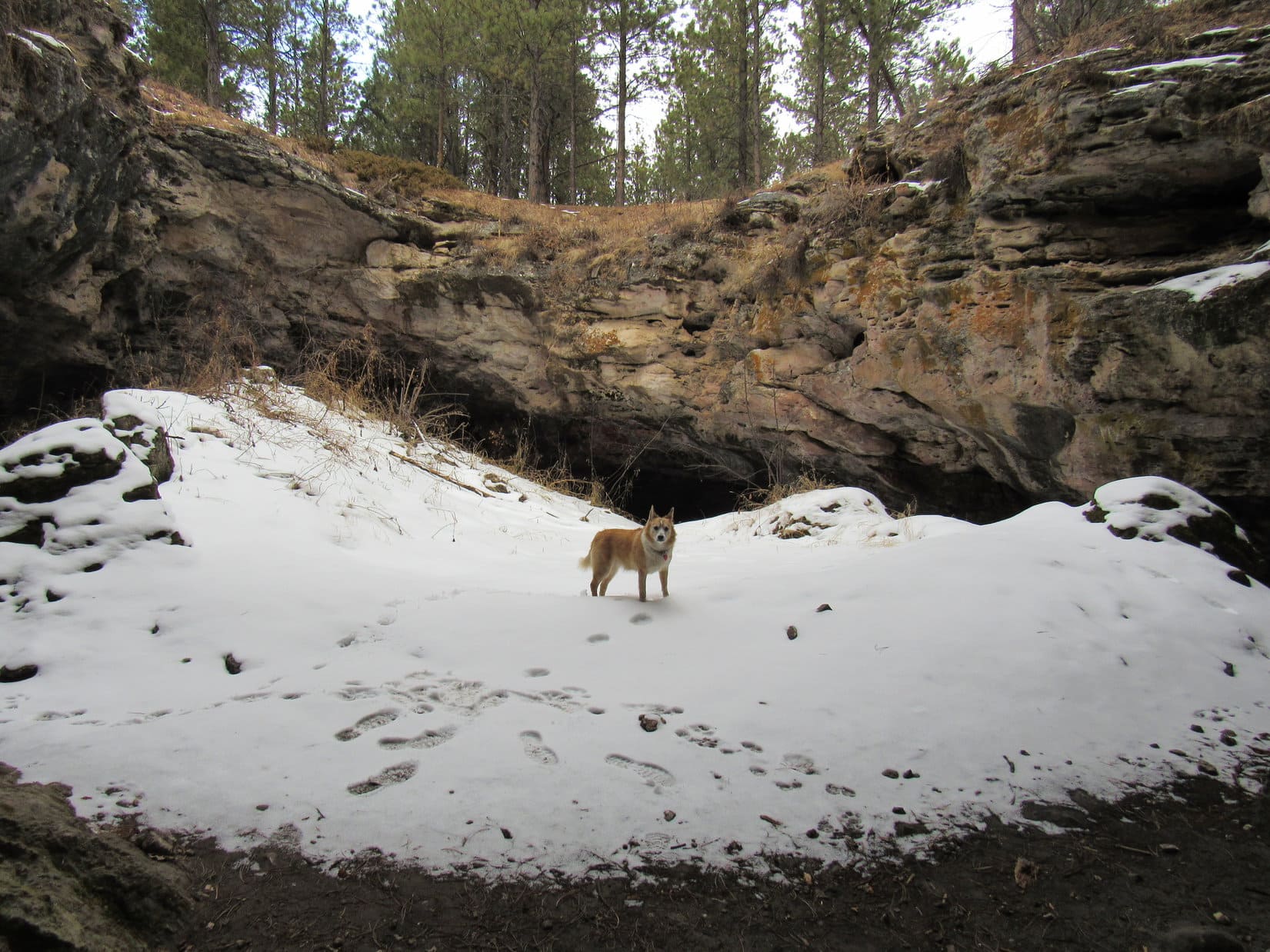
After maybe 0.33 mile, Lupe reached a flat area at the top of a little hill.  Possibly HP4600 on the topo map?  If so, Lupe wasn’t far from the Ice Cave now.  A clearing could be seen to the S, although with the sky so overcast, SPHP wasn’t certain if it was SE, due S, or SW.  Heading over to it, the clearing extended off to the R, which was the right direction.

At HP4600. Photo looks SE.
At the clearing. Photo looks S.

After passing through the clearing, another hill was directly ahead.

I’m thinking this is it, Loop!  The Ice Cave ought to be somewhere up on that hill.  Keep an eye out for any kind of an opening.  If I remember right, it ought to be easy to spot.

Almost there! Photo looks S.

According to the map, the cave entrance should have been on the near side of the hill, but Loopster went right on up to the top without seeing any sign of it.  The cave didn’t seem to be anywhere up on top, either.  Lupe reached the far side of the hill.  A road was visible heading off toward more hills.

No Ice Cave yet! Maybe it’s still a little farther? Photo looks S.

Keep going, SPHP?

Not sure, Loop.  Doesn’t seem right that it could be that much farther.

Well, there’s no cave here.

No, there isn’t.  Hang on, let me check the map again.

Any exciting conclusions?

Maybe.  If we really were at HP4600 earlier, that road we see from here, which doesn’t appear on the map at all, might be heading for the HP4581 region.  That’s way too far S.  Kind of think maybe we’re already too far S.

Go back then?

Yeah, I think so, let’s try shortcutting back N to the region W of HP4600.

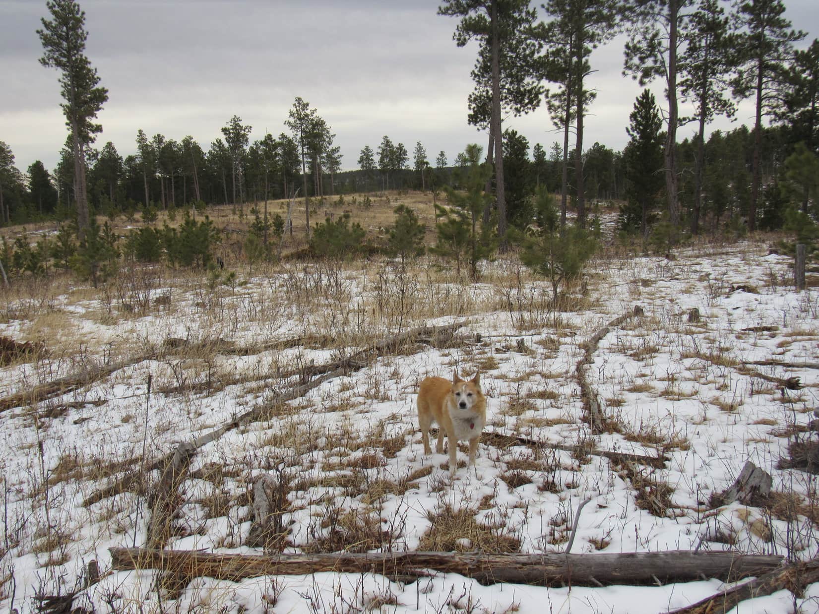
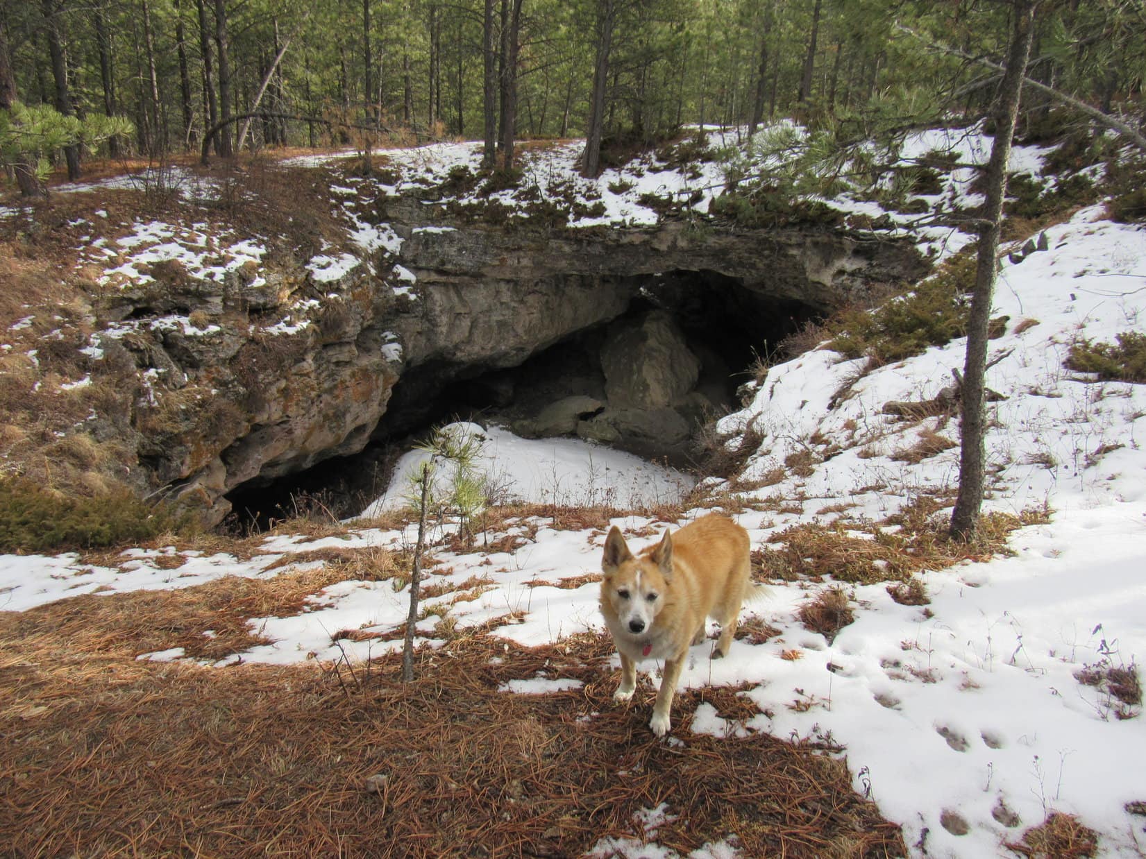
Heading N, Lupe crossed a big field in the upper end of a drainage before reaching a heavily forested saddle SW of HP4600.  Surprisingly, a road curved up to this point from the canyon to the W.

On the unexpected road in the saddle SW of HP4600. Photo looks WSW.

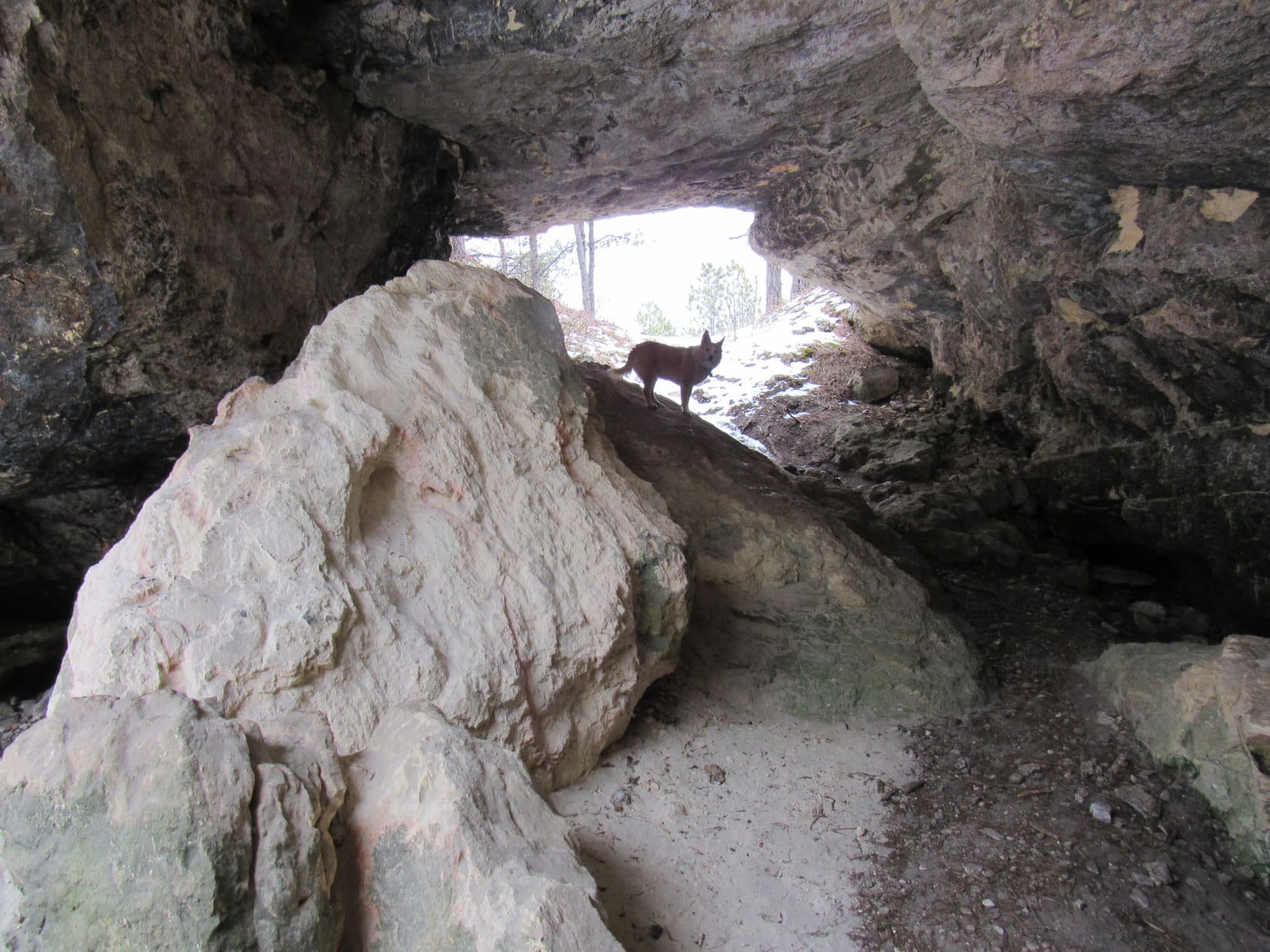
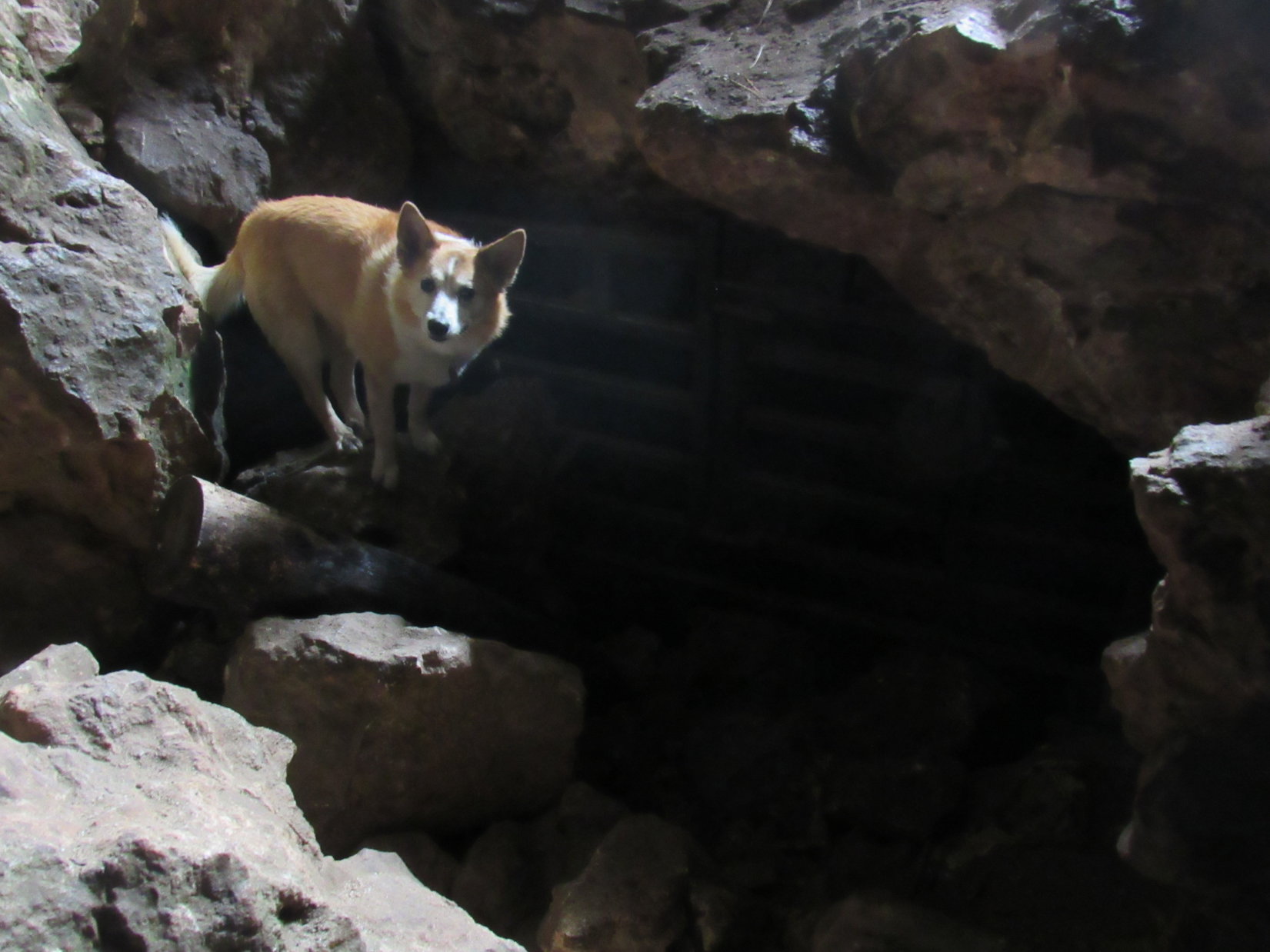
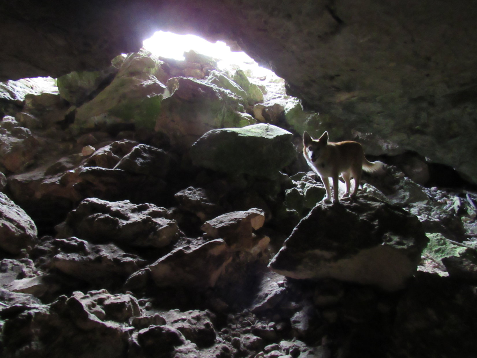
Lupe followed the road farther up the slope.  She’d barely gotten started when there it was – the Ice Cave!

This must be it!

Good job, Looper!  Yes, this is the Ice Cave, alright, but how do we get down there?  It’s just a vertical drop on all sides!

You tell me, SPHP!  You’re the one who has been here before.  Did you use a rope?

Hmm.  I don’t remember using any rope.  But I don’t remember any issue getting into the cave, either.

Well, we’ve found the Ice Cave, but SPHP doesn’t remember how to get down there!

Circling around to the SE, Ah-ha! – another opening!

Here we go, Looper!

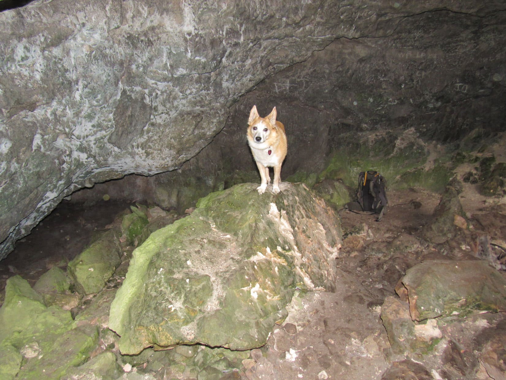
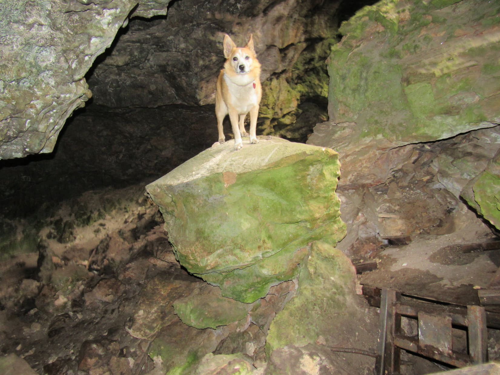
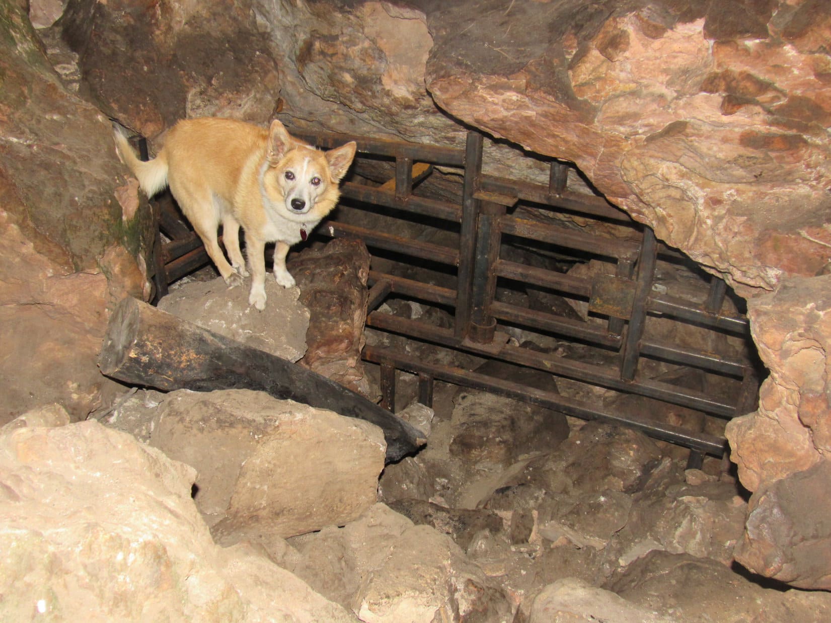
A path led down through an opening so large that even SPHP didn’t have to duck.

At the Ice Cave easy access entrance. Much better than leaping into the pit! Photo looks NW.
Partway in.
Looking back out.

The short tunnel led down into the pit with vertical walls that Loop had discovered first.

In the pit below the vertical entrance.
Overhead opening (L) and the easy walk-in access (R). Photo looks SE.

Along the W side of the pit, a jumble of rocks, many coated with an odd, thin, light-green layer of moss or algae slanted down into a dimly lit region.  The American Dingo, now turned spelunker from peakbagger, began a wary descent into the gloom.

By the opening into the lower chamber.
Descending into the Ice Cave.
Is this really a good idea?

It wasn’t far to the bottom.  Still enough light to see, but the camera worked better using the flash.

At the bottom. Dark recess (L).

At the bottom was a solid rock wall, containing a single dark recess.  Other than that, there was just the slope of collapsed material Lupe had come down.  No doubt that dark recess was the route deeper into the Ice Cave.

Look, Loop!  It’s not blocked off!

Oh, joy!  Are you sure about this, SPHP?  We aren’t going in, are we?

Yeah.  We won’t go far.  Hold on a minute, I’m going to put new batteries into the flashlight.  These are about shot.

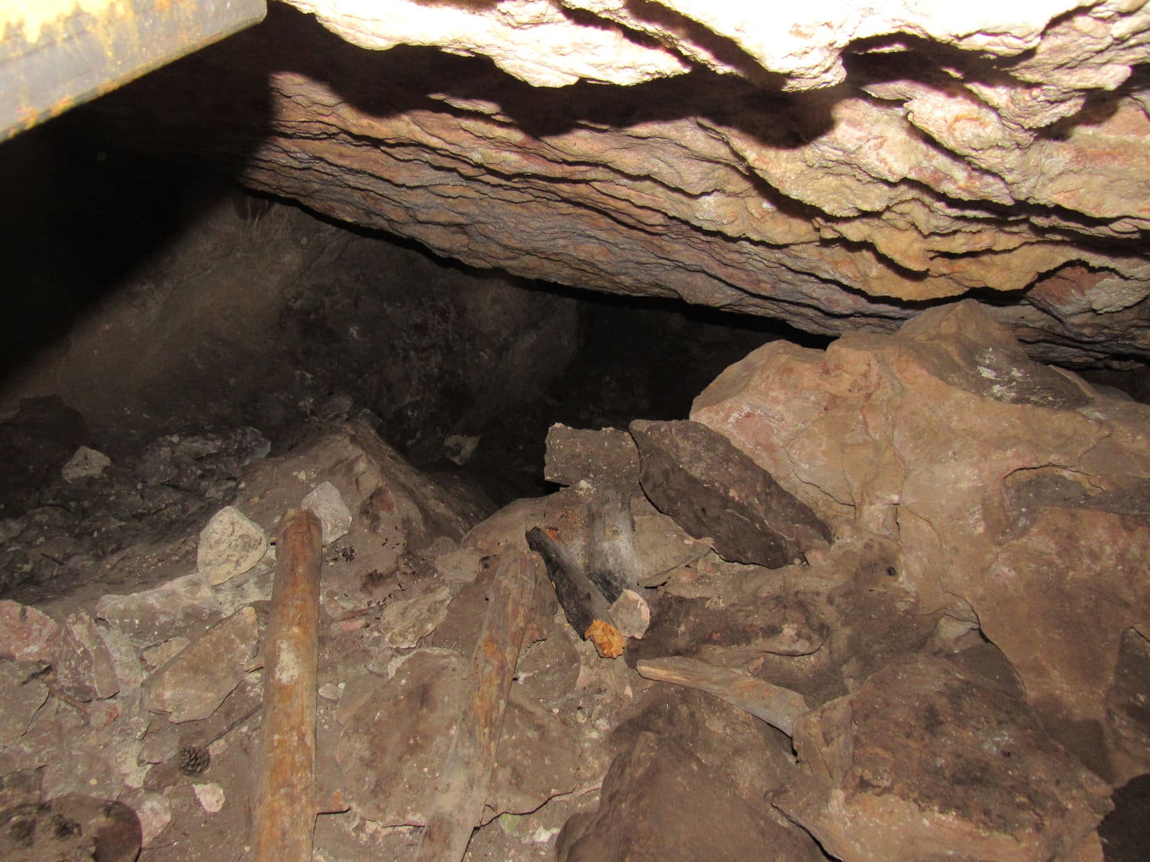
An illusion!  The dark recess wasn’t a passage at all.  2 or 3 feet back in was just another part of the solid wall of rock.  SPHP searched along the lower edge of the entire rock wall, soon exhausting all possibilities.  The whole thing was as solid and continuous as could be.

Huh!  I don’t get it?  Where is the opening into the rest of the cave?

You sure there’s more to it than this, SPHP?

Yah.  Absolutely positive.  Ice Cave isn’t as long as Erskine Cave, but it went at least 50 or 100 feet into absolute darkness, something like that.  The passage wasn’t as tight as at Erskine Cave, either.

And what was in there?

At the very end there was a room, easily big enough to stand and move around in.  From the ceiling, a huge icicle hung down.

That sounds awesome!  Explains the Ice Cave name, too!  Was the icicle dripping?

Oh, it was super cool!  Don’t remember for sure if the icicle was dripping, but I suppose it must have been, at least part of the time.

Shining the flashlight around some more, a glint of metal revealed bars fastened into the slope of debris Lupe had come down.

Hey, Loopster!  Here it is!  The passage into the lower cavern.

Oh, it is blocked off!  What a relie … I mean, what a crying shame!

Yeah, it’s a pity!  Would be fun to go in there again.

Looks like a mighty tight opening, SPHP.

Yeah.  I thought it was larger.  Such a long time ago, though.

By the small opening (at lower L).
A better look.

Hey, SPHP!  There’s a bigger opening over here!

Is it blocked, too?

Yes, come and take a look.

Oh, that’s it!  This must have been the way we went in before.

We?

Yes.  The only other time I’ve been to this Ice Cave was with my friend, Mark.  He lived not too far from here and knew about this place.  I’d never heard of it before.

Mark?  The Mark Anderson with his friend Hillary that we climbed Boulder Hill with a few years ago?

Yup, one and the same.

By the big opening in natural light.
Same spot using the flash.
Looking between the bars deeper into the cavern.

Well, I guess that’s about all there is to see here now, Looper.  Nothing more we can do with all the cave entrances blocked.

Yes, such a tragedy, isn’t it?  Can we go?

Sure.  But what did you think of Erskine Cave and Ice Cave?

Much more interesting than I thought they would be, SPHP!  I’ve learned some dark secrets, past and present, and can see where spelunking might be fun!  Think I’ll stick to peakbagging, if you don’t mind, though.  Never going to see any deers or squirrels in a hole in the ground!

True dat!  OK, c’mon, let’s get out of here.

Back out.

So are we done for the day, SPHP?

Not quite, Loop.  Want to explore a little more of Stagebarn Ridge?  Maybe we can get a good view of Stagebarn Canyon?  It’s really quite impressive from down in it.  Kind of wonder what it looks like from above?

Fine with me!  Let’s do it!

Heading NE, Lupe went back up and over HP4600.  From there she worked her way N, crossed TR8287, then went SE up onto another portion of Stagebarn Ridge a mile away from the Ice Cave.

Exploring more of Stagebarn Ridge. Photo looks ESE.

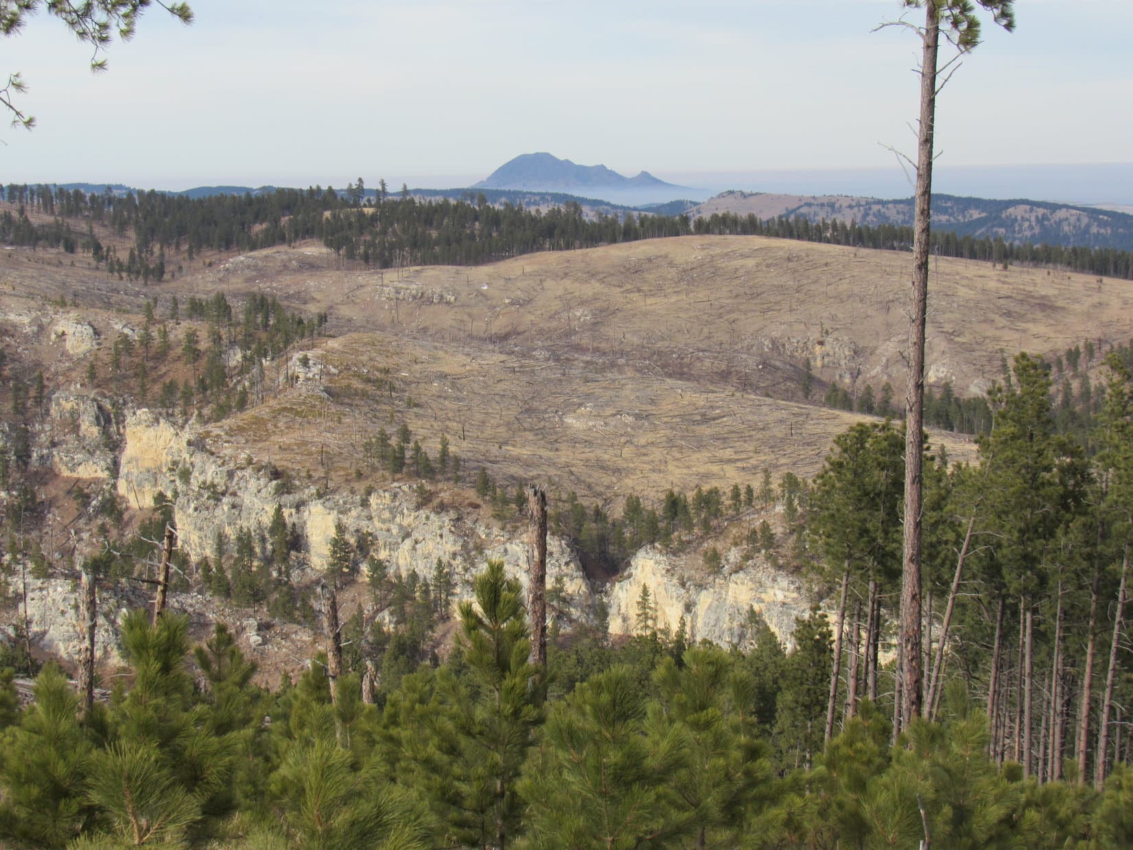
The views were pleasant, but not as impressive as SPHP expected.  Lupe got to see part of Stagebarn Canyon, but never went far enough SE to see South Stagebarn Canyon, since the portion of the ridge overlooking it appeared to be heavily forested.  A chocolate coconut bar, apple, and Taste of the Wild break was taken at a point where Bear Butte (4,422 ft.) could be seen off in the distance.

About as far SE on Stagebarn Ridge as Lupe went. Photo looks ESE.
Stagebarn Canyon (Center) and Bear Butte (R of Center) from Stagebarn Ridge. Photo looks N.
Stagebarn Canyon and Bear Butte (Center) with help from the telephoto lens.
Zoomed in on Bear Butte.

Break time over, Lupe headed NW.  Blue sky!  For the first time today, the sun was breaking through the clouds.  The wide open spaces of Stagebarn Ridge were beautiful in the late afternoon sunlight!

On Stagebarn Ridge.

Lupe sniffed and roamed on the way back to TR8287.  Once there, she faced the same long road hike back.  The Carolina Dog did not go past the Ice Cave again, but Erskine Cave was right along the way, and she did stop by to peer into it once more.  Mostly, though, it was a fun, quiet trek watching for deer as the light began to fade.  Loopster saw some, too!

Never did see that coyote again, though!  (End 5:11 PM, 41ºF)

At the Ice Cave, Black Hills of South Dakota 1-29-21

Links:

Next Black Hills Expedition                      Prior Black Hills Expedition

Black Hills, SD Expedition No. 134 – Copper, Odakota, Green & Hat Mountains Plus The Dragon Caves (6-20-15)

Recommended Black Hills Regional Caves:

Jewel Cave National Monument

Wind Cave National Park

Rushmore Cave

Want more Lupe adventures?  Check out Lupe’s Black Hills, SD & WY Expeditions Adventure Index, Master Adventure Index, or subscribe free to new Lupe adventures!

Trapper Peak, Bitterroot Range, Montana (8-15-20)

Days 10 & 11 of Lupe’s 3rd Summer of 2020 Dingo Vacation to Wyoming & Montana!

8-14-20, Daybreak, 32ºF, Upper Taylor Fork trailhead, Madison Range, MT – Just getting light out.  The sun wouldn’t be up for a while yet.  Jobe was up already, busily rearranging gear in his Rubicon when SPHP came to.  Lupe sniffed excitedly, raring to go as soon as SPHP let her out of the G6.  Maybe she was expecting another Koch Peak (11,293 ft.) outing?

That wasn’t in the cards, a travel day was.  Wasn’t long before Jobe was ready.  Handshakes and pawshakes, and he was off.  The G6 followed the Rubicon across the bridge over Taylor Creek a minute later.  For 3 snail-paced bumpy miles, the Koch Peak adventure was sort of still on.  Wasn’t until the turn E into the rising sun on Taylor Fork Road that SPHP was certain the G6 wouldn’t pop a tire.

At Hwy 191, SPHP turned N down the Gallatin River valley.  Heavy traffic even this early in the day.  At I-90, the G6 headed W.  Jobe was long gone.  His adventures were taking him E to Billings tonight.  Been fun, but Lupe wouldn’t see her friend Jobe Wymore again this year.  The Carolina Dog was off for parts unknown!  W of Butte, SPHP turned S on I-15.  Never been here before!  Let the next adventure begin!

8-14-20, 11:40 AM, Hwy 43 –  The Big Hole River was plenty wide, but not terribly deep.  Peering into the water, the rocks forming the river bottom were all slimy and green, thick with long strands of algae swaying in the current.  Slippery!  Lupe did not venture in, preferring to admire the river’s sparkling surface from a dry rock.

Checking out the Big Hole River.

Hwy 43 ended at a “T” intersection with Hwy 93 at Lost Trail Pass along the Idaho – Montana border.  Sticking with Montana, SPHP turned N.   At Conner came a L (W) turn on West Fork Road, a shortcut which crossed both the E and W Forks of the Bitterroot River en route to Hwy 473.

Not far now!  Heading SW on Hwy 473 for a couple of miles, an access point for the W Fork of the Bitterroot River appeared on the L just before the Trapper Creek Job Corps Center came into view on the R.  Another 0.5 mile, and the highway crossed Trapper Creek.  Immediately beyond it was a sign for a R turn saying “Forest Access Baker Lake”.

8-14-20, 1:21 PM, W Fork of the Bitterroot River – Lupe waded in the cool, clear cool waters of the Bitterroot River.  No slimy green algae coating the rocks here!  Every pebble on the bottom stood out in crisp, watery relief.  SPHP waded in with the Carolina Dog for a few minutes, but she was soon more interested in a squirrel scolding her from the trees above the riverbank than cooling off.

W Fork of the Bitterroot River at the access point across Hwy 473 from the Trapper Creek Job Corps Center.

SPHP relaxed on a tiny sandy beach.  It had been too early to want to head up to the Baker Lake trailhead, so upon finding the access road, SPHP had simply turned around.  Tempting to take a swim, but the trip journal needed attention.  Two hours listening to the soothing rippling waters zoomed by.  Loop would have preferred to continue the squirrel siege, but really hadn’t been making any progress with it.  In any case, it was time to move on.

According to the topo map, the Baker Lake access road left Hwy 473 as USFS Road No. 363.  After crossing a big meadow, proof appeared on the R as the road turned up into the trees.

Yup! This is the right way, alright!

A mile from the highway, a big sign at a junction with Baker Lloyd Road (No. 5629) said 9 miles to the Baker Lake trail.  SPHP continued straight, sticking with No. 363, which by now was climbing steadily and getting both washboardy and very dusty.

At the junction with Baker Lloyd Road, which isn’t the way to go.

Another mile on No. 363 led to a spot where roads curved both L and R.  Directly ahead on a hillside was a “363”, apparently meant for the road going off to the L.  Instead, SPHP made a sharp R turn onto a road with a small sign saying “5634” with a hiking symbol below it.

The 8 miles on USFS Road No. 5634 were an adventure of their own!  Nearly the entire way the road wound crazily or made long switchbacks along a steep forested slope.  The rate of climb was never worrisome, in fact, parts of the route were level or close to it, yet the whole drive was unnerving, especially where openings appeared in the forest.  It was then possible to see the plunging mountainside and a vast airy expanse over to mountains miles to the E, mountains no higher than where the G6 now crept cautiously along.

However, the true source of anxiety was the extreme narrowness of the road, which produced a greatly heightened sense of always being on the brink.  No. 5634 was fine for one vehicle, but what if another was met on its way down the mountain?  The prospect of having to back down for who knew how far was dreadful, yet it must happen all the time.

An answer came 3 miles into the journey.  A vehicle did appear coming the other way.  Luck of the Dingo!  A Jeep!  No way two vehicles could pass on the road at this point, but the Jeep pulled almost entirely off the road leaning at a 40º angle on the uphill slope.  The G6 squeezed past.

Onward!  G6, ho!

Should have come up earlier in the day!  3 more times vehicles appeared heading down.  Luckily, all these instances occurred at points where it actually was possible to sneak by, the only abuse suffered by the G6 the rude scraping of tree branches along the passenger side.

8-14-20, 4:02 PM, Baker Lake trailhead –  The Baker Lake trailhead proved to be little more than a long wide spot where USFS Road No. 5634 simply dead-ended.  Room enough to carefully turn around, if the joint wasn’t too overrun already, which it might have been if those 4 vehicles that had already departed had still been up here.

SPHP did turn around, parking the G6 facing back out as close to the exit as possible.  Might help avoid getting hemmed in when the time came to depart!  An hour after leaving Hwy 473, the American Dingo hopped out.  If Loopster was as relieved as SPHP to finally be here, she gave no indication of it.

A short stroll past pickups and SUV’s to the end of the road led to the usual display of rules and regulations, but little of interest specific to this location.  Hours yet until the sun would set, but here on the E side of the mountain, much was already in shadow.  20 feet beyond the display, a well-worn single track trail curved up into the sullen deep green gloom of tall densely-packed conifers.

The evening wore on.  By nightfall, only 5 vehicles remained.

Baker Lake trailhead at the end of USFS Road No. 5634. Photo looks N.

8-15-20, 7:55 AM, 52ºF, Baker Lake trailhead – Morning sunlight filtering through the trees completely dispelled yesterday’s gloom as Lupe set off for Baker Lake on Trail No. 234.  The trail began with a short steep climb W or SW through thick forest before leveling out as it turned S.  Upon reaching a small clearing, the trail started switchbacking higher.  Before long, Looper came to a huge rock formation out in a larger opening.

This must be Baker Point!  Lupe scrambled partway up for a look.  Kind of hazy out, especially to the E.

About to set out from the Baker Lake trailhead. Photo looks S.
Baker Point. Photo looks SSE.

At Baker Point, Lupe reached the start of a broad ridge sloping slowly, but steadily higher.  The trail headed WNW along this ridge passing through a more open forest of younger trees.  After gaining perhaps 200 feet of elevation, the trail left the ridgeline to head more directly W or WSW along a slope N of the Baker Creek valley, flattening out as it did so, and even losing elevation in spots.

Glimpses of the ridge to the SW that Lupe ultimately needed to get over to began appearing.  Eventually, Loop caught sight of towering cliffs on the E face of East Trapper Peak (9,928 ft.), too.

In the younger forest past Baker Point.
The ridge on the L leads to Trapper Peak. Photo looks SW.
East Trapper Peak (R). Photo looks WSW.

After losing 80 feet of elevation, a big opening was reached on the N (R) side of the trail.  This region contained many huge rocks that had long ago crumbled ago from the ridge the trail had abandoned, the top of which was now in sight at least 100 feet higher.

Below the ridge the trail had abandoned. Photo looks N.

From this low point, the trail began climbing again as it wound among boulders and tree roots in an older forest.  Close to Baker Lake exposed slabs of rounded bedrock appeared.  With so much rock about, the forest was more dispersed.  Upon reaching Baker Creek, Loop crossed a bridge of three small logs before following the stream to its source.

Boulders, tree roots, and an older, denser forest en route to Baker Lake.
Slabs of bedrock appeared shortly before reaching Baker Lake. Photo looks N.
Crossing the 3 log bridge over Baker Creek.
Baker Creek was small, but quite scenic flowing over exposed bedrock.

Lupe found Baker Lake tucked away in a spectacular setting!  Large rock formations bordered the E and S shores, and magnificent mature forests encircled the lake wherever sufficient soil was present.  Huge protective ridges pressed in from the N and S, and off to the W was a splendid view of the E face of East Trapper Peak.  Mirror smooth, the lake doubled the grandeur of its surroundings in near perfect reflections.

Baker Lake. East Trapper Peak (L of Center). Photo looks W.
Another angle. East Trapper Peak (R). Photo Looks WSW.
East Trapper Peak from Baker Lake. Photo looks W with help from the telephoto lens.

Evidently, Baker Lake is a popular destination.  Exploring boulders and bedrock along the E shore, Lupe saw colorful tents and hammocks both nearby, and over on the W side of the lake.  However, getting to Baker Lake was merely a good start to the day for the peakbagging Dingo.

Trapper Peak (10,157 ft.) was Lupe’s destination.  Unseen, except for the E summit, Trapper Peak was still another 2,300+ feet higher and 2 miles away.  There was actually an official Trapper Peak trail No. 133 that came up the mountain’s humongous SE ridge, but the Baker Lake route that Lupe was taking was shorter, more scenic, and required 640 feet less elevation gain.

The whole trick to making the Baker Lake route work was to get up onto the ridge S of the lake, which was merely a different part of the same SE ridge the official trail went up.  However, the topo map showed the N face of this ridge being very steep for 200+ feet.  Didn’t look so bad from here at the lake, though.  Lupe headed for it, staying somewhat E of the lake following an easy route higher along bedrock slabs.

The ridge Lupe had to get up onto as seen from Baker Lake. The route up is just to the R of the big pine tree at L. Photo looks SSW.
On the bedrock slabs heading for the E end of the ridge (Center). This region is SSE of Baker Lake. Much better than going due S from the lake. Photo looks SSE.

SPHP had previously seen GPS tracks of routes others had successfully tried from Baker Lake.  Nearly all of them went up toward the lower E end of the part of the ridge closest to the lake.  A shaded area full of trees could be seen between two cliffy spots as Lupe got closer.  Figuring this was the way to go, suspicions were soon confirmed by the discovery of a use trail near the bottom of the slope.

Aim for the dark area (L of Center) between the cliffy spots! Photo looks S.
At the base of the climb, which is just to the R of these cliffs. Photo looks SSE.

The slope the use trail went up was steep, very steep, but not all that rocky.  SPHP clung to trees, branches, bushes – basically whatever was available, whenever available.  With 4 on the floor, Loopster had no trouble.  Near the top, the rate of climb diminished.  Gonna make it!

Getting close to the top. Photo looks S.
Made in the shade! The use trail flattens out just beyond Lupe. Photo looks SSE.

Up on top, a large pile of deadfall was near the big flat spot where the use trail came up.  The use trail turned R here, heading W just S of a line of cliffs.  However, before going that way, Lupe scrambled over some of the deadfall to a rocky high point visible just a little to the NE.  This high point featured several large dead trees, and was a terrific viewpoint.  Baker Lake could be seen from here, as well as both East Trapper Peak (9,928 ft.) and North Trapper Peak (9,801 ft.).

At the viewpoint NE of where the use trail reached the ridgeline. Photo looks NNE.
Baker Lake (Center) from above. Photo looks N.
East Trapper Peak (L) and North Trapper Peak (R). Photo looks WNW.

Reaching the ridgeline meant that the only tricky part of the ascent was over, but the Carolina Dog still had a long way to go.  Returning to the use trail, she now followed it W through a forest different from the one down by Baker Lake.  Up here, the trees were smaller, more spaced out, and many were dead.

Following the use trail higher. Photo looks WNW.

The use trail gained elevation at an easy to moderate pace that didn’t vary much.  Every now and then, Lupe ventured N to the edge of the cliffs to check out the views.  She finally came to a point where Middle Lake was in sight, along with just a glimpse of Gem Lake above it.

Middle Lake (near Lupe’s head). East Trapper Peak (L) and North Trapper Peak (Center). Photo looks NW.

Close to this viewpoint, the terrain steepened as Loop climbed a ridge of light-colored talus.  These rocks tended to be flattish, which made them an easier scramble than they might otherwise have been.  Lichens gave all the rocks on top of the ridge a mottled dark gray and light green cast.

This ridge was HP8768 on the topo map.  Ahead was a chasm due to a large notch in the main ridge, and a terrific view of East Trapper Peak.

Climbing the light-colored talus ridge. Photo looks W.
East Trapper Peak (R) from HP8768. Photo looks W.

Lupe now had to veer SW along the talus ridge to avoid the chasm.  The talus slowed things down, but eventually played out.  Back in the forest, Loop soon turned W again, quickly regaining the elevation she’d lost leaving HP8768 and more.

By now the use trail was intermittent, but the overall route was clear.  The open forest and moderate pace of climb made travel relatively easy.  Lupe kept heading W, constantly gaining elevation.  Eventually the line of cliffs to the N began to curve NW.

A high point of light-colored rocks now appeared near the edge, but the terrain steepened rapidly in that direction, and a young densely-packed forest made attaining that high point difficult.  Abandoning the attempt to follow the cliffs any farther, Lupe took a course more to the WNW.

The forest soon began to thin.  Suddenly it ended.  A few thin lines of stunted trees ran down a long slope of scattered rocks and loose soil.  Directly ahead were several distant high points.

Oh, I think that’s it, SPHP! Trapper Peak (L)! Photo looks WNW.

Wandering higher on the vast open slope beyond the forest, Lupe now had views of mountains to the SW.  A ridge of dark stone appeared to the N, the summit of East Trapper Peak (9,928 ft.).  Instead of going to it, the American Dingo aimed for the saddle leading to Trapper Peak.

In the open on Trapper Peak’s vast SE slope. HP9587 (R of Center). Photo looks SW.
Below East Trapper Peak’s summit ridge. Photo looks N.

On the way to the saddle, Lupe came across the official Trapper Peak trail No. 133 bound for the same destination.  By then, she didn’t have much farther to go.  The broad flat saddle between East Trapper Peak and Trapper Peak proved to be terrain similar to the giant slope Looper had just come up, a rock-strewn plain of gritty loose soil and short, sparse vegetation.

Approaching Trapper Peak. Trail No. 133 (R). Photo looks W.
East Trapper Peak from the saddle. Photo looks NE.

Before heading for Trapper Peak’s summit, Lupe ventured over to the N edge of the saddle.  Here, beyond a giant cirque, was a tremendous view of a series of rugged peaks and jagged ridges extending from North Trapper Peak (9,801 ft.) all the way to El Capitan (9,983 ft.).

El Capitan (far L) and North Trapper Peak (far R). Photo looks NNW.

At the W end of the saddle, the official Trapper Peak trail vanished as far as SPHP could tell.  Two high points were visible ahead, the more distant one clearly higher than than the one Lupe faced at the moment.  Gonna be slow going!  All talus from here on.

At the W end of the saddle, approaching the talus-covered slopes leading to the summit. Photo looks W.

Lupe hadn’t seen anyone along the entire Baker Lake route except right at Baker Lake, but the official Trapper Peak trail was busy.  Hikers were coming and going.  From here, most seemed to head W right over this first high point.  Following their example, Looper did the same.

On the talus slope leading to the first high point. Photo looks W.

From the top, which turned out to be a series of mini high points along a talus ridge modestly higher toward the W, the next high point ahead was in full view.  Definitely the true summit!  Whether coming up onto this first ridge was really the best route or not seemed doubtful.  At the W end, the American Dingo faced a short, but very steep down climb in big talus to get to a minor saddle leading to the final ascent.

Maybe it would have been better to stay lower simply skirting this ridge to the S?  Hard to say.  Didn’t matter now.  Lupe did what she had to do.

True summit of Trapper Peak (Center) from the first high point. Photo looks WNW.
East Trapper Peak (L) from the E end of the first high point. Photo looks ENE.
At the W end of the first high point with the final ascent dead ahead! Getting down to the saddle leading to it was trickier than it looks. Photo looks NW.

8-15-20, 1:18 PM, Trapper Peak – Made it!  Well, almost.  Having scrambled up from the S, Lupe was now a little SW of the true summit, maybe 20 or 25 feet below it.  Quite a few people around.  Lots up on top.  Still early, the Carolina Dog could wait for them to clear out.  Time for a rest, anyway.  Except for a bit of haziness, the weather was perfect.

Hah!  That was SPHP’s opinion.  The American Dingo was hot.  While SPHP found a perch from which to enjoy the views, Loop searched for a comfortable spot with a bit of shade.  None!  Giving up on finding any, Lupe finally plunked herself down on a patch of dirt to pant and snap at flies.  A couple bowls of water provided at least some relief.

Don’t happen to have a parasol in that backpack, do you, SPHP?

A little SW of where Lupe and SPHP were hanging out, an airy platform of rock provided a tremendous vantage point.  Like the true summit, it was occupied.  However, when it eventually opened up, Loop went over that way for a look around.

Airy platform (L) before it got vacated. Photo looks W.
Due to some big cracks, as close to the airy platform as Loop got. Photo looks W.

To the S and SW, Boulder Peak (9,804 ft.), East Boulder Peak (9,480 ft.) and HP9587 stood out.  Beyond them a huge expanse of lesser peaks and ridges stretched to the horizon.

HP9578 (L), East Boulder Peak (Center) and Boulder Peak (R). Photo looks SSW.
HP9578. Photo looks S with help from the telephoto lens.

Due N, and more than 2,500 feet lower, a good chunk of Cave Lake was visible.  Sugarloaf Peak (9,586 ft.) towered a couple of ridges past it, while El Capitan (9,983 ft.) dominated the scene farther NNW.

Cave Lake (R of Center), Sugarloaf Peak (Center), & El Capitan (far L). Photo looks N.
El Capitan. Photo looks NW with help from the telephoto lens.
Looking WNW.
Summit from close to the airy platform. Photo looks NE.

People continually came and went.  Most stayed up at the true summit only a little while before moving on, but a few lingered for a long time.  Lupe was patient, but the summit was never unoccupied.  More than 1.5 hours drifted by.

Alright.  Ready or not, maybe it was time for action?  Despite a couple in the middle of enjoying a picnic up there, SPHP encouraged Loopster to proceed.  On a mountain this busy, complete privacy was a luxury.

Guess we’re going to go barge in at the top now! Photo looks NE.
Looking back on the way to the true summit. Photo looks WSW.
Memorial stone near the summit.

Looper got high, very high!  But not quite all the way to the tippy top yet.  East Trapper Peak was in view again, and so was the entire SE ridge that the official Trapper Peak trail comes up.

East Trapper Peak (L of Center) and the first high point on the way up (R of Center). Photo looks E.
Trail No. 133 comes up the long slope in the foreground. Photo looks SE.

Lupe and SPHP kept inching closer to the picnickers.  They finished eating, but the woman started calling people on her cell phone.  Meanwhile, Loopster discovered a survey benchmark, and got up on one of the very highest rocks.

The first of 2 survey benchmarks Lupe found on Trapper Peak.
Just a foot or two lower than the true summit. Photo looks WNW.

Lupe had been waiting for a turn on the summit rock for nearly 2 hours now.  The couple was sitting right next to it.  SPHP finally apologized for the intrusion, as Loop leapt up to the true summit.  Close to the highest point, another survey benchmark was attached to this rock.

True summit of Trapper Peak. El Capitan (Center) in the distance. Photo looks NW.
The “Trapper” survey benchmark.
How’s this for a view? We’re higher than El Capitan (Center) and everything else around here! Photo looks NW.

Fortunately, the couple was friendly.  They didn’t mind Lupe being up here, too.  The American Dingo took the liberty of going past them to get over to the best view of North and East Trapper Peaks.

East Trapper Peak (R). Photo looks NE.
North Trapper Peak (L) and East Trapper Peak (R). Photo looks NE.
More of the chasm between them. Photo looks NE.

Unfortunately, the phone conversations quickly headed S.  Suddenly, the woman was weeping as she spoke with her mother.  Awkward, but the situation didn’t last.  Trapper Peak’s joyful mood had been ruined for the couple.  They left, heading down the mountain.

Sad that their Trapper Peak experience ended that way, but it worked for Lupe.  For the first time she had the true summit all to herself.  Still people not too far away, so the Carolina Dog better enjoy it while she could.

In dramatic solitude at the true summit! Photo looks NE.
More of the summit region. Photo looks NE.
Looking WSW now.
Looking W with help from the telephoto lens.

8-15-20, 3:29 PM, Trapper Peak – The true summit photo shoot hadn’t taken long, but Loop had now been at or near the top of Trapper Peak for over 2 fabulous hours.  So this was it, the inevitable moment of truth.

On Trapper Peak.

While the return was simply a matter of retracing the same basic Baker Lake route, Lupe changed things up a bit, making new discoveries and having new experiences along the way.

After scrambling down to the little saddle between Trapper Peak and the first high point to the E, Loop followed a trail S, losing elevation instead of going up and over that talus ridge.  Once she turned E, cairns were all over the place, but still no path.  Just a jumble of large talus, same as the ridgeline had been.

So, no matter which route was taken, it was simply a time-consuming talus trek over to the big saddle W of East Trapper Peak.  Once Lupe got there, instead of jumping on the official Trapper Peak trail to start down the enormous SE slope, Lupe climbed East Trapper Peak (9,928 ft.).  This was easily accomplished from close to the SE end of the summit ridge where she didn’t have to do much scrambling.

For no more effort than it took, the side jaunt up East Trapper Peak was very worthwhile!  The views of Trapper Peak were splendid, and even Baker Lake and most of the route back to it were visible from up here.

Trapper Peak from East Trapper Peak. Photo looks WSW.
North Trapper Peak (Center) and El Capitan (far L). Photo looks N.
East Trapper Peak summit region with Trapper Peak in the background. Photo looks WSW.
Baker Lake (L). The route back circles along the top of the cliff line. Photo looks ESE.

During the return, those boots started bothering SPHP’s paws again.  Lupe suffered no such inconveniences.  Once back in the forest, the Carolina Dog had a blast racing about searching for squirrels, while SPHP hobbled after her.

The talus ridge at HP8768 was easily avoided.  However, this success was completely overshadowed by a mistake SPHP made descending the very steep slope leading down to Baker Lake.

Instead of staying toward the E (R), halfway down SPHP led Loop down a path more to the W.  This missed the nice trek on the slabs Lupe had taken earlier in the day that would have gotten her back to Baker Lake with little difficulty.  The American Dingo dropped much further down into a jungle of deadfall, boulders, bogs, and hollows.  SPHP endured a lot of useless thrashing about before reaching the S shore of Baker Lake.

8-15-20, 8:40 PM, Baker Lake trailhead – Whew!  What a day!  Even Lupe was acting tired as SPHP limped gingerly to the G6.  The Trapper Peak adventure wasn’t over yet.  One more thing to do.  After getting Loopster fed and the pack stuffed back into the G6, SPHP opened a Coke and a box of Dots, then turned the key.

In the morning, vehicles would be coming up super narrow USFS Road No. 5634.  Now was the time to get back down to the highway.  Twilight faded to black on the 8 mile Coke slurping, Dot munching journey back to USFS Road No. 363.  Slowly, cautiously!  Still took a long time, but the experience was much less nerve-wracking in the dark without those daunting views or oncoming vehicles to worry about.

Success!  Took the better part of an hour, but so what?  The American Dingo could now spend the night twitching and dreaming of her Trapper Peak adventures at the access area along the beautiful W Fork of the Bitterroot River.  And why not?  That was SPHP’s plan, too.

Trapper Peak, Bitterroot Range, Montana 8-15-20

Links:

Next Adventure                          Prior Adventure

Want more Lupe adventures?  Choose from Lupe’s Summer of 2020 Dingo Vacations to Wyoming, Utah & Montana Adventure IndexDingo Vacations Adventure Index or Master Adventure Index.  Or subscribe free to new Lupe adventures.