Black Hills, SD Expedition No. 203 – Gimlet Creek to Minnesota Ridge (5-6-17)

Start 8:23 AM, 50°F, USFS Road No. 203.5 just off Rochford Road

Lupe liked the looks of this place – green grass, a bubbling creek, choice of sun or shade.  A slice of American Dingo paradise, that’s what it was!  Loopster was all smiles.

Lupe was all smiles at the start of Expedition No. 203. She anticipated a great day ahead!

Smiles and energy, that is!  Lupe took off running.  She bounded through the tall grass wet with dew near Gimlet Creek.  Of course, she tested the waters of the creek itself, too.  They quickly earned the Carolina Dog seal of approval.

Lupe’s day started close to the confluence of Gimlet Creek & East Gimlet Creek. Here she tests the waters of East Gimlet Creek.

As SPHP started up USFS Road No. 203.5, Lupe raced through fields on both sides of the creek.  Sometimes she scrambled partway up the sides of the valley.  She was looking for squirrels, but didn’t find any.  A great many of the large trees on the hillsides were dead, killed by pine bark beetles.

Lupe remained hopeful, though.  The day was just beginning.  Having a creek to follow was simply glorious!  Loop loved being able to cool off in the stream.  At intervals, the road had big mud puddles, too.  Lupe strolled through each one, slurping up cloudy brown water as she went.  She was definitely getting her mineral requirements met.

Lupe on USFS Road No. 203.5 in lower Gimlet Creek valley. Photo looks N.
Lupe got to follow USFS Road No. 203.5 up Gimlet Creek valley for more than 2 miles. Actually, it was SPHP who followed the road. Loop was busy exploring.
Looking downstream in the Gimlet Creek valley. The lower part of the valley was fairly narrow as seen here. Photo looks S.
Looking NNW up the valley.

Only a week ago, Lupe had found snow up in the hills on Expedition No. 202.  No chance of that today.  Not even close.  Beneath a cloudless blue sky, the day was warming up fast.  In fact, the forecast was for near record temperatures in the 80’s °F.  From winter to summer with scarcely any transition between.  Not good, but not that unusual in the Black Hills.

After 2 miles, the road forded Gimlet Creek.  Lupe was already slowing down due to the rising temperatures.  She stayed closer to SPHP and the road.  Fur coats are wonderful when it’s cool out, but not so great when it’s warm.  Lupe’s tongue hung out.  She wore a perpetual smile whether she wanted to or not.

By the time Lupe reached the Gimlet Creek ford on USFS Road No. 203.5, she was slowing down. The day was warming up fast, and the heat was starting to get to her. The creek and every mud puddle she came to were welcome sights.

Beyond the ford, the valley widened out considerably.

The valley had become much wider by the time Lupe reached the ford on Gimlet Creek. Photo looks N across the valley, which curves to the E (R) here for a short distance.

About 0.25 mile N of the ford, Gimlet Creek turned E.  From a side valley to the W, a smaller tributary stream flowed into a pond before continuing over to its confluence with Gimlet Creek.  Several ducks flew away as Lupe drew near the pond.

Getting close to the pond, which isn’t in view quite yet, but isn’t far off to the L. The small tributary stream flows through the fenced-in area seen above Looper on its way to Gimlet Creek on the far R. Photo looks NE.
Lupe reaches the pond, the biggest water feature she would see on Expedition No. 203. Several ducks had flown off as Lupe approached. Photo looks NW.
A good bridge crossed the small tributary of Gimlet Creek where it exited the pond. Lupe had come up USFS Road No. 203.5 from the direction seen on the L. Photo looks SW.

A family of Canadian geese had made this pond home.  When Lupe arrived, they were out for a stroll on the green grass nearby.

Momma and papa goose out for a stroll with their 5 chicks.

The little geese were far too young to fly, so when momma and papa saw Lupe, they led the chicks back to the safety of the water.  In the meantime, the ducks had already returned.

By the time Lupe circled around to the N side of the pond, the ducks had already returned. Photo looks S down the Gimlet Creek valley the way Lupe had come.
The geese returned to the safety of the water while Lupe was around.

For a few minutes, Lupe and SPHP enjoyed watching the ducks and geese.  Unseen frogs sang a noisy tune.  It was a pleasant scene, but Lupe was soon eager to press on.

Immediately N of the pond, USFS Road No. 203.5 left the valley and disappeared up a forested hillside.  Lupe didn’t follow it.  Instead, she went W on a fading side road, which paralleled the tributary of Gimlet Creek.  She had to go around deadfall timber blocking the road in a number of places.

The side road soon ended at a marshy area where another small valley came down from the N.  Lupe crossed the marsh, still heading W.  She stayed in the valley the tributary of Gimlet Creek flowed through.  Eventually this valley turned N, too.

The tributary of Gimlet Creek was a very small stream, but did have flow.  After the valley turned N, Lupe came across another minor road following this stream.  The road forded the tiny creek 5 or 6 times.  Lupe was always glad to have another chance to cool her paws off.

A minor road Lupe was following upstream forded the little creek 5 or 6 times. Lupe was always glad to have another chance to cool her paws off or get a quick drink. Photo looks NNE.
The tiny stream supported a lush green ribbon of life.

Lupe was 1.25 miles from the pond when she came to a pole fence across the valley.  On the other side was a better road.  Lupe went around the fence and continued N on this new road.   She met a little green snake basking in the sun.  Though it was warm out, the snake didn’t move even when SPHP prodded it with a stick.

Why the snake didn’t move wasn’t clear.  It looked fine, but perhaps something was wrong with it?  The only sign of life it gave was to flicker its tongue when lightly poked.

Lupe came to this small green snake basking in the sun on the road. It wouldn’t move other than to flick its tongue now and then.

The new road quickly brought Lupe to a junction.  A sign said Lupe had been on Killoern Springs Road (USFS Road No. 204.1B).  The other road at the junction was USFS Road No. 204.1.  Lupe sat in the shade of a big pine tree while SPHP checked the maps.

Lupe relaxes in the shade of a pine tree while SPHP checks the maps.
Looking NW from the junction of Killoern Springs Road and USFS Road No. 204.1. Pine bark beetle damaged sections of the forest are a common sight in the Black Hills these days.

The maps confirmed that Lupe was now more than 3 miles from where she’d left the G6.  She actually did have a peakbagging goal today.  She was on her way to Minnesota Ridge (6,240 ft.), the summit of which was still another 2 miles to the NW.  Only a little farther N on No. 204.1 was another junction, this one with Minnesota Ridge Road (USFS Road No. 203).  In fact, Lupe could see the junction from here.

Minnesota Ridge Road wouldn’t take Lupe all the way to the summit, but it would get her reasonably close.  Lupe headed for it.

The march up Minnesota Ridge Road was sunny.  The day was very hot for early May.  The little stream Lupe had been following had completely disappeared.  Lupe panted.  Her tongue hung out as she plodded along the dusty road behind SPHP.  A couple of times, SPHP stopped to give her water.

The road didn’t climb all that steeply, but it was steep enough.  The heat sapped both Lupe’s and SPHP’s energy.  A mile from the last junction, the road finally began to level out.  Lupe reached another intersection with Greens Gulch Loop.

The road leveled out about the time Lupe reached this intersection with Greens Gulch Loop (unseen to the L). Photo looks N.

SPHP checked the maps again.  Lupe could go either way, W on Greens Gulch Loop or N on Minnesota Ridge Road.  No matter which way she went, she would have to leave the road before long.

Loop stayed on Minnesota Ridge Road for another 0.25 mile.  She reached a big mud hole where frogs were singing noisily.

Frogs singing in this mud hole on the E side of Minnesota Ridge Road ceased their din when Lupe appeared. Lupe was far enough N now. It was time to leave the road to look for the summit of Minnesota Ridge. Photo looks ENE.

Lupe left the road heading WNW through the forest.  The true summit of Minnesota Ridge might be as much as 0.5 mile away or even a little more.  SPHP was more concerned with how difficult it might be to find the summit, than how far away it was.  The topo map showed only a gradual rise in the terrain toward the W.  The top of Minnesota Ridge was likely to be flat, forested, and cover a lot of territory.

Although many trees were still green and growing, the forest floor was thick with beetle-killed deadfall timber.  Lupe wound around trying to avoid the worst of it.  At least it was clear Lupe actually was gradually gaining elevation as she continued WNW.  Nothing except more forest was in view in any direction.

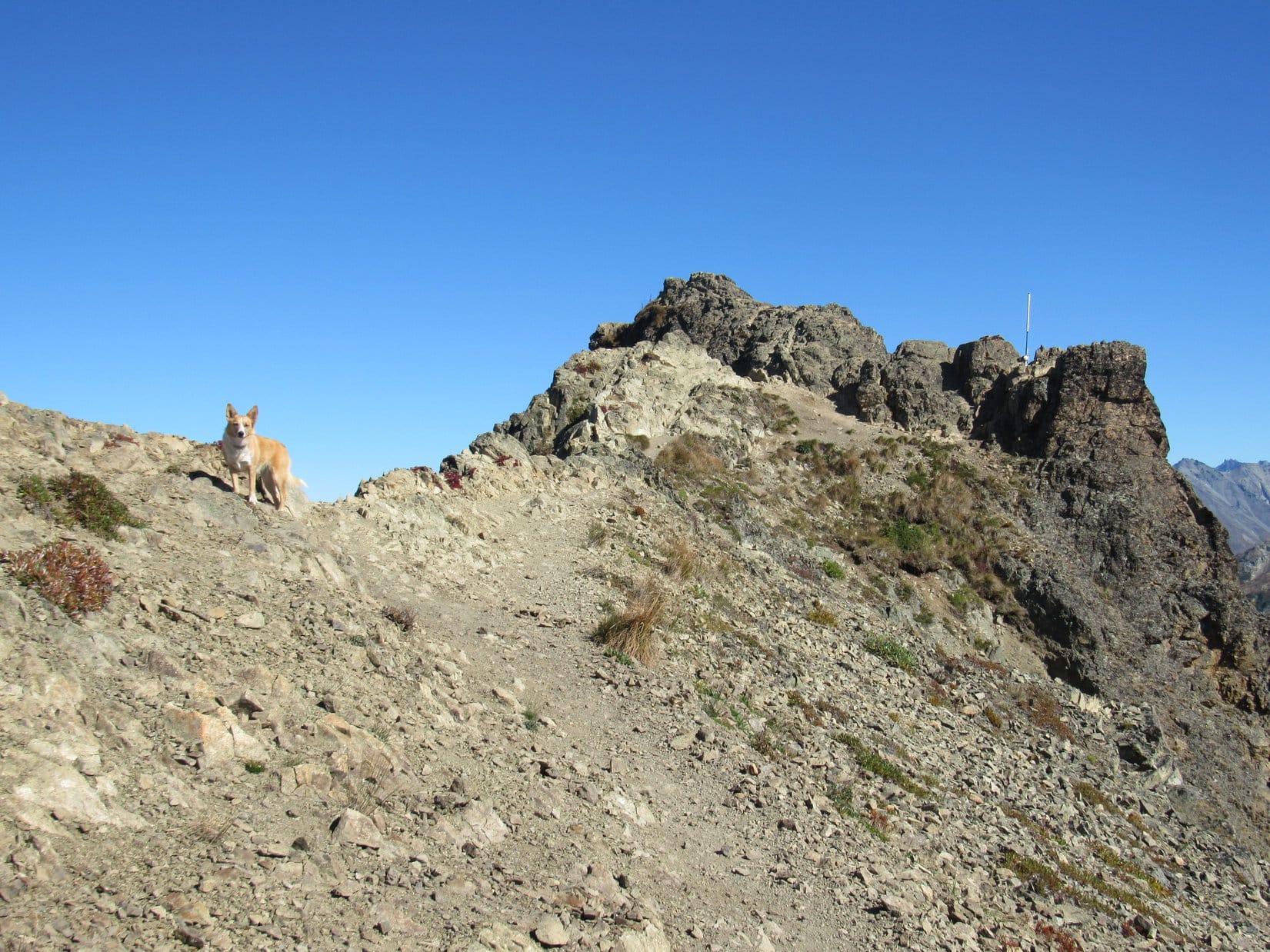
After a long wandering way, Lupe started catching glimpses of distant ridges miles away to the W.  She was nearing the W edge of Minnesota Ridge, which was the steepest side of the mountain.  As she reached what seemed to be the highest terrain, Lupe found a series of boulders scattered along a line running roughly N/S.

Tree broken views of distant ridges farther W appeared as Lupe reached the W “edge” of Minnesota Ridge. A line of boulders ran N/S. Maybe one of them was the true summit? Photo looks W.

Lupe had hardly seen any rocks in the forest until now.  Maybe this was Minnesota Ridge’s summit area?  It seemed likely.  Perhaps one of these boulders would be clearly higher than all the others?  Maybe it wasn’t going to be as hard to find the true summit as SPHP expected.

Lupe explored S along the line of boulders.  She didn’t have to go too far before it became clear the terrain was definitely going to start dropping off if she went any farther this way.

Lupe on the last big boulder at the S end of the highest terrain. A short exploration to the S from here confirmed that Lupe would lose elevation going any farther that way. Photo looks S.

Once it was established that there was no point in going any farther S, Lupe turned N again.  She followed the line of scattered boulders looking for the highest one.

Lupe willingly leapt up on each boulder SPHP thought might be the true summit of Minnesota Ridge (6,240 ft.), but the process soon became somewhat of a comedy.  Each time SPHP believed Lupe had been at the true summit, another boulder that seemed clearly a little higher would be found hidden in the forest another 20 to 50 feet farther N.

Lupe on the 1st boulder SPHP declared the true summit. Photo looks NE.
On the 2nd “true summit”. Photo looks NW.
On the 3rd “true summit”. Photo looks E.
Lupe on the 4th “true summit”. This one was well back from the W edge of the mountain, and had an interesting knob of different colored rock firmly fastened on top. There was even a clearing in the forest nearby. Photo looks NW.
The 5th “true summit” rock had its own little ecosystem growing on it. SPHP named this one Garden Rock. Photo looks ENE.
Looper on the 6th “true summit”, the highest and farthest N in the line of boulders. Photo looks NNW.

Finally after standing on 6 different “true summit” boulders, the line of boulders faded away.  The ground to the N seemed to dip slightly, so No. 6 was probably it. To be certain, though, Lupe continued N near the W edge of the mountain.  Only when it was clear that the terrain was going to start dropping off decisively would Lupe claim her peakbagging success.

It didn’t happen.  Beyond the slight dip, the ground rose slowly again.  Lupe went hundreds of feet N before coming to another area where the terrain leveled out.  She was almost certainly higher now than she had been back at boulder No. 6.  This large area of flat ground was sunny and open.  Most of the trees had been killed by pine bark beetles, and had subsequently snapped and fallen over.

SPHP didn’t like it.  This area now had to be considered the true summit, but the place lacked charm.  All the deadfall was just plain ugly.  A couple of modest-sized rocks about equal in elevation were now joint contenders for true summit.  Once again, Lupe willingly got on each one.

Boulder No. 7 in contention for the title of true summit. However, No. 8 only 25 feet away was about the same elevation, too. Photo looks SSW.
“True summit” No. 8 was in an ugly place with lots of deadfall. Photo looks N.

“True summits” 7 and 8 were in such a hideous place, there was no point in lingering.  The terrain to the N was still flat, so Lupe needed to explore it too, in order to make certain this was actually the top of the mountain.

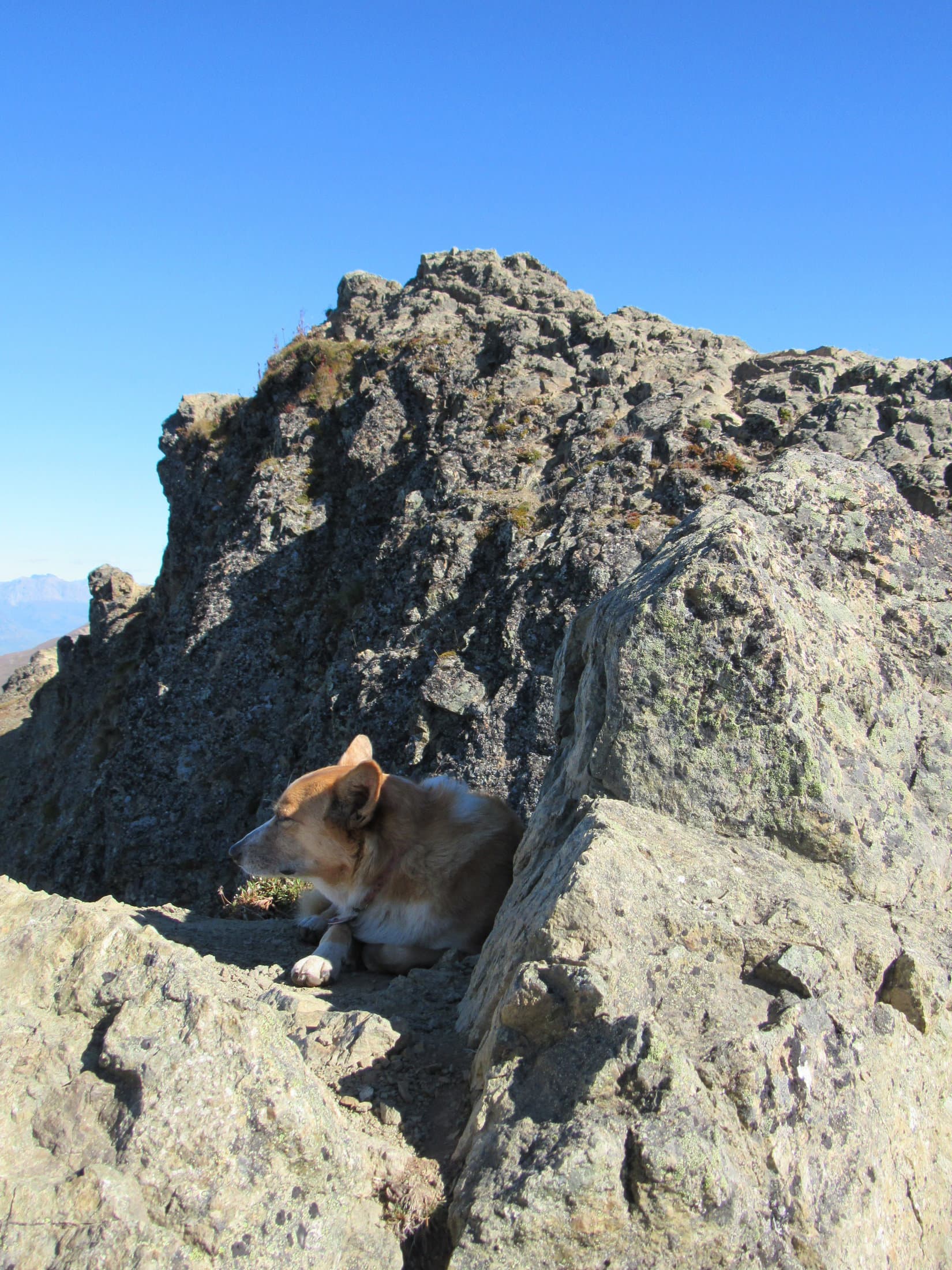
The deadfall was bad for hundreds of feet.  Lupe and SPHP made slow progress, but nearing the end of it, a rock ledge appeared ahead.  It was definitely at least 5 feet higher than anywhere Lupe had been yet!  SPHP was glad.  Lupe worked her way over to it.

From the S end of the rock ledge, Lupe could see that the ledge continued on to the NNW for some distance.  Lupe was at the top of a line of small cliffs which became larger off to the NNW, but only because the terrain below the cliffs was dropping off faster than the ledge above.  The S end of the ledge where Lupe first reached it appeared to be the highest point.

The rock ledge definitely made a better looking “true summit” No. 9.  Lupe perched on top while SPHP scrambled down through rocks and deadfall to get her official Minnesota Ridge (6,240 ft.) summit photo.

Lupe perches on “true summit” No. 9 at the S end of the rock ledge. Photo looks N.

Lupe even enjoyed a bit of a view from the ledge, making it even more worthy of being the summit.

The view to the W wasn’t spectacular, but was much better than a bunch of collapsed dead trees.

Lupe and SPHP explored a little farther to the NNW along the rock ledge.  The ledge lost elevation gradually in this direction, but continued onward.

Beneath the shade of a big pine tree, not far from “true summit” No. 9 at a point where the views to the W were pretty good, Lupe and SPHP took a break.  Lupe crunched some of her Taste of the Wild.  SPHP munched an apple.  The water in the water bottles was icky warm now, but that couldn’t be helped.  Warm water or none at all.  Take it or leave it.

After 5 or 10 minutes, a couple of large birds came sailing by.  They circled and soared in updrafts near the ledge.  They circled around many times, but were moving so fast through the small patch of sky where Lupe had a clear view of them between the pines, it was hard for SPHP to get a good photo.

One of the two large birds soaring on updrafts near the long ledge. The birds circled around to swoop by many times during Lupe’s break.
Hawks or eagles? SPHP wasn’t sure. They didn’t seem quite large enough to be eagles.
Lupe on a big rectangular rock at the edge of the ledge. Her break area was just off to the L. True summit No. 9 is only a short distance beyond her. Photo looks SSE.
On the same rectangular rock.

When the big birds soared away for the final time, Lupe’s break was over.  She returned briefly to “true summit” No. 9.  Since the terrain 30 to 50 feet back from the edge of the ledge seemed to be slightly higher, Lupe resumed her search for the absolutely highest point.

Nothing really stood out as being the exact spot, so Lupe chose a small rock that looked as high as anything else around for her final “true summit” No. 10 photo.  If this wasn’t the real deal, SPHP was convinced it had to be within a foot or two of the actual high point, which might be hidden anywhere among all the deadfall nearby.  This was close enough as far as Carolina Dogs are concerned!

True summit No. 10. Even if this wasn’t the actual tippy top of Minnesota Ridge it had to be close. Certainly close enough as far as Carolina Dogs are concerned. Photo looks NNE.

Ten true summits were more than enough for any mountain.  Lupe claimed her peakbagging success.  Now what?  The sun was still high in the sky.  Hours and hours of daylight remained.  May as well explore NNW along the rock ledge to see how far it went.  Maybe there were places with better views than Lupe had seen so far?

Lupe explores farther NNW along the rock ledge. Photo looks SSE.

Lupe did come to a few places where the rock ledge provided better views!  All of the views were to the W where Lupe could see the edge of the higher limestone plateau country of the western Black Hills.  She could see Nipple Butte (6,800 ft.), Flag Mountain (6,937 ft.) and other high points she had been to before on prior expeditions, but they were all miles away.

Looking SW from the ledge toward the higher limestone plateau country of the western Black Hills.
Lupe out on the largest rock platform she found along the entire ledge. Nipple Butte and Flag Mountain are in view on the horizon straight up from her, but they are very far away. Photo looks SW.

The rock ledge eventually petered out.  The views were gone.  It was clear Lupe really had been to the summit.  She had lost enough elevation by now so there was no doubt.  With all the time left in the day, Lupe could still do some exploring.

Years ago, back during the days of her early expeditions, Lupe had come to the Minnesota Ridge area on several different occasions, although she had never sought out the summit before today.  Somewhere to the W was a road she had followed as a very young Dingo a couple of different times.  It would be fun to travel it again.  Somewhere to the N was a road she had been on before that would lead her to it.

Lupe and SPHP went N looking for the road.  Lupe was losing elevation steadily now.  She came to a big field that didn’t seem familiar.

Lupe came to this big field somewhere on the N slope of Minnesota Ridge. SPHP didn’t recognize it. Photo looks S.

The big field led down to another good-sized field, where Lupe discovered an American Dingo display stand.

Lupe on the American Dingo display stand. What else could it be?

From the American Dingo display stand, Lupe headed NW.  She picked up a faint road she had never been on before.  Eventually it turned W and led her to the USFS road SPHP remembered W of Minnesota Ridge.

Lupe traveled S on this road, which ultimately proved to be USFS Road No. 204.1A.  It was fun to recognize a few places along the way.  Lupe took a short break at a tiny creek she had been to years before.  This creek flows down into Greens Gulch, but Lupe did not follow it as she had done on one prior occasion.

Lupe drank again from this tiny stream that flows into Greens Gulch. It had been years since she’d last been here.

The road went up and down.  It was surprising how much of it still seemed familiar, despite the years gone by.  The uphill stretches weren’t that long or difficult, but made the heat more oppressive.  Lupe had plenty of time.  After climbing past one uphill stretch, Lupe and SPHP took a water break.

Yes, the water was warm, but it did feel good to sit down and rest a bit.  A few clouds were drifting through the blue sky.  Lupe seemed content to lay panting on the ground, watching and listening.  Why not?  SPHP stretched out, too.  The heat made being lazy easy.

SPHP watched clouds.  Lupe listened to birds and watched for signs of activity in the forest.  Half an hour went by.  Then Lupe spotted a deer peering at her through the forest.  For a couple of minutes, Lupe and the deer stared at each other.  When the deer finally looked away and started moving, it was too much for Lupe.  Instinct took over and she was off like a shot.  A minute later she was back.  Lazy day break time was over.

Lupe’s trek along the road continued.  She soon came to a familiar intersection where she turned E on USFS Road No. 204.1.  She completed her big loop around the W side of Minnesota Ridge and arrived back at Killoern Springs Road.

On the remaining 3 miles back to the G6, Lupe retraced her route taken earlier in the day.  The ducks and Canadian geese were still at the pond.  Lupe and SPHP stopped to watch them for 15 minutes before pressing on S down Gimlet Creek valley.

Nearing the pond again. Photo looks E.
The Canadian geese were still at the pond. Lupe and SPHP watched them for a little while before pressing on.

The G6 wasn’t far from the confluence of Gimlet Creek and East Gimlet Creek.  On her last exploration of the day, Lupe visited the confluence.  She drank the refreshing cold water, and cooled her paws off one more time in the combined stream.

Expedition No. 203 had been different from most in recent years.  It was more of a throwback to the long treks of Lupe’s early years, with less emphasis on peakbagging.  Lupe had really enjoyed Gimlet Creek, the pond, and the easy strolls through the long valleys.  She still made it to the top of Minnesota Ridge, and got to see territory she hadn’t been to in years.

The unseasonal heat showed one thing, though.  It was soon time to think about heading to higher ground and cooler climes.  For a little while yet, that still meant higher terrain in Lupe’s Black Hills.  However, it wouldn’t be long before more distant adventures beckoned.

The start of Lupe’s grand summer of 2017 was fast approaching.

(End 6:04 PM, 77°F)

At the confluence of East Gimlet Creek (L) and Gimlet Creek (R) at the end of the day.

Links:

Next Black Hills Expedition                   Prior Black Hills Expedition

Want more Lupe adventures?  Check out her Black Hills, SD & WY Expeditions Adventure Index, Master Adventure Index, or subscribe free to new Lupe adventures!

Lazy Mountain, Chugach Range, Alaska (9-1-16)

Day 34 of Lupe’s Summer of 2016 Dingo Vacation to the Canadian Rockies, Yukon & Alaska

Pepper Peak (5,381 ft.) had been a stupendous day and a glorious summit, but Lupe and SPHP hadn’t really recovered yet from yesterday’s huge 4,500 feet of elevation gain.  No matter.  Feeling it or not, Lupe was climbing one more mountain today.  The calendar now said September.  After 3 fabulous, unforgettable weeks in Alaska, this was the American Dingo’s last full day in the Land of the Midnight Sun.

Lazy Mountain (3,740 ft.) was destined to be the last peak Lupe and SPHP would climb together in Alaska in 2016, or maybe forever.  Tired or not, it was time to begin (9:55 AM, 48°F).  At least Lupe had another clear, bright day.  She was guaranteed some great views of Palmer, the Matanuska River valley all the way to the Knik Arm off Cook Inlet, and mountains in all directions.

Right away, Lupe had a choice to make.  Two trails diverge near the trailhead parking lot.  They both go about halfway up Lazy Mountain to where they meet again near a picnic table situated on a point with a view.  A single combined trail goes the rest of the way to the summit.  The old Lazy Mountain approach was supposed to be the steepest.  The newer Lazy Moose trail is an easier climb, but winds around a bunch on switchbacks that add considerable distance.

Even though energy levels were low, Lupe and SPHP started straight up the Lazy Mountain trail.  The reports were no joke.  The trail started out steep.  It didn’t stay that way long.  It soon got steeper, and then stayed that way.  Whoever named Lazy Mountain must have realized what they were in for, and decided they were too lazy to even attempt it.  Otherwise, the name makes no sense at all.

As usual in most of Lupe’s Alaskan trail experiences, the Lazy Mountain trail started in a forest.  Gradually the forest thinned, and tall bushes started to dominate.  The forest had thinned out considerably, by the time Lupe reached the picnic table near the intersection with the Lazy Moose trail.  It had been a long, hard climb with frequent rest breaks, but Lupe was halfway up the 3,000 feet of elevation gain needed to reach the summit.

At the picnic table, SPHP chatted for a little while with a guy who came running (yes, running!) up the same Lazy Mountain trail Lupe and SPHP had just staggered up.  He said he lives in Palmer, and runs this far up Lazy Mountain 3 times a week.  He plays in a Christian music band, and was very surprised to hear that Lupe lives in South Dakota.

Why he was flying to Sioux Falls, SD tomorrow to play in a big concert there!  He had been with his band to South Dakota many times, including Pine Ridge and Lupe’s Black Hills.  South Dakota was a hot spot for his kind of music.  He wished Lupe and SPHP well, before running off down the longer Lazy Moose trail.

Small world.  Sort of.  Lupe still had another 1,500 feet of mountain climbing left to do in Alaska.  Somehow it still loomed large, not small.  Lupe’s trek resumed.  Still steep, but perhaps not quite as steep as before.  Tall bushes dominated, but most of the trees were gone.  On and on.  Up and up, for a while longer.

Finally, Lupe was past the bushes.  She was up in the tundra zone.  Some places were devoid even of the tough, beautiful, little tundra plants.  Bare dirt and small rocks were exposed.  Lupe had made a lot of progress up the mountain by now.  For a while, the trail leveled out.  There was even a completely flat section!  A high point that might be the summit was in view ahead.

Getting there! Lupe climbing Lazy Mountain. She’s already up above tree line here. Only scattered clumps of bushes and tundra remain. Photo looks NE.
For a while, SPHP wasn’t sure which high point might be the true summit of Lazy Mountain. It turned out to be the one on the L that the trail is heading for. Photo looks NE.

The trail soon started climbing again, but never as steeply as earlier on.  Below a ridge, Lupe passed a second picnic table.  The built-in benches were in good shape, but nearly all the boards forming the table part were missing.  Lupe did not stop.  She kept on going.  Her final climb in Alaska was dead ahead.

Lupe on her final climb in Alaska. The top of Lazy Mountain is in view only a short way ahead. Photo looks NE.

Lupe gained the summit ridge.  It wasn’t terribly long, maybe 100 feet.  At the far NE end, was a smaller ridge of solid lumpy-looking rock.  The true summit of Lazy Mountain was perched at the far end of the little ridge, perhaps an extra 20 feet above the main ridge.

Lupe rests in the shade at the base of the lumpy rock ridge at the far NE end of Lazy Mountain’s main summit ridge. Matanuska Peak is the high point in the background. Photo looks SE.

Lupe scrambled up to the highest point at the far end of the lumpy rock ridge.  She was done mountain climbing in Alaska!  This was it, the true summit of Lazy Mountain (3,740 ft.)!

Lupe perched at the true summit of Lazy Mountain, having just completed all of her mountain climbing in Alaska in 2016. Photo looks NNE.

Lupe could not be persuaded to stay up at the highest point on Lazy Mountain when SPHP tried to back down off the lumpy ridge for a more distant shot of her at the summit.  There was quite a bit of exposure up there, and not a lot of room to maneuver.

It was OK, she had made it to the top for a good close up.  Not to mention all the many other dramatic peaks she had climbed on her Summer of 2016 Dingo Vacation!  If the Carolina Dog felt better a little lower down, she had certainly earned a reprieve from posing at the top of precipices.

Lupe on the lumpy rock ridge. The true summit of Lazy Mountain is on the L. Lupe couldn’t be persuaded to remain at the high point long enough for SPHP to scramble back down for a more distant photo of her up there. The high point had a lot of exposure and not a lot of room. Photo looks ENE.
Matanuska Peak from Lazy Mountain. Photo looks SE.

Mountain climbing in Alaska was over.  Time to take a look around at what Lupe could see from her last Alaskan mountain.  Unlike most of the mountains Loop had climbed, where the most impressive views were of other mountains, Lazy Mountain’s most dramatic views were down toward the Matanuska River valley.

More than 3,000 feet below Lazy Mountain, the braided confluence of the Matanuska River and Knik River could be seen to the SW near the start of the Knik Arm of the North Pacific Ocean off Cook Inlet.  Bodenburg Butte (886 ft.) rising more than 600 feet above immediately surrounding terrain, looked like a little hill.

The Matanuska River (Center) flows toward the Knik River (L). They have a braided confluence near the Knik Arm seen on the upper R. Bodenburg Butte(L) looks like a little hill from Lazy Mountain. Photo looks SW.

The most dramatic mountains Lupe could see from Lazy Mountain were very far away to WSW, in the direction of Mount Susitna (4,396 ft.), also known as Sleeping Lady.  (The Legend of Sleeping Lady)  Well beyond Mount Susitna were impressive white mountains on the edge of vision.

Mount Susitna (Sleeping Lady) is the long blue ridge, subject of a local legend. Photo looks WSW from Lazy Mountain using the telephoto lens.
High, white mountains could be seen faintly very far away beyond Mount Susitna. Photo looks W using the telephoto lens.

Considerably closer, it was possible to see several smaller peaks with snow and ice on them in other directions.

Unknown peak with snow in view from Lazy Mountain. Taken using the telephoto lens.

Matanuska Peak (6,093 ft.) to the SE was easily the most impressive of the nearby mountains.

Matanuska Peak (L) was easily the most impressive of the mountains nearby. Photo looks SE.
Matanuska Peak through the telephoto lens.

Even including the larger summit ridge, and not just the small, final lumpy rock part leading to the true summit, there wasn’t much exploring to be done up on Lazy Mountain.  Lupe could see virtually the entire summit area at a glance.  However, there was plenty of room to move around some from one end to the other, gaining slightly different vantage points.

Except for the highest lumpy rock part where the true summit is, most of Lazy Mountain’s summit area is in view here. The town of Palmer is below, mostly on the far side of the Matanuska River. Mount Susitna can be made out on the far horizon. Part of the Talkeetna Range is seen on the R. Photo looks W.

Lupe found a shady spot close to the lumpy rock ridge where she could doze a bit.  SPHP relaxed gazing off first in one direction, then another, seeing dazzlingly beautiful Alaska, possibly for the last time, from the top of a mountain Lupe had climbed.

Lupe dozes a little below the true summit. Photo looks NE.
Looking NNE toward the Talkeetna Range.

Lupe stayed up on Lazy Mountain for 45 minutes.  The time came to start thinking about moving on.  Despite the rigors of the steep trail up, the perfect day and wonderful views at the top had made Lupe’s final climb in Alaska a lovely, memorable experience.  Now only the return trip down the mountain remained.

Lupe ready to leave the mountaintops of Alaska. The lumpy rock ridge and true summit of Lazy Mountain are on the R. Photo looks NE.
Looking down on the town of Palmer, situated mostly on the far side of the Matanuska River. Photo looks WSW.
The Matanuska flows away toward the Knik Arm. Photo looks SW.
Starting down the trail. Several peaks of interest are seen along the far ridge. Straight up from Bodenburg Butte, the little hill in the valley at (Center), are 3 dark wavy peaks. The two on the L are East Twin Peak (5,840 ft.)(L) and West Twin Peak (5,472 ft.)(R). To their L across a gentle saddle is a seemingly unimpressive hill in sunlight. That hill is actually Pepper Peak (5,381 ft.) where Lupe had such a tremendous adventure only a day earlier. The high point of the dark peaks to the L of Pepper Peak is Pioneer Peak (6,398 ft.). Photo looks SW.

When Lupe got down close to the first picnic table, she took the Lazy Moose trail instead of the Lazy Mountain trail.  The Lazy Moose trail was considerably longer, but not nearly so steep.  The trail had markers along it, which seemed to represent feet traveled along the trail, starting from the lower end.

The first marker Lupe came to said 15,800, implying that Lupe was about 3 miles from the trailhead.  The markers were about 1,000 feet apart on the higher part of the trail.  Lower down, they were consistently 200 feet apart.  The Lazy Moose trail had lots of switchbacks and general winding around.  The markers told the story of Lupe’s progress down her last Alaskan mountain.

Lupe enjoyed trotting and sniffing along the easier trail.  Late afternoon on the first day of September was comfortably sunny and warm.  Lupe led SPHP down Lazy Mountain, exploring for only a little longer the fabled Land of the Midnight Sun (4:23 PM, 72°F).

Loop on the Lazy Moose trail, Lazy Mountain, Chugach Range, Alaska.

Directions to the Lazy Mountain Recreation Area trailhead:  From the Glenn Hwy in Palmer, go E on Arctic Road (Old Glenn Highway) for 2.5 miles.  Take a L on Clark-Wolverine Road, 0.5 mile after crossing the Matanuska River.  Proceed 0.5 mile to a T intersection.  Take a R on Huntley Road, following it to the end.  Stay to the R going down to the trailhead parking lot.

Links:

Next Adventure                        Prior Adventure

Matanuska Peak, Chugach Range, Alaska (9-5-19)

Want more Lupe adventures?  Choose from Lupe’s 2016 Canadian Rockies, Yukon & Alaska Adventure Index, Dingo Vacations Adventure Index or Master Adventure Index.  Or subscribe free to New Lupe Adventures.

Black Hills, SD Expedition No. 202 – Ford Mountain, Storm Hill & Ingersoll Peak (4-29-17)

Start – Old Hill City Road near the 1880 Train crossing NNE of Ford Mountain (10:13 AM, 40°F).

The week after Joe & cousin Dusty headed back home to Colorado was overcast and cold.  On the 25th, Lupe stared bored out the window all day as light snow fell.  Winter’s last blast didn’t amount to much, but snowflakes were still sailing on the breeze the next  morning.  Although only an inch or two had fallen, once again Lupe’s world was all white.

By afternoon, the snow ended.  By evening, it had warmed up enough to melt almost everything that had fallen.  The world reverted to green, but gray clouds remained.  The next few days weren’t much warmer.  Now and then a cold rain or mist fell.

When Lupe finally got to venture up into the Black Hills again, it wasn’t surprising Expedition No. 202 got off to a snowy start.  The snow hadn’t melted yet up here.  Lupe, of course, was delighted!  She frolicked and cooled off on the clean new snow with enormous enthusiasm.  It was a great start to her journey up Ford Mountain (5,641 ft.).

Lupe was delighted to find a couple inches of snow to frolic on as she set out for Ford Mountain.

The snow was only a couple of inches deep, but it was everywhere on the N slope.  Fortunately, the slope wasn’t too steep.  SPHP was able to follow Lupe up despite the slick snow.  Before long, Lupe had gained enough elevation to see another mountain she hoped to climb today.  Storm Hill was off to the NE.

Storm Hill, another mountain Lupe hoped to visit today, came into view as she climbed Ford Mountain. Photo looks NE.

At first, going up Ford Mountain was easy.  Less than 1/3 of the way up, though, Lupe reached a zone covered with a lot of deadfall timber.  Progress up the mountain slowed considerably.

Lupe arrives at the zone of heavy deadfall timber. The deadfall greatly slowed SPHP’s progress up the mountain. Photo looks SSE.

The deadfall didn’t diminish until Lupe neared the top of Ford Mountain’s NE shoulder.  The NE shoulder featured scattered rock outcroppings.  Lupe got up on the highest one, but the forest was so thick she didn’t have any distant views.  She could barely make out Ford Mountain’s summit off to the SW.

Lupe on the highest rock outcropping on Ford Mountain’s NE shoulder. The mountain’s summit is barely discernable between the trees beyond her. Photo looks SW.

Lupe lost only a little elevation traversing the snowy saddle leading to the final climb.  Deadfall was a problem here, too, though not quite as bad as earlier on.  This climb was noticeably steeper, making footing more difficult for SPHP with the snow around.

The final 50 feet up was much rockier than the rest of the mountain had been.  Lupe still had an easy time of it, while SPHP scrambled slowly to the top.

The last 50 feet to the top were steeper and much rockier than the rest of Lupe’s route up had been. Photo looks SSW.

When Lupe reached the top of Ford Mountain (5,641 ft.), she found a roughly circular summit area 100 feet in diameter.  The area was nearly flat, but slightly higher toward the center.  All along the edge, from the NE around to the E and S, an uneven rock ledge perched above cliffs offered sweeping unobstructed views.

Lupe close to where she first reached the summit area. Five Points (6,221 ft.) (R) is the highest mountain seen beyond her. Union Hill (6,120 ft.) is the snowiest high point on the far L. Photo looks N.
Storm Hill (5,656 ft.) is on the L. Farther away R of Center is Mount Warner (5,889 ft.). Samelius Peak (5,856 ft.) is on the far R. Photo looks ENE.
Black Elk Peak (7,231 ft.), the highest mountain in South Dakota, is straight up from Lupe on the horizon. Photo looks S.
Sylvan Hill (7,000 ft.) is the most distant peak L of Center. Saint Elmo Peak (6,458 ft.) is the smaller, snowy mountain in the distance beyond Lupe. Photo looks SSW.

After checking out the splendid views, Lupe visited Ford Mountain’s true summit.  The center of the summit area was so flat, she really didn’t find any one point that looked noticeably higher than the rest.  No cairn or survey benchmark was to be seen either, but Lupe did find something way cooler than that – a stone fortress!

Another look at Black Elk Peak. This photo shows more of Ford Mountain’s summit. Photo looks S.
No cairn or survey benchmark could be found on Ford Mountain, but Lupe did find this cool stone fortress! Photo looks WNW.

On her many adventures in the Black Hills, Lupe sometimes comes across small structures which could serve as Dingo Outposts, but seldom anything as elaborate as the Dingo Fortress on Ford Mountain.  Someone had spent a lot of time moving a lot of heavy rocks building it.

An opening to the WNW served as a doorway.  Lupe went inside to inspect her latest Black Hills Dingo Bastion.

Yes, a Carolina Dog would be safe in this solid stone fort. It was almost a Dingo Castle! Photo looks E.

The stone fort met with Lupe’s approval.  Best, most elaborate summit cairn ever!  After sniffing around the interior a bit, Lupe came out to see what else there was to see up here.Part of Hill City was in view off to the NW.

The NE end of Hill City is in view in the valley below. The highest peak on the R is Union Hill (6,120 ft.). Photo looks NW.

The view of Bishop Mountain (5,706 ft.) to the SW was partially blocked by the forest, and wasn’t that impressive.  So that was about it.  Lupe made a final tour of the sights from the cliff edge.

A nice look S all the way from Black Elk Peak (L) over to Sylvan Hill (far R).
Storm Hill, Lupe’s next peakbagging objective. She would travel up the W slope seen on the L. An intense fire on the mountain destroyed most of the forest some years ago. Photo looks NE with help from the telephoto lens.
Looking N at Five Points (Center) using the telephoto lens. The peak on the L is known to Lupe as False North Point.

Lupe retraced her original route up on the way down Ford Mountain.  She was surprised when she arrived at G6 and SPHP walked right on by without even stopping.  She was even more surprised when SPHP started following train tracks on the other side of Old Hill City Road.  It was the first time she’d ever followed train tracks.

SPHP knew they would lead her to the base of Storm Hill.

Lupe was surprised to be following train tracks on her way to Storm Hill.

Lupe wouldn’t see a train today, but the tracks aren’t abandoned.  They only see use during the summer, when the 1880 Train runs from Hill City past Oblivion to Keystone and back.  The round trip is a popular sightseeing excursion for tourists.  A few more weeks, and the 1880 Train would be running again.

Fortunately, there was something else Lupe didn’t see as she was busy sniffing along the tracks in the first gap the railroad passed through.  The bunny saw Lupe, though.  It remained absolutely still on a bank only a few feet above the tracks.Lupe followed the 1880 Train tracks for 0.5 mile to the base of Storm Hill.

Storm Hill dead ahead! Photo looks NE.
Lupe left the railroad tracks here where they turned SE. The back side of Mt. Rushmore is seen in the distance. Photo looks SE.

The first part of Lupe’s ascent went through a gently sloping pine forest.  The day had warmed up enough so the snow on the ground was melting.  Lupe ate snow and had a fun romp in the open forest as she headed NE toward a saddle.

Upon reaching the saddle, Loop turned E.  The mountain was getting progressively steeper and rockier.  Lupe reached the part of the forest that had burned years ago.  With less shade, the snow was vanishing fast here.

The real climb began when Lupe reached the charred forest. Photo looks ENE.

So many dead trees were still standing that the amount of deadfall timber laying on the ground wasn’t too bad yet.  Lupe could still easily run around exploring.

Lupe exploring the charred W slope of Storm Hill.

Of course, it got rockier and steeper the higher up Lupe went.  However, her route was never too difficult, even for SPHP.  As Lupe neared the top of Storm Hill, she could see a tower and a solar panel up there.

As Lupe neared the top of Storm Hill, she could see a tower and solar panel at the summit.

It turned out that by coming up from the W, Lupe arrived at the true summit right away without having to traverse any of the summit ridge.  Most of the summit ridge was off to the E and notably lower.  The area around the true summit was very rocky and much, much smaller than on Ford Mountain.

Ropes and guy wires supported the small tower.  Electrical wires were around, too.  At first, it wasn’t clear if they were live or not.

Lupe reaches the top of Storm Hill. It wasn’t initially clear if the tower, solar panel, and all the wires running around still served a purpose, or not. Photo looks SW.
The true summit of Storm Hill was quite a small area dominated by the tower and associated paraphernalia perched on top. Photo looks SW.

Lupe and SPHP approached the tower cautiously paying special attention to electrical cords and wires.  Lupe made it up onto the highest rocks with no problem.  Although someone had gone to considerable effort to set all this stuff up, nothing appeared to be in working condition.  It was all dead.

The view of Black Elk Peak (7,231 ft.) still sporting a dusting of snow at the end of April  was gorgeous. Summit Peak (5,655 ft.) is the lower forested ridge to the L of Lupe’s ears. Lupe had been there on Expedition No. 194. Although the topo maps show the true summit of Summit Peak at the SW (R) end of the ridge, Lupe remains quite certain it is at the NE (L) end. Photo looks S.

The solar panel appeared to have been meant to charge a bank of 7 batteries.  What purpose the tower used to serve wasn’t clear.  All the wires and equipment around made moving about the summit a bit tricky.

The solar panel was probably meant to charge this bank of 7 batteries.
Lupe enjoys a bit of shade from the solar panel. Ford Mountain (5,641 ft.) is the closest rock-capped hill on the L. Bishop Mountain (5,706 ft.) is the ridge immediately beyond it. Photo looks SW.
Loopster on the very highest rock on Storm Hill. The EverStart battery appeared more likely to be a NeverStart battery at this point in time.
Part of the notably lower portion of Storm Hill’s summit ridge is seen on the L. On the horizon, Mount Warner (5,889 ft.) is the highest point straight up from Lupe’s head. Samelius Peak (5,856 ft.) is the high point straight up from her tail. Photo looks E.
Another look E.

After taking a look around from the true summit, Lupe and SPHP retreated a little down off the high point just to get away from the wires and equipment.  It was time for a break.  At least SPHP thought so, but Lupe wasn’t hungry.  She was happy enough to curl up for a rest, though, while SPHP consumed the usual apple.

Since Lupe wasn’t really into it, break time didn’t last any longer than the apple did.  When it was over, Lupe briefly returned to the true summit.  SPHP took a few more photos before Lupe started back down the mountain.

After break, Lupe returned briefly to the true summit. Photo looks S from the break area.

Looking N. Hwy 385/16 E of Hill City is seen below. Part of Mitchell Lake is, too. The highest peak on the L is Five Points.

Once again, Lupe returned to the G6 (1:52 PM) by the same route she had taken to the mountain.  This time SPHP let her in.  She still had plenty of time to climb another peak, but a ride was in order to get closer to her next objective.  Lupe enjoyed barking at several cows and horses along the way.

SPHP parked the G6 again 3 or 4 miles farther E where Centennial Trail No. 89 crosses Old Hill City Road (2:07 PM, 46°F).  Ingersoll Peak (5,356 ft.) was Lupe’s next destination.  It was somewhere not too far off to the NE, but SPHP wasn’t completely certain exactly how far away it was.  A mile or two, maybe?  The plan was to follow Centennial Trail No. 89 going N a little way before leaving it to turn E to search for the peak.

Lupe set out crossing the 1880 Train tracks and Battle Creek immediately N of Old Hill City Road.  She continued N on Centennial Trail No. 89.  The trail led gradually up a side valley where a mix of pines and aspens lined both sides of the trail.

After crossing the 1880 Train tracks and Battle Creek, Lupe followed Centennial Trail No. 89 going N up a gentle side valley. A mix of pines and aspens lined both sides of the trail. It was now close to mid-afternoon. Only a little melting snow remained. Photo looked NNE.

Lupe hadn’t gone too far when a logging road left Centennial Trail No. 89 heading up the ridge to the E.  Why not follow it to see if Ingersoll Peak could be seen from up there?  Lupe took the logging road.

The logging road faded away before even reaching the top of the ridge.  Lupe kept going, though, and managed to get there.  The forest had been thinned, but not enough to see much off to the E.  However, it appeared the ridge gained more elevation to the NE, which seemed to be the right direction to go.

Lupe struck off following the ridgeline.  It had minor ups and downs, but on the whole she was gaining elevation.  After reaching a couple of high spots where there still wasn’t much to see, she finally came to a rock outcropping on the E side of the ridge where there was a view.  Ingersoll Peak was in sight, but farther away than SPHP expected.

From this rock outcropping, Lupe got her first look at Ingersoll Peak. It was farther away than SPHP expected. Photo looks E.

It took a while to get there.  Lupe tried to go around the N end of an intervening valley to avoid losing elevation, but it didn’t work.  The valley was too long.  She wound up turning E and going down into two sizable valleys separated by a lower ridge before the terrain allowed her to climb out again and regain all her lost elevation.

Once she was out of the second valley, Loop came across a dirt road leading NE toward even higher ground.  Before long it curved around to the SE and brought her to the base of Ingersoll Peak’s W slope.  Here Lupe followed an abandoned side road that made a big switchback to the NE and then S, gaining more elevation along the way.

The side road leveled out near a huge rock, turned SE and looked like it was about to start losing elevation.  Lupe left the side road near the huge rock to climb Ingersoll Peak’s W slope.  The slope was heavily forested, so it wasn’t possible to see very far ahead.  After gaining 200 feet of elevation, suddenly the slope leveled out rapidly.

A rock formation 50 feet away looked higher than anything else around.  Subsequent exploration proved this rock formation was the true summit of Ingersoll Peak (5,356 ft.).  Lupe needed a boost from SPHP to get up on the highest rocks.

Lupe reaches the summit of Ingersoll Peak! The mountain was so heavily forested she didn’t have much of a view. Photo looks NW.
On the very highest rock. Photo looks N.

Ingersoll Peak was so heavily forested, Lupe didn’t have much of a view.  She saw no reason to dawdle on the highest rocks, preferring to explore the summit area as soon as SPHP told her it was OK to jump down.

More of the summit rock formation is seen here. The highest rocks are just to the L of Lupe and a bit behind her. Photo looks NNW.

Most of the large summit area was off to the E.  It was so heavily forested, a couple inches of snow remained up here.  Lupe didn’t find any views, but sunlight filtered by the trees created a pleasing pattern of shadows and highlights on the snow.  The top of Ingersoll Peak felt secluded and still a bit wintery.

Looking back toward the true summit (hidden by the trees on the R) from near the NE end of the larger summit area. The dense forest, snow, shadows, and filtered sunlight made Ingersoll Peak feel secluded and remote. Winter still lingered here. Photo looks SW.
The wily Snow Dingo on secluded Ingersoll Peak.

When exploration confirmed Lupe had already been to the true summit, Lupe returned to it.  This time she didn’t want to get up on the highest rocks where there wasn’t any room to move around.  However, she did agree to hang out among the slightly lower rocks for a few more photos.

Among the rocks of the summit formation. Photo looks WSW.
Looking N.

Lupe left the summit of Ingersoll Peak going back down the W slope.  She had already lost substantial elevation when she came to a rock outcropping where she could see Storm Hill off to the NW.

From this rock outcropping well down the W slope, Lupe got her only decent view from Ingersoll Peak. Storm Hill (5,656 ft.) is in the distance straight up from Lupe. Samelius Peak (5,856 ft.) is the high point on the R. Photo looks NW.

Lupe came to the abandoned road near the huge rock again.  She followed the switchback down to the lower road, which she took back to the area where she first found it.  W of the road was a barren hill strewn with scattered deadfall.  Lupe went over there for a look at the view, which was far better than any she’d had from Ingersoll Peak.

From this barren hillside, Lupe had a much better view than she’d found anywhere on Ingersoll Peak. The rugged terrain near Black Elk Peak (Center) can be seen. Photo looks SW.

Lupe returned to the road.  She wasn’t going to cross the two valleys to the W this time.  Instead she followed the road down into a long valley.

Lupe near the start of the road’s descent into the long valley. Photo looks SW.
Heading down. Photo looks SSW.

At the end of the valley, Lupe arrived at Old Hill City Road again.  For more than a mile, she followed the 1880 Train tracks as they wound around toward the W.  Along the way, she saw a single Canadian goose floating on a tiny pond.  The lonely goose honked a hopeful greeting.

From the 1880 Train tracks on the way back to the G6, Lupe saw this solitary Canadian Goose floating on a tiny pond. It honked at Lupe, but didn’t fly away.

Canadian geese and Carolina Dogs aren’t likely to become best of friends.  SPHP encouraged Lupe to keep trotting right on by.  (End 5:52 PM, 44°F)

Links:

Next Black Hills Expedition                   Prior Black Hills Expedition

Want more Lupe adventures?  Check out her Black Hills, SD & WY Expeditions Adventure Index, Master Adventure Index, or subscribe free to new Lupe adventures!