Black Hills, SD Expedition No. 183 – Iron Mountain & Woodpecker Ridge (11-20-16)

Time for a change of focus.  Lupe had spent most of her Black Hills Expeditions of the last couple of months peakbagging in the NW Black Hills, often going as far as the Bear Lodge Mountains in NE Wyoming.  Only one named peak remained in that general direction that was a current peakbagging priority for her, Sweetwater Mountain (6,440 ft.), but she didn’t have permission from the land owner to climb it until hunting season was over in December.

So, what to do?  Looking over the topo maps on Peakbagger.com, SPHP noticed a couple of peaks a few miles SSW of Iron Mountain that Lupe had never been to.  They weren’t far away, which was kind of important on a short November day, since Lupe was getting off to a late start.  Woodpecker Ridge and Peak 5688 should be fun!  Lupe could start from Lakota Lake.

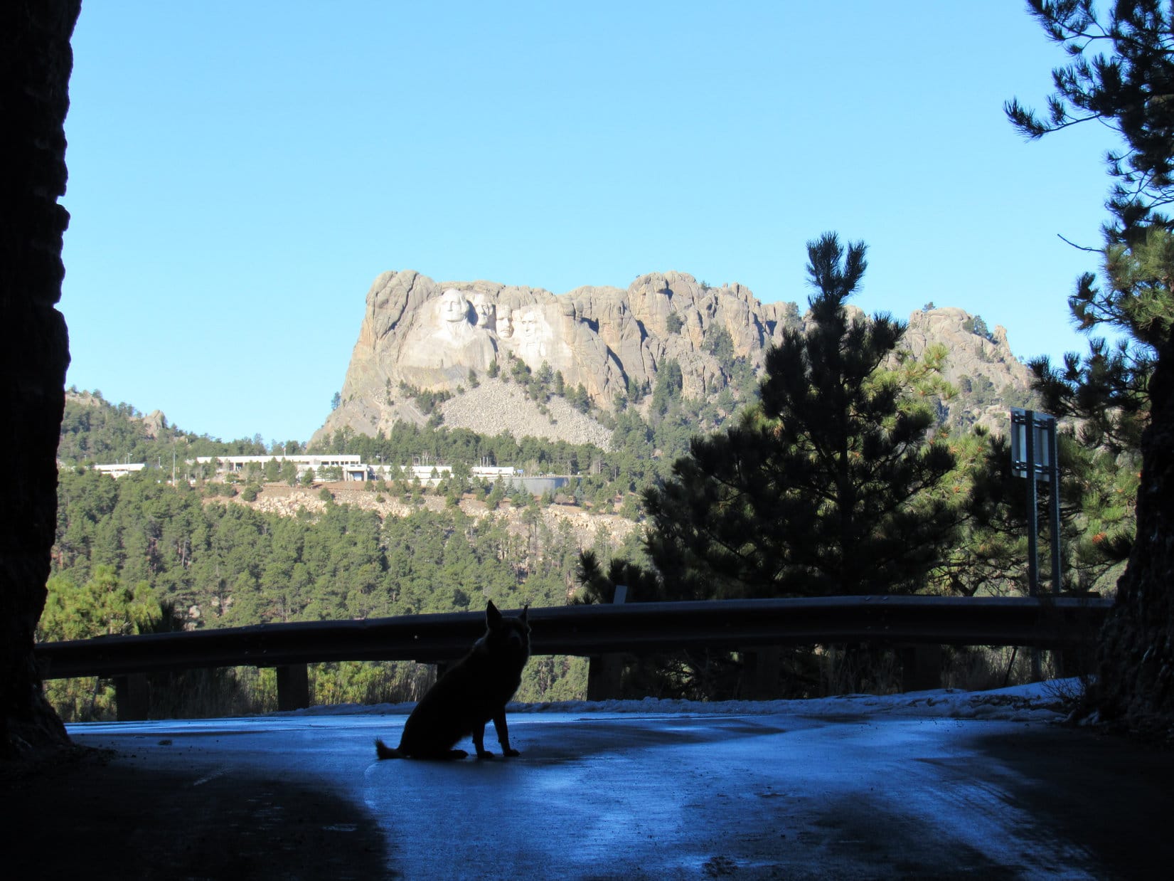
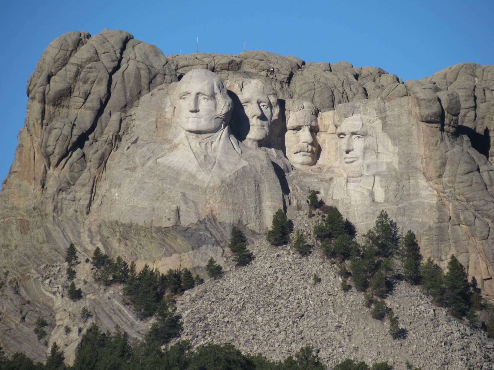
To get to Lakota Lake, Lupe and SPHP took Iron Mountain Road (Hwy 16A) going S from Mount Rushmore National Memorial near Keystone.  Iron Mountain Road is a fun drive.  It ultimately winds all the way up to the top of Iron Mountain (5,446 ft.).  Along the way, Iron Mountain Road spirals up several pigtail bridges, features a couple stretches of “divided highway” consisting of one-way single lanes, and passes through short tunnels deliberately constructed to frame Mount Rushmore.

Naturally, Lupe and SPHP stopped to enjoy a few of the sights along the way up Iron Mountain.

Lupe by one of the pigtail bridges along Iron Mountain Road.

Pigtail Bridge sign along Iron Mountain Road, 11-28-16

Lupe at the start of the longest tunnel on Iron Mountain Road. Three tunnels were purposely constructed to frame Mount Rushmore. The camera couldn't handle the light contrast well enough for Mt. Rushmore to show up in this shot. Photo looks NW.
Lupe at the start of the longest tunnel on Iron Mountain Road. Three tunnels were purposely constructed to frame Mount Rushmore. The camera couldn’t handle the light contrast well enough for Mt. Rushmore to show up in this shot. Photo looks NW.
Lupe now at the other end of the tunnel closer to Mt. Rushmore. Photo looks NW.
Here's how it looks driving through the tunnel on the way to Mount Rushmore National Memorial. Photo taken with help from the telephoto lens.
Here’s how it looks driving through the tunnel on the way to Mount Rushmore National Memorial. Photo taken with help from the telephoto lens.
Mount Rushmore, Black Hills, South Dakota, Photo looks NW.

At the top of Iron Mountain is a paved parking lot, and a short walking path to a viewpoint.  Right next to the viewpoint is a ridge of rock roughly 20 feet high, where the absolute summit of the mountain is located.  Lupe and SPHP stopped briefly to make the tiny climb to the absolute summit for a look around.

Since the true summit is on the W edge of the large summit area, the best views were toward Harney Peak (7,242 ft.) to the W, and Mount Rushmore (5,725 ft.) to the NW.  From Iron Mountain, Lupe had a great view of some of the most rugged terrain in the Black Hills!

Lupe on Iron Mountain. Harney Peak, the highest mountain in South Dakota, is in the background. Photo looks W.
Harney Peak, the highest mountain in South Dakota, from Iron Mountain. Photo looks W using the telephoto lens.
Mount Rushmore from Iron Mountain. Photo looks NW with help from the telephoto lens.

After all the sight-seeing stops coming up and over Iron Mountain, it was 10:01 AM (46°F) by the time Lupe arrived at Lakota Lake.  SPHP left the G6 parked at the empty picnic ground.

Lupe arrives at the Lakota Lake picnic ground. Photo looks E toward the dam.
Lupe near Lakota Lake. Lakota Lake is E of Iron Mountain Road about 3 miles ESE of Iron Mountain. A short gravel road leads to the picnic ground on the W shore near the N end of the lake. Photo looks NE.

Lupe’s first peakbagging goal was Woodpecker Ridge (5,680 ft.).  Woodpecker Ridge is about 2 miles long, running SW/NE.  The ridge is W of Iron Mountain Road, and S of Iron Creek.  The topo map showed that the summit was near the far SW end of the ridge, about 3 miles from where Lupe was starting at Lakota Lake.  Lupe and SPHP followed the gravel road SW from the Lakota Lake picnic ground back to Iron Mountain Road.

Iron Creek Trail No. 15, starts on the W side of Iron Mountain Road, right across from the road to Lakota Lake.  The plan was for Lupe to follow Iron Creek Trail No. 15 up the valley for a mile, or so, to where the topo map showed the easiest approach to the Woodpecker Ridge summit from the NNE.  After a relatively gentle mile-long climb, Lupe would reach the ridgeline about 0.25 mile E of the summit.

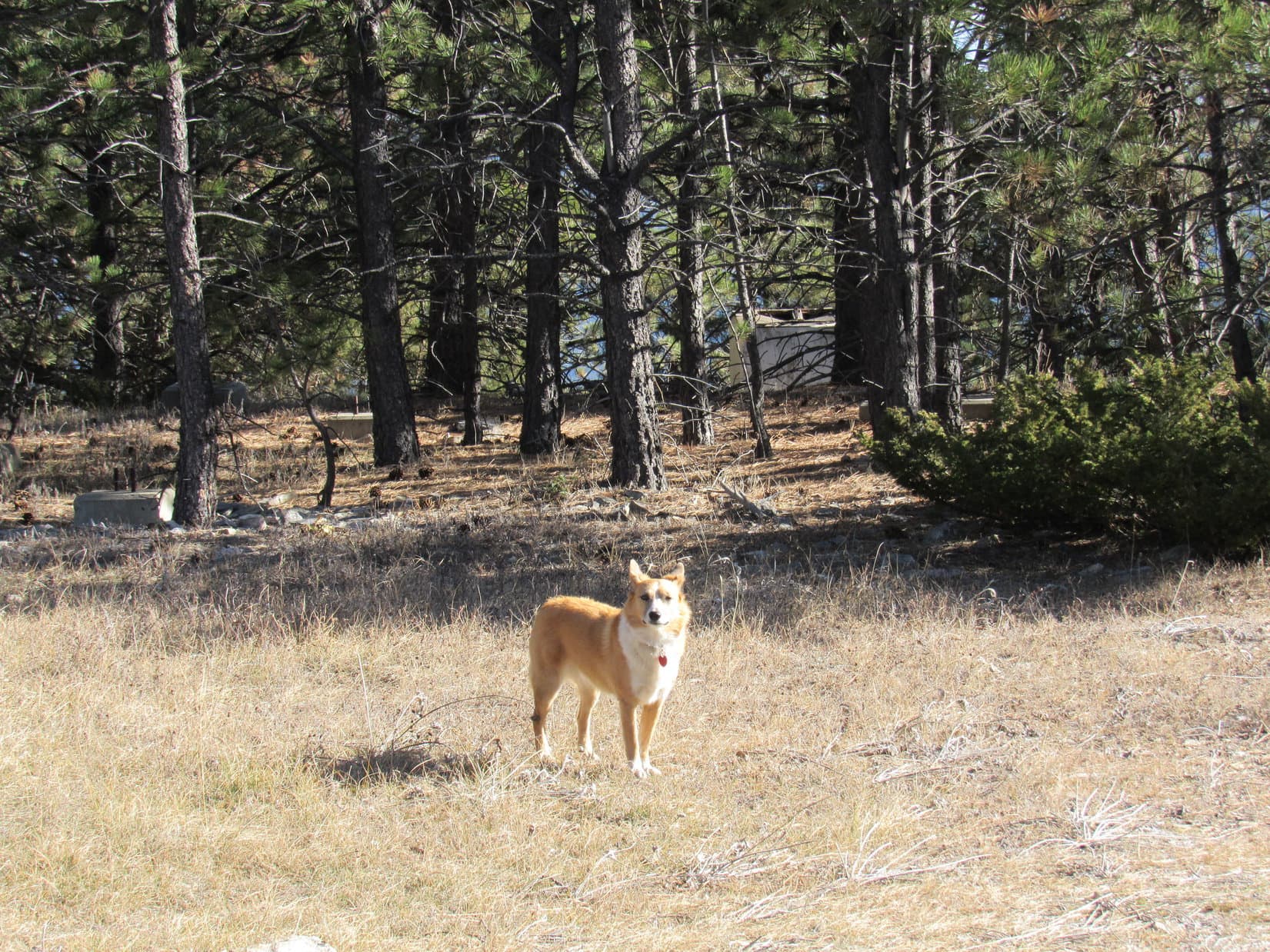
At first, everything went according to plan.  Lupe enjoyed trotting along the single track Iron Creek trail looking for squirrels.  Less than an inch of new snow on the ground made things look fresh and bright.  The trail crossed Iron Creek several times, but there were plank bridges or good stepping stones to help SPHP get across.

Lupe on the plank bridge at the first Iron Creek crossing on Iron Creek Trail No. 15.
On Iron Creek Trail No. 15. Less than an inch of new snow made the trail look clean and bright.

At the fourth creek crossing, there was no bridge.  SPHP didn’t see any convenient stepping stones around either.  No way was SPHP going to wade across chilly Iron Creek this time of year!  Lupe and SPHP went a little back downstream looking for a way to cross the creek.

Lupe hadn’t gone far, when a rather questionable way across the creek presented itself.  SPHP had to reach out over the creek to lean against a boulder on the other side.  SPHP was barely able to grip the top of the boulder and shinny up, but it did work.  Lupe, of course, had no problem simply leaping over the creek.  Carolina Dogs don’t let little things like minor creek crossings interfere with their plans!

Lupe and SPHP were now on the S side of Iron Creek, but not yet anywhere near where SPHP had planned for Lupe to start up Woodpecker Ridge.  Lupe was only a little past the NE end of the ridge.  Cliffs could be seen high above.  It wasn’t at all clear if there would be a way up that would avoid the cliffs and allow Lupe to reach the ridgeline from here, but SPHP decided to try it anyway.

The start of the climb didn’t go very well.  Lupe and SPHP climbed onto a small ridge to the E, before turning S.  Right away, Lupe had to climb up onto a big rock outcropping.  Ten paces later, a drop-off forced her right back down to the W.  However, once around the rock formation, she was able to climb steadily through the forest, heading SSW.

There were plenty of rocks scattered around the whole way.  Lupe eventually came to an area of fairly large boulders.  The boulders slowed SPHP down quite a bit, although Lupe had fun exploring them.

Lupe among the boulders on the way up Woodpecker Ridge. Photo looks SSW.

As Lupe got closer to the cliffs above, the boulders got larger.  At the base of the cliffs were boulder fields that would have taken a long time to traverse.  Lupe and SPHP worked around to the W of them.

Lupe below the base of the cliffs. She is on the N side of Woodpecker Ridge, not too far from its NE end. Photo looks SE.

Fortunately, the line of cliffs was not continuous.  Lupe bypassed them to the W, too.  She was able to keep climbing steadily SSW through the forest.  On the way up, Lupe even saw a woodpecker, but it wasn’t close enough for SPHP to get a decent photo.

As it turned out, Lupe wound up climbing well above the first cliffs.  Lupe and SPHP reached the ridgeline near High Point 5537.  Lakota Lake, and the top of the cliffs Lupe had bypassed, could be seen far below.

Part of Lakota Lake, where Lupe had started her journey to Woodpecker Ridge, is seen far below. The tops of the cliffs Lupe bypassed on the way to High Point 5537 are in view in the foreground. Photo looks NE.
Mount Rushmore from High Point 5537, near the NE end of Woodpecker Ridge. Photo looks NW using the telephoto lens.
Harney Peak from High Point 5537. Photo looks NW.
Lupe on High Point 5537 near the NE end of Woodpecker Ridge. Photo looks NE.

SPHP was glad Lupe had reached the ridgeline at High Point 5537.  It meant Lupe would get to explore most of the length of Woodpecker Ridge.  She now faced only about 150 feet of net elevation gain on the way to the summit.  SPHP expected a relatively easy hike SW along the ridge.

Exploring Woodpecker Ridge was fun, but soon proved to be a lot of work, too.  The ridgeline was rough, not level.  Lupe had to climb over or around many rock formations.  The rocks weren’t the worst of it, either.  The farther SW Lupe went, the more deadfall timber she encountered.  The rocks and deadfall weren’t terrible, but SPHP’s progress became very slow.

Another problem began to worry SPHP.  Since there was so little net elevation change along the way, it might be hard to tell where the true summit of Woodpecker Ridge was.  SPHP started taking photos of Lupe at notable high points, just on the chance that she was already at the summit.

Lupe at one of the notable high points along Woodpecker Ridge. This turned out not to be the true summit, or even close to it. Photo looks N.

Lupe finally reached a place where there were significant elevation changes ahead.  Two distinct hills weren’t too far away.  SPHP hoped the closest one was the summit of Woodpecker Ridge, and the more distant one was Peak 5688, Lupe’s other peakbagging goal for the day.  A brief halt to check the topo maps was in order.

Lupe finally arrived at this high point from which two distinct hills could be seen ahead. SPHP initially hoped that the one on the L was the summit of Woodpecker Ridge, and the one on the R was Peak 5688. In truth, both hills were summits of Woodpecker Ridge enclosed by the 5680 foot contour, with the one on the R likely being the true summit. Photo looks SW.

The topo maps said differently.  What they showed was disappointing.  Lupe hadn’t made nearly as much progress along Woodpecker Ridge as SPHP had believed.  Both of the hills in view were high points of Woodpecker Ridge, the summits of which were both enclosed by the 5680 foot contour.

On Peakbagger.com, the more distant hill farther to the W with a much larger area enclosed by the 5680 foot contour was shown as the location of the true summit.  Still, there was a chance that the closer hill was actually the true summit.  Lupe would have to visit both to make certain she reached the top of Woodpecker Ridge.

One more thing was evident, too.  At the pace Lupe and SPHP were going, there was absolutely no chance Lupe was going to reach Peak 5688 today.  By the time Lupe reached the W summit of Woodpecker Ridge, the sun was going to be too low in the sky to do anything but start looking for an easier way back to the G6.  Oh, well.  That’s often how things go in the mountains.

Lupe still near the point where SPHP realized the two hills ahead were both summits of Woodpecker Ridge enclosed by the 5680 foot contour. Harney Peak is seen in the distance. Photo looks NW.
Harney Peak from Woodpecker Ridge about halfway between High Point 5537 and the E summit enclosed by the 5680 foot contour. Photo looks NW using the telephoto lens.
Most of the time, trees blocked the views from Woodpecker Ridge. However, Lupe did come to points with views in various directions. This photo looks E or SE out onto the prairies beyond the Black Hills.

Lupe and SPHP pressed on toward the two hills.  If anything, the rock formations Lupe had to find a way around were bigger than before, and the deadfall still worse.  There was more elevation loss and gain to deal with, too.  It took more than half an hour just to reach the E summit, even though it hadn’t been very far away.

Lupe reaches the E summit of Woodpecker Ridge. Although the W summit is probably the true summit, the views were more open and better from this E summit. Harney Peak is seen in the distance. Photo looks NW.
Mount Rushmore from the E summit of Woodpecker Ridge. Photo looks NNW using the telephoto lens.

Lupe and SPHP took a break up on the E summit of Woodpecker Ridge, but only stayed 15 or 20 minutes.  It was nice up there, but it was too late in the day to lounge about given the continual difficulties Lupe faced negotiating all the obstacles nature placed in her path along Woodpecker Ridge.

The time arrived to begin the final push to the likely true summit of Woodpecker Ridge.  Lupe headed W down into a broad saddle.  The more level terrain should have made the going much easier, but the deadfall timber here was the worst Lupe had faced all day.

The W summit can be seen ahead, but it was hard to make any decent time getting there through this mess! Photo looks W.
Although Lupe is generally very good at making her way through deadfall, SPHP encourages her to take her time. At least a couple of times in the past, Lupe has been impaled on broken branches, resulting in a lot of pain and hundreds of dollars worth of vet bills. Photo looks W.

It took close to another 45 minutes to make it over to the W summit of Woodpecker Ridge.  Sadly, the W summit was ugly.  There was a lot of deadfall.  Even so, enough trees were still standing to block the views.  Although Lupe could now claim a successful ascent of Woodpecker Ridge, the achievement seemed anti-climactic.

Lupe reaches the W summit of Woodpecker Ridge. She could finally claim a successful ascent. Photo looks NE.
Lupe questions SPHP's judgment in selecting this ugly spot for her peakbagging objective of the day.
Lupe questions SPHP’s judgment in selecting this ugly spot for her peakbagging objective of the day.
A better view from the W summit of Woodpecker Ridge. Photo looks N.

Lupe and SPHP took another break.  Lupe relaxed.  SPHP took a look at the topo maps again.  The sun was low enough so Lupe really needed to start making tracks toward a decent route out of here.

Lupe relaxes on Woodpecker Ridge while SPHP checks the topo maps.

The topo maps showed some kind of a trail off to the W that would lead N before curving NE down a ravine into the Iron Creek valley again.  There was a road down there that would take Lupe back to Iron Creek Trail No. 15 again.  Somehow, SPHP would just have to deal with the creek crossings, even if it meant fording the stream.

SPHP polished off the last apple.  Time to pack up and go.  The sun would be down in minutes.  Lupe was ready.  Puppy, ho!  Onward!

Lupe's last moment on top of Woodpecker Ridge, just before heading down. Photo looks S.
Lupe’s last moment on top of Woodpecker Ridge, just before heading down. Photo looks S.

Lupe and SPHP left the summit heading N.  Before long, Lupe reached a cliff edge.  The terrain forced her down to the W.  She saw two more woodpeckers as she progressed down the slope.  As soon as it was possible, Lupe turned N again.  Lupe and SPHP wandered through a forest with less deadfall than before, but it was still slow going.  The area was full of thistles.  Time passed.  The light was fading.  Lupe still hadn’t found a trail or road.

SPHP decided to check the topo maps again.  The maps could not be found.  It became clear they had somehow been left up on Woodpecker Ridge.  Not good.  Still, they probably wouldn’t be needed.  The distance Lupe needed to cover to reach Iron Creek wasn’t that far.  One way or another, she would make it.

It’s hard to say exactly where Lupe and SPHP went, but probably somewhere in the area where the topo maps on Peakbagger.com show a point marked 5190 feet of elevation, 0.5 mile NNW of the Woodpecker Ridge summit.  As Lupe and SPHP wandered N, Lupe finally came to a faint remnant of a road.  It did curve NE down into a ravine.  Lower down, the ravine had huge solid rock walls.

Lupe reached the road leading to the W end of Iron Creek Trail No. 15 before it was dark.  Old cabins were strung out along the road, but there was no sign of activity anywhere.  By the time Lupe reached the start of the trail, stars were coming out.  At the trailhead, a sign said Iron Creek Trail No. 15 had 11 water crossings.  Oh, boy!

It wasn’t a problem, though.  Lupe and SPHP made great time along the single track trail.  Luckily, there was a decent way across Iron Creek at every crossing – a bridge, stepping stones, a fallen log – always something.  The stars became bright against a black sky.  The flashlight came out.  Lupe and SPHP enjoyed a last hour of quiet travel in the darkness.

Somehow, even in the dark, a way across Iron Creek appeared near crossing No. 4 (No. 8 counting in reverse).  Funny that it could be found in the night, when SPHP hadn’t seen it during daylight, but there it was.  Yay!  No fording of the freezing stream was required!  And that, was that.  No suspense remained over the outcome of Expedition No. 183.

Lupe and SPHP made it back to the G6 (5:57 PM, 33°F).  All the way back over Iron Mountain, the Carolina Dog rode with her head out the window, hoping to see a deer in the headlights, but she saw none.  By the time she reached Keystone, Lupe had given up.  It was kind of an anti-climactic end, like reaching the summit of Woodpecker Ridge had been.

Yet for Lupe and SPHP, it had been another great day adventuring together in the Black Hills.  It’s often the journey, and not the final goal, that make the day and the memories.

Lupe at one of the notable high points along Woodpecker Ridge. This turned out not to be the true summit, or even close to it. Photo looks N.
Lupe at one of the notable high points along Woodpecker Ridge.

Links:

Next Black Hills Expedition                     Prior Black Hills Expedition

Want more Lupe adventures?  Choose from Lupe’s Black Hills Expeditions Adventure Index or Master Adventure Index.  Or subscribe free to new Lupe adventures.

Black Hills Expedition No. 182 – Mount Pisgah (WY) & Laird Peak (SD) (11-13-16)

The sign said “Lunney”.  This was it!  Beyond a gravel parking area, SPHP opened a wire gate, then drove the G6 down a steep little slope, parking it next to an old building (8:49 AM, 48°F).  SPHP closed the gate again.  Lupe could come out now.  She bounded out of the G6 expecting great things!

Lupe arrives at the Lunney place, ready to start on her next Black Hills, WY adventure. Photo looks E.
The G6 parked on land owned by rancher Lauris Tysdal. The Lunney place just off US Hwy 85 is seen just beyond the fence. Photo looks W.

Lupe was in the Black Hills of Wyoming, about 5 miles S of the junction of Highways 85 & 585 at Four Corners.  She had just seen Red Butte on the E side of Hwy 85 less than a half mile to the N.  SPHP had been watching for the Lunney place, mentioned in a May, 2009 trip report by Edward Earl on Peakbagger.com.

The Lunney place was important as an access point to rancher Lauris Tysdal’s land and Mount Pisgah (6,380 ft.).  Mount Pisgah was one of two peakbagging goals Lupe had in this vicinity.  She already had Mr. Tysdal’s permission to cross his land to climb Mount Pisgah.  Later in the day, Lupe and SPHP would be looking for the owner of the ranch where Sweetwater Mountain (6,440 ft.) was, hoping to get permission to climb it, too.

First things first, though.  Before climbing Mount Pisgah, Lupe was going to go see Red Butte, a fin of red clay topped with a layer of limestone.  Lupe and SPHP went N through a field just E of US Hwy 85.  Red Butte was soon in view.

Lupe S of Red Butte. This fin of red clay capped by a layer of limestone is a somewhat unusual landmark in the Black Hills area. It is more typical of parts of Wyoming farther W. Photo looks N.
Red Butte, WY from the S. The butte is just E of US Hwy 85, about 5 miles S of Four Corners. It is seen to be much longer than it appears here when viewed from the E or W. Photo looks N.

After a good look at Red Butte, Lupe and SPHP returned to the G6 where a dirt road on the Tysdal Ranch headed SE.  This road would take Lupe all the way up to the top of Mount Pisgah.

Lupe about to start for Mount Pisgah. She would follow the dirt road seen here. It went SE beyond the building, then turned NE (L) before reaching the trees. Photo looks SE.

The road took Lupe SE past an old, low building, then turned NE before reaching the trees.  Lupe soon came to a fence across the road.  The fence wasn’t mentioned in Edward Earl’s report.  The Carolina Dog slipped under the fence.  She stayed on the road, as it entered the forest and wound its way up a small canyon.

Coming out into more open ground again, Lupe could see the same rock formations Red Butte was made of evident along the NW side of the canyon.

The same rock formations Red Butte was made of were also evident on the NW side of the canyon the road to Mount Pisgah passed through. Photo looks NW.

Now and then, side roads left the road Lupe was following.  She didn’t take any of the side roads, per Edward Earl’s advice.  The main dirt road slowly turned ENE as it went up the canyon.  For a while, the road looked like it was heading for a minor pass to the E.  Instead, it made a sweeping curve to the S before reaching the pass.

The road grew steeper, and wound around quite a bit, but was generally heading S.  Suddenly, Lupe dashed ahead.   She was looking up into the forest to the SE.  SPHP saw it, too.  Not too far away, a large coyote was watching Lupe!  As soon as it made eye contact with SPHP, it fled E into the forest.  Lupe was disappointed that the wild dog didn’t want to be friends, but it was probably for the best.

Lupe reached an orange well pump mentioned by Edward Earl.  By now, Lupe could see a tall tower up on the NW end of the huge Mount Pisgah summit plateau.  Edward Earl’s trip report had mentioned that a tower shown on the topo map at the N end of Mount Pisgah was not there, but Lupe most definitely saw one.  It was in plain sight.

Lupe at the orange hydrant, mentioned (as an orange well pump) by Edward Earl's trip report. Photo looks SE.
Lupe at the orange hydrant, mentioned (as an orange well pump) by Edward Earl’s trip report. Photo looks SE.

By now, Lupe was fairly high up on the NW slope of Mount Pisgah.  There were tree-broken views off to the N and W, but Lupe hadn’t come to any clear views.

From the orange hydrant, the road leveled out.  It turned sharply E, passing below the steep N face of the mountain.  Within a few minutes, Lupe came to a fetid brown pond in a depression S of the road.  The pond was shrunken by drought.  Hoof prints showed thirsty cattle had churned up the mud around the pond.  Apparently, cattle aren’t overly concerned about water quality.

Lupe at the fetid stock pond shrunken by drought. This pond is just S of the road, and N of the steep upper N face of Mount Pisgah. The brown water looked simply horrid. Photo looks ENE.

Beyond the nasty pond, the road swung toward the NNE before rounding the end of a narrow ridge extending in that direction from the summit plateau.  The road then turned S along the less steep E face of Mount Pisgah.  The forest was left behind.  Lupe was out in grasslands.  Here, she had a clear view to the E of the Black Hills in South Dakota across a valley several miles wide.

On the E slope of Mount Pisgah, Lupe had a sweeping view to the E of the Black Hills in South Dakota across a wide valley. Photo looks NE.
Lupe on the road up Mount Pisgah. Here she is on the upper E slope of the mountain. The road eventually entered the forest again, before making a couple of switchbacks to emerge up on the summit plateau. Photo looks S.

Another tower was visible ahead on top of the mountain, as Lupe followed the road S along the upper E slope.  The road re-entered the forest, made a couple of switchbacks, and emerged on open ground up on the E side of the huge summit plateau.

Most of the plateau was grassland, but the N end was pine forest.  Pines also ringed the edges of the plateau, cutting off the views, which was a little disappointing.  Not just one, but three large towers were visible to the S, a little W of a stand of pines where the true summit of Mount Pisgah was hidden from view.

Lupe reaches the open ground on the huge Mount Pisgah summit plateau. The road continued S toward 3 large towers. The towers were W of a stand of pines where the true summit of Mount Pisgah was still hidden from view. Photo looks S.

The road led toward the three large towers.  Lupe went that way, but her top priority was to find the true summit of Mount Pisgah.  Edward Earl had reported that the highest ground was somewhere under a cluster of young evergreens, along with no fewer than 8 concrete slabs with anchor bolts.  The concrete footings were likely part of a structure that was started, but never completed.

Two of the three large towers W of the true summit of Mount Pisgah. Photo looks SW.

W of the towers, Lupe slipped under a barbed wire fence running E/W that Edward Earl hadn’t mentioned.  Not too far S of the fence, she found the concrete slabs with anchor bolts.  The ground in this area was all quite level.  There was no clear, exact, high point, but Lupe had reached the true summit of Mount Pisgah.

Lupe stands on one of the concrete slabs Edward Earl mentioned in the area of the true summit of Mount Pisgah. Photo looks NE.

The cluster of young evergreens, wasn’t as young as it had been when Edward Earl was here nearly 7.5 years ago.

Lupe at the summit of Mount Pisgah. A couple of the concrete footings with anchor bolts are in view on the L. The young evergreens Edward Earl had seen nearly 7.5 years ago weren't so young anymore. Photo looks E.
Lupe at the summit of Mount Pisgah. A couple of the concrete footings with anchor bolts are in view on the L. The young evergreens Edward Earl had seen nearly 7.5 years ago weren’t so young anymore. Photo looks E.

The true summit of Mount Pisgah wasn’t too exciting, really.  Although the highest ground was quite close to the E edge of the summit plateau, there were too many trees around to see much of anything.  With Lupe’s peakbagging goal accomplished, she left the summit to take a closer look at the towers.

To the SSE of the three towers was a battered old blue and yellow school bus.  Due to broken glass on the ground, SPHP wouldn’t let Lupe get too close to it.  SPHP gathered up a number of Lupe treasures someone had carelessly discarded near the bus.

Lupe near the battered blue and yellow bus. Broken glass nearby meant Lupe couldn't get too close to it. Why on earth it was here was unfathomable. Photo looks NE.
Lupe near the battered blue and yellow bus. Broken glass nearby meant Lupe couldn’t get too close to it. Why on earth it was here was unfathomable. Photo looks NE.

Edward Earl had only mentioned one tower W of the summit, but now there were three.  The two farthest to the N had new-looking concrete slabs for support, and new outbuildings near them.  The N towers must have been installed after Mr. Earl had been to Mount Pisgah.

The three towers W of the summit. The towers on the L and R were new since Edward Earl was here in May, 2009. Photo looks N.

It doesn’t take a Carolina Dog long to look at a few towers!  Lupe was soon ready to move on.  Of course, she still had one tower left to check out, the one at the NW end of the summit plateau that she had seen from down by the orange hydrant.

Lupe and SPHP went N along the E edge of the summit plateau, hoping to catch an open view, but found none.  Lupe then went NW to the road again on her way to the NW tower.  A side road off the main dirt road went N into the forest.  Near the N edge of the plateau, it turned W and took Lupe to the lone tower Edward Earl had somehow missed. it turned W and took Lupe to the lone tower Edward Earl had somehow missed.

Part of the Mount Pisgah summit plateau. Photo looks NW.
Looking S back at the 3 towers W of the summit.
The 3 towers W of the summit from near the start of the side road to the 4th tower at the NW end of the mountain. The intersection with the main dirt road is at the L edge of this photo near the trees. Photo looks S.
Lupe nears the NW tower. It must have been here when Edward Earl was around; the outbuilding next to it looked quite old. How he missed it is unclear. Photo looks W.

The NW tower had broken wires hanging off of it.  Paint had peeled off much of the old shack next to it.  However, a heater or air-conditioner on the NE side of the shack was running.  How had Edward Earl missed this tower?  It must have been here, as old as it appeared to be.  Strange.

SPHP went over to the N edge of the summit plateau, hoping for a view.  Lupe didn’t come.  She was standing frozen near the shack.  She looked like she does whenever she steps on a cactus.  SPHP went back to her.  Lupe held up a little front paw, pleading to be carried.

SPHP carried Lupe over to the edge of the plateau.  Lupe rolled over on the ground, so SPHP could check her paws for cactus spines.  Nothing.  SPHP hadn’t seen any cactus anywhere on Mount Pisgah, either.  Maybe Lupe had stepped on something else sharp?  Ever since her bad experience with cactus in the Wildcat Hills of Nebraska, Lupe tends to assume cactus is everywhere any time her paws hurt.

Lupe at the NW end of the summit plateau before starting down the mountain. For a minute or two, she wanted to just sit here. Worried about cactus, she was hoping SPHP was going to carry her back to the G6. Photo looks SE.

Apparently, Lupe would have liked SPHP to carry her all the way back to the G6.  She stopped several times on the way down the mountain.  There really wasn’t anything wrong with her that SPHP could see.  She always came running when SPHP got too far ahead.

Instead of taking the road back, Lupe and SPHP went down Mount Pisgah’s NW slope.  A power line went down this way, too.  Most of the time Lupe stayed within sight of it.

Surprisingly, although Lupe hadn’t found any clear views from the edge of the summit plateau on top of the mountain, coming down the NW slope, she did!  Red Butte and Sweetwater Mountain (6,440 ft.), Lupe’s next peakbagging objective, were both in view from several spots on the way down.

Red Butte (L) and Sweetwater Mountain (the long forested ridge on the horizon) as seen from the NW slopes of Mount Pisgah. The canyon seen below Red Butte is the same one Lupe traveled through (from L to R) on the road leading to the top of Mount Pisgah. Photo looks NW.
Looking down on Red Butte with a little help from the telephoto lens. Photo looks NW.

The NW slope was steep until Lupe reached a road after losing 200 to 300 feet of elevation.  Lupe took the road SW a short distance to the edge of a small meadow where it looked like there might be a view.

The meadow turned out to be part of a much more extensive grassland.  Lupe did have a great view to the SW.

Lupe finds a much more extensive grassland than she'd been expecting. She had a great view from here. Photo looks SW.
Lupe finds a much more extensive grassland than she’d been expecting. She had a great view from here. Photo looks SW.

Lupe went through the grassland, and continued on down the NW slope of Mount Pisgah.  Down here, it wasn’t so steep.  Most of the time Lupe was in forest, but a forest full of small openings and glens.  Lupe’s route down was an easy one.

Crossing the big grassland, Lupe could see the entire length of the Sweetwater Mountain plateau off to the NW.
Lupe came to several dirt roads on the way down Mount Pisgah. She didn't follow any of them very far, but she did travel a short stretch of this road. Photo looks NNE.
Lupe came to several dirt roads on the way down Mount Pisgah. She didn’t follow any of them very far, but she did travel a short stretch of this road. Photo looks NNE.

The American Dingo eventually reached the road she had followed to the top of Mount Pisgah down in the canyon.  She followed it back to the Lunney place, which was only 10 or 15 minutes away (12:25 PM, 55°F).

The G6 was already up on the gravel parking area on the Lunney place with Lupe in it, and SPHP was just closing the gate to Lauris Tysdal’s land, when a jeep drove up.  Mr. Lunney was in it, somewhat surprised, no doubt, to find Lupe and SPHP on the property.

SPHP explained how Lupe had come to be here.  Mr. Lunney seemed satisfied with the explanation.  He began to tell SPHP a little bit about the history of the Lunney place.  His grandparents had bought the property, which includes over 8 acres of land with the house and outbuildings, back in the 1940’s.  In recent years, it had belonged to his mother, but she passed away earlier this year.

Mr. Lunney has another home, so this Lunney property is eventually going to be sold, although exactly when wasn’t clear.  There was no big rush to sell it.  Having been in the family so many decades, Mr. Lunney has a lot of fond memories of this place.

Lupe still had another peakbagging objective today.  After SPHP’s pleasant chat with Mr. Lunney, it was time to go look for the owner of the ranch that Sweetwater Mountain is on.  The ranch wasn’t far away, but the owner didn’t seem to be home.  Without permission from the owner, Lupe couldn’t climb Sweetwater Mountain.

SPHP was writing a note to leave on the door of the rancher’s home, when the owner drove up on an ATV.  SPHP had a conversation with him.  The upshot of it all was that Lupe was refused permission to climb Sweetwater Mountain.  However, when hunting season is over at the end of November, she is welcome to come back to climb it in December.

Well, that was that.  No Sweetwater Mountain today.  Lupe still had a few hours of daylight to do something with.  In the end, it was decided she might just as well climb Laird Peak (6,906 ft.) N of O’Neil Pass in South Dakota.  Laird Peak wasn’t a hard climb at all, and was on the way home.

Lupe and SPHP left the G6 parked S of a corral about 0.33 mile N of Hwy 85 along USFS Road No. 106 (2:35 PM, 48°F).  Lupe took a dirt road E up a shallow valley past Tom Spring.  The road reached an intersection at the upper end of the valley.  From there, Lupe bushwhacked E along the N side of a fence to a small forested rise.  She found the Laird Peak survey benchmark on top of the rise.

The Laird Peak survey benchmark was at the top of a small forested rise.
Lupe on Laird Peak. The survey benchmark is seen below her tummy. Photo looks N.
Sweet Lupe on Laird Peak.
Even though at 6,906 feet, Laird Peak is quite high for the Black Hills, it was another mountain with no views due to so many trees. The summit area is of modest size. A significant part of it is seen here. The post marking the survey benchmark location is seen on the R. Photo looks N.

Climbing Laird Peak had been quick and easy.  Lupe had no more peakbagging to do.  It was only around 3:00 PM, but the November sun was already quite low.  It would be dark in another 2 hours.

Since it would only take half an hour to get back to the G6, Lupe had some free time to roam and sniff.  She had no real purpose other than to enjoy life as a free-roaming Dingo in the woods.  Lupe and SPHP wandered through the forest.  The Carolina Dog made a big loop to the N, before returning to Laird Peak’s summit.  She then made a big loop to the S, getting fairly close to US Hwy 85.

Lupe nearly back to the Laird Peak summit at the end of her exploratory loop to the N. Photo looks S.

Sharply slanting pine-filtered rays of sunlight announced the imminent arrival of sunset.  Time to start back to the G6.  Lupe’s Black Hills Expedition No. 182 was drawing to a close.  Happily, she’d made it to Mount Pisgah in Wyoming, one of her two main peakbagging objectives, and Laird Peak in South Dakota, but Sweetwater Mountain had eluded her.

Hopefully, sweet Lupe will see the world from the top of Sweetwater Mountain sometime in December, but life’s uncertain, and that’s another adventure for another day.

Roaming free S of Laird Peak near day’s end. Photo looks NNE.

Links:

Next Black Hills Expedition                  Prior Black Hills Expedition

Want more Lupe adventures?  Choose from Lupe’s Black Hills Expeditions Adventure Index or Master Adventure Index.  Or subscribe free to new Lupe adventures.