Black Hills, SD Expedition No. 106 – Smith Mountain and Flag Mountain (11-28-14)

Black Friday.  The day after Thanksgiving.  The day everyone celebrates being totally over-stuffed with delicious turkey and all the trimmings by spending a fortune Christmas shopping online or at the mall.  Well, not quite everyone.  American Dingoes neglect their patriotic duty to keep the economy humming.  They prefer to go on adventures instead!

At 10:06 AM (50°F), SPHP parked the G6 at the Newton Lake (a pond, really) trailhead a few miles NW of Hill City just off Deerfield Road.  Time to start working off a few zillion calories!  The N end of Smith Mountain (5,897 ft.) was immediately to the W.  Lupe couldn’t just go W, though, to get there.  The Newton Fork of Spring Creek, too big to simply leap across, was in the way.

Lupe and SPHP crossed Deerfield Road and got on the Mickelson Trail heading WNW.  The trail was covered with 6″ of snow.  Lupe and SPHP trudged along, burning calories already.  The trail soon crossed Newton Creek at a very nice bridge.  0.5 mile after Lupe got on the trail, she was a little N of the N end of Smith Mountain.  Lupe and SPHP left the Mickelson Trail, climbed up the embankment to Deerfield Road, and crossed over to the S side of the highway.

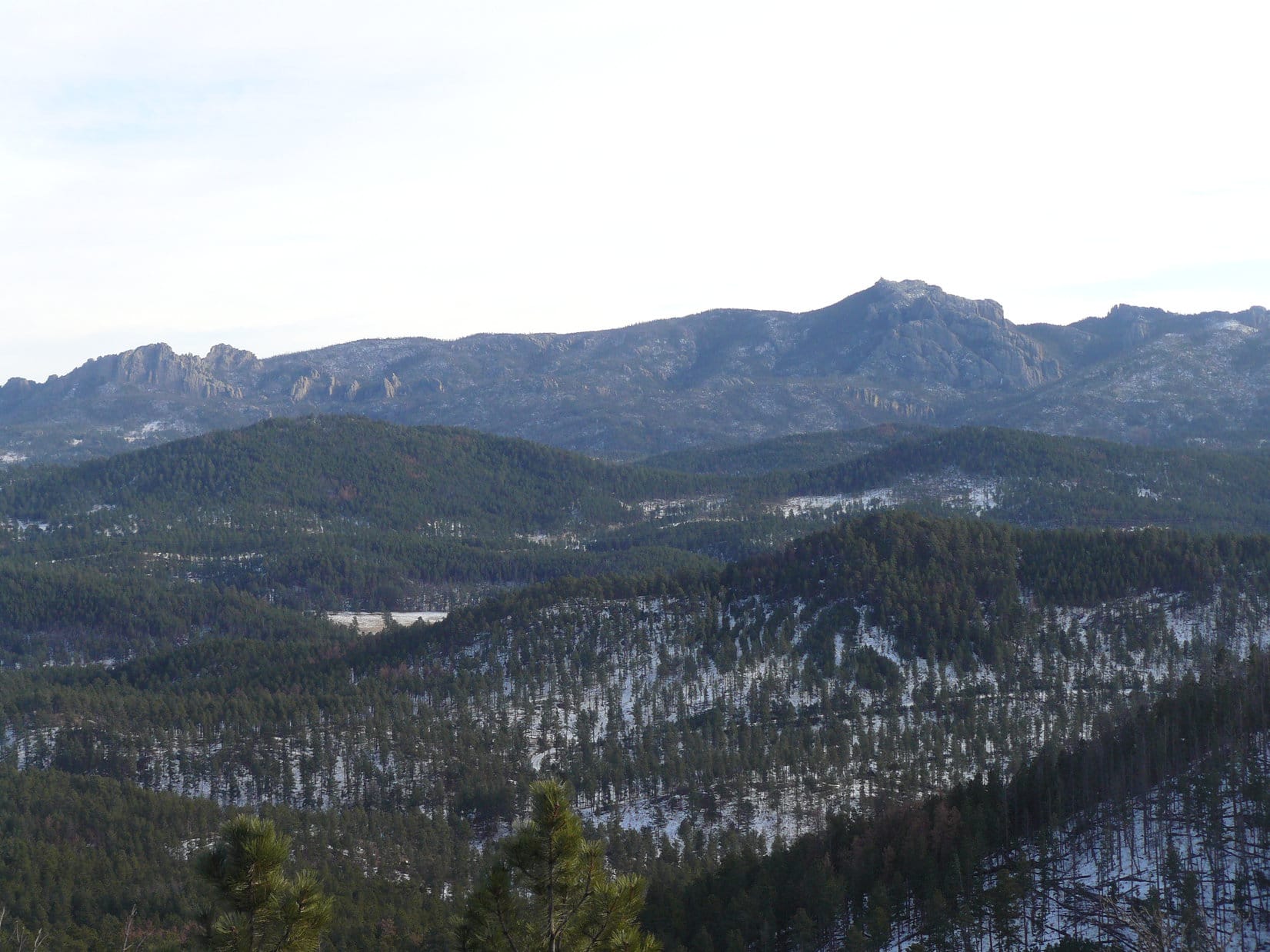
Smith Mountain was the first of 3 peakbagging objectives Lupe had for the day.  The other two, Flag Mountain (5,896 ft.) and Campaign Hill (5,800 ft.), were both S of Smith Mountain.  Smith Mountain is a nearly mile long ridge running N/S.  Lupe and SPHP started climbing the slope at the N end of the ridge.  There was quite a lot of deadfall timber to work past, and snow everywhere, too.  By the time Lupe reached the first little saddle where she could see over to the W side of the mountain, the sun was so warm SPHP had to stop and take off a jacket.

Lupe gained the top of the ridge close to the highest point at the very N end of Smith Mountain.  If there had been fewer trees blocking the view, she would have gone to the very top of the N high point to take a look at Lowden Mountain (6,055 ft.) a mile to the N.  Instead, Lupe headed S along the ridge looking for the true summit of Smith Mountain.  She came to a couple of high spots definitely higher than the N high point.  SPHP thought the second one she came to was likely the true summit.

Lupe at the 2nd high point S of the northernmost high point on Smith Mountain.

Lupe continued S along the Smith Mountain ridge.  This part of the forest had been thinned before the pine bark beetle infestation started.  There was far less deadfall timber to contend with.  The remaining trees were healthier.  More sunlight could reach the ground between them, so there wasn’t nearly as much snow around.  It was far easier to move along, and Lupe and SPHP caught better glimpses of the views to E.

The ridge started angling a little more to the SSE.  After having lost some elevation, Lupe was climbing again.  As Lupe went higher and higher, SPHP began to realize that Lupe hadn’t actually reached the true summit of Smith Mountain yet; it was still ahead.

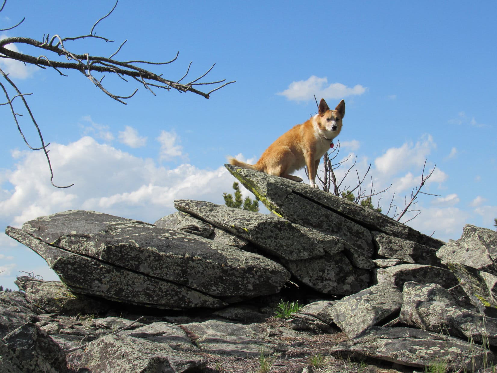
Lupe didn’t have very far to go to reach it.  Soon she was sniffing around much bigger rock formations at the true summit of Smith Mountain.  The highest rocks were so huge, she couldn’t actually get up on top of them, but she climbed up almost as high.  SPHP lifted her up so she could put her front paws on the highest rock, just a foot or two below the very highest point, which was out of reach to the W.

Lupe at the true summit of Smith Mountain. She climbed higher than shown here, and SPHP lifted her up so her paws could touch the big rocks within just a foot or two of the very top. That was close enough! The American Dingo was claiming a peakbagging success! Dingoes are practical, not purists. Photo looks W.

From the true summit, Lupe and SPHP continued only a little way farther SSE along the ridge before turning more to the SSW to start losing elevation.  Lupe stayed high enough on the mountain to avoid a couple of draws that drained W.  Eventually the terrain sloped more to the SSW.  Lupe and SPHP headed down.

Suddenly there was the sound of gunfire!  Hunters were about.  Lupe was instantly alarmed.  She insisted on stopping.  SPHP found a dry spot.  Lupe and SPHP took a break just sitting on the pine needles on the forest floor.  Lupe wasn’t hungry, but SPHP ate a tangerine and a few carrot sticks.  The gunfire had come from quite some distance to the S or SW.

A little while after the gunfire ended, SPHP was ready to move on.  Reluctantly, Lupe tagged along close by.  Almost as soon as Lupe started off again, SPHP spotted a road ahead.  SPHP didn’t realize it at the time, but this was USFS Road No. 386.1B.  Lupe reached it at a bend at the NE corner of a big clearing.  She could follow the road W or S.  Lupe and SPHP headed S in the direction of Flag and Campaign mountains.  There was quite a bit of snow and ice gradually melting on the road.

Eventually, No. 386.1B began turning E to go around the S end of Smith Mountain.  Lupe left the road continuing S.  Before long, she reached a big field extending E/W down in the Patterson Creek valley.  Lupe crossed the field.  Patterson Creek meandered along the S side of the field.  It had plenty of water in it, and was flowing along quite nicely.  Fortunately, the creek was just small enough to leap over.  Both Lupe and SPHP made it across without difficulty.

Near the S side of Patterson Creek was a snowy road going E/W.  A quick check to the W revealed a dead end.  The road went farther E following the Patterson Creek valley downstream.  Lupe went just a little way E on the road, before turning S to start the climb up Flag Mountain.  There was quite a bit of snow on the ground here, and some deadfall timber, too.  Lupe succeeded in avoiding most of the snow and some of the deadfall timber by climbing up a little ridge approaching Flag Mountain from the NNE.

The last 200 feet of elevation gain up the N slope of Flag Mountain was different.  It was fairly steep, full of snow and choked with deadfall.  Lupe had lots of time to sniff around in the shattered forest while SPHP struggled up the mountain.  Meanwhile, the sunnier skies Lupe enjoyed earlier in the day disappeared.  A cold breeze started up out of the WNW.  The mood had turned a bit gloomy by the time Lupe and SPHP made it to the top of Flag Mountain.

The summit area was a little surprising.  It was as big as several houses, and mostly level.  The biggest part was toward the E where the ground was mostly grassy, with trees along the N and NE perimeters.  The very highest point was near the W end, where the summit was much rockier and narrower.  The rocks weren’t very large.  Lupe hopped up on top for a look around.  There were quite a few trees around, but she could see Harney Peak (7,242 ft.) to the SE.

Lupe reaches the summit of Flag Mountain. Photo looks SE toward Harney Peak.

Harney Peak (L) with a little help from the telephoto lens.

The most wide open views from Flag Mountain were toward the E and S from the larger E portion of the summit area.  There were a few bushes, but no trees along the SE perimeter to block the view.  The most impressive view was SE toward Harney Peak, but Lupe also had a pretty good view off to the ENE toward Five Points (6,221 ft.).

Harney Peak from Flag Mountain. Photo looks SE.
Five Points is the wavy ridge on the R. Privately named False North Point is the pointy peak on the L. Looking ENE from Flag Mountain.

Lupe had now climbed 2 of her 3 peakbagging goals for the day, Smith and Flag Mountains.  Her 3rd goal, Campaign Hill was supposed to be just 0.5 mile S of Flag Mountain, but at first glance, SPHP did not see it.  After looking more carefully from the SE edge of the Flag Mountain summit, SPHP saw the E end of a low forested hill to the S.  It seemed too low to be Campaign Hill, but after consulting the maps again, that had to be it.

Campaign Hill wasn’t very far away, but the S slope of Flag Mountain was too steep to go directly down that way.  SPHP got cold feet.  No, really, truly cold feet.  SPHP’s old boots leaked badly.  After tramping around for hours in melting snow, SPHP’s feet were totally sopping wet.  They had been that way essentially the whole day.  Now, standing around on Flag Mountain in the cold breeze, SPHP’s feet felt like they were freezing up.

The sun was low in the sky, but there were still a couple of hours left before sunset.  Lupe and SPHP hadn’t gone all that far as the crow flies, but it had taken a long time to get to Flag Mountain with all the snow and deadfall timber along the way.  It might take quite a while to get back, too.  SPHP needed to start moving to get the circulation going again.  Decision time.

Well, no sense risking frostbite.  Campaign Hill would still be there another day.  Lupe and SPHP started slowly back down the N slope of Flag Mountain through the snow and deadfall timber again.  Lupe went all the way back down the mountain to the Patterson Creek valley again.

Looking W up the Patterson Creek valley on the way back to the G6.

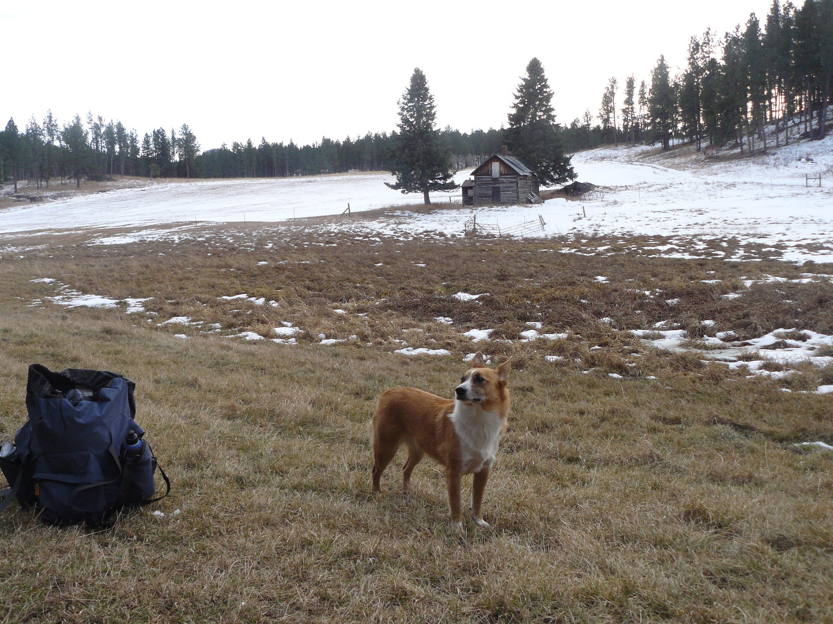
Lupe and SPHP crossed Patterson Creek and went over to the N side of the field.  Since there was no need to climb Smith Mountain again, Lupe and SPHP followed the fence along the edge of the field heading W up the valley to see what was there.  The field branched out into two even bigger fields, one to the SW and one to the NW.  Two big spruce trees stood near an old abandoned cabin where the fields met.  It was a pretty spot.

This old abandoned cabin is about 1 mile SSW of Smith Mountain. Photo looks SSW.

Lupe continued along the NE edge of the field heading N along the fence line.  The field soon divided again.  One arm of it went off to the W.  The other arm turned and went N a long way.  SPHP could see a home way up toward the far N end.  The fields were probably private property.  Lupe and SPHP decided to angle NNE through the forest, hoping to find USFS Road No. 386.1B again somewhere W of Smith Mountain.

Lupe did find No. 386.1B again near the big clearing where she had first reached it earlier in the day on the way to Flag Mountain.  This time, Lupe followed No. 386.1B going N.  The road wound around a little, but most of the time made steady progress to the N.  Along the way, Lupe was exploring new territory W of Smith Mountain.  She saw deer and squirrels in the forest, so she was having some fun.

After a little while, SPHP saw an intersection up ahead.  As Lupe got close to the intersection, her fun suddenly ended.  A shot rang out very close by.  Hunters again!  This time much, much closer.  Lupe wanted to hide near a big tree close to the intersection.  SPHP complied.  Several more shots rang out.  SPHP knew Lupe wasn’t going anywhere until they stopped.

Ten minutes of silence went by.  SPHP headed for the intersection.  Lupe didn’t want to go, but was scared to be left behind.  The side road was marked No. 386.1F.  It went NNE and looked like a shortcut back to the G6 compared to No. 386.1B, which would take a very long way around to the NW.  From the intersection, SPHP saw the hunter’s pickup truck parked not too far away along No. 386.1F.

Another shot rang out.  Lupe and SPHP retreated SW to a big rock.  SPHP sat and looked at maps, while Lupe huddled as close as she could get.  The maps showed it would have been faster to take No. 386.1B around the E side of Smith Mountain from Patterson Creek.  Too late for that!  No. 386.1F was definitely a shortcut back to the G6 from here.  It would save at least a mile compared to staying on No. 386.1B.

After it had been quiet for a while again, Lupe and SPHP returned to the intersection and started NNE on No. 386.1F.  Within a few minutes, Lupe was past the hunter’s pickup truck.  The road was snowy and icy.  There were lots of tracks in the snow.  There must have been quite a few hunters.  Lupe saw a couple of them to the E higher up on Smith Mountain.  One waved.  SPHP waved back, but did not stop.  No more shots were heard.

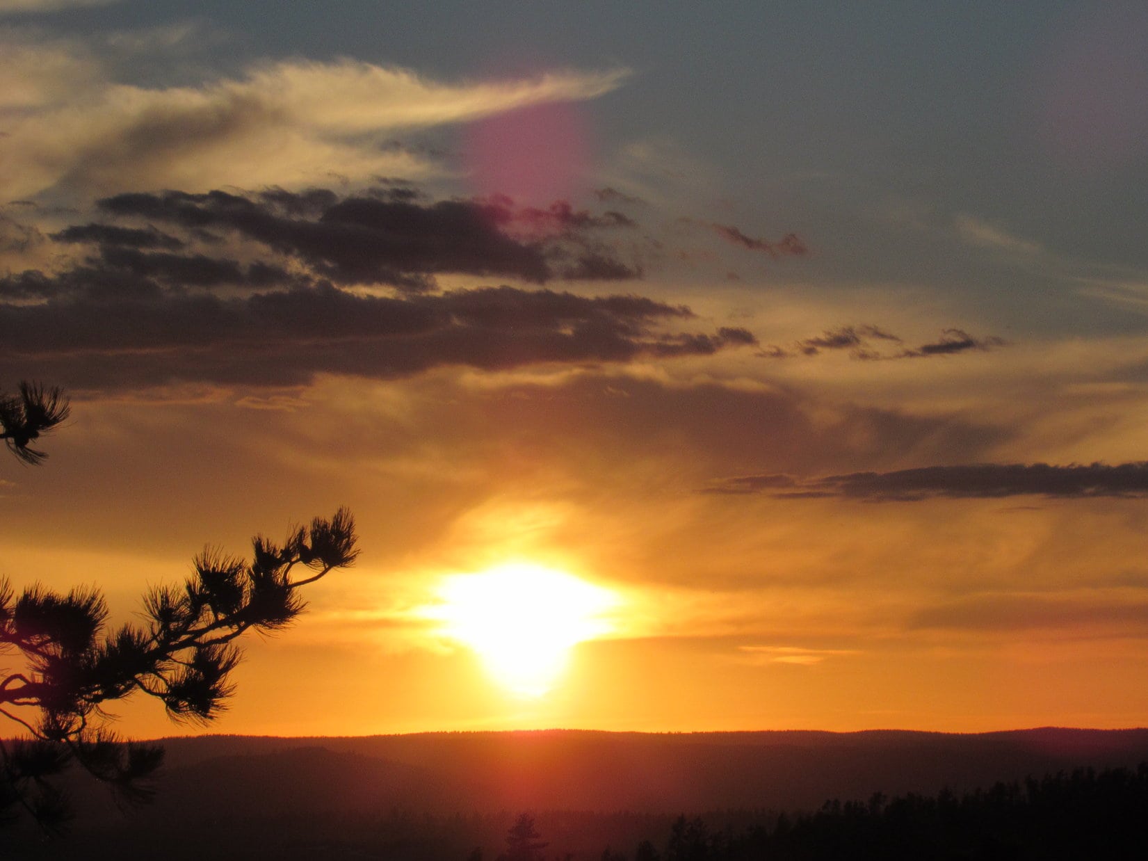
No. 386.1F led down into a big draw NNW of Smith Mountain.  Lower down, the road became so choked with deadfall timber, Lupe and SPHP left it.  The mountain slopes seemed easier going than the road.  The sun set.  For just a few minutes, there was a beautifully colored sky to the SW.

It was 4:59 PM (41°F), and getting pretty dark by the time Lupe and SPHP reached the G6 again.  SPHP’s feet were still cold, but moving on the long march back had helped.  They weren’t as cold as they had been standing around on top of Flag Mountain.  Carolina Dogs have great circulation.  SPHP felt Lupe’s paws.  They were practically burning hot!  It felt good just holding them!  Lupe just grinned.

Sunset from down in the draw along USFS Road No. 386.1F near the NW end of Smith Mountain.

Links:

Next Black Hills Adventure                     Prior Black Hills Adventure

Want more Lupe adventures?  Choose from Lupe’s Black Hills Expeditions Adventure Index or Master Adventure Index.  Or subscribe free to new Lupe adventures.

Black Hills, SD Expedition No. 207 – Peak 6720, Medicine Mountain, Peak 6680 & Copper Mountain (6-3-17)

Start 10:06 AM, 67°F, USFS Road No. 304 near the lower end of Tree Draw, about 4 miles S of Deerfield Road

Well, this was it!  Lupe trotted happily along the road leading up Tree Draw.  At least there was some shade.  It was already warm out.  Only a few little white clouds dotted the sunny blue sky.  Lupe’s pink tongue dangled so far out of her mouth, it looked like it ought to belong to a considerably larger Dingo.

Lupe was destined to spend a good deal of the day panting.  Summer was here!  Due to the heat, Expedition No. 207 would be her last Black Hills Expedition until cooler weather arrives in the fall.

Miss Enormous Pink Tongue on the way up Tree Draw on her last Black Hills expedition until cooler weather comes in the fall. Photo looks WNW.
At least the trees in Tree Draw provided some welcome shade. Photo looks WSW.

The road went W for 0.5 mile, then turned S for 0.375 mile.  Lupe was now approaching the upper end of Tree Draw.  The road angled SW and started climbing more steeply.  It faded away entirely at a barbed wire fence.  Lupe ducked under the fence, and quickly reached a minor pass.  This was the saddle NNW of Peak 6720, her first peakbagging destination for the day.

A broad, gently rounded ridge led SSE up to the top of the mountain.  On the way, Lupe dodged scattered deadfall timber.  Near the summit, the deadfall was worse and had fallen over the barbed wire fence, which unfortunately came up here, too.  SPHP lifted Lupe over the dangerous downed fence.

At the saddle on the ridge above Tree Draw. Lupe followed this broad ridge right on up to the top of Peak 6720, which is dead ahead. Photo looks SSE.

At the N end of the first sizable rock outcropping she came to, Lupe reached the true summit of Peak 6720.

Lupe on the true summit of Peak 6720. Photo looks NW.
Astride the highest rock formation at the N end of the summit ridge. Photo looks NNW.
Dingo on the Rocks.

The summit ridge sloped gradually down toward the SSE.  Beyond a gap of relatively level ground were more rock formations.  Lupe left the true summit to explore them, too.

Lupe went over to explore slightly lower rock formations farther along the ridge. Photo looks SSE.
The rock layers along the spine of Peak 6720 were tilted nearly straight up. A jumble of loose rocks lay scattered immediately below the highest ones. Photo looks SSE.

Fewer trees grew around the rock formations S of the true summit.  Lupe enjoyed better views from here, even though she wasn’t quite as high on the mountain as before.  She could see Sylvan Hill (7,000 ft.) off to the SE where she’d been only a week ago on Expedition No. 206.

Lupe liked scrambling around on the rocks strung out along the spine of Peak 6720. Here she’s at the top of the S high point. Sylvan Hill (7,000 ft.) where she had been only a week ago on Expedition No. 206 is seen on the horizon right behind her. Photo looks SSE.
Loopster enjoying being up on the S high point. Why not? The views were terrific! Photo looks SE.

Looking NNW back along the jagged spine of Peak 6720.
Black Elk Peak (7,231 ft.) (R of Center) from Peak 6720 with help from the telephoto lens. Photo looks SE.
Sylvan Hill (7,000 ft.) (L) and Peak 6733 (highest point on the far ridge on the R) from Peak 6720.  Lupe had been to both on Expedition No. 206.  Photo looks SSE.

It hadn’t taken long to get to Peak 6720, so Lupe wasn’t ready for much of a break yet.  She remained on the summit ridge only 20 minutes.  That was long enough to get a drink, scramble around on the rocks some, and see the views.

Medicine Mountain (6,878 ft.), 2 miles to the SSW, was next on the Carolina Dog’s peakbagging agenda.  Lupe left Peak 6720 heading straight on down the SW slope.  Progress was slow at first.  SPHP had to navigate a band of loose rock directly below the spine of the mountain.  This was followed by a much longer band of deadfall timber.  The deadfall was considerably worse here than on the way Lupe had gone up.

Loose rocks and deadfall were left behind, though, well before Lupe reached the floor of the valley to the W.  A dirt road in the valley headed straight for Medicine Mountain.

Leaving Peak 6720 behind. Photo looks back to the NE.
Down in the valley on the dirt road leading straight for Medicine Mountain (6,878 ft.). Photo looks SSW.

Loop had about a mile to go to reach USFS Road No. 297 down by Negro Creek, but the dirt road she was on veered off onto the W (R) slope of the valley after only half that distance.  The Carolina Dog left the road to remain in the valley instead.  Following an old cow path, she went around the E side of a large fenced area on the valley floor.

When a spring and small creek appeared, Lupe made good use of them.

In the lower part of the valley. Photo looks WSW.

Lupe reached USFS Road No. 297.  She was halfway from Peak 6720 to Medicine Mountain.  Negro Creek, a small stream, but much larger than the tiny tributary in the valley she’d just come through, was flowing through an interestingly shaped pond on the other (SW) side of the road.  The pond was home to a family of Canadian geese.

Negro Creek flows through this interestingly shaped pond N of Medicine Mountain (Center).  Photo looks S.
A family of Canadian geese made the pond on Negro Creek their home.

Lupe and SPHP trudged S on USFS Road No. 297 far enough to get past a barbed wire fence before leaving the road to cross Negro Creek.  While SPHP jumped across, Lupe hopped right in the creek and laid down.  She then got up, and strolled up and down the creek a few times while drinking the cold water.  When the Carolina Dog felt sufficiently refreshed, she leapt out of the creek to start climbing Medicine Mountain.

The day was hot.  At least, it was hot for climbing mountains.  Despite her revitalizing dip in Negro Creek, Lupe’s tongue was soon hanging out again.  The heat sapped SPHP’s energy.  Most of the mountain was forested, but Lupe came to a few sunny fields on the way up, too.  Lupe and SPHP made numerous short rest stops in shady places.

Lupe explored the forest while SPHP kept chugging slowly up Medicine Mountain.  There wasn’t much deadfall until almost to the top.  Lupe arrived at the base of a narrow rock outcropping after coming up the N ridge.  The outcropping looked only 20 feet high.  A route existed where SPHP might be able to scramble directly up.

No problem with the little scramble, but the first 20 feet led only to a false summit. However, Lupe didn’t have much more to go.   Loop and SPHP worked a little higher along the E side of a rocky ledge, while proceeding S.  In a couple of minutes, Lupe was at the top of Medicine Mountain’s N summit.  A line of rocks of roughly equal elevation along the ledge provided terrific views to the N.

This time, break first – then views.  Lupe had water and Taste of the Wild.  An apple, as usual, for SPHP.  Lupe curled up in the shade of a tree, surrounded by delicate white wildflowers.  Medicine Mountain was a busy place.  Flies buzzed, bees hummed, butterflies chased each other in dizzying circles.

A variety of butterflies chased each other in dizzying circles. This one landed briefly to take a break with Lupe.
Relaxing in the shade among the wildflowers.

After a 10 minute rest, Loop and SPHP were ready for a look around.  From the rocks of the N ledge, Lupe could see in every direction except S.  The best views were toward the N & W.

After her break, Lupe went out on the rocks of the N ledge for a look around. She could see Odakota Mountain (7,200 ft.) (L) the 2nd highest in all of South Dakota. Green Mountain (7,164 ft.) is the high point in the distance to the R of Lupe. Photo looks NW.
The view to the NNW. Green Mountain (7,164 ft.) again in sunlight on the far L. Copper Mountain (6,920 ft.) is the ridge L of Center.
Peak 6680 is the lower hill to the L of Lupe. Looper would be going there next after leaving Medicine Mountain. Photo looks W.
Gillette Prairie, an area of grasslands within the Black Hills, is in view on the R.  Distant ridges along the E edge of the high limestone plateau country lie beyond it. The closest ridge on the L is Copper Mountain (6,920 ft.). Lupe hoped to get there, too, before her day was over. Photo looks NNW.
Odakota Mountain (R of Center) and Peak 6680 (L). Photo looks WNW.

So far, Lupe had only made it to the lower N summit of Medicine Mountain.  If she wanted to see the views to the S and complete her peakbagging goal, she would have to go to the mountain’s true summit.  A saddle with considerable deadfall timber led over to the higher S summit, which wasn’t far off.  Lupe could be there in minutes.

Lupe ready to head for Medicine Mountain’s S summit (Center). Photo looks S.

Once she was across the saddle, Lupe found a short, faint trail leading up the NW side of the S summit.  The highest point on Medicine Mountain (6,878 ft.) proved to be occupied by a young aspen tree.

The young aspen tree on the right sprawled out over all the very highest rocks on Medicine Mountain. As far as Lupe was concerned, this was close enough. Photo looks NW
Odakota Mountain (7,200 ft.) (L) from the true summit of Medicine Mountain. Photo looks WNW.

The best views from the S summit were toward the rugged country around Black Elk Peak (7,231 ft.) to the SE.

Black Elk Peak (7,231 ft.) (Center) and Sylvan Hill (7,000 ft.) (R).
Black Elk Peak (straight up from Lupe) with help from the telephoto lens. Photo looks SE.

Looper could see a long way to the S.

Looking S from Medicine Mountain’s true summit. Atlantic Hill (6,393 ft.) is the bump on the horizon straight up from Lupe. Northeast Cicero Peak (6,240 ft.) is the highest point far off at Center L. Photo looks S.

Lupe spent a little while near the true summit of Medicine Mountain.  However, if she wanted to have enough time to actually get to Peak 6680 and Copper Mountain, she couldn’t dilly dally too long.  Disappointingly, a little sniffing around revealed no medicine on Medicine Mountain, so Lupe moved on.  She took the faint path leading back to the saddle, and began a descent down the mountain’s W slope.

The W slope was moderately steep and full of deadfall timber.  Lupe was nearly down to a huge field in the next valley before she was out of it.  She continued W across the field, and headed for a saddle ESE of Peak 6680.  The saddle and much of the rest of the way up were covered with a forest of dense young pines 10 to 15 feet high.

The young pine forest would have been difficult to travel through, but fortunately, a series of lanes free of trees existed by which it was possible to weave up the mountain mostly unhindered.  As Lupe approached the summit of Peak 6680, she came to an older forest and started seeing rock outcroppings.

Lupe saw a great many wild irises on Expedition No. 207. She found these on the W slope of Medicine Mountain on her way to Peak 6680.
Approaching Peak 6680‘s summit ridge from the ESE.

Lupe had been to Peak 6680 once before, way back on Expedition No. 96 on 9-20-14.  It had been so long ago, SPHP couldn’t remember what the summit was like.  Lupe rediscovered a 150 foot long summit ridge oriented E/W with large rocks scattered along the N edge where the slope below was steepest.  This whole ridge was forested, but a few spots offered Loop glimpses of distant views.

The rocks at the far E and W ends of Peak 6680’s summit ridge seemed to be the two highest points on the mountain. Here Lupe is at the E high point. Medicine Mountain (6,878 ft.) can be glimpsed beyond Lupe. Farther away, Sylvan Hill (7,000 ft.) is in view on the R. Photo looks E.
Lupe out on a slightly lower ledge near the E high point. Odakota Mountain (7,200 ft.) in view beyond her. Photo looks NW.
Medicine Mountain (6,878 ft.) with help from the telephoto lens. Photo looks E.

Lupe had come up at the E end of Peak 6680’s summit ridge.  The ridge was roughly level, but with slightly higher points at each end.  Lupe could see a rock at the far W end which looked like it might be the true summit.

Naturally, the American Dingo had to go check it out.

Looking W along the summit ridge from near the E end. The rock that is the high point at the far W end can be seen between the trees straight up from Lupe’s nose.
Up on the highest rock at the W end of the ridge. This might have been the true summit of Peak 6680, but it was hard to tell for sure. In any case, Lupe had already been to the E high point, so she was here to claim another peakbagging success! Photo looks N.
Not a bad perch!

Although it wasn’t really clear if the E or W high point was the true summit of Peak 6680, Lupe had now been to both.  She could now claim peakbagging successes at 3 different mountains today.  SPHP was pretty certain she still had time to get to Copper Mountain, too.

Copper Mountain was 2 miles due N.  Loop wasted no time getting started.  She went E back a little beyond the rocks at Peak 6680’s E high point, before turning N.  She traveled down to a very wide saddle leading to the long S ridge that would take her to Copper Mountain.  It was a bushwhack all the way through the forest until she came to a dirt road upon attaining the S ridge.

Now Lupe and SPHP could make good time.  The dirt road followed the top of the ridge to Sixmile Road (USFS Road No. 301), a major gravel road.  Lupe crossed No. 301 continuing N before eventually turning E.  The sun was getting low, but would still be up for another hour or so, when Lupe reached the cliffs at the SE end of Copper Mountain (6,920 ft.).

The last time Lupe had been here was 14 months ago, when she’d first met her mountaineering friend Jobe Wymore.  Jobe had used Lupe’s Black Hills scouting services, and come all the way from the west coast to visit Odakota Mountain.  Lupe and SPHP had then gone with Jobe all the way to the Wildcat Hills of Nebraska.

Fun times, and it was fun to think about them again now!  Neither Lupe nor SPHP had ever met a real mountaineer before.  Jobe had turned out to be such a great guy with so many interesting tales to tell!  Lupe hadn’t seen Jobe since that day, but it was possible she was going to see him again on one of her 2017 Dingo Vacations this summer!

Medicine Mountain is the conical peak on the R. Photo looks SE.
Looking SW at Odakota Mountain (7,200 ft.) from Copper Mountain. Jobe Wymore had come all the way from the W coast to peak bag Odakota Mountain, because it is the 2nd highest in South Dakota. (Jobe had already climbed the highest mountains in all 50 states.)  After Odakota, Lupe had also brought Jobe here to Copper Mountain where the views are better.
Lupe at the far SE end of the cliffs on Copper Mountain. Black Elk Peak (7,231 ft.) is on the L. Medicine Mountain (6,878 ft.) is on the R. Negro Creek with the pond where the Canadian geese live is in the valley with the green grass seen near Lupe’s head. Photo looks SE.
A closer look with the telephoto lens at the Negro Creek valley. Photo looks SE.
Looking N across Copper Mountain’s summit area from the high point at the edge of the cliffs.
Looking N across Gillette Prairie. Terry Peak (7,064 ft.) (L) and Custer Peak (6,804 ft.) (Center) are faint on the far horizon.

The evening views from Copper Mountain were beautiful.  Lupe and SPHP stayed a little while admiring them, talking about Jobe, and remembering.  The sun was getting lower, though, and Lupe had a bit of a bushwhack ahead of her to get back to the saddle above Tree Draw near Peak 6720.

Lupe’s return trip went fine.  The heat of the day was gone.  Lupe and SPHP were both energized.  Lupe saw many deer, a few squirrels, and one giant deer (elk) on the way.  She had a blast!  She made such good progress, she even had time for a quick side trek back up to the top of Peak 6720 to see the sun set.

Expedition No. 207 marked the end of Lupe’s Black Hills expeditions for a while.  The first of her splendid Summer of 2017 Dingo Vacations full of more distant adventures would be starting soon!  (9:11 PM, 52°F)

On the tippy top of Peak 6720 again at sunset.
Expedition No. 207 nears its conclusion.
On the jagged spine of Peak 6720.

Links:

Next Black Hills Expedition                      Prior Black Hills Expedition

Want more Lupe adventures?  Check out her Black Hills, SD & WY Expeditions Adventure Index, Master Adventure Index, or subscribe free to new Lupe adventures!