Black Hills, SD Expedition No. 92 – Peak 6735 (6-9-14)

After rain and fog all weekend long, Monday had dawned clear and bright.  Rain wasn’t at all unusual this time of year.  In fact, today was the 42nd anniversary of the Black Hill’s June 9, 1972 flood, when 238 people lost their lives.  Nothing remotely close to that dramatic and tragic was going to happen today.  SPHP registered at the entrance to the Black Elk Wilderness near the Horsethief Lake trailhead (10:36 AM, 59°F).

Lupe and SPHP took off heading SSW on Horsethief Lake Trail No. 14.  The normally pleasantly bubbling little creek was gushing right along, overflowing its banks and parts of the trail.  Most of the time, it wasn’t hard to get over or around the wet spots.  The rushing creek in the leafy canyon between towering granite spires was actually rather cheerful and beautiful.

A leafy side channel of the creek along Horsethief Lake Trail No. 14. Ordinarily, this would have been dry ground.

The creek was left behind by the time Lupe reached a junction with Centennial Trail No. 89 about 0.75 mile from the trailhead.  Lupe and SPHP turned right, taking a short stretch of trail going W that is part of both Horsethief Lake Trail No. 14 and Centennial Trail No. 89.  When the trails separated again, Lupe turned left, staying on Horsethief Lake Trail No. 14.

As Lupe continued SSW, she started encountering a fair amount of deadfall timber fallen across the trail.  Huge numbers of ponderosa pine trees infested with pine bark beetles have died in the Black Hills in recent years.  Over time, high winds blow over increasing numbers of the dead trees.  Lupe and SPHP had to spend quite a lot of time off the trail going around the deadfall.

After about 2 miles, Lupe reached the S end of Horsethief Lake Trail No. 14 at a “T” intersection.  Lupe turned right, following Grizzly Bear Creek Trail No. 7.  The trail wound around heading generally W or NW.  Lupe didn’t need to follow Grizzly Bear Creek Trail No. 7 very far, only about 0.375 mile.  Lupe’s peakbagging goal for the day was Peak 6735, more than a mile to the SW.  There is no trail to Peak 6735.

SPHP started looking for a way across Grizzly Bear Creek, a larger stream than the one near the start of Horsethief Lake Trail No. 14.  Naturally, Grizzly Bear Creek was also running high.  Fortunately, it didn’t take too long to find a place where a few boulders enabled SPHP to jump over.  The American Dingo, of course, had no problem getting across.

On the SW side of Grizzly Bear Creek, Lupe found herself in a meadow that sloped gradually up to the W.  Parts of the meadow were soggy and marshy, but by the time Lupe and SPHP reached the trees again, Lupe was back on dry ground.  An old dirt road headed S around the E side of the mountain ahead.  Lupe and SPHP followed it S for a little way.

The road gradually gained elevation, but reached a high point.  From here, the road turned SE.  Lupe needed to go SW, and she didn’t need to lose elevation.  Lupe and SPHP left the dirt road, and started climbing the mountain.

The first part of this climb was about the only place all day where Lupe didn’t have to contend with a lot of deadfall timber.  She raced this way and that sniffing around in the forest, while SPHP trudged ever upwards.  Before too long, the mountain began to narrow.  Deadfall and a series of large granite rock formations appeared.  The climb became progressively steeper and more difficult.

Happy Lupe enjoying the climb.

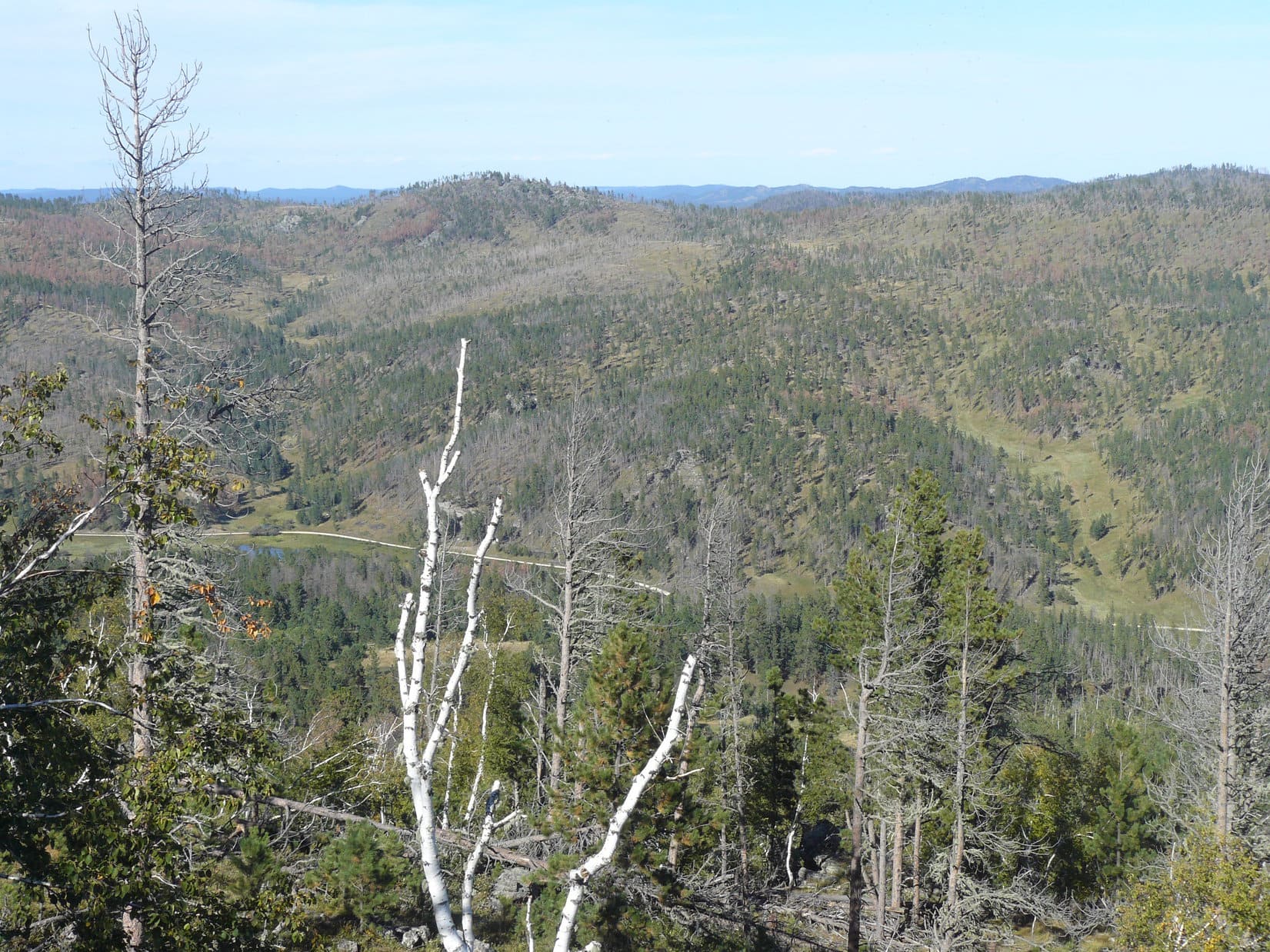
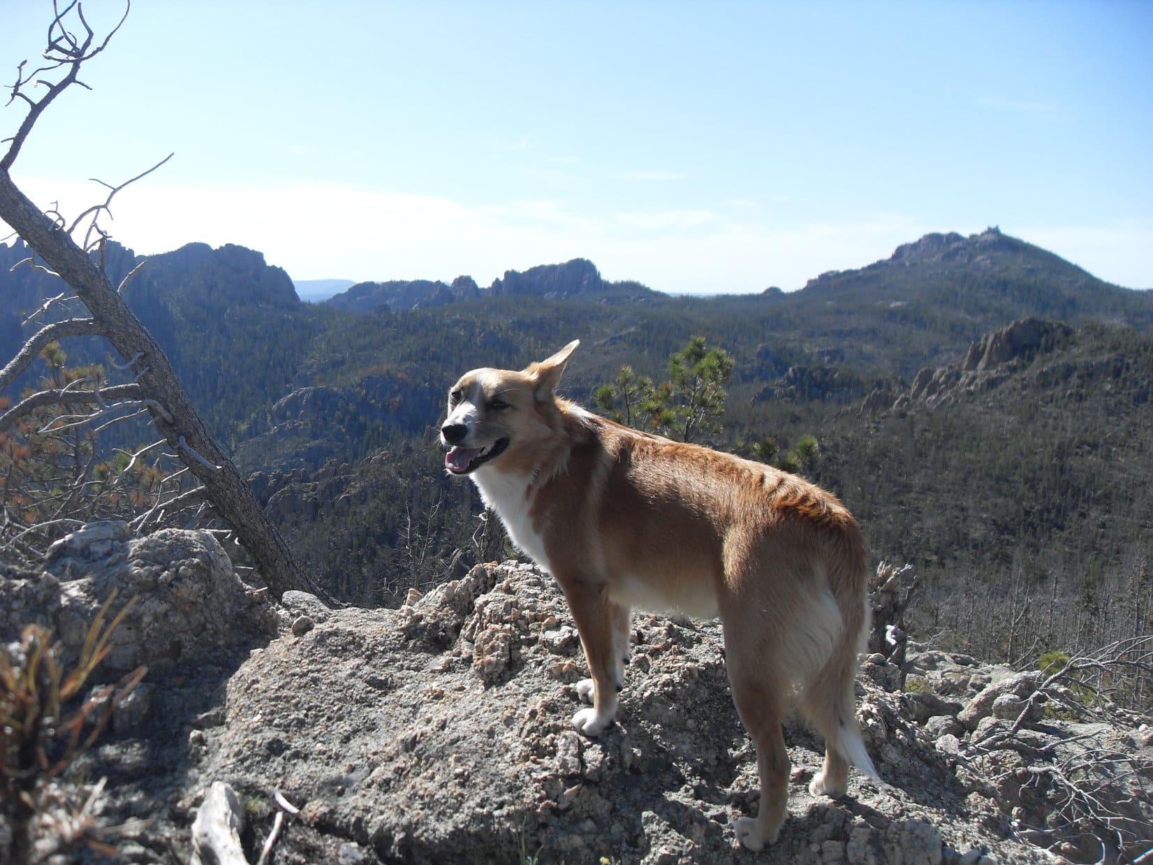
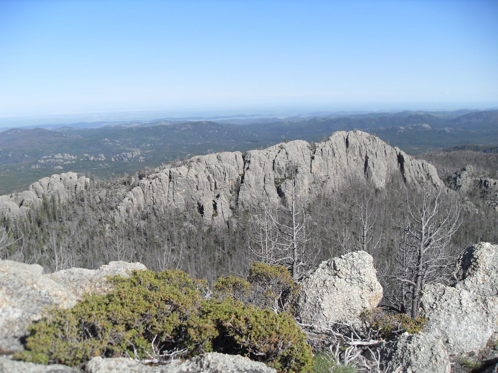
As Lupe and SPHP continued up, the rock formations were larger and closer together.  Most of the time it was easier to go around to the S of them, although occasionally it was easier to make forays to the N.  Lupe was able to climb up on top of a few of the rock formations.  Eventually, SPHP was able to see that Lupe was getting up in the world.  Huge granite walls were visible on nearby mountains, especially in the area to the N leading up to Harney Peak.

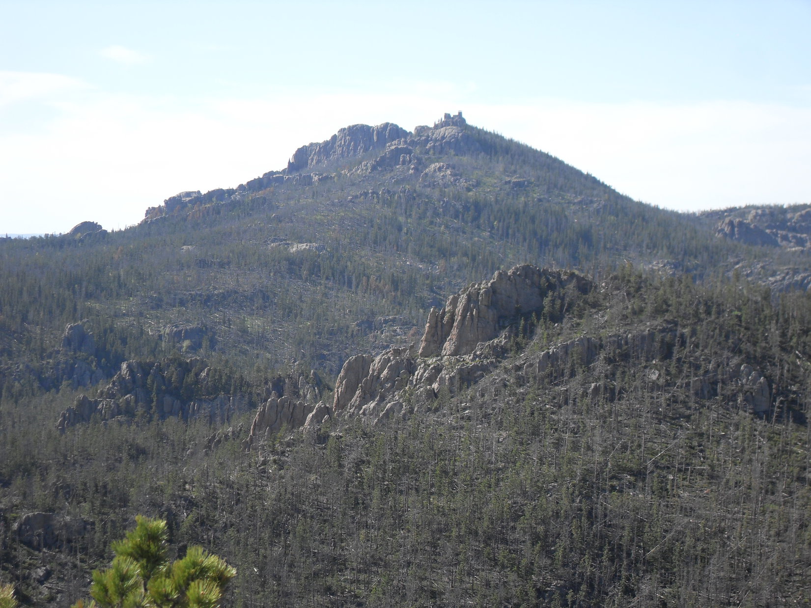
From each rock formation, another higher one came into view up ahead.  Finally, it looked like Lupe was getting close to the top of the mountain.  SPHP expected Lupe to emerge up on Peak 6710, about 0.25 mile NW of her Peak 6735 goal.  When Lupe reached the high point, though, the view was disappointing.  Things didn’t look right at all.  There was no way Lupe was on Peak 6710.

Actually, the scenery was great!  The trouble was that SPHP could see another mountain ahead to the SW.  It was several hundred feet higher!  So, if Lupe wasn’t on Peak 6710 now, where was she?  SPHP already had a pretty good notion, even before checking the maps.

Sly Dingo Lupe arrives up on a high point looking like she knows something SPHP doesn't!
Sly Dingo Lupe arrives up on a high point looking like she knows something SPHP doesn’t!

Yes, the depressing news was true.  That higher mountain to the SW had to be Peak 6710.  Despite how long it had taken to get here through all the wretched deadfall timber and toiling around the big rock formations, Lupe hadn’t gone nearly as far as SPHP had thought.  She wasn’t as high up, either.  Lupe was on top of Peak 6411, still 0.33 mile NE of Peak 6710.

Lupe on High Point 6411. She is still 0.33 mile NE of Peak 6710 seen on the L.

It was time for a rest.  SPHP had intended for Lupe to bypass Peak 6411 to the N.  Instead, Lupe and SPHP had climbed SW up the spine of the mountain to get here.  Lupe still had to continue on to Peak 6710, or at least close to it, on her way to Peak 6735.  To get there, she was going to have to lose over 100 feet of elevation going down to a saddle before she could resume climbing.

The task of getting to Peak 6710 looked daunting.  More rock formations, an exhausting maze of deadfall timber, and another steep climb were still ahead.  As discouraging at it was, there was nothing to do, but get on with it.  One step at a time.  The rest break was over.  Lupe and SPHP headed slowly down into the saddle SW of Peak 6411.  Nothing had changed.  The way forward was a lot like Lupe’s climb up Peak 6411.

Finally, it was over.  Lupe and SPHP were close to the top of Peak 6710.  The summit was a big, high steep granite rock formation.  Lupe and SPHP got to within 10 feet of the top.  SPHP could probably scramble up on top, but there was no way for Lupe to get up there, even with SPHP’s help.  The granite was just too vertical.  SPHP couldn’t quite see the top, but it felt like the summit might be a scary high place.  Getting back down safely didn’t look very easy, either.

Well, it would have been nice to reach the absolute summit of Peak 6710, but Lupe’s real goal was Peak 6735.  If she could reach the top of Peak 6735, that would just have to be good enough.  SPHP gave up on Peak 6710.  Lupe and SPHP headed SE down toward the saddle over to Peak 6735.

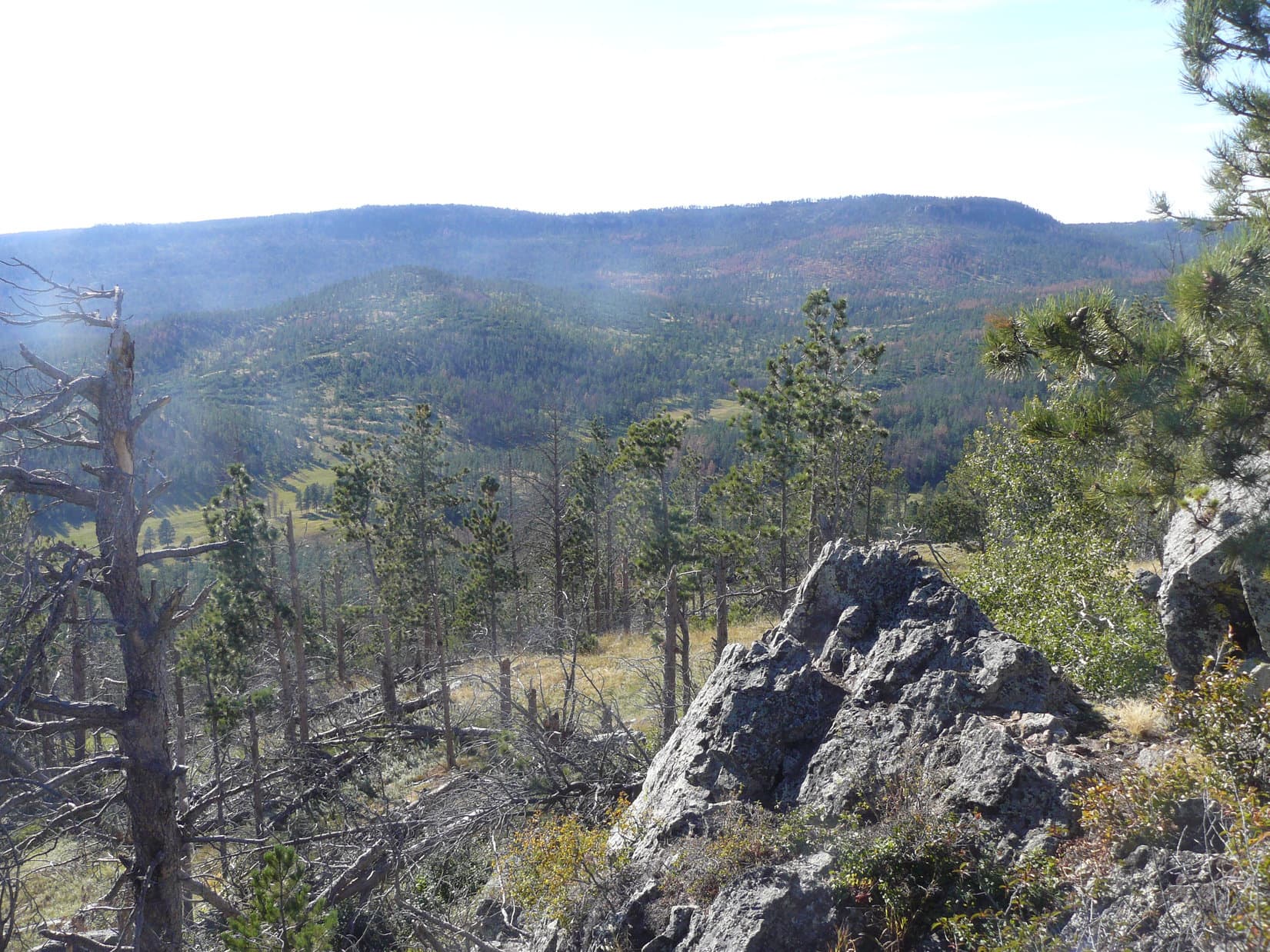
Lupe lost nearly 250 feet of elevation crossing the saddle.  Due to the deadfall, it was all miserably slow going.  The true summit of peak 6735 is more toward the S end of the summit area.  Lupe and SPHP skirted the N end of the high ground to the W.  Lupe had another steep climb, but eventually it got easier.  There was somewhat less deadfall timber near the end.  Lupe and SPHP started making faster progress.

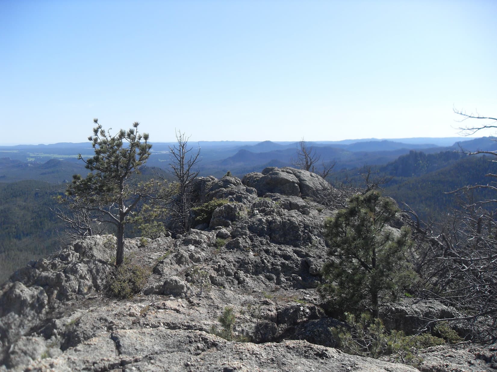
The top of Peak 6735 was much easier to navigate than Peak 6710 had been.  The whole area was rocky, but it was easy to approach the very highest rocks at the true summit by circling around a bit to the S.  After a long, hard struggle, Lupe had done it.  She stood on top of Peak 6735!

Lupe on top of Peak 6735! Harney Peak (L) is the highest point on the horizon. Peak 6710 is closer and can also be seen on the L. The cliffs on the SW (L) side of Peak 6710 are in clear view. Lupe and SPHP hadn't been able to see the cliffs ahead coming from the NE (R). It may be a good thing SPHP didn't climb the last 10 feet to the top of Peak 6710!
Lupe on top of Peak 6735! Harney Peak (L) is the highest point on the horizon. Peak 6710 is closer and can also be seen on the L. The cliffs on the SW (L) side of Peak 6710 are in clear view. Lupe and SPHP hadn’t been able to see the cliffs ahead coming from the NE (R). It may be a good thing SPHP didn’t climb the last 10 feet to the top of Peak 6710!

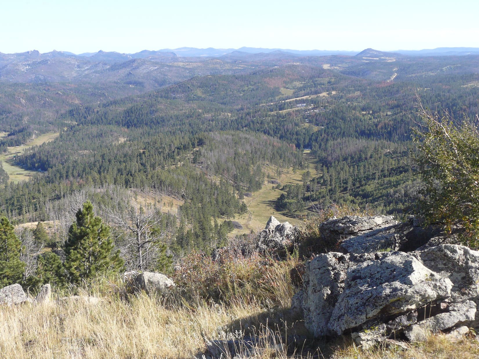
Peak 6735 featured marvelous 360° views.  As annoyingly difficult as it was to get here, SPHP was pretty certain Peak 6735 must not be visited very often.  Not many people or American Dingoes have ever been treated to these views.  Lupe and SPHP were glad to be here!

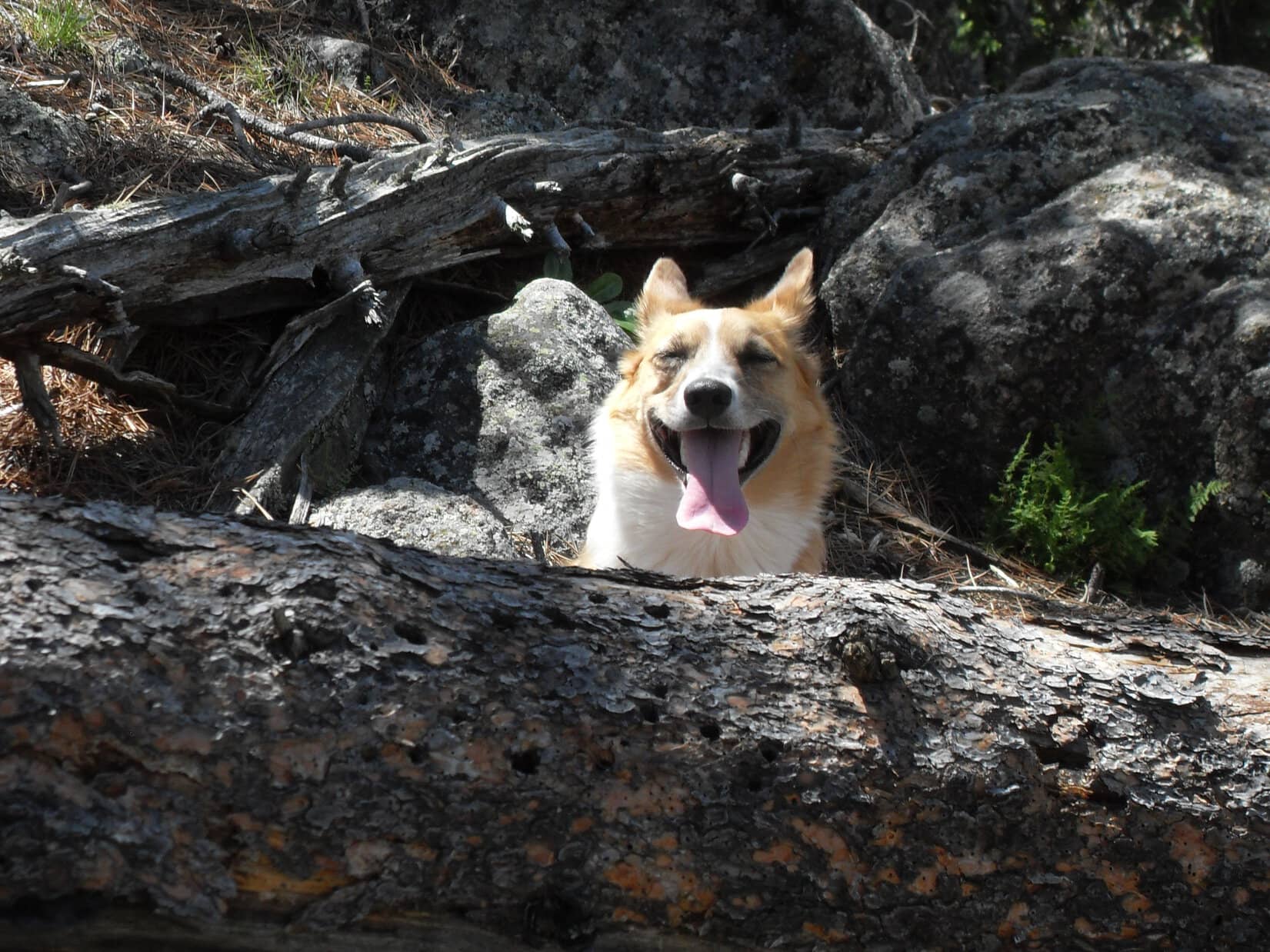
It had been a long, exhausting climb through rugged territory.  By far the worst obstacle, though, had been the shattered dead forest.  Lupe and SPHP needed a rest break, a much longer one than Lupe had taken on High Point 6411.  Rest, water, snacks and big views were all part of a most welcome respite.

The Cathedral Spires (6,840 ft.) (L) are behind the dead tree, Little Devil's Tower (6,960 ft.) (L) is just to their right. Peak 6920 (Center) is directly above Lupe's ear. Harney Peak (7,242 ft.) is the high peak on the R, with Peak 6710 seen below and slightly to the R of Harney. Photo looks NW.
The Cathedral Spires (6,840 ft.) (L) are behind the dead tree, Little Devil’s Tower (6,960 ft.) (L) is just to their right. Peak 6920 (Center) is directly above Lupe’s ear. Harney Peak (7,242 ft.) is the high peak on the R, with Peak 6710 seen below and slightly to the R of Harney. Photo looks NW.
Looking NW with the same peaks in view as in the photo above.
Looking S from the summit of Peak 6735. The fact that so many of the dead trees hadn't fallen over yet made it relatively easy to move around on Peak 6735. Clearly it will get harder in the future!
Looking S from the summit of Peak 6735. The fact that so many of the dead trees hadn’t fallen over yet made it relatively easy to move around on Peak 6735. Clearly it will get harder in the future!
Harney Peak and Peak 6710 using the telephoto lens. Photo looks NW.
A Carolina Dog takes a well-deserved break on Peak 6735. Photo looks NE.

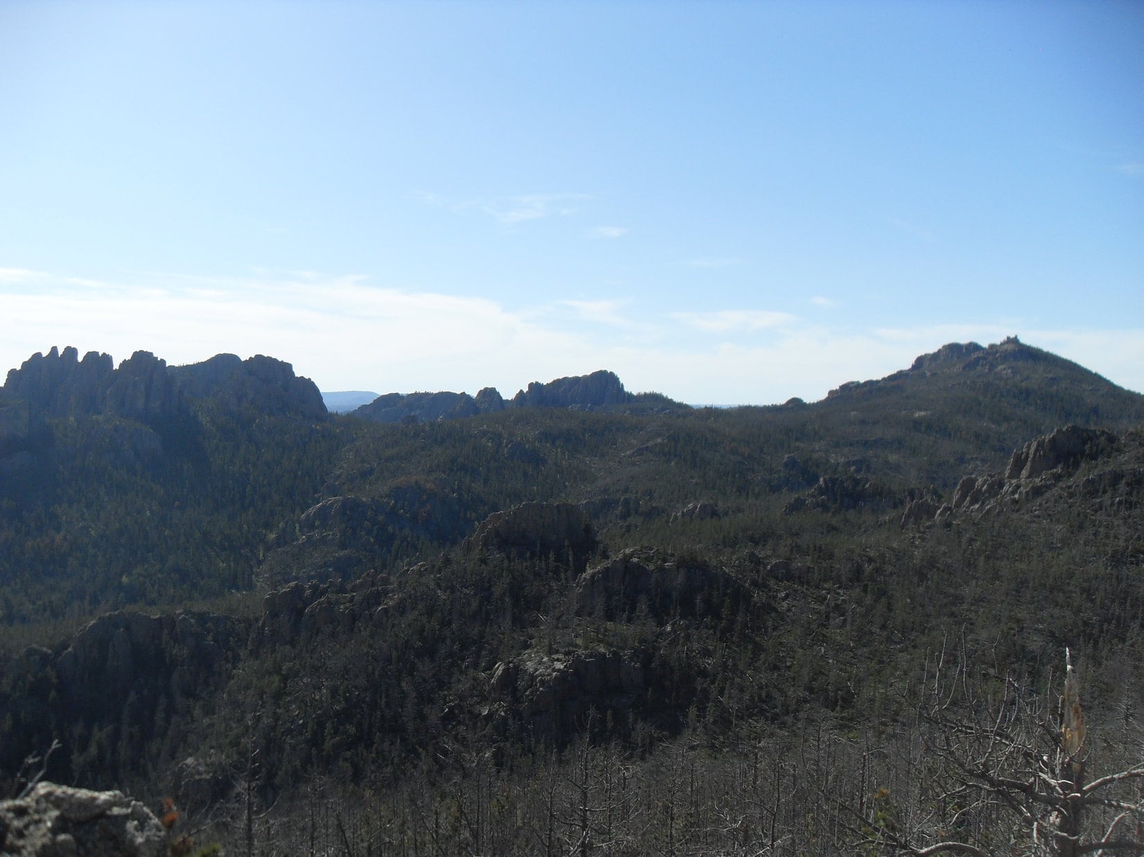
After the rest break was done, it was time to do some exploring of the summit area.  A big granite arm of the mountain extended off to the SW without losing too much elevation.  Lupe had clear sweeping views to the S from this granite ridge.  Nothing she saw to the S was as high as Peak 6735!

A beautiful green carpet of kinnikinnick was growing on parts of the summit area. Here Lupe is enjoying the kinnikinnick just below the true summit.
The SW arm of Peak 6735. Northeast Cicero Peak (6,240 ft.) is the highest point on the horizon just L of Center.
View to the SW from the SW ridge.
Looking SE.
Looking SE.
Looking back to the N toward the summit. Harney Peak is on the L.

After a leisurely exploration of the SW arm of the mountain and around to the SE, Lupe and SPHP returned to the summit of Peak 6735 for a final look.

Lupe was in dazzlingly bright sunshine on Peak 6735, but it wasn't going to last. It was already getting late in the afternoon.
Lupe was in dazzlingly bright sunshine on Peak 6735, but it wasn’t going to last. It was already getting late in the afternoon.
A final look WNW from the summit at the Cathedral Spires (L) and Little Devils Tower (R), both near the center of this photo.

It would have been nice to explore the high ground N of where Lupe had come up the mountain, but it had taken a very long time to get up here.  The slanting rays of the sun gave notice that it was already late afternoon.  Lupe’s time on Peak 6735 was running out.  The N ridge wasn’t quite as high as where Lupe had already been, anyway.

Although the world was beautiful from up on Peak 6735, it was time to move on.  When darkness fell, SPHP didn’t want to be lost wandering in a wilderness of steep terrain, deadfall timber, cliffs and huge rock formations.  Lupe and SPHP left Peak 6735 heading N.

Looking NE just before leaving Peak 6735. (Note Lupe down in the shadows on the lower L.)

It was now a race against time to get back to a trail before darkness fell.  There was no need to go back up Peak 6710 again.  This time, after crossing the saddle to Peak 6710, SPHP led Lupe N along the E side of the mountain aiming for the saddle over to High Point 6411.

Upon reaching the saddle, Lupe and SPHP crossed it continuing N.  Lupe wasn’t going back to High Point 6411, either.  The plan was to go directly down to Grizzly Bear Creek Trail No. 7.  The terrain started dropping steeply.  SPHP feared Lupe would lose hundreds of feet of elevation only to find herself at the top of a cliff.  If she did, there would be no choice but to climb all the way back up before trying another route.

The steep descent went on for what seemed like a long time.  Close by to the E, a huge wall of granite appeared.  Across the valley to the N, SPHP could see similar steep declines that ended in sheer cliffs below.  Lupe was losing a lot of elevation.  Luckily, the terrain wasn’t getting any steeper.  Lupe forged ahead of SPHP.  She could maneuver on the slope much better than SPHP could.

At last, looking down from above, SPHP saw Lupe sitting motionless, panting happily.  Lupe had found it!  She was sitting right on Grizzly Bear Creek Trail No. 7.  SPHP joined her on the trail.  Good work, Lupe!  SPHP praised her.  Lupe beamed.  The shortcut had worked, and there was plenty of daylight left, even though the trail was in the shadow of the mountains.  Lupe and SPHP set off heading E down the trail.

It was much farther, and took much longer, than SPHP anticipated to get back to Horsethief Lake Trail No. 14.  There was the usual deadfall timber plus half a dozen creek crossings to deal with along the way.  SPHP managed to find a way to jump over the high-flowing creek each time.  For Lupe, the stream crossings were a piece of cake.  She leaped across with ease.

By the time Lupe and SPHP made it back to Centennial Trail No. 89, it was getting dark.  The flashlight had to come out for the last stretch of Horsethief Trail No. 14 after leaving the Centennial Trail.  In the darkness, it was much harder to avoid all the water flowing over the trail.

Lupe’s long adventure to Peak 6735 and back ended at 9:53 PM (52°F).  Nearly 11.5 hours had gone by, most of it spent in rugged terrain choked with deadfall.  Lupe didn’t complain.  She never does.  She hopped in the G6 and curled up for the ride home.

SPHP didn’t complain either.  The views from Peak 6735 had been splendid.  The sense of remote isolation, complete.  In truth, it had been a fun and challenging day.  So much fun that SPHP thought Lupe should return to Peak 6735 some day.  Maybe some day, she will.

Harney Peak from Peak 6735.

Links:

Next Black Hills Expedition                  Prior Black Hills Expedition

Want more Lupe adventures?  Choose from Lupe’s Black Hills Expeditions Adventure Index or Master Adventure Index.  Or subscribe free to new Lupe adventures.

Black Hills, SD Expedition No. 95 – Peak 6720 & Medicine Mountain (9-13-14)

SPHP wanted to park the G6 at the start of Tree Draw on the W side of Newton Creek Road (USFS Road No. 304), but there wasn’t any place to park there.  Lupe and SPHP had to abandon the G6 at a wide spot along the road about 0.25 mile farther S (11:04 AM, 53°F).  Lupe trotted ahead of SPHP on No. 304 back down to Tree Draw.

The side road going W across Newton Creek was marked as ATV trail No. 6918, but SPHP’s old map showed it as USFS Road No. 304.1B.  Whatever its proper designation these days, Lupe and SPHP followed it W up Tree Draw.

It was a beautiful, clear, bright morning.  Less than 72 hours earlier, on the night of September 10/11, the Black Hills had experienced its earliest measureable snowfall on record.  The records went all the way back to 1888.  Parts of the Black Hills had received up to 8″ of snow.  Lupe, of course, was delighted!  She had a blast frolicking in big patches of snow still melting in shady spots.

Lupe loved the rapidly melting snow along USFS Road No. 304.1B going up Tree Draw.

No. 304.1B went W for 0.5 mile, then turned SSW for another 0.5 mile.  The road ended at a barbed wire fence shortly before reaching the top of a saddle along a high ridge.  Lupe and SPHP got past the fence, and continued up to the saddle.  On the other side of the saddle, a herd of black cows was grazing in the upper reaches of a wide grassy valley.

Lupe’s first peakbagging goal of the day, Peak 6720 was in sight about 0.25 mile to the SSE along the ridgeline.  A fair amount of deadfall timber laying across the ridge looked like the only obstacle in the way of an otherwise easy stroll up to the summit.

Lupe's route up Peak 6720 from the NNW. The deadfall timber was the only real obstacle to an otherwise easy climb.
Lupe’s route up Peak 6720 from the NNW. The deadfall timber was the only real obstacle to an otherwise easy climb.

At the top of Peak 6720, Lupe found 3 separate high points strung out along the ridge.  Each high point featured a rocky outcropping.  The middle rock outcropping was the true summit, but fewer standing trees made the views better from the N and S high points.

Although the rock formations at the high points weren’t all that large, they were somewhat tricky to navigate.  The presence of significant amounts of deadfall timber, and an annoying bumper crop of thistles didn’t help.  Lupe and SPHP spent at least half an hour up on Peak 6720.  Part of that time was used up just moving around between the high points.

Peak 6720 is the highest point along a long ridge that runs for several miles in a NNW/SSE direction.  Although there are a number of other points nearly as high along the ridge, Lupe and SPHP had good views over a wide swath of territory in most directions.

Medicine Mountain (6,878 ft.) from Peak 6720 using the telephoto lens. Photo looks SSW.
Lupe on Peak 6720.
Lupe on Peak 6720.
A splendid view to the WNW from Peak 6720. Gillette Prairie is seen in the distance on the R. Copper Mountain (6,920 ft.) and Green Mountain (7,164 ft.) are in view along the high distant ridge on the L.
Lupe on the true summit of Peak 6720. Odakota Mountain (7,200 ft.), the 2nd highest mountain in South Dakota, is the high point along the far ridge near the center of the L side of this photo. Photo looks WSW.
Harney Peak (7,242 ft.) is the high point on the far ridge. Photo looks SE from the S high point on Peak 6720.

Lupe visited all 3 of the high points on Peak 6720 before heading NW down the mountain into the long valley SSW of the saddle to Tree Draw.  Well down the slope, Lupe passed to the N of a tall rock formation, turned SW, and proceeded down to the bottom of the valley.

A dirt road went along the W side of the valley.  Black cows were grazing near it, but moved off up the valley as Lupe and SPHP approached.

Medicine Mountain from the valley W of Peak 6720. Photo looks SSW.
These cows W of Peak 6720 decided it was best to trot on up the valley to avoid meeting Lupe and SPHP.

Lupe and SPHP followed the road, which was probably USFS Road No. 297.3E, going SSW down the valley.  SPHP knew there would be more cows ahead, having seen several herds from up on Peak 6720.  When the next herd came into view, Lupe and SPHP crossed a tiny stream on the W side of the valley and headed up into the trees.

After going high enough to avoid disturbing the cows while passing by, Lupe and SPHP tried going SSW along the side of the hill.  For a while it worked out OK.  In fact, it was a rather interesting trek.  The hillside had some interesting geology.  Very shiny fine-grained rocks and nice specimens of white quartz formed part of the rock formations Lupe came to.  There were even some pieces of rose quartz.  SPHP wondered what made the shiny rocks so glittery?

The hillside became steeper.  A deep, narrow side ravine coming down from the NW blocked Lupe’s way forward.  Lupe and SPHP had to go down off the hillside.  At the base of the hillside, Lupe found the tiny creek again.  However, it wasn’t so tiny as it had been upstream.  It still wasn’t all that large, but there was quite a bit of black mucky marshy ground around it.

Finding a way across the marshy creek took a little while, but Lupe and SPHP managed to get across out into the main part of the valley again.  The road had disappeared.  The valley was full of tall grass and scattered stands of trees.  Even though this was all Black Hills National Forest land, Lupe came to several barbed wire fences.

At the lower end of the valley, Lupe found a faint road (a remnant of USFS Road No. 297.3E?) again.  It soon led Lupe and SPHP to USFS Road No. 297, a major gravel road.  Not too far away, a pond on Negro Creek was on the other side of No. 297.  Lupe’s next peakbagging goal, Medicine Mountain (6,878 ft.) could be seen beyond the pond.

The faint road in the lower part of the valley SW of Peak 6720 shortly before it reached USFS Road No. 297. Photo looks SW.
The pond on Negro Creek near USFS Road No. 297. Medicine Mountain, Lupe's next peakbagging goal, is seen almost a mile beyond the pond. Photo looks S.
The pond on Negro Creek near USFS Road No. 297. Medicine Mountain, Lupe’s next peakbagging goal, is seen almost a mile beyond the pond. Photo looks S.

To get around some private property (the pond was part of it), Lupe and SPHP followed USFS Road No. 297 S less than 0.25 mile.  Lupe then bounded over Negro Creek, and went W across a field to the edge of the forest.  A rather striking hill with two big rock outcroppings at the top was back to the SE across No. 297.

This striking hill with 2 big rock outcroppings at the top was SE of where Lupe started her climb up Medicine Mountain.
Looking SE using the telephoto lens.

Lupe and SPHP started climbing Medicine Mountain from the NNE.  There was no road or trail.  At first there was quite a bit of deadfall timber to contend with, and the going was slow.  About 1/3 of the way up, Lupe came to a meadow.  Lupe and SPHP headed W across the meadow, still gaining elevation.  At the end of the meadow, Lupe turned S climbing again through the forest.

The mountain got steeper higher up, but fortunately there wasn’t as much deadfall.  Medicine Mountain has two high points separated by a large saddle several hundred feet long.  The N high point is somewhat lower than the S one.  Near the end of the climb, Lupe and SPHP arrived at the base of cliffs at the N end of the N high point.

Lupe and SPHP couldn’t climb the cliffs.  A short exploration to the E revealed discouragingly steep terrain littered with deadfall timber.  The W side of the mountain looked more encouraging.  The cliffs forced Lupe and SPHP to lose some elevation going around to the W, but then there was a place where it might be possible to climb up.  Lupe and SPHP managed to scramble up without much difficulty.

Even though the N high point wasn’t the true summit of Medicine Mountain, Lupe was already here.  It made sense to explore the N high point first.  The views from the cliffs at the very N end were great.  An unobstructed 180° panorama was on display.  It seemed like a terrific place to take a break.  SPHP filled Lupe’s bowl with Taste of the Wild, and then sat down to eat an apple while admiring the scene.

Green Mountain (L Center), Copper Mountain (Center), and Gillette Prairie (R) from the N end of Medicine Mountain. Photo looks N.
Odakota Mountain (Center) from the N end of Medicine Mountain. Photo looks NW.
The tallest branch of the dead white tree points straight up at Peak 6720. To the left is the valley that Lupe came down. Near the end of it, there is a glimpse of the pond on Negro Creek down by USFS Road No. 297. Photo looks NNE.

Lupe was too busy to eat her Taste of the Wild.  A chipmunk scurrying around on the rocks had her bamboozled, but she remained very interested in its sudden appearances and disappearances.  The entertainment went on for several minutes.  SPHP wasn’t paying any attention when suddenly Lupe made a low “woof”.

Lupe searches for the Houdini chipmunk up at the N end of the N high point on Medicine Mountain. Bear Mountain (7,166 ft.) is the high ridge on the horizon. Photo looks SW.

Glancing over at Lupe, SPHP saw that she was standing stock still.  She had forgotten all about the chipmunk.  Now she was staring intently at some low juniper bushes close to SPHP.  The fur on the back of her neck and all along her spine was standing on end.

Lupe didn’t move a muscle.  For a couple of minutes she stood staring at the bushes.  She made several deep, menacing “woofs”.  What the heck was it?!  SPHP hardly dared to move.  Had Lupe caught wind of a mountain lion?  Had it stalked Lupe and SPHP clear to the top of Medicine Mountain?  The idea seemed preposterous, but something sure had Lupe’s attention.

Suddenly the menacing creature broke from the juniper bushes making a mad dash.  It disappeared in a flash.  A white bunny rabbit?!  That was the fur-raising threat?  Well, no doubt it was for the best that there hadn’t been a mountain lion, but a white bunny rabbit seemed ridiculously disappointing.  Couldn’t there at least have been a bobcat or something?

SPHP laughed at Lupe.  Seriously, Lupe, a bunny rabbit?  I’ve never seen you react that way before to such a harmless creature!  What a big, brave American Dingo!  You almost had me believing there was a mountain lion or some ferocious predator.

Oh, I see.  This is Medicine Mountain and the white bunny was full of bad medicine, right?  It really wasn’t what it seemed when it dashed away.  Probably transformed by old Indian magic and evil spirits from its true form!  SPHP laughed again.

Lupe paid no attention to SPHP’s teasing.  She knew what she knew.  Lupe gave up on disappearing rabbits and chipmunks.  Now that the bunny was gone, she relaxed.  Things were back to normal.

Lupe suddenly realized how hungry she was.  She devoured her Taste of the Wild.  SPHP shared part of an energy bar with her.  When Lupe was fueled up again, it was time to go explore the true summit at the S end of Medicine Mountain.

The saddle to the S high point was easily crossed.  A faint trail led up to the summit from the NW.  The S end of the summit area was grassy and open.  Once again, Medicine Mountain provided an unobstructed 180° panorama, this time to the S.

Harney Peak (7,242 ft.) (L) and Little Devil's Tower (6,960 ft.) (R) from Medicine Mountain. Photo looks SE.
Harney Peak (7,242 ft.) (L) and Little Devil’s Tower (6,960 ft.) (R) from Medicine Mountain. Photo looks SE.
Lupe on Medicine Mountain. Photo looks SW.
Peak 6680 is the rounded forested hill in the foreground below the high ridge on the L. Odakota Mountain is seen on the R. Photo looks W.
Peak 6680 is the rounded forested hill on the L in the foreground below the high ridge. Odakota Mountain is seen on the R. Photo looks W.
Looking S.
Looking S.
Looking SE.
Looking SE.
Looking NNE at Peak 6720 (Center).

Lupe and SPHP dawdled for more than half an hour on Medicine Mountain.  When it was time to go, Lupe took the faint trail NW down to the saddle area.  From the saddle, Lupe and SPHP went W down the slope.  It was slow going.  Deadfall timber lay strewn in every direction.  To avoid some of it, Lupe and SPHP turned SW, finally reaching some open ground.

Lupe lost elevation rapidly and came to a road.  SPHP led her W across the road to a little hill with a view toward Peak 6680.  Peak 6680 was supposed to have been Lupe’s 3rd peakbagging goal of the day.  It was only a mile to the WNW, but there was a big valley between here and there.  The fields down in the valley would have been easy to cross, but they were private property.

Gunfire started up off to the N.  Lupe didn’t want to go anywhere.  She wanted to stop and hide.  SPHP did stop to pet and reassure her.  The sun was starting to get kind of low.  OK, Lupe, no more mountains.  Let’s get away from the gunfire, instead.  Lupe and SPHP went back to the road and followed it SW.  The road reached a “T” intersection with another road.

SPHP didn’t know it at the time, but this was USFS Road No. 297.3M.  Lupe and SPHP followed No. 297.3M going SE, and then S about 0.75 mile down a long valley.  The road then turned E and wound around the S end of a low ridge.

Looking NE back up at the S end of Medicine Mountain shortly after reaching USFS Road No. 297.3M.

Looking NE at the S end of Medicine Mountain from USFS Road No. 297.3M, 9-13-14

A last look back to the N at Medicine Mountain from USFS Road No. 297.3M.
A little squirrel found safety from an overactive barking American Dingo up in a dead tree along USFS Road No. 297.3M.

When Lupe reached the main gravel road, SPHP mistakenly assumed she was a little farther S than she really was.  SPHP turned N thinking this was County Road No. 317, which Lupe could follow several miles to USFS Road No. 304, and then several more miles back to the G6.

In reality, No. 317 was a little bit farther S.  Lupe was actually on No. 297.  SPHP kept watching for a turn to the E that never came.  It didn’t take too long to figure out what had happened.  It was OK.  Lupe could just keep going N on No. 297 until she got close to the pond on Negro Creek.  Then she could go back up the valley of black cows to the saddle over to Tree Draw.

Along the way, Lupe came to a striking hill to the E of No. 297.  It looked similar to the one she had seen just before starting her climb up Medicine Mountain.  This one had three big rock outcroppings at the top.  SPHP guessed that the two rock outcropping hill must not be much farther N.  Pretty soon, Lupe saw the two rock outcropping hill, and then the pond on Negro Creek.

The 3 rock outcropping hill E of USFS Road No. 297. Photo looks N.
Looking N along USFS Road No. 297 at the 3 rock outcropping hill. The 2 rock outcropping hill was still a little farther ahead, and beyond it the pond on Negro Creek.

The sun was already down, and the light was fading by the time Lupe had traversed the valley of black cows to reach the saddle to Tree Draw.  Lupe and SPHP went over the saddle and followed No. 304.1B back down to Newton Creek Road and the G6 (7:46 PM, 44°F).  Stars were shining above.  Lupe wanted to linger and sniff the air near the G6.  Well, why not?  It was a gorgeous evening.

Sunset from the saddle N of Peak 6720 to Tree Draw.

Thirty minutes later, all twilight had faded from the night sky.  Myriad stars glittered in the blackness above.  Lupe was finally ready to go home.  On the drive N along Newton Creek Road back to Deerfield Road, Lupe and SPHP both saw it!  A big white animal dashed across the road heading E.  It was gone in a flash.  A huge white coyote, a ghost coyote!

Lupe’s hackles were up.  The fur on the back of her neck and all along her spine was standing on end.  The rabbit up on the N high point of Medicine Mountain had been white, too.  You, don’t think?

Nah, no way, couldn’t be!

Links:

Next Black Hills Expedition             Prior Black Hills Expedition

Want more Lupe adventures?  Choose from Lupe’s Black Hills Expeditions Adventure Index or Master Adventure Index.  Or subscribe free to new Lupe adventures.