Black Hills, SD Expedition No. 209 – White Tail Peak (10-1-17)

Start – 10:57 AM, 52°F, intersection of South Rapid Creek Road (USFS Road No. 231) & USFS Road No. 191.

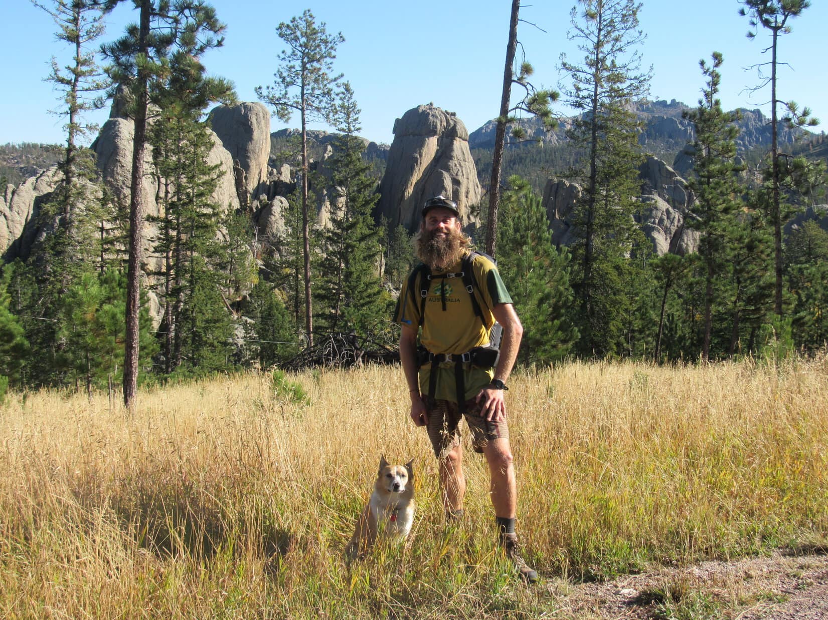
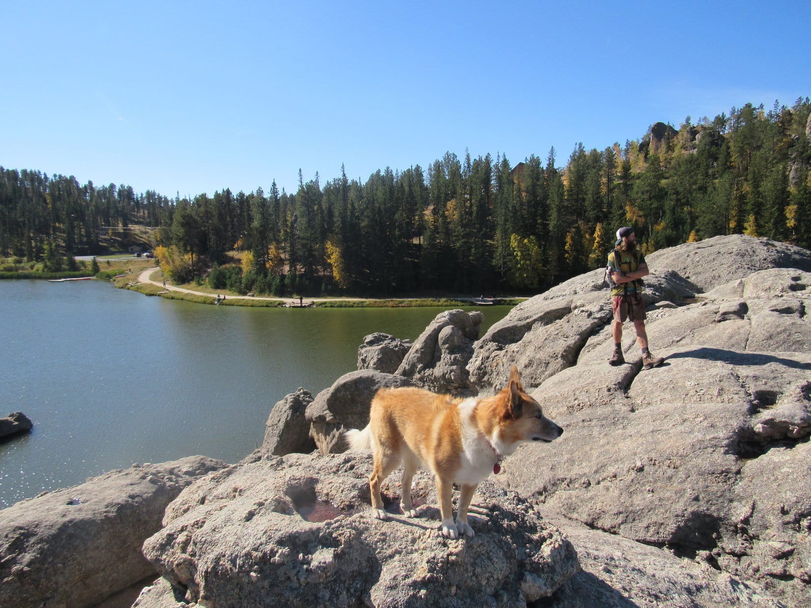
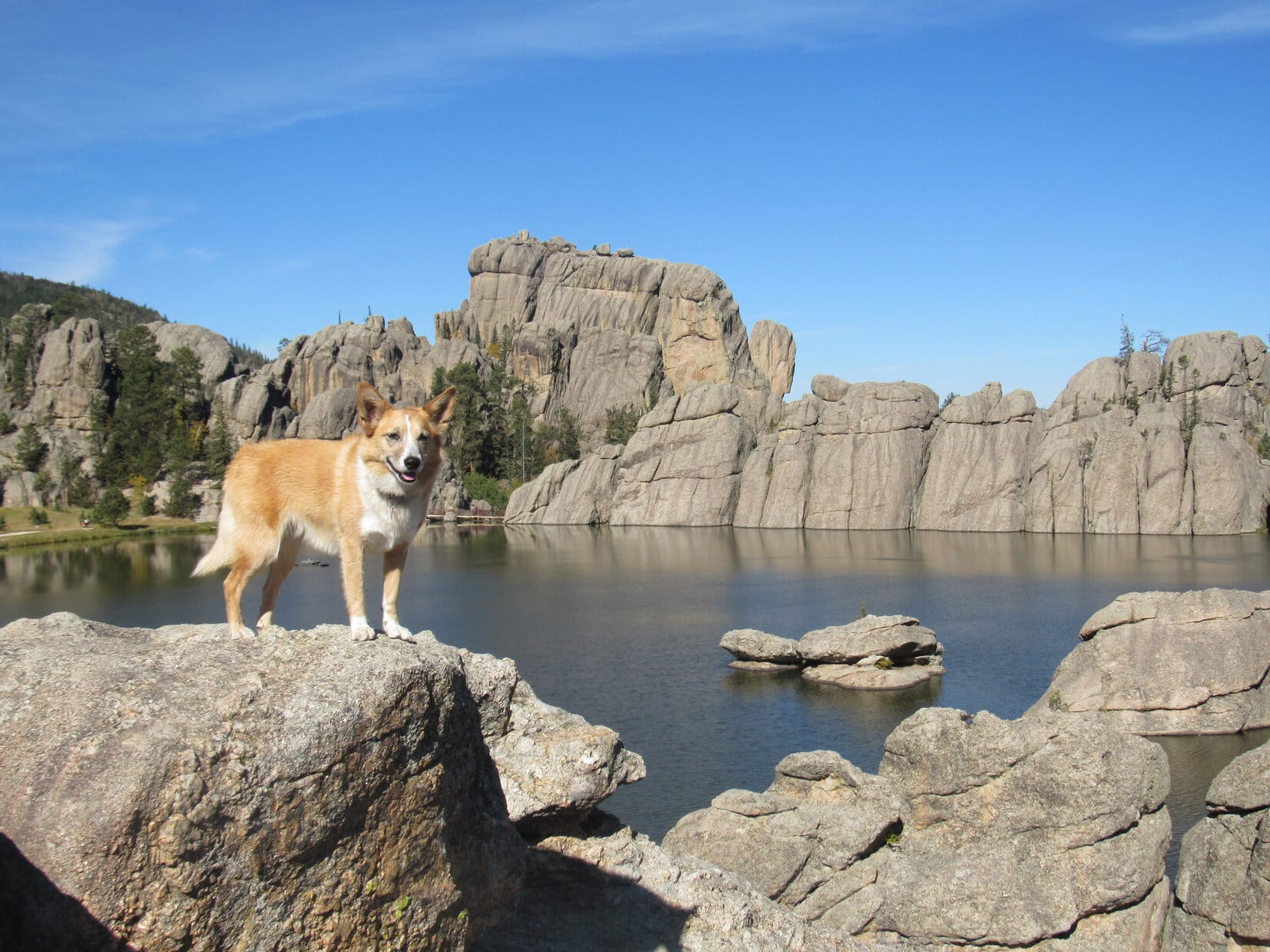
Lupe’s summer of 2017 adventures were over.  Her friend, Australian adventurer Luke Hall, who had recently paid her a visit here in the Black Hills, was gone.  Things were finally back to normal!  For the first time since early June, it was just Loopster and SPHP setting out on a Black Hills, SD expedition.

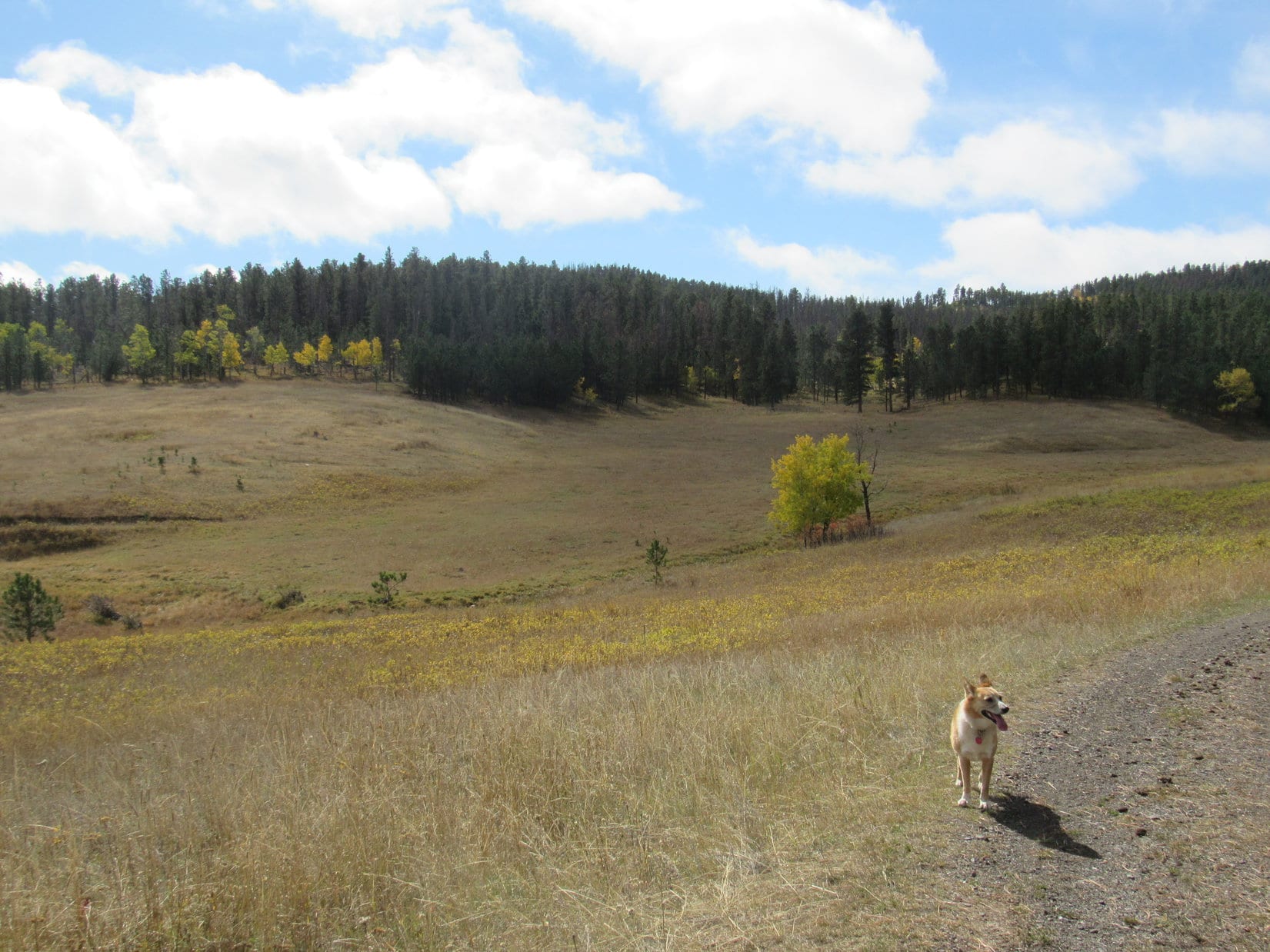
This expedition was looking promising, too!  Cows, so many beautiful cows, were right here near the start!  Lupe was thrilled.  The cows less so.  In fact, they looked on with deep concern.  Wasn’t that one of those ferocious American Dingoes?!

Expedition No. 209 was getting off to a promising start. Look at all those beautiful cows! Lupe was thrilled! Photo looks E.
Looking the opposite direction from the cows up the valley of the South Fork of Rapid Creek. USFS Road No. 231 is seen on the R. Photo looks W.

The cattle needn’t have worried.  They didn’t get chased, barked at, or devoured.  Instead, SPHP started SSW on USFS Road No. 191, leading Lupe up Long Draw.  When Lupe reached an intersection 0.5 mile later, she turned W on No. 191.1A.

At the start of USFS Road No. 191.1A in Long Draw. Photo looks W.

In the next 0.5 mile, No. 191.1A curved S, then W again.  Lupe reached another junction.  She had been this far once before over 2 years ago on Expedition No. 138.  That time she’d stayed in Long Draw, continuing W on No. 191.1A.  This time, just for something different, she turned SSW up Lessering Draw on No. 191.1C.

Near the start of Lessering Draw. Looper yawns waiting for SPHP to get on with it and snap the shot! Photo looks SSW.

Lupe had seen a small stream in Long Draw.  A tiny, trickling tributary of it was here in the lower end of Lessering Draw.  When the road entered a pine forest, Lupe spotted an abandoned cabin near the tiny stream.  The Carolina Dog went to investigate.

Checking out the old cabin in Lessering Draw. Photo looks SSW.

SPHP wouldn’t let Looper go inside the old cabin for fear of rusty nails or broken glass, but she did peer in to see what it was like.  “Dilapidated” pretty much sums it up.  Clearly, many years had passed since this cabin was inhabitable, even in the most rustic sense of the word.

Lupe returned to No. 191.1C continuing SSW.

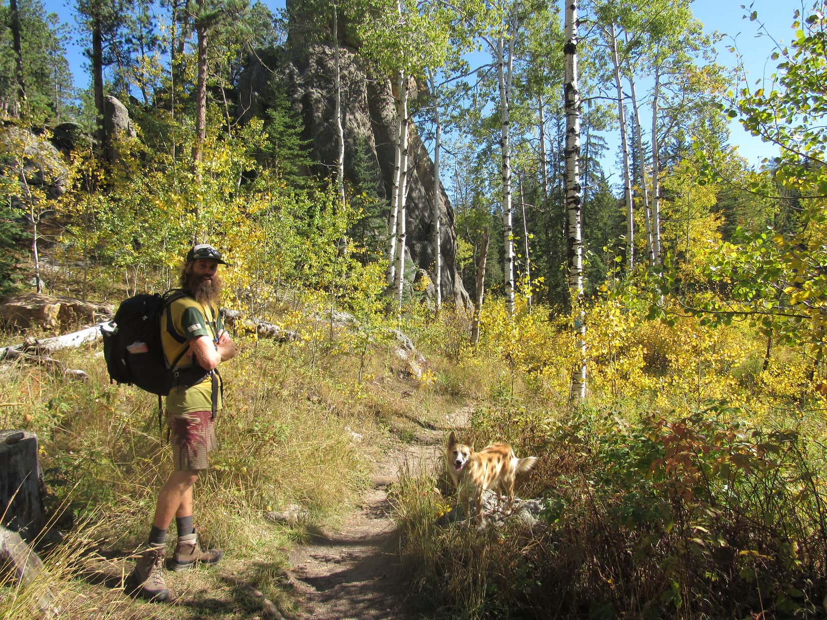
Not far from the old cabin, Lupe re-emerged from the forest.  The road curved W passing through a lovely large meadow surrounded by low forested hills.  Aspen trees, greatly in the minority along the edge of the pines, were showing a bit of fall color.

Beyond the old cabin, Lupe reaches a large meadow. Aspen trees were beginning to show a little fall color. Photo looks SW.
A bit farther on, another view of the same meadow. Photo looks ESE.

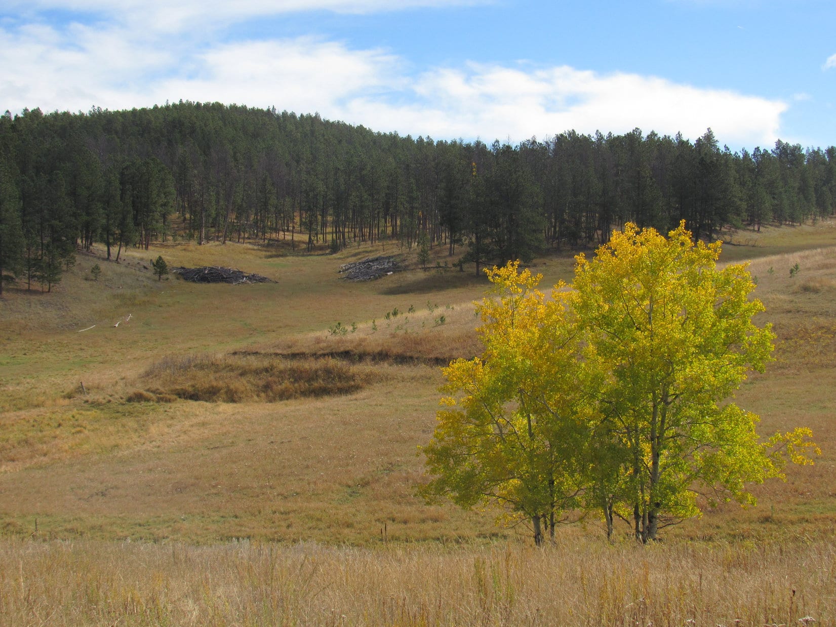
As Lupe proceeded through the meadow, No. 191.1C faded away to little more than a grassy track.  At the far end was a barbed wire fence.  An opening in the fence brought Lupe to USFS Road No. 125.

Lupe reaches USFS Road No. 125. The big meadow she had come through in Lessering Draw is still in view on the L. Photo looks ESE.

The Carolina Dog and SPHP continued W on No. 125.  The road passed through a narrow, forested part of upper Lessering Draw, which soon divided.  Lupe stuck with No. 125, as it curved N up one of the ravines to a minor pass.

Right at the pass was a barbed wire fence running roughly SW/NE.  Lupe went over a cattle guard to get past it.  (American Dingoes are highly skilled at crossing cattle guards!)  From here, No. 125 went N down the other side of the pass.  SPHP surmised it was heading for Maitland Draw.

Lupe needed to go more W than N.  White Tail Peak (6,962 ft.), her objective for the day, was 1.5 miles WNW of the pass.  Lupe left the road to follow the fence line WSW up a forested slope.  Upon reaching a ridge, she abandoned the fence to follow the ridge NW toward High Point 6346.  On the way, White Tail Peak came into view.

Nearing High Point 6346, Lupe gets her first view of White Tail Peak on Expedition No. 209. The summit is on the R. The mountain’s long SE ridge extends all the way to the L. Photo looks WNW.
Loopster astride High Point 6346. Peak 6962 is seen in the distance. Photo looks SW.

Loop easily leapt up onto the rock formation at the top of the ridge.  She stood astride High Point 6346.  That done, she pressed on to the NW toward White Tail Peak.  She was looking for the easiest way to get there with minimal elevation loss.  As it turned out, she could soon turn W toward the mountain without having to lose much at all.  She even came across a road leading W.  The road soon forked at Point 6424.

The road Lupe had been following was USFS Road No. 190, which angled NNW from here.  A side road going SW was marked No. 190.1A.  Lupe and SPHP had been on No. 190 before on prior expeditions to White Tail Peak.  Lupe could eventually work up and around to the summit that way.  A more direct route, though, would be to scale the mountain’s SE slope.  Today, Lupe had a special reason for doing so.

It looked feasible.  Lupe and SPHP left both roads behind, heading NW up a grassy slope of open forest.  Scattered deadfall provided the only obstacles.  The Carolina Dog purposely headed for the area between the mountain’s short and long SE ridges.  After traveling some distance, Lupe arrived at the edge of a golden forest.

Lupe arrives at the golden forest SE of White Tail Peak.
At the edge of the golden forest (R). The ridge beyond Lupe is part of White Tail Peak’s long SE ridge. Photo looks W.
Happy Lupe in the forest of gold.

Lupe happily sniffed her way through the magical forest of gold.  Above the golden forest, her climb steepened.  Would she would encounter a blocking line of limestone cliffs?  SPHP knew cliffs rimmed large portions of the upper E and S sides of White Tail Peak.

No cliffs appeared.  The American Dingo’s ascent didn’t even get all that steep before the terrain started leveling out again.  Lupe came to a faint road.  She followed it a little S, reaching a line of ragged limestone outcroppings.  This had to be it!  The spine of White Tail Peak’s long SE ridge.

Lupe reaches the limestone spine of White Tail Peak’s long SE ridge. Photo looks S.

This was Lupe’s 4th Black Hills, SD Expedition to White Tail Peak.  Yet to SPHP there had always been something lacking on her prior visits.  Long ago, so long ago it had been before there was a Carolina Dog, SPHP had been here alone.  Tattered, cobwebbed memories existed of a grand viewpoint at the end of a long march S.

To SPHP those memories were the essence of White Tail Peak.  SPHP had always wanted Lupe to see those sweeping views, but she had never run across them again.  Were the memories real, dreams, or confused with some other place?

On all of her prior expeditions here, Lupe had visited a limestone ledge SE of the summit where she’d enjoyed some very nice views.  However, they had never seemed as dramatic as SPHP’s old memories of White Tail Peak.  A sense of disappointment always lingered.

On one occasion, Lupe had specifically gone looking for the site of SPHP’s old memories.   Somewhere W of her usual limestone ledge, she’d found a much longer ridge going S.  Her exploration of it revealed some different vantage points.  However, none seemed familiar or measured up to SPHP’s expectations.  This wasn’t the place, either.

Today the plan was for Lupe to find out the truth.  SPHP had never allowed her to do a truly thorough search before.  And most helpfully, for the first time, SPHP had brought along a topo map.

The topo map revealed that White Tail Peak has 3 ridges protruding to the S – a short SE ridge, a long SE ridge, and a long SW ridge.  Studying it had convinced SPHP that Lupe had never been to White Tail Peak’s long SE ridge.  The long ridge she had visited must have been the long SW ridge.  The other times she had only been to the limestone platform near the end of the short SE ridge.

Her successful ascent from the SE up a visible gap between ridges made SPHP confident Lupe now stood on the long SE ridge’s limestone spine right at this very moment!  All that remained was to follow the ridge however far S or SE it went.

It was exciting to think Lupe was on the verge of discovery!  First, though, SPHP thought it best to go find White Tail Peak’s non-descript summit.  May as well make certain of locking in a successful full ascent before doing anything else.  Peakbaggers think like that.  Instead of going S, Lupe followed the faint road N.

Within minutes, the American Dingo reached a junction.  Ahh, so this was the turn SPHP had always missed or dismissed before!  Lupe was practically at the summit, it was only 100 feet to the NW.  She went up to claim her peakbagging success.

Lupe reaches the flat, non-descript true summit of White Tail Peak. It’s possible to drive right to it from the N on an ATV. Photo looks N.

Lupe had visited the short SE ridge every other time she’d come to White Tail Peak.  Though the views didn’t completely measure up to SPHP’s old memories, they were still impressive for the Black Hills.  It wasn’t far away.  Lupe might as well go take another look at them while she was here.  It was tradition now!

On the winding road leading from the summit to the viewpoint at the end of the short SE ridge.

Looper and SPHP followed a familiar winding road SE through an immature pine forest.  A few minutes brought Lupe to her usual White Tail Peak viewpoint.  Time for a break and a look around.  This was still a favorite place!

The view to the NE from the short SE ridge.

SPHP relaxed munching an apple.  Lupe devoured Taste of the Wild.  Water for all, though it wasn’t much needed.  The day had gone from mostly cloudy to overcast and noticeably cooler than before.  While Lupe and SPHP watched, even lower clouds streamed in from the NW.  A chill breeze blew way up here.  The incoming clouds were low enough so wisps of fog sailed by.

The low gray clouds were all part of one huge one.  The monstrous cloud fanned out rapidly, spreading gloom across the Black Hills.  Sunshine fled its influence, retreating far to the SE.  The apple gone and Lupe satisfied, it was time for a few photos.

Looking N from the short SE ridge.
Looking SW. Lupe had come up somewhere over on the now somewhat foggy ridge seen here, which had to be part of White Tail Peak’s long SE ridge.
Lupe stands on a narrow rock pathway leading to the last limestone platform at the end of White Tail Peak’s short SE ridge. Photo looks SE.
At the very end of the short SE ridge. Photo looks SE.
Same view with a little help from the telephoto lens.

The photo session over, Lupe and SPHP left the short SE ridge, retreating NW back to White Tail Peak’s summit.  Enveloped in a thickening fog, the mountain was growing colder and gloomier by the minute.

Good grief!  After coming all this way, suddenly there wasn’t any point in exploring the mountain’s long SE ridge.  Even if it led to the views SPHP remembered, Lupe wasn’t going to be able to see a thing.  Disappointment reigned.

Nothing could be done about it.  May as well forget about the whole thing.  Another time.  Would have had some nice fall colors, too.  Should have gone there first!  Sigh.

Reluctantly, SPHP led Lupe on the road N, away from the still unexplored long SE ridge.  May as well head for USFS Road No. 190.  It would take her E down off the mountain.  Maybe Lupe could explore some sort of an interesting loop on the way back to the G6?

Lupe went all the way N to No. 190, and began following it E.  She’d already lost some elevation, and was about to lose a bunch more, when suddenly the sky brightened.  Uncertain, Lupe and SPHP paused.  The trend continued.

Apparently conditions weren’t going to continue deteriorating after all.  It wasn’t going to be so bad.  The monstrous cloud wasn’t as dark or low as before.  The breeze was dying down and the air felt warmer.  Maybe Lupe could see something from the long SE ridge after all?

Worth a shot.  Back Lupe went.  To the summit again and beyond.  Lupe made the turn onto the faint road, which wasn’t so faint near the intersection.  She reached the limestone spine of the long SE ridge where she’d been before.

OK, this was it!  The moment of discovery was at hand.  Lupe explored S.  Up and down, onto and off of the discontinuous limestone spine.  Multiple times.  For a while, the forest hid everything.  Lupe went on, now heading SE.  She lost elevation, but not too fast.  Didn’t this have to be it?

Then there it was.  A first small limestone ledge with a view to the SW, a view worthy of what SPHP remembered.  Lupe was on the right track!  Naturally, she went over to see this glorious sight.

Lupe reaches the first small limestone ledge along the long SE ridge with a view like SPHP remembered from long ago.

To the SW, Lupe saw a broad canyon, created over eons by the North Fork of Castle Creek.  The creek wasn’t visible, but far below aspen trees glowed with the fleeting glory of early autumn.

Across the gaping canyon was Peak 6962, a remote mountain so alike to White Tail Peak (6,962 ft.), the summit was even the exact same elevation.  Just below its forested upper reaches, limestone cliffs extended around the N and E edges of the mountain.  Cliffs like those Lupe now perched above.

Peak 6962 (L) is the long, forested cliff-rimmed ridge on the far side of the gaping canyon of the North Fork of Castle Creek. Far below Lupe’s perch, millions of dying aspen leaves go out in a blaze of glory. Photo looks SW.

Looking SE along the edge of the long ridge Lupe was on revealed a series of similar viewpoints nearby.

Looking along the SW edge of White Tail Peak’s long SE ridge. Plenty more viewpoints were ahead for Lupe to check out before she would reach the end! Photo looks SE.

Traveling onward, Lupe checked out viewpoints along both sides of the long SE ridge.

At another viewpoint a little farther SE. Same basic view with Peak 6962 on the L. Photo looks SW.
Another look from farther back at Lupe’s vantage point. Photo looks SW.
Now out at the very end of the same vantage point. Photo looks WSW.
Still there with Peak 6962 on display across the entire background. Photo looks SW.
Now on the opposite (NE) side of the long SE ridge. White Tail Peak’s short SE ridge, which Lupe had always gone to before, is in view. Photo looks N.
Looking NE toward Custer Peak (6,804 ft.) (Center).
Custer Peak with help from the telephoto lens. Photo looks NE.

At the far SE end of the long ridge, Lupe finally found the big, nearly flat, open viewpoint SPHP remembered.  Even on an overcast day, the panoramic views were fabulous!

Out at the very end of the long SE ridge. Reynolds Prairie is the large grassland far beyond Lupe. Black Elk Peak (7,231 ft.) (L), Green Mountain (7,164 ft.) (R), and many other mountains Lupe has been to are seen on the horizon. Photo looks SSE.
Black Elk Peak (L) on the horizon. Photo looks SE.
Flag Mountain (6,937 ft.) (L) and Peak 6962 (R). Photo looks S.
Canyon of the North Fork of Castle Creek. Photo looks SW.
Looking NW along the ridge.

Perhaps on some bright sunny day, Lupe will return to White Tail Peak for a 5th time to see it all again beneath crystal blue skies.  For now, though, SPHP was content.  Lupe had rediscovered this glorious vantage point overlooking a vast portion of the central Black Hills.  White Tail Peak was everything dim memory had credited and cherished it as.

A cool breeze still blew.  Hours had flown by.  Time for the intrepid Carolina Dog to move on.  Puppy ho!  Lupe headed NW, back the way she had come.

On the way back, still on the long SE ridge. Green Mountain (L) is far on the horizon. Flag Mountain (Center) and Peak 6962 (R) in view closer by. Photo looks S.

As soon as practical, SPHP looked for a way for Lupe to get down off the long SE ridge.  She soon came to one.  Safely down, Lupe roamed the long slope to the SE, passing the same golden forest on her way back to the junction of USFS Roads No. 190 & 190.1A.

Heading down.
Passing the golden forest again.

Lupe had fun on the way back to the G6.  SPHP led her N on USFS Road No. 190 hoping to make a nice loop.  The American Dingo wound up going much farther N than anticipated.  A trail or road shown on the topo map failed to materialize.  An unmarked side road SPHP did try did not turn E as hoped.  Instead it began to fade away somewhere W of High Point 6217.

Enjoying the colorful woodlands.
Heading NNW on USFS Road No. 190. A road or trail shown on the topo map that SPHP was counting on to go E failed to materialize. Photo looks NNW.
A side road off No. 190 that SPHP did have Lupe try kept going N. Here it threatens to fade away completely. Photo looks N.

The failing road had to be abandoned.  Lupe bushwhacked E a long way.  Deadfall slowed progress considerably.  The sun must have set or was close to it.  Light was fading.  Hurry, hurry!

Yes!  A road!  Good deal, and none too soon.  SPHP quickly figured out that it was leading toward Long Draw.  Immediately overconfident again, SPHP had Lupe take a turn into Maitland Draw instead.

In the dim light, Lupe saw, sniffed, or otherwise sensed a presence before SPHP realized it was there.  Cows!  Way out here.  Enthusiastic Lupe streaked off barking.

The American Dingo returned before long, panting hard and apparently well satisfied with her romp.  Certainly more pleased than the annoyed cows had been.

No more of that, Loopster!  It’s getting dark anyway.  Better stay close.

Just grand.  The road didn’t go all the way through Maitland Draw like the map showed!  It turned S instead of staying E.  Maybe that wasn’t so bad?  SPHP suspected Lupe was on USFS Road No. 125.  Sure enough, she reached the cattle guard back up at the minor pass.  The rest of the way to the G6 was known.  Lupe had come this way earlier.  She would soon be back in Lessering Draw.

A curious, and perhaps very sad thing had happened shortly before Lupe reached the minor pass.  At first it seemed simply strange and unexpected.  Lupe had quit barking at the cows some time ago, when suddenly there was an answer!  A wild barking or howling, from off to the NW.

A coyote?  Maybe.  Lupe listened, but showed little interest and did not respond.  After a few minutes, it was not heard any more.  On the long dark trudge back to the G6, SPHP reflected, and eventually felt guilty and sad.  Glittering stars in an ink black sky shone down with a cold, cruel light.

Maybe an answer should have been made?

The more SPHP thought about it, the more that wild sound had seemed desperate.  Perhaps desperately searching.  What if it hadn’t been a coyote?  A poor lost or abandoned dog way out here?  Maybe it had heard Lupe and thinking salvation was at hand, had come running a great distance with soaring hopes looking for her?  If so, the disappointment at not hearing a response, and not knowing which way to turn, must have been crushing.

White Tail Peak had been a great and successful day for Lupe, but the accusatory thought persisted.  Perhaps the day had also needlessly ended as a bitterly cruel one for an innocent, lonely creature in need of help?  The uncertain truth remained somewhere out there, shivering alone in darkness, now miles away beneath eternally uncaring silvery stars.  (End – 7:40 PM, 35°F)

On White Tail Peak’s long SE ridge, 10-1-17

Links:

Next Black Hills Expedition                     Prior Black Hills Expedition

Black Hills, SD Expedition No. 283 – White Tail Peak (11-6-21)

Black Hills, SD Expedition No. 138 – White Tail Peak (9-19-15)

Want more Lupe adventures?  Check out her Black Hills, SD & WY Expeditions Adventure Index, Master Adventure Index, or subscribe free to new Lupe adventures!

Black Hills, SD Expedition No. 208 – Little Devil’s Tower & Black Elk Peak with Australian Adventurer Luke Hall (9-26-17)

Start: Hwy 87/89, 0.25 mile NW of Sylvan Lake Lodge, 9:46 AM, 46°F

Wonder of wonders!  Australian adventurer Luke Hall was actually here – in Lupe’s Black Hills of South Dakota!  He’d arrived yesterday afternoon only a few weeks from the end of a 6 month trip exploring the western United States.

During his recent travels, Luke had scrambled up many notable mountain peaks, including Mt. Whitney (14,498 ft.) in California and Mt. Elbert (14,433 ft.) in Colorado, the two highest mountains in the lower 48 states.  He’d spent a lot of time along the Pacific coast, and visited a great many national parks – Yosemite, Death Valley, Sequoia, King’s Canyon, Grand Canyon, Zion, Bryce, Mesa Verde, Mt. St. Helens, Mt. Rainier, Rocky Mountain – the list went on and on.

Surfing, swimming, backpacking, mountain biking, climbing – Luke had been a busy guy in 2017, but that was perfectly normal for him.  In previous years, he’d explored western Canada, 10 different countries in South America, wandered through much of Europe, and toured Morocco and Egypt.  He spent 2 years living and working in London, England, and another 2 years in Banff, Canada.  Maybe it wasn’t so surprising that Luke had finally landed in the remote Black Hills of South Dakota after all?  He did get around!

Fittingly enough, Lupe and SPHP had first met Luke Hall over a year ago on Gunsight Mountain (6,441 ft.) in Alaska.  Now Luke was here to join Lupe on one of her Black Hills, SD expeditions.  He had already dropped by Mt. Rushmore (5,725 ft.) on his way in, so Black Elk Peak (7,231 ft.), the highest mountain in South Dakota, seemed like a good destination.  For Luke it would be an easy day, but maybe he wouldn’t mind dialing it down a notch after 5+ solid months of more strenuous adventures?

It was a lovely bright, clear day as Lupe, Luke and SPHP set out.  First stop along the way was Sylvan Lake.

Lupe and Luke together again in the Black Hills for the first time since meeting over a year ago on Gunsight Mountain (6,441 ft.) in Alaska. Black Elk Peak, the highest mountain in South Dakota was today’s ultimate destination. Photo looks E.
Only 10 or 15 minutes after setting out, Luke and Lupe reach the NW shore of Sylvan Lake.
The small dam creating Sylvan Lake, which features a short walkway with a railing, is seen beyond Luke. Photo looks N.
Looking NE across the lake.
A few ducks were out on the calm water.

After a look at Sylvan Lake from the NW shore, Lupe, Luke & SPHP followed a trail that goes all the way around the lake back down below the dam.  Lupe led Luke around to the NE & E sides of the lake.

Looking SW from the rock formations along the N shore.
Sylvan Lake is located at the far NW corner of Custer State Park. Though small, the lake nestles among scenic granite formations.  It’s a popular destination for tourists and locals alike with a swimming beach and picnic ground.  Paddle boat rentals, a convenience store and Sylvan Lake Lodge are all nearby. Photo looks W.
Lupe showing her buddy Luke around Sylvan Lake. Photo looks WNW.
Loopster and Luke on a large granite formation that extends out into Sylvan Lake from the E shore. Photo looks SW.
Looking NNW at the N half of Sylvan Lake.

Trail No. 9 from Sylvan Lake is the most direct and popular route to Black Elk Peak, but Lupe had another trail in mind.  She led Luke past the picnic ground at the SE end of the lake, and took Trail No. 4 to the Little Devil’s Tower trailhead instead.

Taking Trail No. 4 was a longer route to Black Elk Peak, but had the advantage of giving Luke a chance to climb Little Devil’s Tower (6,960 ft.) along the way, and get a close look at the Cathedral Spires (6,840 ft.), too.

Luke & Lupe along Trail No. 4 to Little Devil’s Tower.
A 0.25 mile long spur trail off Trail No. 4 leads to the summit of Little Devil’s Tower. Here Lupe is near the spur trail with a view of the Cathedral Spires. Photo looks E.
Luke & Looper on the way to Little Devil’s Tower. Cathedral Spires in the background. Photo looks E.

A 0.25 mile long spur trail leads from Trail No. 4 to the summit of Little Devil’s Tower.  The end of the route involves a quick, easy scramble up the granite.  Even small children can make it with a little supervision and an occasional boost.

Luke & Loop nearing the top of Little Devil’s Tower. Photo looks N.

Luke, Lupe and SPHP quickly arrived at the summit of Little Devil’s Tower (6,960 ft.).  There were cliffs around, especially to the N, but they were of no concern.  Although a bit rough, the uneven granite summit area is quite roomy.

The 360° views from Little Devil’s Tower are among the best in the Black Hills, with Black Elk Peak (7,231 ft.) to the NNW and the Cathedral Spires (6,840 ft.) to the SE being the most eye-catching.

Luke and Loopster arrive at the uneven granite summit of Little Devil’s Tower. Photo looks ESE.
Another view with some of the Cathedral Spires (also known as the Needles) in the background. Photo looks ESE.
Lupe with the Cathedral Spires in the background. This was Lupe’s 5th ascent of Little Devil’s Tower. Photo looks SE.
Although the day had started out clear and bright, quite a few clouds were around by the time Lupe reached the top of Little Devil’s Tower. A chill breeze was blowing out of the S, too. Photo looks SE.
Looking NNW toward Black Elk Peak. For those with insufficient time to climb Black Elk Peak, the shorter trip on Trail No. 4 up to the top of Little Devil’s Tower can provide similarly striking views of the Black Hills.
Sylvan Hill (7,000 ft.) is the long ridge 2.5 miles away with the high point poking up just R of Center. Photo looks WSW.

At first, no one else was around up on Little Devil’s Tower.  It wasn’t long, though, before a couple appeared.  Bryan and Rene Jobo from Franklin, Tennessee joined Lupe, Luke and SPHP at the summit.

Rene and Bryan were on vacation in the Black Hills, and apparently having a good time relaxing and hitting some of the area’s highlights.  Bryan, Rene, Luke and SPHP were soon chatting pleasantly.  Lupe got involved posing for photos.

Australian adventurer Luke Hall poses with Bryan & Rene Jobo from Franklin, TN up on Little Devil’s Tower. Photo looks SE.
Despite a cool SW breeze, Lupe wasn’t about to get left out. Here she poses with Bryan & Rene, too.
In addition to posing with an American Dingo up on Little Devil’s Tower while in the Black Hills, Bryan & Rene were looking forward to attending the Custer State Park annual buffalo roundup in a couple more days. Lupe would have loved to go to help herd buffalo around, too. Unfortunately, SPHP never seems to think that a huge buffalo herd will appreciate a noisy Dingo, so Lupe has never gotten to go.

Bryan and Rene stayed chatting with Luke and SPHP for a while, but didn’t have time to accompany Lupe all the way to Black Elk Peak.  They had other adventures in mind to press on toward.  Soon after Bryan and Rene said good-bye; Luke, Lupe and SPHP resumed the trek to Black Elk Peak.

Luke near the Cathedral Spires on the way back to Trail No. 4 to resume the trek to Black Elk Peak. Photo looks E.

Trail No. 4 went N past some of the Cathedral Spires, and eventually linked up with a short section of Trail No. 3, which led in turn to Trail No. 9.  Near the end of a spur trail off Trail No. 9, a metal stairway hidden in a narrow opening in the granite spiraled up to a rock stairway leading to the old fire lookout tower on Black Elk Peak (7,231 ft.).

Luke reaches the old fire lookout tower at the summit of Black Elk Peak. Photo looks N.
Until August 11, 2016 when the U.S. Board of Geographic Names voted unanimously in favor of the name Black Elk Peak, the highest mountain in South Dakota had been known as Harney Peak. Luke poses by a plaque at the lookout tower which has not been updated yet.  In May, 2015, the South Dakota State Board of Geographic Names had proposed renaming the mountain Hinhan Kaga (Making of Owls), but that recommendation was never enacted.  Lupe would have preferred Squirrel Mountain, or at least Chipmunk Mountain, but, oh well!
Looking ENE from the Black Elk Peak summit. The most distant big square block of granite at Center is the back side of Mt. Rushmore.

Upon arrival at South Dakota’s highest point, Luke, Lupe and SPHP spent a few minutes out on the fire lookout tower’s W facing observation deck taking in the views.  The wind had shifted to the NW by now, though, and was even colder than at Little Devil’s Tower.

View to the NNW from the fire lookout tower observation deck on Black Elk Peak.

Even Lupe was soon ready to retreat back into the lookout tower.  The tower wasn’t very large inside, but Luke enjoyed exploring the winding passage down to the basement.  An open doorway led out to a massive granite shoulder of the mountain immediately W of the tower.  Everyone enjoyed a break in the shelter of a few pines growing out of the rock.

After snacks and water, it was time for photos from various points on the granite near the lookout tower.

Luke and Lupe NW of the fire lookout tower. The tower was last staffed in 1967. Made of stone, it has held up remarkably well during the ensuing 50 years, despite the efforts of any huffing and puffing big, bad Dingoes. Photo looks SE.
Luke & Lupe up on rocks N of the tower. Photo looks NE.
Adventure buddies Lupe and Luke
Lupe on Black Elk Peak. This was her 7th visit to the mountain. Her last visit was over 2 years ago on 9-7-15. Back then the mountain was still officially Harney Peak, as it had been since 1896. Photo looks W.
Helicopters giving tours of the Mt. Rushmore area often make a pass around Black Elk Peak. Lupe loves barking at helicopters! She’s spotted one now!
The view to the SE.
Cathedral Spires (L) and Little Devil’s Tower (R) are in view beyond Lupe & Luke. Photo looks S.
Black Elk Peak was Luke’s 3rd US State high point after Mt. Whitney in California and Mt. Elbert in Colorado. Photo looks S.

All too soon, it was time to depart.  On the way back to the G6, Lupe, Luke and SPHP followed Trail No. 9 all way to Sylvan Lake.  The sun was sinking, but down out of the wind the evening was pleasant.

Starting down. Sylvan Hill is seen in the distance. Photo looks SW.
On Trail No. 9 before the junction leading to Little Devil’s Tower (R). On the return trip Luke & Lupe stuck with Trail No. 9 all the way, the most direct route back to Sylvan Lake. Photo looks SSW.
Little Devil’s Tower from Trail No. 9. Luke & Loopster had been up there only a few hours ago! Photo looks SW.
A view to the NW from Trail No. 9.
Loop & Luke at the last big viewpoint along Trail No. 9 on the way to Sylvan Lake. Photo looks NNE.
Australian adventurer extraordinaire Luke Hall presents the Black Hills of South Dakota!
Looper takes a break on a lovely bench provided by the Highpointers Foundation. This bench is along Trail No. 9 at the first good viewpoint toward Black Elk Peak (formerly Harney Peak) on the way up from Sylvan Lake.

The light was fading fast by the time Lupe reached the G6 again at 6:45 PM (upper 50’s °F).  Climbing mountains with Luke, and getting to show off her Black Hills home territory had been great fun!

The fun wasn’t over yet, though.  There would be pizza and beer with Luke at home.  (What, no beer for the faithful, peakbagging Carolina Dog!?  No fair!)  Even better, Luke was sticking around for a while.  Another adventure was in store tomorrow.

It just doesn’t get any better than that!

Adventurer Luke Hall originally hails from Sydney, Australia. Lupe & SPHP were thrilled that he took the time to come pay a visit to the beautiful Black Hills of western South Dakota!
Adventuring buddies Luke & Lupe on Black Elk Peak, 9-26-17

Links:

Next Black Hills Expedition                  Prior Black Hills Expedition

Badlands National Park, South Dakota with Australian Adventurer Luke Hall (9-27-17)

Gunsight Mountain, Talkeetna Range, Alaska (8-23-16)

Luke Hall’s travel & adventure blog

Want more Lupe adventures?  Check out her Black Hills, SD & WY Expeditions Adventure Index, Master Adventure Index, or subscribe free to new Lupe adventures!