Black Hills, SD Expedition No. 266 – Peak 5500 & Wildcat Peak (2-22-21)

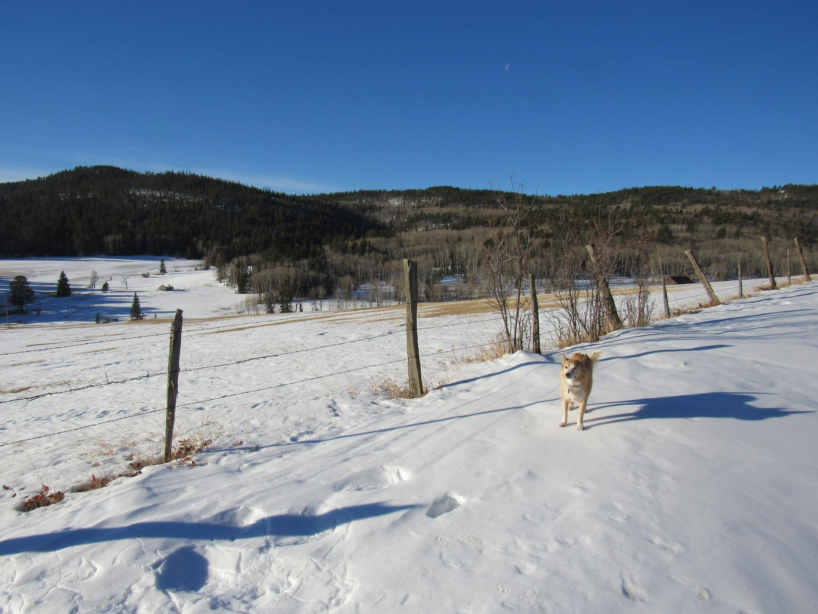
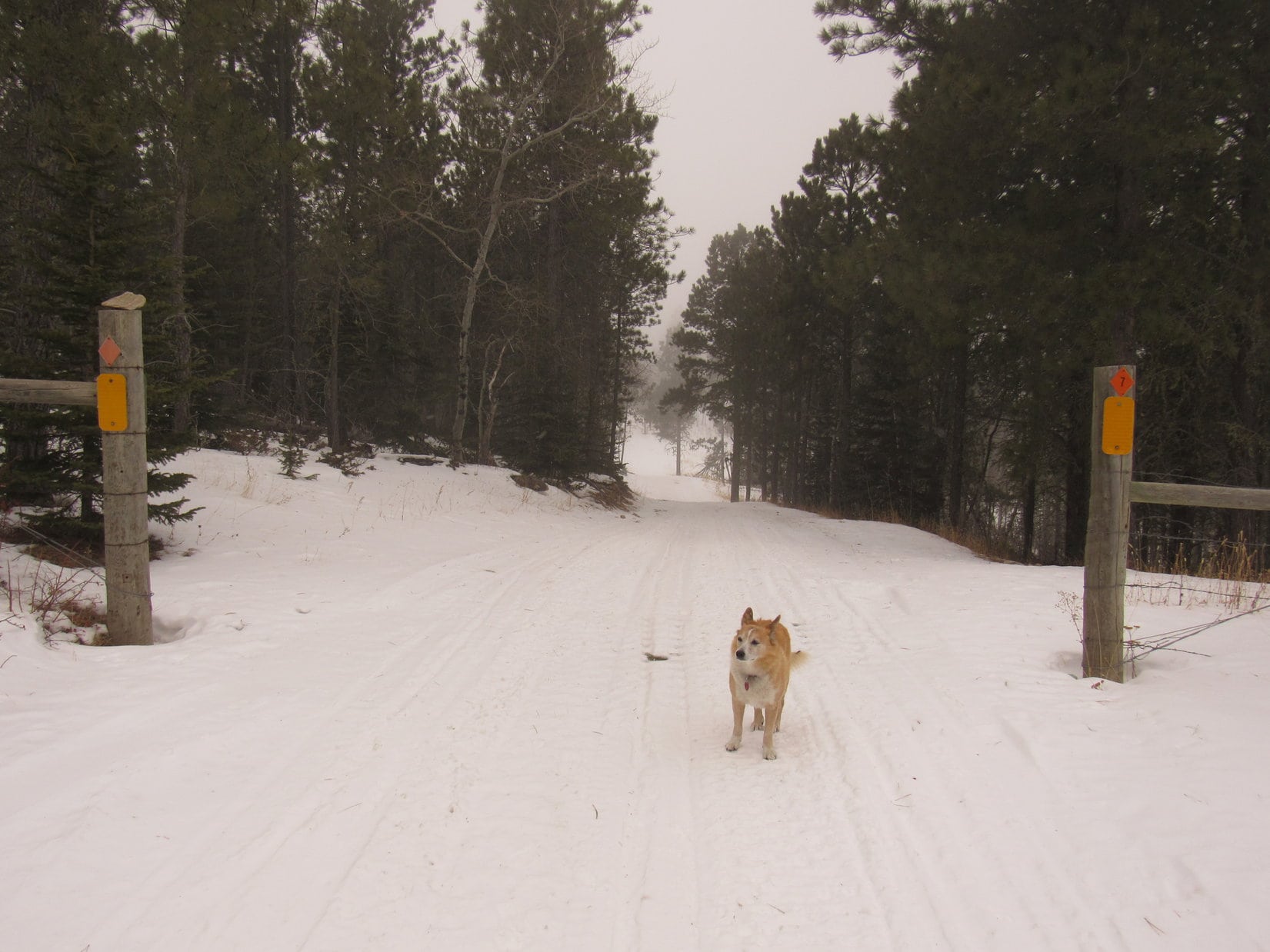
7:48 AM, 31ºF, intersection of Dewey Road (Custer Co. No. 769) and Elk Mountain Road – What a gorgeous day!  A few little clouds in a brilliant blue sky.  Supposed to warm up a bunch today, too, after what had been a bitter cold couple of weeks in the first part of February.  Highs in the upper 50’s ºF in the forecast back home!

Yeah, so much for that around here.  Not even up to freezing yet.  Lupe set out for gleaming white Elk Benchmark (5,669 ft.) heading into the teeth of a frigid NW wind.  Looked like, felt like, winter!

Elk Benchmark from Elk Mountain Road. Photo looks NW.

I thought you said it was going to be nice out, SPHP!  Just sort of windy.

Hah!  Yeah, silly me!  Actually supposed to get windier, too.  40 mph gusts!  How are you faring, Looper?  Are you freezing?  Want to turn back?

I’m OK so far, but windier won’t be good.  Are you sure you’re up to this?

Not entirely, Loop.  A lot colder and snowier than I was expecting, but the mountains ought to provide us some shelter once we get closer.

Let’s keep going then, SPHP.  If we can get out of the wind, that will help a bunch.  Hopefully, it will warm up some, too.

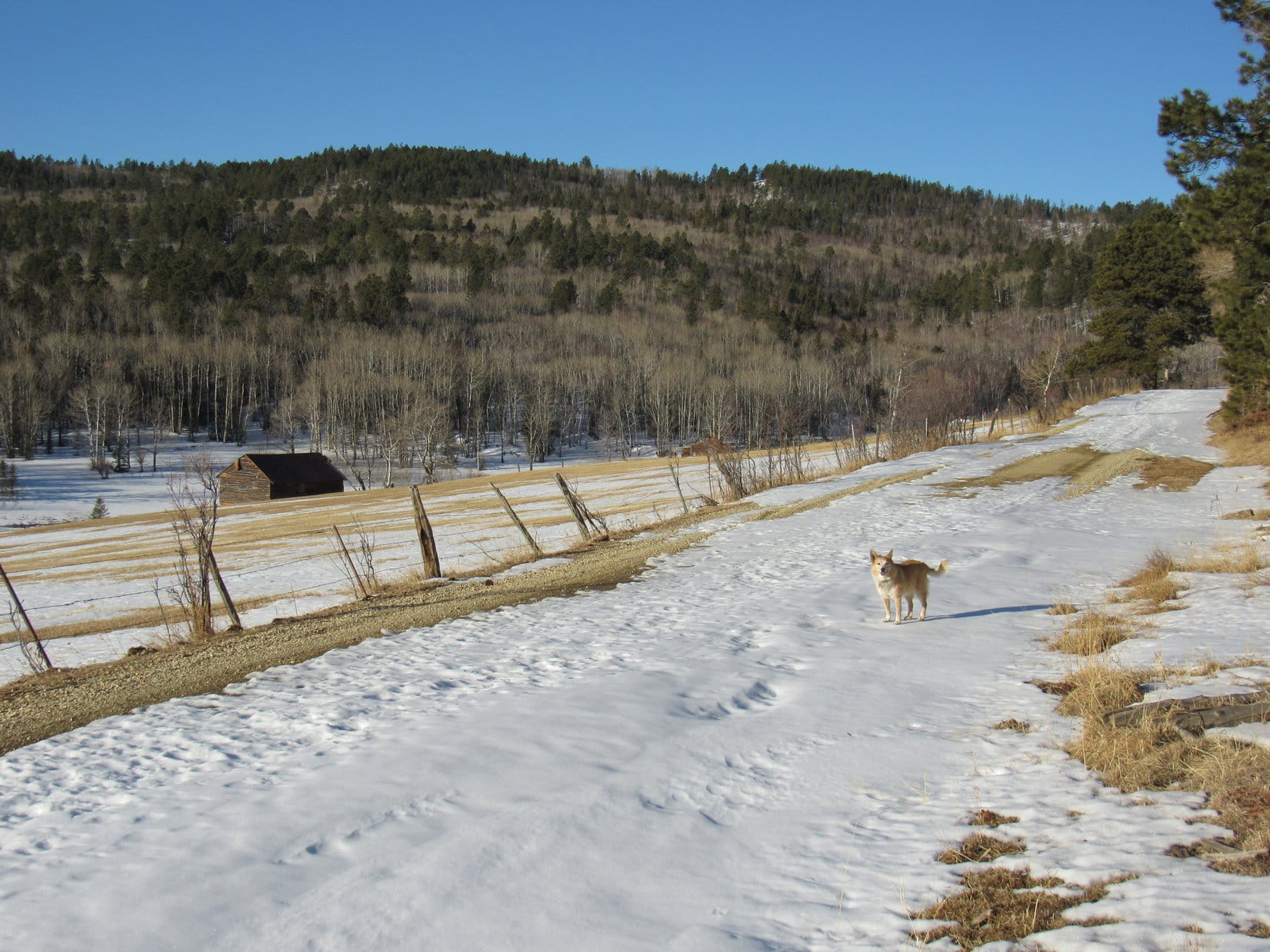
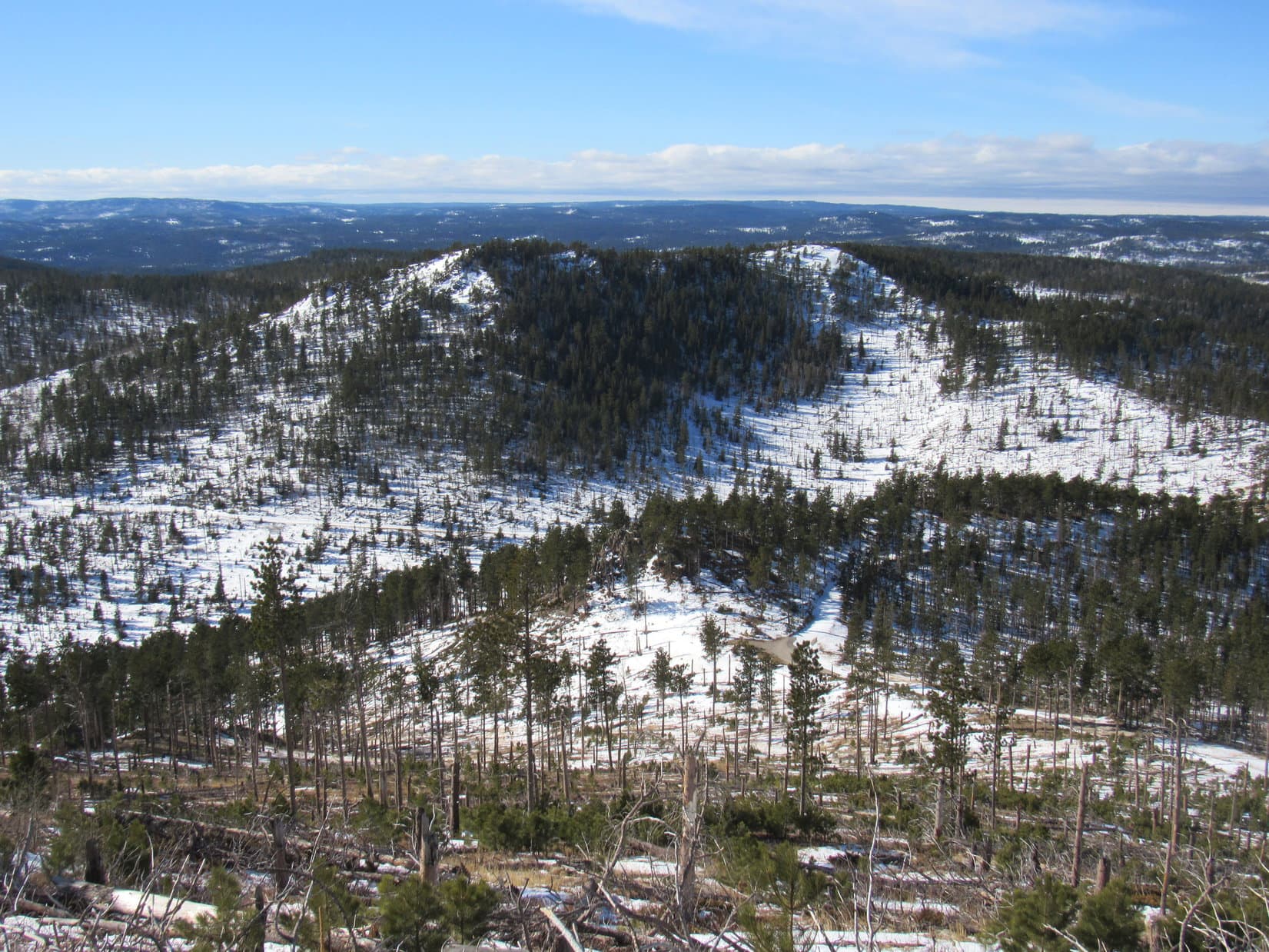
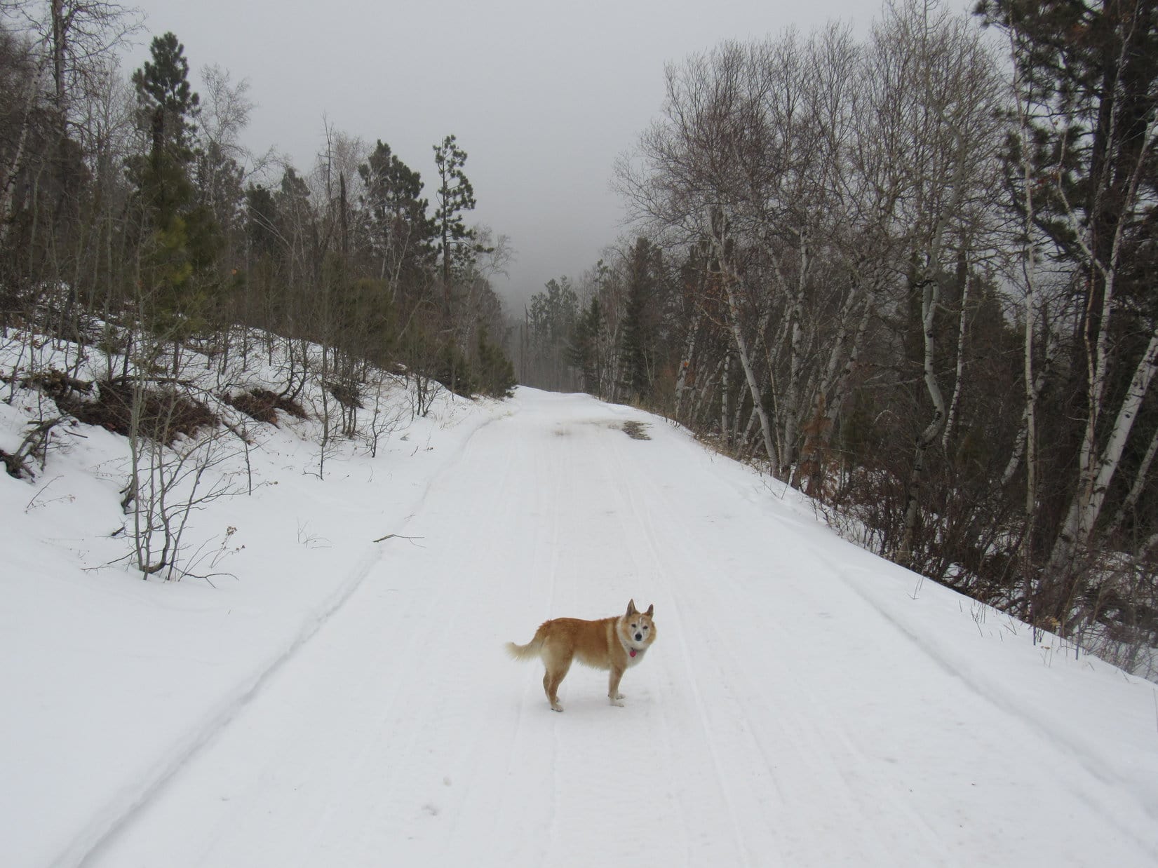
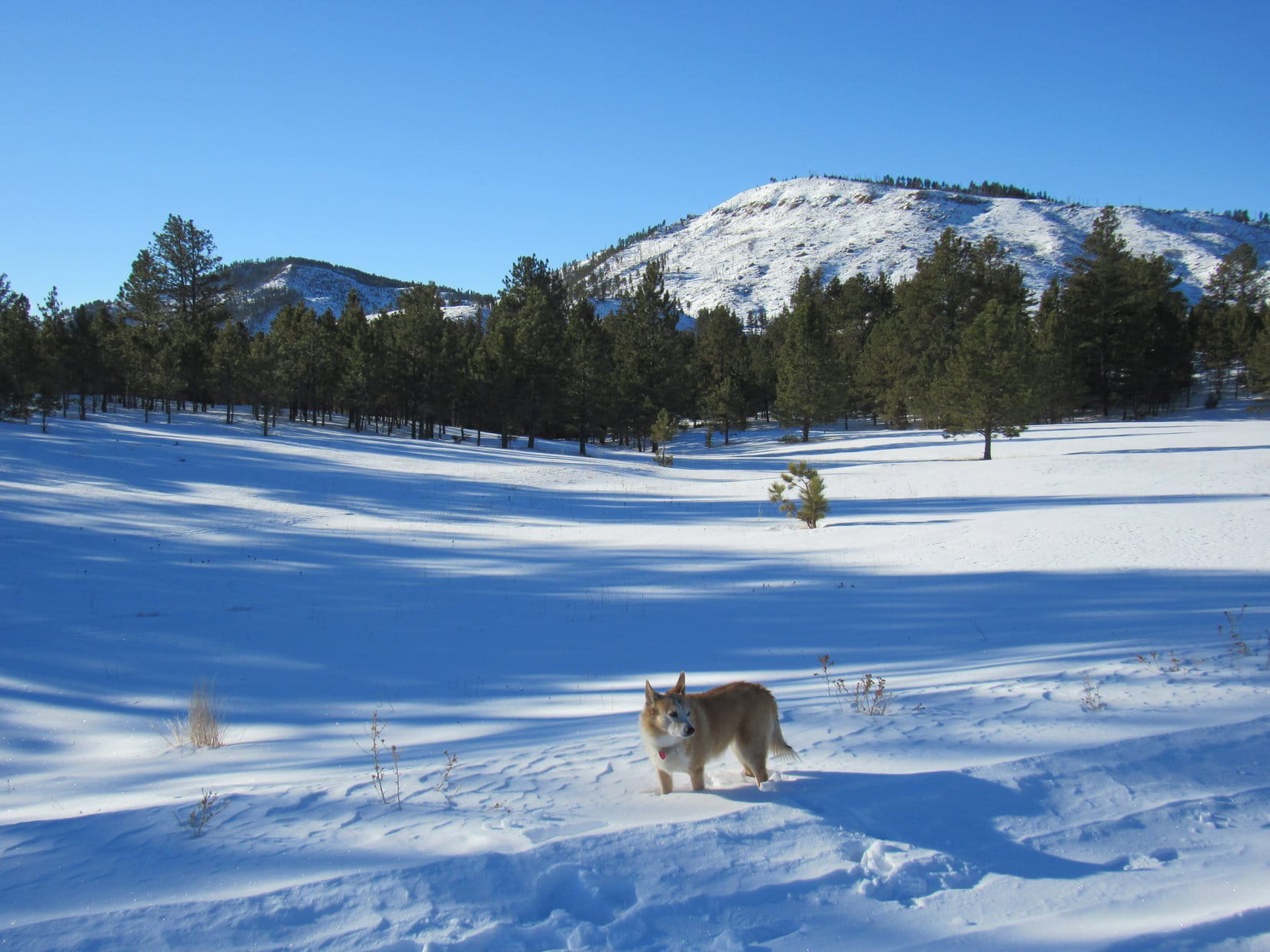
A cold, cold trek for nearly 1.5 miles, but conditions improved after that.  At 2.5 miles long and more than 500 feet high, Elk Benchmark made an excellent windbreak.  Might have warmed up a bit by the time Lupe got close to it, too.  Elk Mountain Road turned SW into a sheltered valley.  Suddenly the winter display was simply beautiful, instead of an ordeal.

Peak 5500 and Wildcat Peak (5,500 ft.) were already in sight.  Going to be a fun day, if it didn’t get too windy up on top!

Still out in the cold wind. Peak 5500 (L) and Elk Benchmark (R). Photo looks W.
Beautiful here! Not as windy. Wildcat Peak (L) and Peak 5500 (R). Photo looks S.

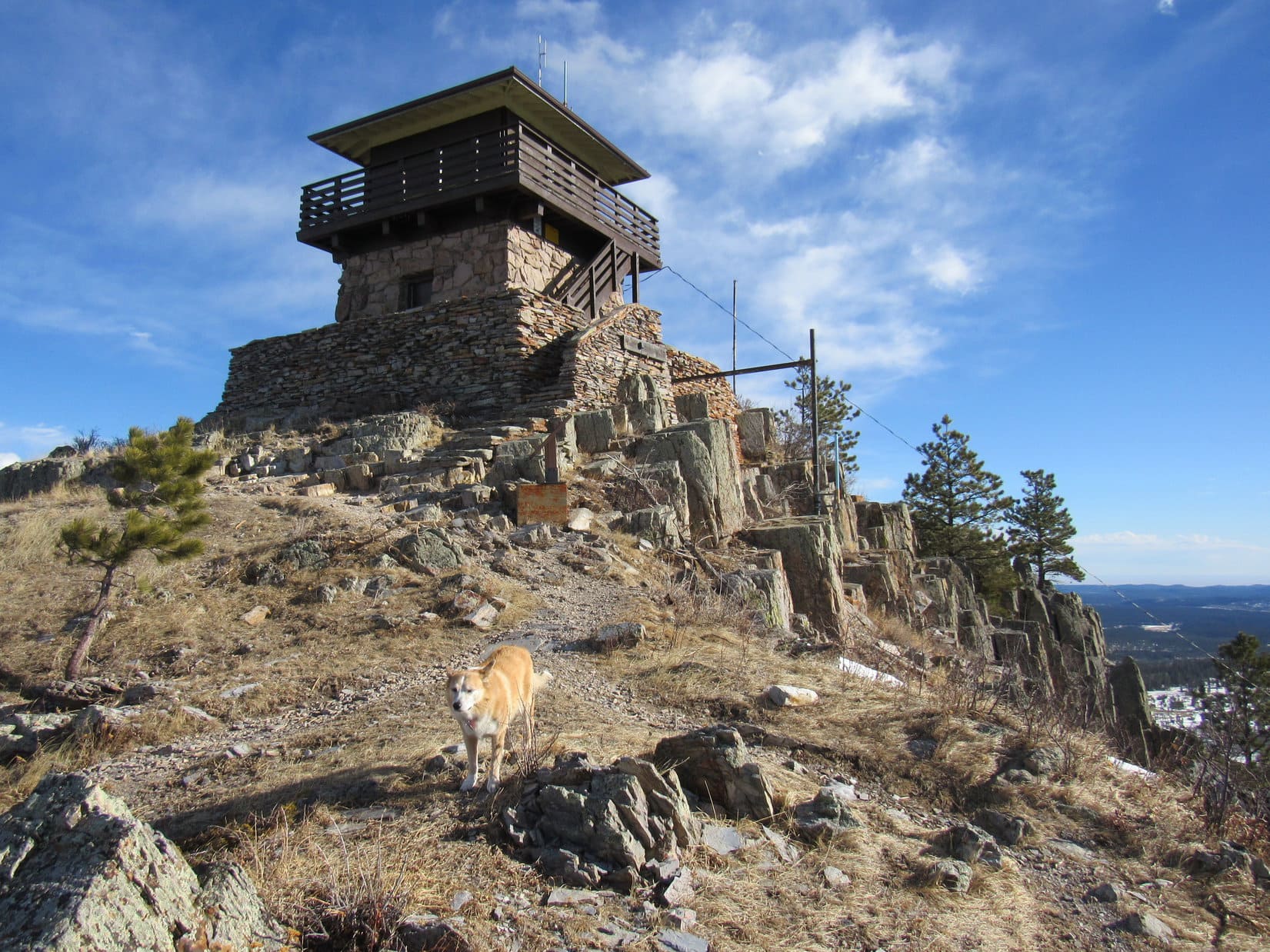
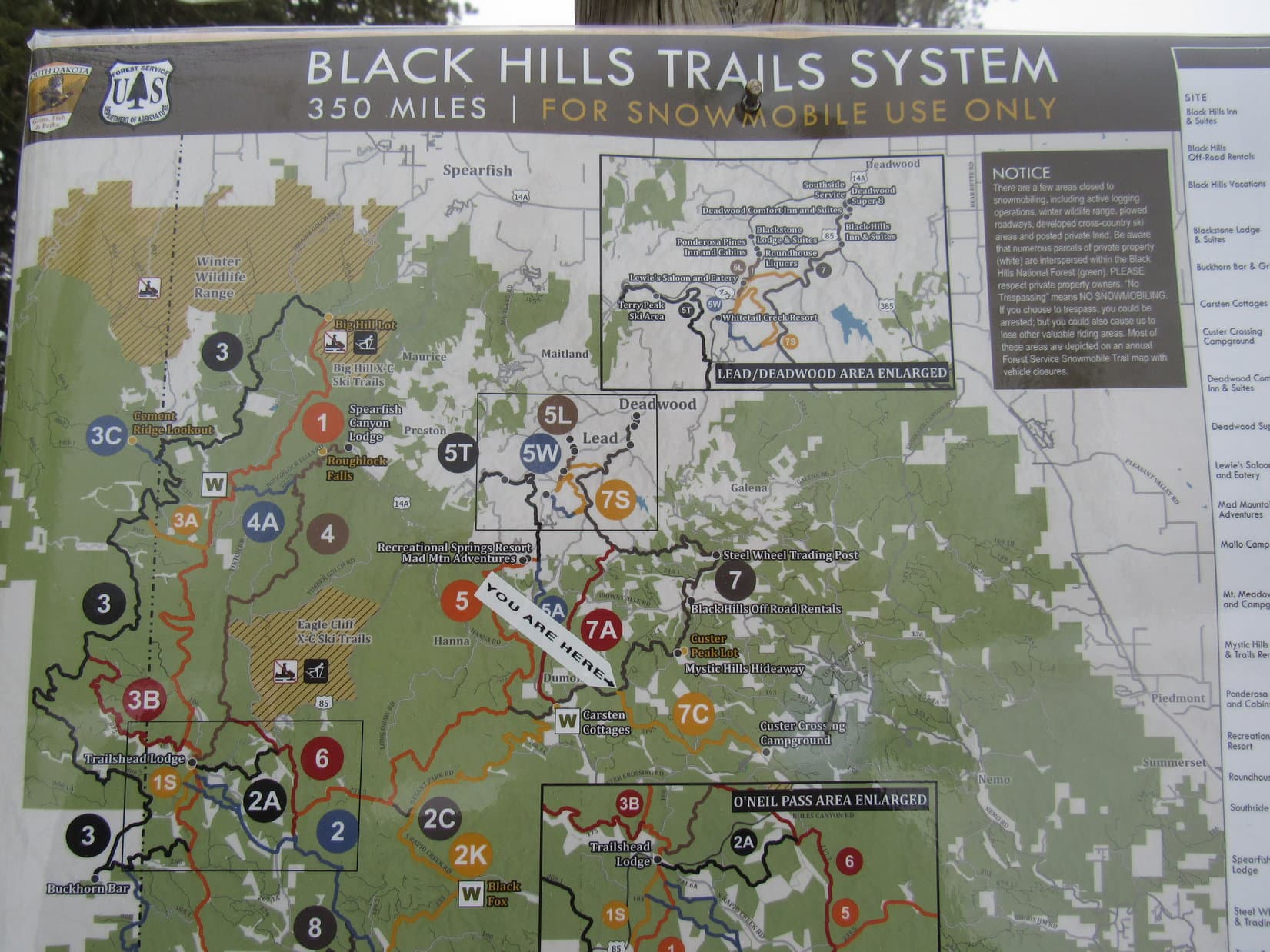
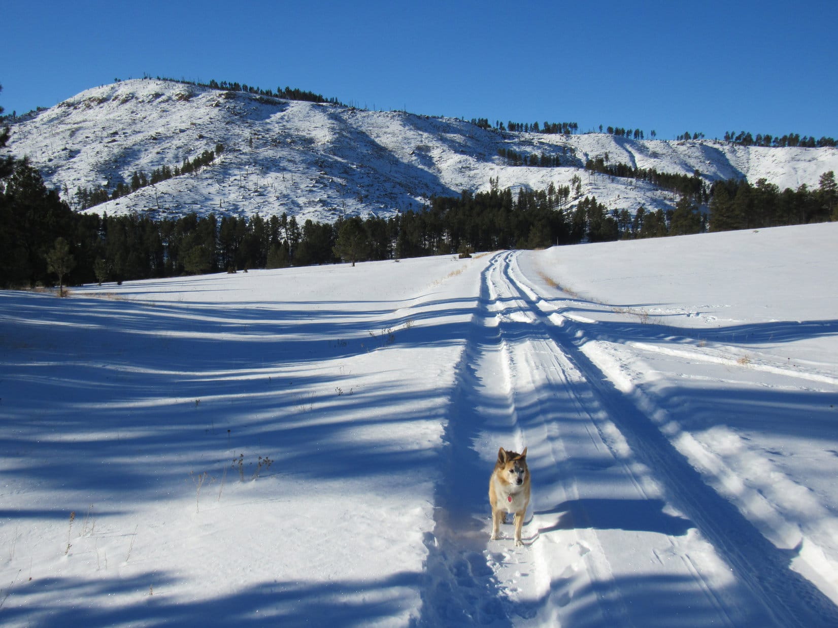
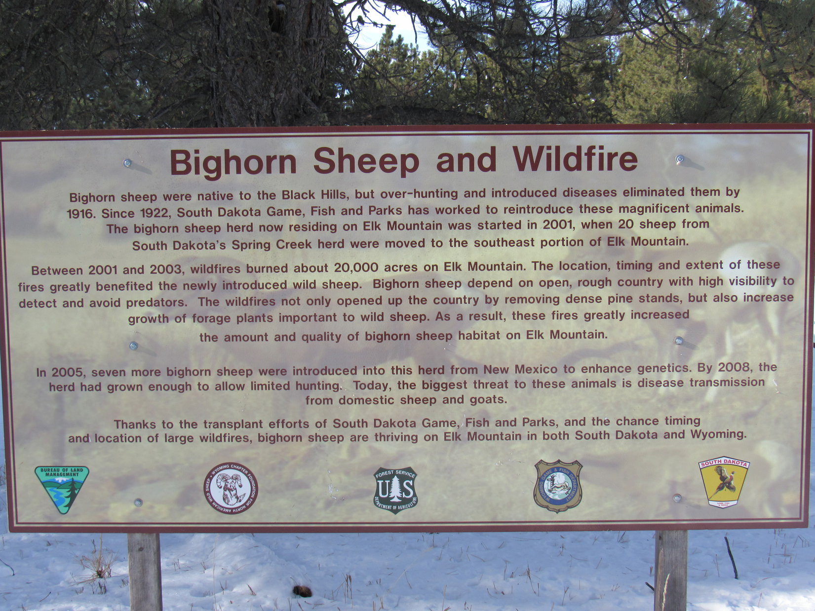
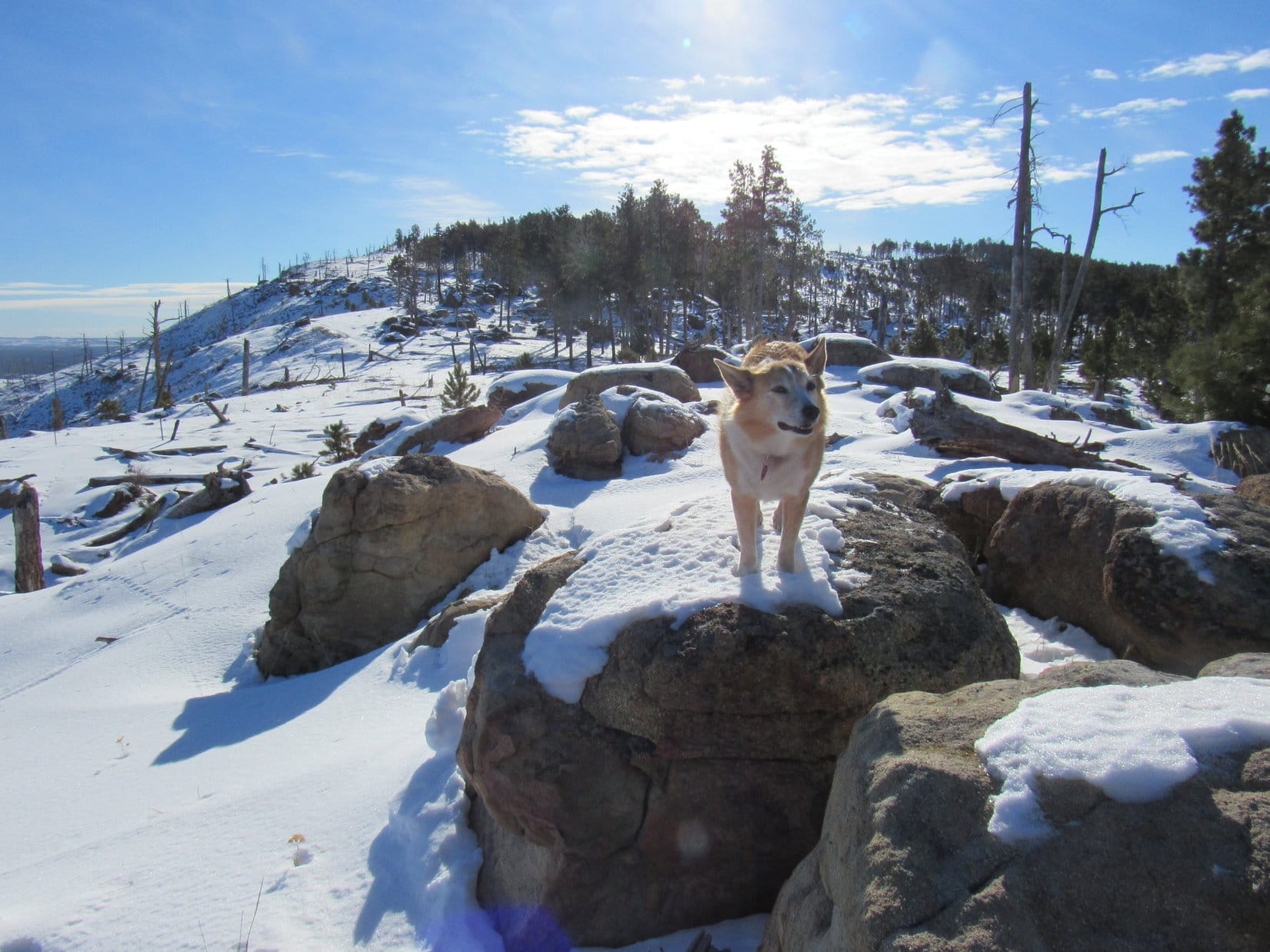
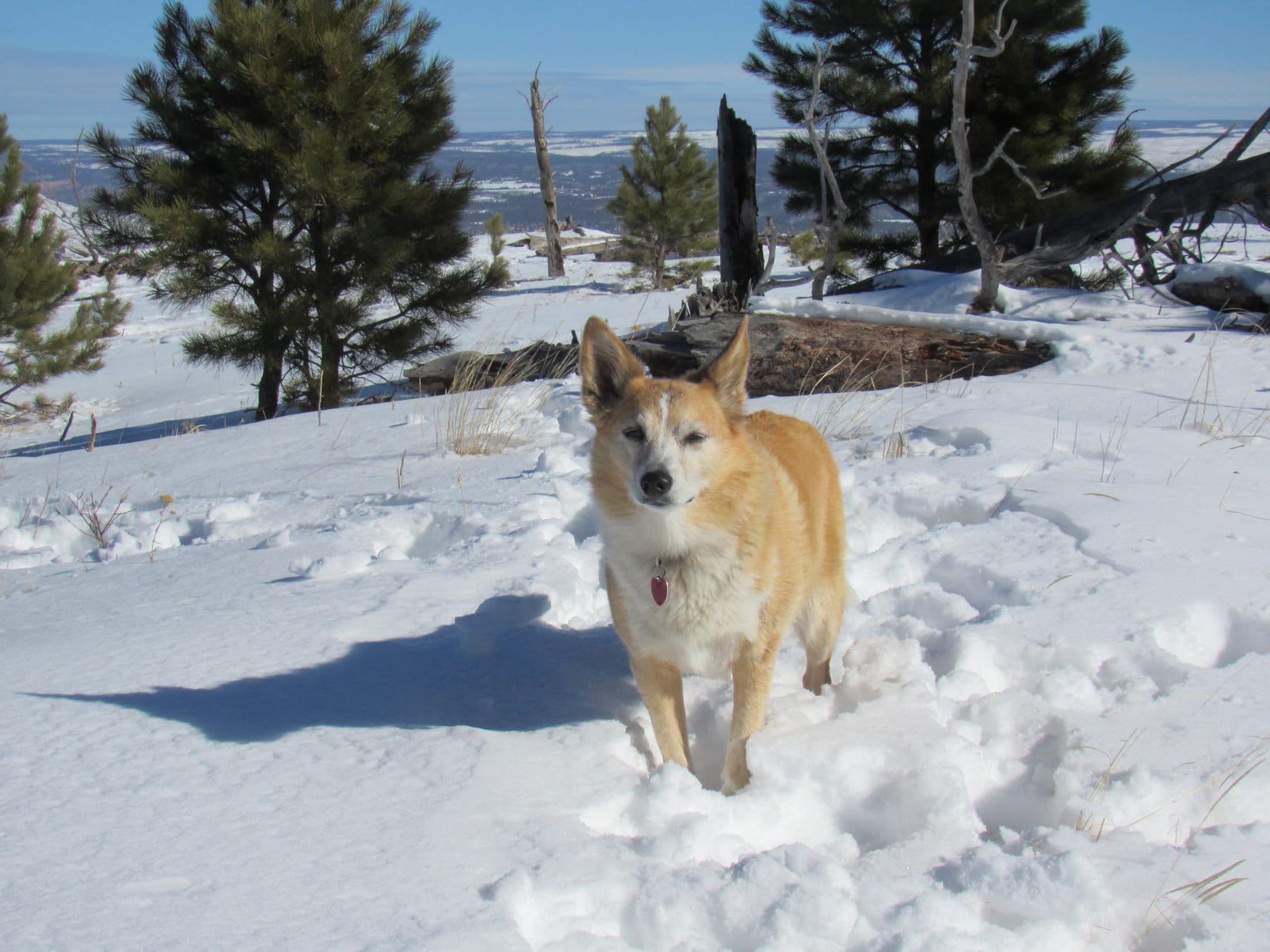
At the W end of the protected valley, Elk Mountain Road wound 300 feet up to a pass separating Elk Benchmark and Peak 5500.  SPHP paused to read a sign about Bighorn sheep.  As soon as SPHP finished, Lupe left the road and began climbing SE into the snowy forest.

Peak 5500 (L). The road curves R up to a pass. Photo looks SW.
Bighorn sheep sign at the pass.
About to head into the forest. Photo looks SE.

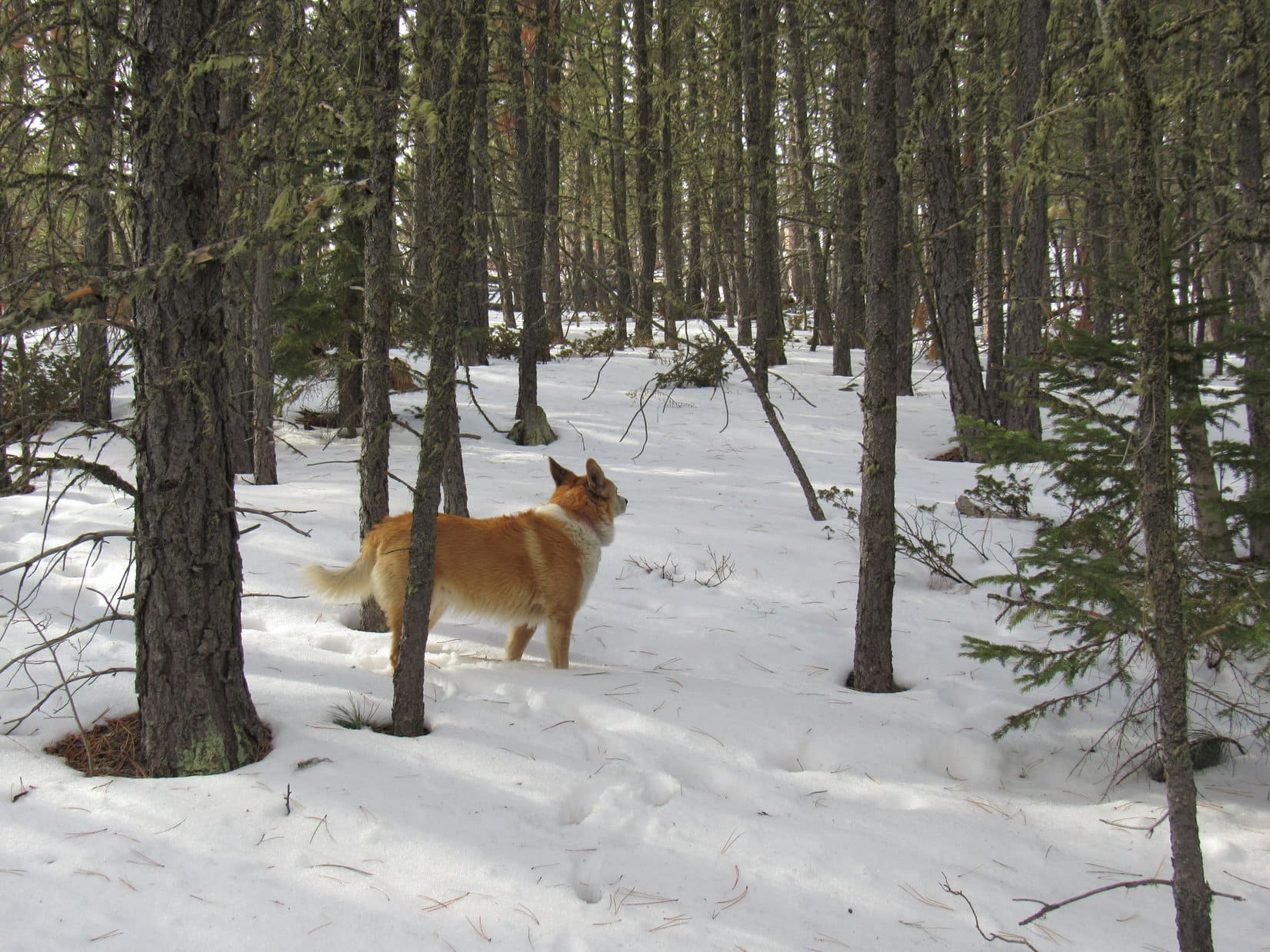
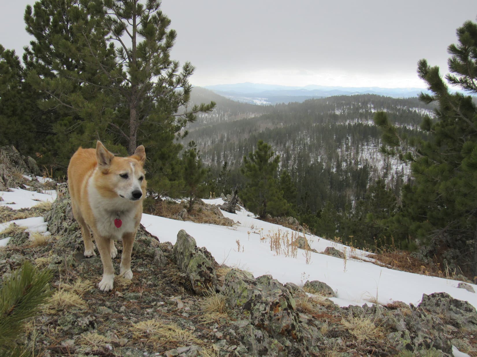
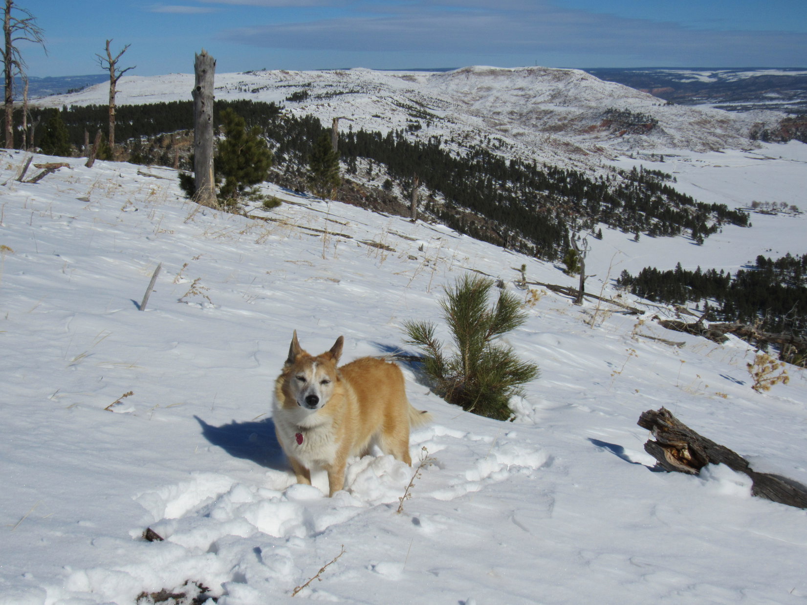
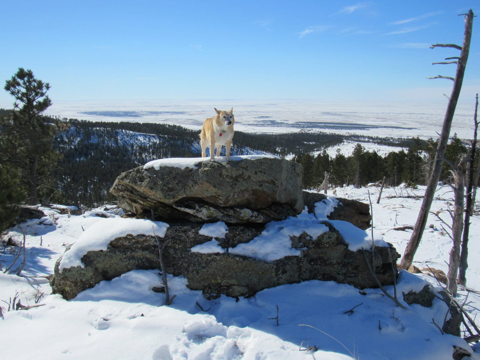
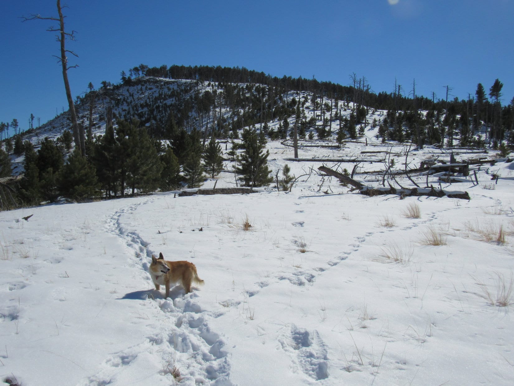
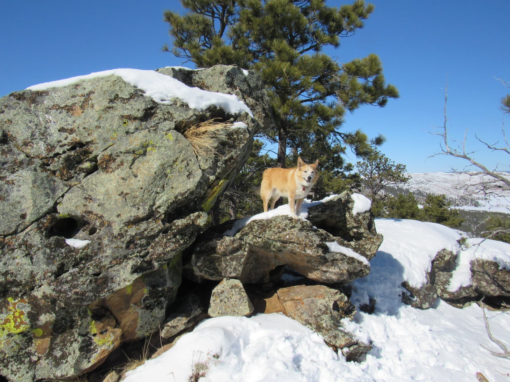
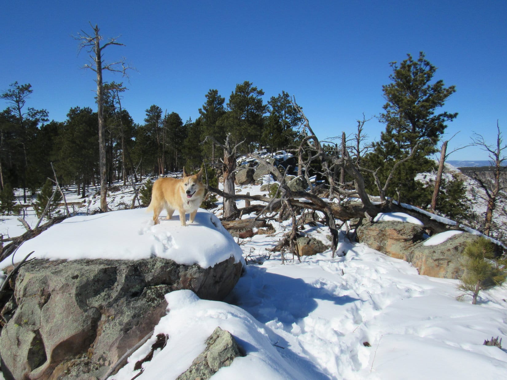
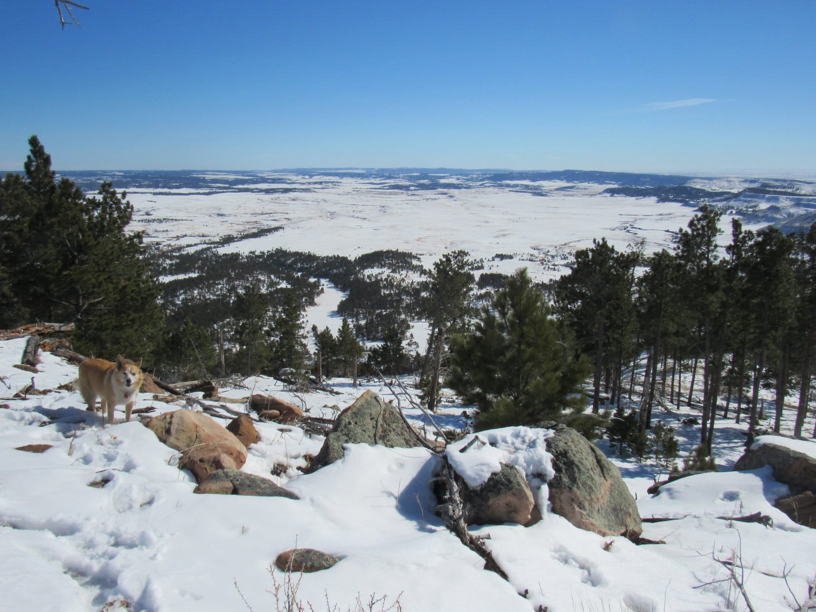
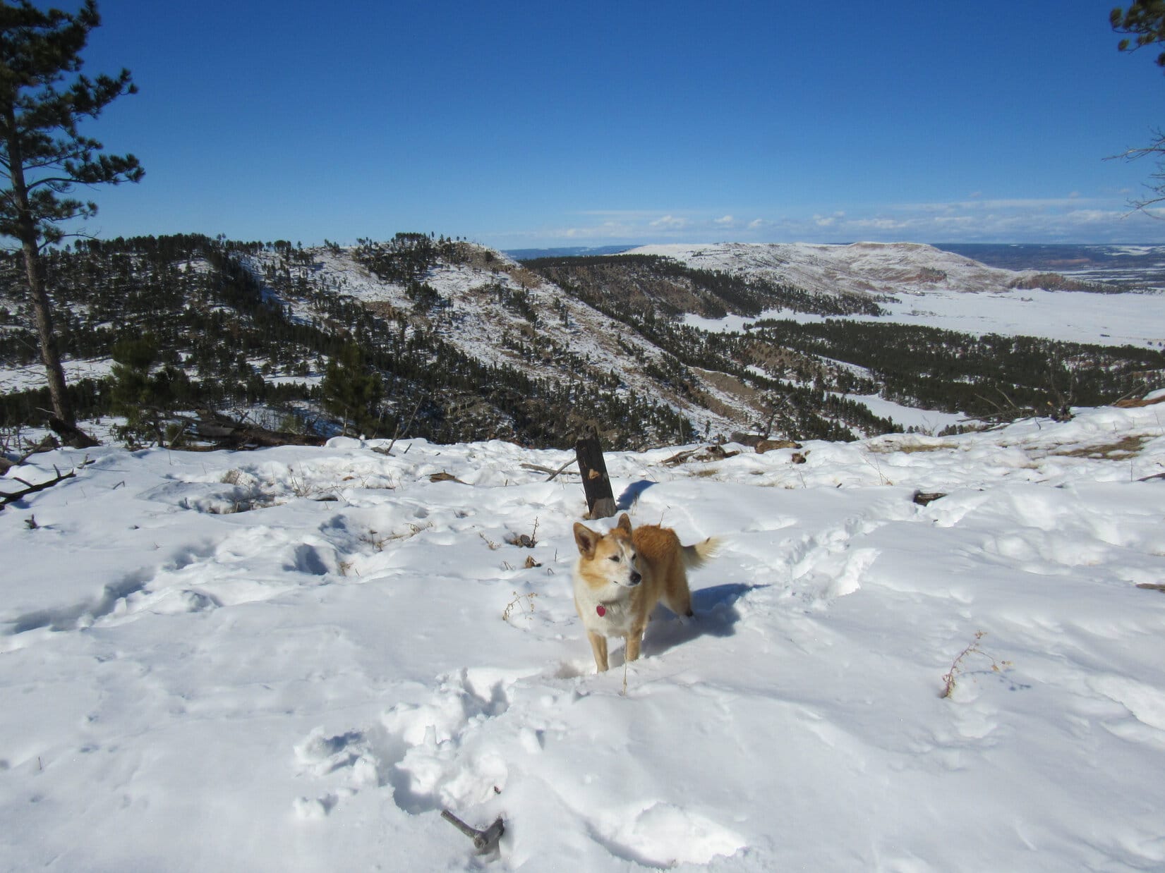
The snow was a foot deep most places, enough to make Lupe work.  Once she got into the forest a little way, she turned E until she reached the edge of the ridge she was going to follow up Peak 5500.  From here she had a great view of the secluded valley she’d come through on Elk Mountain Road, and much of the ridgeline leading to the summit.

Lupe came through the valley seen on the R. Elk Benchmark (L). Photo looks NE.
At the E edge of the ridge. Peak 5500 (L of Center). Photo looks SE.

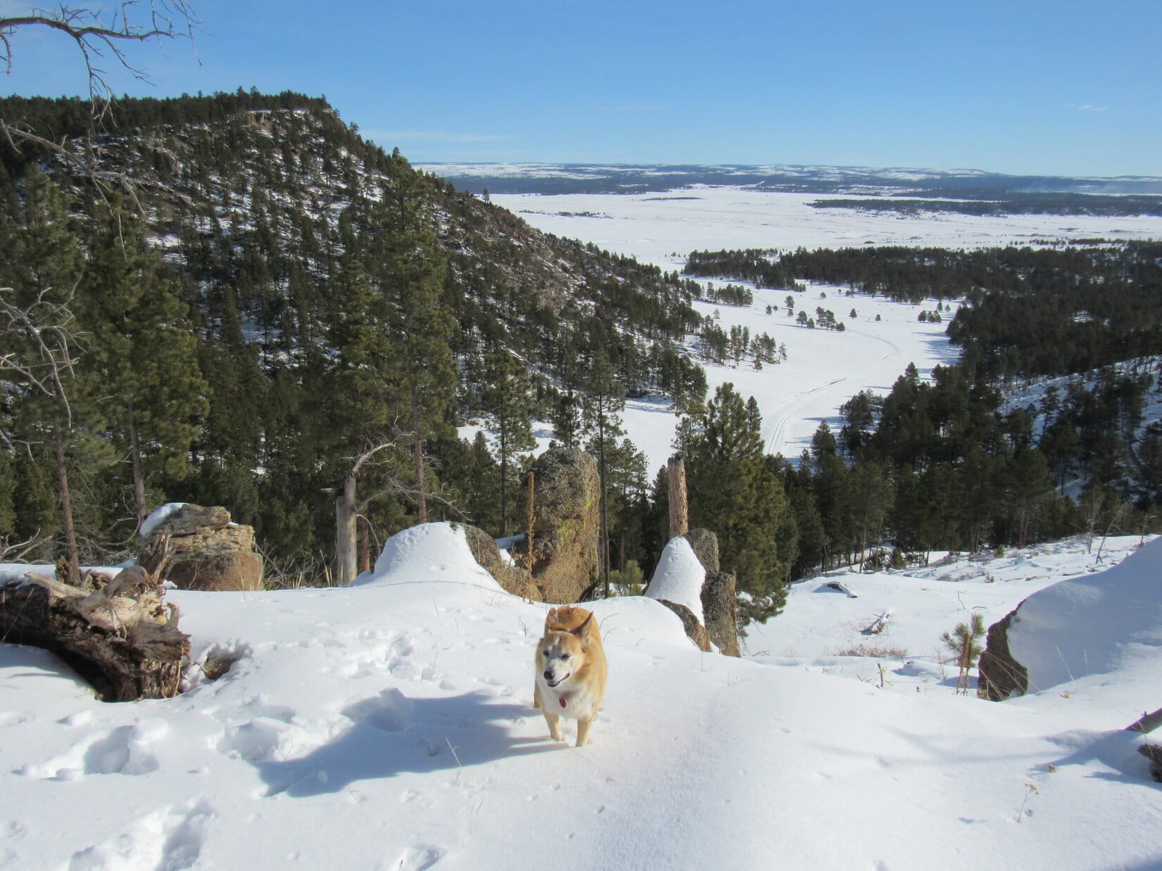
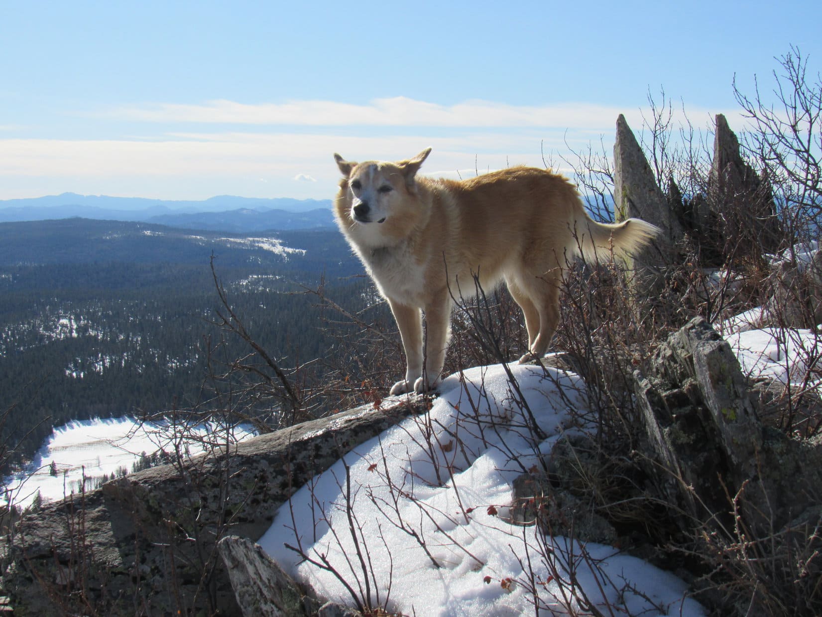
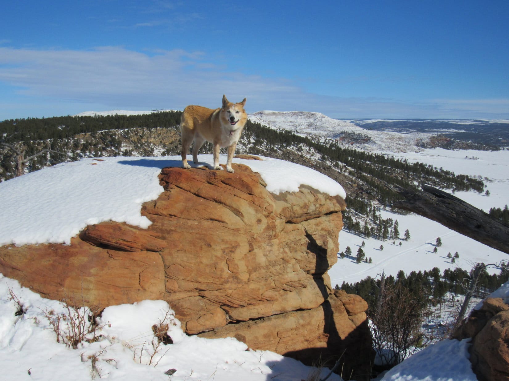
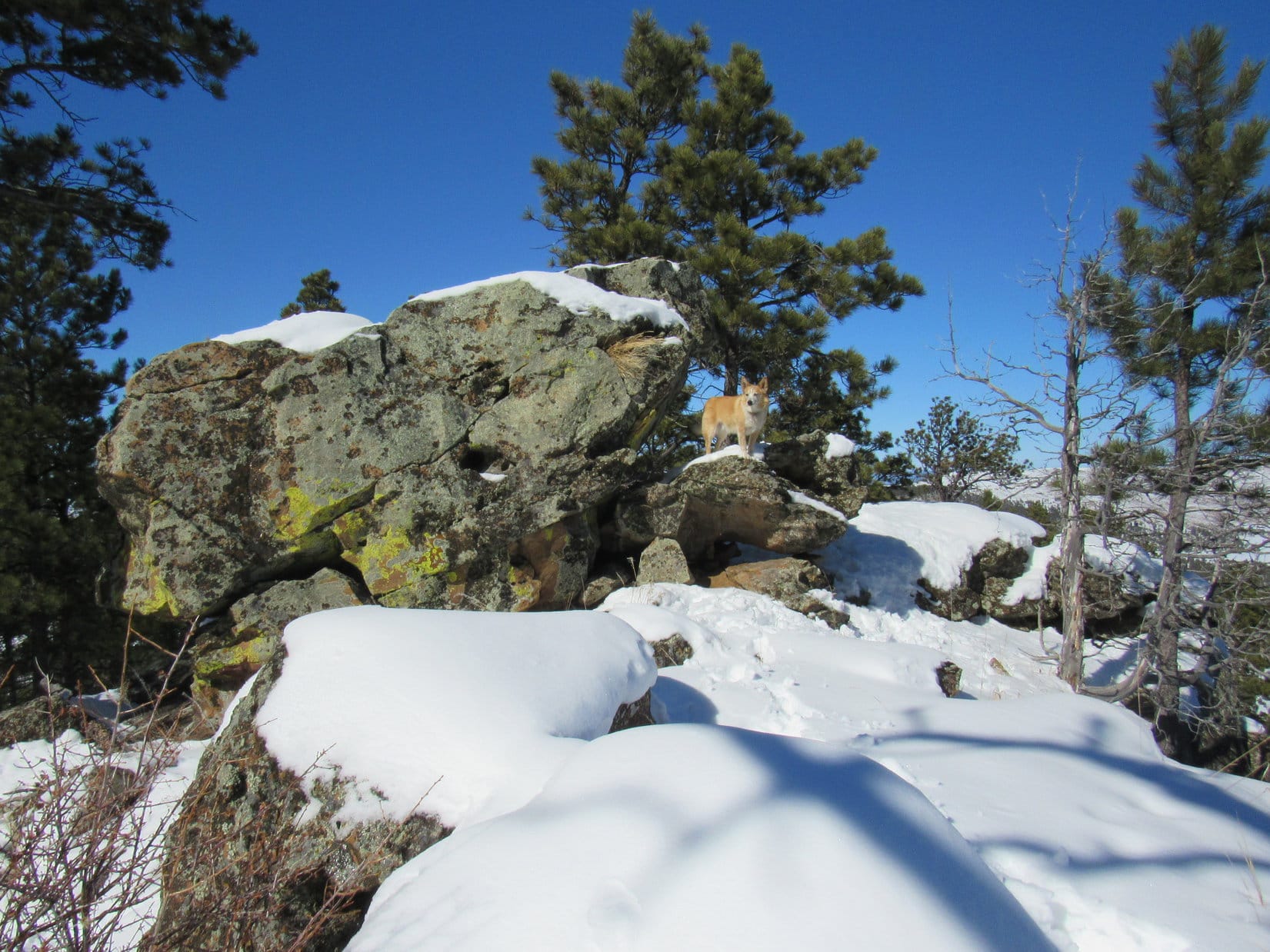
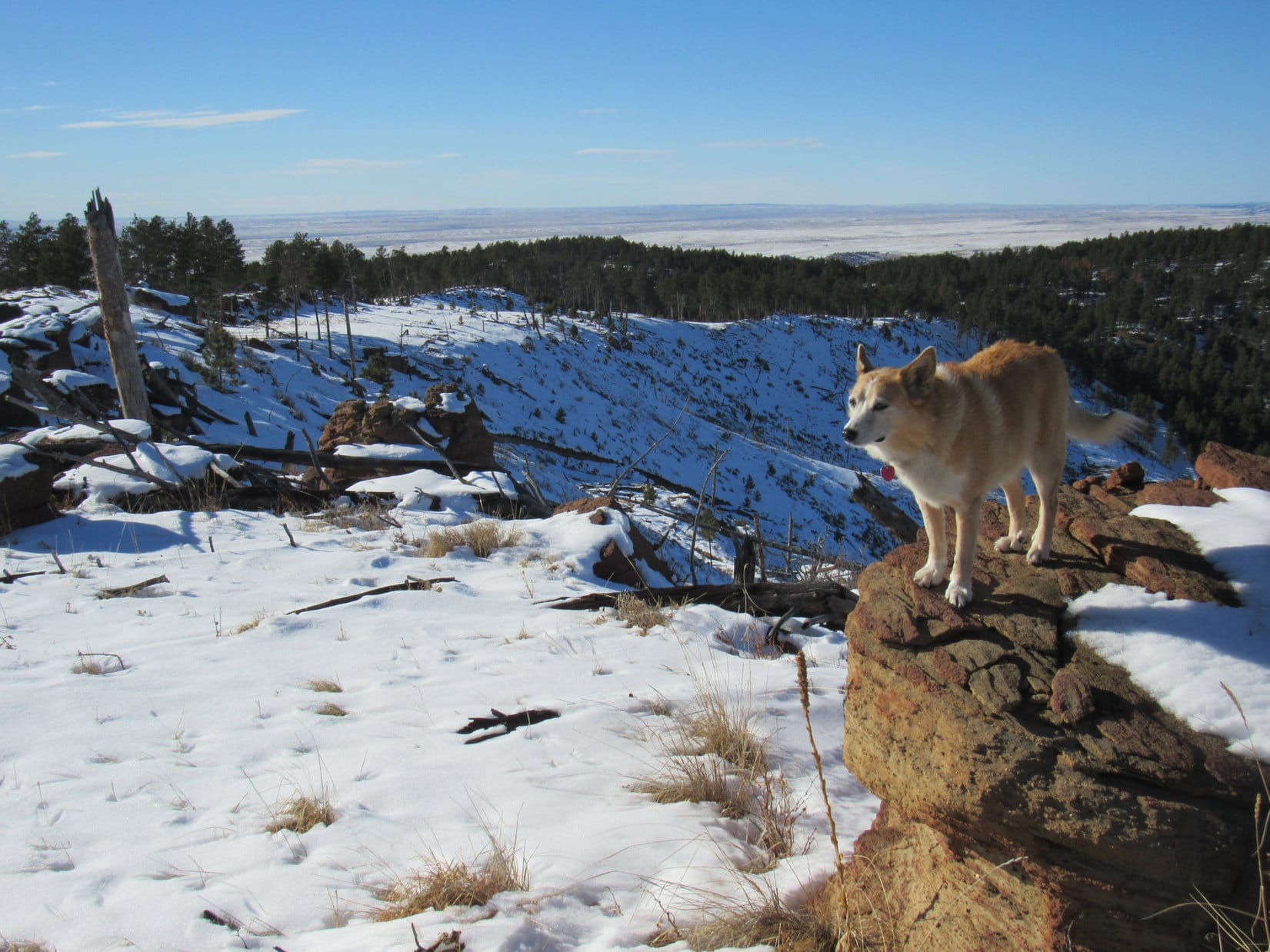
The American Dingo kept going, climbing SE along the ridgeline.  Every so often, she stopped to enjoy the unobstructed views to the E from big rocks perched along the edge.

S end of Elk Benchmark (L). Photo looks NE.
On the same boulder, but now looking SE toward Peak 5500’s summit (R).

The edge of the ridge was wide open.  Breezy up here, but nothing like it had been down on the prairie.  The forest just W of the ridgeline helped a lot to minimize it’s effect, but Lupe could still hear the wind roaring among the swaying pines.

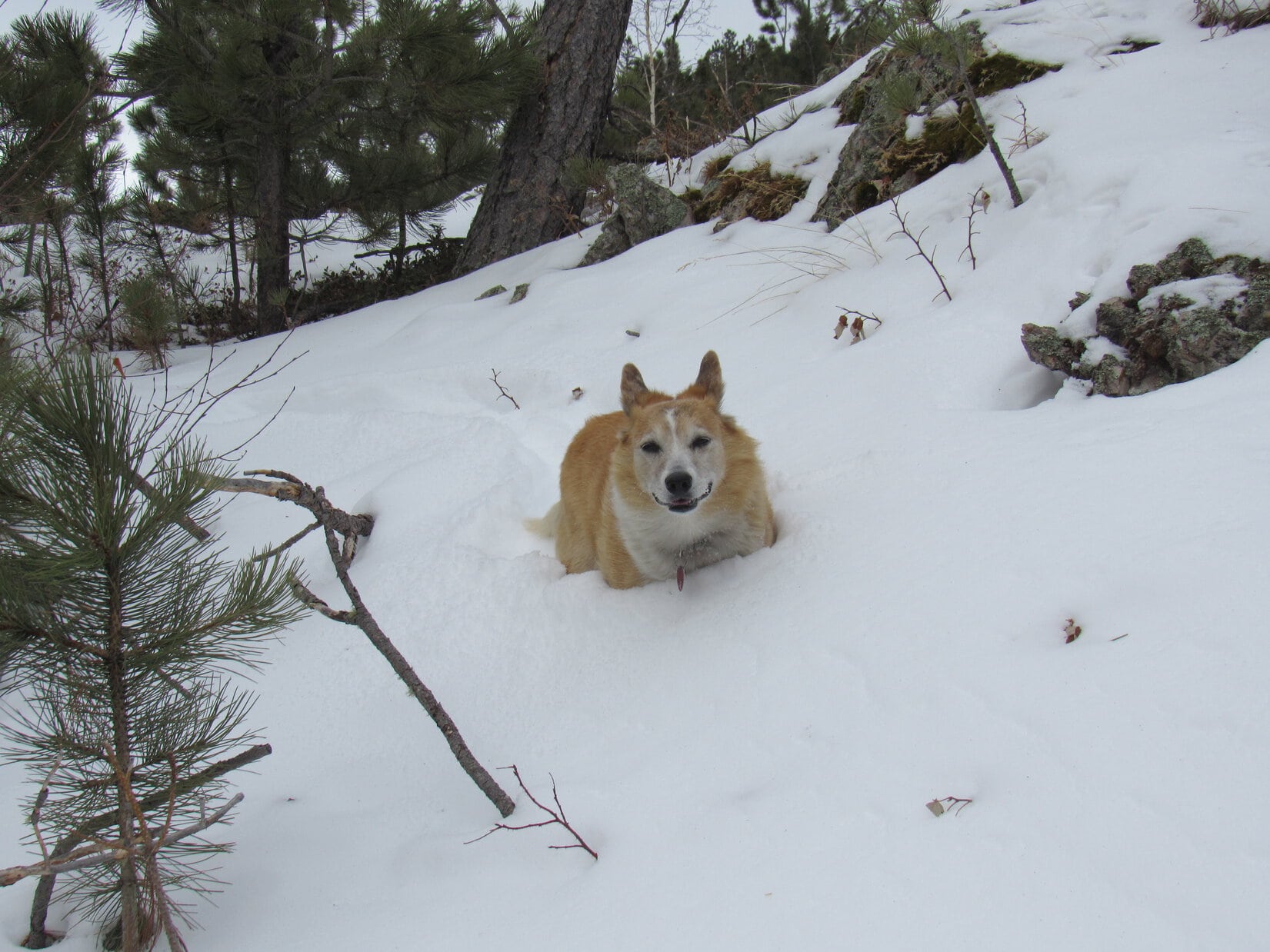
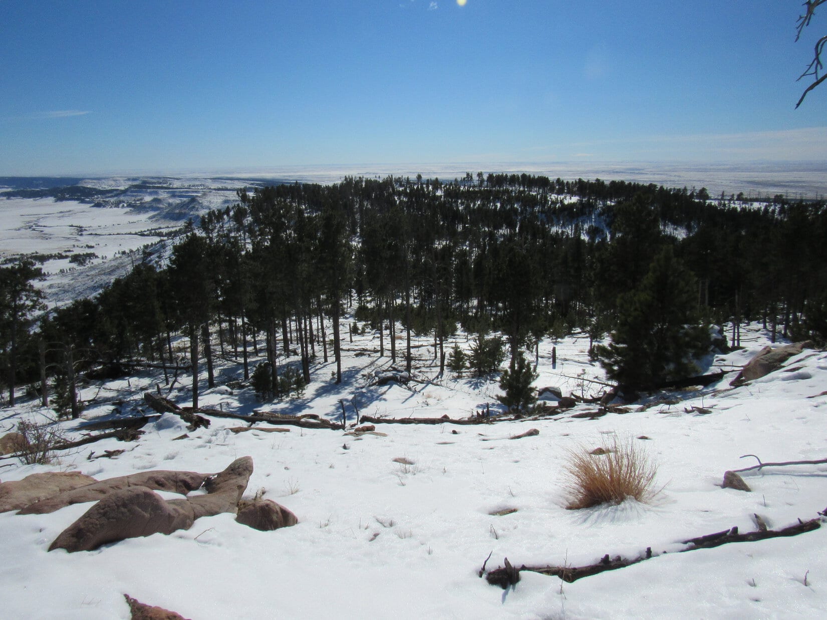
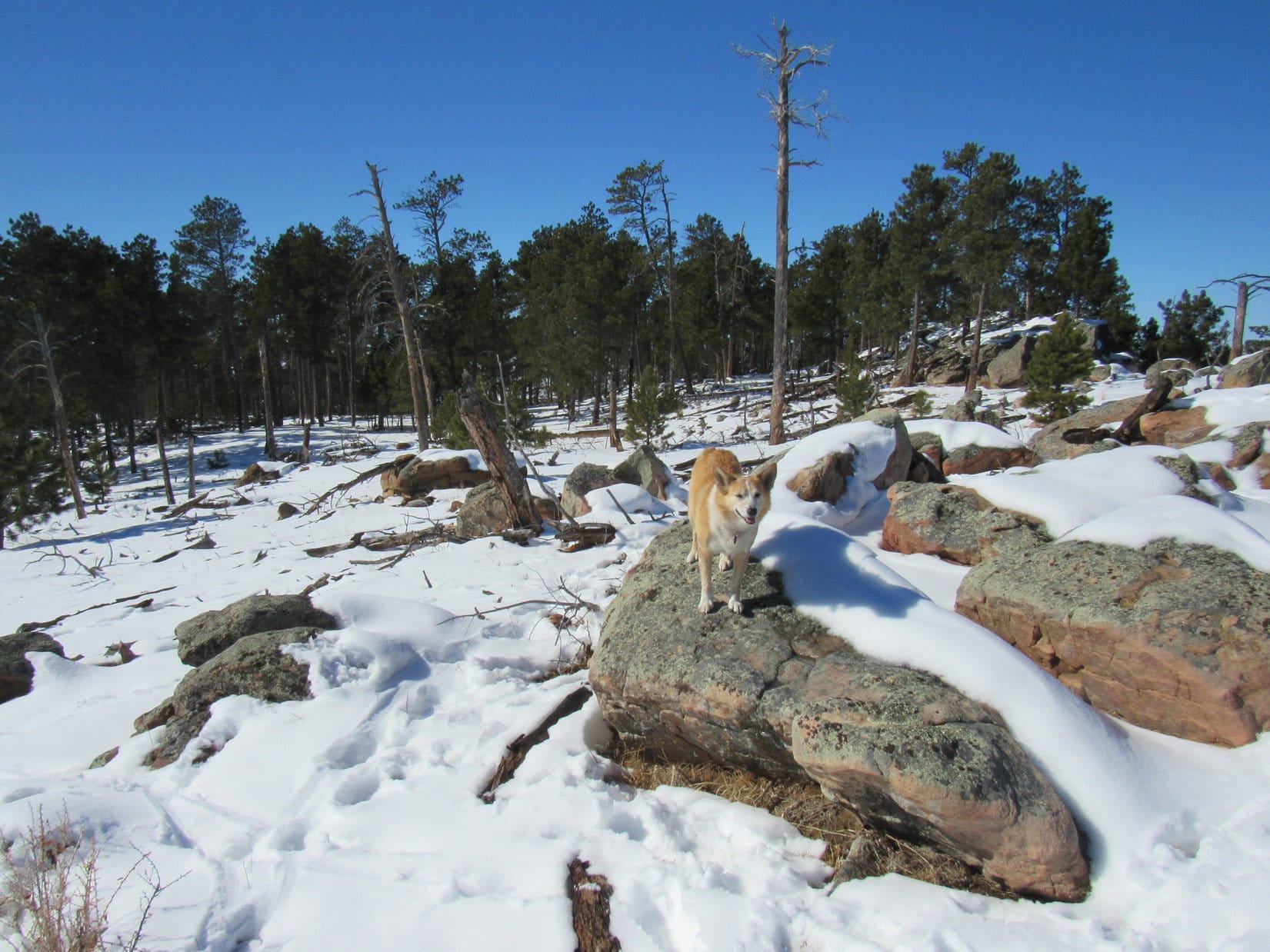
Partway up, Lupe came to a flat bouldery area where there was a break in the forest.  She could see a long way W into Wyoming from here, but was again exposed to the wind’s full force.  Annoying, but since it wasn’t quite as cold out now, the gale wasn’t as frigid as it had been earlier.

On the wind-swept boulders. Photo looks SE.
A big view into Wyoming through a gap in the forest. Photo looks W.

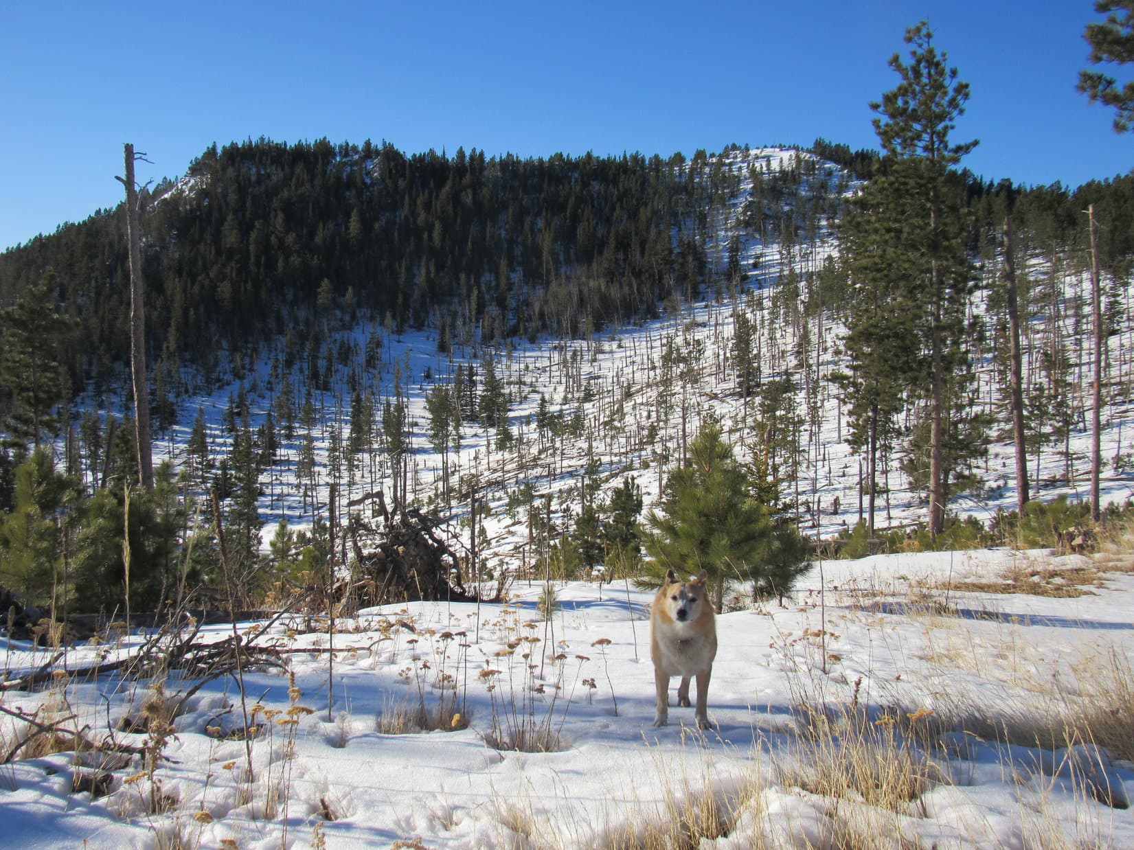
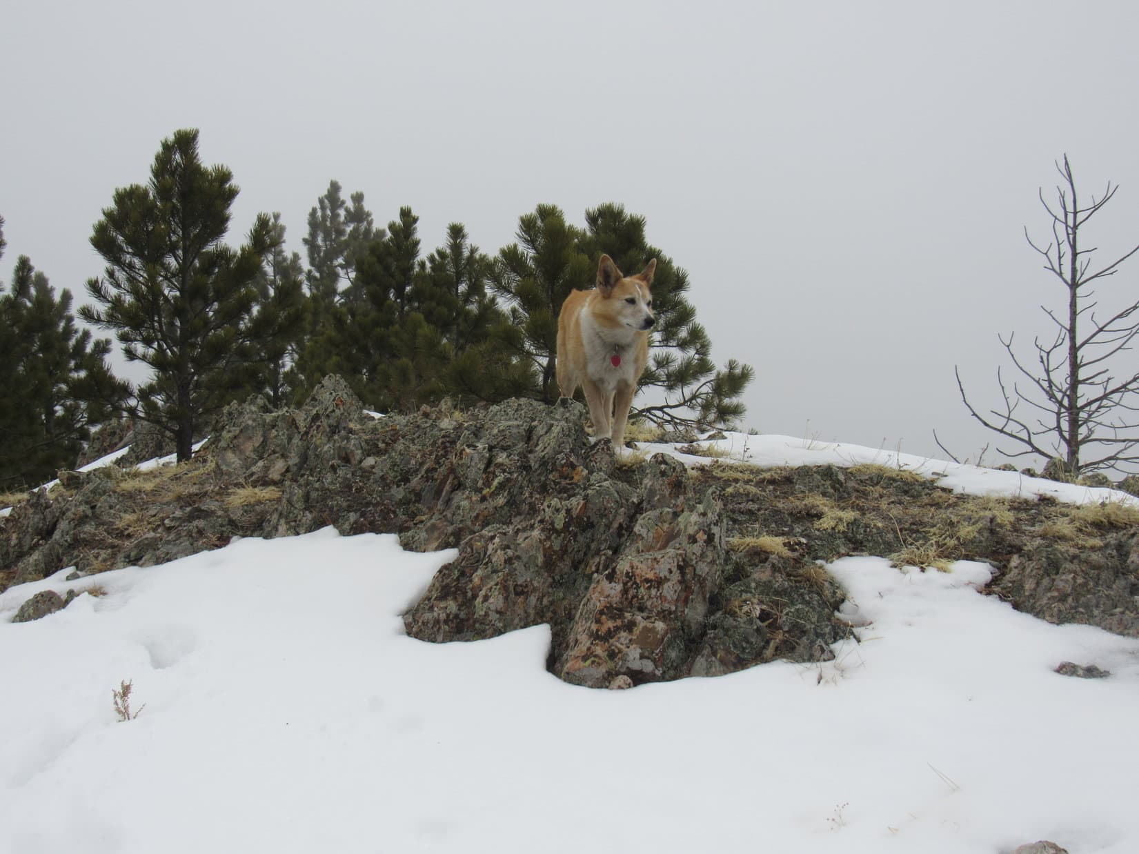
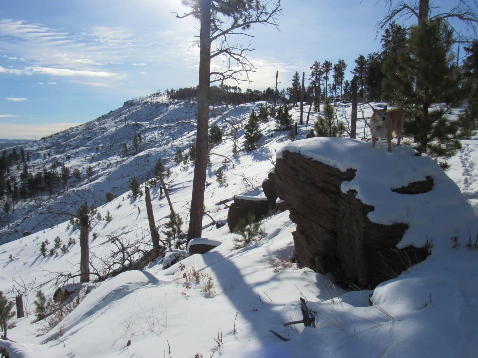
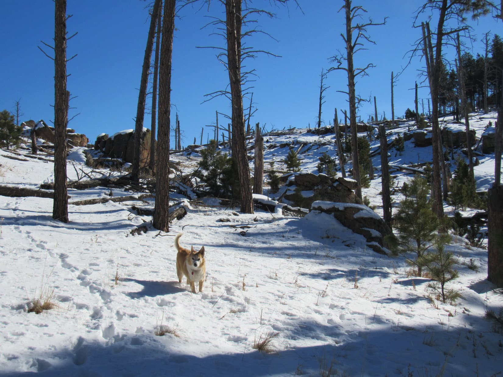
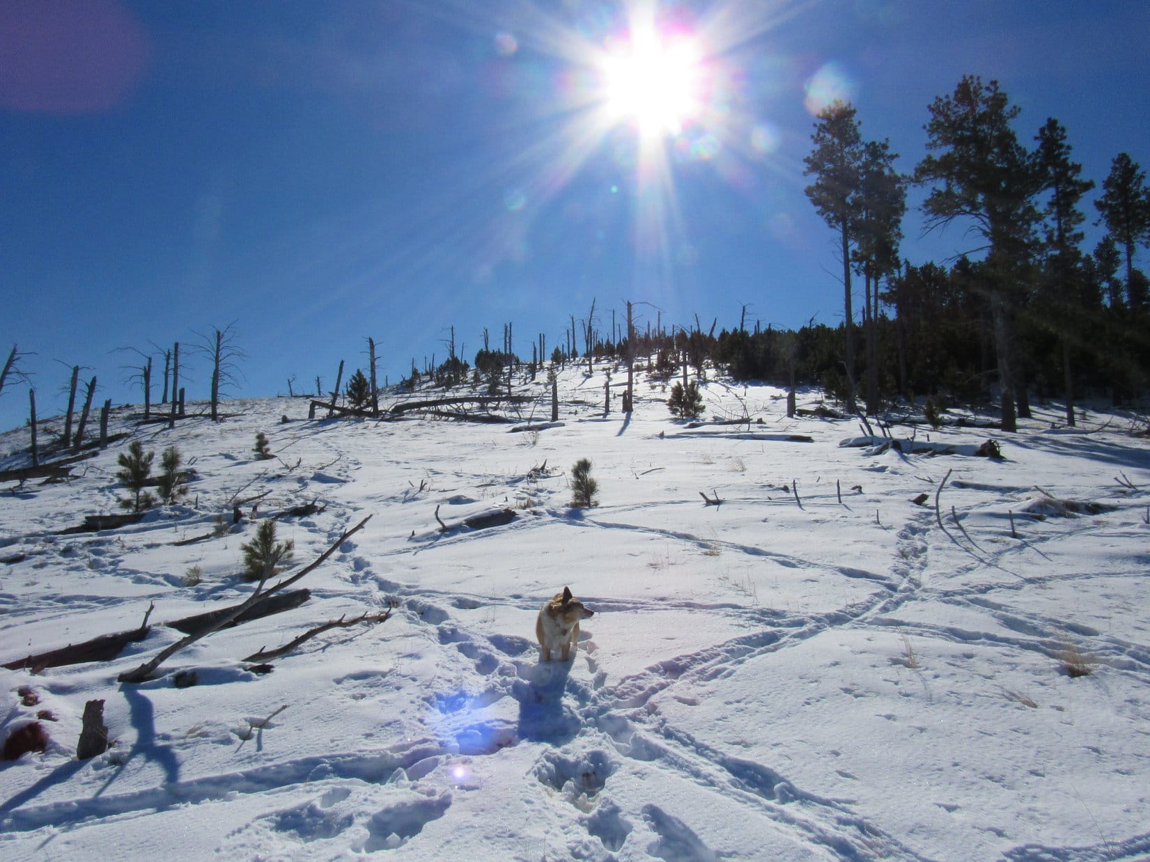
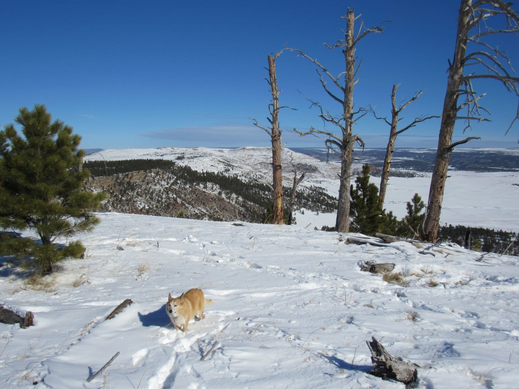
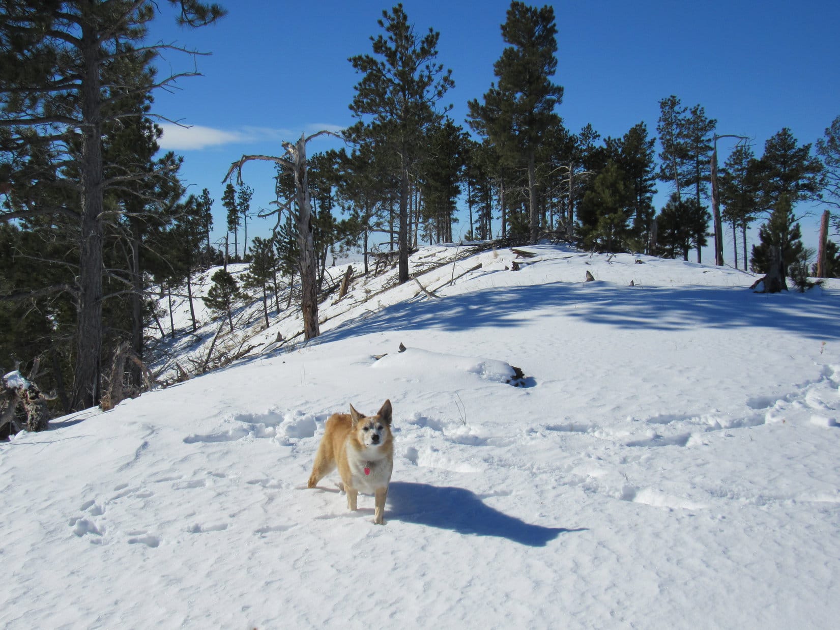
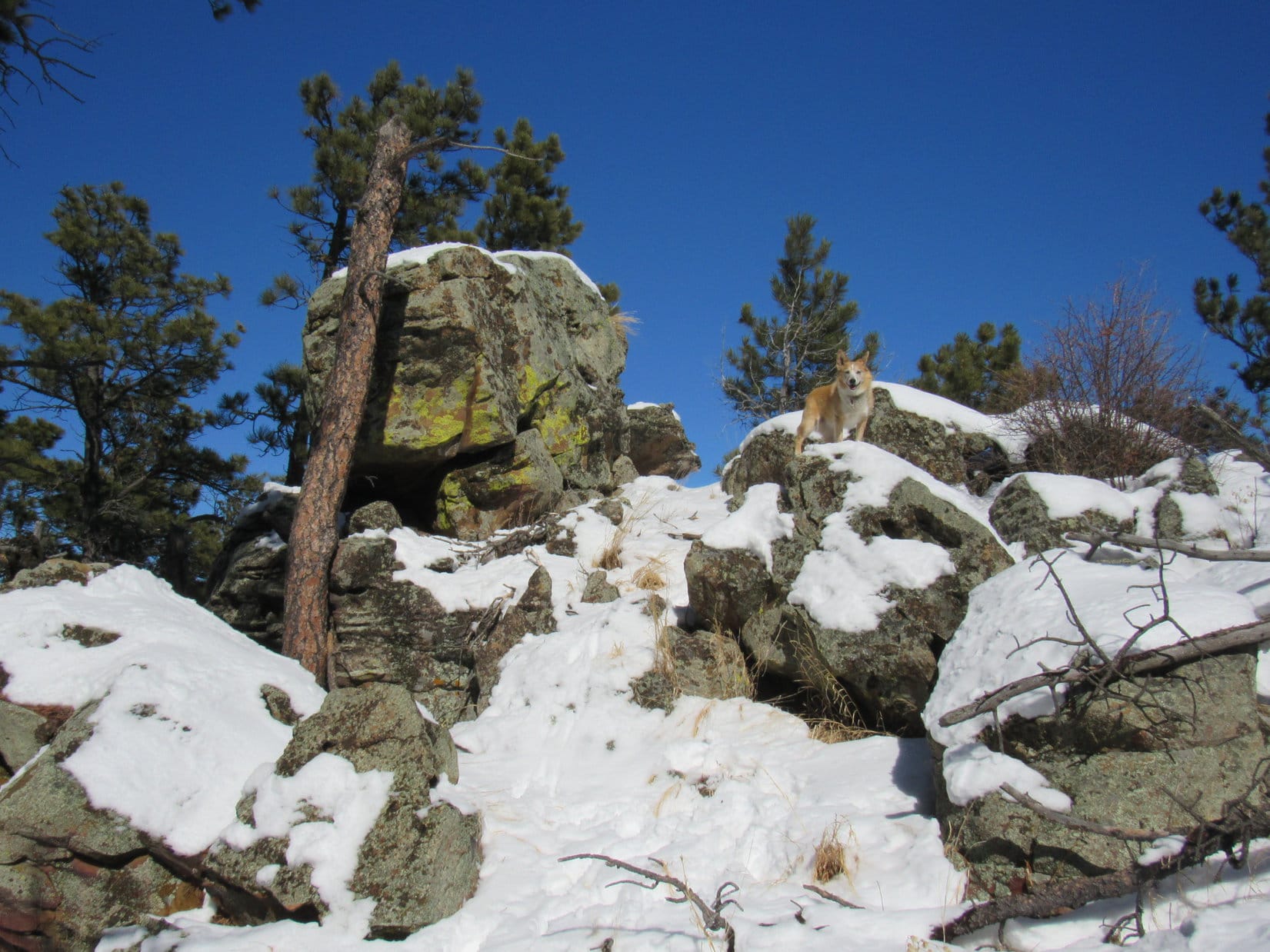
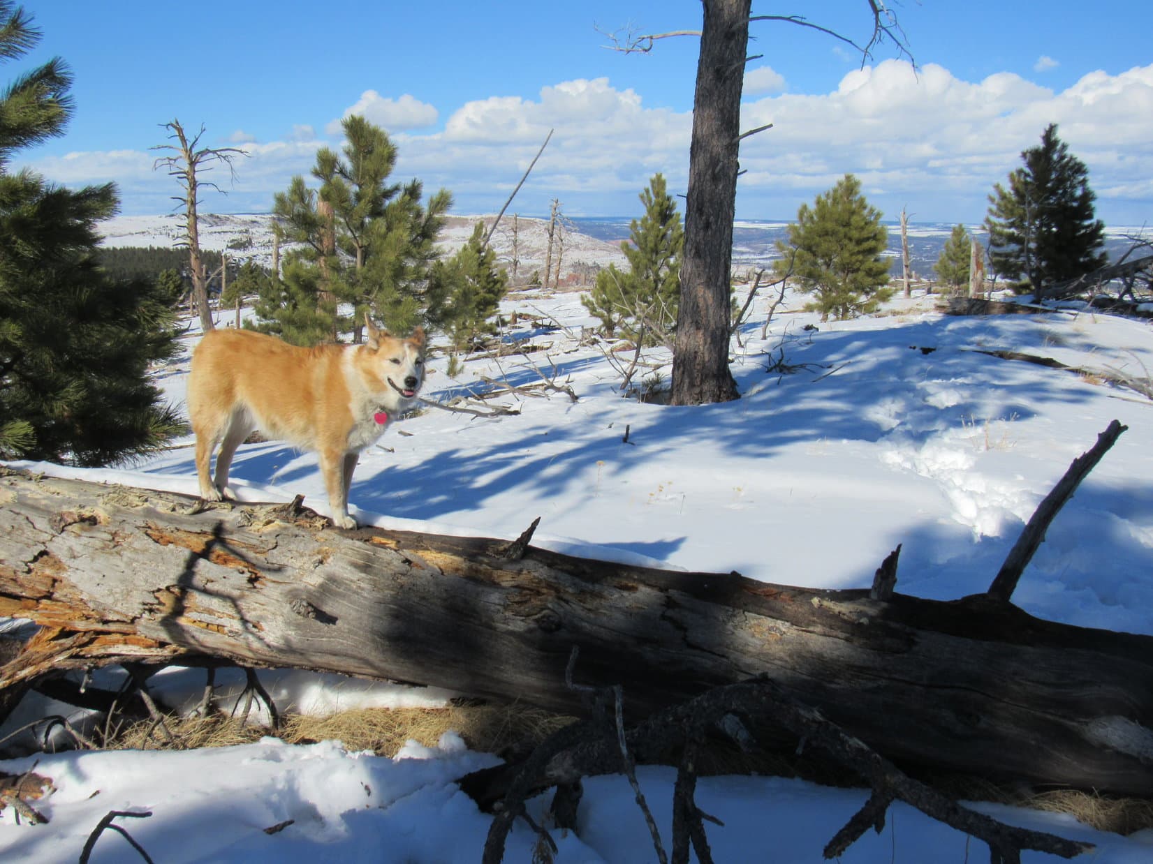
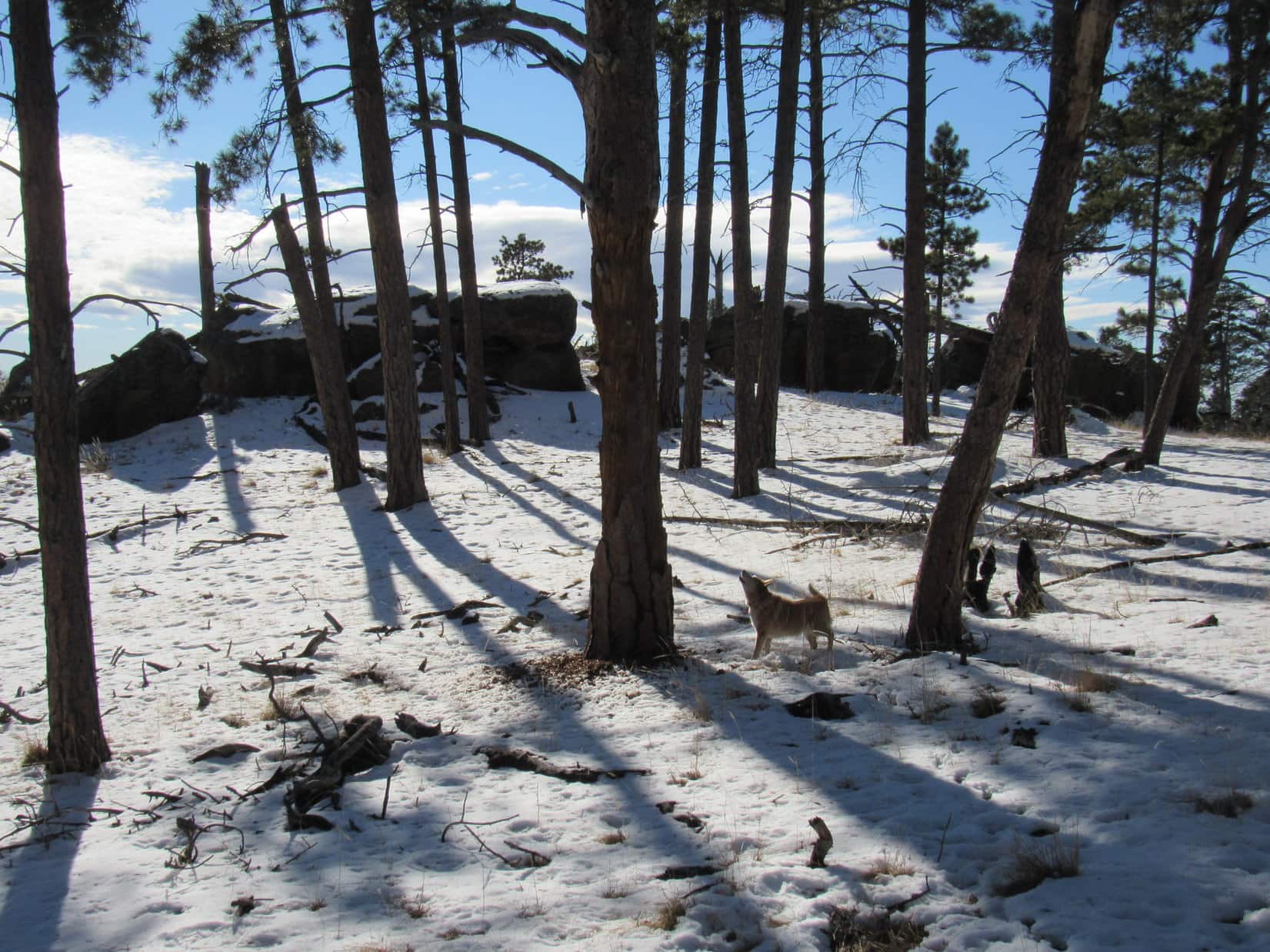
The climb continued.  Really wasn’t all that steep most of the time.  Lupe explored boulders and rock outcroppings.  Soon she was high enough to see the white, barren N end of Elk Benchmark, where the forest had burned away nearly 20 years ago.

Fun among the big rocks. Photo looks E.
Up nearly all the way, but not too steep. Photo looks ESE.
The white plateau of the N end of Elk Benchmark comes into view. Photo looks N.

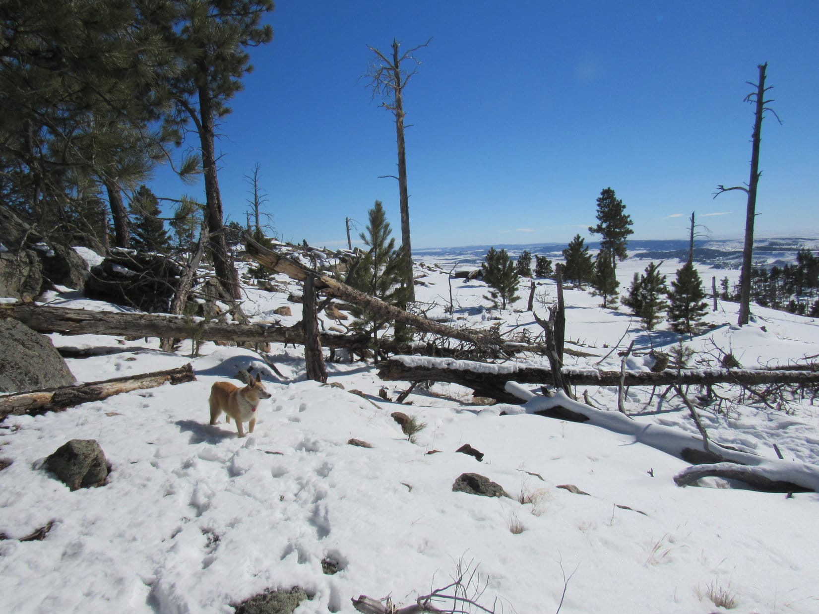
Near the top there were hardly any big rocks.  Scattered dead trees stood forlornly on an open snowy slope covered with animal tracks and a few human ones, too.  Loopster sure would have liked to see some of those Bighorn sheep, but none seemed to be around.

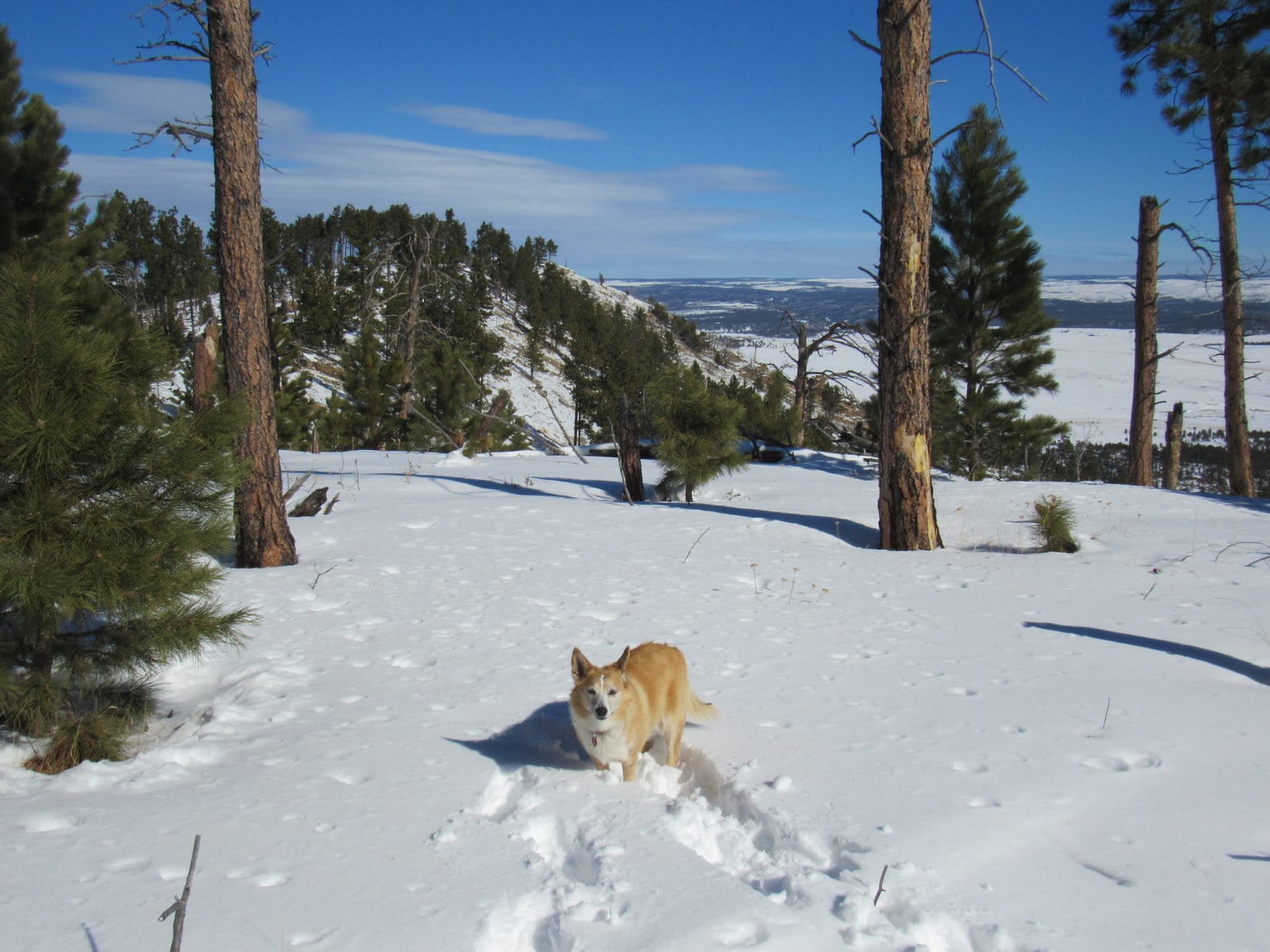
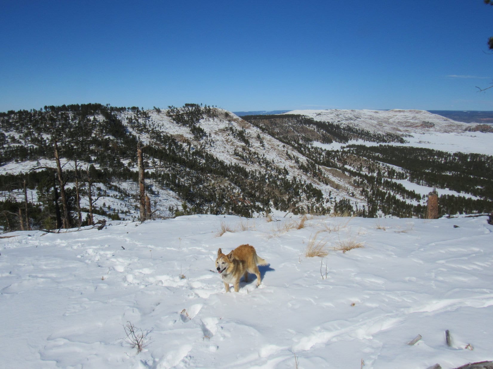
Fully exposed to the cold wind again, Lupe turned S toward the summit, often having to contend with deadfall hidden beneath the snow.  The big view of Elk Benchmark (5,669 ft.) back to the N continued to improve.

Lots of tracks up here, but sadly no Bighorn sheep. Photo looks SE.
Quite a view of the white N end of Elk Benchmark (Center) now! Photo looks N.
Getting close to the top of Peak 5500. Photo looks S.
A scenic group of 4 dead trees near the edge. Elk Benchmark (L). Photo looks N.

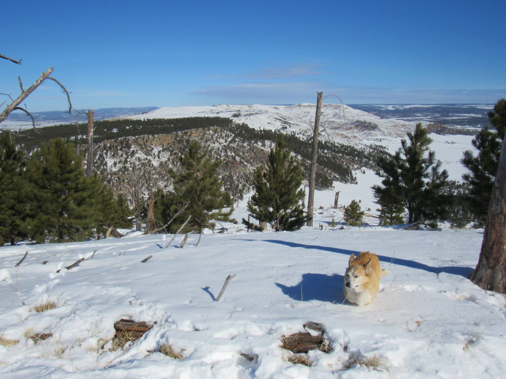
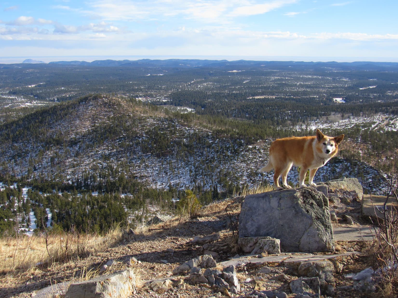
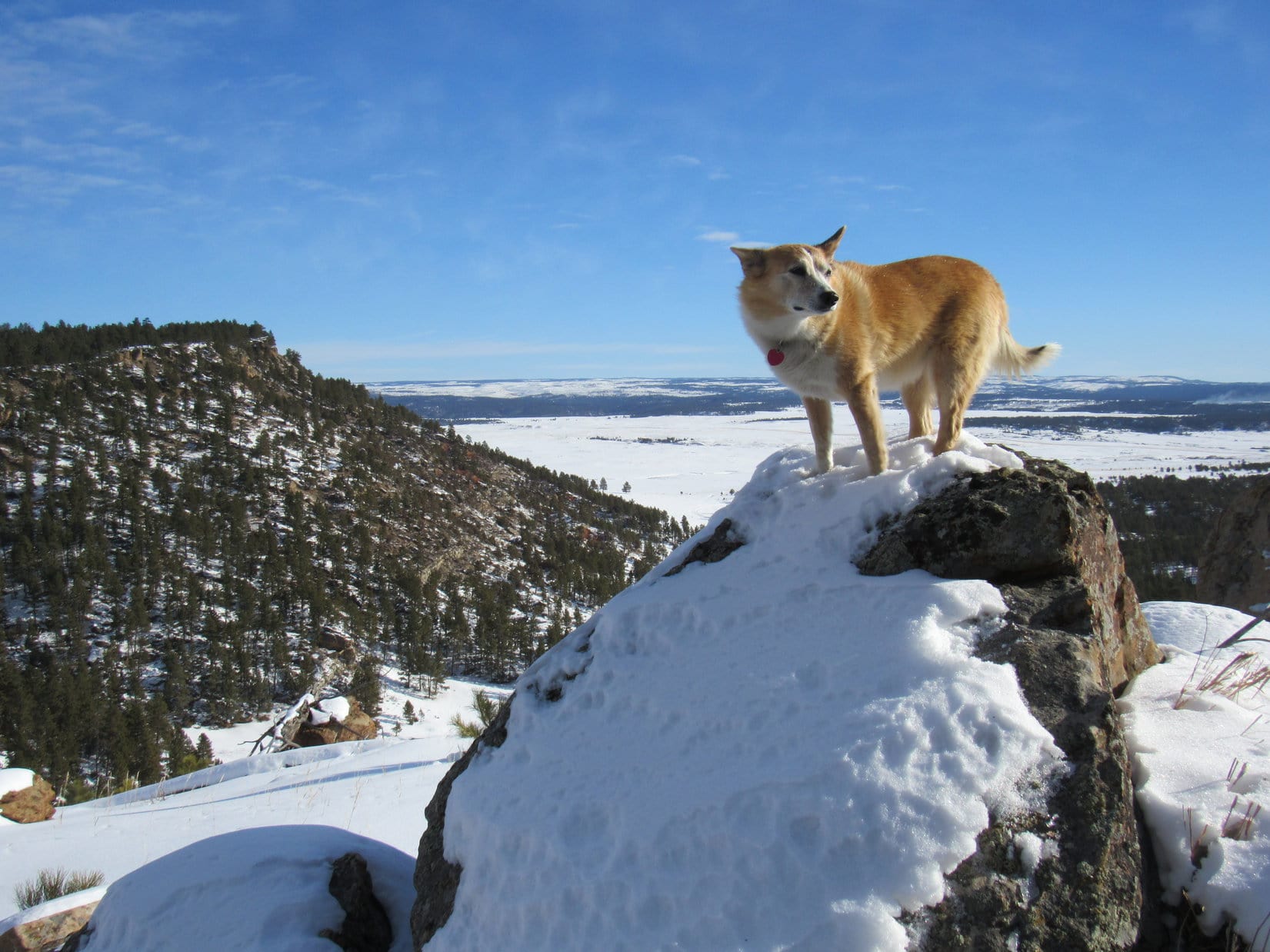
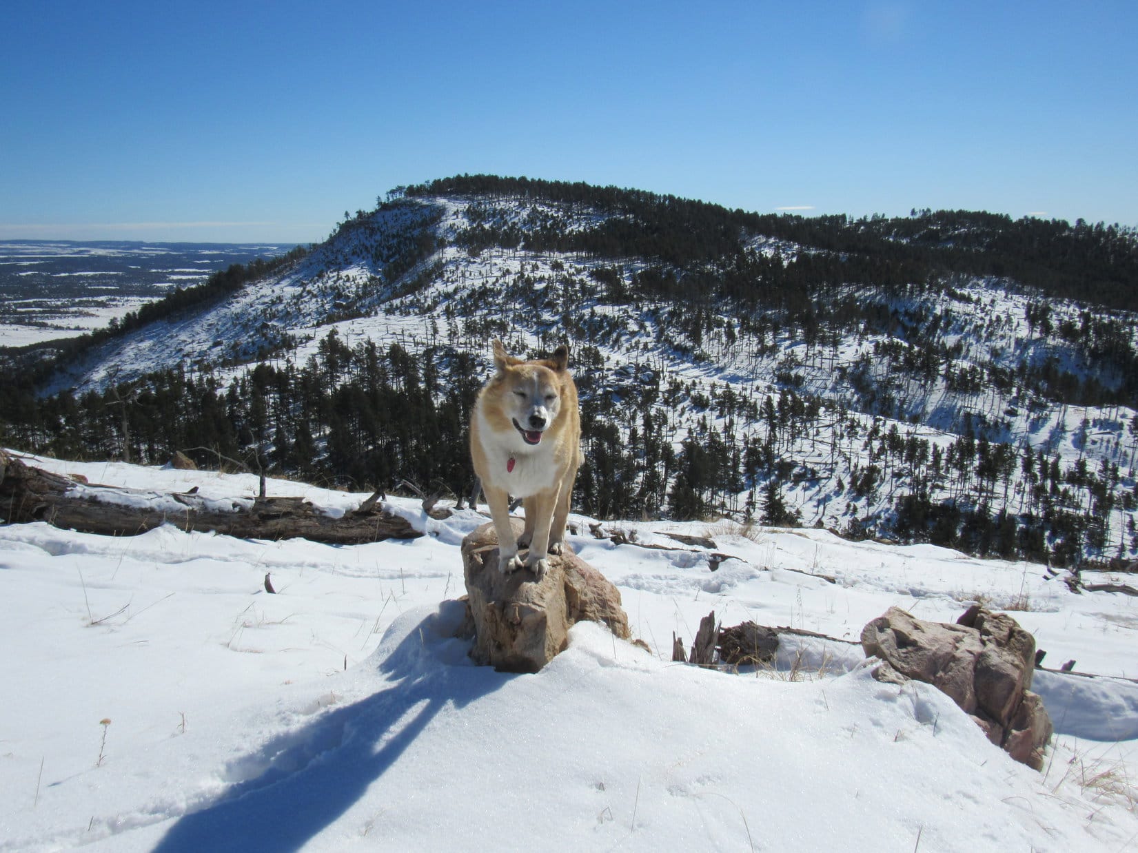
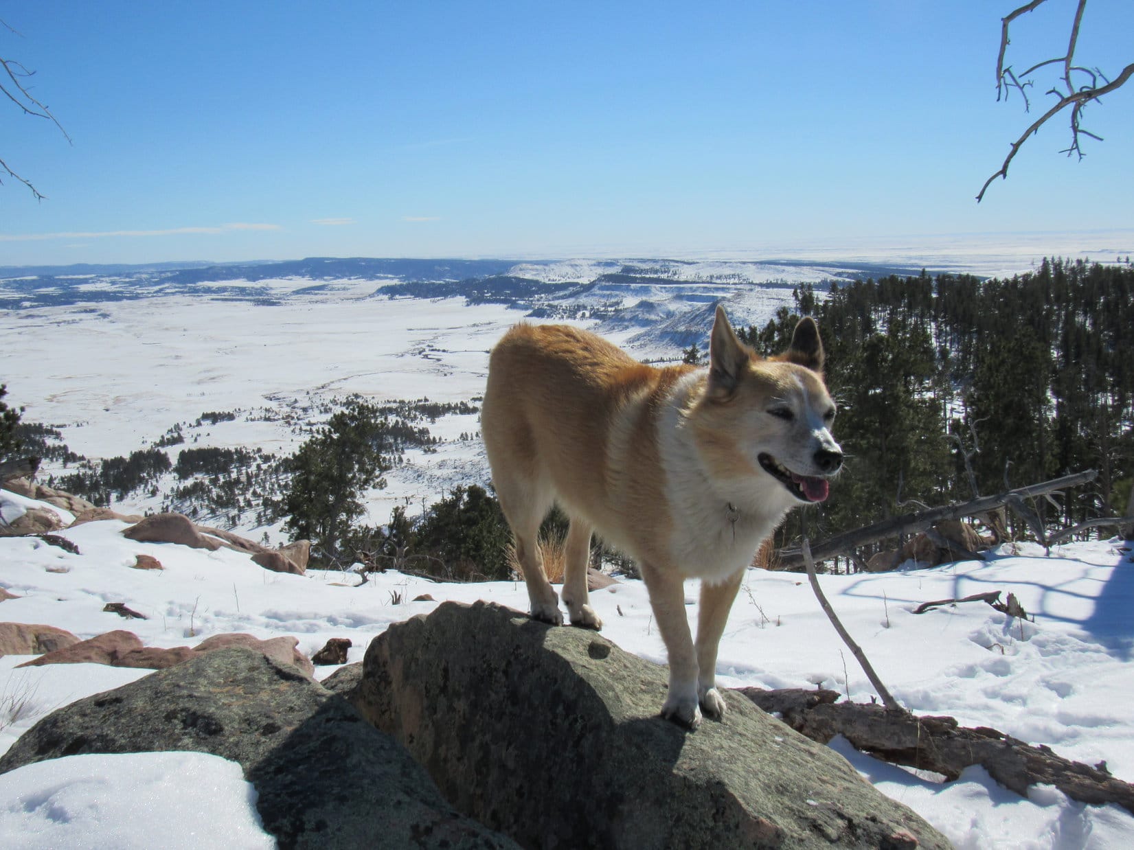
A little NE of Peak 5500’s true summit, Wildcat Peak (5,500 ft.) came into view.  Such a beautiful mountain!  Lupe had been to Wildcat Peak nearly 5 years ago.

Wildcat Peak (Center). Photo looks SE.
Wildcat Peak from Peak 5500. Photo looks SE with help from the telephoto lens.

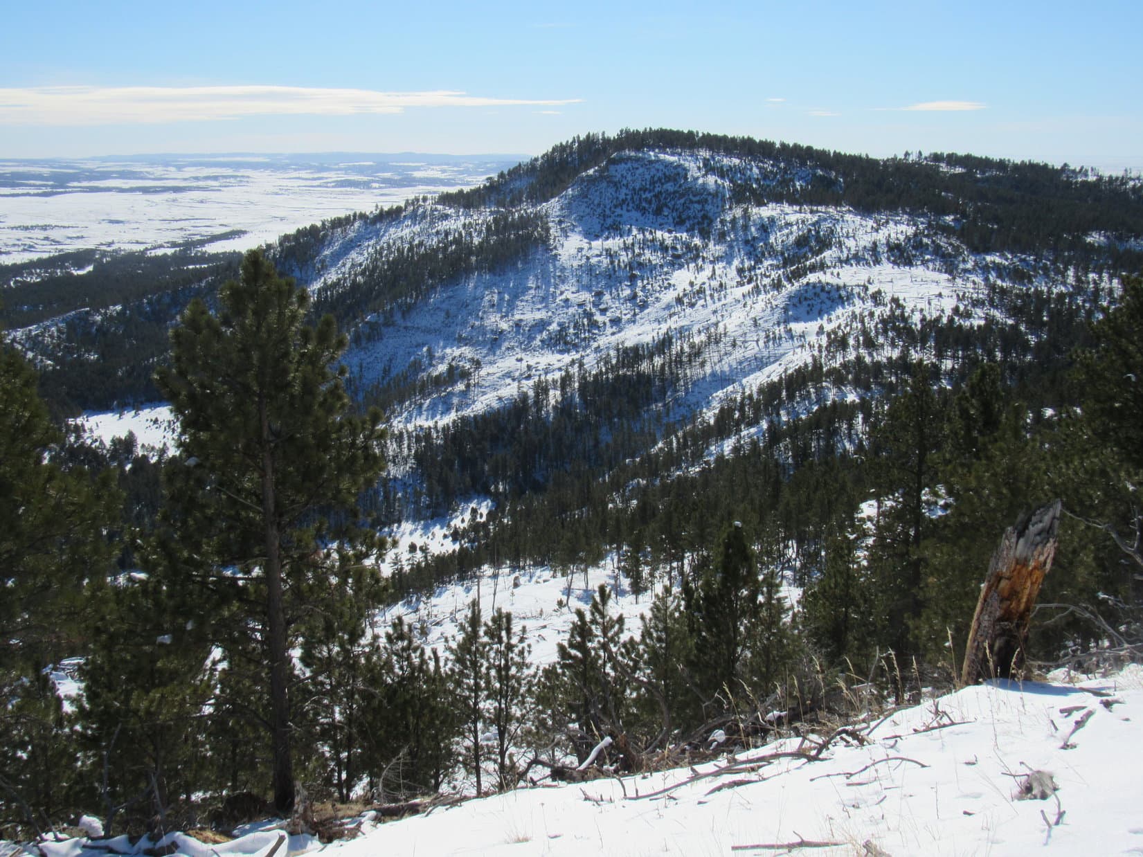
In fact, Lupe had been to Peak 5500 before, too.  She’d come up over it on that same day in April, 2016 on her way back from Wildcat Peak.  Ready to complete her 2nd ascent, Loop headed for the true summit.

True summit of Peak 5500 (R of Center) dead ahead! Photo looks WSW.
On top of Peak 5500. Photo looks NE.

The true summit was more of a small area than any one identifiable point, especially with so much snow around.  With her 2nd ascent of Peak 5500 complete, Lupe was ready for a break.  Fortunately, the forest was close enough to help minimize the wind to some degree.  Loop and SPHP hung out enjoying the fabulous view of Wildcat Peak.

Not for long, though!  Snow everywhere.  No dry place to sit, and enough of a chilly breeze to soon convince both Dingo and human that moving on might be a good idea.  Loop ventured back to the NE for a last look at Elk Benchmark before returning briefly to Peak 5500’s true summit.  She then headed S exploring Peak 5500’s long summit ridge.  The Carolina Dog’s next journey to Wildcat Peak was underway!

Elk Benchmark from Peak 5500. Photo looks N with help from the telephoto lens.

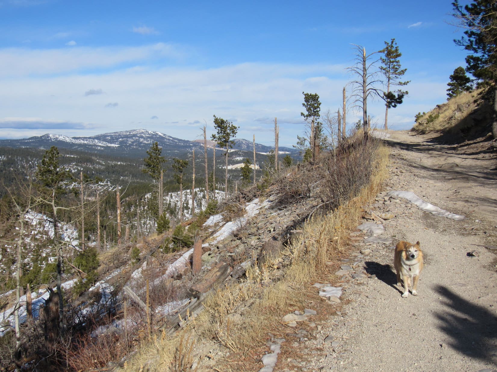
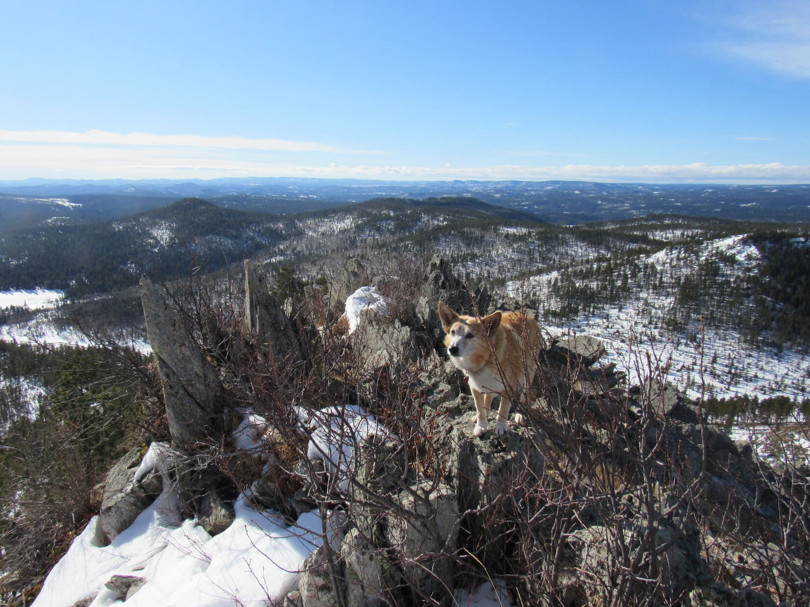
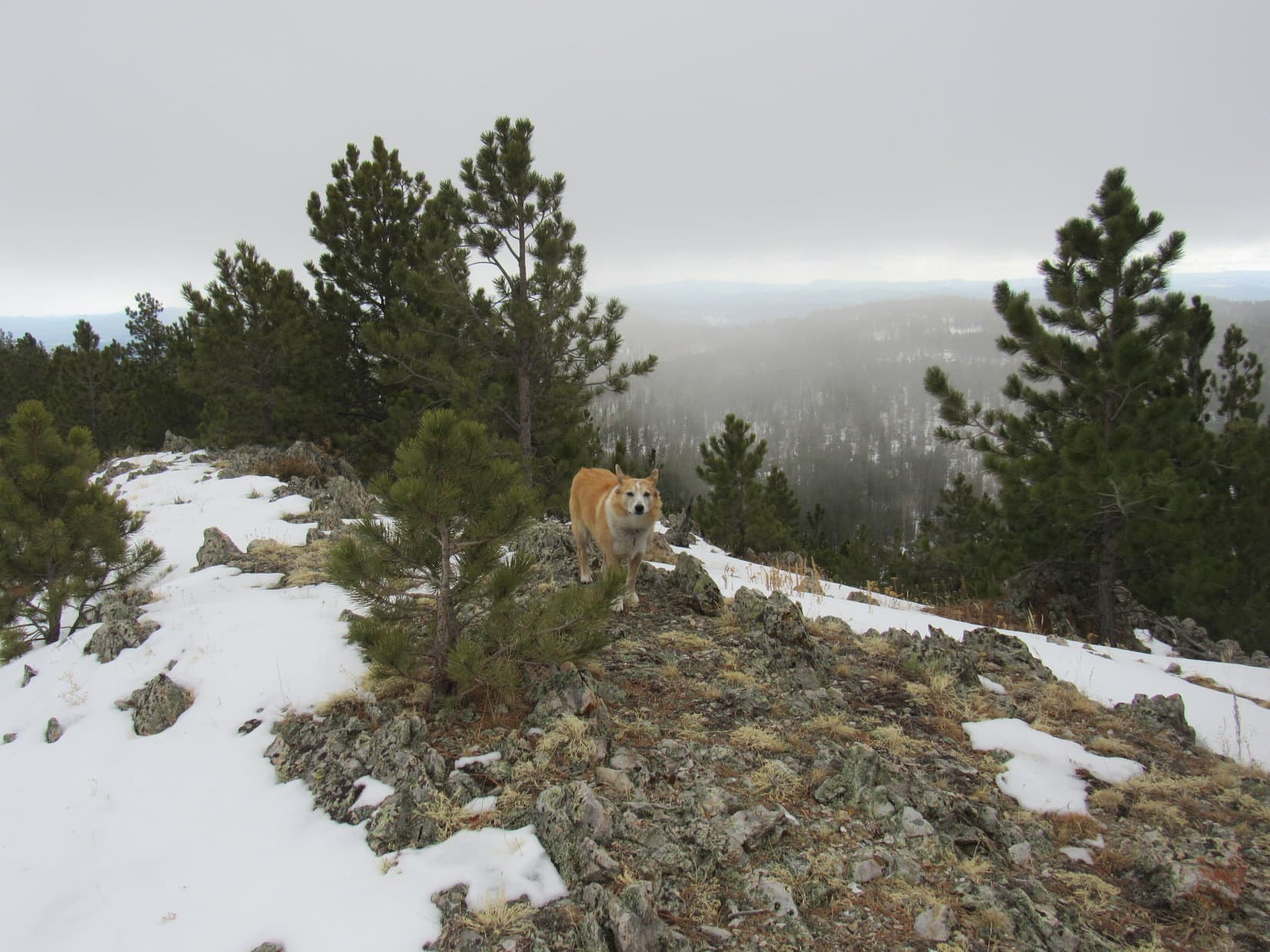
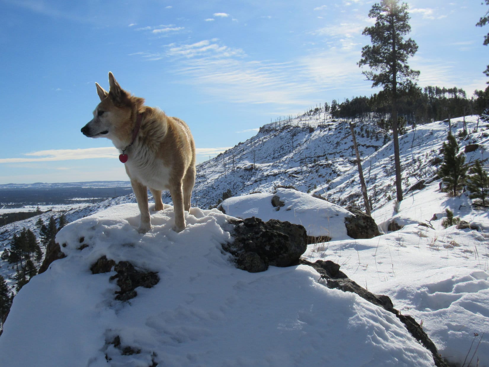
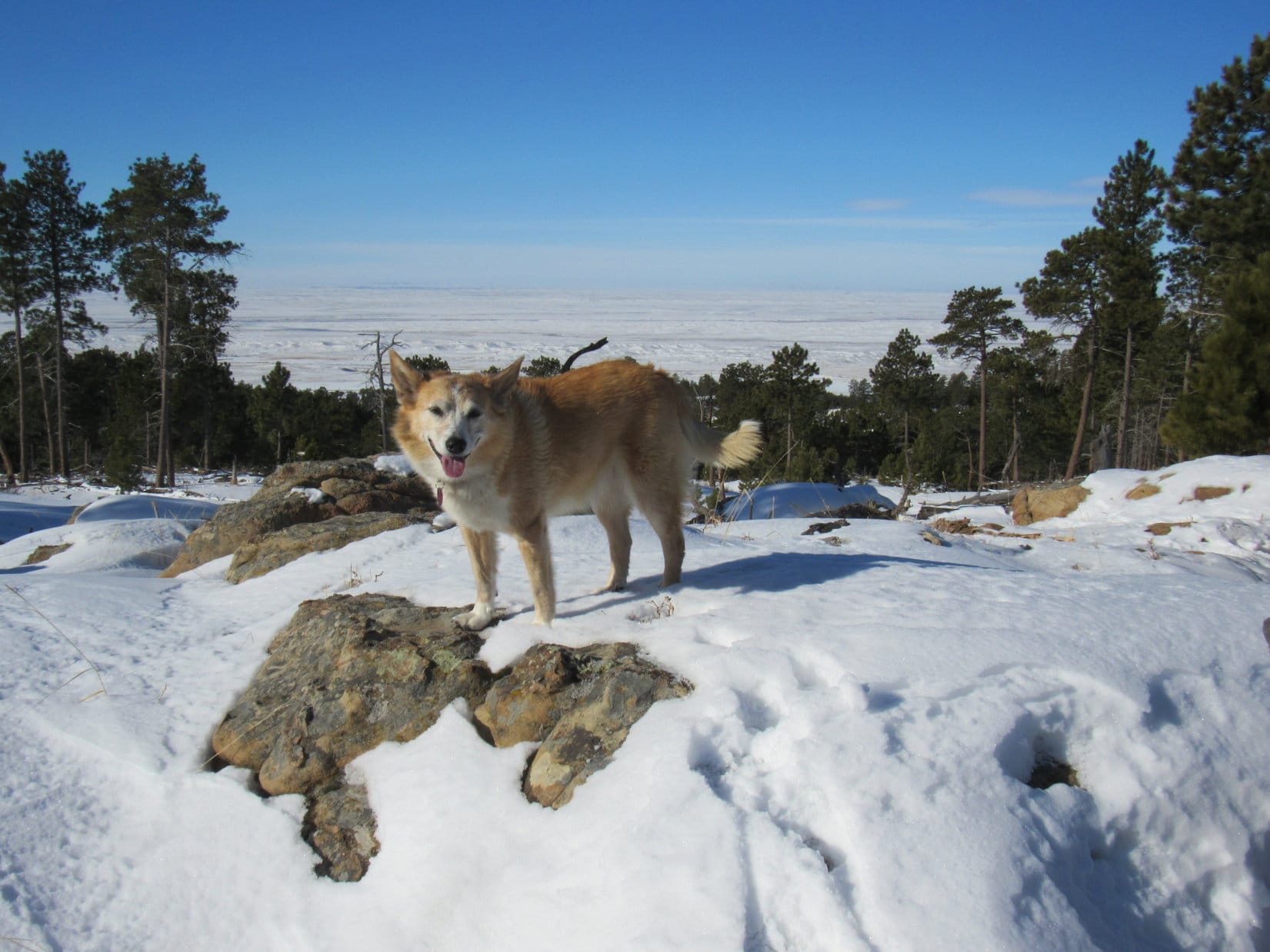
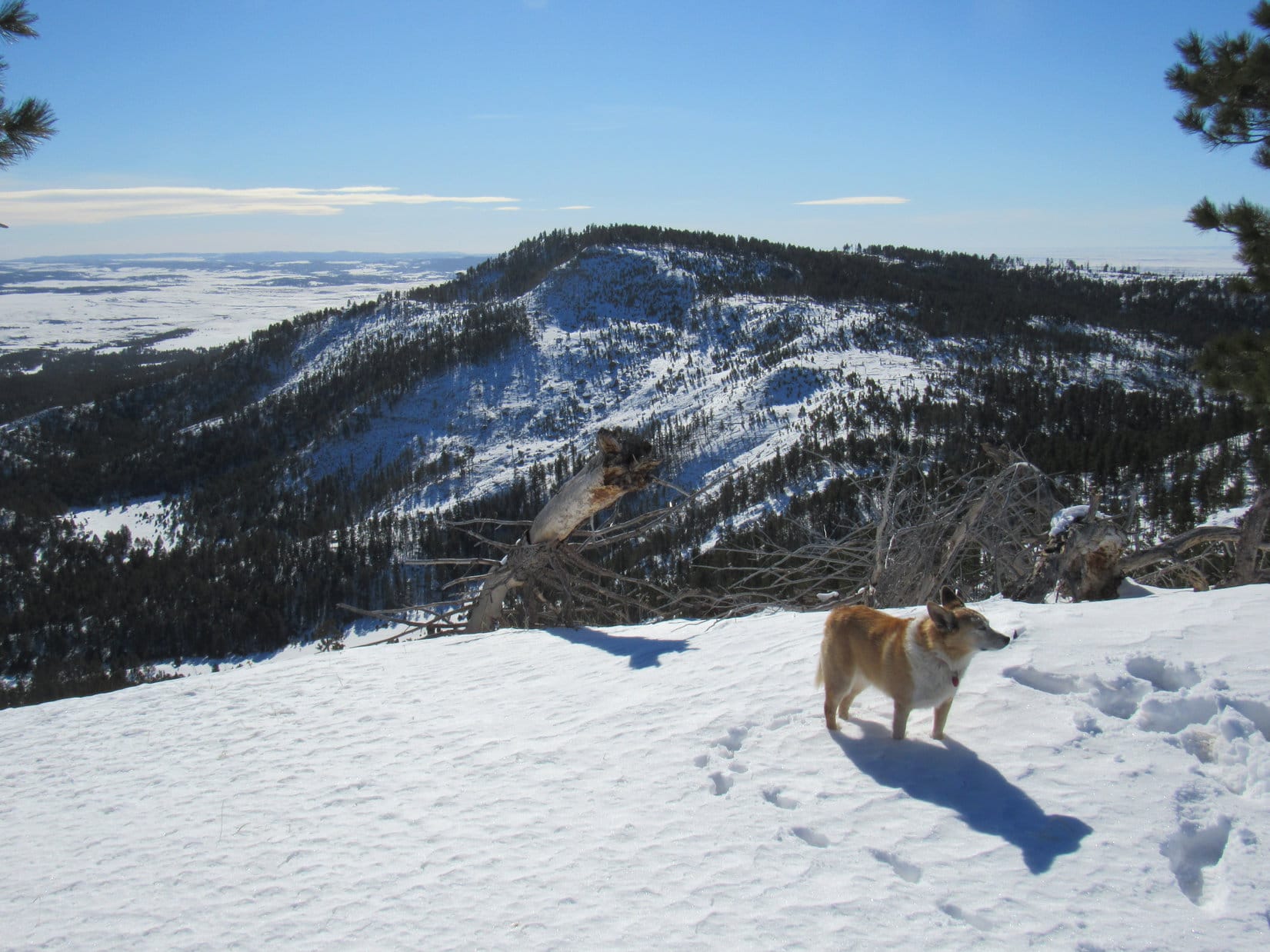
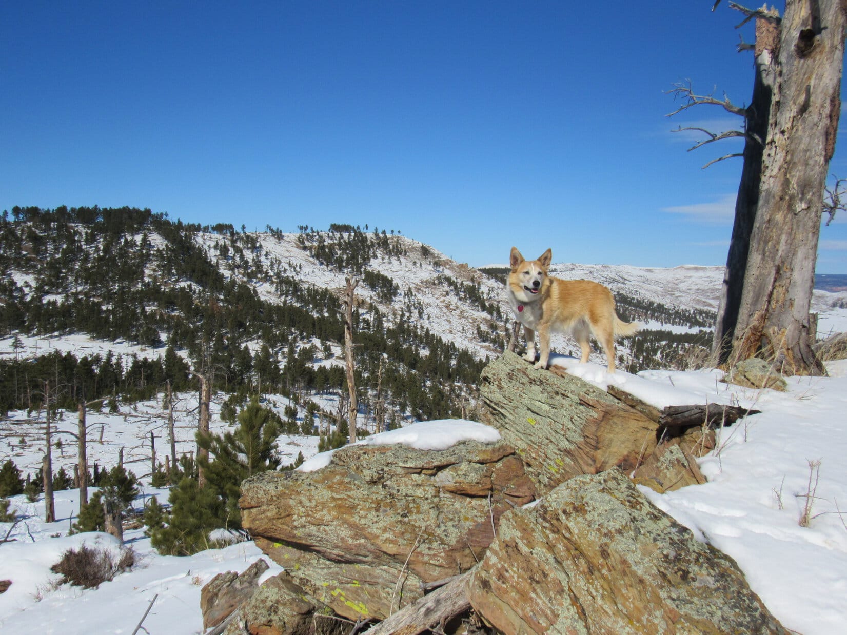
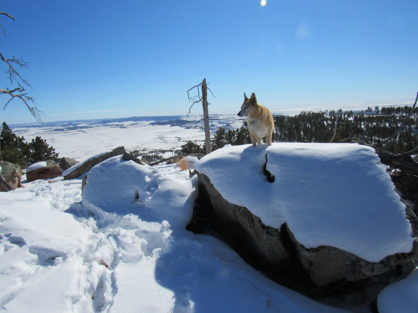
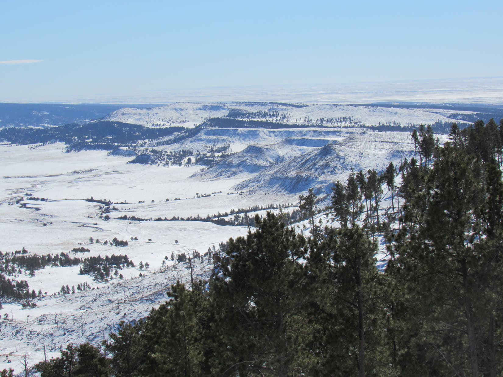
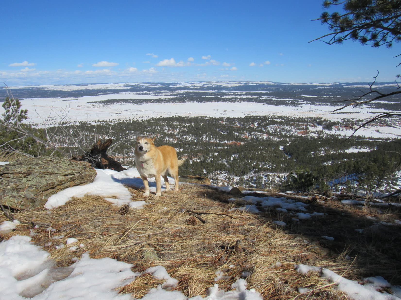
Lupe didn’t have to go very far S to reach an open region where all the trees were dead.  For a rocky, wind-swept stretch hundreds of feet long, she again had big views into Wyoming.  Continuing S, Loop regained the protection of a live forest.  She had a final look back at the moderately higher true summit before turning SW into the trees.

Last look back at the true summit (L of Center) while exploring Peak 5500’s S ridge. Photo looks N.
Getting close to the S end. Photo looks SW.

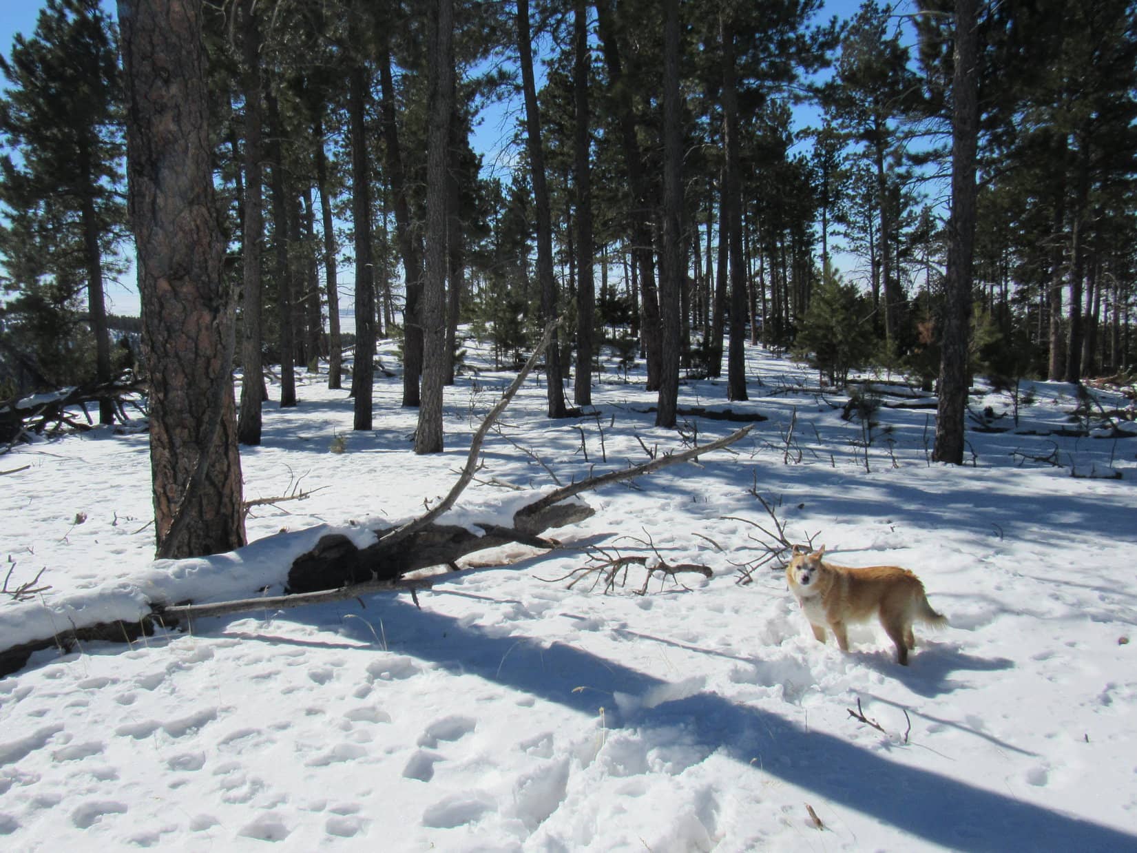
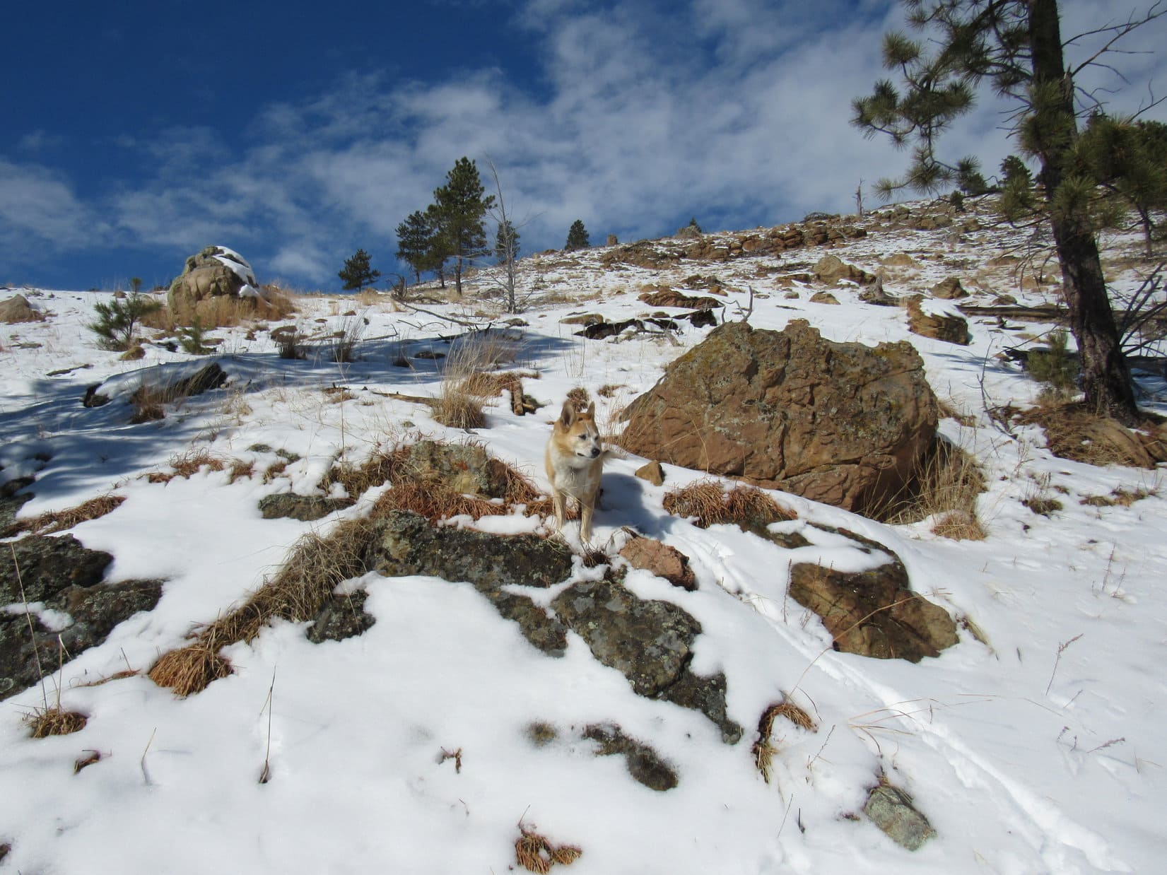
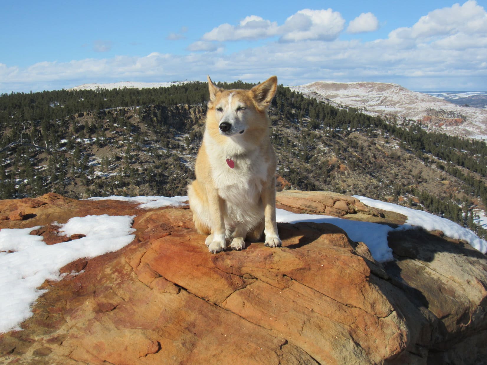
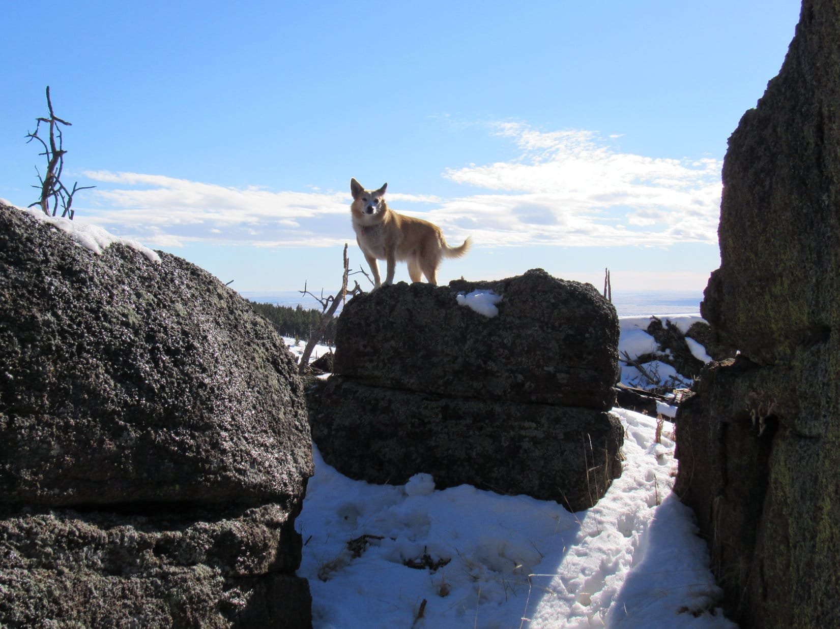
Where Peak 5500’s S ridge really start to drop off, the forest gave way to more open territory again.  With Wyoming less than 0.25 mile away, Lupe got up on a rock formation with a panoramic view.

A grand view of Wyoming! Photo looks SSW.

Loop continued SW down the slope a little way.  Easy enough, but what the American Dingo really needed to do was to get down to the saddle leading to Wildcat Peak.  With snow still melting on Peak 5500’s SE face, it was just steep and slick enough to be a bit of a challenge for SPHP.

Wildcat Peak (Center) from where Lupe started down into the valley. Photo looks SE.

A slow, cautious descent went fine.  Lupe got down to where the terrain leveled out somewhat below and SW of the saddle.  Didn’t take her long to get up to it.  A big clearing at the saddle was full of deep snow.

Heading down Peak 5500’s SE face. Photo looks NNW.
At the saddle between Peak 5500 and Wildcat Peak. Photo looks NE.

The trek up Wildcat Peak was reminiscent of the one up Peak 5500.  A bit steeper on average, but the American Dingo was again climbing SE near the E edge of a long ridge.  Still plenty of wildlife tracks in the snow, but no human ones here.  The fabled Bighorn sheep again disappointed by failing to put in an appearance.

Heading up Wildcat Peak (Center). Fairly steep along in here. Photo looks SE.
Following a wildlife highway partway up on easier terrain. Photo looks SE.

As Lupe regained elevation, Elk Benchmark (5,669 ft.) came into sight again, along with a steadily improving view of Peak 5500.

Peak 5500 (L) and Elk Benchmark (R). Photo looks N.
Not far from the top of Wildcat Peak now. Peak 5500 (L) and Elk Benchmark (R). Photo looks N.

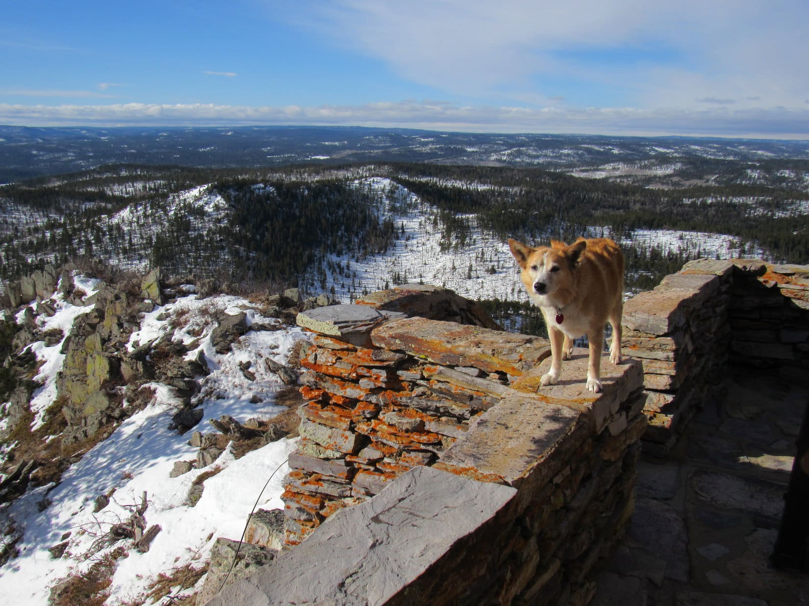
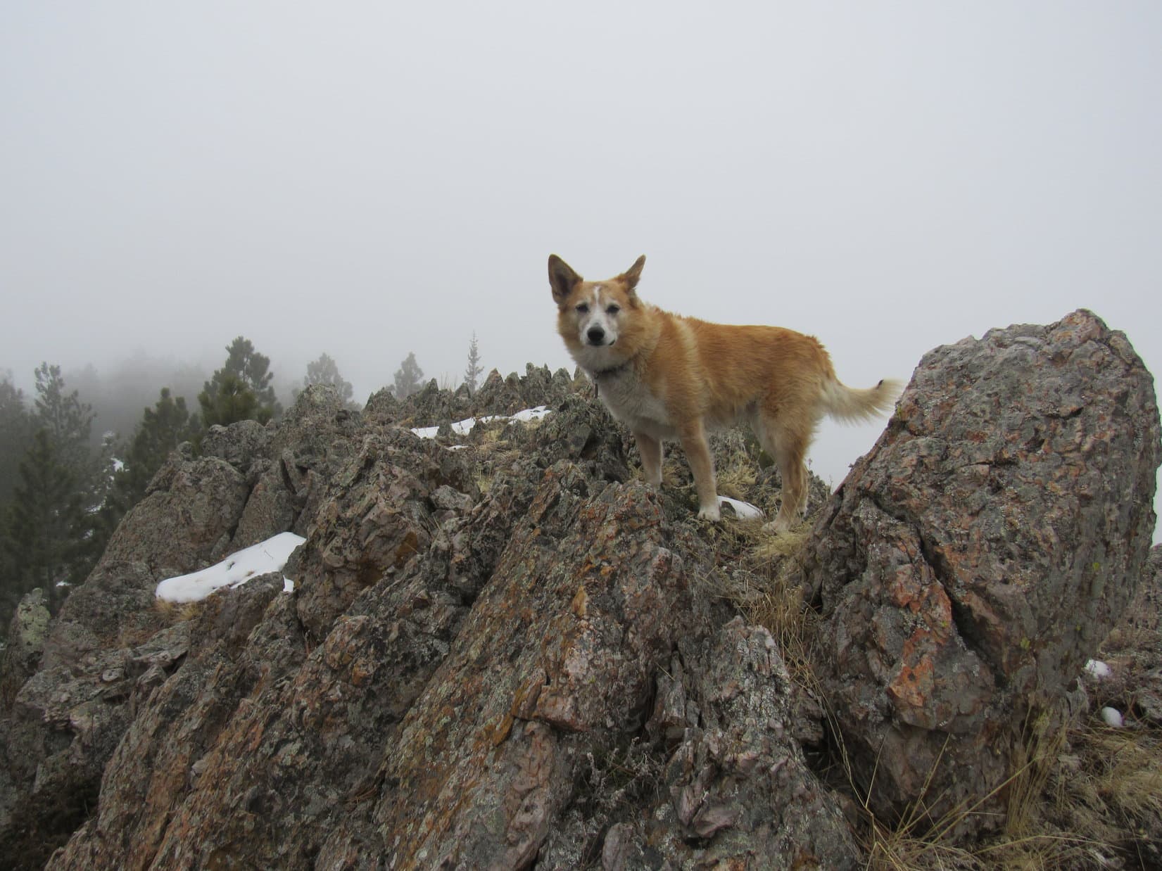
Wildcat Peak (5,500 ft.) had definite true summit, a huge rock at the NW end of a summit ridge several hundred feet long.  Many boulders that weren’t much lower were strung out along the entire length of this ridge, but there was no denying that the one at the NW end was higher than any other.

Loop near Wildcat Peak’s true summit boulder (L). Photo looks NE.

Not a wildcat in sight, SPHP!

Nope.  But then why should there be, Looper?  If I remember right, last time you were here you proclaimed this mountain to be American Dingo Peak, didn’t you?  “Bring it on, Wildcats!” and all that sort of thing.

Oh, that’s right, I did!  Kind of forgot about that.  Can’t even sniff any sign of a wildcat now.

No wildcat prints in the snow, either.  Guess you scared ’em all off.  They probably figured you’d be back every now and then to defend American Dingo Peak against all comers.

That must be it!  I sort of thought wildcats might still sneak up here now and then, but maybe wildcats know about Carolina Dogs’ reputation for ferocity?

Makes sense to me, Loopster.  Certainly explains the current dearth of wildcats.  The poor wildcats are terrified to get anywhere near this joint.

The summit boulder was too tall for Lupe to be able to get up onto it by herself.  SPHP wasn’t about to lift her way up there, either, when it was all slick with snow on top.  No sense in risking a fall.

Instead, both Loop and SPHP got up on the highest rock next to it.  As Loopster’s personal representative, SPHP reached up and tapped the top of the summit boulder.  Success!  Good enough for Dingo work, anyway!

At the true summit, or as close to it as Lupe got. Photo looks NNW.
Wildcat Peak or American Dingo Peak – take your pick!

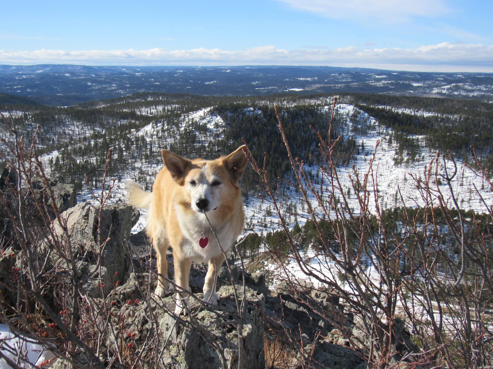
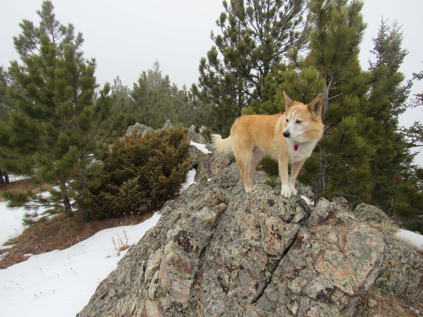
Wildcat Peak’s mostly forested summit region sloped away to the SW, but toward the SE end of the upper ridge there was a clearing with big views to the S.  Leaving the true summit, Lupe headed that way.

Heading for the SE end of Wildcat Peak’s summit ridge. Photo looks SE.
On a big rock near the SE end. Photo looks SSE.
Looking back along the summit ridge. Photo looks NW.

Although it was still quite cool and windy, the snow had partially melted off some of the big rocks near the SE end of the ridge.  Choosing a rock with a reasonably big dry spot, SPHP sat down.  Lupe snuggled close, and was soon curled up on SPHP’s lap, since solid rock ranks distressingly low on the Dingo comfort scale.

Break time!  Taste of the Wild, a chocolate coconut bar, and an apple – the usual fare.  It all disappeared while contemplating the dazzling white scene to the S.  A huge expanse was in sight, but none of it was higher than Wildcat Peak where Lupe was now.

That wasn’t quite true.  Barely detectable way off on the far SW horizon, shimmered a faint white triangle.  Might even have been a cloud, except that the triangle never moved or changed.  SPHP was almost certain it was actually the top of Laramie Peak (10,272 ft.).

Much closer, 5 miles SSE, were several peaks Lupe had visited nearly 5 years ago.  Sullivan Peak (4,967 ft.) and Twin Buttes (4,949 ft.) were both long white ridges, the highest points in that region.  Red Point (4,680 ft.) was little more than a tiny, heavily-forested, dark green hill.  Nothing red about it!

Looking SSE from Wildcat Peak.
The 2 most distant white ridges are Sullivan Peak (L of Center) and Twin Buttes (R). The forested hill (L) is Red Point. Photo looks SSE with help from the telephoto lens.
Looking down Wildcat Peak’s S slope. Photo looks S.
Looking SE.

Oh, it’s good to be back on American Dingo Peak, isn’t it, SPHP?

Certainly is, Loop!  You going to let the wildcats reclaim their mountain now that you’ve visited it twice?

That’s getting a little radical, SPHP!  Maybe we Dingoes can just share it with them?  Wouldn’t really mind if some wildcats want to come prowling through here now and then.  I actually like cats, you know!

Of course!  Cats are cool.  And wildcats are super cool!

Brisk, snow-blindingly brilliant, blue sky minutes drifted away one by one.  Really was good to be here again.  All too soon, it was time for the American Dingo to start back.

An hour after Lupe first reached the top of Wildcat Peak, she passed by the true summit boulder again.  Before leaving for good, Loop ventured briefly out to the E edge of the mountain a little NE of the summit.

Everything off to the E looked pretty flat, but it was all a beautiful mix of green forests and white prairies beneath the wild blue sky.  Banks of red dirt added a few little splotches of color.  A long way to anything higher than Wildcat Peak.

Sadly, time to head back. Photo looks NW.
Near the true summit again. Photo looks E.
Looking NE.
Leaving Wildcat Peak. Peak 5500 (L) and Elk Benchmark (R). Photo looks N.

Lupe’s return varied only slightly from the way she’d come up.  Down at the saddle leading to Peak 5500, the Carolina Dog simply headed straight up the SE slope.  Steep, but no worse than it had been farther W.  Once back up on Peak 5500’s S ridge, Loop headed N.

Back on Peak 5500’s S ridge. Photo looks NNE.

Hey, SPHP!  I’ve been thinking.

Dat so?  What about?  Do tell!

This is Peak 5500, right?

Yup.

No other name for it?

Not that I know of, Loop.

Well, then!  If the wildcats want their peak back, maybe Peak 5500 can be American Dingo Peak instead?  That way everyone’s happy!  The giant deers have their Elk Benchmark, the wildcats have Wildcat Peak again, and we American Dingoes have our own mountain, too!  How do you like that idea, SPHP?

Mighty considerate of you, Loopster!  American Dingoes wouldn’t really lose much in the change, either.  Peak 5500 is just as high as Wildcat Peak.

American Dingo Peak is a much snazzier name than plain old Peak 5500, too, SPHP, and Wildcat Peak already had a good name!  It’s settled then!  Peak 5500 is the new American Dingo Peak!  The wildcats can have their mountain back.

OK, fine!  As far as we’re concerned, so it is!  Only one problem, Looper.

Problem?  What problem?

What happens when the Bighorn sheep want their own mountain?

I’m not a magician, SPHP!  You snooze, you lose!  I’m claiming Peak 5500 for the American Dingoes.  The sheep can have Bighorn Sheep Pass.  After all, that’s where they put their sign!

Back at Peak 5500’s summit. (aka the new American Dingo Peak!) Photo looks N.

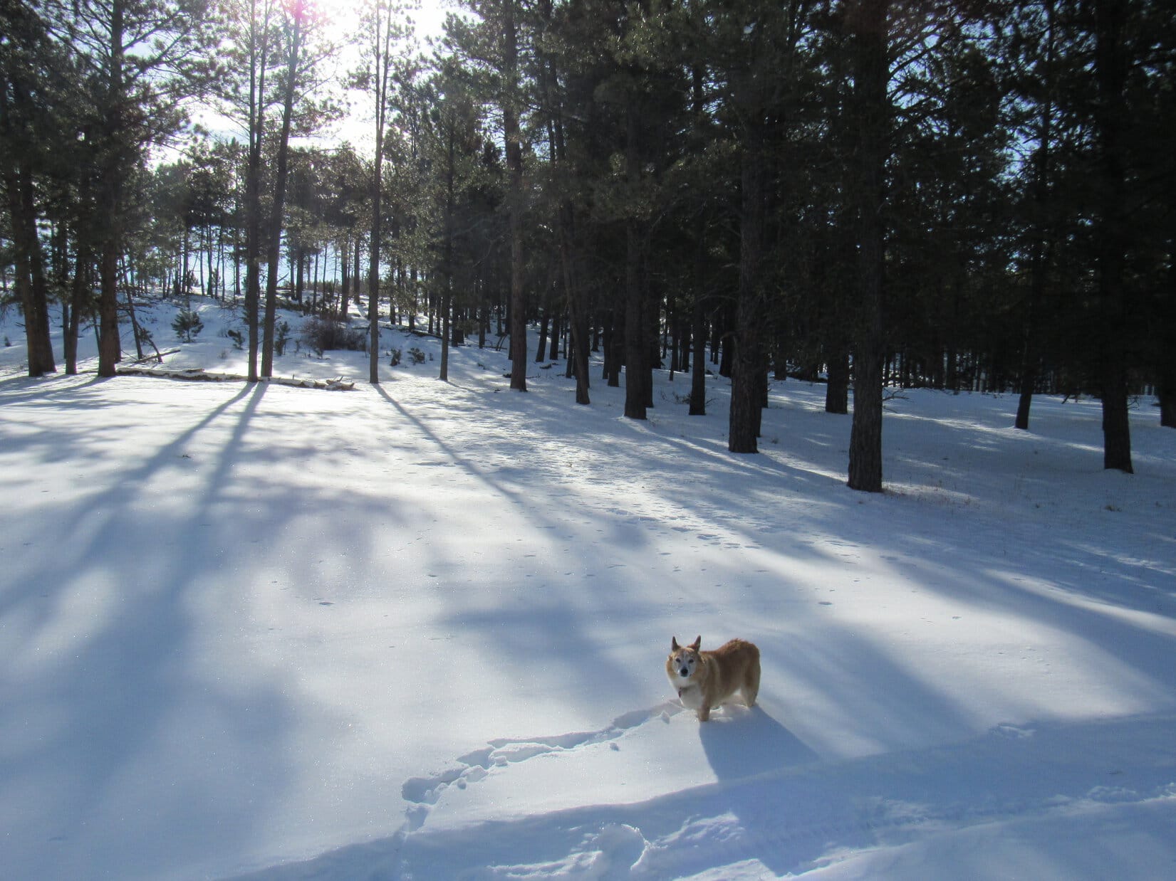
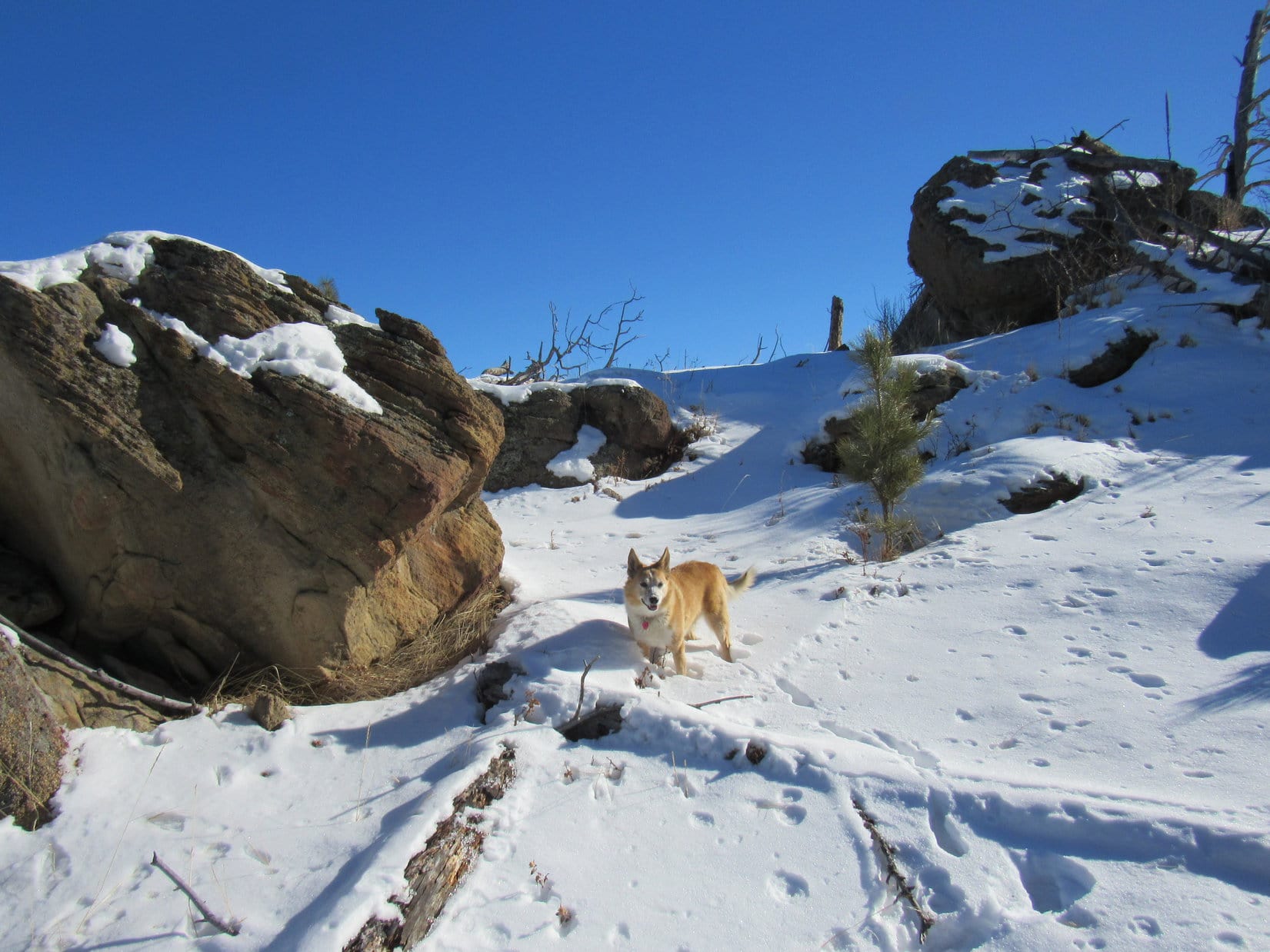
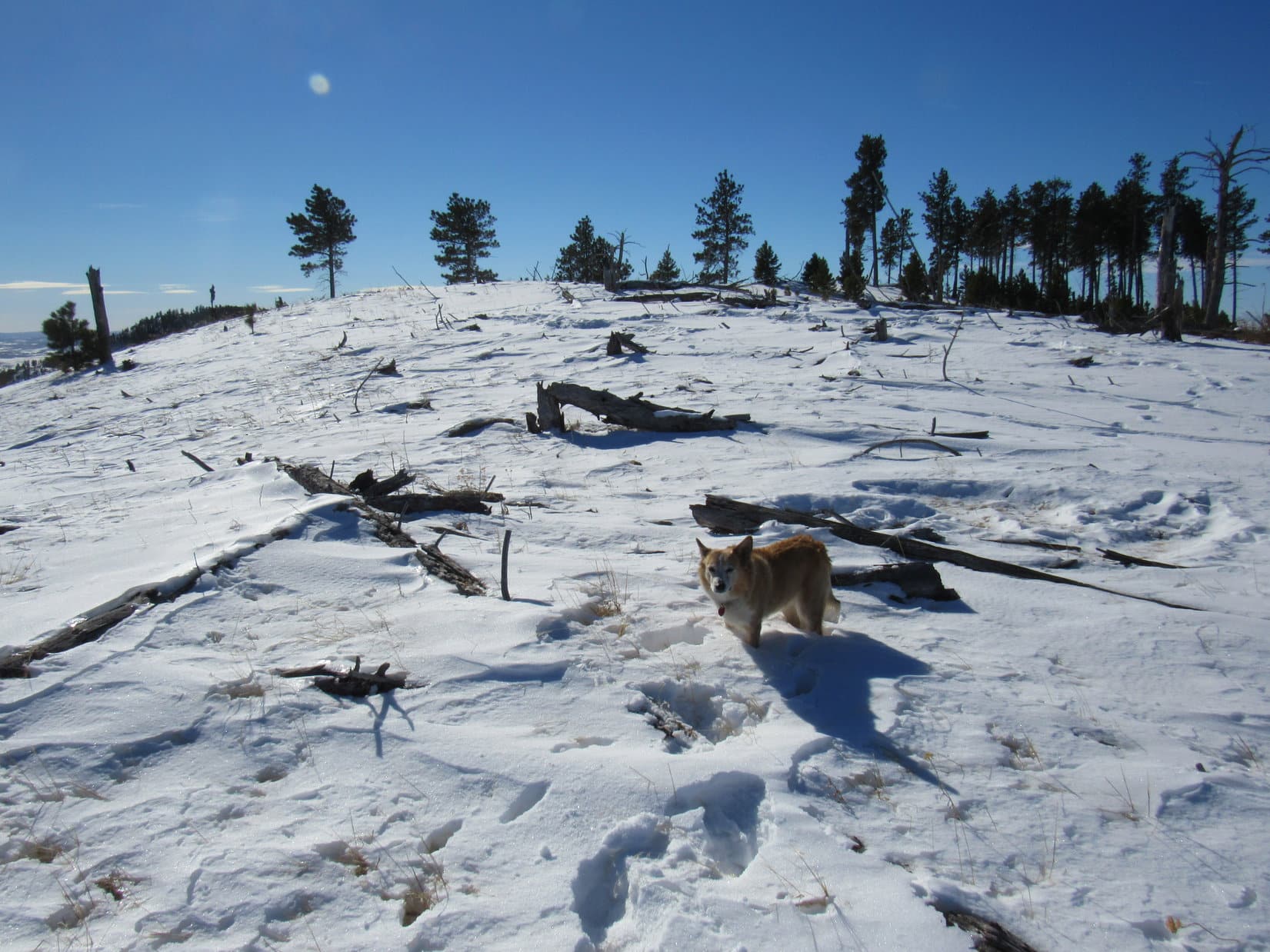
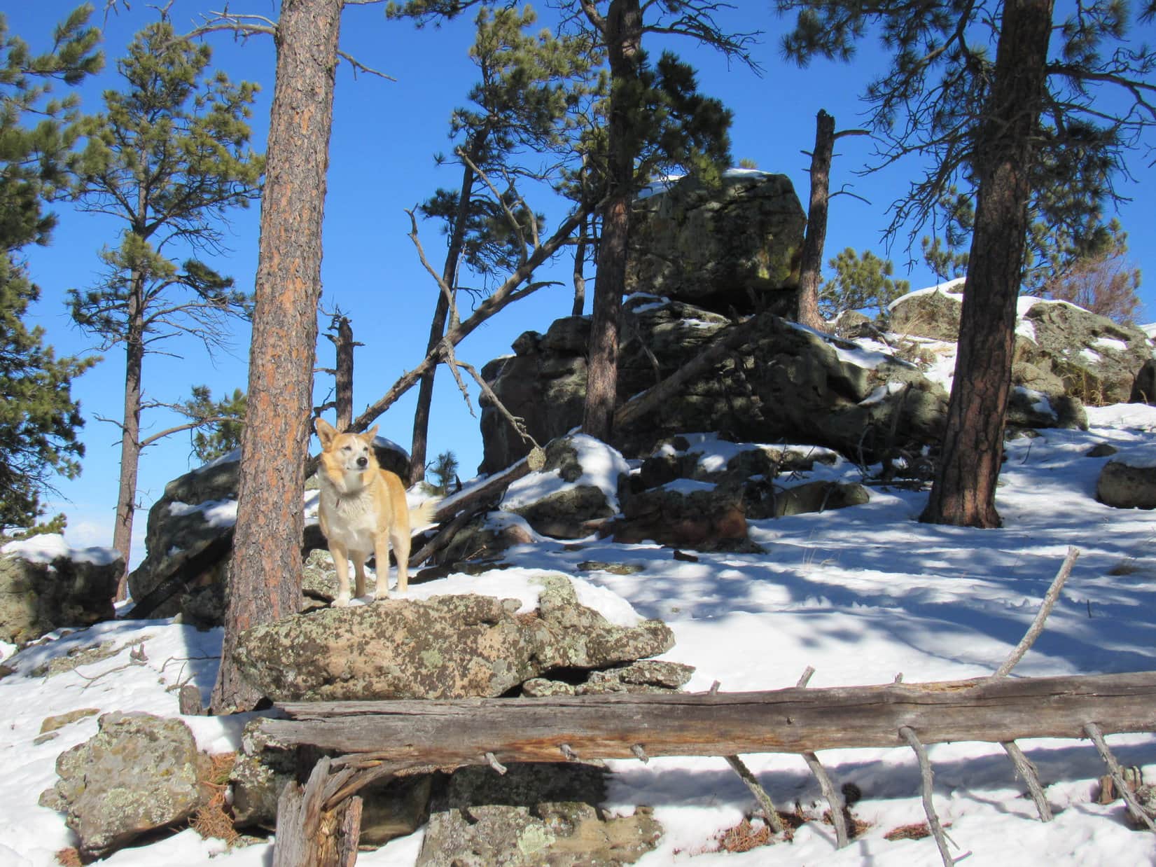
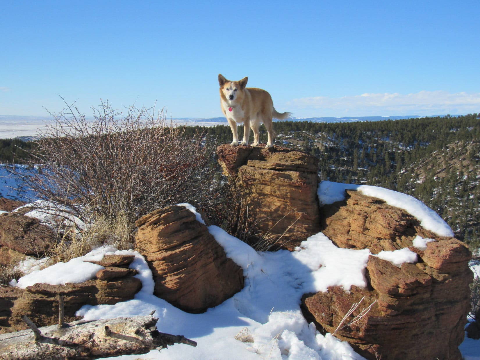
With the issue resolved, it was – Onward!  Puppy, ho!  On the way down the NW ridge leading to newly proclaimed Bighorn Sheep Pass, Lupe stopped briefly at some of the big rocks to enjoy the views.

Second time at this rock. Not as snowy as it had been earlier. Photo looks N.
On a spiffy Dingo display pedestal. Photo looks NW.
A nice look at the lower end of the NW ridge. Most of it is actually in Wyoming, but Lupe is still in South Dakota at this point. Photo looks W.

The Carolina Dog was almost down to Bighorn Sheep Pass, when all of a sudden there was an enchanting sound in the forest.  Lupe dashed away, snow flying behind her!  SPHP followed the Dingo’s shrill yipping to a squirrel tree.

Pleading with the squirrel to come down and play.

Happy times!  Only squirrel of the whole day, but one was better than none.  Every bit as good as a Bighorn sheep or a wildcat as far as Lupe was concerned.  Joy rang through the forest.  Once satisfied that she had given the squirrel what for, Lupe explored some big rocks to the W.

Exploring among rocks just inside Wyoming. Photo looks SW.

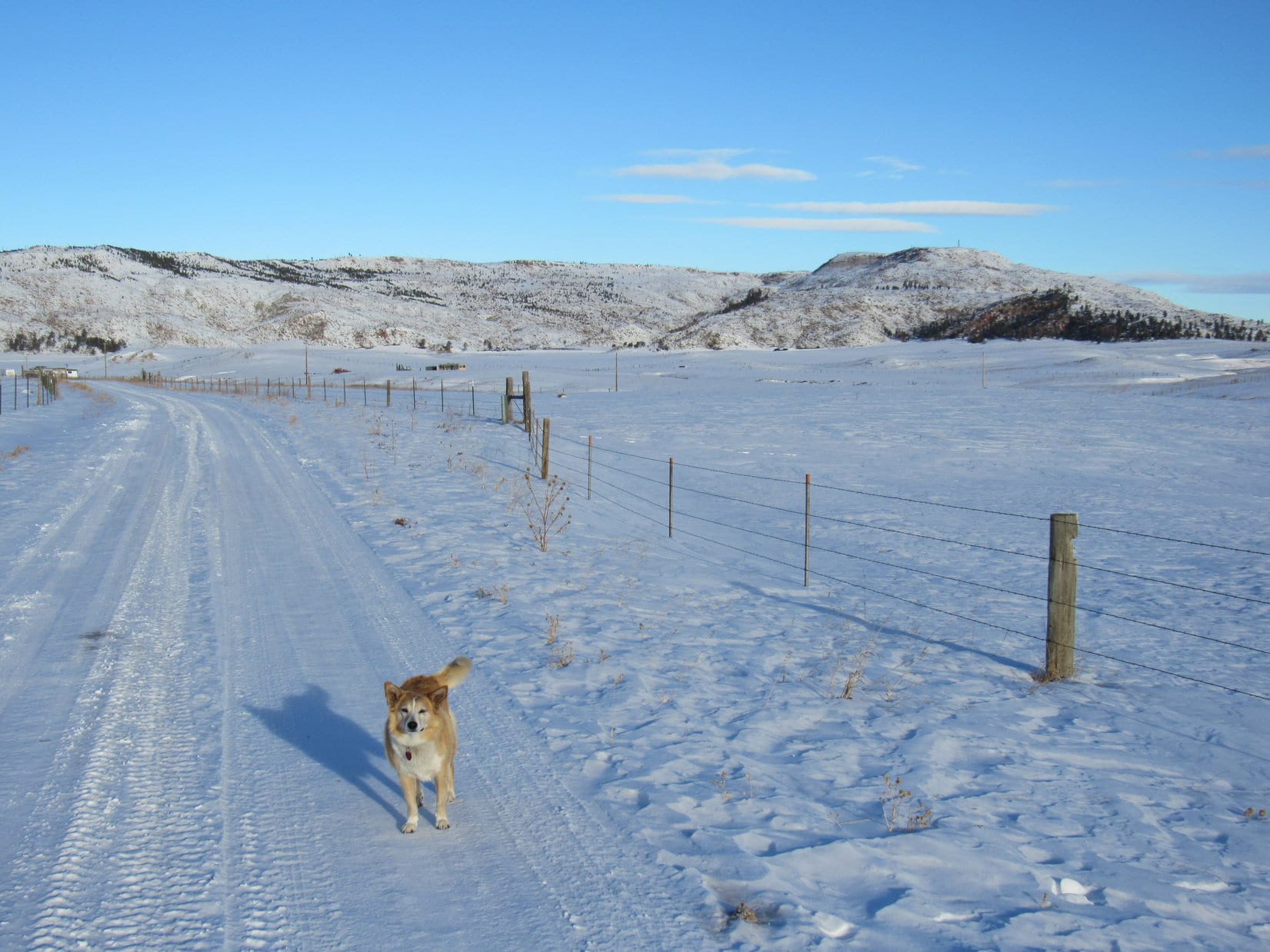
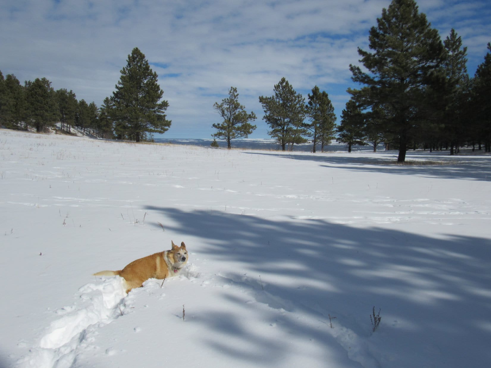
Then it was on down to Bighorn Sheep Pass, and a lovely late afternoon stroll on Elk Mountain Road back to the G6.  (End 4:18 PM, 41ºF)

Wildcat Peak from American Dingo Peak, Black Hills of South Dakota, 2-22-21

Links:

Next Black Hills Expedition                      Prior Black Hills Expedition

Black Hills, SD Expedition No. 168 – Wildcat Peak, Fanny Peak & Summit Ridge (4-21-16)

Want more Lupe adventures?  Check out Lupe’s Black Hills, SD & WY Expeditions Adventure Index, Master Adventure Index, or subscribe free to new Lupe adventures!

Black Hills, SD Expedition No. 265 – Custer Peak & Peak 6600 (2-3-21)

8:28 AM, 41ºF, start of USFS Road No. 216.1, 0.5 mile SE of Custer Peak – Bright and breezy when Lupe hopped out of the G6.  Such a long time since she’d been here!  Snow!  Only yesterday, deadfall had been her bane on the way to Peak 5316 in the southern Black Hills.  Snow was much more to the American Dingo’s liking.

Cool, clear, and breezy at the start of USFS Road No. 216.1. Photo looks WSW.

To what do I owe this great honor, SPHP?

What honor is that, Loop?

2 Black Hills Expeditions in a row.  Been forever since we’ve done that!

Ahh!  Easily explained.  This is the last warm day before a long cold snap moves in.  We’ve been spoiled!  Real winter is on the way.  Subzero every night!  A few more days until it gets that bad, but the deterioration is supposed to start this evening with a chilly wind out of the NW.  Sort of surprised at how breezy it is already.

Well, whatever the reason, I’m glad we’re here!  C’mon, SPHP, I’ll race you to the top!

Heh.  Might as well chalk another one up for the Carolina Dog right now.  SPHP started the trudge WNW, snow crunching underpaw.

C’mon, slowpoke! Loopster with her usual early lead. Photo looks WNW.

This was familiar territory.  Looper’s 7th ascent of Custer Peak, in fact.  Want the best views in the N central Black Hills?  The under 2 mile road trek up to the fire lookout tower on Custer Peak (6,804 ft.) is where to go.  Dominant views of the entire region!  Judging by how breezy it was down here, though, might be a gale up there today.

For nearly a mile, USFS Road No. 216.1 gradually steepened as it curved NW on the way to the saddle between Peak 6600 and Custer Peak.  The E face of Peak 6600 came into sight less than halfway there.  It wasn’t until Lupe got to the saddle region that she had her first really good look at Custer Peak.

Peak 6600 comes into view early on. Photo looks WNW.
Custer Peak from a knoll near the saddle leading to Peak 6600. Photo looks ENE.

USFS Road No. 216.1 curved sharply SSE shortly before Lupe got to the saddle.  However, No. 216.2A continued right on up to the saddle, where SPHP was surprised to see a new outhouse.  New in the 4.5 years since Lupe had last been here, that is.  At the saddle, No. 216.2A turned toward Custer Peak.  The road would go nearly all the way to the top.

At SPHP’s insistence, Lupe paused early on the No. 216.2A trek for a good look at the NE face of Peak 6600.

Peak 6600 from USFS Road No. 216.2A. Photo looks SW.

Didn’t take Loopster long to get to where No. 216.2A approached the base of Custer Peak.  From here, the road climbed steadily, ultimately completing a clockwise circuit of the entire mountain.  The views were fabulous where unobstructed, as they were most of the way up.

Terry Peak (7,064 ft.) to the NW was the most impressive sight, but the Carolina Dog was happier on the E and S sides of the mountain, where she was protected from the gusty wind which continually strengthened as she gained elevation.

Approaching Custer Peak on USFS Road No. 216.2A. Photo looks NE.
On the much calmer E side of the mountain. Photo looks N.
Getting close to the end of the road. Terry Peak (L). Photo looks NW.

No. 216.2A dead-ended 100 feet below the summit.  Exposed to the wind, Lupe did not enjoy the path that switchbacked the rest of the way to the top.  SPHP paused to examine a new plaque near the fire lookout tower, but the Carolina Dog was anxious to get out of the breeze.

Start of the short path that switchbacks to the summit. Photo looks SSW.
The new information plaque near the lookout tower.
Come on, SPHP! Let’s get out of the wind!

The wind wasn’t all that terrible, but SPHP had to agree that life was more pleasant on the sunny E side of the lookout tower.  To Loopster’s joy, this time SPHP hadn’t forgotten to bring the chocolate coconut bars.  She curled up on SPHP’s lap, inhaling her share, then munched some Taste of the Wild.

After a pleasant 10 or 15 minutes peacefully enjoying the views, it was time to brave the wind and take a few photos between major gusts.

The sunny E side of the lookout tower, where Loop and SPHP hung out for a bit. Photo looks W.
Peak 6380 (L) in the foreground, and Bear Butte (4,422 ft.) (far L) in the distance. Photo looks ENE.

Terry Peak (7,064 ft.), framed between Deer Mountain (6,652 ft.) and Bald Mountain (6,617 ft.), was the big view, but Lupe could also see all the way S to Black Elk Peak (7,231 ft.), and W to the limestone plateau country.

Deer Mountain (L), Terry Peak (Center), and Bald Mountain (R). Photo looks NW.
Peak 6600 (L of Center) in the foreground. Photo looks SW.

One or two laps around the lookout tower was about all the American Dingo was willing to put up with.  She didn’t get any respite from the wind yet, though.  After descending the tower steps, SPHP searched for the Custer survey benchmarks near the N side of the foundation.

Benchmark No. 2 near the NW corner of the lookout tower points E toward another marker 10 feet away.
“Custer” survey benchmark dated 1925.

Lupe’s Custer Peak tour concluded with a look at the views from a short ridge SW of the tower.

Black Elk Peak (far L) on the horizon. Photo looks S.
Looking SSW.
Peak 6600 (Center) in the foreground. Photo looks SW.

40 minutes!  After a 4.5+ year absence, hardly seemed enough to do justice to Custer Peak, but the wind wouldn’t let up, and the Carolina Dog was anxious to go.  Plenty more to do today, anyway, down where the breeze wouldn’t be so stiff.  Lupe started her descent leaving the summit as she’d found it, bathed in sunshine and battered by the wind.

About to head down. Photo looks NE.

Once back to the road, SPHP paused briefly for another look at Peak 6600, then it was on down around to the leeward side of the mountain.

Peak 6600 (Center) in the foreground. Photo looks SW.

You sure seem interested in Peak 6600 today, SPHP!

That’s because that’s where we’re going next!

We are?  I thought we might be done with the wind and all.

The wind’s not that bad, Loop, especially down below.  More adventures in store!  We’re going to climb Peak 6600, since it’s got such a fabulous view of Custer Peak, then head NW a few miles to climb Peak 6480.

Peak 6480?

Yes, another 300+ foot prominence peak from Lists of John.  Sort of been thinking maybe we ought to start working the 300+ foot prominence lists this year, since you’ve been to just about every named peak in the Black Hills that we can legally climb.  Quite a few of them more than once.  Gives us new places to explore!

I’m all for exploring, SPHP!  Sounds good!

By the time Lupe got back around to the windy N side of Custer Peak, a line of gray clouds could be seen approaching from the NW.

Wonder if that’s the lead edge of the front coming in, Loop?  Didn’t think it was supposed to get here until this evening.  Hope the wind doesn’t get too much stronger.

Started out OK, but sure hasn’t warmed up any today, either, SPHP.

Reaching the saddle leading to Peak 6600, Lupe left the road, plunging right into the dense, snowy forest.  A 260 foot climb almost due S would get her up to the 6600 foot contour at the NW end of the summit ridge.

In the snowy forest, beginning the trek up Peak 6600.

As expected, the route steadily steepened.  Some rocks, some deadfall, but mostly just trees and snow.  Lupe had done this once before, nearly 6 years ago, and been rewarded with a fantastic view of Custer Peak.  Best one possible, in fact, since Peak 6600 was the easily the highest point anywhere close to Custer Peak, and the summit ridge had a nice rocky spot where an unobstructed view could be obtained.

Any idea how much deeper this snow is going to get, SPHP?

Lupe wasn’t far from the top when the forest darkened.  Overhead, the sky was now a soft gray.  What happened to all the sunshine?  Loop was right!  Felt colder out, too.

C’mon, Looper!  The front must be here early!  Let’s get up to where we can get a couple of nice shots of Custer Peak before the weather deteriorates any further.

Didn’t take long.  A few more minutes, and Loopster was there, standing in the cold wind on the rocky viewpoint at the NW end of Peak 6600.

An hour had gone by since Lupe had left Custer Peak.  What a change!  Not only had all hint of sunshine utterly vanished, but a massive soft gray cloud hung low over everything.  Only on the far horizon did a brighter line indicate the already distant edge of the monstrous cloud.

The rocky viewpoint at the NW end of Peak 6600’s summit ridge. Photo looks S.

Custer Peak was still in view, except for the top 50 or 100 feet, where fog was now streaming by.  All in shadow now, instead of lovely sunshine, but nothing to be done about that.

Be ready, Loopster!  As soon as the fog clears from the summit, we’ll grab a quick photo of Custer Peak before things get any worse.

Bad decision!  Should have snapped one right away.  The Carolina Dog was ready, but the summit didn’t clear even for an instant.  Instead, the cloud suddenly swallowed the entire mountain.  Moments later, even Black Elk Peak (7,231 ft.), far to the S, was gone.

Black Elk Peak (Center) dimly on the horizon, moments before it vanished, too. Photo looks SSE.

Oh, come on!  Really?  It’ll clear, if we have a bit of patience, Loop.  Got to be a little break before too long.

Lupe seemed unconvinced, but was willing to curl up on SPHP’s lap for the warmth, if nothing else.  Another chocolate coconut bar didn’t hurt a thing, either.

No break in the cloud.  Peak 6600 became an island in a gray oblivion, the only place left standing in the whole world.  15 minutes ticked away.  Tiny snowflakes filled the air.

OooooK!  Even I can take a hint, if ya knock me over the head with a 2 x 4!  Custer Peak photo isn’t happening, Loop.  Wha’dya say we go in search of the true summit of Peak 6600?  After that we can see about Peak 6480.

Best idea you’ve had in the last hour, SPHP!  Let’s do it!

Final moments at the NW high point of Peak 6600. Photo looks N.

The summit ridge dipped a bit as Lupe traveled SE along it.  Pines and fog hid whatever was ahead until she was almost upon it.  After going several hundred feet or more, a sizable rock formation appeared.  Possibly the true summit, although no telling in this fog.

Circling around to the SE, Loop found a spot where she could scramble to the top, which proved to be kind of a weird jagged area.

At the jagged-topped true summit candidate. Photo looks N.

Nope!  Not the true summit.  Continuing SE only a little farther, Lupe went up a slope to definitely higher terrain.  The American Dingo was almost at the SE end of the summit ridge.  Congratulations were in order!  SPHP was almost certain the elevated line of rock Lupe had reached was the true summit of Peak 6600.

True summit of Peak 6600. Photo looks N.

There didn’t seem to be any reason to linger on Peak 6600, especially if Loop still hoped to get to Peak 6480 when the forecast was for steadily deteriorating conditions.  A couple of minutes at the top, and Lupe was on her way down the S ridge.

Starting down Peak 6600’s S ridge. Photo looks S.

Not too far to USFS Road No. 216.1!  The descent went well, and in less than 0.25 mile, Lupe picked the road up again a little SE of a high point.  (Point 6427 on the topo map)  Looper headed for it, reaching an open gate at the top in a thin fog and light snow.

At Point 6427 on USFS Road No. 216.1. Photo looks NW.

Continuing NW on the snowy road, Lupe soon came to an intersection at a low spot.  A map was posted here.  SPHP took a look.

Snowmobile trail map posted along USFS Road No. 216.1.

What’s it say, SPHP?

Nothing helpful to us, Looper.  It’s a large scale snowmobile trail map.

The way things are going, we’ll be needing a snowmobile before this is over.

That had a ring of truth to it.  SPHP looked down at the American Dingo standing patiently on the snowy road, earnestly returning SPHP’s gaze.  All around, the forest was a mystery of fog and tiny swirling flakes.  Treetops swayed in the wind, releasing occasional cascades of fresh accumulations.  Snowing harder.  Even Loop was starting to turn white.

Not really that bad out.  Barely cold enough for snow, but the temp was supposed to drop, the winds increase.  Would it even be possible to find Peak 6480 in the fog?  Suppose Lupe did, what then?  Not going to see a thing.

What do you think, Loop?

About?

Call it, or go on?  We can come back, and do Peak 6480 another time.

Awesome out here in the snowy woods, isn’t it, SPHP?

Absolutely!  But possibly pointless, too.  Not sure it’s worth trying to go all the way to Peak 6480.  Might not recognize it, even if we find it.

Whatever you want to do, SPHP!  You know I’ll be there!

Truer words never spoken.  Not spoken now either, only conveyed by those completely trusting eyes.  No sense in letting a friend like that catch pneumonia!

So, Expedition No. 265 came to an early end.  Part success, part failure.  1.5 miles back to the G6.  A beautiful time in fog and snow, enjoying winter’s silence and solitude together.  (End 1:07 PM, 31ºF)

USFS Road No. 216.1A near Peak 6600, Black Hills of South Dakota 2-3-21

Links:

Next Black Hills Expedition                        Prior Black Hills Expedition

Want more Lupe adventures?  Check out Lupe’s Black Hills, SD & WY Expeditions Adventure Index, Master Adventure Index, or subscribe free to new Lupe adventures!