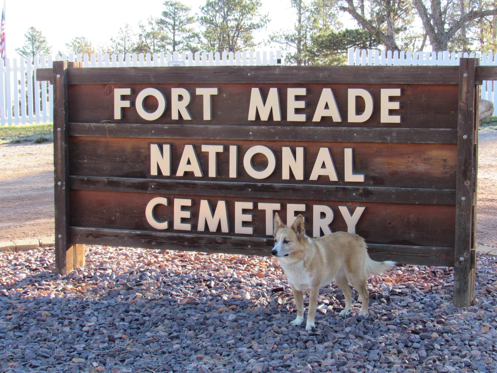
Start – Fort Meade National Cemetery near Sturgis, 8:46 AM, 35°F
Lupe arrived at Fort Meade National Cemetery the day after Veteran’s Day. The cemetery was officially closed this time of year. Loop wouldn’t have gone in even if it wasn’t. Some might consider an American Dingo prancing around a cemetery disrespectful, even though she wouldn’t have done any harm.
Lupe arrived at the Fort Meade National Cemetery the day after Veteran’s day on a bright, crisp morning.
Lupe was actually here to visit a few peaks near Sturgis she’d never been to before. Once SPHP was ready, she crossed the road W of the cemetery, and started climbing along a ridgeline through a pine forest. She didn’t have far to go before reaching a broad meadow of tall grass.
W of Fort Meade Cemetery, Lupe reaches a meadow of tall grass near the start of her way up Peak 3950. Photo looks W.
In the meadow, Loop happened upon a dirt road that curved SW. She followed it higher back up into the forest. A huge dead tree had fallen over the road, blocking it completely. From the trunk of the dead tree, Lupe could see Bear Butte(4,422 ft.) off to the NE rising dramatically from the surrounding prairie.
From the trunk of the dead tree, Lupe saw Bear Butte rising dramatically from the surrounding prairie. Photo looks NE.Bear Butte’s summit is the N end of Centennial Trail No. 89 which winds 111 miles through eastern portions of the Black Hills all the way to Wind Cave National Park.
The road climbed steadily through the forest. Before long, though, the terrain began to level out. The forest became more open and park-like, and the road curved NW.
Off to the SW, it looked like there might be views from the edge of the mountain. Lupe left the road to explore in that direction. Several deer fled as she approached the edge. Loop had a nice view of the valley S of Sturgis.
Lupe came to this nice view of the valley S of Sturgis. Photo looks SSW.
Peak3950 was Lupe’s destination. The summit was only 0.5 mile NW from here. Lupe traveled NW near the sharp SW edge of the mountain. At first, the terrain was level or rolling. The American Dingo had her choice of staying in the pine forest or out on another tall grass meadow, and did some of both. Bear Butte was still in view from the meadow.
On the way to the summit of Peak 3950, Lupe spent part of her time in this big tall grass meadow, from which she could still see Bear Butte. Photo looks NE.
In the meadow, Loop came upon the road again. She followed it NW back into the forest, gaining elevation at a moderate pace. Lupe stayed on the road until she was close to Peak 3950’s summit. The final part of the climb was an easy romp through the woods.
On the road again getting close to the top of Peak 3950. Photo looks NW.
Peak 3950’s summit area was large and relatively level. The highest part was near the N end. No single point stood out as the exact location of the true summit, but Lupe was satisfied. Climbing Peak3950 had been easy and fun.
Lupe at the top of Peak 3950. Climbing the mountain had been quick and easy. Photo looks SSE.On Peak 3950’s flat summit. Photo looks E.
At the top of Peak 3950, trees hid the views in most directions. However, along the edge of the steep W slope, Lupe found rock outcroppings from which she could see the town of Sturgis.
From rocks along the W rim, Lupe could see the town of Sturgis. Photo looks WNW.Sturgis, SD from Peak 3950. Photo looks NW.A look at the downtown area with a little help from the telephoto lens. Photo looks NW.Looking W.
Lupe could also see her next two peakbagging objectives. Oyster Mountain and Sly Hill were both in sight to the NW.
Lupe’s next peakbagging objectives were in view.Oyster Mountain(4,040 ft.) is the forested ridge on the L. SlyHill(3,920 ft.) is straight up from the blue water tank on the R. Photo looks NW.
Names, dates, and initials had been carved into the rocks Lupe was standing on. One rock S of the summit area even had a whole phrase carved into it.
Many names, dates, and initials were carved into rocks along the W edge of the mountain. Someone had gone to the trouble of carving the phrase “The fear of the Lord is to hate evil.” into this rock.
Lupe lingered on Peak 3950 for a little while, but didn’t stay terribly long. She still had more peakbagging to do. After sniffing around some and enjoying the views, it was time to head back to the G6.
On her way back down, Lupe returns to the upper tall grass meadow SE of Peak 3950’s summit. Photo looks SE.
Once Loop made it back to the G6 (10:41 AM), SPHP drove into Sturgis looking for a way to Oyster Mountain or Sly Hill. A mile NW of town, a road went N over a saddle on the ridge connecting the two mountains. A mile beyond the saddle, SPHP parked the G6 again (11:10 AM, 49°F).
Lupe got out ready to climb Oyster Mountain’s NE ridge. At first, she was in a mixed oak and pine forest, but she didn’t have far to go before reaching a meadow. Bear Butte was once again in view.
Lupe at the first meadow she came to on the way up Oyster Mountain. Photo looks SW.Bear Butte(4,422 ft.) from the lower slopes of Oyster Mountain’s NE ridge. Photo looks NE.
Just like on Peak 3950, Lupe found a dirt road in the meadow which took her higher and back into the forest. Loop followed this road SW most of the way up Oyster Mountain’s NE ridge. Sometimes she had glimpses of views along the way, but usually there were too many trees to see much of anything.
The road eventually reached a saddle. Loop would start losing elevation if she stayed on the road, so she left it. She headed W, still climbing steadily.
Before long, the Carolina Dog arrived at the top of a small hill. Maybe this was Oyster Mountain’s summit? SPHP wasn’t certain. The topo map had been forgotten in the G6.
Not long after leaving the dirt road, Lupe reached the top of this small hill. At the time, SPHP thought this might possibly be Oyster Mountain’s summit. Photo looks WSW.
Lupe continued W from the small hill, and soon reached a slightly higher hill. A ridge nearly the same height was in view to the SW across a small valley. The valley drained toward a depression to the W.
SPHP remembered the topo map had shown a depression close to Oyster Mountain’s true summit. Loop ought to be able to find the summit by crossing the valley, then following the ridge on the other side.
So that’s what she did. When Lupe made it up onto the ridge, she could see I-90 in the valley below on the other side.
After crossing the small valley, Lupe climbed up onto this ridge where she could see I-90 below. Photo looks SW.
Lupe followed the ridge WNW. The terrain was nearly level for a little way, but soon Loop saw slightly higher ground ahead. The summit had to be over there.
Oyster Mountain’s S slope from the ridgeline. The summit isn’t much farther ahead in the trees on the R. Photo looks WNW.
Shortly before reaching the top of Oyster Mountain(4,040 ft.), Loop came to a sparsely forested sunny hillside. Snow was visible on Terry Peak(7,064 ft.) on the far horizon. Closer by, Lupe had a nice view of heavily forested Crook Mountain(4,930 ft.).
Snow is visible on Terry Peak’s ski runs on the far horizon (L). Heavily forested Crook Mountain is in view on the R. I-90 is seen in the valley below. Photo looks SW.
Oyster Mountain’s summit proved to be a relatively narrow, 150 foot long, flat ridge. Forest blocked any views. Minor rock outcroppings that didn’t amount to much were on the S side near the far W end.
Lupe on top of Oyster Mountain(4,040 ft.). Photo looks ESE.Carolina Dogs are rarely seen on Oyster Mountain. However, the mountain’s odd and mysterious name was part of the allure that brought Lupe here. Oyster Mountain seems an unlikely name for a mountain in the Black Hills. Lupe was about as far from an ocean here as you can get in North America.Lupe goofing around trying to be silly and dramatic from the little rock outcroppings near the W end of the summit ridge. Photo looks E.
Loopster took her only Taste of the Wild break of the day up on Oyster Mountain. The shady summit ridge was a pleasant place. Traffic noise from I-90 only partially marred the sense of isolation.
On the way back to the G6, Lupe stopped by the sunny slope E of the summit again for a final look. She then left the ridgeline, cutting down to the depression in the small valley. The depression was bone dry now, but looked like a seasonal pond forms here during wet periods.
As she left Oyster Mountain, Loop swung back by this sunny slope E of the summit for a final look. Photo looks S.Lupe near the depression on Oyster Mountain. The depression was bone dry now, but looked like a seasonal pond must form here during wet periods. Photo looks W.
After leaving the depression, the American Dingo retraced her route up all the rest of the way down. Lupe had fun running and sniffing around, but it was only 1.25 miles back to the G6. It didn’t take her all that long to get there. (1:09 PM)
Loop still had one more peak to climb near Sturgis. SPHP drove to the saddle between Oyster Mountain and Sly Hill, parking near a fence surrounding a “rubble site” (1:16 PM, 52°F). A sign nearby indicated Dingoes might not be entirely welcome on Sly Hill, the top of which was only 0.5 mile to the SE. Hmmm.
American Dingoes can be quite foxy, and the name of her objective was Sly Hill, after all. Lupe wouldn’t hurt a thing. Off she went, slinking through the forest. It didn’t take her long to reach a wide flat meadow rimmed with pines. The topo map showed this area as the true summit of Sly Hill(3,920 ft.).
Lupe at the official top of Sly Hill according to the topo map. SPHP was skeptical that this was actually the true summit. Photo looks NW.The Sly Dingo on Sly Hill feeling pretty foxy.Near the S rim of Sly Hill, a bit SW of the official summit according to the topo map. Photo looks WSW.
The topo map showed another high point on Sly Hill only 0.25 mile to the SE. High Point 3917 was supposed to be almost as high as the official summit. Maybe Lupe should go on over there to check it out while she was still in the area? It seemed like the thing to do.
Off Lupe went. She lost a bit of elevation exploring a narrower part of the ridge that forms Sly Hill. Soon Loop was approaching High Point 3917, a far smaller area that came to much more of a definite peak than the official summit. She caught a glimpse of Bear Butte as she began the short climb.
Looking back along the ridge linking Sly Hill’s official summit and High Point 3917. Photo looks NW toward the official summit.As Lupe started the short climb up to High Point 3917, she caught this glimpse of Bear Butte. Photo looks NE with help from the telephoto lens.On the way up to High Point 3917. Photo looks SE.
Climbing High Point 3917 was easy. Lupe got up on the top rocks at the foot of a big pine tree. Up until now, SPHP hadn’t been totally certain where Lupe was on Sly Hill, but the views from here confirmed her position. Parts of Sturgis could be seen, though trees obscured some of the town.
Loopster on the highest rocks at High Point 3917 on Sly Hill.Western parts of Sturgis are in view here from High Point 3917. Photo looks S.Looking SE from High Point 3917. A small portion of eastern Sturgis is in view on the R.
Lupe’s exploration of Sly Hill was now complete, except for one thing. On the way to the official summit shown on the topo map, Lupe had passed N of some high ground that seemed like it might actually have been higher than the official summit.
So Lupe returned to Sly Hill’s official summit, then proceeded W looking for the high ground she’d bypassed earlier. She climbed a heavily forested narrow ridge. The official summit could not be seen from here, but SPHP would have bet money that this high point to the W was actually the true summit of Sly Hill.
Lupe on top of the high point W of the official summit. SPHP would have bet money that this was actually the true summit of Sly Hill(3,920 ft.). Photo looks WNW.
Lupe had done about all there was to do up on Sly Hill. The Carolina Dog left the W high point (and likely true summit) traveling NW along the ridgeline. This proved to be the most rugged terrain she’d come to on Sly Hill. She went by several interesting rock formations on the way down.
Loop on one of the rock formations she came to on the way down. Photo looks S.On the most impressive rock. Photo looks NW.
The Sly Dingo of Sly Hill made it back to the G6 without incident (2:34 PM). At least a couple of hours of daylight remained. With visions of Lupe making one more peakbagging attempt at yet another modest, seldom-visited hill, SPHP drove Lupe to the Whitewood area. She even got close to Spearfish. However, she had no luck at any other hills or mountains.
So Sly Hill was Lupe’s final peakbagging success of Expedition No. 215. That didn’t bother the Carolina Dog at all. She didn’t mind riding around barking at deer, cattle and horses at all! She had a blast the whole time, yipping and yapping until it was way too dark to see.
Looking across the saddle separating Sly Hill from Oyster Mountain (Center). Photo looks NW.
Day 9 of Lupe’s 2017 Dingo Vacation to the Laramie Range & Beyond!
Though shown on the road map, Lamont didn’t even seem to be a town. Sagebrush, a few cattle, and a highway intersection was about it. After turning W off Hwy 287, SPHP found a place to park. Lupe got out for a look around. Off to the NW, she could see her next peakbagging objective, Whiskey Peak(9,225 ft.), the highest point in the Green Mountains.
Whiskey Peak from Lamont, Wyoming. Photo looks NW.
The view was encouraging. Whiskey Peak looked like an easy climb for the Carolina Dog. The big question was access. If Lupe could get to Whiskey Peak, SPHP was certain she could climb it. The only roads into the area that the G6 might be able to manage were NW of the town of Bairoil. Even those roads might quickly deteriorate to high clearance or 4WD vehicles only.
Hwy 73 was paved all the way to Bairoil. So far, so good. Bairoil didn’t really seem to be much of a town either, but there was a lot more here than at Lamont. Bairoil appeared to be more of an energy-related industrial center. Metal buildings, industrial equipment, and vehicles were widely scattered along a network of dirt and gravel roads. There didn’t seem to be a whole lot going on right now. Maybe because energy prices were still relatively low in 2017?
A pronghorn antelope in the thriving industrial metropolis of Bairoil, Wyoming.
The street layout in Bairoil didn’t seem to match up very well with what was shown on the old topo map. SPHP drove NW through town, staying mostly to the L at turns, and continued this same practice once Lupe was N of town. A number of gravel roads headed out this direction, none marked in any way that meant anything to SPHP.
After bumping along for 2 or 3 miles, SPHP parked the G6 near an intersection on relatively flat, sparsely vegetated ground. There hadn’t been any signs indicating private property or prohibiting public access on the way here. Close enough! Situation excellent! This was about as far as SPHP had dared hope the G6 would be able to make it, anyway. Lupe could start for Whiskey Peak from here. (10:35 AM, 62°F)
Lupe a few miles NW of Bairoil about to start out for Whiskey Peak. Part of the Abel Creek drainage is seen in the foreground. Photo looks NE.
A strong breeze was blowing out of the W as Lupe set out. She didn’t head straight for Whiskey Peak, which was now to the NE, but followed a road leading NW from the intersection. This road, which was in such good condition the G6 might easily have followed it farther, appeared headed for a ridge a few miles away. The ridge was mostly bare, but dotted with scattered pines or junipers.
A fairly strong W wind was blowing as Lupe began following this road. The road headed toward Whiskey Ridge, but Lupe didn’t follow it very far. Photo looks NW.
A fence ran parallel to the road, not too far off to the R (NE). Lupe stuck with the road only until the fence ended. Staying on the road would have taken Loop up to Whiskey Ridge, but a more direct route to Whiskey Peak appeared to be an option. Up on more heavily forested slopes along a higher part of Whiskey Ridge straight N from here, another road could be seen.
Lupe followed the road she started out on only to this point where the fence turned. A different road, which was a much more direct route to Whiskey Peak, is seen at upper L going up the ridge. Lupe headed for it from here. Photo looks NNE.
Lupe abandoned the road she’d been following, and headed NE avoiding the fence. She crossed the Abel Creek drainage, which was dry and fairly shallow here. A faint, grassy road led out of the drainage to a better road that headed for Whiskey Ridge. Loop followed it N across high prairie toward the forest, gradually gaining elevation all the way.
On the way N to Whiskey Ridge. The high ridge on the L is Stratton Rim. The small high point seen straight up from Lupe’s back is Stratton Rim North(8,740 ft.). The less uniform ridge on the R is part of Whiskey Ridge. Photo looks W.
The road Lupe was on led right to the road she’d seen from a distance high up in the forest on Whiskey Ridge. As she got near the trees, the slope began to increase dramatically. Soon Lupe was climbing steeply. The road up was in bad shape. For a long way, it was deeply eroded and full of loose rocks. As a road, it was nothing but a disaster, though it still made a good trail.
By now, it was quite warm in the sun. The steepness of the route caused SPHP to stop many times to rest. Lupe was eager to escape the heat. She curled up in the shade whenever SPHP stopped, and frequently accepted water.
By and by, Lupe finally reached the top of the ridgeline. The remnant of the road she’d been following went right on over the saddle where she came up. Oddly enough, what appeared to be a large electrical service box was close by.
Lupe reaches the top of Whiskey Ridge at this saddle. She’s standing on the faint remnant of the road she’d been following. This road went right on over the saddle past the unexpected electrical service box seen beyond Loop. Photo looks N.
Not realizing how much of a shortcut Lupe had taken, SPHP was puzzled to find no other roads around. The topo map showed a road following closely along the top of Whiskey Ridge for nearly 2 miles from a pass NE of Stratton Rim North. The plan had been for Lupe to follow this road all the way to Whiskey Peak. However, it was nowhere in sight.
SPHP failed to realize Lupe had arrived at the 8,730 foot saddle at the E end of the 2 mile stretch where the road to the summit abandons the ridgeline. Very close to where Looper was, it jogged N going downhill a short distance before turning SE to head for Whiskey Peak. If Lupe had just stuck with the road she’d been on a bit farther, she would soon have come to it.
Instead, Loop and SPHP turned E, and began climbing a grassy slope which led to a forested high point. It seemed like the most reasonable thing to do, since it was clear Whiskey Peak was still well to the E from here. As Lupe went up the grassy slope, she started getting her first look at some impressive views.
As Lupe climbed the grassy slope, she got her first look at this wild looking territory N of Whiskey Ridge. Photo looks NNW.Looper coming up the grassy slope. Whiskey Ridge leads toward Stratton Rim in the distance on the L. The road Lupe had just missed coming to that winds along Whiskey Ridge, is seen on the R. Lupe had arrived at the saddle below coming up through the trees on the L. Photo looks WSW.
Loop entered the forest above the grassy slope, and continued on up to the high point. The high point itself wasn’t heavily forested. Lupe could see a tower up on Whiskey Peak from here.
SPHP was surprised by how close Lupe was already. She was over 9,000 feet, and the summit was only a mile away. Getting there would be a cinch! A long grassy slope went all the way to the top.
Lupe reaches the first high point over 9,000 feet. SPHP was surprised by how close she was to the top of Whiskey Peak already. The tower (L) was only a mile away.
A small ridge led E from the first high point Lupe had reached to another slightly higher one no more than 0.25 mile away. (High Point 9041 on the topo map) Loopster started for the next high point following this little ridge.
Lupe following the small ridge leading to High Point 9041. Whiskey Peak is dead ahead. Photo looks E.
Lupe never got to High Point 9041. Instead, she spotted a small pond to the N at the bottom of a short slope. The pond looked refreshing! Naturally, the American Dingo had to go check it out.
Before she got to High Point 9041, Lupe spotted this small pond. Photo looks N.Oh, yeah! Lupe doesn’t like to swim, but wading in the pond was fun and refreshing.The ridge Lupe had been following is seen on the L. Photo looks W.
After wading around to cool off and drinking her fill, Lupe left the pond. She traveled E through an open forest where yellow wildflowers grew in sunny glades.
Among the yellow wildflowers.
Beyond the forest, Lupe reached the long grassy slope that went the rest of the way up to the top of Whisky Peak. As she approached, a small herd of 5 horses watched with concern. These horses seemed to be wild, and living up on Whiskey Peak permanently. They were curious, but gave Lupe and SPHP a wide berth.
This small herd of horses watched the Carolina Dog’s approach with a mix of concern and curiosity. They gave Lupe a wide berth, but never left the broad grassy slopes W of the summit. They seemed to be wild and living on Whiskey Peak on a permanent basis.
Lupe reached the summit of Whiskey Peak(9,225 ft.). The highest point was near the S end of a long, spacious ridge. Pink, orange, tan and white rocks and boulders were plentiful. The biggest, most eye-catching view was off to the ESE toward Ferris Mountain(10,037 ft.).
Lupe at the summit of Whiskey Peak. Ferris Mountain (Center) was the most eye-catching view from here. Photo looks ESE.Ferris Mountain from Whiskey Peak. Photo looks ESE with help from the telephoto lens.
Whiskey Peak featured plenty of impressive views in other directions, too. Lupe and SPHP hung out around the summit quite a while taking it all in.
The W wind hadn’t been bad most of the way up, but was practically a gale on top of Whiskey Peak. Loop took little breaks now and then between photo sessions. She usually sought out the lee side of rocks, or sat next to SPHP for shelter.
Mighty breezy up here, SPHP! Is this it?
Sure is, Loop. Is this what?
The top of the mountain, silly. Is this it?
Oh, yes, of course! Yeah, this is the top, alright. Look at those views!
Yes, yes, quite splendid. And windy. So it’s time to celebrate, right?
Oh, sure! Congratulations, Looper, you’ve climbed another magnificent mountain! All the way to the top. Great job, Loop!
Thanks for shaking my paw and all, SPHP. I do appreciate your sentiments, but I was hoping for a bit more actually. This is sort of a special place, right?
Yes, I suppose it is special. What were you hoping for? Water, Taste of the Wild? I brought plenty of both.
Umm, no. Those are fine usually, but I was hoping for something a little more appropriate for the occasion.
Huh, like what?
You’re a bit slow as usual SPHP. Where are we after all?
Whiskey Peak.
Exactly!
Ruh, roh! Lupe gazed expectantly up at SPHP, her eyes shining merrily with a big smile on her face. The wind ruffled her fur, but she was momentarily unperturbed.
For a moment, not knowing what to do, SPHP did and said nothing. Gradually, the smile began to fade from Looper’s face. As SPHP began to pet her, Loop’s ears drooped. Gone was the look of a 4 year old on Christmas morning. Tears glistened in her always trusting light brown eyes.
Sorry, Loop.
So, there’s nothing else in the pack for me, for us, then?
No, sorry Loop.
No Glenfiddich? Not even a little Jack Daniels?
Not a drop. Guess, I didn’t think. I didn’t realize you might be expecting anything like that.
Lupe blinked back the tears.
Oh, it’s OK. I suppose I should have known. We’ve been to Elk Mountains and there haven’t been any elk. Deer Mountain and there weren’t any deer. Bear Mountain and there weren’t any bears. I never will understand you humans. I just thought that this time, after all the mountains we’ve been to, maybe this one was a really special place. Maybe this time you really were planning a special celebration for me. I got my hopes up.
Sorry to have disappointed you, dearest Dingo. I’ll make it up to you somehow, before too long. Whiskey Peak is a really special place. Just like all the other mountains we’ve been on. There are countless mountains in the world, and we will only ever see the world from a tiny fraction of them. Seeing these fabulous views, even if for only a little while, and even if we never ever come back to see them again, makes this place special. And what makes it really special is that we are both here to share it together, sweet Dingo of mine!
Lupe sighed, then smiled weakly.
I know you’re right, SPHP. But promise me one thing. If we ever do come back to Whiskey Peak, you won’t disappoint me again. Deal?
Deal! Shake?
Lupe lifted her freckled paw and let SPHP shake it.
OK, SPHP. Let’s go see what else there is to see from here before I get blown off clear to the next county.
Looking S toward the little community of Bairoil. The views were terrific, but Loopster was not enjoying the gale out of the W.Hiding out from the wind. Photo looks SE.Much of Whiskey Peak’s summit ridge is in view here. Loop is on some of the very highest rocks. Lupe found no cairns, but Whiskey Peak did sport the fairly sizeable stone fort seen beyond her. Photo looks NNW.View to the WNW.Looper in the stone fortress. Photo looks WNW.Looking NE toward Muddy Gap.
After taking a break and spending a while near Whiskey Peak’s true summit, Lupe went N along the summit ridge toward the tower close to the N end. The ground near the tower was definitely lower than where she’d already been, but this area provided a different vantage point for another look around.
Nearing the tower at the N end of Whiskey Peak’s long summit ridge. Photo looks N.Ferris Mountain from the N end of the summit ridge. Photo looks ESE.Lupe found the Rapid survey benchmark on a rock N of the tower.View to the NNW.Looking W from near the tower.Looking S along Whiskey Peak’s summit ridge. The stone fort near the true summit is in view on the L.Another look at the interesting dome-like hills to the NNW.Looking NW.
Lupe still had a long way to go, so she couldn’t stay up on Whiskey Peak too long. The wind being what it was, she was glad of that. From the tower, she started down the huge grassy slope to the W. The wild horses saw her coming again, and circled back around the S side of the slope up towards the true summit to stay out of the Carolina Dog’s way.
The wild horses circled away from Lupe back up toward the true summit.
On the way down, Loop stuck to the road that came up the center of the grassy area for a considerable distance.
Lupe stuck to the road coming down the center of the grassy area for a while, but eventually headed back to the pond she’d passed in the forest on the way up. Photo looks E.Purple wildflowers on Whiskey Peak.
Lupe eventually left the road to go back to the pond she’d gone wading in on the way up. From the pond she went NW through the forest, hoping to avoid having to climb the high point W of the pond again by staying N of it.
This turned out to be the worst possible route back to the saddle where she’d first reached Whiskey Ridge. Either staying on the road from the tower, or climbing from the pond back up to the high point would have been better. The forest NW of the pond was full of deadfall timber, plus a steep drainage that was a bother to cross.
Nevertheless, Loop made it back to the grassy slope leading down to the saddle where she’d first reached Whiskey Ridge. The shortest route back to the G6 would have been to leave the saddle going S right back down the steep rocky road she’d come up earlier in the day. However, by now, SPHP had seen the road following Whiskey Ridge farther WSW, and understood where Lupe was on the topo map.
Instead of going straight back to the G6, following the road along the ridge would eventually get Lupe to where she could peakbag Stratton Rim North(8,740 ft.) today, too. This was a long detour, but Loop still had time enough to do it. It seemed like a fun idea, and she wasn’t likely to ever have another chance like this one.
So from the saddle, Lupe followed the ridge road.
Following the road winding WSW along Whiskey Ridge. Lupe’s next peakbagging goal, Stratton Rim North, is the little high point at Center. Photo looks SW.Orange wildflowers growing near the road on Whiskey Ridge.
After 2 miles on the winding road traversing Whiskey Ridge, Lupe reached Low Pass. Several roads intersected here. Stratton Rim North was still another 0.75 mile away. Only an ATV trail went the remaining distance to it, but that was plenty good for Loop.
After following the road along Whiskey Ridge for 2 miles, Lupe arrives at Low Pass.Several roads intersected near Low Pass. The one seen here heads down into a valley to the N. Loop wasn’t going this way.Only this ATV route continued the remaining 0.75 mile to Stratton Rim North from Low Pass, but it was a great trail for Lupe to follow. Photo looks W.Almost there! Approaching Stratton Rim North. Photo looks SW.
The ATV trail didn’t go quite all the way to the top of Stratton Rim North, passing N of the high point only a short distance below it. The wind was howling here, even worse than it had been up on Whiskey Peak. Lupe wasn’t thrilled with the idea, but she did manage to climb to the top of Stratton Rim North(8,740 ft.).
SPHP was glad she did. The views were really terrific!
Loop arrives at the summit of Stratton Rim North. Whiskey Peak (L), where she’d just come from, and more distant Ferris Mountain (R) are in view. Photo looks E.Ferris Mountain from Stratton Rim North. Lupe wasn’t enjoying the wind at all. It was much gustier here than it had been earlier in the day. Periods of relative calm existed between sudden blasts. Photo looks E with help from the telephoto lens.The rest of Stratton Rim from Stratton Rim North. Photo looks SW.High Point 8729 is the small bare hill L of Center ringed by a few trees near the top. A long snow bank is seen below the E lip of Stratton Rim’s long N ridge. Photo looks NW.Looking N.Ferris Mountain (R) with help from the telephoto lens. Photo looks ESE.Whiskey Peak (R of Center) with help from the telephoto lens. Photo looks ENE.
Lupe’s journey to Whiskey Peak and Stratton Rim North had been a success! However, the American Dingo was anxious to escape the powerful blasts of the gusty W wind. SPHP briefly considered the possibility of going straight on down Stratton Rim North’s E slope, but decided it was too steep to be worth the trouble. May as well take the ATV trail back to Low Pass.
Before she got all the way back to Low Pass, though, Loopster did take a shortcut. She left the ATV trail descending E down a minor ridgeline into a valley. She intercepted a road going S down the valley from Low Pass. The road gradually curved SE.
Lupe was still high enough to have panoramic views to the S and E, but far enough down so Stratton Rim sheltered her from the wind. The evening trek back to the G6 was easy, beautiful, and fun. Lupe saw a larger herd of wild horses, and several pronghorn antelope on the way.
Happy times out of the wind on the way back to the G6. Ferris Mountain (L) is in the distance. Photo looks ESE.View to the S on the way back from Stratton Rim North.Red wildflowers.On the way back, Lupe passed this sign. It understated the distance to Whiskey Peak (at least following the road) by a good mile. Photo looks NW.Lupe passed by this larger herd of wild horses, too.Pronghorn antelope
It was still light out when Lupe got back to the G6 (7:42 PM, 65°F). After having her evening Alpo, she wanted out again. She wandered around sniffing for a bit, then found a place to curl up. This far from Stratton Rim, the W wind swept over her, though not nearly so strongly as up on the ridge.
And there Lupe stayed, listening and watching, as clouds swept past overhead and light of day faded away. Whiskey Peak disappeared from view as the world turned black. And if SPHP had had any Glenfiddich or Jack Daniels, Lupe surely would have gotten a shot or two before bed, but alas, the poor doggie had none!