Lupe was beside herself with joy! SPHP had just informed her that Cousin Dusty and Uncle Joe were in town. That could mean only one thing – an adventure in the mountains! The Carolina Dog couldn’t wait. She insisted that SPHP take her to Grandma’s house to pick them up right away. Sure enough, it was true! Dusty and Joe were there, ready and waiting to go.
Hat Mountain(6,779 ft.) in the W central Black Hills was the day’s peakbagging objective. Although Dusty and Joe have visited South Dakota many times, they had never been to this part of the hills before. Maybe they would enjoy seeing nearby Deerfield Reservoir before heading for the mountain? A quick stop was a success. Dusty and Lupe both had a fun time cooling off in the lake. Dusty loves fetching! Joe threw a stick into the water for her several times.
Dusty enjoys a cool swim while fetching a stick. Photo looks ENE.Dusty and the all important stick.Lupe emerges from Deerfield Reservoir. The American Dingo didn’t go swimming like Dusty did, preferring to restrict herself to just wading.
Once Dusty and Lupe were done cooling off, it was time to head for Hat Mountain. The trek started 0.5 mile S of the lake at the junction of Deerfield Road and USFS Road No. 691. For the first mile, everyone followed No. 691 going SSW toward the mountain. The last 0.25 mile was an easy off-road hike up Hat Mountain’s N slope. Dusty led the way.
On the way up Hat Mountain’s N slope. Photo looks S.Dusty nears the summit. Photo looks S.
The top of Hat Mountain(6,779 ft.) is a flat oblong close to 80 feet long and half that wide. Bushes grow in a small depression toward the S end, but no trees are found on the summit. Joe and Dusty were impressed with the 360° panoramic views.
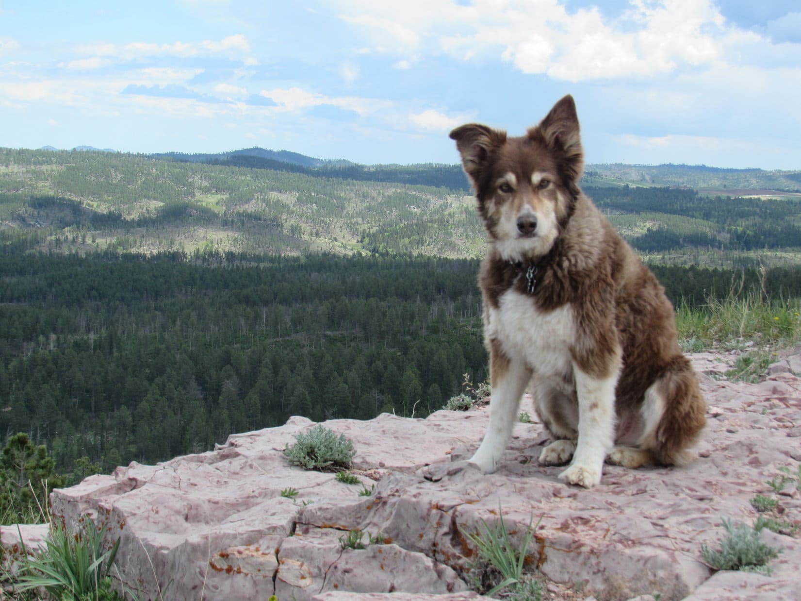
Dusty and Joe on the summit. Part of Deerfield Reservoir (R) is in view. Custer Peak(6,804 ft.) is on the far horizon way beyond Dusty. Photo looks NNE.The valley of the N Fork of Castle Creek is seen in the distance beyond Joe. Photo looks NW.Cousin Dusty on Hat Mountain. Dusty was doing mighty well for a 12 year old! She loves visiting the Black Hills where she can roam off leash like Lupe.
While Dusty and Joe pondered the views, Lupe and SPHP went over to get a photo of the old Hat survey benchmark. Set in 1950, it’s looking rather worse for the wear now. The “A” in “Hat” has been completely obliterated, though parts of the “H” and “T” are still visible.
Hey, SPHP! The survey benchmark is over this way, remember? This was Lupe’s 4th ascent of Hat Mountain. Green Mountain(7,164 ft.) is the highest ridge on the L. Photo looks SSE.The Hat survey benchmark is easy to find toward the E side of the summit area.
A week ago on Expedition No. 230, Lupe had gone with Rizzo, Buddy & Josh Hilpert to Ward Draw and K2Peak. Josh had told SPHP about a friend of his who had seen lots of pieces of old Indian artifacts up on Hat Mountain. Although Lupe and SPHP had been on Hat Mountain 3 times before, SPHP had never noticed anything like that up here. Still, it was an intriguing tale, and one of the main reasons Joe had been interested in coming to Hat Mountain today.
An initial scan of the small rocks scattered across the summit area proved disappointing. Joe found a few pieces of rock that looked like they might possibly have been chipped as part of a tool making process, but none even faintly resembled a finished product. SPHP didn’t see anything unusual, and the few poorly chipped rocks Joe came up with didn’t interest Lupe or Dusty at all.
Despite the discouraging results on the summit, Joe wasn’t ready to completely give up on the idea that there might be something of interest here. Joe decided to make an exploratory circle a little below the top of the mountain to see if might be possible to run across something down there. Dusty went with Joe, while Lupe and SPHP hung around up top just enjoying the views.
Joe and Dusty circle the summit of Hat Mountain looking for artifacts. Photo looks NNE.Lupe in the depression at the S end of the summit area. According to the story Josh had told SPHP, there were supposed to be lots of pieces of artifacts here, but even Joe, who is a geologist, couldn’t find anything too interesting. Photo looks SSW.Black Elk Peak (7,231 ft.) (L on the horizon) and Green Mountain(7,164 ft.) (R). Photo looks SE with help from the telephoto lens.Black Elk Peak (L) and Little Devils Tower(6,960 ft.) (R). Photo looks SE with lots of help from the telephoto lens.Lupe a little below the S end of the summit area. Photo looks NE.Joe & Dusty continue circling the summit. Photo looks WSW.
The stroll below the summit was scenic, but unproductive. Joe found even less of interest down below than up on top. The whole artifact deal was basically a bust.
Oh, well. Just looking had been sort of fun. Joe and Dusty returned to the summit for a group photo with Lupe.
Cousin Dusty & Uncle Joe with Lupe on Hat Mountain.
Then it was time to head back down to the G6.
South Castle Rock(6,840 ft.) & Castle Rock(6,783 ft.) (both on L), Nipple Butte(6,800 ft.) (Center), and Flag Mountain(6,937 ft.) (R) from USFS Road No. 691 on the way back to the G6. Photo looks N with help from the telephoto lens.
Upon reaching the G6, Dusty and Lupe were both very much in favor of another refreshing short side trip to cool off in Deerfield Reservoir.
Dusty & Joe back at Deerfield Reservoir. Photo looks NW.Lupe wading in Deerfield Reservoir. Photo looks W.
Then it was back to Grandma’s house for dinner on the deck, fun chasing tennis balls on the front lawn, and the traditional walk up the hill and around the bend to the cul-de-sac.
Start – 10:44 AM, 57°F at the Gold Run trailhead near Deerfield Reservoir
Sunny skies, a light S breeze, and pleasant early October temperatures – a great day for a romp in the Black Hills! Lupe would likely get to see some fall colors, too. First things first, though. Loop hadn’t been to Deerfield Reservoir in a while. She may as well take a quick look at the lake before dashing off on her peakbagging adventures.
Only a small portion of the lake was visible from here, but the deep blue waters were a pretty sight surrounded by low pine-covered hills.
Lupe started the day with a look at Deerfield Reservoir. The blue lake was a pretty sight. Photo looks N.
After admiring the lake, Lupe set off for her first peakbagging destination of the day. She left Deerfield Reservoir heading SW up a forested embankment. It wasn’t far to Deerfield Road, which she followed W to USFS Road No. 691 (Williams Draw Road). Traveling S along No. 691, Loop came to a small field where she could see Hat Mountain(6,779 ft.) up ahead.
From this small field near USFS Road No. 691, Lupe gets a fairly good view of Hat Mountain up ahead. Photo looks SSW.
Hat Mountain was only a mile away, so it wouldn’t take Lupe long to get there. That is, if cows blocking the road could be convinced to get out of the way. Not to worry! The cattle were mightily and speedily impressed by the Carolina Dog’s enthusiastic persuasive abilities. They complied immediately with her wishes.
These cattle on USFS Road No. 691 were quickly convinced to move and let Lupe and SPHP pass. Photo looks SW.
A little farther on, Lupe left the road herself. She started her trek up the lower NE slope of Hat Mountain passing through a beautiful stand of yellow aspens.
Starting up among the yellow aspens. Photo looks SSW.
Above the aspens, Lupe climbed through a pine forest. Above the pines, the upper N slope of Hat Mountain was grassy and treeless.
Looper on the upper N slope of Hat Mountain. Photo looks S.
When Lupe reached the summit, the first thing she did was to go over to the survey benchmark. It was easy to find toward the E side of the flat, barren summit area.
Lupe stands next to the survey benchmark. Part of Deerfield Reservoir, where she had started from, is in view. Custer Peak(6,804) (Center) can be seen on the horizon. The huge grassy area in between is Reynolds Prairie. Photo looks NNE.The survey benchmark is so scratched up it’s getting a little hard to read “Hat”.
Next Lupe went to see the sights. She had unobstructed views in every direction. Simply fabulous!
Looking NNW. The grassy area seen straight up from Lupe is part of the Castle Creek valley. The most distant peak seen on the R is Terry Peak(7,064 ft.).Black Elk Peak(7,231 ft.) is the distant high point on the L. Green Mountain(7,164 ft.) is the high ridge on the R. Photo looks SE.Green Mountain, the long high ridge on the R, would be Lupe’s next peakbagging goal. The summit is near the edge seen almost straight up from Lupe. Photo looks SE.Most of Hat Mountain’s flat, oval-shaped summit area is in view here. Photo looks S from near the N edge.Near the S end of Hat Mountain’s otherwise flat summit is this small depression. Photo looks SW.Loopster stands next to the small depression. The grassy ground seen in the distance straight up from her back is the upper S slope of South Castle Rock(6,840 ft.). Photo looks N.Loop stands on a ledge at the S edge of the summit area. A little of the Heely Creek valley is seen below. Photo looks SW.Kind of windy up here, SPHP! Think I’m going to go hide in the depression as soon as you’ve taken this shot. Photo looks NE.
Carolina Dogs aren’t fans of wind, and it was rather breezy up on Hat Mountain. The steady 15 mph SW breeze was enough to make Lupe want to look for a sheltered spot. She found that the small depression near the S end of the summit area worked fine. She curled up there and took a little break.
Lupe retreats to the small depression to relax out of the wind. Photo looks SW.Take as much time looking at the views as you like, SPHP. Think I’ll take a nap. Wake me when it’s time to go to the next mountain.
SPHP joined Lupe in the depression for a short break, then left to stroll around the summit again for another look at the views. Meanwhile, Loop dozed off for a few minutes in her sunny, sheltered spot before SPHP announced it was time to move on.
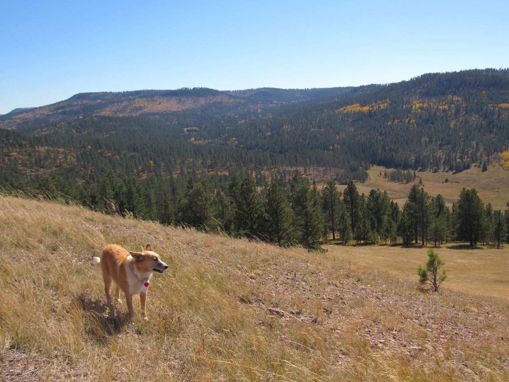
Lupe left Hat Mountain heading S. Green Mountain(7,164 ft.), her next peakbagging goal was still close to 4 miles away even as the crow flies.
Looper stands at the S end of Hat Mountain’s summit ready to head down to the grassy slope below. Photo looks S.On the way down Hat Mountain. Photo looks SW.Looking back at the Hat Mountain summit from the upper S slope. Photo looks N.Lupe leaves Hat Mountain heading for Green Mountain, the high ridge on the L. On the way, she would cross the Heely Creek valley, seen below on the R. Photo looks SSE.
The first part of the way to Green Mountain was easy. Lupe descended mostly open ground into the Heely Creek valley where fall colors were on display.
On the way down Hat Mountain to cross Heely Creek. Photo looks SW.Fall colors on display in the Heely Creek valley. Photo looks SW.
Heely Creek was very small this time of year, only a foot wide and a few inches deep. As soon as Lupe crossed it, her long gradual climb to the top of Green Mountain began.
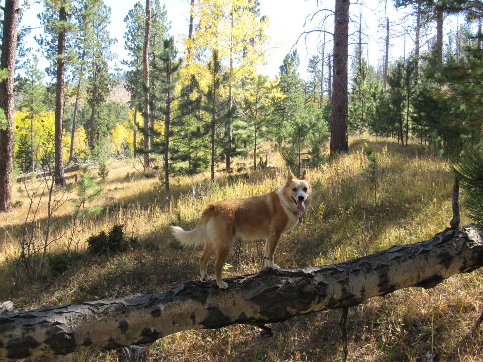
Once she entered the forest S of Heely Creek, Lupe followed old logging trails and minor USFS roads. Sometimes she was on faint roads abandoned so long ago that pine trees were growing on them. Other times she simply went through the forest not on any road or trail at all.
On the way to Green Mountain, still W of USFS Road No. 691. Photo looks SSE.
About 2 miles from Hat Mountain, Lupe reached USFS Road No. 691 again. She followed it S for a mile. When it began angling SW, she left No. 691 going SE up a forested slope with enough deadfall on it to slow progress down for a while. Eventually she came to a minor USFS road, which she was able to follow E the rest of the way to Green Mountain.
Green Mountain(7,164 ft.) is one of the highest points in the entire Black Hills. However, the only distant views available are obtained along the E rim of the mountain. The best views are toward the SE from limestone outcroppings right along the edge.
Lupe reaches the E edge of Green Mountain. On the horizon are Five Points(6,221 ft.) (L) and Black Elk Peak(7,231 ft.) (R). The large grassy area is the S end of Gillette Prairie. Photo looks E.Looking N along the E edge of Green Mountain.A cairn can be seen on the limestone pillar beyond and behind Lupe. The pillar has a commanding view to the E, but is not the actual summit of Green Mountain. Photo looks NE.Looking SW along the rim.Black Elk Peak (Center) is in view on the horizon. Copper Mountain(6,290 ft.) is the much closer forested hill toward the R. Photo looks SE.
While Lupe was enjoying the big views, SPHP noticed a chipmunk. Lupe hadn’t spotted it yet. The chipmunk was scrambling around the limestone, appearing and disappearing right along the brink of the cliffs.
Lupe didn’t notice this chipmunk scrambling around the limestone right along the brink of the cliffs. Sometimes it disappeared over the edge before reappearing again a few feet away.
SPHP kept a watchful eye on the Carolina Dog. These limestone cliffs were no place to go chasing around after chipmunks or anything else! The chipmunk was sure-footed and could cling to the vertical face of the limestone. Lupe could not. Fortunately, she never saw the crafty, quiet “tiny squirrel”.
Lupe perches near the edge of the cliffs where the chipmunk had been scrambling around a few minutes earlier. She never did see it. The big ridge on the R is High Point 7159, an unnamed mountain only 5 feet lower than Green Mountain. Photo looks SE.
After taking in the views, and enjoying a Taste of the Wild and water break, Lupe agreed to let SPHP give her a boost up onto the limestone pillar where the cairn was. The pillar was an excellent American Dingo display platform with a tremendous view.
On the limestone pillar. Five Points is in view on the horizon on the L. Part of Gillette Prairie is seen below. Photo looks E.The cairn can be seen better here.PeakbaggingCarolina Dog (L) in the foreground, Black Elk Peak (R) in the distance, and Copper Mountain (R) between them. Photo looks ESE.
Ordinarily, Green Mountain offers complete solitude. That wasn’t the case today, however. Upon arrival at the E edge of the mountain, Lupe and SPHP had both seen a hunter perched on the limestone. He had a tremendous view, and was using binoculars to scan a wide swath of territory below. The hunter and SPHP had waved at one another, but did not speak.
Surprisingly, Lupe and SPHP weren’t alone on Green Mountain. From his limestone perch, this hunter quietly scanned a broad swath of territory below. Gillette Prairie is seen in the distance. Photo looks NE.
Lupe hates gunfire. If that hunter took a shot at anything from so close by, poor Loopster would have been terrified. Having seen the views and had a little break, it was probably best not to tarry here any longer. It was a long way back to Deerfield Reservoir, anyway.
Of course, before leaving Green Mountain, Lupe still needed to visit the true summit to claim her peakbagging success. Lupe and SPHP headed N from the limestone pillar. The highest ground on Green Mountain was somewhere back in the forest only a little W of the E rim.
A fairly large area was nearly level. It wasn’t really possible to identify an exact high point. A variety of potential highest spots existed, none convincingly higher than the others. Most of them featured small mounds of broken limestone. After searching around for a few minutes, it was time to pick one. Close enough for Dingo work!
At Green Mountain’s true summit, or as close to it as Lupe and SPHP could find. Photo looks N.This was Lupe’s 4th visit to Green Mountain.
Although Lupe had been to Green Mountain 3 times before, it was a big place. She’d never explored some of the territory toward the N end. Enough daylight remained today so she could go sniff about over there on her way back to Deerfield Reservoir. Looper headed NW through the forest looking for a couple of sub-peaks shown on the topo map. Both were still over 7,000 feet elevation.
The first hill she would come to was High Point 7062. Plentiful deadfall timber slowed SPHP’s progress, but High Point 7062 eventually did come into view.
High Point 7062 (L), located 0.625 mile NW of Green Mountain’s summit, comes into view. Photo looks NNW.
As it turned out, High Point 7062 was worth visiting. The small summit was capped with a limestone outcropping from which there were 180° views to the N. Lupe climbed up for a look around. She could see the top of Hat Mountain(6,779 ft.) from here.
Up on High Point 7062. Photo looks N.High Point 7062 was worth visiting! Lupe could see a long way N from here. Photo looks N.Hat Mountain, where Lupe had been earlier in the day, is the grassy, flat-topped hill on the L. Photo looks NW from High Point 7062 with help from the telephoto lens.
From High Point 7062, Loop could also see her next objective, High Point 7025, more than 0.5 mile to the W. High Point 7025 had a much larger summit area in the form of a 400 to 500 foot long ridge. The fairly narrow ridge was all about the same elevation, but heavily forested. Lupe wouldn’t have much in the way of views over there.
High Point 7025, Lupe’s next objective, is the heavily forested ridge seen on the L. Photo looks W.
Even so, when Lupe left High Point 7062, she headed W for High Point 7025. She enjoyed a beautiful early evening trek, while exploring new territory.
Lupe enjoys the evening on her way to High Point 7025. Photo looks WNW.
Lupe made it to High Point 7025. She traversed the entire summit ridge from N to S, then back again. As anticipated, there wasn’t much to be seen in the way of views due to the forest.
On the High Point 7025 ridge. Photo looks SE back toward Green Mountain.
The sun was getting low. Deerfield Reservoir was still 4 miles N as the crow flies. Better keep going! Lupe left High Point 7025 heading N. She explored more beautiful territory, saw lots of deer, and eventually found minor roads that led her back to USFS Road No. 691.
Darkness fell on the long road hike back to the G6. Stars glittered above in a moonless sky. The wind had died down hours ago. SPHP tramped along, Lupe trotting nearby. No lights, no traffic, no noise. Everything as it should be when adventure’s done. Quiet time together, then the long drive home. (End – 8:09 PM, 44°F)
Heading down the N slope of High Point 7025 on the way back to Deerfield Reservoir. Hat Mountain on the L.