Peak 8840 & Eagle Rock, Laramie Mountains, Wyoming (5-29-16)

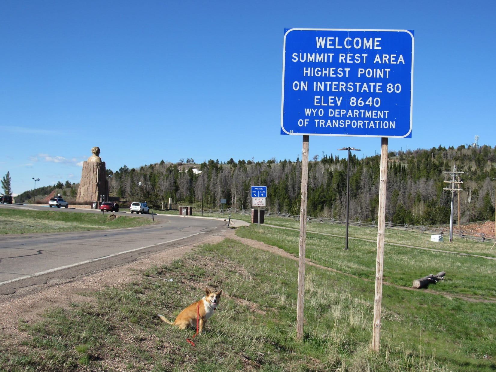
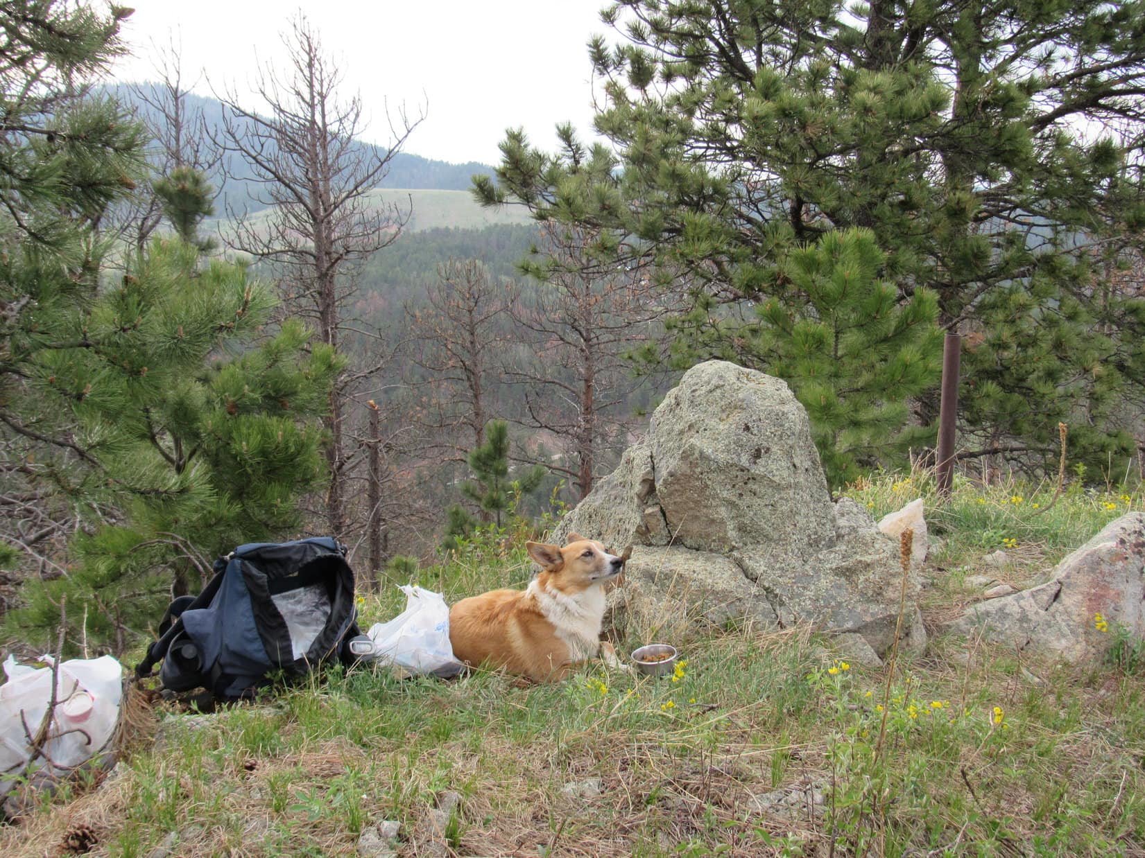
Lupe had already had a great day in the Laramie Mountains of Wyoming!  She’d gotten an early start and climbed The Summit (8,880 ft.), Leg Benchmark (9,055 ft.), and Pole Mountain (9,040 ft.).  SPHP had more peakbagging exploits in mind for her, but rain showers had delayed her start for Peak 8840.  It was OK.  Lupe and SPHP ate lunch in the G6 while waiting for the rain to end.

The sun came out.  It was time to go (3:24 PM, 59°F)!  The G6 was parked at the intersection of USFS Roads No. 703 & 714.  Lupe and SPHP got out, and crossed the terrible cattle guard where No. 703 continued N.  The cattle guard was in such bad shape, SPHP hadn’t even dared to take the G6 across it.

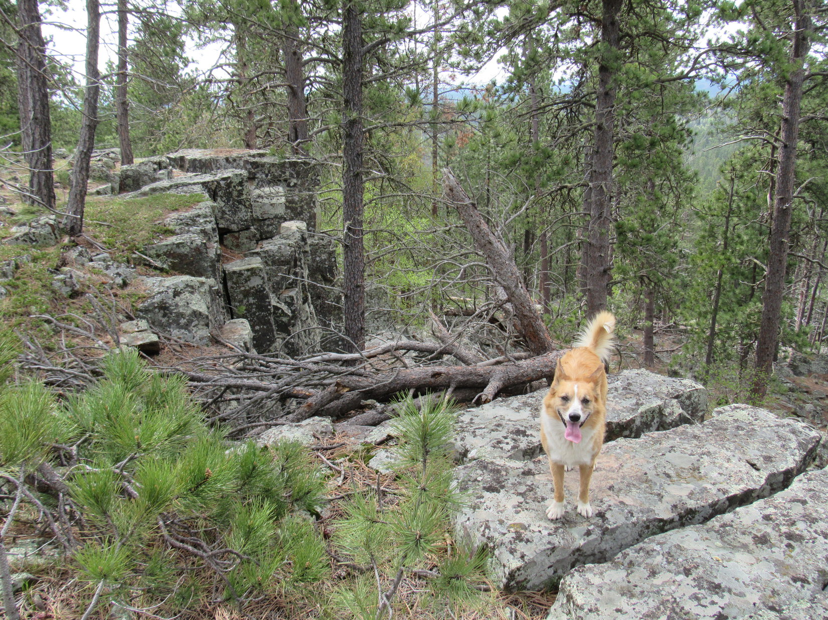
Peak 8840 was an easy peakbagging goal.  It was only a mile N of the G6.  Lupe could follow No. 703 (Pilot Hill Road) almost all the way there.  Peak 8840 wasn’t much of a peak, just a high spot along a big ridge.  Lupe was already up on the ridge, so she would only gain 200 feet of elevation.  Lupe was going to Peak 8840, anyway.  Peakbagging doesn’t always have to be an ordeal!

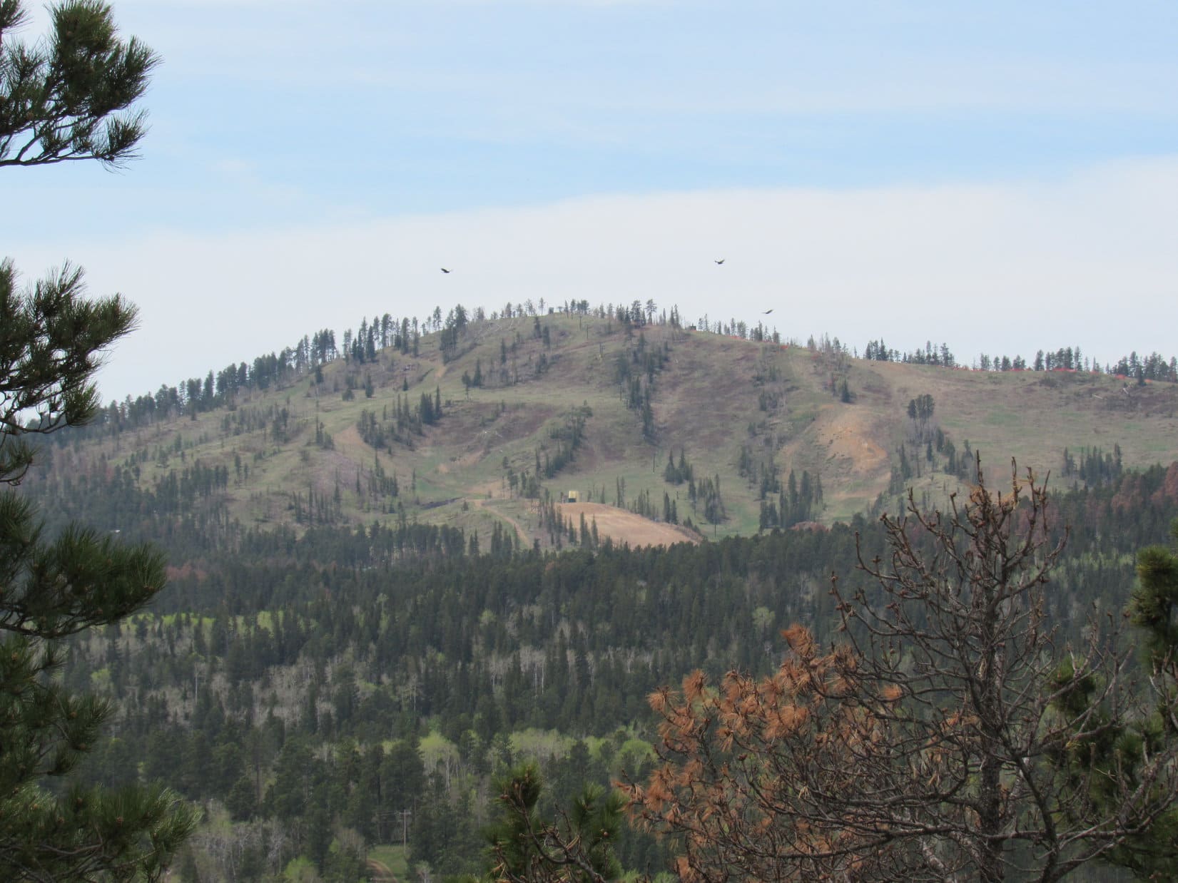
The road wound around a bit as it went over a sparsely forested rise.  On the other side of the hill, No. 703 continued N.  To the NNW, Lupe saw a big hill with several towers on top.

Lupe came over a rise to see this big hill with towers on it up ahead. No. 703 (Pilot Hill Road) is seen continuing past the R (E) side of the hill. Photo looks NNW.
Lupe came over a rise to see this big hill with towers on it up ahead. No. 703 (Pilot Hill Road) is seen continuing toward the R (E) side of the hill. Photo looks NNW.

The trudge N on dirt road No. 703 wasn’t too exciting.  Although big clouds could still be seen off in various directions, it was sunny and kind of hot out.  The ridge Lupe was on was 0.25 mile wide, and even more in some places.  No. 703 went around the E side of the hill with the towers on it, gaining elevation slowly along the way.

The road leveled out when Lupe got NE of the towers on the hill.  It was so sunny and warm, Lupe and SPHP took a break under a big pine tree a short distance W of the road.  SPHP put on sunscreen, and then consulted the topo map.  Peak 8840 had to be at the top of the long gentle slope now visible to the NE on the other side of No. 703.

Lupe and SPHP returned to No. 703 and kept going.  Before long, the road started curving NW on its way to Pilot Hill, still 1.75 miles away.  Pilot Hill (8,859 ft.) was actually a bit higher than Peak 8840.  Lupe would have gone there, too, except Pilot Hill wasn’t in the Medicine Bow National Forest.  SPHP wasn’t sure there was legal access, and didn’t care to walk all the way over there to find out.

Where No. 703 turned NW, Lupe and SPHP left the road.  Despite being in the national forest, there was a barbed wire fence near the road.  Lupe and SPHP slipped under it.  Lupe trotted up the long grassy slope toward the summit of Peak 8840.  It was an easy, if unspectacular, hike.

Nearing the summit, SPHP turned around to look at the view.  Suddenly the need for speed was apparent!  Although it was still warm and sunny out on Peak 8840, a big cloud was approaching from the SW.  Rain was pouring from it.  The cloud was still miles away, but wouldn’t take too long to get here.  Lupe and SPHP started hurrying toward the highest point at the end of the long slope.

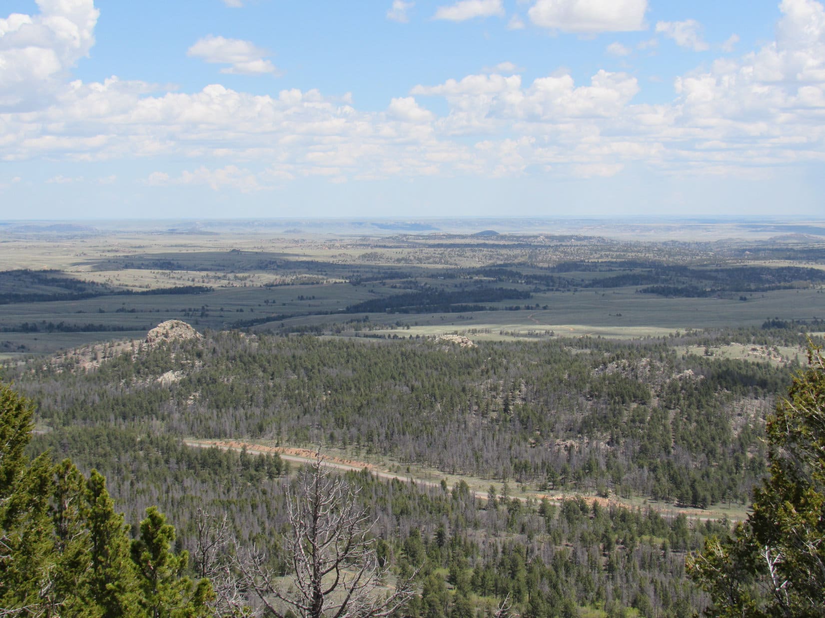
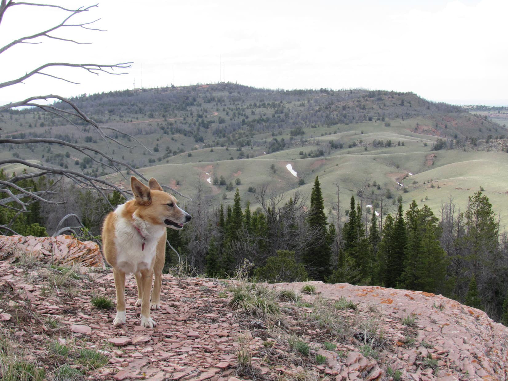
The summit proved to be right where it looked like it would be.  Several big dead pine trees were standing there.  NE beyond the summit, the ground sloped down only slightly toward a long snow drift a couple of feet deep.  Beyond the snow drift was the living forest that lined the N edge of the mountain.

Lupe at the summit of Peak 8840. Photo looks SW toward the approaching storm.
On the summit of Peak 8840. The summit didn't offer any dramatic views.
On the summit of Peak 8840. The summit didn’t offer any dramatic views.

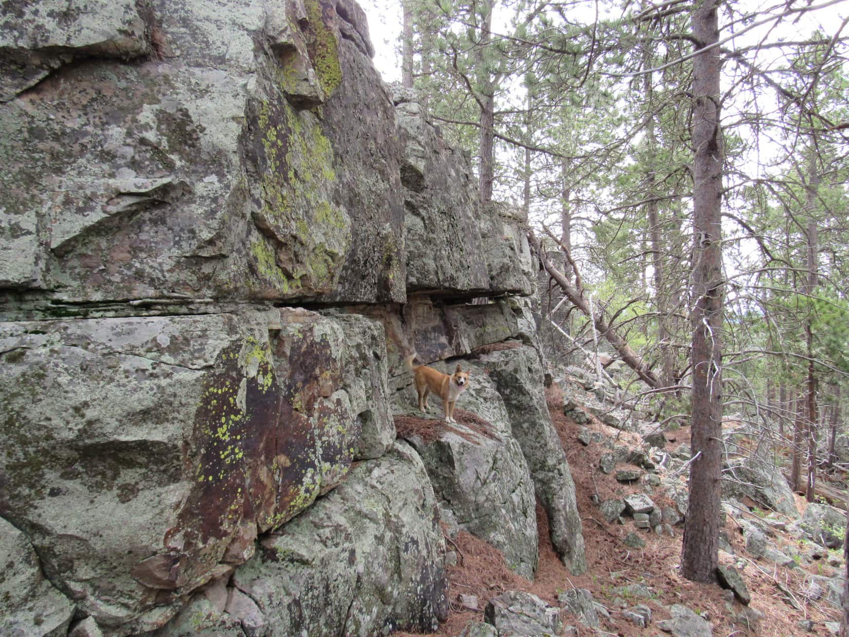
SPHP wasn’t entirely convinced right away that Lupe had made it to the true summit of Peak 8840.  Clearly there wasn’t any higher ground to the S, W or N, but a ridge extended out to the E from the summit.  It wasn’t possible to see far enough to rule out higher points along the E ridge.

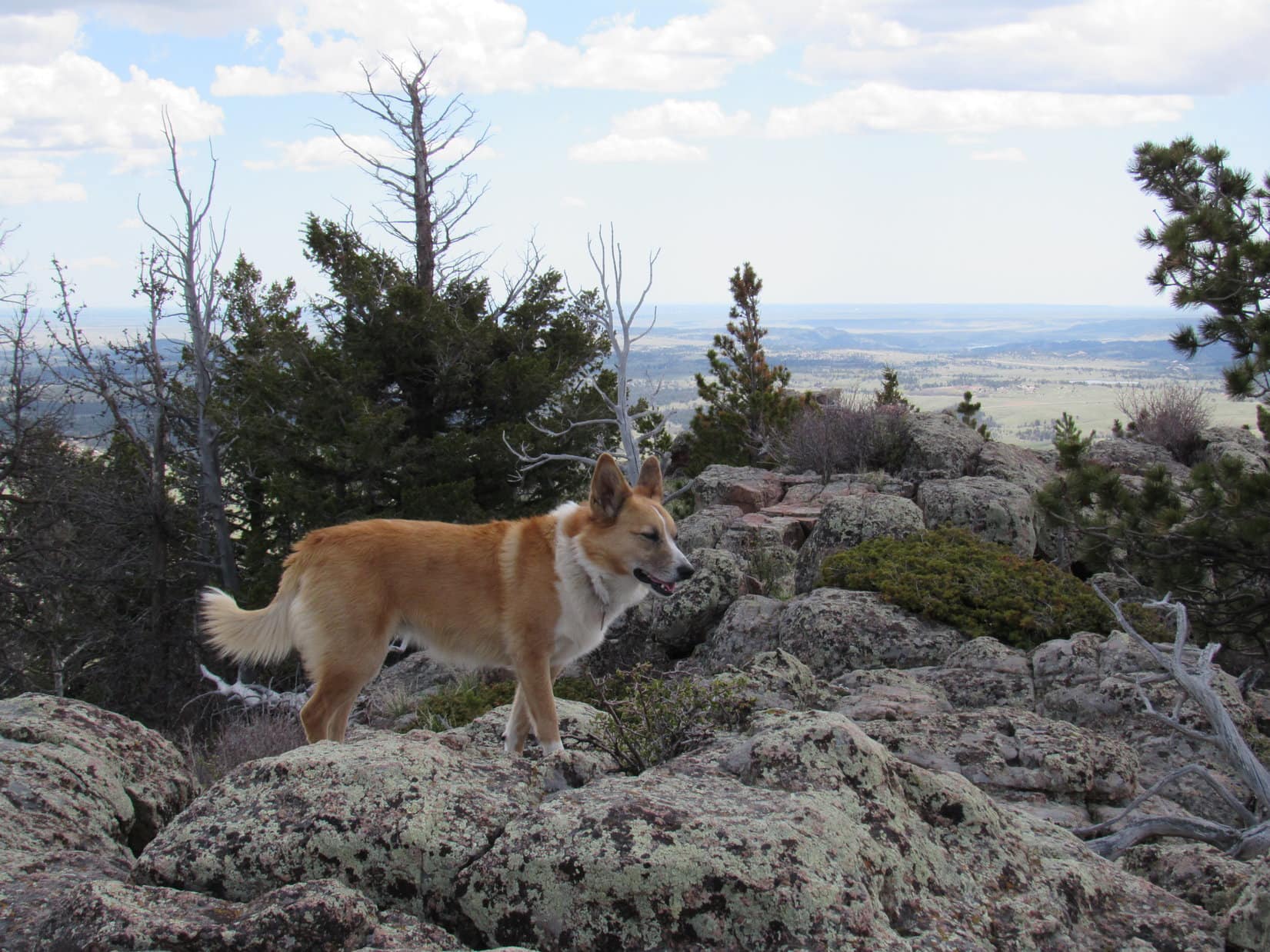
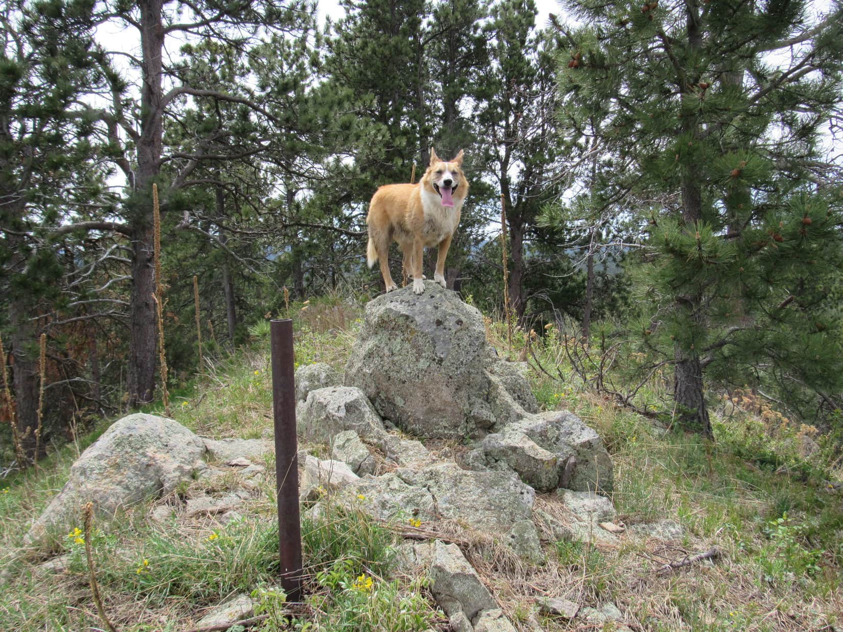
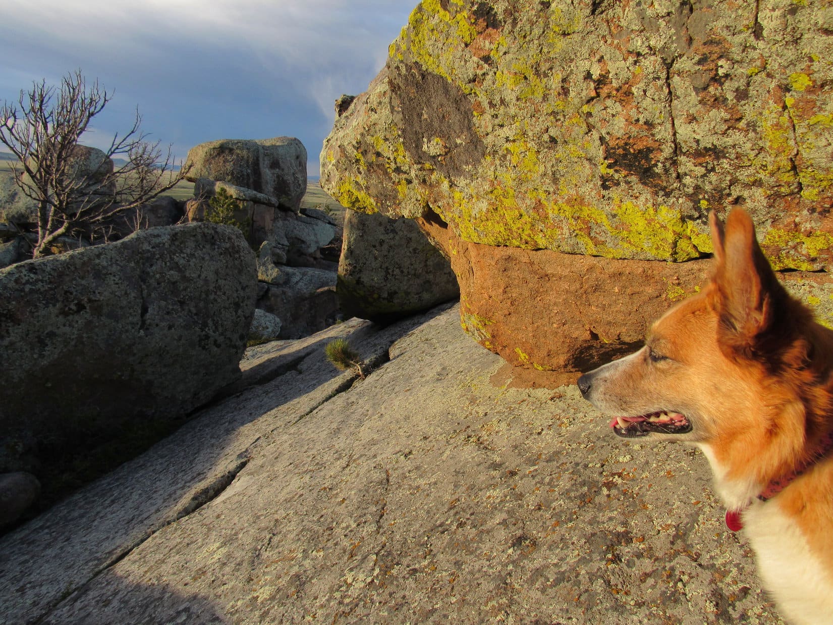
Despite the approaching storm, Lupe and SPHP made a hasty exploration of the E ridge.  There weren’t any higher points on it than the summit Lupe had already been to.  However, there were some much better viewpoints.  Lupe and SPHP went all the way to the E end of the ridge.  Near the end, on the S side, Lupe came to a well-constructed cairn of reddish/pinkish rocks.

Lupe on the cairn of reddish/pinkish rocks near the end of the E ridge of Peak 8840. Photo looks S.
Looking SW.

Lupe posed for a couple of photos on the reddish/pinkish rock cairn with nice views to the S in the background.  Then Lupe checked out the views from the N side of the E ridge.

There was some pretty remote, dry looking territory N of the E ridge of Peak 8840. Photo taken with the telephoto lens looking N.
Pilot Hill (8,859 ft.) from the E ridge of Peak 8840. Photo looks NW.

With the exploration of the E ridge complete, Lupe and SPHP hastened back to the summit of Peak 8840.  There wasn’t much time to lose.  The storm was getting closer.  Lupe returned to Pilot Hill Road and made for the G6.

For the last 10 or 15 minutes, Lupe and SPHP got sprinkled on.  Thunder could be heard in the distance, although Lupe saw no lightning.  Less than a minute after reaching the G6 (4:57 PM, 50°F), the rain hit.  It wasn’t a cloudburst, but it rained steadily for 15 minutes.  Lupe was safe and dry in the G6.

Lupe looking kind of smug about her just in the nick of time escape from the rain.

The rain eased up, but didn’t stop entirely.  SPHP started the G6 and drove E on USFS Road No. 714.  The day was now wearing on, but Lupe had one more peakbagging goal left ahead of her – Eagle Rock (8,320 ft.).

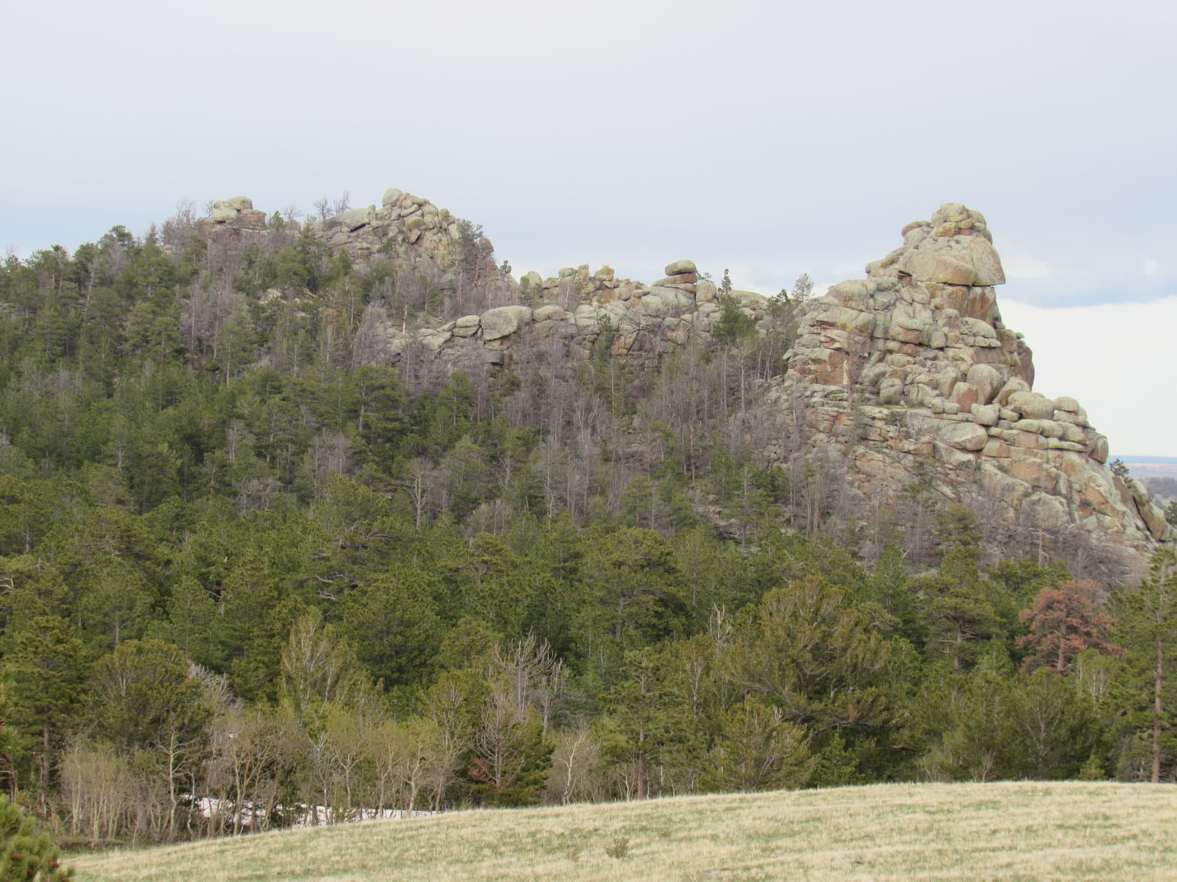
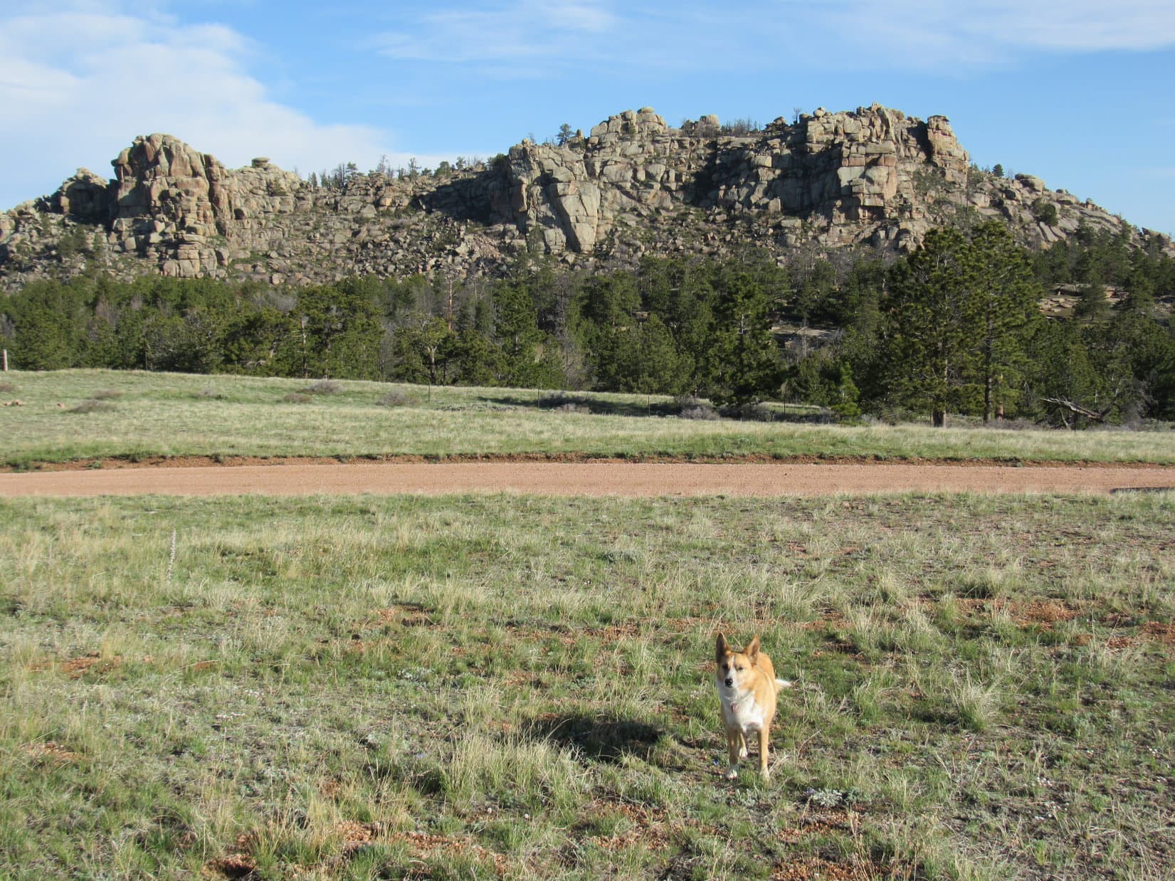
The first views of Eagle Rock weren’t very encouraging.  It looked very rocky, and perhaps impossible for Lupe to climb.  SPHP stopped the G6 0.5 mile WSW of Eagle Rock to wait for the rain to clear.  SPHP hoped Lupe would see a rainbow.  A double rainbow started to form, but faded before it really became distinct.

Lupe and SPHP explored a group of big rocks in a grassy field SW of the road while raindrops continued to splash down sporadically.  Lupe was perfectly happy sniffing around.  SPHP continued to contemplate Eagle Rock.

Eagle Rock from the WSW near USFS Road No. 714.

Even after the rain completely ended, there continued to be big clouds around.  Now they were off to the N.  Thunder could occasionally be heard.  Slowly the situation calmed down.  SPHP found a place to park the G6 at a small pullout along No. 714.1F less than 100 feet N of its intersection with No. 714 (6:40 PM, 44°F).

Lupe and SPHP left the G6 and followed No. 714.1F going N toward the W side of Eagle Rock.  No. 714.1F went through a strange area where there was a maze of little roads.  This looked like an abandoned campground, or at least a dispersed camping area with a number of sites.  Big mud puddles covered the road in some places.  Some of the puddles were fed by small streams trickling out of a marshy aspen forest.

Eagle Rock from the SSW near USFS Road No. 714.1F.
Lupe on No. 714.1F on her way to Eagle Rock. Big mud puddles covered the road in several places. Some of the puddles were fed by tiny streams trickling out of the marshy aspen woods.

Before long, No. 714.1F climbed out of the aspen forest and into the pines.  When SPHP figured Lupe had gone far enough N, it was time to turn E to start the climb up the short, but steep slope to Eagle Rock.  Soon Lupe was quite high up on the mountain.

Lupe nears the top of Eagle Rock (8,320 ft.). Photo looks N.

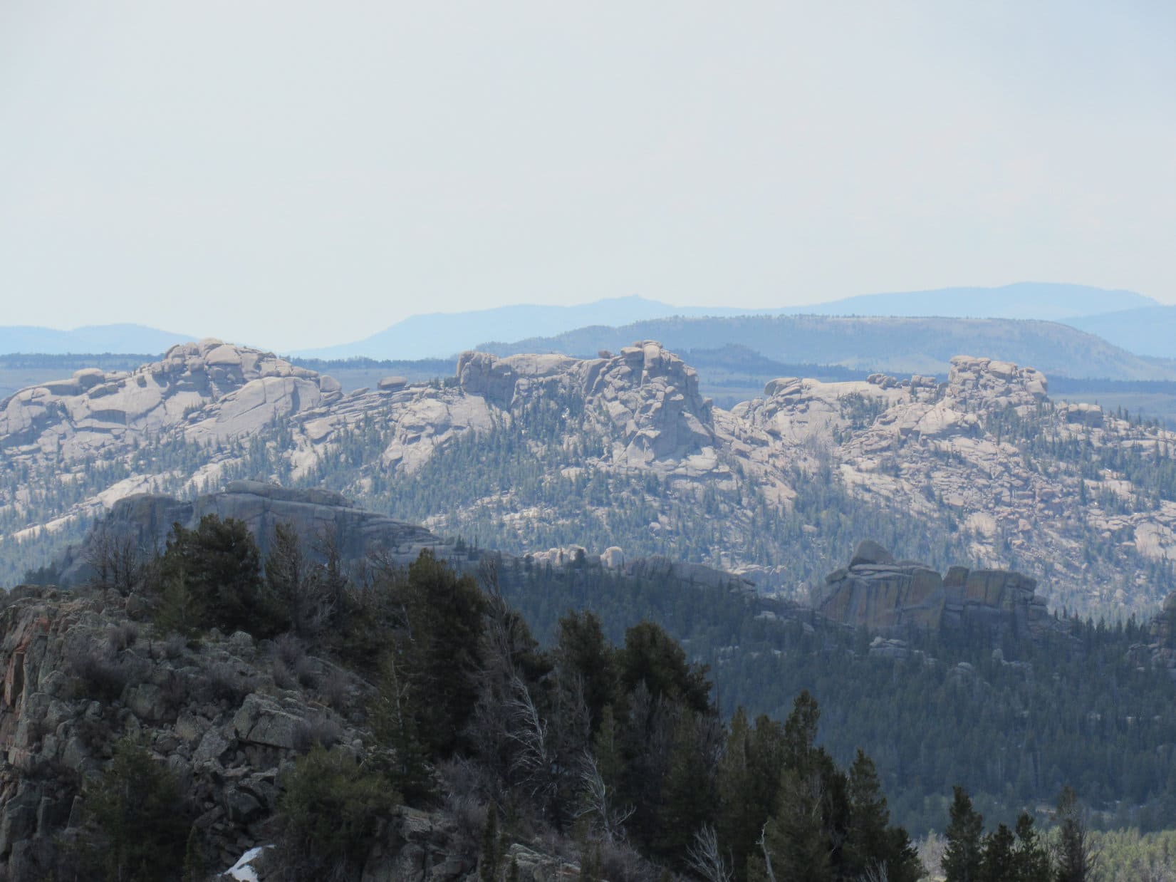
It had been apparent from a distance that the top of Eagle Rock consisted of a line of very rocky and distinct high points, each crowned by stacks of large, rounded boulders.  Even from near the top, though, it wasn’t entirely clear which of these high points was the true summit.  SPHP could rule out the high points toward the S, but depending on where one was, either the middle or N high points looked like the summit.

Lupe below the very highest rocks of the middle high point of Eagle Rock. SPHP believes this may well be the true summit, but isn't entirely certain. There were high points farther N that also seemed like possible candidates too.
Lupe below the very highest rocks of the middle high point of Eagle Rock. SPHP believes this may well be the true summit, but isn’t entirely certain. There were high points farther N that also seemed like possible candidates, too.

Lupe visited the middle high point first.  Slowly and carefully, Lupe and SPHP also worked around to competing high points farther N.  The SE face of Eagle Rock was virtually a cliff, but it was possible to maneuver around on the ridgeline or just to the W of it.  In truth, Lupe never got right up on top of the very highest rocks, but she got within 5 or 10 feet each time – close enough for Dingo work!

Lupe near the high point farthest N. The actual top is 5 to 10 feet higher and close to where SPHP took this photo from, and Lupe had already been there, too. Photo looks SW along the very rocky Eagle Rock summit ridge. What may be the true summit, the middle high point, is seen just to the L of Center.
Lupe near the high point farthest N. The actual top is 5 to 10 feet higher and close to where SPHP took this photo from. Lupe had already been there, too. Photo looks SW along the very rocky Eagle Rock summit ridge. What may be the true summit, the middle high point, is seen just to the L of Center.
After visiting the N high point, Lupe returned to the middle high point to see how high up she could get. Here she is sitting right next to the very highest rock. Photo looks N.
Lupe sits between the highest rocks of the middle high point. The rock on the left may be the true summit of Eagle Rock. Just a foot or two behind Lupe is a cliff, but American Dingoes have much better sense than to go over cliffs. Photo looks ESE.
Lupe still near the middle high point of Eagle Rock. One of the N high points she visited is seen beyond her some distance away. From some angles, the N high point looked to be the true summit of Eagle Rock. Photo looks NE.

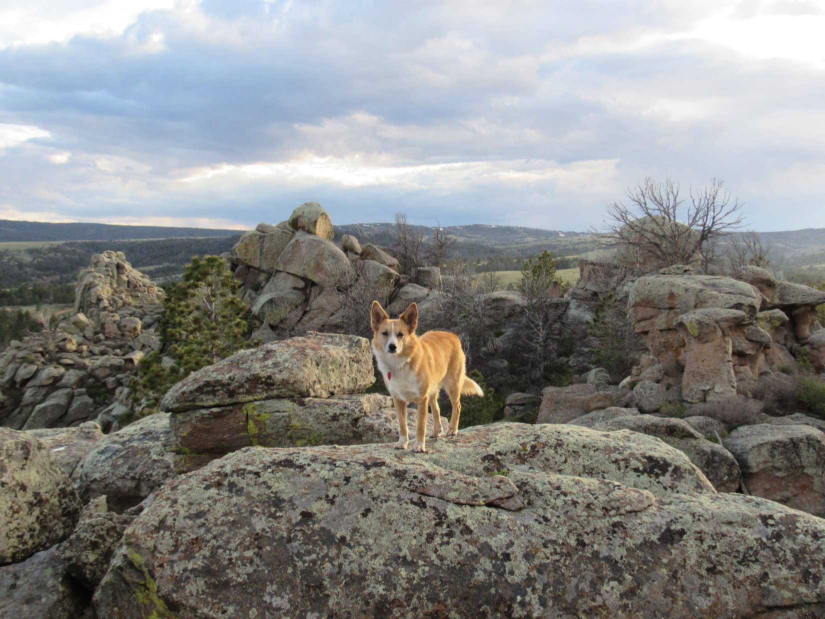
Scrambling around among the boulders on Eagle Rock was a lot of fun.  It was certainly a much more interesting summit than Peak 8840 had been.  SPHP was pleased with how very close Lupe was able to get to the absolute tops of the very highest rocks.  Even though she technically fell a little bit short, Lupe was definitely claiming Eagle Rock as a peakbagging success!

After climbing Eagle Rock, Lupe returned to the G6 (8:02 PM, 5-29-16). She spent the night car camped along No. 714.1F near the mountain. The next morning, Lupe saw this view of Eagle Rock from the SE. From this angle, it looks like the true summit is at the N high point on the R.

Links:

Next Adventure                     Prior Adventure

Want more Lupe adventures?  Choose from Lupe’s 2016 Laramie Mountains, WY Adventure IndexDingo Vacations Adventure Index or Master Adventure Index.  Or subscribe free to new Lupe adventures.

The Summit & the Headquarters National Recreation Trail to the Leg Benchmark & Pole Mountain, Laramie Mountains, WY (5-29-16)

Lupe’s luck was about to change!  Five long days of unrelenting Dingo boredom while SPHP helped clean out the house in Laramie, Wyoming were over.  Lupe was in the G6, speeding SE on I-80 toward The Summit for her first taste of peakbagging fun on this whole trip.  She was finally going to get to play in the mountains, and the excited Carolina Dog could hardly wait.

At Exit 323, SPHP turned off I-80.  A few minutes later, SPHP parked the G6 at a long pullout on the E side of Old Hwy 30, close to the start of USFS Road No. 724 (7:43 AM, 53°F).  The hike up No. 724 to the top of The Summit (8,880 ft.) was trivial, less than 0.25 mile long with an elevation gain of only 70 feet.

Nevertheless, Lupe was joyous!  Being outside exploring anything new was so much better than moping around being ignored back at the old house.  SPHP was almost equally glad.  SPHP had been allergic to the dusty air in the old house, which had been locked up for many years.  Breathing easier already, SPHP was looking forward to several great days of freedom in the Laramie Mountains.

The top of The Summit was a huge, round, flat, forested area.  A variety of small buildings and large towers were scattered across the landscape.  No one was around.  Lupe and SPHP wandered among the pines and towers looking for the highest point on the mountain.  The trees hid the views for the most part, but there was a view of Turtle Rock (8,600 ft.) from the SE edge of the big hill.

Lupe reaches the biggest tower on The Summit (8,880 ft.) in the Laramie Mountains of Wyoming. Photo looks SW.
Looking SE toward Turtle Rock (8,600 ft.) from The Summit. Taken with the telephoto lens.

There were also partial views to the S and SW where it was possible to see much higher snow-capped peaks.  They were far away – probably in Colorado.  SPHP looked around for a clear view of them, but couldn’t find one.  Toward the E central part of the summit area, Lupe came across a big rock that appeared to be the highest point on The Summit.

Lupe perches on the summit rock of The Summit. Photo looks N.

Lupe on the highest rock on The Summit, Laramie Mountains, WY 5-29-16

A better view of what most of the top of The Summit looked like. Photo looks S.
Two more of the towers on The Summit. These were only a little way NW of the highest rock on the hill. Photo looks NW.

Climbing The Summit was a quick and easy start to Lupe’s day, but just made Lupe and SPHP eager to explore more scenic, less developed peaks.  Lupe headed back down USFS Road No. 724 to the G6.

As Lupe and SPHP neared the G6 again, SPHP decided to continue on past it up a dirt road on the E side of Old Hwy 30.  The dirt road led straight to a big dirt parking lot.  From the S end of the parking lot was a much better view of some of the distant snow-capped peaks Lupe had only glimpsed from up on The Summit.

E of The Summit and practically right next to the E side of Old Hwy 30 was a big dirt parking lot with this great view of snow-capped peaks far away to the S in Colorado. Photo taken with the telephoto lens.
E of The Summit, and practically right next to the E side of Old Hwy 30, was a big dirt parking lot with this great view of snow-capped peaks far away to the S in Colorado. Photo taken with the telephoto lens.

The huge snowy mountains were gorgeous and inspiring, but they were far away.  Besides, there was clearly still way too much snow up on the high peaks for Lupe adventures.  In another 6 weeks, the story would be different, but not yet.  Lupe and SPHP returned to the G6 (8:19 AM, 50°F).

SPHP had a couple of nearby peakbagging goals in mind for Lupe – the Leg Benchmark (9,055 ft.) and Pole Mountain (9,040 ft.).  SPHP hoped Lupe could reach them from the Headquarters National Recreation Trail.  The Summit trailhead at the W end of the trail was less than a mile away.

Lupe and SPHP hopped in the G6, crossed I-80, and drove to the trailhead.  A sign said a fee was required to park there.  Just over the hill, though, along I-80 was a huge rest stop with free parking.  So SPHP drove to the rest stop to park the G6 (8:29 AM, 50°F).  Lupe took up peakbagging interstate highways – a sign said this rest area was the highest point on I-80!

Lupe takes up peakbagging interstate highways at The Summit rest stop at Exit 323 in Wyoming.
Lupe takes up peakbagging interstate highways at The Summit rest area at Exit 323 in Wyoming.
Abe Lincoln glowers down on I-80 from The Summit rest area at Exit 323 in Wyoming.

Lupe and SPHP headed for the Summit trailhead of the Headquarters National Recreation Trail, where Lupe started her quest to climb the Leg Benchmark and Pole Mountain.

Lupe at the start of the W end of the Headquarters National Recreation Trail. Photo looks NNE.
Lupe at the start of the W end of the Headquarters National Recreation Trail. Photo looks NE.

Lupe hadn’t gone very far, when she made a great discovery.  A huge, deliciously cold snowbank covered a fairly long stretch of the trail.  Lupe frolicked on it, and got cooled off.  Lupe eventually came to a few more scattered snowbanks along the trail, but none anywhere near the size of this first one.

This big snowbank near the W end of the Headquarters National Recreation Trail made for one very happy Carolina Dog! Photo looks NE.

The Headquarters National Recreation Trail was fun and easy.  The trail headed generally E winding its way through a pine and aspen forest.  There was some up and down along the way, but nothing too drastic.  Lupe netted a few hundred feet of elevation gain, but that was about it.

After a little while, Lupe came to a sign where the trail divided.  To the left was Cardiac Bypass.  To the right was a Scenic Overlook.  Lupe and SPHP took the Cardiac Bypass.  Almost immediately it became clear that there was a viewpoint a little higher up a short distance off the trail.  Lupe and SPHP left the trail to check out the view.Lupe on the Headquarters National Recreation Trail, Laramie Mountains, WY 5-29-16The view was splendid!  The Summit, which Lupe had climbed only a short while ago, was visible to the W.  Far beyond The Summit, Medicine Bow Peak (12,013 ft.) could be seen in the Snowy Range.  Several other high snowy mountain ranges were spread out across the far S and SW horizons.

Lupe at the viewpoint a little off the Cardiac Bypass of the Headquarters National Recreation Trail. The Summit is the hill on the L. Snowy Medicine Bow Peak is seen on the horizon on the R. Photo looks W.
Lupe at the viewpoint a little off the Cardiac Bypass of the Headquarters National Recreation Trail. The Summit is the hill on the L. Snowy Medicine Bow Peak is seen on the far horizon on the R. Photo looks W.
Medicine Bow Peak (12,013 ft.) (Center) using the telephoto lens. Lupe climbed Medicine Bow Peak and other nearby peaks on her Summer of 2015 Dingo Vacation. Photo looks W.

SPHP knew the Headquarters National Recreation Trail did not go directly to either of Lupe’s two peakbagging goals, the Leg Benchmark and Pole Mountain.  The trail gets closest to the Leg Benchmark, but passes to the W of it.

After Lupe had followed the trail some distance, SPHP became anxious to figure out just where Lupe should leave the trail to start climbing the Leg Benchmark.  When a rocky high point appeared on the N side of the trail, Lupe and SPHP climbed up to see what lay ahead.

Lupe climbed this rock formation N of the trail. SPHP hoped to see the Leg Benchmark from here. Photo looks N.
American Dingo scout, Lupe, near the top of the rock formation.
Beyond Lupe is a first look at the long high ridge of the Leg Benchmark. Photo looks ESE.

The long high ridge of the Leg Benchmark was in view, but still a little way off.  Lupe and SPHP returned to the Headquarters National Recreational Trail and continued E.

Crocuses were blooming along the trail. In the Black Hills, crocuses started blooming in April.
Crocuses were blooming along the trail.

Before long, the trail started to gradually lose elevation.  Lupe came to a three-way intersection.  To the right (S), the National Headquarters Recreation Trail continued toward Browns Landing.  To the left (NE) the Summit Loop Trail headed up a hill.

Lupe had come to several trail intersections before, including at least a couple that were marked as part of the Summit Loop Trail.  SPHP didn’t really know where the Summit Loop Trail went, but Lupe did need to gain some elevation going NE up to the ridgeline, before turning SE toward the Leg Benchmark.  Lupe and SPHP took the Summit Loop Trail.

The Summit Loop Trail climbed steadily.  When it reached the ridgeline, there was a little open ground where the trail bent around to the NW.  Lupe and SPHP left the trail heading SE and entered the forest again.  Lupe went up and over one forested rise, down across a shallow saddle, and then began her ascent of the Leg Benchmark ridge from the NW.  She soon reached another high rock formation where she could get a better view of what lay ahead.

Pole Mountain finally came into view at this high point along Lupe's route to the Leg Benchmark. Photo looks SE.
Pole Mountain finally came into view at this high point along Lupe’s route to the Leg Benchmark. Photo looks SE.
Lupe having fun near the rocks of a high point on the way to the Leg Benchmark. Photo looks SE.

Lupe reached a few false summits along the way, but SPHP knew she was getting close.   When Lupe started coming to survey benchmarks, SPHP knew she had arrived.  Lupe found four survey benchmarks altogether!  The third one, which was on the very highest rock, actually said “Pole” instead of “Leg”.

Lupe had made it to the Leg Benchmark (9,055 ft.)!  It hadn’t been nearly as hard as SPHP had feared.  Lupe’s next goal, Pole Mountain, was in clear view to the ESE.  There was a lot more to see from the Leg Benchmark, too.  At least four distant snow-covered mountain ranges were visible on the far horizon from the S around to the W.

Lupe and SPHP stopped for a nice long break up at the Leg Benchmark.  It was a great place to be!  The Leg Benchmark seemed to be the dominant high point of these mountains.

Lupe at the last false summit. The true summit where the Leg Benchmark is located is in view just ahead. Photo looks SE.
This was the first benchmark Lupe came to on her way to the Leg Benchmark. This one was perhaps 40 feet away from the true summit.
The 2nd survey benchmark Lupe found.
The survey benchmark at the true summit. This was the third one Lupe found, and actually said Pole instead of Leg. Nearby Lupe found a fourth benchmark, but SPHP didn't take a picture of it.
The survey benchmark at the true summit. This was the third one Lupe found, and actually said Pole instead of Leg. Nearby Lupe found a fourth benchmark, but SPHP didn’t take a picture of it.
Lupe stands on the highest rock of the Leg Benchmark. Photo looks NNW.
Lupe still at the highest point of the Leg Benchmark ridge. Photo looks SE along the ridgeline.
Lupe still on the highest point of the Leg Benchmark ridge. Photo looks SE along the ridgeline.
Pole Mountain (9,040 ft.) from Leg Benchmark. The 4th benchmark Lupe found on Leg Benchmark is seen on the rock on the far R. Photo looks ESE.
Pole Mountain (9,040 ft.) from Leg Benchmark. The 4th survey benchmark Lupe found on Leg Benchmark is seen near the edge of the rock on the far R. Photo looks ESE.

When the leisurely rest break was over, Lupe and SPHP set off continuing SE along the Leg Benchmark ridgeline.  The ridge went on for quite a distance, with only modest elevation loss.  Gradually the forested slope to the NE became less steep, and it wasn’t as far down to the saddle between Leg Benchmark and Pole Mountain.

The saddle over to Pole Mountain had been clearly visible from up on top of Leg Benchmark.  Most of it was flat, open terrain that would be easy to cross.  Lupe followed the Leg Benchmark ridgeline down to where it looked like a straight shot over the saddle to Pole Mountain.  Then Lupe and SPHP turned NE, leaving the ridge and plunging down into the forest.

Lupe SE of the Leg Benchmark summit before she left the ridgeline. The nearby grassland is part of Browns Landing. Turtle Rock (8,600 ft.) is the rocky three-pronged peak seen in the distance L of Center. Photo looks S.
Turtle Rock (8,600 ft.). Photo looks S using the telephoto lens.

The slope wasn’t bad going down off the ridge.  Near the bottom, Lupe was delighted to encounter a wide band of snowdrifts 2 or 3 feet high still melting in the shade of the trees.  Lupe had fun cooling off on the snow before leaving the forest.  As soon as she left the trees, Pole Mountain was directly ahead to the ENE across the open ground of the saddle.

The W face of Pole Mountain features a long, massive rock outcropping.  Clearly, Lupe and SPHP couldn’t climb that!  In fact, SPHP wasn’t entirely certain Lupe would be able to find any way to the top.  However, it did look like the situation would be more promising farther E along the S face.  Lupe and SPHP crossed the flat, open saddle and started climbing.  As Lupe climbed, she worked her way E across the S side of the mountain.

The top of Pole Mountain (9,040 ft.) was quite rocky, but Lupe did find an easy way up about midway along the S slope.  The summit ridge extended 200 feet in a NW/SE direction.  The highest point was toward the middle, but somewhat closer to the NW end, not far at all from where Lupe came up.  Lupe and SPHP went to check out the true summit and NW end of the mountain first.

Lupe atop the NW end of the Pole Mountain summit ridge. Leg Benchmark is the high point (R of Center) on the ridge seen in the background. Photo looks WNW.
The Leg Benchmark (9,055 ft.) summit from Pole Mountain. Photo looks WNW using the telephoto lens.
Lupe stands on the true summit of Pole Mountain (9,040 ft.). Photo looks SE along the summit ridge.

The view of the Leg Benchmark ridge from the NW end of Pole Mountain was great!  After spending a little time there appreciating the fine view, Lupe went to check out the SE end of the summit ridge.  Although a bit lower, the SE end of the summit featured a panoramic view of high plains extending far off to the E.

Lupe farther SE along the summit ridge of Pole Mountain, near where she climbed up. Photo looks SE.
A huge area of high prairie was visible all around to the E of Pole Mountain. This photo looks NE toward Bisbee Hill (8,480 ft.) (L) and Markley Hill (R), both of which Lupe climbed the next day.
A huge area of high prairie was visible E of Pole Mountain. This photo looks NE toward Bisbee Hill (8,480 ft.) (L) and Markley Hill (8,520 ft.) (R), both of which Lupe climbed the next day.

As beautiful as the panorama to the E was, it was hard not to focus on the distant snow-capped peaks of Colorado to the SW.  Rain showers were starting to develop in that direction, too.

Lupe on a rocky ledge near the SE end of the Pole Mountain summit. Distant snow-capped peaks of Colorado and light rain showers were in view beyond her. Photo looks SW.
Lupe on a rock ledge near the SE end of the Pole Mountain summit. Distant snow-capped peaks in Colorado and light rain showers were in view beyond her. Photo looks SW.
Using the telephoto lens, the high snowy mountains in Colorado looked impressive and forbidding. Photo looks SW.

After a pleasant stay, the time came for Lupe to leave Pole Mountain.  The Carolina Dog went back down the same S slope where she had come up, and crossed the grassy saddle over to the start of the forest covering the long Leg Benchmark ridge.  She then climbed through the forest up to the ridgeline, and made a second ascent all the way to the true summit of Leg Benchmark.

Lupe among the snowdrifts at the base of the Leg Benchmark ridge. Photo looks WSW.
Lupe returns to the top of Leg Benchmark for her 2nd ascent of the day. Pole Mountain, where she had just been, is seen beyond her. Photo looks ESE.

Lupe and SPHP enjoyed one more rest break up on Leg Benchmark.  It was a great place, and it seemed like a shame to leave it, but Lupe had plenty more to do in the Laramie Mountains before the day was done.  Lupe and SPHP left Leg Benchmark for the final time, and began the trek back to the G6.

Lupe returned to the Headquarters National Recreation Trail.  The American Dingo retraced her earlier route along it.  She did make one change, however.  Instead of taking the Cardiac Bypass, she took the trail to the Scenic Overlook.  The Cardiac Bypass wasn’t all that much shorter, and the Scenic Overlook trail loops right back to it after providing some of the very best views Lupe found anywhere along the Headquarters National Recreation Trail.

By 1:58 PM (68°F), Lupe and SPHP were back at the G6.  Lupe had already had a wonderful day in the Laramie Mountains, but it was still relatively early.  A happy Carolina Dog jumped in the G6.  Then Lupe and SPHP headed N looking for the next adventure.

Lupe relaxes up on Leg Benchmark during her final ascent of the mountain.

Links:

Next Adventure

Want more Lupe adventures?  Choose from Lupe’s 2016 Laramie Mountains, WY Adventure IndexDingo Vacations Adventure Index or Master Adventure Index.  Or subscribe free to new Lupe adventures.

Black Hills, SD Expedition No. 173 – Strawberry Ridge, Sugarloaf Mountain & Woodville Hills (5-21-16)

Lupe had been revved up for a couple of days.  SPHP had promised to take her on one of her Black Hills expeditions this morning, yet she almost didn’t get to go.  Lupe was up early, but the morning sky was totally overcast.  Low clouds socked in the nearby hills.  It looked like rain and fog were in Lupe’s immediate future, not fun in the sun.

SPHP was hoping for rain, actually.   May, normally one of the wettest months of the year in the Black Hills, had hardly seen 0.25″ so far, and the month was already 2/3 over.  Moisture is almost always good news in the Black Hills, and it was really needed now.

Rain didn’t come.  A light mist fell, but it didn’t amount to anything.  After a couple of hours, the clouds seemed to be lifting.  SPHP checked the forecast.  Clouds and wind, but only a 20% chance of rain.  Well Loopster, looks like you win!  We may as well try it, although we may not see much if the skies don’t clear up any more than this.

Lupe was thrilled!  She wasn’t worried about clouds.  If she just got to run around sniffing in the forest, that was fine with her.  She could still look for squirrels!

Lupe’s first peakbagging goal of the day was an easy one.  SPHP parked the G6 near the start of Gilt Edge Road, just off Hwy 385 S of Lead/Deadwood (9:44 AM, 58°F).  The top of Strawberry Ridge (5,890 ft.) was only 0.2 mile N.  Lupe charged into the forest, excited to be underway.

SPHP trudged up the hill.  The slope was moderate, until Lupe arrived at the base of a rocky ridge with a line of small cliffs facing SW.  Lupe and SPHP went around the S end of the rocks, and easily got up on top.

Lupe up on the rocky ridgeline along the SW edge of the Strawberry Ridge summit area. Photo looks NW.

The Strawberry Ridge summit area was large and flat.  Nothing stood out as the absolute high point.  The most interesting part of the mountain was the line of small cliffs to the SW.  Forest hid the views in every direction.

Following the edge of the cliffs NW a little way, Lupe came to a small opening where Custer Peak (6,804 ft.) could be seen off to the SSW.  That was about it for views.  At least the clouds had lifted quite a bit by now.  Although hazy ill-defined clouds still dominated the sky, they weren’t nearly so low as earlier in the day.  At times, the sun even came out.

Custer Peak from Strawberry Ridge. Photo looks SSW using the telephoto lens.

Lupe and SPHP looked around for the highest spot on Strawberry Ridge, but it really was all about the same elevation.  SPHP finally chose a spot for Lupe’s summit photo.  She grinned cheerily for the camera.  Then she went and explored some of the interesting rocks along the line of small cliffs.

Lupe grins at the summit of Strawberry Ridge (5,890 ft.). It was getting warm out, which kept her panting, which made her look so happy. She actually was happy, though, too! Photo looks NNW.
Lupe grins at the summit of Strawberry Ridge (5,890 ft.). It was getting warm out, which kept her panting and made her look happy. She actually was happy, though, too! Photo looks NNW.
Near the edge of the SW cliffs. Photo looks SSE.
Exploring the low cliffs. Photo looks SSE.
Starting down the mountain. Photo looks N.

After exploring Strawberry Ridge, the short march back to the G6 was uneventful except that Lupe found a squirrel to bark at, and SPHP found the first Lupe Treasure of the day.  A big black tarp had been abandoned in the forest near Gilt Edge Road.  SPHP managed to get it stuffed into the trunk of the G6 (10:24 AM, 62°F).

For a moment, Lupe was reluctant to hop into the G6.  She was worried that Strawberry Mountain was going to be it for the day.  Why, the day was hardly getting started.  She didn’t want to go home yet!  SPHP persuaded her there was more fun in store.  Lupe leaped in.  She mostly enjoyed the ride to the next stop, but whined a little when there weren’t enough cows, horses or deer to bark at along the way.

SPHP parked the G6 at the Sugarloaf trailhead of the Mickelson Trail along Hwy 85 SW of Lead (10:37 AM, 66°F).   Lupe wasn’t going to take the Mickelson Trail, however.  She had another peakbagging goal nearby, and the trail didn’t go to it.  Lupe was going to climb Sugarloaf Mountain (6,037 ft.).

Sugarloaf Mountain was only 0.33 mile SW of the trailhead, but SPHP didn’t know how to get to it.  A private home blocked the way through the valley E of the mountain.  Lupe and SPHP tried finding a way past the private property by following Whitetail Creek upstream along Hwy 85.  The creek was pretty, but due to its proximity to the highway, there were a lot of Lupe Treasures along it.

Whitetail Creek next to Hwy 85. Photo looks W.

The exploration up Whitetail Creek was a failure.  Lupe kept coming to more private property along the creek.  It didn’t look like there was any access to Sugarloaf Mountain from here.  Lupe had to turn around and go back.

SPHP finally found a way up onto a ridge E of Sugarloaf Mountain.  Lupe never got to the top of the ridge, but followed it S until she could cross the valley to the W.  Down in the upper reaches of the valley, Lupe came to a tiny stream flowing over an abandoned road.  The stream was full of silt and mud.  Lupe laid right down in it to cool off.  A two-toned American Dingo emerged from the mud.

Lupe emerges from the muddy little stream E of Sugarloaf Mountain. The American Dingo seemed proud of her new two-toned look!

Lupe seemed quite pleased with her new two-toned look!  Or maybe it was just that the cool mud felt good.  It was getting warmer and sunnier out.  The air was very humid.  As Lupe headed NW up out of the valley toward Sugarloaf Mountain, SPHP started sweating.  SPHP stopped to put on sunscreen, as much for the breather as for protection from the sun.

While Lupe climbed Sugarloaf Mountain, SPHP started thinking about how it was getting to that time of year when Lupe needs to be exploring higher mountains than the Black Hills.  Heat always saps SPHP’s energy.  Lupe isn’t immune either.  Climbing mountains in the heat is even worse wearing a fur coat!

The Carolina Dog soon arrived at the top of Sugarloaf Mountain (6,037 ft.).  The summit area was a narrow ridge maybe 50 feet long running N/S.  A big rock toward the N end was clearly the highest point on the mountain.  A few feet N of it, a 3″ diameter pipe stuck up several feet out of the ground.  Lupe hopped up on the summit rock to complete her ascent.

Lupe on the summit of Sugarloaf Mountain (6,037 ft.). Photo looks S.
Looking N.

Sugarloaf Mountain was forested, but there were several places along the narrow summit ridge where it was possible to get a distant view.  Lupe could see Terry Peak (7,064 ft.) and Deer Mountain (6,652 ft.) to the W.  To the NE was the town of Lead.

The snow was all gone from the ski runs on Terry Peak (7,064 ft.) Photo looks W.
The town of Lead, SD was in view to the NE. Photo taken with telephoto lens.
Big birds were circling near Deer Mountain (6,652 ft.). Photo looks SW using the telephoto lens.
The old Homestake Gold mine in Lead, SD could be seen from Sugarloaf Mountain. The former mine now serves as a physics underground research facility. Photo looks NE using the telephoto lens.

After a lengthy rest break on Sugarloaf Mountain, Lupe and SPHP headed S down off the mountain.  Lupe was on her way to her last peakbagging goal of the day, the highpoint of Woodville Hills (6,280 ft.).  The journey started out well.  As expected, Lupe came to a gravel pit shown on the maps while still coming down Sugarloaf.  The gravel pit had a number of very small ponds along the E side of it.  Frogs were croaking away, but stopped abruptly when Lupe drew near.

S of the gravel pit, Lupe found a road.  Lupe and SPHP started following it SW, but came to a No Trespassing sign.  A big house could be seen off to the W, a short distance ahead.  Lupe and SPHP went S to avoid it, but came to a big housing subdivision at the W end of Ruby Flats.  The housing subdivision was quite new.  Many of the lots were undeveloped, although beautiful new homes were scattered around, too.

Lupe and SPHP passed through the subdivision on paved streets named Rubys Way and Outlaw Pass.  Outlaw Pass seemed appropriate enough, but no one stopped outlaws Lupe or SPHP.  Lupe made it through the subdivision without incident, and returned to the forest heading SE.  It wasn’t too far to a new obstacle – a deep gash in the land.

The gash was man-made.  Lupe and SPHP followed the gash to the S from up above.  At the S end, Lupe went down an embankment to arrive at a rough road that came through the gash.  Lupe needed to continue SE, but a log entrance across the rough road was marked with a “private property, no trespassing” sign in that direction.  Reluctantly, Lupe and SPHP turned N going through the gash.

Lupe in the gash. Photo looks N.

Lupe had hardly started on the way N, when an ATV suddenly appeared at the N end of the gash and came toward her.  Lupe and SPHP got off the rough road to let the ATV go by, but the driver stopped to chat.  The couple in the ATV turned out to be the owners of the private property to the S.  They quickly informed SPHP that the rough road was part of Old Rail Road, and wasn’t part of their property.  No problem going S following the road.

That was good news!  As soon as the ATV roared off, Lupe and SPHP turned around and headed S again.  A small pond was down below the W bank of Old Rail Road just beyond the log entrance.  Frogs croaked in the pond as Lupe passed by above.  Old Rail Road stayed almost level as it wound its way around to the E and then S again.  Lupe was now making good progress toward Woodville Hills.

Lupe on Old Rail Road on her way to Woodville Hills. Photo looks ESE.

After more than 0.25 mile on Old Rail Road, other roads started coming in from the W.  Old Rail Road got bigger and turned to gravel.  Lupe started passing by homes on large forested lots.  Old Rail Road led to a valley where it intersected Englewood Road near Aqueduct Creek.  The Mickelson Trail ran through the valley paralleling the creek.  Lupe and SPHP paused at the Englewood trailhead for a short break.

Lupe cools her paws off in Aqueduct Creek shortly after her break at the Englewood trail head of the Mickelson Trail. Photo looks SSW.

After the brief break at the trailhead, Lupe continued S a short way upstream near Aqueduct Creek.  While SPHP gathered a few Lupe Treasures along the bank, Lupe cooled her paws off in the stream.

Brownsville Road intersects Englewood Road just S of the Englewood trailhead.  Lupe could have followed Brownsville Road 1.5 miles around to the S end of the Woodville Hills ridge to a point not far from the summit, but the wide gravel road was a rather dull option.  Instead, Lupe left Aqueduct Creek, and crossed over to the E side of Brownsville Road.  Lupe and SPHP disappeared into the forest.

The Woodville Hills ridge is all forested, and runs for more than a mile in a NNW/SSE direction.  Lupe and SPHP made a steep climb up onto a secondary ridge protruding out to the W.  Lupe followed the secondary ridge E toward the main ridge.  She came to an interesting big rock formation of fairly sharp rocks along the way.  Lupe and SPHP skirted around to the S of it.

Lupe sits at the base of the big sharp rock formation first encountered on her way to the main Woodville Hills ridge. This photo was actually taken on her return trip from the summit, when she passed by it again. Photo looks E.

Beyond the sharp rock formation, Lupe still had to keep climbing to the E in order to get up onto the main ridge.  She reached it not too far from its N end.  The true summit of Woodville Hills was still a mile or more to the S.

Shortly after starting S on the main ridge, Lupe found an abandoned fort.  She promptly took possession of it, proudly proclaiming it Fort Dingo!

Lupe establishes Fort Dingo in the Woodville Hills! Photo looks NE.

Lupe and SPHP expanded American Dingo territory exploring the Woodville Hills ridgeline to the S.  Lupe came to a series of minor high points along the way.  She climbed most of them.  Although there was elevation loss between each high point, overall Lupe was still clearly gaining elevation.

Yellow flowers like these were common along the Woodville Hills ridgeline.
Lupe on a high point that SPHP initially thought might be the true summit of Woodville Hills. As it turned out, the true summit was still a little farther S. Photo looks SW.

Lupe finally reached the true summit of Woodville Hills (6,280 ft.) very close to the S end of the ridge.  SPHP had hoped there would be a good view of Custer Peak (6,804 ft.), but the Woodville Hills summit was buried in the forest like the rest of the ridgeline.  There really wasn’t much of a view in any direction.

Lupe reaches the true summit of Woodville Hills! Photo looks S.
Looking N at Lupe on the true summit.

Lupe and SPHP explored a bit farther S along the ridgeline.  Lupe had hardly left the true summit, when she arrived at a dirt road that came up from the E.  Clearly, Lupe hadn’t taken the easiest route to the summit, but SPHP remained convinced her route had been more interesting.

Nearby, a narrow gap in the trees offered a still hazy look at Custer Peak.  Brownsville Road could be glimpsed through the forest down below to the S.  Lupe’s explorations of the Woodville Hills were now complete.  It was time to turn around.  Lupe returned to the summit briefly, before pressing on to the N.

A short distance from the true summit of Woodville Hills was a small gap in the trees offering this view of Custer Peak. Photo taken with the telephoto lens looking SE.
A short distance from the true summit of Woodville Hills was a small gap in the trees offering this hazy view of Custer Peak. Photo taken with the telephoto lens looking SE.

For the most part, Lupe’s return route was the same.  She returned to Fort Dingo, she followed Old Rail Road again, and passed through the new subdivision at the W end of Ruby Flats.  Lupe even returned to make a second ascent of Sugarloaf Mountain.

Lupe relaxes on her 2nd ascent of Sugarloaf Mountain. Photo looks N.

However, the last part of Lupe’s journey back to the G6 was different.  Lupe followed a dirt road S of the summit around the E side of Sugarloaf Mountain.  SPHP expected it to descend down into the valley to the E, but it did not.  Instead it curled around the N side of the mountain, dropping steeply, before finally coming out between a couple of cabins at the NE end of the White Tail Court Resort along Hwy 85.

From the White Tail Court Resort, it was only 0.25 mile back to the G6 parked at the Sugarloaf trailhead of the Mickelson Trail.   It took Lupe and SPHP quite a long time to get there, though.  Along the way, SPHP collected the great majority of the Lupe Treasures found during the day between Hwy 85 and Whitetail Creek.

There were more Lupe Treasures available than SPHP was able to carry, but  Lupe was satisfied.  Once she got back to the G6 (7:34 PM, 57°F), she didn’t want to go back for more.  She had accomplished all three of her peakbagging goals, established Fort Dingo in the Woodville Hills, and been on top of Sugarloaf Mountain twice.  That was enough!  She hopped in the G6.  The next treasures she wanted to see were a nice bowl of Alpo and a soft bed at home.

Lupe on Sugarloaf Mountain, 5-21-16Lupe Treasures collected: 11 plastic bottles, 19 glass bottles, 34 aluminum cans, a large black tarp, a baby’s sweater, and miscellaneous trash.

Links:

Next Black Hills Expedition                       Prior Black Hills Expedition

Want more Lupe adventures?  Choose from Lupe’s Black Hills Expeditions Adventure Index or Master Adventure Index.  Or subscribe free to new Lupe adventures.