Black Hills, SD Expedition No. 156 – Commissary Point & Buzzard’s Roost (2-11-16)

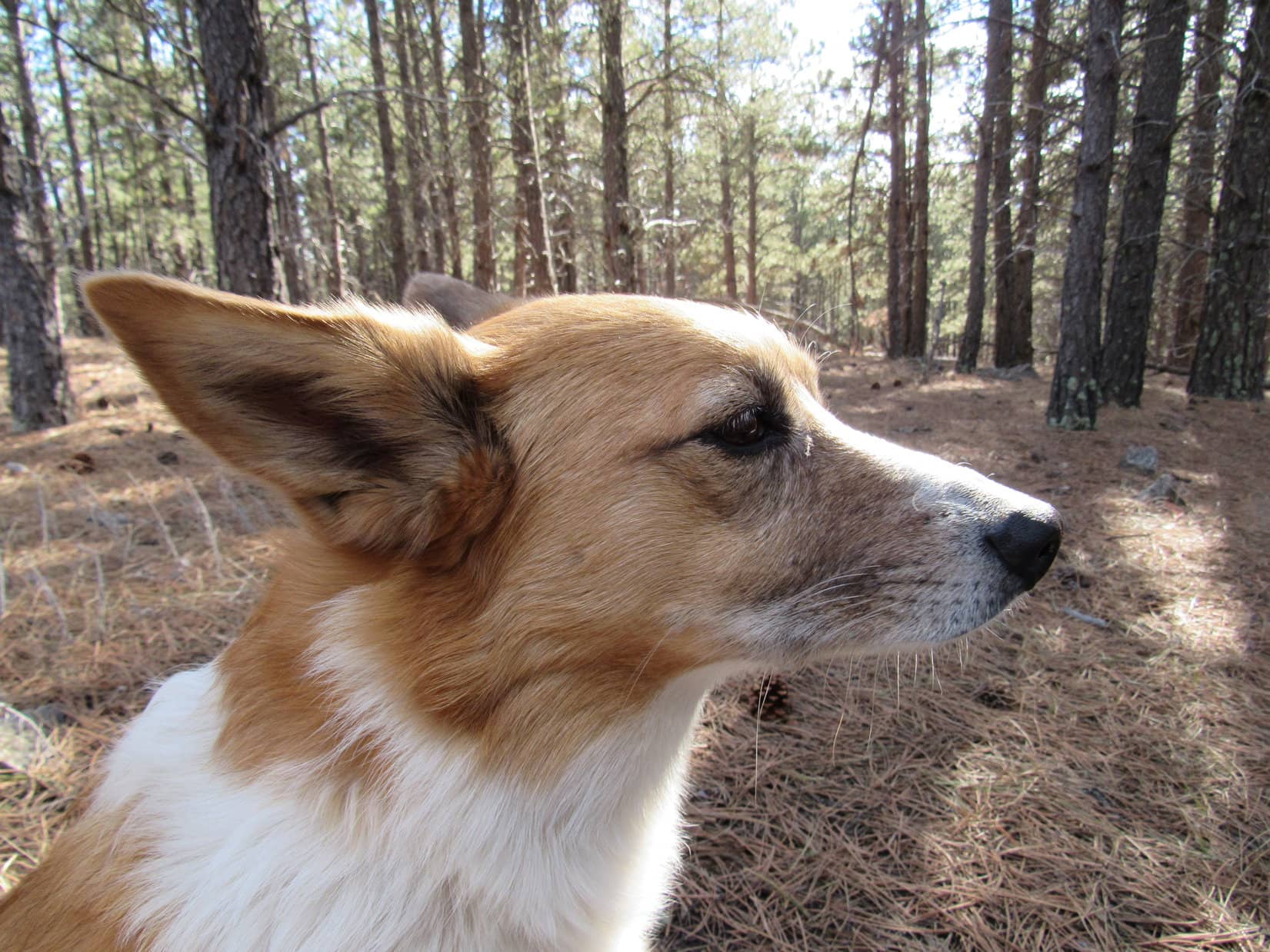
February 11, 2016 was Lupe and SPHP’s 5th anniversary!  Lupe first arrived to live with SPHP the evening of February 11, 2011 as a tiny almost 2 month old puppy.  She made friends with SPHP that very first night, and a life of fun and adventures together began.  When SPHP suggested a Black Hills Expedition to celebrate this 5th anniversary, Lupe was totally in favor.  In fact, she was in a big rush to get going!

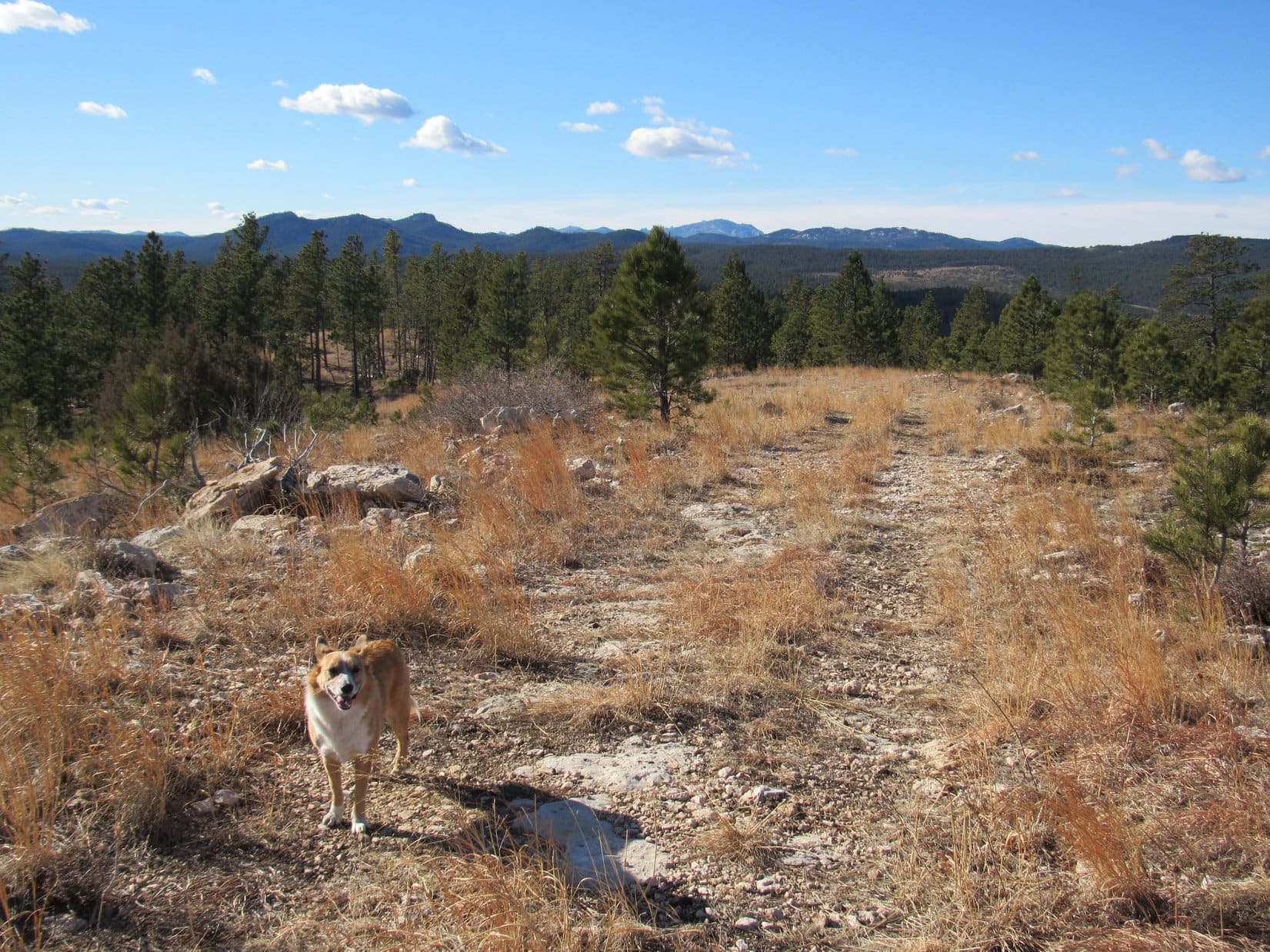
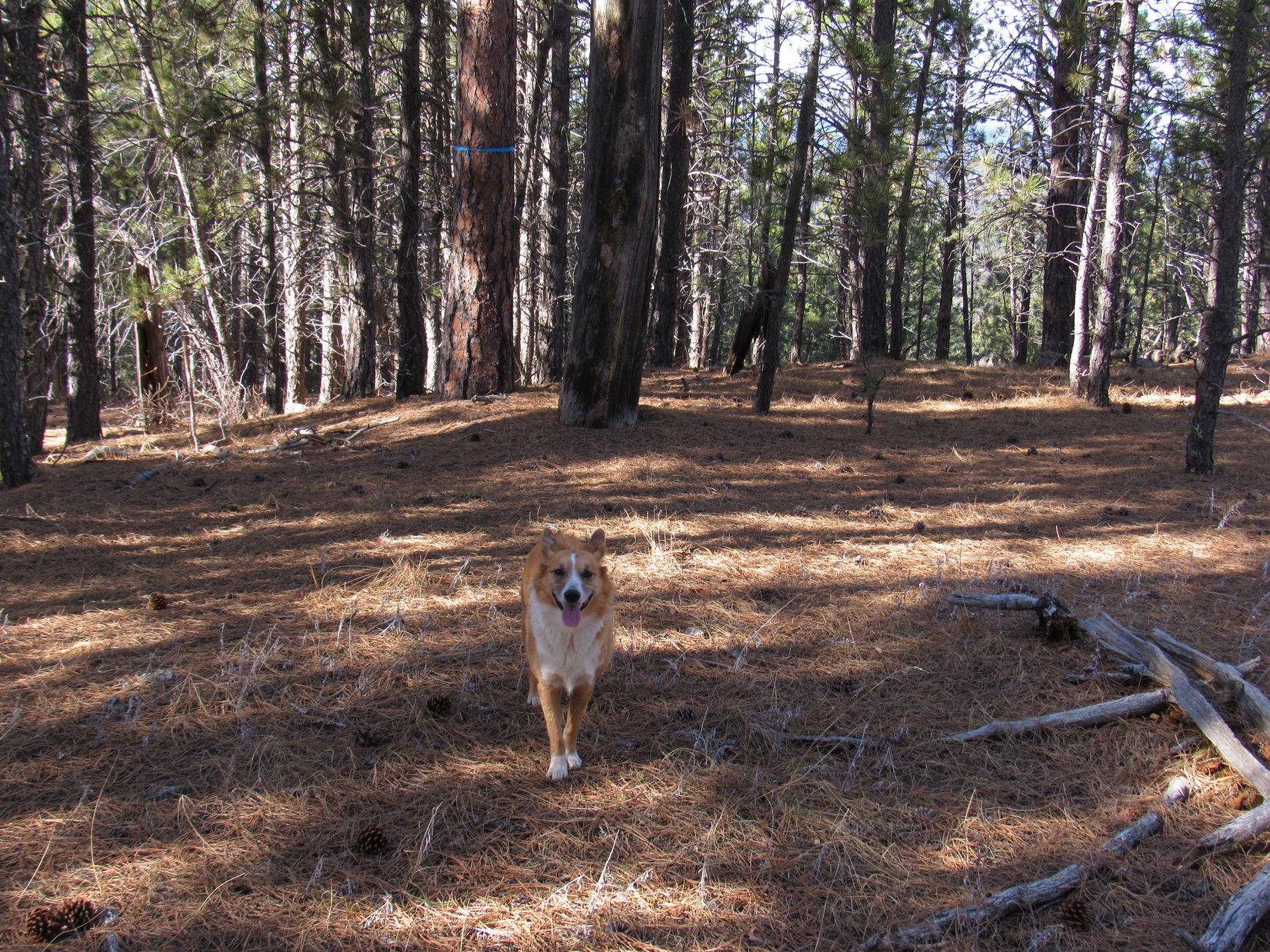
SPHP parked the G6 (8:27 AM, 48°F) at a little pullout along Victoria Lake Road not far from where it left Sheridan Lake Road.  Lupe and SPHP started out following an abandoned road heading NW.  Before too long, the road divided.  Lupe turned NE going up a rather rocky route.  The road was a little steep at first, but started leveling out.  Lupe and SPHP left the road, and climbed N up to a high point.

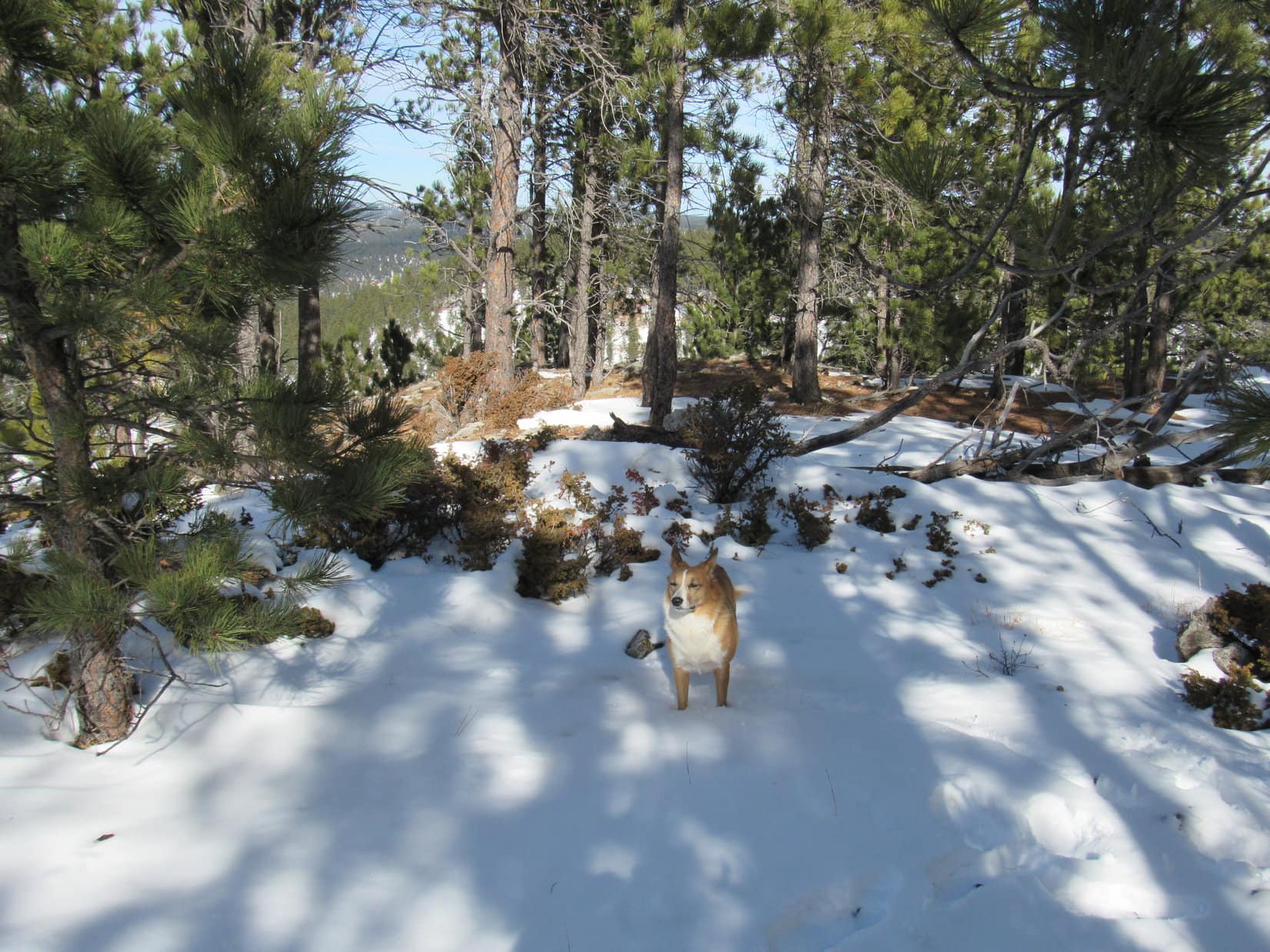
Lupe had a couple of peakbagging goals for the day.  The first one was Commissary Point (4,598 ft.), a little over 2 miles NNW of where the G6 was parked.  SPHP hoped to get a glimpse of Commissary Point from this high point (High Point 4516 on the Peakbagger.com topo map), but no such luck.  High Point 4516 was all forested.  There weren’t views in any direction.

Lupe and SPHP continued N from High Point 4516, gradually losing elevation.  SPHP hadn’t brought along any topo map of the area SE of Commissary Point where Lupe was, so it wasn’t real clear which way to go.  As Lupe headed N, she began to get glimpses of another high hill up ahead.  Lupe went toward it, but SPHP soon realized Lupe was rapidly approaching a deep intervening ravine.

It looked like maybe it was possible to get over to the high hill without losing elevation by circling around to the E of the ravine, and then turning NW.  SPHP was doubtful.  Lupe was in an area where the watersheds typically drain to the E.  If the deep ravine ahead drained E, it would cut off any approach to the high hill from that direction.  Better to try going W, even though that meant losing elevation.

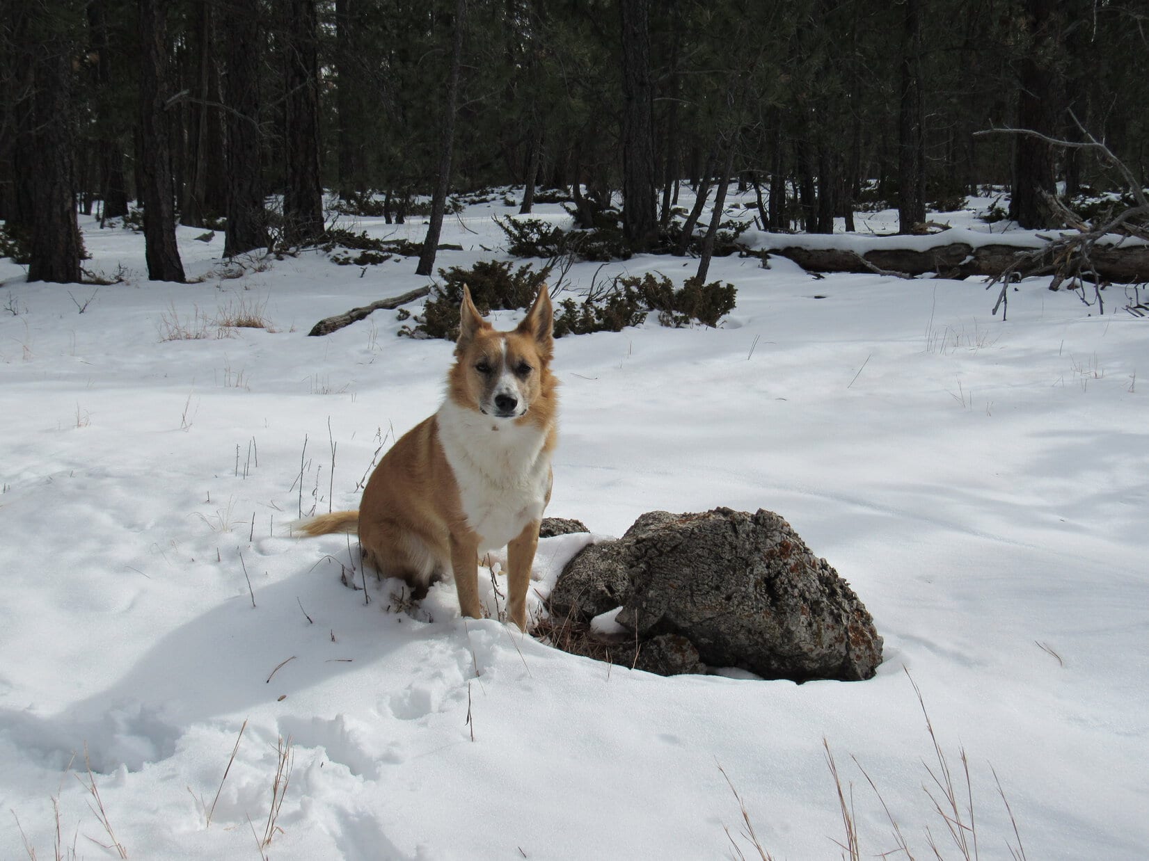
Lupe lost elevation.  Lots of it, as in hundreds of feet.  There was an old barbed wire fence in the forest that was falling over, which presented a danger to Lupe.  SPHP tried to keep her well away from it, but the fence went W, too.  SPHP lifted Lupe over the vicious low-hanging barbed wire strands, to get her N of the fence.  Lupe finally reached the bottom of a side ravine coming down from the S.  SPHP was surprised to find a good single track trail there.  A short trek to the N on it led Lupe and SPHP to another trail that went E/W.

SPHP had guessed wrong.  The trail going E was going UP the big ravine that had been blocking Lupe’s way to the N.  The ravine drained to the W.  There had been no need for Lupe to lose all this elevation.  Oh, well.  Nothing to do, but regain it.  Lupe and SPHP took the trail going E.

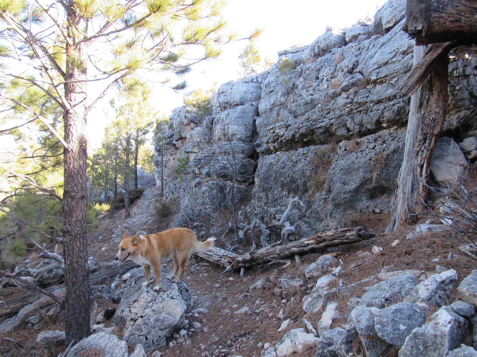
The single track trail was a surprisingly good one.  It headed up the ravine gaining elevation at a moderate pace.  There were some big rock walls along the N side of the ravine.  It was pretty scenic down here.  The only problem with the trail was that it was quite icy for long stretches.  The trail showed signs of recent use.  There were footprints in the snow and ice.  Maybe this was the way to Commissary Point?

Lupe on the trail down in the ravine.

As the “Ice Trail” started nearing a saddle, SPHP noticed another trail branching off to the N.  Since Commissary Point had to be N, and not any farther E, Lupe and SPHP took the branch trail.  SPHP quickly became convinced this was the trail to Commissary Point.  It remained a very good single track trail, and was going roughly in the right direction.  The branch trail went N up a big side gully.  After gaining a fair amount of elevation, it then switchbacked up the W side of the gully to arrive up on a relatively level bench area.

The bench area was mostly meadow, but forested around the edges.  To the N, there was higher ground.  SPHP expected the trail would continue N on up the slope, but instead it wound around to the S going back toward the N edge of the ravine where the Ice Trail had been.  When the trail turned E and started losing elevation, SPHP concluded maybe it was just going to make a loop back down into the ravine somehow.

Lupe didn’t need to go back down to the ravine.  She needed to go N!  SPHP had seen some cairns along the trail shortly after it reached the bench.  Maybe SPHP had missed another branch of the trail going N on to Commissary Point?  Lupe and SPHP returned to where the cairns were, and even went back beyond them, but there didn’t seem to be any other branch of the trail.  Odd.

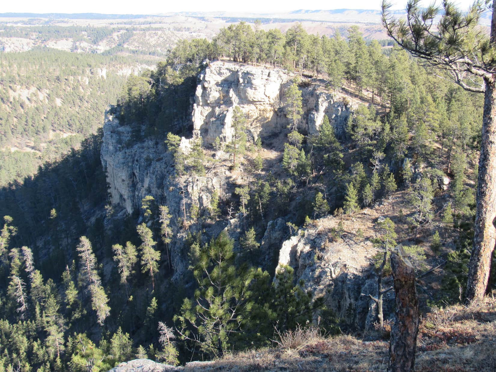
Well, Lupe was going to go N on up the hill, trail or no trail.  She went 100 feet N, gaining about 30 feet of elevation on the way, and suddenly found the trail again!  Surprising, but very handy.  Lupe and SPHP continued N on the trail.  It was clear that Lupe was getting close to the top of Commissary Point.  The trail angled over toward the W side of the hill.  There it continued N above some big cliffs just to the W.  Some places there were big views between the trees to the W or N.

Miss Tasty Nose at a viewpoint along the trail. Lupe and SPHP ultimately wound up over on top of the cliffs seen beyond Lupe. Photo looks N.
These small cliffs were just E of the trail. The top of the hill was just a little way above them. Photo looks N.

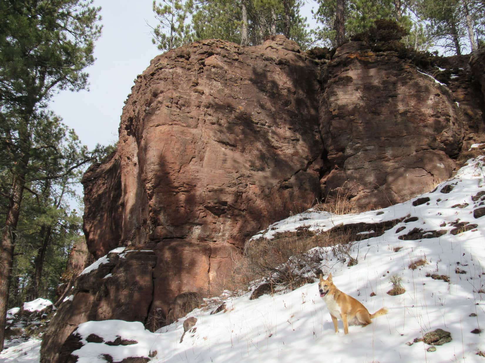
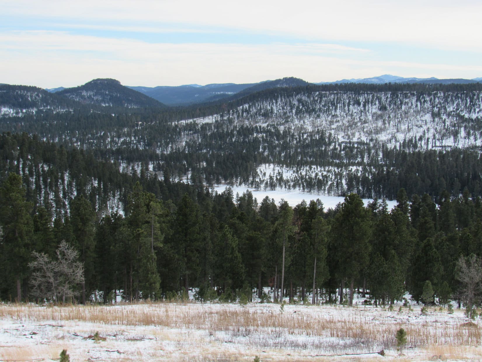
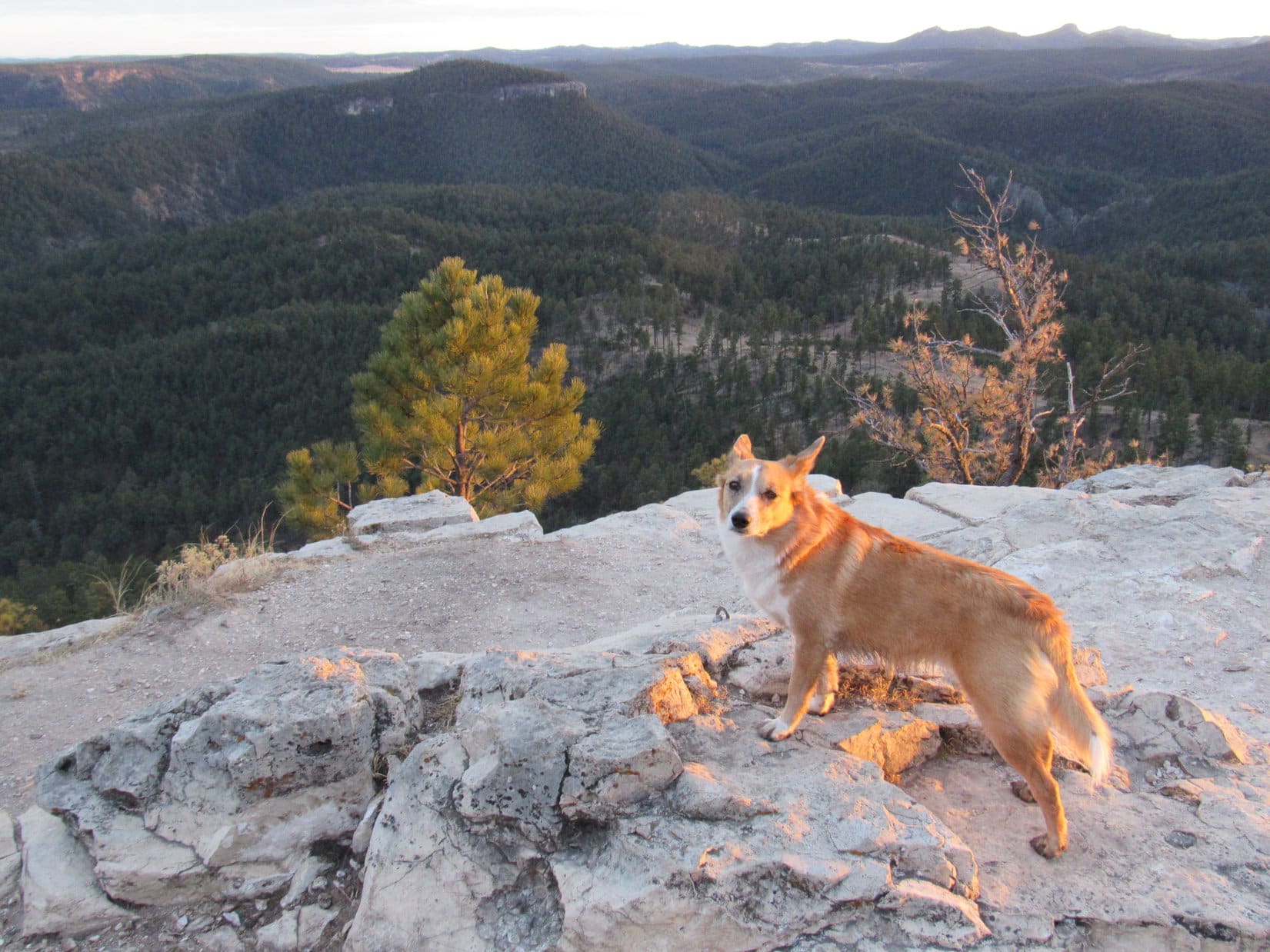
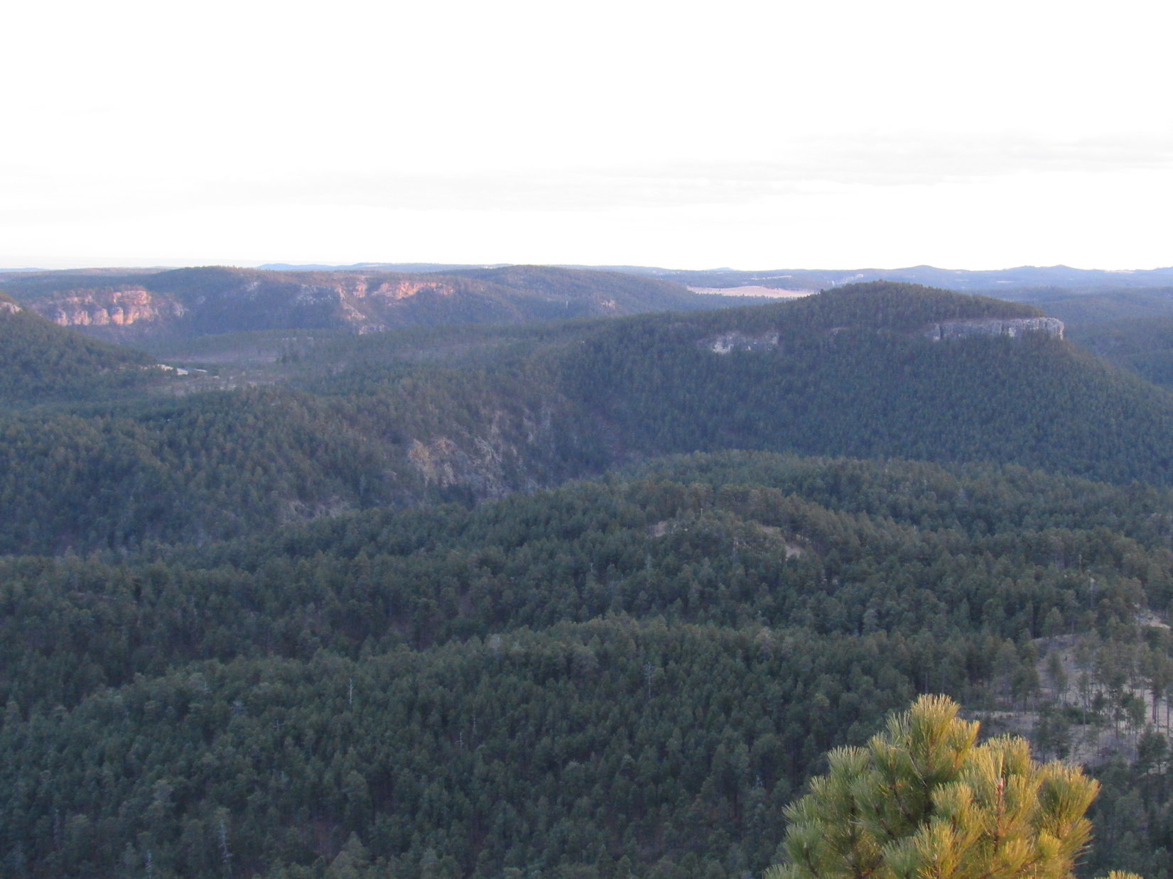
Shortly after passing by some small cliffs on the E side of the trail, Lupe and SPHP left the trail to climb up to the top of the hill.  The top wasn’t very far up above the small cliffs.  The summit was fairly level, open and grassy.  SPHP wasn’t surprised to see there was a dirt road up here.  There were great views in most directions.  Lupe claimed her first peakbagging success of the day.  She had made it to the top of Commissary Point!

Looking SSW from the summit toward Boulder Hill (5,331 ft.) (L) and Harney Peak (7,242 ft.) (R).
Looking SSW from the summit toward Boulder Hill (5,331 ft.) (L) and Harney Peak (7,242 ft.) (C).

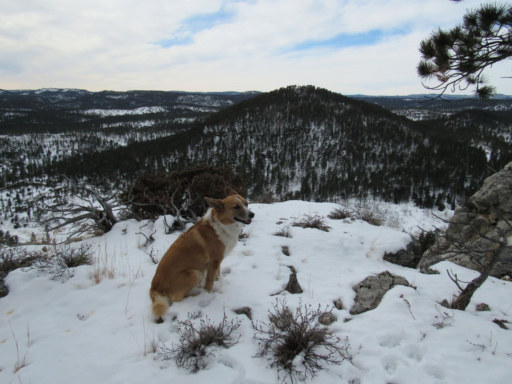
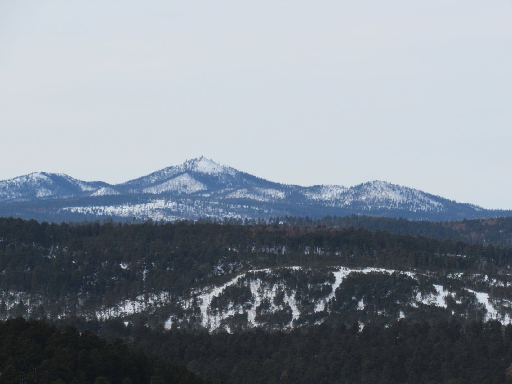
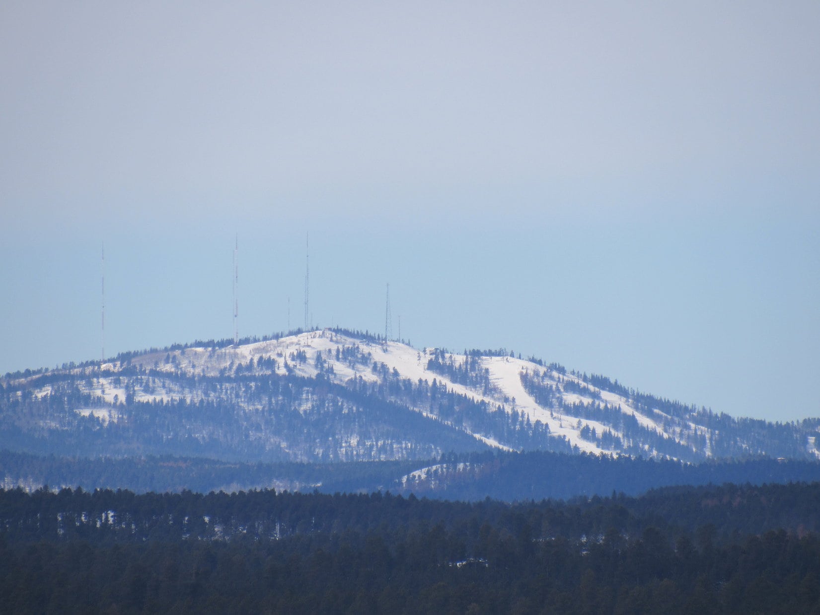
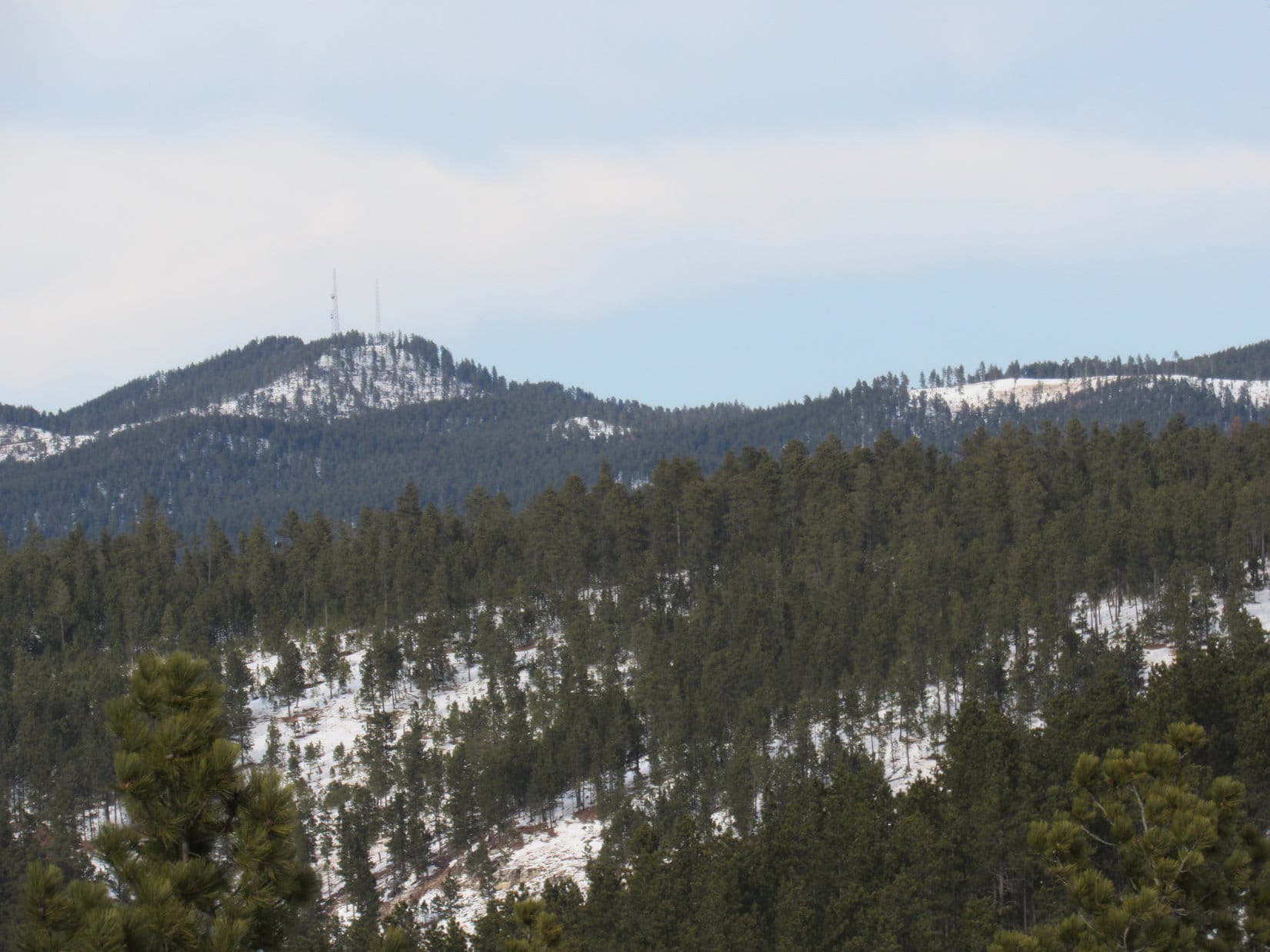
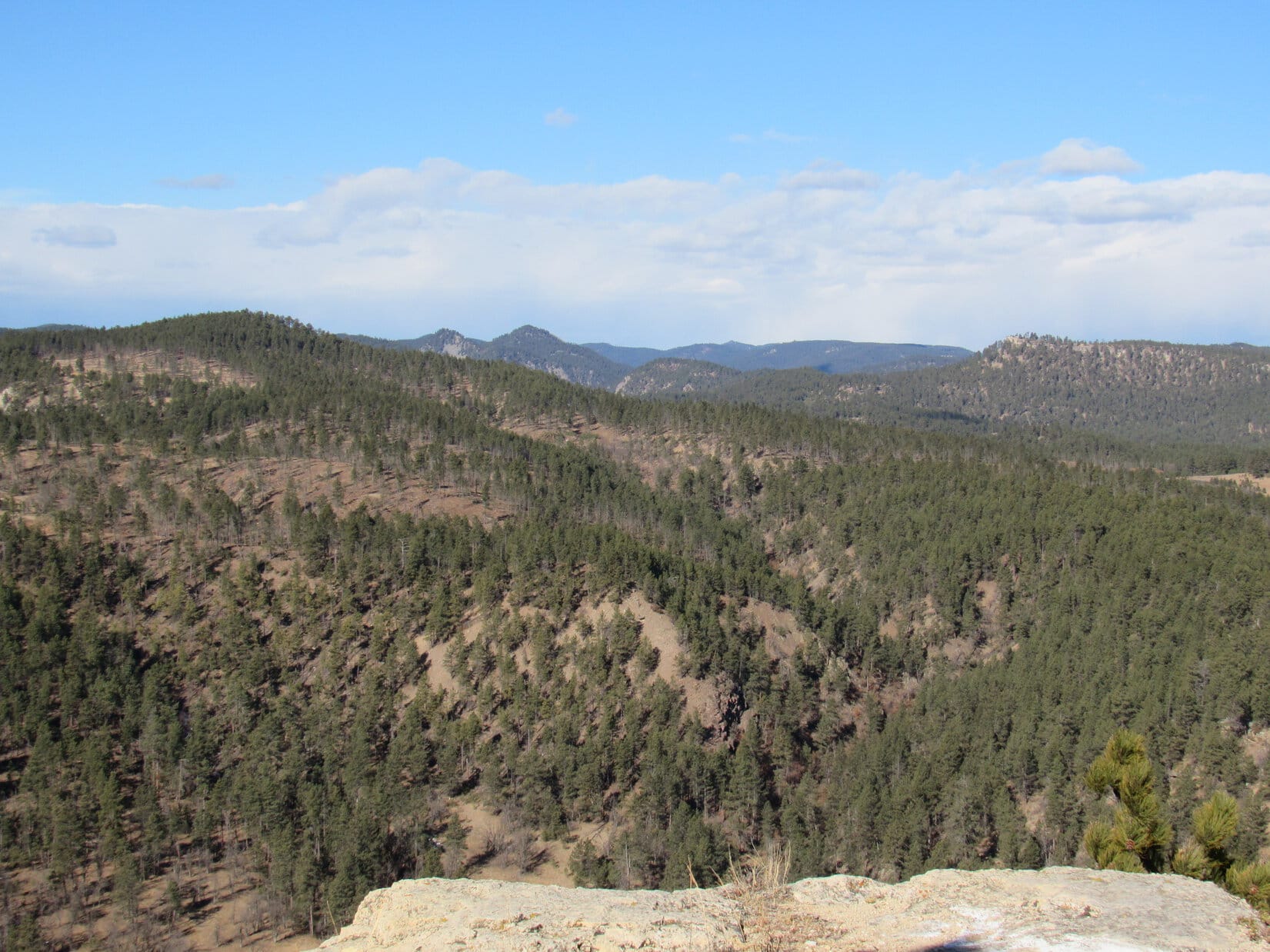
SPHP started looking around to the W and N to get oriented for Lupe’s next peakbagging goal, Tomaha Point.  Funny, nothing that looked like it might be Tomaha Point was anywhere close.  Buzzard’s Roost (4,695 ft.) should have been rather prominent 1.5 miles to the NNW, but it didn’t seem to be there, either.  Thrall Mountain (5,091 ft.) was in sight, but looked pretty far away.

SPHP glanced off to the NE.  There was some forested land over there, part of this same hill, that looked like it might be a little higher than where Lupe was.  Something was wrong.  Maybe Lupe wasn’t at the summit of Commissary Peak yet?  Another problem – back to the S, High Point 4516 looked noticeably higher than where Lupe was.  Something was definitely wrong.

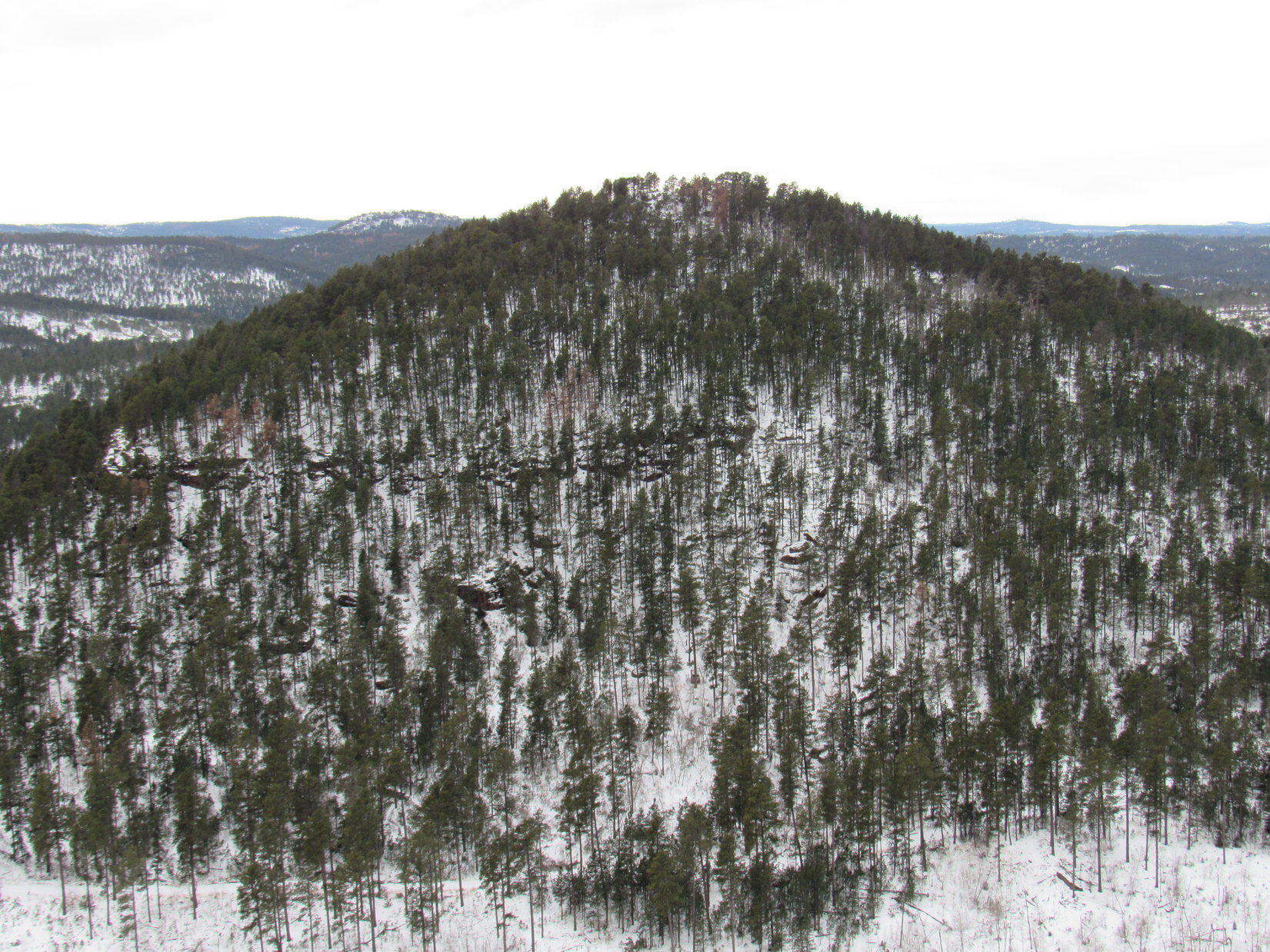
Looking back to the NW, suddenly SPHP knew exactly what was wrong.  That big forested hill over there, beyond a huge canyon and a barren ridge, was Commissary Point – the real Commissary Point.  SPHP had led Lupe up the wrong mountain!  This wasn’t Commissary Point at all!

Scratch one peakbagging success.  Lupe still had a long way to go to get to Commissary Point.  Well, Lupe could still get there, but the chances of getting as far as Tomaha Point today, another 2 miles NW of Commissary Point through rugged terrain, had just gone down the tubes.

"Ha, ha, ha! Oh, for Poodle's sake, SPHP! You mean to tell me that big hill way beyond the barren ridge is the REAL Commissary Point?" Photo looks NW.
“Ha, ha, ha! Oh, for Poodle’s sake, SPHP! You mean to tell me that big hill way beyond the barren ridge is the REAL Commissary Point?” Photo looks NW.
Commissary Point is the forested hill at the center of this photo connected to the barren ridge on the L. Buzzard's Roost is the high ridge on the R. Photo looks NW.
Commissary Point is the forested hill at the center of this photo connected to the barren ridge on the L. Buzzard’s Roost is the high ridge on the R. Photo looks NW.

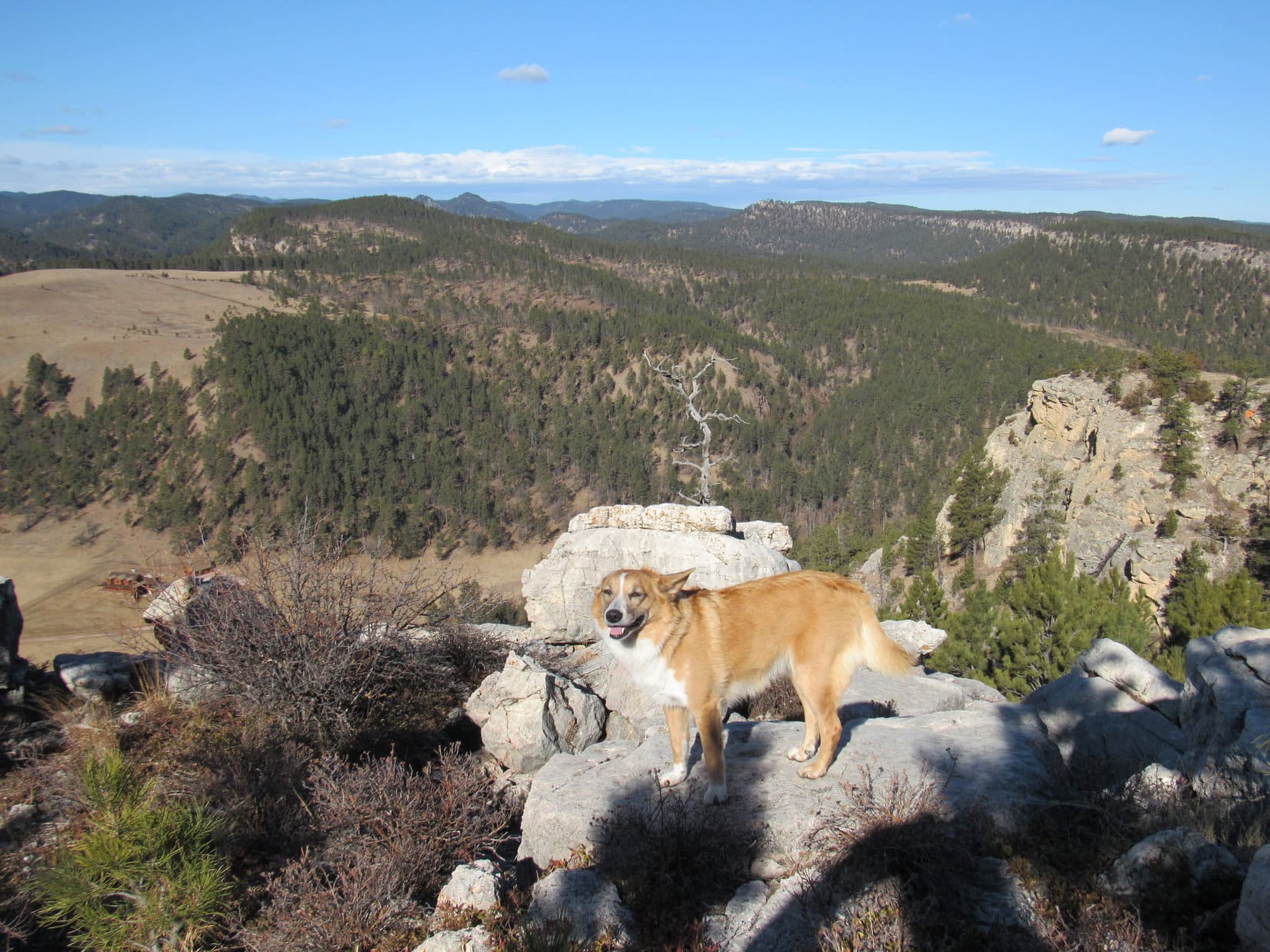
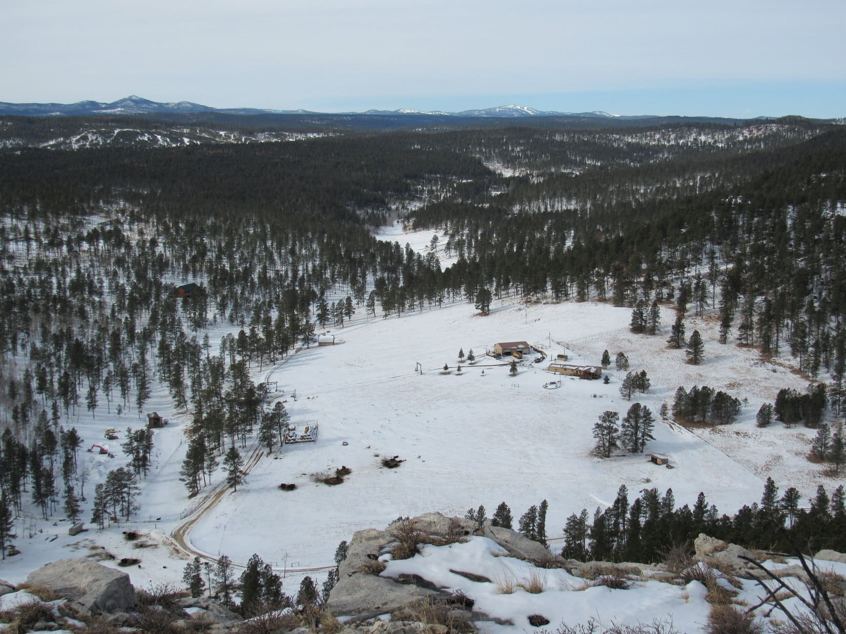
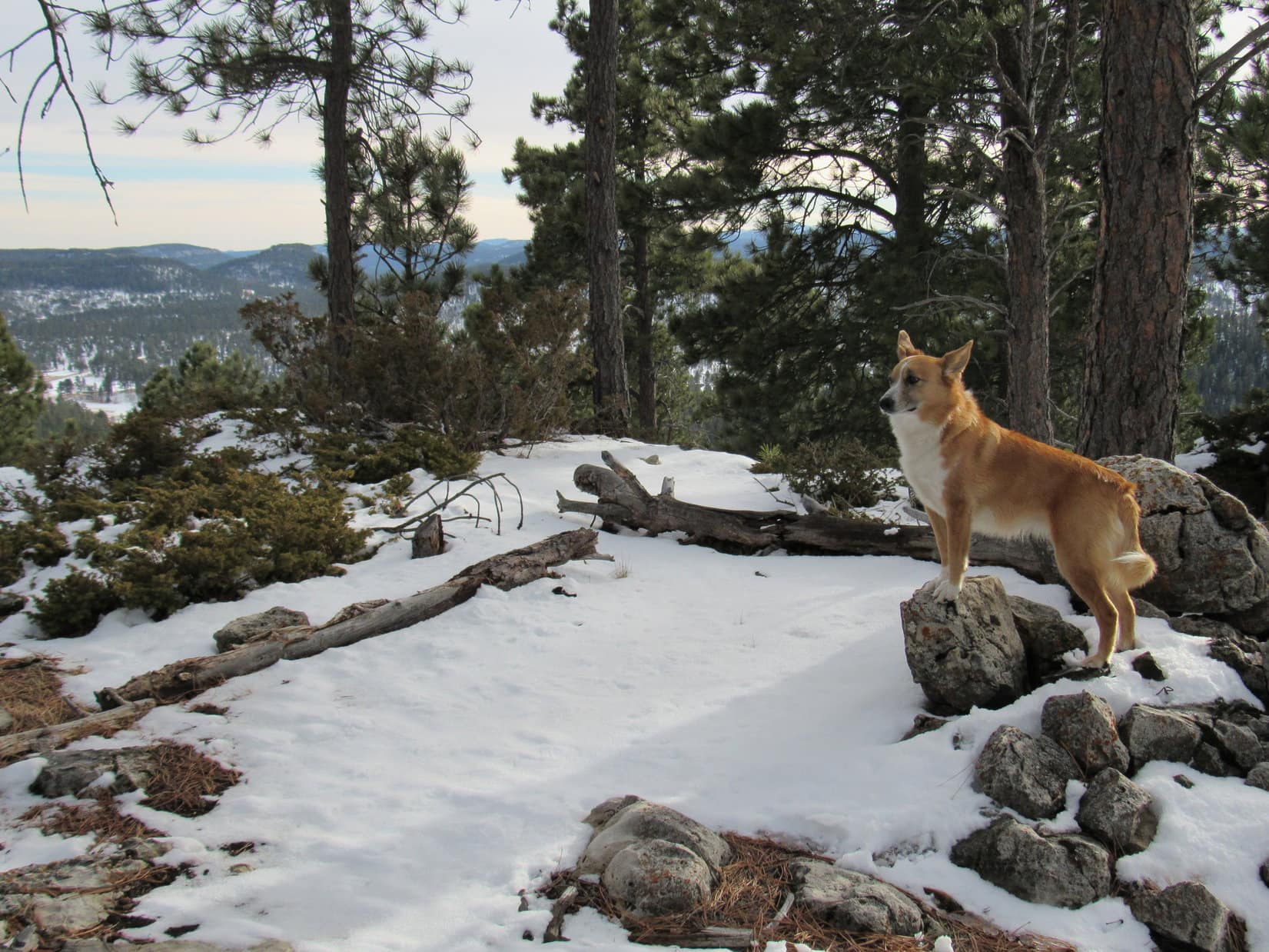
Lupe and SPHP returned to the trail.  To get to Commissary Point, Lupe would have to go all the way back the way she had come clear down to where she first got on the Ice Trail.  Before doing all that, though, since she was already way up here, SPHP thought Lupe may as well explore this mountain.  It wasn’t too much farther N to a big viewpoint jutting out to the W.

The trail took Lupe almost all the way to the viewpoint.  It went N to a road that Lupe and SPHP followed the rest of the way out to the W end of the prominence.  The viewpoint was level and tens of feet wide, but surrounded on 3 sides by big cliffs.

It had been breezy all day long, except down in the ravines.  Up here on this prominence totally exposed to the NW wind, it was nothing short of a roaring gale.  Trees swayed wildly with each gust.  The strong unpredictable wind was a bit unnerving, even though Lupe and SPHP stayed far from the cliff edges.

There certainly was a tremendous view, though.  Lupe and SPHP remained out on the viewpoint for several minutes trying to enjoy the impressive scene.  Unfortunately, the wind was being just too much to contend with.  Neither Lupe nor SPHP could really relax and appreciate the panorama.

Lupe on her way back down to the trail from the top of the "fake Commissary Point".
Lupe on her way back down to the trail from the top of the “fake Commissary Point”.
Looking NNE from the very windy viewpoint.
Commissary Point (L), Thrall Mountain (more distant and slightly L of Center) and Buzzard's Roost (R) from the windy viewpoint. Photo looks NW.
Commissary Point (L), Thrall Mountain (more distant and slightly L of Center) and Buzzard’s Roost (R) from the windy viewpoint. Photo looks NW.

Completely, 110% satisfied, with the amount of fresh air being shipped in from Canada, Lupe and SPHP retreated, leaving the hurricane viewpoint behind.  Lupe followed the road back to the trail, and turned S.  She followed the trail all the way back down to where she had first gotten on the Ice Trail.

There was only one important variation along her route back.  Instead of just taking the shortcut back down the bank N of the bench to reach the trail below, Lupe and SPHP stayed on the upper trail.  SPHP wanted to see just where the two trails connected.  The upper trail took off to the W, and then started winding around so crazily, SPHP began to wonder if the trails really did connect.

In the end, the upper trail turned out to be the same trail as the lower one.  However, it wound all around the perimeter of the whole bench area near the edges of the cliffs.  It took 0.5 mile to do what could have been accomplished in 100 feet.  Clearly, this trail was built to take advantage of the views, every last one of them!

Lupe sniffing around again on the Ice Trail back down in the ravine.

When Lupe reached her original starting point on the Ice Trail, she continued on heading W.  She soon came to Victoria Creek, or at least its creek bed.  The creek was dry, except for puddles in some places.  Just beyond the creek, Lupe reached a road.  The road was icy, but Lupe and SPHP followed it NW.  It soon led to a fence on the border of private property.

Lupe and SPHP turned away from the fence and climbed a ridge to the SW.  Once up on the ridge, Lupe found the trail again.  SPHP remembered being here before, on another expedition with Lupe a long time ago.  This was part of the Pink & Black Checkered trail, wasn’t it?  Maybe not, SPHP looked, but didn’t see any of the pink and black checkered markers along the way.

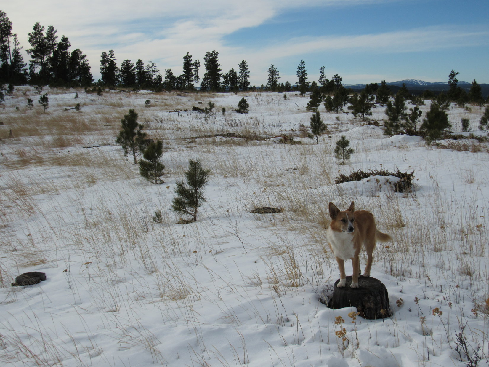
The trail gained elevation as it headed generally W.  Lupe and SPHP followed it only until it was at the S end of the barren ridge leading to Commissary Point.  There Lupe and SPHP turned N, and started following the barren ridge.

Lupe on the barren ridge SE of Commissary Point, seen beyond her.
Lupe and SPHP had been up on the highest part of the hill pictured here. Photo looks ESE.
The biggest rock prominence just R of center is the very windy viewpoint on the hill that is NOT Commissary Point. Photo looks ESE from the barren ridge.

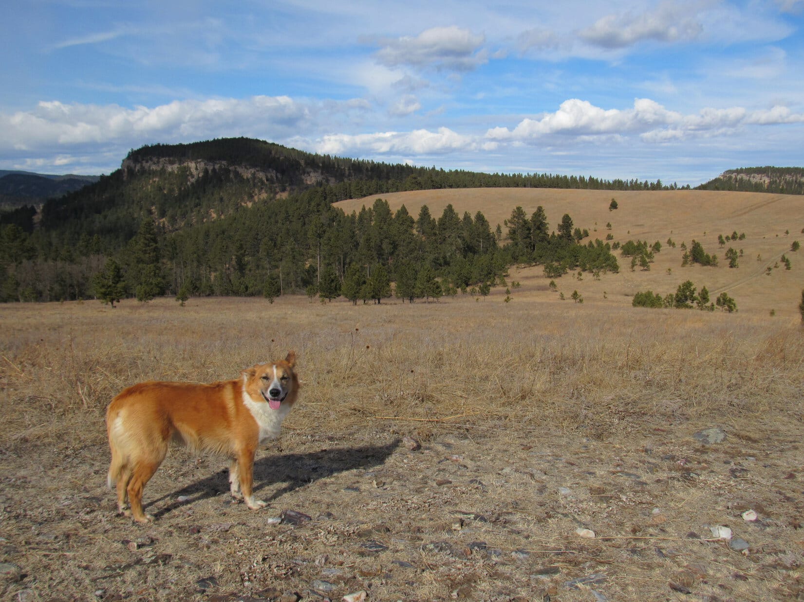
Up on the barren ridge, Lupe and SPHP were following an old dirt road that showed little sign of use.  However, as Lupe started getting close to the forest at the NW end of the barren ridge, she found a freshly graded road.  Much of the E end of Commissary Point has been logged recently.  The ground is all chewed up, and Lupe saw big stacks of dead pine trees.  It was kind of a mess.

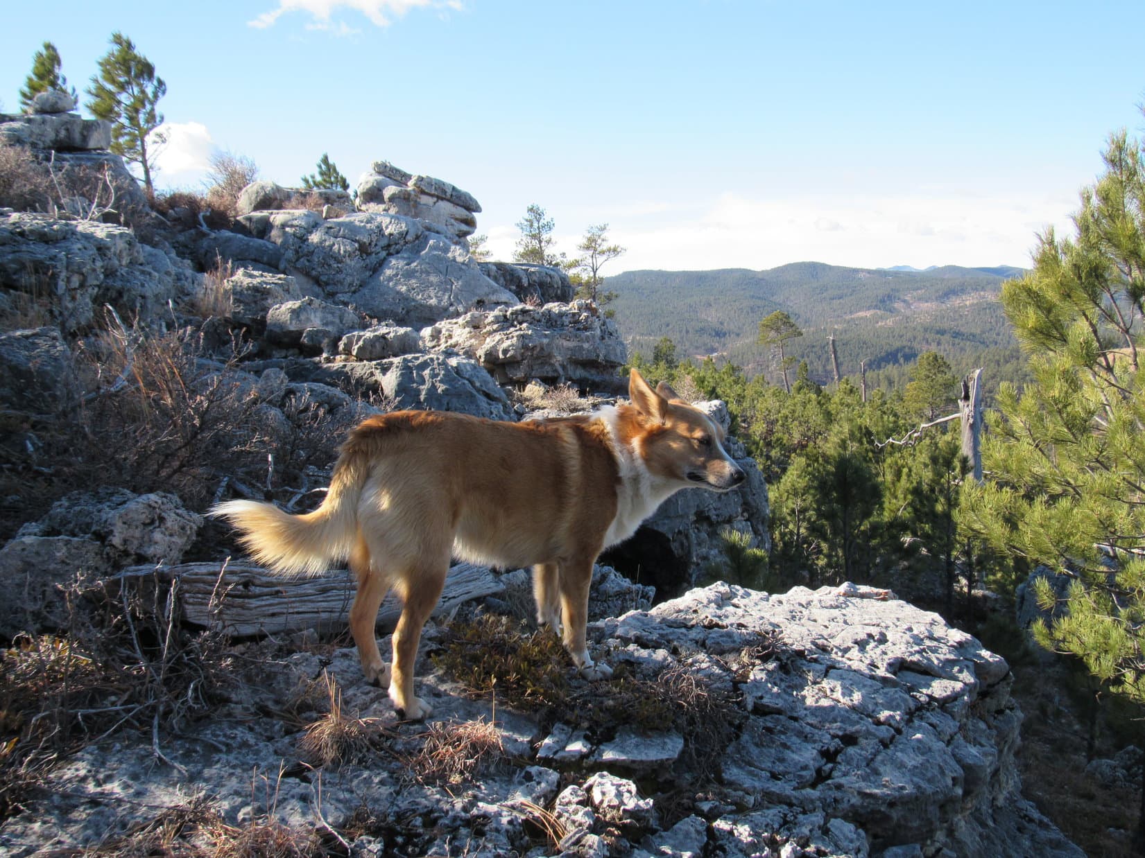
Once Lupe had a good start going NW up Commissary Point, she went to the S rim of the mountain, reaching it at a place where there was a view toward Boulder Hill and Storm Hill.  Beyond this point, the forest had not been logged near the rim.  It was thick, overcrowded and dark.  Lupe passed through the dense forest staying on the S shoulder of the mountain, before turning N for the final climb up to the summit.

Near the S rim of Commissary Point. Of the 3 high points in the distance in the center of the photo, Storm Hill is on the L. Boulder Hill is the knob on the R. Photo looks S.

The final climb was short and easy.  Lupe reached the summit to claim her real, genuine Commissary Point peakbagging success!  Nothing could be seen from the summit except the surrounding dense forest, although it was pretty clear there was some very steep ground close by to the N.  Lupe and SPHP stopped for a break.  Lupe had Taste of the Wild, water, and was most eager to help SPHP with a couple of chocolate-covered granola bars.  SPHP had water and an apple, too.

This is it! The real deal! Lupe is on the summit of Commissary Point. Photo looks W.
Loopster on Commissary Point, 5 years to the day after she came to live with SPHP.
Lupe on Commissary Point. This photo looks E. Note the huge difference in the view from the photo looking W.

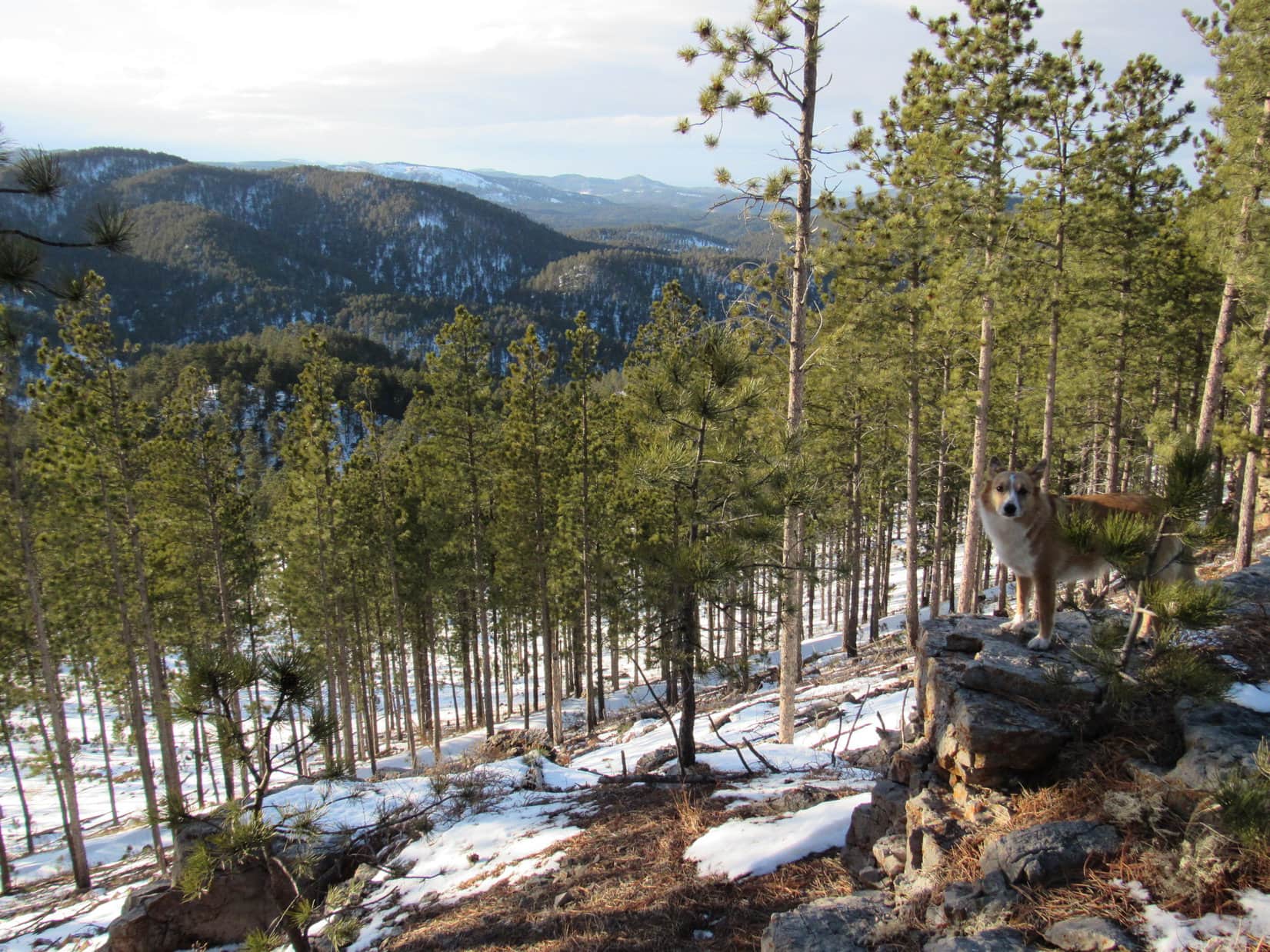
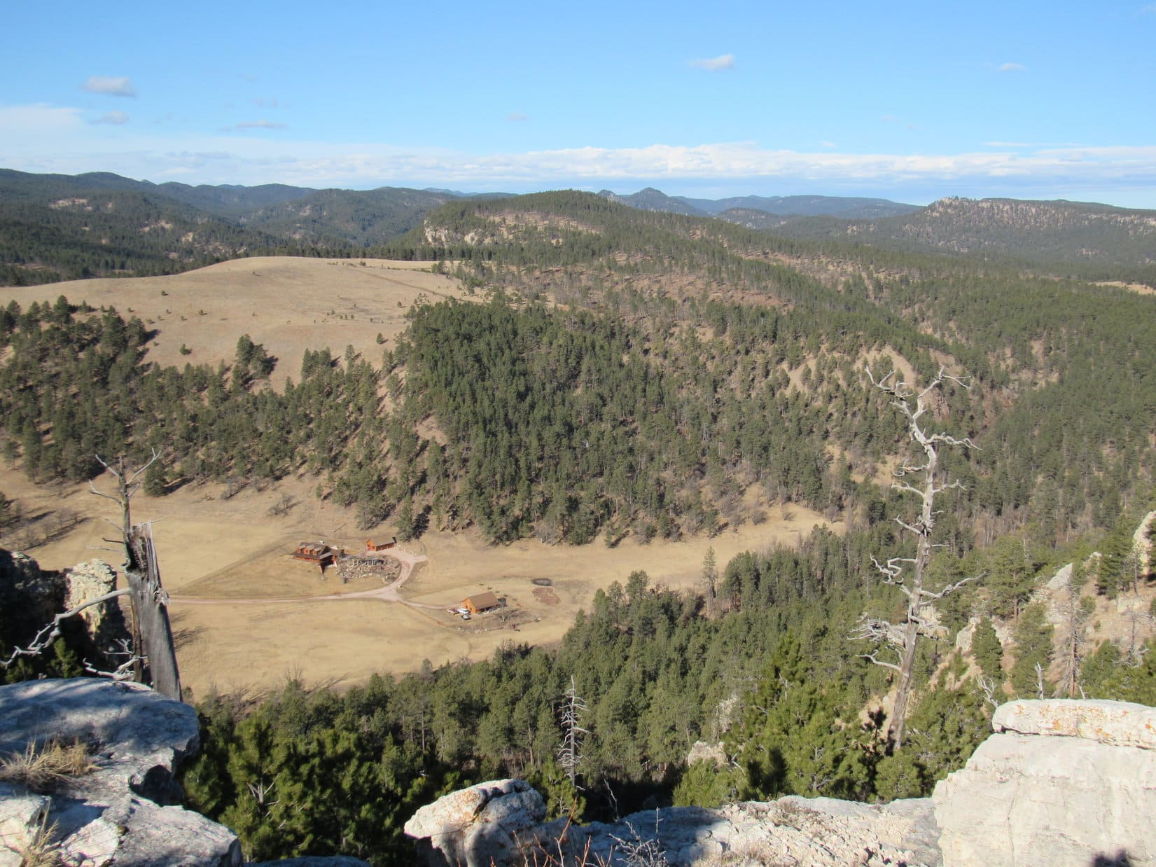
Although the summit of Commissary Point offered no distant views, the topo map showed that there ought to be some from cliffs at the slightly lower W end of the mountain.  Lupe and SPHP left the summit heading W through the forest.  It was a pleasant stroll, and Lupe had fun running around exploring.  It only took 5 or 10 minutes to reach the W end of the mountain.

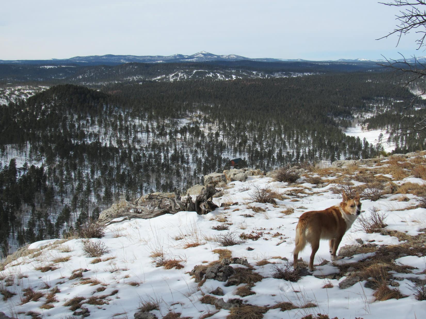
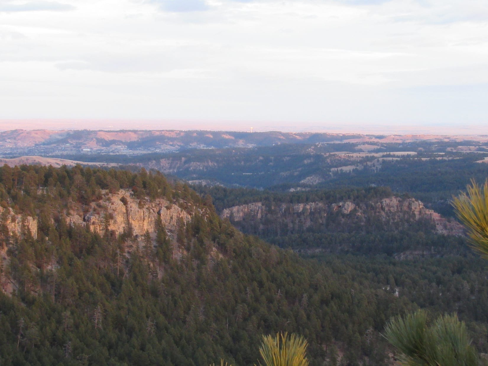
A nearly level limestone platform was at the edge of high cliffs.  There were only a few trees close to the edge, providing a little strip of open ground where there were big 180° views from the S around to the W and N.  This exposed ground felt the full force of the NW wind, which was still very strong.  Lupe didn’t like the wind, but she did like peering over the edge from a safe distance.

Buzzard's Roost is the high ridge seen beyond Lupe. Photo looks NNW from the W end of Commissary Point.
Buzzard’s Roost is the high ridge seen beyond Lupe. Photo looks NNW from the W end of Commissary Point.
Strong gusts of the NW wind ruffled Lupe’s fur out on the exposed viewpoint. The wind was coming from behind her in this photo. Photo looks NNW.
Rapid Creek is seen below down in Dark Canyon. Buzzard’s Roost is way up above, just R of Center.
Looking W.
Looking W.
Thrall Mountain near Johnson Siding is the highest distant point at Center. Photo looks NW.

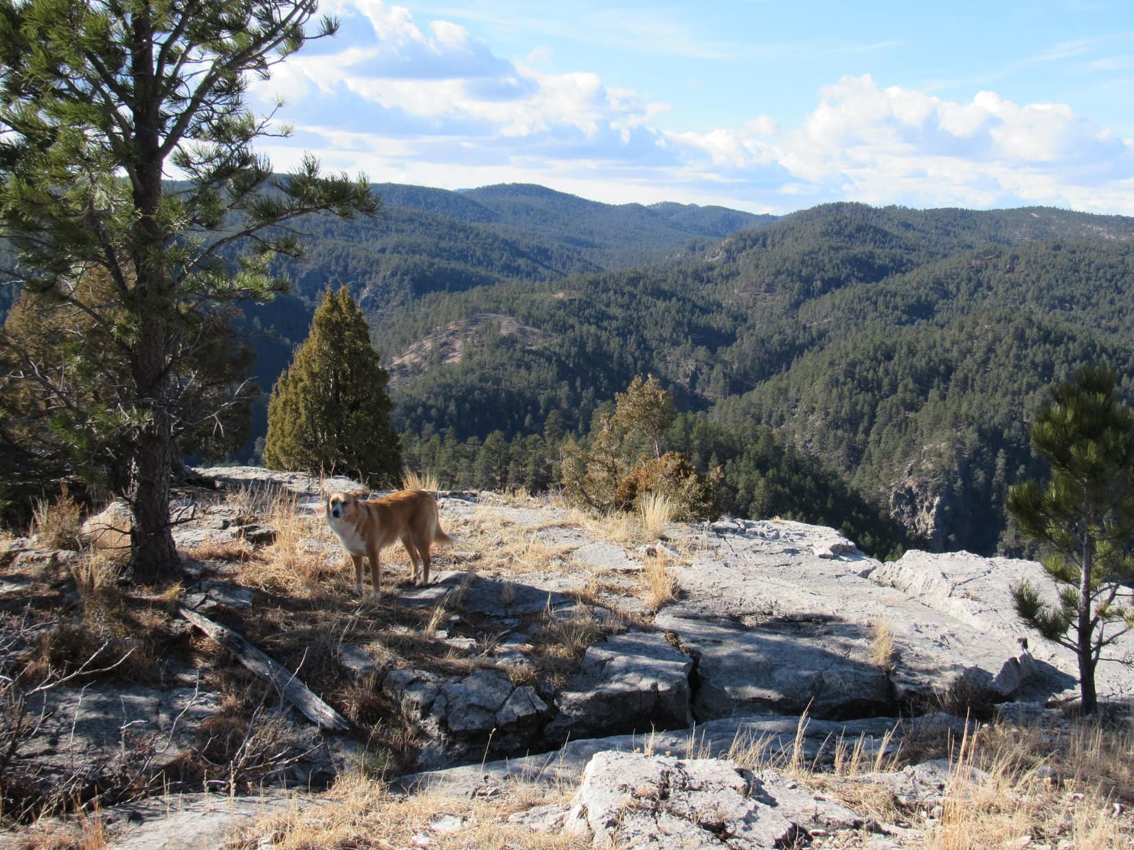
Lupe and SPHP stayed for a little while at the W end of Commissary Point.  The Carolina Dog would have stayed longer, if there hadn’t been such a roaring gale out of the NW.  Lupe at least saw Tomaha Point, still 2 miles off the to NW, but there was no way Lupe and SPHP were going to make it clear over there today.  There were big canyons between here and there.  It was time to start heading back to the G6.

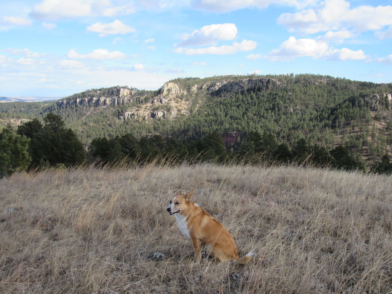
Both Lupe and SPHP were rather glad to go back into the dense forest, where they were protected from the wind.  Instead of returning to the summit of Commissary Point, Lupe explored the forest near the cliffs along the S rim of the mountain.  There were several places where the forest gave way to open spots with views to the S along the way.

Looking SSE from near the S rim of Commissary Point. The closest big patch of open ground in the distance is part of the barren ridge Lupe would go back over on her way to the G6. The G6 is parked near the more distant patch of open ground well beyond the ridge.

Lupe went back along the barren ridge SE of Commissary Point again.  She was pretty excited when she heard a helicopter approaching from the S.  It flew by a bit to the S of Lupe.  She barked and leaped like a nut case, but it worked – the terrified helicopter flew away to the NNE.

The tiny black spec in the sky just L of Center is not dust on your screen. It is the helicopter that got Lupe so stirred up. Photo looks SE from the barren ridge.
Lupe on the barren ridge on her way back to the G6. Photo looks ESE toward the hill she had climbed earlier in the day – the one that turned out NOT to be Commissary Point!

Lupe returned to the single track trail at the S end of the barren ridge.  She turned E, and followed the trail all the way down to where it crossed the road down in the canyon, and then Victoria Creek.  Now Lupe was back on the Ice Trail.  When she reached the branch of the trail that went S up the side ravine, she took it.

The branch trail climbed for a little while, and then went up and down over a series of little hills and gullies.  Lupe and SPHP arrived back at the G6 at 3:20 PM (50°F).  Lupe had succeeded in climbing Commissary Point, but had lost so much time doing it along SPHP’s very circuitous route, she didn’t get to climb Tomaha Point.

No Tomaha Point to finish the day?  No problem.  SPHP hatched another plan.  There was still more than enough time left for Lupe and SPHP to drive over to the Buzzard’s Roost trailhead along Hwy 44W (Rimrock Hwy).  The trail to the top of Buzzard’s Roost wasn’t very long, maybe around 0.75 mile.  Lupe could see the sunset from Buzzard’s Roost!  She would also get a look back at Commissary Point from there.

Lupe and SPHP spent 30 minutes in Rapid City, and then drove on out Hwy 44W to arrive at the Buzzard’s Roost trailhead on the S side of the Hwy at 4:29 PM (50°F).  Lupe took the Sundown Trail up to the short Buzzard’s Roost trail that went to the high point at the end of the ridge.

(Signs said the Sundown Trail was extremely difficult.  The difficulty was way overstated.  The Sundown Trail was just a normal hiking trail, a bit rocky in places, that gained elevation gradually as it followed along the base of low cliffs.  Easy to moderate the whole way by Lupe standards.)

The sun was already very low on the horizon when Lupe reached the summit of Buzzard’s Roost, right at the very end of the ridge. Big cliffs were close at paw on 3 sides.  Lupe and SPHP were both very glad that the fierce NW wind had by now almost completely subsided.  Lupe and SPHP sat together on the white limestone surveying the views, while waiting the last few minutes for sunset.  Off to the SE, Lupe and SPHP saw Commissary Point and much of the territory Lupe had spent the day exploring.

Lupe reaches the summit of Buzzard's Roost shortly before sundown. She had been to Buzzard's Roost once before, over 3.5 years ago. Kathy and Lanis had been with Lupe then.
Lupe reaches the summit of Buzzard’s Roost shortly before sundown. She had been to Buzzard’s Roost once before, over 3.5 years ago. Kathy and Lanis had been with Lupe & SPHP then.
Looking SSE toward Commissary Point, the forested hill just L of Center near the top of the photo.
The last rays of the sun illuminate the cliffs on the L, where Lupe had been early in the day. Commissary Point is on the R.
From Buzzard's Roost, Lupe could see the W side of Rapid City, SD (just in front of and below the most distant forested ridge). Photo looks E.
From Buzzard’s Roost, Lupe could see the W side of Rapid City, SD (just in front of and below the most distant forested ridge). Photo looks E.

As Lupe and SPHP sat there, SPHP noticed that Lupe was staring intently at the edge of the cliff just a few feet away.  SPHP asked Lupe what she saw.  Lupe growled, and looked ready to spring over there.  No way!  Don’t!  SPHP hung on to Lupe, and talked to her.  She kept staring, but calmed down.  She must have heard something.  SPHP detected nothing unusual.

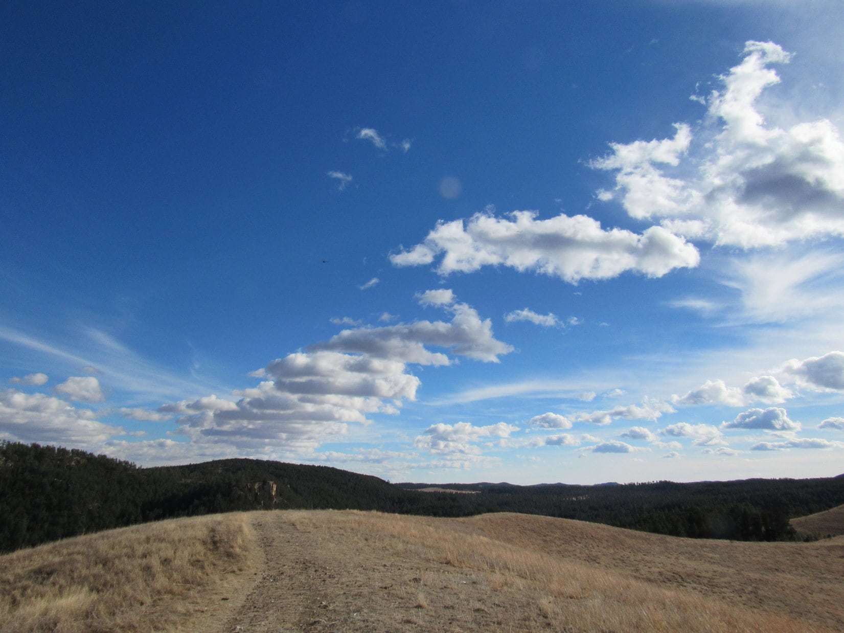
Sunset arrived.  The colors weren’t super spectacular, but they were pretty good – certainly worth seeing.

Sunset on Buzzard's Roost.
Sunset on Buzzard’s Roost.
5 years spent with Lupe fade into history.

On the way back to the G6, Lupe took the Buzzard’s Roost/Jack’s trails.  Jack’s trail should have been even easier than the Sundown Trail, but it was icy, and wet, and a sea of mud.  Lupe and SPHP tried to stay on the grass near the edge of the trail whenever possible.

Lupe reached the G6 at 5:59 PM (46°F).  It was almost dark out.  Another long February night was here.  This one would soon start like the first one SPHP spent with tiny puppy Lupe 5 years ago, snuggled together to get some sleep.  Except, maybe this time Lupe would be tired enough to actually sleep.  No more 10,000 licks from a lonely, scared little Carolina Dog excited to just to have a new friend, any friend, after being torn away from her mother and siblings a few hours earlier.

It was going to be a good night, but really, that one 5 years ago was better.
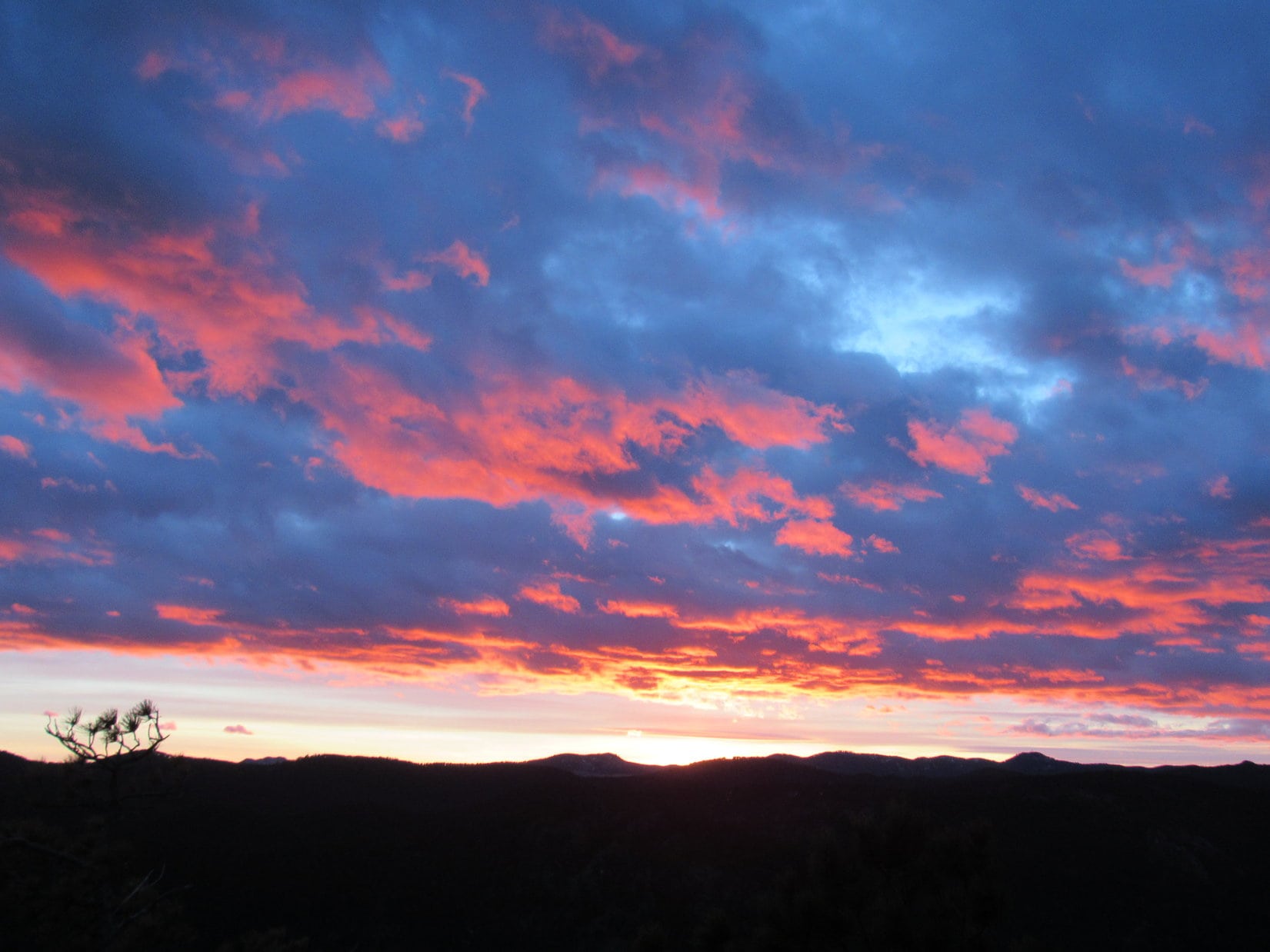
Sunset at Buzzard's Roost, 2-11-16Links:

Next Black Hills Expedition                     Prior Black Hills Expedition

Want more Lupe adventures?  Choose from Lupe’s Black Hills Expeditions Adventure Index, Dingo Vacations Adventure Index, or Master Adventure Index.  Or subscribe free to new Lupe adventures.

Cirque of the Towers, Lonesome Lake, Skunk Knob & Jackass Pass, Wind River Range, WY (9-2-15)

Lupe was gone.  The bright-eyed, sharp-eared Wild Dingo of the Night had taken her place.  Stars blazed above while the Wild Dingo of the Night sniffed eagerly around this way and that in the darkness.  In and out of the tiny house, again and again.  Finally the Wild Dingo of the Night was gone for good.  Lupe snoozed on her red down sleeping bag.  SPHP could finally pass out, too.

Morning came.  Day 25 of Lupe’s great Summer of 2015 Dingo Vacation.  Lupe was camped in the Cirque of the Towers in the Wind River Range of Wyoming.  She had come over Jackass Pass from Big Sandy Lake the previous day.  There was lots to do and see!  Lupe and SPHP began the day by climbing up the valley just SW of Pingora Peak (11,884 ft.) to see Cirque Lake.

Lupe climbs up the side valley SW of Pingora Peak on her way to see Cirque Lake. This photo looks S back toward War Bonnet Peak (12,369 ft.) (L) and Warrior Peaks (12,406 ft.) (R).
From L to R: Watch Tower, Block Tower, Sharks Nose & Overhanging Tower in the Cirque of the Towers.
From L to R: Watch Tower (12,326 ft.), Block Tower (12,210 ft.), Sharks Nose (12,229 ft.) & Overhanging Tower (12,164 ft.) in the Cirque of the Towers.
War Bonnet Peak (L) and Warrior Peaks (R). Photo looks S.
War Bonnet Peak (L) and Warrior Peaks (Center). Photo looks S.
Lupe reaches Cirque Lake. From L to R: Part of Watch Tower, Block Tower, Sharks Nose, & Overhanging Tower. Photo looks W.
Cirque Lake, Sharks Nose (L) & Overhanging Tower (R).
Looking S from near Cirque Lake in the Cirque of the Towers. Wind River Peak is the highest peak in the distance L of center.
Looking SSE from near Cirque Lake in the Cirque of the Towers. Wind River Peak (13,192 ft.) is the high most distant peak L of center.
Watch Tower (L) and Block Tower (R) from Cirque Lake.
Wind River Peak is seen far away to the SE from Cirque Lake. The top of War Bonnet Peak juts up over the ridge.
Wolfs Head (12,160 ft.) from Cirque Lake. As Lupe climbed up the valley to Cirque Lake, she saw mountain climbers who had risen before dawn already way up on top of the scary narrow ridge between Pingora Peak and Wolfs Head. Photo looks NNW.
Pingora Peak from near Cirque Lake. Pingora Peak and other peaks in the Cirque of the Towers are popular with mountain climbers. Lupe saw climbers on Pingora Peak and Wolfs Head this day. Mountain climbing can be dangerous, of course. Only 5 days earlier, on August 28, 2015, two experienced climbers had fallen to their deaths from Pingora Peak. Photo looks NE.
Lupe squints in the sunshine at Cirque Lake in the Cirque of the Towers. Overhanging Tower on L. Photo looks WNW.

Lupe and SPHP took a short break up at Cirque Lake.  Lupe drank from the lake and had some Taste of the Wild.  SPHP watched mountain climbers way up on the ridge between Pingora Peak and Wolf’s Head.  They were shouting to each other, and apparently having a great time as they worked their way slowly toward Wolf’s Head.

Lupe and SPHP were quite content with the stunning views from Cirque Lake.  American Dingoes don’t go in for any sports that require ropes, except Tug-‘O-War.  SPHP feels the same way about it.  It’s both fun and scary enough just watching those daring souls who enjoy clinging to the face of some precipice.

Only the day before, on her way up the trail from Big Sandy Lake to Jackass Pass, Lupe had seen a climber coming down the trail who had been injured in a fall.  The climber had been limping along under his own power, but others in the party said he had a rather badly injured leg due to a 50 foot fall on Pingora Peak.  In his case, ropes and equipment had prevented a more disastrous outcome.

After shouts of joy and triumph were heard from the climbers now on top of Wolf’s Head, Lupe and SPHP left Cirque Lake and started back down into the main part of the Cirque of the Towers where Lupe’s tiny house was still set up.  Lupe’s next destination was the biggest waterfall in the Cirque of the Towers.

Lupe starts back down from Cirque Lake in the Cirque of the Towers. East Temple Peak is seen in the distance (far L). War Bonnet Peak (L) and Warrior Peaks (Center). Photo looks SSE.
Lupe starts back down from Cirque Lake in the Cirque of the Towers. East Temple Peak (12,600 ft.) is seen in the distance (far L). War Bonnet Peak (L) and Warrior Peaks (Center R). Photo looks SSE.
Lupe’s “tiny house” (tent) is seen here as the dark spot to the L of the big trees in the lower R part of this photo. Photo looks S.
Jackass Pass is the low ridge on the L. Wind River Peak is seen far in the distance beyond Haystack Mountain (Center). War Bonnet Peak (R). Lupe headed for the biggest waterfall in the Cirque of the Towers, which is not seen here, but is to the left of the small pond near the center of this photo.
Jackass Pass is the low ridge on the (L). Wind River Peak is seen far in the distance beyond Haystack Mountain (11,978 ft.) (Center). War Bonnet Peak (R). Lupe headed for the biggest waterfall in the Cirque of the Towers, which is not seen here, but is to the left of the small pond near the center of this photo.
Lupe reaches the largest waterfall in the Cirque of the Towers. Photo looks WSW.
Pylon Peak (R) in the Cirque of the Towers. Photo looks W.
Pylon Peak (12,378 ft.) (R) in the Cirque of the Towers. Photo looks W.

The waterfall was gorgeous.  Lupe took a big refreshing drink, of course.  No trip to the Cirque of the Towers is complete without a side excursion down to Lonesome Lake to the E.  So Lonesome Lake was Lupe’s next destination.  SPHP also had plans for Lupe to complete one peakbagging goal, too.  After checking out Lonesome Lake, Lupe was going to climb up towering Skunk Knob (11,099 ft.)!

Looking NE from the waterfall at Lizard Head Peak. Skunk Knob, Lupe's peakbagging goal, is the high point of the rocky hill in the foreground on the (L). (Below the skyline)
Looking NE from the waterfall at Lizard Head Peak (12,842 ft.). Skunk Knob, Lupe’s peakbagging goal, is the high point of the rocky hill in the foreground on the (L). (Below the skyline)
Approaching Lonesome Lake. The summit of mighty Skunk Knob is right at the center of this photo. Texas Pass is the low point of the skyline toward the (L).
Approaching Lonesome Lake. The summit of mighty Skunk Knob is right at the center of this photo. Texas Pass is at the low point of the skyline toward the (L).
Watch Tower (L) and Pingora Peak (R) from Lonesome Lake.
Watch Tower (L), Pingora Peak (Center) & Bollinger Peak (R) from Lonesome Lake. Photo looks W.
Watch Tower (L), Pingora Peak (Center) & Bollinger Peak (12,232 ft.) (R) from Lonesome Lake. Photo looks W.

Lupe certainly had one of the most gorgeous playgrounds a Carolina Dog ever had this day.  She spent the entire day absolutely surrounded by spectacular peaks.  She saw sparkling lakes and drank from cold, clear streams.  She searched for squirrels in shady green forests.  She explored long, twisting secret passages in jungles of tall bushes.  She climbed up high rocky hills and ridges.  All of the time she was busy having an epic wonderful day.

After reaching Lonesome Lake, Lupe crossed the North Popo Agie River where it leaves the E end of the lake.  She then headed W on a trail in the forest.  The trail paralleled the N shore of Lonesome Lake at some distance from it.  SPHP thought this trail would ultimately lead up to Texas Pass.  However, when the trail emerged from the forest out into some open ground close to Pingora Peak, it pretty much just disappeared.

There was still forested ground higher up.  Not knowing where else to look for the trail, Lupe and SPHP began climbing higher and entered the forest again, heading toward Texas Pass.

The North Popo Agie River flows E out of Lonesome Lake.
Pingora Peak from N of Lonesome Lake. Photo looks W.
Lupe in the forest N of Lonesome Lake on the trail to Texas Pass. Photo looks WSW. Watch Tower is the high peak in the distance.
Mitchell Peak from Lonesome Lake. This mountain is named after Finis Mitchell, who climbed it 10 times. Photo looks SE.
Jackass Pass (ridge on L), War Bonnet Peak (Center L), and Warrior Peaks (R) from Lonesome Lake. Photo looks S.
War Bonnet Peak (L) and Warrior Peaks (Center) from Lonesome Lake. Lupe's tiny house where she spent 2 nights is out of sight beyond the forested ridge on the right.
War Bonnet Peak (L) and Warrior Peaks (Center) from Lonesome Lake. Lupe’s tiny house where she spent 2 nights is out of sight beyond the forested ridge on the right.
The E face of Pingora Peak.

Part way up through the forest, Lupe found a semblance of a trail heading up toward Texas Pass.  Lupe and SPHP followed it above tree line.  Once above tree line, Lupe left the trail and started climbing the open ground heading directly for Skunk Knob.  When Lupe reached the top, SPHP was surprised to find two other people already there.  They were quite friendly.

The two people were on a long backpacking trip and had come up from their camp down at Lizard Head Meadows.  They planned on climbing Mitchell Peak the next day, which is supposed to be a relatively easy scramble.  Lupe and SPHP wanted to climb Mitchell Peak, too, but there wasn’t going to be time.  The two backpackers were busy watching climbers up on the ridge between Pingora Peak and Wolf’s Head through binoculars.

The climbers were not the same ones Lupe and SPHP had seen earlier in the day in the same location.  The backpackers were concerned that these climbers were going rather slowly.  They needed to get to Wolf’s Head pretty soon, so they would have time to get safely back down before storms or darkness.

Now and then the climber’s shouts to one another could be heard, but SPHP couldn’t make out what they were saying.  No doubt with those big soft keen ears, Lupe knew, but she wasn’t providing any translations.

Success! Lupe reaches the top of Skunk Knob. Photo looks ESE toward Lizard Head meadows. Mitchell Peak on (R).
Success! Lupe reaches the top of Skunk Knob. Photo looks ESE toward Lizard Head Meadows. Mitchell Peak on (R).
Pingora Peak (Center), Wolf's Head (Center R in shadow) and Bollinger Peak (far R) from Skunk Knob.
Pingora Peak (Center), Wolf’s Head (Center R in shadow) and Bollinger Peak (far R) from Skunk Knob.  Photo looks WSW.
Looking N at Texas Pass from Skunk Knob.
Mitchell Peak from Skunk Knob. Jackass Pass is on the (R). Photo looks SSE.
Mitchell Peak (12,482 ft.) from Skunk Knob. Jackass Pass is on the (R). Photo looks SSE.
The North Popo Agie River valley and Lizard Head meadows from Skunk Knob. Photo looks SE.
The North Popo Agie River valley and Lizard Head Meadows from Skunk Knob. Photo looks SE.
Don't even think about it, Loopster! Lupe astride Skunk Knob with Lizard Head Peak towering above. Photo looks NE.
Don’t even think about it, Loopster! Lupe astride Skunk Knob with Lizard Head Peak towering above. Skunk Knob was Lupe’s final peakbagging achievement of her great Summer of 2015 Dingo Vacation.  Photo looks NE.

SPHP chatted with the two backpackers on Skunk Knob.  They let SPHP look at the climbers nearing Wolf’s Head through their binoculars.  Lupe rested happily among the boulders.  Well, pretty happily, it was rather windy on Skunk Knob.  Wind is not a favorite with Lupe.  When SPHP finally finished the conversation with the backpackers, Lupe was ready to go.

Just NE of Skunk Knob is a deep cirque with an unnamed lake in it.  The way down to it looked pretty easy, so Lupe and SPHP headed down toward it.  Lupe didn’t get all the way down to the lake, but got pretty close to it before turning SSE and following the valley below the lake back down into the forest.

The unnamed lake in the cirque between Skunk Knob and Lizard Head Peak.

There was a stream in the valley that came down from the unnamed lake.  Lupe crossed it several times.  Eventually she left the stream to head through the forest.  SPHP was looking for Lonesome Lake.  Lupe was looking for squirrels.  She found a few, too.  There were even a few deer in the forest.

Lupe and SPHP emerged from the forest at the E end of Lonesome Lake right where the North Popo Agie River flows out of it.  Lupe and SPHP crossed the stream (easy rock hopping this time of year, but no bridge), and followed the trail to Jackass Pass for a little way near the shore of Lonesome Lake.

It looked like autumn was arriving today.  The fall colors looked stronger and brighter than they had just this morning.  Before leaving Lonesome Lake, it was time to stop and appreciate this view for a while longer.  SPHP and Lupe took a break near the shore.  Soon the very busy American Dingo was conked out among the pretty leaves.

Fall colors near Lonesome Lake along the trail to Jackass Pass.

Lupe near Lonesome Lake, Wind River Range, WY 9-2-15There was time left in the day to climb back up to Jackass Pass to see the Cirque of the Towers and Lonesome Lake from that splendid vantage point.  SPHP lost the trail going up there, and didn’t run into it again until nearing the pass.  Lupe didn’t care, she had fun in the forest.

Once again, it was quite windy up on Jackass Pass, but Lupe and SPHP had a stupendous view of nearly all the territory Lupe had explored on this fantastic day in the Wind River Range.

Wolf's Head (far L) and Pingora Peak (L) from Jackass Pass. It's easy to see from this photo that SPHP should have continued farther W (L)along the open area on the far side of Lonesome Lake before turning to climb up to Skunk Knob. Going farther W would have avoided the climb through the forest. Texas Pass and Skunk Knob are just to the right of this photo.
Wolf’s Head (far L) and Pingora Peak (L) from Jackass Pass. It’s easy to see from this photo that SPHP should have continued farther W (L)along the open area on the far side of Lonesome Lake before turning to climb up to Skunk Knob. Going a bit farther W would have avoided climbing through the forest. Texas Pass and Skunk Knob are just off to the right of this photo.
Looking W from Jackass Pass.
Looking NW from Jackass Pass.
Lupe braves the wind on Jackass Pass. Skunk Knob, which she had just climbed earlier in the day, is lined up to appear just under Texas Pass on the R side of this photo.
East Temple Peak (L) and Temple Peak (R) using the telephoto lens from Jackass Pass. Photo looks SSE.
Cirque of the Towers from Jackass Pass. Lupe would spend one more night here.

Evening was coming on.  It was time to leave Jackass Pass and head once more down into the Cirque of the Towers to Lupe’s tiny house.  Her big day of exploring the Cirque of the Towers, Lonesome Lake, mighty Skunk Knob, and Jackass Pass was almost over.  So was her great Summer of 2015 Dingo Vacation.

Heading back to the tiny house in the Cirque of the Towers.

There was still a surprising amount of daylight left when Lupe got back to her tiny house.  She rested a little bit, but not for long.  She spent the evening racing up and down the mountainsides.  It was simply amazing.

SPHP wasn’t racing up and down anything.  Instead, SPHP watched the sunlight retreat higher and higher up the mountain slopes.  For dramatic effect, every 20 or 30 minutes big boulders were sliding off long melting snowbanks on Warrior Peaks.  SPHP saw them go, and heard them crashing down on the rocks below.

Lupe returns to her tiny house in the Cirque of the Towers for a 2nd night.
"Well, that was a fun day! What we doing tonight, SPHP? Feel like running up and down mountainsides barking happily? No? Well, I do. Be back in a bit."
“Well, that was a fun day! What we doing tonight, SPHP? Feel like running up and down mountainsides barking happily? No? Well, I do. Be back in a bit.”
The last of the sunlight on War Bonnet and Warrior Peaks.

Even for high-spirited, fun-loving American Dingoes, all good things must come to an end.  Lupe’s first little backpacking trip enabling her to spend a whole day up at the Cirque of the Towers, Lonesome Lake, and Skunk Knob was a huge success, but except for the trip back, it was over.  Essentially, so was her great Summer of 2015 Dingo Vacation.

Lupe spent another restless, excited night in the Cirque of the Towers.  She and SPHP were up before dawn the next day (Day 26 of her 2015 Dingo Vacation) to head back out over Jackass Pass, down to Big Sandy Lake, and on to the G6.  The road trip back home (involving a lot of hard barking at hundreds, maybe thousands, of cows and horses along the way) began shortly after reaching the G6.  Lupe spent that evening at Guille’s in Casper, WY.

About 2:30 PM on 9-4-15 (Day 27 of her 2015 Dingo Vacation), Lupe arrived back home in the Black Hills of South Dakota.  She ran over to Dog Heaven at the neighbor’s, and was welcomed back with a big Milk Bone.  She raced back home with it to show SPHP what a smart, lucky and beloved Dingo she is.

This photo taken early on the morning of 9-3-15 as Lupe and SPHP were leaving the Cirque of the Towers to head home was the last photo SPHP took on Lupe's 2015 Dingo Vacation. What's in store for 2016? Lupe and SPHP are still working on that!
This photo, taken early on the morning of 9-3-15 as Lupe and SPHP were leaving the Cirque of the Towers to head home, was the last photo SPHP took on Lupe’s 2015 Dingo Vacation. What’s in store for 2016?  Rest assured Lupe and SPHP are cooking up something great!  Subscribe now for more (Mostly) True Dingo Adventures with Lupe in your future!

Links:

Prior Adventure

Prior Dingo Vacation      This Dingo Vacation       Next Dingo Vacation

Want more Lupe adventures?  Choose from Lupe’s 2015 Wyoming, Colorado & Utah Adventure IndexDingo Vacations Adventure Index or Master Adventure Index.  Or subscribe free to new Lupe adventures.

Black Hills, SD Expedition No. 155 – White Mansion, Flagstaff Mountain & Veteran Peak (2-6-16)

Lupe was off to a late start.  It got later when SPHP realized the camera had been left behind.  Doh!  Going back to retrieve the camera cost another 40 minutes.  It was already 10:27 AM (44°F) by the time SPHP parked the G6 along the start of USFS Road No. 414.6K.

Lupe was eager to start exploring.  She sniffed around excitedly, and rolled in delight in the 4″ of new snow that had fallen a couple of days ago.  Lupe was the first to mar the pristine appearance of the clean, white road.  No other tracks were in the snow.  Lupe and SPHP started off intent on making some.

Lupe had been here just 2 weeks ago on Expedition No. 153 when she’d climbed Green Top.  Back then, there hadn’t been enough time left in the day to also climb White Mansion (5,340 ft.), just a mile to the NE.  Now she was back to climb it, if she could.  Seen from the W, the highest part of White Mansion presented a continuous line of limestone cliffs.  If the other side of the mountain looked the same, there wouldn’t be any way Lupe could reach the summit plateau.

Lupe enjoying the snow on USFS Road No. 414.6K. Green Top (5,360 ft.) can be seen ahead between the trees on the L.
White Mansion from the SSW near USFS Road No. 414.6G. Would there be a way for Lupe to reach the top?

Lupe headed N on No. 414.6K until she reached an intersection S of Green Top.  At the intersection, Lupe turned E on No. 414.6G.  She soon left the road entirely where No. 414.6G turned N.  She headed E for the S end of White Mansion.  After crossing a snowy little valley, she began to climb.

White Mansion is over 0.5 mile long N/S.  Like many mountains in the Nemo area, the most prominent features are two widely separated bands of rock where cliffs tend to form.  Near the top is a light-colored limestone cap.  Lower down is a band of reddish, purplish gray rocks.  Lupe could expect the summit area up on top of the limestone cap to be a relatively flat, forested plateau surrounded, or nearly surrounded, by cliffs.

White Mansion is a little bit unique.  The limestone cap and intervening layers below it have been eroded away from the S end of the mountain.  Only the reddish purplish gray rocks remain to form the top of the S end.  Of course, the N half of the mountain where the limestone cap still exists is considerably higher than the S end.

Lupe began her climb up White Mansion at the very S end of the mountain, where it looked like it would be easiest to get up above the first reddish, purplish gray layer of rock.  It really wasn’t a steep or difficult climb at all.  Only the snow made things tricky at all for SPHP, since it made the slope much slicker than it would otherwise would have been.

Lupe nears the low cliffs at the very S end of White Mansion.

Lupe quickly found a pretty easy spot to get up above the first layer of reddish, purplish gray rocks.  Next came a stroll through the snowy forest heading N looking for the S end of the limestone cap.  Lupe and SPHP both really enjoyed the trek.  SPHP stayed near the W rim, where Lupe was already high enough to start getting some views.  Lupe was more intent, however, on charging around through the forest.  She found a few squirrels to bark at, and had a great time.  The day was off to a very satisfying start!

Lupe and SPHP were gradually gaining elevation.  The cliffs along the W rim grew taller.  Before Lupe reached the S end of the limestone cap, she came to a little forested hill, which was the high point of the S part of the mountain.  From the hill, the ground dipped slightly down into a very snowy clearing.  Just beyond the clearing, Lupe could see the S end of the limestone cap up ahead.

Lupe reaches the snowy clearing S of the limestone cap on White Mansion. Photo looks N.

Lupe and SPHP crossed the snowy clearing, and started up the hill toward the limestone cap.  Near it, SPHP spotted Lupe’s nemesis – a broken down barbed wire fence.  SPHP lifted Lupe over it, so she wouldn’t get hurt.   Who puts a fence way up here, anyway?  Were they trying to fence in mountain goats?  No cow would come up here.

Lupe was now right at the base of the S end of the limestone cap.  The cap was very narrow here.  It wasn’t all that tall, but there wasn’t any remotely feasible way up for Lupe.   SPHP already knew there wouldn’t be any way up along the W side of the cap.  Lupe would have to explore the E side of the mountain.

At the S end of the limestone cap. Not that tall here, but still no way up!

The ground just below the E side of the limestone cap was pretty steep.  Not terribly steep, but steep enough with the snow around to make SPHP proceed with caution.  Fortunately, Lupe didn’t have to go very far N along the E side of the mountain before she came to a couple of breaks in the limestone wall.  The 2nd one, farthest N, was bigger and looked more promising.

Lupe waits for SPHP to start the climb up this 2nd break in the limestone cap. If not for the snow, which made things treacherous, this would have been a steep, but relatively easy route up.

If there hadn’t been any snow around, the route up the 2nd break in the limestone cap would have been no problem.  The snow made it slick, though.  SPHP was reduced to crawling up on all fours clinging to trees, bushes, rocks, whatever there was for support.  It was rather like the climb up out of South Boxelder Creek canyon back on Expedition No. 154 on the way to Crystal Mountain (5,680 ft.), but this climb wasn’t nearly so long.

Success!  Well, maybe.  Lupe and SPHP made it up onto the limestone cap near the S end.  However, the ridge was so narrow along in here, that SPHP feared the limestone cap might not be continuous.  It was possible Lupe was on a little rock island in the sky, not connected to the rest of the mountaintop farther N.

The views were good, though.  Lupe could see to the S and W.  The forest blocked the views to the E and N.  It was certain Lupe wasn’t at the actual summit yet.  There was clearly higher ground toward the N.  Time for Lupe to begin her explorations of the limestone cap!  Lupe and SPHP headed N.  Lupe came to lots of places with great views to the W and NW along the way.

Green Top (Center) from White Mansion near the S end of the limestone cap. Photo looks SW.
Green Top with a little help from the telephoto lens.
Custer Peak (6,804 ft.) (L) and Terry Peak (7,064 ft.) (Center) are on the far horizon. Photo looks WNW. (Click on photo to expand.)
Custer Peak with help from the telephoto lens.
Terry Peak.
Terry Peak.

The limestone cap was only 20′ wide, less in some places, as Lupe started going N.  However, Lupe was not on a little disconnected island in the sky.  The ridge became wider, eventually becoming hundreds of feet wide.  Lupe was slowly gaining elevation as she went along the W rim where the views were.  Eventually, though, there was a dip ahead.

It looked like there was even higher ground N of the dip, but it was hard to tell for certain due to the forest.  Maybe Lupe was already at the summit?  SPHP took a photo just in case.  Lupe was very close to a rock platform jutting a bit out toward the NW.  There were probably some nice views over there looking down on the valley below.

SPHP thought this mighty boulder near a viewpoint to the NW might be the true summit of White Mansion.
Looking down from the NW viewpoint on the secluded ranch WNW of White Mansion. Custer and Terry Peaks again on the horizon.
Green Top. Photo looks SW.
Lupe on the NW viewpoint. Photo looks WNW toward Custer Peak.
Green Top (L) and more distant Crystal Mountain (R) where Lupe had been on Expeditions No. 153 & 154 respectively. Taken with telephoto lens.
Green Top (L) and more distant Crystal Mountain (5,680 ft.) (R) where Lupe had been on Expeditions No. 153 & 154 respectively. Taken with telephoto lens.

After a few photos from the rock ledge to the NW, which was a great viewpoint, Lupe and SPHP continued exploring.  Lupe went down into the very snowy dip, and on up the other side.  Lupe had to climb enough so that SPHP was convinced the true summit of White Mansion was still to the N.

N of the dip, there really weren’t any views.  The forest was too dense.  Lupe found the true summit was near the very N end of the mountain.  The whole area was so flat it was impossible to say that any one particular spot was it.

Lupe near the very N end of White Mansion. She's standing at a spot that seemed to be as much the true summit as anything else around. Photo looks N.
Lupe near the very N end of White Mansion. She’s standing at a spot that seemed to be as much the true summit as anything else around. Photo looks N.

Lupe had done it!  She had reached the very top of White Mansion!  It had been fun.  There was still plenty of time left for Lupe to have more fun continuing on to some other peakbagging goals, but they were far enough away so Lupe needed to return to the G6 first.  Lupe and SPHP started heading back S.

SPHP wasn’t looking forward to going back down the snowy chute near the S end of White Mansion where Lupe first reached the top of the limestone cap.  Going down there might be worse than coming up.  Lupe found a squirrel to bark at down in the dip.  While Lupe focused on the squirrel, SPHP looked down the slope to the E.

Lupe intent on a squirrel.

From the dip, a wide swath of ground to the E dropped off at a very manageable rate.  Lupe could clearly lose a lot of elevation going that way without coming to any real obstacle.  She would easily get well below the limestone cap.  Whether there were cliffs farther down was impossible to say, but the route looked very promising.

When Lupe was finally satisfied that the squirrel wasn’t coming down out of the tree, Lupe and SPHP headed down to the E.  There were no cliffs below.  It soon became clear that this was by far the easiest way up and down the mountain.  Pretty soon the highway from Nemo to Sturgis was in sight not that far below.  Lupe and SPHP turned S staying up on the mountainside.

Lupe returned to the snowy field S of the limestone cap.  She went back along the W rim of the S end of the mountain again.  She again had a blast racing around in the snowy woods.  At the very SE end of White Mansion, she found an even easier way down going through a little ravine than the way she’d come up.  Then Lupe and SPHP took a short cut SW through a valley back to USFS Road No. 414.6K.  By 1:47 PM (50°F), Lupe was back at the G6.

Lupe’s next peakbagging goal was Flagstaff Mountain, about 3 miles N of White Mansion.  It was twice that far following the paved highways.  The highway from Nemo to Sturgis went right around the E slopes of Flagstaff Mountain, but with all the snow plowed up along the shoulders, there wasn’t anywhere to park.  SPHP finally found a place to park the G6 (2:09 PM, 48°F) next to the highest spot on Flagstaff Mountain Lane just S of the mountain.

Flagstaff Mountain was an easy climb.  No steep stuff, no cliffs, just a stroll up a big hill.  Lupe enjoyed herself sniffing around in the forest.  Fairly high up on the S side of the mountain, there was a big treeless field.  There were good views back to the S from the upper end of the field.

Looking S from the top of the field on the S side of Flagstaff Mountain. White Mansion (L) and the upper part of Green Top (Center) are in view. Harney Peak (7,242 ft.) can also be seen way in the distance on the R.
Looking S from the top of the field on the S side of Flagstaff Mountain. White Mansion (L) and the upper part of Green Top (Center) are in view. Harney Peak (7,242 ft.) can also be seen way in the distance on the R.

From the upper end of the field, Lupe had only another 100 feet of elevation to gain to reach the E end of the summit ridge.  The summit ridge runs E/W, and is shaped like a boomerang.  The W end bends toward the SW, and the E end bends toward the SE.  The W end is somewhat higher than the E end.  Lupe reached the top of the ridge at the lower E end.

The ridge was forested at both ends, but the middle was mostly open and grassy.  Young trees dotted the broad, almost flat terrain.  There was quite a bit of snow around, at least 6″, blown into deeper drifts by the N wind.  Tall trees along the S side of the ridge blocked the views in that direction.  There were some tall trees to the N, too, but not as many.  Terry Peak to the WNW was the most interesting point on the horizon.

The broad, snowy summit ridge of Flagstaff Mountain. It was breezy and cool up here. Photo looks WNW toward Terry Peak (R).
Veteran Peak (L), 4.5 miles due N of Flagstaff Mountain, with the help of the telephoto lens.

The very highest point on Flagstaff Mountain was all the way around at the far W end of the summit ridge.  Here Lupe found the only significant rock formations on the mountain.  They were only 10-15 feet tall, but provided a nice setting for a few summit shots.  The summit area was pretty heavily forested.  The only real view was a narrow one to the S toward White Mansion.

Lupe on the summit of Flagstaff Mountain at the W end of the ridge. Photo looks SW.
Lupe on the summit of Flagstaff Mountain at the W end of the ridge. Photo looks SSW.
Looking W at Lupe on the summit.
Lupe seemed happy to perch up on the very highest rock. Photo looks W.

Instead of retracing her route along the summit ridge on the way back to the G6, Lupe left the summit heading W.  After losing some elevation, she circled around to the SE to reach the grassy field again.  There she headed E back to her original path up Flagstaff Mountain.  All that remained was just a very easy trek back down into the woods, and on to the G6 (3:09 PM, 44°F).

Exploring Flagstaff Mountain had taken only an hour.  Lupe still had time left in the day for a 3rd peakbagging goal, as long as it was just a relatively short one, too.  She had already seen Veteran Peak (5,333 ft.), 4.5 miles due N, from Flagstaff Mountain.  Veteran Peak was only 0.5 mile E of Vanocker Canyon Road, maybe 0.75 mile as the road to the top went.  Lupe could do that!

High winds were in the forecast for the next few days.  In the 10 minutes it took to get from Flagstaff Mountain Lane to the wide shoulder along Vanocker Canyon Road near the intersection with USFS Road No. 139.1, the weather had changed.  Suddenly it wasn’t just breezy, it was windy out.  The suddenly chill N wind wasn’t too bad down on the ground, but it could sure be heard up in the treetops.

SPHP hesitated.  If the wind continued to strengthen rapidly, Veteran’s Peak in an early February gale wasn’t going to be such a great experience.  Perhaps it would be best to wait a few more minutes to see what happened.

Lupe hadn’t eaten anything all day.  Maybe she was hungry?  SPHP offered her some Taste of the Wild in her silver bowl.  She turned it down, at first.  SPHP offered her a few pieces of it by hand.  She took it and suddenly realized she really was hungry – famished actually!  While Lupe devoured nearly the entire day’s supply of Taste of the Wild, SPHP had a couple of tangerines.

The wind hadn’t gotten any worse in another 10 minutes, so it was decision time.  Lupe and SPHP hopped out of the G6 (3:34 PM, 44°F).  It would be fine.  Lupe and SPHP set out on USFS Road No. 139.1.  Just 200 feet from the highway, there was a side road off No. 139.1 that turned NE up a hillside.  Lupe and SPHP stayed on the lower road, which wound around the SW side of the hill to the E, and then turned E.

On the S side of the hill, Lupe was sheltered from the N wind.  It was actually quite beautiful out.  The now slanting sunlight was shining on the fresh, white snow.  No. 139.1 gained elevation very gradually.  Lupe sniffed along, happily.  There were a few tracks in the snow.  Someone had been cross country skiing here, and big paw prints showed they had a large dog with them.  The paw prints went only one direction – the way Lupe was going, away from the highway.

The towers up on Veteran Peak came into view.  They couldn’t have been more than another couple hundred feet higher, probably less, and weren’t very far away.  No. 139.1 didn’t go there, though.  For a moment, at a very snowy spot, SPHP thought the road just ended, but then realized it just continued over a saddle going E downhill.  Looking back, SPHP saw Lupe had just passed a faint road going up to the NW.  There was a “No Motor Vehicles Allowed” marker there.

Lupe and SPHP took the faint side road.  The snow was deep on it.  There weren’t any tracks in the snow here.  Lupe left quite a trail, though, bounding through the deep snow.  The side road soon reached another road, which headed NE on its way up Veteran Peak.  This road was covered with snow drifts 2-3 feet deep.  It went up along the NW slope of Veteran Peak.  With all the snow on the road, it was much easier for Lupe to just climb up onto the ridge above it.  The wind had swept most of the snow off the ridge.

Cimbing Veteran Peak. The top isn’t far off now!

Before long, Lupe was up on Veteran Peak.  There were two big towers, each with a small building at its base.  The top of the mountain was a nearly level ridge of moderate length running NNE/SSW.  There was plenty of room to move around, although there was quite a bit of snow drifted up most places.  The very highest point on the mountain seemed to be a rock between the two towers.

Looking N from Veteran Peak where Lupe first reached the top of the mountain.

The entire summit area was forested, not that thickly, but enough to prevent clear views in most directions.  There was a view off to the N where Lupe first reached the top of the mountain.  From the highest rock, Lupe could see off to the S and SE, but that was about it.  Disappointingly, Bear Butte (4,422 ft.), out on the plains to the NE, which should have been the most interesting feature in sight, could only be glimpsed between the pines.

Looking NNE along the Veteran Peak summit ridge.
Lupe on the true summit rock. Photo looks S, the direction of the most wide open views.
Looking SSW back along the summit ridge from near the NNE end.

Moments after Lupe started back down the SSW ridge on her way back to the G6, the weather changed again.  While she’d been up on top, the skies were clear and sunny.  The wind had died down.  Now an unpleasant breeze was suddenly picking up again.  The air seemed colder than before.

Dark clouds spread rapidly across the sky from the NW.  The sun disappeared from view.  The mood changed.  Veteran Peak transformed into a lonely, forsaken outpost.  The natural world was still beautiful, but also hinting that it could be cruel as well.

Lupe stayed on the upper road.  When she got around to the SW side of the hill between Veteran Peak and the G6, she could see USFS Road No. 139.1 below.  A big dog was down there, and a cross country skier, too.  Like Lupe, they were on their way back to their vehicle.  It turned out two more dogs and several people were waiting for them down by the highway.  The big dog’s name was Bear.

A few minutes of sniffing and it was time to go.  Lupe and SPHP were into the G6 and headed for home.  (4:34 PM, 38°F)  Alpo, a soft bed and her blankie awaited the lucky Carolina Dog.  Meanwhile, a roaring ferocious night swept in on the creatures of the Black Hills.  To live wild and free, you have to be incredibly tough!

Veteran Peak, Black Hills, South Dakota 2-6-16

Links:

Next Black Hills Expedition                   Prior Black Hills Expedition

Want more Lupe adventures?  Choose from Lupe’s Black Hills Expeditions Adventure Index or Master Adventure Index.  Or subscribe free to new Lupe adventures.