Livingston Peak, Absaroka Range, Montana (8-19-20)

Days 14-16 of Lupe’s 3rd Summer of 2020 Dingo Vacation to Wyoming & Montana!

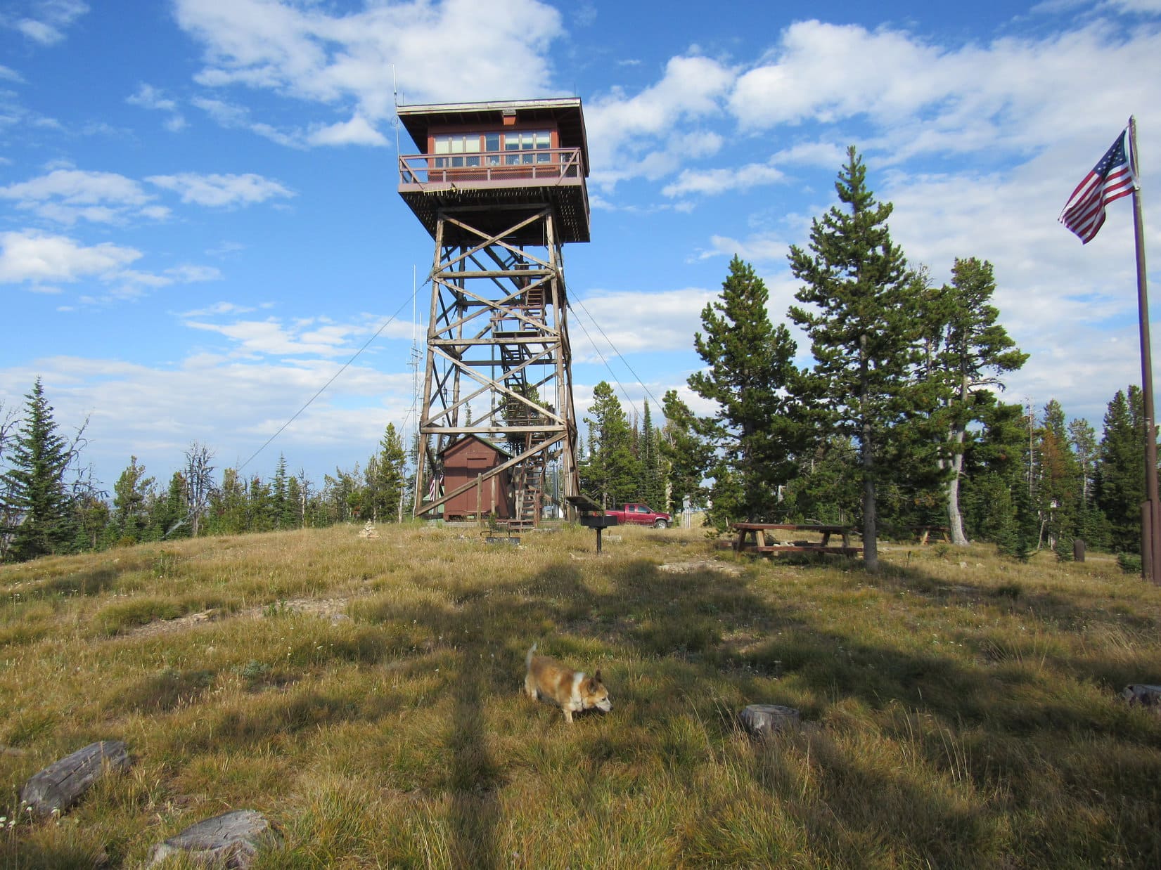
8-18-20, 4:35 PM, 72ºF, Kings Hill Pass, Hwy 89 – As Lupe sniffed her way around the Kings Hill campground loop, sad thoughts.  A few years ago, this had been a popular place.  The campground was open again after being closed the last couple of times the Carolina Dog had visited, but hardly anyone around now.  Most of the beautiful trees had been cut.  A sign said water was no longer available due to the spring drying up.

Along the road to nearby Porphyry Peak (8,192 ft.), the situation wasn’t much better.  Trees cut way back from the roadside were heaped in ugly brown piles.  At least it only turned out to be this way near the start.  After the first curve, the forest hadn’t been touched.

Looper trotted along keeping an eye out for squirrels.  She’d spent much of the day relaxing by Jefferson Creek while SPHP caught up the trip journal.  That had gotten mighty dull after a while, so she was happy just being on the move again.

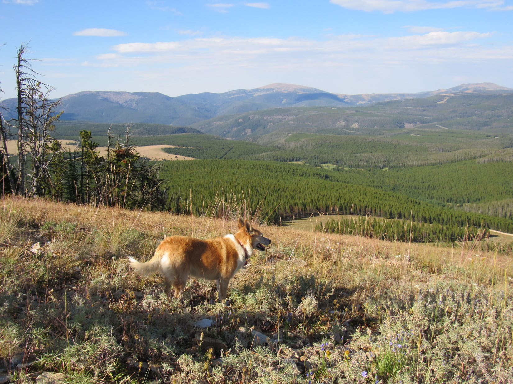
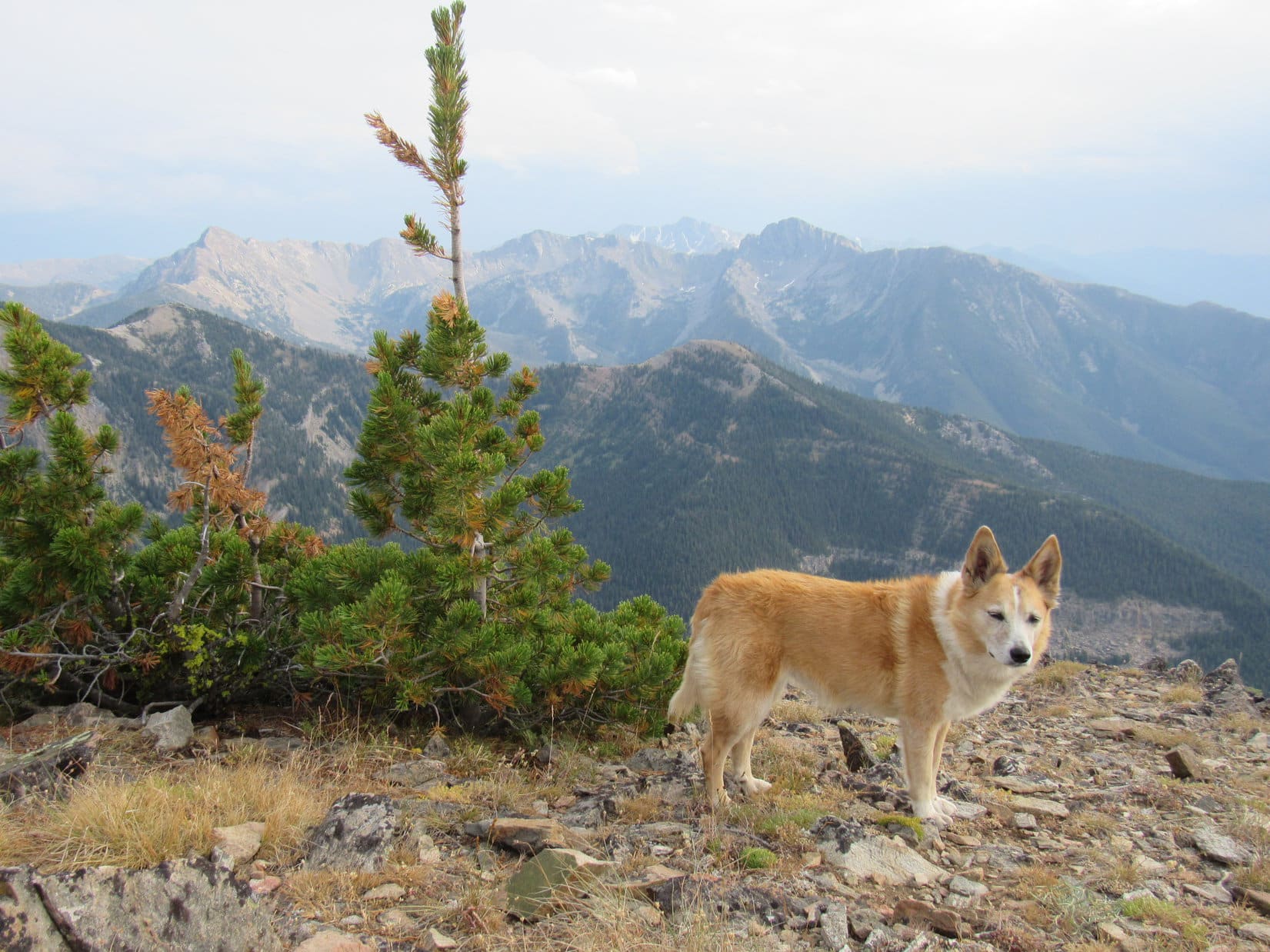
Didn’t take long to reach Porphyry Peak’s summit.  The sky was the clearest the American Dingo had seen it up here in years.  Miles to the NE, Long Mountain (8,621 ft.), Big Baldy Mountain (9,177 ft.), and Yogo Peak (8,801 ft.), 3 of the highest peaks in the Little Belt Range, were all looking good!

Relaxing by Jefferson Creek.
Near the fire lookout tower on Porphyry Peak. Photo looks E.
Long Mountain (L), Old Baldy Mountain (Center) and Yogo Peak (R). Photo looks NE.

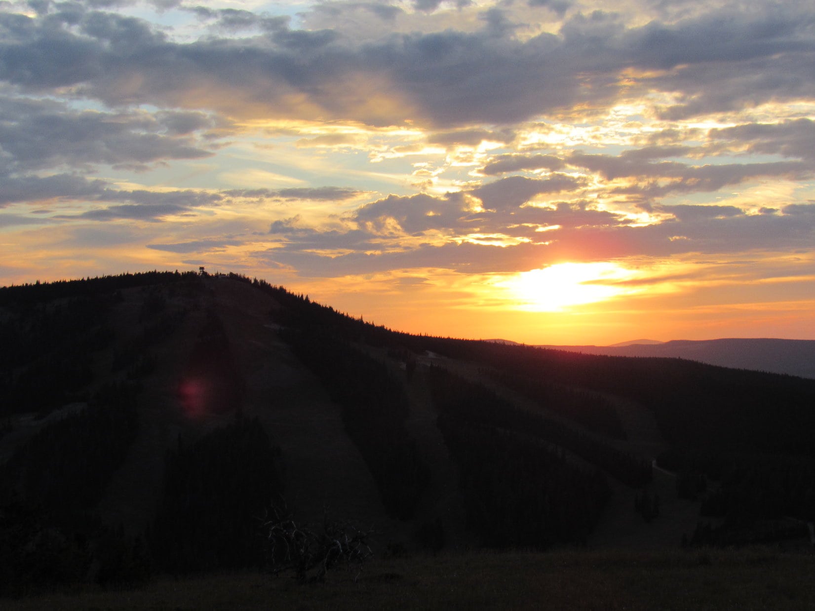
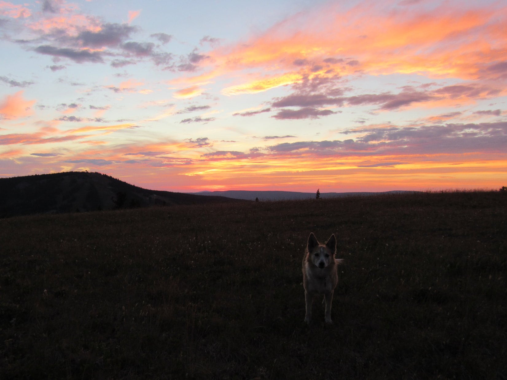
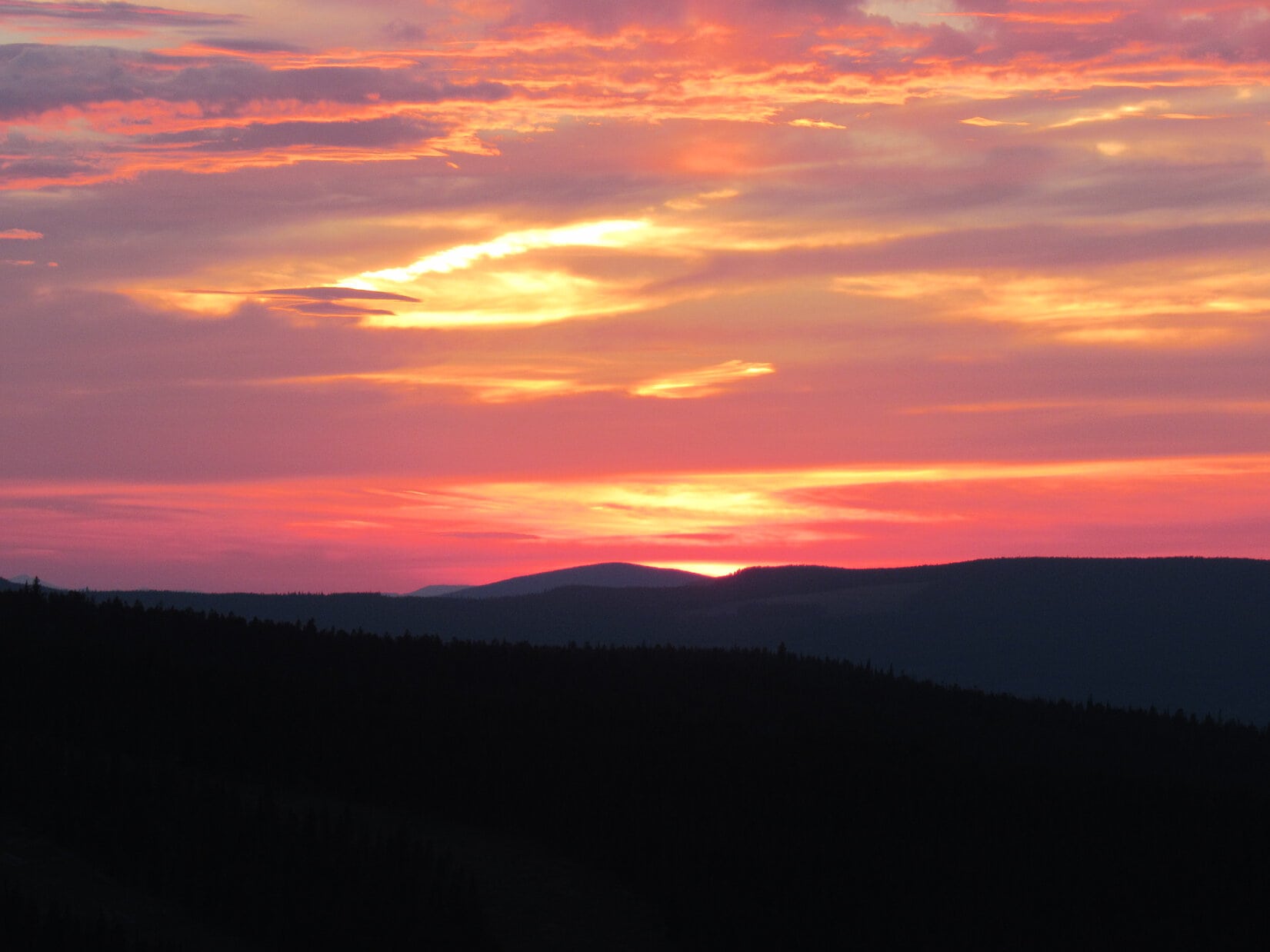
8-18-20, 7:32 PM, 71ºF, Kings Hill Pass – Porphyry Peak hadn’t taken all that long.  Loop had been back for an hour already.  She was surprised, but all for it when SPHP suggested heading up to Kings Hill (8,008 ft.), too.  With the air so clear and a few clouds around, maybe there would be a fabulous sunset?

Lupe arrived at the summit just in time.  Eh, not super spectacular, but not bad, either.

Porphyry Peak (L) from Kings Hill. Photo looks WNW.
Sunset from Kings Hill.
Little Belt Mountains.

8-19-20, morning, Hwy 89, S of White Sulphur Springs – Wet pavement was all the G6 encountered as an isolated storm drifted off to the E, but the sky still looked stormy ahead.  After a brief stop in Livingston, SPHP drove S a couple of miles to a L turn (Hwy 89, MP 49.8) onto East River Road (Hwy 540).  After crossing a bridge, East River Road curved SE.

Hey, SPHP!  Wasn’t that the Carter bridge?  We spent some time here down by the Yellowstone River not too long ago, didn’t we?

Yup!  That’s right, Loop!  We stopped at the river after checking out the Suce Creek trailhead, remember?

Isn’t that the trailhead for Livingston Peak (9,314 ft.)?  Are we going to do that next?

Yes, and yes!

Having scouted it out before, SPHP drove right to the trailhead.

Livingston Peak (Center) from the NNW a week earlier.
Suce Creek Road is a L (E) turn off East River Road 3 miles SE of Hwy 89 and the Carter Bridge over the Yellowstone River. Photo looks S.
Suce Creek Road from East River Road. Photo looks ESE.
Livingston Peak from about a mile in on Suce Creek Road. Photo looks NE.
Sign at a R turn to the Suce Creek trailhead. Photo looks NE.
At the Suce Creek trailhead a week earlier. Photo looks NE.

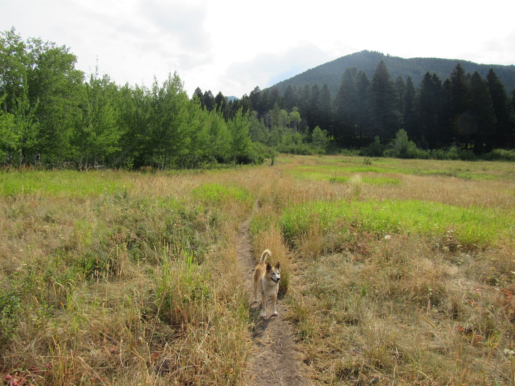
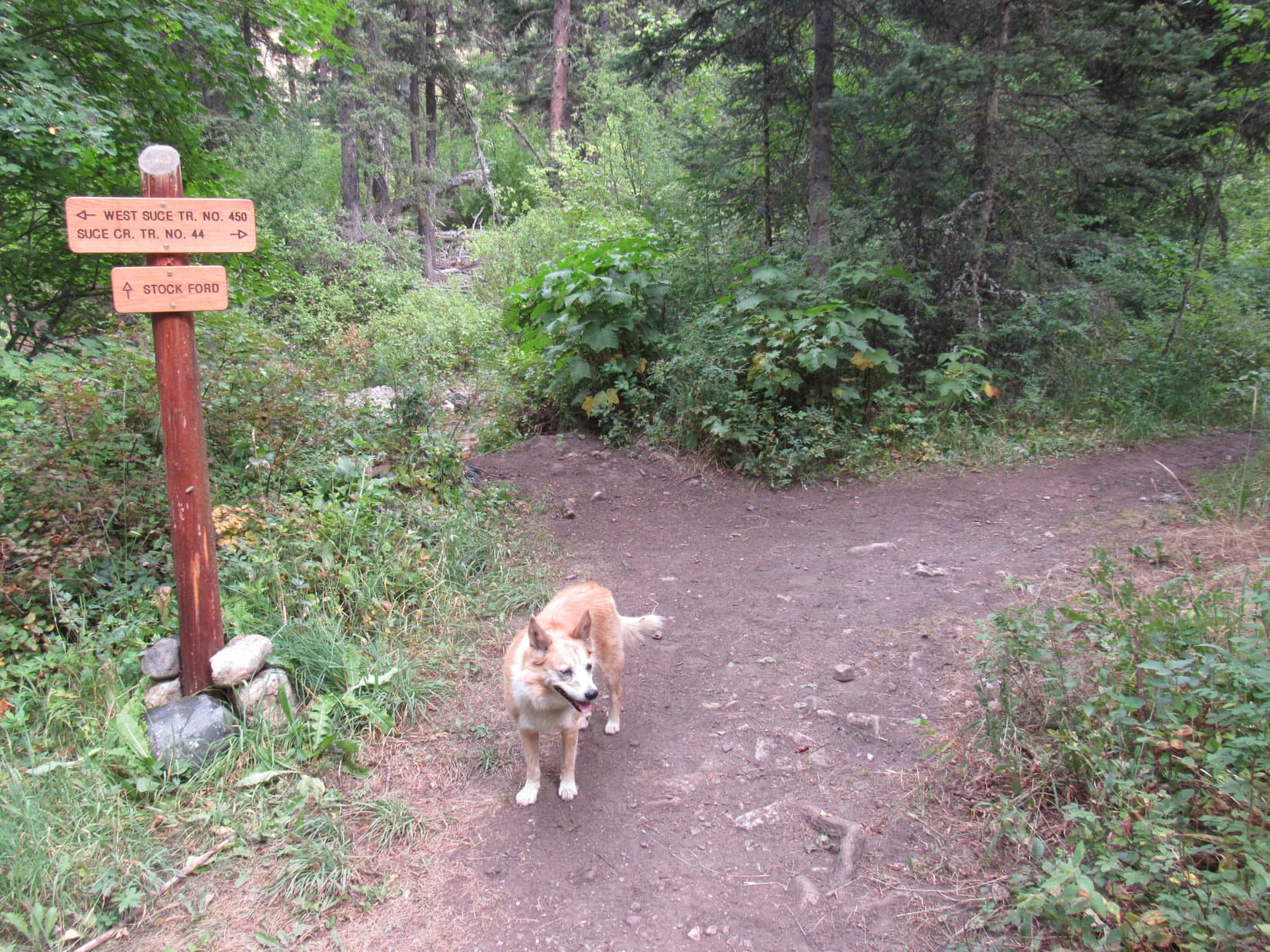
8-19-20, 11:10 AM, 64ºF, Suce Creek trailhead – A small thunderstorm passed through shortly after Lupe reached the trailhead, resulting in a 15 minute delay waiting in the G6 for the rain to stop.  Quite a few clouds still around, but plenty of blue sky to the W, so maybe it was going to be OK?  SPHP had a look at a posted map of area trails before Loop started up Suce Creek trail No. 44.

Suce Creek area trail map. Loop started out from the lower trailhead.
At the start of Suce Creek trail No. 44.

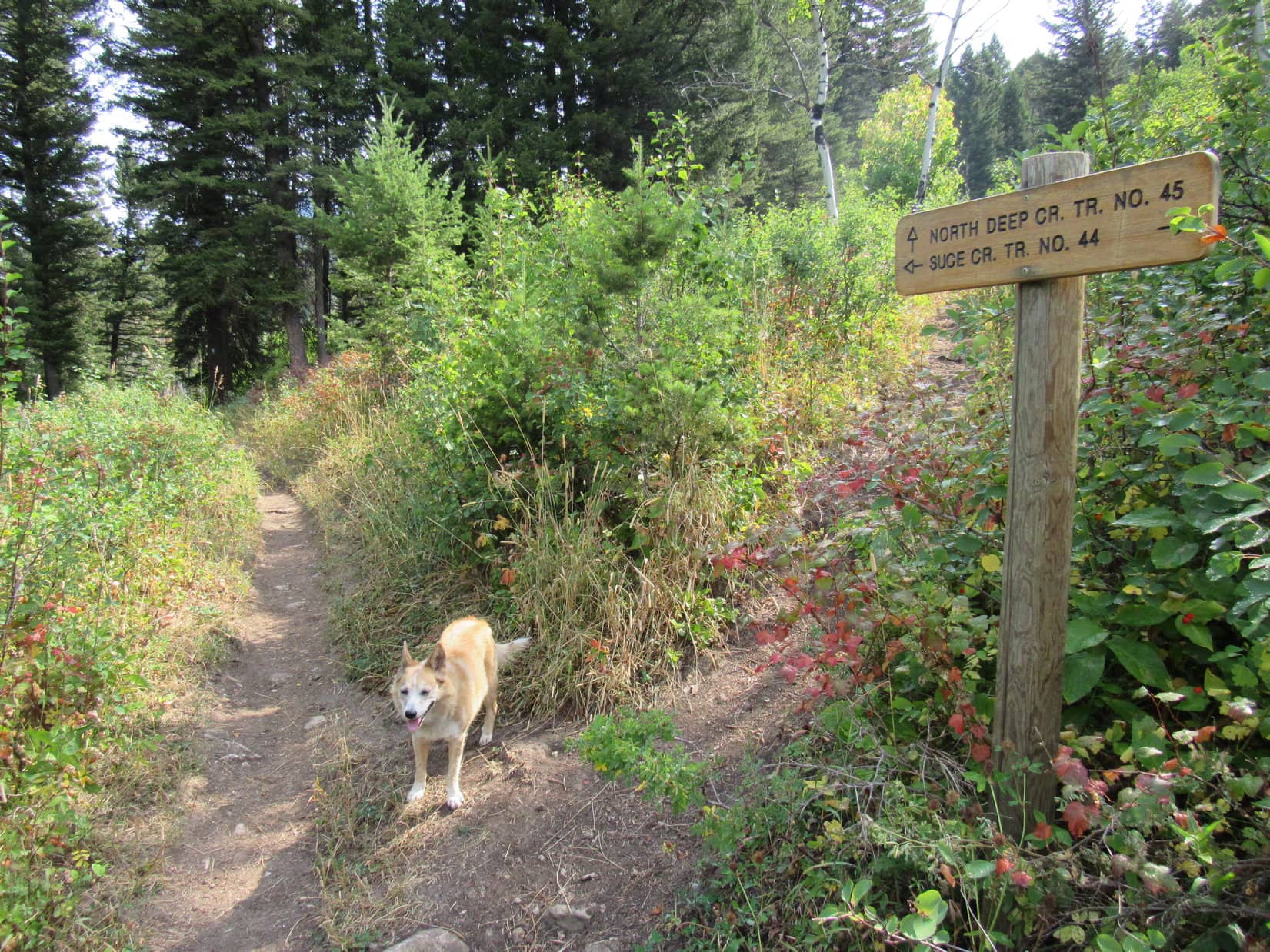
Heading SE, Lupe crossed a meadow.  The trail then curved N, climbing into a region of tall bushes.  Loop gained 100 feet of elevation before the trail leveled out.  Here a junction appeared on the R with North Deep Creek trail No. 45, but the American Dingo ignored it and went on.

Crossing the first meadow. HP7290 (R). Photo looks SE.
At the junction with N Deep Creek trail No. 45, which Lupe didn’t take. Photo looks NE.

The Suce Creek trail soon curved back to the W and started downhill.  After losing 280 feet of elevation, Lupe came to a large half-rotten log with a wooden handrail serving as a bridge over a small stream.

Crossing the log bridge.

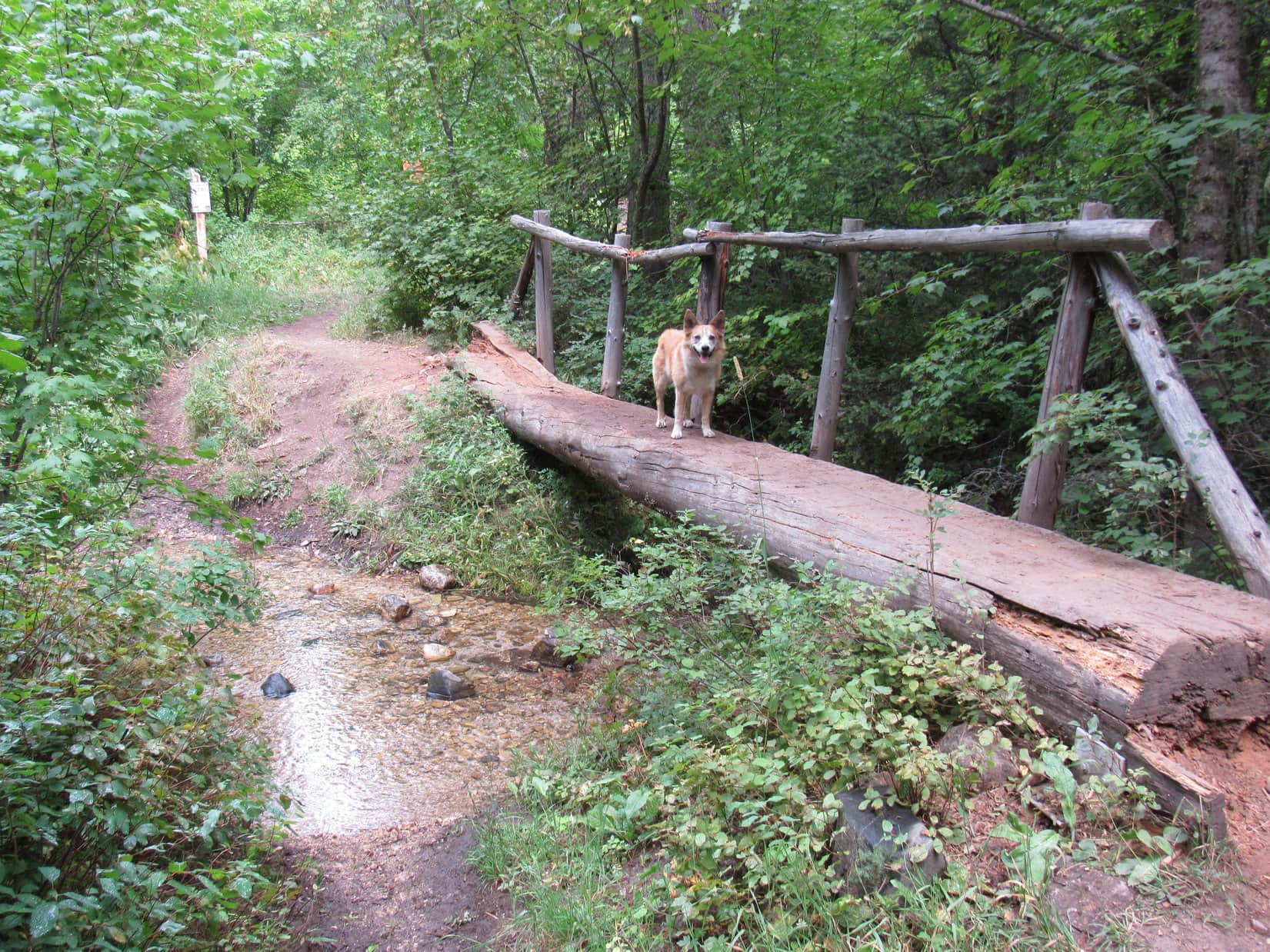
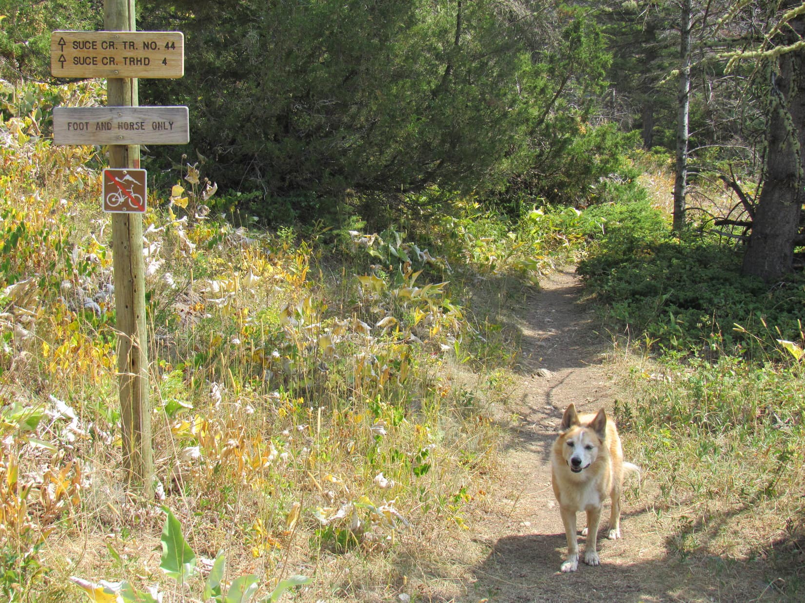
Just beyond the log bridge was another trail intersection, this time with West Suce Creek trail No. 450, which went off to the L.  Directly ahead was Suce Creek itself.  Lupe went R, sticking with Trail No. 44.

Intersection of Suce Creek trails No. 44 and No. 450.

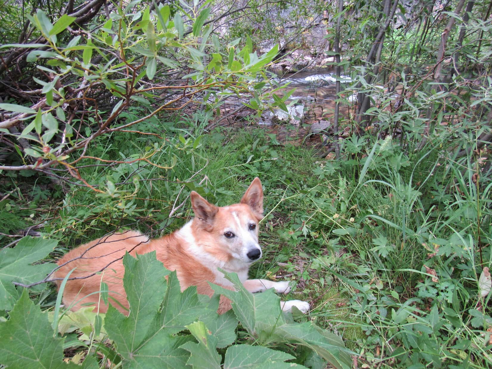
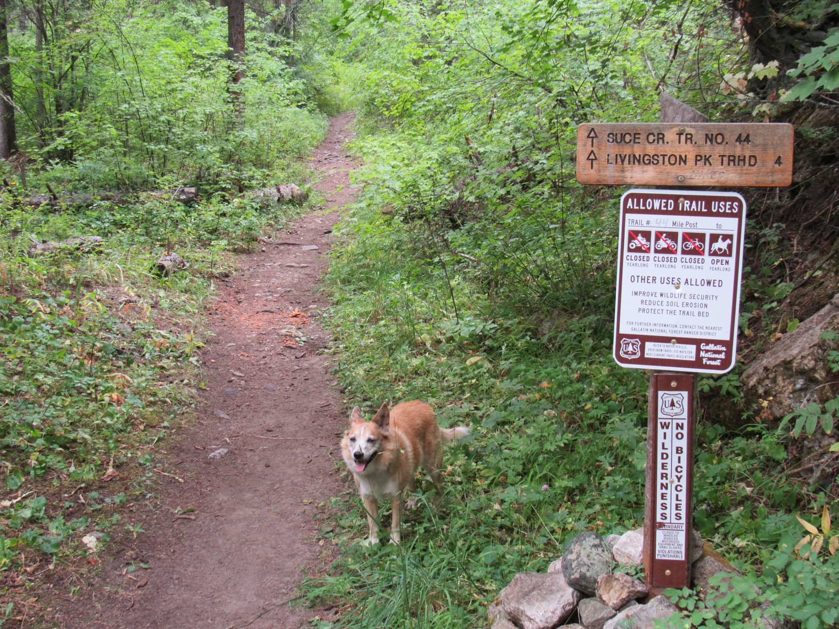
Staying SE of Suce Creek, the trail went NE up a long leafy valley.  Due to the dense vegetation, Suce Creek was often heard, but seldom in sight.  Before long, Lupe started coming to more signs.  The first one mentioned an actual Livingston Peak trailhead 4 miles ahead.  9 or 10 minutes past this sign the trail forked.

The L branch quickly led to a bank overlooking Suce Creek where the trail simply ended, apparently eroded away.  Returning to the R branch, there was a small “NF TRAIL” sign.  Loop continued on this way.

On leafy Suce Creek trail No. 44. Photo looks NE.
Maybe there’s a shorter way to Livingston Peak, SPHP? 4 miles to the official trailhead!
The L branch of a fork disappears into Suce Creek.
This way, SPHP! Taking the R branch.

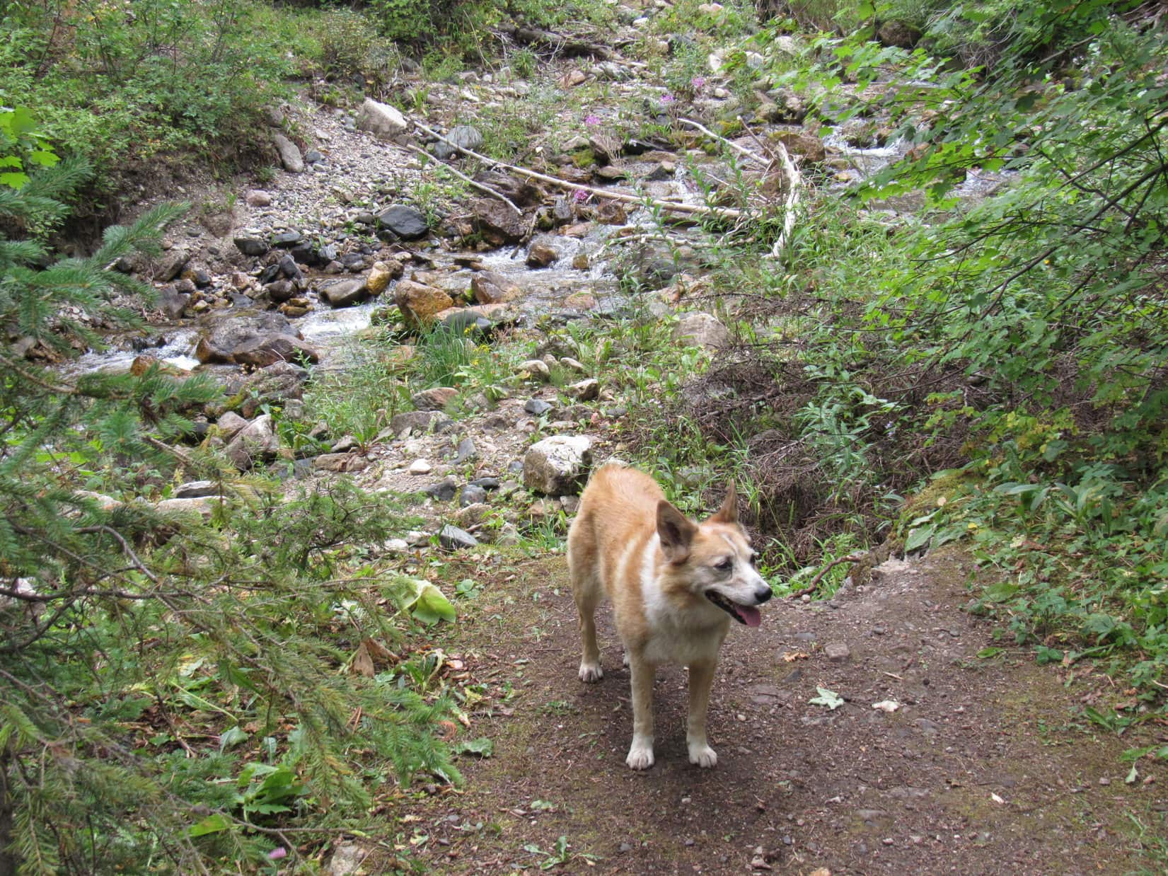
45 minutes from the trailhead, Suce Creek trail No. 44 finally crossed Suce Creek.  No bridge here, but the stream was merely a rock hop.  Up to this point, Lupe had been gaining elevation quite slowly.  However, the incline now steepened somewhat as she started up into the Lost Creek valley.

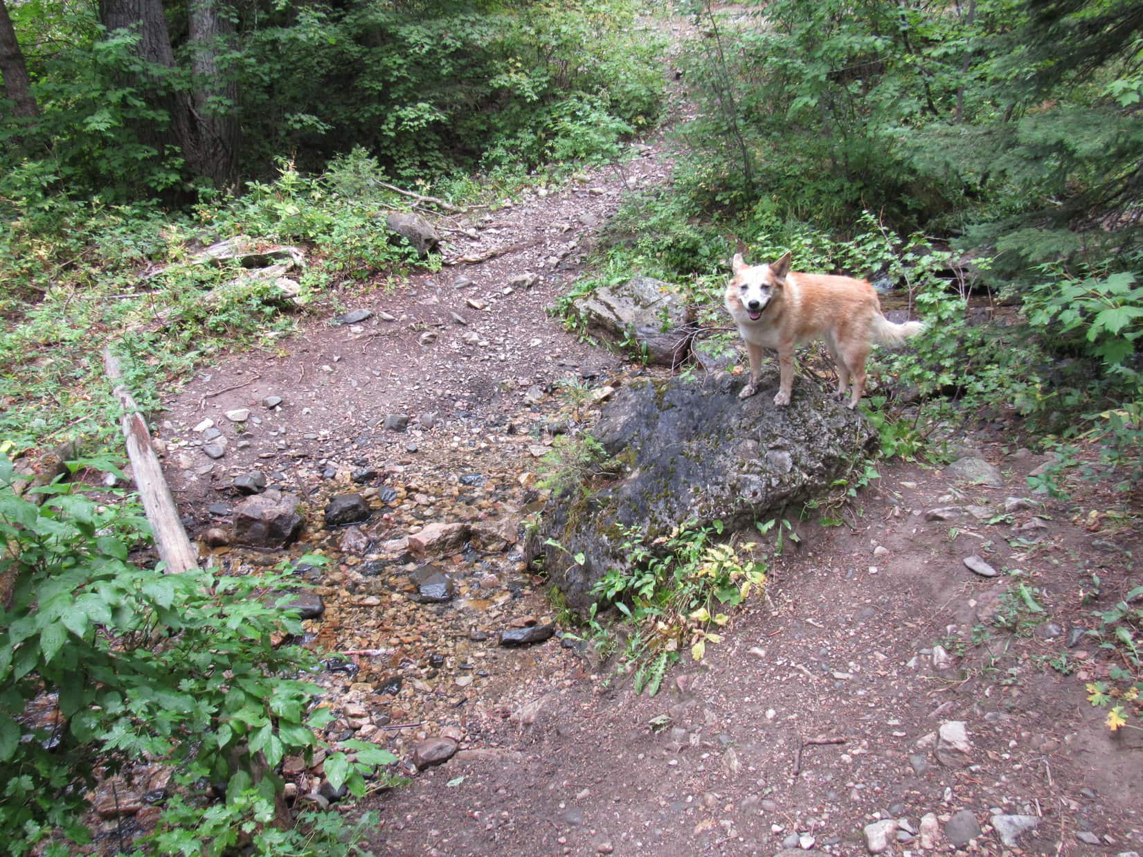
Lost Creek was just a tiny thing.  The trail crossed it several times, often as little more than dry washes, or a mud hole at one point.  Farther up the valley, Lost Creek actually had better flow.  45 minutes after crossing Suce Creek, Lupe crossed Lost Creek at a point where the stream was deepest, which still wasn’t saying much.

Fording Suce Creek.
Lost Creek is looking pretty good here! A mighty 2 inches deep!

Beyond this final Lost Creek crossing, Trail No. 44 left the valley floor.  Lupe climbed a short, steep slope.  Curving sharply back to the SW, the trail promptly leveled out.  Soon occasional breaks in the forest were providing first glimpses of Livingston Peak (9,314 ft.) and Mount Delano (10,138 ft.).

At the start of a long switchback reached after crossing Lost Creek. Photo looks SW.
A glimpse of Livingston Peak (L). Photo looks ESE.
Mount Delano (L). Photo looks S.

Loopster followed this nice, flat switchback for 0.5 mile before reaching a clearing at Pass 6420.  A crude wooden bench offered a good view of Mount Delano.  The top of what might have been Mount McKnight (10,310 ft.) was even in sight.

Arriving at a big clearing 4 miles from the Suce Creek trailhead. Photo looks E.
Mount McKnight (?) (Center), Mount Delano (R). Photo looks SSE.

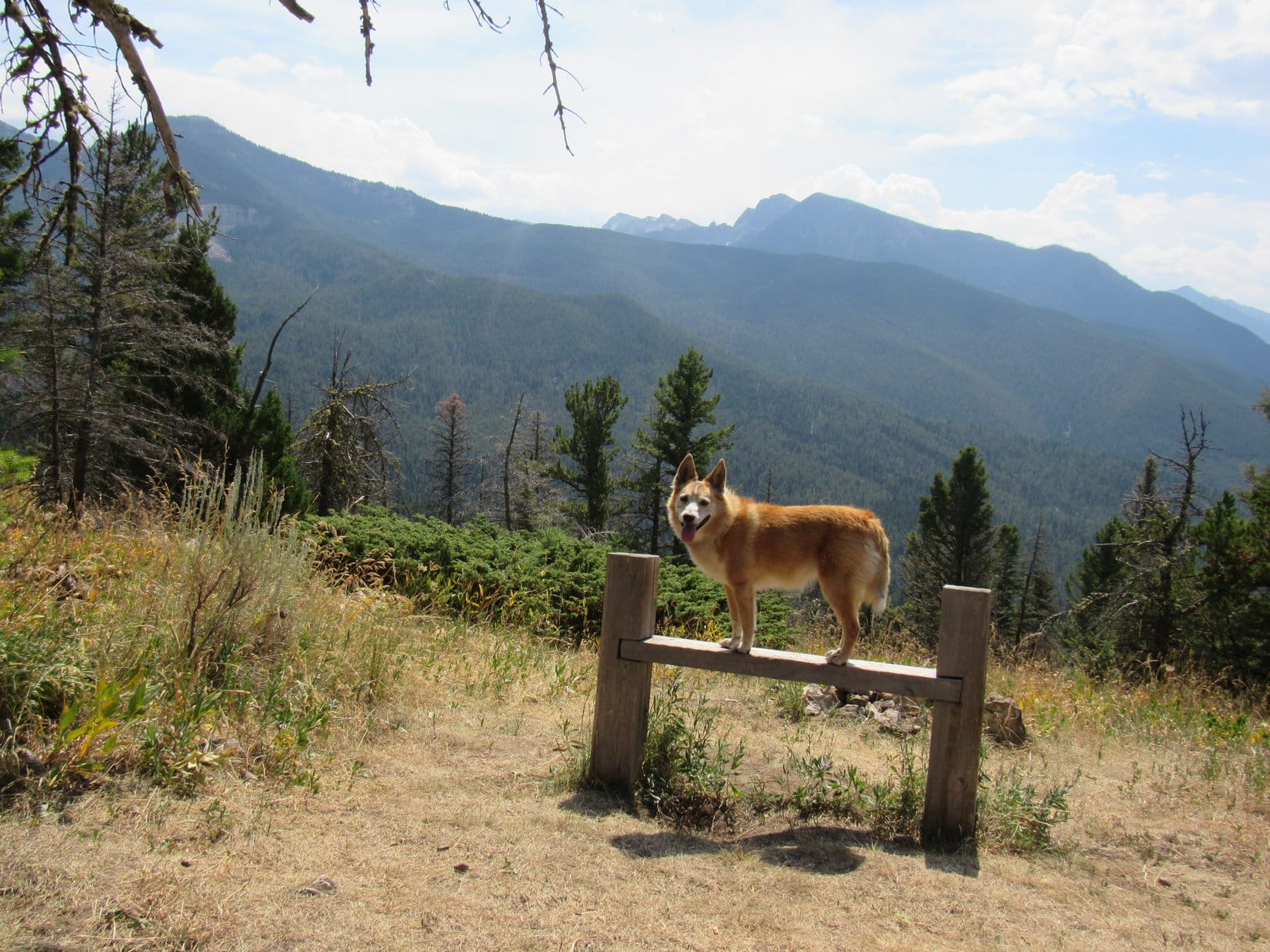
This clearing was a major intersection with a number of other trails.  The upper end of West Suce Creek trail No. 450 went off to the SW from here.  Just around a corner to the NE, was a spur going NW to the official Livingston Peak trailhead.  Lupe had no reason to visit that destination, though.  Instead she headed NE on Livingston Peak trail No. 449.

About to start up Livingston Peak trail No. 449. Photo looks NE.

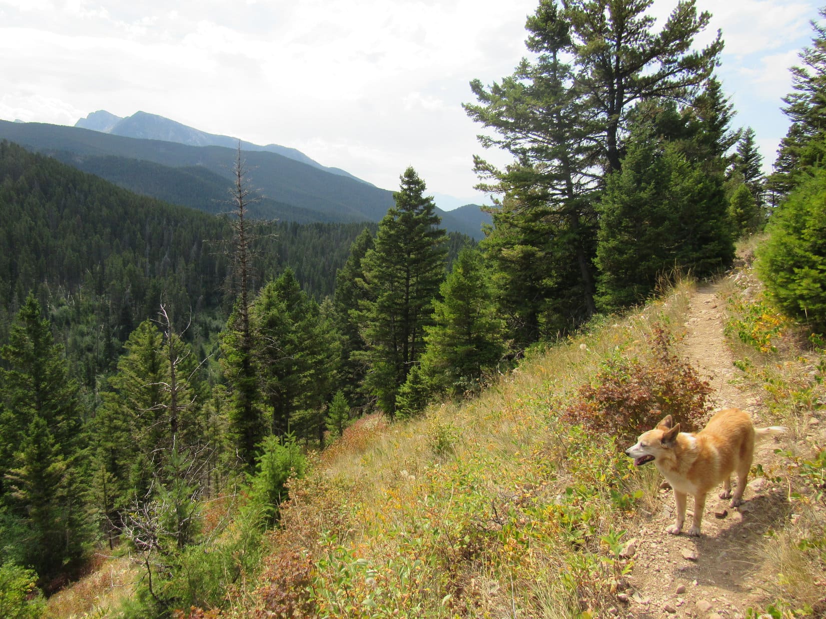
Lupe had traveled 4 miles in 2 hours to get to the clearing, but only had a net gain of 800 feet of elevation to show for it.  Still 3,000 feet to go!  Even so, the first part of the Livingston Peak trail still wasn’t steep.  The trail wound NE on a broad, forested ridge gaining elevation at an easy to moderate pace.

SPHP began hearing a sound like the faint jingling of bear bells, but Lupe seemed oblivious to it.  Turned out that the sound was actually water trickling through a rusty 4″ diameter pipe half buried along the edge of the trail.  This pipe followed the trail for quite a long way, even after the trail left the ridge to traverse the same steep slope Lupe had been on earlier, but now well above that first long switchback.

From up here, Lupe had a much better view of Livingston Peak.

Livingston Peak from the upper switchback. Photo looks E.

This upper switchback was also long and flat.  Easy traveling!  Loopster made rapid progress.  Soon she could see a big rock formation 1.5 miles off to the ENE.  Checking the topo map, SPHP suspected Pass 8300 was over in that vicinity.

On the also easy, upper switchback. Photo looks NE.
Pass 8300 is up next to the big rock formation (Center). Photo looks E.

Continuing NE, the terrain was changing.  Somewhere along the way, Lupe left the moss-covered water pipe and upper switchback behind, as the steepness of the slope the trail was on began to decrease.  The trail eventually turned E, crossing a fairly large meadow before returning to the forest where the Carolina Dog went over minor Pass 7060.

On the E side of Pass 7060, Livingston Peak trail No. 449 curved N, but soon gradually swung around to the E, then SE.  For a little way, Lupe was on the NE side of the upper Lost Creek drainage.  As soon as the trail dipped to cross the dry stream bed, the situation changed.

Up to this point, both the Suce Creek and Livingston Peak trails had been easy to moderate (at worst) climbs virtually the entire way.  The couple of long switchbacks had been been quite flat, and beyond Pass 7060 there had been a stretch where Lupe had even lost a little elevation.  However, on the SW side of Lost Creek, Trail No. 449 started climbing much more aggressively, pinned tightly between a steep forested slope and the creek bed.

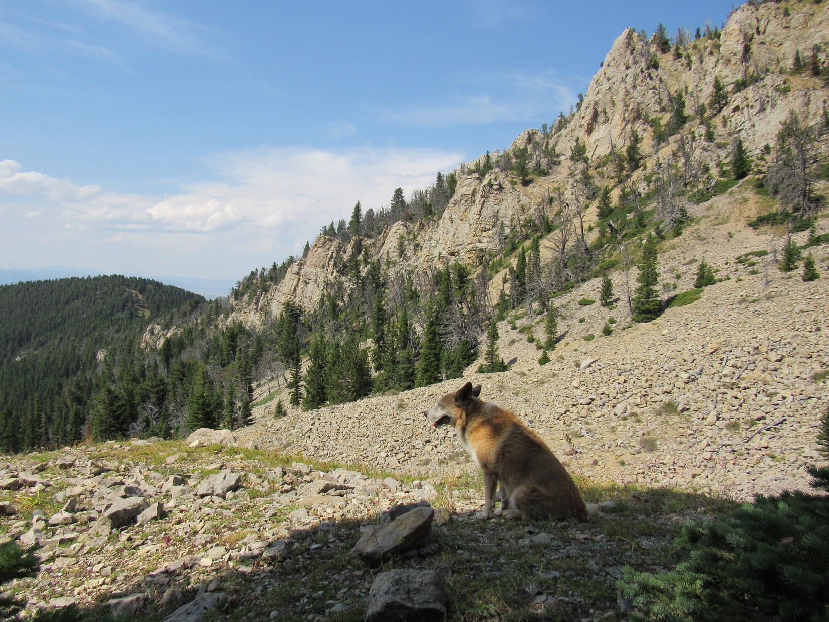
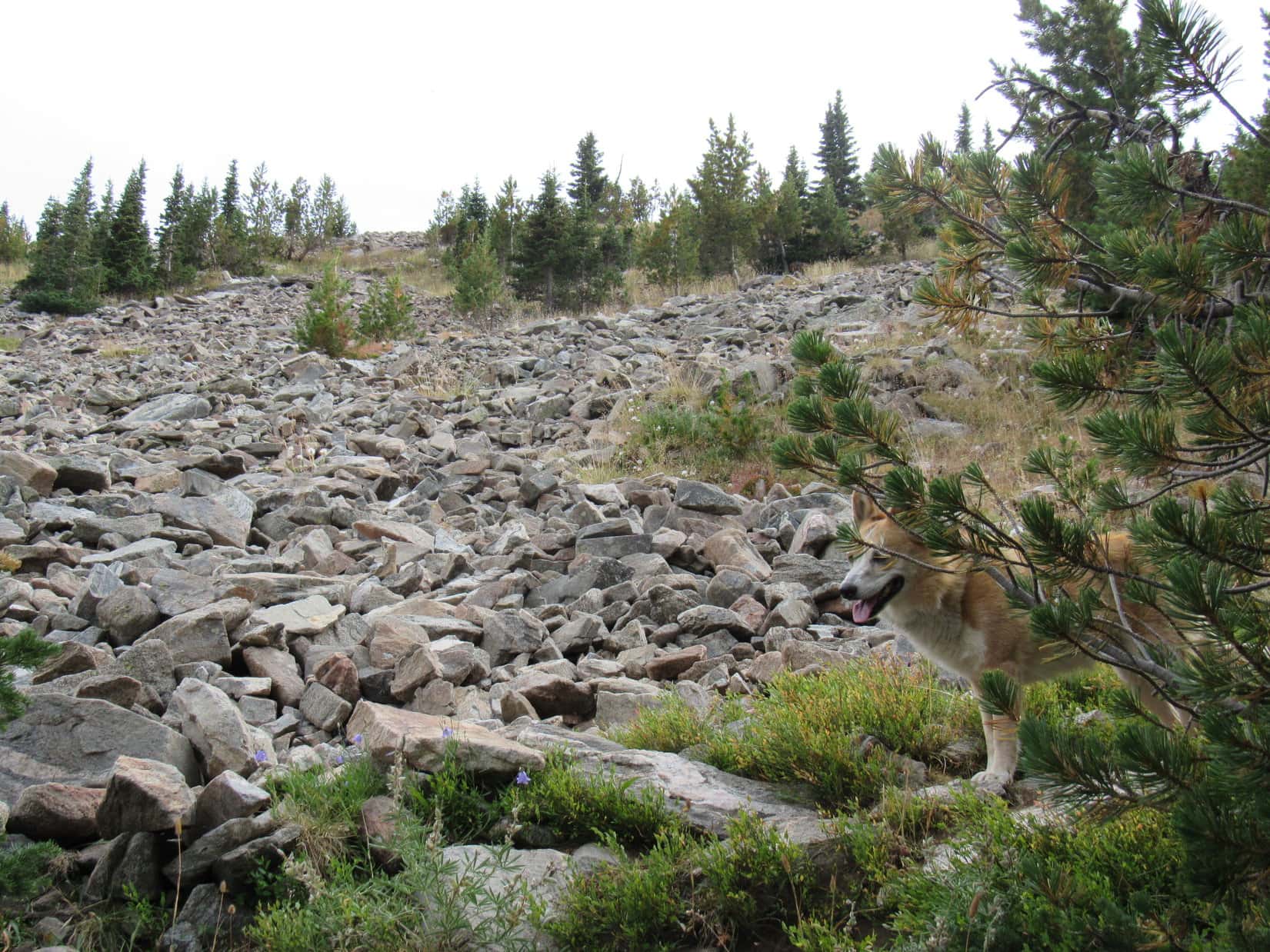
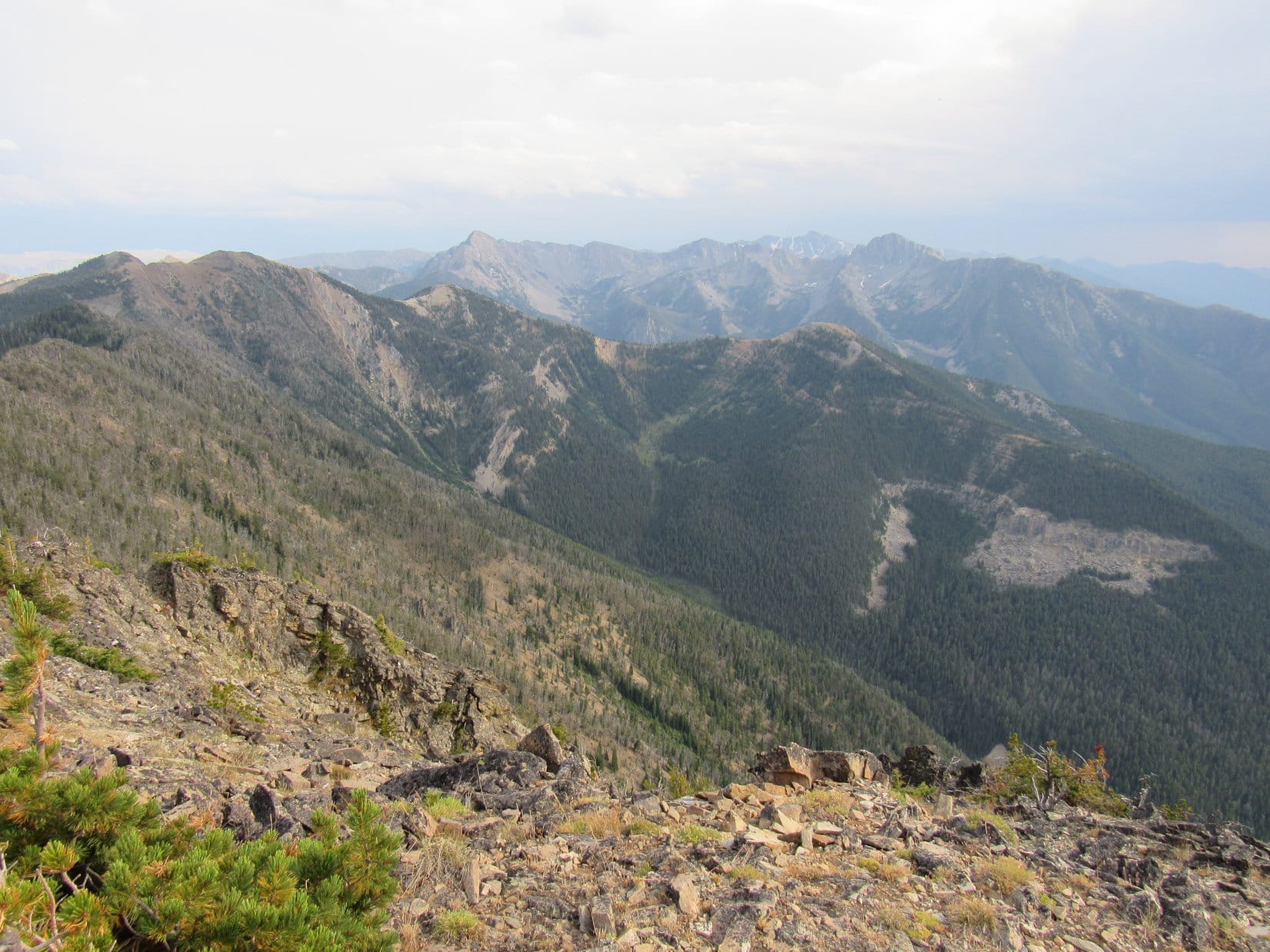
On the NE side of the valley, large rock formations formed the crest of a long ridge rising to the SE.

Rock formations seen shortly before crossing upper Lost Creek. Photo looks N.
SW side of Lost Creek. The trail starts climbing much more aggressively here.

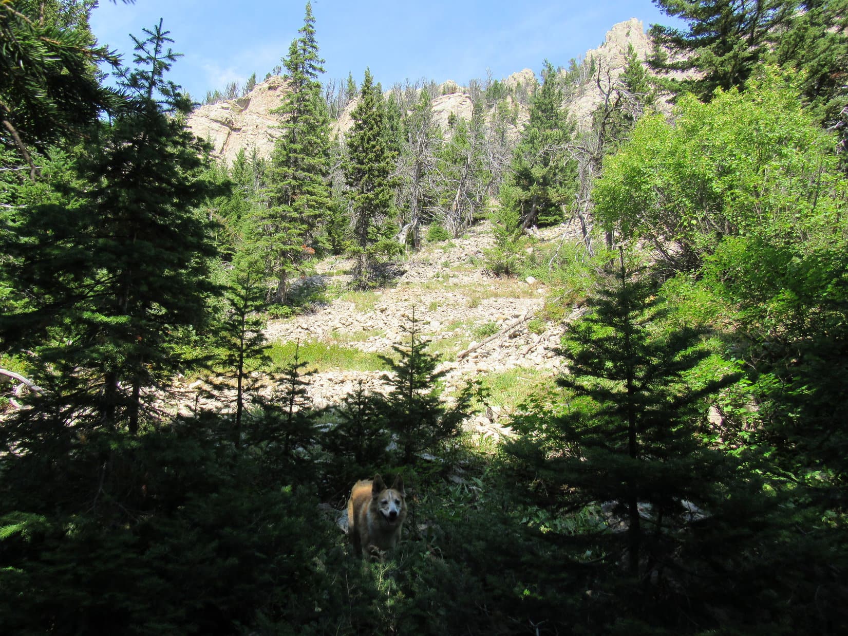
At first, Lost Creek seemed to be completely dry this high up, but that wasn’t entirely true.  Now and then a trickle of water surfaced, enough for Lupe to get a drink, but little more than that.  The trail soon crossed back over to the NE side of the valley, where it remained from then on continuing relentlessly higher.  Meanwhile, views of the rocky ridge to the NE became more and more impressive.

HP7623 (L) and the ridge of rock NE of the trail (R). Photo looks NNW.
Seems like we’re finally starting to get somewhere! Photo looks NNW.
Can’t be too much farther to Pass 8300! Photo looks SE.

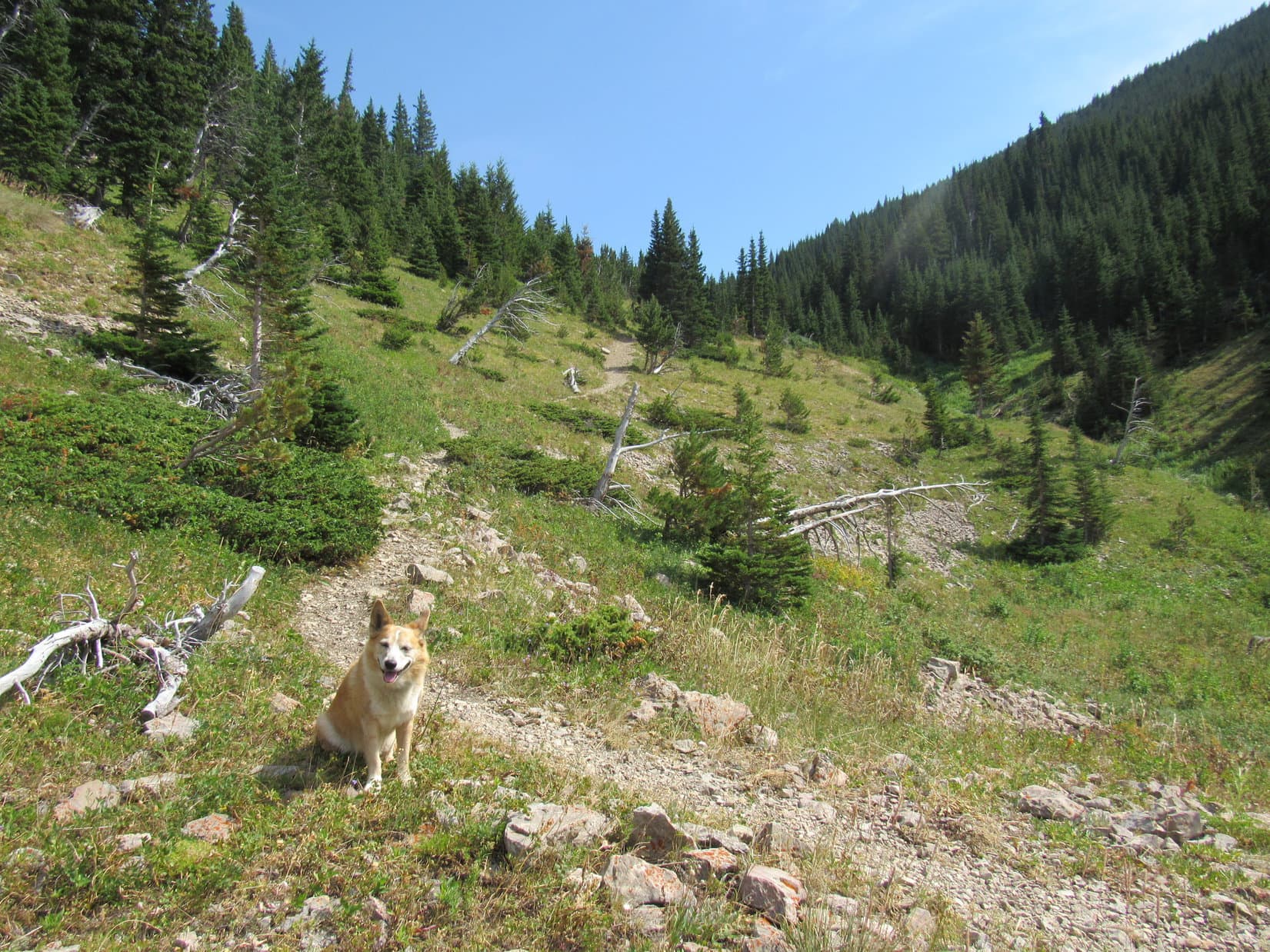
The last water in Lost Creek was seen right before the trees gave out.  Ahead, a meadow stretched all the remaining distance up to Pass 8300.  Another 200+ feet of elevation gain ought to about do it!

Pass 8300 (Center) appears ahead. Photo looks SE.

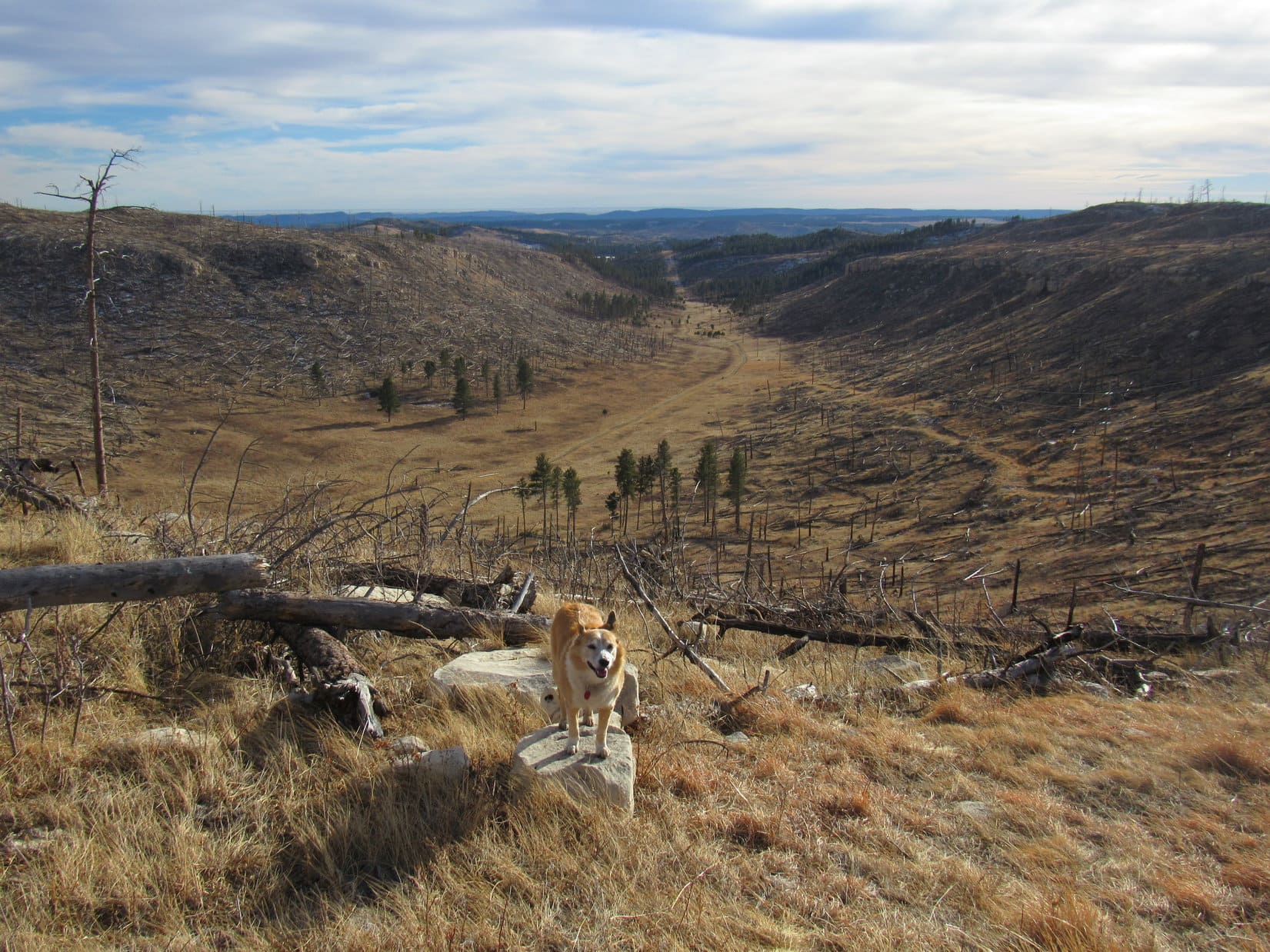
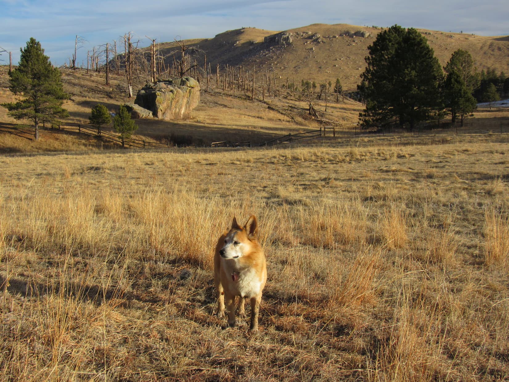
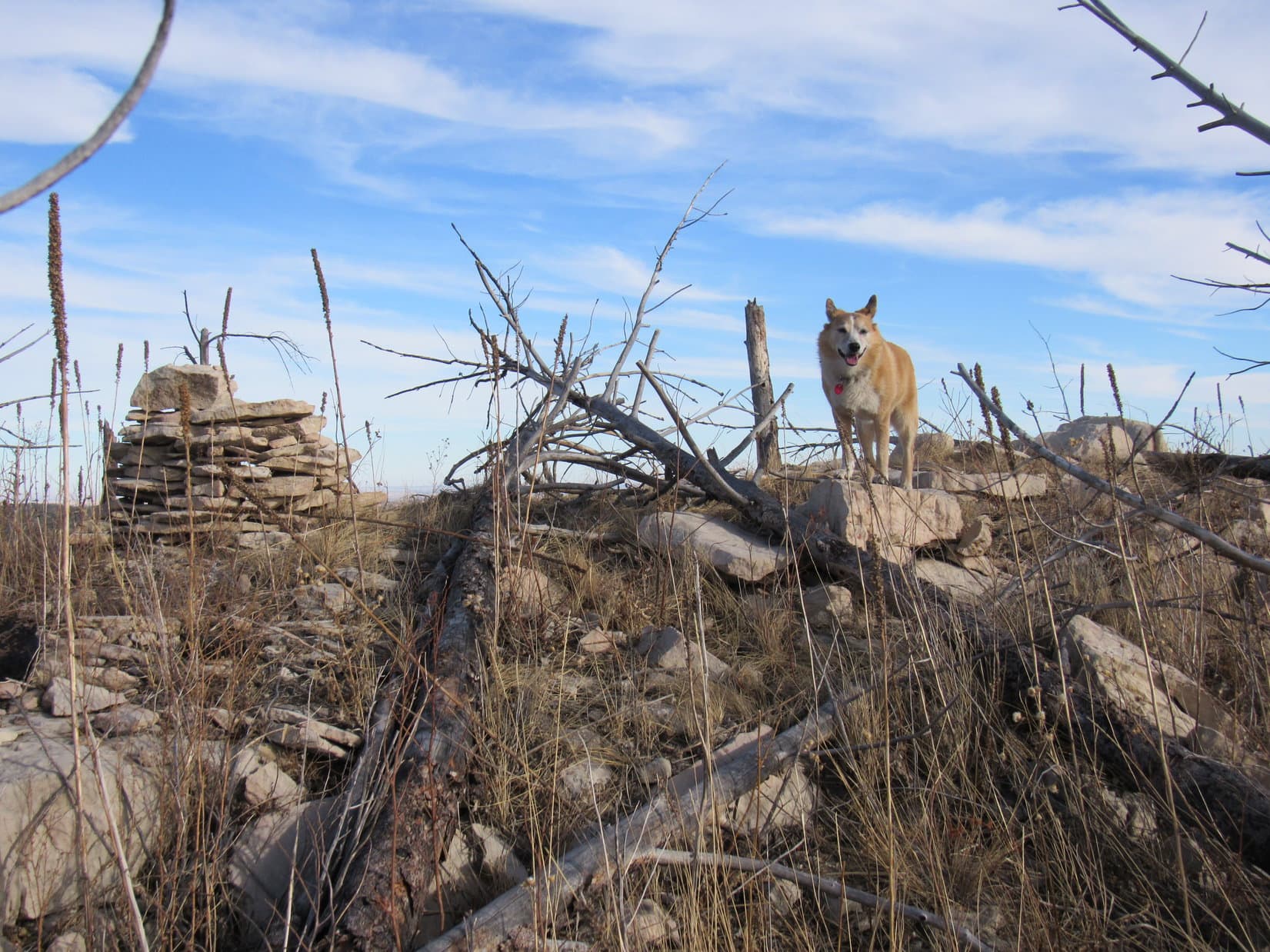
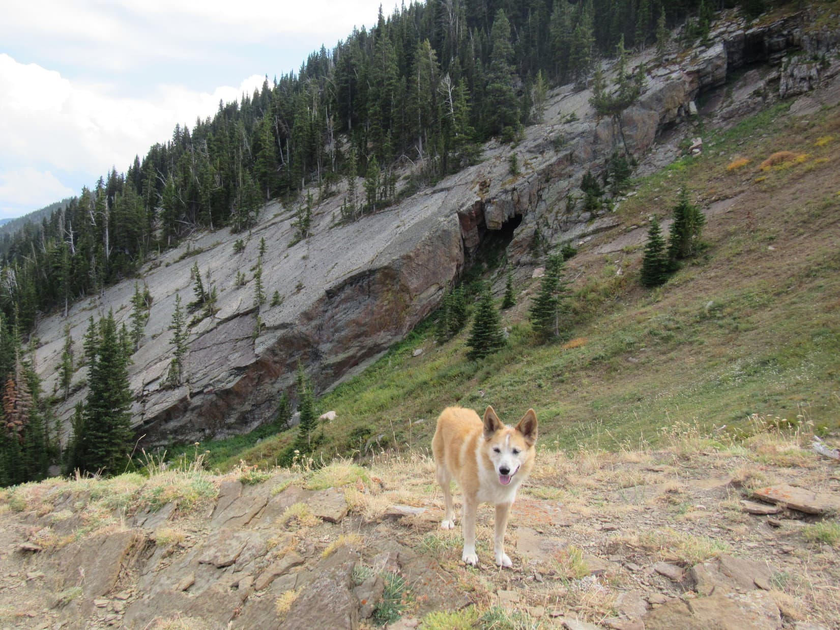
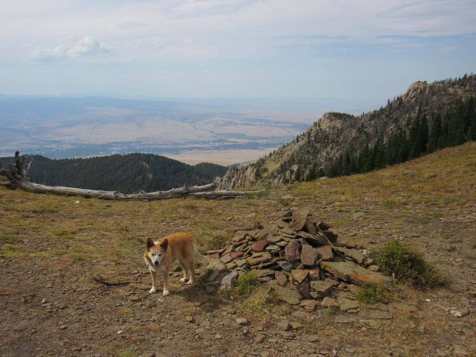
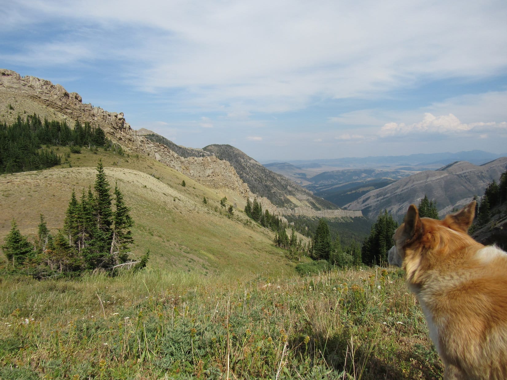
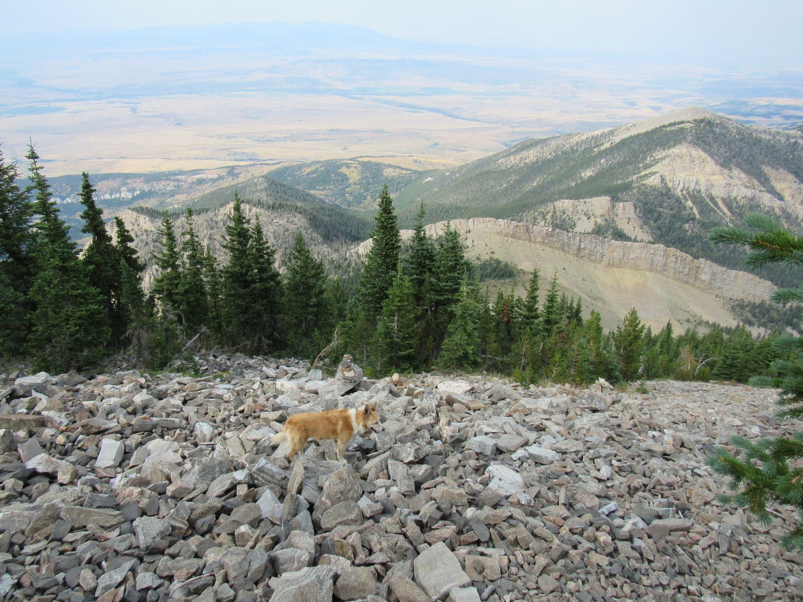
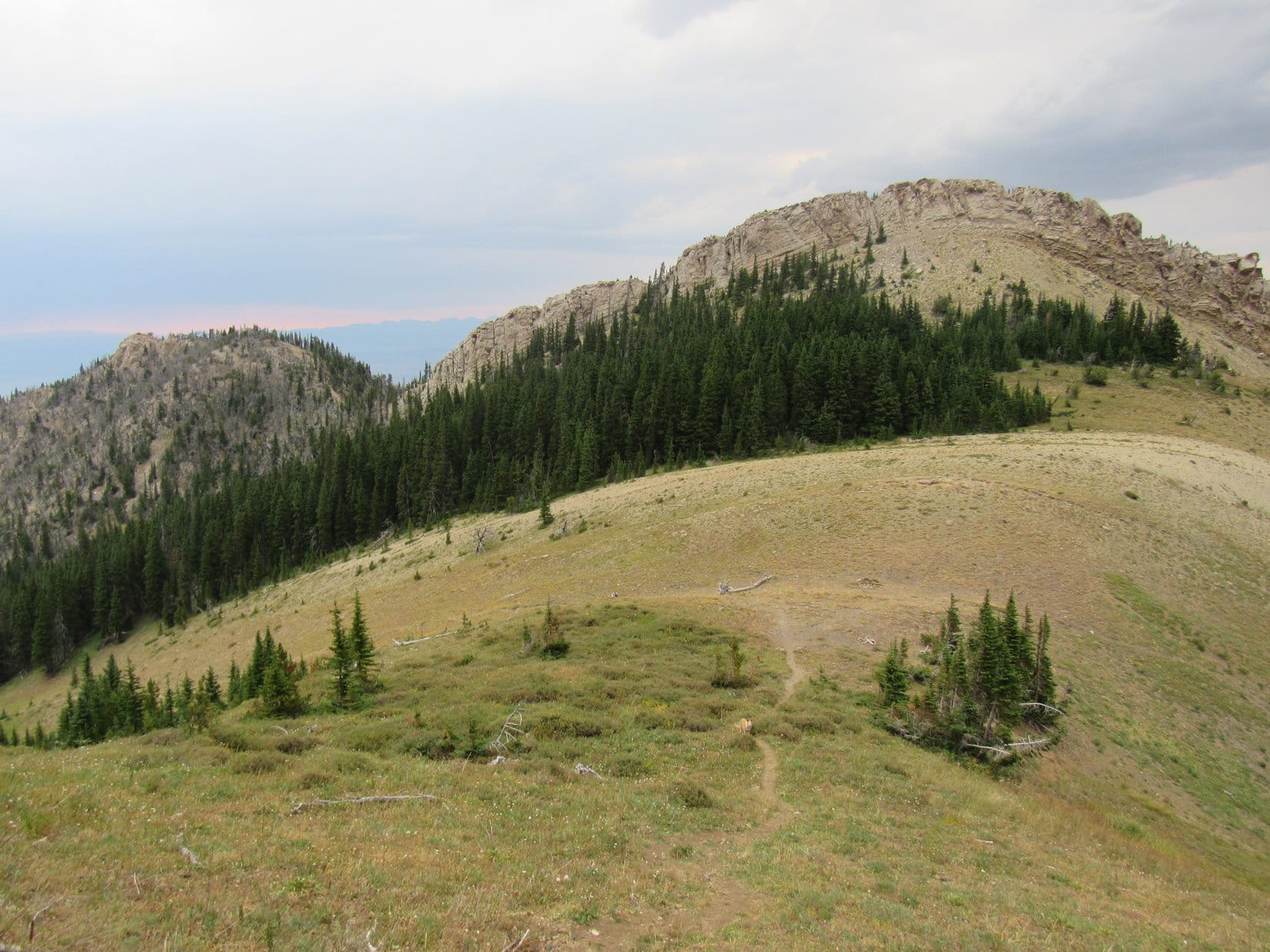
Pass 8300 was a broad grassy region.  A large cairn sat out in the middle of it.  Although the topo map showed a trail continuing over the SE side of the pass into East Baldy Basin, Lupe saw no sign of it.  The view of the canyon on the other side was impressive, though, and so was the sight of a massive forested slab of rock on Livingston Peak’s N slope.

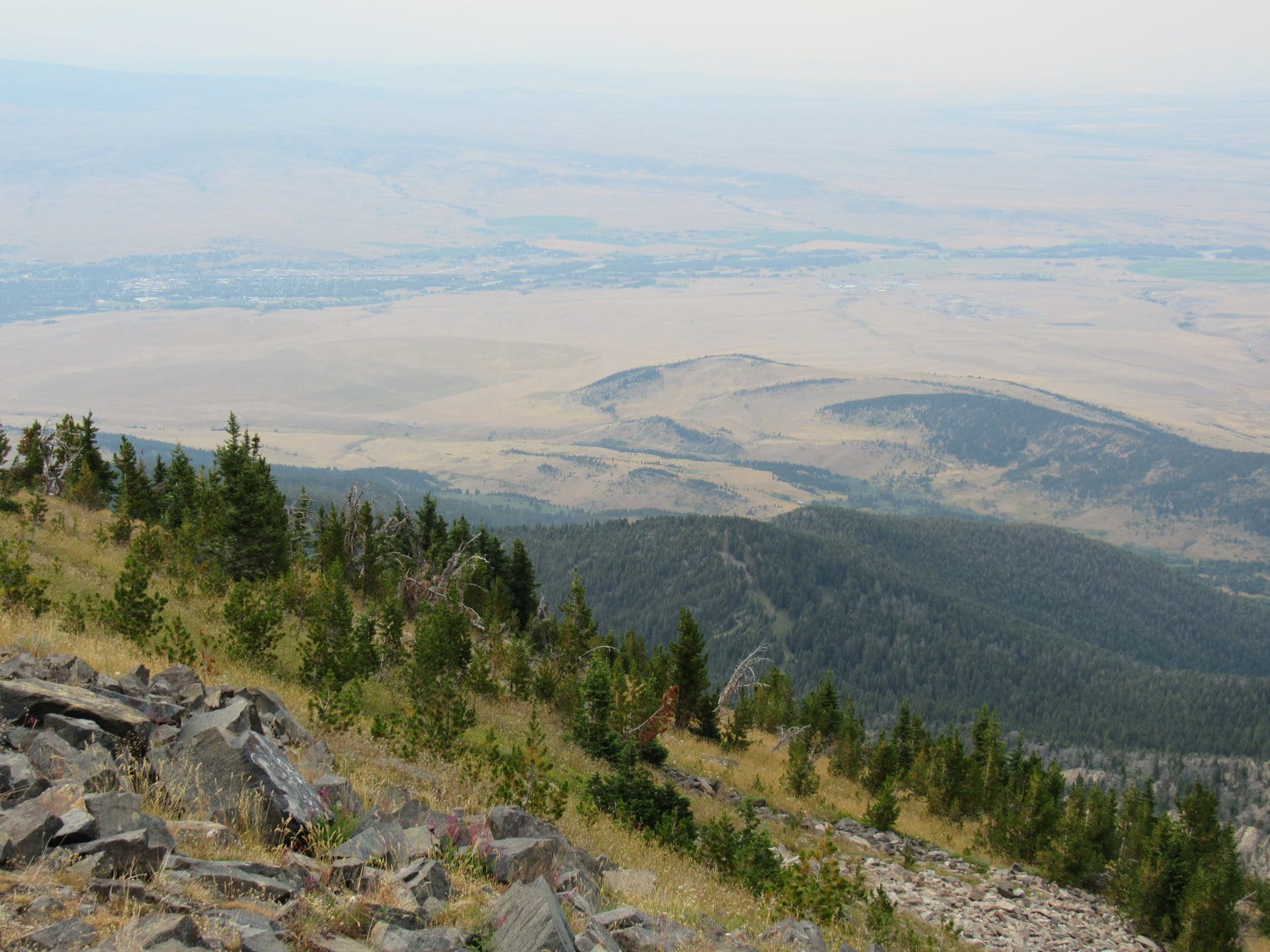
The N side of Pass 8300 was bordered by a grassy hill topped by a strip of forest above which a distinctive crest of solid rock curved like the brim of a giant old-fashioned bonnet.  Back to the NW was a hazy view of Livingston, Montana, fully 3,800 feet lower way down in the Yellowstone River valley.

Looking over Pass 8300. Photo looks SE.
N slope of Livingston Peak. How do trees even survive on that slab of rock with so little soil? Photo looks SSE.
By the Pass 8300 cairn. Livingston, Montana is visible down in the Yellowstone River valley beyond Lupe and forested HP7623 (L of Center). Photo looks NW.
Pass 8300. Photo looks NNE.

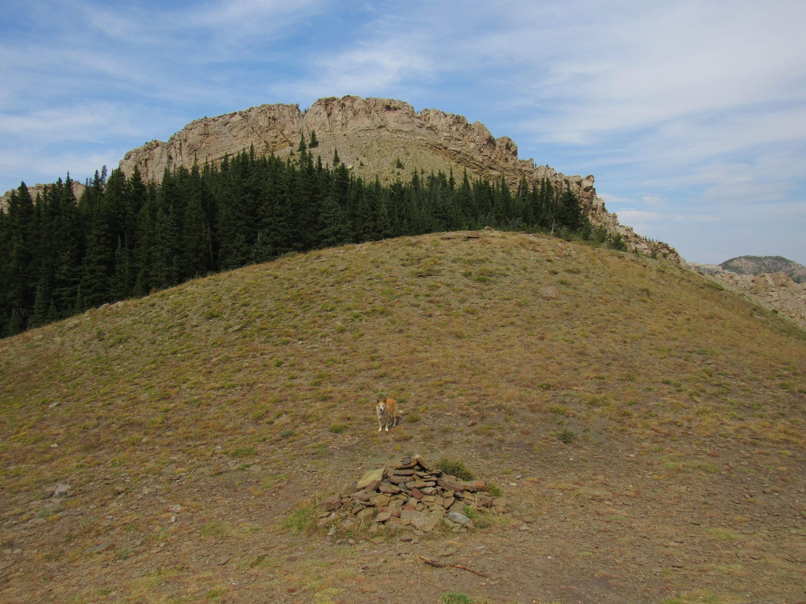
The S side of Pass 8300 was bordered by a steep forested slope.  The N face of Livingston Peak (9,314 ft.) looked about 300 feet high, but only part of it could be seen from here.  In reality, Loopster still had another 1,000 feet to go.  After a short rest break, the American Dingo headed for the trees at the base of the slope.

N face of Livingston Peak from Pass 8300. Photo looks SW.
Mission Creek valley (R) from just below the trees S of Pass 8300. HP8460 (Center). Photo looks ENE.
Looking back at Pass 8300 before heading up. Peak 8631 (far R). Photo looks NNE.

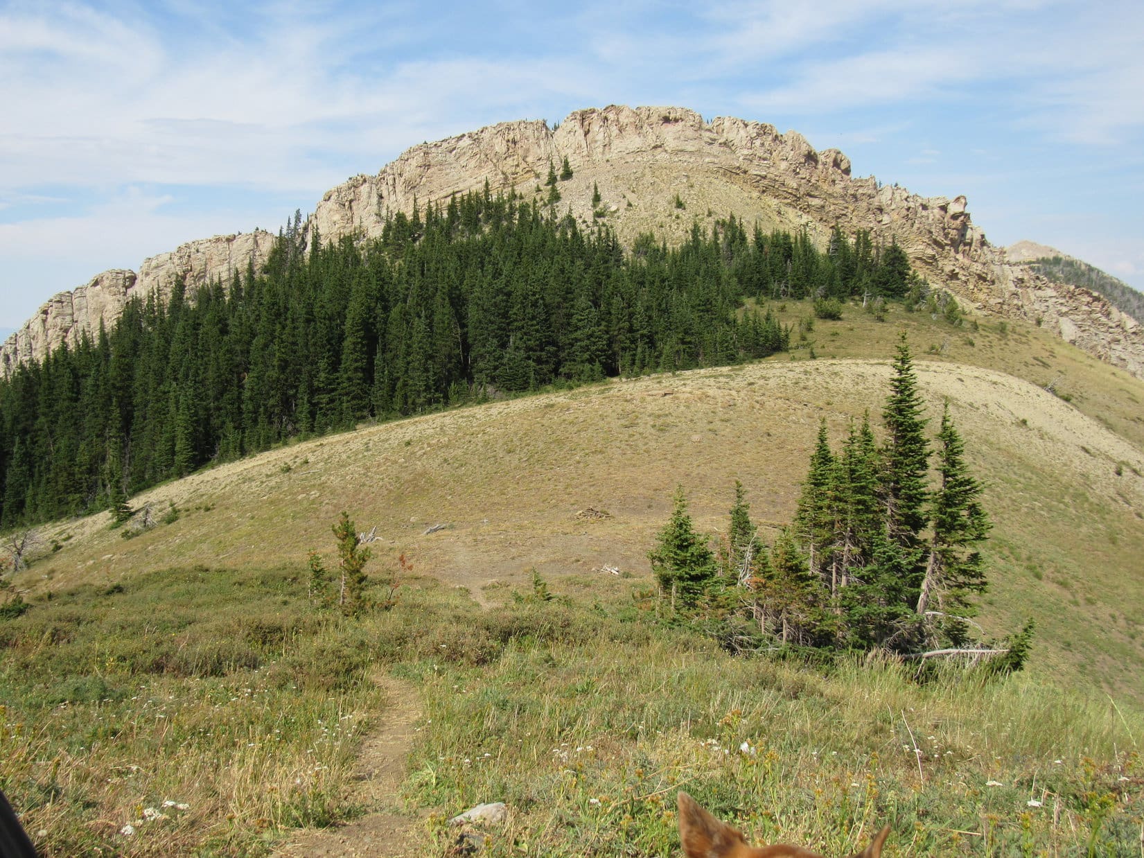
Fortunately, a use trail went up Livingston Peak’s N face.  The slope was so steep that SPHP kept grabbing branches and tree trunks for support, as Lupe charged practically straight up the mountain.  Nearly the entire route was forested, but toward the top, the trees shrank in size and began to thin out.

Getting easier! Already a long way up the N slope where the trees start thinning out. Photo looks S.

Rock slides appeared, a few cairns showing the route higher.  Above the rocks, Lupe found the trail again on a grassy slope dotted with young pines, but it soon played out, vanishing 50 feet below the top.

By the rock slides. Photo looks SE.
Looking down on Pass 8300 (R of Center). Peak 8631 (R). Photo looks NNE.
Almost there! Photo looks SE.

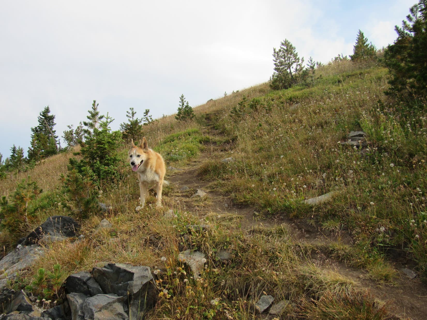
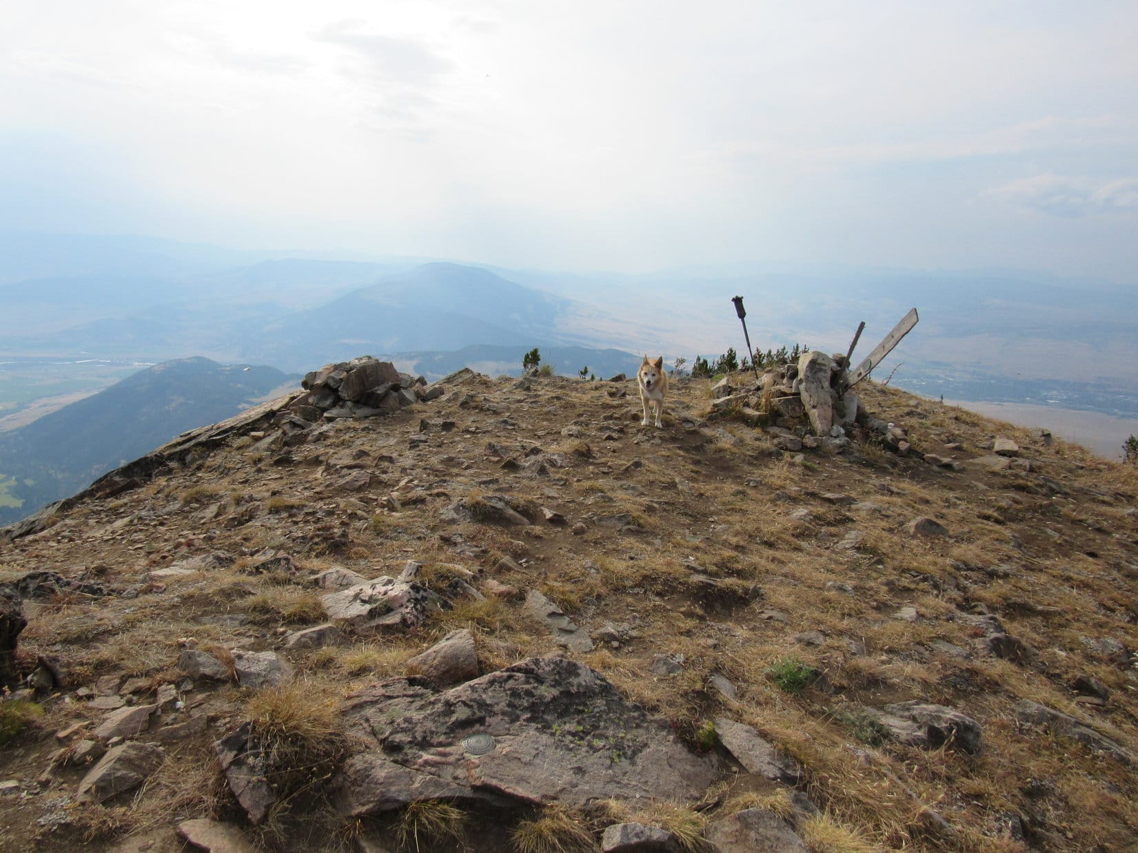
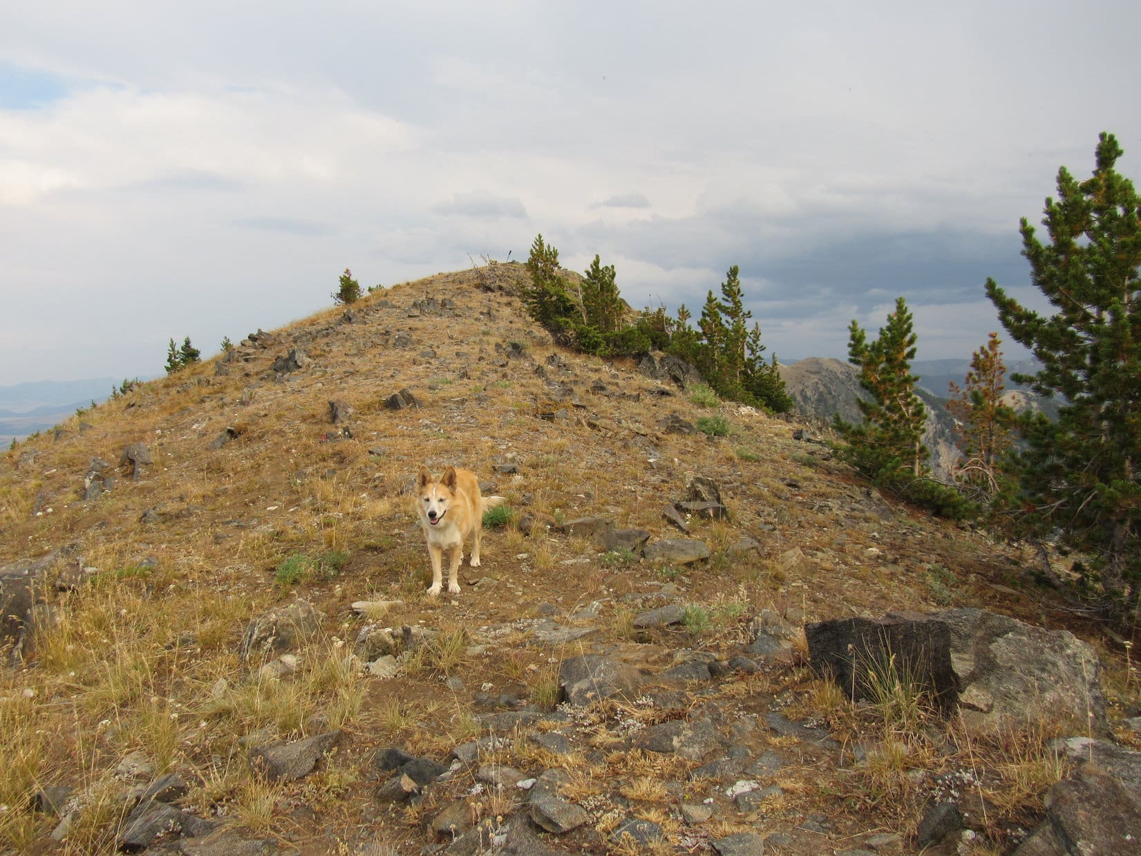
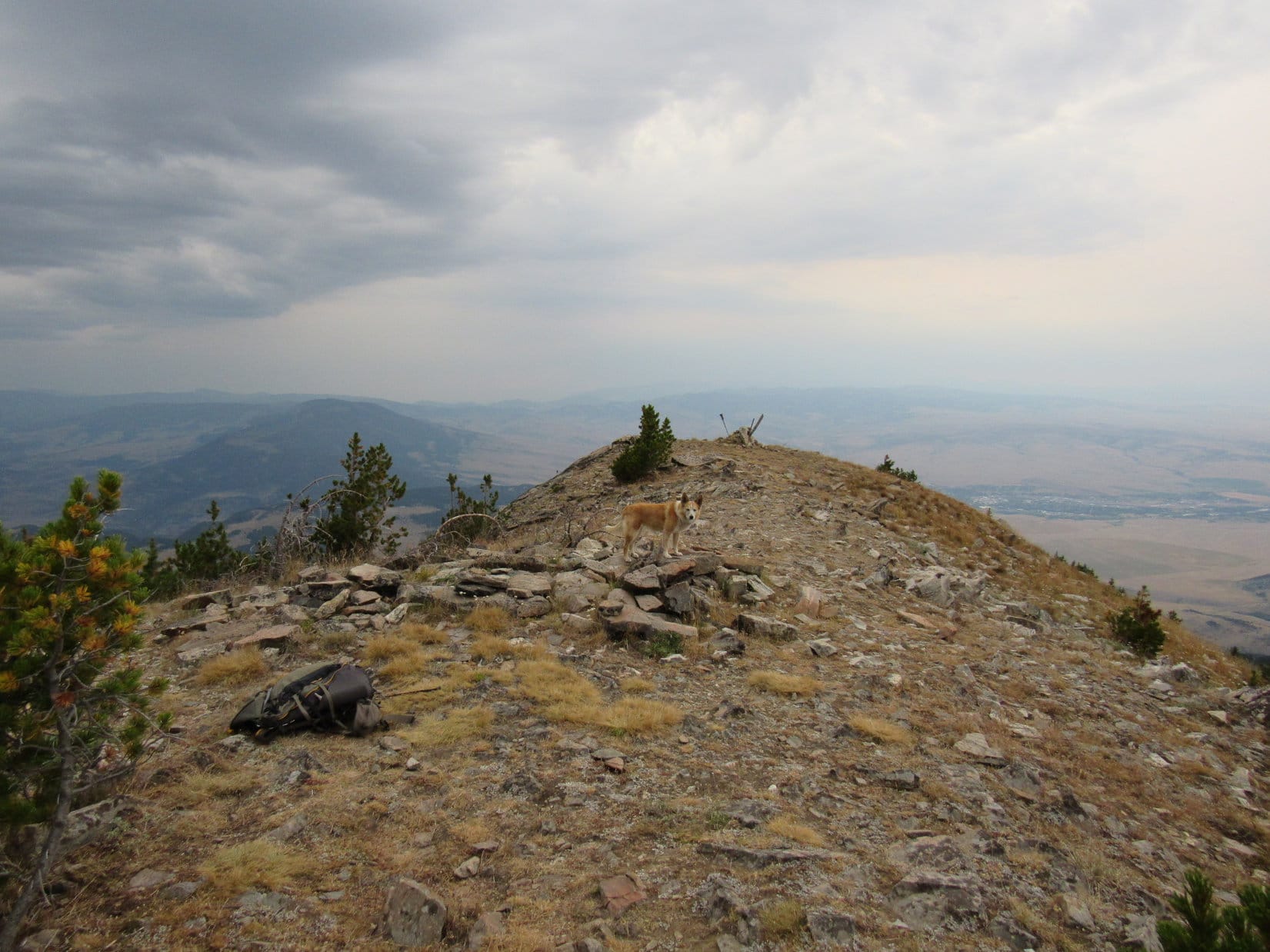
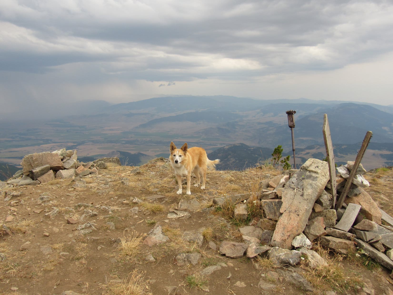
The rest was easy!  Lupe reached a stony NW/SE oriented summit ridge.  A cairn with boards and a metal pole sticking out of it at weird angles was visible a short distance to the SE.  From the cairn, the true summit appeared to be over at a collection of rocks 25 or 30 feet farther SE, but they were only marginally higher.

Made it! On the summit ridge. Photo looks SE.
By the oddly decorated cairn. Photo looks NW.

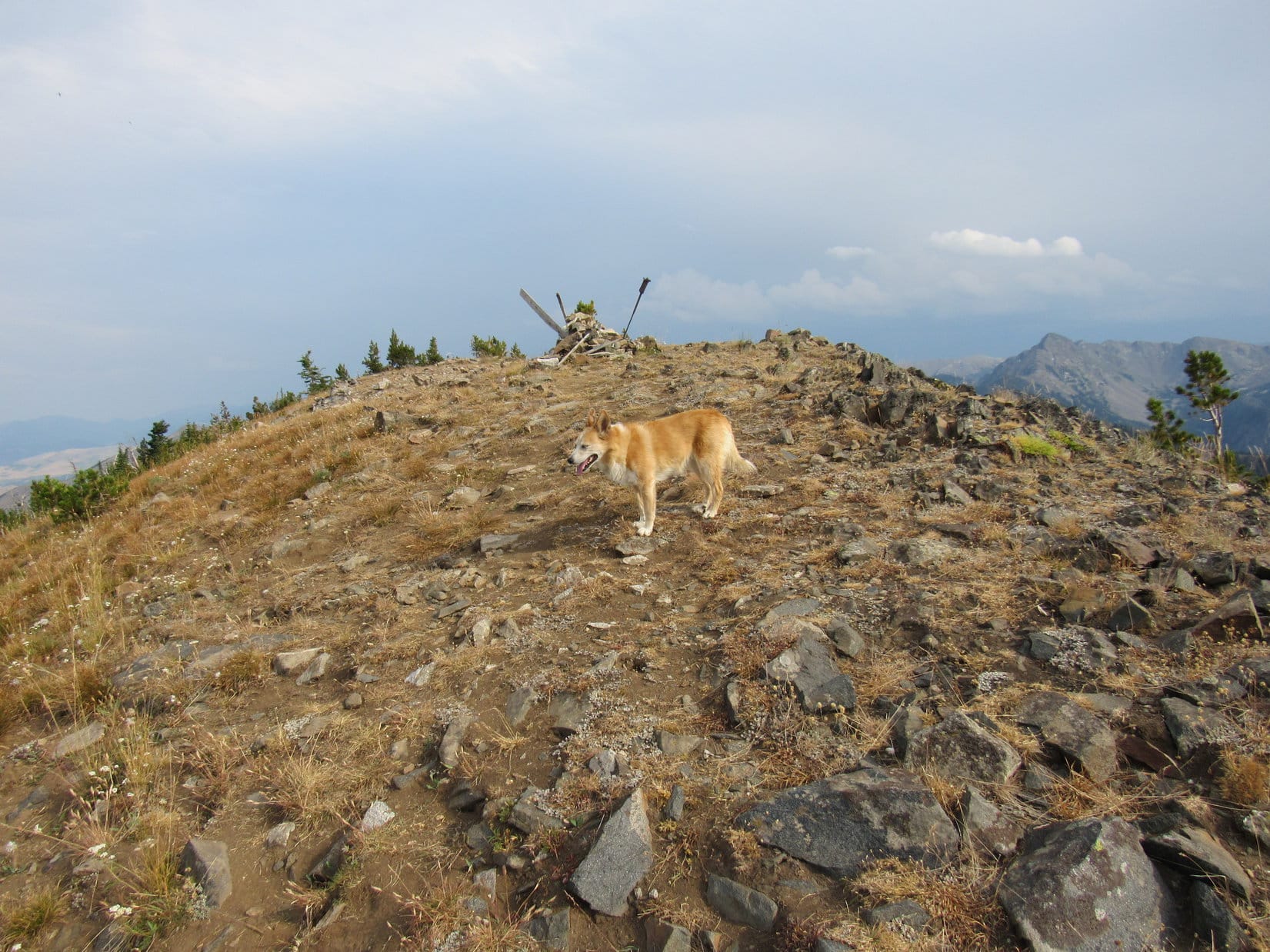
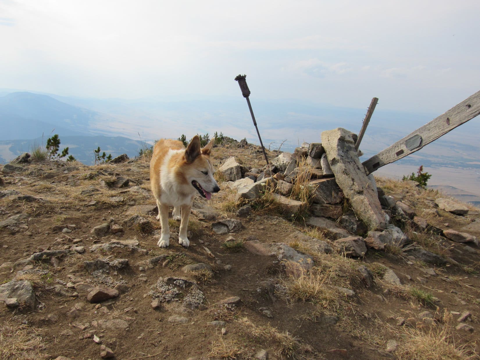
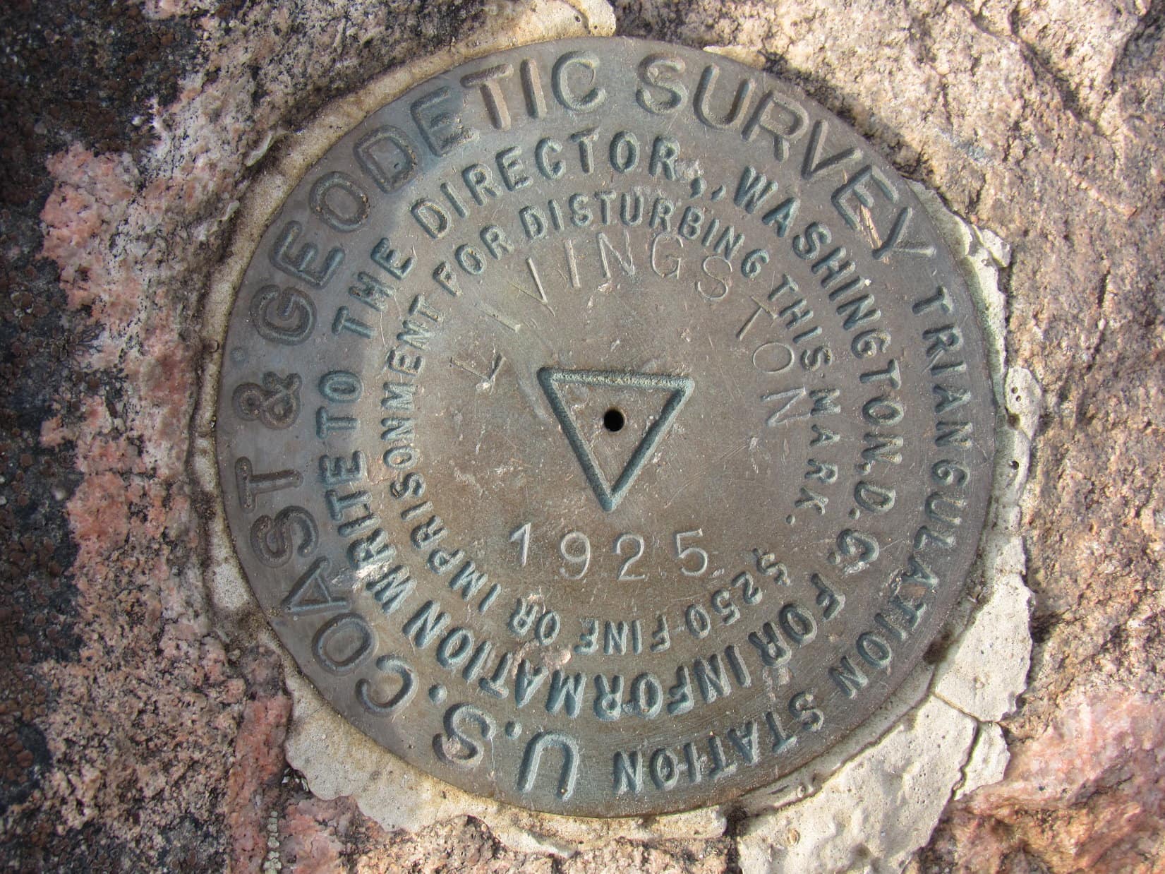
5:08 PM, Livingston Peak – Whew!  From Suce Creek, Livingston Peak had been a long march followed by that 1,000 foot very steep climb at the end.  SPHP dumped the backpack by some stunted pines near the true summit.  A couple photos of a survey benchmark attached to one of the largest rocks, and it was time for a break.

The survey benchmark (Center) and cairn from the true summit. Canyon Mountain (8,038 ft.) (L of Center). Photo looks WNW.
“Livingston” survey benchmark.

Too bad the sky wasn’t as clear as it had been earlier!  Only weakly sunny now.  Plenty of general murkiness, but still some blue sky to the N.  A small thunderstorm rumbled 25 miles S, dropping heavy rain as it drifted NE.  SPHP kept an eye on it as Looper relaxed.  No worries.  Gonna miss Livingston Peak by a wide margin.

Taking it easy for a bit.

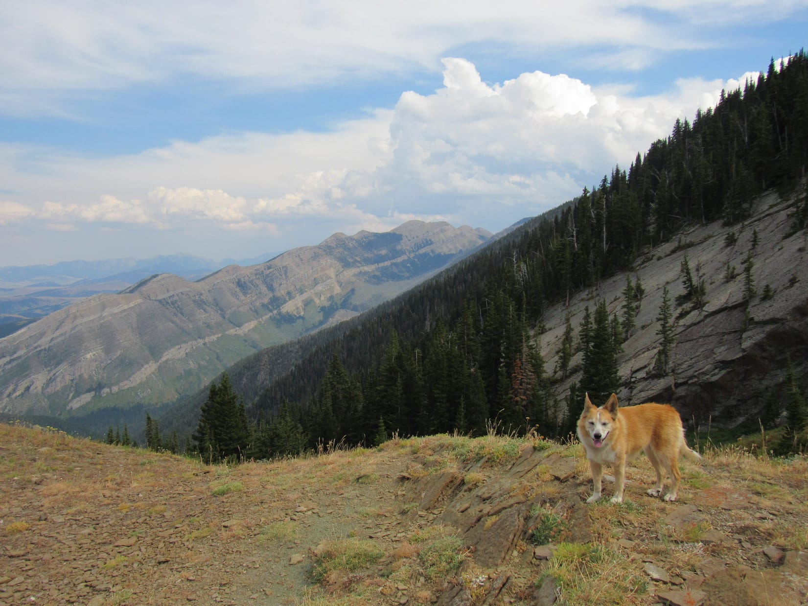
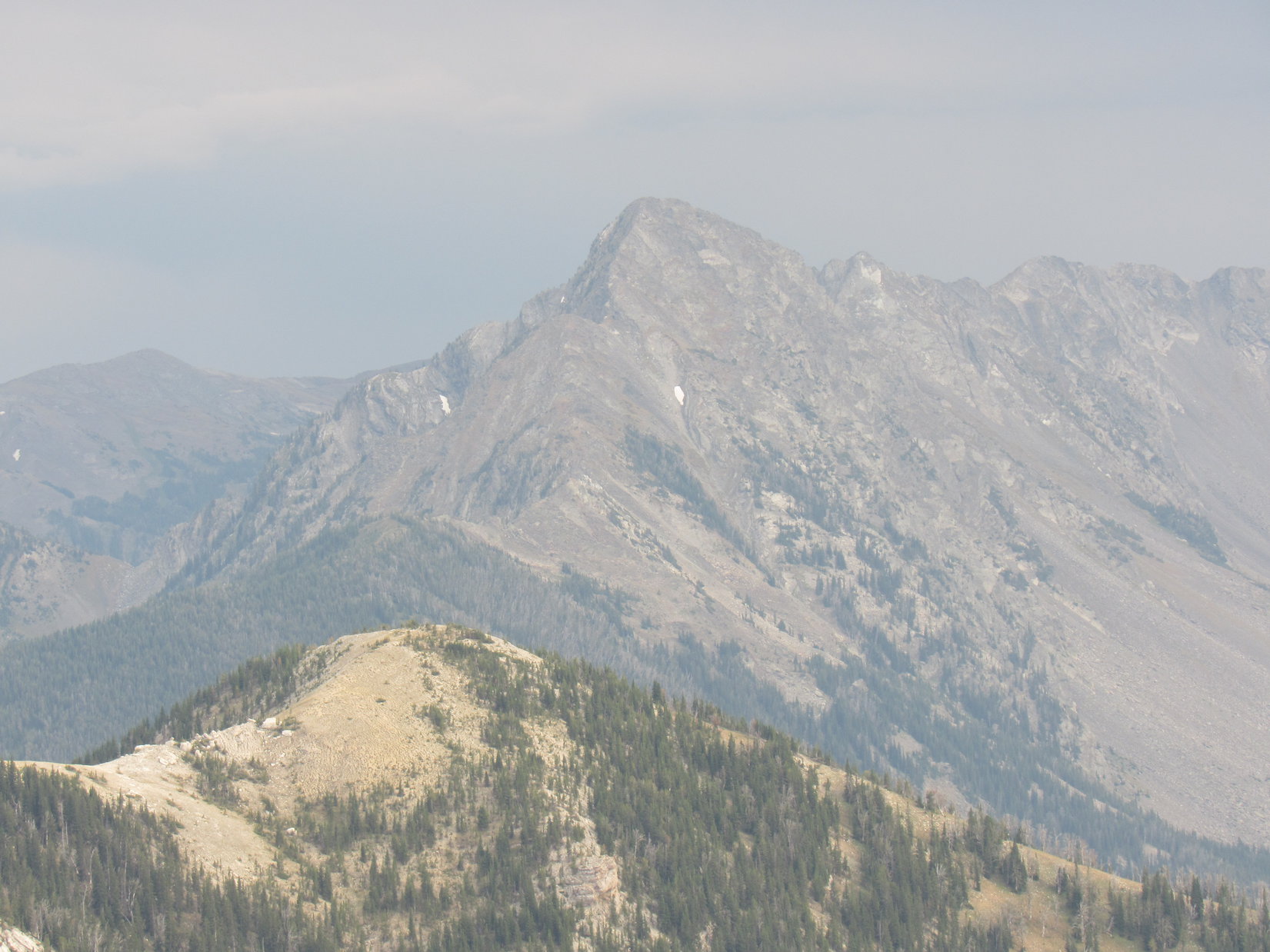
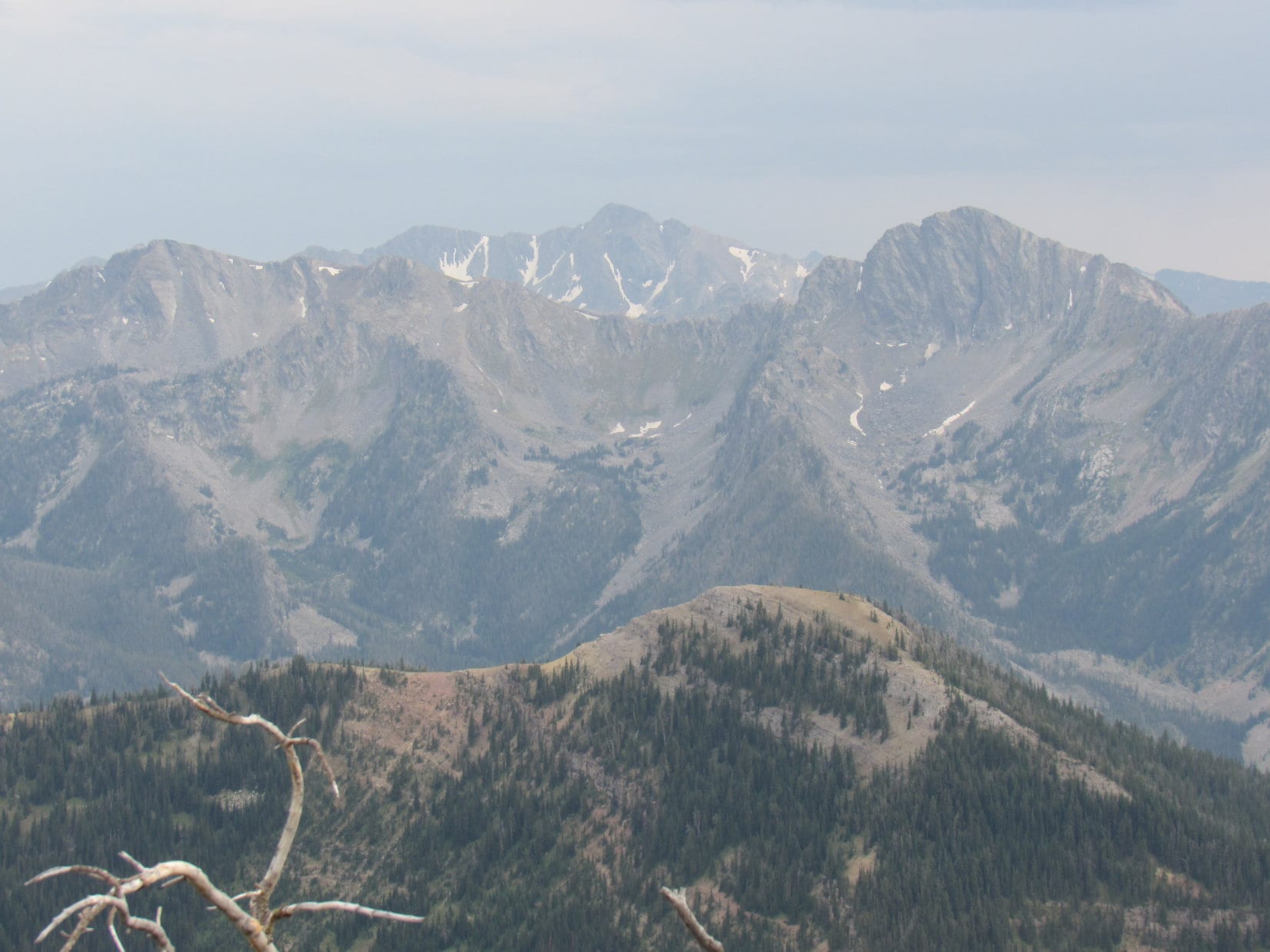
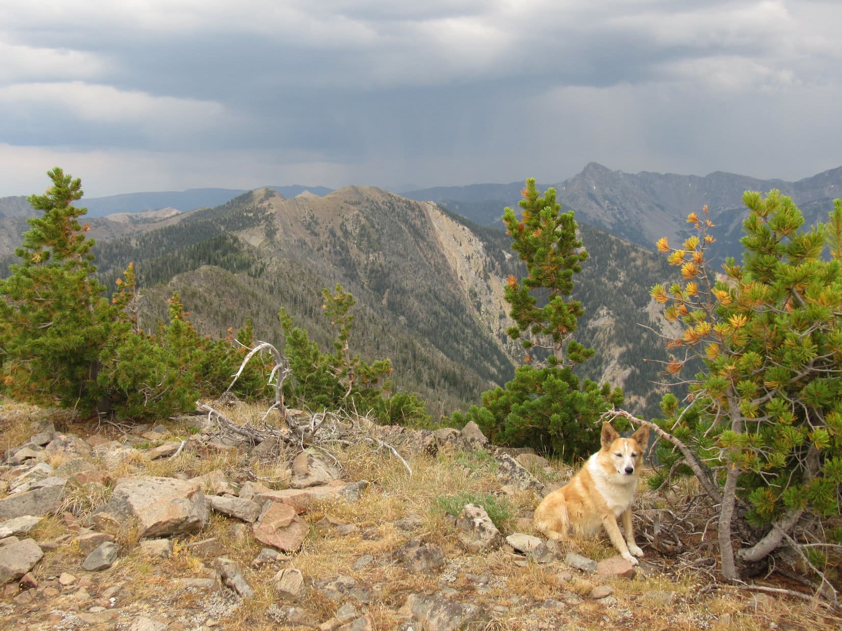
The best views were to the S where Black Mountain (10,941 ft.) soared well beyond Mount Delano (10,138 ft.), which was connected by a long ridge of lesser peaks to Peak 10228 farther E.

Peak 10228 (L). HP8806 in the foreground above Lupe’s rump with Black Mountain (Center) in the distance beyond it. Mount Delano a bit to the R. Photo looks S.

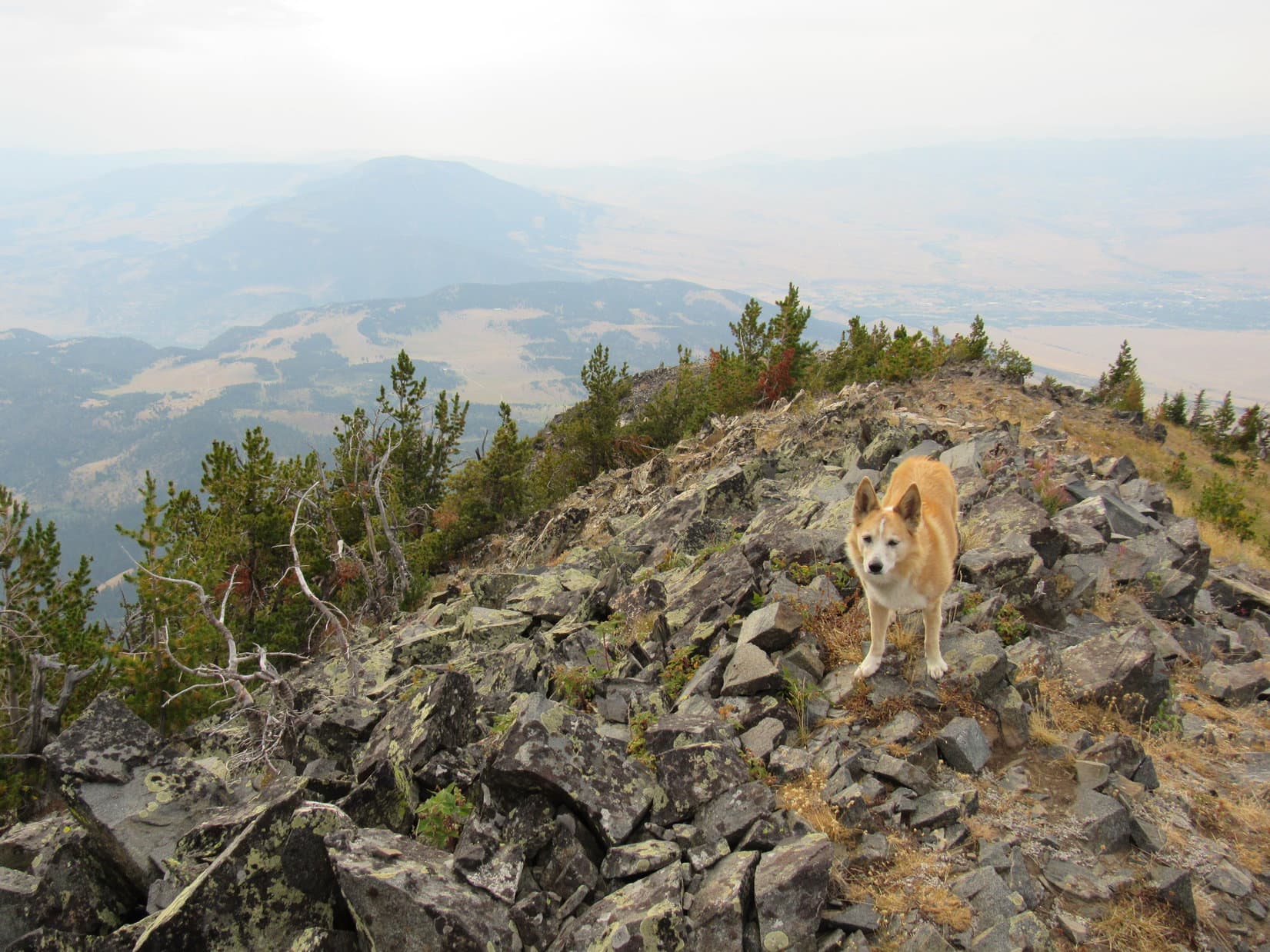
The highest part of Livingston Peak’s summit ridge was 600 or 700 feet long.  The N slope Lupe had come up had been very steep, but the S side of the mountain was even steeper, nearly a precipice.  The true summit was much closer to the NW end of the summit ridge than the SE end, and the cairn even more so.

Another thunderstorm appeared W of the first one, but observation led merely to the conclusion that this storm was destined to miss Livingston Peak, as well.  After enjoying a decent break, Loopster set off to explore the longer part of the summit ridge to the SE.  Small pines concentrated along the S edge were easily bypassed by staying a bit to the N.

Exploring the summit ridge. Photo looks SE.

From the entire ridge, Lupe had a clear view of Peak 8631 and HP8460 to the NE.  After traveling SE far enough to get past most of the trees, she also had a panoramic view of everything that way, too.

Peak 8631 (L) and HP8460 (Center). Photo looks NE.
Peak 9472 (far R). Photo looks SE.
Peak 9472 (far L) and Peak 9444 just to the R of it. Peak 10228 (L of Center), Black Mountain (R of Center), and Mount Delano (R). Photo looks S.
Peak 10228 (Center). Photo looks SSE with lots of help from the telephoto lens.
Peak 10088 (L), Black Mountain (Center), and Mount Delano (R). Photo looks S with help from the telephoto lens.

If Lupe had had the time, she could have explored Livingston Peak’s SE ridge for miles, but she went only 400 or 500 feet from the true summit to where the highest part of the ridge began to drop off appreciably.  Doubling back to explore the much shorter section of the ridge NW of the true summit, SPHP kept a close eye on events to the SW where rain showers could still be seen beyond the lower Suce Creek valley and Yellowstone River.

Storms to the S and SW bore watching. Lower Suce Creek valley (R). Photo looks SW.
Lower Suce Creek valley (Center). Yellowstone River beyond it. Photo looks SW with help from the telephoto lens.
Venturing out along the NW ridge. Photo looks SE back toward the cairn.

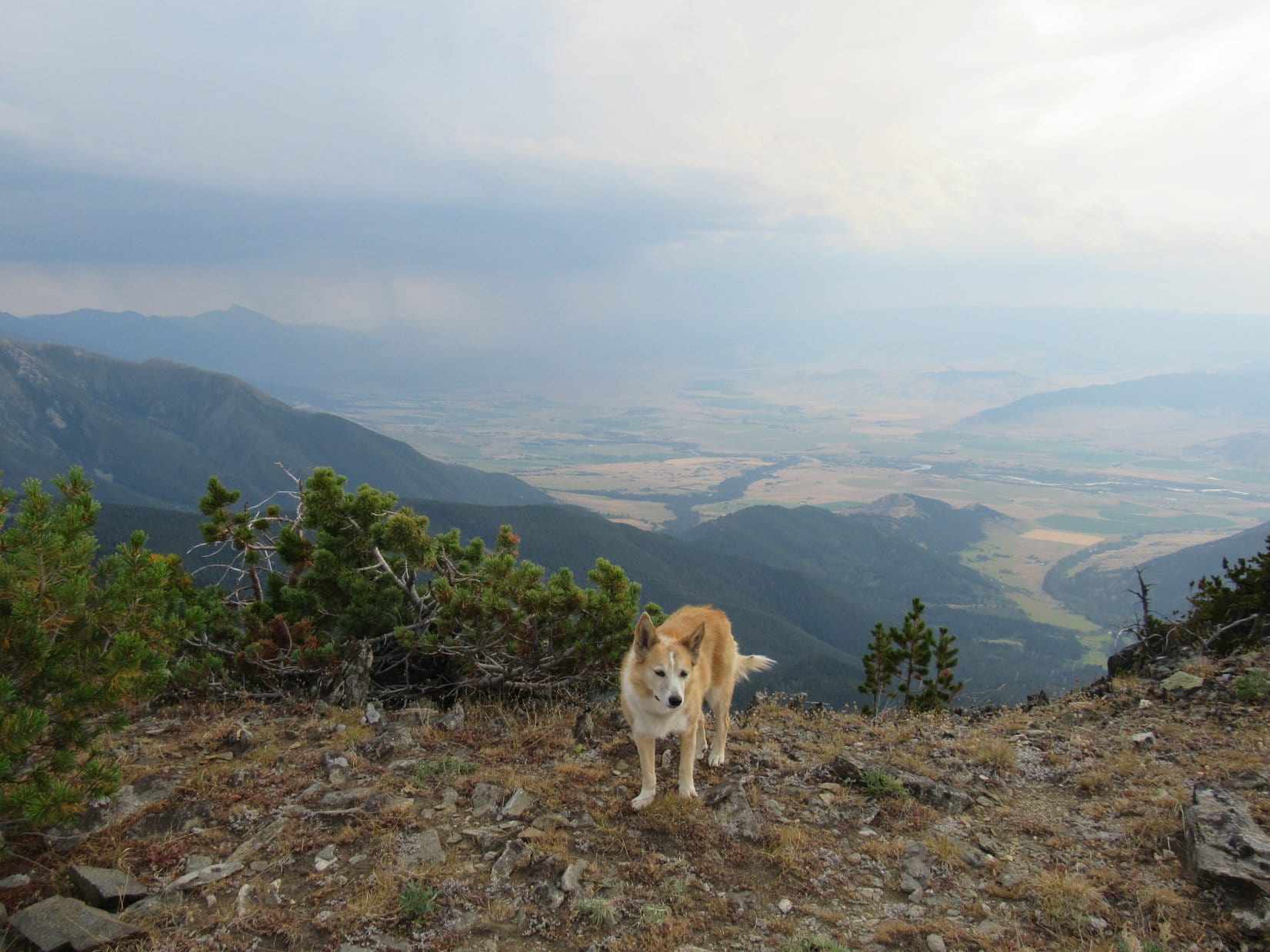
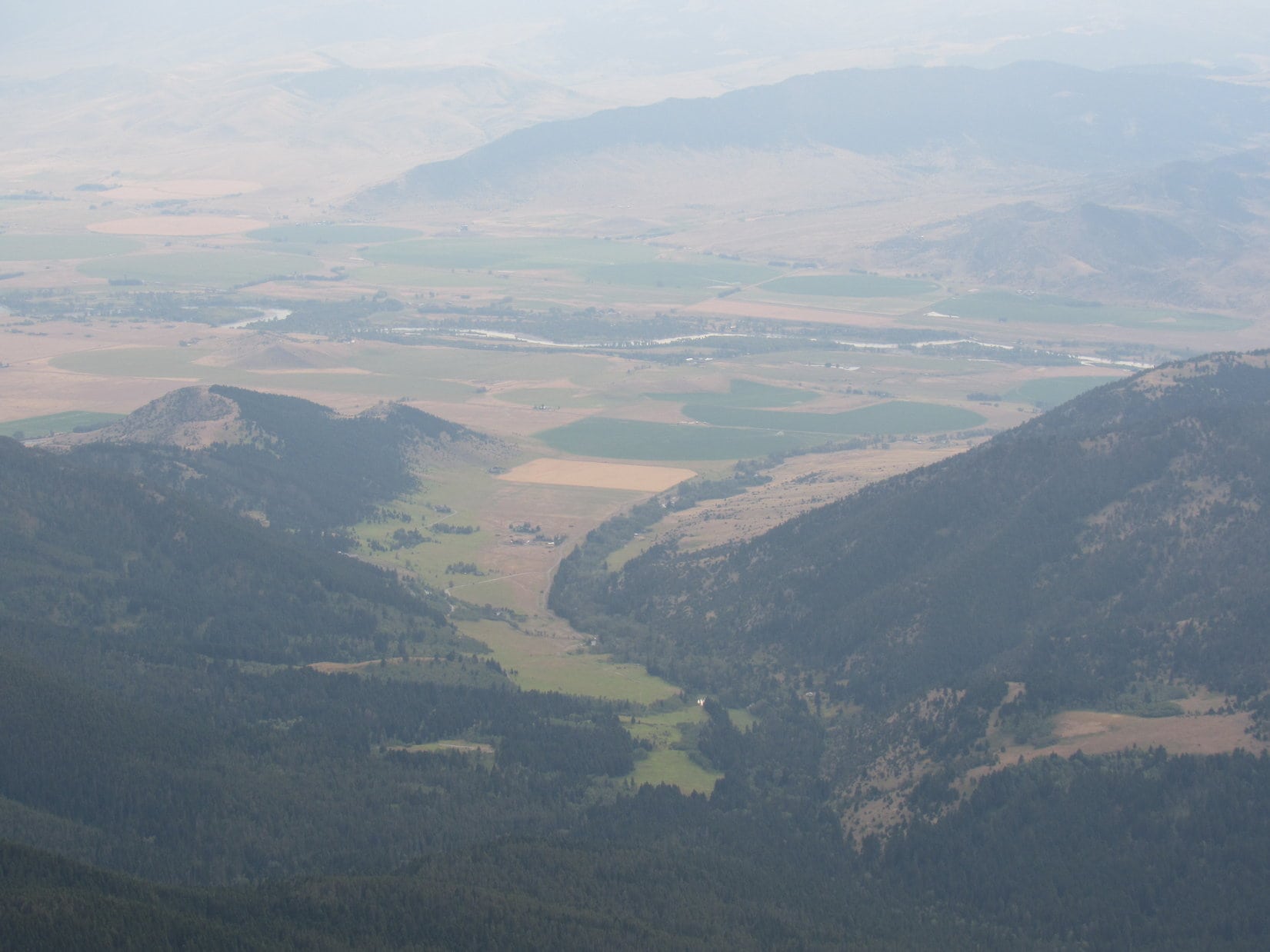
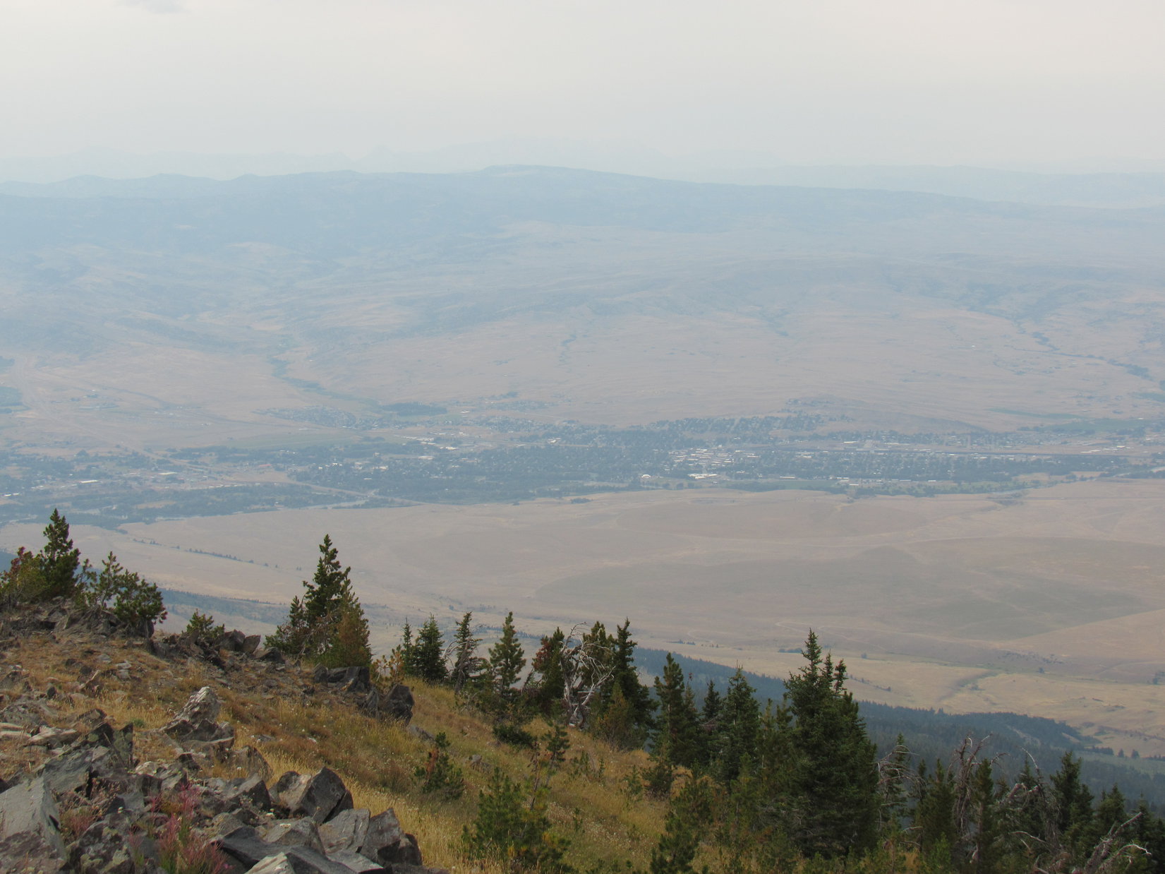
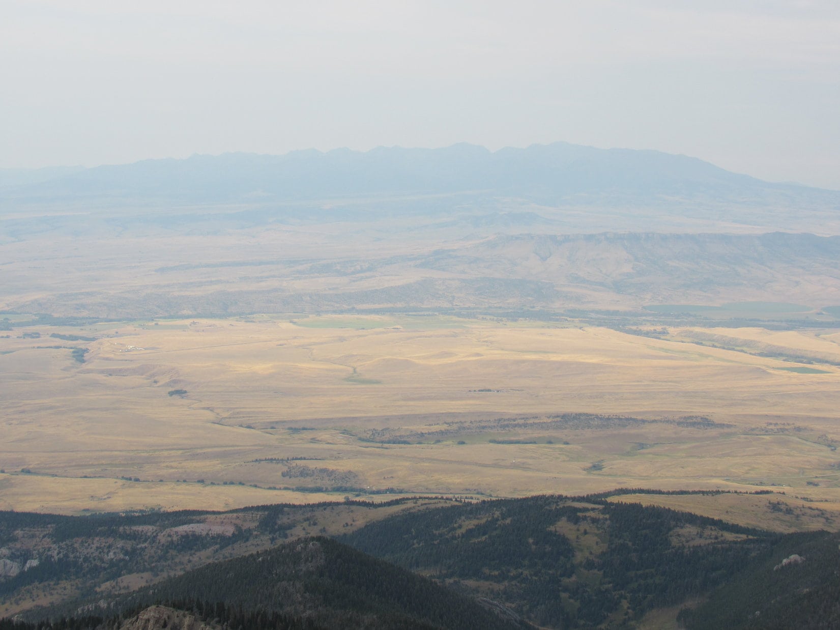
Lupe went only 200 or 300 feet beyond the cairn to where the NW ridge got kind of rocky.  Beyond this point, the ridge started dropping off much more steeply.  Unfortunately, conditions to the W were deteriorating.  What should have been a great view of Livingston, Montana was very hazy.  Prairies, hills and mountains beyond it were barely visible.  Far to the N was a dim view of the Crazy Mountains.

As far NW as Lupe went. Canyon Mountain (8,308 ft.) (L). Livingston, MT (lower R). Photo looks NW.
Livingston, MT. Photo looks NW with help from the telephoto lens.
Looking down on HP7623 (Center). Yellowstone River beyond it. Photo looks NNW.
Crazy Mountains in the distance. Photo looks N.

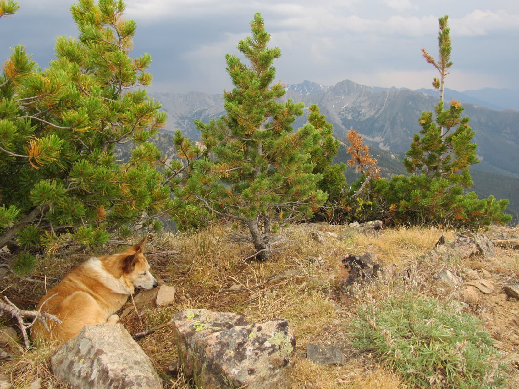
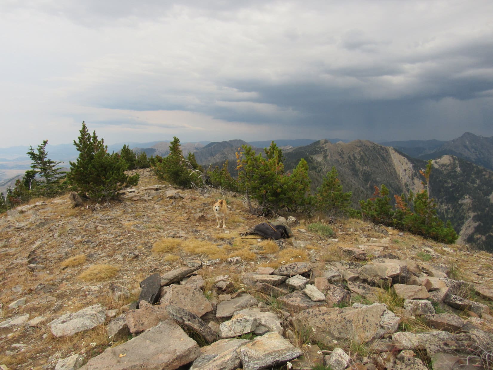
By the time Lupe had been up on Livingston Peak for 40 minutes, not a speck of blue sky remained.  A third thunderstorm was now off to the SW.  Not wanting to leave before her traditional hour at the top was over, Loop headed back to the stunted pines near the true summit to relax a while longer.

The entire S horizon darkened as the Carolina Dog watched a gray wall of heavy rain creep steadily closer, sweeping from vision everything in its path.  Raining almost everywhere to the S now.  Lupe and SPHP hung in there, enjoying a few last precious moments of rest, solitude, and quiet contemplation.

Enjoying another break as the rain spreads. Peak 9472 (L), Peak 9444 (Center), and Peak 10288 (R). Photo looks SE.

8-19-20, 6:12 PM, Livingston Peak – Alright!  Hour’s up!  Better get with it.  A final stroll about the true summit area, and Lupe stood by the cairn on top of Livingston Peak (9,314 ft.) for the last time.  The wall of rain to the S was only a few miles away now.  Impact seemed certain.

Near the end. Looking SE from the true summit.
Loop’s last moments at the true summit with the cairn beyond her. Photo looks NW.
By the cairn with rain on the way. Photo looks W.

Onward!  Puppy, ho!

Might have waited too long!  Hurry, hurry!  Livingston Peak’s steep N slope would be extremely slick and super treacherous, if it got soaked.  Bad enough when it was dry!  In a rush, Lupe and SPHP left the summit heading NNW down the grassy slopes leading to the rock slides.

Uh, oh.  Where’s the trail?  SPHP couldn’t find it.  Loop sniffed about, but didn’t seem to know where it was, either.  A couple of minutes marching back and forth looking for some sign of it, and SPHP spotted a cairn down among the rocks.  There we go!

Below the rocks, the trail was easily picked up again.  The race was on, such as it was.  SPHP had to proceed at least somewhat cautiously.  Just too steep!  Meanwhile, Lupe decided to play a game.  The crazy Carolina Dog kept stopping and letting SPHP go on ahead.  She just sat there until SPHP was completely out of sight before she’d even consider following.  SPHP often had to call her again and again before she’d reappear.

Not a good time for these Dingo shenanigans!

Down, down, down!  For some reason the rain was holding off.  Ought to have been here by now.  A few scattered big drops hit.  Thunder rumbled closer and closer.  Any moment now!

Yet it didn’t happen.  Started sprinkling a few times, but kept quitting.  Lucky!  Would be great to get down to Pass 8300 before the rain really hit.  Lupe finally got the idea that down was the place to be.  The waiting and stalking game apparently over, she zipped on by SPHP.

Hah!  Made it!  There was Loopster waiting down at the pass.

Back at Pass 8300. Photo looks N.

Somehow the rain must have missed Livingston Peak?  Even so, the race was still on.  The way the sky looked, likely a temporary reprieve.  Once SPHP joined Looper at Pass 8300, she led the way, turning NW down into the upper Lost Creek drainage on Livingston Peak trail No. 449.

The Luck of the Dingo held!  The trail seemed longer than SPHP remembered, but Lupe got clear down past the steep part along Lost Creek, too.  Still no rain, but storms were now squeezing in from both S and N.  Making great progress here, though!  The path was now level or a slight downhill slant most of the time.

The forest grew dim.  Hard to tell what the storm situation was.  Lupe made it over minor Pass 7060, and through the meadow!  The American Dingo reached the long straightaway of the upper switchback, but trouble was inevitable.  Trapped!  Raining to the N!  Raining to the S!  Thunder and lightning to the W!  Livingston Peak was the only place where it wasn’t raining.  Not gonna last.

Toward the end of the upper switchback, it began.  Light rain at first.  Reaching the ridge leading down to the trail junction where the wooden bench was, SPHP stopped to put on the ancient tattered blue Cookie Monster look-alike rain poncho.  Flashlight on!  An already damp Dingo resumed the trek.  Moments later, the deluge hit.

Not exactly a cloudburst, but it rained hard.  Lightning flashed, thunder boomed.  Totally drenched, Loopster was miserable and worried sick.  Scary close!  Again and again the impenetrable black forest suddenly lit up in a blinding blaze, momentarily illuminating dripping trees and pouring rain.  An instant later black as death again, only the feeble beam of the flashlight revealing the muddy trail ahead.

30 minutes, and the rain abated.  Thunder and deadly lightning drifted E.  Occasional light showers, then nothing.  No way to dry off, though.  Sopping wet vegetation overhung the trail in too many places.

8-19-20, 10:08 PM, Suce Creek trailhead – The Livingston Peak adventure was finally over.  SPHP opened the door of the G6, and a mighty weary American Dingo leapt inside.  Atop a pile of gear and pillows, Lupe curled up on her pink blankie and started licking herself dry.  Too tired to even eat much, she closed her eyes after only 0.5 can of Alpo.  Lights out, totally zonked.

8-20-20, 7:22 PM, SW of Meeteetse, WY – Light already fading, Lupe stood alongside the W end of Hwy 431.  Parched sagebrush and a white sky.  Off to the W, a pink-orange sun had just sunk into the murk.

At the W end of Hwy 413 SW of Meeteetse, Wyoming. Photo looks NE.

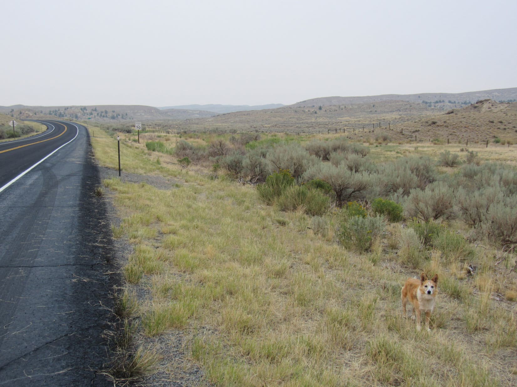
The Carolina Dog’s 3rd Dingo Vacation of the Year of Perfect Vision was over.  Livingston Peak had been the grand finale.  Lupe was going home.

August 20th!  Wasn’t supposed to be like this.  So many mountains yet to climb this summer!  But the sun had been pink-orange at the Suce Creek trailhead this morning, too.  SPHP hadn’t thought much of it at the time.  Rained again for an hour.  About mid-morning when it started getting sunny and hot, Lupe and SPHP had driven down to the Yellowstone River access point, and hung out down there for a few hours.

However, yesterday’s rains were merely local.  By mid-afternoon, the air was hazy again.  The plan was to go climb mountains in the Beartooths next, but when Lupe got there, the air was thick with smoke.  Only a dim outline of the mighty Beartooths could be seen.

No sense in going to all the trouble of climbing big mountains smothered in smoke!  Eh, no worries.  The Beartooths aren’t the only mountains in the American West.  Time for Plan B!  Lupe could just slip down into Wyoming and head for the grand and glorious Wind River range.

Wyoming was no better.  In fact, it was worse.  Not a cloud in the sky.  Ought to have been a perfect day.  Looking straight up Lupe could see a blue tinge.  Everywhere else, a dirty white sky.  A uniform dirty white for hundreds of miles.

Somewhere out W, countless wildfires were raging.  The Livingston Peak rain had been a lucky, local fluke.  Almost everywhere else, the W was in drought.  Come to think of it, the sky had been hazy only a few days ago even at West Butte (6,983 ft.) way up in the Sweetgrass Hills by the Canadian border.

SW of Meeteetse, SPHP came to the realization that the Wind River range wasn’t going to be any different.  Not much chance of finding clear skies anywhere else out W either.  Prime time to be in the mountains, yet maybe the season was effectively over?  Significant, widespread rains weren’t likely this time of year.  Not out W!

That’s what it was going to take, too, wasn’t it?

The Year of Perfect Vision felt cursed.  Was climbing season really, truly over already?  Was Lupe done?  Enormously disappointing, but sure felt like it.  Maybe the Carolina Dog’s grand day at Livingston Peak really was the end.  (Home, 8-21-20, 1:35 AM)

On Livingston Peak, Absaroka Range, Montana 8-19-20

Links:

Next Adventure                           Prior Adventure

Want more Lupe adventures?  Choose from Lupe’s Summer of 2020 Dingo Vacations to Wyoming, Utah & Montana Adventure IndexDingo Vacations Adventure Index or Master Adventure Index.  Or subscribe free to new Lupe adventures.

Black Hills, SD Expedition No. 264 – Peak 5017 & Peak 5316 (2-2-21)

9:00 AM, 49ºF, Song Dog Road (USFS Road No. 682), 0.25 mile W of the Wind Cave National Park water supply area –  Oh, what a fabulous day!  Sunny and very warm for the beginning of February in the Black Hills.  Lupe was here to make the most of it while she could!  For the first time this winter, a long stretch of extremely cold weather was coming soon.

Loopster had been here a couple of times before back in 2017 to scale the Twin Sisters Range Highpoint (4,980 ft.), just a little over a mile ENE and already in sight.  However, that wasn’t going to be the Carolina Dog’s destination today.  On to something new!  A couple of 300+ foot prominence peaks taken from Lists of John were her objectives.

The N face of the first one, Peak 5017, dominated the view from here.

Twin Sisters Range (L) and the N face of Peak 5017 (R). Photo looks E.

Ready, Looper?

Been waiting on you, as usual, SPHP!

Ahh, yes, of course!  This first peak should be a snap.  Just follow the road!

The American Dingo hit Song Dog Road, which started out heading SW, sort of the wrong direction.  However, after going up a long gentle slope, the road curved sharply to the E.  Lupe quickly reached a saddle where a less traveled road on the L trended NE.  Song Dog Road curved SE here, starting to head downhill.

About to set off on Song Dog Road. Photo looks SW.
At the first bend. Photo looks NE.
At the saddle. Song Dog Road goes R, and a side road goes L here. Peak 5017 (R). Photo looks ENE.

Which way, SPHP?

Take the side road to the L, Loopster.  Must say, I’m rather disappointed!

Why?  What’s wrong?

We’re already done with Song Dog Road, and you didn’t even hum a tune!

There’s a reason for that, SPHP!

Really, like what?

It’s broad daylight!  We Dingoes like to sing at night.  Should have brought me here when there’s a full moon!  I’d warble you up some real tunes then!

I see.  Didn’t think of that, but I suppose it makes sense.  Bad timing on my part.  If we don’t get back from Peak 5316 before dark, maybe we can come back here tonight for a Dingo concert?

In that case, keep an eye out for coyotes today, SPHP!

What for?

So I can invite them to chime in on the chorus!

Big concert tonight, if there’s a full moon! Hope you can stick around for it! On the side road leading to the N end of Peak 5017 (R). Photo looks NE.

The side road didn’t go all the way to the top of Peak 5017, passing below the N rim instead.  So Lupe left the road to climb up to the N high point, which wasn’t hard at all.  Before heading S for the true summit, she spent a few minutes checking out the views.

Peak 5208 (L of Center). Photo looks NNE over the Cold Springs Creek valley.
Twin Sisters Range Highpoint (L of Center). Photo looks ENE.

Peak 5017’s true summit was now a mere 250 yards away, an easy stroll across completely open prairie.

There’s the true summit of Peak 5017 (L) already! How easy is this? Photo looks S.

In nothing flat, Loopster was scoring her first peakbagging success of the day.  Rocks in a small group toward the SW edge of Peak 5017’s summit region were the highest points around.  A large portion of the southern Black Hills was on display, with distant glimpses of Wyoming to the SW, Nebraska to the S, and the prairies of western South Dakota to the E.

Although this wasn’t rugged territory, the panorama conveyed an overall sense of scenic spaciousness, the most pleasing views off to the SW toward Parker Peak (4,848 ft.) and Matias Peak (4,780 ft.).

Peak 5017 summit. Photo looks SW.
Parker Peak (Center) and Matias Peak (far R), both on the horizon. Photo looks SW with help from the telephoto lens.
Looking SE down Antelope Canyon.

The scene to the W was pleasant, but undramatic.  In the foreground was the same grassy ridge bordered with bits of crumbling limestone that Lupe had traveled on the side road she’d taken to get here.  Beyond the grassy region was a flat, forested plain, backed by slightly higher forested ridges in the distance.

Looking W.

The highest ground visible from Peak 5017 was to the N, yet a lack of any particularly sharp peaks served to create a feeling that something better was hidden beyond what could be seen from here.  The big, partly bald summit of Northeast Cicero Peak (6,240 ft.) was higher than anything else, and hinted at mountainous, rather than merely hilly, terrain.

Northeast Cicero Peak (far L). Photo looks NNE.

Only took 30 minutes to get up to Peak 5017, so there really wasn’t much reason to take any long break.  When SPHP looked into the backpack for the expectant American Dingo, that assessment was reinforced.

Criminy, Looper!  I didn’t bring the chocolate coconut bars!

What?  I saw you take some out of the box this morning!

Yeah, but I just threw them in a plastic sack.  Must still be sitting on the kitchen counter back home, along with the apples.

A lot of good that does us, SPHP!

Sorry about that, Loop!  Really am.  Care for some Taste of the Wild?

Maybe a little bit.  It’s not the same though.  Got any water to go with it?  Sort of dry.

Yes, I did bring water.  Here ya go!

No chocolate coconut bars!  I’ll be singing the blues at the concert tonight!

30 minutes on Peak 5017, and it was Onward, Puppy ho!  The Carolina Dog was on her way again.  Returning to the G6 by a much more direct route, she cut straight down Peak 5017’s N face from the side road.

Back on the side road after leaving Peak 5017. Photo looks SW.
We’ll head straight for the G6 (L) from here! Photo looks NW.

10:35 AM, Song Dog Road, back at the G6 –

We’re not driving closer to the next peak, SPHP?

Nope!  Peak 5316 is only 2.5 miles N of here, so we can just keep going on paw.

2.5 miles?  That’s it?  There goes the entire Dingo concert you wanted!  We’ll be back way before dark.

Dem’s da breaks, Loop.  Hate to miss out, but maybe I won’t.  Peak 5316 might take a lot longer than you think.  The region we’re going to travel through burned years ago.

So, lots of deadfall?

Yup, gonna be a mess, but who knows for how far?  

Soon enough, Lupe was crossing Cold Springs Creek, no great feat, since it was frozen stiff.  Ahead were the shattered burnt remains of a forest which had once covered the region near the now barren ridge SPHP intended to climb.

Crossing Cold Springs Creek. Photo looks NNE.

Lupe quickly reached the first deadfall.  A fair amount of big stuff, but it wasn’t as bad as SPHP had feared.  Winding around as needed, it was possible to avoid the worst of it without too much trouble.

The only real difficulty was going to be in getting above a line of limestone cliffs strung out along the ridge Loopster was approaching.  However, the cliffs weren’t very high, and it appeared there were breaks the American Dingo could take advantage of.  If that didn’t work, all she would have to do was stay more to the E (R), where the cliffs melted almost completely away.

The deadfall trek begins. Photo looks N.
Sometimes necessary to just go over stuff. Photo looks N.

Near the base of the ridge, Lupe came to a grassy region which must have been meadow all along, since there wasn’t any deadfall.  She found an old road going E/W, and followed it E a little way before turning N.

SPHP decided that the measly cliff line didn’t look so bad.  Loop headed right for the SE end of the ridge’s W lobe.  A steep climb among lots of small deadfall put Lupe at the base of a 10 foot cliff that was a deadfall mess itself.

At the cliffette. A 10 foot scramble up toward the R put Lupe on top. Photo looks WNW.

Lupe scrambled up with relative ease, while SPHP thrashed about trying to climb over or move dead branches.  Would have been a breeze minus the deadfall.  At any rate, SPHP soon joined Loopster on top.  Nice view looking back at Peak 5017 from here, and the deadfall situation to the N looked a bit better, at least for a little way.

Peak 5017 (straight up from Lupe). Photo looks S.
HP5100 (R). Photo looks N.

HP5100, the hill at the S end of the long ridge Lupe was about to follow N, was now in full view to the NE.  No need to go all the way to the top of it.  The topo map showed a trail W of HP5100 that would get Loop to the ridgeline farther N.

Staying toward the W, Lupe started N.  She found what might have been a remnant of the trail, and had a little luck following it, but soon lost it as huge quantities of deadfall overwhelmed any remaining traces.

Fortunately, the forest that had burned up here must not have been terribly old.  Most of the deadfall was only of moderate size instead of enormous tree trunks.  Even so, it took a wretched, time-consuming slog to get to the ridgeline N of HP5100.

No relief here!  Just more of the same ahead.

Same old, same old, but we’ve made it to the ridgeline! Photo looks NNE.

The ridge climbed steadily at a moderate to easy pace, as SPHP chugged N through the thicket.  Looper stuck close by since doing anything else would only vastly increase the amount of effort required.  Roaming any great distance was simply out.

Every now and then, Lupe reached a small patch of clear ground.  Then it was time for a short break.  Despite all the local ugliness, the largely unobstructed views were actually quite impressive.

HP5100 (R) with Peak 5017 beyond it. Twin Sisters Range (L). Photo looks SSE.

After a while, the ridge became less of a steady climb, and more of a succession of little hills.  A series of these high points appeared to the NW, where the ridge Lupe was on was about to merge with the next ridge to the W.  A number of green pines, somehow missed during the conflagration, beckoned from the high points farthest N.

Maybe Looper was about to get past the burn?  Wouldn’t that be nice!

Look! Live pines ahead! Photo looks NW.

Still took a while to get there.

At another break spot. Buffalo Gap (Center, straight up from Lupe’s ear) and Twin Sisters Range (R). Photo looks SE.
Could be worse! At least the rest of this stuff hasn’t fallen over yet! Photo looks NW.

Lupe finally reached the high points where the green pines were.  She was already at more than 5,200 feet elevation as she continued N over a couple of minor high spots.  Unfortunately, the hoped for end of the burn area, while in sight now, wasn’t anywhere close.

Off to the NW, though, something else was in sight, too.  A skinny, little ridge, oriented NW/SE and capped with limestone, stuck up above the immediately surrounding terrain.

It was in the right direction.  Was that Peak 5316?

Thar she blows! Peak 5316 is straight up from Loop. Photo looks NW.

Still a mile to go to get there, apparently a deadfall laden trek all the way.  Ahead, the terrain sloped gently down to a skinnier part of the ridge Lupe was on that connected to another high spot.  Instead of going straight across the skinny part, Loop roamed E a little way toward a somewhat grassier region to see what things looked like over there, getting a nice view of Peak 5208 in the process.

Peak 5208 (Center). Photo looks SE.

Heading NW back toward the skinny bridge to the N, Looper followed the brink of a line of limestone cliffs.  Suddenly, intense excitement!  Looking down, a herd of giant deers was racing away, having either heard or caught sight of SPHP snap, crackle, and popping through the deadfall.  All the Carolina Dog could do was stand up here with a commanding view and whine.

Elk in the valley to the NE with help from the telephoto lens.
Love the giant deers, but it’s on to Peak 5316! Skinny ridge just ahead! Photo looks N.

After crossing the skinny section, Lupe reached the high point at the end of a 5,200 foot contour extending over 0.5 mile SE from Peak 5316.  Poised on a chunk of white limestone, Loop took a final glance back at the territory to the SE.  From here, she could see the whole ridge leading over to the N end of Peak 5208, and the Booker Ranch valley N of it.

Booker Ranch valley (L), Peak 5208 (R). Photo looks SE.
Glancing S back across the skinny part of the ridge.

Still plenty of deadfall around as Lupe turned NW for Peak 5316, but it wasn’t as bad as earlier on.  In fact, the American Dingo found a faint road that helped tremendously until it curved SW over to another ridge.

Closing in on Peak 5316, Loop came to a ridge topped by a ragged line of limestone.  When it got too gnarly, she stayed SW of it.

Getting there! Peak 5316 (Center) is the high point ahead. Photo looks NW.
Peak 5316 (L). Photo looks NW.

The ragged limestone ridge played out.  Beyond it was a minor dip full of deadfall, but Lupe was soon climbing again.  Passing beneath a power line, she scrambled up onto the SE end of the broader limestone cap on Peak 5316.  More deadfall, of course!  Loop worked her way through it, and reached the marginally higher true summit near the NW end.

A cairn!  Quite a nice one.  Surprising, actually.  Lupe hopped aboard, accepting congratulations from SPHP on her peakbagging success.

Made it! On the Peak 5316 summit ridge! Photo looks NW.
Success! Photo looks ESE.
Wonder how many dead trees I had to jump over to get here? Must have been thousands!

Time for a break, the big one of the day.  Lupe curled up on SPHP’s lap after munching some Taste of the Wild.  The higher forested hills to the N that she’d seen from Peak 5017 were much closer now, and hemmed in the views in that direction.  Everything to the S was wide open.

To the W were 2 similar flat-topped hills.  Loopster had been to the more distant one, Peak 5240, about a mile away, in 2017.  Fun to see it again!

Peak 5280 (L) and Peak 5240 (R, beyond Lupe). Photo looks WSW.

Peak 5316 is mighty nice, SPHP, but it’s hard to get fully into the spirit of things without a chocolate coconut bar!

Yep, no apples, no bars.  Life is tough, isn’t it?

Good chance we’ll live through these sufferings, though, SPHP!  I see a couple of easier ways back.  I can’t tell you how scintillating that long ridge trek to get here was, but it would sort of be nice not to have to leap over all those dead trees again.

Agreed, Looper.  What’cha got in mind?

Two options!  We could follow that power line S.  Hardly any deadfall under it.  Or we could go down that scenic valley, and cross over a single ridge into the next valley beyond.  Looks a lot easier down there!

Think I like Option 2 the best, Loop.  Thought we’d go explore the last little bit of Peak 5316’s NW ridge before we’re done.  We can swoop down into the valley from there!

Easy Option 1: Follow the power line back. Photo looks SE.
Easy Option 2: Go down to the deadfall-free valley. Photo looks SSW.

Clouds drifted by in the bright blue sky, and Lupe’s hour on Peak 5316 sailed away, too.  Almost over and done with, by the time the American Dingo returned to the summit cairn for a last look around.  Then it was off to explore the little stretch of ridge remaining to the NW.

Peak 5316’s NW ridge from the summit cairn. Photo looks NW.

More deadfall there, too, of course!  The whole trek had been chock full of it, so anything less would have been a disappointment.  A brief look at the beautifully forested hills to the N, a vision of what Peak 5316 must have been like not so awfully long ago, and the return to the G6 began.

Looking ESE back at the summit.
Maybe we’ll be back? Gotta be some squirrels in all those trees! Photo looks N.

The NW ridge curved W and sank into the pines.  Lupe followed it down to a saddle where she picked up a dirt road heading S into the Option 2 valley she’d seen from above.

Oh, it was all so easy down in the grassy valley!  Not a stick or stone to slow SPHP down one jot.  Before long, the Carolina Dog was following the road higher as it climbed the ridge to the S.

Peak 5316 (Center) from the valley. Photo looks N.

Once on top, Loop followed the road SW until she was close to the rim overlooking the next valley.  Deadfall covered the steep slopes, but the valley floor was all meadow with a dirt road running down the middle.

Oh, it’s beautiful! And so much faster than staying up on these ridges! Photo looks S.

The valley was wonderful, once Lupe got down to it!  An easy trek, and so many deer!  This valley was the source of Cold Spring Creek, but it wasn’t until Lupe reached the lower end that a clear-running trickle appeared.  Near the end, the valley curved SE and broadened out.  And there was Peak 5017, glowing in the late afternoon sunshine!

Not much farther now!

Peak 5017 (Center) near the end of the day. Photo looks SE.

4:11 PM, 50ºF, Song Dog Road – Well, that was it for Expedition No. 264.  The American Dingo hopped in the G6, SPHP turned the key, and the 4 mile drive back to Hwy 89 began.

An awful lot of deadfall to deal with today, but we still had a good time, didn’t we, Looper?

Sure did, SPHP!  That Option 2 route was fun and so easy with the roads and all the deer!  Definitely the way to go.

Indeed!  Went a little too well.  Got back so soon that now I’m going to miss out on your Dingo concert this evening.

We’re still on Song Dog Road, aren’t we?  Probably have time to warble you up a tune or two before we get back to the highway, if you want.  I could probably do that much, even if the moon isn’t up yet.

That sounds great, Loopster!  Warble away!

What would you like to hear, SPHP?  Beethoven’s 9th?  Led Zepplin’s Stairway to Heaven?

Oh, I had no idea it would be anything so elaborate!  Whatever you have in mind would be fine.

How about the Chocolate Coconut Bar Blues?

Peak 5316, Black Hills of South Dakota 2-2-21

Links:

Next Black Hills Expedition                    Prior Black Hills Expedition

Black Hills, SD Expedition No. 199 – Twin Sisters Twice & Castle Rock (4-12-17)

Want more Lupe adventures?  Check out Lupe’s Black Hills, SD & WY Expeditions Adventure Index, Master Adventure Index, or subscribe free to new Lupe adventures!