Good grief! The temperature, already chilly enough back at home, was dropping instead of rising. Maybe a Black Hills expedition today wasn’t such a great idea after all? Lupe had been as enthusiastic as always, though. Hopefully the morning would warm up as forecast. This afternoon it was supposed to get a little above freezing, a heatwave compared to the 14°F the G6 was registering.
By the time Lupe was on East Cascade Mountain Road off Hwy 71 approaching the Seven Sisters Range High Point(4,420 ft.), the G6 said it was 20°F out. Better, but still a crispy start. SPHP parked the G6 just N of the junction with Big Buck Boulevard (7:49 AM). A few minutes later, Lupe had permission to enter and inspect the private property to the E.
The Seven Sisters Range High Point is dead ahead. Photo looks E along East Cascade Mountain Road.
20 acres were for sale by owner E of Big Buck Boulevard. The property was all barb wire fenced and had a small, partially finished cabin on it. The acreage was tucked in a scenic spot at the base of the Seven Sisters Range High Point, and went partway up the mountainside. Although some of the land was a bit steep and rocky, most of it was horse pasture. The asking price was $100,000.
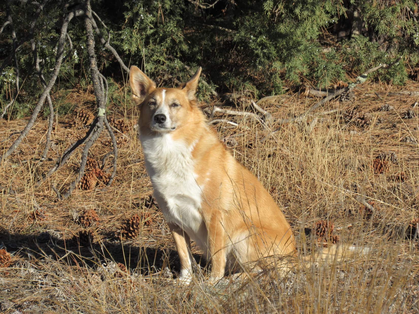
Lupe starts her inspection of the 20 acres for sale W of the Seven Sisters Range High Point. Photo looks ENE.
Two horses were supposedly on the property. Lupe saw no sign of them, but did see horses in pastures to the N and S. Cows at a cattle operation W of Big Buck Boulevard were mooing loudly. The property had an ambiance that an American Dingo could certainly appreciate! Lupe went to sniff around the little cabin. She got up on the deck that faced N toward the best view.
The cabin was 7 years old, but only partially completed. No heat, no power and no water. Kind of a Spartan existence. Lupe couldn’t go inside, and it didn’t take her long to complete her outside inspection. She left the cabin to head up the mountain for an even better look at the view.
After inspecting the rustic cabin, Lupe climbed higher up on the 20 acres for a better look at the views. Lupe knew people looking for horse property in the Black Hills. Maybe she could earn a finder’s fee? She was disappointed when SPHP explained that she lacked the necessary real estate license. Photo looks W.
Lupe kept climbing. The higher she went, the better the views were.
A wintery view from the upper W slopes of the Seven Sisters Range High Point. Peak 4371 is seen on the L. Photo looks SSW.
Lupe reached the top of the W face of the mountain near the N end. For the most part, trees hid the views. Lupe could no longer see the little cabin, but managed to find a few gaps between the trees from which she could see off into the distance.
Looper at the N end of the W face of the mountain. Photo looks WSW.Looking N.
The mountain’s true summit was clearly farther S, somewhere close to the edge of the W face. Loopster led the way S to go look for it.
The high point is this way, SPHP! Come on! Photo looks SSE.
Winter had made a comeback in the past week. It certainly felt like February again! When Lupe came to a small snow-free patch of ground before even reaching the high point, SPHP called a halt. Time to warm up! Lupe huddled inside SPHP’s jacket. She was shivering a little. SPHP took off a shoe to warm up a foot.
After a few minutes resting quietly, Lupe tensed up. Off to the NE, a herd of deer was running through the snow. Although quite a distance away, the deer were of keen interest to the Carolina Dog. Lupe watched excitedly until the last deer disappeared into the forest.
When Lupe quit shivering and SPHP’s foot had warmed up, it was time to carry on. The high point couldn’t be much farther.
Lupe stands next to the little bare patch of ground where she stopped to warm up inside SPHP’s jacket. She’d enjoyed watching a herd of deer running through the snow in the thinly treed area down the slope seen behind her. Photo looks NE.Lupe stands at a viewpoint only 20 feet from where she’d warmed up at the bare patch of ground. Peak 4371 is the closest big ridge on the L. Photo looks SSW.
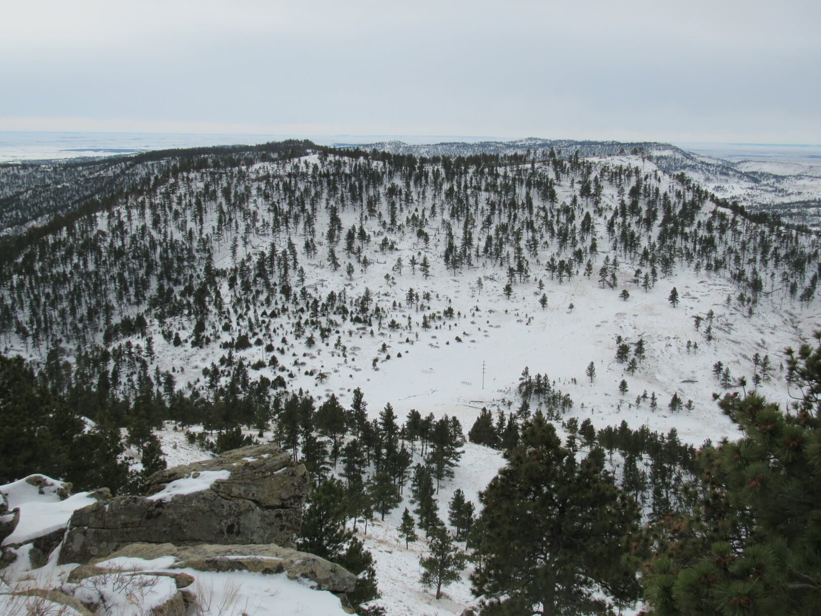
The Seven Sisters Range High Point(4,420 ft.) wasn’t far from where Lupe had warmed up. The summit area turned out to be quite large, 200 – 300 feet long N/S and not quite as wide E/W. The whole area was thinly forested. The terrain was so flat it was hard to discern any definite exact highest spot among the snow drifts.
The best views were along the edge of the steep W face of the mountain, though the ground seemed slightly higher a little farther E. Lupe toured the summit area hoping to find a squirrel in one of the trees, but it was so cold out any squirrels must have been curled up in their holes and wrapped in their bushy tails for warmth.
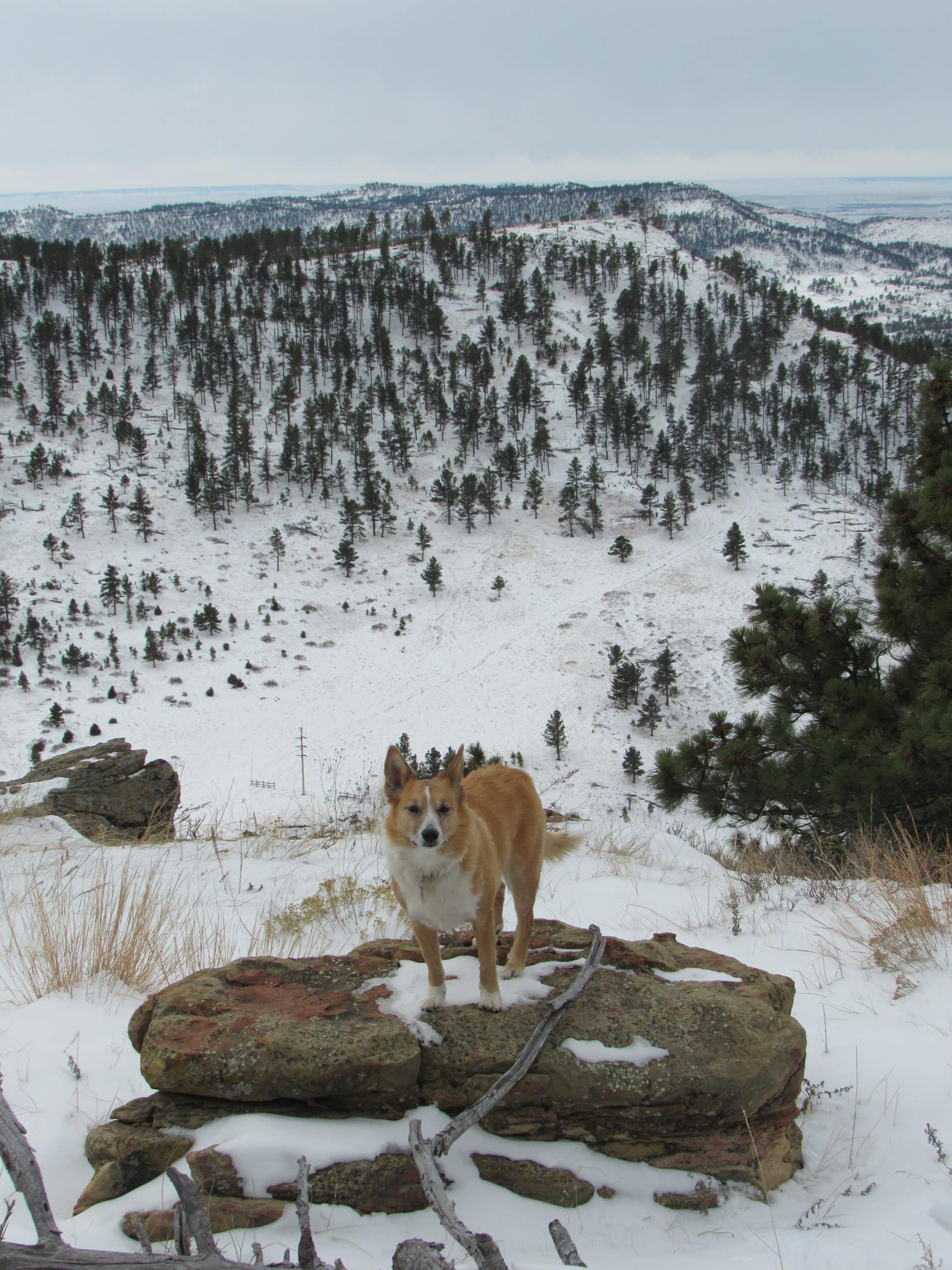
Lupe reaches the Seven Sisters Range High Point. The summit area was large, thinly forested and quite flat. Photo looks SSW toward Peak 4371.Looking WNW from along the W rim of the summit area.Lupe stands at what seemed to be the true summit of the Seven Sisters Range, although there was a lot of ground around very nearly as high. Photo looks WSW.
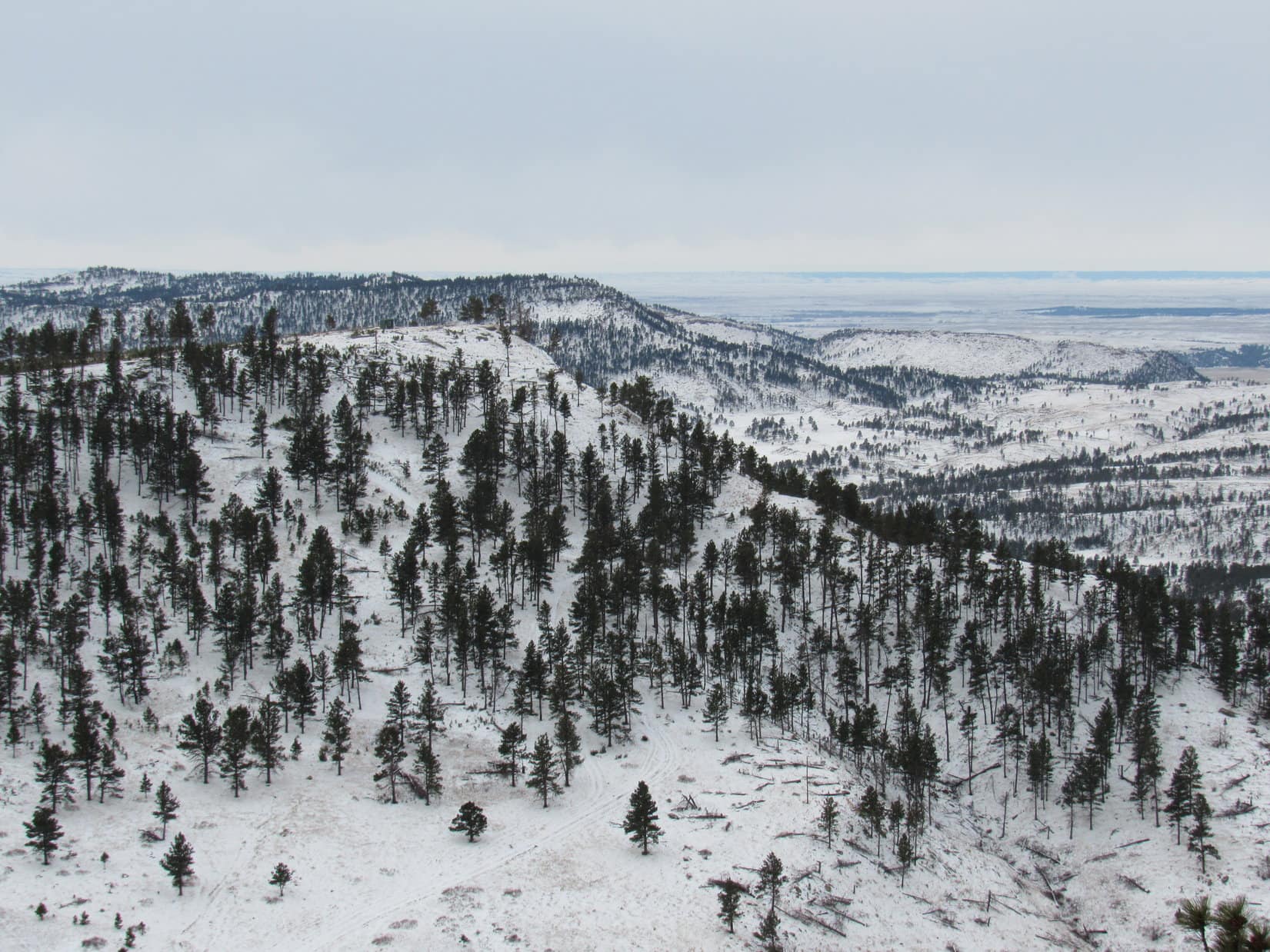
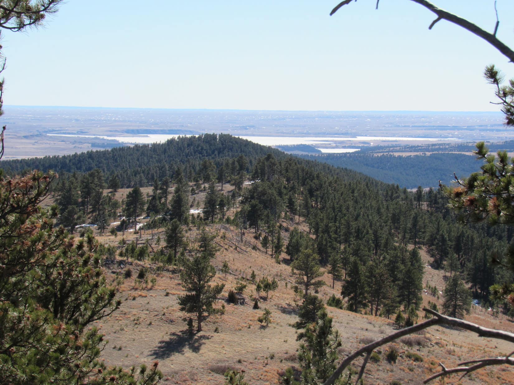
Disappointed by the lack of squirrels, Lupe continued S near the W rim of the mountain. Grand open vistas were on display to the SW. Under the overcast sky, the snow made the scene look clean and white, remote and desolate. What a great place to be! Off to the E, South Knapple Canyon was in view.
Looking E down South Knapple Canyon. The high prairies of western South Dakota are seen beyond the edge of the Black Hills.
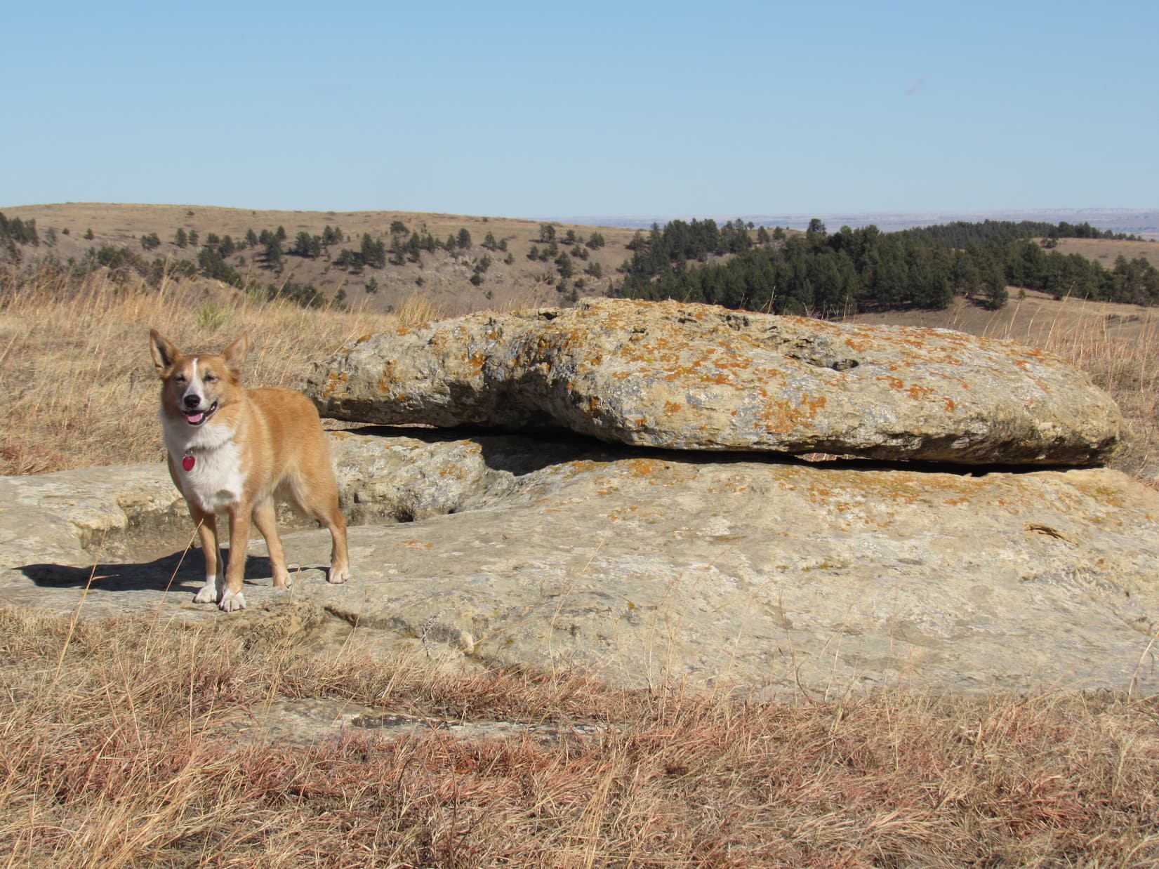
When Lupe got to the area near High Point 4360 on the Peakbagger.com topo map, she had a clear view of her next peakbagging objective, Peak4371, ahead.
When Lupe reached the area near High Point 4360 toward the S end of the Seven Sisters Range High Point, she had a clear view of Peak 4371 ahead. Photo looks SW.Looking back toward the summit of the Seven Sisters Range from near High Point 4360. The sky was dark off to the NW (L) where a snow shower was going on. Photo looks N.
Beyond High Point 4360, the ridgeline turned SE. Soon Lupe could see far below a snowy pass she would have to traverse to get to Peak 4371.
SE of High Point 4360, Lupe came to this overlook where she could see the snowy pass leading to Peak 4371.
As Lupe continued SE, she discovered a snow-covered road. The road descended gradually at first, but became steep, rocky, and soft as it made a sharp turn down to the pass. Following the road made it much easier for Lupe to get down to the pass than it would have been otherwise.
The road did not continue up Peak 4371. Upon reaching the pass, Lupe left it. She enjoyed a snowy romp over to the base of Peak 4371’s NE ridge. The NE ridge was the steepest part of the climb up the mountain, but wasn’t bad at all. When Lupe was halfway up, the ridgeline turned W gaining elevation at an easier pace.
Peak 4371 had looked fairly heavily forested from a distance. SPHP wasn’t certain if Lupe would find any clear views from the top. On her way up the W ridge, Looper agreed to pose for a photo at nice viewpoint, just in case the summit was buried in trees.
The Seven Sisters Range High Point from the NE ridge of Peak 4371. Photo looks N.Lupe on her way up Peak 4371. She is on the upper E ridge here, with a great view of the Seven Sisters Range High Point to the NNE.
Lupe didn’t reach the summit of Peak 4371 until she made it all the way to the far W end of the mountain. The summit area here was much smaller than at the Seven Sisters Range High Point, though there was still plenty of room to move around. The whole area sloped moderately down toward the E. A rock very close to the W edge of the mountain was clearly the true summit.
Success! Lupe stands on the rock that’s the true summit of Peak 4371. Photo looks SW.Lupe still perched on Peak 4371’s summit rock. This photo shows a little wider view of part of the summit area. Peak 4310 is the next snowy ridge seen on the L. Lupe was going there next! Photo looks SSW.
Trees were at the summit of Peak4371, but the top of the mountain wasn’t buried in them as SPHP had feared. Views could be seen in most directions, although Lupe often had to move around a bit to get a clear look. The whole summit area was only 50 or 60 feet in diameter, so it didn’t take Lupe long to explore it.
Loopster on another rock along the W rim of Peak 4371. Photo looks NW.
The best view from Peak 4371 was a sweeping panorama to the SSW. Lupe was fortunate to be here on a day when the white snow made the scene particularly beautiful. Lupe could see her next peakbagging objective, Peak4310, plus a couple other peaks of interest.
Peak 4310, the nearest snowy ridge and Lupe’s next peakbagging objective, was in clear view from Peak 4371. Photo looks SSW.Lupe was fortunate to be on Peak 4371 on a day when the snow made the scene so beautiful and grand! Snowy Peak 4310 (L) is in view close by. The highest point in the distance on the far L is Flagpole Mountain(4,320 ft.). The most distant of the low ridges in the foreground on the R may be part of Devil’s Slide Mountain(3,965 ft.). Photo looks SSW using the telephoto lens.A wider look at Peak 4310 nearby. To get there, Lupe would have to go all the way down to the big treeless patch of snow seen at Center below. From this pass, she could follow a road going first SW (R) then SE (L) up the mountain. Photo looks S.
Lupe left the summit of Peak 4371 following the SE ridge. She was losing elevation steadily, but it was soon apparent that she was going to have to lose it even faster. Below to the S, she could see the wide pass leading to Peak 4310. The slope leading down to it was rather steep.
This time there wasn’t any road to follow. Lupe started directly down the steep S slope. She had barely left Peak 4371’s SE ridgeline, however, when suddenly Lupe wanted to stop. Exactly why wasn’t clear. Nevertheless, only 10 or 12 feet below the edge of the ridge, Lupe and SPHP stopped to rest on a small rock ledge.
Even though it had warmed up enough to be helpful by now, SPHP let Lupe huddle inside the jacket. She wasn’t shivering, though, like last time. Maybe she had stepped on a cactus under the snow? Maybe she had heard something that had made her nervous? Her reason for wanting to stop wasn’t clear, but Lupe seemed happy resting right here. At least the view of Peak 4310 was splendid.
Lupe on the little rock ledge she wanted to stop at for a while on the upper S slope of Peak 4371. The view of Peak 4310 to the SSW was splendid from here.
Another idea. Maybe Lupe was hungry? She was! She devoured an entire bowl of Taste of the Wild. The poor Carolina Dog was famished! Climbing two mountains already had built up an appetite.
While Lupe was crunching happily away, SPHP noticed what appeared to be a structure near the W end of Peak 4310 where the true summit was supposed to be. A house or some sort of outbuilding? A tower was in view near it, too. Using the camera’s telephoto lens, SPHP saw that the structure was a shed of some sort, not a home. A road could also be seen winding up the NW side of the mountain to reach a high saddle E of the true summit.
Even after dining, Lupe was perfectly content right where she was. However, it was time to press on. Puppy, ho! Picking a way down the steep, snowy slope took a while, but Lupe made it down to the pass. From the pass, she took the road up to the high saddle in the middle of Peak 4310. On the other side of the saddle, off to the SE, was another surprise. A rather nice cabin was situated in a wooded area.
Peak 4310 has two high points at opposite ends of the mountain. The true summit is to the W. Slightly lower High Point 4304 is to the E. Lupe went to check out High Point 4304 first, passing to the N of the hidden cabin.
At High Point 4304, Lupe found a large rock. From it, she had a great view to the SE down Red Canyon. She could see Angostura Reservoir, the largest lake in the Black Hills region. The lake is formed by a dam on the Cheyenne River.
Lupe on the big rock at the top of High Point 4304. Photo looks SE down Red Canyon toward frozen Angostura Reservoir.Another look at Angostura Reservoir using the telephoto lens. Photo looks SE.
The view toward Angostura Reservoir was the best, but Loop could also see Flagpole Mountain(4,320 ft.) to the S.
Flagpole Mountain is the distant high point straight up from Lupe’s head. Photo looks S.
Having seen what there was to see from High Point 4304, Lupe headed W to visit the true summit of Peak 4310. She passed by the hidden cabin again.
Lupe passed to the N of this rather nice cabin on Peak 4310 both on her way to and back from High Point 4304. Photo looks SW using the telephoto lens.
Although Peak4310 was the lowest hill Lupe climbed on Expedition No. 193, the true summit was the most barren and open here. Consequently, the views were amazing! The summit area was larger than Peak 4371’s, but smaller than at the Seven Sisters Range High Point.
Although Peak 4310 was the lowest of all the peaks Lupe climbed on Expedition No. 193, the views were simply amazing. A beautifully wintery look at Sheps Canyon is seen here. The high point in the distance L of Center is Flagpole Mountain(4,320 ft.). Photo looks S.This photo shows much of the summit area at the W end of Peak 4310. Lupe found the highest rock on the mountain near the trees on the L. Photo looks N.Another look at Angostura, this time from the W end of Peak 4310. Photo looks SE.The great view to the WNW.
With fantastic views in practically every direction, Lupe and SPHP lingered on top of Peak 4310 longer than anywhere else. A medium-sized flat rock was at the true summit of the mountain. Lupe and SPHP sat here for a while admiring the wintery scenes all around. SPHP ate an apple. Lupe sat contently on SPHP’s lap, enjoying being petted and adored.
Lupe stands on the flat rock at the true summit of Peak 4310. For a minor Black Hills peak, the views were outstanding! Photo looks WSW.At the N end of the summit area, Lupe had this fabulous view back to the N. Peaks 4371 and the Seven Sisters Range High Point are seen on the R.Looking NW.
Upon reaching Peak 4310, Lupe had achieved all of her primary peakbagging goals for Black Hills, SD Expedition No. 193. Yet the position of the sun, seen dimly through the clouds, indicated it was only mid-day. Lupe had a few secondary goals in the general area. Maybe she still had time to climb another peak, if she got back to the G6 soon enough?
After the apple was gone, Lupe and SPHP spent an extra 10 minutes on Peak 4310, simply wandering around looking at all the splendid views again. Before departing, Lupe returned to the rock at the true summit. It was a little sad to be leaving such a great place.
Before departing, Lupe returned to the rock at the true summit of Peak 4310. Photo looks SE.
To return to the G6, Lupe had to retrace her entire route. She took the road from the high saddle on Peak 4310 all the way back down to the pass leading to Peak 4371. She climbed Peak 4371’s steep S slope, passing by her prior rest stop at the little rock ledge just below the SE ridgeline. Here she turned for one last look at Peak 4310. It was as beautiful as a Christmas card.
Looking back at Peak 4310 for a final time, it was as beautiful as a Christmas card. Photo looks SSW.
Since it was on her way, Lupe tagged the rock at the true summit of Peak 4371 again. Then she went back down the E ridge along the N side of the mountain. Where the E ridge angled NE, the Carolina Dog climbed up on a big rock outcropping for yet another look around.
Lupe returns to the rock at the true summit of Peak 4371 to complete her 2nd ascent of the mountain on Expedition No. 193. Photo looks NW.Partway down the E ridge of Peak 4371, Lupe got up on this big rock formation. From here, the ridge turns NE and drops more steeply down to the pass leading to the Seven Sisters Range High Point. Photo looks SE.This American Dingo can be encountered almost anywhere in the Black Hills of South Dakota. No need to exercise any special caution, however. Dingoes are wary, but extraordinarily friendly once you get to know them.
As Lupe continued down the NE ridge to the next pass, the sun made its best effort of the day to break through the clouds. Patches of blue sky began appearing. The day felt warmer. Snow softened and began to melt.
As Lupe came down Peak 4371’s NE ridge, patches of blue sky appeared. As the sun tried to break through the clouds, it became noticeably warmer out. Photo looks N toward the Seven Sisters Range High Point.
Down at the pass, Lupe got back on the road leading up to the Seven Sisters Range High Point. Approaching High Point 4360 again, she saw another herd of deer up there. The Carolina Dog raced off to investigate, perhaps with the intention of procuring dinner, but the deer had a huge head start on her. They were long gone well before she reached High Point 4360.
As far as Lupe was concerned, it was still an exhilarating experience!
Lupe comes running back from High Point 4360. No venison for dinner, not even close, but it had still been a fun romp. Hope springs eternal in a Carolina Dog’s heart!
SPHP went back up to High Point 4360 with Lupe to see where the deer had been. No telling if this had been the same herd Lupe saw early in the day when she stopped at the snow-free spot to warm up. Probably not, since this was the opposite S end of the mountain, and those deer had been heading N.
Back to the road. Lupe didn’t have much farther to go to reach the Seven Sisters Range High Point again.
Approaching the Seven Sisters Range High Point. This time coming from the SSE.
Lupe had to leave the road to return to the Seven Sisters Range High Point summit. Another mountain successfully ascended for a 2nd time today!
This time, Lupe didn’t linger very long. She already knew there weren’t any squirrels to be found here! She continued N along the scenic W rim of the mountain.
The sunshine hadn’t lasted long. By the time Lupe made it back up to the summit of the Seven Sisters Range, the sky was overcast again. Photo looks W from the W rim of the mountain.
Lupe went all the way back to the N end of the mountain for a final look at the view there. Then she started down the W slope where she had originally come up early in the day. SPHP took a long time to picking a way down the steep slope, but Lupe eventually arrived back at the rustic cabin and 20 acres for sale (2:04 PM, 35°F).
With 3.5 hours left before sunset, it seemed like Lupe ought to be able to climb another peak today. However, the G6 fell just short of making it up a long snowy slope on West Cascade Mountain Road. SPHP wasn’t even certain this was the way to Peak4340, so decided to forget this one until the snow was gone. Miles farther N, the road to Peak4160 was a muddy, sloppy mess.
So that was it. No more peaks. Expedition No. 193 was over. Oh, well! Lupe didn’t care. She had a wonderful time barking at cows and horses all the way home. SPHP didn’t really care either. What a wonderful day it had already been, roaming the Seven Sisters Range with the plucky Carolina Dog, exploring an unexpectedly gorgeous part of Lupe’s world!
At the N end of the W rim of the Seven Sisters Range High Point, Lupe’s last stop before heading down to the G6. Photo looks WSW.
Nope! No way! I’m not budging from this spot. Take it off! Take it off, now!
Tugging on the leash only made Lupe dig in and resist. She wasn’t going anywhere.
OK, Loop, but you gotta stay close to me. Let me lead the way.
The American Dingo had won. SPHP couldn’t drag her all the way up the mountain by the neck. The leash came off. Would Lupe follow? Reluctantly she did. Her adventure had hardly begun, and she was already terrified. SPHP had spoken the dreaded word: cactus. Ever since her adventure in the Wildcat Hills of Nebraska with mountaineer, Jobe Wymore, cactus has been a greatly feared nemesis.
Lupe followed right at SPHP’s heels. A very faint remnant of a road led W up the mountain. Lupe wasn’t about to go running around off the road, or take the lead. She did plod steadily along, however, which was all it would take to ultimately be successful. Onward and upward!
SPHP had been afraid of this. Lupe was on her way up Maverick Mountain (3,750 ft.) on the SE edge of the Black Hills. The southern part of the Black Hills region is the driest and lowest. Cactus line (sort of like tree line) tends to be in the 4,500 to 5,000 ft. range. Maverick Mountain is well below that, so cactus wasn’t unexpected.
Lupe had arrived early at the Romney GPA (Game Production Area) parking lot (7:39 AM, 45°F), which serves as the Maverick Mountain trailhead. On recent expeditions, she has been working on climbing peaks in the southern Black Hills that prolific climber Brian Kalet visited and added to the Peakbagger.com data base in May of 2016. Maverick Mountain was yet another Brian Kalet peak.
Counterintuitively, being lower meant that climbing Maverick Mountain was a more daunting task for Lupe than the higher Brian Kalet peaks she had been to farther N – all because of the cactus. If Lupe was going to climb Maverick Mountain at all, though, this was the time of year to do it. Once the weather warmed up consistently, another even greater danger might be present. SPHP wouldn’t even consider bringing her here then to risk a prairie rattlesnake bite.
Lupe’s Maverick Mountain adventure had begun only a few minutes ago, when she passed under a short wooden section in an otherwise barbed wire fence near the N end of the Romney GPA parking lot. She’d paused by a fallen steel tower, and then headed straight past it to start up the base of a forested ridge. She’d barely reached the trees when SPHP realized the situation, and spoken the dreaded word that brought Lupe to a screeching halt.
One of the signs posted along the barbed wire fence at the edge of the Romney GPA.Plaque at the Romney GPA parking lot off Scenic Road. While hunting is the most common use of the Romney GPA, public access is allowed for other uses, too. The summit of Maverick Mountain is in the Romney GPA about a mile W of the parking lot. Photo looks NE.Lupe at the start of her route up Maverick Mountain. She went under the section of wood fence seen here. (It’s near the N end of the parking area.) Beyond it, part of a fallen steel tower is laying on the ground. Lupe started up toward the bare spot on the ridge going to the R of the two big trees. She encountered both cactus, and the faint road leading to the top of Maverick Mountain before reaching the ridgeline. Photo looks WNW.Lupe near the fallen steel tower. An old road leads up Maverick Mountain from the E. It was essentially non-existent at the start and end of Lupe’s route. However, at one time it apparently went to the L of the 2 big trees seen on the L. Lupe went to the R of the trees, but luckily still found a remnant of the road appearing as an almost indiscernible trail a little farther up the hillside. The old road got better as it went W (toward the L) up Maverick Mountain. Photo looks WNW.
Lupe resumed her trek with trepidation, as SPHP watched carefully for cacti on the way up the first hillside. The Loopster wasn’t at all eager to move quickly, which was good, since there was plenty of cactus SPHP needed to guide her around.
Lupe had initially started up toward a bare spot on the ridgeline ahead. Before she even got that far, she came across a trail angling to the W (L) that was so faint, at first, that SPHP wasn’t even certain it wasn’t imaginary. However, it quickly improved and soon proved to be the old dirt road leading to the summit.
The road became easy to follow. Fortunately, there wasn’t any cactus on it. Lupe’s confidence began to return. Although she now trotted ahead on the old road, she was careful not to leave it. She understood perfectly well that the horrible cactus was waiting for her off the road.
Things were going well, again. Lupe gained elevation steadily. The road passed through a mixed forest of Ponderosa pines and junipers. Spiny Yucca plants grew in sunny spots between the trees. Occasional open views of the prairie to the E improved rapidly. The highlight was the Cheyenne River sparkling in the morning sunlight.
Maverick Mountain is on the SE edge of the Black Hills. As Lupe climbed W, she had long distance views of the western SD prairies back to the E. The highlight of the view was the Cheyenne River sparkling in the morning sun. 4-lane Hwy 79 is seen down by the river, and crosses it on the R. Photo looks SE with help from the telephoto lens.Getting higher. Photo looks SE.
Once Lupe found the old road going W up Maverick Mountain, it was typically easy to follow. Where it wasn’t, straight ahead was always a good assumption. The road kept progressing steadily W, with few twists or turns.
Fairly high up on the mountain, Angostura Reservoir came into view to the S. Only on the edge of the Black Hills, and not actually in them, Angostura Reservoir is the largest lake in the entire Black Hills region. Popular for fishing and boating, the lake was created by a dam on the Cheyenne River.
Fairly high up on Maverick Mountain, Lupe had this view of still frozen Angostura Reservoir. Located on the far SE edge of the Black Hills, it is the largest lake in the region. Photo looks S.
The old road faded away as it leveled out neared the top of Maverick Mountain. Ahead of Lupe was an open field. A dried up stock pond was in the middle of the field toward the S. Trees rimmed the N and W edges of the field. A small hill straight ahead was clearly the location of the true summit.
Almost there! The road faded out here with the summit of Maverick Mountain in view at the top of the small hill toward the R. Photo looks WSW.
Lupe was worried about cactus when the road disappeared. She had good reason. Even though the cactus had been worse lower down, there was still some scattered around. Lupe followed SPHP closely across the field. She made it to the summit of Maverick Mountain(3,750 ft.) without incident.
A cluster of several big Ponderosa pines grew right at the true summit of Maverick Mountain. Photo looks NNW.Success! Despite it’s cacti defenses, Loopster arrives at the summit of Maverick Mountain! Photo looks NNW.Comin’ for you Brian Kalet! Maverick Mountain was another southern Black Hills peak Brian Kalet had entered into the Peakbagger.com data base in the spring of 2016. Lupe has been climbing as many of them as she can lately.
Ordinarily, Lupe would have lingered on top of the mountain for a little while, exploring the summit area and seeing what there was to see. With cactus on the mountain, though, she wasn’t about to get too rambunctious, or hang around for very long. The views toward higher hills to the N and W were almost completely blocked by trees, anyway.
Lupe did roam around enough, though, to see the highlights of what views Maverick Mountain had to offer off to the S and E.
Looking E toward the prairies of western SD beyond the Black Hills. You’d be happy too, if you managed to get all the way to the top of Maverick Mountain without getting stabbed in the paw by a cactus spine!The Cheyenne River from Maverick Mountain. An old windmill that had fallen over on the mountain S of the dried up stock pond is sort of in view beyond and to the L of Lupe. Photo looks SE.The fallen over windmill is now on the R. The dried up stock pond is behind the closest pine tree L of Center. The way back down the mountain is off to the far L side of this photo. Photo looks ESE.
After a 15 or 20 minute stay up on the Maverick Mountain summit, Lupe headed E back across the N side of the field where the dried up stock pond was to start her trip back down the mountain. The Carolina Dog was eager to get off this pin cushion!
Besides, Lupe had other higher peaks to climb not too far away near Hot Springs, SD.
On her way back down Maverick Mountain, Lupe was facing the great views of the Cheyenne River far below. Photo looks SE using the telephoto lens.The old road is rather faint here, but Lupe is almost right on it. Maverick Junction where Hwys 79, 18 & 385 meet 5 miles E of Hot Springs, SD is seen far below on the L. Photo looks ENE.
When Lupe reached the last hillside at the bottom of the mountain, SPHP made her stop and stay put. Due her fear of cactus, she didn’t dare disobey.
SPHP started searching around. Earlier, SPHP had noticed Lupe wasn’t wearing her pink collar. She’d had it on when she started out. Where had it gone? After some thought, SPHP had decided it must have come off in this area during all the commotion with the cactus and the leash right near the start of Lupe’s excursion.
The search was a failure. Lupe’s pink collar was nowhere to be seen. Lupe stood motionless wondering what was going on? An idea! SPHP took the leash out of a pocket. Hah! There it was! Lupe’s pink collar had gotten tangled up with the leash, and been in SPHP’s pocket all along. Doh!
Sorry, about the wait Looper. Guess I’m losin’ it. Come on, let’s go! Lupe was more than ready. She returned to the G6, leaving Pin Cushion Mountain behind forever! Even Brian Kalet couldn’t get her to come back a second time. (9:25 AM, 48°F)
Maverick Mountain had only been a warm-up. Lupe had other higher peaks to climb not too far away near Hot Springs, SD. Soon SPHP was parking the G6 on Sheridan Street in the N part of Hot Springs. (9:40 AM, 50°F) A stroll S to the end of the block brought Lupe to the start of Battle Mountain Road.
Lupe turned E on Battle Mountain Road. The road climbed relentlessly all the way up to almost the top of, you guessed it, Battle Mountain(4,434 ft.)! A short ascent up a jeep trail and rotting wood-framed steps brought Lupe to the rocks at the S end of the summit near the old fire lookout tower. Looper got up on the rocks for a look around.
Lupe up on rocks near the very top of Battle Mountain. Photo looks NW.Looper checks out the views from Battle Mountain. The high ridge on the L is part of the Seven Sisters Range. Photo looks SSW.
Lupe had been up on top of Battle Mountain once before, nearly two years ago on Black Hills, SD Expedition No. 126. Back then a tribe of Neanderthals, still hanging around Hot Springs long after the woolly mammoths Hot Springs, SD is famous for (see Mammoth Site of Hot Springs) were gone, had left a lot of trash including broken glass strewn around the summit. Due to all the sharp broken glass, SPHP had had to carry Lupe all around the summit area.
The summit of Battle Mountain was in considerably better condition today. Almost no trash around. Although there was still some broken glass, it looked weathered and old, lacking sharp, stabby points and edges. SPHP was still cautious about letting Lupe get near the worst of it, but for the most part she could roam the top of Battle Mountain at will.
The big tower seen here was visible from down on Sheridan Street in Hot Springs where the G6 was parked. It isn’t quite at the top of the mountain, however. Photo looks WNW.Loopster on the old Battle Mountain fire lookout tower. Photo looks SW.
Battle Mountain has a collection of towers on it. They partially obstruct the view of Angostura Reservoir from the summit. Photo looks S.
The reason for Lupe’s return to Battle Mountain didn’t seem to be in view from the summit. Pine trees blocked the views to the NE. Less than 2 miles that way was where Lupe’s next peakbagging goal was. Friendshuh Mountain(4,450 ft.) was barely higher than Battle Mountain. Lupe would have to go considerably farther than 2 miles to get there. Dudley Canyon was in the way.
Friendshuh Mountain wasn’t actually another Brian Kalet peak. Gustav Sexaur added it to the Peakbagger.com data base. However, Gustav had never been there. So far, Brian Kalet was the only Peakbagger.com account holder to have ever actually climbed Friendshuh Mountain. Either way, it was another red circle on Lupe’s Black Hills map that needed to turn green!
Lupe left the Battle Mountain summit heading N into the forest. She was barely below the summit’s limestone cap when a glimpse of Friendshuh Mountain appeared between the pines.
Friendshuh Mountain from just below the limestone cap at the N end of the Battle Mountain summit. Photo looks NE.
Friendshuh Mountain isn’t in the Black Hills National Forest. Neither is Battle Mountain. Both are in the Battle Mountain GPA (Game Production Area), however, so there is public access.
Coming down the N slope of Battle Mountain, SPHP was looking for the Battle Mountain GPA access road, which leads to the N end of Dudley Canyon close to Friendshuh Mountain. Lupe found a way down off the limestone escarpments she ran into along the way, and very quickly came to a road. Was this it? The road headed E through a cut in the mountain. SPHP was pretty certain this wasn’t the right road.
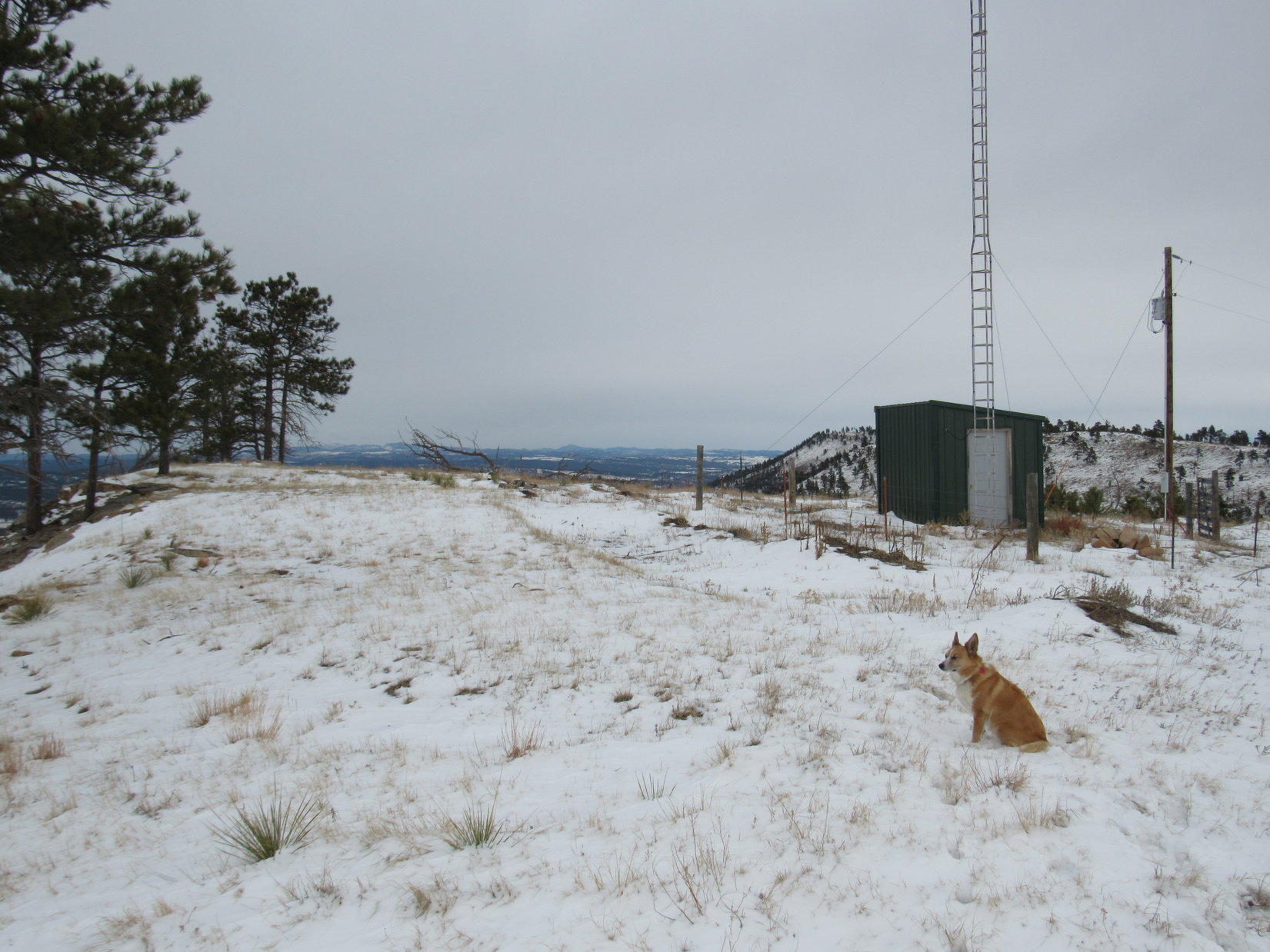
As Lupe had come up Battle Mountain Road, fairly close to the top of the mountain there had been 3 roads she could have taken. None of them had any signs. The first (lowest) turned N and went by a small building with a tower or big antenna next to it. The second road also angled N, and came only 100 or 150 feet before Battle Mountain Road turned sharply S on its final short leg to the summit.
Where Battle Mountain Road had turned S, a third road had continued E uphill and then turned N. Lupe was on this third, highest road.
Despite the lack of a sign, SPHP was pretty sure that the second road was actually the Battle Mountain GPA access road Lupe needed to be on. Instead of going E through the cut, Lupe followed the high road S and then W back down to the intersection with Battle Mountain Road. When she reached the second road, she turned and started following it N.
Lupe at the start of the 2nd road leading N from Battle Mountain Road near the top of Battle Mountain. This turned out to be the correct choice. This is the Battle Mountain GPA access road leading to the N end of Dudley Canyon.
For about 0.25 mile, the road was quite level. It headed N on the W side of Battle Mountain. When the road started curving NE making its way around the NW slope of Battle Mountain, Lupe was surprised and happy to find snow and ice. From here on, she came to frequent stretches of snow, ice and mud wherever the road was shaded.
Lupe was surprised and happy to find snow and ice on the road where it curved NE around the NW slope of Battle Mountain. She came to many snowy, icy, muddy stretches from here on wherever the road was heavily shaded. Photo looks NE.
On the N side of Battle Mountain, the road began to lose elevation, going all the way down to about 4,080 ft. There it crossed a saddle heading ENE toward Dudley Canyon. This was the first drop.
By now SPHP was certain Lupe was on the correct road. It began winding around to the N and sometimes NW, slowly regaining nearly all of the elevation Lupe had just lost. The road stayed on the upper W slopes of Dudley Canyon. Due to the forest, most of the time the canyon wasn’t even in view. Lupe had fun. She found a few squirrels to bark at.
The Battle Mountain GPA access road eventually turned E. When it did, Lupe started losing elevation again. She had barely started down when Friendshuh Mountain came into view to the SE.
Shortly after the road turned E, and before it had lost much elevation again, Friendshuh Mountain came into view to the SE.Loop on the Battle Mountain GPA road as it starts its second significant elevation loss. From here, the road soon turned NE (L) and dropped down into the N end of Dudley Canyon. Friendshuh Mountain is in view ahead. Photo looks SE.
The road turned briefly toward Friendshuh Mountain before turning back to the NE and making its second and final significant drop down into the N end of Dudley Canyon.
At around 4,135 ft. elevation, Lupe reached the bottom of Dudley Canyon. Next to the road, a map was posted of the Battle Mountain Game Production Area. Apparently not enough game was being produced. The map itself had been a frequent target. It was riddled with bullet holes.
The N end of Dudley Canyon was mostly open ground with scattered stands of pines. Lupe reached the bottom of the canyon down by the pines on the R. She would eventually continue on up the other side of the canyon in the draw seen beyond them. Photo looks ENE.This bullet hole riddled map of the Battle Mountain GPA is posted down at the bottom of the N end of Dudley Canyon. The Friendshuh Mountain GPA adjacent to the N is shown, too. A parking area was just S of this map. A dirt road nearby continued N through an open gate.
A parking area was S of the map, and a dirt road headed N through an open gate. Lupe followed the road 100 yards to a double gate which was padlocked shut. Another dirt road headed ESE up the draw behind it.
100 yards N of the map was this double gate, which was padlocked shut. A dirt road beyond it went up the draw seen on the right. Lupe went through the gate and up the draw. Photo looks ESE.
Lupe and SPHP went under and over the double gate respectively. Lupe followed the dirt road up the draw. Part of the road shaded by pines was snowy and muddy, but it wasn’t long before Lupe was up on a sunny hillside. The road now went E along the N side of a barbed wire fence.
Lupe came to another set of double gates, both of which were standing wide open. Friendshuh Mountain was in view beyond them directly to the S only 0.33 mile away. Lupe was almost there!
The Carolina Dog didn’t head directly for Friendshuh Mountain, however. The top of the barren ridge the road had been climbing was only a little farther uphill. An interestingly shaped flat rock up there looked like it might offer a great unobstructed view of whatever was over on the E side of the ridge. SPHP wanted to go see the views.
Lupe was a little reluctant to leave the road. Her concern was justified. On the way to the odd flat rock, SPHP saw her nemesis again. Cacti were scattered on the dry, sunny ridge. Not as many as at Maverick Mountain, but enough to be a concern. Still, it was a good thing Lupe had come this way. Upon reaching the odd flat rock, she made a discovery even more interesting than the sweeping views to the N and E.
Long, long ago, something else had come this way. Something gigantic and dangerous! Pressed deep into the rock next to the odd flat rock was a dinosaur track! Other similar depressions were nearby, but none were so clear as this one.
Lupe on top of the odd flat rock on the ridge. She had come to see the big sweeping views to the N and E, but discovered something even more interesting – the huge dinosaur track pressed into the rock below. (The depression on the L.) Photo looks E.Dingoes may rule the earth now, but that wasn’t always true! Another look at the dinosaur track. Photo looks SE.
The huge dinosaur track was pretty cool, and the wide open views on the barren ridge were great, too. The summit of Friendshuh Mountain was covered with pines, so the views might be limited up there. Why not take a break here? Lupe was happy with that idea. She curled up inside the dinosaur track while SPHP ate an apple.
Daring Dingo dallies in dino depression! Lupe actually curled up and rested for 10 minutes in the dinosaur track.Loop back on top of the odd flat rock next to the dino track (out of sight just to the R). The open gates in the fence line Lupe would go through to finish her trek to Friendshuh Mountain are in view. Photo looks WSW.
After her brief rest stop in the dinosaur track next to the odd flat rock, Lupe returned to the road and went S through the open gates. The dirt road went up a gradual slope heading almost straight for Friendshuh Mountain.
Lupe soon arrived at a large water tank, which had plenty of water in it. Here the dirt road angled SE going over a gentle pass on its way around the E side of Friendshuh Mountain. To the SW, a faint single track trail went up toward the trees N of the summit. Information SPHP had previously found online indicated that the two routes made a loop around Friendshuh Mountain, but didn’t go to the summit.
Lupe arrives at the water tank. She’s very close to the summit of Friendshuh Mountain now! Photo looks SSW.Lupe didn’t like the area near the water tank. Scattered cacti grew in the grassland around here. She didn’t get into the cactus, but she did get a few painful, sharp thorns from some other kind of plant stuck in her right front paw. SPHP had to pull the thorns out.
The area near the water tank was Lupe’s least favorite part of the journey to Friendshuh Mountain. Cacti grew in scattered clumps in the grassland. Some other plant with thorns was around, too. Lupe had a couple of painful thorns in her right front paw by the time she reached the water tank. SPHP pulled them out, but Lupe wasn’t happy. She demanded to be carried from here.
Fortunately, the summit of Friendshuh Mountain was very close by now. SPHP carried Lupe up the faint trail to the SW. From the top of a little ridge N of the mountain, Lupe could see that the trail soon became a dirt road a little farther to the SSW. The views to the W and SW were quite nice here. SPHP put Lupe down for a couple photos. She seemed a little more confident again.
Lupe just N of the top of Friendshuh Mountain. Battle Mountain and the towers on it (L) are in view. SPHP wonders if the small hill in the far distance on the R isn’t Matias Peak(4780 ft.)? Photo looks WSW.Looking WNW. SPHP would have liked to explore the rocky ridge in the foreground, but with cactus around, it just wasn’t worth the worry and potential pain for Lupe. The ridge remains unexplored by American Dingoes.
Lupe made the final climb from the trail up to the summit of Friendshuh Mountain(4,450 ft.)on her own. She felt safer and more confident among the trees than out on the open grasslands. She came to no cactus up on the summit area, but she did find a limestone summit cairn next to a big melting snow bank. The cold snow felt good on sore paws.
Success! Lupe reaches the summit cairn of Friendshuh Mountain. The cold snow felt good on sore paws. Photo looks S.Friendshuh Mountain was defended not only by cacti, but dinosaurs, too! Even so, a wily Carolina Dog managed to reach this summit cairn.
Friendshuh Mountain had a roomy, flat summit area about 250 or 300 feet long N/S. It sloped gradually down toward the E. The top was open forest, but around the edges, the forest was thicker and effectively blocked the views in most directions.
After a short exploration, Lupe spent most of her time on Friendshuh Mountain at the S end of the summit area where there were fewer trees, and the best views were on display. Lupe and SPHP rested here, enjoying the scene and simply being together in the warm sunshine.
Frozen Angostura Reservoir was partially in view to the S.The big ridge on the horizon is part of the Seven Sisters Range (Center). Photo looks SW.A glimpse between the trees off toward the ESE.
After a pleasant half hour on Friendshuh Mountain, the time came to think about beginning the return trip to the G6. Before leaving the mountain, Lupe returned briefly to the area near the summit cairn.
Before leaving Friendshuh Mountain, Lupe returned briefly to the area near the summit cairn. Here she is at the W edge of the summit. Photo looks NNE.Loop enjoyed the feel of the cold snow on her paws near the summit cairn one more time. The cairn is in the shadows on the R. Photo looks SW.
Lupe was fine going down the forested N slope of Friendshuh Mountain on her own. However, when SPHP wanted to cut directly across the open land back to the road leading to the gates near the dinosaur track, it was a different story.
Carolina Dogs have no fear of dinosaurs, but cacti are another matter. SPHP had to carry Lupe all the way down to the road. Even then, she wasn’t thrilled about being put down again.
While Lupe was being carted across the open ground on the way down to the road, she had this sweeping view off to the NNW. Black Elk Peak(7,231 ft.) (R) is on the horizon. Photo looks NNW.Couldn’t you at least carry me back to the forest? The open gates N of Friendshuh Mountain are seen ahead. After going through the gates, the odd flat rock and dinosaur track are off to the R (E). The way back to Dudley Canyon is to the L (W).
Since it was a little later in the day, SPHP wanted to return to the odd flat rock and the dinosaur track. The sun would be lighting up more of the dino track now. Loopster was dubious about wisdom of leaving the road, even for such a short distance. When she managed to trot over to the dino track without incident, she cheered up.
Lupe cheered up when she reached the dinosaur track again without encountering any cactus. She wasn’t the least bit concerned about encountering the dinosaur. The track was obviously quite old. That dinosaur had to be many miles away by now. Photo looks SE.Now that it was later in the day, the dinosaur track was better lit up by the sun. From the orientation of the claw marks, the dinosaur had been on its way from Wind Cave National Park to the Badlands National Park. Probably a tourist, or in search of one.Looper seemed to enjoy being in the dinosaur track. She returned to her old resting place again, but this time she just sat there watching instead of curling up. Perhaps she was hoping to get a glimpse of the next dinosaur to come this way.Come on, SPHP! Sing along with me! Oh, give me a home, where the dinosaurs roam, and the deer and the antelope play! Where never is seen, a cactus that’s green, and your paws won’t get stabbed all day!
From the odd flat rock and the dinosaur track, it was about 4.0 miles back to the G6 in Hot Springs. Lupe got to follow the road back the entire way, retracing her earlier route to Friendshuh Mountain.
When Lupe got to the forest on the W side of Dudley Canyon again, she forgot all about cactus when she saw a squirrel. She dashed off into the forest without a moment’s hesitation. From then on, she left the road to roam through the forest whenever she felt like it. Although there were still a few cacti scattered around, she didn’t step on any and had a great time.
Since the side trip up to the top of Battle Mountain(4,434 ft.) was so short, Lupe returned to the summit again when she got back to Battle Mountain Road.
On her way back to the G6, Lupe made the short side trip up to the top of Battle Mountain again. Photo looks SW.I’ll have a Dingo on the rocks, please! A great way to end any long day. Photo looks NW.
Wow, it was 62°F out when Lupe reached the G6 (4:08 PM)! What a fabulous, warm, bright day it had been for February! Despite repeated cactus concerns, overall Expedition No. 192 had been a fun time with several more peakbagging successes for the Looper.
On the way home, Lupe got a ride in the G6 through beautiful Wind Cave National Park. She did see a few buffalo roaming, but not a single dinosaur. Dinosaurs just aren’t that common any more, even way out here in the remote Black Hills of western South Dakota.
Lupe on Battle Mountain near the end of Expedition No. 192. Photo looks SSW.
Trailhead Directions:
Maverick Mountain – The parking lot for the Romney GPA serves as the trailhead. From Maverick Junction (intersection of Hwys 18, 79 & 385 about 5 miles E of Hot Springs, SD), go 0.7 mile W on Hwy 18/385. Turn S (L) on Scenic Road immediately after crossing Fall River. Follow Scenic Road 1 mile S to the Romney GPA parking lot on the R (W).
Battle & Friendshuh Mountains – A few blocks E of Evans Plunge in Hot Springs, SD, Hwy 385 turns N on its way to Wind Cave National Park. Take Thompson Avenue E (R) just N of the turn. A couple of blocks to the E, Thompson Avenue feeds straight into Battle Mountain Road (also known as Skyline Road), which goes 1.2 miles to the summit of Battle Mountain. Another 2.5 miles on the unsigned Battle Mountain GPA access road leads to the parking area at the bullet hole riddled map about 0.5 mile NW (as the crow flies) of Friendshuh Mountain.