Black Hills, SD Expedition No. 197 – Parker Peak & Horse Trap Mountain (3-27-17)

Start (10:49 AM, 54°F)

Crocuses!  Lupe discovered pale, lavender crocuses along the trail, not many, but a few here and there.  No denying it now, spring had arrived in the Black Hills!  As far as Lupe was concerned, crocuses were infinitely better than the cacti she had been reluctantly dealing with on her recent Black Hills expeditions.  SPHP couldn’t have agreed more.

Crocuses herald the arrival of spring in the Black Hills.

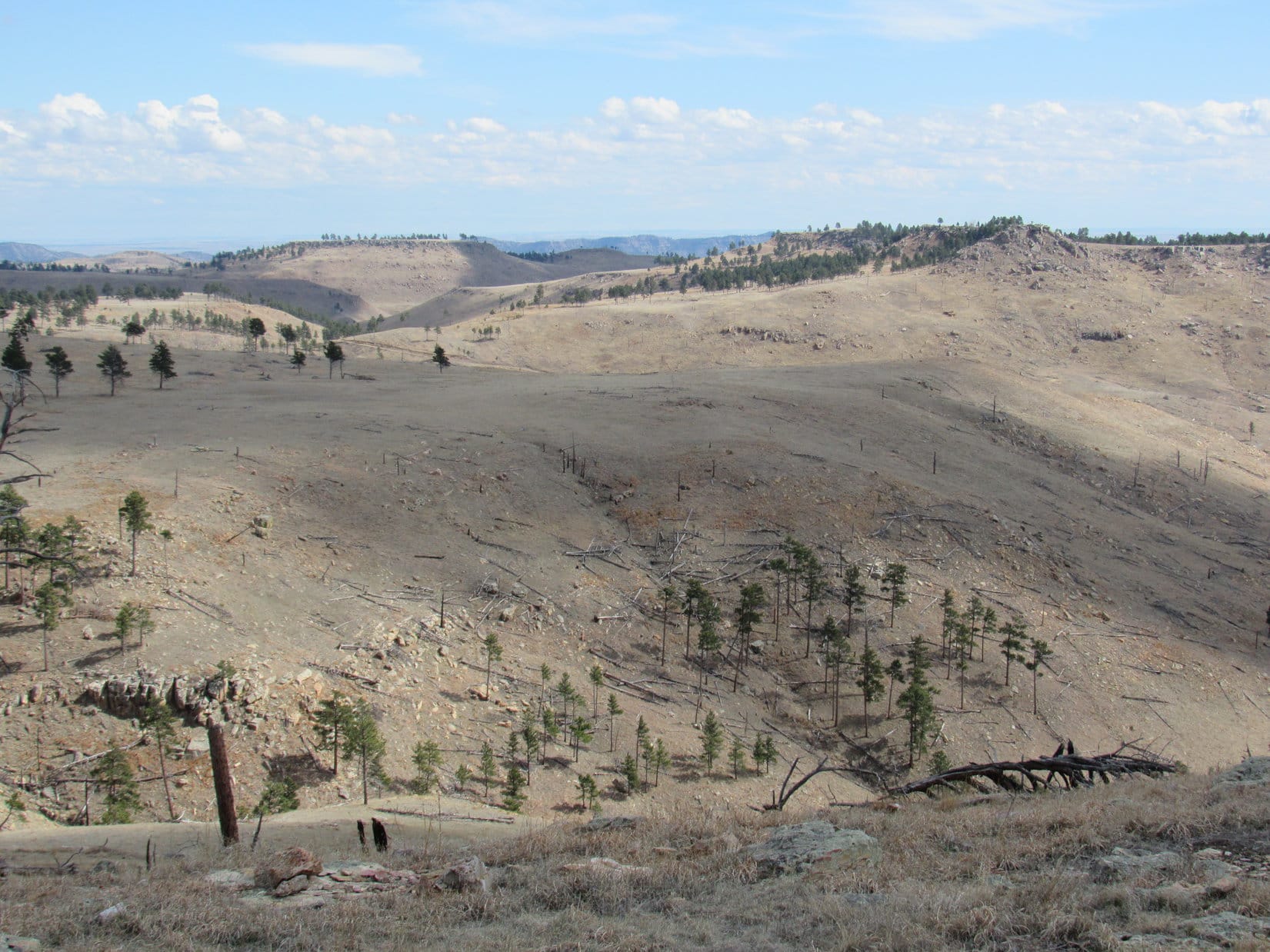
The trail had led Lupe right up to the top of the broad ridge.  The ridge ran for miles E/W, and had a number of large extensions to the S.  Most of the ground up here was rolling grasslands, rimmed by Ponderosa pines along the edges, with more pines scattered in various places across the open ground.

Lupe arrives up on the broad ridge that ran for miles E/W. The survey benchmark, at the top of the pipe seen sticking up out of the ground beneath her, provided SPHP with a good indication of her precise location. Photo looks SW.

The question was, which way to go from here?  The plan was to follow 4WD roads up on this huge ridge to Lupe’s two peakbagging objectives of the day – Parker Peak (4,848 ft.) and Horse Trap Mountain (4,682 ft.), but neither mountain was in sight, nor was any road visible.  Maybe the old roads shown both on the Peakbagger.com topo map and SPHP’s old Black Hills USFS map didn’t even exist anymore?  Entirely possible.

What was for certain was that Parker Peak, the high point of Fall River county, was miles away at the far W end of this ridge.  Horse Trap Mountain, however, was somewhere closer by to the S.  Maybe it was still E of here?

Lupe explored E along a fence line, going up to the crest of a gentle rise where a few large pines were clustered.  Looking E and SE from here revealed nothing.  All the terrain was nearly as high, and a lot of it was forested.  No sign of Horse Trap Mountain.

The only thing Lupe discovered by going E was that crocuses weren’t present up on top of this ridge.  Instead, her feared cactus nemesis was.  Not a lot of cactus, but enough so SPHP carried her over one small patch.  The cactus wasn’t a surprise, SPHP had expected it.  Even up on this high ridge, Lupe was still below cactus line.

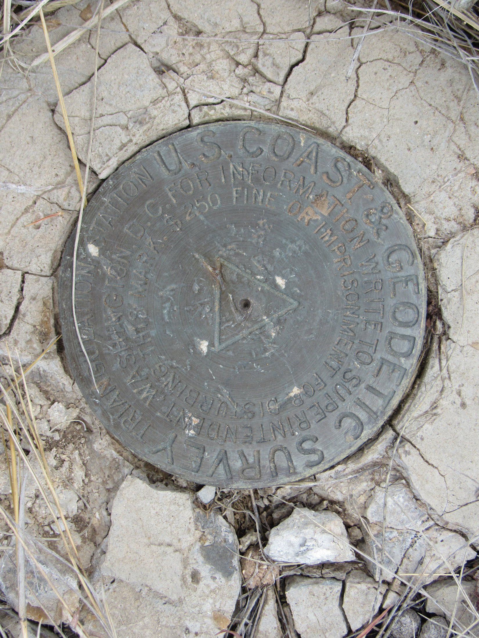
Going farther E didn’t look promising.  Lupe retraced her steps, returning to where the trail had first brought her up to the top of the ridge.  At the fence corner, Lupe came to a pipe sticking up out of the ground.  SPHP hadn’t noticed it before.  A survey benchmark at the top of the pipe provided a clue, such a good clue that after consulting the maps, SPHP knew exactly where Lupe was.  Horse Trap Mountain was more than 2 miles SSW of here.

SPHP started leading Lupe WSW down toward an earthen dam for a dried up stock pond.  However, Loop was now wary.  The foray to the E had shown her that cactus was present.  She followed SPHP reluctantly.

Crossing the earthen dam, Lupe didn’t notice the one cluster of cactus growing on it.  Her confidence started returning.  SPHP enticed her SW up to the top of the next rise without much of a problem.  By staying where there were trees, the chance of encountering more cactus was reduced.

Unfortunately, the ridge didn’t have enough trees to provide continuous shade.  Lupe soon realized cactus was up here, too.  She insisted upon returning to her now familiar method for dealing with cacti.  The Carolina Dog stood or sat motionless while SPHP scouted ahead.  She would only come when SPHP sat on the ground to signal that the route was safe.

In some places it wasn’t safe.  SPHP had to carry the American Dingo a few times over the thicker cactus patches.  It would sure help to find a road, any kind of a road.  Lupe would be willing to trot along a road confident that cactus wouldn’t be on it.

Lupe was in luck!  A little down over the other side of the rise, she did find a road.  The road was faint and seldom used, even grassy, but it was a road.  Upon reaching it, Lupe was immediately relieved of the worst of her cactus worries.  She was willing to travel the road without her time consuming cacti technique being employed.

The grassy road went S.  Within minutes, Lupe passed by the ruins of an old cabin.  A little farther on, the road came to a major intersection in a clearing.  Dirt roads radiated out in 4 or 5 directions.  Ahead, across a tree filled canyon, Lupe saw an interesting butte in the distance.  SPHP didn’t realize it at first, but this was Lupe’s first view of Horse Trap Mountain.

Lupe near the major dirt road intersection. The butte in the distance is Horse Trap Mountain. Photo looks SSW.

A canyon was between Lupe and the interesting butte.  Consulting the topo maps, SPHP realized the interesting butte was very likely Horse Trap Mountain.  To get there, Lupe would have to take the road leading W.  If it was the road shown on the topo map, it would soon make a big detour to the NW to get Lupe around the end of Falls Canyon.

The road did exactly as the topo map showed.  Not only was Lupe ever more confident about the cactus situation, but SPHP was increasingly confident of the existence of the road system shown on the topo map.  Things were going well!

After rounding the NW end of Falls Canyon, the road turned S.  Lupe hadn’t gone as far S as the map showed she would need to in order to reach a turn to the W, when another road angling that direction appeared.  After another quick map consultation, SPHP concluded this road was most likely a short cut to Parker Peak.  Did Lupe want to go there first or to Horse Trap Mountain?

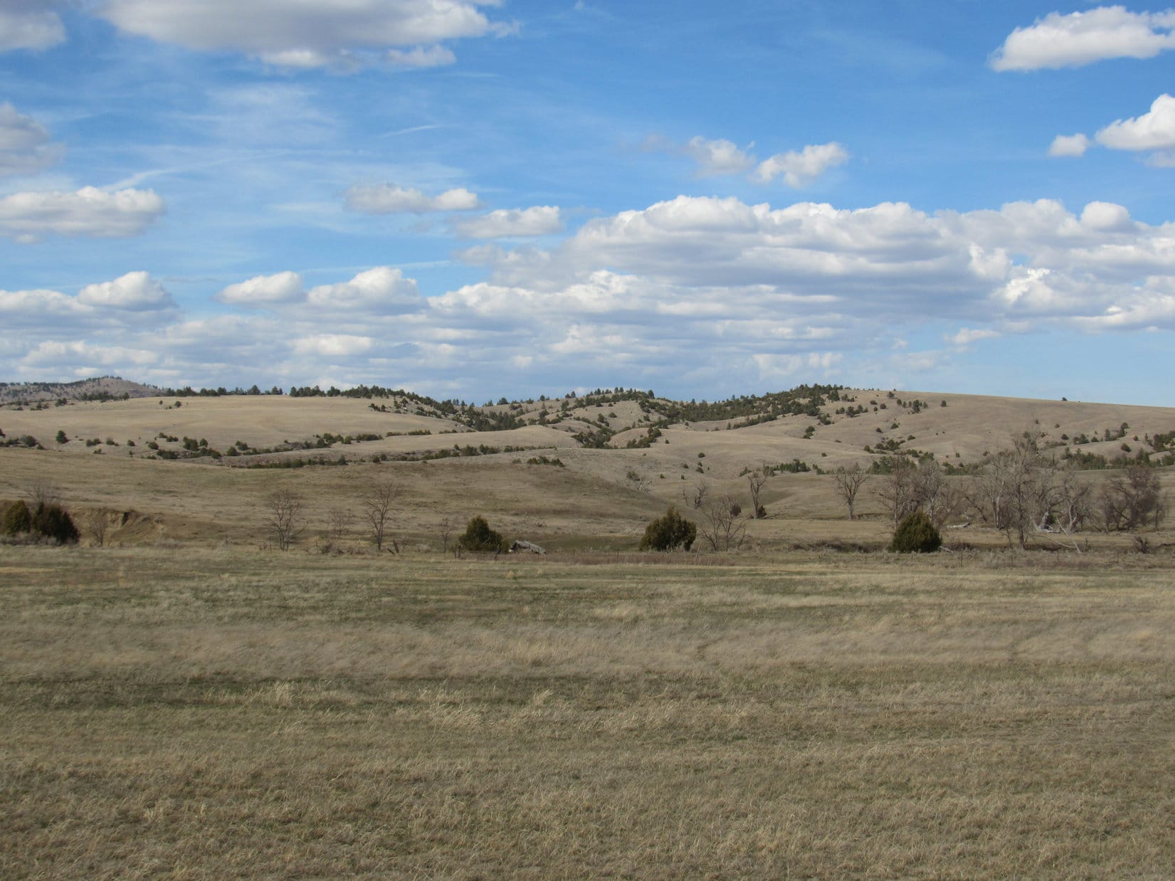
Lupe went W for Parker Peak.  The short cut worked.  The new road eventually intersected the main route shown on the topo map.  Everything went fine.  The roads, which were only a mix of dirt and grass the entire way, served as a Dingo superhighway.  Lupe was making great progress!  It was an easy trek.  The route was level or close to it most of the time.  What elevation changes Lupe came to were all gradual.

She often had beautiful views along the way.

Lupe enjoyed beautiful views on her way to Parker Peak. The high ridge in the distance is more than a mile SE of Parker Peak. Photo looks SW across Hell Canyon.
The high point straight up from Lupe is the top of Parker Peak protruding barely above an intervening lower ridge. Photo looks W.
View to the NW. The dark high point on the far horizon a little R of Center is Wildcat Peak (5,500 ft.).  The ridge on the far R is Elk Benchmark (5,669 ft.). The closer forested hill on the L is an unnamed peak a couple miles N of Matias Peak.

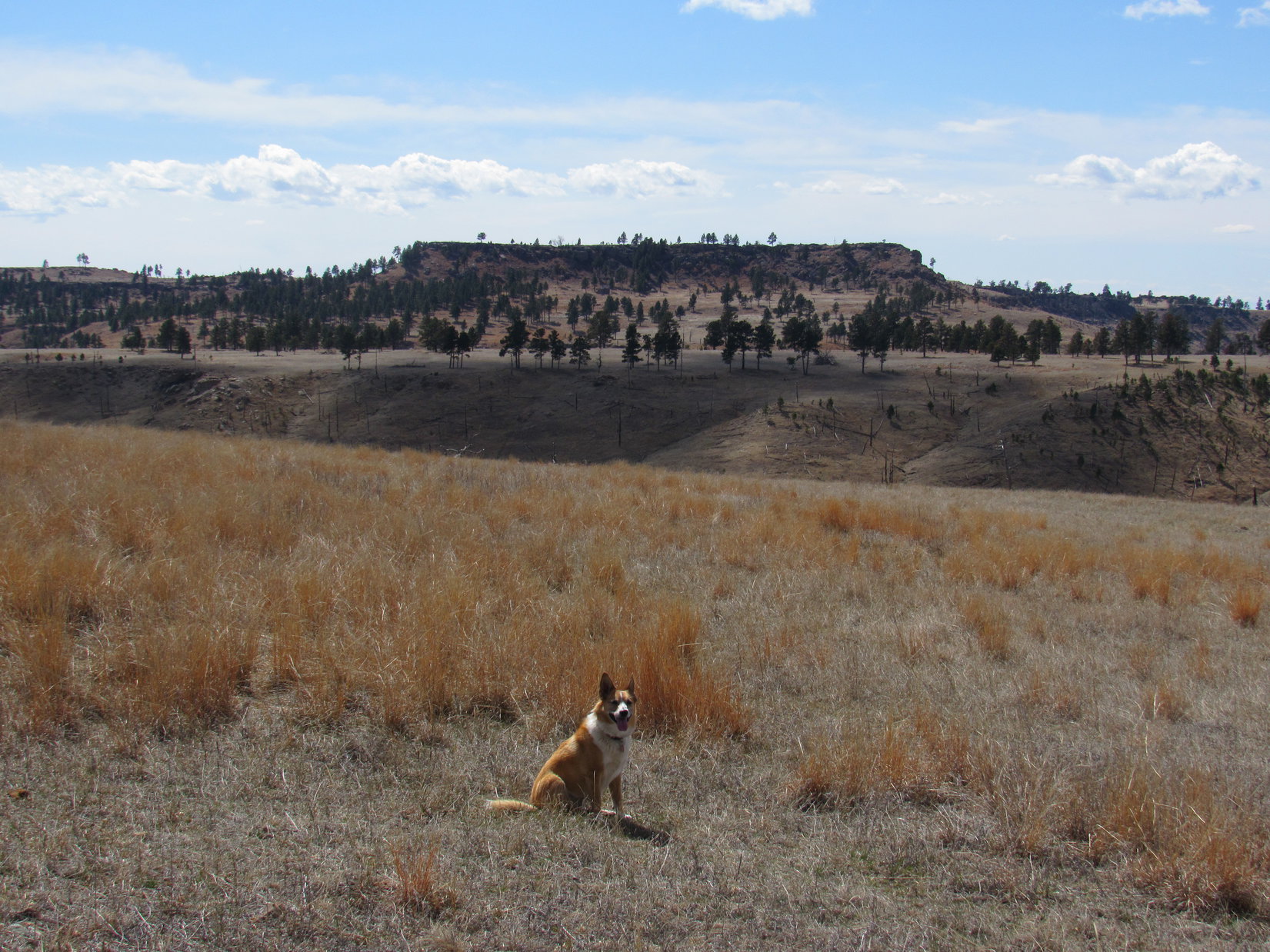
As Lupe got closer to Parker Peak, the views gradually changed.

The same unnamed ridge SE of Parker Peak, but now looking SSW at it across Hell Canyon.
Another view to the NW, this time looking a little more N with less help from the telephoto lens.
Looking down Hell Canyon toward Horse Trap Mountain (R of Center). Photo looks SE.

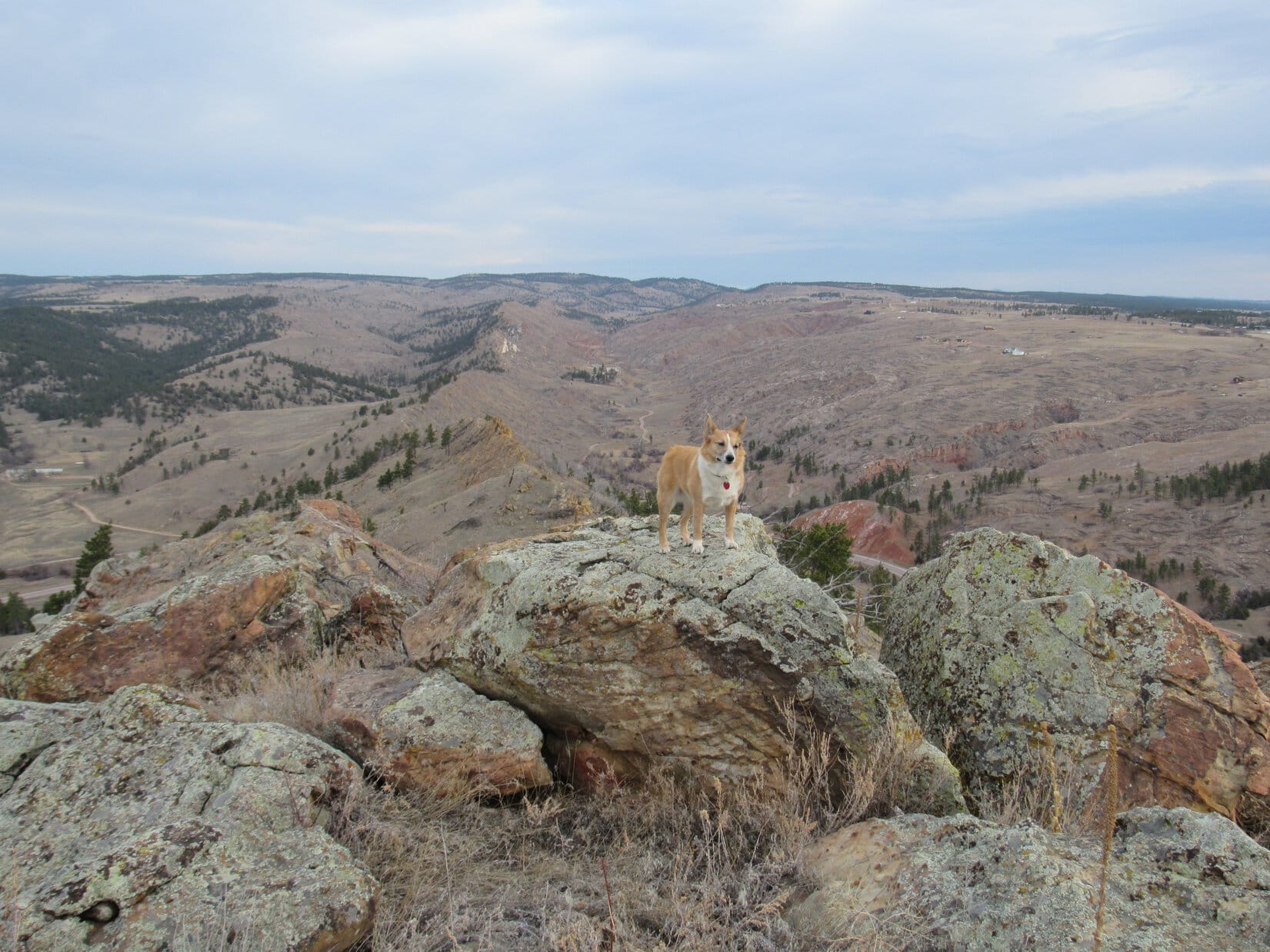
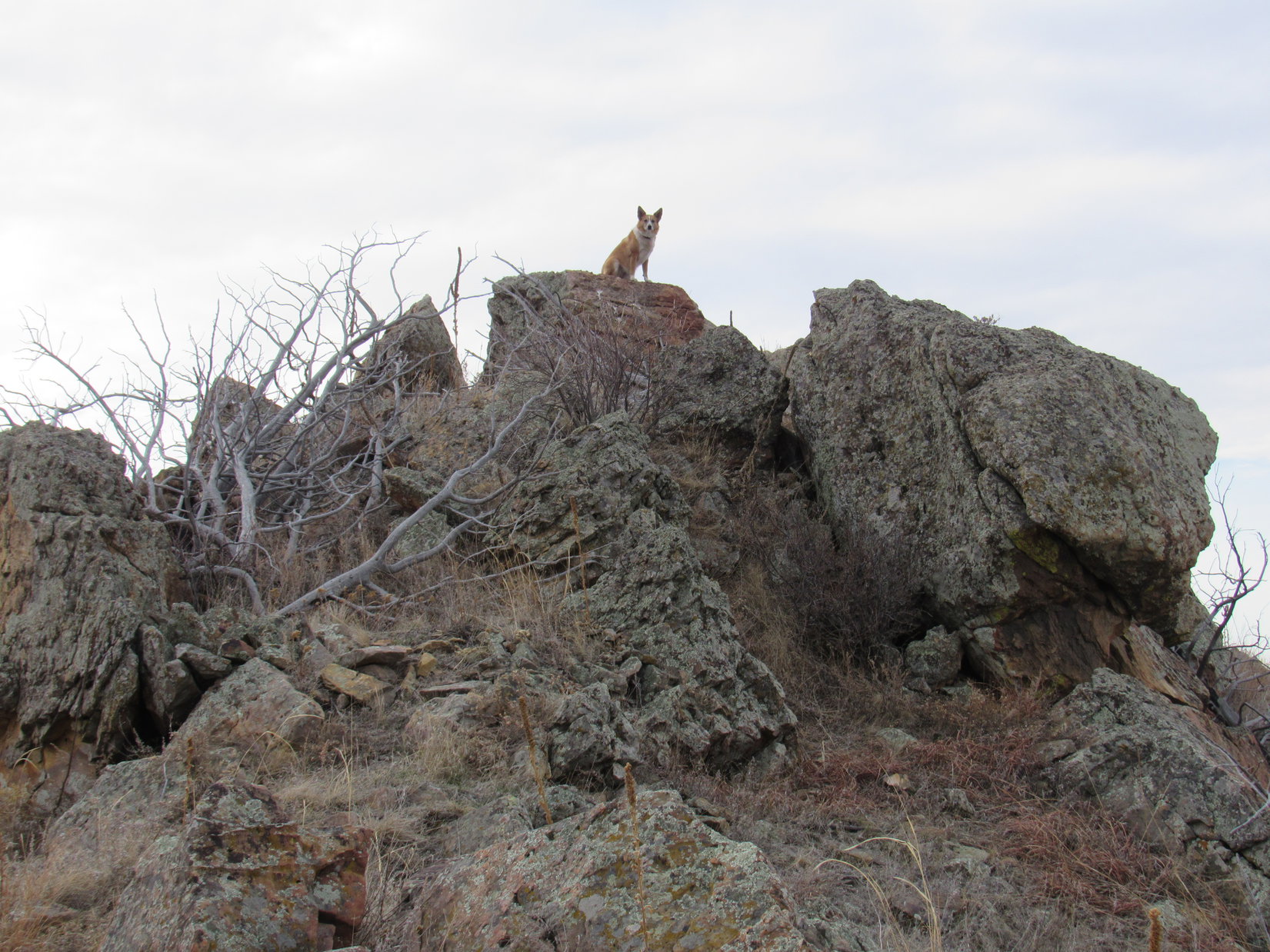
The road passed to the N of a skinny lower ridge 0.5 mile E of Parker Peak.  Lupe left the road to climb up on the skinny ridge for a good view of her objective, now in clear view.

Parker Peak from the skinny ridge 0.5 mile to the E. The skinny ridge was topped with colorful rocks. Photo looks W.

Lupe returned to the road after leaving the skinny ridge.  She was closing in on Parker Peak rapidly now!  In hardly any time at all, she was on her way up.

After leaving the skinny ridge, Lupe rapidly closed in on Parker Peak. Photo looks W.
Starting up!

The road Lupe was on reached the roomy summit area near the S end.  The true summit was along the W side almost at the N end.  On her way there, Lupe saw 4 concrete foundation corners, and discovered 2 survey benchmarks.  The foundation corners were all that were left of a former fire lookout tower.

Lupe stands on one of the old concrete foundation corners. All four of them are in view. They were all that remained of the old fire lookout tower. Photo looks SW.
The first survey benchmark Lupe came to on Parker Peak as she headed N along the W side of the summit area.
Lupe on top of Parker Peak. Part of the town of Edgemont, SD can be seen in the distance on the far R. Photo looks SW.
The second survey benchmark Lupe came to. This one was also near the W side of the summit area. By the time Lupe reached it, she was within a few tens of feet of the N end of the mountain.
Lupe stands next to the northernmost survey benchmark. Part of an old retaining wall is behind her on the L. Edgemont, SD is now seen in the distance at Center. Photo looks SW.

Lupe arrived at the highest rocks on Parker Peak (4,848 ft.) at the N end of the summit area to claim her peakbagging success of Fall River county’s highest point.  The views were splendid!

Success! Lupe at the true summit of Parker Peak. Wildcat Peak (straight up from Lupe’s rump) and Elk Benchmark (a little to her R) are in view again on the far horizon. Photo looks NW.
Matias Peak (4,780 ft.) is the forested hill on the R. Photo looks WNW.
Lupe starts settling in at the Parker Peak summit for a little rest break. Far below her lofty perch, the intersection of Hwys 89 & 18 is seen on the far L. The Mickelson Trail slants from the L to the Center before turning due N. Photo looks N.
Horse Trap Mountain (L) from Parker Peak. Photo looks SE.

At the summit, Lupe was ready to relax.  She was thirsty and hungry, lapping up a couple bowlfuls of water, and crunching up most of the Taste of the Wild supply.  Then she rested while SPHP petted her.  She encouraged SPHP to continue whenever it looked like there might be a break in the Dingo lovefest.

What? You aren’t done giving me love already are you? Please continue!

The sun was still fairly high in the sky.  Lupe had plenty of time to get to Horse Trap Mountain.  Lupe and SPHP loitered at the summit for a long time.  Parker Peak was the highest point around.  Lupe could see long distances in nearly every direction.

The time came to move on.  Lupe had a last look at the fantastic view to the N.

A last look to the N.

Then Lupe began working her way toward the S end of the summit area.  She posed for a few photos along the way.

Near the edge of the W face. Photo looks SW.
Matias Peak (R) from Parker Peak. Photo looks WNW.
At the S end of the summit area. The curved road on the far R is the old highway to Edgemont. Photo looks SSW.
Looking from the S end of the summit area back toward the true summit. Photo looks NNE.

After going all the way to the S end of Parker Peak’s summit area, Lupe started her journey to Horse Trap Mountain.  She took the road she had come up back down off Parker Peak, and headed E retracing her route.

All the roads shown on the topo map really did exist!  In fact, even more roads existed than shown.  None of these roads amounted to much.  They were all simple grass and dirt pasture trails, but they allowed Lupe to occasionally take minor shortcuts.  Surprisingly little cactus was around, but the Carolina Dog was happiest staying right on the roads where she didn’t even have to think about her sharp, spiny enemy.

Lupe went 2 miles E before turning S for Horse Trap Mountain.  It was still 1.5 miles away.  The trek S was easy and relaxing.  Lupe stopped briefly at a few of the better viewpoints along the way.

The trek to Horse Trap Mountain was relaxing and beautiful. Photo looks SW towards highlands on the far side of Hell Canyon.

As she drew near Horse Trap Mountain, Lupe came to a place where she had an impressive view of Falls Canyon.

Nearing Horse Trap Mountain, Lupe had this impressive view of Falls Canyon. Photo looks SSE.
Horse Trap Mountain from the W edge of Falls Canyon. Photo looks S.

At last, Horse Trap Mountain was dead ahead.  However, a large ravine was between Lupe and the mountain.

Lupe reached this open ground where Horse Trap Mountain was dead ahead. However, a large ravine was between Lupe and the mountain. Photo looks S.

The road brought Lupe down to a narrow saddle leading to the NNE ridge going up Horse Trap Mountain.  To the W was the large ravine.  To the E was Falls Canyon.  The road turned sharply and began to descend into Falls Canyon.

No road went up Horse Trap Mountain, but the NNE ridge was an easy climb for Lupe.  She soon arrived up at the NE end of the football fields long summit area.  First she took a look at the grand views to the E and SE from here.  She could see Flagpole Mountain (4,320 ft.) and several other peaks she had visited on recent expeditions.

It was fun to see them all again from this new vantage point.

Lupe on the rocks at the E edge of the Horse Trap Mountain summit area. Flagpole Mountain (4,320 ft.), which she had visited recently on Expedition No. 195, is seen in the distance at Center. Impressive Falls Canyon is in the foreground. Photo looks SE.
Flagpole Mountain (R of Center) from Horse Trap Mountain. Photo looks SE with help from the telephoto lens.
A couple of peaks Lupe had visited in the Seven Sisters Range exactly a month ago on Expedition No. 193 are in view on the far horizon. Peak 4371 is near the L edge of the photo, and Peak 4310 is a little to the R of it. The closer barren hill only 2 miles away at Center is Roundtop Hill. Lupe has never been there. Photo looks ESE.

The top of Horse Trap Mountain was mostly open grasslands dotted with Ponderosa pines.  The summit area was shaped like an elongated circle, longest NE/SW, and sloped gradually to the S.  The summit’s edges were rimmed all around with cliffs of modest height.

The true summit of Horse Trap Mountain (4,682 ft.) was evidently somewhere along the N or NW rim.  After admiring the views of spacious Falls Canyon and the distant peaks to the E and SE, Lupe went to find it.

The summit of Horse Trap Mountain was open grassland dotted with Ponderosa Pines. Photo looks W from the NE end of the mountain where Lupe came up. From here, Lupe went to find the true summit, heading beyond the trees seen on the R.

A short, easy stroll brought Lupe to the highest rocks and true summit of Horse Trap Mountain along the N rim.  She could see the top of Parker Peak (4,848 ft.), where she had been only a couple hours ago from here.

Lupe at the true summit of Horse Trap Mountain. The top of Parker Peak, where she had been only a couple hours earlier, is on the horizon at Center beyond a branch of Hell Canyon. Photo looks NW.
Looking N from the true summit at the territory Lupe traveled across to reach Horse Trap Mountain.
View to the SE from the true summit.
Looking SW from the true summit. Lupe’s a little hard to see, but she’s right in the center of this photo.

Lupe and SPHP took a 15 minute break to enjoy the views from the true summit.  Lupe polished off the rest of her Taste of the Wild supply, and tanked up on water again.

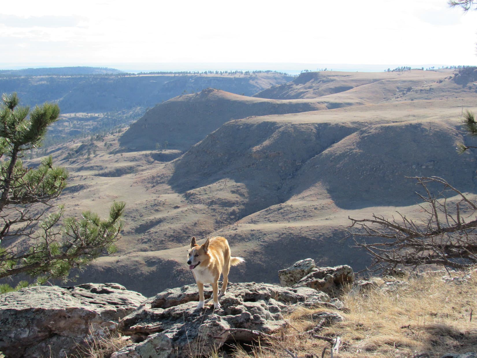
When break time was over, the American Dingo took a counter-clockwise tour of the edge of Horse Trap Mountain’s summit.  Beautiful views were in every direction.  Some of them were quite different from the usual Black Hills terrain, and reminded SPHP vaguely of sights seen in much higher mountain ranges.

Looking WNW. Parker Peak is in view again on the R.
Lupe along the NW rim. The rough, rocky terrain seen here was fairly typical along the edges of Horse Trap Mountain’s summit. Photo looks NE.
SPHP was impressed with this view of the lower part of Hell Canyon, which seemed to be on a rather grand scale for the Black Hills. Photo looks SW.
Another look at Parker Peak. Photo looks NW.
Looking WSW across Hell Canyon.
Lupe liked this big view of Hell Canyon, too. Photo looks WSW.
Looking S. The high plains of western South Dakota are seen beyond the end of the Black Hills.
Lupe at the S end of the summit area. The cliffs along the escarpment here weren’t as high as elsewhere around the mountain, but the views were still great. Photo looks W along the S escarpment.
Falls Canyon and Flagpole Mountain (R) from the S end of Horse Trap Mountain. Photo looks SE.

After going clear around the W end of the mountain all the way to the S end, Lupe traveled N across the grassy center of the summit area to return to the true summit of Horse Trap Mountain for a final time.  She took a second 15 minute break here.  It was a glorious place to be!

The sun was starting to sink in the W.  Lupe still had a couple of hours left before sunset, but it was miles back to the G6.  The vast majority of her journey would be a pleasant trek along the same dirt and grass roads up on the big ridge, but near the end Lupe would have to navigate that field with cactus and then find the trail down.

It was time to leave Horse Trap Mountain.

Looking NE along the way to start back down off Horse Trap Mountain.

The return journey in the evening light was wonderful!  Spring was in the air, and by now Lupe realized there really wasn’t much cactus around.  She romped through the fields and forests.  To complete her joy, the Carolina Dog even found a squirrel to bark at.  No cactus bothered her.  Lupe found the trail leading down off the big ridge.

The sun was long down.  Not much twilight remained by the time Lupe reached the G6 again (7:36 PM, 50°F).

On the long drive home, Lupe barked at cows and horses until it was so dark SPHP concluded she could only smell them, not see them.  Expedition No. 197 wasn’t officially over until the American Dingo finally decided there was nothing left out there worthy of being barked at.

Maybe a dry barker would like something cold and wet to soothe it?  The Sonic Drive-Inn was still having its half price drink sale after 8 PM, and it was already after 9 PM.  Would Looper like to go get a milkshake?  Yes, indeed!  SPHP didn’t have to ask twice.

A great day of adventure finished with Lupe relaxing on the bed slurping up chocolate milkshake from a bowl, while SPHP worked on the strawberry one.  And then it was lights out.

A Carolina Dog twitched now and then during the night, but whether she was dreaming of Parker Peak, Horse Trap Mountain, adventures past, or adventures yet to come, was impossible to tell.

Links:

Next Black Hills Expedition                    Prior Black Hills Expedition

Want more Lupe adventures?  Check out her Black Hills, SD & WY Expeditions Adventure Index, Master Adventure Index, or subscribe free to new Lupe adventures!

Black Hills, SD Expedition No. 196 – Devil’s Slide, Cascade Falls & Tepee Mountain (3-19-17)

Start (7:46 AM, 50°F)  J. H. Keith Memorial Park, Cascade Springs, Hwy 71 S of Hot Springs.

Nothing like starting the day off with a little dread.  Upon arrival, Lupe understood the situation immediately.  Another expedition, another cactus-infested mountain.  When would this ever end?  Lupe’s soft Dingo ears drooped.

Not many more of these lower peaks below cactus line to go, Looper.  You’ll be alright.  Once you’ve done them, you won’t ever have to return.  Besides, you’ve actually had some really fun times on these peaks, haven’t you?  Come on, it won’t take long.  I’ll help you dodge the cacti.  What do you say?

What do I say?  I say, OK, fine, but you ought to join in the fun.  About time you went barefoot, too, SPHP!  It’s a shame you’ve been missing out on the whole, complete joyful experience of all these barefoot treks through cacti lately.  Besides, it might be amusing to see human ears droop for a change.

Heh, I appreciate your concern Loop, but think I’ll pass on that.  Just a matter of personal vanity, you understand.  I don’t look nearly as good as you do with droopy ears.  Come on, let’s go!

The E slope wasn’t bad.  Definitely better than the optional route up the barren sunbaked WSW slope would have been.  That might well have been a cactus nightmare.  As it was, Lupe hardly encountered any cacti until she was at the top of the ridgeline.  By then, she was almost to the summit of Devil’s Slide Mountain (3,965 ft.).

Loop nears the summit of Devil’s Slide Mountain. She’d hardly encountered any cactus at all during her climb up the E slope. Photo looks NW.

As expected, cactus was thick on the other side of the ridge.  Lupe stayed mostly toward the E to avoid it.  She quickly made her way to the summit.  The top of Devil’s Slide Mountain consisted of an assortment of large boulders resting on a prominent knob along the ridgeline.

No trees were up here to block the views.  Lupe could see in every direction.

Lupe reaches the top of Devil’s Slide Mountain. With no trees around, she had fabulous views in every direction. Photo looks NNW along the spine of the ridgeline.
Lupe at the true summit. The steep slopes below the curved ridge in the distance on the L are known as Horseshoe Bend. Photo looks SSE.
Highway 71 is seen below on its way to Hot Springs, SD. The high ridge on the R is part of the Seven Sisters Range. Lupe had been climbing hills over there only a few weeks ago on Expedition No. 193. Back then, everything had been white with snow. Photo looks NNE.
Lupe on the very highest rock. Horseshoe Bend in view on the L. Photo looks SSE.

Lupe’s adventures had taken her to the top of Flagpole Mountain (4,320 ft.) only a week ago on Expedition No. 195.  SPHP thought she ought to be able to see the summit from here beyond Horseshoe Bend, a steep sharply curving slope along the NW face of the mountain.

Loop had an unobstructed view of the entire length of Horseshoe Bend from Devil’s Slide Mountain, but the light was a little glary.  Horseshoe Bend was far enough away so SPHP couldn’t tell if the actual summit of Flagpole Mountain was in view or hidden behind the top of the ridge.  Binoculars would have solved the puzzle, but SPHP didn’t have any along.

Although Lupe had a great view of the entire length of Horseshoe Bend, SPHP couldn’t tell if she could see the actual summit of Flagpole Mountain from Devil’s Slide or not. SPHP suspected it was just out of view beyond the top of the ridge. Photo looks SSE.

Not all of the views from Devil’s Slide Mountain were of more hills and mountains.  To the S and SW, high plains stretched away to the horizon beyond the Black Hills.  Closer by, Lupe could see Cascade Creek in the valley below.

High plains stretch away to the horizon SW of Devil’s Slide Mountain. Hwy 71 is in view below on its way to Ardmore, SD and Nebraska. Cascade Creek is to the R of the highway. Photo looks SW.

It was too early in the day to take a real break, but Lupe and SPHP hung around up on top of Devil’s Slide Mountain for a while enjoying the views.  Eventually it was time to press on.  Lupe had more adventures in store.

Lupe lingers at the summit of Devil’s Slide Mountain. Photo looks S.
Time to go, Looper! Come on down! Photo looks S with a little help from the telephoto lens.
Starting down.

Lupe returned to the G6 (9:16 AM, 57°F).  Her next stop, Cascade Falls, was only a few miles away.  The picnic ground was closed and barred shut to vehicles this time of year, but there was plenty of room to park the G6 at the turnoff.

Lupe went around the gate, through the picnic ground, and down the steps leading to Cascade Creek and the falls.  She had a drink, waded around, and enjoyed the view of Devil’s Slide Mountain from below.

Devil’s Slide Mountain from Cascade Creek above the main falls. Photo looks NE.
The true summit of Devil’s Slide Mountain is the high point seen on the L.
Yep, this is it – Cascade Falls! More like rapids really, but they feature a great swimming hole below and some fine wading, including a number of much smaller pools to soak in, above. Photo looks W.
A look downstream. Photo looks SSW.
Aren’t you coming in SPHP? Photo looks NW.
Cascade Falls as seen from downstream. Devil’s Slide Mountain is in view on the R. Photo looks NNE.

After visiting Cascade Falls, Lupe’s next stop was only a mile farther S at the Cheyenne River.  A sign S of the river told about the Wood Stage Station, which used to be close by.  More than a century ago, a stagecoach route ran from Sydney, Nebraska to Deadwood, South Dakota.  The sign mentioned General Custer’s 1874 Expedition to the Black Hills.

This historical marker about the Wood Stage Station is just S of the Cheyenne River on the E side of Hwy 71.

Custer’s only expedition to the Black Hills made him even more famous due to the discovery of gold.  Despite being on her 196th Black Hills expedition, Loop hasn’t become famous, but then she’s never found any gold.  SPHP sort of wishes she would, but understands that American Dingoes are more squirrel oriented than gold oriented.

At least Lupe’s relations with the Sioux nation are far superior to General Custer’s.

The Cheyenne River flows out of Wyoming around the S end of the Black Hills on its way to the Missouri River. Photo looks WSW from the Hwy 71 bridge.

Lupe’s next peakbagging objective was Tepee Mountain (3,970 ft.) on the S bank of the Cheyenne River a couple miles W of Angostura Reservoir.  Lupe had seen Tepee Mountain for the first time only a week ago on Expedition No. 195.  From Flagpole Mountain, Tepee Mountain appeared as a much lower, heavily forested ridge.

SPHP turned E off Hwy 71 onto Maitland Road five miles S of the Cheyenne River.  According to SPHP’s old Black Hills USFS map, Tepee Mountain is on BLM land, but private ranches are nearby.  SPHP had to look for access for Lupe.

More than a mile SSW of Tepee Mountain, Lupe and SPHP stopped by the headquarters of the Tepee Creek Ranch.  Two ranch dogs were eager for Lupe to come out and play, but she had to stay in the G6 while SPHP chatted with the rancher’s wife.

The wife was friendly.  She didn’t seem opposed to Lupe crossing the ranch to climb Tepee Mountain, but mentioned that cows were calving and it had been so warm and dry out lately snakes were already out.  She suggested that SPHP check out the possibility of public access along the Cheyenne River from Angostura Reservoir before resorting to crossing the ranch.  SPHP agreed to do that.

Lupe visited the S shore of Angostura Reservoir, as requested by the Tepee Creek rancher’s wife, but found no public access leading W along the Cheyenne River. Photo looks N.

Five miles of dusty gravel roads brought Lupe to a boat launch on the S shore of Angostura.  Immediately to the W was a mobile home park, which appeared to be bordered by more private ranchlands.  Lupe found no sign of public access to Tepee Mountain from here.

Lupe and SPHP left Angostura Reservoir.  An approach from Maitland Road would have to do.  SPHP found a spot to park the G6 (10:53 AM, 72°F).  The summit of Tepee Mountain was more than 2 miles N from here.

Lupe was none too keen on starting the trek.  The first half of her journey was through hilly, forested terrain.  The forest was a mix of junipers and Ponderosa pines.  Junipers thrive where it’s dry.  Lupe associates them with cactus.  She’s right, too.  Cacti were present from almost the very start.

The forested hillsides didn’t have much cactus, but wound around a long series of ravines in crazy directions.  The uneven ground was tiring to traverse.  Higher up, the terrain was much more level, but many areas were so dry on top that even the junipers couldn’t survive.  The sunny, exposed terrain was full of cactus.

Lupe in the mixed forest of pines and junipers. There was a lot less cactus in the forest than up on the sunny top of these low hills, but Lupe came to many ravines. Photo looks S.

Lupe and SPHP used her usual technique for dealing with cactus.  SPHP scouted ahead looking for a safe route forward.  When SPHP sat on the ground, Lupe took it as the signal she could advance that far.  Rinse and repeat.  Where there was too much cactus, SPHP carried Lupe far enough to get to a less infested area.

Progress was slow, but steady.  At first, Lupe and SPHP stayed mostly on the high ground along the edge of the trees.  Later, Lupe tried staying more in the forest.  Traveling each type of terrain had its benefits and drawbacks.  It was an extraordinarily warm day for March.  The Carolina Dog was thrilled to find a small rapidly shrinking patch of melting snow in the forest on the N side of a hill!

Lupe was thrilled to find this small rapidly melting snow bank on the N slope of a hill. It was a very hot day out for March. The cold, wet snow felt marvelous!

As wearisome as the forested hills were, SPHP was not looking forward to reaching the end of them.  From Maitland Road, Lupe had already seen the S slopes of Tepee Mountain.  She would have to make a long, gradual climb up a barren, sun drenched slope.  SPHP feared Lupe would face an incredible concentration of cacti the entire way.

Lupe might have to be carried more than a mile to the top.

Tepee Mountain as seen from Maitland Road. The summit is the high point on the R. SPHP feared Lupe would encounter so much cactus on the barren S slope that she would have to be carried all the way to the top. Her route would take her up from the R side of this photo. Photo looks N using the telephoto lens.

The forest ended when Looper reached the N end of the low hills.  Now she faced open grasslands the rest of the way up Tepee Mountain.  Just ahead was a dirt road at the bottom of a shallow ravine that drained to the W.  Beyond the road was a barbed wire fence.  Lupe would have to cross both the road and the fence.  First, though, she followed the road uphill to the E.

Traveling this short section of dirt road up the ravine was easy.  Lupe was confident she wouldn’t encounter any cactus.  Near a junction of fences, she left the road and went under the fence to the N.  SPHP thought Lupe might be on BLM land now, but wasn’t certain.

Despite the heads up from the rancher’s wife, Lupe hadn’t seen a single cow or rattlesnake.  However, cows had clearly spent a lot of time in the pasture N of the fence.  This was great news for Lupe!  The cows had eaten everything down so there wasn’t much vegetation left.  Best of all, cows are apparently hard on cactus.  SPHP had feared this area would be totally infested; instead there was hardly any!

Lupe now N of the low forested hills seen behind her. This field had far less cactus in it than SPHP had feared. Lupe made relatively good time the rest of the way up Tepee Mountain. Photo looks SSE.

Lupe wasn’t convinced this barren ground was safe.  She insisted that SPHP continue to scout out the cactus situation ahead.  Overall, though, she made significantly faster progress.  She traveled up the long, gentle slope going NW, staying close to another barbed wire fence coming down the mountain.

As Lupe climbed higher, more cactus appeared – enough to slow things down again, but it wasn’t too bad.  The fence line turned N.  Lupe kept going NW until she came across a cattle trail that went N, too.

The cattle trail was like a super highway.  Lupe trotted along unworried and unhindered by cactus.  By the time the cattle trail curved E, Lupe was only 150 yards from the top of the mountain.  She found cactus again as soon as she left the trail, but SPHP guided her through it.  Lupe reached the summit of Tepee Mountain (3,790 ft.).  Sweet success!

The large summit area was mostly grassland.  Barren terrain sloped gradually away to the S and E.  Junipers and pines were scattered thinly along the edge of the steeper W slope.  The steepest drop off was to the N, where a thick line of trees blocked the view most places.  The highest rocks on the mountain were clustered in a small area near the NW corner of the summit.  Four or five different medium-sized rocks might have been the absolute highest point.

The most impressive view was toward the NW.  Lupe could see Flagpole Mountain (4,320 ft.).  She had been there only a week ago on Expedition No. 195.

Lupe reaches the summit of Tepee Mountain. The most impressive view was this look at Flagpole Mountain. Lupe had been there only a week ago on Expedition No. 195. Photo looks NW.
Looking N at some of the colorful cliffs E of Flagpole Mountain.
Lupe stands on the rock that SPHP thought might be the highest one, though 4 or 5 rocks nearby were about as high. Photo looks N.
Looking ESE. The high plains of western South Dakota go to the horizon.

Lupe was happy to reach the summit of Tepee Mountain.  After a few photos, she curled up in the shade of a juniper tree.  She had a great view of Flagpole Mountain while enjoying some Taste of the Wild.  It was an amazingly warm day.  Only mid-March and the temperature was somewhere in the 70’s!

Lupe rested in the shade of a juniper tree while having Taste of the Wild and enjoying this beautiful view of Flagpole Mountain (L). Photo looks NNW.

SPHP munched an apple and shared water with Lupe.  When the apple was gone, SPHP got up to wander around the summit area to see what else there was to see.  Lupe preferred not to move around much.  She was still worried about cactus.  Besides, she liked the shade of the juniper tree.  She was curious about what SPHP was up to, though.

Sometimes she peered out from her juniper tree stronghold to see what was going on.

Whatcha up to, SPHP? … Don’t worry Loop, just having a look around. … OK, but don’t wander off too far and leave me stuck here all alone up on this pincushion! Photo looks WNW.
SPHP had to wander a little E of the true summit to find a break in the trees big enough to provide this view of the Cheyenne River. Part of Angostura Reservoir is seen in the distance on the R. Photo looks NE.

Lupe soon decided she didn’t want to miss out on any of the views.  She came out from her juniper trees to join SPHP and pose in a few more photos.

Angostura Reservoir from Tepee Mountain. Photo looks NE.
Looking NW toward the true summit.
Still looking toward the true summit as a cloud passes overhead providing temporary shade. The big green junipers on the L are at the top of the mountain. Photo looks NW.
Looking W.
The view to the WNW.

At the conclusion of her scenic summit tour, Lupe wanted to go relax in the shade of the juniper tree some more.  SPHP went with her.  There was no rush.  The sun was high in the sky, and Lupe might never be on Tepee Mountain again.  Time enough to enjoy this unique moment, and seldom seen view of Flagpole Mountain.

SPHP petted Lupe; in turn, she licked SPHP’s hand.  Puffy white clouds sailed slowly through the pale blue sky overhead.  Lupe and SPHP were both happy.

Happy times on Tepee Mountain in the shade of the juniper tree.

As it always does, the time came to say good-bye to the mountain.  Lupe and SPHP started back to the G6.  Lupe followed the same route as before, except that when she reached the low, forested hills again, she stayed farther to the W and lower down.  Hidden on the N slopes of various ravines, she found half a dozen more patches of snow to eat and cool off on.

There were still cacti to deal with.  Lupe remained cautious.  SPHP helped guide her through, and carried her for short distances where necessary.  She finally reached Maitland Road again W of the G6, but it wasn’t far away (3:31 PM, 81°F).

Looking back at Tepee Mountain (Center) on the way to the G6. Photo looks NNW.

Over 80°F, in March!  Incredible!  On the way home, Lupe stopped again at Cascade Falls.  The thirsty Carolina Dog had a huge drink from the creek.  SPHP thought the water would be cold, but it was surprisingly, comfortably warm.  This time, SPHP joined Lupe wading around in Cascade Creek.

Lupe returned to Cascade Falls for a 2nd time on this incredibly warm March day. SPHP joined her wading in the surprisingly warm creek. Photo looks S.
For cactus weary paws, Lupe recommends wading in Cascade Creek! Photo looks N.

Expedition No. 196 was a success, but wasn’t entirely over until Lupe was done with her enthusiastic barking from the G6 at all the cows and horses she saw on the way home.  SPHP thought she deserved a special treat for braving the cactus on two more mountains today.  The Sonic Drive-Inn was advertising half price milkshakes after 8 PM.

Lupe had a good time being taken out to the Sonic Drive-Inn.  She was delighted when SPHP bought her a milkshake of her very own.  Lupe had chocolate.  SPHP had strawberry.  When the milkshakes were gone, it was time for nighty-night and dreaming together about the day’s adventures, and adventures yet to come.

Links:

Next Black Hills Expedition                   Prior Black Hills Expedition

Want more Lupe adventures?  Check out her Black Hills, SD & WY Expeditions Adventure Index, Master Adventure Index, or subscribe free to new Lupe adventures!