Snow! In May! So much of it the G6 would never get through. Carefully, SPHP backed the G6 up to a place where it could be turned around. Half a mile SE of the junction of County Road No. 303 and USFS Roads No. 110 & 117 in Manganese Draw, SPHP parked the G6 at a wide spot along No. 303 near a cattle guard where private property began. Lupe would have to start for Crow’s Nest Peak from here. (10:52 AM, 52°F).
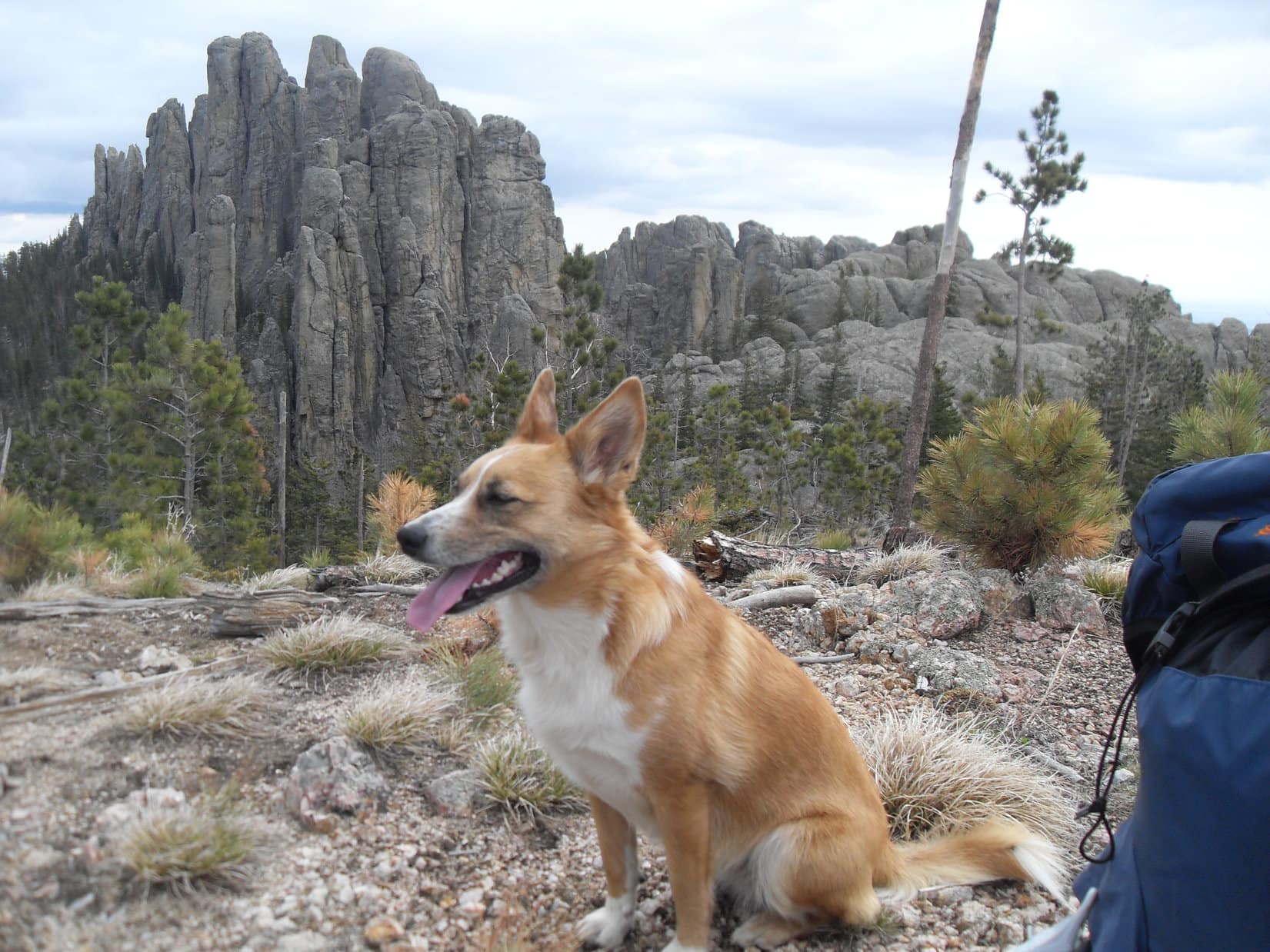
So much snow on the road this late in the spring was unexpected, but Lupe was already at 6,500 ft. elevation, which is pretty high territory for the Black Hills of South Dakota. Her destination, Crow’s Nest Peak (7,048 ft.), is one of only a handful of mountains in the Black Hills topping out at over 7,000 ft.
Despite it’s lofty elevation, Crow’s Nest Peak doesn’t have the appearance of even a notable small hill, much less a peak. All of the nearby ground is gently rolling territory that’s nearly as high. Lupe and SPHP certainly weren’t expecting any dramatic views today.
In fact, the big question wasn’t whether Lupe could climb the mountain, but whether she would be able to find it? Lupe’s 2 prior attempts to reach Crow’s Nest Peak from the S and SE on Black Hills, SD Expeditions No. 72 and No. 84 respectively had both ended in failure. Snow on the ground had played a role both of those times, too. Although Lupe must have gotten close on Expedition No. 72, Crow’s Nest Peak had been so difficult to recognize SPHP hadn’t been certain if she had even seen the mountain.
This was a new day, though. This time, Lupe was starting for Crow’s Nest Peak from a closer point and a new direction. As the crow flies to it’s nest, the summit was only 2.5 miles to the SSW. Lupe began her latest attempt on Crow’s Nest Peak by finding a place to leap over to the S side of Castle Creek. She then turned NW up Manganese Draw.
Blue skies, pleasant temperatures – it was going to be a glorious spring day for a romp in the hills! Lupe had an easy time trotting along sniffing through the meadows near the clear running stream.


Lupe had to cross the creek several more times as it meandered through the valley, but there was always a way across. Before long, Lupe was approaching the intersection of County Road No. 303 with USFS Roads No. 110 & No. 117. Even if the G6 had been able to get this far, this would have been the end. Lupe saw that No. 117 heading S from the intersection in the general direction of Crow’s Nest Peak was completely covered by a huge snowbank.

The plan was to follow No. 117 a couple miles S to get close to Crow’s Nest Peak. From the intersection, Lupe avoided the big snow bank by returning to the meadow close to Castle Creek. She crossed the creek one more time, and didn’t go back to the road until she was beyond the snow bank. No. 117 climbed steadily as it wound around toward the SW.
Between the brilliant sunshine and fast warming temperatures, the steady upward trek along the road soon started feeling rather warm. After going 0.5 mile SW on No. 117, an unmarked dirt side road headed SE up an even steeper slope toward the forest. This was probably USFS Road No. 117.5D. Getting out of the hot sun and up into the shady forest sounded good to both Lupe and SPHP. Lupe would have a better time exploring the forest than following the main road anyway.
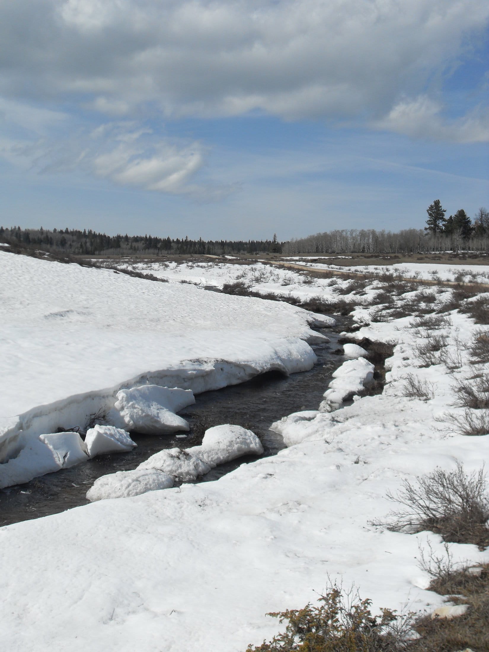
A short steep climb along No. 117.5D brought Lupe to the edge of the forest. Much more snow was hidden here, still melting in the shade of the trees. The snow wasn’t everywhere, but Lupe frequently encountered drifts 2 feet deep. No. 117.5D continued climbing for a while, but eventually leveled out. The road disappeared completely not long after reaching the high ground.
Crow’s Nest Peak was still 1.5 to 2.0 miles S. According to SPHP’s old USFS map, Lupe should reach USFS Road No. 377 before she went half that far. Dodging snow drifts as much as possible while staying on the highest ground, Lupe and SPHP wandered S through the forest.
Picking a way through the snowy forest was slow going. Lupe went on and on, but came to no roads. After what seemed like quite a while, Lupe came to a high spot in the forest. SPHP wondered if this might even be Crow’s Nest Peak, but soon decided it couldn’t be. (Note: Lupe was likely at the end of the ridge extending SE from High Point 7036 on the Peakbagger topo map. Expedition No. 86 occurred shortly before Lupe discovered Peakbagger.com. SPHP did not have a topo map along on this or any of Lupe’s earlier Black Hills expeditions.)
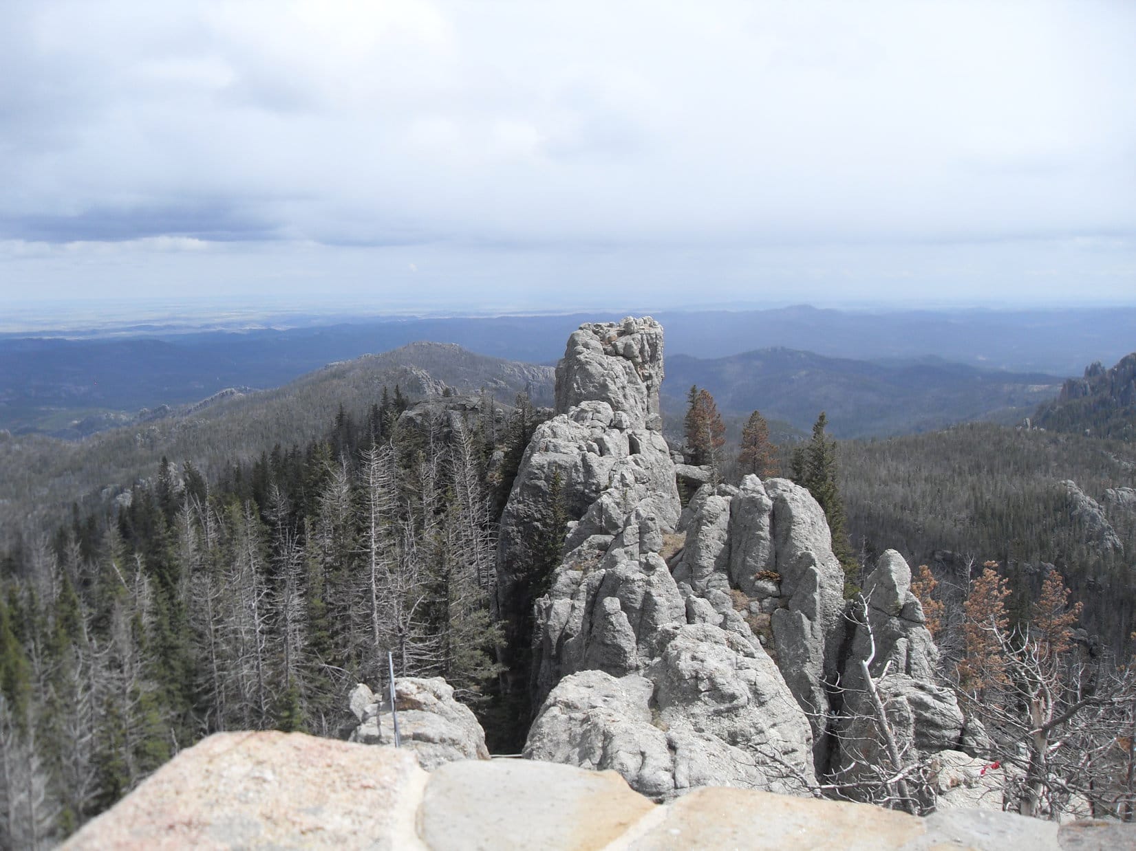
Little could be seen from the high spot. The only distant view was toward the S or SE, but it wasn’t much of a view and there weren’t any apparent landmarks. However, Lupe did have a glimpse between the tees of slightly higher ground off to the SW.

The next small ridge to the SW wasn’t that far away, but progress toward it was slow due the snow drifts. Lupe finally arrived up on this ridge, but it didn’t appear to be Crow’s Nest Peak, either. Lupe could see even less from here (likely High Point 7034), but it looked like there might possibly be higher ground to the SE.
Lupe tried following the ridgeline SE, but didn’t seem to be losing or gaining any significant elevation. However, she eventually came to a rocky ledge from which she had somewhat more of a view. From here there appeared to be slightly higher ground off to the WSW. Noticeably higher ground was off to the SSW, but farther away than SPHP thought Crow’s Nest Peak ought to be. Still, nothing else around here could be any higher.
Lupe continued SE on the ridge, but soon had to give up on finding any better viewpoint. She now left the ridge going toward the closer high ground to the WSW. Another slow trek through the snow drifts brought Lupe to this new high ground. She wasn’t really any higher than before back on the last ridge. Not a thing could be seen except the forest. The terrain in all directions was virtually flat. Lupe turned S.
Only a few minutes after turning S, Lupe came to a road. No. 377 at last! Lupe followed the road WSW, and quickly arrived at a small clearing in the forest where she found a water trough surrounded by a pole fence. Nearby was an unexpected intersection. The new road was unmarked, but the road Lupe had been following was clearly marked as USFS Road No. 377.1C.

Time to stop and check the USFS map again. SPHP figured this new road must be USFS Road No. 377. The map had surprising news. The map confirmed the new road was No. 377, but Lupe was nearly 2 miles E of where she was supposed to be, a little N of Knutsen Spring!
It hardly seemed possible Lupe had gone this far E, but that was what the map showed. How had SPHP gotten so badly turned around with the sun out in a cloudless sky? Lupe was still far from Crow’s Nest Peak. The map showed she had two options from here. After a short jog S to Knutsen Spring on No. 377, the road would turn W, then NW for 2 miles. At another junction, she would then have to turn SE following a different road for nearly another mile just to reach USFS Road No. 266.1A at a point 0.5 mile E of the mountain.
A shorter, more direct route was possible, too. After reaching Knutsen Spring, if Lupe simply left No. 377 continuing S through the forest, she should find No. 266.1A less than 0.25 mile away. No. 266.1A would then take Lupe 2 miles WSW straight to Crow’s Nest Peak. That seemed like the thing to do. Yet it was shocking to think that Lupe was still nearly as far away from Crow’s Nest Peak as when she’d left the G6. Was Crow’s Nest Peak going to elude Lupe for a 3rd time?!
Lupe and SPHP left the junction with No. 377.1C heading W on No. 377. This also seemed odd, since No. 377 was supposed to be going S to Knutsen Spring from here. The only other choice, though, was to head E on what SPHP assumed was No. 377.1D, and for certain Lupe didn’t need to be going any farther E. SPHP figured No. 377 would turn S soon, but it didn’t. It kept going W.
With Lupe so far E of where she should have been, going W was probably OK, even though the road wasn’t going where it was supposed to according to the USFS map. The next new development, however, was more disturbing. Lupe started losing elevation, and losing it fast. The road was going downhill! Snow was plentiful, both on the road and in the surrounding forest. Downhill or not, Lupe had best stick to the road and continue W.
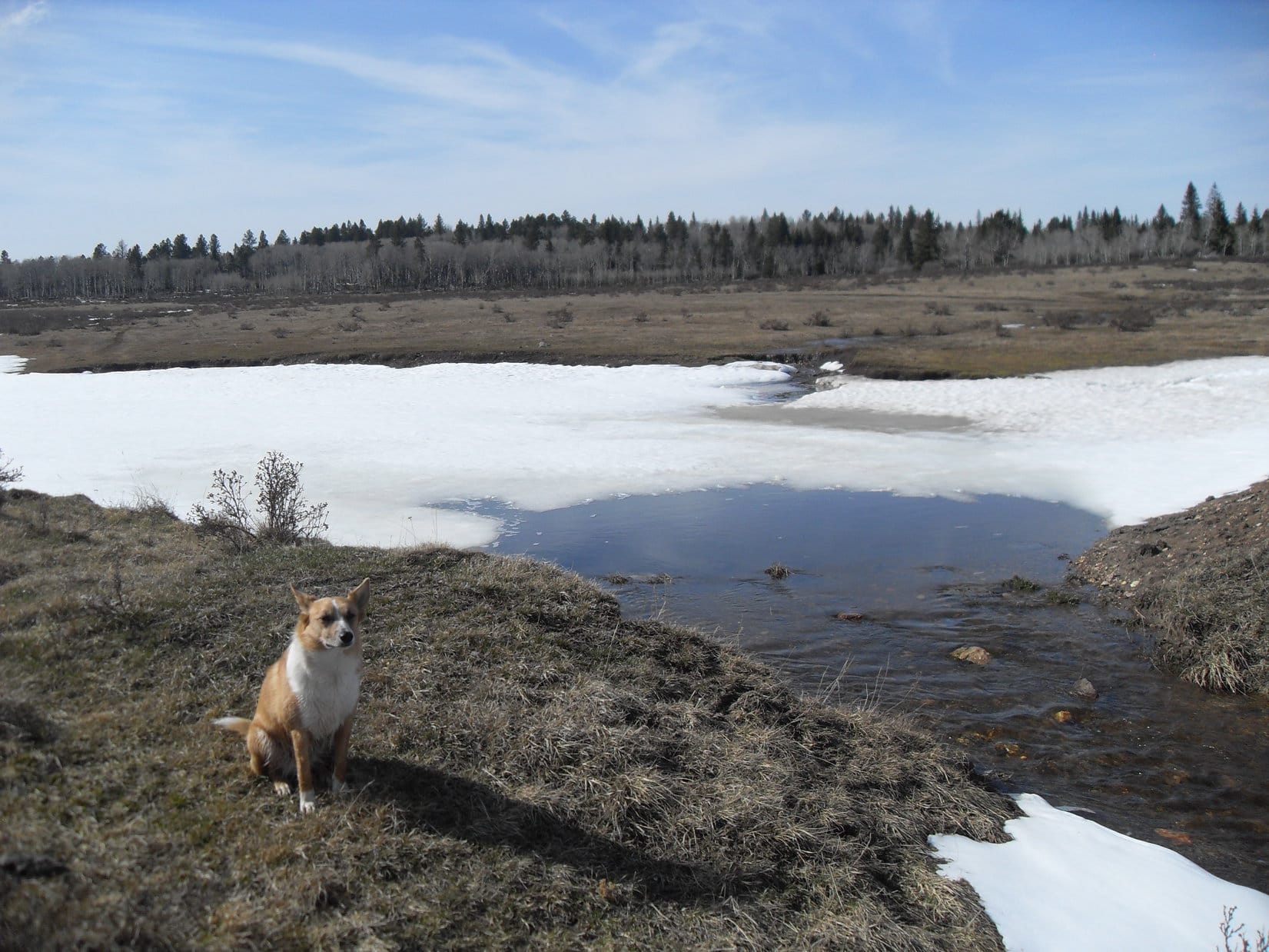
Down, down, Lupe and SPHP went. Before long, the forest ended. The road entered a snowy meadow. Another surprise! A much better gravel road was in view ahead. The gravel road was unmarked where Lupe reached it, but a marker confirmed Lupe had been traveling No. 377. Nothing made any sense. Why was this good gravel road even here? It hadn’t been that long since Lupe had left No. 377.1C. Lupe turned S on the gravel road, while SPHP pondered these mysteries.
Gradually, it began to dawn on SPHP that this good gravel road had to be No. 117 again. Lupe was now somewhere farther S than where she’d originally left it. Back at the marker for No. 377.1C, Lupe hadn’t actually been anywhere near Knutsen Spring, but much farther W, about where SPHP had originally thought she was before seeing the marker and consulting the map. Within another 0.5 mile, Lupe should come to another road that would take her SE to Crow’s Nest Peak.
Before she’d gone another whole 0.5 mile, Lupe did come to another road. This new road went ESE up a small draw, and was marked as No. 377.1A. This seemed like it might be the right road. At least it was going the right direction. Lupe took it.
No. 377.1A steadily regained Lupe’s lost elevation, which was a good thing. The road gradually turned SE, which seemed good, too. The road was so soft and muddy from melting snow, Lupe and SPHP traveled much of the time off in snowy meadows nearby.
SPHP was watching for an expected junction with No. 377 again 0.5 mile from No. 117, but it never materialized. Strange. The map showed it, but no junction appeared. Lupe continued on. About 1.0 mile from No. 117, Lupe was approaching the top of a rise. Off to the W in a meadow sat a large white plastic tank, presumably for water. It was enclosed by another pole fence. There wasn’t much snow up here. Was Lupe coming to the top of Crow’s Nest Peak?

A short distance beyond the white water tank at the top of the rise, Lupe found an unexpected road intersection. If she stayed on No. 377.1A continuing SE, Lupe would start losing elevation at a good clip. Turning SSW, she would lose less elevation following No. 377.1B. Both roads were clearly marked. Which way? SPHP had no clue.
Lupe pricked up her ears listening to a wild turkey gobbling somewhere in the forest as SPHP sat on a log studying the USFS map. It didn’t even show a road No. 377.1B. Crow’s Nest Peak couldn’t be that far away, but where was it? Lupe and SPHP went over to the white plastic water tank. It bore no markings that shed any light on the situation. Back to the log. The question remained, which way to go?
SPHP remembered another map in the pack. It was an old Black Hills National Forest “Travel Information Map”. Maybe it would provide a clue? SPHP took it out of the pack for a look. The BHNF travel information map showed the USFS Roads in much greater detail than the old USFS map, although it contained absolutely no other details except section lines and numbers.
No wonder everything had been so confusing! The BHNF travel information map was an enormous help! It showed road patterns that matched up with what Lupe had been seeing on the ground. The road numbers agreed with the markers Lupe had seen, too. SPHP’s old USFS map, normally reasonably accurate, was riddled with inaccuracies. It was a work of fiction in the area Lupe had been traveling through.
The BHNF travel information map showed the intersection of USFS Roads No. 377.1A and No. 377.1B where Lupe was right now. She clearly needed to take No. 377.1B. Although the BHNF travel information map didn’t show Crow’s Nest Peak, by comparing section lines on the two maps it was easy to see Lupe was only 0.5 mile NE of the summit. Lupe and SPHP took off heading SSW on No. 337.1B.
As the roads went, Lupe would have more than 0.5 mile to go to reach Crows Nest Peak. In fact, the BHNF travel information map led SPHP to believe she would have to go 0.5 mile just to reach the next intersection with USFS Road No. 266. Well before Lupe had gone 0.5 mile, however, she came to a small clearing. A road buried in snow disappeared going S into a dense forest. There was no marker for it, but it was probably No. 266.
A less snowy road made a sharp turn to the W into another dense forest. A marker showed this was still part of No. 377.1B. Lupe did need to go W to get to Crow’s Nest Peak, so she left the small clearing staying on No. 377.1B.
Lupe didn’t go much farther before she reached a larger clearing. This clearing wasn’t completely treeless. Spruce trees were scattered around. On the N side of the road was a good-sized pond. Three ducks were paddling around on this pond, but they flew off as Lupe approached.
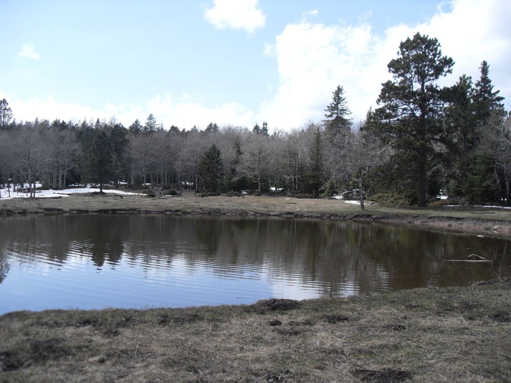
Although the pond contained rather murky, brown water, it still seemed like a relatively nice place to take a short break. Lupe had Taste of the Wild, while SPHP munched an apple.
After finishing her Taste of the Wild, Lupe went down to the edge of the pond. She saw a salamander trying to avoid detection by burying itself in the mud at the bottom of the pond. Salamanders are a fairly unusual sight in the Black Hills. Lupe wondered what that strange thing was? Fortunately, as far as SPHP was concerned, she didn’t want to find out badly enough to enter the cold, dirty-looking water.

The time came to press on from Salamander Pond, but SPHP had a hard time discerning where No. 377.1B went from here. A foray to the S revealed nothing. As it turned out, No. 377.1B continued W hidden under snow. It seemed like Lupe was gaining a little elevation as she followed the road W. Soon she was definitely gaining elevation. The faint road climbed a small hill from the SE.
Lupe arrived on top of the little hill to find a small, flat, opening in the forest. Part of the opening was buried beneath a large snow bank. A big pool of snow melt water covered a portion of the road ahead to the W. The whole area was so level, most of the ground was soggy. Water trickled NE into a marshy area among the trees.
Was this Crow’s Nest Peak? Lupe seemed to be at the top of the small hill, but saw no signs or markers anywhere. To the E, lots of snow could be seen between the trees. A spur of the road headed in that direction. However, before going E, Lupe went W to check out the big pool of water. Beyond it, SPHP thought it looked like there might be a view.
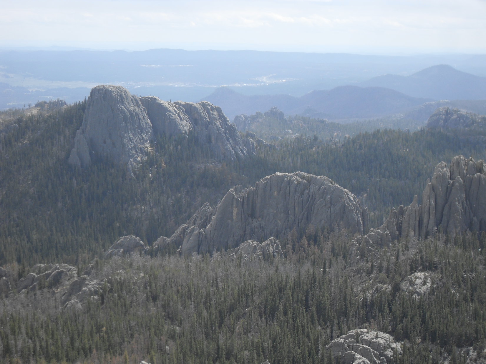
Going over to the big pool, the ground was sopping wet. Beyond the pool, however, the ground was drier and Lupe did have a bit of a view off to the W. The forest had been thinned enough in this direction so that she could see a few high hills that had to be well into Wyoming. Closer by were blue ridges nearly as high as where Lupe was now. SPHP thought Lupe must be on Crow’s Nest Peak, but found no proof.

Lupe traipsed back E past the snow melt water pool, crossing the soggy ground again to reach the trees at the E side of the clearing. She explored the spur of the road that went E into the forest. Only a few trees into the forest, Lupe found herself at the edge of another even smaller clearing. This tiny clearing was full of snow. The snow made it hard to tell, but it looked like the spur road ended already at a small turnaround circle in the clearing.
Out in the middle of the tiny clearing, a red and yellow metal post stuck up out of the snow. Lupe and SPHP ran over to the post. It said “Survey Marker”! This had to be it!

Excitedly, Lupe and SPHP started digging in the snow around the post. At first Lupe didn’t find anything. SPHP found a few rocks close to the W side of the post. Almost immediately, Lupe uncovered something metal about half a foot N of the post. The survey marker! SPHP brushed the rest of the snow away. The marker said “1912”. At the center of a circle rimmed with the usual propaganda a single joyful word was stamped: “Crow”.
After failing on two prior expeditions, Lupe had arrived! She was now undeniably on Crow’s Nest Peak (7,048 ft.). She had found the survey marker someone had set here 102 years ago! SPHP took a picture of it, not realizing until later on how blurry it had turned out. Oh, well.

There were no views from the tiny snow-filled clearing. The clearing bore no resemblance to what one thinks of as a mountain top. Lupe hadn’t had much in the way of a distant view anywhere along the way here, either. Yet finding the survey marker felt like finding a treasure. Lupe was actually at one of the highest points in the Black Hills. Looking for the marker in this remote part of the western Black Hills had been fun!

Lupe and SPHP left the summit feeling inexplicably happy. Nothing wrong with being happy is there? The American Dingo seemed to take it for granted. SPHP decided happiness needs no weighty justification. Take it when you can get it, and be glad! If being too happy is a problem, it’s among the best problems you can have. Enduring it is easy. Lupe and SPHP were willing to tough it out!
The Carolina Dog’s peakbagging goal for the day had been achieved. SPHP knew there was beautiful open land flanked by forests not too far off to the W. Lupe could wander over that way, find USFS Road No. 117 again, and have fun exploring on her way back to the G6. Lupe passed by the pool of snow melt water on the W side of Crow’s Nest Peak one more time.

After enjoying the view W of the pool for a few minutes, Lupe followed the road down the SW slope of the little hill. The road was in poor condition here. It led to an intersection where Lupe turned WNW. After passing through a level clearing, Lupe resumed losing elevation as the road went downhill through a forest. Emerging at the far end, Lupe could see the good gravel road, USFS Road No. 117, again.

When Lupe reached No. 117 again, SPHP was surprised there was no sign at all for Crow’s Nest Peak at the turn onto the minor road she had been following. A short distance off to the W was a junction with another good gravel road. Lupe went over to check out that junction. She found a sign saying this other good gravel road heading N was No. 117.5K.
A stream with a strong current was flowing S on the W side of No. 117 from this junction. Ordinarily, no stream exists here. It was all snow melt. Maybe Lupe could have some fun following the temporary stream S along the road? SPHP kind of wanted to see if there were any more roads heading toward Crow’s Nest Peak from No. 117, and if any signs for Crow’s Nest Peak existed anywhere along the way.
Lupe had a good romp exploring the meadows near the snow melt stream as she followed No. 117. The road wound around to the SW. Lupe paralleled it for at least 0.5 mile before coming to a bend where two big truck tires had been turned into water troughs. One was full to the brim, while the other was nearly empty.


SPHP checked the maps again. Lupe hadn’t come to any more roads. It wasn’t likely any roads would leave No. 117 for Crow’s Nest Peak from any farther S than where Lupe was here. SPHP’s curiosity was satisfied. May as well head back N.
The two truck tire watering troughs were as far SW as Lupe went along USFS Road No. 117. The snow melt creek was pretty impressive down here. Lupe started following it back upstream.

Lupe went all the way back to the junction with No. 117.5K. The meadows W of No. 117.5K looked so beautiful and inviting, Lupe and SPHP left No. 117 to continue N in those meadows. Lupe came to a pond along the snow melt stream that was mostly full of snow. A small waterfall tumbled into the little pond.
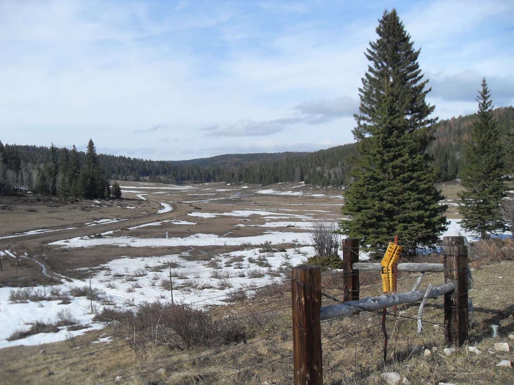
No. 117.5K went almost straight N gaining elevation gradually. Eventually the road went over a little pass. Beyond the pass was another long beautiful valley off to the NNE. SPHP continued marching along soggy, wet side roads in the fields W of No. 117.5K, while Lupe roamed to her heart’s content. SPHP stayed toward the W side of the valley near the forest, since Lupe enjoys having a mix of open ground and forest to run around on and explore.


No. 117.5K ended as a good gravel road a little N of the pass. Near a barbed wire fence, it veered off to the NW as a muddy minor road. Lupe was hungry again by the time she reached this point. She took another Taste of the Wild break near the fence where the good part of No. 117.5K ended.


From the fence at the N end of the good part of No. 117.5K, Lupe left the road to continue NNE down the long gentle valley ahead. She roamed the W side of the valley, crossing many little snow melt streams. SPHP found another dirt road, and followed it where it wasn’t too muddy. The easy, gradual, downhill trek was beautiful. The air grew chilly as the sun began to sink. It was still early spring up at this elevation.
Eventually, SPHP saw No. 117 reappear on the E side of the valley. Soon No. 117.5D came into view, too, on the far side of No. 117. This was the road where Lupe had originally left No. 117 to escape the heat and explore the forest on her way to Crow’s Nest Peak. Lupe could have gone over to No. 117 again, but instead she stayed on the W side of the long valley.
SPHP led her along the dirt road even after it re-entered the forest, turned NW, and started gaining elevation. This proved to be a mistake. Soon Lupe and SPHP had to leave the road to plunge down the N side of a densely forested steep slope. The snow was feet deep here. Suddenly, Lupe was leaping and bounding through snow up to her neck.
After what seemed like a long struggle, Lupe escaped the snow when she reached the floor of a valley. She came to another road, No. 117.5I. The intrepid Carolina Dog was now a little farther W in upper Manganese Draw than she had been early in the day. Her adventure to Crow’s Nest Peak and back was almost over. Before long she was E of No. 117 again, following Castle Creek downstream. At 6:38 PM, (44°F) Lupe reached the G6.
Lupe had enjoyed sunshine all day near Crow’s Nest Peak. Surprisingly, on the way home it turned out the rest of the Black Hills only a few miles to the E was under dense cloud cover. Lupe was tired. She curled up on the G6’s passenger side front seat. SPHP thought she might go to sleep as the light faded.
The Carolina Dog couldn’t relax, though. She was too worried she was missing out! She wound up standing and watching for cows, horses and deer to bark at all along the long road home. For Lupe, the adventure never ends!

Links:
Next Black Hills Expedition Prior Black Hills Expedition
Want more Lupe adventures? Choose from Lupe’s Black Hills Expeditions Adventure Index or Master Adventure Index. Or subscribe free to new Lupe Adventures.