Black Hills, SD Expedition No. 80 – New Year’s Eve Peak (3-23-14)

10:39 AM, 31°F – Intersection of USFS Road No. 710 & Hwy 385, a few miles S of Pactola Reservoir

Lupe was off to a late start, but for a good reason – two good reasons, actually.  Last week’s Expedition No. 79 – The Snow Trek, had been an 11 hour in the field ordeal, and subsequent complete social fiasco.  Big Sid, the neighbor’s dog who had been joining Lupe on recent expeditions, had been returned home late – 10 PM, and totally exhausted.  Though Loop recovered quickly, Sidney had hardly been able to move for days afterward.

The neighbors were not amused.  They’d been worried sick about Sidney being gone so long.  Apparently Big Sid had a curfew.  Who knew?  Sid’s exhausted condition had earned SPHP the rather unflattering nickname “Dog Killer”.  Sidney wasn’t going to be allowed to join Lupe on her expeditions any more.  SPHP hadn’t even bothered checking this morning whether there had been a change of heart.  Back to the old ways – just SPHP and Loop from now on.

So after The Snow Trek fiasco, something less arduous had sounded good to get back into the swing of things again.  Rushing off early for another super long day wasn’t in the cards this time around.

The other reason Lupe was off to a late start was that it had been only 6°F when she’d gotten up.  No sense in following up The Snow Trek with the Frozen Solid Trek was there?  Lupe’s adventures are supposed to be fun, not dubious episodes of “Survivor”.  Although Lupe had been eager to get going, SPHP had insisted on hanging around the house for a few hours letting the day warm up.

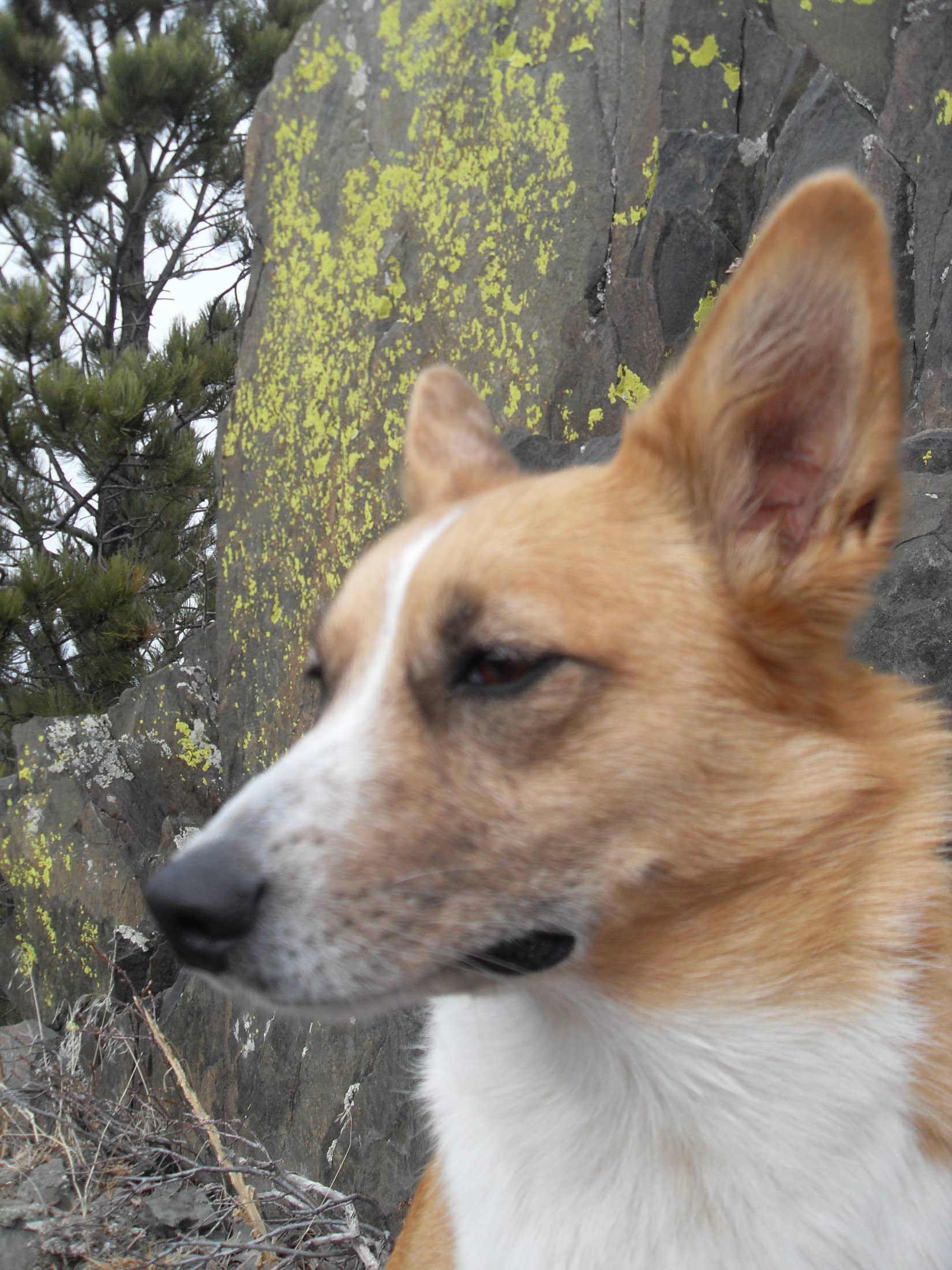
At any rate, Lupe was here now, and happy to be out and about again.  She trotted W on USFS Road No. 710, following it gradually up a forested valley.  A dusting of new snow that had fallen overnight was unspoiled, showing no tracks.  Snow was plentiful, but not nearly as plentiful as it had been in the higher hills W of Nahant last week.

After going a mile, Lupe reached the upper end of the valley.  Here the road leveled out as it went through an open forest of large, beautiful pines.  Beyond the pines was barren ground, all clean and white beneath a blanket of snow.  Lupe saw a big white hill (High Point 5217) only 0.33 mile away to the W.

Lupe on USFS Road No. 710 after passing through the open forest of tall pines at the upper end of the valley. Photo looks NE.
After emerging from the forest at the upper end of the mile long valley, USFS Road No. 710 headed into a barren area where the forest had burned years ago. Blue skies and the white snow made everything look clean, bright and cheerful. High Point 5917 is the hill on the R. Photo looks W.

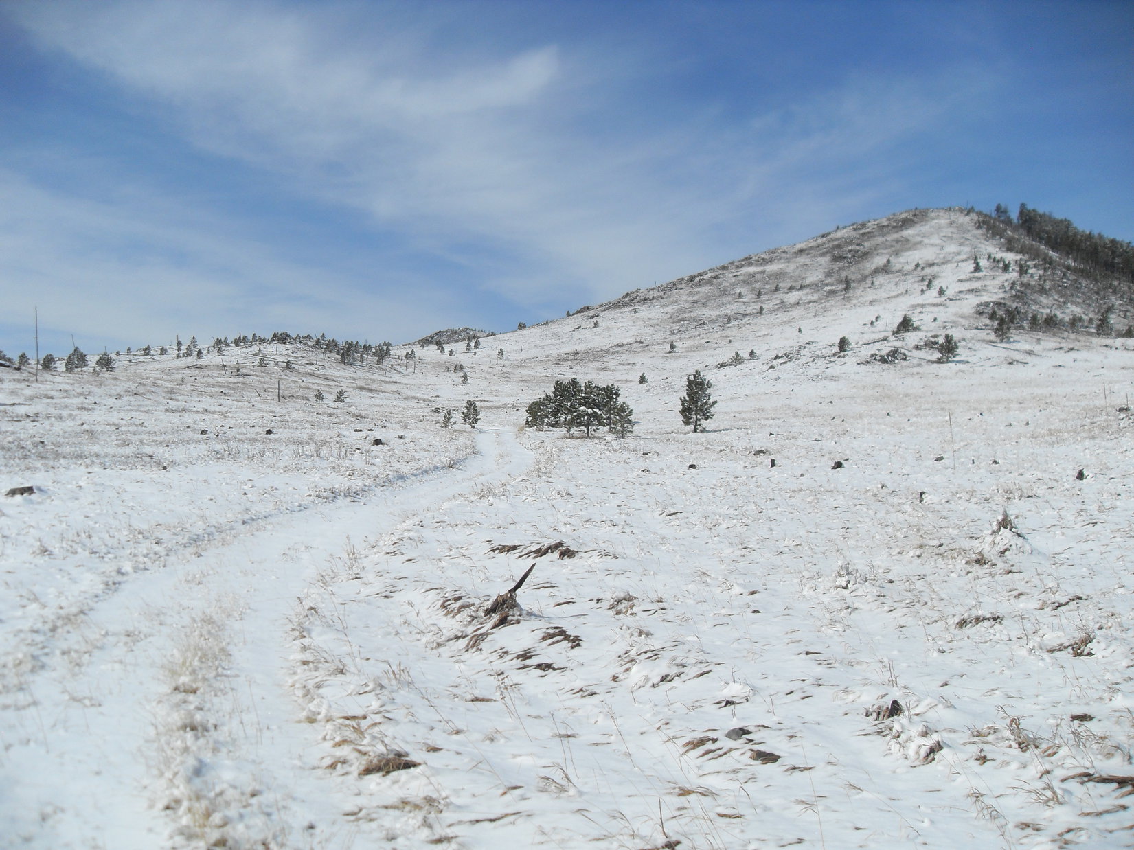
This barren area must have burned in a forest fire many years ago.  The dazzling white snow beneath the blue sky made everything look bright and cheerful.  Lupe stayed on No. 710 as it curved to the S.  The road soon circled back to the SE, passing through another stand of tall pines on the way.

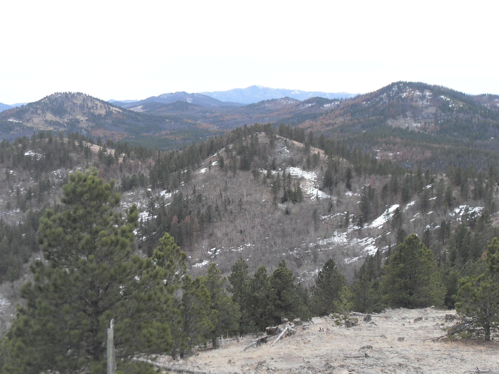
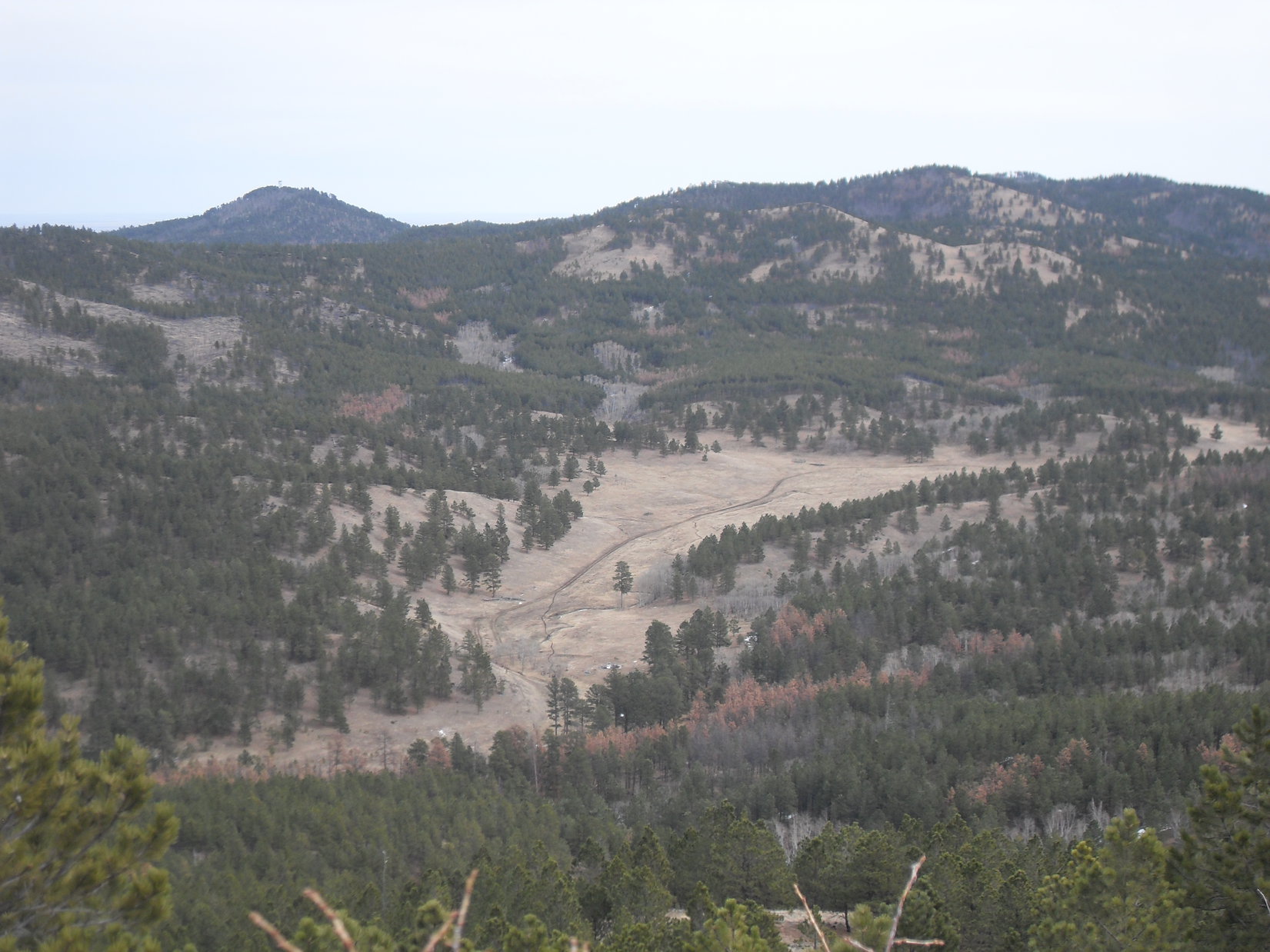
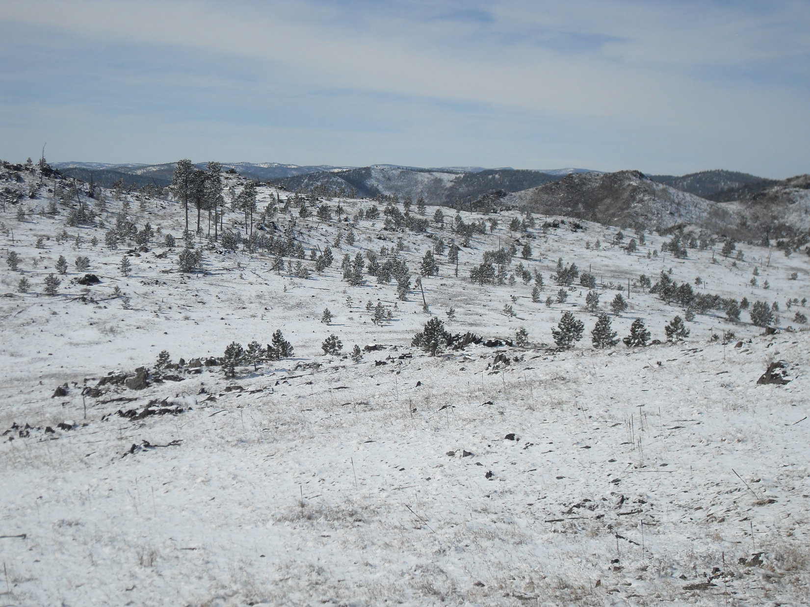
By the time No. 710 emerged from this second stand of trees, Lupe was gaining elevation again.  Off to the N was a smaller, snowy hill.  The American Dingo left the road to climb it.  From here, Lupe could see much more of the burn area.  With so few trees around, she was treated to a panoramic view to the S and W, a rare sight in the mostly heavily forested central Black Hills.

Looking SW from the small hill N of the road, Lupe could see quite an extensive area that had burned years ago. Small pines were growing, indicating the forest will eventually take over again. In the meantime, the panoramic views were great!
Harney Peak (7,242 ft.), the highest mountain in South Dakota, was in view from the hill Lupe was on. Photo looks S.

To the SE, Peak 5800 was in view only 0.5 mile away.  Earlier, SPHP had been thinking maybe Lupe should climb it.  However, the day was now so nice out that greater ambitions had started to set in.  SPHP had visions of Lupe making it all the way to Old Bald Peak (6,130 ft.).

Peak 5800 was in view only 0.5 mile away from the small hill. Earlier, SPHP had been thinking maybe Lupe should climb it today. By now, though, SPHP had a grander vision that Lupe might make it all the way W to Old Bald Peak instead. Photo looks SE at Peak 5800.

The views were so wonderful from this small hill, that it seemed to make sense for Lupe to head W up to High Point 5917, the first snowy hill she had seen.  High Point 5917 was considerably higher than where Lupe was now, so the views should be even better over there.  Furthermore, High Point 5917 was on the way to Old Bald Peak, if Lupe was really going that far.

So instead of continuing SE to climb Peak 5800, Lupe went S back down to the road and started following it NW.  She passed through the second grove of trees again, then kept going NW, leaving the road and ultimately climbing all the way to the top of High Point 5917.

No doubt about it, the views were even better here!

Looking back at Peak 5800 (L) from High Point 5917. The smaller hill Lupe had been on earlier is the closest hill on the far L. Part of Sheridan Lake is seen as a patch of white in the distance on the R. Photo looks SE.
Harney Peak again. This time as seen from High Point 5917. Photo looks S.
Lupe on High Point 5917 in happy expectation of some kind of treat or attention from SPHP as a reward for having reached such a lofty height.

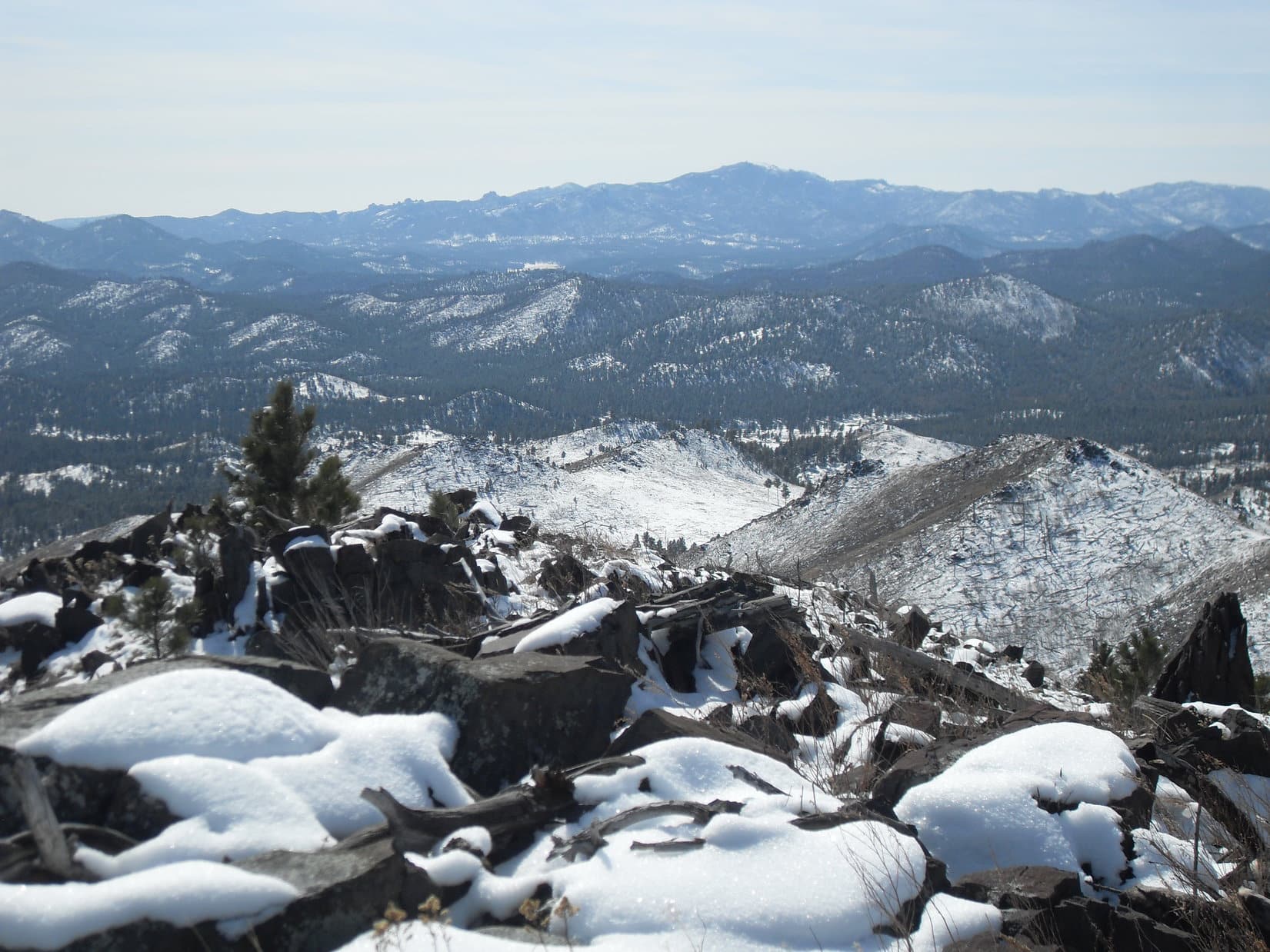
After enjoying the terrific views from High Point 5917, Lupe left going SW down the hill.  She lost a couple hundred feet of elevation on the way down to a saddle leading over to the next ridge.  Right away, she had to regain nearly all of the elevation she had just lost.  When she arrived up at the first real high point on the next ridge, SPHP recognized this place.

Lupe had been here before, way back on Expedition No. 41.  This ridge would go a little farther W, and then turn N on its way up to Peak 6046 about 0.5 mile away.  Lupe had come down this way on Expedition No. 41 after climbing Peak 6046 by another route.  It had been the last day of 2012, which was how Peak 6046 had become privately known as New Year’s Eve Peak (6046 ft.).

Returning to New Year’s Eve Peak was an appealing idea.  2014 wasn’t exactly new anymore, but there was still snow on the ground and the year was still young!  Lupe set off to the W, following the ridgeline as it curved N.  The final climb up the S slope was a little steep, but soon Lupe was back on New Year’s Eve Peak again.

Lupe back on top of New Year’s Eve Peak for the first time since the end of 2012. Photo looks N.

It hadn’t taken all that long to get here, but the mood of the day had changed by the time Lupe reached the top of the mountain.  The blue skies were gone.  Gray clouds hung low over the hills.  A chill light breeze blew in from the NE.

Lupe and SPHP sat together looking at the view to the W.  Lupe had some Taste of the Wild.  SPHP ate an apple.  Old Bald Peak was still 2.5 miles off to the WSW.  It was easy to see Lupe would have to lose hundreds of feet of elevation again to continue any farther W.  Then it would be up and down all the way to Old Bald Peak.

The weather had changed by the time Lupe reached the top of New Year’s Eve Peak. The sky was overcast and a chill breeze blew in from the NE. In the end, SPHP decided she shouldn’t continue on to Old Bald Peak. Photo looks W in the direction she would have taken.

In the end, SPHP decided the change in weather meant Lupe shouldn’t continue W looking for Old Bald Peak.  Instead, the original idea of climbing Peak 5800 returned.  It was much closer to where the G6 was parked.

Even that never happened.  After leaving New Year’s Eve Peak, Lupe made it all the way back E to the NW face of Peak 5800.  By then, the mountaintops were all hidden in the clouds.  Beneath the dark, foggy sky, the gloom was thicker than ever.  Tiny snowflakes fell.  The top of Peak 5800 was no more than 200 feet higher, but Lupe would have to start by climbing a slippery snow-covered boulder field.

SPHP hesitated.  Snowflakes swirled in the cold breeze.  Maybe this wasn’t the day for Peak 5800, either.

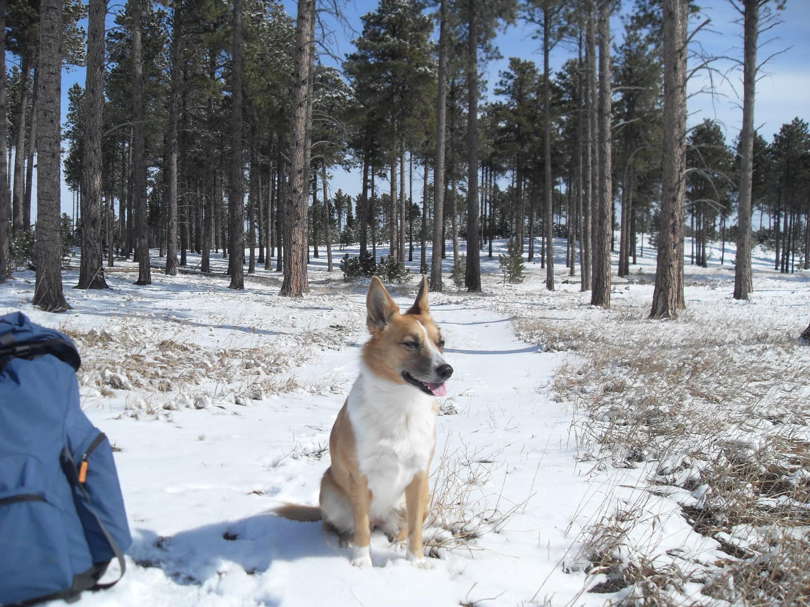
And that was it.  Lupe and SPHP left the mountain.  Lupe took a shortcut going N down a long slope through a snowy forest.  On the way, she heard gunfire.  Now she was desperate for SPHP’s protection.  SPHP urged her onward.  Lupe reached USFS Road No. 710 again.  Still, she didn’t feel safe until she was back in the G6 (3:07 PM, 32°F).

Barely 4.5 hours.  Not much of an expedition compared to The Snow Trek ordeal a week ago.  Too bad big Sid hadn’t been along today, he would have loved it!  The shorter day would have been better suited to his needs.  Who knew, though, if Big Sid would ever come along again?

As for Lupe, she hadn’t made it back to Old Bald Peak (which she had visited once before) or to the top of Peak 5800, but maybe she still would some day.  At least, she’d had a good time, and seen some beautiful sights.  And whether the calendar said it was the right day for it or not, she had enjoyed her journey back to the cold, lonely summit of New Year’s Eve Peak.

Harney Peak is seen in the distance between pine trees on the summit of New Year’s Eve Peak. Photo looks S.

Links:

Next Black Hills Expedition            Prior Black Hills Expedition

Expedition No. 41 – New Year’s Eve Peak (12-31-12)

Expedition No. 112 – New Year’s Eve Peak (12-31-14)

Expedition No. 147 – Silver Peak & Old Bald Peak (11-24-15)

Want more Lupe adventures?  Choose from Lupe’s Black Hills Expeditions Adventure Index or Master Adventure Index.  Or subscribe free to new Lupe Adventures.

Black Hills, SD Expedition No. 81 – Peak 6070 & Nugget Gulch Peak (3-30-14)

Off like a shot, running and bounding everywhere!  Guess she did like being here.  For some reason, Lupe hadn’t seemed too fired up about going “hiking in the mountains” this morning when SPHP had suggested it.  Good thing her enthusiasm had returned.  The G6 was parked at the junction of Hwy 385 and USFS Road No. 710 several miles S of Pactola Reservoir (8:20 AM, 40°F).  Lupe was in for a long day.

Lupe was here a week ago on Expedition No. 80.  She had followed No. 710 nearly a mile W up a draw to some beautiful open ground with great views to the S, ultimately reaching New Year’s Eve Peak (Peak 6046) for the first time from the E.  Today the plan was to go much farther.  Lupe would explore a side road, No. 710.1A.  Her intended destination was Old Bald Peak (6,130 ft.).

Cool, overcast, and a little breezy – conditions were great for a day in the hills.  The snow that had been here a week ago was nearly gone.  SPHP set out following damp, mushy, muddy No. 710.  Lupe dashed, bounded, and sniffed her way through the forest nearby.

The road gained elevation slowly over the 0.33 mile W to the junction with No. 710.1A .  Lupe took No. 710.1A as planned.  It initially went NE, before looping around the E end of the ridge N of Peak 5800.   Once around the end of the ridge, the road turned NW heading up into the Clear Creek valley.

A mile up Clear Creek valley, No. 710.1A turned S.  Lupe left it continuing NW on a less-traveled side road.  The side road climbed more steeply.  Lupe stuck with it, and after 0.25 mile arrived at a saddle where she had a view to the W.  Less than 0.5 mile to the N, she could see the Seth Bullock lookout tower on Scruton Mountain (5,922 ft.).  Lupe was already almost as high.

SPHP realized the Carolina Dog was now N of New Year’s Eve Peak (Peak 6046), which is higher yet.  Lupe left the side road and began climbing SW up a ridge.  Well before she reached the top of New Year’s Eve Peak, another road appeared.  This road was nearly level and headed W.  Lupe followed it.  Soon the new road curved around to the S, taking Lupe along the W slope of Peak 6046.

A lengthy stretch of the road was covered with deadfall timber.  Progress was slow until SPHP managed to get past it all.  Thankfully, someone had cleared the deadfall off the rest of the road.  Lupe and SPHP made rapid progress to the E end of the saddle W of Peak 6046.  Once again, Lupe left the road.  She traveled W across the saddle.  On the other side, she began exploring the hills to the W and NW.

The American Dingo climbed up to the top of the highest point in this vicinity for a look around.  Lupe was higher than Scruton Mountain now, and about as high as New Year’s Eve Peak (Peak 6046), which she could still see to the E.  Farther away, Harney Peak (7,242 ft.) and Five Points (6,221 ft.) were in view off to the S.

Lupe was now clearly higher than Scruton Mountain (R). The Seth Bullock lookout tower can be seen on top. Photo looks NE.
Harney Peak (L of Center), is the highest point on the horizon. Five Points (R) is noticeably closer. Photo looks S.

Lupe could see several more high points along the big ridge she was on off to the NW.  The Carolina Dog stayed on the ridge, continuing her explorations of the area going first W and then NNW.  She visited a number of high spots before reaching the last big one to the N.  After crossing a small open field, she climbed to the top of this last big high point.

(Note:  Lupe had reached Peak 6070, a mile NW of Peak 6046.)

A narrow, rocky spine of the mountain projected out to the S.  Lupe followed it beyond the forest to a point where she had a terrific panoramic view.  She saw Harney Peak and Five Points again.  SPHP recognized Lupe’s objective, Old Bald Peak, off to the SW.

Bright yellow-green lichens clung to the sharp rocks of the S spine of Peak 6070.
Lupe on the S spine of Peak 6070.
Happy Dingo on Peak 6070.
Looking SSW.
Harney Peak is seen L of Center. Five Points is on the R, and False North Point is on the far R. Between them in the distance is Sylvan Hill (7,000 ft.) Photo looks S from Peak 6070.
SPHP finally recognized Old Bald Peak (6,130 ft.) (R), Lupe’s original objective, from Peak 6070. Photo looks SW.

The S spine of Peak 6070 was rather breezy, but the views were awesome.  Lupe and SPHP took a break here.  Lupe had water and Taste of the Wild, plus half of SPHP’s cheese sandwich.  SPHP had the rest of the sandwich and an apple.

While pondering the views during this rest stop, SPHP noticed a line of hills off to the NW.  A look at the map showed these hills were located between West Nugget Gulch and Middle Nugget Gulch.  The highest point, Nugget Gulch Peak (6,000 ft.), was practically treeless.  It would provide a 360° view.

Lupe had been to Old Bald Peak before.  Once, she had also traveled through West Nugget Gulch on USFS Road No. 249.  However, she had never explored the hills between West Nugget Gulch and Middle Nugget Gulch.  She had never been in Middle Nugget Gulch, either.  Maybe it was time for Lupe to explore the Nugget Gulch Range?

By the time Lupe’s rest break was over, it was decided.  Old Bald Peak was out.  Lupe was pressing on to the Nugget Gulch Range!

Lupe’s last photo on the rocky S spine of Peak 6070 after her rest break here. Photo looks N.

The S end of the Nugget Gulch Range was 1.5 miles due W.  To get over there, Lupe would have to lose considerable elevation.  She wound up going to the minor high point N of Peak 6070 before finally turning sharply SSW.  Now she lost elevation rapidly, but still managed to lose as little as possible by reaching the valley W of Peak 6070 at the saddle leading to the S end of a line of smaller hills to the NW.

USFS Road No. 244 crossed this saddle going N/S.  Lupe simply went W across it, since she had hardly started her trek W to the Nugget Gulch Range.  She went SW through the forest around the S end of the line of small hills to the NW.  This was rocky ground.  SPHP managed to stumble and fall on all the loose rock.  SPHP’s right arm took the brunt of the blow.

Lupe came running to provide comfort and support.  A Carolina Dog’s love and encouragement is a great help.  Within a few minutes SPHP felt much better and was able to continue, no worse for the wear.

Once W of the line of small hills, Lupe came to a part of the forest which was nearly level.  She lost elevation only gradually, enjoyed an easy romp, and eventually emerged from the forest at the E side of a wide grassy field in Middle Nugget Gulch.  The first big hill at the S end of the Nugget Gulch Range was on the other side.  Lupe and SPHP headed right for it.

Lupe crossed a dirt road and small dry creek bed in the field.  By the time she reached the trees on the far side, she was gaining elevation again.  The slope steepened as she made her ascent of the big hill.  When she reached the top, another somewhat higher hill was in view to the NW.

SPHP had hoped Lupe would have a relatively easy time going NW along the ridgeline to the highest point at Nugget Gulch Peak.  Instead, she came to several hills in succession.  A steep and substantial drop came right after climbing each one.  All the lost elevation had to be immediately regained on the way up the next hill in the series.

Lupe and SPHP tried skirting along the E slopes to avoid having to go all the way to the top of each hill.  Unfortunately, this maneuver wasn’t terribly helpful.  The steep hillsides, scattered deadfall timber, and slippery patches of snow made progress as slow as before.

Only the last part of the journey was easy.  A long ridge rose gradually to the high point of the Nugget Gulch Range.  Lupe wasn’t as high as she had been back at Peak 6070 earlier, but at least she was back up at 6,000 feet when she finally arrived at Nugget Gulch Peak (6,000 ft.).  The mountaintop was covered with small rocks and low bushes.

Lupe arrives at the Nugget Gulch Peak after a long trek over and around the series of hills to the S. The little summit area was covered with small rocks and low bushes. Lupe had 360° views from here. Photo looks NNE.

Lupe did have 360° views from Nugget Gulch Peak.  She could see Silver Peak (5,810 ft.) to the N.  Old Bald Peak was now due S, and Harney Peak was still visible much farther S.  Lupe had a bird’s eye view of Middle Nugget Gulch far below.  Scruton Mountain was straight E beyond it.

Looking S from Nugget Gulch Peak. Harney Peak (7,242 ft.) is the distant peak at (Center). Five Points (6,221 ft.) is the not quite as distant mountain that breaks the ridgeline leading to Harney Peak L of Center. Old Bald Peak (6,130 ft.) is the highest hill on the R. Some of the hills Lupe traversed to get here are in the foreground.

Lupe and SPHP were both getting tired by now.  Another rest break was in order.  The last of the provisions were consumed, except for some pieces of chocolate oatmeal cookie that the Carolina Dog stashed, burying them with her nose.  Carolina Dogs are smart that way.  They plan ahead in case of an emergency or tough times to come.

Lupe had a terrific view of Middle Nugget Gulch far below. Scruton Mountain (5,922 ft.) is on the L. Peak 6070 is the 2nd ridge on the R. Photo looks E.

The rest break did some good.  Lupe was ready to continue.  She left Nugget Gulch Peak still going N.  She quickly encountered a rock formation almost as high.  At first, SPHP wasn’t certain if Lupe could get beyond it, but with a little care, she did.  Once past the rock formation, a short ridge led to another somewhat lower high point.

Lupe was still S of High Point 5953 when she left the ridge to drop down into Middle Nugget Gulch.  Her steep descent followed a forested side ridge going NE.  Middle Nugget Gulch was narrow and forested where Loop reached the valley floor.  She found a single track trail, and began following it S up the gulch.

Middle Nugget Gulch began to widen out.  The single track trail became a dirt road.  As Lupe reached more open land, she found a cabin nearby in the trees.  SPHP was surprised to see it.  The cabin proved to be abandoned and in a state of disrepair.

The abandoned cabin Lupe came across in Middle Nugget Gulch.

Continuing S up the now broad valley, Lupe and SPHP stayed close to the forest along the W side of the big field.  The creek had a little water in it in some places.  In other spots the creek bed was just damp.  Lupe was delighted to see a big snow bank near the edge of the forest.  It was the first big patch of snow she’d come to in a while.  Lupe thrashed around on it, eating snow and cooling off.

Loopster enjoying the snow bank.

After climbing so many hills and mountains earlier in the day, it was great to have an easy route up Middle Nugget Gulch.  A little beyond the S end of the big field, Lupe re-entered the forest and reached an intersection.

It had already been a fairly long day, and the G6 was still miles away.  SPHP should have had Lupe take the road to the SE (L).  It led to Horse Creek Road, and was the quickest route back to the G6.  However, there was territory to the SW that Lupe hadn’t explored before.  The easy trek up Middle Nugget Gulch had restored some energy.  Lupe and SPHP took the road leading SW (R).

A little later on, Lupe reached another intersection where she turned S (L) on USFS Road No. 249.  This road wasn’t steep, but climbed steadily.  Deer kept Lupe entertained for a while, but the road went on and on.  Lupe passed E of Old Bald Peak.  She was well to the SSE of it by the time the road finally reached a pass.  A short distance S of the pass, Lupe reached an intersection with USFS Road No. 530 where No. 249 ended.

Another mile S on No. 530 finally brought Lupe to a place where she could leave the road and go over a small saddle to the E.  She was now 3 miles from where she’d left Middle Nugget Gulch, but no closer to the G6.  Lupe was tired.  She begged SPHP to stop.  Frequent short rest breaks became the order of the day.

E of the saddle, Lupe eventually found USFS Road No. 669.  After nearly 2 miles, it finally brought her to Horse Creek Road.  Another mile E on Horse Creek Road was followed by a road-less trek, and another big climb to the top of the ridge to the N.  Here, Lupe reached USFS Road No. 710 again.  By now it was dark and raining.

Lupe had perked up at various points along the way, but she was Dingo-tired.  At least the last mile E on No. 710 was downhill.  A dark, wet, muddy trek ended at the G6 (8:12 PM, 41°F) nearly 12 hours after Lupe had left it.  The cold, wet Carolina Dog leaped in without any encouragement or the slightest hesitation.  She curled up on the passenger side front seat, heaved a giant Dingo sigh, and closed her eyes.

At home, SPHP dried Lupe off on the bed with a towel.  Although she must have been famished, she managed to come downstairs only long enough to drink a little milk and have a little Alpo.  She didn’t finish either before returning to bed.  SPHP made spaghetti and brought her some, but the bleary-eyed American Dingo was too exhausted to touch it.  SPHP left it in a bowl on the bed near her.

When SPHP woke up the next morning, a storm was going on with a howling N wind and snow.  If it had been snowing harder, it would have been a genuine blizzard.  Lupe still snoozed, not moving a muscle.

Someone had been up in the night, though.  The spaghetti was gone.

Looking NNW back down Middle Nugget during Lupe’s return from the Nugget Gulch Range.

Links:

Next Black Hills Expedition           Prior Black Hills Expedition

Want more Lupe adventures?  Choose from Lupe’s Black Hills Expeditions Adventure Index or Master Adventure Index.  Or subscribe free to new Lupe Adventures.