Black Hills, SD Expedition No. 67 – Big Sid Joins the Pack! (10-26-13)

Blizzards used to hit the Black Hills in late winter or early spring with some degree of regularity.  Whether due to global warming, long term cycles, pure chance, or other factors, blizzards have become increasingly rare here.  Yet this one hit October 4th, easily the earliest in the season SPHP could ever remember.

Leaves were still on the trees and caught the heavy snow, making the storm far more destructive.  Huge branches, even entire trees collapsed.  SPHP narrowly avoided losing power to the house by trimming branches off a tree in the back yard using an electric pole saw before they broke and fell on the main power line.

The whole town was a mess.  Intense cleanup efforts took days.  It was weeks before things were back to normal.

The October 4th blizzard dropped a couple feet of heavy, wet snow at a time of year normally before the first frost, never mind all this!
No one went anywhere for a few days.
Leaves still on the trees caught the heavy, wet snow and made the storm far more destructive. Lots of branches broke. Even large trees snapped.
Lupe was amazed by all the snow.
A couple big branches had broken over at Lupe’s friend Sidney’s house.
SPHP cleared a Dingo path on the front walk.
All the clean white snow was destructive, but beautiful, too.
At first, Lupe wasn’t sure what to make of this radical overnight transformation of the neighborhood, but she did enjoy being outdoors while all the cleanup activity going on.

Lupe enjoyed all the outdoor cleanup activity after the storm, but weeks went by and she hadn’t gone on a single Black Hills expedition yet in October, normally a great month to be out in the hills.

Finally, the great day arrived!  At home, all the snow had melted long ago.  The debris was gone or cut up for firewood.  It was time to get out in the hills, and see what things looked like out there.  As a special treat, Lupe got to invite her friend and next door neighbor, Sidney, to come along with.  Nina said it was OK.  This would be the first time Big Sid ever got to come with Lupe on one of her expeditions!

Sidney zoomed out the front door of his house, full of enthusiasm, but without the faintest idea what was about to happen.  SPHP had trouble persuading him to get into the G6.  He kept wanting to run back home to get JB.  Finally, SPHP got Sidney in the car.  Lupe and Sidney were off on an adventure together!

SPHP drove far enough into the central hills to get to where there was still some snow around, parking at the junction of USFS Road No. 256 and Rocky Johnston Road (10:56 AM, 50°F).  Everyone piled out of the G6 and started following Rocky Johnston Road going gradually up a valley.

Everyone didn’t keep doing that, though.  By now, Sidney was alarmed at this turn of events.  Where was JB?  Where was Nina?  Where was Cassie?  No one in his family was here.  He’d been dog-napped!

Every time SPHP relaxed and stopped paying attention, Sidney snuck back to the G6.  Big Sid wanted to go home.  It was scary being way out here with Lupe.  What terrible fate might be in store?  What evil lurked in that scrawny Dingo’s heart?  Mommy!  Daddy!  Help!  Save me!

Knock it off, Sid, you big chicken-dog!  You’re going to be fine.  You’re not going home now, we just got here.  Stick with Loopster, and have some fun exploring.  You’ll love it.  Stay close!  Come on, now!

Big Sid finally realized SPHP wasn’t going to let him back in the G6.  Ever so reluctantly, fearful of being totally abandoned and alone outside, he decided he had no choice but to follow wherever the Carolina Dog went and hope for the best.

Rocky Johnston Road went W at first, then turned N.  The road hike was easy, but kind of boring.  SPHP thought Sidney might become more interested and involved sniffing around in the forest E of the road.  At first, Big Sid thought leaving the road was nuts, but seeing Lupe busy exploring the forest soon made him forget some of his fears.  He began to get into the swing of things, too.

Sidney was in no shape to keep up with Lupe, but did his best.  What he lacked in physical conditioning, he started gaining in spirit.  He often arrived to take his turn sniffing at points of canine interest about the time Lupe completed her own investigations.  Through the snowy forest, Lupe led and Sidney followed.  Big Sid forgot all about the G6.  He actually was having a good time!

The trek through the forest paralleled Rocky Johnston Road for more than a mile, but eventually big white fields, a home, and outbuildings could be seen ahead at the end of the valley.  To avoid this private property, Lupe, Sidney and SPHP crossed over to the W side of Rocky Johnston Road and climbed NW up a snowy slope.

The terrain up above was nearly level.  Lupe and Sidney continued NW through a thinly forested area.  More snow was up here than down below, but it wasn’t too deep.  Before long, Lupe reached a small clearing where a couple of unmarked USFS roads met.  The roads went W or NW.  Both directions looked interesting.

However, something even more interesting was in sight to the N beyond a much larger clearing –  a high ridge topped by small limestone cliffs.  That ridge was likely the highest ground Lupe and Sidney would come to today, so taking a look at the sights from up there seemed like a good idea.

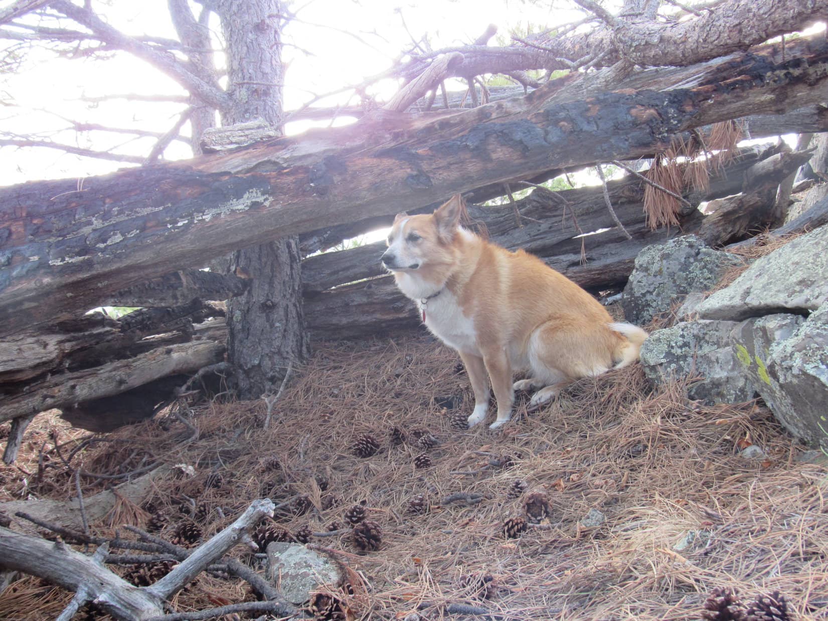
When you join Lupe’s pack, the American Dingo doesn’t cut you much slack.  An hour after leaving the G6, Sidney found himself climbing a mountain.  It wasn’t all that big a mountain, but it was steep enough near the top.  The limestone at the S end of the ridge was discontinuous.  Even Lupe and SPHP couldn’t find a way up onto a couple of limestone islands in the sky.

Nevertheless, a route was found to the top of the ridge slightly farther N.  Sidney followed Lupe up.  A 180° panoramic view existed to the W.  Lupe was used to seeing this sort of thing, but maybe it was a new experience for Sidney.  Big Sid seemed a little shocked at the size of the world.  He wasn’t afraid of being up here, though.  He stood calmly surveying the vast territory in view before him.

Lupe and Sidney arrive up on top of the high ridge. A couple of limestone islands in the sky that weren’t easily accessible are seen beyond them. Photo looks S.
Never been on a mountain before, Sid? Yeah, I do this all the time. The views aren’t bad here, but I’ve seen lots better than this. Stick with me, play your cards right, and maybe I’ll take you to some of the really good stuff! Photo looks S.
OK, Sid, pay attention. You need to start learning your way around. That big field down there is at the upper end of Gudak Gulch. I’ve been by it before on Expedition No. 56, so I know. Off in the distance is Terry Peak (7,064 ft.), lots of towers and a ski resort on it. Biggest peak in the northern Black Hills. If you want to learn downhill skiing around here, either Terry Peak or nearby Deer Mountain are your choices. Photo looks NNW.
We were way down there?!
This is totally awesome! I had no idea a backyard could be this big! Hey, I think I saw something move down there. Maybe it’s good to eat! How do we get to it?

On the ridge, Big Sid was visibly encouraged and an eager participant when break time was announced and he got to share in the Taste of the Wild with Lupe.  SPHP sat munching an apple while the chow hounds made great progress lightening the backpack.

A few minutes after break time was complete, it was time to head back down.  Lupe and Sidney returned to the little clearing S of the ridge.  Big Sid wouldn’t have to climb any more high points, but his inaugural expedition with Lupe was far from over.  Lupe and Sidney began exploring the USFS road going W.

This road leading W from the small clearing eventually proved to be USFS Road No. 219. Photo looks W.

The road turned SW, but remained level for a while before eventually starting to lose elevation.  Lower down there was less snow.

After losing some elevation, there was less snow on USFS Road No. 219. Photo looks WSW.

When the USFS road turned S, SPHP figured Hwy 17 coming N out of Rochford couldn’t be too far away to the W.  Leaving the road to climb a minor ridge to the W soon proved the point.  Yes, there was Hwy 17 on the other side.  Lupe and Sidney followed the ridge S a little, then left it to cross Hwy 17 and get on the Mickelson Trail near the confluence of the North Fork of Rapid Creek and Buskala Creek.

Traveling S on the flat, wide Mickelson Trail was easy, but a little dull.  Lupe and Sidney did get to see an interesting old red building.  The sides and roof were made of something round.  A fascinating and highly informative plaque told all about this historical building and exactly what it was made of, but SPHP can’t recall a single detail.  Must be the A.D.D.

Lupe and Sidney passed by this historical red building made of some circular things while traveling a short stretch of the Mickelson Trail about a mile N of Nahant. Photo looks NNW.

S of the historical red building, everyone left the Mickelson Trail to cross Hwy 17 again.  A gravel road, which might have been a driveway, led E up into the hills.  There was no sign of any recent traffic on this road, but sure enough, a little way up the hill a house could be seen tucked back against the trees at the edge of a field to the NW.

The driveway started curving N, so Lupe and Sidney left it to cross the dam of a small stock pond.  They headed SE over a low pass back onto USFS land, and soon after arrived at USFS Road No. 256.

When it turned out Lupe and Sidney had entered private property, they crossed the dam of this small stock pond and headed back onto USFS land continuing over the low pass seen at Center. Photo looks SE.

Hours had gone by.  Sidney wasn’t used to anywhere near this much exercise.  He was tired!  The easiest and most merciful thing to do would have been to follow No. 256 a few miles E to reach the G6 at the junction with Rocky Johnston Road.  Lupe, however, wasn’t done exploring.  She crossed No. 256 going SSE, eventually climbing up a ridge.  Sidney did his best to keep up, but his enthusiasm was clearly waning.

The ridge Lupe led Sidney to was hideous.  Either fire, pine bark beetles, or a combination of both had wiped out the pine trees.  Loggers had subsequently come through and clear cut a large area.  All the devastation did have one benefit.  It opened up views of higher country to the SW.

S of USFS Road No. 256, Lupe and Sidney wound up on this ugly ridge where fire or pine bark beetles had wiped out the forest. Loggers had clear cut the dead trees. At least the logging opened up the views. Photo looks S.

From the hideous ridge, SPHP looked for an easy route to the E or NE.  The sun was starting to get low, and Sidney was fading.  The terrain stubbornly remained easiest going SSE.  Finally, the time came to forget about the terrain and just do it.  Lupe turned NE entering a thick, healthy forest and descended into a valley.

Lupe came across these unusual slender plants in the woods during her explorations S of USFS Road No. 256. She always finds interesting things to sniff, but by now long shadows meant it was time to be getting back to the G6. Photo looks N.

The valley was in shadow and noticeably darker, but Lupe and Sidney made good progress going NE through the forest.  They found a dirt road, which led to USFS Road No. 203 up on Minnesota Ridge.  No. 203 eventually led N to No. 256 again.

Sunset was imminent.  The G6 was still nearly 2 miles E.  Big Sid was a trooper, but desperately wanted to stay on the road now.  He couldn’t understand why the crazy American Dingo insisted upon remaining in the forest.  She was still racing back and forth while wandering up and down various slopes.  Sidney tried to follow Lupe, but headed straight for the road every time she got close to it.

The sun set.  Lupe stayed in the forest N of the road.  She went down a steep, snowy slope.  She jumped over a small stream at the bottom.  The G6 was in view!  To Sidney’s relief, the Carolina Dog finally returned to the road and led him to the G6.  At 5:41 PM (40°F), Lupe’s fun and Big Sid’s ordeal were over.

Expedition No. 67 had been the biggest outing of Sidney’s life!  JB and Nina later reported that poor Sid couldn’t even move the next day.  He was exhausted and sore for days on end.

Dingo initiation rites are brutal, but Big Sid had made it!  Sidney would be invited along again on more expeditions for more adventures.  Over the next few months, he was a regular member of Lupe’s pack.  Long-suffering Sid willingly braved whatever she put him through.

Big Sid must love a challenge, he was always eager to go!Links:

Next Black Hills Expedition                     Prior Black Hills Expedition

Want more Lupe adventures?  Check out her Black Hills, SD & WY Expeditions Adventure Index, Master Adventure Index, or subscribe free to new Lupe adventures!

Black Hills, SD Expedition No. 228 – Centennial Trail No. 89: Spring Creek to Samelius (5-6-18)

Start: 9:09 AM, 58°F, Spring Creek trailhead of Centennial Trail No. 89

Lupe was back!   For the second week in a row, she was starting her day’s adventures at the Spring Creek trailhead of Centennial Trail No. 89.  Last week she had gone all the way N to Twin Sisters (5,244 ft.) and the Brush Creek trailhead.  This time around, she was going to explore Centennial Trail No. 89 all the way S to the Samelius Peak trailhead.

Like last week, the first order of business was to follow the spur trail from the trailhead up Spring Creek.  The spur trail would join the main trail at the Sheridan Lake dam.  The Carolina Dog didn’t mind repeating this easy, scenic stroll at all.

Starting up the spur trail along Spring Creek.
Spring Creek canyon on the way to Sheridan Lake.

Shortly after crossing the first of three beam bridges over Spring Creek, Lupe heard a rush of water over and above the usual noise made by the creek.  She soon came to the source of this noise.  A tremendous waterfall was sending a spray of water not only down into Spring Creek, but even raining down upon the opposite shore.

A tremendous waterfall was raining down not only upon Spring Creek, but completely over it! Only a week ago, this waterfall hadn’t even been here.

Lupe had been on this spur trail lots of times.  No waterfall had ever been here before!  Only a week ago, it hadn’t been here, either.  How strange!  Loop went closer to investigate.

Hmm.  This wasn’t a real waterfall, at least not a natural one.  Water was shooting out of the side of the canyon from halfway below the ridgeline above.  Must be a pipe or some other man made source up there.

A horizontal waterfall! Now that’s something you don’t see everyday!

The horizontal waterfall made quite an impression.  Lupe liked cooling off in its spray.  Once she was cool and wet enough, she continued up the spur trail.

Crossing the 2nd beam bridge over Spring Creek.
Continuing up the canyon. The trail is nearly level almost all the way to Sheridan Lake.
Crossing the 3rd and final beam bridge. Part of the Sheridan Lake dam is now in view ahead. Photo looks WNW.

The spur trail joins the main Centennial Trail No. 89 at the S end of the Sheridan Lake dam.  Last week Lupe had gone N across the dam.  This time she didn’t.  Instead, she left the dam going W across a brushy area, part of the seldom needed lake overflow channel.  She quickly reached the S shore of Sheridan Lake.

On the S shore at the far E end of Sheridan Lake. The rounded hill at Center beyond the lake is Clark Mountain (5,267 ft.).
Looking back at Sheridan Lake dam. Photo looks NE.

A sign about Sheridan Lake was nearby.  The sign mentioned the trail system and showed a map of Flume Trail No. 50.  Centennial Trail No. 89 and Flume Trail No. 50 are the same trail along the SE shore of Sheridan Lake, but they split here near the dam.  Centennial Trail No. 89 continues N across the dam, but Flume Trail No. 50 goes E.

This sign about Sheridan Lake is posted near the divergence of Centennial Trail No. 89 and Flume Trail No. 50.

Lupe followed the dual Centennial/Flume trail SW along the SE shore of Sheridan Lake.  The ground right along the shoreline was fairly steep.  The nearly level trail stayed 30 to 40 feet above the lake.  A Ponderosa pine forest permitted only tree broken views.

The joint Centennial/Flume trail stays 30 or 40 feet above the SE shore of Sheridan Lake. Photo looks SW.

0.5 mile from the dam, Lupe was getting close to Blue Wing, a residential resort community where the Flume Trail begins.  The lakeshore wasn’t as steep here, so she went down to take a look at the Blue Wing inlet.  The lake was smooth as glass.  A red-wing blackbird was singing from a perch on a cattail.  Shouldn’t it have been a blue-wing blackbird?

Lupe visits the Blue Wing inlet of Sheridan Lake. Photo looks NNW.

A footbridge led across an orange creek into the resort community of Blue Wing.  The Flume trailhead of Centennial Trail No. 89 was close by.  This was the W end of Flume Trail No. 50.

A footbridge leads across an orange creek as Lupe reaches the resort community of Blue Wing. This is the W end of Flume Trail No. 50.

Centennial Trail No. 89 skirted the N end of Blue Wing on a curving stretch of paved road.  After only a few hundred feet, the trail left the road heading W into open forest.  It soon turned S.  Looper was gaining elevation steadily now.  The trail began passing small rock formations.

SW of Blue Wing, Lupe reaches small rock formations along Centennial Trail No. 89. Photo looks S.

0.5 mile from Sheridan Lake, Centennial Trail No. 89 crossed a gravel road.  The trail now began to steepen.  Switchbacks appeared.  Lupe started getting glimpses of Sheridan Lake again.

After gaining several hundred feet of elevation, the trail turned W.  It passed just S of a couple of big rock formations N of High Point 5412.  Lupe left the trail to climb up onto the lowest one.  Part of Sheridan Lake was in view a mile away.  (topo map)

On the lower of two big rock formations N of the trail. The higher one is on the L. Part of Sheridan Lake is in view. Photo looks N.

Lupe didn’t bother climbing the highest of the two rock formations.  It wasn’t until the Carolina dog returned to the trail and went a bit further that she saw that the higher rock formation was already occupied!  Way up near the top, a couple of turkey buzzards sat surveying the scene.

Turkey buzzards were already in possession of the rock formation Lupe hadn’t climbed.

Continuing on, Centennial Trail No. 89 went down a few switchbacks and crossed a saddle leading toward High Point 5624.  The trail then turned SSW passing E of High Point 5624.  Here the trail bounced up and down along the mountainside.  Lupe kept gaining elevation only to lose it again.  Forest permitted only tree broken views of Calumet Ridge (5,601 ft.) to the ENE, and Mount Warner (5,889 ft.) to the S.

Beyond High Point 5624, Centennial Trail No. 89 left the pine forest.  Lupe descended into a valley of aspens and open ground.

Lupe reaches the valley S of High Point 5624. Photo looks SW.

The trail began following a grassy abandoned road which went W up the valley.  Lupe ended up back in the pine forest on a saddle at the top of a ridge.  For the first time, she had tree broken views of distant ridges and mountains to the SW.

The American Dingo had reached the main ridgeline leading to Mount Warner.  For the next 0.75 mile, Centennial Trail No. 89 stayed high on the ridge climbing steadily SSW toward the summit.  At the top of the mountain, the trail passed 50 feet N of the true summit.

Light rain showers were sweeping in out of the N when Lupe reached the highest rocks on Mount Warner (5,889 ft.).

At the summit of Mount Warner 50 feet S of Centennial Trail No. 89. Photo looks W.
Rain showers were sprinkling Mount Warner when Lupe arrived. Photo looks ENE.
On the highest rock.

Lupe and SPHP took shelter from the rain along the S side of a line of rocks at the summit.  Time for a break, anyway!  Lupe wasn’t hungry yet, but she was ready for water.  SPHP had an apple.  Half an hour went by simply relaxing.  The rain showers moved on and the sun came out.

Trees hid the views from Mount Warner in most directions.  From down the S slope a little way, Lupe was able to get a fairly good look at both Samelius Peak (5,856 ft.) and more distant Black Elk Peak (7,231 ft.).

Samelius Peak (L) and Black Elk Peak (Center) from Mount Warner. Photo looks SW.

Lupe still had a lot of exploring to do.  She returned to Centennial Trail No. 89, which now lost elevation heading SE.  The trail quickly brought her to a rock shelf providing a less obstructed view of Samelius Peak.

Yes, there it is, Samelius Peak!

From the rock shelf, Centennial Trail No. 89 began curving E.  Loopster entered a more level area where the forest was full of deadfall timber.  Pine bark beetles had taken a heavy toll here.  This stretch wasn’t long, however.  Soon the forest was looking better again.  Lupe briefly went to check out the views from a rock outcropping 100 feet N of the trail.

Hey! Guess what? I can still see a tiny piece of Sheridan Lake from here! Photo looks N.

The view to the N wasn’t bad.  Lupe could still see a sliver of Sheridan Lake, but this was the last time she would see it.  Lupe returned to the trail.  It went E a little way, then turned N losing elevation more rapidly again.  The terrain leveled out at a saddle between Mount Warner and High Point 5636.

At the broad saddle between Mount Warner and High Point 5636. Photo looks SE.

From the saddle, Centennial Trail No. 89 turned SE and proceeded clear around the SE end of Mount Warner.  At first, Lupe was losing elevation at an easy pace.  Later on the trail wound along the mountainside going both up and down with little net elevation change.

Going around the SE end of Mount Warner. Photo looks SSE.

Once around the end of the mountain, Centennial No. 89 turned NW and began climbing toward the still unseen saddle between Mount Warner and Samelius Peak.  Another 1.5 miles on the trail would bring Lupe to the Samelius Peak trailhead.

However, Lupe had been on this part of the trail before.  Maybe it was time for something a little different?  A bit of peakbagging was in order!  Lupe and SPHP left Centennial Trail No. 89 heading SE down a valley.  After wandering for 0.25 mile, Loopster turned SW and began climbing.  Another 0.25 mile brought her to the saddle between Hardesty Peak (5,562 ft.) and Samelius Peak (5,856 ft.).

Off trail in the saddle between Hardesty Peak & Samelius Peak. Photo looks WSW.

Lupe paused in the saddle for another water break, but was soon on her way up the NNW slope of Hardesty Peak.  The climb from the saddle was steep, but involved only 200 feet of elevation gain.  Loop went up near the E edge of a boulder field.  Before long, she was on Hardesty Peak’s E/W running summit ridge.

The true summit was only a little E of where Lupe came up.  Although forest hid the views in almost every direction, both Samelius Peak and Mount Warner could be seen from here.

At the true summit of Hardesty Peak. Mount Warner is on the L. Photo looks NE.
Oh, we’ve come a way from Mount Warner (Center), SPHP! Samelius Peak (L) is close by, though. Are we going there next? Photo looks N.
Samelius Peak from Hardesty Peak. Photo looks NW.

Time was marching on.  Lupe needed to as well.  Nearby Samelius Peak was her last peakbagging destination for the day.  The American Dingo went back down to the saddle leading to Samelius Peak the same way she had come up.

On the way back down to the saddle leading to Samelius Peak (R) Lupe stayed R (E) of this boulder field. Photo looks NW.

The climb up Samelius Peak was longer than going up Hardesty Peak had been.  Lupe gained more than 500 feet of elevation following a SE ridge to a S ridge, which led to the summit.  Close to the summit were a few minor high points and saddles, but nothing posed any real difficulty along the way.

The weather had changed again, however, by the time Lupe reached the top.  Rain showers were passing through once more.  Loop discovered a crude Dingo shelter at the top of Samelius Peak.  Unfortunately, it was so primitive it really didn’t provide any protection from the rain.

At the summit of Samelius Peak. Rain showers are sweeping through once more. The lower hill at Center is Humbolt Mountain (5,722 ft.). Storm Hill (5,656 ft.) is on the L. Photo looks WNW.


Lupe discovers a crude Dingo shelter at the top of Samelius Peak.
Would you mind calling a roofing contractor, SPHP? This really isn’t much help.

The Dingo shelter didn’t amount to much, but oh well.  Lupe decided she was hungry!  As rain sprinkled down, she devoured all of her Taste of the Wild.  SPHP ate the last apple.  After a while, the rain diminished as the showers moved off.

Although the top of Samelius Peak was forested, there were more openings between the trees here where Lupe could see the views than either Mount Warner or Hardesty Peak had provided.

Black Elk Peak (7,231 ft.) from Samelius Peak. Photo looks SW.
Black Elk Peak with help from the telephoto lens.
Loop on Samelius Peak’s highest rock. Humbolt Mountain is beyond her on the L. Five Points (6,221 ft.) is on the R. Photo looks NW.
Custer Peak (6,804 ft.) is the distant pointy peak on the L. New Year’s Eve Peak (6,046 ft.) is the highest point on the R. Photo looks NW with help from the telephoto lens.

After 45 minutes at the top of Samelius Peak, Lupe was ready to move on.  She had a last look around the summit area, then headed down the mountain.

The Samelius Peak trailhead of Centennial Trail No. 89 was only 0.4 mile away to the SW.  Lupe headed WSW to intercept the trail only a little N of the trailhead.  For a long way, this route was quite steep, but it finally started leveling out to some degree.  Lupe soon intercepted Centennial Trail No. 89 as expected.

Samelius Peak summit area. Photo looks NE.
Samelius Peak summit again. This time looking SW.
Starting down the mountain. Photo looks E back up toward the summit.
Back on Centennial Trail No. 89. Photo looks SW.

The Samelius Peak trailhead wasn’t far from here.  Even though it was the wrong direction considering the time of day, Lupe went all the way to it.

Climbed 3 mountains and made it all the way to the Samelius Peak trailhead. Pretty good, huh?
Centennial Trail map. As the trail goes, it’s 8 miles one way between the Spring Creek & Samelius Peak trailheads.

It was evening.  No time to dilly dally here at the trailhead.  The sun would still be up for at least an hour, maybe close to two.  However, Lupe faced an 8 mile long return to the Spring Creek trailhead.  Somewhere along the way, it was going to get dark.

Almost as soon as she reached the Samelius Peak trailhead, Lupe started back.  This time she would take Centennial Trail No. 89 the whole way.

Oh, a long beautiful evening stroll ahead. Maybe we’ll see some deers?

The sun was still up, but on the horizon when Lupe reached the summit of Mount Warner for the second time.  She no more than tagged the true summit before hurrying on.  Sunlight disappeared from the mountains.  Dusk, then darkness.  The flashlight came out before Loop reached Blue Wing.  No moon, but the sky was clear and the stars were brilliant.

A black night, but reflections of starlight sparkled in Sheridan Lake as Lupe trotted by well above the shoreline.  In inky darkness, she crossed the beam bridges over Spring Creek.  Lupe heard, but did not see, the odd horizontal waterfall still spraying from the mountainside.

The G6 sat alone at the Spring Creek trailhead when Lupe arrived.  It had been a long day, but another good one on Centennial Trail No. 89. (10:28 PM, 47°F)

Sunset on Mount Warner, Black Hills of South Dakota, 5-6-18

Links:

Next Black Hills Expedition                    Prior Black Hills Expedition

Next Trail Section South:

Black Hills, SD Expedition No. 130 – Centennial Trail No. 89: Samelius to Big Pine & Horsethief Lake (5-23-15)

Next Trail Section North:

Black Hills, SD Expedition No. 227 – Centennial Trail No. 89: Spring Creek to Twin Sisters & Brush Creek (4-29-18)

Centennial Trail No. 89 Map & Brochure

Want more Lupe adventures?  Check out her Black Hills, SD & WY Expeditions Adventure Index, Master Adventure Index, or subscribe free to new Lupe adventures!