Black Hills, WY Expedition No. 181 – Missouri Buttes (11-6-16)

Well, Loopster, it’s all been kind of leading up to this lately.  Don’t know if you are going to meet with any success today or not, but we’re at least going to try it.

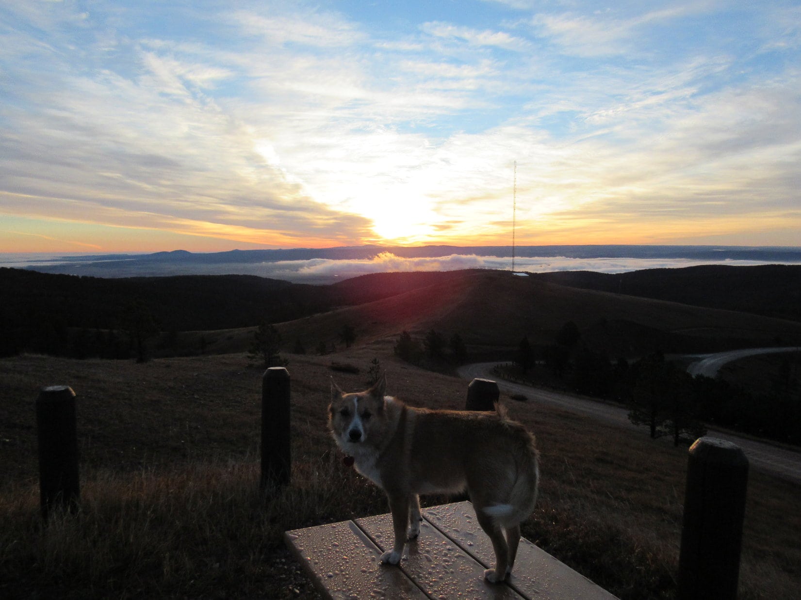
Lupe wasn’t worried.  She wasn’t paying any attention to SPHP at all.  The eastern sky was just beginning to get light, but she could see cows, lots of big, beautiful, black cows, in the pastures along I90.  The cow-crazed American Dingo was busy barking for all she was worth.  A little later on, NW of Sundance along Hwys 14 & 24, there were herds of deer to entertain her, too.

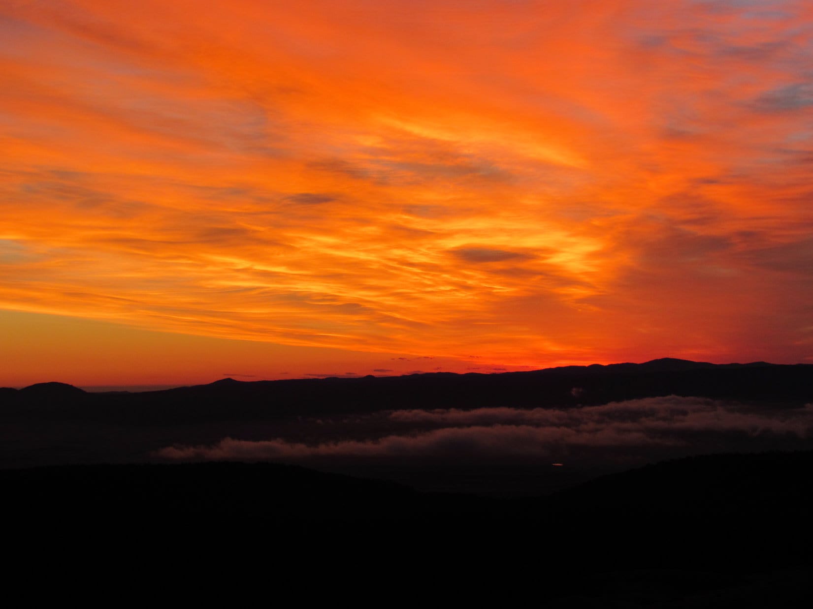
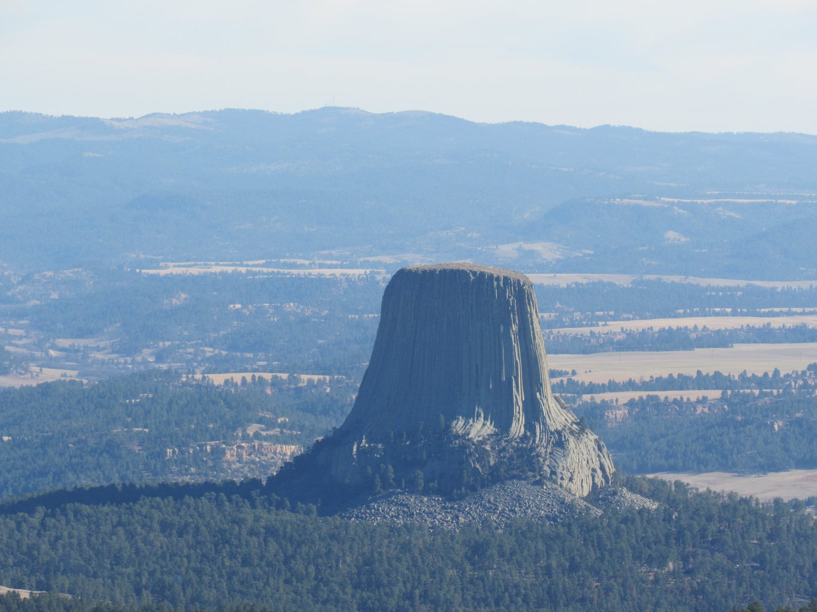
Wyoming Hwy 24 goes right past America’s very first national monument.  Lupe’s first stop of the day was a quick one to see Devil’s Tower (5,112 ft.).  Not a soul was around early on a Sunday morning in November.  The sun’s first rays struck the tower while Lupe was there to see it.

Lupe arrives at Devil’s Tower, America’s first national monument, in time to see the first rays of the morning sun on it. Photo looks W.
Devils Tower plaque along Hwy 24.
Devil's Tower in the early morning light. Photo looks W.
Devil’s Tower in the early morning light. Photo looks W.

Lupe and SPHP didn’t go into the national monument.  Devil’s Tower is one peak Lupe is never going to bag unless she sprouts Dingo Wings.  However, with a little luck, she was going to get to see the top of it today!  After a good look at Devil’s Tower, Lupe and SPHP continued N on Hwy 24.

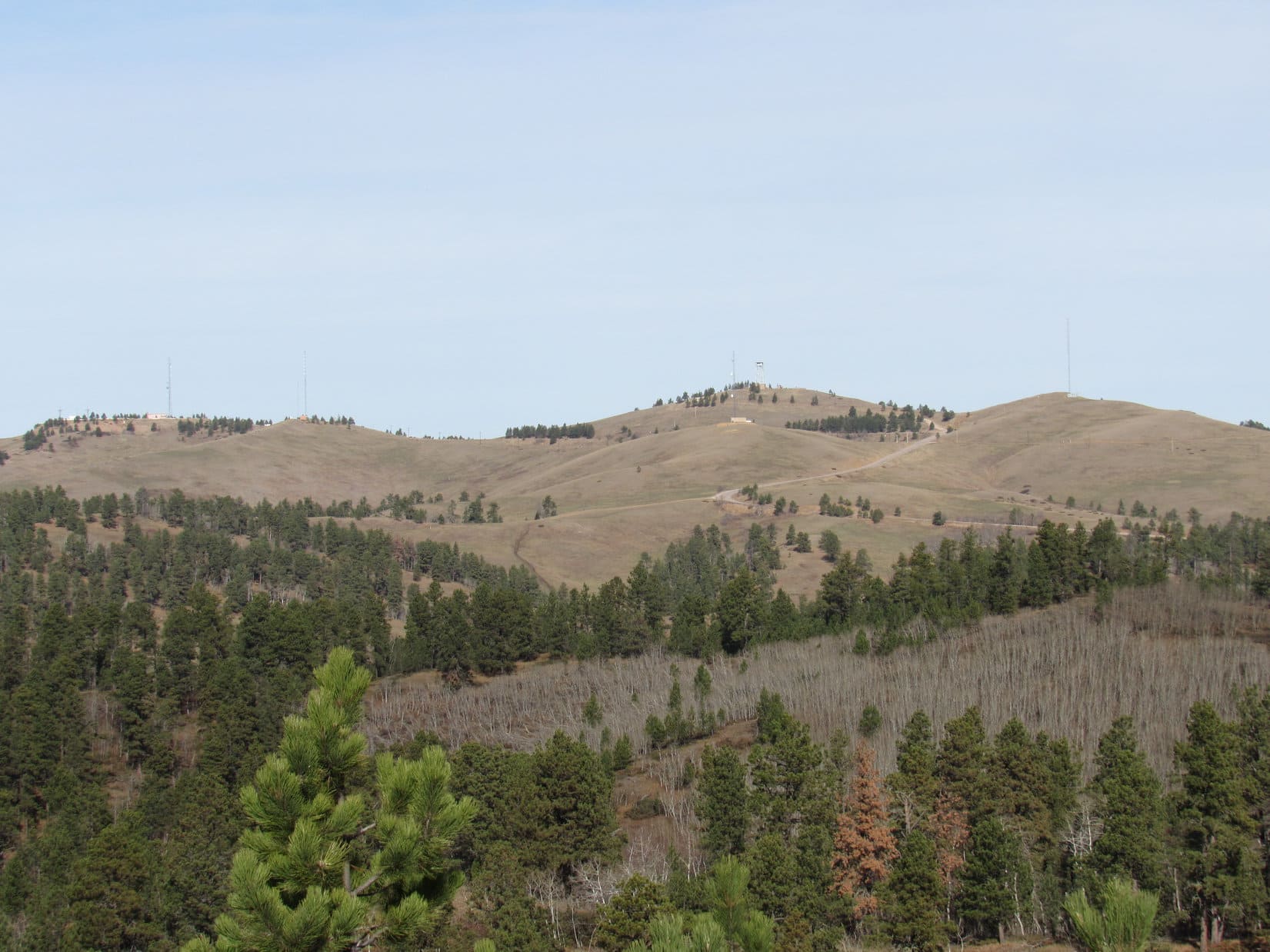
On 3 consecutive Black Hills Expeditions to the Bear Lodge Mountains, Lupe had seen distant views of both Devil’s Tower and the Missouri Buttes from a variety of vantage points.  They are the most famous and dramatic landmarks in the entire NE Wyoming region.  Although climbing Devil’s Tower was completely out of the question for the Carolina Dog, she was here now to try her luck climbing the Missouri Buttes (5,374 ft.).

SPHP had good reasons to believe Lupe might not make it.  There are actually 4 separate buttes in the Missouri Buttes cluster.  All are located within an area covering no more than 2 square miles about 4 miles NW of Devil’s Tower.  The problem was, all of the Missouri Buttes are on private land.  Lupe’s first hurdle was to find and secure permission from the landowner to enter the owner’s private property.

Even if permission could be secured to access the private property, there was another big problem.  The only information SPHP found online about climbing Missouri Buttes was a trip report by PanamaRed on SummitPost.org indicating there was Class 3 & 4 scrambling with some exposure near the top of the highest NW Missouri Butte.  Lupe and SPHP are up for some light Class 3, but anything approaching Class 4 just wasn’t going to happen.

Three miles N of Devil’s Tower junction, Lupe and SPHP left Highway 24 on Barlow Canyon Road.  The gravel road crossed the Belle Fourche River, went a mile N, and then turned W.

Looking S at Devil's Tower from Barlow Canyon Road. Lupe loved this view. Not for the big rock in the distance. All those beautiful black cows were what caught her fancy!
Looking S at Devil’s Tower from Barlow Canyon Road. Lupe loved this view. Not for the big rock in the distance. All those beautiful black cows were what caught her fancy!

SPHP wasn’t certain where to go, but wound up at the Lake Guest Ranch headquarters located near the NW end of Missouri Buttes Lake.  Even though it was early on a Sunday morning, SPHP received a friendly reception from a couple of ranch hands.  The ranch owner was available to talk to!

Lupe on her way to seek permission to climb the Missouri Buttes.

SPHP was invited in to talk to the owner.  The Lake Guest Ranch HQ was a pretty cool place inside.  SPHP was hopeful.  When SPHP explained to the owner why Lupe was here – to seek permission to climb the Missouri Buttes, the response was polite, but firm.  The answer was no.  The owner’s insurance wouldn’t allow it, it was hunting season and dangerous, etc.

The negative response was devastating!  Well, not devastating – there are plenty of mountains in the world Lupe can climb – but it was disappointing.  That was that, though, nothing could be done about it.  Lupe wasn’t going to get to climb the Missouri Buttes.  Until …

Until the Lake Guest Ranch owner said that he didn’t even own the land the 2 highest Missouri Buttes are on.  Didn’t own the land?!  Who did?  It was part of the Nuckoll ranch.  His neighbor J.W. Nuckoll owns the land came the response.  SPHP was given a phone number for the Nuckoll ranch.

Back in the G6, SPHP tried the phone number.  A recording, but no response.  Hmmm.  Didn’t we pass a sign or something for the Nuckoll ranch on the way here, Loop?  I think we did.

Not sure, SPHP.  Unless it was branded on the side of a cow, I wouldn’t have noticed!

Lupe and SPHP drove off from the Lake Guest Ranch looking for the Nuckoll ranch.  Along Barlow Canyon Road, there it was.  A mailbox said Nuckoll, and an old building nearby said something about Nuckoll sheep and wool.  This was it!  A driveway led more than a mile S into a side canyon before ending at two houses.  A sign on the first one said J.W. & Thea Nuckoll.

J.W. was an old-timer.  He was on oxygen, but was friendly when SPHP met him.  SPHP explained why Lupe was here.  J.W. said he had climbed the Missouri Buttes himself.  He had even climbed Devil’s Tower!  That was good, that was very good.  Surely he would understand?

He did!  Mr. Nuckoll agreed to let Lupe and SPHP climb the Missouri Buttes.  He had even more good news.  When SPHP asked how difficult a climb it was, Mr. Nuckoll told SPHP about a trail to the top of the highest NW Missouri Butte.  That sounded great!  SPHP then asked about the NE Missouri Butte, too.  Mr. Nuckoll said it was even possible to ride a horse to the top of the NE butte.  Lupe would have no problem!  SPHP thanked Mr. Nuckoll, and went off to tell Lupe the good news.

In just a few minutes, Lupe was on her way (8:51 AM, 53°F)!  The first part of the hike started farther along the driveway, beyond the two houses.  For a short distance, Lupe was on a road continuing up the little canyon.  There were lots of cows around.  Lupe and SPHP climbed a forested slope heading SSW to avoid them.  Up above, Lupe arrived at the edge of a huge gently sloping field.  The highest NW Missouri Butte (5,374 ft.) was already in view!

Lupe arrives up at the huge, gently sloping field. The highest NW Missouri Butte was already in view. Photo looks SW.

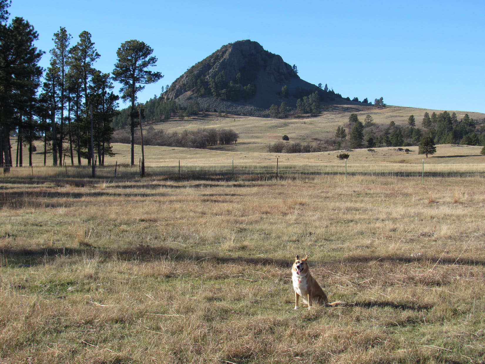
The somewhat lower NE Missouri Butte (5,212 ft.) is closer to Devil’s Tower, and wasn’t any farther away than the highest NW Butte.  Lupe and SPHP decided to go for the NE Missouri Butte first.  Even though the SE end of the butte looked the most rugged, Lupe went over to take a look at it, and see if Devil’s Tower was in view.

Lupe approaching the NE Missouri Butte. Photo looks S.
Devil’s Tower was already in view even before Lupe started her climb up the NE Missouri Butte. Photo looks SE.
Looking NE before climbing the NE Missouri Butte.
The SE end of the NE Missouri Butte as seen from the N. The highest part of the NE Missouri Butte is close to this end, but the butte is much more easily climbed from the NW.

The SE end of the NE Missouri Butte was quite steep and rocky, but it didn’t look impossible to climb up from here.  However, Lupe had already seen that the NW end of the butte was definitely easier.  Lupe and SPHP went back around to the NW end, where Lupe made her ascent.

Slippery pine needles on a moderately steep slope were about all Lupe had to contend with going up.  Before long, Lupe was at the true summit of the NE Missouri Butte, which proved to be near the SE end of the ridge.  An old wooden cross was sticking up from a summit cairn near some of the highest rocks.  The panoramic views toward the E were spectacular!

Of course, Devil’s Tower was the most striking landmark in view.  Much farther away, Warren Peaks (6,650 ft.) and Inyan Kara (6,360 ft.) could be seen, too, although they didn’t show up all that well in the morning haze.  Long pine-covered ridges with yellow cliffs, and the Belle Fourche River valley were off to the NE.  To the W, Lupe could see her next peakbagging goal, the NW butte, which is highest of all the Missouri Buttes.

Lupe at the summit of the NE Missouri Butte. Photo looks SE.
The highest NW Missouri Butte as seen from the 2nd highest NE Missouri Butte. Photo looks WNW.
Looking ESE from the summit.
The highest NW Missouri Butte again. A small part of Missouri Buttes Lake is in view along with the HQ of the Lake Guest Ranch. Photo looks W.
The Lake Guest Ranch HQ using the telephoto lens. Photo looks WSW.
Long pine-covered ridges with yellow cliffs dominated the views to the NE.

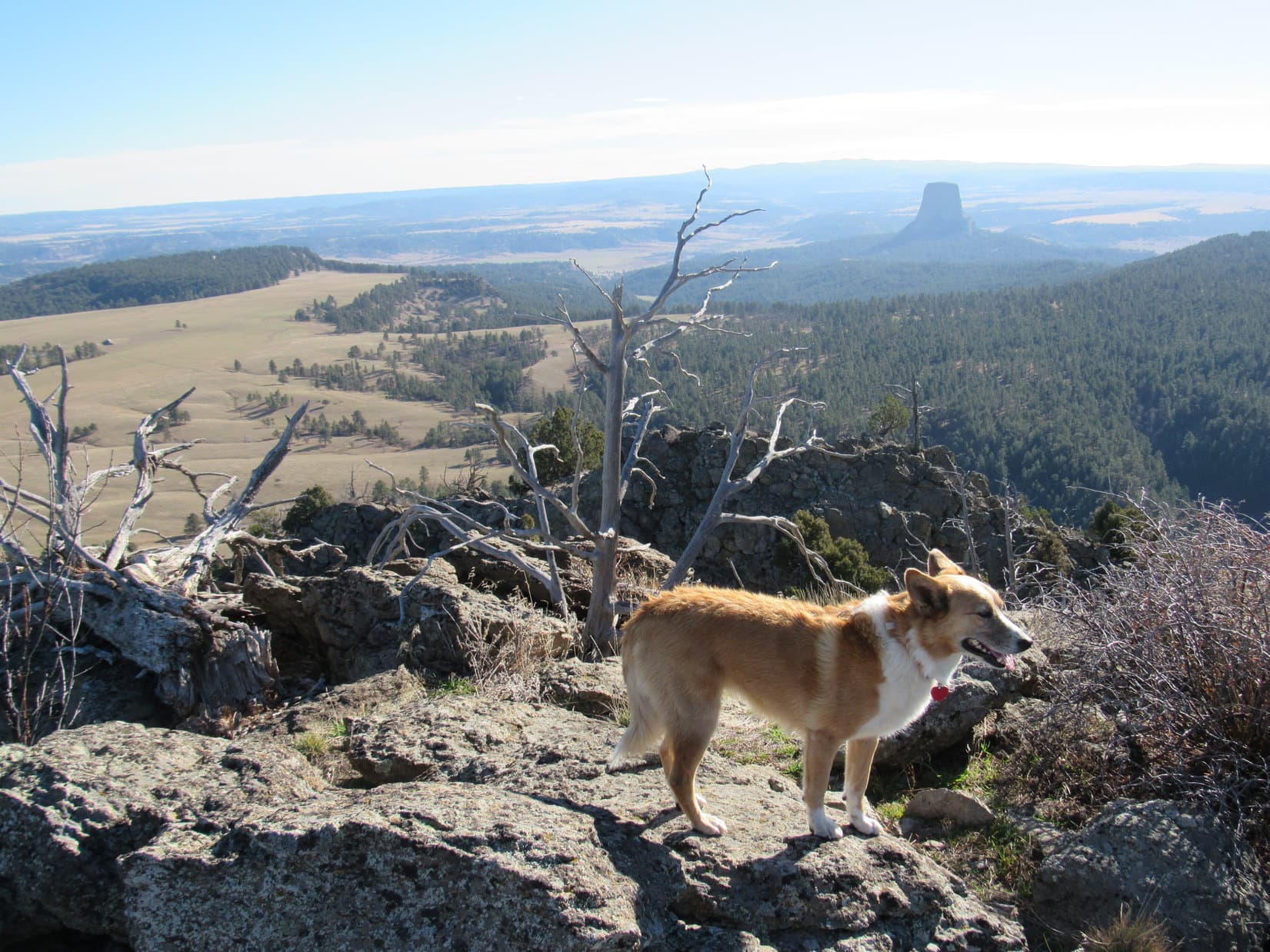
Lupe and SPHP took a break up on NE Missouri Butte.  The views were really awesome.  It was so wonderful that Mr. Nuckoll had granted Lupe permission to come and see this unique scene.  Lupe could see the top of Devil’s Tower from here!

What a sight! Lupe could see the top of Devil's Tower from NE Missouri Butte. She didn't even have to climb the tower or take a helicopter up to see it. Photo looks SE.
What a sight! Lupe could see the top of Devil’s Tower from NE Missouri Butte. She didn’t even have to climb the tower or take a helicopter up to see it. Photo looks SE.
Looking SSW at a couple of the lower Missouri Buttes.

After 45 minutes spent enjoying the summit of the NE Missouri Butte, it was time for Lupe to go see if she could find the trail Mr. Nuckoll spoke of leading to the top of the highest NW Missouri Butte.  Lupe went down the W slope of the NE Missouri Butte, and crossed the saddle over to the NW butte.

A big gash was visible on the NE side of the NW Missouri Butte, but it looked mighty steep and straight.  Mr. Nuckoll had spoken of the trail up the butte making a sharp turn.  SPHP didn’t think Lupe should try going up that NE gash.  It didn’t look like there was any way a trail could make a sharp turn from there.

The post by PanamaRed on SummitPost.org didn’t say what route he had taken to the top, but SPHP had the impression from photos PanamaRed posted that he had climbed up from the NW.  If that led to Class 3 & 4 scrambling, Lupe wouldn’t succeed in going up that way either.

Lupe started up the NW Missouri Butte from a boulder field at the base of the N face.

Lupe starts up the highest NW Missouri Butte. She went up the boulder field and then climbed through the trees to the base of the cliff. She then worked along the base of the cliff to the W (R). Photo looks SSW.

Lupe climbed up beyond the boulders into a zone of trees and bushes.  It was steep going, but still doable.  The worst part was the incredible number of low thorny bushes.  They didn’t seem to bother Lupe, but SPHP had to watch carefully before grabbing on to anything.

When Lupe reached the base of the cliff, she worked her way to the W, still climbing steeply all the way among trees and thorny bushes.  Her route led toward a couple of large rock protrusions sticking out to the N.  About the time she got close to the first big rock formation, Lupe reached some steep grassy ground above most of the trees and thorny bushes.

It looked like there was a route continuing W (R) up a channel between rock formations.  How high up this route went was difficult to see, although it looked like it might be possible to make a sharp turn to the E (L) near the top.  Maybe that was the way to go?  While pondering, SPHP suddenly realized Lupe was already on a very faint trail.  The barely discernable trail went steeply up a ramp toward the E (L) from here.

Maybe it was best to check out the ramp first?  The ramp went up to a high point where sunlight could be seen.  May as well see what was on the other side of that high point, before attempting to negotiate the rocky channel.

The ramp was a relatively easy climb.  In just a few minutes, Lupe and SPHP were at the top.

Lupe sits on a rock just above the top of the ramp. Photo looks W, back in the direction she came up the ramp. The ramp itself is not shown.
This view greeted Lupe at the top of the ramp on the N face of NW Missouri Butte. The NE Missouri Butte, where she had just been, is seen on the L. It turned out that the ramp did not end here. It made a sharp turn to the S (R) in front of the little tree that looks like it is growing out toward Devil's Tower. The ramp then leveled out, becoming an easy walk as it went S along the upper NE face of the butte. Photo looks SE.
This view greeted Lupe at the top of the ramp on the N face of NW Missouri Butte. The NE Missouri Butte, where she had just been, is seen on the L. It turned out that the ramp did not end here. It made a sharp turn to the S (R) in front of the little tree that looks like it is growing out toward Devil’s Tower. The ramp then leveled out, becoming an easy walk as it went S along the upper NE face of the butte. Photo looks SE.

Devil’s Tower and the NE Missouri Butte, where Lupe had just been, were both in view from the top of the ramp.  Peering S around the corner to the NE side of the butte, SPHP was surprised and pleased to see that the ramp continued.  It leveled out quite a bit as it traversed the NE face of the butte.

The ramp’s continuation was an easy walk, but didn’t go very far.  It soon ended at place where a few rocky steps up brought Lupe onto the moderately sloping NE part of the summit area.  The good news was that Lupe was almost to the top!  A short walk through a forest of junipers would take her to the summit of the highest NW Missouri Butte.  Her peakbagging success was assured!

The bad news was that Lupe’s nemesis was here, too, in great profusion!  The first thing SPHP saw upon gaining the summit area was cactus.  Lots of big cacti clusters were scattered around.  Lupe would have to be carried the rest of the way to the true summit.

Cacti like these grew in large patches scattered around the summit area. Lupe had to be carried the last 150 feet to the true summit of the NW Missouri Butte.

So, Lupe wound up being toted the last 150 feet to the true summit of the highest NW Missouri Butte.  She took her summit break there, under strict orders not to move around.  She wanted to be where SPHP was anyway, so it all worked out fine.

Lupe reaches the summit of the NW Missouri Butte, the highest of them all! Photo looks NNE.
There was an old radio tower on top of the NW Missouri Butte. The shack was unlocked and open. It was full of dirty, apparently unusable, old electronic equipment. Much of the summit area on NW Missouri Butte is covered with juniper trees like those seen here, although the area of the true summit where Lupe is, was largely free of them.

PanamaRed had posted a photo of the Missouri Buttes USGS survey benchmark, but at first SPHP didn’t see it.  A brief search revealed it partially hidden by a bush along the very NW edge of the summit, a little way W of the highest rocks.

This Missouri Buttes USGS survey benchmark was partially hidden by a bush along the very NW edge of the summit area. It was not right at the highest rocks.
The Missouri Buttes USGS survey benchmark is seen at (Center) near the bottom of this photo. Photo looks W.

The best views from the NW Missouri Butte in the vicinity of the true summit were the panoramic views to the W and N.  Junipers blocked the views in other directions.  Even though the air was rather hazy, it was still possible to see the outline of the Bighorn Mountains to the W.  Off to the NW and N, there was nothing higher than NW Missouri Butte anywhere in sight.

Lupe near the true summit. Photo looks W. The Bighorn Mountains could be seen on the horizon, but don't show up in the photo. Lupe assures you, they are out there!
Lupe near the true summit. Photo looks W. The Bighorn Mountains could be seen on the horizon, but don’t show up in the photo. Lupe assures you, they are out there!
Looking down at land immediately to the W of NW Missouri Butte. Missouri Butte Road leads right to the NW Missouri Butte, but may not be entirely on the Nuckoll ranch. Access to it was from the road leading to the Lake Guest Ranch. Lupe didn't start her trek from down there anyway, although it would have been a much closer starting point.
Looking down at land immediately to the W of NW Missouri Butte. Missouri Butte Road leads right to the NW Missouri Butte, but may not be entirely on the Nuckoll ranch. Access to it was from the road leading to the Lake Guest Ranch. Lupe didn’t start her trek from down there anyway, although it would have been a much closer starting point.
Thanks to Mr. Nuckolls kindly granting permission to be on his land, Lupe got to visit the top of this highest Missouri Butte. Photo looks NE.
Lupe at the true summit. There were cliffs just beyond the rocks. Photo looks N.
Cliffs along the N edge. Photo looks NE.

After 25 or 30 minutes relaxing near the true summit, it was time to explore the SW part of the summit area, which was hidden by juniper trees.  SPHP had to carry Lupe for fear of the cacti, but she didn’t mind getting a free ride.  From the SW end of the summit area, it was possible to see the Lake Guest Ranch HQ and Missouri Butte Lake.

Missouri Buttes Lake and the Lake Guest Ranch HQ (seen to the R of the lake). Photo looks SW.

Lupe also had a clear view of the 2 lower S Missouri Buttes.

The 2 lower S Missouri Buttes as seen from the SW end of the NW Missouri Butte summit. Photo looks S.

Lupe and SPHP returned to the summit for a final look around.  Lupe then got carried back down to the NE end of the summit area near the start of the ramp.  Before taking the ramp down, Lupe checked out the views from this end of NW Missouri Butte.

Lupe at the NE end of the NW Missouri Butte summit. She had a fabulous view of the NE Missouri Butte (L) and Devil's Tower (R) from here. Photo looks ESE.
Lupe at the NE end of the NW Missouri Butte summit. She had a fabulous view of the NE Missouri Butte (L) and Devil’s Tower (R) from here. Photo looks ESE.
Looking SE.
Devil's Tower from NW Missouri Butte. Photo looks SE.
Devil’s Tower from NW Missouri Butte. Photo looks SE.
Looking E at NE Missouri Butte.

Lupe took the ramp all the way back down to its beginning on the steep grassy slope near the large rock protrusions where SPHP first noticed the very faint trail.  Now that it was clear there actually was a trail, it was possible to see it continuing on down the mountain.

The trail went down to a much larger boulder field than the one Lupe had crossed coming up.  This area was well to the W of the area of trees and thorny bushes below the cliff Lupe had been in earlier.  Lupe went all the way down the boulder field, passed through a couple of stands of trees, and reached the pasture below the N face of NW Missouri Butte.

From near a stock pond, it was possible to get a good look at the best route up the mountain.

View along the cliffs near the top of the N face of NW Missouri Butte. Note the orange coloration on some of the rocks. (Probably orange lichens.) Photo looks W as Lupe was about to go down the steep part of the ramp (not pictured).
Lupe makes it down off the butte. NE Missouri Butte is in view beyond the stock pond. Photo looks E.
The easiest route up the NW Missouri Butte is visible in this photo taken from near the stock pond. Photo looks S at the N face of the butte. The easiest route up is through the trees on the W (R) to the loose rocks. Climb the loose rocks up to the trees below the orange spot near the center of the top of the butte. From there, the ramp leads to the E (L) up along the trees and bushes seen to the L of the orange spot. The ramp then curls around the E (L) side of the mountain (out of view) to gain the NE slope of the summit area. Easy, squeezy! Class 2 or Class 3 Lite all the way!
Lupe and SPHP originally came up through the trees and thorny bushes from the lower L. Not the best way to do it! Come up from the R, get through the trees to the steep grassy area below the orange spot, then go L up the ramp. The trail should become visible while still among the loose rocks before reaching the trees below the orange spot. Photo looks N.

Lupe had climbed both the highest Missouri Buttes.  Her Expedition No. 181 was an unqualified peakbagging success!  However, there was still a lot of daylight left.  Why not go take another look from the top of the NE Missouri Butte?  A few hours had gone by, and the sun would be shining from another angle.  There was only a little bit of cactus up there that SPHP had seen at the far SE end.  Lupe could avoid it easily.

Lupe was fine with going back up.  So once again, she climbed the W slope and then followed the summit ridge SE to the top of the NE Missouri Butte.  With the afternoon sun now lighting up the near side of Devil’s Tower, the view was even better than earlier in the day.

Devil's Tower in the afternoon sun from NE Missouri Butte. Photo looks SE using the telephoto lens.
Devil’s Tower in the afternoon sun from NE Missouri Butte. Photo looks SE using the telephoto lens.
Inyan Kara Mountain is seen faintly on the far R horizon.
Hmmm. That Carolina Dog looks a bit familiar! So does that odd tree stump-shaped rock in the distance.

Devil's Tower from NE Missouri Butte, WY 11-6-16Lupe on NE Missouri Butte, WY 11-6-16Lupe and SPHP spent another 30 beautiful minutes up on the NE Missouri Butte.  Then it was time to call it a day.  SPHP had told Mr. Nuckoll that it would be great to get a chance to talk to him some more when Lupe returned from Missouri Buttes.  It was probably best to get there well before the Nuckolls wanted to have their supper.

Lupe left NE Missouri Butte for the 2nd and final time.  She liked crossing the huge, wide open pasture, and going through the forest on the way back.  Before long, she was back at the Nuckoll’s house (3:26 PM, 55°F).

Looking S at one of the lower Missouri Buttes on the way down the NE Missouri Butte.
NW Missouri Butte on the way back. Photo looks W.

No one was around.  SPHP checked both homes, but there was no one to thank for the wonderful day Lupe had on the Missouri Buttes.  No telling where the Nuckolls had gone, or when they might return.  SPHP left a note in the door.

Then a very lucky American Dingo, one which had been to the top of the two highest Missouri Buttes, enjoyed a noisy evening drive past herds of cattle and deer on her way home.Lupe on NE Missouri Butte, WY 11-6-16Links:

Next Black Hills Expedition                Prior Black Hills Expedition

Want more Lupe adventures?  Choose from Lupe’s Black Hills Expeditions Adventure Index or Master Adventure Index.  Or subscribe free to new Lupe adventures.

Black Hills, WY Expedition No. 180 – Warren Peaks, Bull Hill, Ragged Top & Lone Tree Hill (10-30-16)

Fog!  Must be just a ground fog, though.  Stars could still be seen above.  With any luck at all, we’ll drive out of it, Loop.  Lupe whined.  She couldn’t see them, but she could smell ’em.  Cows were hidden out there in the foggy darkness!  The Carolina Dog barked, leaping from window to window trying to catch sight of them.

On the way up to Warren Peaks, the G6 did emerge from the fog.  Lupe was going to get to see sunrise from the highest point in the Bear Lodge Mountains after all!

Sunrise from Warren Peaks. The dark outline of the Black Hills in South Dakota is on the horizon. Photo looks ESE.

It was cool and a bit windy when Lupe arrived up on Warren Peaks (6,650 ft.) (7:18 AM, 38°F).  For almost the end of October, conditions were actually exceptionally nice.  Off to the ENE, Lupe could see a thin layer of very low clouds.  That had to be part of the fog she’d gone through to get here.  To the W, the Bear Lodge Mountains were acting like a dam, holding back a sea of more substantial low clouds.

Very low, thin clouds were in view to the ENE. They were part of the ground fog Lupe had traveled through to get here. Photo looks ENE.
Lupe on the highest rocks on the mountain near the Warren Peaks fire lookout tower.

Lupe and SPHP watched the sunrise develop.  Just for fun, Lupe took a little stroll down to a slightly lower hill SE of the fire tower.

The Warren Peaks fire tower from the barren hill to the SE.

Lupe returned to the summit of Warren Peaks.  Sunrise was taking longer than anticipated.  The sun was above the horizon, but obscured by clouds.  SPHP was still interested in watching the display, but Lupe was ready for action!

The sun was up, but obscured by clouds.
Lupe on a picnic table waiting for SPHP to lose interest in the sunrise. It was time to get going!

This was Lupe’s third expedition in a row to the Bear Lodge Mountains in NE Wyoming.  Once again, she had 3 peakbagging goals for the day.  The first one was Bull Hill, only a mile N of Warren Peaks.

The big rounded partly bare hill seen beyond Lupe is Bull Hill, Lupe’s first peakbagging goal on Expedition No. 180. This photo was taken a week before when Lupe visited Warren Peaks on Expedition No. 179. Photo looks N from Warren Peaks.

When SPHP finally quit dawdling watching the sunrise, Lupe and SPHP drove N on USFS Road No. 838.  Before going to Bull Hill, SPHP wanted to check out a viewpoint a short distance NW of Warren Peaks, the same viewpoint where Lupe had seen Devils Tower and Missouri Buttes in twilight at the end of the day on Expedition No. 179.  Now that it was morning, maybe it would be possible to get a clearer view?  (7:49 AM, 38°F)

Heh.  No view at all.  The white sea of low clouds trapped to the W of the Bear Lodge Mountains blanketed all of the territory in that direction.  Lupe and SPHP went on.  SPHP parked the G6 near the intersection of USFS Roads No. 838 and No. 847 (8:06 AM, 38°F).

Getting to Bull Hill (6,394 ft.) was easy.  Lupe trotted E down USFS Road No. 847 to a side road with a Bull Hill Road sign.  She followed Bull Hill Road around the N side of a forested ridge, then SE up the Whitetail Creek valley.  Bull Hill Road curved E, going up and over a saddle.  At the saddle, Lupe was directly S of Bull Hill.  She left the road, climbing up a pasture to the open forest at the top of the mountain.

Lupe on Bull Hill. The fire tower on Warren Peaks is seen in the distance. The cairn and pipe next to Lupe were a little W of the highest point on Bull Hill. Photo looks S.
Lupe stands near the highest point on Bull Hill. Photo looks ENE.

Lupe and SPHP explored the top of Bull Hill.  Toward the E was a nice view of Crow Peak (5,787 ft.) in South Dakota, but Lupe had just seen essentially the same view from even higher Warren Peaks.  After a short stay on Bull Hill, Lupe headed back to the G6 (9:31 AM, 45°F).

Lupe’s next peakbagging goal, Ragged Top, was back to the S a few miles, not really all that far away.  After a short drive, SPHP parked the G6 at the intersection of USFS Road No. 838 and an unmarked road on the E side of No. 838.  (This intersection is a few hundred feet N of the start of No. 838.1B on the W side of No. 838, and marked as 6,374 ft. elevation on the Peakbagger.com topo map.)

To get to Ragged Top (6,260 ft.), Lupe didn’t really have to gain any elevation at all.  In fact, she would lose a little on the way there.  Ragged Top is the high point at the SW end of a mile long ridge.  The G6 was already parked near the higher NE end of the ridge.  Lupe cut through the forest on the W side of USFS Road No. 838 to reach No. 838.1B.  She followed the road SW toward Ragged Top.

Lupe on USFS Road No. 838.1B on her way to Ragged Top. Photo looks SW.

USFS Road No. 838.1B ended at a meadow at a high point.  Lupe was more than half way to Ragged Top, but would have to do some bushwhacking from here.  American Dingoes are great at bushwhacking!  Lupe descended into a saddle leading to a lower forested hill along the ridge.

Lupe in the meadow where USFS Road No. 838.1B ended. She was a little over halfway to Ragged Top here. Next she had to descend into the saddle leading to the forested hill seen beyond her. That hill was part of the main ridgeline leading to Ragged Top, and where she would encounter the first significant rock outcroppings on the way. Photo looks SW.

The saddle area was forested, too.  What’s more, the forest floor was densely carpeted with low juniper bushes.  Lupe found easier traveling over less vegetated ground along the SE side of the ridge.  When Lupe climbed up the forested hill on the SW side of the saddle, she reached the first significant rock outcroppings.

Lupe on the first significant rock outcropping she encountered on her way to Ragged Top. Photo looks SW.

From here on, the now undulating ridge to Ragged Top was much narrower than before.  Lupe passed by, or went over, several more rock formations along the way.  The last part of the ridge turned S as Lupe approached the final high point – the small summit known as Ragged Top.  Soon Lupe was surveying the situation from the top of Ragged Top.

Lupe surveys the world from the top of Ragged Top! Photo looks N.
Lupe on Ragged Top. Photo looks NE.

The best views were actually from rocks farther S where the ridge ended.  Lupe could see both Inyan Kara (6,360 ft.) and Sundance Mountain (5,824 ft.) beyond a bank of clouds sneaking out to the E from the sea of clouds to the W.

Inyan Kara (Center - on the horizon) from a bit S of the Ragged Top summit. Photo looks S.
Inyan Kara (Center – on the horizon) from a bit S of the Ragged Top summit. Photo looks S.
Sundance Mountain (L just beyond the clouds). Photo looks SE.

Lupe was still at the S viewpoint, when a sudden loud explosion echoed up from the valley below!  Gunfire!  Lupe ran to SPHP.  That was it for the photo session.  More gunfire rang out every few minutes.  No way Lupe was letting SPHP get more than a foot away.  The final photo of the Ragged Top summit, taken from the S, had to be Lupe-less.

S face of the Ragged Top summit. There was supposed to be a courageous Carolina Dog poised dramatically atop the highest rocks, but loud gunfire put an end to that notion. Photo looks N.

Lupe had made it to Ragged Top, but she didn’t want to be there now!  With gunfire going on sporadically, all she wanted to do was hide.  Time to get the Carolina Dog out of here!  SPHP led the way back to the G6.

When Lupe reached the forested saddle again, she decided to slink along hidden pathways between the low juniper bushes that dominated the forest floor.  In this manner, she slunk along all by herself clear up to the edge of the meadow where USFS Road No. 838.1B had ended.  As far as the American Dingo was concerned, her slinking worked just fine!  Lupe didn’t get shot.  Not even once.

At the meadow, Lupe and SPHP took a break.  Lupe curled up on SPHP’s lap, so SPHP could pet her and hold her.  This was most reassuring.  It certainly helped that the gunfire stopped, too.  Lupe and SPHP shared a chocolate coconut granola bar.  Things were looking up!  Things were also looking like a mess.  SPHP noticed Lupe treasures scattered along the edge of the forest.

Cleanup ensued.  As Lupe and SPHP continued back to the G6, more Lupe treasures were encountered, this time in the form of empty shotgun shells.  By the time Lupe was back at the G6 (12:07 PM, 55°F), she had two grocery sacks full of treasures.

Warren Peaks from near USFS Road No. 838.1B on the way back to the G6. Photo looks N.

Lupe had one more peakbagging goal for Expedition No. 180, but it was a long way N from here.  On the way, Lupe and SPHP stopped again (12:15 PM, 55°F) at the viewpoint NW of Warren Peaks where she had seen Devils Tower (5,112 ft.) and Missouri Buttes (5,374 ft.) a week ago.

The clouds were gone!  Devils Tower and Missouri Buttes were in view to the NW.  The air was rather hazy, but it was much easier to see them now than at sundown last week.

Devils Tower and Missouri Buttes from the viewpoint NW of Warren Peaks. Photo looks NW using the telephoto lens.

Lupe had a great time in the G6 traveling N to start her journey to her 3rd and final peakbagging goal of the day.  She rode with her head out the window, with the wind in her face.  She saw lots of deer in the forest, plus cows to bark at near Hwy 24.

When SPHP finally parked the G6 (1:17 PM, 61°F) again, Lupe recognized this place.  She had been here before.  She was at the intersection of Planting Spring Road (USFS Road No. 881.1) and USFS Road No. 830.  Two weeks ago on Expedition No. 178, she had stumbled onto this junction on her way to Bald Mountain (4,800 ft.).  Now it was the starting point for her journey to Lone Tree Hill (4,600 ft.).

The first part of Lupe’s route to Lone Tree Hill she had already been on before.  Lupe and SPHP set out going WNW on USFS Road No. 881.1.  Almost right away, Lupe passed by a rather elaborate tent and camper setup on the N side of the road.  Several guys planning on going deer hunting occupied the camp.

Once past the hunters, Lupe had a blast running around in the woods along No. 881.1.  She made good time to the intersection with USFS Road No. 881.1A, which leads to Bald Mountain.  Lupe did not take the turn to Bald Mountain, staying instead on No. 881.1.  The road quickly turned N.

No. 881.1 eventually angled NW for a while.  When it finally turned W, Lupe could see sky between trees at the far end of a slight rise ahead.  Lupe was about to reach the W edge of the large flat ridge she had been traveling along.  Lone Tree Hill (4,600 ft.) was supposed to be off to the NW beyond the edge of the ridge.  Would she be able to see it?

The Peakbagger.com topo map showed No. 881.1 ending (near elevation 4,768 ft.) before reaching the edge of the ridge.  The road didn’t actually end.  Instead, it curved SW on its way down to a somewhat lower area.  Lupe and SPHP left the road going W through the forest, and up the slight rise.

Lupe reaches the W edge of the big, relatively flat ridge she had been traveling. This photo looks SW, the only direction with a relatively clear view. Devils Tower is seen faintly on the horizon above Lupe’s ear. Missouri Buttes are on the R.

Lupe arrived at the edge of a N/S running line of small cliffs.  There weren’t any discernable breaks in the cliff line.  Due to the forest, the only relatively clear view was off toward the SW, where Lupe could see Devils Tower and Missouri Buttes on the far horizon.

It was hard to see between the trees, but there did seem to be a large hill off to the NW where Lone Tree Hill should be.  That had to be it!  Lone Tree Hill appeared to be poorly named.  Although some of the slopes below the line of rock at the summit were bare or sparsely forested, there were plenty of trees on Lone Tree Hill.

Aptly named or not, from a distance Lone Tree Hill looked like an easy climb.  There was one problem, though.  Lone Tree Hill stood off by itself a mile NW of the ridge Lupe was on.  How could Lupe get safely down off these cliffs to cross the low ground between here and there?

The topo map showed only one semi-promising route nearby.  A ravine to the NE trended W to the lower ground Lupe needed to reach.  SPHP hesitated.  No. 881.1 had turned SW where Lupe had left it, heading down toward lower territory, too.  Maybe the road would take Lupe safely down below the cliffs?  That might be a lot easier than bushwhacking through a steep ravine!

Lupe and SPHP left the cliff edge to return to No. 881.1.  Once there, Lupe followed it SW.  The road lost some elevation, but then started to level out and turn S.  It looked like it was going to continue S, staying above a band of cliffs.  Hmmm.  Not good.  Lupe left the road briefly, entering a small ravine leading W.  No dice.  The ravine quickly cliffed out.  The drop was only 15 or 20 feet.  Didn’t matter, it may as well have been 10 times that much.

OK.  The ravine to the NE really was the only reasonable possibility.  Of course, there must be other routes, but they would all be significantly longer.  Lupe had made good time getting to the cliffs.  Even so, it was late enough in the day so the amount of time left before sunset was something to keep in mind.  The afternoon was clouding up.  It wouldn’t be a good idea to still be wandering around in a trackless forest trying to find and bushwhack back up a steep ravine after dark, especially with no moon or stars to help stay oriented.

Better get a move on!  Lupe and SPHP headed back up the road.  Lupe regained all her lost elevation, before leaving the road again to go try the ravine to the NE.  The ravine started out fine.  Gradually, Lupe lost elevation again.  She found an animal trail to follow.  Rock formations appeared on the slopes of the ravine, but Lupe didn’t come to any cliffs on the way W.

The NE ravine route worked!  Lupe lost over 400 feet of elevation.  She found herself safely down in a tall grove of white-barked aspens where the ground leveled out.  She was actually having a great time exploring this remote forest.  SPHP was confident Lupe was going to successfully climb Lone Tree Hill now!

Lupe had been going W down the ravine.  Now it was time to turn NW.  The tall aspens gave way to a forest of scrub oak.  Lupe romped around among fallen leaves looking for squirrels in the oak trees.  She found several squirrels, much to her delight and the squirrels’ annoyance.  Sometimes scrub oaks grow in dense clusters, but this forest was more open than that.  It wasn’t hard to move around.  Lupe was making great progress again.

Exploring the scrub oak forest.

Lupe turned N upon reaching a long saddle leading to Lone Tree Hill’s S Ridge.  By climbing the S ridge, Lupe could get to the lower E end of Lone Tree Hill’s summit ridge.  As Lupe progressed along the saddle, she encountered areas of open ground interspersed between stands of forest.

Lupe was making progress! As she got to the saddle leading to Lone Tree Hill’s S ridge, she came to this view of Lone Tree Hill up ahead. Photo looks NNW.

Lupe reached the S ridge.  Her climb up Lone Tree Hill was about to begin in earnest.  She immediately encountered a new obstacle.  The scrub oak forest was now behind her, and the S ridge leading up was all pine forest.  At least it had been.  The pine forest was devastated!

A tangle of dead trees, most laying perpendicular to Lupe’s route, was blocking the way forward.  It looked like a tornado had hit this place!  The trunks of many trees had simply snapped.

As Lupe started her climb up the S ridge, her route was blocked by a devastated pine forest.

Progress became excruciatingly slow, as Lupe and SPHP struggled over, under, and around the deadfall timber.  Fortunately, the S ridge wasn’t very long.  Lupe only had to gain 200 feet of elevation to reach the lower E end of Lone Tree Hill’s summit ridge.  This was taking forever, though!  SPHP started to worry about how much time was going by.

Slowly, ever so slowly, Lupe and SPHP picked a way up through the shattered forest.  “Lone Tree” Hill, indeed!  If, only!  That “Lone Tree” term had been used rather loosely, hadn’t it?  As in, “Lone Tree” means less than 10,000 trees.  Silly SPHP had been expecting like, maybe, one tree – perhaps a few more, if one counted little trees springing up around the big one.  Not this!  Who had named this place, anyway?  Must have been an Indian 300 years ago.  The name hadn’t been justified in at least that long.

As Lupe starting getting close to the E ridge, the deadfall gradually diminished.  Then, finally, she was out of it.  Hallelujah!  Lupe reached the lower E end of Lone Tree Hill’s summit ridge.  The top of the mountain was in view not too far to the W.

Lupe reaches the lower E section of Lone Tree Hill's main E/W trending summit ridge. The top of the mountain is in view to the W. Photo looks W.
Lupe reaches the lower E section of Lone Tree Hill’s main E/W trending summit ridge. The top of the mountain is in view to the W. Photo looks W.
Getting closer! There was actually a fair amount of deadfall timber near the top of Lone Tree Hill, but nothing like what Lupe had already come through on the S ridge.

Lupe started making good progress again.  She headed for the higher W portion of Lone Tree Hill’s summit ridge.  Near the top, she encountered more deadfall timber.  The deadfall slowed SPHP down, but not Lupe.  Lupe went straight to the top of the mountain.  She had made it!  Lupe stood on the summit of Lone Tree Hill.

Lupe reaches the summit of Lone Tree Hill! Photo looks SE in the direction she came from to get here. The ravine she came down along the distant ridge is a bit hard to see from this angle, but is almost directly above her. Just to the L of that ravine is the part of the big flat ridge where the Peakbagger.com topo map shows High Point 4801.
Looking S from the true summit.

The true summit of Lone Tree Hill was a bit W of where Lupe had come up.  The mountain featured a band of rock and very small cliffs along the S edge of the summit ridge.  Views toward the S were generally quite good.  By moving around the summit, it was possible to see a long way in almost any direction.

The S edge of the summit ridge featured a band of very small orange-yellow cliffs. Photo looks ESE toward High Point 4801 (R).
The top of Lone Tree Hill had some deadfall timber, but it wasn’t too bad. Photo looks E.

The far W end of the summit ridge was a bit lower than the rest of it, but had hardly any trees.  Lupe had a 270° panoramic view from here!  It was a great place to take a break, and celebrate Lupe’s final peakbagging success of the day.

Lupe reaches the far W end of the Lone Tree Hill summit ridge. She had 270° panoramic views from here. Missouri Buttes are on the far horizon directly above Lupe. The top of Devils Tower pokes above the forested ridge on the L. Photo looks SW.
Looking SSW.
Looking SSW.
Looking NW.
Looking NW.

Lupe and SPHP shared water and chocolate coconut granola bars.  Lupe had her Taste of the Wild.  SPHP consumed an apple.  The sun was getting lower, but Lupe would have time to get back to the road before dark.  Actually, it was getting hard to even tell where the sun was.  The sky, which had been at least partly sunny and blue in the morning, was now a boring, indistinct, gray smudge in almost every direction.

Lupe lingered on Lone Tree Hill as long as possible.  Best to enjoy the moment!  Lone Tree Hill was the type of small peakbagging objective that Lupe might well never ever return to again.  It was sort of far from home, sort of hard to get to, and there are higher and more dramatic places to go.

Yet, being on Lone Tree Hill was great!  The sweeping views of the wide open spaces, forested hills, and long dark ridges of remote NE Wyoming were wonderful.  And even if the pine trees weren’t alone on Lone Tree Hill, Lupe and SPHP were.  The solitude and serenity was unbroken, except by the distant mooing of cattle and occasional twittering of small birds.  Lone Tree Hill was good for the spirit.

As it always does, the time came to start for home.  No devastated S ridge for Lupe this time, though!  It would be much easier to head right on down the mostly barren S slope of the mountain from the W end of the summit ridge.  Lupe was ready.  The return trip was something to look forward to, too!

Lupe starts down Lone Tree Hill, eager for more adventures on the long way back to the G6.

The busy American Dingo made the most of the return trip.  She stopped frequently on her way down the mountain to scan the scene below.  She streaked across meadows, sniffed around in forests, barked at squirrels, saw some deer, found and climbed back up the ravine onto the big ridge, ultimately returning to USFS Road No. 881.1.  She traveled the road in fading light, as the forest darkened and grew more mysterious around her.

Lupe on her way back from Lone Tree Hill. Photo looks N.

The deer hunters were in their big tent, talking and laughing, when Lupe passed by again.  Brightly glowing light escaped the tent at various openings.  Smoke drifted out a black smokestack.  Sounded like good times going on inside.

The hunters didn’t see the American Dingo trot by.  She was almost to the G6 (6:09 PM, 54°F), her day’s adventures nearly over, destined for a long ride home to a late Alpo dinner, warm bed, and sweet dreams of a day spent alive and free in the Bear Lodge Mountains of Wyoming.

Lupe on the way back, in the scrub oak forest SE of Lone Tree Hill.
In the scrub oak forest SE of Lone Tree Hill.

Note:  Lupe treasures gathered on Black Hills, WY Expedition No. 180 included 19 aluminum cans, 9 plastic bottles, 3 glass bottles, 48 shotgun shells.

Links:

Next Black Hills Expedition                 Prior Black Hills Expedition

Want more Lupe adventures?  Choose from Lupe’s Black Hills Expeditions Adventure Index or Master Adventure Index.  Or subscribe free to new Lupe adventures.