Black Hills, SD Expedition No. 150 – New Year’s Eve Peak & Peak 5800 (1-1-16)

At 10:41 AM, SPHP parked the G6 at the junction of USFS Road No. 710 and Hwy 385, just a few miles S of Pactola Reservoir in the central Black Hills.  Lupe was late, a whole day late.  A week or more of cold weather had lasted right on up through New Year’s Eve.  The cold had kept Lupe and SPHP from coming until now.

Today, however, was different.  It was New Year’s Day 2016!  The Black Hills were warming up.  Although the temperature would only gain another couple of degrees the rest of the day, it was already 38°F out.  Plenty warm for one of Lupe’s Black Hills Expeditions, and a great way to start 2016 out!

Late though she was, Lupe started out trotting W along USFS Road No. 710.  Here in the shade of Peak 5800, there were 3 or 4 inches of snow on the ground.  Lupe was really happy to be out on an adventure again.  Soon she was racing around through the snow off the road, sniffing madly as she went.  No. 710 climbed slowly and steadily up a little forested valley.  After nearly a mile, No. 710 started turning S as it emerged from the valley into more level and open ground.

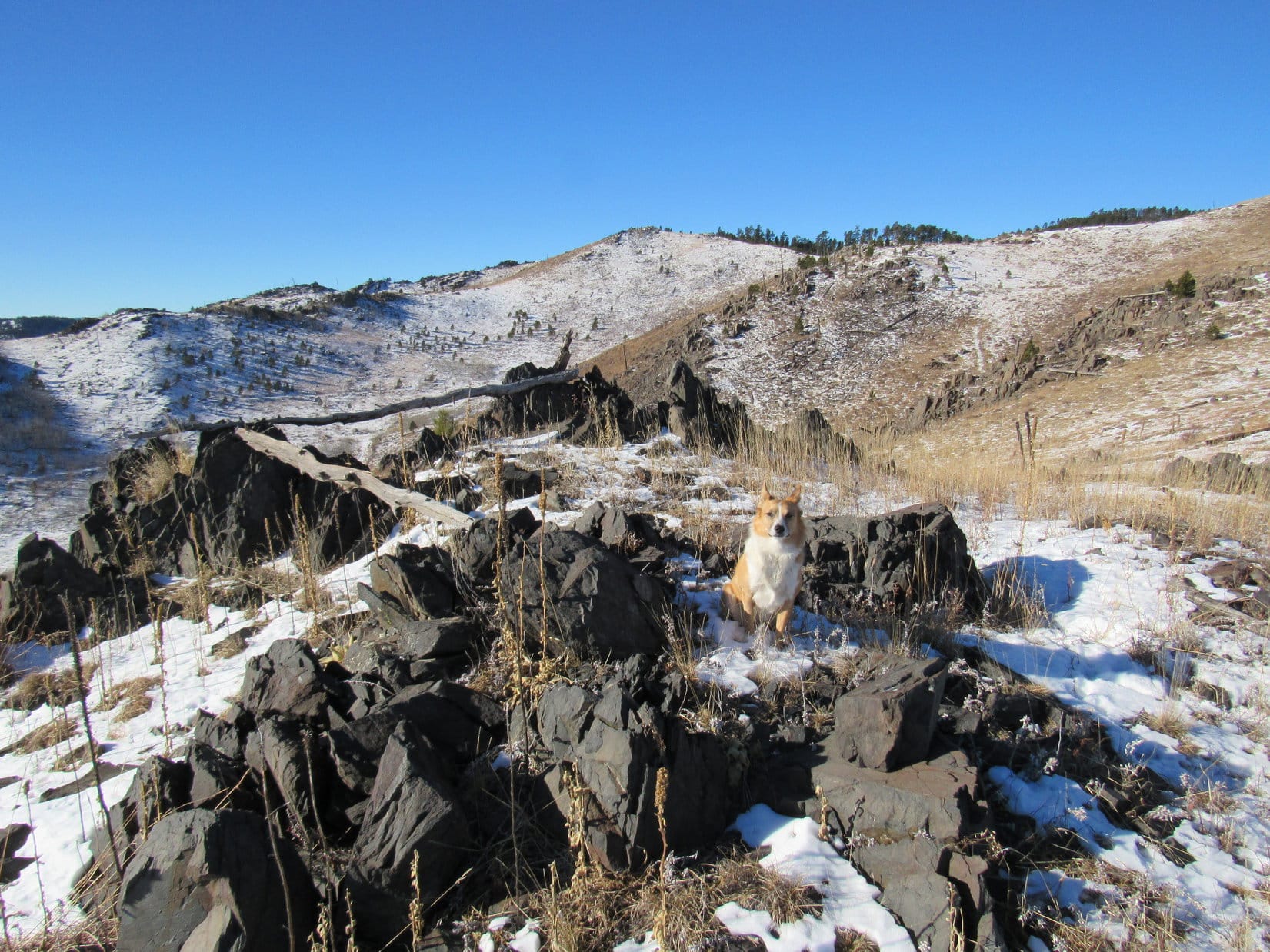
Lupe and SPHP left No. 710 as it curled back to the SE.  Lupe went S up to the edge of some high hilly ground.  Much of this area had burned some time ago, and there were very few trees left.  Without the trees, there were some pretty nice views to the E, S & W.  Small outcroppings of jagged dark rocks, often standing on end, were exposed, and added interest to the scene.

Lupe in the barren hilly area after leaving USFS Road No. 710. Photo looks SW.

Lupe was on her way to Peak 6046.  The first time Lupe and SPHP ever climbed Peak 6046 was back on New Year’s Eve 2012.  At the time, SPHP had privately designated Peak 6046 as New Year’s Eve Peak (6,046 ft.).  Lupe had returned on the last day of 2014, too.  So in both 2012 and 2014, Lupe and SPHP had watched the sun set on the last day of the year up on New Year’s Eve Peak.  It has become a little bit of a tradition.

The forested summit of New Year's Eve Peak barely pokes above the barren ridge on the R. Pistol Point is the highest barren hill at the center of the photo. Photo looks WNW.
The forested summit of New Year’s Eve Peak barely pokes above the barren ridge on the R. Pistol Point is the highest barren hill at the center of the photo. Photo looks WNW.

Even though the cold weather caused Lupe and SPHP to miss sunset on the last day of 2015 up on New Year’s Eve Peak, it still seemed appropriate to try to make up for it by showing up on New Year’s Day 2016.

Lupe at Pistol Point, privately named for the rock right behind Lupe that looks just a bit like the handle of a pistol jammed down into the ground. Pistol Point is at the S end of a ridge that comes sweeping down from New Year's Eve Peak to the SSE.
Lupe at Pistol Point, privately named for the rock right behind Lupe that looks just a bit like the handle of a pistol jammed down into the ground. Pistol Point is at the S end of a ridge that comes sweeping down from New Year’s Eve Peak to the SSE.

Lupe and SPHP wandered among the barren hills heading W towards Pistol Point.  Pistol Point is just a private name for the high point at the S end of a ridge that comes sweeping down to the SSE from New Year’s Eve Peak.  From Pistol Point, Lupe would just follow this ridge to reach the summit of New Year’s Eve Peak.

Looking NNW at New Year's Eve Peak from Pistol Point.
Looking NNW at New Year’s Eve Peak from Pistol Point.
Peak 5917 from Pistol Point. Photo looks ENE.
Lupe on the ridge S of New Year's Eve Peak. The summit is the high point toward the R. Photo looks NNW.
Lupe on the ridge S of New Year’s Eve Peak. The summit is the high point toward the R. Photo looks NNW.

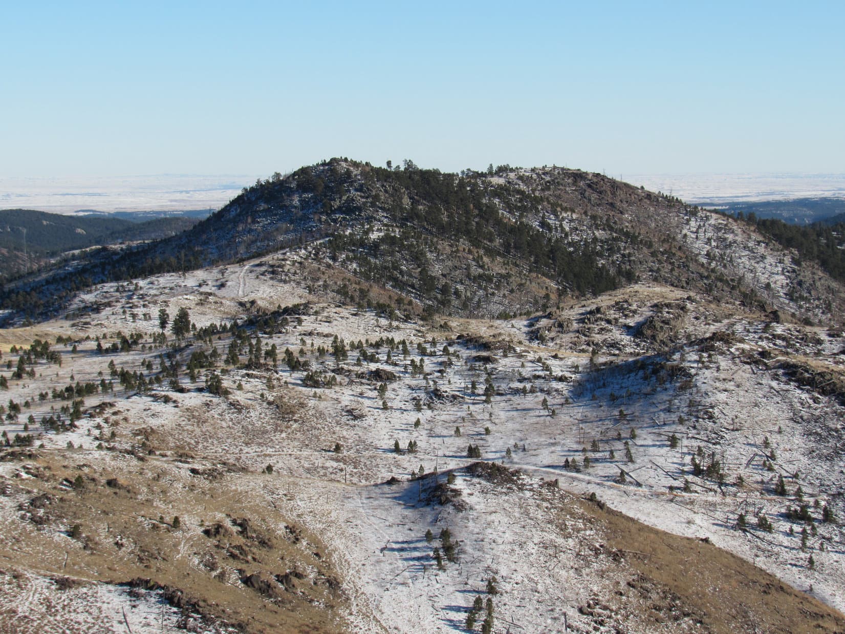
As Lupe and SPHP neared the summit of New Year’s Eve Peak, it became apparent that there had been changes since the last time Lupe was here a year and a day ago.  There had been a fair amount of logging done to thin the trees on the S side of the summit.  Although the logging hadn’t done a thing for the appearance of the local vicinity, SPHP anticipated it might have opened up the views quite a bit.

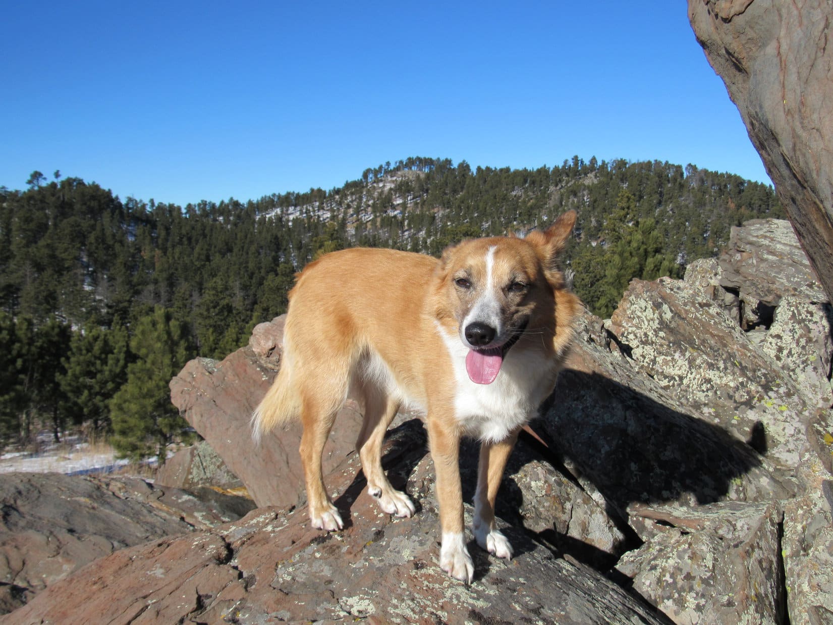
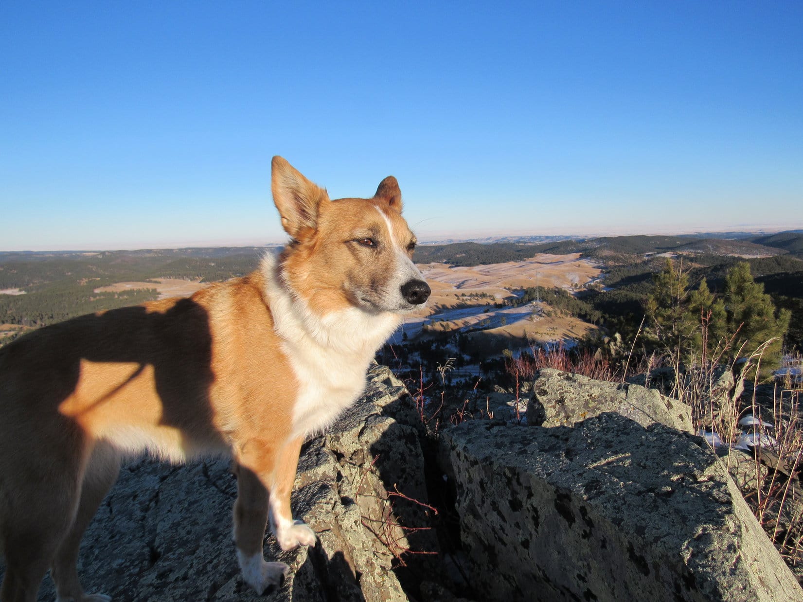
When Lupe arrived at the highest rock outcropping on New Year’s Eve Peak, she found that someone had placed a small cairn there.  With a lot of the trees gone from the S side of the summit area, the mountain looked and felt different.  The summit used to be in the gloomy dark shade of tall pines.  Now it was much more open and bright.  Nearby were sunny expansive views to the S.

It appeared that only a small part of the S side of the summit area had been logged.  In other directions, New Year’s Eve Peak looked pretty much the same.

Lupe on the summit of New Year's Eve Peak. This was her 3rd time on the mountain. Photo looks W.
Lupe on the summit of New Year’s Eve Peak. This was her 3rd time on the mountain. Photo looks W.
With so many trees gone from the S side of the summit area, there was a wide open view of Harney Peak (the high point on the far horizon just above Lupe's head). A year and a day ago, this photo wouldn't have been possible. Photo looks S.
With so many trees gone from the S side of the summit area, there was a wide open view of Harney Peak (the high point on the far horizon just above Lupe’s head). A year and a day ago, this photo wouldn’t have been possible. Photo looks S.
Harney Peak from New Year's Eve Peak. Five Points is the wavy ridge seen above Lupe's tail. Photo looks S.
Harney Peak (7,242 ft.) from New Year’s Eve Peak. Five Points (6,221 ft.) is the wavy ridge seen above Lupe’s tail. Photo looks S.
Lupe on the very summit of New Year's Eve Peak. Photo looks N.
Lupe on the very summit of New Year’s Eve Peak. Photo looks N.
Lupe on the highest rock outcropping on New Year's Eve Peak. The small cairn in front of her was new since the last day of 2014. Photo looks S and shows how few trees are left in that direction. At the end of 2014, the entire summit was heavily forested.
Lupe on the highest rock outcropping on New Year’s Eve Peak. The small cairn in front of her was new since the last day of 2014. Photo looks S and shows how few trees are left in that direction. At the end of 2014, the entire summit was heavily forested.
Looking W from New Year's Eve Peak.
Looking W from New Year’s Eve Peak.
Looking SE from New Year's Eve Peak with the telephoto lens. Shown are Boulder Hill (L), Silver Mountain (Center) and Calumet Ridge (R) beyond Sheridan Lake.
Looking SE from New Year’s Eve Peak with the telephoto lens. Shown are Boulder Hill (5,331 ft.) (L), Silver Mountain (5,405 ft.) (Center) and Calumet Ridge (5,601 ft.) (R) beyond Sheridan Lake.

After posing for pictures on New Year’s Eve Peak, Lupe had some Taste of the Wild.  SPHP ate an orange.  A chill breeze out of the N stirred up now and then.  New Year’s Eve Peak sure seemed different.

The change was partly due to the logging opening up the view, but mostly psychological.  Lupe and SPHP were here hours earlier in the day than in either 2012 or 2014.  Back then, Lupe had been here near sunset on the last day of the year.  The mood had been reflective, one of looking back at a year gone by – a year still alive and glowing, but about to disappear never to see the light of day again.  A year imminently fading into history.  New Year’s Eve Peak had been a lonely, remote, and faintly sad place.

Now, it was lighter and brighter out.  The fact that it was New Year’s Day instead of New Year’s Eve, created a mood of a new beginning, the start of something.  New Year 2016 was here, all shiny, new, full of promise and possibilities, none of which had been missed or wasted yet.  New Year’s Eve Peak was only the tiniest start of the journey to all the adventures in store for Lupe in 2016.

Lupe and SPHP did something they hadn’t had time to do on New Year’s Eve Peak before.  Lupe went to explore the N and E ridges.  The N ridge wasn’t very long.  It ended at a huge tangle of deadfall timber.  Beyond it, Lupe could see the Seth Bullock Lookout Tower on Scruton Mountain (5,922 ft.).  SPHP had wanted to get a good look at it, but with all the deadfall around, it was best to just get Lupe out of there.

It was a little longer trek, still under 10 minutes, over to the high point of the E ridge of New Year’s Eve Peak.  There was a much bigger rock outcropping there, but the highest point was clearly somewhat lower than the true summit Lupe had been to already.  Furthermore, the area was pretty heavily forested.  There weren’t views in any direction.

Even though Lupe hadn’t found anything of particular interest at either the N or E ridges of New Year’s Eve Peak, it was still fun to have explored the mountain a little better.  With the explorations complete, Lupe and SPHP returned to the S ridge to retrace Lupe’s route back toward the G6.  SPHP had one more peakbagging goal for Lupe that would alter part of that route – Peak 5800.

Lupe back at Pistol Point at the end of the S ridge from New Year's Eve Peak. Peak 5800, which Lupe would try to climb next, is the highest hill seen above Lupe. Photo looks E.
Lupe back at Pistol Point at the end of the S ridge from New Year’s Eve Peak. Peak 5800, which Lupe would try to climb next, is the highest hill seen above Lupe. Photo looks E.
Peak 5800 from Pistol Point using the telephoto lens.

On at least a couple of prior occasions, Lupe and SPHP have considered climbing Peak 5800.  SPHP remembers once standing with Lupe at the base of the rocky W face contemplating the climb.  It had been late on a dark gray day, though, with some snow already on the ground, and more light snow already swirling in the air.  It didn’t seem like a smart move at the time, so Lupe and SPHP had just returned to the G6.

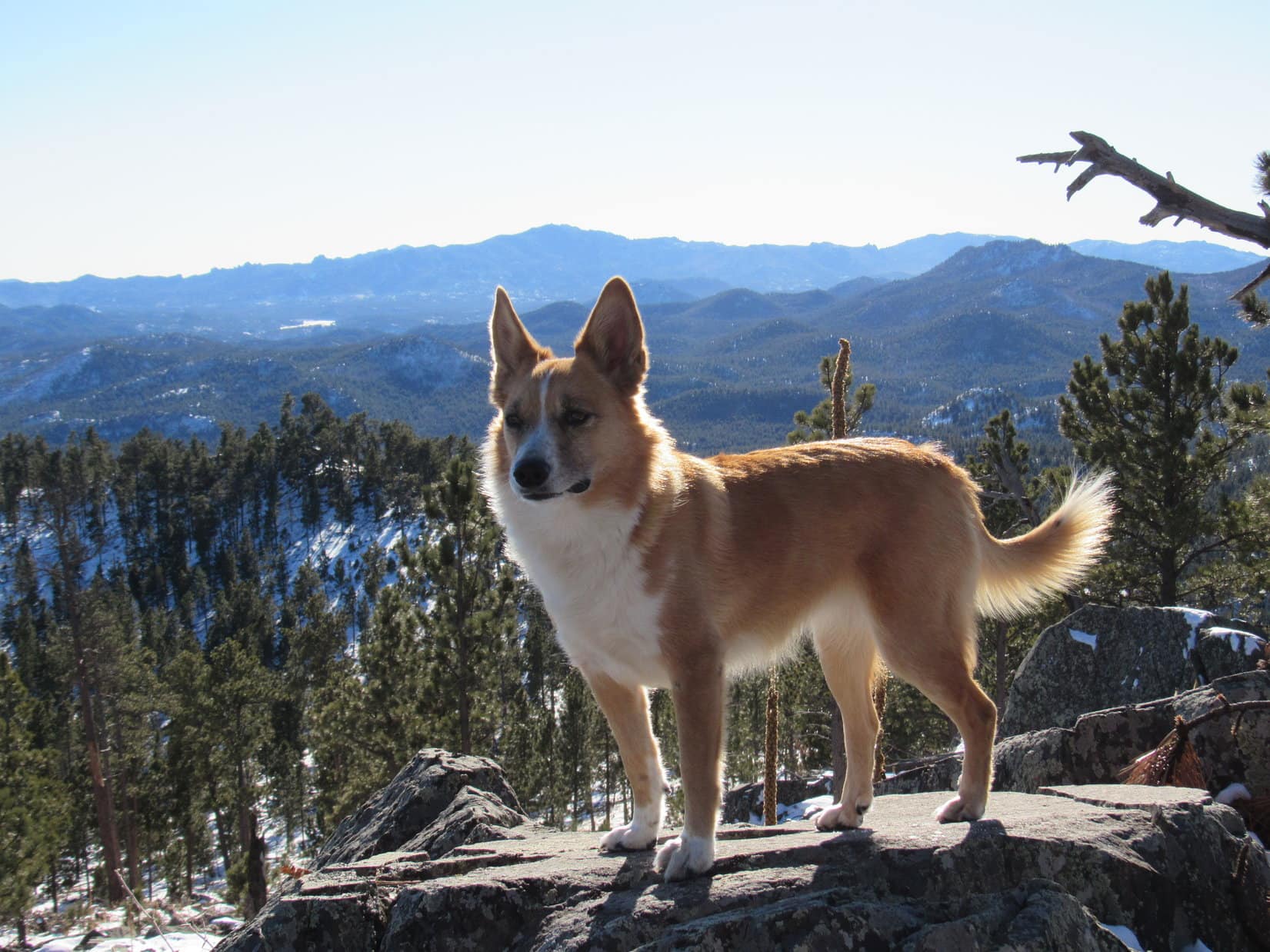
Under the bright, cool, cloudless skies of New Year’s Day 2016, though, it looked like it should be possible to climb Peak 5800 without difficulty, if a reasonable route existed up the rocky W face.  After reaching Pistol Point again, Lupe and SPHP left the S ridge from New Year’s Eve Peak, and headed E toward Peak 5800, still retracing Lupe’s earlier route.

Getting closer to Peak 5800. Photo looks E.

As Lupe started getting close to Peak 5800, she wandered a bit to the S, away from her earlier route.  She checked out views from some of the high points of the barren, rocky hills.  Back to the NW, the high forested ridge of New Year’s Eve Peak started to look small and far away.

Lupe poses on a rock on one of the barren hills for a photo looking WNW back at New Year's Eve Peak, the forested hill seen above her on the horizon.
Lupe poses on a rock on one of the barren hills for a photo looking WNW back at New Year’s Eve Peak, the forested hill seen above her on the horizon.

Lupe and SPHP continued E toward Peak 5800.  Suddenly Lupe saw something she very rarely sees out on her Black Hills Expeditions.  People!  Two people were near some rocks to the SE.  One of them had a rifle.  The other was just a boy.  They weren’t too far away.  Lupe stayed very close to SPHP.  The man and boy started moving toward Peak 5800.

About the only places Lupe and SPHP ever see people in the hills are highways and some major gravel roads, where they are plentiful.  Sometimes there are people on minor roads and ATV trails, but almost without exception, they are with some kind of vehicle – an ATV, a jeep, a motorcycle, something.  Only on a few of the major maintained trails does Lupe ever see anyone on foot – yet here were two people on foot at least a mile from any significant road or trail.

Lupe and SPHP followed the hunter and the boy toward Peak 5800, and soon caught up with them.  What were they hunting?  The man pointed down to a track in the snow.  Mountain lions.  They were hunting a big Tom that they knew had been here recently.  The track looked old, though.  It wasn’t very distinct.  The hunter knew the big cat could be very far away by now.

The boy seemed very impressed with the notion that lions were around here somewhere.  He was an outdoor kid, something pretty rare these days.  The boy talked in hushed tones about catching a 5 lb. monster trout in Pactola Lake a few weeks ago.  He liked Lupe, but didn’t try to pet her.  Lupe just stood close to SPHP during the quiet conversation with the hunter and the boy.  She didn’t interrupt in any way.

By now, Lupe and SPHP were pretty close to Peak 5800.  The W face loomed almost directly ahead.  SPHP explained to the hunter that Lupe planned to climb the mountain and go down over the other side, where the G6 was parked close to Hwy 385.  The hunter and boy intended to stay here, W of Peak 5800.

Lupe and SPHP went on.  In just a few minutes, Lupe started the climb up the W face.  It was steep and quite rocky, with scratchy brambles clinging to the soil between the rocks.  There was always a good route up, though, and the climb wasn’t really all that far, just a couple hundred feet of elevation gain at most.

Lupe nearing the top of Peak 5800. Photo looks WNW back toward New Year's Eve Peak.
Lupe nearing the top of Peak 5800. Photo looks WNW back toward New Year’s Eve Peak.

Near the top, the mountain was suddenly much less steep.  The rest of the way was a pretty easy stroll.  At the highest point, a big, flat slab of rock tilted perhaps 20 degrees down toward the NW.  Lupe and SPHP clambered up on the rock to reach the summit of Peak 5800.

The sun was still up.  There might be an hour of daylight left before sunset.  The world looked very pretty in the slanting rays of the sun.  Lupe looked around.  If Peak 5800 was the home of mountain lions, they had all fled at the approach of a fearsome Carolina Dog, for no lions were to be seen anywhere.

Lupe reaches the summit of Peak 5800. New Year's Eve Peak is seen in the distance to the WNW on the L.
Lupe reaches the summit of Peak 5800. New Year’s Eve Peak is seen in the distance to the WNW on the L.
Lupe surveys the rest of the mountain from the top of Peak 5800. Nope, not seeing any mountain lions up here! Photo looks E.
Looking SE along the Peak 5800 ridgeline from the summit. Lupe would soon go explore over to the far end of the ridge seen here.

The top of Peak 5800 is a fairly broad and level ridgeline, most of which extends out to the SE from the true summit.  Lupe and SPHP explored as far as the highest point near the SE end just before the mountain begins to drop off much more steeply.

From a point a little N of the SE high point, Lupe and SPHP headed down the NE slopes of Peak 5800.  The heavily forested slope was steeper than expected, and a bit slippery in the snow, but not too much of a challenge.  Lupe sniffed around not finding so much as a squirrel, never mind a mountain lion, while SPHP slowly worked on down the mountain.

Lupe and SPHP reached the G6 again at 4:07 PM (32°F).  New Year 2016 was off to a great start, with Lupe’s 150th Black Hills, SD Expedition a success.  Nevertheless, it was a little sad that Lupe and SPHP hadn’t gotten to New Year’s Eve Peak in time for a proper final good-bye to 2015, a year in which Lupe had many glorious adventures.

With a little luck, Lupe and SPHP will return to New Year’s Eve Peak in time to say good-bye to 2016, but not until after many more long, daring and inspiring American Dingo adventures yet to come!

Looking NW along the ridgeline from the SE high point back toward the true summit of Peak 5800. New Year's Eve Peak is still seen in the distance toward the L.
Looking NW along the ridgeline from the SE high point back toward the true summit of Peak 5800. New Year’s Eve Peak is still seen in the distance toward the L.

Happy New Year 2016 to all from Lupe!  May your 2016 be full of fun adventures and dreams come true!

Links:

Next Black Hills Expedition                   Prior Black Hills Expedition

Black Hills, SD Expedition No. 112 – New Year’s Eve Peak (12-31-14)

Black Hills, SD Expedition No. 187 – New Year’s Eve Peak (12-16-30)

Want more Lupe adventures?  Choose from Lupe’s Black Hills Expeditions Adventure Index or Master Adventure Index.  Or subscribe free to new Lupe adventures.

Walk Up Peak & Taylor Peak, Utah (8-27-15)

A little before 7:00 AM on Day 19 of Lupe’s great Summer of 2015 Dingo Vacation, things weren’t looking too promising.  The G6 was all wet.  It must have rained during the night.  Low gray clouds hid the sky.  It looked like it might rain all day.

Within 20 minutes, though, a patch of blue sky appeared.  It started spreading rapidly.  By the time Lupe and SPHP reached the trailhead near Spirit Lake Lodge, half the sky was already blue.  It was going to be a great day to climb Walk Up Peak (12,365 ft.), after all!

At 7:34 AM (48°F), Lupe started along the Tamarack Lake trail through the still damp forest.  By the time she reached Tamarack Lake, the clouds were almost all gone.  Tamarack Lake was gorgeous.  Brightly lit mountains reflected on the smooth, calm surface.  The NE ridge leading to Walk Up Peak was in view across the lake.

Lupe along the Tamarack Lake trail.
Tamarack Lake is about 1.5 miles W of Spirit Lake. Photo looks SW across the lake towards the NE ridge leading up to Walk Up Peak.
Tamarack Lake is about 1.5 miles W of Spirit Lake. Photo looks SW across the lake toward the NE ridge leading up to Walk Up Peak.
Lupe at Tamarack Lake. This photo looks SE. SPHP believes the mountain is Dagget Peak.
Lupe at Tamarack Lake. This photo looks SE.

Tamarack Lake, UT 8-27-15Tamarack Lake, UT 8-27-15Lupe followed the trail heading W through the forest.  The trail stayed pretty close to the N shore of Tamarack Lake.  By the time she reached the W end of the lake, a breeze had picked up.  There were little waves on the lake now.

Lupe near the W end of N shore of Tamarack Lake.

The trail had gained only about 200 feet of elevation in the 1.5 to 2 miles from the trailhead to Tamarack Lake.  Once the trail got past the W end of the lake, it quickly gained another 300 feet going up a forested ridge.  Up on the higher ground, the trail continued W through the forest until it broke out into the open.  The trail headed across grasslands straight for a big pond.

Lupe reaches the E shore of the big pond. Photo looks W.
Looking S at the ridge that leads to Walk Up Peak. SPHP named this biggest pond N of the peak Walk Up Pond.
Looking S at the ridge that leads to Walk Up Peak. SPHP named this biggest pond N of the ridge Walk Up Pond.

Lupe circled around the N and W shores of the big pond.  SPHP named it Walk Up Pond, since it was the largest of several ponds to the N of the big ridge leading to Walk Up Peak.  Lupe headed S towards the forest at the base of the big ridge.  Along the way, she came to a much smaller pond half full of reeds.  SPHP cleverly named this Reed Pond.

Lupe E of Reed Pond, a smaller pond S of Walk Up Pond. Don't expect to find this name on any map. SPHP made it up.
Lupe E of Reed Pond, a smaller pond S of Walk Up Pond. Don’t expect to find this name on any map. SPHP made it up.

Lupe reached the forest S of the ponds.  Her climb up the big ridge to Walk Up Peak now began in earnest.  She liked the forest, and spent her time there looking up hoping to find squirrels to bark at in the trees.  The forest really didn’t go very far up the mountain, though.  Soon SPHP was through the forest.  Lupe entered a narrow band of small bushes.  When Lupe got above the bushes, there was only heather, rocks, and a brisk N breeze.

Lupe is getting near the upper end of the forest here. Fish Lake is seen to the W.
Lupe getting near tree line. Fish Lake is seen to the W.
Lupe is in the zone of small bushes here. Above the bushes is only rocks and heather.
Lupe in the zone of small bushes. Above the bushes are only rocks and heather.
Rocks and heather on the big ridge leading to Walk Up Peak. Photo looks SW.
Rocks and heather on the big ridge leading to Walk Up Peak. Photo looks WSW.

The highest part of the big ridge Lupe was climbing from the N went for many miles in an E/W direction.  The high country was all open and gently rolling.  There were numerous peaks spread out along the ridge.  The peaks weren’t particularly impressive.  They just looked like really big round hills.  Even so, the views from the high country were vast and splendid.

Lupe reaches the high country. Although the high country was gently rolling, there were some pretty steep drop-offs near the edge. Photo looks E.
The biggest lake seen here is Tamarack Lake. Photo looks NE. Spirit Lake where Lupe started her adventure is the lake farthest away on the right.
The biggest lake seen here is Tamarack Lake.  Spirit Lake, where Lupe started her adventure, is the lake farthest away on the right.  Photo looks NE.
Walk Up Lake S of the big ridgeline. (Not the same as Walk Up pond which is N.) Photo looks SE.
The highest hill with the shadows of clouds on it at the center of this photo is Dagget Peak. The slightly higher hill beyond it to the right is Eccentric Benchmark. Walk Up Lake is in the foreground. Photo looks ESE from the E end of Walk Up Peak.
The highest hill with the shadows of clouds on it at the center of this photo is Dagget Peak (12,040 ft.). The slightly higher hill beyond it to the right is Eccentric Benchmark (12,276 ft.) (Chepeta Peak). Walk Up Lake is in the foreground. Photo looks ESE from the E end of Walk Up Peak.

Walk Up Peak was another really big hill, similar to the others along the ridgeline.  Lupe had to make a long trek to the W from where she came up the ridge to get to the top of Walk Up Peak.

There was no marker at the high point on Walk Up Peak.  The top of the mountain was just a barren field of rocks and heather like the rest of the ridge.  Lupe did find a cairn just a little way to the NW, though, where the views were best.

Lupe reaches the summit cairn on Walk Up Peak. The cairn is a little way NW of the actual summit, which Lupe had already visited. Photo looks WSW toward Taylor Peak, the next big hill along the ridge.
Lupe reaches the summit cairn on Walk Up Peak. The cairn is a short distance NW of the actual summit, which Lupe had already visited. Photo looks WSW toward Taylor Peak, the next big hill along the ridge.
Looking WNW from the summit cairn on Walk Up Peak.
This photo looks ENE from near the summit cairn on Walk Up Peak. It shows a good deal of the ground Lupe traversed to get here. She climbed up from the left side of the photo near the far end of the ridge. Dagget Peak and Eccentric Benchmark at the 2 big hills in the distance at the right edge of the picture.
This photo looks ENE from near the summit cairn on Walk Up Peak. It shows a good deal of the high ground Lupe traversed to get here. She climbed up from the left side of the photo near the far end of the ridge. Dagget Peak and Eccentric Benchmark are the 2 big hills in the distance at the right edge of the picture.

It was windy up on Walk Up Peak.  The wind had been blowing ever since Lupe reached the high country.  Puffy white clouds raced across the sky heading S or SE.  Lupe doesn’t really like wind, but it wasn’t too bad.  She was willing to go onward and climb another peak.  Taylor Peak (12,600 ft.) was next in line to the W.  Lupe and SPHP headed off in that direction, leaving Walk Up Peak behind.

Down at the lowest part of the saddle between Walk Up Peak and Taylor Peak, Lupe discovered an odd looking little tower.  It looked like some kind of weather station to SPHP.  Lupe wasn’t sure, she was more suspicious.  It just didn’t look right to her.  She investigated it cautiously at first, before deciding it was nothing to worry about.

Lupe checks out the possible weather station between Walk Up and Taylor Peaks.

The summit of Taylor Peak was a huge jumble of purple-gray rocks interspersed with heather.  Lupe found a summit cairn in the midst of the sea of rocks.  The cairn was so far from the edge of the mountain that the only interesting view was off to the WSW.  There were some high mountains in that direction.  SPHP wondered if the highest one might not be Kings Peak, the highest point in all of Utah.  It was in the right direction, so maybe it was Kings Peak, but SPHP was not certain.

Lupe wasn’t worried about the view.  She was tired of the wind and ready for a rest.  After some water and Taste of the Wild, a comfy bit of heather near the summit cairn on Taylor Peak served as a Dingo bed.  She wanted SPHP to scratch her belly.  It must have felt good.  After a few minutes she was asleep.  Lupe and SPHP stayed at the cairn for a good long while.  It was a great place to be.  Lupe and SPHP hadn’t seen another soul all day, and wouldn’t see anyone on the way back either.

Lupe reaches the summit cairn on Taylor Peak amidst a sea of purple-gray rocks.
Is that Kings Peak (13,528 ft.), the highest mountain in Utah, in the distance? SPHP thought maybe it was, but didn’t really know. Photo looks WSW.
Lupe chillin' on Taylor Peak. She wished the wind would stop, but it didn't.
Lupe chillin’ on Taylor Peak. She wished the wind would stop, but it didn’t.

After a while, it was time to go.  There were more peaks farther W along the ridge, but the puffy white clouds seemed to be getting more and more numerous.  It was afternoon, and a long way back to the G6.  The N wind wasn’t all that strong, but it was relentless.  It was probably best to head back, rather than go any farther.

The way back was just a retracement of Lupe’s journey to Taylor Peak.  On the way, she visited the summit of Walk Up Peak again for another look.

A view to the ESE from Taylor Peak. Elbow Lake is the closest one. A portion of Chepeta Lake is seen beyond it.
Before leaving Taylor Peak, Lupe went to check out this view to the ESE. Elbow Lake is the long skinny one. A portion of Chepeta Lake is seen beyond it.
Looking NW from near the summit cairn on Walk Up Peak.
Looking NW at the Burnt Fork Lakes from near the summit cairn on Walk Up Peak.
Looking SE from the summit cairn on Walk Up Peak toward the actual summit.
A last look at Walk Up Lake and the country S of the big ridge. Photo looks SE.

By the time Lupe started heading down the N side of the big ridge, the weather was starting to look a bit ominous.  The clouds to the NW looked bigger and darker than before.  Maybe it was going to rain?

As Lupe heads down the N side of the big ridge, the weather looks like rain is a possibility. Photo looks W toward Fish Lake.
As Lupe heads down the N side of the big ridge, the clouds look like rain is a possibility. Photo looks W toward Fish Lake.

The wind grew stronger.  Dark clouds sailed by.  It rained, but only a few drops.  There was no thunder or lightning.  By the time Lupe was down to the forest near the base of the big ridge, it was all over.  The clouds were gone, the wind had died down, and it was a beautiful day again.

By the time Lupe reached the forest, it was a beautiful day again.

Lupe was glad to get back to the forest.  There was no wind!  There were squirrels!  It was fun!  Lupe explored the forest with enthusiasm.  In hardly any time at all, she was back to Tamarack Lake.

Lupe approaching Tamarack Lake from the W.
Back at Tamarack Lake.

Near the E end of Tamarack Lake, there was a side trail that went 1/3 mile S to Jessen Lake.   It seemed like a fun thing to do.  There was time and the weather was now lovely, so Lupe took the side trail.  It went through the forest just E of Tamarack Lake.

Lupe on her way to Jessen Lake. Here she is E of Tamarack Lake.

Jessen Lake was smaller than Tamarack Lake.  It was tucked more closely beneath the big ridge to the S.  Forests surrounded the entire lake.  Lupe followed the trail E along the N shore.

Jessen Lake.
Jessen Lake.

At the NE corner of Jessen Lake, a stream left the lake flowing NE.  The Jessen Lake trail paralleled the stream, making a loop back to the main trail.  Lupe was now less than 0.5 mile from the trailhead at Spirit Lake.  The fun wasn’t over quite yet, though!  The pines along the main trail were full of squirrels trying to enjoy the evening.  The joyous high-pitched barking of an American Dingo echoed through the forest.

Links:

Next Adventure                          Prior Adventure

Want more Lupe adventures?  Choose from Lupe’s 2015 Wyoming, Colorado & Utah Adventure IndexDingo Vacations Adventure Index or Master Adventure Index.  Or subscribe free to new Lupe adventures.