Wyoming Peak, Wyoming (8-28-15)

The morning of 8-28-15, Day 20 of Lupe’s great Summer of 2015 Dingo Vacation, dawned bright and beautiful.  While Lupe started her day playing in the forest near the outlet stream from Spirit Lake in the Uinta Mountains, SPHP had decisions to make.  Up until now, Lupe’s vacation had been going pretty much according to plan.  The trouble was, Lupe had way more yet to do than time remaining to do it all in.

A bright morning greeted Lupe at the outlet stream from Spirit Lake in the Uinta Mountains of Utah.

Before long, SPHP had decided which adventures had to go on the chopping block for this Dingo Vacation, and which would remain.  It was time to head out.  SPHP called Lupe back to the G6.  After just a few fun days in Utah (where she did live “Life Elevated”!), Lupe was going to head N into southwestern Wyoming.  Lupe loves riding in the G6, and was ready for whatever adventure lay ahead.

The first part of the drive was a long one on gravel USFS Roads.  Lupe left Spirit Lake on USFS Road No. 001.  When it reached the intersection with No. 221, instead of taking it E back to the Sheep Creek Geological Loop, SPHP took it N to Wyoming.  It was a very pretty drive that took Lupe out of the Uinta Mountains.

Lupe finally reached pavement again when she crossed Hwy 414 between McKinnon and Burnt Fork.  N of Hwy 414, a paved road headed NE through scenic ranchlands to meet up with Hwy 530 S of Green River, WY.  Heading N on Hwy 530, there was some pretty wild looking territory off to the E toward the N end of Flaming Gorge National Recreation Area.

After a short stop in the town of Green River, WY, Lupe went W on I-80 just 6 miles to Hwy 372.  Hwy 372 headed NW paralleling the Green River, but at some distance from it, so the river was often out of sight.  This territory was high, dry prairie land.  It was dominated by low hills and sagebrush.  In late August, it all looked hot, dusty and not terribly inviting.  Hwy 372 eventually led to Hwy 189, which Lupe took N to La Barge.

This sign along the Green River told a little about its history during the fur trading days of the early 1800's.
This sign along the Green River told a little about its history during the fur trading days of the early 1800’s.
The Green River was a huge lake N of the Fontenelle Reservoir dam.
This rather striking butte was E of Hwy 189 just a few miles S of La Barge, WY.

After a quick tour of the small town of La Barge in the G6, Lupe and SPHP drove 2 miles S on Hwy 189, and turned W on La Barge Creek Road, No. 315.  The first 11 miles of No. 315 were paved.  After that it turned to gravel.  The road headed W, before gradually turning N as it followed the beautiful La Barge Creek valley upstream.  The valley grew progressively narrower as the road went on.

La Barge Creek.
La Barge Creek.

La Barge Creek, WY 8-28-15About 20 miles from Hwy 189, suddenly the gravel road deteriorated sharply.  For 3 miles it crossed private land where the road was so poor that SPHP considered just turning the G6 around.  If the road had been at all wet, there wouldn’t have been any choice.  High clearance vehicles wouldn’t have any problem with it, but the road was just about all the challenge the G6 could take on.

After 3 miles, the road entered the Bridger National Forest, where it immediately improved.  There were still some pretty rough spots now and then, but nothing like what the G6 had just come through.  SPHP resolved to leave the area by some other route.

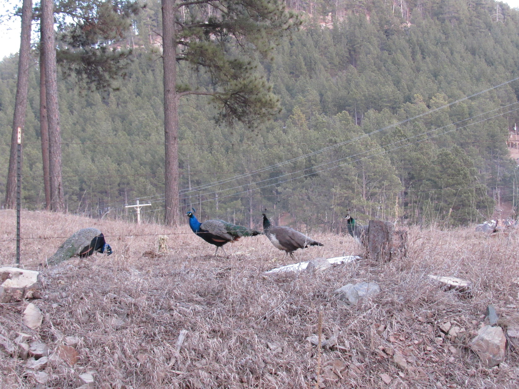
Lupe was now up in the mountains of the Wyoming Range.  Her destination was Wyoming Peak (11,378 ft.), the highest mountain in the entire range.  Of more immediate interest to Lupe, cows were grazing in the high mountain valleys.  There was plenty of hard barking going on in the G6, even though most of the cows were so far away they were unaware of the frantic Carolina Dog passing by.

Lupe was determined to bark at every cow she saw on her 2015 Dingo Vacation, no matter how far away they were.
Lupe was determined to bark at every cow she saw on her 2015 Dingo Vacation, no matter how far away they were.  Actually, it was good enough if she could just smell them.  In her excitement, she barked at plenty of cows that weren’t even there!

SPHP had some notes on how to find the trailhead for Wyoming Peak, but what little signage there was at the few intersections along the road didn’t match up real well with the notes.  SPHP just kept driving slowly N looking for USFS Road No. 10126, which leads to the trailhead.  Finally a high peak came into view.  It had to be Wyoming Peak!

Wyoming Peak is the highest point at the center of this photo. Photo looks NE.
Wyoming Peak is the highest point at the center of this photo. Photo looks NE from Greys River Road.

SPHP soon found USFS Road No. 10126 at the confluence of Greys River and Shale Creek.  This point was 41 miles from where La Barge Creek Road had left Hwy 189.  Greys River was a pretty good sized stream, even in late August, but Shale Creek was quite small.  The trailhead was supposed to be 3.5 miles in along No. 10126.  As poor as the main road had been in places, SPHP didn’t want to try taking the G6 up No. 10126.  Lupe would have to walk.

It seemed like it was already pretty late in the day to think about climbing Wyoming Peak, especially when it was a 3.5 mile hike just to get to the trailhead.  However, SPHP thought it wouldn’t hurt to at least scout things out.  The weather was clear and favorable.  Maybe Lupe could still make it up Wyoming Peak today.  Lupe and SPHP left the G6 at the start of USFS Road No. 10126 at 2:56 PM (70°F), and began following the road up Shale Creek.

There really wasn’t much of a trailhead.  At a bend in the road was a marker, and a trail heading up a hillside, but there were no big signs and no parking area where the trail to Wyoming Peak left No. 10126.  Lupe and SPHP started up the trail.  At first it was pretty steep, but before too long, the trail started on a series of long switchbacks.

Lupe starts her climb up Wyoming Peak. Photo looks W.

The trail Lupe was following climbs Wyoming Peak from the SW.  It appeared to get only moderate use, and was often rather narrow.  Even so, most of the trail was in quite good condition.  It was always easy to follow.  There was only one tricky spot at a sharp bend where red dirt had eroded away from the trail down into a steep gully.  The tricky part was very short.  Lupe and SPHP were beyond it in just a few seconds.

The entire W slope of Wyoming Peak is consistently steep, but whoever designed the trail did an excellent job.  There were steep parts at the very beginning and the very end, but for the great majority of the climb, the trail consisted of long switchbacks rising at just the right pace.  SPHP didn’t have to stop to rest very often.  It was easy to make fast progress up the mountain.

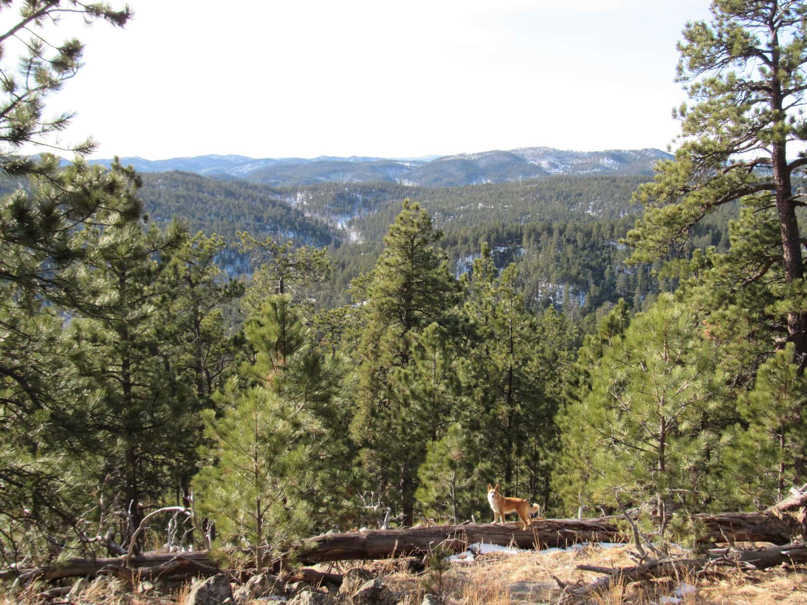
Before reaching tree line, the trail also made good use of available shade.  It passed through some of the scattered forests along the way.  In between the forested areas, the trail was exposed to big views to the W.  The combination of shady rest stops along with great views made for a very fun climb.

High on the mountain Lupe came to this rocky section of trail. Most of the trail up was not very rocky at all.
High on the mountain Lupe came to this rocky section of trail. Most of the trail was not very rocky at all for such a big mountain.

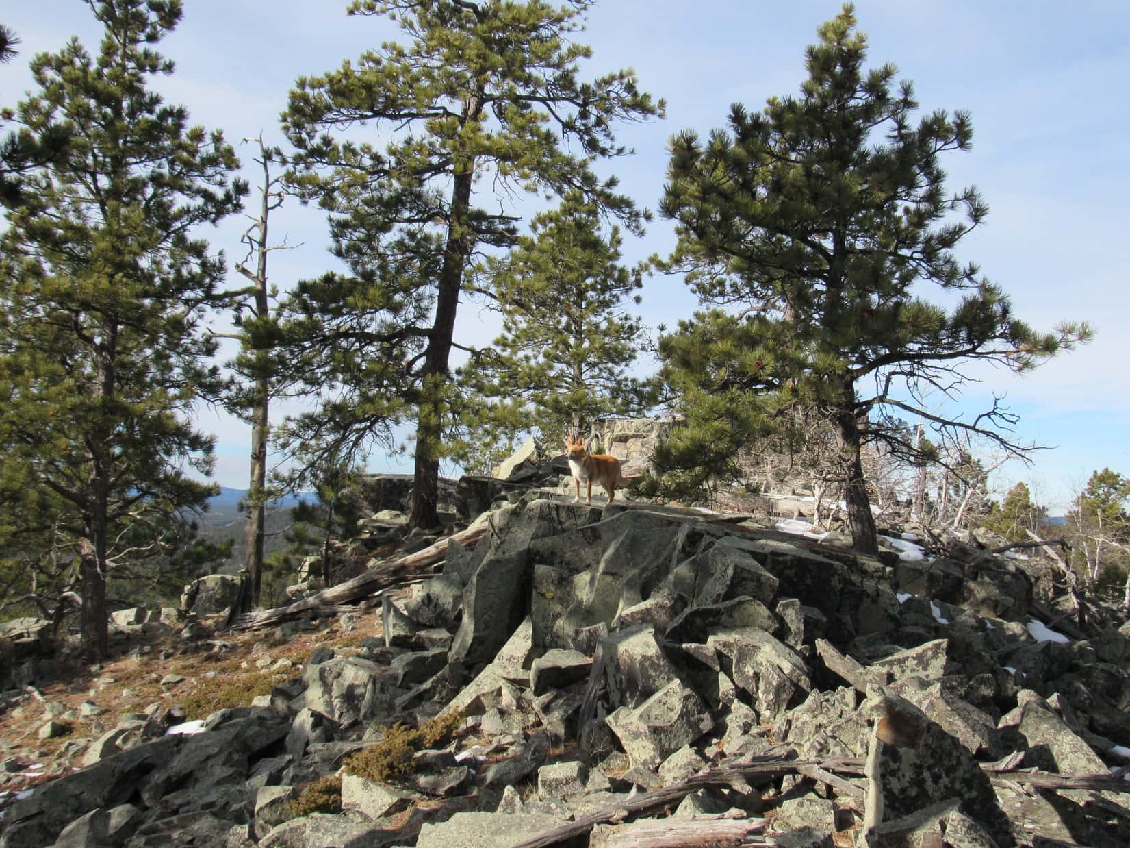
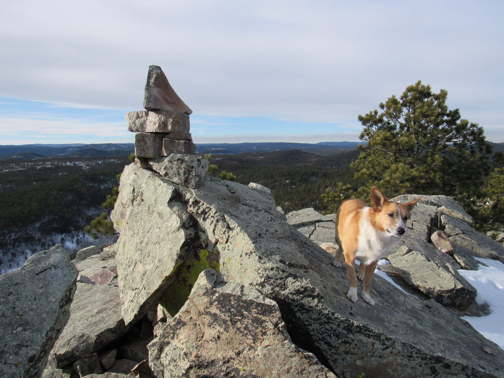
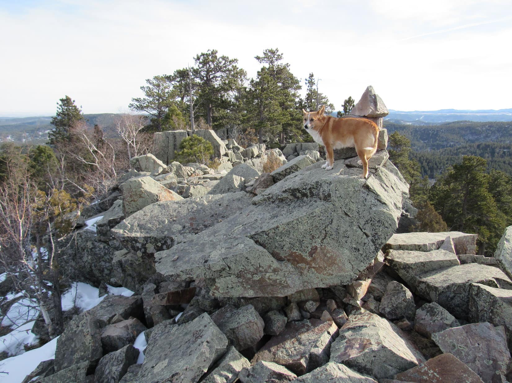
Near the end of the climb, the trail reached a saddle between Wyoming Peak to the N and Mount March Madness (11,220 ft.) to the S.  Much of the rest of the way to the top, the trail consisted of very short, steep switchbacks full of loose rock.  Despite the late start, Lupe made it to the summit of Wyoming Peak an hour before sunset!

Lupe takes a break at the saddle between Wyoming Peak and Mount March Madness. Photo looks S at Mount March Madness.
Lupe takes a break at the saddle between Wyoming Peak and Mount March Madness. Photo looks S at Mount March Madness, which greatly resembled a pyramid.
Lupe at the summit of Wyoming Peak. What lofty mountaintop is complete without a pile of man-made rubble?
Lupe at the summit of Wyoming Peak. What lofty mountaintop is complete without a despicable pile of man-made rubble?

SPHP was not happy with the ugly collapsed building on top of Wyoming Peak.  SPHP stuffed as many broken little boards with nails in them, and other small hazardous looking pieces of debris as possible into a sack.  The sack went in the backpack to be disposed of later.  Only 10,000 more trips and Wyoming Peak will be junk free again!

The views were really great from Wyoming Peak.  The view that captured the imagination the most was a very high and rugged mountain far away to the N.  It was so far away, the camera just wouldn’t capture its faint outline.  SPHP was almost certain that distant peak had to be the famous Grand Teton (13,770 ft.). Lupe and SPHP spent more than half an hour up on Wyoming Peak, while the sun sank steadily in the W.

Looking N at the rather ominously named Mount Coffin from Wyoming Peak.
Looking N at the rather ominously named Mount Coffin (11,242 ft.) from Wyoming Peak.
Looking NE. The Wind River range could be seen on the horizon, but there was enough smoke haze so the camera didn't pick it up.
Looking NE. The Wind River range could be seen on the horizon, but there was enough haze so the camera didn’t pick it up.
Using the telephoto lens to peer a bit farther N through the smoke haze.
Using the telephoto lens to peer a bit farther N through the smoke haze.  The ridge in the foreground is part of Mount Coffin.
Lupe squints for another photo with the low slanting sunlight on her face. Photo looks SE.
Mount March Madness from the top of Wyoming Peak. Photo looks S.
Lupe ready for a break from all the photo ops. The shot looks E.
Lupe ready for a break from all the photo ops.  Photo looks E.
Another telephoto lens shot.
You done yet, SPHP? There's not a single squirrel up here!
“You done yet, SPHP? There’s not a single squirrel up here!”

With the sun sinking into a smoky haze from distant forest fires, it wasn’t possible to get a decent picture toward the W.  Lupe and SPHP saw mountain ranges off in that direction, though, too.  They were lined up one after another, fainter and fainter as far off into the horizon as it was possible to see.

Lupe and SPHP sat together admiring the world from the top of Wyoming Peak.  When it became clear the sun was just going to sink into the murk without any particularly wonderful sunset, it was time to go.  Lupe may as well get a good start down the mountain before it got dark.

Lupe does some off trail exploring on the way down Wyoming Peak. Mt. Coffin is seen to the N.
Lupe going down the trail SW of Wyoming Peak.

Fading light from Wyoming Peak, 8-28-15Lupe was about 80% of the way down the trail by the time it was so dark the flashlight had to come out.  When she reached Shale Creek Road (USFS No. 10126) again, Lupe wanted to take a break.  She had water and what was left of her Taste of the Wild.  Then she just curled up for 15 minutes before she was ready to go again.

In the meantime, a nearly full moon had come up over the side of Mount March Madness.  The flashlight was no longer needed.  Together Lupe and SPHP traveled the moonlit road beneath the shining stars.Mount March Madness from Wyoming Peak, WY 8-28-15Links:

Next Adventure                     Prior Adventure

Want more Lupe adventures?  Choose from Lupe’s 2015 Wyoming, Colorado & Utah Adventure IndexDingo Vacations Adventure Index or Master Adventure Index.  Or subscribe free to new Lupe adventures.

Black Hills, SD Expedition No. 151 – Buck Mountain (1-5-16)

A cold snap was on the way.  The 5th of January was going to be the last day with highs approaching 40°F for a while.  If Lupe was going to get in another Black Hills, SD Expedition any time soon, it had to be now or never.  Given a choice like that, Lupe and SPHP chose now!

At 9:52 AM, SPHP parked the G6 near the start of USFS Road No. 448 just off Bogus Jim Road.  The day was crisp, clear, and calm.  The G6 said it was 32°F.  It probably was in the sunny spot where the G6 was parked, but as Lupe headed W on No. 448 into the shady valley of the South Fork of Bogus Jim Creek, it felt colder than that.  The forested valley felt like an icebox.

Lupe started Expedition No. 151 to Buck Mountain heading W along snowy USFS Road No. 448.
In the shady valley of the South Fork of Bogus Jim Creek it was downright chilly. Here Lupe stands on a frozen ice flow from a nearby spring. The ice covers the entire road.

To get to Buck Mountain (5,553 ft.), Lupe would have to leave the chilly valley, and climb over a ridge to the N to another valley where the Middle Fork of Bogus Jim Creek flows.  After following USFS Road No. 448 for a little over a mile, Lupe and SPHP left the road heading NW.  Lupe climbed through a forest of small trees to arrive at a saddle area.

SPHP had hoped to be able to see Buck Mountain ahead to the N from the saddle, but the area was so heavily forested, it was hard to see much of anything.  An unnamed 5,360 ft. mountain was just NE of the saddle.  It would only require gaining another 200 ft. to get up there.  Maybe Lupe could see Buck Mountain from up there?

When Lupe arrived at the top of the 5,360 ft. mountain, it was very heavily forested, too.  A couple of small openings offered some views toward the S and SW.  Toward the N or NW, though, it was hard to see much of anything.  SPHP could just glimpse a mountain that looked like it was probably about where Buck Mountain should be, but that was about it.

Lupe reaches the top of the 5,360 ft. mountain just SE of Buck Mountain. It was too heavily forested to get more than a glimpse of Buck Mountain from here. Photo looks E.
Looking SW from the 5,360 ft. mountain.

Lupe and SPHP retreated back down to the saddle area.  Lupe went NNW descending into the valley of the Middle Fork of Bogus Jim Creek.  On the way, Lupe found a steep, snowy little road.  In some spots along the road, Buck Mountain was in view.  It was dead ahead to the N.

Lupe on her way down to the Middle Fork of Bogus Jim Creek. Buck Mountain is dead ahead to the N.
The summit of Buck Mountain from the S.

The little road took Lupe all the way down to the valley floor.  The Middle Fork of Bogus Jim Creek was very small, but there was some water in it.  Lupe jumped across it, and even SPHP could just step across.  Just beyond the creek was USFS Road No. 202.  Although Buck Mountain was straight ahead just N of the road, the mountain was clearly too steep to climb easily from the S.  Lupe headed W on No. 202.

Before long, Lupe came to a little side valley with an unmarked road in it heading NW.  This was probably USFS Road No. 202.2C.  Lupe and SPHP followed this side road, but not very far.  As soon as it looked like there was another side valley to the NE, Lupe and SPHP headed that way into the forest.  Lupe was circling around to the N side of Buck Mountain.  SPHP hoped and expected Buck Mountain would be relatively easy to climb from the N.

Lupe eventually reached a saddle area N of Buck Mountain.  There was a surprisingly large rock outcropping in the middle of this area between Buck Mountain to the S, and an unnamed mountain to the N.  Lupe and SPHP climbed up on the rocks to see what the route up the N slope of Buck Mountain looked like.

Lupe on part of the large rock outcropping N of Buck Mountain. This isn’t even the top of it. Photo looks NW.
Looking S toward Buck Mountain from the large rock outcropping to the N. This view was not entirely encouraging. Buck Mountain looked pretty rocky and steep near the summit!

The view of Buck Mountain to the S was rather surprising, and a bit concerning to SPHP.  The summit of Buck Mountain looked very rocky and steep.  The approach from the E actually looked easier than from the N.  However, it also looked like there might be two ridges of rock up at the summit separated by a sizable notch, with the ridge W of the notch being higher and the true summit.  Getting past the notch from the E might be difficult.

It was hard to tell with all the trees, but maybe Lupe wouldn’t even be able to climb Buck Mountain?  That would be disappointing!

There was only one way to find out.  Lupe and SPHP headed straight for Buck Mountain.  SPHP intended to head directly up to the notch, if it was possible.  Lupe didn’t get very far up the N slope before she came to a big rock formation.  A long line of large blocky rocks extended up the mountain forming a N/S ridge.  SPHP wanted to stay to the W of it, but a quick check showed that the ground over there was pretty steep and littered with boulders.

The terrain pretty much forced Lupe and SPHP to go around the NE and then E side of Buck Mountain.  Lupe was able to gain elevation steadily along the way.  To the W was a fairly steep boulder field, but it wasn’t all that high.  Above the boulder field was the wall of rock forming the N/S ridge.  It looked like it might be possible for Lupe to get up there if she climbed toward the SW.

Lupe had no trouble navigating the snowy boulder field.  Taking a slow, cautious approach, SPHP didn’t have much problem with it either.  It took a little while to get up there, but Lupe reached the top of the high rock ridge.  SPHP was a bit apprehensive about what she might see.  SPHP expected Lupe would see a dip of some sort down to a notch, and then another higher rocky spire to the W.  Would Lupe even be able to get over there?

Looks had been deceiving!  There was no notch.  There was no higher ridge to the W.  Lupe was on top of Buck Mountain!  The actual very highest point appeared to be off to the N some distance.  Since Lupe had climbed up closer to the S end of the summit ridge, Lupe and SPHP went to explore the S end of Buck Mountain first.

Lupe reaches the top of Buck Mountain. Photo looks N along the summit ridge. The actual highest point on the mountain is beyond Lupe a little way to the N. Photo looks N.

Even though there were quite a few trees along the rocky summit ridge of Buck Mountain, there were also lots of rather cool rock platforms featuring commanding views in one direction or another.  By moving around to the proper viewpoint, it was possible to get a wide open view in almost any direction.  The S and middle portions of the summit ridge were easy to get around on, too.  The ridge was level enough and wide enough to maneuver easily.

Buck Mountain had quite a few trees even along the rocky summit ridge, but there were lots of cool rock platforms with great views in one direction or another. This photo looks E.
Looking SSE from Buck Mountain.
Wow! Kind of a dramatic view to the SW. Even though Buck Mountain isn't all that high compared to parts of the Black Hills, it sure felt like Lupe was way up there!
Wow! Kind of a dramatic view to the SW. Even though Buck Mountain isn’t all that high compared to parts of the Black Hills, it sure felt like Lupe was way up there!
Looking E toward Green Mountain (L) and the Bogus Jim Creek valley (R).
Looking E toward Green Mountain (5,240 ft.) (L) and the Bogus Jim Creek valley (R).
Lupe near the S end of Buck Mountain. USFS Road No. 202 is seen in the valley below. Photo looks SW.

After exploring and enjoying the views toward the S end of the mountain, it was time for Lupe to go N and achieve her Buck Mountain peakbagging goal by reaching the very highest point on the mountain.  The N end of the summit ridge was more rugged than the S end.  Lupe and SPHP had to be a little careful along in here.

The N end of the summit ridge was pretty rugged. This photo looks N along the W side of the ridge. The cairn at the top of Buck Mountain is in sight!

Not far from the cairn at the summit, Lupe and SPHP ran into a 6′ wall of rock blocking the way forward.  There was no way Lupe could see over it.  SPHP climbed up partway to look over the rock wall.  Lupe waited below in a cleft in the rocks for a report.  Which way next?

Lupe waits below in a cleft in the rocks for SPHP to report on how to get around the rock wall blocking the route to the summit cairn.
The summit cairn is now clearly in sight beyond the upper portion of the rock wall blocking Lupe's advance.
The summit cairn is now clearly in sight beyond the upper portion of the rock wall blocking Lupe’s advance.

The blocking rock was only a couple of feet thick, but it didn’t look like a good idea to attempt to go over it.  To the W was a sheer drop off onto a steep boulder field below.  The only way around seemed to be to climb down to the E off the main ridge.  The boulder field on that side of the mountain could be navigated easily enough with some care.

No sooner had Lupe and SPHP started toward the E than SPHP realized there was a convenient platform of rock 1.0 – 1.5 feet wide going all the way around the E side of the rock wall.  Lupe and SPHP took the platform, and got past the rock wall.  Lupe still had to go down off the summit ridge onto the boulder field, but only for a short distance.

Beyond the blocking rock wall just below the E side of the summit ridge. Lupe had to go over the boulders a short distance to where she could climb up to the summit. Photo looks N.

Lupe and SPHP soon found a short steep little route up to the summit.  SPHP had to climb carefully, but Lupe was up in a flash.  She perched up next to the summit cairn to claim her peakbagging success on Buck Mountain.

Lupe reaches the summit cairn on Buck Mountain! Photo looks N.
Looking S along the summit ridge.

The N end of the summit ridge was smaller than the S end, and very rocky.  The views were absolutely great, though.  With Lupe’s peakbagging goal accomplished, Lupe and SPHP took a break on the rocks just N of the cairn.

Lupe wasn’t in the mood for her usual Taste of the Wild for some reason.  She seemed concerned that the cheese sandwich SPHP had brought along might be too big for just one measly human.  She was pretty insistent that SPHP needed help.  With the Carolina Dog’s kind assistance, what remained of the cheese sandwich was quite manageable for SPHP.

Looking N from near the summit cairn.
Lupe, now satisfyingly full of cheese sandwich, at the break spot just N of the summit cairn. Photo looks S.

Some Black Hills mountains turn out to be just high spots in a thick forest with no views.  That’s pretty common, actually.  Buck Mountain turned out to be a very fun peak for Lupe and SPHP.  It was just a little bit challenging, but rewarded the effort with lots of splendid views from a variety of lookout points.

Lupe and SPHP lingered up on Buck Mountain for quite a while enjoying the moment.  Before heading down, SPHP scouted a little way to the N to see if there was a better way off the mountain.  In the end, Lupe and SPHP returned the way they came.  Lupe took one more trip to the S end of the summit ridge for a final look.  Then it was time to scramble down the little boulder field on the E side of the mountain.

Lupe back down below the boulder field on the E side of the mountain. The large rocks of the summit ridge are seen above the boulders.

Once down below the boulder field, Lupe and SPHP headed N back to the saddle area close to the large rock outcropping.  Lupe seemed rather glad to be down off Buck Mountain.  Evidently, she preferred running around in the forest.  When she saw a squirrel dash into a hollow log, she spent a good 10 minutes trying to figure out how to get at it.  With enormous enthusiasm, the Carolina Dog kept running around the log sniffing, then suddenly stopping to dig frantically here and there.

Lupe trying to get a squirrel out of a hollow log. It was fun, but futile - the squirrel was safe inside.
Lupe trying to get a squirrel out of a hollow log. It was fun, but futile – the squirrel was safe inside.

The squirrel was totally safe.  Lupe could not get it.  She had fun trying, although she yipped in frustration now and then, too.  When she was ready to give it up, Lupe and SPHP started the trek back to the G6.  Instead of retracing Lupe’s earlier route, Lupe and SPHP headed down the E side of the saddle.

Although not as dramatic as climbing a mountain, Lupe enjoyed exploring the forest on the way back.  She reached the G6 again at 3:55 PM (35°F).  On the way home, Lupe barked at the usual cows and horses.  She also branched out into barking at something a bit more exotic.

Peacocks along Bogus Jim Road.

Links:

Next Black Hills Expedition                       Prior Black Hills Expedition

Want more Lupe adventures?  Choose from Lupe’s Black Hills Expeditions Adventure Index or Master Adventure Index.  Or subscribe free to new Lupe adventures.