Black Hills, SD Expedition No. 98 – The Northern Hills Day of Deterioration (10-2-14)

About 5 miles SW of Lead in the northern Black Hills, SPHP found a spot to park the G6 (9:59 AM, 45°F).  Lupe started Expedition No. 98 along the E side of USFS Road No. 194 a short distance N of Hwy 85.  The skies were blue, the air was calm, and the cool morning air felt good.  The forecast called for a high in the low 60’s °F (although at lower elevations) with an outside chance (20%) of rain.

Deer Mountain (6,652 ft.), site of a local downhill ski resort, was only 0.5 mile away.  Lupe and SPHP followed No. 194 N gaining elevation, but soon left the road to turn NE and head up through the forest toward the summit.  The climb was moderately steep, but not terribly long.  The day had hardly started when Lupe and SPHP arrived on top of Deer Mountain.

Lupe arrives at the chair lift on top of Deer Mountain.
There was quite a view to the NE toward the town of Lead, SD from the top of Deer Mountain. The view might be particularly impressive when conditions are all white and right for skiing. Since Carolina Dogs hardly ever go skiing, Lupe was happier with this beautiful, sunny morning. The only thing disappointing about Deer Mountain to Lupe was that there weren’t any deer. However, she did see a jackrabbit. Lupe now thinks of Deer Mountain as Jackrabbit Mountain.
Although Deer Mountain at 6,652 ft. is a pretty high peak for the Black Hills, Terry Peak 2 miles to the N is even higher at 7,064 ft. Photo looks N.

Lupe and SPHP left Deer Mountain heading N back down to USFS Road No. 194.  Terry Peak (7,064 ft.), site of another downhill ski resort just 2 miles N of Deer Mountain, was Lupe’s next peakbagging goal.

Lupe on the N slopes of Deer Mountain with Terry Peak in the background. Photo looks N.
Terry Peak using the telephoto lens.

Lupe and SPHP followed No. 194 almost all the way up to the top of Terry Peak.  It would have been possible to drive up, although the road did deteriorate some toward the end.

Looking SSE from USFS Road No. 194 a little below the summit of Terry Peak. Custer Peak (6,804 ft.) is the pointy peak on the L. Harney Peak (7,242 ft.) is on the far horizon near the center. Deer Mountain is the rounded hill in the foreground on the R.

The top of Terry Peak is cluttered with assorted towers, metal buildings, and power lines.  The ski facilities are a bit lower down toward the NE.  An apparently abandoned lookout tower sits at the very summit.  A huge observation deck with 2 different stairways up to it crowned the entire building.

The lookout tower’s appearance was suffering from a lack of maintenance, but there wasn’t anything wrong with the views from the platform on top!

Lupe up on top of the Terry Peak lookout tower. Photo looks S.
Low gray clouds were starting to pass over the Terry Peak lookout tower while Lupe was up on the observation deck. It became quite windy and cool as each cloud sailed by overhead. This photo looks WNW. The long distant ridge on the R is part of the Black Hills in Wyoming known as the Bear Lodge Mountains.
Looking N at the Terry Peak lookout tower after Lupe came down off the viewing platform. Some of the clouds were starting to look pretty dark.

Lupe and SPHP enjoyed 360° views from the huge observation deck.  Lupe and SPHP lingered up there for a while, but the weather started to deteriorate.  The skies had been mostly clear earlier in the morning, but now puffy white clouds were sailing by.  Some of them were pretty big.  Each cloud brought a cold wind with it.  The sky started to darken.  The clouds kept getting bigger and grayer.

Lupe wanted to get down out of the wind.  SPHP finally agreed.  Lupe and SPHP left the observation deck, and wandered over to the base of a tall tower to the N for a look at a couple of Lupe’s next peakbagging goals without towers in the way.

Foley Mountain hardly even looks like a hill looking down from Terry Peak. The top of Foley Mountain was in the trees beyond and to the R of the white building near the center of this photo. Photo looks NNW.
Bald Mountain at least looked like a hill from Terry Peak. It is the rounded hill with all the dead trees on it just R of center in the foreground. The hill beyond it is Mount Theodore Roosevelt (5,680 ft.). Photo looks NE.

SPHP had originally planned for Lupe to head down the N slope of Terry Peak to Foley Mountain (6,640 ft.), but there appeared to be a lot of private property in the area.  The weather continued to deteriorate, too.  Maybe it was best not to get too far from the G6.

Lupe and SPHP returned to USFS Road No. 194, and followed it all the way back to the G6 (1:24 PM, 54°F).  Along the way, Lupe was pelted a number of time with crusty, round snow granules.  None of these snow showers lasted very long, and there was no accumulation.  The snow granules all melted as they hit the ground.

SPHP had been gathering Lupe Treasures along No. 194.  After depositing them in the trunk of the G6 for future recycling, Lupe and SPHP got in and headed NW on Hwy 85 to Nevada Gulch Road.  SPHP drove all the way up to the Barefoot Resort, which had been visible from Terry Peak.

The Barefoot Resort seemed to be quite close to the top of Foley Mountain.  SPHP found an empty parking lot behind a long, low building and parked the G6 (1:41 PM, 45°F).  Almost as soon as Lupe and SPHP left the car, someone started shooting guns close by.  Lupe bolted back into the safety of the G6.  Fortunately, the gunfire didn’t last long.  After a few minutes of silence, SPHP managed to persuade the doubtful Dingo to come back out.

The long building seemed to be abandoned.  Although there was a nice big gravel parking lot behind it, when Lupe and SPHP went around to the front to get a look at Terry Peak, the yard was nothing but thistles and tall weeds.  There was a pretty good close-up view of Terry Peak from the NNW, though.

Terry Peak from the NNW.

Lupe and SPHP went back behind the building.  A gravel road headed uphill going N out of the parking lot into the forest.  After about 100 yards, the road ended near more buildings.  There was still slightly higher ground to the N, so Lupe left the road and went on through the forest.

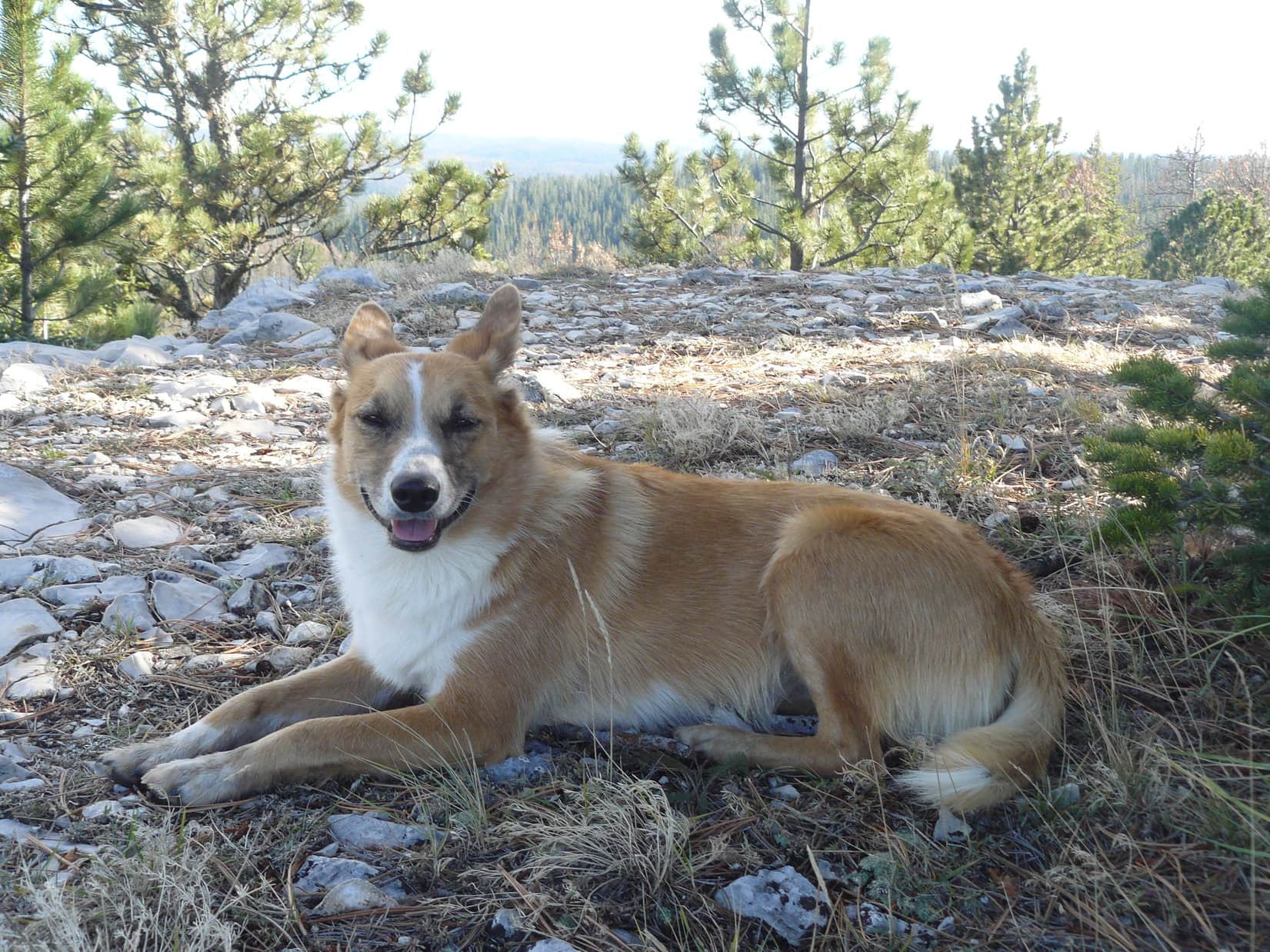
After about 5 minutes, Lupe reached a fairly big rock outcropping.  This appeared to be the summit of Foley Mountain.  Lupe and SPHP scrambled up easily enough.  From up on top, it was clear that this rock formation was, indeed, the summit.  A 3″ diameter capped pipe stuck up out of the ground at the very highest point.  Lupe got up next to it to claim her 3rd peakbagging success of the day.

Lupe at the summit of Foley Mountain. The summit area was all forested, so there weren't any views.
Lupe at the summit of Foley Mountain. The summit area was all forested, so there weren’t any views.

Since the top of Foley Mountain was all forested, there weren’t any clear views.  There was little reason for Lupe and SPHP to linger.  After peering between the trees as much as possible, it was time to go.  Lupe scrambled back down off the rock formation.  Within 10 minutes, she was back at the G6 (2:16 PM, 44°F).

Lupe on her way down the rock formation at the top of Foley Mountain. Photo looks NE.

By now the sky was overcast.  A chill breeze blew.  Lupe still had a 4th peakbagging goal, Bald Mountain (6,617 ft.).  Bald Mountain was only a mile to the E, but Wharf Resources had gold mining operations between Bald Mountain and Foley Mountain.  SPHP would have to drive to a better access point.  Along the way, Lupe and SPHP stopped at a pullout along Nevada Gulch Road with a good view of Bald Mountain.

Bald Mountain from a pullout near Foley Mountain along Nevada Gulch Road. Photo looks E.

SPHP had to drive quite a distance down Nevada Gulch Road to find a decent place to park the G6.  Lupe and SPHP started back up Nevada Gulch Road on paw and foot.  It wasn’t too far to a side road with a sign for Lost Miner’s Lodge.  After a short trek along this side road, Lupe turned N climbing up the forested S slope of Bald Mountain.  Lupe crossed a couple more roads along the way, but they appeared to be seldom, if ever, used.

The drive down Nevada Gulch Road had lost a lot of elevation.  Lupe had to gain over 850 feet to reach the summit of Bald Mountain.  As Lupe neared the top of the mountain, the terrain started to level out.  Meanwhile, snow showers started in again.  This time they were heavier and lasted longer than the ones after Lupe left Terry Peak.  There still wasn’t any accumulation, however.

Finally, Lupe reached the top of Bald Mountain.  It really hadn’t been a bad climb.  Although traffic could be heard from down on Nevada Gulch Road, Bald Mountain still seemed much wilder than anywhere else Lupe had been this day.  Quite a few trees on the summit had fallen over, killed by mountain pine bark beetles.  Consequently, it was possible to get a bit of a view in some directions.

Lupe on top of Bald Mountain. She collected a lot of burrs in her tail on the way up! Photo looks NE.
Lupe seems to have thought of something absolutely hilarious, but she didn't let SPHP in on the joke.
Lupe seems to have thought of something absolutely hilarious, but she didn’t let SPHP in on the joke.
The top of Bald Mountain also featured a 3" diameter pipe. This pipe was taller than the one on Foley Mountain, painted white, and uncapped. Photo looks SW toward Terry Peak.
The top of Bald Mountain also featured a 3″ diameter pipe. This pipe was taller than the one on Foley Mountain, painted white, and uncapped. Photo looks SW toward Terry Peak.

The summit area on Bald Mountain was large and flat.  It was hard to tell where the exact highest point might be.  Lupe found a pipe sticking up out of the ground.  Just like on Foley Mountain, the pipe seemed to be at about the highest point around.

The views from Bald Mountain weren’t the greatest.  Too many trees were still standing.  Pretty soon, it was time to leave.  Lupe and SPHP started back down the S slope again.

Lupe shortly after starting back down the S slope of Bald Mountain. Photo looks S.

The snow showers held off while Lupe was up on top of Bald Mountain, but shortly after she started back down, the snow started in again.  This time the snow showers persisted much longer.  The ground started to turn white.

As Lupe lost elevation, though, the snow turned to rain.  Lupe was cold and soaking wet by the time she got back to the G6 (4:33 PM, 39°F).  SPHP turned on the heater full blast, and put a jacket over Lupe to help her warm up.

The burrs in Lupe’s tail must have been bugging her.  As SPHP drove to Lead, Lupe started tearing burrs out of her fur with her teeth.  SPHP found a place to park in Lead, and commenced to help Lupe get rid of the pesky burrs.  Lupe had a few hundred burrs in her fur, so it took quite a while.  By the time de-burring operations were over, the windows of the G6 were all fogged up.  De-fogging operations began.

It was still raining.  Lupe and SPHP stopped by a Subway in Lead.  After sharing a sandwich, despite the conditions, Lupe and SPHP made a quick trip up one more mountain.  It was cold, windy and snowing hard when Lupe left the G6 at 5:45 PM (32°F).  The mountaintop wasn’t far away, but by the time Lupe reached it, blizzard conditions had set in.

Snow was piling up fast.  The wind absolutely howled.  Fog and developing darkness made it hard to see, especially while being pelted by the driven snow.  Lupe flattened her soft ears and posed for one last peakbagging photo.  Lupe and SPHP were both freezing.  A mad dash back to the G6 ensued (6:16 PM, 32°F).

Well, Loopster, that was quite a day!  Five peaks climbed!  Think we will call this one the Northern Hills Day of Deterioration!

A cold, sodden Carolina Dog stared back at SPHP.  Think I’ll just call you nuts!Lupe on Green Mountain, 10-214

Links:

Next Black Hills Adventure                    Prior Black Hills Adventure

Want more Lupe adventures?  Choose from Lupe’s Black Hills Expeditions Adventure Index or Master Adventure Index.  Or subscribe free to new Lupe adventures.

Black Hills, SD Expedition No. 99 – Peak 6820 & Crook’s Tower (10-8-14)

11:00 AM (60°F).  Rather a late start for Lupe’s expedition, but she would still have fun.  She was about to spend the rest of this glorious early fall day roaming the high country of the western Black Hills.  The sky was a clear blue with a few wispy clouds.  The air was calm, stirred only by an occasional light breeze.  The American Dingo was raring to go!

The G6 was parked just S of the W end of Besant Park at the junction of USFS Road No. 206 (Besant Park Road) and No. 206.2D.  As soon as SPHP let Lupe out of the G6, she streaked off across No.  206 racing N into a huge field that was part of Besant Park.  Oh, no!  She had T-bone steak on her mind!  Two black cows fled at the sudden noisy appearance of the bold Carolina Dog.  SPHP hadn’t noticed them, but Lupe sure had.

Lupe barked a couple of times just for good measure as she gave up the chase.  From far away, a brown and white streak came racing back across the field to SPHP.  The cows, also now very far away, mooed unhappily at having been disturbed.  A couple minutes later, Lupe arrived back at SPHP out of breath and panting hard.  She had a huge grin on her face.  Yes, this was already a glorious day!

It was time to move on before Lupe really got into trouble.  While she had been running around in Besant Park, SPHP saw something Lupe hadn’t noticed.  Quite close by, off in a much smaller unfenced field to the SW, a huge black bull was grazing.  SPHP hurried Lupe S on No. 206.2D.  Let’s go find Peak 6820 and leave the cows alone!

Peak 6820 was Lupe’s primary peakbagging goal for the day.  SPHP wasn’t entirely certain Lupe hadn’t been there once before.  Back on Black Hills, SD Expedition No. 58 on 5-11-13, Lupe had climbed a high ridge somewhere not too far to the E.  Maybe it was possible that ridge was part of Peak 6820?  It would be fun to find out.

Lupe didn’t stay on No. 206.2D very long.  After she had gone several hundred yards, SPHP noticed a trail heading E.  Peak 6820 was only about a mile to the E, so Lupe and SPHP followed the trail.  It climbed through the forest and arrived up on a high ridge.  SPHP recognized the ridge as the same one Lupe had been to on Expedition No. 58.  It wasn’t part of Peak 6820, though.  About 0.75 mile away, SPHP could see a modestly higher forested hill to the E.  That hill had to be Peak 6820!

Even though it wasn’t going to take Lupe any closer to Peak 6820, Lupe and SPHP explored the ridge Lupe was on around to the NNE.  At first the ridge was fairly broad, open and grassy.  The N end, though, was all in the forest.  SPHP had been hoping for a view of Besant Park to the N, but any view was hidden by the trees.  Lupe and SPHP returned S to where Lupe had come up.

Lupe could have gone down into the valley heading straight toward Peak 6820. However, it looked like she might not have to lose so much elevation, if she followed the ridge she was already on to the S.  It looked like this ridge would eventually swing around to the E toward Peak 6820.

Lupe and SPHP headed S following the ridgeline.  The ridge stayed about the same elevation, but gradually grew narrower.  Lupe came to several rock outcroppings, but the rock formations ended as Lupe approached a shallow saddle.  The saddle led over to the next ridge to the S.  Down in the saddle, Lupe found a dirt road, possibly another part of No. 206.2D.  She followed the road only a short distance before leaving it to angle SE up onto the next ridge.

The next ridge did go E.  As Lupe followed this second ridge, she could sometimes see White Tail Peak (6,962 ft.) to the S.  The second ridge started out as a broad, level mix of forest and meadows, but became narrower and rockier as Lupe went E.  The level part of the ridge ended at a small limestone cliff.  Lupe and SPHP had to double back to the W, and then turn SE to get past the cliff.

Lupe came to another saddle.  Everything to the NE was down in a thickly forested valley in the direction of Peak 6820.  To the SW, the land sloped down more gently into a sunnier, thinly forested area.  Ahead, another ridge rose to the SE.  Lupe and SPHP went up to the high point.  Lupe could see Peak 6820, but she wasn’t much closer to it.  Peak 6820 was still 0.5 mile away, but now to the NNE.

By now, it was clear that Lupe was going to have to lose some elevation to get to Peak 6820.  Lupe and SPHP went NW back down to the saddle, turned NE and plunged down into the forest.  There was quite a bit of deadfall timber, which slowed SPHP down considerably.  It wasn’t too far to the bottom of the valley, however, and once down there, Lupe came to a faint road.

Lupe followed the road NNW, slowly regaining elevation.  She soon arrived at an odd place.  Hidden down here in a small glade, was a huge metal water tank.  Nearby stood a an old tower with a rickety ladder leading up to a small warped platform at the top.

Lupe reaches the hidden water tank and tower down in the forest SW of Peak 6820. Photo looks N.

The water tank was nearly full to the top with a rusty brown water so murky SPHP could see only an inch or two into it.  Perhaps the tower had featured a windmill at some point in time?  A horizontal pipe stuck out over the water tank from near the base of the tower.

This photo shows the horizontal pipe hanging out over the water tank, and the sagging platform at the top of the tower. Photo looks NE.

Not too far to the NNE, Lupe came to another odd place.  A square area about 25 feet long on each side was fenced off by a barbed wire fence.  Inside the fence was a wooden framed structure only 6 inches high.  The wooden framework was completely covered with sheets of metal nailed to it.

Lupe sniffs around near the possible mine shaft cover SW of Peak 6820.

SPHP didn’t like the looks of it.  The only reason SPHP could think of for such an odd structure was that it served as a cover for a large, deep mine shaft.  If so, it was there to protect people or animals from a potentially fatal fall.  The cover looked like it had been here for years.  Who knew how structurally sound it still was, or how deep the hole hidden beneath it?

One thing about SPHP’s theory didn’t make sense.  There didn’t seem to be a tailings pile anywhere around.  There should have been a pretty big one nearby, if this was really the site of an old mine shaft.  Very strange!  Whatever the explanation, SPHP didn’t think anything good could come from lingering around here.  Lupe continued NNE toward Peak 6820.  She soon found another old road, or maybe it was the same one that had led to the water tank and tower.

The old road went NNE up the side of Peak 6820.  Parts of the road were clear, but much of it was choked with deadfall timber.  Lupe and SPHP spent more time off the road than on it trying to get past all the deadfall.  Shortly before reaching the top, the road veered E.  It emerged up from the forest at a fairly large clearing on Peak 6820.

The first thing Lupe noticed was a mud puddle large enough to bathe in.  She ran over to it, plunked herself down to cool off, and lapped up lots of very murky-looking water.  She emerged refreshed and well supplied with both essential and non-essential minerals, evidently quite satisfied with the experience.

The summit area on Peak 6820 is large and flat.  Much of it is open meadow, but the meadow is entirely fringed by forest.  There was hardly even a glimpse of a view in any direction.  Lupe and SPHP set off to explore the area.  The highest ground seemed to be a little way E of where Lupe had come up.

Lupe on Peak 6820. This point toward the S central part of the summit area seemed to be as much the true summit as anywhere else.

After exploring to the S and E, Lupe and SPHP returned to the mud puddle on the way to explore the N and W parts of the mountaintop.  Naturally, Lupe couldn’t resist taking another dip.

Double-dipper Lupe emerges from her Dingo-sized mud hole on Peak 6820 for a 2nd time.

Explorations to the N and W revealed only that the jeep trail Lupe had followed up the mountain continued over the top and on down the other side to the NNE.  There were some cliffs lower down toward the NW, but they weren’t terribly tall and were buried so deeply in the trees that even the cliffs didn’t provide any views.

With the summit area now fully explored, Lupe and SPHP left Peak 6820 heading WNW.  This time Lupe went down into the valley between Peak 6820 and the ridge to the W.  The terrain forced SPHP to the WSW for a little while, but eventually Lupe and SPHP were able to turn WNW again.  There was no trail and a considerable amount of deadfall timber to contend with, but this was a more direct route back to the G6.

The climb back up onto the ridge to the W was rather slow due to the deadfall, but once there, Lupe and SPHP made rapid progress again.  Lupe followed the ridge N to the trail she had been on early in the day.  She followed the trail W back to No. 206.2D, and then N to the G6 (2:46 PM, 66°F).

Approaching the G6, SPHP saw that there was now a big herd of black cows across USFS Road No. 206 in Besant Park.  This time, Lupe didn’t get to run after them.

Lupe would have loved to have more fun with these cows in Besant Park, but party pooper SPHP wouldn't permit it.
Lupe would have loved to have more fun with these cows in Besant Park, but party pooper SPHP wouldn’t permit it.

There was still plenty of time left in the day for Lupe to do some more exploring.  Crooks Tower (7,137 ft.) was only 3 miles away to the WSW as the crow flies.  Lupe had been there before, but it would still be fun to see it again.  It was still quite a long winding way to Crooks Tower from here, though.  To save some time, Lupe and SPHP hopped in the G6 and drove around to a closer point.

SPHP parked the G6 again at 3:09 PM (61°F).  Lupe was now only 0.33 mile W of Crooks Tower at the intersection of USFS Roads No. 189 and No. 189.4A.  Lupe and SPHP headed E on No. 189.4A.  Before long, Lupe had completed her 5th ascent of Crooks Tower!

Lupe relaxes on Crooks Tower. This was her 5th ascent.

The summit of Crooks Tower is a relatively small (large room-sized), level limestone platform.  Although Crooks Tower is one of the very highest mountains in the Black Hills, there are plenty of ridges almost as high in the area.  The ridges and forest block the views in most directions, but Harney Peak (7,242 ft.) can be seen far to the SE.  There is a less dramatic distant view off to the N, too.

SPHP had never realized it before, but by standing at just the right spot and peering between tree branches, it was possible to get a look at Inyan Kara (6,360 ft.) off to the WNW in Wyoming.

Harney Peak (L) can be seen on the far horizon from Crooks Tower. Photo looks SE.
Looking N from Crooks Tower.

After enjoying the views from Crooks Tower, Lupe and SPHP returned to the G6.  There were still at least a couple of hours of daylight left.  SPHP pondered what Lupe should do next?  The top alternatives were a visit to Clayton Pond, or exploring USFS Road No. 189.4B.  Since Lupe was practically at No. 189.4B already, it won out.

Lupe and SPHP left the G6 where it was, and went right on by to USFS Road No. 189.4B.  The only marker at the start of the road wasn’t entirely legible, but seemed to indicate this was No. 189.4C or 189.6C, but that didn’t agree with SPHP’s USFS map.

No. 189.4B led Lupe WNW down a shallow valley.  The ridge to the N was sunny and thinly forested.  The S side of the valley was shady and densely forested.  Tall grass, taller than Lupe, lined both sides of the road.  Lupe virtually disappeared on her little side excursions.  She soon tired of having to leap up to see where she was, and stayed mostly on the road.  The road gradually and steadily lost elevation.

After more than a mile, there was a fence with a gate.  Ten minutes after going through the gate, Lupe reached an intersection.  USFS Road No. 189.4C went S.  No. 117.6B went N.  Off to the NNW, a curve in No. 117 could be seen up ahead across a big open field in a larger, wider valley.  Lupe and SPHP followed No. 117.6B all the way to No. 117.

USFS Road No. 117 as seen from No. 117.6B. This corner of No. 117 was as far as Lupe managed to get on her explorations WNW of Crooks Tower. Photo looks WNW.

By the time Lupe reached No. 117, she was 2 miles from the G6.  The sun was getting low.  It was time to turn back.  SPHP checked the maps for an alternate route, hoping Lupe could make a loop.  No, she really couldn’t.  Other roads in the area were too long, and it was too late in the day to cut directly through the forest.  Lupe and SPHP returned on No. 189.4B, this time going up the valley, instead of down.

On the way back, SPHP started thinking it might be fun to watch the sunset from Crooks Tower.  Even though forest hid the views to the W at the very summit, there was a ridge almost as high just S of USFS Road No. 189.4C a short distance SSW of the true summit.  Maybe Lupe could see the sunset from there?

Lupe arrived up on the ridge with a little time to spare.  The W end of the ridge ended at a small limestone cliff.  It wasn’t high enough to really get a good view to the W, but the view in that direction was better than it would have been at the true summit of Crooks Tower.  SPHP sat down next to a tree to wait.  A chipmunk darting around on the rocks nearby entertained Lupe.

Lupe watching the chipmunk (not pictured).

The chipmunk eventually ran off.  Lupe rested on the ground near SPHP.  The edges of her big, soft attentive ears glowed in the last rays of sunlight.Lupe near Crooks Tower, 10-8-14

Waiting for sunset.
Waiting for sunset.

Sunset from SSW high point on Crooks Tower, 10-8-14When the show was over, Lupe and SPHP continued on to the true summit of Crooks Tower.  Lupe made her 2nd ascent of the day, and 6th all time.  The full hunter’s moon was due to come up soon.  Darkness fell and stars began to appear.  Lupe and SPHP waited.  As the pale moon rose, a lone coyote began to howl.  Lupe was entranced.

For several minutes, the lone coyote howled, pausing now and then to listen.  At last, very faintly from far to the W came a few answering howls.  That was good.  The coyote had a friend.  So did SPHP.  It was time to take her home.  (7:06 PM, 41°F)Lupe at sunset SSW of Crooks Tower, 10-8-14

Links:

Next Black Hills Expedition                    Prior Black Hills Expedition

Want more Lupe adventures?  Choose from Lupe’s Black Hills Expeditions Adventure Index or Master Adventure Index.  Or subscribe free to new Lupe adventures.