Black Hills, SD Expedition No. 213 – Crows Nest Peak (10-29-17)

Start: 8:35 AM, 42°F, at the first pullout SE of USFS Road No. 157 along West Deerfield Road near Castle Creek

A week shot by.  The American Dingo was back!  The G6 was parked no more than a mile NW of where it had been at the start of Expedition No. 212 only 7 days ago.  Back then Lupe had gone N visiting 4 peaks along the E edge of the limestone plateau.  Today she would be going mostly W farther into the high country.

A short walk NW along West Deerfield Road brought Loop to the start of USFS Road No. 157.  Close to the intersection, a bridge went over Castle Creek.  Lupe had started off Expedition No. 212 by checking out Castle Creek.  May as well make it a tradition!  Before crossing the bridge, Lupe went down near the stream.  As always, Castle Creek was looking good!

Just like on Expedition No. 212 a week ago, Lupe started off Expedition No. 213 with a quick visit to Castle Creek. The creek was looking good, and a cheery American Dingo was expecting another great day exploring the Black Hills.

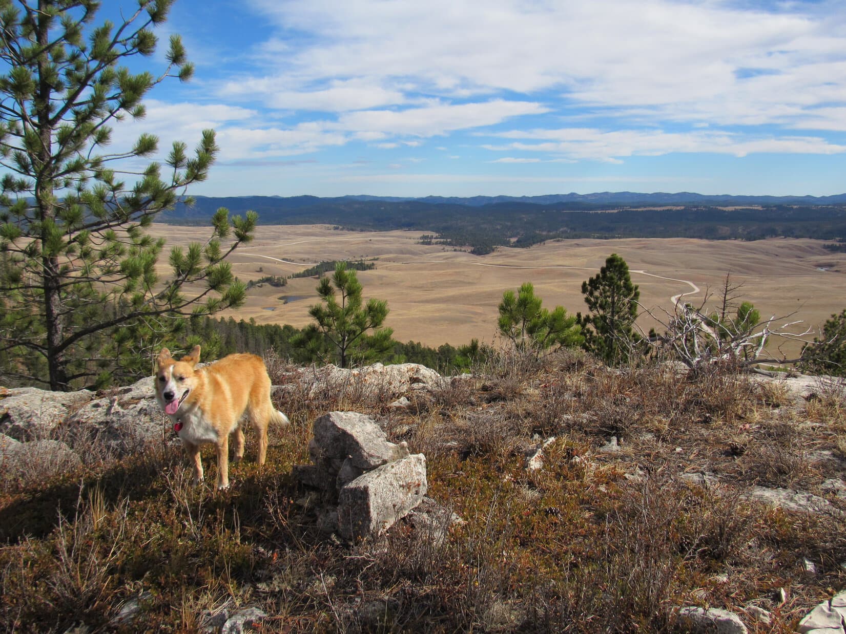
Returning to No. 157, Lupe crossed the bridge.  The road went past a house over to the SW side of the Castle Creek valley, before turning SE for 0.5 mile.  Lupe could still see the G6.  Beyond it was a forested ridge featuring an impressive limestone cap.  This late October morning was cool and bright.  Everything was bathed in sunlight.  What a beautiful day!

Lupe on USFS Road No. 157. The red G6 is in view parked near West Deerfield Road on the other side of the Castle Creek valley. Photo looks NNE.

The first part of the plan for the day was to take No. 157 from the Castle Creek valley up into the limestone plateau country.  Lupe didn’t start gaining elevation until she was getting close to a big bend where No. 157 makes a nearly 180° turn going around the SE end of a forested ridge.  After making the turn, the road climbed steadily heading WNW high on the SW side of the ridge.  Private property down in the Silver Creek valley could be seen below.

About 0.33 mile from the big bend, Lupe reached an intersection with USFS Road No. 157.1A.  Loop had followed No. 157 up the Silver Creek valley at least a couple of times on previous Black Hills expeditions, but she’d never been on No. 157.1A before.  The topo map showed that No. 157.1A stayed higher up near the spine of the ridge, and would eventually feed back into No. 157 again in a couple of miles.

Why not?  Exploring a new route is usually fun.  Lupe took No. 157.1A.

No. 157.1A went NW for a while.  Low juniper bushes provided scattered ground cover beneath a pine forest.  The terrain sloped moderately up to the NE.  The road stayed within a few hundred feet of the top of the ridge.

Lupe gained a fair amount of elevation.  However, the day’s early sunshine seemed to have vanished.  It actually seemed colder now than when Lupe had started out.  The mood of the day had really changed.  Gone was the bright cheerfulness.  Suddenly the forest felt quiet, remote, sullen – like late fall of a dying year, with more than a hint of winter.

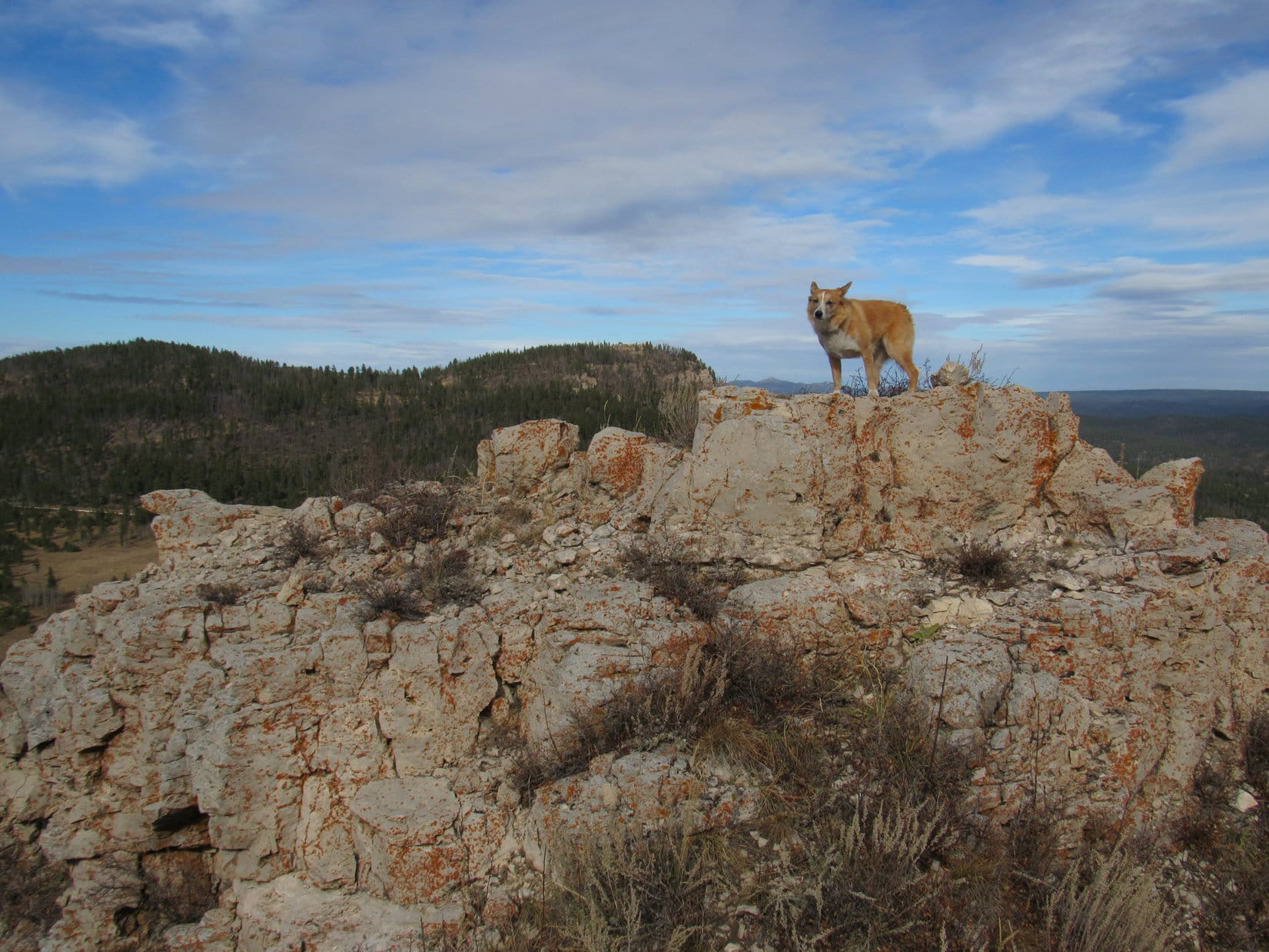
Lupe might get a decent look at the Castle Creek valley from the top of the ridge, if a place could be found where trees didn’t block the view.  As she went on, a few rocks appeared near the ridgeline.  Close to one of these rocks a narrow, gray opening could be seen between the pines.  Might as well take a look!  Lupe sniffed her way through the forest to the top of the ridge.

No wonder the mood had turned grim and chill!  Lupe could see Castle Creek valley alright, but the sky was completely overcast.  Not a speck of blue anywhere.  Mountaintops across the valley were shrouded in fog.

At this little opening along the ridge near USFS Road No. 157.1A, Lupe could see Castle Creek valley below. However, the mountaintops were now cloaked in fog, and the day’s earlier cheerful, sunny mood had vanished. Photo looks N.

Lupe went NW through the forest a little way, then returned to the road.  She reached it near a “Y” intersection.  USFS Road No. 157.1C branched off to the N here, going over a small saddle.  The maps showed it would eventually dead end.

The American Dingo stuck with No. 157.1A, which headed more W than before.  The road climbed more steeply for a little way before leveling out.  Lupe had left the edge of Castle Creek valley behind now.

Continuing W on USFS Road No. 157.1A.

As Loop traveled onward, it appeared as though there were high points off to the SW which might provide a view of Silver Creek valley.  She didn’t bother going over there, though.  Probably not worth the effort with low clouds and fog around.  The Carolina Dog stayed on the road, which wound around still heading W.

Lupe continues W on USFS Road No. 157.1A. The scene varied somewhat along the way. Lupe saw high points off to the SW that she didn’t bother visiting that might have provided a view of the Silver Creek valley. Sometimes there were rock formations to the N or NE. This area had quite a bit of deadfall timber.

Suddenly, Lupe noticed a pickup truck ahead parked on the road.  Two men dressed in camouflage were standing near it.  Hunters!  Lupe and SPHP had to go right by them.  Neither looked or acted friendly.  The younger one asked SPHP only where Lupe was going, and seemed suspicious of the answer – Crows Nest Peak.  Meanwhile, the older man fiddled with a bow and ammunition.

No doubt Crows Nest Peak (7,048 ft.) was an unlikely response.  Crows Nest Peak was still miles away.  Furthermore, though one of the highest points in the Black Hills, Crows Nest Peak wasn’t much of a peak at all, just a spot in the woods nominally higher than the surrounding terrain.  Why would anyone be going there?  Wandering alone way out here on a gloomy day like this was probably suspicious enough itself.  Crows Nest Peak must have seemed a doubly suspicious and evasive answer.

Lupe went right on by the hunters.  SPHP had no intention of stopping to explain.  If the hunters were surprised to see Lupe, seeing them had been a surprise, too.  Best to avoid any possibility of getting into a quarrel with armed strangers with unfriendly dispositions, especially in such a remote place.  These guys were weird – in an unbalanced, slightly threatening way.

That was it, though.  Nothing happened.  Lupe reached the end of USFS Road No. 157.1A where it met up with No. 157 again.  This was familiar territory, although it had been 2 years since Looper had last been here.  For more than a mile, she continued WNW on No. 157.  She reached a junction with No. 157.1F, which headed N to Fulton Draw.

Lupe didn’t need to go to Fulton Draw.  It only led back down to Castle Creek.  She stayed on No. 157, which gradually began curving SW.  The terrain was flat along in here.  Lupe had already gained most of the elevation she would need to on the way to Crows Nest Peak.

More than 0.67 mile beyond No. 157.1F, Lupe reached another junction.  An unmarked road branched off to the R.  Just beyond this intersection, a barbed wire fence crossed No. 157.  Lupe made a short foray along the unmarked road.  She came to a place where ice rested in large, muddy ruts at a curve in the road.

A short exploratory foray along the unmarked road brought Lupe to these ice-filled muddy ruts at a curve.

Hmm.  If Lupe managed to make it to Crows Nest Peak today, it would be her 4th successful ascent.  However, she had only reached it once before coming from this general  direction.  On that occasion, traveling through the forest, Lupe had come to a small pond with cattails.

Was the cattail pond where this road was heading?  It seemed likely.  SPHP remembered a road near the pond, but Lupe hadn’t taken it.  Instead, from the cattail pond she’d followed a barbed wire fence a long way N or NW through the woods.  Although Lupe had ultimately made it to Crows Nest Peak, she’d gone a long way through a trackless stretch of forest with no real landmarks.  Trying that again in this weather seemed unwise.

Lupe returned to No. 157 and continued past the barbed wire fence.  SPHP expected her to reach a road going to Procunter Spring pretty soon, but she didn’t.  Odd.  After more than 0.5 mile, Lupe reached a “Y”.  Only the branch to the R could possibly be the way to Procunter Spring, but even it didn’t seem quite right.

Lupe reaches another road intersection. Did the road to the R lead to Procunter Spring? SPHP knew Lupe was near the N end of Coulsen Hughes Draw, but being here in the fog was disorienting, as though Lupe was in a dream.

The Carolina Dog had been here before.  Loop wasn’t far from Coulsen Hughes Draw.  SPHP was certain of that.  Yet it had been years since she had been at this exact spot.  Being here now in the fog felt like a dream where things look familiar, yet are all jumbled up.  Which way?

SPHP checked the map.  Somewhere around here, Loop was supposed to leave No. 157 and travel NW staying on high ground.  The actual terrain didn’t seem to match up very well with what the map showed, though.  Slightly higher ground was back the way Lupe had come to reach this intersection.  Maybe it made sense to retrace her route a little before plunging into the forest?

So that’s what Lupe did.  She went back to a place where there was a bit of a hill off to the L.  Despite misgivings, SPHP then followed her into the trees.  In the fog, the forest seemed mysterious, abandoning the road faintly dangerous.  The only real landmark Lupe would come to was a huge field 1.5 to 2 miles off to the NW.  It might be terribly easy to get turned around and lost before ever getting there.

Lupe hadn’t gone far before there was reason for concern.  She’d climbed the small forested hill, but the high ground she was supposed to follow NW from here didn’t seem to exist.  Instead, the forest sloped gradually down in every direction.  Not far ahead, a meadow could be glimpsed through the trees, which didn’t seem right either.  May as well check it out, though.

Lupe reached the edge of the meadow.  What she saw was surprising, almost shocking.  The meadow was wide and very long, so long the end couldn’t be seen in either direction.  It made no sense.  How could Lupe have missed this huge meadow on her prior attempts to reach Crows Nest Peak from this direction?  It seemed impossible, yet here it was.

Which way?  Lupe looked expectantly at SPHP.  What was the holdup?  SPHP stood staring at the meadow, pondering the view first in one direction, then the other.  Not a clue.  Everything looked wrong.  Nothing made sense.  There had to be an explanation, though.  What was it?

Confusion vanished.  Certainty came flooding back.  Oh, yeah, it all made sense now!  This long meadow was the NW branch of Coulsen Hughes Draw.  Had to be!  SPHP had become disoriented in the fog, apparently even before Lupe had left the road.  This meadow didn’t run E/W like SPHP initially believed.  Lupe had been traveling W, not N, going over the hill.  This meadow went N/S.

Lupe turned N, gradually gaining elevation.  As expected, the American Dingo soon came to an old wooden sign where the road to Procunter Spring crossed Coulsen Hughes Draw.  Whew!  Back on track.  Simply amazing how easy it had been to get turned around in the fog!

When Lupe found this sign along USFS Road No. 157 in Coulsen Hughes Draw, SPHP was finally certain where she was again. It was amazing how easily disoriented SPHP had become in the fog! Photo looks NE.

Puppy, ho!  Lupe still had a long way to go to get to Crows Nest Peak.  At least she knew which way to go now.  From the sign, Loop followed No. 157 going NE.  When the road curved E, she took a side road heading N through a gap in a fence.

The side road had a lot of deadfall timber on it.  Lupe soon left it heading WNW across the upper end of Coulsen Hughes Draw.  Moderately higher ground was ahead.  Lupe reached the top of a broad forested ridge.  This was part of the high ground she had been supposed to take NW, though she was farther W on it than SPHP had intended.  No matter, Lupe could get to Crows Nest Peak this way.  Onward!

On the broad ridge NNW of Coulsen Hughes Draw. Photo looks N.

For 0.75 mile, Lupe traveled N or NW on top of the broad ridge.  It was still overcast, but not as foggy up here as it had been back at Coulsen Hughes Draw.  Lupe ran and sniffed.  There was no road or trail to follow.  Lupe loved exploring, and things seemed to be going well.

Farther N on the ridge, Lupe came to this nice stand of white-barked aspens. Photo looks NW.

At the N end of the ridge, the terrain began sloping down.  Lupe came to another road, which seemed vaguely familiar.  Lupe had been here on one of her previous expeditions, hadn’t she?  The American Dingo followed the road downhill to the W a short distance, before leaving it to continue N.

More pretty white aspens seen on the way down off the ridge. Photo looks WNW.

Lupe went over a small forested hill, and quickly arrived at the edge of a big field.  Yes!  Reaching this field meant Loop was less than a mile from Crows Nest Peak.

Finally at the big field. Reaching this point meant Loopster was less than a mile SE of Crows Nest Peak. Photo looks SW.

At the far side of the field, Lupe could see a road heading N into the forest.  This might well be USFS Road No. 266.  Lupe crossed the field.  The road wasn’t marked, but it was going the right way.  Loop and SPHP took the road.

After passing through a stretch of forest, what looked like the level top of an earthen dam for a stock pond could be seen off in the woods.  Lupe went over to check it out.  Sure enough, a small iced-over shallow pond was on the other side.  Not 15 feet away, down next to the pond, was the carcass of a deer.

Something alive was feeding on the carcass!  An instant after Lupe arrived on the scene, a head turned and fixed a beady yellow eye on her.  Unhappy at being disturbed, a huge feathery eagle launched into the sky and flew off.  It wasn’t a bald eagle, but the giant bird was still a sight to see.  You would have had to been there, though.  SPHP was way too slow to get a photo.

Lupe (L) at “Eagle Pond”. Photo looks SW.
Another look at Eagle Pond. Lupe on the L again. Photo looks W.
This deer carcass the eagle had been feeding on was only a couple feet from the frozen pond.

From Eagle Pond, the road Lupe was following turned W or WNW.  Loopster hadn’t gone too far on it when another road came in from the ENE.  A marker showed this was USFS Road No. 377.1B.

At the junction with USFS Road No. 377.1B. Finding No. 377.1B confirmed that Lupe had been following No. 266 since crossing the big field. Photo looks NE.

Finding No. 377.1B confirmed that Lupe had been following USFS Road No. 266 since crossing the big field.  Lupe took the road leading W from the junction.  Crows Nest Peak was no more than 0.25 mile away now.  In fact, Loop could soon see a hill N of the road.  The summit had to be up there.

Even though it was a slightly longer route, the Carolina Dog stuck with the road.  When she reached a familiar meadow SW of the summit, she turned N on a spur road that would take her there.  The spur is so seldom traveled that it didn’t even seem much like a road anymore.  It was more like a single track trail.

Nearly there! This spur road, which is so infrequently traveled it now seems more like a single track trail, curls up to the top of Crows Nest Peak from the SW. Photo looks SSW.

The spur road went N climbing a hill before leveling out.  A little farther on it curved E.  Lupe immediately arrived at the frozen remnant of a tiny pond.  She climbed up on a mound of red dirt at the W end.  She’d made it to Crows Nest Peak!  This wasn’t the official summit, which was still a football field E, but had to be about as high, and was the landmark Lupe always went by.

On the mound of red dirt at the W end of the tiny frozen pond. This pond is only a few hundred feet W of Crows Nest Peak’s summit. Photo looks SW.
The browns, pale blue, and white of the frozen pond were kind of pretty.
Looking E from the red mound on the W side of the frozen pond. The official summit of Crows Nest Peak is straight ahead a short distant into the trees slightly R of Center.

Lupe had come a long way.  Time to claim her peakbagging success!  The Carolina Dog left the frozen pond heading E.  She crossed a small grassy area.  There used to be a road here, but no trace of it remained.  At a small opening in the forest maybe 60 or 70 feet back into the trees, Lupe came to a survey stake and benchmark.

This was it!  This flat place in the forest entirely lacking views in any direction, a total and complete mockery of its name, was one of the highest spots in the whole Black Hills.  Lupe was at the official summit of Crows Nest Peak (7,048 ft.).

Intrepid explorer and adventurer, Lupe the Carolina Dog, reaches the summit of Crows Nest Peak for the 4th time. Photo looks NE.
105 years have passed since this survey benchmark was placed on Crows Nest Peak in 1912. While much of the rest of the world has been transformed since then, Crows Nest Peak can’t have changed too much, at least not yet. Lupe and SPHP like it that way.
Crows Nest Peak summit. Some crow’s nest! This joint is flat as a pancake and devoid of views. Yet this remote high ground is still one of Lupe and SPHP’s favorite spots in the entire Black Hills. Photo looks E.
Yes, I made it! You didn’t really think a little fog was going to stop an American Dingo, did you?

It had been a long, and occasionally confusing trek.  Lupe and SPHP took a half hour break near the survey marker.  Taste of the Wild, water, and an apple.  Tiny snowflakes drifted down on a light swirling breeze.  The temperature must have been at or below freezing, but the tiny flakes all melted as they hit.

Cold, humid, quiet.  SPHP sat on the ground petting Lupe’s soft fur.  She liked that.  Snowflakes filled the air.  It felt again like winter was coming.  Hidden in the remote high country, despite the absence of views, Crows Nest Peak was still a magical place.

This foggy, overcast day had been the perfect day to come here.  It didn’t matter that there weren’t any views.  Lupe wouldn’t have been able to see them anyway, even if there had been some.  Her journey here had felt more mysterious and adventurous beneath the close gray sky.

It seemed like Lupe still had plenty of time; she’d gotten off to a fairly early start this morning.  Hard to tell for certain, though, without being able to see the sun.  It was one thing to wander around in the fog, entirely another to get caught in darkness away from any road on a cold, snowy night.  Lupe at least better get back to No. 157 before it got dark.

On the way back, Lupe had many more adventures.  Although she was following the same basic route, she varied it enough to explore a fair amount of previously unseen territory along the way.  The temperature slowly dropped.  It didn’t snow all the time, but it did more and more often.  Never too hard, and the snowflakes were never too big.

Starting back. Lupe near the tiny frozen pond toward the W end of Crows Nest Peak. Photo looks WSW.
At the junction of USFS Roads No. 266 & 377.1B, this unmarked road went S. Lupe explored it all the way back to the big field. Photo looks S.
Upon reaching the big field somewhere SW of where Lupe had crossed it before, the unmarked road went past this larger pond. Photo looks ENE.
Back at the big field. Photo looks SSE.
On another road after crossing the big field. Loop is now heading for the start of the big trackless ridge leading back to Coulsen Hughes Draw and USFS Road No. 157. The N end of that ridge begins only a little SE of here. Photo looks NW.

This seemed to be a big day for discovering frozen ponds.  A little E of the ridge Lupe had followed N from Coulsen Hughes Draw earlier, Loop found yet another one in a shallow valley.

On the way back, Lupe discovered this pond E of the big ridge she had followed N from Coulsen Hughes Draw earlier in the day. Photo looks S.

A faint road leading S from this pond ultimately proved to be the same one where she’d left USFS Road No. 157 hours ago.  This proved that the pond was situated at the far, far N end of Coulsen Hughes Draw.

Upon reaching No. 157 again, Lupe followed it E.  She hadn’t gone too far, when she came to a barbed wire fence.  Beyond it was the old cattail pond!

Lupe reaches the cattail pond along USFS Road No. 157. Photo looks NE.

The cattail pond was the last pond of the day.  No. 157 turned S here, and quickly led Lupe past the muddy ruts with ice in them she had seen before.  Another mystery solved!

The Carolina Dog’s explorations were nearly over now.  Lupe stuck to No. 157 going E.  She passed by No. 157.1F again.  She returned to No. 157.1A.  The weird hunters were gone.  Good!

It snowed harder.  In a few places, a little began to stick.  A 15 minute off-road foray to a potential viewpoint revealed only snow and fog.  OK, that was it.  The rest of the way back was all business.  Lupe watched, but didn’t even bark at a herd of cows grazing near the junction of USFS Roads No. 157.1A and No. 157.

Near the junction of USFS Roads No. 157.1A and No. 157. Lupe watched, but didn’t even bark at these cows. Photo looks S.
Heading down USFS Road No. 157. The Silver Creek Valley is below on the R. Photo looks SE.

Lupe hopped into the G6 without hesitation (5:57 PM, 29°F).  Moments later, a frigid wind came out of the NW blowing snow much harder than before down Castle Creek valley.

During October, 2017, Lupe had visited many of the highest peaks in the Black Hills along the E edge of the limestone plateau.  In most cases she hadn’t been to these peaks in more than 2 years.  Expedition No. 213 had been a fun day out, but suddenly it was looking like Crows Nest Peak would be the last the Carolina Dog would see of the high country this year.

On USFS Road No. 157 back in the Castle Creek valley at the end of the day. Photo looks NW.

Links:

Next Black Hills Expedition                    Prior Black Hills Expedition

Want more Lupe adventures?  Check out her Black Hills, SD & WY Expeditions Adventure Index, Master Adventure Index, or subscribe free to new Lupe adventures!

Black Hills, SD Expedition No. 212 – South Castle Rock, Castle Rock, Nipple Butte & Flag Mountain (10-22-17)

Start – 10:28 AM, 46°F, at the first pullout along West Deerfield Road near Castle Creek W of the intersection with Deerfield Road (County Road No. 306)

Fall colors were over and done with.  Sad, but the glories of autumn fade quickly.  Nothing new about that.  Lupe was still enthused!  This bright, comfortably cool day in late October was made to order for a continuation of the Carolina Dog’s recent tour of some of the highest peaks of the Black Hills along the E edge of the western limestone plateau.

Today, Lupe would visit 4 such peaks.  She’d been to all of them before more than once, but it had been well over two years since her most recent visit and would be fun to see them again.  Besides, SPHP had promised Loop she would get to explore a whole new canyon on the way back at the end of the day.

Something old, something new, that’s what we’re gonna do!

If that’s supposed to be poetry, SPHP, don’t quit the day job.

Hah, too late, I already have!

My, what a big deficit you’re running, SPHP!

Never mind that, the better to go adventuring with you, my dear Dingo!

Loopster was totally in favor of that.  She started off with a quick look at pretty Castle Creek, which somehow always has good flow even during seasonally dry periods like this.  Then the American Dingo crossed West Deerfield Road and began the climb toward her first peakbagging objective, South Castle Rock (6,840 ft.).

Expedition No. 212 begins with a quick look at Castle Creek. Photo looks NNW.
Looking NW up the Castle Creek valley after crossing West Deerfield Road.

A short climb through a pine forest brought Loop to a grassy field.  The upper S face of South Castle Rock was already in view.  This was going to be a nice, easy stroll most of the way.  Lupe headed N through the field, passed through another forested stretch, and was soon back out in the open again.  The only short steepish part of the whole climb was up in the trees directly ahead.

After a short climb through a pine forest, Loop reaches a grassy field. The upper S face of South Castle Rock is already in view in the distance. Photo looks N.
Getting closer! Lupe squints in the bright morning sunshine. Photo looks N.
The only steep part of the climb up South Castle Rock is in the trees ahead. Photo looks NNW.

The best views from South Castle Rock aren’t from the summit, but from limestone cliffs high up on the far S ridge.  That was right on Lupe’s way to the summit, so she went there first.  She had a great panoramic view to the S and E from here.  To the N, Loop could see the end of nearby Castle Rock’s E ridge.

From limestone cliffs along South Castle Rock’s far S ridge, Lupe had sweeping views to the S & E. Photo looks SE past Deerfield Reservoir.
The end of Castle Rock’s E ridge is seen on the R. South Castle Rock and Castle Rock are different parts of the same mountain. Photo looks N.
At the edge of South Castle Rock’s S ridge. Photo looks N.

South Castle Rock has two high points.  Being slightly higher, the N high point is the actual summit.  From the cliffs along the S ridge, Lupe circled well W of the S high point before turning N again.

The summit wasn’t far off, but the discouraging sight of all the deadfall timber Lupe had to traverse to get to there made SPHP realize the Komperdell trekking poles generously gifted by Jobe Wymore had been forgotten in the G6.  Doh!  SPHP had used them for the first time a week ago on Expedition No. 211.  The poles had been quite useful for nagivating deadfall then, and would have been handy to have here.  Oh, well!

After circling around the S high point, the sight of all the deadfall on the way to the true summit made SPHP realize the Komperdell trekking poles had been forgotten in the G6. They would have been mighty handy to have here! Photo looks N.

The true summit of South Castle Rock (6,840 ft.) sits at the N end of a fairly large limestone cap surrounded by low cliffs.  Getting through the deadfall to reach the cap was the hard part.  That done, Lupe circled to the SW where the cliffs were lowest.  One mighty, unassisted, clawing leap, and she was on top!

At the highest point at the N end, someone had built a cairn since Lupe was last here.  Trees hid the views in most directions, but Loop did have a tremendous view of Reynolds Prairie to the E.  She also had a clear view of Castle Rock’s E ridge to the NE.

Lupe arrives at the S end of South Castle Rock’s limestone cap. She was able to leap on top from a point farther W (L). Photo looks NW.
At the summit. Someone had built the small cairn next to her since the last time Lupe was here in June, 2015. Although forest hides the views in most directions, Lupe could see much of Reynolds Prairie to the E. Photo looks E.
The slightly lower summit of Castle Rock (6,783 ft.) is on the ridge seen beyond Lupe. That’s where she was heading next. Photo looks NE.

After a short break near the cairn, Lupe left South Castle Rock’s limestone cap at the same SW point where she’d leapt up.  Less than a 0.25 mile trek brought her to Castle Rock’s E ridge.

The E ridge was 200 feet wide and rounded, sloping down toward cliffs on both sides.  The top was nearly level along most of its length.  Lupe followed the ridge ESE all the way to where the ground started dropping toward the cliffs at the far end.  The true summit seemed to be here near the ESE end, but it was hard to tell for certain.  Having traveled the whole length of the ridge, Loop must have been at the actual high point somewhere along the way.

The apparent summit of Castle Rock (6,783 ft.) was forested and clogged with deadfall, but Lupe had great views from the cliffs along the edges of the ridge in every direction except back to the W.

At the summit of Castle Rock as near as SPHP could determine. A glimpse of the N end of Reynolds Prairie is seen below. Photo looks NE.
South Castle Rock as seen from Castle Rock. The summit is on the R. Photo looks SW.
Looking SE from Castle Rock’s E ridge. Parts of Deerfield Reservoir are seen beyond Reynolds Prairie. The distant high ridge on the R is Green Mountain (7,166 ft.).
Nipple Butte (6,810 ft.) (L) and Flag Mountain (6,937 ft.) (Center), Lupe’s 2 remaining peakbagging destinations for the day, from Castle Rock’s E ridge. Photo looks N.

After visiting Castle Rock’s summit on the E ridge, Lupe headed back W.  Although the mountain’s long, skinny N ridge is somewhat lower, she went out onto it.  A big, flat, barren area at the southern end of the N ridge provides good views to the W and NE.  This area is Lupe and SPHP’s favorite part of Castle Mountain.  Despite the openness, the whole place has a secluded, tucked-away feel.

Loop on the big barren area near the S end of Castle Peak’s long, skinny N ridge. This is a favorite spot! Flag Mountain is seen beyond Nipple Butte on the R. Photo looks N.
An expansive view of the N end of Reynolds Prairie. Photo looks NE.
Looking W from Castle Peak’s N ridge. SPHP promised Lupe she would get to explore this big canyon on the way back to the G6 later on.
Flag Mountain is partially hidden by Nipple Butte on the L. Custer Peak (6,804 ft.) is the distant high point on the R. Photo looks N with help from the telephoto lens.

The easy way off Castle Rock’s N ridge is found on the E side almost at the S end.  Lupe followed an animal trail down there.  She lost elevation traveling N well below Castle Rock’s N ridge where the slope wasn’t too bad.  This was a forested area full of long grass hiding an annoying amount of deadfall timber.  SPHP was soon wishing for those Komperdell trekking poles again.

Nipple Butte (6,810 ft.), Lupe’s next destination, was 0.5 mile away.  The deadfall didn’t let up until she reached the saddle leading to Nipple Butte from Castle Rock.  Once she traversed the saddle, the climb steepened quickly.  Lupe was approaching from the S, but the best way up is a chute on the WNW side of the mountain, so she circled around to the W as she went higher.

The top of Nipple Butte is a ragged, rugged chunk of limestone with lots of broken rock below on most of the surrounding slopes.  Of all the peaks Lupe was visiting on Expedition No. 212, Nipple Butte was the only one that was at all scrambly.  The Carolina Dog got a bit too high, too soon, reaching the rocky slopes while she was still SW of the summit.

Loop reaches the rocky zone while still SW of Nipple Butte’s summit. Photo looks NE.

It would have been faster, if Loop and SPHP had circled around farther to the W before getting so high, but it didn’t really matter.  Lupe crossed a slope of broken limestone scree, and reached the chute on the WNW side of the mountain.

At the start of the steep chute up to the summit area. This chute is on the WNW side of Nipple Butte. Photo looks NE.

The chute was steep, but not long.  Lupe was at the top in no time.  Before going to Nipple Butte’s true summit, she got up on the high point N of the upper end of the chute.

On Nipple Butte’s N high point. Flag Mountain is in view at Center. Photo looks N.

From the top of the chute, a six foot high wall of limestone was all Lupe had to get up to reach the summit.  The six feet were simply too high and vertical for her to manage on her own.  However, there were a couple of rocks SPHP could stand on from which she could be boosted to the top.

Meekly, the American Dingo lifted one of her front paws.  She needed help and was ready for assistance.  SPHP picked her up, stepped into position, and lifted her to the small limestone platform at the top of Nipple Butte.  SPHP then scrambled up after her.

A single chunk of limestone 1.5 feet higher than the rest of the summit platform is the true summit.  It was large enough for Lupe to stand on.  So easy, yet dramatic.  She’d made it!  There Lupe stood, on the tiny absolute top of Nipple Butte (6,810 ft.) with 360° views!

Oh, yeah!  Nice work, Loop.  Photo time!

Loop at the summit of Nipple Butte. Photo looks SW.
Most of the summit platform is in view here. Photo looks SW.
Oh, so beautiful, Looper! If your big soft Dingo ears were any larger, you look like you could use ’em to take off and fly away. Don’t try it, though!
Looking SW. The summit rock is now in the foreground on the R.
Next to the summit rock. Still looking SW.
The N end of Reynolds Prairie. The N high point of Nipple Butte, which Lupe was on earlier is seen on the L. Photo looks NE.
Flag Mountain (6,937 ft.) (R) from Nipple Butte. USFS Road No. 189 is in view. Photo looks N.
The middle of Reynolds Prairie. Photo looks E.

Lupe and SPHP sat together up on Nipple Butte for a little while.  The sense of space and airiness from the tiny platform is among the best on offer anywhere in the Black Hills.

When the time came to go, SPHP climbed down first.  The American Dingo remained on top for one last photo atop the summit rock.

The summit as seen from Nipple Butte’s N high point. The 6′ high limestone wall SPHP boosted Loop up is at Center. The vegetated area below is the top of the chute Lupe climbed to get here. The forested ridge on the L is Castle Rock. Photo looks S.
The S end of Reynolds Prairie, bits of Deerfield Reservoir, and the distant high ridge of Green Mountain (R) from Nipple Butte. Photo looks SSE.

One more peak to go!  SPHP helped Loopster off the summit platform.  Puppy, ho!  Back down the steep WNW chute to broken limestone scree leading to scattered boulders, and finishing it all off with the usual deadfall infested trek in the forest.

Heading down the WNW slope. Photo looks W.

Lupe reached USFS Road No. 189 at the saddle leading to Flag Mountain.  Half a mile NW of here a spur road leaves No. 189.  The spur winds 0.75 mile NE almost to the top of Flag Mountain.

Nah, not that way!  Instead, Loop crossed No. 189 heading N.  Traveling directly up Flag Mountain’s S ridge would be shorter and more fun.  An hour after leaving Nipple Butte, the Carolina Dog was standing in the remnant of the old fire lookout tower on Flag Mountain (6,937 ft.).

Lupe in the remnant of the old fire lookout tower on Flag Mountain. Photo looks E.
Perched up on the wall, feeling good about her 4th successful ascent of the day!
Looking S back where Lupe had come from. Nipple Butte is seen in front of Castle Rock (Center).
Looking W along Flag Mountain’s summit ridge.
Near the remnant of the fire lookout tower. Photo looks E.
Another look from a bit farther W.

Flag Mountain was the highest of any of the peaks Lupe climbed today.  The views were grand, though this much larger summit area did not give quite the same feeling of exposure and airiness she’d had up on Nipple Butte.

Early in the day, there had only been a light NW breeze.  By the time Lupe reached Nipple Butte, the wind had switched to the SW and picked up to about 15 mph.  The same SW wind was still blowing up here.  With the sun now noticeably progressing toward the horizon, the breeze felt a bit chilly.

Lupe and SPHP lingered up on Flag Mountain anyway.  This was warm compared to what would likely be coming before too long.  Who knew how many more weeks it would be before cold and snow would take over up in this western high country?

Lupe lingers on Flag Mountain. Who knew how much longer it would be until snow and cold would take over in this western Black Hills high country? Reynolds Prairie is on the L. Both Nipple Butte and Castle Rock are on the R. Photo looks SSE.
White Tail Peak (6,962 ft.) is the long ridge at Center. Lupe had enjoyed some fabulous views from there only 3 weeks ago on Expedition No. 209. The more distant mountain on the R is Terry Peak (7,064 ft.). Photo looks N.
From the wall of the old lookout tower, Peak 6962 (Center) is in view. Photo looks NNW.
Black Elk Peak (7,231 ft.) is the high point on the far horizon at Center. As the highest mountain in South Dakota and the Black Hills, many of Lupe’s expeditions feature a view of Black Elk Peak from one direction or another. Photo looks SE.

With 4 successful ascents, Lupe had completed all of her peakbagging objectives for Expedition No. 212.  The time had come for SPHP to honor the promise to let her roam some never before explored territory in the big canyon W of South Castle Rock, Castle Rock and Nipple Butte.

Final moments up on Flag Mountain’s summit ridge before descent. Photo looks NE.

Lupe left Flag Mountain traveling W.  She ultimately took a route down similar to her path up, following the S ridge much of the way.   An early turn to the SW served as shortcut to USFS Road No. 189.

Once across No. 189, the American Dingo began her explorations of the big canyon traveling SSW.  It was downhill from here all the way to West Deerfield Road.

NNW of Nipple Butte looking forward to starting the long trek down the big canyon. Photo looks SSE.

Lupe saw lots of deer.  She got muddy paws and drank from a small stream, a tiny tributary of Horsethief Creek, itself no great torrent.  Looper was one busy Carolina Dog the whole way, free to run and play.

In the upper part of the canyon W of Nipple Butte. This seldom, if ever, used road went most of the way down the canyon. Photo looks SSW.
Miss Muddy Paws after a drink from the tiny stream. The road was reduced to a single track trail here. Photo looks S.
Somewhere W of Castle Rock or South Castle Rock. The faint road is back. Looking S.
Near Horsethief Creek in the lower end of the canyon, now more of a wide valley. Photo looks NNE.

The sun was close to setting by the time Lupe neared West Deerfield Road.  The G6 was a only short walk SE along the road.  Expedition No. 212’s adventures were almost complete.  Behind Loop, the top of South Castle Peak still glowed in the last light of day.

South Castle Rock glows in the last light of another great day spent in Lupe’s Black Hills. Photo looks NNE.

That glow was gone before Lupe even got to the G6 (6:01 PM, 36°F).  Expedition No. 212 might be officially over, but Lupe’s fun wasn’t.  She was back early enough so twilight would last a long time.

For nearly an hour on the ride home, a frantic American Dingo watched for deer, cows and horses to bark at.  Many decibels provided near constant earsplitting proof of the success of this project.  No doubt a hugely satisfying encore to a splendid day!

South Castle Rock.

Links:

Next Black Hills Expedition                   Prior Black Hills Expedition

Want more Lupe adventures?  Check out her Black Hills, SD & WY Expeditions Adventure Index, Master Adventure Index, or subscribe free to new Lupe adventures!