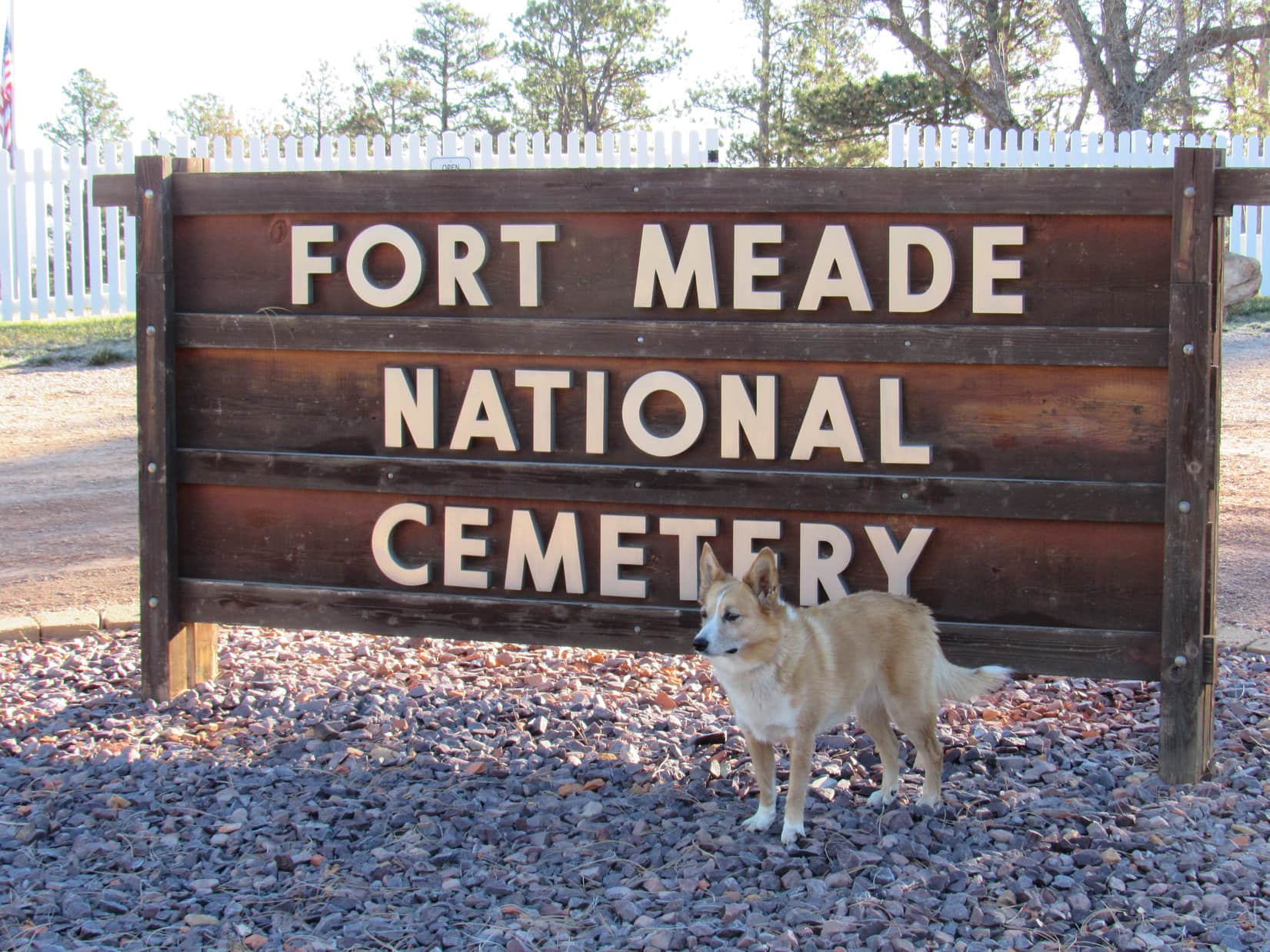
Start – Fort Meade National Cemetery near Sturgis, 8:46 AM, 35°F
Lupe arrived at Fort Meade National Cemetery the day after Veteran’s Day. The cemetery was officially closed this time of year. Loop wouldn’t have gone in even if it wasn’t. Some might consider an American Dingo prancing around a cemetery disrespectful, even though she wouldn’t have done any harm.
Lupe arrived at the Fort Meade National Cemetery the day after Veteran’s day on a bright, crisp morning.
Lupe was actually here to visit a few peaks near Sturgis she’d never been to before. Once SPHP was ready, she crossed the road W of the cemetery, and started climbing along a ridgeline through a pine forest. She didn’t have far to go before reaching a broad meadow of tall grass.
W of Fort Meade Cemetery, Lupe reaches a meadow of tall grass near the start of her way up Peak 3950. Photo looks W.
In the meadow, Loop happened upon a dirt road that curved SW. She followed it higher back up into the forest. A huge dead tree had fallen over the road, blocking it completely. From the trunk of the dead tree, Lupe could see Bear Butte(4,422 ft.) off to the NE rising dramatically from the surrounding prairie.
From the trunk of the dead tree, Lupe saw Bear Butte rising dramatically from the surrounding prairie. Photo looks NE.Bear Butte’s summit is the N end of Centennial Trail No. 89 which winds 111 miles through eastern portions of the Black Hills all the way to Wind Cave National Park.
The road climbed steadily through the forest. Before long, though, the terrain began to level out. The forest became more open and park-like, and the road curved NW.
Off to the SW, it looked like there might be views from the edge of the mountain. Lupe left the road to explore in that direction. Several deer fled as she approached the edge. Loop had a nice view of the valley S of Sturgis.
Lupe came to this nice view of the valley S of Sturgis. Photo looks SSW.
Peak3950 was Lupe’s destination. The summit was only 0.5 mile NW from here. Lupe traveled NW near the sharp SW edge of the mountain. At first, the terrain was level or rolling. The American Dingo had her choice of staying in the pine forest or out on another tall grass meadow, and did some of both. Bear Butte was still in view from the meadow.
On the way to the summit of Peak 3950, Lupe spent part of her time in this big tall grass meadow, from which she could still see Bear Butte. Photo looks NE.
In the meadow, Loop came upon the road again. She followed it NW back into the forest, gaining elevation at a moderate pace. Lupe stayed on the road until she was close to Peak 3950’s summit. The final part of the climb was an easy romp through the woods.
On the road again getting close to the top of Peak 3950. Photo looks NW.
Peak 3950’s summit area was large and relatively level. The highest part was near the N end. No single point stood out as the exact location of the true summit, but Lupe was satisfied. Climbing Peak3950 had been easy and fun.
Lupe at the top of Peak 3950. Climbing the mountain had been quick and easy. Photo looks SSE.On Peak 3950’s flat summit. Photo looks E.
At the top of Peak 3950, trees hid the views in most directions. However, along the edge of the steep W slope, Lupe found rock outcroppings from which she could see the town of Sturgis.
From rocks along the W rim, Lupe could see the town of Sturgis. Photo looks WNW.Sturgis, SD from Peak 3950. Photo looks NW.A look at the downtown area with a little help from the telephoto lens. Photo looks NW.Looking W.
Lupe could also see her next two peakbagging objectives. Oyster Mountain and Sly Hill were both in sight to the NW.
Lupe’s next peakbagging objectives were in view.Oyster Mountain(4,040 ft.) is the forested ridge on the L. SlyHill(3,920 ft.) is straight up from the blue water tank on the R. Photo looks NW.
Names, dates, and initials had been carved into the rocks Lupe was standing on. One rock S of the summit area even had a whole phrase carved into it.
Many names, dates, and initials were carved into rocks along the W edge of the mountain. Someone had gone to the trouble of carving the phrase “The fear of the Lord is to hate evil.” into this rock.
Lupe lingered on Peak 3950 for a little while, but didn’t stay terribly long. She still had more peakbagging to do. After sniffing around some and enjoying the views, it was time to head back to the G6.
On her way back down, Lupe returns to the upper tall grass meadow SE of Peak 3950’s summit. Photo looks SE.
Once Loop made it back to the G6 (10:41 AM), SPHP drove into Sturgis looking for a way to Oyster Mountain or Sly Hill. A mile NW of town, a road went N over a saddle on the ridge connecting the two mountains. A mile beyond the saddle, SPHP parked the G6 again (11:10 AM, 49°F).
Lupe got out ready to climb Oyster Mountain’s NE ridge. At first, she was in a mixed oak and pine forest, but she didn’t have far to go before reaching a meadow. Bear Butte was once again in view.
Lupe at the first meadow she came to on the way up Oyster Mountain. Photo looks SW.Bear Butte(4,422 ft.) from the lower slopes of Oyster Mountain’s NE ridge. Photo looks NE.
Just like on Peak 3950, Lupe found a dirt road in the meadow which took her higher and back into the forest. Loop followed this road SW most of the way up Oyster Mountain’s NE ridge. Sometimes she had glimpses of views along the way, but usually there were too many trees to see much of anything.
The road eventually reached a saddle. Loop would start losing elevation if she stayed on the road, so she left it. She headed W, still climbing steadily.
Before long, the Carolina Dog arrived at the top of a small hill. Maybe this was Oyster Mountain’s summit? SPHP wasn’t certain. The topo map had been forgotten in the G6.
Not long after leaving the dirt road, Lupe reached the top of this small hill. At the time, SPHP thought this might possibly be Oyster Mountain’s summit. Photo looks WSW.
Lupe continued W from the small hill, and soon reached a slightly higher hill. A ridge nearly the same height was in view to the SW across a small valley. The valley drained toward a depression to the W.
SPHP remembered the topo map had shown a depression close to Oyster Mountain’s true summit. Loop ought to be able to find the summit by crossing the valley, then following the ridge on the other side.
So that’s what she did. When Lupe made it up onto the ridge, she could see I-90 in the valley below on the other side.
After crossing the small valley, Lupe climbed up onto this ridge where she could see I-90 below. Photo looks SW.
Lupe followed the ridge WNW. The terrain was nearly level for a little way, but soon Loop saw slightly higher ground ahead. The summit had to be over there.
Oyster Mountain’s S slope from the ridgeline. The summit isn’t much farther ahead in the trees on the R. Photo looks WNW.
Shortly before reaching the top of Oyster Mountain(4,040 ft.), Loop came to a sparsely forested sunny hillside. Snow was visible on Terry Peak(7,064 ft.) on the far horizon. Closer by, Lupe had a nice view of heavily forested Crook Mountain(4,930 ft.).
Snow is visible on Terry Peak’s ski runs on the far horizon (L). Heavily forested Crook Mountain is in view on the R. I-90 is seen in the valley below. Photo looks SW.
Oyster Mountain’s summit proved to be a relatively narrow, 150 foot long, flat ridge. Forest blocked any views. Minor rock outcroppings that didn’t amount to much were on the S side near the far W end.
Lupe on top of Oyster Mountain(4,040 ft.). Photo looks ESE.Carolina Dogs are rarely seen on Oyster Mountain. However, the mountain’s odd and mysterious name was part of the allure that brought Lupe here. Oyster Mountain seems an unlikely name for a mountain in the Black Hills. Lupe was about as far from an ocean here as you can get in North America.Lupe goofing around trying to be silly and dramatic from the little rock outcroppings near the W end of the summit ridge. Photo looks E.
Loopster took her only Taste of the Wild break of the day up on Oyster Mountain. The shady summit ridge was a pleasant place. Traffic noise from I-90 only partially marred the sense of isolation.
On the way back to the G6, Lupe stopped by the sunny slope E of the summit again for a final look. She then left the ridgeline, cutting down to the depression in the small valley. The depression was bone dry now, but looked like a seasonal pond forms here during wet periods.
As she left Oyster Mountain, Loop swung back by this sunny slope E of the summit for a final look. Photo looks S.Lupe near the depression on Oyster Mountain. The depression was bone dry now, but looked like a seasonal pond must form here during wet periods. Photo looks W.
After leaving the depression, the American Dingo retraced her route up all the rest of the way down. Lupe had fun running and sniffing around, but it was only 1.25 miles back to the G6. It didn’t take her all that long to get there. (1:09 PM)
Loop still had one more peak to climb near Sturgis. SPHP drove to the saddle between Oyster Mountain and Sly Hill, parking near a fence surrounding a “rubble site” (1:16 PM, 52°F). A sign nearby indicated Dingoes might not be entirely welcome on Sly Hill, the top of which was only 0.5 mile to the SE. Hmmm.
American Dingoes can be quite foxy, and the name of her objective was Sly Hill, after all. Lupe wouldn’t hurt a thing. Off she went, slinking through the forest. It didn’t take her long to reach a wide flat meadow rimmed with pines. The topo map showed this area as the true summit of Sly Hill(3,920 ft.).
Lupe at the official top of Sly Hill according to the topo map. SPHP was skeptical that this was actually the true summit. Photo looks NW.The Sly Dingo on Sly Hill feeling pretty foxy.Near the S rim of Sly Hill, a bit SW of the official summit according to the topo map. Photo looks WSW.
The topo map showed another high point on Sly Hill only 0.25 mile to the SE. High Point 3917 was supposed to be almost as high as the official summit. Maybe Lupe should go on over there to check it out while she was still in the area? It seemed like the thing to do.
Off Lupe went. She lost a bit of elevation exploring a narrower part of the ridge that forms Sly Hill. Soon Loop was approaching High Point 3917, a far smaller area that came to much more of a definite peak than the official summit. She caught a glimpse of Bear Butte as she began the short climb.
Looking back along the ridge linking Sly Hill’s official summit and High Point 3917. Photo looks NW toward the official summit.As Lupe started the short climb up to High Point 3917, she caught this glimpse of Bear Butte. Photo looks NE with help from the telephoto lens.On the way up to High Point 3917. Photo looks SE.
Climbing High Point 3917 was easy. Lupe got up on the top rocks at the foot of a big pine tree. Up until now, SPHP hadn’t been totally certain where Lupe was on Sly Hill, but the views from here confirmed her position. Parts of Sturgis could be seen, though trees obscured some of the town.
Loopster on the highest rocks at High Point 3917 on Sly Hill.Western parts of Sturgis are in view here from High Point 3917. Photo looks S.Looking SE from High Point 3917. A small portion of eastern Sturgis is in view on the R.
Lupe’s exploration of Sly Hill was now complete, except for one thing. On the way to the official summit shown on the topo map, Lupe had passed N of some high ground that seemed like it might actually have been higher than the official summit.
So Lupe returned to Sly Hill’s official summit, then proceeded W looking for the high ground she’d bypassed earlier. She climbed a heavily forested narrow ridge. The official summit could not be seen from here, but SPHP would have bet money that this high point to the W was actually the true summit of Sly Hill.
Lupe on top of the high point W of the official summit. SPHP would have bet money that this was actually the true summit of Sly Hill(3,920 ft.). Photo looks WNW.
Lupe had done about all there was to do up on Sly Hill. The Carolina Dog left the W high point (and likely true summit) traveling NW along the ridgeline. This proved to be the most rugged terrain she’d come to on Sly Hill. She went by several interesting rock formations on the way down.
Loop on one of the rock formations she came to on the way down. Photo looks S.On the most impressive rock. Photo looks NW.
The Sly Dingo of Sly Hill made it back to the G6 without incident (2:34 PM). At least a couple of hours of daylight remained. With visions of Lupe making one more peakbagging attempt at yet another modest, seldom-visited hill, SPHP drove Lupe to the Whitewood area. She even got close to Spearfish. However, she had no luck at any other hills or mountains.
So Sly Hill was Lupe’s final peakbagging success of Expedition No. 215. That didn’t bother the Carolina Dog at all. She didn’t mind riding around barking at deer, cattle and horses at all! She had a blast the whole time, yipping and yapping until it was way too dark to see.
Looking across the saddle separating Sly Hill from Oyster Mountain (Center). Photo looks NW.
October 21st dawned bright and breezy, the air exceptionally crisp and clear. Puffy white clouds sailed the blue sky. SPHP knew instantly that cancelling had been a mistake, but nothing could be done about it. Yes, this was a breezy day, but nothing approaching the forecast 40+ mph wind gusts would ever materialize.
Lupe’s opportunity to meet new friends had been rescheduled. November 4th arrived, and she was finally on her way! What a day this was, though! Heavily overcast, dark and cold. Only a couple of days ago, the forecast had looked fine. Now this! Again too late to do anything about it. Expedition No. 214 was on, come what may!
At 7:59 AM, with exactly one minute to spare, Lupe arrived at the Latchstring Inn at Savoy in Spearfish Canyon. No sign of Rizzo, Buddy & Josh, yet. No worries, they’d be here soon enough. In the meantime, Lupe went over to take a look at the Spearfish Canyon Lodge.
The Spearfish Canyon Lodge at Savoy normally has wonderful views of some of Spearfish Canyon’s most impressive limestone cliffs. Today it was socked in with fog.
Looper also had time to check out Little Spearfish Creek.
At Little Spearfish Creek. Two of the best waterfalls in the Black Hills are on Little Spearfish Creek. Spearfish Falls is only 20 or 30 feet downstream of where Lupe stands here. Roughlock Falls is less than a mile upstream. Lupe wouldn’t get to see them today.
Rizzo, Buddy & Josh soon arrived. Rizzo and Buddy were so excited about going on an expedition, they weren’t about to hold still for a group photo. Lupe and her new friend, Josh, posed together, though.
Lupe and new friend Josh Hilpert at Savoy in Spearfish Canyon.
The date wasn’t the only thing that had changed for this first outing together. Only a couple of days ago, Plan A’s chosen destination had fallen through. A major disappointment at the time, but now clearly a good thing given the weather.
Josh had expressed interest in any routes Lupe knew of up into the country E of Spearfish Canyon. On prior expeditions Lupe had explored two such routes. Plan B was that Loop would take Rizzo, Buddy and Josh on one of them. Two specific destinations became Expedition No. 214’s objectives – Elk Mountain(6,422 ft.) and the cliffs overlooking Savoy.
Lupe’s route to Elk Mountain started at Annie Creek Road near Elmore, 4 miles up Spearfish Canyon from Savoy. The weather remained cold and heavily overcast, even a bit foggy, but everyone was in good spirits as the trek began. (8:36 AM, 32°F)
Lupe and her new friend Buddy near the start of Annie Creek Road. Photo looks N.
Annie Creek Road went N for 0.75 mile. Upon reaching the side canyon Annie Creek flows down, it turned NE for another 0.75 mile. The snowy road was an easy romp, being nearly level this whole way. It was a good place for everyone to become acquainted.
Lupe wasn’t used to having so much company, but the dogs all got along just fine. Buddy and Rizzo were adventure dogs, too! In fact, Rizzo and Josh have been enjoying their own weekly adventures in the Black Hills even longer than Lupe and SPHP. Buddy wasn’t as experienced in the adventuring business, having only recently joined the Hilpert family. However, it was clear he was relishing his good fortune.
The first big decision came at an intersection 1.5 miles from the start. The only time Lupe had been to Elk Mountain before was nearly 1.5 years ago. Back then, she had taken the road to the L, which went W back to Spearfish Canyon before turning NW. The road stayed level, but ultimately came to two places where old bridges had collapsed. Lupe had made it past the first resulting gap, but not the second. In the end, she’d had to climb a very steep slope, though once on top, this had ultimately proven to be a good direct route to Elk Mountain.
The other option was take the road to the R, which went NE up the Annie Creek valley. Last time, looking for a shortcut back to the G6 late in the day, Lupe had gone down a different steep slope that had brought her into this valley. SPHP remembered it had looked like Lupe could have followed roads all the way down, if she had been willing to take a somewhat longer route.
Nearing the first intersection. A decision would have to be made soon – go L or R? Josh crouches to stay in the photo (which he didn’t have to do). Buddy on the L while Rizzo circles around behind Josh. A familiar furry face out front and center. Photo looks N.Same spot, but showing better how foggy it was. Josh pats Buddy while Rizzo helps himself to some snow.
It was cold and damp. Ice and snow might make hillsides treacherous. It seemed best to avoid the steep climb up from the road to the L. The decision was made to turn R, following the road up Annie Creek valley.
Another intersection was reached only 0.25 mile farther on. Rizzo and Buddy crossed Annie Creek for a brief exploratory foray on a side road going SE up Lost Camp Gulch. That wasn’t the way to Elk Mountain, though, so they quickly returned.
Buddy (L) & Rizzo (R) return from a brief foray up Lost Camp Gulch. The small stream is Annie Creek. Photo looks SE.
Lupe and SPHP had never been this far up Annie Creek before, but it seemed reasonable to continue on the road following the creek a little farther before looking for a way up onto higher ground to the N. Rizzo, Buddy and Josh had never been here before either, so they simply tagged along.
The road following Annie Creek headed NE, beginning to gain significant elevation above the stream on the way. Eventually a minor side road appeared on the L. It went N up a steep, forested slope. N was the right direction, so the side road seemed like a good way to reach higher ground quickly.
After a steep climb, the side road leveled out as expected. The forest was pretty foggy up here.
Buddy and Lupe on the minor side road once it leveled out. The forest was cold and quite foggy up here. Photo looks NNW?
Elk Mountain couldn’t have been much more than 1.5 miles to the NW as the crow flies from here. Due to the fog, though, the mountain wasn’t in sight. No other landmarks more than a couple hundred feet away could be seen, either. As long as Lupe kept heading N or NW, though, SPHP was confident she would eventually find the mountain.
The minor road eventually faded and curved off in the wrong direction. Lupe and SPHP led everyone N or NW, traversing snowy slopes. The terrain was more convoluted here than where Lupe had been on her first visit to Elk Mountain. Lupe tried to keep gaining elevation, but often she had to lose some. She finally came to a big fence.
Reaching the fence was encouraging! Beyond it were extensive gold mining operations. Lupe had seen them before. She had followed this fence N on her first trip to Elk Mountain. She hadn’t had to follow it more than 0.25 mile before she’d seen a big pond inside the fence. If the American Dingo could find that pond again today, SPHP was certain of the rest of the route to Elk Mountain.
Everyone trudged NW along the fence. The terrain went up and down, but eventually seemed to be going more down than up. On and on, much farther than Lupe had followed the fence the first time. SPHP had expected it to be farther coming this way, but quite a bit of time went by. The pond didn’t materialize. By now it was so foggy Lupe might not even be able to see it.
Why hadn’t the pond appeared? Had the Carolina Dog passed it in the fog? Could it really be this far? Josh and SPHP stopped to consult the topo map and discuss things. The problem was, the topo map SPHP had was old. The mining operations, which had altered a great deal of terrain, were newer and not shown on the map. SPHP knew the mine was SE of Elk Mountain, but only had a general idea of how far SE.
Consulting the map without being able to see some landmark shown on it, was no help. Even more disturbing, it turned out that Josh and SPHP had completely different ideas on what direction Lupe had been going! Knowing the truth about that was sort of important. Critical, one might say.
15 or 20 feet beyond the fence, a mine worker was standing on a knoll. He was busy watching or directing someone else operating a truck or other equipment that could be heard, but wasn’t in sight from outside the fence. Josh suggested asking him where this spot was on the map. Sure, why not?
The miner was friendly, and glad to be of service. He said this was the Wharf Mine. No doubt that was true. Other than that, he was a wealth of misinformation. Before even looking at the topo map, he volunteered that Lupe and company were somewhere between Foley Mountain(6,640 ft.) and Terry Peak(7,064 ft.).
What!? Impossible! If true, Lupe had been going in completely the wrong direction for a long time. Another glance at the map convinced SPHP that couldn’t possibly be right. Lupe would have had to take the road up Lost Camp Gulch to be anywhere close to the area between Foley Mountain and Terry Peak. Rizzo and Buddy had started up that road, but that hadn’t been where everyone had ultimately headed.
Josh and SPHP showed the miner the topo map. He ultimately pointed out a different area ESE of Elk Mountain, and said that was where this place was. That didn’t seem right either, but it wasn’t outlandish. Lupe might not be too far S of there. If so, that was good news.
Nearby, a road headed away from the fence. The miner said to follow it to get to Elk Mountain. Worth a shot, maybe. After thanking the miner for his assistance, everyone took the unmarked road.
The snowy road was fairly level. The forest was foggier than ever. Away from the fence, all sense of direction, accurate or not, was lost. Rizzo, Buddy, Lupe, Josh & SPHP arrived at a fork in the road. Which way? The road to the L led to a hill. The road to the R was level or losing elevation gradually as it disappeared into the fog.
Rizzo in the fog that was threatening to confound Expedition No. 214.After leaving the fence at the edge of the gold mine behind, Rizzo, Buddy, Lupe and Josh arrive at a fork in the road suggested by the miner. Which way now?Buddy on the L, Rizzo again behind Josh. In the fog, Lupe was having a hard time even finding Elk Mountain. Photo looks ?
On the vast majority of mountains, the summit is kept at the top. SPHP suggested taking the L fork going up the hill. If Lupe was anywhere on the slopes of Elk Mountain, going up would eventually get everyone to the summit.
The hill proved to be a small one. The road soon leveled out. It began curving to the L, then disappeared beneath a pile of deadfall. In every direction, the terrain sloped down. Gah! SPHP thought higher ground was visible in a small opening between trees off to the R, then became convinced it might only have been fog.
Josh had a compass! He’d mentioned it before. SPHP was completely turned around, so when Josh mentioned the compass again, suddenly it seemed to be the crucial missing link. Was the compass accurate? Josh was convinced it was. According to the compass, this road up the hill had been going W before turning SW.
No one was going to get to Elk Mountain going SW! SPHP still believed the mountain was NW from here, but NW was down a slope. Lupe and SPHP led everyone N off the road, into the forest. The terrain to the N lost elevation, too, but more slowly than going NW would have. It wasn’t long before Lupe was gaining elevation again. SPHP found a road! Yes!
No! Josh had the temerity to point out this was the very same road that had just been left behind. Really? Yeah, really. There were the fresh foot and paw prints. Proof positive. Good grief! Better go back to the fork and try the road to the R. Josh headed off in the wrong direction. Everyone arrived again at the place where the road turned SW and disappeared under the deadfall. Company halt! About face, and march!
Back once again at the fork, the road to the R was the next subject of exploration. After 5 or 10 minutes, a long straight section was reached that stretched ahead as far as could be seen into the foggy forest. What direction was that? Josh checked the compass. The road went W.
This wasn’t going to work either. SPHP was convinced Lupe was still too far S. Going a long way W would only bring everyone to cliffs at Spearfish Canyon. A lot of time was being chewed up wandering all these roads. Best to go back to the fence at the mine, and keep following it as before. If that didn’t work, Expedition No. 214 was doomed to failure. Sad, but true.
The terrain went down at first, as Lupe followed the fence. This didn’t seem right, but she hadn’t gone far when suddenly, there was the pond! It was faintly visible in the fog beyond the fence. Confusion vanished. Lupe was going to get Rizzo, Buddy and Josh to the top of Elk Mountain after all! Puppies, ho! Onward!
After crossing shallow McKinley Gulch, a rough road was reached. This road went NE to an intersection near the upper end of the gulch. A much better road ran E/W here. W was now the way to go! Still unseen, Elk Mountain was only 0.5 mile away.
On the road to success! Looking W on the road near the upper end of McKinley Gulch. Rizzo at Josh’s feet.
The road W soon arrived at another fork. Lupe took the L branch going SW. She followed it looking for one more turn, a driveway on the R. Found it! Gaining elevation all the way, the driveway headed W to the S side of Elk Mountain, then curled all the way around to the mountain’s E and then N slopes.
Rizzo and Buddy charge on ahead. The summit of Elk Mountain wasn’t much farther now! Photo looks NW.
It was only early November, but the top of Elk Mountain was a winter wonderland! Snow, frost, cold and fog. It could have been January, the way things looked and felt.
Lupe, Buddy & Rizzo on the final stretch to the summit. It was only early November, but Elk Mountain was a winter wonderland! Photo looks S.A better look at Rizzo at lower L.Buddy’s turn up front.
Due to the fog, the success of the whole expedition had been in doubt for hours, but everyone made it to the top of Elk Mountain(6,422 ft.).
Buddy and Josh Hilpert with Looper up on Elk Mountain. Rizzo’s here too, a little way off in the background.Rizzo next to the playhouse at the summit of Elk Mountain. Rizzo once fell out of a truck at 60 mph, and is lucky to still be able to go exploring the Black Hills. Rizzo is a very experienced Black Hills explorer, and has been many places Lupe’s gone to, plus more besides!Buddy at the summit. Buddy is a recent addition to the Hilpert clan. Lucky guy! He loves his weekly outings in the Black Hills with Josh and Rizzo. Buddy had one oddity about him. When he stood, one of his back legs would often start quivering and shaking as though he was very cold. Josh says this is normal for Buddy. It happens even when it’s warm out.
Of course, all views from Elk Mountain on this glorious day were hidden in the fog. Right on the summit, though, was a sight that brought cheer to the whole group. Lupe and SPHP had known it was here, but it was a complete and welcome surprise to Rizzo, Buddy & Josh.
At the top of the mountain is a small octagonal structure with 7 windows and a little door. It appears to be a child’s playhouse. Nothing of significance was inside. Hundreds, maybe thousands of dead flies covered the carpeted floor. On this cold, snowy day, that didn’t matter.
The playhouse was unlocked, a little warmer, and much drier than being outdoors. It was just large enough so Rizzo, Buddy, Lupe, Josh & SPHP could all get inside. Everyone got in to rest and warm up a bit. Lupe had water and her usual Taste of the Wild. Rizzo and Buddy tried some Taste of the Wild, too, and found it to their liking.
Josh and Buddy near the octagonal child’s playhouse on Elk Mountain. This structure came as a complete surprise to Rizzo, Buddy & Josh, but they were glad to see it on this cold day.Of course, Lupe and SPHP had seen the playhouse before. In good weather, it has a fantastic view of the Wharf gold mine. Today, it was just large enough to serve as a shelter for the entire expedition.
Josh and SPHP discussed options for the rest of the day. Unfortunately, it had taken so long to find Elk Mountain, there wasn’t going to be much time for extras. The other original objective for the day, going to the cliffs overlooking Savoy, was out. It would take too long to get there, and nothing would be gained from going to a fabulous viewpoint in the fog, anyway.
Ragged Top Mountain(6,200 ft.) was only 1.25 miles NW, but other than peakbagging for peakbagging’s sake, again there didn’t seem to be any point in the fog. The old townsite of Preston was closer, but consists mainly of a single decaying old building. Not too scintillating. It wasn’t enough of an enticement on such a wintery day.
In the end, no other easily attainable objectives nearby came to mind. Days are short in November, and it was already early afternoon. In this weather it would get dark even earlier than normal. Just getting back to the vehicles was going to take hours.
So once everyone had taken a break and warmed up a little in the charming, dead-fly decorated playhouse, it was time for another look around Elk Mountain’s summit before beginning the journey back.
Josh and Rizzo on Elk Mountain. The weather hadn’t improved any during break time in the playhouse. Photo looks SW.Rizzo awaits departure time.Josh grasps a post to which a small metal crucifix (not pictured) is attached while Buddy looks on. A certain Black Hills dingo is still in the vicinity, too. Photo looks NNE from near the playhouse.Rizzo near the crucifix post. Photo looks NNW.Looking W.A self-flocking frosty tree.Despite the weather, Lupe’s Elk Mountain guide service had ultimately been fruitful.
With no views to linger for, final inspection of Elk Mountain’s relatively small summit ridge didn’t take much time. Soon the descent through the mountain’s winter wonderland began.
Rizzo & Buddy start the descent.Josh and either Rizzo or Buddy on the upper N slope of Elk Mountain. Photo looks N.Loopster blends in with the winter wonderland, not too far below the summit yet. Photo looks SSW.
The first part of the journey back was a simple retracement of the ascent. By the time everyone was S of McKinley Gulch, back at the fence on the W side of the Wharf gold mine again, the fog had lifted to a degree. The pond Lupe had been looking for on the way to Elk Mountain was now in clear sight.
On the journey back, the fog lifted to a degree. The pond at the Wharf gold mine was now in view from the fence around the mine. This pond is less than a mile SE of Elk Mountain. Photo looks N.
While heading S from the pond not far from the fence, SPHP saw terrain to the SW that looked familiar. Hadn’t Lupe been over there the first time she went to Elk Mountain? Yes! A quick foray in that direction brought the expedition to a road Lupe had been on before.
From here, it was possible to follow a series of unmarked roads S or SE that ultimately led back down to Annie Creek. The clouds had lifted enough to reveal partial views from a few points along the way.
Looking SW toward Spearfish Canyon.Josh, Buddy & Lupe on the way down to Annie Creek. The W end of Foley Mountain(6,640 ft.) is in view. Photo looks SE.Fellow Black Hills explorer and adventurer Josh Hilpert with Lupe.
Light was beginning to fade by the time the last intersection 1.5 miles from the vehicles was reached. The rest of the way back was a snap from here. Maybe enough time remained for a little more exploring? SPHP talked Josh into checking out the road Lupe had taken to Elk Mountain the first time.
It was farther along this road to where the first bridge had collapsed than SPHP remembered. After 0.5 mile or more, it was time to forget it and turn around.
In increasing darkness, the march back along Annie Creek Road seemed longer than it had early in the day. The adventure dogs all had a fine time, though, while Josh and SPHP chatted.
There had been plenty of opportunities to visit during the day. It had been fun to compare notes and have wide ranging discussions on peaks, places, and a variety of other topics. Rizzo, Buddy and Lupe had gotten along well together. The weather hadn’t been conducive to enjoying scenery, but had made Expedition No. 214 seem far more mysterious and challenging than it otherwise would have been.
It had been a good day, a fun time for all. Rizzo, Buddy & Josh Hilpert live in Sturgis, SD, so perhaps more adventures are in store with Lupe’s new friends from time to time. It’s something to look forward to!
With new adventuring friends Buddy & Josh on Elk Mountain. Camera-shy Rizzo was around here somewhere, too!