Exhaustion. Near total exhaustion. SPHP sat down right on the pavement. Both dogs laid down nearby. Even they were incredibly weary. All the provisions SPHP had brought were long gone. Stars glittered in the night sky. The full moon shone down on a silent world. What a gorgeous, still evening!
Everything was going to be fine. Lupe, Big Sid and SPHP had made it to the intersection of Hwy 17 and USFS Road No. 256, a little N of Nahant in the W central Black Hills. A few minutes rest, and Lupe and company would push on to the G6 parked less than 0.5 mile away. After nearly 11 hours in the field, the Snow Trek ordeal would come to an end (9:05 PM, 35°F).
Of course, only the last few hours had really been an ordeal. Most of the day had been beautiful, spent wandering the snowy forest. It had all started this morning with a forecast high of 61°F back home. The day had never been anywhere near that warm up here, but that forecast had gotten SPHP to thinking Lupe ought to continue her explorations of Minnesota Ridge.
Lupe had gone over to Dog Heaven, to see if the neighbor’s dog, Sidney, wanted to come with. Yes, indeed! Big Sid was excited! He got permission to go. So off in the G6 went Lupe, Big Sid and SPHP, all looking forward to a grand romp in the hills.
Arriving at the N end of Minnesota Ridge on USFS Road No. 256, it was clear that the plan for the day needed adjustment. Snow was plowed up 3 or 4 feet deep all along the road. The snow wasn’t that deep in the forest, but there was plenty of it there, too. In any case, there was nowhere to park the G6. Snow was everywhere.
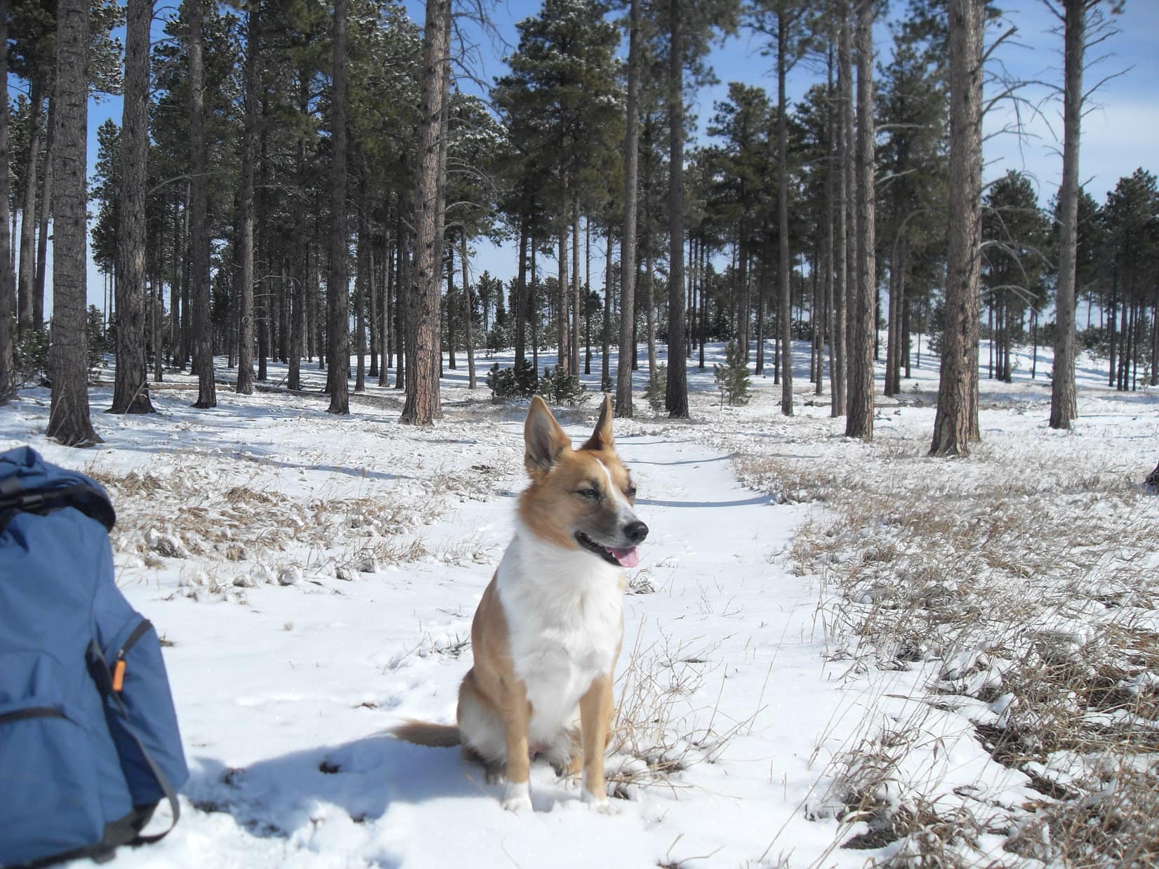
SPHP drove another mile W before finding a place to park (10:12 AM, 36°F). Everyone piled out of the G6. Lupe was barking and leaping for joy! Pristine white snow sparkled in the bright sunlight. Lupe, Big Sid and SPHP headed SE through a field going up a gentle rise. The Snow Trek was underway!

Beyond the little rise, the snowy field went SW down to Hwy 17. Lupe, Sidney and SPHP followed a short segment of the road continuing SW, but left Hwy 17 shortly after it turned sharply N. Everyone went down to the Mickelson Trail, which was nearby to the W.
Lupe was now at Nahant. She could have followed the trail N or S, but SPHP decided to lead the way S, thinking Lupe might eventually get on USFS Road No. 259 and explore Telegraph Gulch.

Lupe wasn’t on the Mickelson Trail very long. She left it to climb a small slope up to USFS Road No. 259, where she and Big Sid continued S. The road was sloppy with melting snow and mud.


The mucky road was icky to walk on. Most of the time, it was best staying entirely off to one side or the other. Lupe and Sidney passed by a dilapidated old house and barn on the W side of No. 259. Shortly after that, the road turned W up into the forest. No. 259 soon turned S again, and went over a small ridge.
The plan had sort of been to take No. 259 several miles S all the way through Telegraph Gulch to USFS Road No. 231. However, after going over the small ridge, an unmarked side road went W up a beautiful little valley. This side road wasn’t shown at all on SPHP’s old USFS map, but looked intriguing. It certainly seemed more interesting than continuing the muddy march along No. 259.
Exploring the mysterious side road became the new plan.

At first, it was possible to follow the side road. Farther up the valley, the snow got progressively deeper. It became difficult to tell where the road was, or if it was even still here at all. Most of the time, it was easiest to stay toward the N side of the valley where there was a little S exposure and less snow.

Lupe had the easiest time dealing with the deeper snow. A hard crust was under a few inches of fresh powder. The crust generally supported Lupe’s weight, so she could trot along on top, but Sidney and SPHP often broke through to the deeper stuff below. Conditions varied, though. Some places the crust was even strong enough to support both Sidney and SPHP.

After going close to a mile up the valley, it split in two. One branch went SW, while the other went NW. The road, if it still existed, was long lost beneath the snow. SPHP hadn’t seen it for a while.
Lupe and Sidney had already been drifting farther and farther up the N side of the valley to avoid the deepest snow, so it was easiest to follow the NW branch of the valley. Deadfall timber made the somewhat steeper climb here tougher for a while, but it wasn’t bad. Less than 0.5 mile brought Lupe and Sid to a saddle on a big ridge. (Pass 6194)
From the ridge, it was possible to see a considerable distance to the N. Both Terry Peak (7,064 ft.) and Custer Peak (6,804 ft.) were in view miles away. The local terrain dropped steeply to the N. Swede Gulch had to be somewhere out there not too far away.
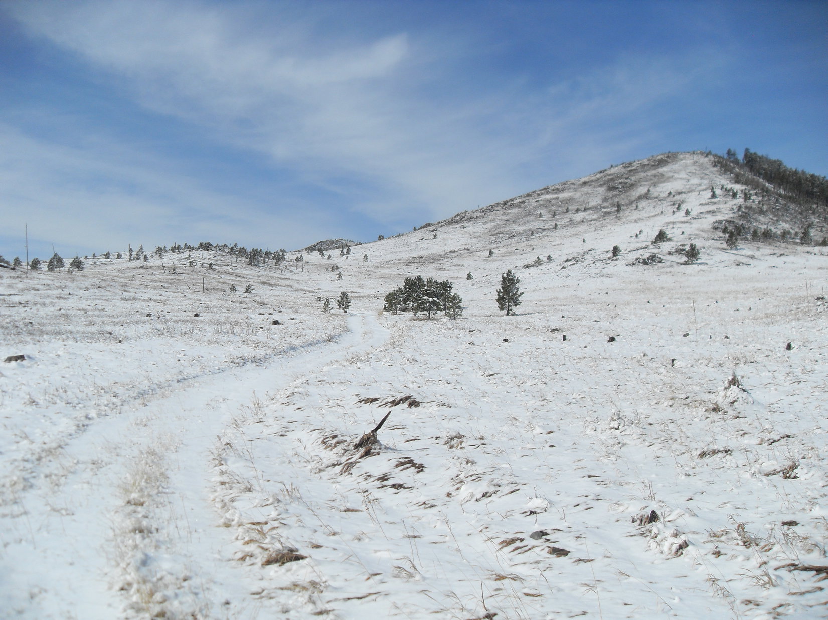
At the saddle, Lupe and Big Sid turned W, following the ridge higher. The views to the N and NE steadily improved. Meanwhile, the snow kept getting deeper.

On and on through the snow. Higher and higher. Maybe it hit 61°F back at home, but not here. Here it was only in the low 40’s. Finally, Lupe and Sidney were high enough to start seeing views off to the S and SW, but SPHP didn’t recognize the nearby terrain.
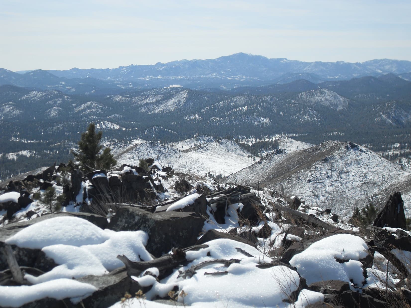
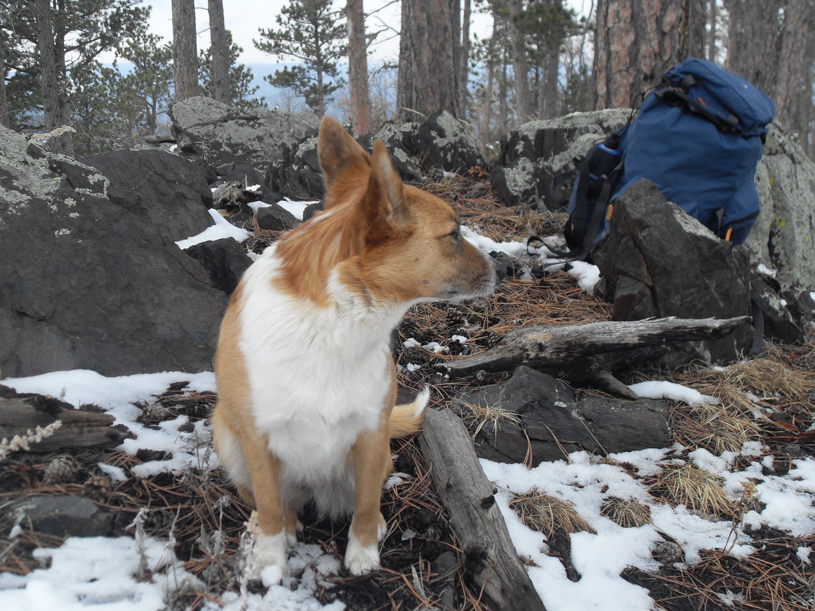
A small rock outcropping at a high point presented an opportunity to dust the snow off the rocks and sit down for a break. Lupe and Sidney made short work of the Taste of the Wild supply. SPHP had an apple while admiring the view to the S, then checked the USFS map.
It was starting to seem like a long time since losing the side road under the snow back down in the valley. The map showed only one possible road in this area. USFS Road No. 234 wound for miles around the W end and along the S side of Swede Gulch. Hmmm. With all the snow, SPHP wasn’t even certain of being able to recognize a road, even if Lupe and Sid did come to one.

Break time was over. Loop, Sidney and SPHP resumed the march W. The ridge now flattened and broadened out tremendously. For a while, elevation was being gained only slowly, if at all. The snow made it tough going. The need to find a road grew. Each step was still taking Lupe and Sidney farther away from the G6. It was time to think about finding a way back.
Fortunately, Lupe and Sidney did discover a road! It continued W, gaining elevation again at a modest pace. Either this was, or would likely feed into USFS Road No. 234 at some point along the way. However, finding the road was not the expected solution to the difficulties with the snow. The road was covered by an even deeper white blanket than the forest had been. The snow was in pristine condition. No sign anyone had been here. The struggle continued.
Finally, after passing first a fence, and then a tree that had fallen across the road, there were tracks. Snowmobiles had been here! The snow was compacted enough so Lupe could usually race along right on top. Sidney and SPHP had some luck staying up on top, too, but not always. Each failure meant post holing down a couple of feet.
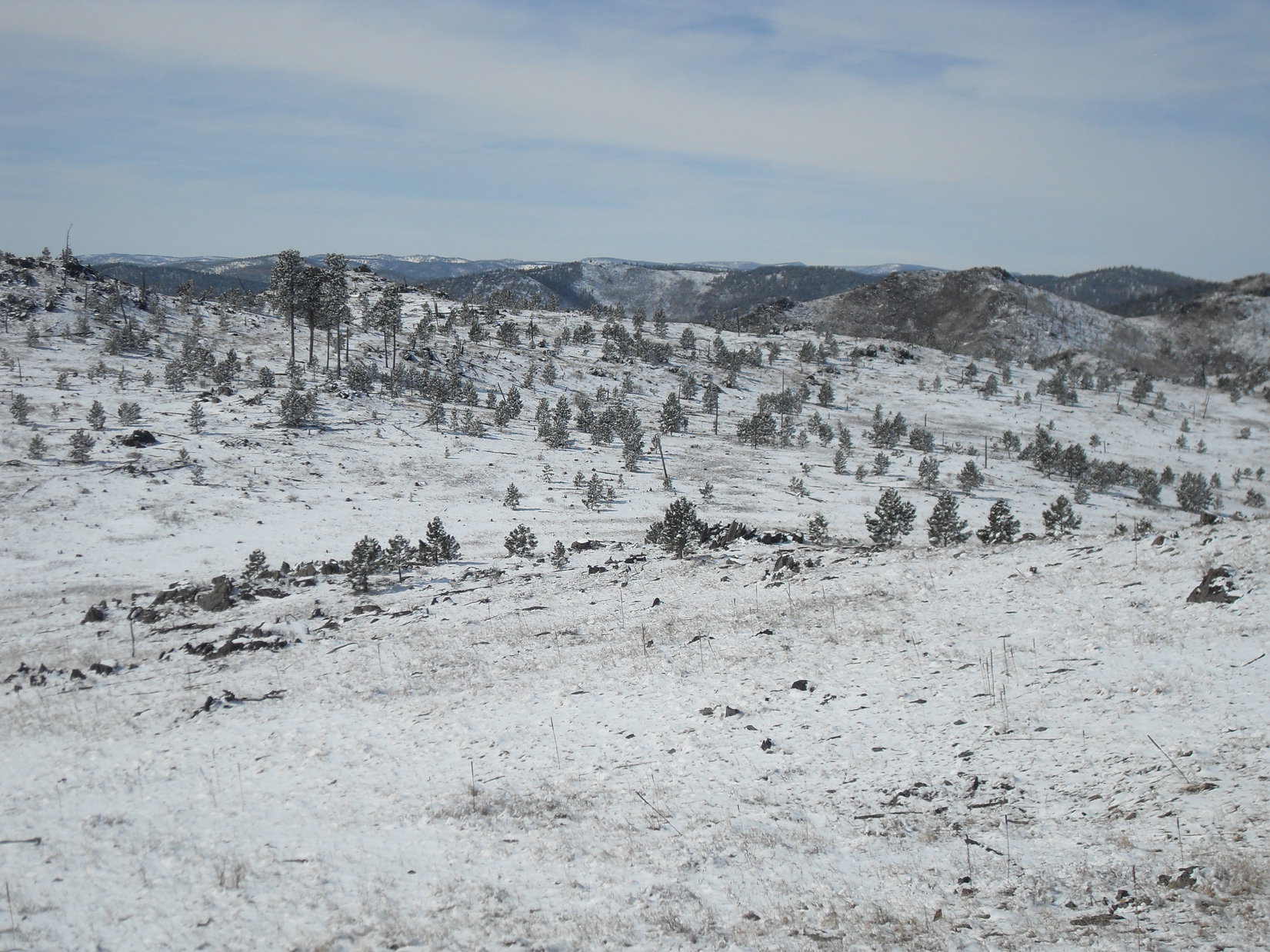
If this really was No. 234, sooner or later, the road would have to turn N. It did turn N, several times, but each time swung back to the W again. On and on. Farther and farther from the G6. The condition of the snow varied. Sometimes even Lupe was sinking in. Other times both Sidney and SPHP could stay on the crunchy compacted crust. Overall, though, pressing onward was an increasingly time and energy-consuming effort.
Lupe and Sidney were in high territory. The scenery was beautiful and remote. The dogs still seemed to be having fun. The snowmobile tracks often stretched on through big openings in the forest where everything was gorgeous and white. The actual road was three feet below the level of the tracks. Where the snow held, it was like traveling over the top of a crusty cloud.
At last, the tracks swung N and kept going that way. Time went by. How much farther? A bit of a curve to the NNE. The road passed through a dense, old forest and started to descend. SPHP expected Lupe would arrive at Tillson Creek pretty soon. She had been there before on a prior expedition. SPHP was elated when the creek came into view.
Decision time. Take the long, but certain route back to the G by staying on No. 234 to No. 206 all the way back to Hwy 17? No. 206 wasn’t far away, and would have had enough traffic to pack the snow down hard for a good walking surface. Or try the shortcut down along Tillson Creek through Swede Gulch to Nahant?
The sun would still be up for a couple of hours. Lupe had followed Tillson Creek through Swede Gulch once before back on Expedition No. 58 on 5-11-13. SPHP remembered it as an easy and beautiful route. It was still miles long, though, and conditions were very different now.
A quick decision. Lupe and Sidney would take the shorter route through Swede Gulch.
It wasn’t long before SPHP began to realize what Lupe and Sidney were in for. Tillson Creek flowed merrily along with plenty of water in it. However, the snow was even deeper down by the creek than before. Snowdrifts 4 to 5 feet high filled the narrow valley, often burying the small creek beneath them.
To make any progress, Lupe and Sidney had to stay up in the forest on the N side of the valley where the snow wasn’t quite as deep. The forest was a mess. Pine bark beetles had killed many trees since Lupe had last been here. A slow, difficult struggle through snow and deadfall timber ensued. Energy drained away. Time flew by. The distance traversed was pitiful.
Suddenly SPHP realized Lupe was coming to open ground ahead. Tillson Creek flowed into a broad, gentle valley of pasture lands intersecting from the NNW. Maybe this was the start of Swede Gulch? SPHP had forgotten about this place, but was very glad to see it. Lupe and Sidney made it past the last big snowbank. A snow-free trail led SE!
We’re saved! Even Lupe and Big Sid were visibly encouraged.


For a little while, Lupe and Sidney made fast progress along the muddy trail, but SPHP’s announcement was premature. The gravel road leading to Nahant from Swede Gulch was still miles away. The valley soon narrowed again. Swede Gulch became a twisting, turning canyon. SPHP expected to see the W fork of Tillson Creek coming in from a narrow side canyon, but never did.
Deep snow returned. Occasionally there were short snow-free stretches of trail, but for the most part, the endless struggle through snow and deadfall timber on the forested N slope of the canyon resumed. We’re doomed! or We’re saved! became the cry around every bend depending on the scene ahead.
Doomed! For real. At a sharp bend, the narrow canyon ahead was completely choked with dense forest and deadfall. Huge mounds of snow among the trees blocked any reasonable way forward. Advance was impossible, thought of retreat unbearable. In desperation, Lupe began to climb the steep canyon wall. With no other choice, Big Sid and SPHP tried to follow.
The American Dingo reached the top of a high, thin rock wall. She’d made it! Big Sid and SPHP managed to get there, too. This was it! Lupe had found a shortcut bypassing the worst part of the canyon! On the other side of the rock wall was a way down again. Back down to the canyon. The situation was better here. It was possible to continue downstream.
The sun was long down, and twilight fading, by the time the canyon seemed to widen out a bit. The going became a little easier. It became possible to spend more time on the trail, and less fighting the deadfall on the wretched N slope. SPHP kept expecting to see the gravel road to Nahant around every bend, but it did not appear.
Then it did appear! No, it wasn’t true. The road proved to be an illusion in the growing darkness. No choice. Puppies, ho! Onward, as rapidly as possible!
Finally, finally, the road appeared again some distance ahead. This time SPHP was almost certain of it. Stopping to peer through the darkness, what was that? A strange, muffled sound. Listen! Where was it coming from? Below! It took a moment to realize that the sound was Tillson Creek. The creek was underfoot, buried beneath snow and ice. Lupe, Big Sid and SPHP were all standing on it!
At least it made for an easy creek crossing. Lupe, Big Sid and SPHP made it to the road. This was it! The real deal and not an illusion. Stars shone above, but the expedition was saved once again. Lupe and Sidney left Tillson Creek behind. Soon the last of Swede Gulch would be left behind, too. Following the level road for a mile E back to Nahant would be easy.
Hah, fools! Around a bit of a bend, to everyone’s dismay, a 5 foot high snowdrift covered the entire roadbed as far as it was possible to see. On both sides, forested slopes dropped steeply N toward the lower end of Swede Gulch where Tillson Creek could still be heard rippling away.
This snow was soft. It wouldn’t even support Lupe. Half a mile of post holing lay ahead. No alternative. Sidney, especially, struggled mightily. Tough, very tough. And cold.
At last it was over. The rest of the way was easy, except for pervading weariness and cramping muscles. An exhausted final march E to Nahant, and then N to the intersection of Hwy 17 and USFS Road No. 256.
A snow and mud-free spot! SPHP collapsed on the pavement to recover. Lupe and Sidney laid down nearby for the same purpose. What a day! Stars twinkled above. The full moon shone down. Silence. The eternal blackness of space and time. Still a little farther to go, but what a glorious moment! What a glorious night!
Links:
Next Black Hills Expedition Prior Black Hills Expedition
Want more Lupe adventures? Choose from Lupe’s Black Hills Expeditions Adventure Index or Master Adventure Index. Or subscribe free to new Lupe Adventures.