Black Hills, SD Expedition No. 248 – Crow Peak (4-6-19)

On February 3rd, the temperature started dropping and never looked back.  February, 2019 was easily the coldest, snowiest month of Lupe’s whole life!  Many days were 20, or even 30°F, below normal.  “Normal” now merely constituted a temporary heat wave before the next frigid onslaught.

The first half of March wasn’t much better.  Day after day, Lupe stared out the front window.  Heaps and mounds of pure white global warming were stacked along the sidewalk.  Attacking the snow shovel became the highlight of most days.

March 9th.
Waiting for spring.

The weather finally began to improve in the 2nd half of March, but it wasn’t until nearly a week into April that SPHP said those magic words.  Did Lupe want to go hiking in the mountains?

The Carolina Dog could hardly believe her big, soft Dingo ears!  More than 2 months had gone by since her last Black Hills Expedition.  She’d pretty much come to the conclusion that her life of adventures was over, finished, kaput!  Oh, but it was on again, at least for today!  Lupe didn’t hesitate a nanosecond.  She leapt about barking a most joyful, emphatic yes!  She was ready to go this instant!  Had been for what seemed like forever.

8:45 AM, 38°F – The trailhead for Crow Peak (5,787 ft.), the prominent peak W of Spearfish, South Dakota, was 4 miles up Higgins Gulch Road (USFS Road No. 214) less than a mile ESE of the summit.  Only one other vehicle was in the huge parking lot when Lupe leapt out of the G6.  The American Dingo had been here once before on Black Hills Expedition No. 123, but that was more than 4 years ago now.

Glad you could make it! Looks like we are going up Crow Peak today. Should be fun! Photo looks W.

With a good trail to follow all the way to the top of Crow Peak, Lupe was going to have an easy time getting back into the swing of adventuring.  The trail started at a brown metal gate on the W side of the trailhead.

The trail to Crow Peak starts at this brown gate.

Information about the trail was posted 100 feet into the forest.

This trailhead information isn’t in sight from the parking lot. Just go through the brown gate and you will come right to it.

The trail started off heading SW paralleling Higgins Gulch.  Lupe gained elevation gradually on a sunny hillside.  The trail gradually curved W.

On a sunny slope a short distance from the trailhead. Photo looks W.
Along the lower SE slopes of Crow Peak. Photo looks W.

Near the S end of the mountain, the trail made a big curve back to the NE.  Before long, it looped around to the N and then back to the W again.  The forest provided more shade in this area.  The trail became either icy or mucky.  Lupe found a patch of snow to cool off on.

Still gaining elevation as we make a big loop back to the NE here! Photo looks ENE.
The trail was either icy or mucky in shady spots along the loop. Photo looks NW.
I’ll be done with this snow soon enough. Then you can take a turn belly flopping onto it, too!

On the S side of the mountain, Lupe came to a place where some of the trees were burnt.  Wonder when that happened?  SPHP didn’t remember any burnt areas on Crow Peak 4 years ago back on Expedition No. 123, but maybe there were?  In any case, whenever the fire had occurred, it had opened up a view of a high ridge to the SW.

View to the SW from the burnt area.

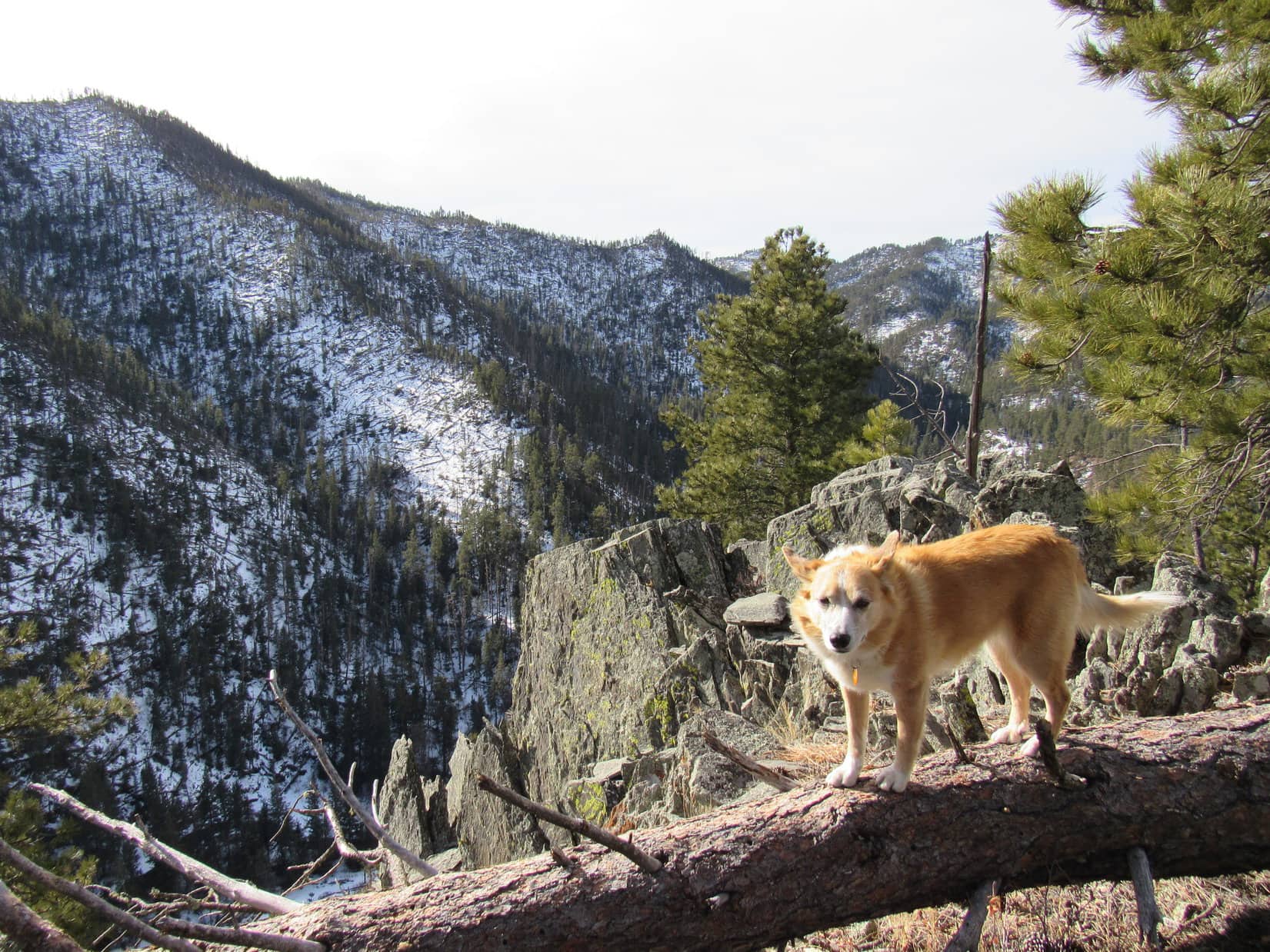
Beyond the burnt area, the trail curved N on its way around a ravine.  Lupe could now see some rock formations high up on the S side of Crow Peak, although it was hard to tell how close they might be to the summit.

Much higher rock formations come into view. Photo looks NNE.
Another look with help from the telephoto lens.

Continuing on, the trail headed W, then gradually curved NW.  Lupe came to a small stream.  This was the only water available along the whole trail.

Not true! I’ve been busy eating snow, so I’m not even thirsty!

After heading NW for a while, the trail curved E along the side of a ridge.  A long shady stretch was buried in snow.  Lupe had no problem getting through the snow, and soon reached a sunnier region.

Some snow is a good thing! Your paws will never get too hot! Photo looks SE.
Coming to the sunny part now! Photo looks E.

Leaving the sunny region, the trail turned NW along the side of a big slope.  A W subpeak of Crow Peak could soon be seen off to the WNW.

That hill on the L is a subpeak 0.5 mile WSW of Crow Peak’s summit. Photo looks NW.

Although it was never steep, the trail kept heading higher.  Lupe started coming to rocky stretches, and for the first time, she began to get distant views from occasional openings in the forest.  Cement Ridge (6,674 ft.), Sundance Mountain (5,824 ft.) and Warren Peaks (6,650 ft.), all far away in Wyoming, came into sight.

Getting rockier! Photo looks N.
Crow Peak’s W subpeak is below on the L. Sundance Mountain is far beyond it on the horizon. The distant ridge on the R is Warren Peaks. Photo looks W.
Warren Peaks (Center). Photo looks W with help from the telephoto lens.
Cement Ridge. Photo looks SW with help from the telephoto lens.

At last, Lupe did come to a steep spot.  Having been headed N, the trail suddenly made a sharp bend back to the SE climbing directly up the rocky spine of a narrow ridge.  The steep section was short.  Beyond it, the trail left the spine of the ridge to head E traversing a big N slope where another part of the forest had burned.

The trail was narrow along in here, and buried under 2 feet of snow.  Some places were icy, but the steep slope made it necessary to go right over them.  Lupe had no problems with the icy trail, and hiking poles made the trek a lot easier for SPHP.

The good news was that Lupe was getting close to the top of Crow Peak!  The summit ridge was now in sight dead ahead.

On the steepest part of the whole trail. A bit rocky, but it really wasn’t very long or that difficult. Photo looks SE.
On the narrow, icy, snowy section. Crow Peak’s summit ridge is dead ahead! Photo looks ESE.

The trail stayed snowy until it began making a big sweeping curve NNW.  Lupe was still climbing, but now heading away from the top of the mountain.

The snow begins to give out as the trail bends away from the summit, which is up the steep slope to the R. Photo looks ENE.
Looking back at the snowy burnt area. Photo looks SW.

Everything was going fine until the trail headed straight at a 10 foot high rock formation and appeared to end.  A big knob of rock was off to the L (W).  A steep forested slope was to the R (E).  Which way?

The knob of rock was out of the question.  Obviously, too steep that way.  Clearly, the Carolina Dog either had to climb up over the rock formation, or go R.  Lupe easily made the 10 foot scramble up the rock formation.  Yes, this was the way!  The trail continued on from the top.

Looking back. Hard to tell from up on the rock formation, but there is a 10 foot drop on the trail here. Lupe has already scrambled up. Obvious where to go on the way down, but a bit confusing on the way up. Photo looks SW.

Once past the slightly confusing point, the trail began to bend to the E.  It soon brought Lupe up to the N end of Crow Peak’s long summit ridge.  All Loop had to do now was follow the ridgeline S to the true summit.

Cement Ridge (Center, on the horizon) from where the trail reached the N end of Crow Peak’s summit ridge. Photo looks SW.

Snow drifts several feet deep covered much of the trail along the summit ridge.  Lupe avoided most of the snow by staying toward the W (R).  This was actually quite a bit easier than trying to stick with the trail.

On the first big snowdrift Lupe came to along the N ridge. Photo looks ESE.
Nearly all the snow was concentrated toward the E side of the summit ridge. By staying toward the W (R), Lupe was able to avoid most of it. Photo looks SSE.
Heading higher on the W side of the ridge. Still some snow up ahead. Photo looks S.

Before reaching the absolute top of the mountain, Lupe came to a place where the summit ridge flattened and broadened out.  Instead of forest, most of this area was grassy or covered with low bushes.  Views to the N and E were already great.  Immediately to the S, a snowy ridgeline went up a last little hill to the top of Crow Peak (5,787 ft.).

Out in the flat open area with the top of Crow Peak now in sight. Photo looks S.
We’re almost there! Come on!
The trail goes right up the snowbank.

The summit of Crow Peak was a ridge about 100 feet long.  Grass and small rocks covered most of a narrow spine.  At the S end, a sign gave the elevation as 5,780 feet.  The ridge dropped away steeply to the E, less so toward the W where a thicket of tall bushes grew.  Only a few trees grew right up on the ridgeline or close to it.  Commanding views to the N and E extended far out onto the prairies beyond the Black Hills.

The most spectacular mountain view was of Terry Peak (7,064 ft.) to SSE.  Spearfish Peak (5,800 ft.) was easy to pick out, too, off to the ESE.  Bear Butte (4,422 ft.) could be seen just about due E, but looked small and far away.

Very close to the top. Photo looks S.
Loop by the sign at the S end of the summit ridge. The high point at Center is Terry Peak, the highest mountain of the northern Black Hills. Photo looks SSE.
This is it! The summit of Crow Peak! Photo looks N.
Looking SSE along the top of the summit ridge. Terry Peak (Center on the horizon) and Spearfish Peak (far L).

Lupe hadn’t seen anyone on the way up Crow Peak until reaching the N end of the summit ridge.  A young guy had been starting back down the mountain there.  However, she hadn’t been at the top of Crow Peak for more than a few minutes before a man from Belle Fourche came along with a large brown dog that was part pit bull.

The most popular viewpoint on Crow Peak is at the S end of the ridge where the sign and big view of Terry Peak are.  Lupe and SPHP moved off to the N to let the man and his dog enjoy the view.  However, the dog was more interested in Lupe and her Taste of the Wild.  Lupe became snarly, so SPHP led her farther N.

The sun was high, temperature in the low 50’s.  In sunshine with only a slight S breeze, conditions were quite comfortable.  Lupe had water and finished her Taste of the Wild in peace.  SPHP munched an apple.

The flat open area Lupe had been to on the way up is seen beyond her. Photo looks N.
That’s Spearfish Peak on the L! Photo looks SE.
Terry Peak (Center). Photo looks SSE.
Spearfish, South Dakota with help from the telephoto lens. Lookout Peak (4,478 ft.) (Center). Photo looks ENE.

After a while, the man from Belle Fourche and his dog left.  Since Lupe had Crow Peak all to herself again, she went back closer to the sign for another look around from the S end of the summit.

By the elevation sign. Photo looks NNE.
A trail led down to the SW, but probably didn’t go far. Lupe explored only a short part of it. Terry Peak (far L). Photo looks SSW.
At the popular viewpoint with Terry Peak (Center) in sight. Photo looks SSE.
Terry Peak (R of Center) and Bald Mountain (6,617 ft.) (far L). Photo looks SSE with help from the telephoto lens.
Warren Peaks in Wyoming (Center). Photo looks W with help from the telephoto lens.
Cement Ridge with help from the telephoto lens. The lookout tower is on the snowy high point R of Center, but the true summit is actually on the L. Photo looks SW.

Two young women appeared.  Lupe and SPHP again retreated N.  After a while, they started taking photos.  SPHP offered to take a few with both of them in the picture.  They accepted, and returned the favor for Lupe and SPHP.

So Lupe got to meet Taylor and Brooke.  As it turned out, Taylor and Brooke were cousins.  Taylor was about to graduate from Black Hills State University in Spearfish with a degree in Education.  She was going to be teaching 3rd grade next fall near Brookings, SD.  Brooke’s degree was in nursing.  She had spent time in Guatemala, which she loved.

Taylor and Brooke had both gotten their feet wet in the deep snow drifts coming up the N summit ridge.  When they were ready to go back down, Lupe showed them how to avoid most of the snow by staying to the W.  Since Taylor and Brooke were so friendly and happy, Lupe and SPHP continued down the Crow Peak trail with them.

Lupe with new friends Taylor (L) and Brooke (R).

By now, lots of people and dogs were coming up the mountain.  On this beautiful day, everyone seemed to be in good spirits.  Taylor and Brooke were pleasant company.  Once past the icy narrow part, going down the winding trail was nice and easy.  Time flew by.  When Lupe got back to the G6, the trailhead was full of vehicles.  Taylor and Brooke each gave Lupe a pat before saying good-bye.  (2:45 PM)

Mid-afternoon.  Hours of daylight left.  Lupe and SPHP took a drive up Spearfish Canyon, then S through the western hills.  Up on Minnesota Ridge (6,240 ft.), SPHP stopped to let Lupe roam for a little while.  Feet of snow were melting in the forest.  The American Dingo felt frisky, and enjoyed a good romp on muddy USFS roads.

In town, SPHP stopped in at Culvers restaurant.  On the way home, Lupe sat happily munching french fries with SPHP.

Oh, yeah!  Felt so good to be back in the adventuring business again!  Crow Peak had been fun!

On Crow Peak, Black Hills of South Dakota, 4-6-19

Links:

Next Black Hills Expedition                Prior Black Hills Expedition

Black Hills, SD Expedition No. 123 – White Rocks, Mt. Roosevelt & Crow Peak (3-21-15)

Want more Lupe adventures?  Check out Lupe’s Black Hills, SD & WY Expeditions Adventure Index, Master Adventure Index, or subscribe free to new Lupe adventures!

Black Hills, SD Expedition No. 247 – Peak 5696 (2-2-19)

Start – 8:30 AM, 37°F at the Silver City trailhead of Deerfield Trail No. 40

Last really warm day for a while!  Tomorrow temperatures were going to start plunging.  Subzero lows and way below normal highs all next week, and beyond.  Winter, after all.  The Carolina Dog wasn’t about to waste this final chance to sneak in a Black Hills expedition!

Nice day, today.  The Silver City trailhead of Deerfield Trail No. 40 was a sheet of ice, but it was above freezing and the skies were blue.  Lupe knew this place.  She’d been here lots of times.  She took off across the bridge over Rapid Creek following Deerfield Trail No. 40 upstream.  Bright sunshine was up on the rocky canyon walls, but down in the shade near the stream it was surprisingly chilly.

The Silver City trailhead was a sheet of ice, but it was a nice day for early February. Photo looks NW.
Still chilly down here in the shade on Deerfield Trail No. 40! Photo looks W.

Deerfield Trail No. 40 led to more bridges over Rapid Creek.  Half a mile from the trailhead, Silver Peak (5,810 ft.) came into view shortly before reaching the 4th bridge.  Loopster had been to Silver Peak 3 times, once fairly recently, but had never climbed it from this direction.  She wasn’t going back up there today, though.

Hey, isn’t that Silver Peak up ahead? We were up there not that long ago on Expedition No. 239, remember? Photo looks SSW.
Approaching the 4th bridge over Rapid Creek. Photo looks SSW.
Looking downstream from the 4th bridge. Rapid Creek was pretty icy. Photo looks NE.

Today’s destination was Peak 5696Lists of John shows that it has 396 feet of rise (prominence), but that was all Lupe or SPHP knew about it.  That was fine.  Exploring is what American Dingoes do best!

The first good chance for access to Peak 5696 came right after crossing the 4th bridge.  The topo map showed Goose Pasture Draw heading 0.75 mile NNW up to a saddle a bit SW of the summit.

Goose Pasture Draw looked promising on the map, but reality was not so enticing.  Lupe found the entrance steep-sided, narrow, and clogged with a tangled mess of trees and bushes amid snow drifts 2 or 3 feet deep.  Hmm.  Maybe not the route it was cracked up to be.  Eh, forget this!

Lupe continued W on Deerfield Trail No. 40.  She came to a particularly scenic stretch where the trail was out in the open close to the N bank of the creek.  It took Looper right past one of her use-in-case-of-emergency haunts, too.  A small Dingo Cave, remnant of some brief unproductive old mining effort, was along the N side of the trail.  Naturally, Lupe stopped in for a quick sniff around.

Rapid Creek from Deerfield Trail No. 40. Photo looks WSW.
Oh, here’s the Dingo Cave! A great spot to hide out during a hail storm!
You can come out, SPHP! Not looking like hail today.

Lupe kept going.  The next opportunity to turn N came 0.5 mile past the 4th bridge.  The map showed a trail going up Post Draw that went up and over Peak 5560 before heading NE to Peak 5696.

Might have worked great, if such a trail existed!  No sign of one.

Even so, Post Draw looked more promising than Goose Pasture Draw had.  Besides, reasonable options for getting up out of the canyon to head for Peak 5696 were fast running out.  Better give it a shot!  Lupe left Deerfield Trail No. 40, and started N up Post Draw.

End of the line for easy sniffing along Deerfield Trail No. 40 and Rapid Creek today. Lupe left them here to head N (R) up Post Draw. Photo looks SW.
Post Draw is this way! Looks a lot better than Goose Pasture Draw did. Photo looks N.

She didn’t get far.  Not as snowy here, but lots of deadfall.  Yet another mess.  The trail shown on the map was a mere old cartographer’s tale.  While Loop could scoot through without too much bother, this was going to take SPHP forever.  So what now?

Kelly Gulch, another 0.5 mile W as the Deerfield Trail went, would work.  Lupe had been up Kelly Gulch before.  There really was a trail leading to USFS Road No. 142 where Spurgeon Gulch came in.  No. 142 might well provide access to Peak 5696 from the W.  Farther to go, though.

SPHP kept eyeing Post Draw’s E slope.  Steep, but even SPHP ought to be able to make it.  Dingo’s play for Lupe.  Far less deadfall and no snow on the slope, and it didn’t look that far up to a flat ridge.  Lupe was here now.  May as well give it a go!  If it didn’t work out, Kelly Gulch would have to do.

So easy, I can do it with my eyes closed! Heading up Post Draw’s E slope. Photo looks NE.

Good thing this slope wasn’t any steeper, or Kelly Gulch really would have been the answer.  SPHP trudged higher, clinging to whatever was available, which usually wasn’t much.  While SPHP gasped for breath, Lupe showed off, wandering effortlessly wherever she fancied.

Unsurprisingly, the flat ridge that hadn’t looked too far up from below was elusive.  The steep E slope went much higher than it had appeared, and became quite rocky near the top.  Lupe gained 250 feet of elevation before actually coming to a small flat area.  A formidable rocky high point was just to the NE.

SPHP voted for taking a break at the flat spot before carrying on.  Loop was willing to let the motion pass.

Getting closer to the ridgeline after a deceptively long climb. Photo looks NE.
Searching for a way up onto the rocks near the top. Photo looks S.
Not all you were expecting it to be, SPHP? Lupe makes it up onto a rough ridgeline. Photo looks NE.
You could rest here, SPHP. This is pretty flat. … Yeah, I’ll take it, Looper. Thanks! Photo looks SSE.

During the break, SPHP studied that next high point to the NE.  Wasn’t really all that much higher, but it was fairly rugged.  Could Lupe even get up there?

The next high point to the NE was rugged. Could Lupe get up there? Photo looks NE.

Yes, she could!  A direct assault wouldn’t have worked, but sneaking a peek around the W side revealed a completely manageable slope.  The slope was nicely strewn with deadfall timber, par for the course.

Your favorite thing, SPHP – deadfall! Think I’ll go take in a movie while you do this. Be back in a bit. Photo looks NNE.

Once the deadfall was dealt with, the top of the high point was terrific!  This was likely to be the most photogenic spot anywhere along Lupe’s route to Peak 5696.  She had wonderful views to the S & E of the canyon Rapid Creek flows through.

Looking down on Rapid Creek (R) from the high point E of Post Draw. Peak 5707 is the long high ridge on the L. Photo looks E.
Silver Peak (5,810 ft.). Photo looks S.
View to the SW. Part of Silver Peak on the L.
Rapid Creek (L). Photo looks ESE.

Lupe lingered 20 minutes enjoying the views of Rapid Creek, Silver Peak, and surrounding region.  She then went on to the actual summit of this high point E of Post Draw.  It was a little farther N, back in the trees away from the best views.

The actual summit of the high point E of Post Draw. Photo looks NNW.

This high point Lupe was on was at the end of a ridge extending 0.5 mile S from Peak 5560, her next objective on the way to Peak 5696.  Without further delay, she followed the ridge N.

The American Dingo lost 120 feet of elevation before reaching a broad saddle full of spindly Ponderosa pines.

At the spindly pines saddle leading N to Peak 5560. Photo looks NE.

Beyond the saddle, a 550 foot ascent of Peak 5560 began.  This became an interesting climb.  The higher Lupe went, the narrower and rockier the ridge became.  The spine of the ridge featured many rocks standing on end or at steep angles.

On the way up Peak 5560’s S ridge. Photo looks NW.
Loop on a platform fairly high up. Photo looks SE.
A rare gap between the trees provides a glimpse of Stewart Gulch (L). Photo looks SW.

Lupe was getting close to the summit of Peak 5560 when she discovered a Dingo Shelter.  Compared to the Dingo Cave down by Rapid Creek, the Dingo Shelter was tiny.  However, it could easily accommodate one medium-sized Dingo, and had both a roof and an escape hatch.

Been clouding up, SPHP. Think a hail storm is coming? Good luck finding a Human Shelter! Don’t worry. I’ll be fine. At the Dingo Shelter high on Peak 5560’s S ridge.

No doubt the Dingo Shelter would serve well in case of hail storms or other emergencies that might arise way out here in this remote part of the Black Hills.

Speaking of the weather, it had been clouding up while Lupe climbed Peak 5560.  Hail storms didn’t seem to be in the forecast yet, but for what was supposed to be an unusually warm winter day, it didn’t feel much warmer up here than when Lupe had started out this morning.  A cool W wind had come up.

Since hail actually wasn’t on the way, the Carolina Dog continued on to the summit of Peak 5560.  Lupe arrived to find the summit had two high points.  A couple of small rock formations of nearly equal elevation were separated by only 20 or 30 feet.  The short ridge between them was all there was to the summit area.

On Peak 5560. At the summit’s SE high point. Photo looks SE.
Peak 5560‘s NW high point had pointier rocks. Photo looks NW.

Too many trees to see much from Peak 5560.  Besides, the W wind was strengthening.  Lupe stayed 5 minutes, then it was on to Peak 5696!

Loop started down Peak 5560’s N ridge.  This ridge featured two lower, but still significant high points.  At the last one, Lupe came to quite an impressive rock formation.  Huge slabs of rock were standing practically on end.

Hurry it up, SPHP! Only staying here a second or two. And for pity sake, scream or something if that rock starts falling before I’m a Dingo Pancake! Photo looks NNW.
View to the WSW from along Peak 5560‘s N ridge.

After visiting the N ridge high points, Lupe turned NE and went down to the saddle leading to Peak 5696.  Having lost nearly 160 feet of elevation, she was getting close to the bottom when she discovered an old mining dig or blast site.

Almost down to the saddle to Peak 5696, Lupe discovers an old mining dig or blast site. Photo looks NE.

Upon reaching the saddle, the Carolina Dog now had to gain 300 feet to get up to the summit of Peak 5696.  The SW face of the mountain was forested, fairly steep, and a little rockier toward the top.  The climb wasn’t particularly difficult, easy, or interesting.

When Lupe got to the top, the pines were swaying amid a 25 -30 mph W wind.  Though the full force of the breeze was partially blocked by the trees, the resulting forlorn, windswept sound only emphasized what a remote, deserted place this was.  The temperature must have been in the upper 40’s °F, but it sure didn’t feel that warm.

A skinny, vertical rock formation only a few feet high was the evident high point of a long, broad summit region which stretched off to the N.  Lupe hopped up on the highest rocks, balancing as if frozen in place, since her perch was rather precarious.

At the skinny summit of Peak 5696. Photo looks SW.

The forest on Peak 5696 was reasonably open, comprised mostly of fairly young trees.  They were more effective against the views than against the sullen breeze.  A rock ledge 30 or 40 feet W of the high point offered somewhat of a look to the WSW, but that was about it.

Loopster in the breeze at Peak 5696’s best viewpoint. Photo looks WSW.

Lupe wanted to curl up out of the wind, so a short break was taken E of the high point.  SPHP took this opportunity to check the topo map.  The summit region extended N beyond what could be seen through the forest.  Although this S end had appeared to be the summit of Peak 5696, the map marked the high point elevation at the N end.

Well, that had to be checked out!  Puppy, ho!

The broad ridge leading N was open forest, with a good 6″ of snow on the ground, and deadfall timber laying perpendicular to Lupe’s path.  At first, this area was all clearly a bit lower than the high point at the S end, but as Loop got farther N, the terrain started sloping gently upward.

The N summit was at least several hundred feet from the S one.  Seemed like maybe it was a bit higher.  The N summit was even more buried in the trees, offering no distant views.  Another vertical rock outcropping, similar to the one at the S end, was the high point.  This probably was the true summit of Peak 5696, but it felt anti-climactic.

So this is it – the true summit of Peak 5696! Thrilling, isn’t it? Photo looks SSE.
Another look at the true summit, in case you just can’t get enough! Photo looks WSW.

Lupe visited a rock formation a bit down the slope W of the true summit, then sniffed around the general area for several minutes.  Not much else to see or do here, but the map showed a ridge that went another 0.25 mile N without losing a whole lot of elevation.  Why not?  Lupe explored a good bit of it, too.

Approaching a minor high point along the N ridge, Loopster came to a largely snow-free, park-like part of the forest.

The park-like forest on Peak 5696’s N ridge. Photo looks N.

Beyond this minor high point, the N ridge started getting narrow and rocky.  Lupe’s Peak 5696 peakbagging objective had been completed.  Perhaps it was time to start back?

Rather than go back the same way with all its steep slopes, Lupe left the ridgeline heading NE down into Gorman Gulch.  A foot of snow was on the ground here.  Lupe gradually turned E, then SE enjoying a long trek down through the snowy forest.

Exploring the snowy forest on the way down into Gordon Gulch. Photo looks NE.

Loopster liked mountain-shaded Gordon Gulch.  Several deer got her all excited.  SPHP wondered what the bottom of Gordon Gulch was going to be like?  Hopefully not another tangled mess.

No worries, this time!  After a fun romp down through the snowy woods, the bottom of Gordon Gulch wasn’t bad at all.  Lupe soon came to a road, USFS Road No. 141.2B, which showed little sign of use.

In Gordon Gulch on USFS Road No. 141.2B. Photo looks S.

So that was that!  The rest of the way back was an easy road trek.  It was longer than expected, but the silent, snowy journey was fun.  No wind down here, and all downhill.

No. 141.2B brought Lupe all the way back to Silver City, exiting Gorman Gulch only a bit E of the trailhead.  Shortly before she got there, Lupe happened upon the Gorman Cabin historic preservation site.  A plaque said this cabin was the last one remaining of several the Gorman family had built in the late 1870’s during the Black Hills gold rush.  Silver City had originally been known as Gorman Camp.

Almost back to the Silver City trailhead, Lupe discovers the Gorman Cabin – a more substantial Dingo hideout in case of hail! Photo looks N.

Peak 5696 had been a fun outing.  Something a little different, with its views of Rapid Creek down in the canyon on the way there.  Lupe was certainly glad she went, and it was a good thing she did, too!  February was destined to be the longest, coldest month of this winter.  It would be a while before the adventurous American Dingo would be out exploring the beautiful Black Hills again.  (2:49 PM, 50°F)

Links:

Next Black Hills Expedition                  Prior Black Hills Expedition

Want more Lupe adventures?  Check out Lupe’s Black Hills, SD & WY Expeditions Adventure Index, Master Adventure Index, or subscribe free to new Lupe adventures!