Black Hills, WY Expedition No. 178 – Vision Peak, Bald Mountain & Stoney Point (10-16-16)

Lupe and SPHP hit the road before dawn.  Lupe was on her way to explore the Bear Lodge Mountains, a remote part of the Black Hills in NE Wyoming separate from the main body of the Black Hills in South Dakota.  The sun was up by the time the eager American Dingo reached the Wyoming border.

Lupe reaches the Wyoming border on her way to the Bear Lodge Mountains.

Lupe had 3 peakbagging goals for the day.  SPHP had high hopes for the first one, due to it’s intriguing name – Vision Peak (4,812 ft.).  Those hopes seemed likely to be justified when SPHP parked the G6 off USFS Road No. 830 about 1.5 miles N of Hwy 24 (8:18 AM, 67°F).  Lupe was already high up on a ridge with a view to the S.

The day was unseasonably warm, but with a fairly stiff WSW breeze.  Lupe headed W on USFS Road No. 887.1, a little used side road closed to motor vehicles.  The road climbed a bit, then crossed over to the N side of the ridge, where Lupe was out of the wind.  No. 887.1 then wound around a little below the long ridgeline heading generally W, while slowly losing elevation.

Lupe on the seldom used USFS Road No. 871.1 that leads W toward Vision Peak from USFS Road No. 830. Photo looks SW.

No. 887.1 wound around for more than a mile.  Lupe didn’t find any squirrels, but whitetail deer were abundant.  The road never returned to the ridgeline, although Lupe and SPHP made one foray up onto the ridge before returning to the road again.  To the N, Lupe had views of another high ridge beyond Lucky Gulch.

Looking N toward a high ridge on the other side of Lucky Gulch.

Lupe was making great progress, when suddenly USFS Road No. 887.1 simply ended W of High Point 4805.  Fortunately, Lupe was already almost to the saddle over to Vision Peak.  A short bushwhack through the forest brought Lupe to the E end of the saddle.

Lupe reaches the narrow saddle over to Vision Peak. Here she is at the saddle’s E end, which was surprisingly bare. Most of the saddle was forested. Photo looks WSW.

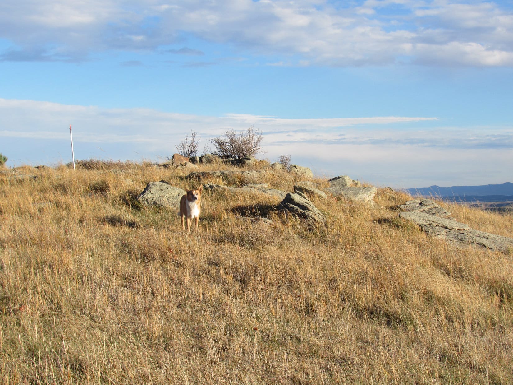
Lupe crossed the saddle and began climbing.  She encountered a couple of minor rock outcroppings along the way, but the climb was neither long nor difficult.  Soon she reached the top of Vision Peak (4,812 ft.).

Lupe at the summit of Vision Peak. This was the best view. Photo looks S.

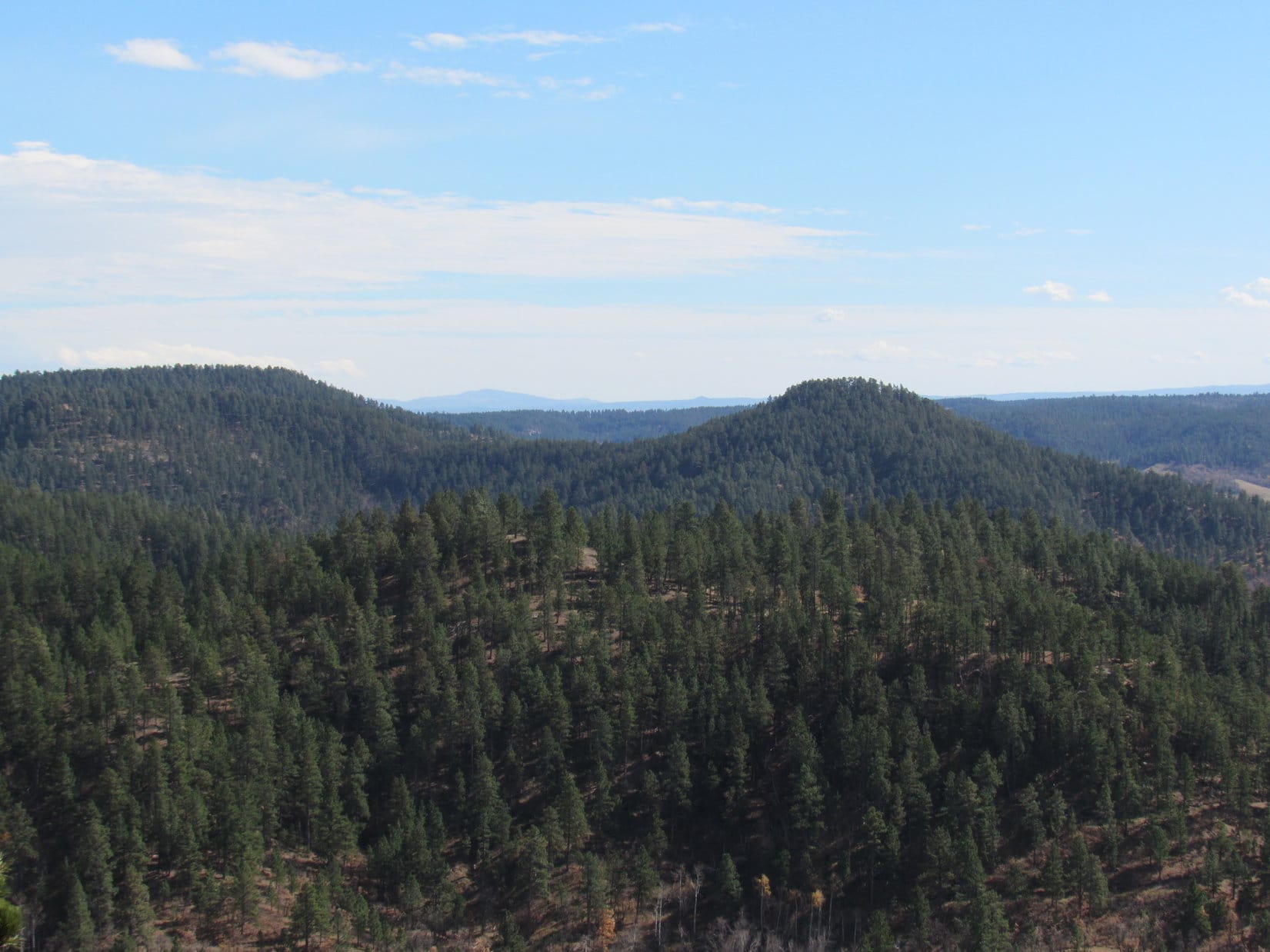
Since Vision Peak is positioned way out at the far W end of a long, fairly narrow ridge, SPHP had been hoping for great wide open views, especially toward the W.  Lupe did find quite a nice view to the S right at the true summit, but most of the summit ridge was too heavily forested to see much.  Somewhat disappointingly, Vision Peak seemed to be a BYOV (Bring Your Own Vision) mountain.

Lupe stands on a big rock at the far W end of the Vision Peak summit ridge. She has a narrow view between the trees to the W.
This photo shows much of the summit ridge of Vision Peak. Here Lupe is near the W end. Photo looks E.

Lupe and SPHP lingered on Vision Peak for a little while, taking a break and enjoying the best view, which was to the S.  The wind was out of the SSW about 20 mph, but wasn’t bad at ground level.  The forest provided quite effective protection, although the wind was certainly heard in the treetops.

On the way back to the G6, instead of taking the road, Lupe and SPHP climbed up onto the long ridge after crossing the saddle E of Vision Peak.  There were more impressive rock outcroppings along this climb up onto the ridge, than there had been climbing Vision Peak.

Although it was a bit out of the way, Lupe visited High Point 4805.  On the way there, she caught a glimpse of a high, partly barren hill off to the NW.  That was probably her next peakbagging goal, Bald Mountain (4,800 ft.)!

Near High Point 4805 (ENE of Vision Peak), Lupe caught this glimpse of Bald Mountain (R) off to the NW.

The trek along USFS Road No. 887.1 to get close to Vision Peak had been pleasant and easy, but the return trip along the top of the ridge was more fun.  Distant views to both the N and S occasionally presented themselves, and deer were plentiful.  Lupe even found a couple of squirrels along the way, which she greeted with her usual enormous enthusiasm.

Even though Vision Peak itself had turned out to be somewhat of an anti-climax, the whole excursion had been a pleasant success (10:55 AM, 70°F).

Lupe’s next peakbagging goal was Bald Mountain (4,800 ft.).  Getting to Bald Mountain was supposed to be another relatively easy tromp through the woods over some high ground with little net elevation change.  SPHP drove farther N on USFS Road No. 830 for a couple of miles looking for a closer starting point, ultimately parking at the start of USFS Road No. 830.4C (11:08 AM, 70°F).

Like No. 887.1, No. 830.4C was gated off and closed to motor vehicles, so it hadn’t seen much recent use either.  Lupe and SPHP set off following it WSW through the forest.  At first, everything seemed fine.  Lupe was having a great romp in the woods, and there were deer everywhere.  Gradually, however, the road turned more to the SW, then SSW, as it became fainter and fainter.  Lupe did not come to any of the side roads SPHP was expecting to find.

Eventually No. 830.4C faded away completely.  Lupe was in the middle of the forest.  It looked like there was blue sky between the trees off to the W, so maybe there was a viewpoint over there.  Lupe and SPHP headed W.  Yes, there was a view.  What SPHP presumed was Bald Mountain was in sight off to the W.  However, there was a big canyon between Lupe and Bald Mountain.  Something was wrong.  Time to consult the maps.

The exciting conclusion was that No. 830.4C must not have been the best place to start for Bald Mountain.  The big intervening canyon between Lupe and Bald Mountain was almost certainly Reservoir Gulch.  Lupe was too far S.  She would have to backtrack and go around the upper end of Reservoir Gulch.

It was farther than SPHP expected.  Lupe went up and down, crossing many ravines feeding into Reservoir Gulch as she now headed back to the NE.  Finally, a road appeared dead ahead.  When Lupe reached it, SPHP saw that less than 100 feet off to the SE, this road intersected a bigger road.  Oh, brother!  Lupe was all the way back to USFS Road No. 830.

The G6 was nowhere in sight.  Lupe was farther N along No. 830 than where it had been left.  A sign at the side road showed that Lupe had reached USFS Road No. 881.1.  Another sign showed that it led to Planting Spring.  Time for another map check.

Lupe at the start of USFS Road No. 881.1 to Planting Spring where it leaves USFS Road No. 830. Photo looks NW.

OK, this was it!  No. 881.1 was definitely the right road to take.  Lupe didn’t need to go all the way to Planting Spring, but in less than a mile Lupe should reach another road going SW toward Bald Mountain.  After a short rest break, Lupe and SPHP set off again.

No. 881.1 was a much better road than No. 830.4C had been.  Even so, Lupe soon came to a gate across the road closing No. 881.1 to motor vehicle traffic, too.  Apparently all these minor roads were closed to motor vehicles.

No. 881.1 went up and down little hills on its way W.  After about a mile or so, Lupe did come to a side road that turned S (L) in a sunny meadow.  This side road was marked No. 881.1A.  Lupe followed it, and soon it did turn SW.

Lupe on USFS Road No. 881.1A on her way to Bald Mountain. There were still some fall colors around.

After 0.25 mile or so, Lupe came to a marker for USFS Road No. 881.1C.  A faint track went off to the WNW (R).  Lupe stayed to the L on the better road.  In another 0.25 mile, No. 881.1A reached some cliffs.  Lupe was now on the N side of Reservoir Gulch.  From the cliffs, Lupe could see Vision Peak off to the SE.

Lupe reaches the cliffs along the N edge of Reservoir Gulch. Vision Peak (Center), where Lupe had been a little while ago, is in view. Photo looks SE.

Lupe had only another 0.5 mile to go to reach Bald Mountain.  She came to a variety of scenic points along the way.  She passed by some groves of scrub oaks sporting orangey brown leaves.

Lupe passed by several big groves of scrub oaks with orange or brown leaves. This grove with orange leaves glowing in the sunlight was particularly nice. Photo looks SW.

USFS Road No. 881.1A did not go quite all the way to Bald Mountain.  It played out about 0.25 mile from the summit.  A few hundred feet farther W was a small ridge topped with scattered large boulders.  It was possible to get a distant view to the W from one of the boulders.

Lupe up on a boulder with a view to the WNW. Her fur is being blown by a strong wind from the SW.

Lupe went S following the boulders.  When the small ridge ended, Lupe continued on through the forest.  She eventually wound up back along the N edge of Reservoir Gulch again.  Here she had an even better view of Vision Peak to the SE.  She was getting quite close to her Bald Mountain objective, too.

Lupe reached cliffs along the N edge of Reservoir Gulch again as she was getting close to Bald Mountain. The views of Vision Peak (L of Center) were even better here. Photo looks SE.
Vision Peak (R of Center) looked heavily forested. Small wonder Lupe hadn't been able to see much from there! Photo looks SE.
Vision Peak (R of Center) looked heavily forested. Small wonder Lupe hadn’t been able to see much from there! Photo looks SE.
Lupe along the dramatic line of cliffs leading to Bald Mountain. Lupe's almost there! Photo looks SW.
Lupe along the dramatic line of cliffs leading to Bald Mountain. Lupe’s almost there! Photo looks SW.

Lupe reached the top of Bald Mountain (4,800 ft.).  The summit area was a huge triangular field of tall grass, several hundred feet long on each side.  Forest ringed much of the N and NW edges of the field, and around the S tip, but elsewhere there were great unobstructed views.  This was more like it!  Bald Mountain should have been named Vision Peak!

The most dramatic view was to the SW.  Off in the distance, Lupe could see Devils Tower (5,112 ft.) and Missouri Buttes (5,374 ft.).

On top of Bald Mountain in the Bear Lodge Mountains of NE Wyoming. The views here were fabulous! Off in the distance are Devils Tower (L) and Missouri Buttes (R). Photo looks SW.
Devils Tower from Bald Mountain. Photo looks SW using the telephoto lens.
Vision Peak (Center) from Bald Mountain. Photo looks SE.
In the huge grassy field at the top of Bald Mountain. Photo looks NNW.
Looking pretty happy on Bald Mountain.

Lupe and SPHP took a stroll around the summit field before settling down for a break.  Lupe had water and Taste of the Wild.  SPHP had an apple.  The big view toward Devils Tower and Missouri Buttes was simply marvelous.  It might have been even a little more marvelous if the weather wasn’t deteriorating.

What had been a 20 mph SSW breeze earlier in the day, had built up to a 35 mph gusty SW wind.  Big clouds were moving in from the SW.  The clouds sprinkled light rain for a few minutes, but the rain shower didn’t amount to much.  Lupe didn’t care for that wind, though!  She preferred curling up behind SPHP to facing directly into the wind to see the view.

The big view toward Devils Tower (L) and Missouri Buttes (Center) on the horizon. A 35 mph wind was gusting up Bald Mountain from this direction. View or no view, Lupe preferred hiding behind SPHP to staring into the wind. Photo looks SW.

With Lupe’s second peakbagging success of the day secured, it was time to return to the G6.  Away from the SW edge of Bald Mountain, the wind was hardly noticeable.  As big clouds sailed across the sky overhead, Lupe roamed the forest.  She saw lots of deer.  The occasional squirrel kept her entertained.

Near Bald Mountain, she passed by the orange and brown groves of scrub oak again.  Farther along, were the yellow aspens.

Returning from Bald Mountain, Lupe passed by the orange and brown groves of scrub oak again. Photo looks N.
Yellow aspens near USFS Road No. 881.1A on the return trip from Bald Mountain.
A particularly brilliant stand of aspens that was more orange than golden.

The return trip was simply a retracement of Lupe’s route to Bald Mountain all the way back to USFS Road No. 830.  From there, Lupe had to follow No. 830 going S until she found the G6 again, still parked at the start of USFS Road No. 830.4C (2:47 PM, 66°F).

Most of the big clouds were gone now.  The sun was out again.   A little over three hours remained before sunset.  Lupe had one more peakbagging goal left for the day.  About 6 or 7 miles farther N on No. 830, the old USFS map showed a side road leading close to Stoney Point (4,480 ft.).  SPHP drove N looking for it.

A wooden rail fence curved away from USFS Road No. 830 where SPHP found the side road Lupe needed to follow toward Stoney Point.  A pickup truck and travel trailer were parked near the start of the side road, which was unmarked by any road number or name.  A big black horse with a large white spot on his forehead stood right in the middle of the side road.  “Spot” seemed to be the campsite’s only occupant at the moment.

SPHP parked the G6 on the W side of No. 830, away from the camp (3:22 PM, 64°F).  Lupe and SPHP then cut through a field on the S side of the rail fence away from “Spot”.  SPHP hoped to keep Lupe from playing a game of “See Spot run!  Run, Spot, run!”  Spot was quite curious about what was going on, and watched Lupe nervously.  Although Lupe loves barking at horses from the G6, she paid Spot no mind.  She reached the side road well beyond where Spot had effectively blocked it.

On the side road, Lupe soon arrived at a fence and gate.  Ahh, yes!  This minor dirt road, like all the others, was also closed to motor vehicles from here on.  A pickup truck with Ohio license plates was parked nearby.  Lupe and SPHP continued following the side road.  Stoney Point was still 2.5 miles to the NE.

Before long, Lupe came to a place where there was a grassy hill on the N side of the road.  Up on the hill were a couple of interesting large boulders.  Lupe and SPHP headed for the boulders.  Lupe leaped up on the biggest one for a photo and a look around.

Up on a boulder on the way to Stoney Point. Photo looks ENE.

With nothing else of note in the area, Lupe and SPHP continued on, taking a shortcut over the small grassy hill.  More boulders came into view as Lupe reached the crest of the hill.  As Lupe passed by the first big one, she discovered someone sitting with his back to the boulder only a couple of feet away.  A hunter!

Lupe’s sudden appearance right next to him seemed to startle the hunter for a moment.  When he saw SPHP, he waved, and SPHP waved back.  Lupe and SPHP went on.  From up on the hill, the hunter had a great view of the large field to the E.  Lupe and SPHP crossed the field, reached the road again, and eventually disappeared from his range of view as the road returned to the forest.

Hearing gunfire on Lupe’s expeditions, isn’t that uncommon.  Usually any gunfire is distant and from people doing target practice, but occasionally there are hunters about, especially this time of year.  However, Lupe has seldom actually seen hunters in the field.  Lupe and SPHP rarely see anyone on her Black Hills expeditions, except near major roads.  Lupe had never come right up on a hunter in the field like this before!

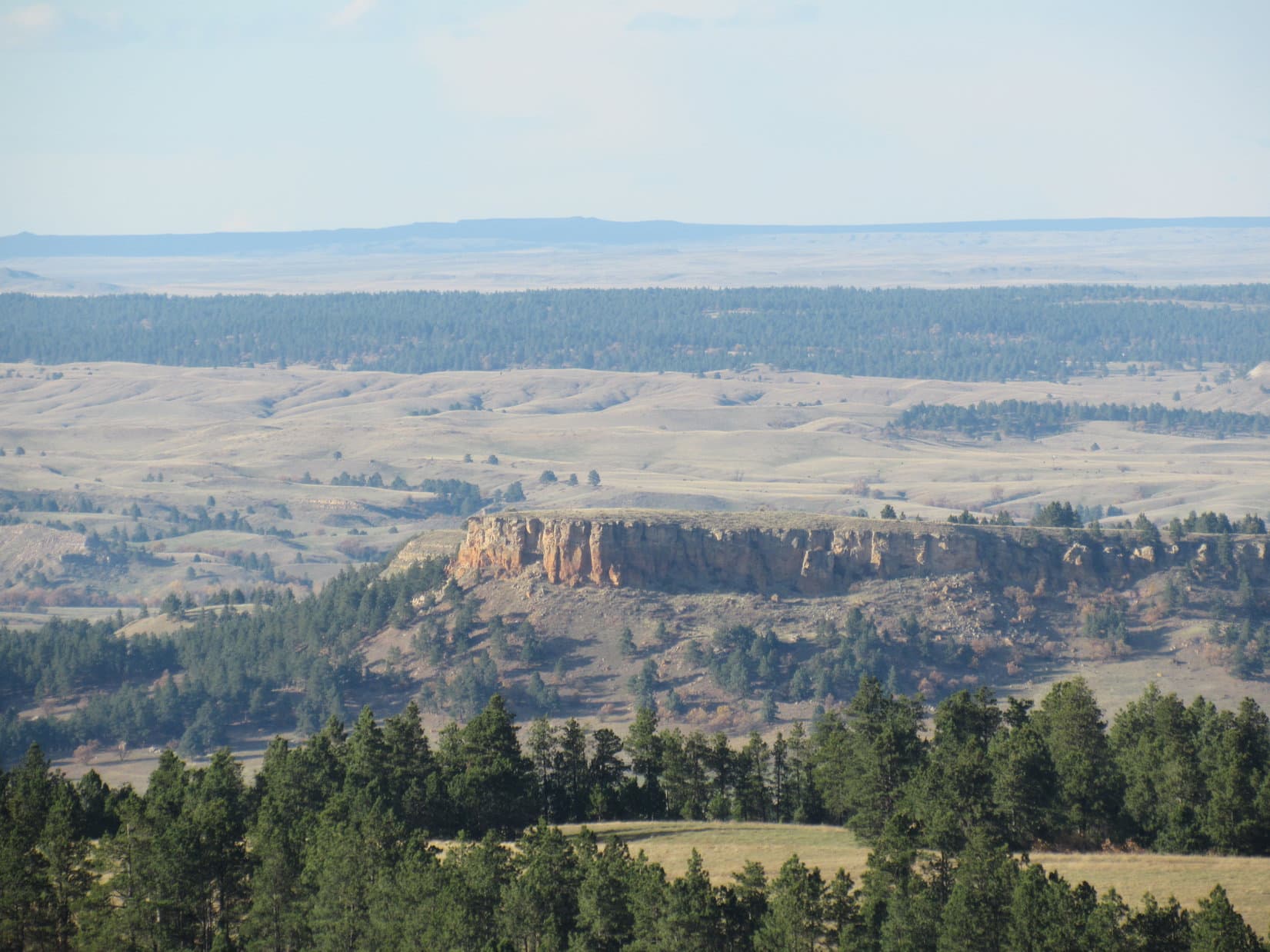
The road went close to the edge of a canyon.  There was a big view to the SE.  On the far horizon, Lupe could see the Black Hills back in South Dakota.

Lupe up on the edge of a wide canyon on her way to Stoney Point. The Black Hills of South Dakota are in view on the horizon. Photo looks SE.

The road left the edge of the canyon curving first N, then NW, as it continued through the forest.  However, the road soon left the forest as it turned N again.  Up ahead was a another grassy hill with some big boulders near the top.  Wearing bright orange, another hunter was stationed up there!

Lupe stuck to the road.  The hunter and SPHP waved as the American Dingo passed on by.  When Lupe reached the top of the hill, the road turned NE crossing a huge level field.  This treeless plain was exposed and windy.  Not as windy as Bald Mountain had been, but a 20 mph SW wind swept across the field.  At the far end of the field were some low rocks near a few pine trees.  When she got there, Lupe sought out a place sheltered from the wind.

Lupe escapes the wind at the low rocks near the NE end of the huge field. Photo looks ESE.

SPHP checked the maps.  Stoney Point had to be close by.  It was just a small hill to the ENE beyond this elevated windswept plain.  Lupe could be there in 15 minutes.  Lupe was disappointed to learn she had to leave her cozy windbreak to press on.

Back in the wind, not far from her windbreak, Lupe stands on low rocks strewn across the NE edge of the huge field. Beyond is a mixed forest of scrub oak and pine. Photo looks NW.
From the edge of the huge field, Lupe could see a very long way to the N and E. This photo looks NNW. Somewhere out there is Montana!
Looking NNW from the huge field using the telephoto lens.

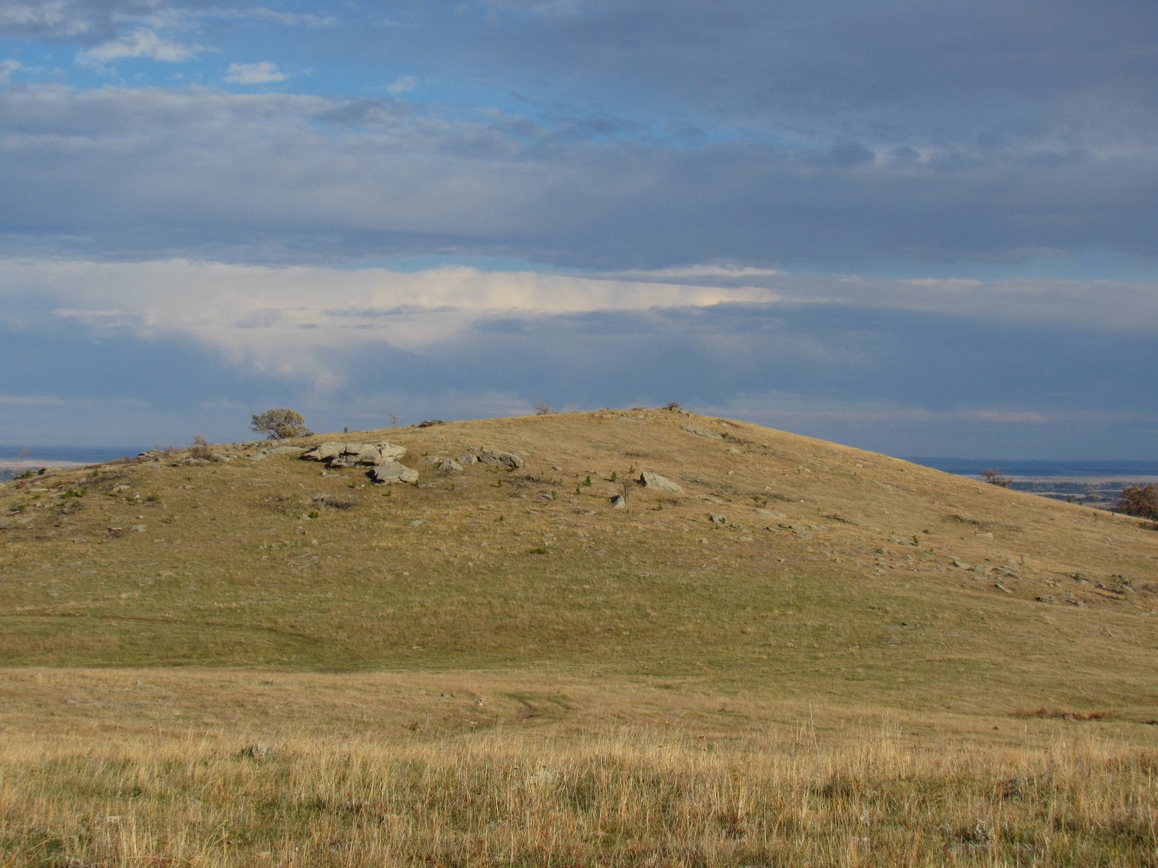
A short distance E of Lupe’s rocky windbreak, Stoney Point (4,480 ft.) came into view.  Stoney Point was just a barren hill with a few boulders, bushes and trees scattered over it.  The views would be good from there, though.

Stoney Point is the small barren hill seen beyond Lupe. Photo looks E.

Lupe headed for the biggest rocks on the NW slope of Stoney Point as she approached.  The wind was blowing hard when she jumped up on them.

Getting closer to Stoney Point! Lupe headed for the biggest collection of rocks seen on the L.
Want a weather report, SPHP? Try WINDY! Hurry up and snap the shot so I can get down off of this rock!
Looking NW from Stoney Point. It may have been windy, but at least it wasn’t cold. The wind was out of the SW, not the N.

From the big rocks, it was only a short stroll up to the summit of Stoney Point.  There were huge distant views from the NW to the ESE.  Lupe could see a very long way out across low pine-covered ridges and high prairie.  Despite the wind, Lupe and SPHP hung around a while checking out the views.

Lupe stands on the highest rocks of Stoney Point, successfully completing her 3rd peakbagging goal of the day! Photo looks SSE.
Looking W back toward the high ridge where the huge field is that Lupe traveled across to get to Stoney Point.
Looking ESE from Stoney Point. Bear Butte (4,422 ft.) is seen on the R as a faint, but noticeable bump on the far horizon.

SPHP had noticed a post with a red top up on Stoney Point when Lupe first arrived, but hadn’t though much of it.  SPHP was surprised when Lupe found a survey benchmark a few feet away.  The old USFS map hadn’t shown a benchmark, but here it was!  A closer look at the topo map from Peakbagger.com did show the benchmark.

The “Stoney” survey benchmark.
Lupe sitting right next to the Stoney Point survey benchmark. It is hard to see, but is about 6" to the L of her tail. Photo looks NW.
Lupe sitting right next to the Stoney Point survey benchmark. It is hard to see, but is about 6″ to the L of her tail. Photo looks NW.

When the time came to leave Stoney Point, SPHP started heading W down the hill on the way back to the huge field.  A minute later, SPHP realized Lupe wasn’t coming.  She was still back up near the summit of Stoney Point.  SPHP called her, but she still didn’t come.  She was standing stiffly in place.

When SPHP left Stoney Point, Lupe didn't come along. Instead she stood stiffly in place. She refused to move, even when SPHP called her. Photo looks ESE.
When SPHP left Stoney Point, Lupe didn’t come along. Instead she stood stiffly in place. She refused to move, even when SPHP called her. Photo looks ESE.

Lupe looked like she did earlier in the year when she had encounters with cactus.  SPHP hadn’t noticed any cactus, but maybe she had stepped on one somewhere up on Stoney Point?

SPHP returned to Lupe.  She let SPHP inspect all her paws.  No cactus spines anywhere – nothing was wrong that SPHP could see.  Still, something must have happened.  Maybe she stepped on something sharp, and thought it was a cactus?

In any case, Lupe wouldn’t budge.  SPHP carried her as far as the big rocks on the NW slope of Stoney Point.  She was willing to pose for a couple more photos from the rocks.

SPHP carried Lupe back to the big rocks on the NW slope of Stoney Point. Photo looks NW.
Lupe on the rocks. Photo looks S.

For some reason, being up on the rocks helped Lupe’s confidence.  Presumably she discovered her paws didn’t really hurt as she moved around.  All on her own, off she went, now leading SPHP on the way back to the G6.  When she reached the E end of the huge field, she paused for one more look back at Stoney Point.

Looking back at Stoney Point beyond Lupe. Photo looks NE.

The second hunter was still in position when Lupe went by again.  Once again, the hunter and SPHP waved.  Returning to the forest, Lupe found a squirrel to bark at.  She had a great time, but a little later, as she was approaching the area where she had startled the first hunter, he came down the hill toward SPHP.  Oh, boy.  Maybe he had heard Lupe barking, and was unhappy thinking she had driven away whatever he might be hunting?

Nope.  The hunter was just friendly.  He was really a very nice guy, and simply wanted to meet Lupe and chat with SPHP.  His name was Joe Eberz.  He was from Ohio, and was way out here in NE Wyoming hunting elk.  Had Lupe seen the rest of his party?  Yes, but only half of it.  Turned out there was a third hunter Lupe and SPHP hadn’t noticed somewhere out there.

Joe hadn’t seen any elk in Wyoming yet, and neither had Lupe or SPHP today.  Plenty of deer around, but none of Lupe’s “giant deers”.  Joe and his party still had several more days to hunt.  Maybe they would find elk before they had to return to Ohio.

Joe and SPHP had a pleasant conversation.  Joe said Lupe really had startled him when she made her first sudden appearance.  SPHP had been amazed to see Joe sitting behind the big rock, too!  Joe petted Lupe, and had his picture taken with her.

Lupe in the remote Bear Lodge Mountains of NE Wyoming with her new friend, elk hunter Joe Eberz from Ohio.

So Lupe returned to the G6 (6:11 PM, 55°F) having made a new friend from Ohio – a great finish to a splendid day of peakbagging way out here in the remote Bear Lodge Mountains of NE Wyoming!

img_3138

Links:

Next Black Hills Expedition                    Prior Black Hills Expedition

Want more Lupe adventures?  Choose from Lupe’s Black Hills Expeditions Adventure Index or Master Adventure Index.  Or subscribe free to new Lupe adventures.

Black Hills, WY Expedition No. 177 – Duling Hill & Iron Mountain (10-10-16)

You awake, Loop?  I’m not sleepy either.  What time is it, anyway?  Ugh, still early.  Want to go out and sniff the air for a few minutes?  She did.

Lupe in the G6 early on 10-10-16. The G6 said it was 5:11 AM, 38ºF.

The moon had set hours ago.  Overhead, Orion was shining brilliantly in the starry night sky.  Nights were already getting long this time of year.  It would be at least another hour until dawn.  Lupe sniffed around in the quiet darkness for 15 minutes.  Then it was back in the G6 to try to get a little more shuteye.

The next time SPHP came to, it was light out.  The sun was already shining on the treetops.  Lupe was wide awake, looking out the window, watching.  The American Dingo was anxious to get out and start her next Black Hills, WY adventure!  OK, Loopster, it’s time, past time really, let’s go!

Duling Hill (6,005 ft.) was Lupe’s first peakbagging objective of the day.  Lupe and SPHP followed USFS Road No. 872.3 a short distance WSW to the “Y” with No. 872.1F.  Lupe turned S on No. 872.1F and promptly arrived at a big canvas tent in the forest just off the road.

Lupe discovered this big canvas tent off USFS Road No. 872.1F. No one was around when she arrived.

The big canvas tent was a rather unusual discovery.  No one was around when Lupe arrived, but there was a big stack of logs outside ready for splitting into firewood.  Evidently there was some kind of stove in the tent.  A long black smokestack leaned out of a hole in the roof.

Someone had gone to considerable trouble to establish this semi-permanent looking camp.  Lupe sniffed around the tent, but there were no windows.  The front door was all zipped and tied shut.  Interesting, but best to leave it alone.  Lupe and SPHP continued SSW on USFS Road No. 872.1F.

Near a high point, Lupe and SPHP left the road to climb up onto a forested ridge to the W.  It wasn’t much of a climb, but SPHP soon caught a glimpse of a high hill about 1.5 miles away to the SW.  That had to be Duling Hill.  No. 872.1F had been heading practically straight for it.

Lupe and SPHP cut back down a short steep slope to return to the road, which was now going SW down a valley.  Lupe had some luck and found a squirrel to bark at in a beautiful grove of golden aspens.

Lupe on USFS Road No. 872.1F. The happy Carolina Dog soon found a squirrel to bark at among the golden aspens. Photo looks SSW.

After an easy stroll down the wooded valley, Lupe reached a junction.  There was a big, round, tan, plastic water trough for cattle here, but it contained no water.  A grassy unmarked road branched off going SE up another small valley.  No. 872.1F turned W.

Lupe left the road, went past the water trough, and crossed a tiny, mucky stream.  She then started climbing S up Duling Hill.  The climb was steepest at the beginning, and soon became more gradual.  Everything was going fine when Lupe’s worries from yesterday suddenly returned.  Gunfire again!  Intermittent just like yesterday.  More target practice.

Up until now, Lupe had been all fired up, full of energy, roaming and racing through the hills.  Even though the gunfire was distant, it instantly made the Carolina Dog nervous and spoiled her fun.  She wanted to stop and hide.

SPHP found a fallen tree to sit on.  Lupe curled up next to the tree.  The Carolina Dog wanted to wait the gunfire out right here.  SPHP allowed her a short break.  No telling how long the gunfire would continue.  Yesterday afternoon it had persisted until after sundown.

Lupe was reluctant to get going again, but she wasn’t in any real danger.  It was time to move on.  The American Dingo stuck closely to SPHP.  Soon she was skirting the NW slope of High Point 5947 to reach the saddle over to the summit of Duling Hill.  The summit wasn’t much farther.  The old USFS map showed a survey benchmark at the top of Duling Hill, for some reason or other marked “Butte”.  SPHP wondered if Lupe would be able to find it.

As it turned out, the “Butte” survey benchmark was very easy to find.  Lupe went right to it.  A conspicuous cairn was built up around benchmark, right at what did appear to be the top of the mountain.  Next to the cairn was some old wire and a wooden cross fallen on the ground.  The summit area was quite large, nearly flat, and forested.  The forest was fairly open, but still effectively blocked the views.

The survey benchmark on Duling Hill did say "Butte", just like the old USFS map showed it would.
The survey benchmark on Duling Hill did say “Butte”, just like the old USFS map showed it would.

Lupe was still so nervous about the distant gunfire, she wanted to stay right next to SPHP.  Many attempts had to be made to persuade her to stay alone near the cairn long enough for a photo.

A very nervous Carolina Dog poses reluctantly at the summit cairn on Duling Hill. The distant, intermittent gunfire from someone just doing target practice kept her on edge. Photo looks NE.
Looking ENE across part of the Duling Hill summit area.

Lupe and SPHP left the Duling Hill summit wandering WNW across a broad area that sloped down only slightly.  The hope was that Lupe would come to some viewpoints along the way.  Lupe did her best.  She found some partial views, but that was all Duling Hill had to offer.

Lupe found this narrow view of Inyan Kara Mountain from Duling Hill. Photo looks SW.
Inyan Kara Mountain (6,360 ft.) with help from the telephoto lens.
This was the clearest view of Hooker Peak (5,862 ft.) that Lupe found from Duling Hill. Photo looks N using the telephoto lens.
Iron Mountain, Lupe’s next peakbagging goal, is the forested hill in the foreground. Far away on the horizon, Warren Peaks (6,650 ft.) can be seen on the L. Photo looks NNW.

Once Lupe’s exploration of the W end of Duling Hill was complete, she headed almost straight N down a long ridge.  The ridge became quite narrow as Lupe lost elevation.  More than half way down, Lupe discovered bones strewn about a small level spot.  Some wild animal had met its fate here.  It must have happened quite a while ago.  The scattered bones were totally bare.

Lupe discovered these bones on the narrow N ridge coming down Duling Hill.

After following the N ridge down from Duling Hill for 0.75 mile, Lupe entered a wide valley of open meadows.  A bright yellow stand of aspens was on display.  Off to the NW was a clear view of Iron Mountain (5,887 ft.), the forested ridge that was Lupe’s next peakbagging goal.

A stand of yellow aspens greeted Lupe in the valley at the lower end of the N ridge from Duling Hill. Photo looks NE.
Iron Mountain, the long forested ridge seen here, was Lupe's next peakbagging goal. Photo looks NW.
Iron Mountain, the long forested ridge seen here, was Lupe’s next peakbagging goal. Photo looks NW.

Iron Mountain was less than a mile away to the NW.  However, small bands of cliffs were visible along the S and SE slopes.  The mountain looked like it could be much more easily approached from the NE than the SE.  Lupe traveled N through the valley, looking for the easiest way up Iron Mountain.  Along the way, she passed a stock pond.

Apparently the stock pond was fed by the tiny stream Lupe had crossed before beginning her ascent of Duling Hill.  The trickle of flow was enough to keep the stock pond from going dry even this late in the season.  The stock pond was kind of a scenic spot, in addition to a source of water for wildlife.

Lupe on her way past a scenic little stock pond SE of Iron Mountain. Photo looks NE.

N of the stock pond, Lupe came to a dirt road.  It was unmarked, but was probably some branch of USFS Road No. 882.  Lupe followed this road only a short distance, then crossed to the other side and followed a single track trail closer to Iron Mountain.  It lead to another road, which was grassy and climbed at an easy pace, winding its way N.

The grassy road took Lupe to a pass NE of Iron Mountain where there was an intersection.  A road marked as USFS Road No. 882.1B went W from the pass, and looked like it was about to turn SW to go up Iron Mountain.  Perfect!

Lupe followed No. 882.1B.  She was feeling better again.  Sometime after she had left the stock pond, target practice had ceased.  No more gunfire!  Lupe was regaining her confidence.  Life is always better when you don’t have to worry about being gunned down!

No. 882.1B brought Lupe high up on the E slope of Iron Mountain, but did not go to the top.  Instead, it turned S, paralleling the ridgeline.  Lupe and SPHP left the road to finish the easy climb through open forest.  Lupe only needed to gain another 70 feet of elevation or so to reach the N end of the summit ridge.

From a distance, Iron Mountain had looked quite densely forested.  SPHP was surprised when Lupe found a flat grassy field at the N end of the ridge.  The meadow was ringed by trees, explaining why this bare spot hadn’t been visible from a distance.  At the N end was a small opening between trees.  Lupe had a clear view of Warren Peaks (6,650 ft.) from here.

To SPHP's surprise, Lupe discovered a meadow up at the N end of the Iron Mountain summit ridge. Later on, SPHP found out that topo maps show this part of the mountain as the true summit. Photo looks NNW.
To SPHP’s surprise, Lupe discovered a meadow up at the N end of the Iron Mountain summit ridge. Later on, SPHP found out that topo maps show this part of the mountain as the true summit. Photo looks NNW.
The lookout tower on Warren Peaks (Center) can be seen in this photo taken from the N end of the summit ridge of Iron Mountain. Photo looks NW using the telephoto lens.

The summit ridge on Iron Mountain was quite broad E/W, and ran N/S for a good 500 to 600 feet.  To the E, the ground sloped away at a moderate pace.  To the W was a line of limestone (Why not iron for Pete’s sake?  This is Iron Mountain, not Limestone Mountain!) cliffs.  The cliffs were on the order of 30 to 40 feet high.

Looking farther W into Wyoming from the cliffs along the summit ridge on Iron Mountain. Hwy 585 can be seen below.
Up on the limestone cliffs along the W edge of the Iron Mountain summit ridge. Photo looks SSW.
Hope you got that shot of the cliff, SPHP. I’m outta here!

The highest part of the summit ridge near the limestone cliffs was nearly level for quite a distance going S from the N end of the ridge.  Lupe and SPHP headed S exploring the ridgeline.  Although SPHP later discovered that topo maps show the true summit of Iron Mountain very close to the N end of the mountain, there was an area 150 feet farther S that seemed a little higher to SPHP.

This more southern high point was certainly more scenic.  It was forested and shady, but right next to the cliffs where there was with an opening between the trees permitting a look at Inyan Kara (6,360 ft.).  Lupe declared it the official true summit of Iron Mountain as far as she was concerned, by posing on the highest rock she could find.

Standing atop the highest rock Lupe could find at her official true summit of Iron Mountain. Unseen just beyond her is a 40 foot cliff. Inyan Kara is seen on the horizon.

Inyan Kara as seen from Iron Mountain. Photo looks SW using the telephoto lens.

Lupe and SPHP went S along the Iron Mountain ridgeline far enough to be absolutely certain the Carolina Dog had visited the true summit.  Then Lupe turned around and went back to the N end of the ridge one more time.  Lupe’s explorations of Iron Mountain were complete.  So were all of her peakbagging goals in this remote part of the Black Hills.  It was time to head back to the G6.

Lupe returned to USFS Road No. 882.1B, following it NE back down Iron Mountain.  She left the road a couple of times to take a look around from two different viewpoints along the way.  Far below to the SE, she saw the stock pond she had passed by earlier.  To the N was Hooker Peak (5,862 ft.), which she had climbed as the sun set yesterday.

On her way down Iron Mountain, Lupe saw the stock pond she had passed by earlier in the day. Photo looks SE.
Hooker Peak as seen from the NE slopes of Iron Mountain. Lupe had been up on top of Hooker Peak yesterday at sunset! Photo looks N using the telephoto lens.

When Lupe reached the pass NE of Iron Mountain at the start of USFS Road No. 882.1B, it would have been very easy to get back to the G6 by taking the road going N from the pass.  That road would soon have turned E and headed almost directly to the G6.  However, SPHP didn’t look at the maps and guessed wrong, taking a road winding SE instead.

Pretty soon it became apparent that the road going SE would eventually lead Lupe right back to the stock pond.  It seemed like the long way around.  SPHP now compounded the first error by making another one.  SPHP left the road taking Lupe NE up a side valley, expecting to find a pass over the ridge.

There was a pass, alright, but much higher up than SPHP expected.  Lupe climbed until she was nearly up to High Point 5783.  She then lost all her elevation gains going E down a steep slope to a road visible below.  SPHP didn’t recognize the road, but Lupe had been here before, just hours ago.  She was back on No. 872.1F, but following the road the wrong way, away from the G6!

Even when Lupe passed by the same stand of golden aspens along USFS Road No. 872.1F where she had found the squirrel early in the morning, SPHP didn't realize where she was, or that she was going the wrong way!
Even when Lupe passed by the same stand of golden aspens along USFS Road No. 872.1F where she had found the squirrel early in the morning, SPHP didn’t realize where she was, or that she was going the wrong way!
Although Lupe and SPHP went the wrong way on USFS Road No. 872.1F, seeing fall colors like these a second time around could hardly be considered a waste of time.

When the big, round, tan water trough came into view, SPHP realized Lupe was back at the tiny stream where she had started her climb up Duling Hill.  Good grief!  SPHP had been leading the American Dingo the wrong way!  Lupe didn’t mind.  She was still having fun.

There was nothing to do about it, except turn around and traipse right back up USFS Road No. 872.1F for the third time today, this time going uphill.  Lupe reached the little pass at the high point on the road, passed by the canvas tent (which was still vacant), and finally arrived at the G6 (1:51 PM, 71°F).

Well, all those navigation mistakes SPHP had made since leaving Iron Mountain had chewed up at least an hour.  It was too bad.  SPHP had been thinking Lupe might travel farther N to the portion of the Black Hills N of Sundance, WY known as the Bear Lodge Mountains.  It would take time to get there, though.  Now, Lupe would arrive with only a few hours left before sunset.

And so, the decision was made to call it for the day.  Black Hills, WY Expedition No. 177 was over.  Lupe and SPHP headed for home.  Lupe had achieved her original peakbagging goals for her two day excursion to this part of the Black Hills in Wyoming.  It wouldn’t be that long before she could return to explore peaks in the Bear Lodge Mountains.

In the meantime, the Carolina Dog was very happy barking at cows and horses along Moskee Road and I90 all the way home.

Links:

Next Black Hills Expedition                    Prior Black Hills Expedition

Want more Lupe adventures?  Choose from Lupe’s Black Hills Expeditions Adventure Index or Master Adventure Index.  Or subscribe free to new Lupe adventures.