Black Hills, SD Expedition No. 260 – Moonshine Gulch, Peak 6205 & Minnesota Ridge (12-8-20)

8:49 AM, 38ºF, Rochford Road 1 mile E of Rochford – 0.25 mile W of Silver Creek Road, a wide valley appeared on the R.  Plenty of room!  SPHP pulled over and parked the G6.  Lupe hopped out and began sniffing around, while SPHP checked the topo map.  Yup, this had to be it – Moonshine Gulch!

At the mouth of Moonshine Gulch, about a mile E of Rochford. Photo looks WNW.

Loop’s mission today was to explore Moonshine Gulch far enough to reach Peak 6205, which shouldn’t be too hard, since Peak 6205 was only a mile away.  The American Dingo set off going WNW up the gulch on a wide dirt and dry grass road.  Pathetically easy at first, but that didn’t last.  Soon the road narrowed and headed into a thicket of deadfall.

Still near the start of Moonshine Gulch on the … uh … road. Photo looks W.

The deadfall was bad for a little way, but the Carolina Dog got beyond it.  The road was now all grassy and easy going again, lined on both sides by white-barked aspens.  Rather pretty, and already feeling quite secluded.  Clearly, no vehicle had been this way in a long time.  Moonshine Gulch promptly curved N, leading straight into another big tangle of deadfall.

On the grassy lane beyond the deadfall.
Among the aspens and pines. Photo looks WNW.
Back into the deadfall. Photo looks SSW.

After scrambling over, under, or around this next batch, Lupe continued N up the valley.  Moonshine Gulch narrowed, becoming more V-shaped.  A tiny frozen stream appeared.  Loop discovered free flowing water only a little farther upstream.

At the frozen trickle. Photo looks NE.
Running water! Photo looks SSE.

All signs of a road vanished as the region down by the stream became choked with vegetation.  Lupe traveled along a bench of somewhat higher ground up on the W slope.  The way things were going, Moonshine Gulch might soon become virtually impassable.

The bench eventually ended, but by then a narrow strip of thick grass had appeared E of the stream.  Lupe crossed over to it.  Continuing up Moonshine Gulch, what was left of the road reappeared, making the trek easier again.  The W side of the valley began to broaden out.  The road went over that way, then started fading in and out – at times helpful, at others, essentially non-existent.

A small frozen pond appeared.  Loopster went down to have a look.

On the exceedingly faint road as Moonshine Gulch widens out again.
At the tiny frozen pond.

Some barbed wire was near the frozen pond, but that wasn’t anything good for Dingoes.  The march N resumed.  The upper end of Moonshine Gulch was supposed to curve sharply W, and it began to look like that was going to happen.

Lupe didn’t really have to go that far N, though, to get to Peak 6205.  Since she was coming to more and more deadfall again, maybe it was about time to climb out of Moonshine Gulch?  Working NW up the deadfall-laden slope to the W, Lupe got high enough to see a somewhat flatter region where a thick forest of young pines grew beneath a canopy of much older trees.

Hmm.  Still some deadfall up here, too, but there didn’t seem to be any reason to go back down into Moonshine Gulch.  Climbing slowly, Loop continued NW through the young pines.  She soon found that the worst of the deadfall could be avoided without much trouble.

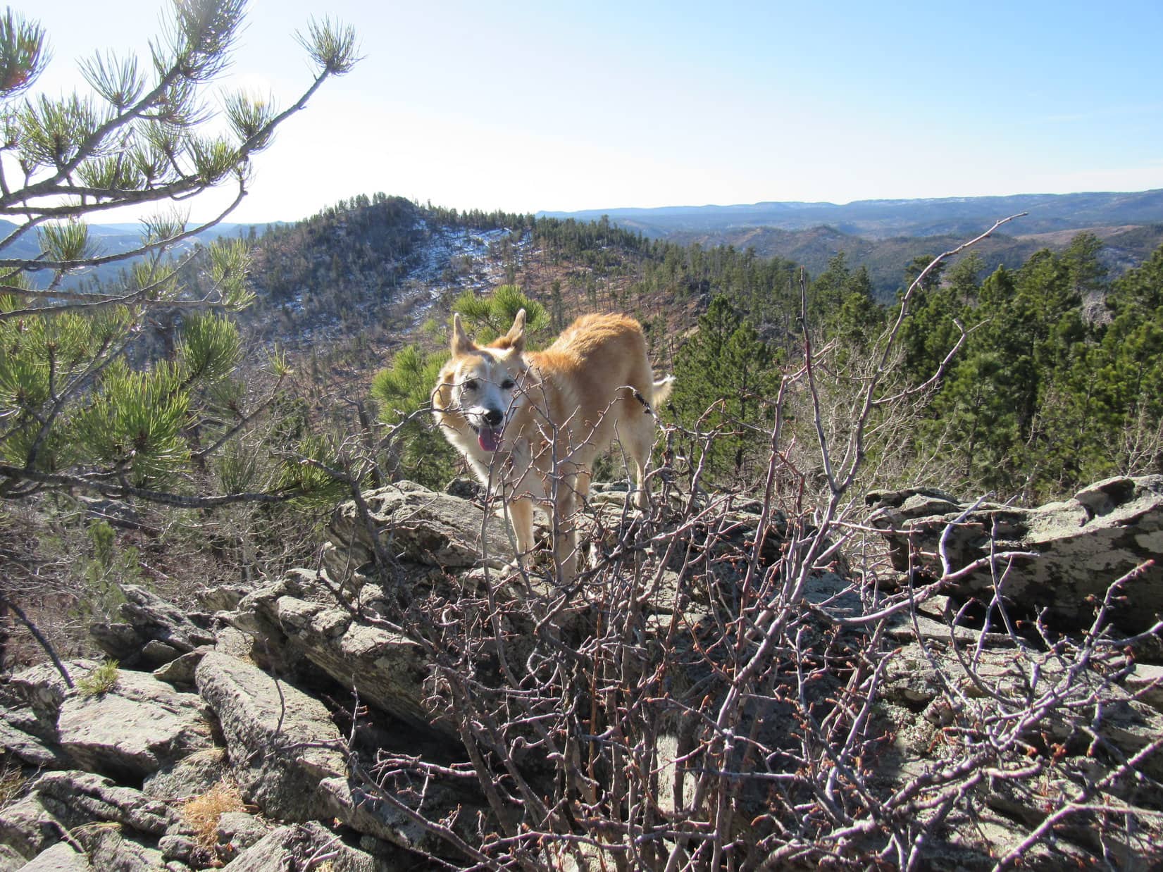
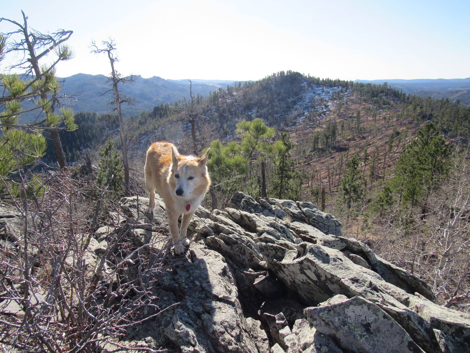
Before long, a small rock formation appeared ahead.

Not sure this is any better, SPHP? Want to try it? At the edge of the young pines after climbing out of Moonshine Gulch. Photo looks NW.
On the highest rock of the little rock formation. HP5880 (Center) in the background. Photo looks NW.

Upon reaching the rock outcropping, Lupe made a surprising discovery.  A road went right past it.  This was a decent road, too, not all faint and grassy like the one down in Moonshine Gulch.  Once again, SPHP checked the old topo map.

So what road is this, SPHP?  Looks like a lot easier way to get here than Moonshine Gulch was!

I’ll grant you that, Looper, but I have no idea what road this is.  The topo doesn’t show any roads at all in this region.  Some USFS Road, no doubt.  Tons of ’em in the Black Hills.  Might be shown on another map, but I think I know where we are.

OK, I’ll bite!  Where are we?

Hey!  No biting!  I think that hill beyond you is HP5880, and the hill right across the road is our destination, Peak 6205.  Doesn’t look high enough, though.  Must be more to it than we can see from here.

So, cross the road and head on up the slope?

Might as well, Loopster!  Go for it!

The mysterious USFS Road not shown on the topo map. Photo looks S.
E slope of Peak 6205. Photo looks WSW.

Lupe climbed and climbed.  Really was a lot more to this slope than had been visible down by the mysterious USFS road.  Good thing, because the top hadn’t looked any higher than HP5880 from below.  Wouldn’t have been any point in climbing the wrong mountain.

Plenty of deadfall to avoid, but nothing out of the ordinary these days.  The higher Lupe got, the more the glimpses of views between the trees confirmed that this really was Peak 6205.  She was clearly way above HP5880 by the time the slope began to level out.  Coming up from the NE, the Carolina Dog arrived near the S end of Peak 6205’s summit region.

An old board was nailed to a tree, and nearly a dozen rusty cans were strewn about.  Remnants of a blue stove with a metal grill sat next to an ancient stone fire ring covered with deadfall.  Several large tree trunks had collapsed next to this fire ring.  10 feet N of the ring was a little bench with stone supports and a log seat.  Didn’t look like anyone had been here in a long, long time.

Looking NE back the way Lupe came up.

Sort of a mess, isn’t it, SPHP?

Someone must have camped out up here once upon a time, Loop.

Nice spot with room enough for a tiny house, although not much in the way of views.  Too many trees!

Probably no views at all when all these dead ones were still standing.  Wonder who would have come to a lonely peak like this?

Adventurers of old, SPHP!  We’re not the only ones, you know!

Heh.  No, I guess not.  Well, what do you say we clean this place up a bit?  Get it a little more ready for adventurers of the future?

No big rush on that from the look of things, SPHP, but fine with me.

Really not that much to do.  SPHP dragged all the deadfall off the fire ring and away from the area around it, pitching it all onto the downed tree trunks nearby.  At least it was now out of the way.  Then all the rusty cans got gathered up and stuffed into a sack.  Once home, they could all go to recycling or the garbage.  SPHP took the metal grill for the blue stove, too, but didn’t have room for the stove itself.

Just going to leave this blue stove on the fire ring, Loopster, even though it’s no good anymore.  Kind of my exterior decorator touch.

Exterior decorator?  Don’t quit the day job, SPHP!

Oh, I won’t!  This is it!  Climbing no name mountains with a nutty Dingo.

Some humans have all the luck, SPHP!

Looper by the remodeled fire ring. Photo looks N.
Does look a little better, SPHP! Lupe on the little bench. Photo looks SSE.

Well, it was time for a break, and then a tour!  The usual Taste of the Wild, water, an apple, and a couple of small shared chocolate coconut bars.  Lupe then went to see the only clear view from the S end of Peak 6205.  From a patch of pine needles and grass, Lupe could look out over Moonshine Gulch toward the rumpled hills to the SE.

Looking SE from Peak 6205.

The true summit of Peak 6205 was NW of the fire ring.  Beyond another heaping helping of wretched deadfall was a 40 foot long narrow, stony ridge.  The highest rocks were at the NW end.

Peak 6205’s summit ridge. Photo looks NW.
True summit. Photo looks SE.

Not much in the way of views here, either.  The best were toward the W.  White Tail Peak (6,962 ft.) and Nipple Butte (6,800 ft.) were the most easily distinguished peaks on the horizon.

At the true summit of Peak 6205. Photo looks SSW.
White Tail Peak (Center) on the horizon. Photo looks W.
Nipple Butte (Center) is the sharpest little blip on the horizon. Photo looks SW.

And that was about it.  Nearly an hour after arriving, Lupe returned briefly to the fire ring toward the S end of the summit region before starting back down the mountain the same way she’d come up.

At the more hospitable S end again. Photo looks SSE.
Pretty snazzy, SPHP! At least compared to how we found it. Think how happy those future adventurers will be!
Starting down the E slope. Photo looks SW.

12:05 PM – Loopster had barely gotten started down the E slope, when SPHP had a change of heart.  The American Dingo had made it to Peak 6205 alright, but now what?  Just go back?  Seemed sort of early for that.

Hey, Loop!  Want to try for Minnesota Ridge (6,240 ft.)?

How far is it?

3+ miles as the crow flies.  Somewhat longer in practice.

It’ll be dark then before we get back won’t it, SPHP?

No doubt.  Don’t think we’ll have much of a problem, though.  Mighty nice out for December.  Supposed to be a record high for this date, in fact!

Lupe was fine with it.  Carolina Dogs love exploring, especially at dusk.  Instead of continuing down the E slope, SPHP went back to the NW end of Peak 6205’s summit ridge.  Following the ridgeline NW, Lupe began working her way down the mountain that way.  She soon saw White Tail Peak again, and even caught a glimpse of Custer Peak (6,804 ft.).

White Tail Peak (Center) on the horizon. Photo looks W.
A glimpse of Custer Peak from the NW ridge. Photo looks N.
Custer Peak (Center). Photo looks N with help from the telephoto lens.

A little farther down the ridge, Peak 6205’s N slope opened up a bit.  This whole region was full of deadfall.  A large grove of aspens was visible W of HP5880 at the bottom of the slope.  Leaving the ridgeline, Lupe picked her way down, eventually managing to reach the aspens.

Two grassy lanes through the aspens appeared to be remnants of old roads.  One went ESE, passing S of HP5880, apparently destined to link up with the mysterious USFS Road Lupe had run across E of Peak 6205.  However, Loop took the other lane, which went ENE.

Near the aspens W of HP5880 (R). From here, Lupe took the lane at far L. Photo looks E.

A short trek on the grassy lane led to a better road beyond the aspens.  Lupe followed this new mystery road as it curved N.  After 0.25 mile, she came to a “T” intersection.  A brown wand identified the road Loop had just taken as USFS Road No. 513.1B, no doubt a spur off No. 513.1, which she had apparently just reached.

On the better road beyond the aspens. HP5880 (L) up in the pines. Photo looks ESE.
Glancing back at Peak 6205. Photo looks S.
Wand near the junction of USFS Roads No. 513.1B & No. 513.1. Photo looks SSW.

No. 513.1 was a better road yet.  SPHP figured it was probably the same one Lupe had come to E of Peak 6205.  In that case, it ought to connect by swinging around the N and E sides of HP5880.  To test this theory, Lupe turned R at the junction, heading ENE.

Sure enough, No. 513.1 began to curve E, then SE.  Most of this territory was flat, but when No. 513.1 started losing elevation, Looper left the road to climb nearby HP5900, the next hill 0.5 mile NNE of HP5880HP5900 wasn’t much of a climb at all coming from the W, but the Carolina Dog did get a halfway decent look back at Peak 6205 from it.

Peak 6205 (L) from HP5900. Photo looks SSW.

On the way over here, Lupe had passed USFS Road No. 513.1C, another spur off No. 513.1 which went N, the general direction she needed to go.  Since No. 513.1C wasn’t too far back and would be a lot easier than a trek through the forest, Loop returned to it.

At the start of USFS Road No. 513.1C where it leaves No. 513.1. Photo looks N.

No. 513.1C was clearly marked as a dead end, but Lupe followed it for nearly 0.5 mile.  A long, gradual descent led to a slow rise.  Near the end, No. 513.1C split, with one branch curving off to the E.  Lupe left the road near this intersection, continuing to wander N through the forest.

Following No. 513.1C. Photo looks N.

Passing over a broad, gentle saddle, the American Dingo reached the start of a forested slope lower.  The terrain steepened and forced her to turn NE, staying SE of a deepening ravine.  After losing a fair amount of elevation in the trackless forest, Lupe came to a spot where she could easily cross over to the N side of the ravine.  Here she came to an animal trail going NE down the slope.

On the animal trail. Photo looks NE.

Near the bottom of the valley Lupe was entering, the animal trail crossed another mysterious old road.  The trail then turned NNE passing through a short section of forest.  Having lost a good 200 feet of elevation, Looper finally emerged on the W side of a broad, grassy valley.

Moonshine Gulch, Peak 6205, and all of today’s explorations since then had all been territory Lupe had never been to before, but she had been here years ago.  Loopster had made it to the Silver Creek valley.  Greens Gulch, the way to Minnesota Ridge (6,240 ft.), split off to the NE only 0.33 mile farther upstream.

We’ve been here before! This is the Silver Creek valley. Photo looks N.

Silver Creek was a small stream, small enough to leap over.  Lupe did so on her way to USFS Road No. 203.1F on the E side of the valley.  Upon reaching the road, Loop followed it N, then NE into Greens Gulch.  0.33 mile trek up Greens Gulch brought the Carolina Dog to an intersection she recognized from Black Hills expeditions long ago.

By Silver Creek after leaping over it. Photo looks NW.
In Greens Gulch, approaching a familiar intersection. Photo looks NE.

SPHP remembered at least one wand, maybe two, marking the roads at this junction, but none were to be seen now.  Checking the maps, it was clear Lupe needed to keep going E up Greens Gulch on USFS Road No. 203.1D, the only road she’d never taken before from this intersection.  No. 203.1D would get her up to a saddle SE of Minnesota Ridge.

Starting up No. 203.1D, Lupe came to a brilliantly lit field of dry grass.  At the far end, the road entered the forest and climbed more steeply.  After gaining more than 200 feet of elevation, Looper still hadn’t come to the saddle yet, but she’d reached another smaller field and the terrain was beginning to level out.  The road continued SE from here, but Lupe left No. 203.1D taking a shortcut straight E.

5 minutes led to a 15 foot high embankment.  Climbing it, Lupe reached the SW rim of Minnesota Ridge.  Turning NW, she quickly came upon a minor rock outcropping.

In the brilliantly lit field along USFS Road No. 203.1D. Photo looks ESE.
At the upper field, still on No. 203.1D. Photo looks NW.
First minor rock outcropping along the SW edge of Minnesota Ridge. Photo looks NE.

Minnesota Ridge encompasses a large, elevated region of pine forest.  Nearly all of it is gently sloping, except along the SW edge where the rim of a long escarpment features rock formations ranging from only a few feet to as much as 30 feet high.

Although Lupe had explored portions of Minnesota Ridge on a number of different occasions, the only other time she had come looking for the summit she had discovered a series of slightly higher rocks as she’d headed NW along the edge of the escarpment.  This time it wouldn’t be necessary to visit all those false “summits”, since the true summit was now known to be nearly 0.5 mile from here.

Gunfire!  Hunters to the NE!  Still unseen, they couldn’t be too far away.  Instantly transformed into a Chicken Dingo, Looper slunk quietly NW, sticking to SPHP like glue.  More shots were heard at intervals of several minutes before the incident ended.  By then, Lupe had come to a more open region along the escarpment.  Peak 6205 was visible 3 miles SSW.

Successfully eluded death and destruction! There’s Peak 6205 (Center). Photo looks SSW.

The last time Lupe had been here, the area close to the true summit had been a deadfall jungle.  The Carolina Dog reached a couple of rocks that looked familiar near the SE end of this region, getting up on both for a look around.  The deadfall was still here, and matters were now further complicated by dense young pines springing up amidst it all.

Pretty sure I’ve been on this rock before.
This one, too!

The true summit wasn’t much farther, only a few hundred feet of little pines and deadfall left to weave through.  When Lupe reached another line of rocks, she knew she was about there.

Farther NW, among the young pines.
Real close to the true summit now!

The true summit was off to the NE, 30 or 40 feet from the escarpment in a part of the forest that was still happily largely deadfall-free.  Loop and SPHP tromped about this slightly elevated flat region, but as before, nothing stood out as the clear high point.  Face it – the true summit of Minnesota Ridge was a roomy, but not terribly interesting place.

Weren’t there bigger rock formations where we saw huge birds flying around here last time, SPHP?

Yes!  There were, Loop.  Turkey vultures, if I remember right.  That’s a little lower ground, but not too far from here, just a bit farther NW.

Well, that was a lot more scenic, SPHP!  Why don’t we go over there?

Good idea!  We can hang out for a little while, and see if the big birds are still circling by.

NW of the true summit where the largest rock formations of the entire escarpment are. Photo looks NW.
This is more like it!

The big rock formations were easily found.  No turkey vultures this time, though.  The sun was already quite close to the horizon.  A short break was all Lupe had time for.  Taste of the Wild, the last apple and chocolate coconut bars all disappeared.

Trees had grown up enough to pretty much hide whatever limited views had been here years ago.  Looper did what she could, though.  Exploring the rim of the escarpment, she gazed out toward the setting sun, or peered into the forest below.

No more turkey vultures, SPHP!
Sort of makes you wonder what ever happened to them?
Exploring the escarpment.

The sun was down well before Lupe got back to USFS Road No. 203.1D near the SE end of Minnesota Ridge.  As dusk deepened, she followed the road W.  Stars twinkled above by the time she’d retraced her journey on No. 203.1F through Greens Gulch back down to the Silver Creek valley.

SPHP had a bright idea.  Instead of following No. 203.1F S down Silver Creek, why not go W?  The topo map showed a road going all the way to USFS Road No. 17, the highway N of Rochford.  No. 17 was only a little over a mile away.  Although a longer route back to the G6 overall, the rest of the march would be easy.

So from Greens Gulch, Lupe took a dirt road that went NW.  It curved W, as the map showed, crossed a muddy low spot containing the remnant of Silver Creek, then proceeded W on a long abandoned route.

It all went as planned until lights appeared ahead.  Avoiding private property, Lupe took a single track trail up a grassy draw that went S or SW.  After gaining a fair amount of elevation, she topped out.  In the weak beam of the little flashlight, no further route W could be seen.  However, the single lane track continued S, or maybe SE.  Hard to tell what to do in the dark, but sticking with the trail seemed the best option.

Exactly where Lupe went on this black December night is now a matter of conjecture.  Somehow she wound up following a road, probably USFS Road No. 217.1A, back down into the Silver Creek valley.  She eventually reached a private road leading to Silver Creek Road (No. 204), passing a number of homes decorated with cheery Christmas lights along the way.

A half moon was up by the time the American Dingo reached Rochford Road.  Not far now.  Only 0.25 mile W to the G6 still silently waiting at the start of Moonshine Gulch.  (7:14 PM, 51ºF)

Sunset from USFS Road No. 203.1D near Minnesota Ridge, Black Hills of South Dakota, 12-8-20

Links:

Next Black Hills Expedition                 Prior Black Hills Expedition

Black Hills, SD Expedition No. 203 – Gimlet Creek to Minnesota Ridge (5-6-17)

Black Hills, SD Expedition No. 78 – The Experimental Forest & Minnesota Ridge (3-9-14)

Want more Lupe adventures?  Check out Lupe’s Black Hills, SD & WY Expeditions Adventure Index, Master Adventure Index, or subscribe free to new Lupe adventures!

Black Hills, SD Expedition No. 259 – Zimmer Ridge & Peak 6600 (11-28-20)

7:59 AM, 18ºF, Whitehorse Road 0.2 mile from Hwy 16/385 – Dang chilly out!  Supposed to warm up a bunch, though.  Lupe was in high spirits as she set off up shady Whitehorse Gulch.  Apparently, the Carolina Dog wasn’t cold, but SPHP’s frigid fingers were glad when the gulch widened out enough to become sunny.

Whitehorse Road wound NW for a little over a mile before Lupe left it.  Crossing a small field of dry grass on the R, she entered the forest.  The terrain immediately began to slope higher, and soon became rocky.  Not bad at all, though.  Getting up Zimmer Ridge (6,600 ft.) was going to be a snap, if it stayed like this.

Near the forest after leaving Whitehorse Road. Photo looks NE.
Starting up Zimmer Ridge’s SW ridge. Photo looks NE.

Heh!  Not to be.  The rock formations along Zimmer Ridge’s SW ridge grew in size, and the slope steepened as the American Dingo climbed.  Looper eventually found herself high up on a bunch of boulders with no safe way forward, forcing a 50 foot retreat.

Determined Dingo, still on Zimmer Ridge’s lower slopes. Photo looks SSE.
On a short, easy, protected ramp higher. Photo looks ENE.
By a cool boulder along the SW ridge. Photo looks S.
A glimpse of Peak 6600 (R) beyond Whitehorse Gulch. Photo looks NW.

A minor setback.  Swinging around the W side of the big boulders, Lupe came to a steepish region of moderate-sized rock.  Scrambling up that, she reached a longer stretch of doghair pine right back on the ridgeline.  Loopster searched for squirrels, but she wasn’t going to be sneaking up on anything with SPHP snap, crackle, and popping twigs and branches every step of the way.

More big rock formations were ahead, but they weren’t gnarly enough to put an end to progress this time.  The forest began to open up along the ridgeline.  Unfortunately, that was due to all the deadfall.  Extremely common these days in the Black Hills, but never a welcome sight.

Scrambling the rocks. Photo looks NNE.
Among the doghair pines.
Another rock formation along the ridgeline. Photo looks SSE.
Oh, boy! Deadfall! Our favorite. Not! Photo looks NNE.

Zimmer Ridge’s SW and S ridges merged together somewhere along in here.  Lupe was getting quite high.  The summit couldn’t be an awful lot farther N, could it?

Maybe yes.  Loop had climbed Zimmer Ridge once before a little over 6 years ago.  Back then she had come up the W slope instead of the SW ridge, but had reached the main ridgeline well S of the summit.  Both routes ought to link up, but nothing looked familiar yet.

The Carolina Dog came to several larger rock formations along the top of the ridgeline separated by stretches of often deadfall-laden forest.  Reaching the N side of one of these outcroppings, aha!

Loopster!  Remember this?  You were here before!

I was?

Yes, yes!  Remember this log sticking out toward Sylvan Hill (7,000 ft.)?  Looks like it has weathered some more, but this has got to be the same one you visited before!

Lovely, I’m sure, but it seems to have made more of an impression on you, SPHP, than it did on me.  I’ll take your word for it.  Is this particular dead log some sort of big event?

Apparently, not!  I just thought it was sort of cool to see a reminder of our first visit to Zimmer Ridge.  I’m certain you were here before.  Took a photo of you by or on this log, which may be why I remember it.  Let’s get another!

Whatever!  Fine and dandy, SPHP!  Perfectly glorious!  But let me know when you’re certain you see a squirrel!

Traveling the ridgeline from one big rock formation to the next. Photo looks N.
Black Elk Peak (7,231 ft.) (R) in the distance. Photo looks ESE.
Once again on the oh, so incredibly memorable log pointing toward Sylvan Hill (L). Photo looks SE.

Having seen this fabulous reminder of the good old days, SPHP now felt that maybe it really wasn’t too much farther N to Zimmer Ridge’s true summit, although after thinking about it, it had seemed like a bit of a trek 6 years ago.

Another clearly higher point was off in that direction.  Looked more like a pine-forested hill than a rock formation, though.  SPHP recalled the true summit as being quite rocky, and surrounded by young aspens.

Whether that hill was or wasn’t the true summit, Lupe still had to go that way, though.  She headed N across a semi-open region harboring more deadfall.  Off to the SE were nice views of Black Elk Peak (7,231 ft.), Little Devils Tower (6,960 ft.), Saint Elmo Peak (6,458 ft.) and others.

On to the next higher point along the ridge. Photo looks NNE.
Black Elk Peak (Center), Little Devils Tower (R), and Saint Elmo Peak (R foreground). Photo looks ESE.

The next high point didn’t turn out to be the true summit, but it could be seen from here.  SPHP was sure that next more heavily forested hill had to be it.  A few rocks and aspens were visible at the top.  Lupe had to lose a bit of elevation to continue over there, but it wasn’t long before she was scrambling on rocks just SE of the top.

True summit of Zimmer Ridge ahead! Photo looks N.
Just below the S (true) summit. Photo looks NW.

Circling around to the N, Lupe climbed up to a gap between several large rocks at the very top of Zimmer Ridge (6,600 ft.).  Three stones were in contention for title of true summit.  Two were side by side just E of this gap, and one was immediately W of it.  SPHP helped Lupe up onto the closest E rock first.

On the E rock. Photo looks ENE.

The W rock was clearly a few inches higher than the two E ones were.  The crafty American Dingo managed to scramble around to the top of it all by herself.

At the true summit of Zimmer Ridge. Photo looks W.

Trees hid the views to the E, but Lupe could see a huge swath of the Black Hills in other directions.  Peak 6600, her next objective, was in sight to the WNW along the ridge on the far side of Whitehorse Gulch.  Big ridges of the limestone plateau country were visible miles farther W.

Peak 6600 (immediately R of Lupe) with ridges of the limestone plateau beyond. Photo looks WNW.

Perhaps the most interesting sight of all was HP6583, the N high point of Zimmer Ridge off to the NNE.  Connected by a 0.5 mile section of the huge ridge, HP6583 wasn’t much lower.  Having been there before, Lupe knew it was a much better place to take a break.  The true summit of Zimmer Ridge was a cool airy spot, but with little room to maneuver and nowhere to relax except well below the highest rocks.

HP6583 (R), the slightly lower N summit of Zimmer Ridge from the true summit. Photo looks N.

Took nearly 50 minutes to get over there.  Not really much of a surprise.  SPHP remembered this trek as having been a terrible deadfall mess.  Now it didn’t seem much worse than a lot of other places in the Black Hills, but Looper was still getting a workout leaping over one dead tree after another along whatever snaky route looked like the path of least resistance at the moment.

Most of the time the going was easiest E of the ridgeline.  The deadfall didn’t get bad until Looper was halfway to HP6583.  With so many trees down, Loop enjoyed a sweeping view of Elkhorn Mountain (6,381 ft.), Black Elk Peak (7,231 ft.), Peak 6920 and others off to the E and SE.

Leaving the true summit region. Photo looks SE.
Elkhorn Mountain (L), Black Elk Peak (Center), Peak 6920 (next knob to the R). Photo looks SE.
A glance back at the true summit (L). Photo looks S.

Shortly before reaching HP6583, most of the deadfall ended.  Lupe passed through a short section of young pine forest which led to a small boulder field next to a big rock formation at the top.  Circling around the NW side, the Carolina Dog scrambled up from the NE.  A lone pine tree’s inopportunely situated branches made following Loop a little tricky, but SPHP soon joined her on top.

Not much room up here, either, but definitely more comfortable than Zimmer Ridge’s true summit had been.  A U-shaped rock formation open to the SE surrounded a small area where Lupe could relax on a bed of pine needles, if she wanted to.  SPHP tossed some prickly pine cones out of it for her.

Loop on the rock formation at the top of HP6583. Photo looks SW.

The views from HP6583 were quite similar to what they’d been over at the true summit.  Loopster and SPHP hung around for half an hour.  A couple of little chocolate coconut bars were shared.  Lupe also partook of some Taste of the Wild while SPHP munched the usual apple.

True summit of Zimmer Ridge (L) from HP6583. Photo looks SW.
Another angle. Photo looks SSW.
Peak 6600 is the high point on the next ridge past Loop’s head. Photo looks W.

Mighty nice day for late November!  Time passed quickly.  Before all was over and done with, Lupe had also visited a lower rock formation off to the NE which had a view of Five Points (6,221 ft.).

Five Points (L of Center) from the lower NE rock formation. Photo looks NE.

Peak 6600 on the W side of Whitehorse Gulch was the American Dingo’s final peakbagging objective for the day.  Abandoning Zimmer Ridge, Lupe started down HP6583‘s NW slope.  This was all densely forested, fairly steep territory.  For a while boulder fields were off to the L (S) as Loop worked her way W.  Some deadfall, but not bad.  No views except trees, a mix of aspens and pines.

Descending Zimmer Ridge. Photo looks WSW.

Looking for a minor hill on the way to Pass 5935, Lupe finally saw it a little off to the NW.  She headed over toward it, but turned W along the S slope instead of going all the way to the top.  Upon reaching the Pass 5935 region, Loop came to a clearing.  Nearby was a dirt road which she followed NW up to a junction with USFS Road No. 387.1B.

Looper reaches USFS Road No. 387.1B near Pass 5935. Photo looks WSW.

Taking No. 387.1B, Lupe followed it up a short rise.  Once it topped out, the road then headed SW down a ravine leading into Whitehorse Gulch.  At the bottom, No. 387.1B turned NW.  Before making the turn, Loop left the road at the bend, heading down to a little pond only 200 feet away.

This pond had been a pretty spot the last time the Carolina Dog had been here more than 6 years ago.  Today it was frozen over, and seemed sad.  Everything looked motionless and dead.  A moment of silent reflection, and Lupe returned to the road, now going NW farther up Whitehorse Gulch.

Nearing the bend in Whitehorse Gulch. Photo looks WSW.
By the frozen pond. Photo looks SW.

For about a mile, No. 387.1B wound its way steadily higher.  Lupe came to a new, unmarked dirt road that angled off to the L, but didn’t take it.  After a while, the air became more strongly pine-scented than usual.  The reason was soon clear.  Logging!  The forest that had been here ever since Lupe had last been this way was now mostly gone.

The loggers had been here just recently.  Lupe passed numerous stacks of fresh cut logs, and huge piles of branches still loaded with green pine needles.  The change opened up the valley view, but the freshly churned up ground wasn’t pretty, the damage too new.

Lupe was undeterred, still happily exploring ahead, but SPHP trudged after her in an increasingly melancholy mood.

Exploring upper Whitehorse Gulch. USFS Road No. 387.1B (R). Where the new dirt road on the L goes remains a mystery. Photo looks NNW.
Whitehorse Gulch. Photo looks NW.
Near the start of the recently logged region. Photo looks NNW.

At the extreme N end of Whitehorse Gulch, No. 387.1B came to an end at a circular turnaround loop.  A more primitive road went W from here, and soon climbed a short steep slope.  Up on top, now 0.75 mile due N of Peak 6600, Lupe found she had reached a minor pass.  A fence crossed the road, but the gate was open.  Beyond the fence was a meadow and views of nearby hills to the NW.

Leaving the road, the Carolina Dog headed S along a broad ridge leading to Peak 6600.  Loggers had been up here, too.  All large trees were gone, although small ones remained, the ground churned up with caterpillar tracks and littered with little broken branches still sporting bright green pine needles.  Zimmer Ridge (6,600 ft.) could be seen off to the ESE, the top of Black Elk Peak poking up behind it.

Zimmer Ridge (Center). Photo looks ESE.

The loggers hadn’t made it all the way to Peak 6600 along this ridge, but they’d gotten fairly close.  Lupe had to duck under the annoying ancient barbed-wire fence that also went this way a couple of times, but finally got past it, too.

Closing in on Peak 6600 (R). Sylvan Hill (L) in the distance. Photo looks S.

Little patches of snow were still slowly melting on the N slopes, as Lupe made the final 200 foot ascent to the top of Peak 6600.  Not particularly steep, just a forested, and in a few spots, snowy trek higher.

Peak 6600 has two summits, E and W, separated by 300 feet.  Coming up the NNE slope of the mountain, Looper reached the E summit first.  She scrambled up onto a narrow, vertical band of rock running N/S at the high point.  This was the same spot she had reached 6 years ago, where SPHP had taken a photo of her silhouetted as the sun sank in the W.

Not that late in the day yet this time around.  SPHP took a couple of new photos of Loop on the E summit, but from different angles than before.

Peak 6600, at the E summit. Photo looks S.
E summit from another angle. Photo looks NW.

Trees interfered with the views.  The W summit was a bit higher in SPHP’s opinion, although it couldn’t be seen clearly from here for the same reason.  Lots of deadfall between the two summits.  Lupe stayed near the N edge, trying to avoid the mess as much as possible, as she headed over to the true summit.

3:17 PM – Lupe stood poised at the true summit of Peak 6600 enjoying a sunlit reception.  45 minutes before sunset.  She would spend 25 of them right here.  This was a beautiful spot, with some room to move around.  The best and only open views were off to the N and W where a series of forested hills led to the high ridges of the limestone plateau country.

In brilliant sunshine at the true (W) summit of Peak 6600. Photo looks N.
Limestone plateau ridges on the horizon (L). Photo looks WNW.
Bear Mountain (7,166 ft.) beyond Lupe. Photo looks WSW.
At the S end of Peak 6600’s W summit region. Photo looks S.

The last apple vanished.  Lupe had more Taste of the Wild.  Water for all.  Conditions were awesome for late November, and the slanting rays of early evening sunlight made everything so beautiful!  Wouldn’t last.  Looper cooperated fully in getting a few more dazzling Dingo shots.

Green Mountain (7,164) (L) in the distance. Photo looks NW.
Evening on Peak 6600. Photo looks W.
Back on the highest rocks of the true summit. Photo looks N.

Would have been fun to stay and watch the sunset, but it was a long way back.  The most direct route would be steep and full of deadfall.  Better to leave early enough to not get stuck out among the worst of it in the dark.

Prudence was going to win out.  The sun wasn’t quite low enough yet to get a true silhouette shot this time, but SPHP tried anyway, hoping to get a couple that might be close before Lupe left Peak 6600 again.  This time she stood proudly atop the true (W) summit, instead of the E one.

Peak 6600, true summit. Photo looks W.
Final moments atop Peak 6600.

And the race was on!  The American Dingo started down Peak 6600’s steep SE slope, dodging all the deadfall as best she could.  She’d barely gotten going, when the views of Zimmer Ridge and the rugged territory surrounding Black Elk Peak were worth a pause.

Zimmer Ridge (Center). Photo looks E.
Black Elk Peak (L), Peak 6920 (Center), and Little Devils Tower (R). The SW ridge of Zimmer Ridge, which Lupe had climbed this morning, is the foreground. Photo looks ESE with help from the telephoto lens.

Dusk in Whitehorse Gulch.  The night sky never did get all that dark.  The white ghost of a nearly full moon rose over the shoulder of Zimmer Ridge.  Skirting fences along the edge of private property, an American Dingo slunk undetected through shadowy forest.

Chilly out again, but homeward bound.  (5:50 PM, 24ºF)

Peak 6600, Black Hills of South Dakota, 11-28-20

Links:

Next Black Hills Expedition                 Prior Black Hills Expedition

Black Hills, SD Expedition No. 101 – Zimmer Ridge & Peak 6600 (10-23-14)

Want more Lupe adventures?  Check out Lupe’s Black Hills, SD & WY Expeditions Adventure Index, Master Adventure Index, or subscribe free to new Lupe adventures!