Black Hills, SD Expedition No. 262 – Peak 5400 & Pillar Peak (1-13-21)

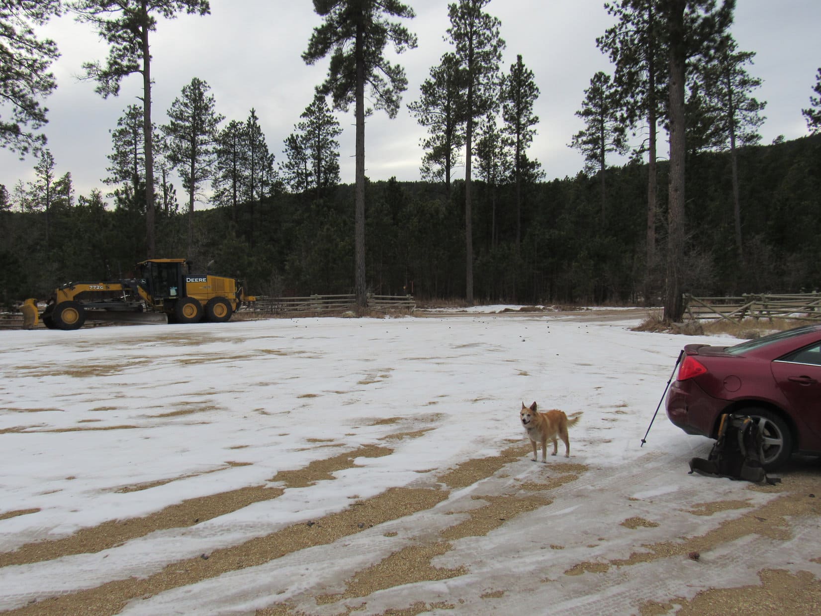
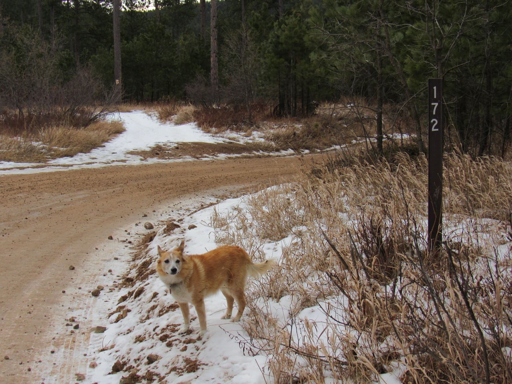
9:03 AM, 37ºF, Camp 5 Road trailhead off Hwy 14A W of Boulder Park – Overcast, but warm for the middle of January.  Last warm day before a giant Canadian air mass was supposed to come howling in out of the N.  Dead calm at the moment, and about time to get New Year 2021 off to a good start!  The American Dingo was rarin’ to go!

Lupe had been here once before, years ago.  SPHP couldn’t remember exactly when, but the big, empty trailhead seemed completely familiar.  Anxious to get underway, Loop set off heading SE down Camp 5 Road.  She soon crossed a dry wash at the bottom of the Box Elder Creek drainage.  Camp 5 Road then curved SW on a short uphill stretch, before leveling out at a meadow 0.25 mile from the trailhead.  Roads branched out in various directions.

This place seemed familiar, too.

At the Camp 5 Road trailhead ready for the first Black Hills, SD expedition of 2021!
Starting out along Camp 5 Road, aka USFS Road No. 172 at this point.
Approaching the Box Elder Creek drainage. Photo looks S.

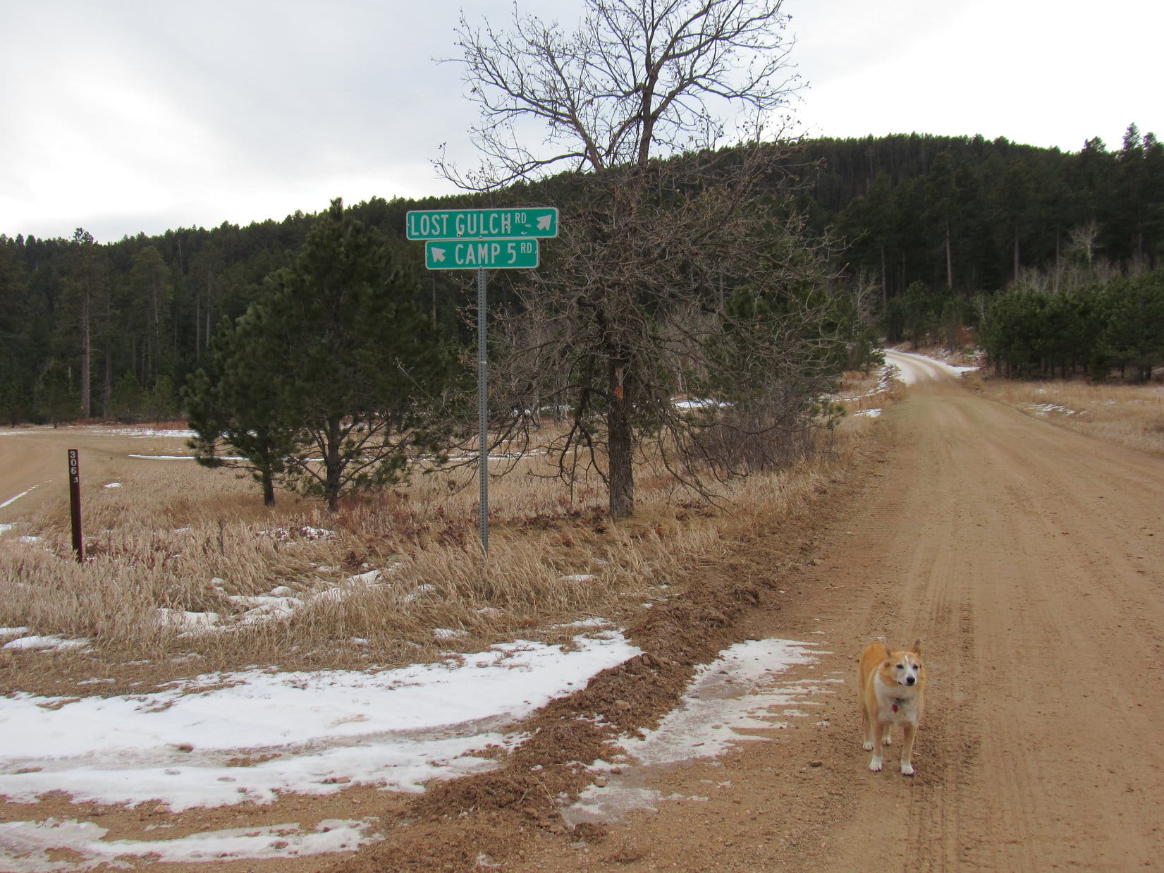
Camp 5 Road resumed its SE course here, branching off to the L.  Lost Gulch Road continued straight ahead, while a lesser road curved off to the NW a bit beyond this junction.

Which way, SPHP?  Where are we going?

Straight ahead, Loop!  Lost Gulch Road!  Thought we’d kick off 2021 with a mountain you’ve never been to before, mighty Peak 5400!

What’s so mighty about it?

Who knows?  We’ll find out when we get there.  Lists of John says it has 360 feet of prominence, which is about all I know about it, unless you remember what it looks like?

Remember what it looks like?  Have we seen it before, SPHP?

Yeah, a long time ago, from Pillar Peak (5,469 ft.).

In the meadow where Camp 5 Road forks off to the L. Lupe continued straight on Lost Gulch Road, aka USFS Road No. 172.1. Photo looks SW.

Pillar Peak (5,469 ft.)!  Pillar Peak had been ages ago!  Well, maybe just one age ago.  Lupe had first climbed Pillar Peak an overcast day way back in February, 2015.  Pillar Peak had the distinction of being the first post SPHP had ever written for The (Mostly) True Adventures of Lupe.

Of course, Lupe had already gotten up to Black Hills expedition No. 120 by then, so there had been an illustrious, still little known prior age, too.

Lost Gulch Road curved W heading up into a forested valley.  Had Loop been this way before?  SPHP was almost certain she had, but nothing along in here rang a bell.  After going 0.5 mile W, Lost Gulch Road curved S (L) at a snowy junction with USFS Road No. 804.

0.25 mile farther, and Lost Gulch Road bent E as it passed a ravine.  SPHP stopped to check the map.  Yeah, this must be it.  Time to leave the road.  Lupe headed SW up the SE side of the ravine.

About to leave Lost Gulch Road. Photo looks SSW.
Heading up the SE side of the ravine. Photo looks WSW.

The Carolina Dog didn’t get far at all before reaching a narrow, deep side ravine coming down from the S.  Since Loop was already well above the bottom of this drainage, it was blocking further advance SW.  Instead of descending into it, Lupe turned S climbing along the side of the steep hill E of this new ravine.

No point in going all the way to the top of this first hill, though.  What Lupe really needed was to get over to the W side of the ravine.  Avoiding additional elevation gain, Loop continued S on a steep slope littered with loose pine needles. The ravine soon rose to Loopster’s level, permitting her to follow the bottom of it higher.

Going up the narrow side ravine. Photo looks S.

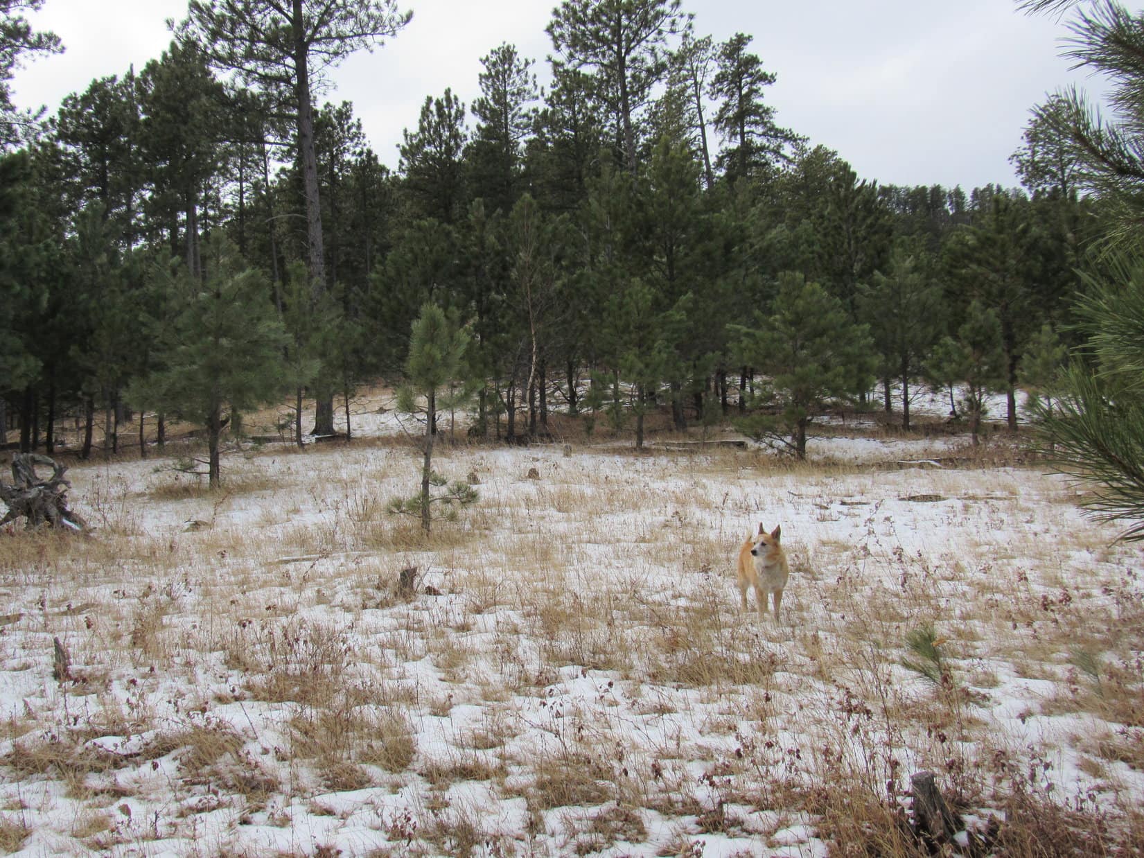
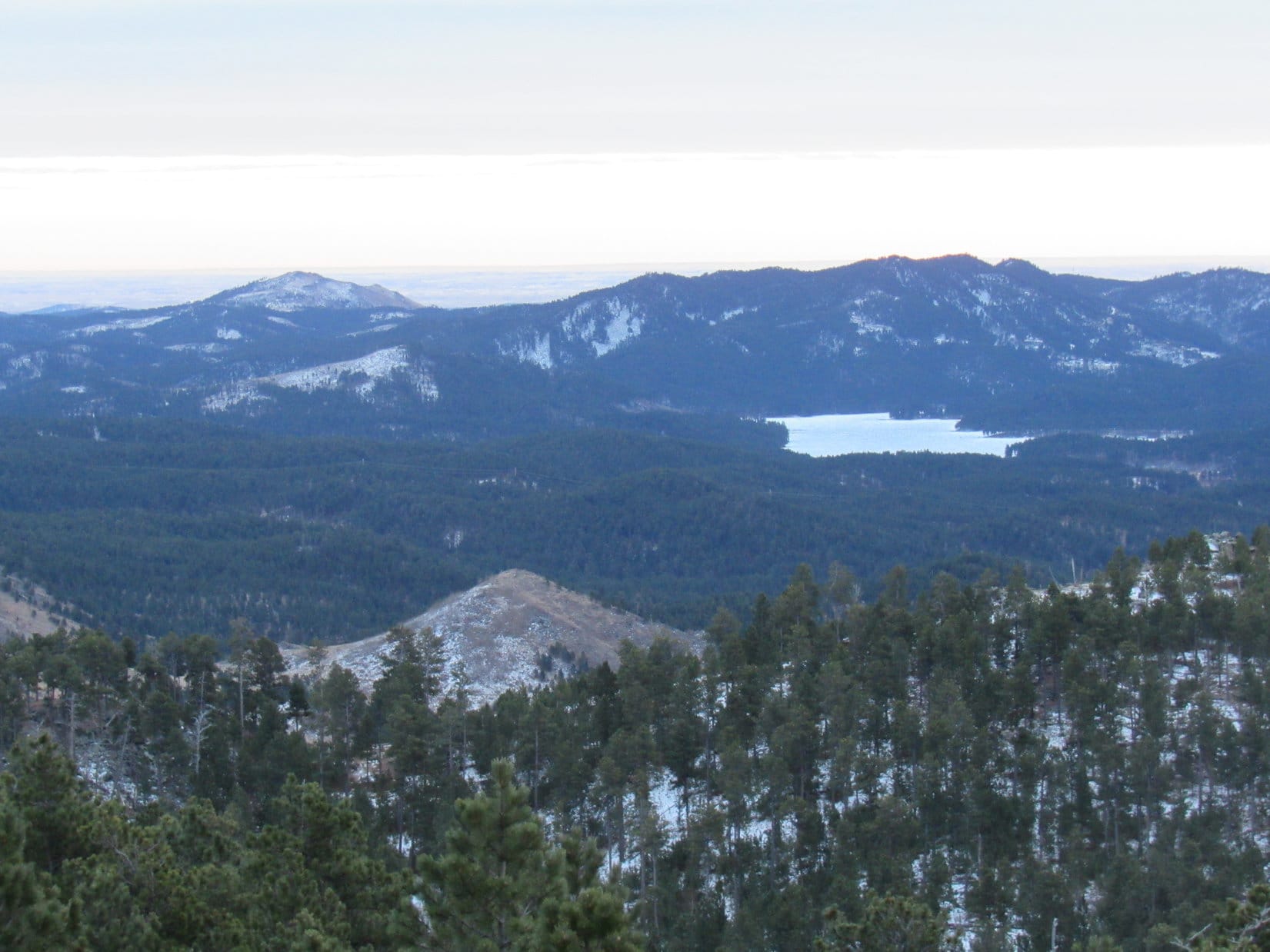
Loopster got only a little higher before the ravine widened and started leveling out to some degree.  She could easily continue SW from here, and began a moderately steep climb.  Before long a clearing with a bit of a view appeared.  Crook Mountain (4,930 ft.) was in sight off to the N.

At the first viewpoint. Crook Mountain (L). Photo looks NNE.

Lupe was now somewhere ENE of unseen HP5082 way out near the far NE end of Peak 5400’s long N ridge.  Continuing SW, she soon came to the S edge of the ridge.  Veteran Peak (5,333 ft.) was visible among other hills to the SE.

Veteran Peak (Center) on the horizon. Photo looks SE.

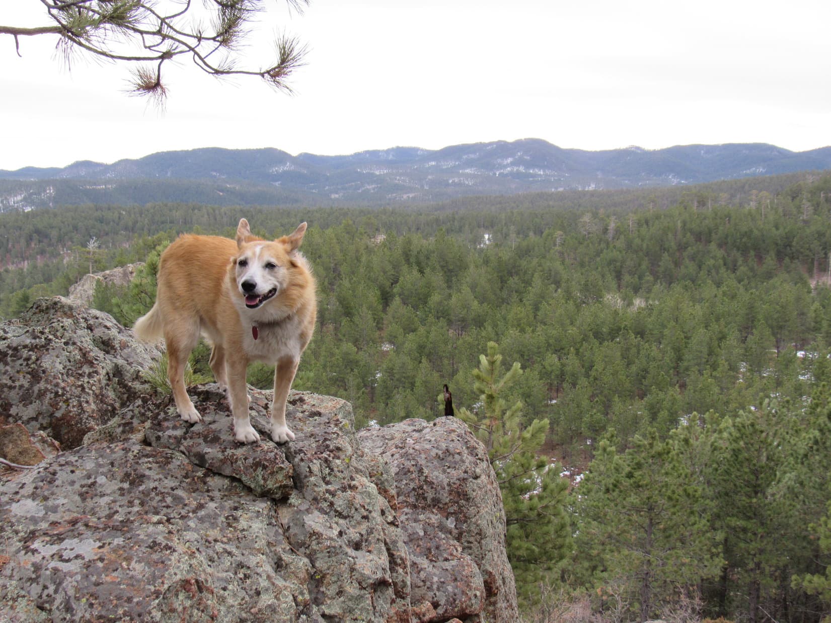
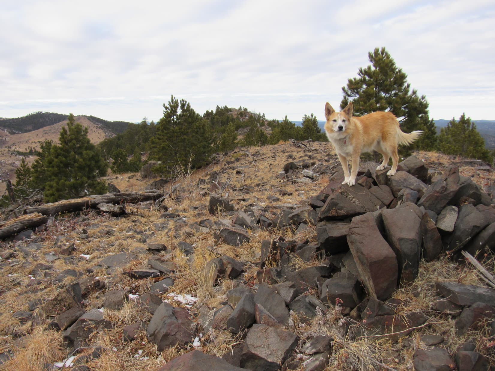
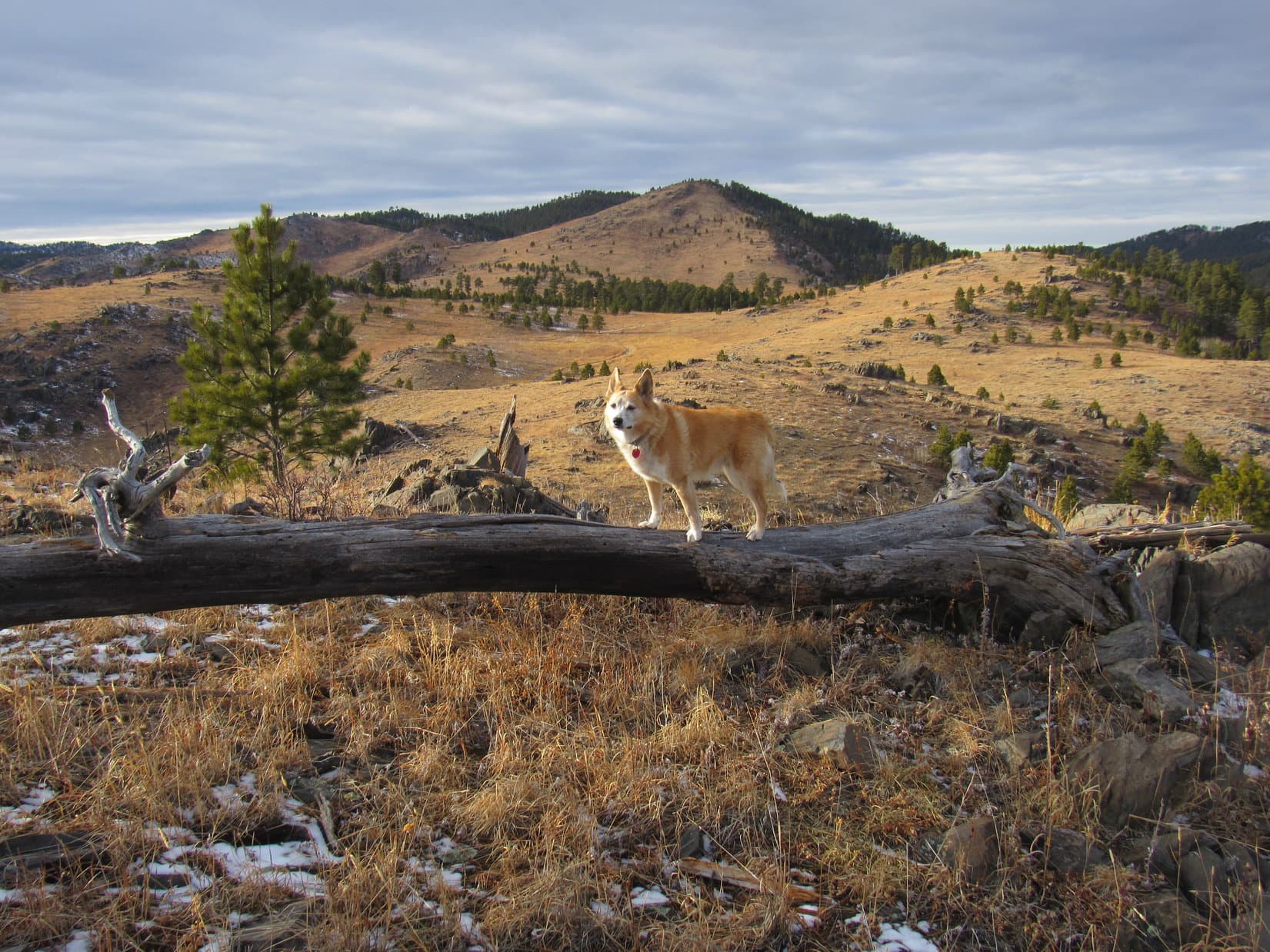
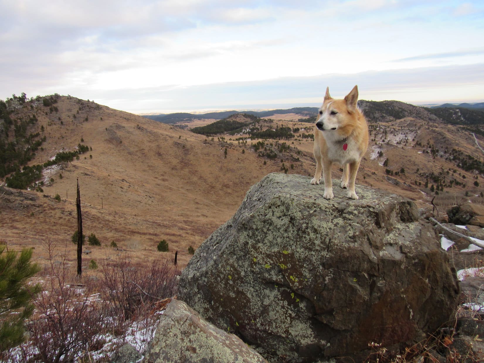
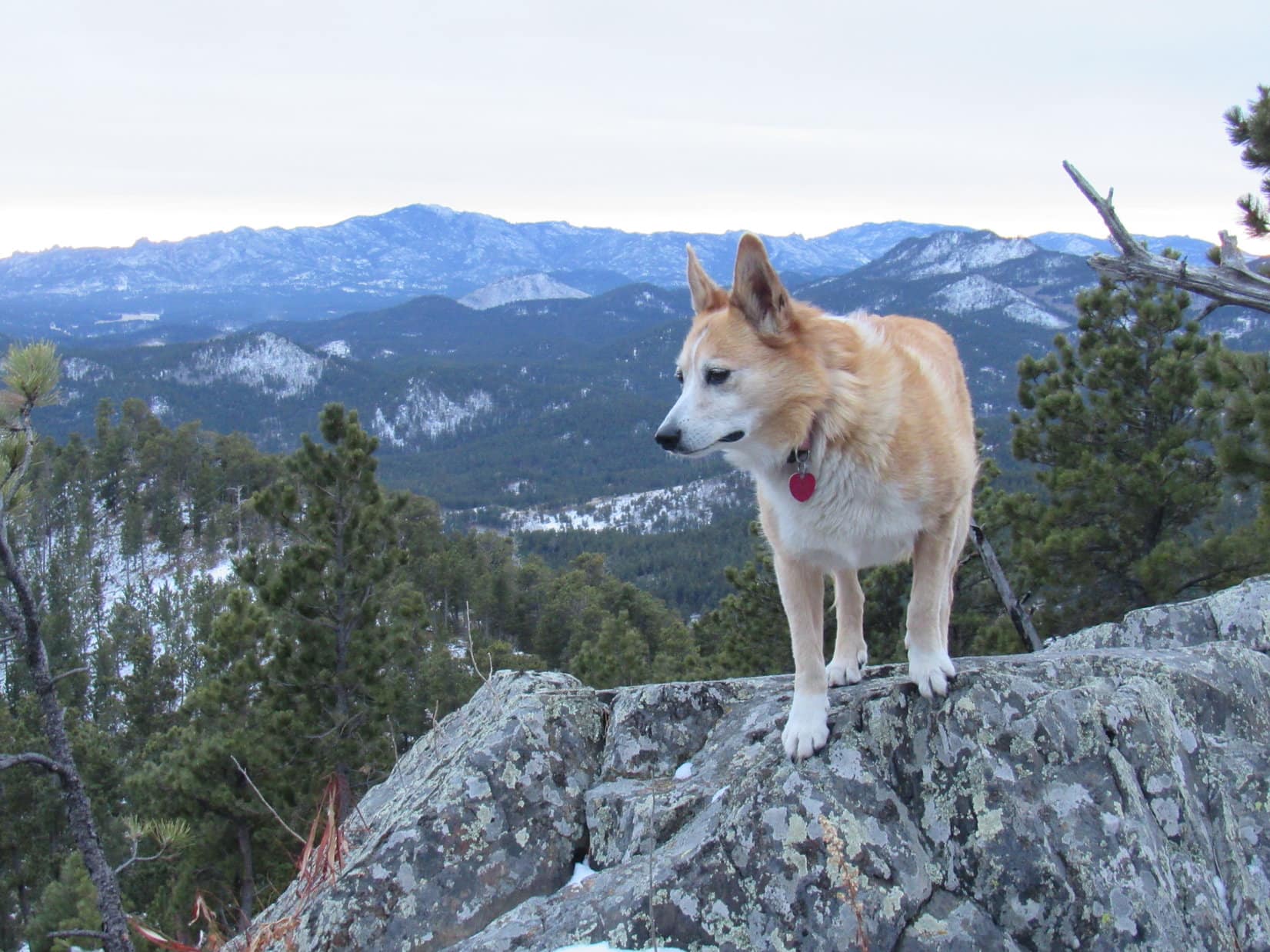
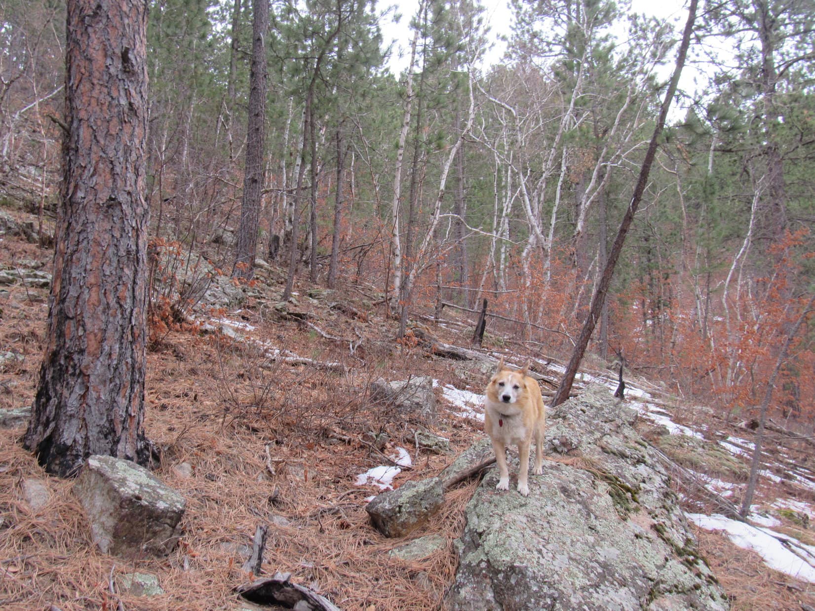
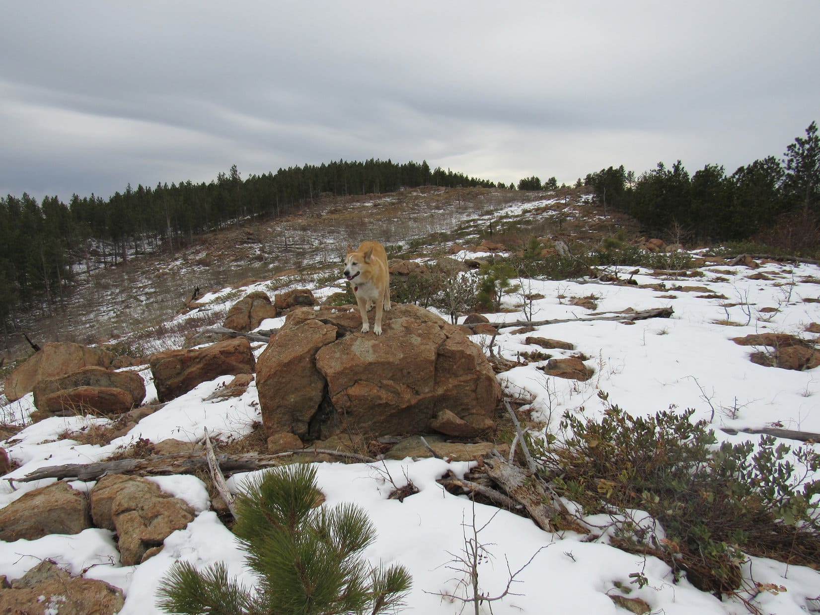
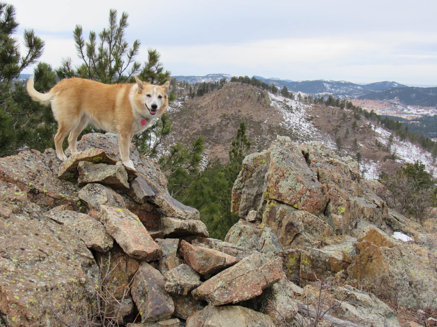
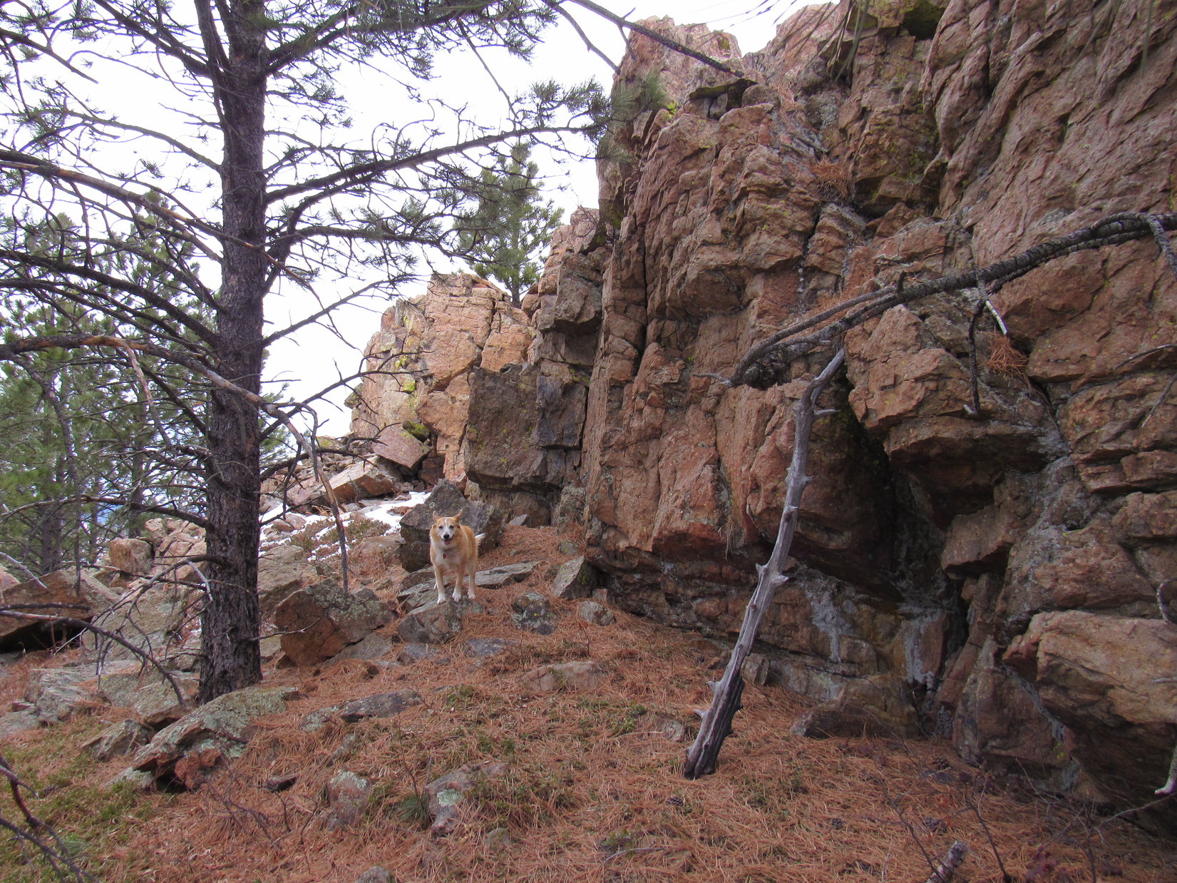
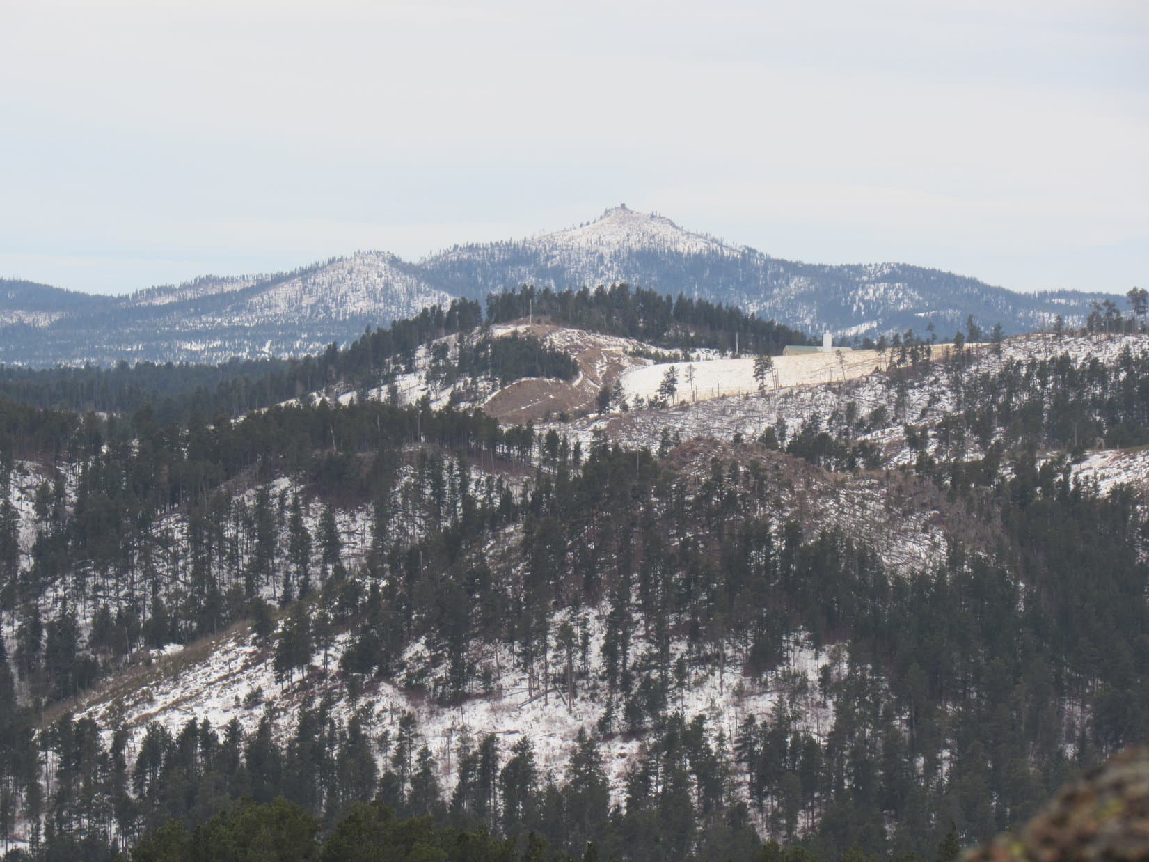
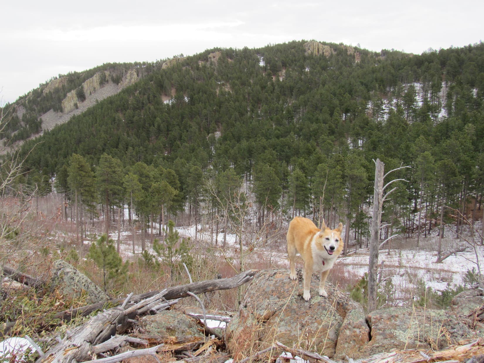
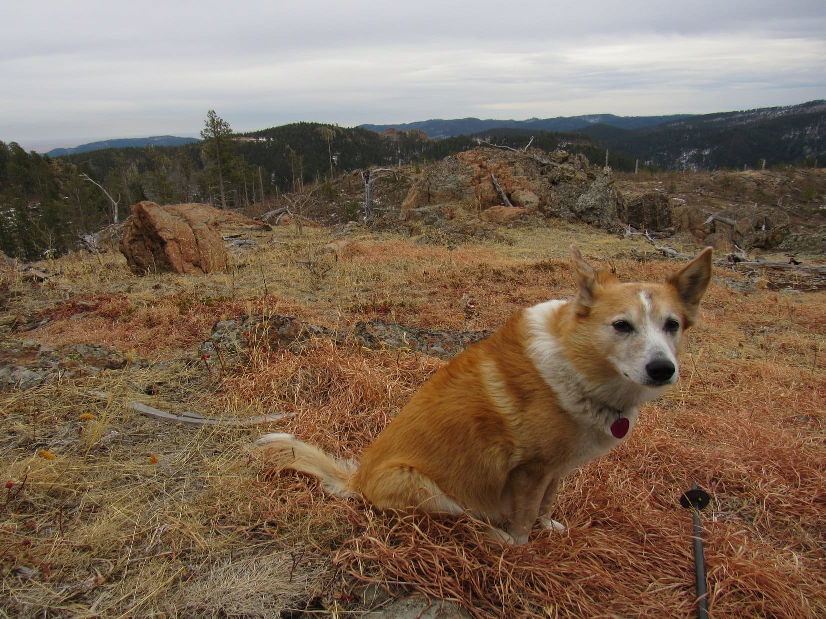
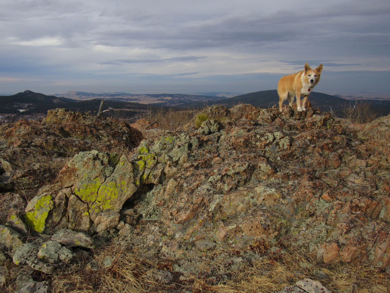
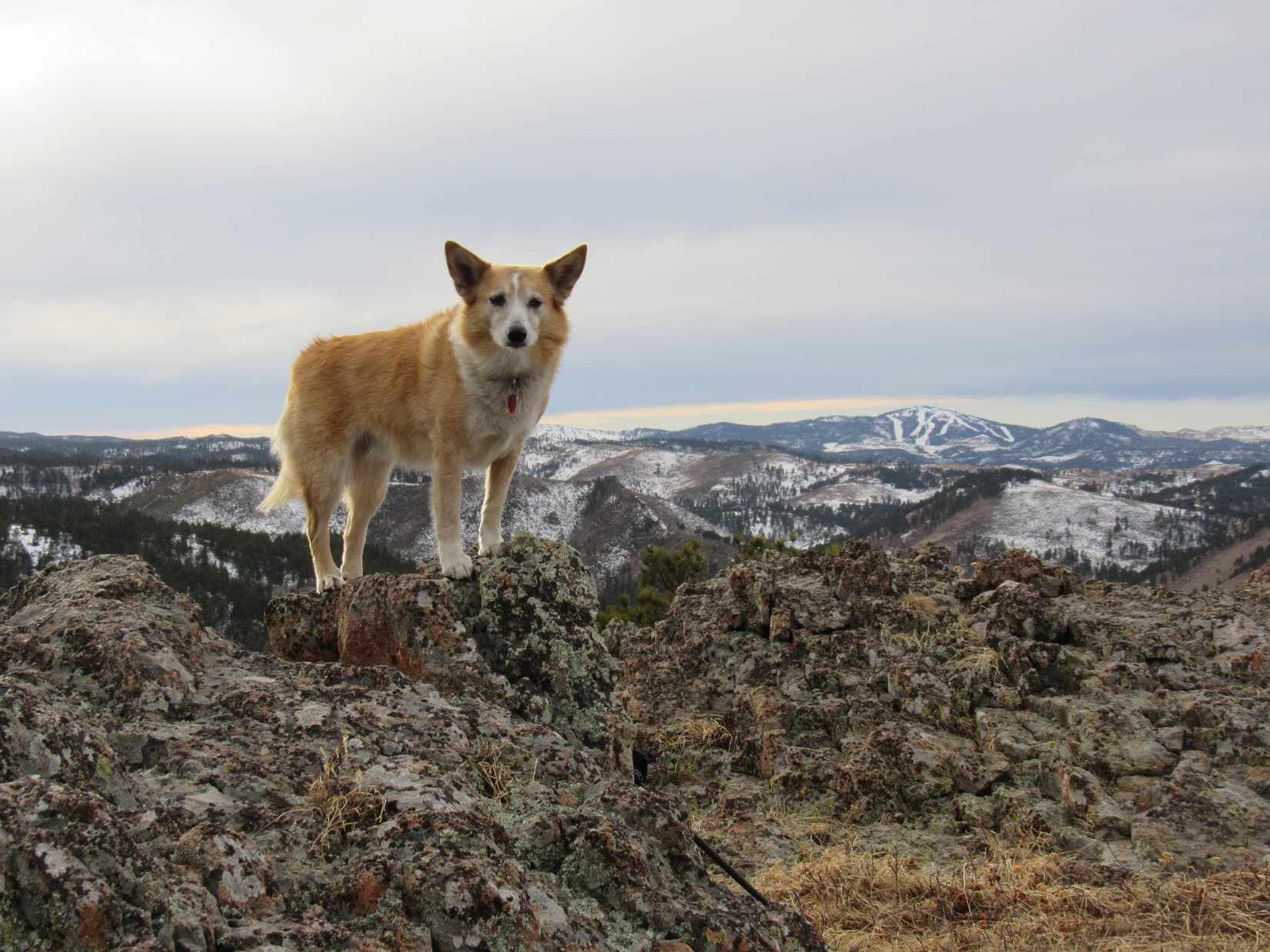
Continuing W along the S or SE edge of the ridge, Lupe came to a series of rock outcroppings providing viewpoints.  She caught a glimpse of Bear Butte (4,422 ft.), and shortly after that a half-way decent look at Peak 5400 itself.

Bear Butte (Center). Photo looks NE with help from the telephoto lens.
Hey! We’re making progress! Peak 5400 dead ahead! Photo looks SW.

Although Peak 5400’s summit was still 0.67 mile away, Lupe had already gained most of the elevation she needed to in order to get there.  As a result, the remaining ridge trek was pretty easy.  Surprisingly scenic, too!  Lots of nice views to enjoy from interesting rock formations along the SE edge.  Even the middle of the ridge was often much more open than SPHP had been anticipating.

Somewhere along the way, Lupe passed or went over HP5082, but exactly when and where that occurred wasn’t entirely clear.

At a rocky clearing. Photo looks W.
Another glimpse of Bear Butte (Center). Photo looks NE.
Approaching one of the larger rock formations. Photo looks SW.

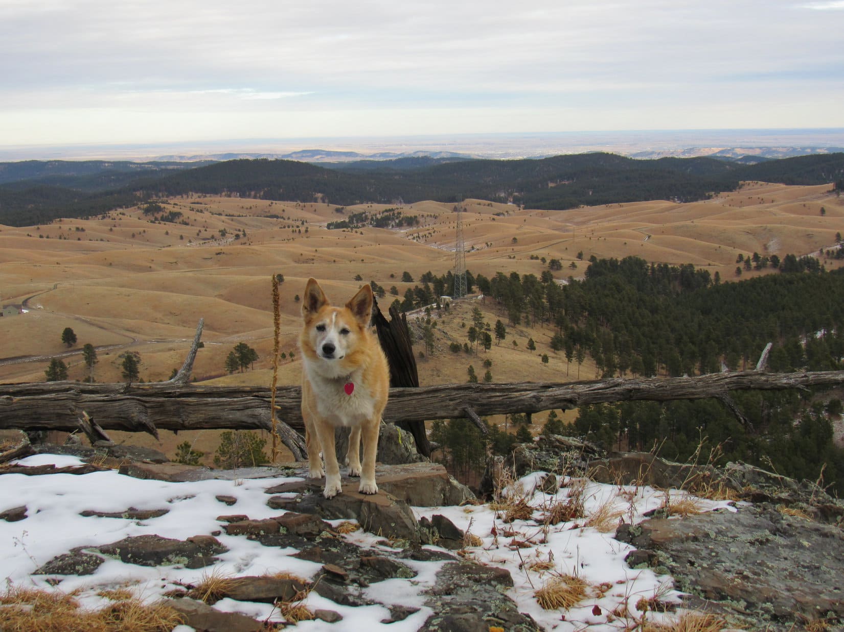
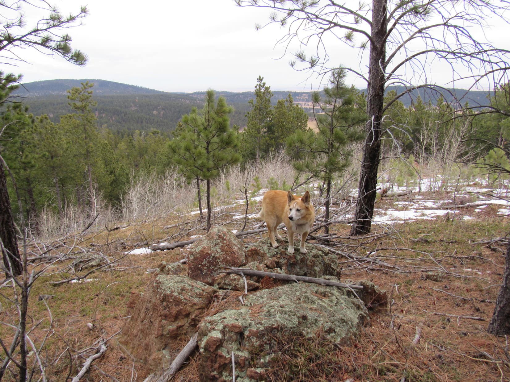
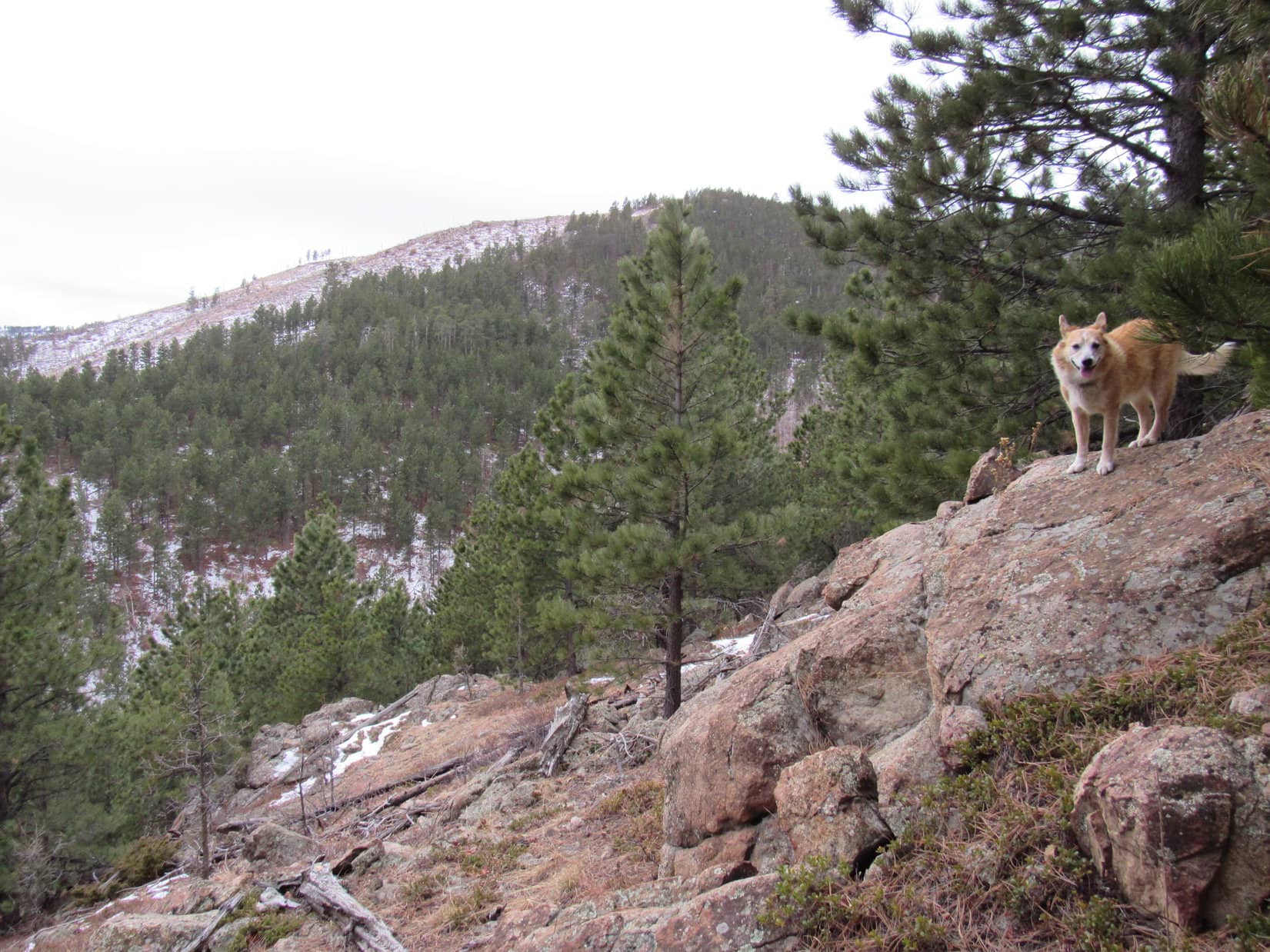
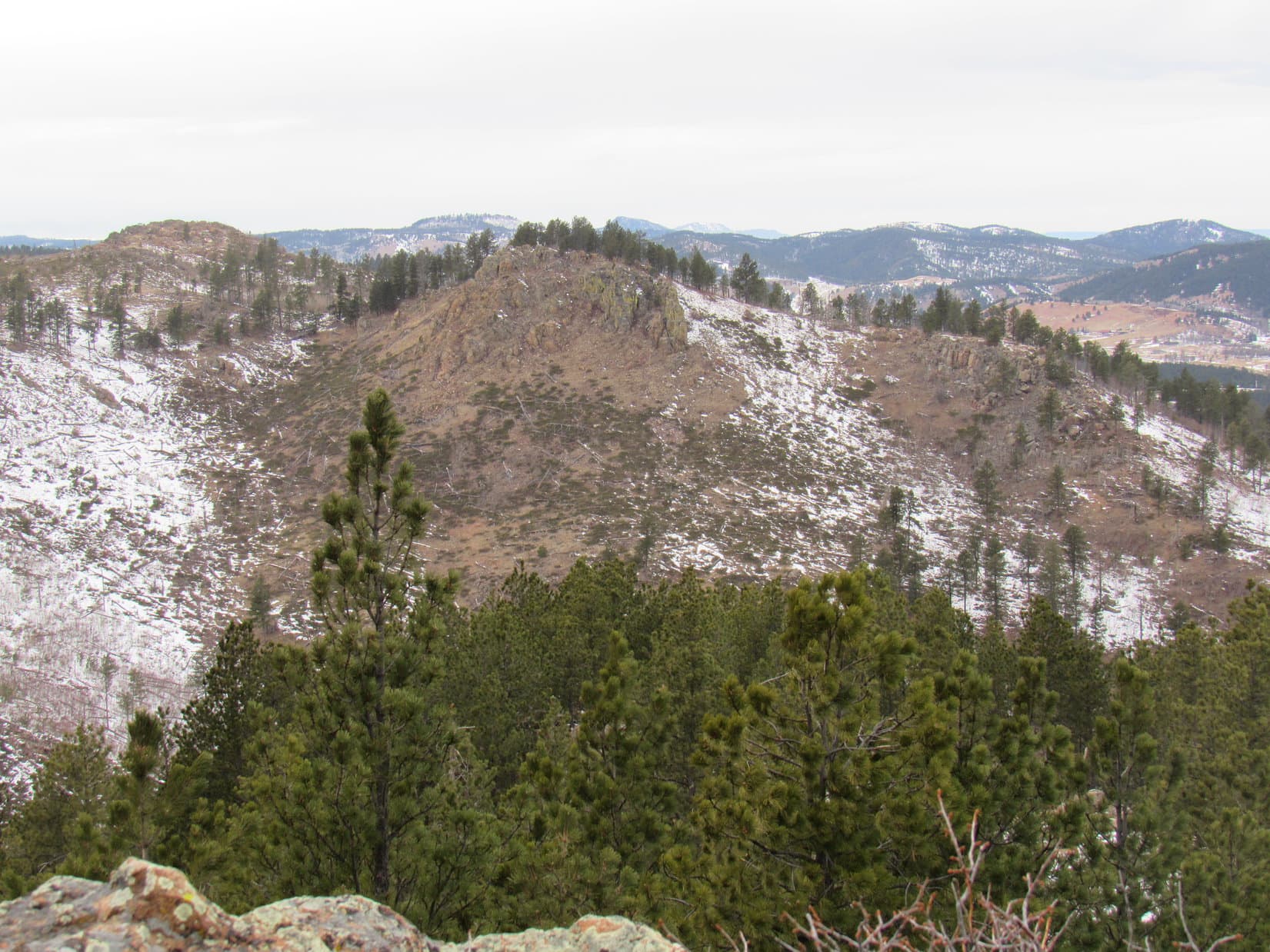
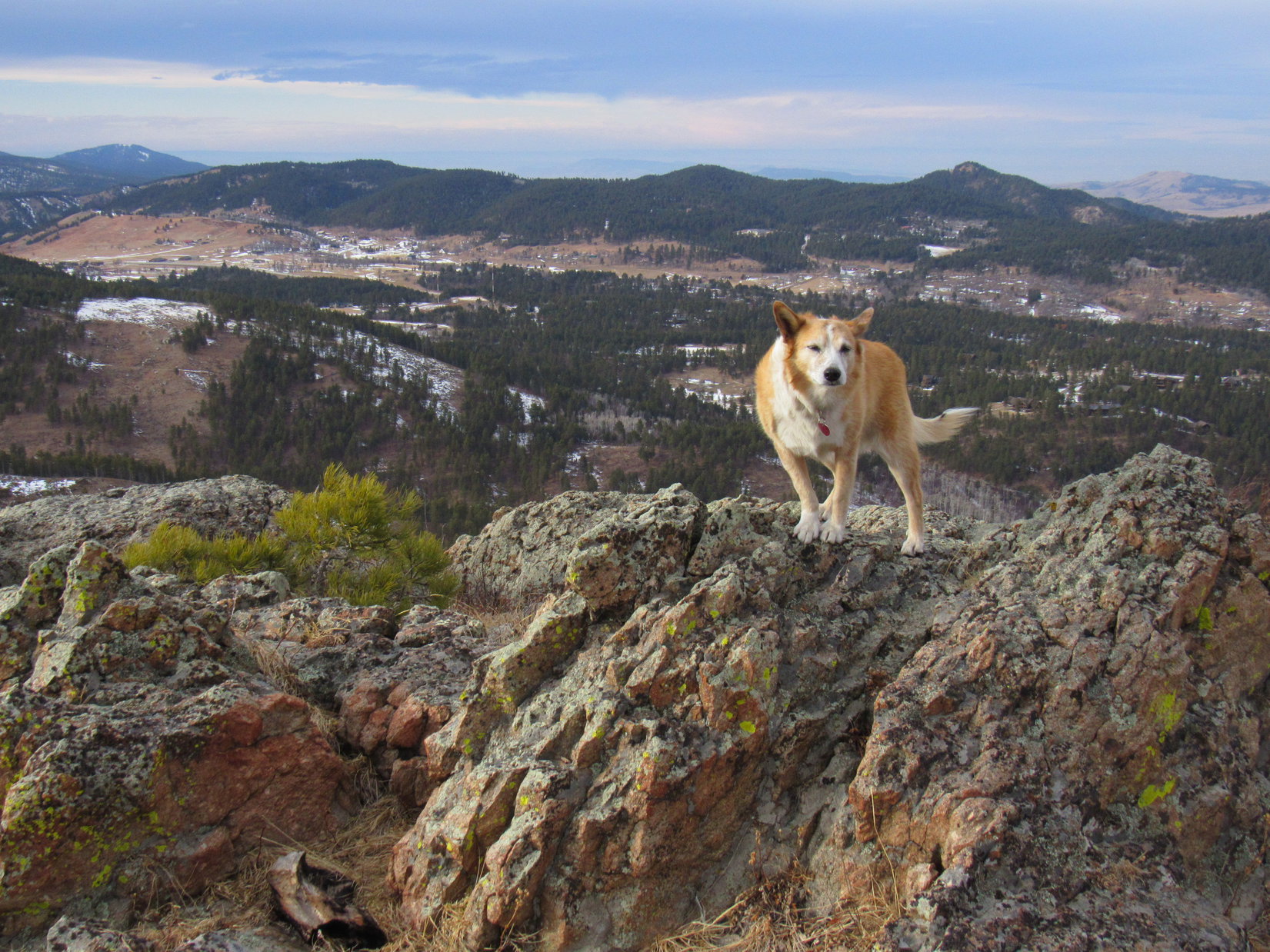
As the ridge turned S, it broadened out and the rate of climb decreased.  Soon the forested summit came into sight beyond a big open region.

Getting close now! Photo looks S.
True summit dead ahead, somewhere up in the trees. Photo looks S.

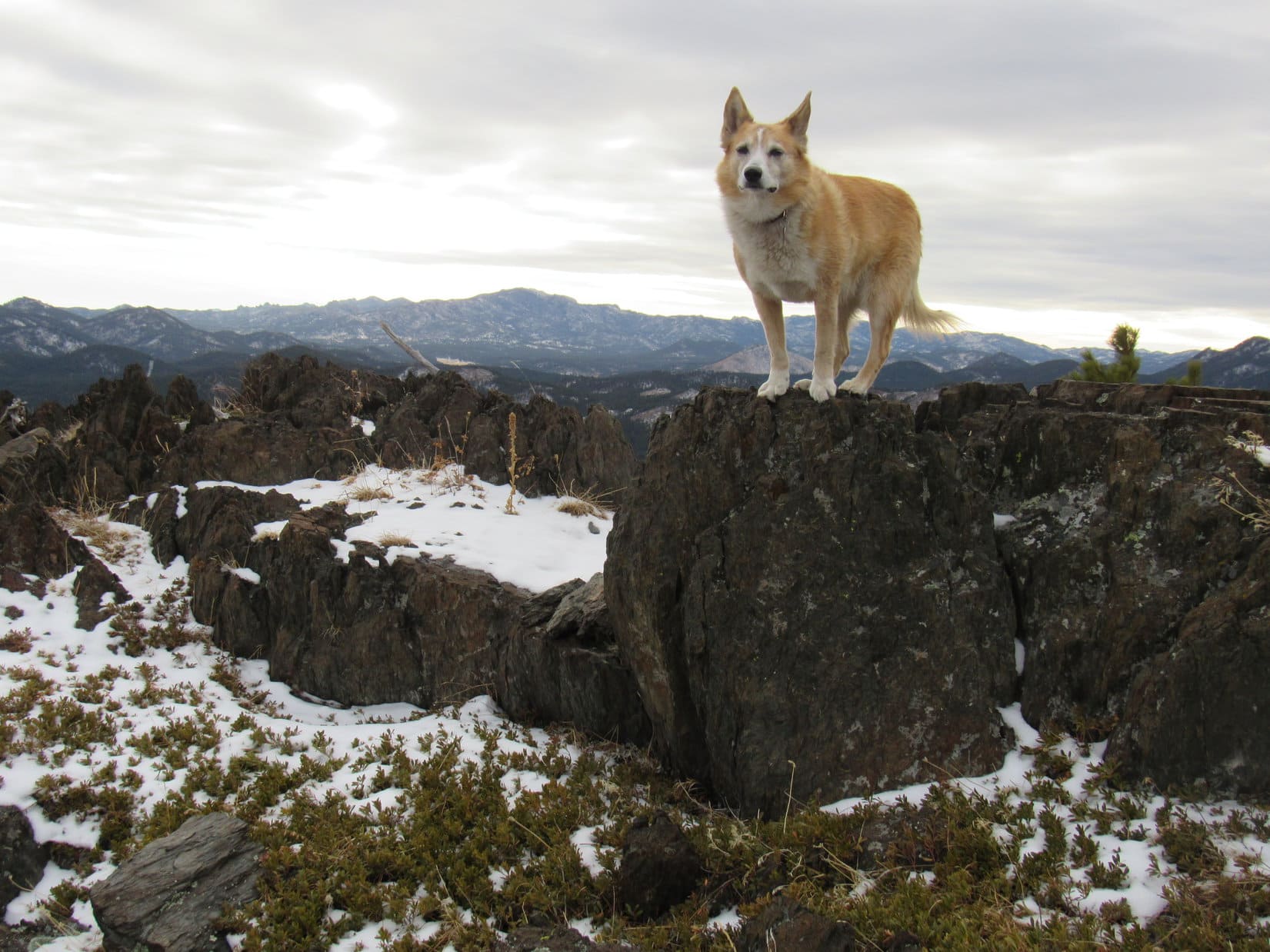
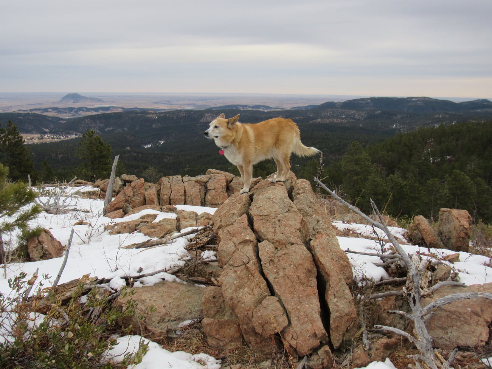
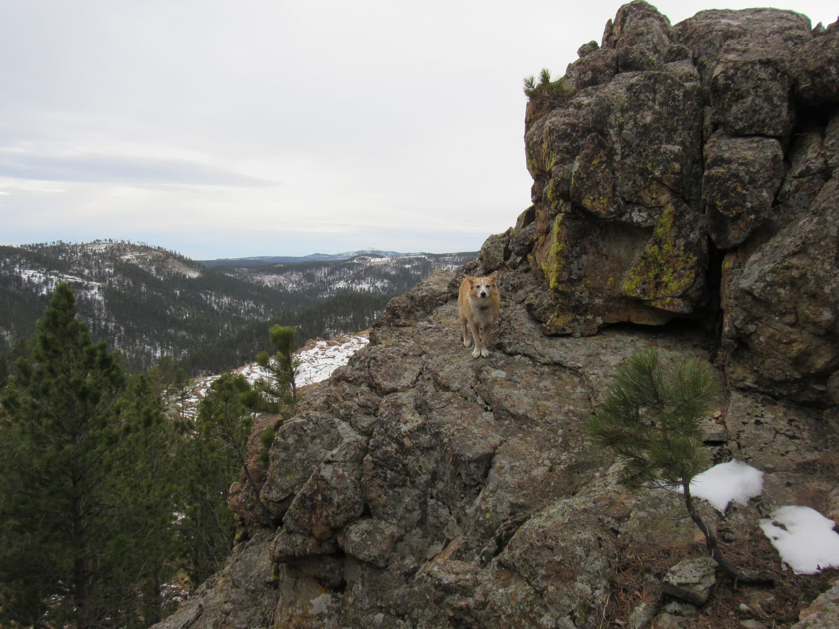
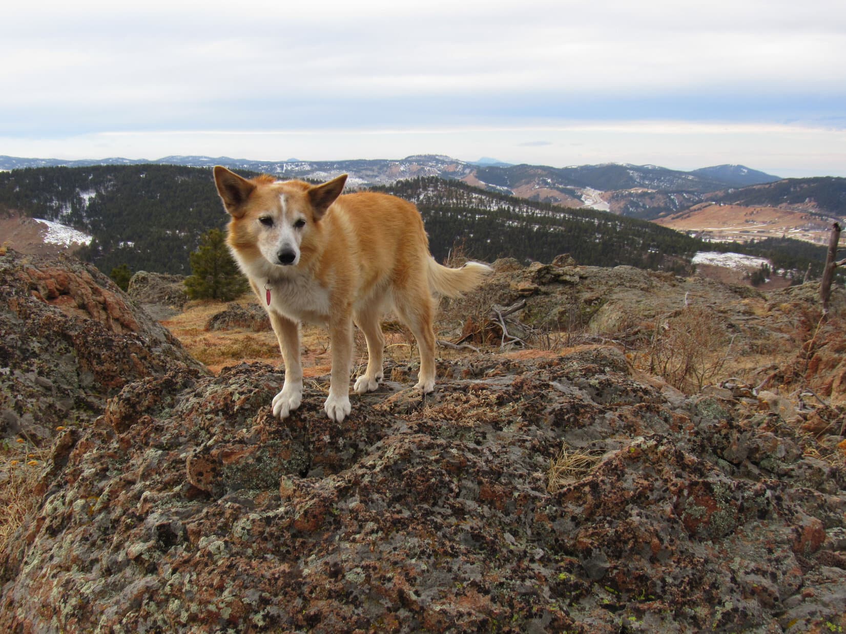
Windy up here!  That Canadian air mass must be moving in sooner than expected.  Carolina Dogs don’t care much for wind, but the terrific views from Peak 5400 were so totally unexpected that Lupe was willing to put up with it to some extent.

The panorama encompassing Bear Butte (4,422 ft.), Deadman Mountain (4,933 ft.), and the prairies E of the Black Hills was incredible, but Pillar Peak (5,469 ft.) and Terry Peak (7,064 ft.) off to the W were even more eye-catching.

Bear Butte (L) and Deadman Mountain (R). Photo looks ENE.
Hey, there’s Terry Peak (L) and our old friend, Pillar Peak (R)! Photo looks WSW.
Terry Peak (Center) and Pillar Peak (R). Photo looks WSW.
Hurry up and take the shot, SPHP! Before I get blown away would be nice! Terry Peak (L) and Pillar Peak (Center). Photo looks W.

Leaving the scenic, but annoyingly windy W edge of the mountain, Loop headed SE intent upon finding both shelter and Peak 5400’s true summit hidden somewhere not too far away in the pine forest.  SPHP figured the top would probably be just a big non-descript flat spot buried among the trees, but that turned out not to be the case at all.

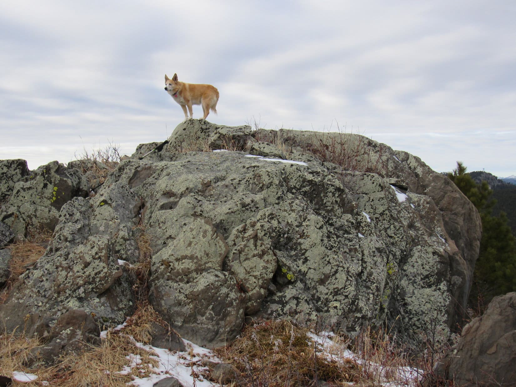
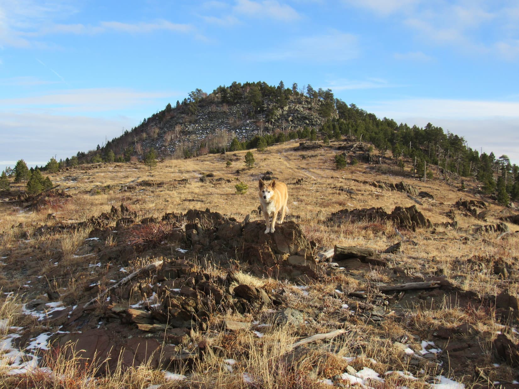
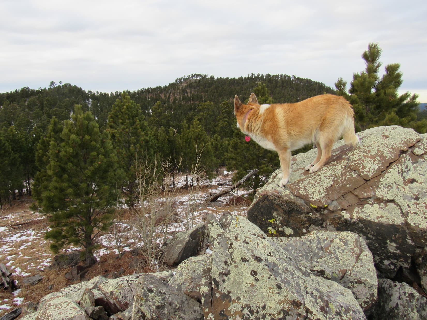
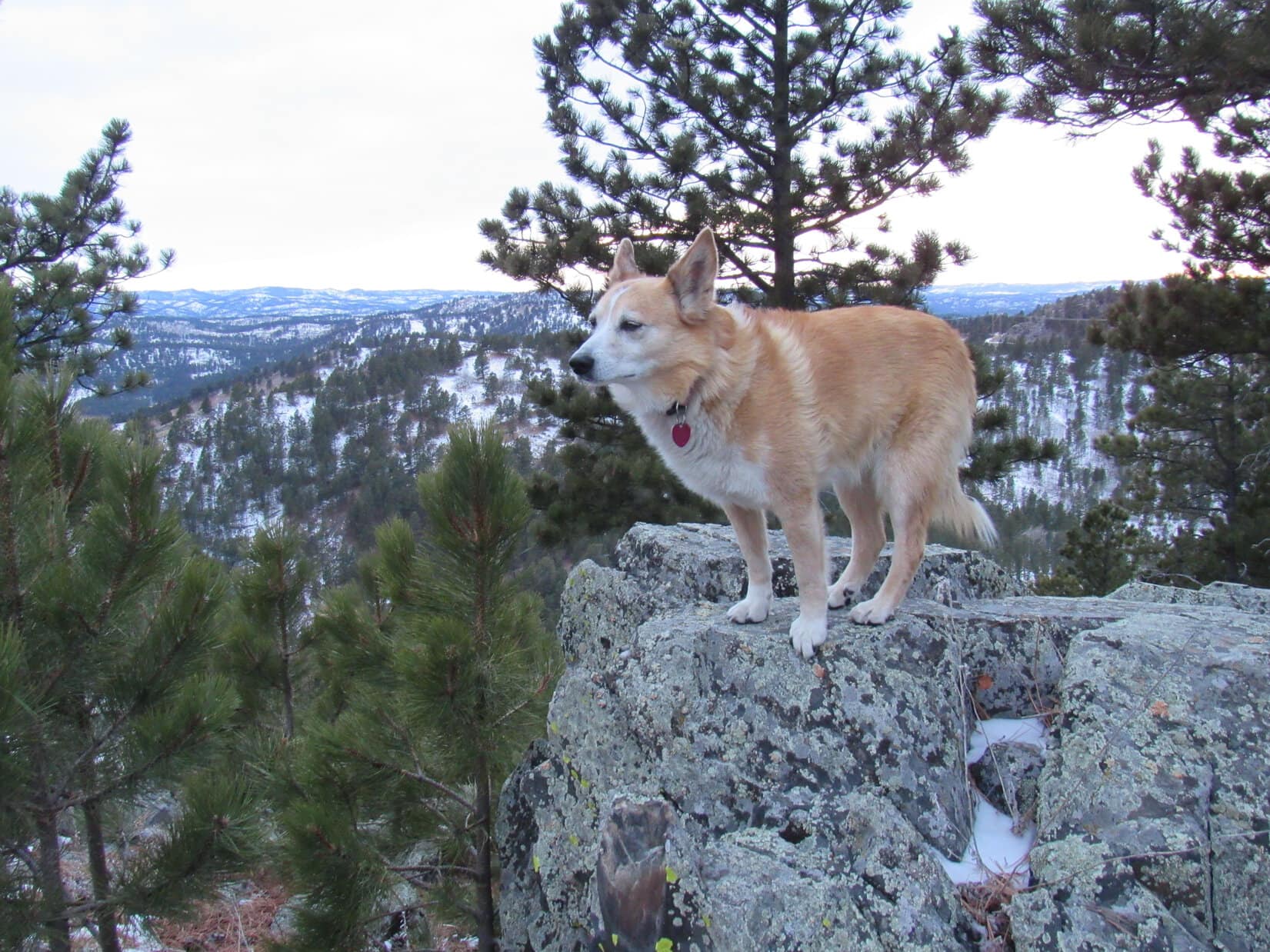
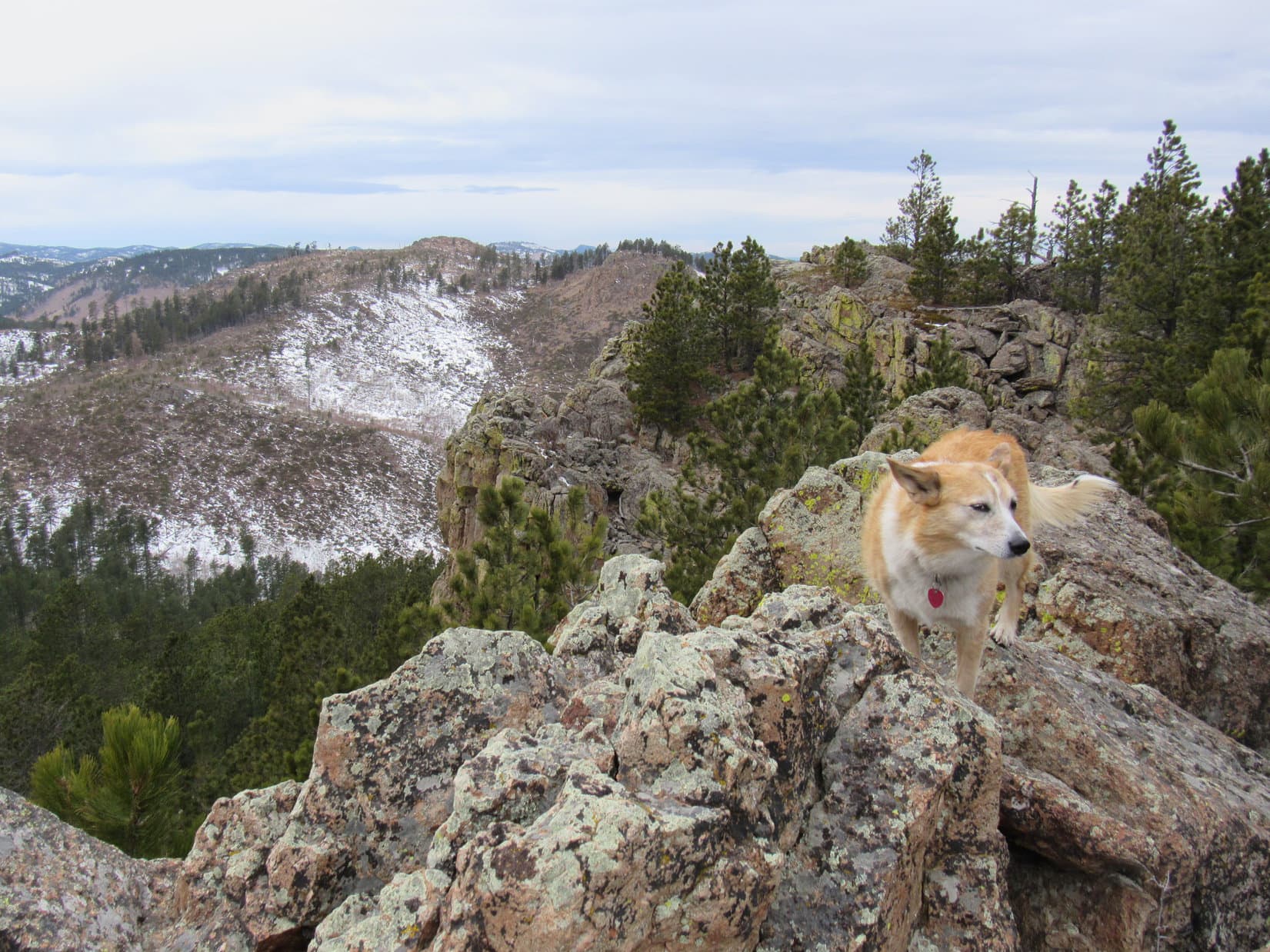
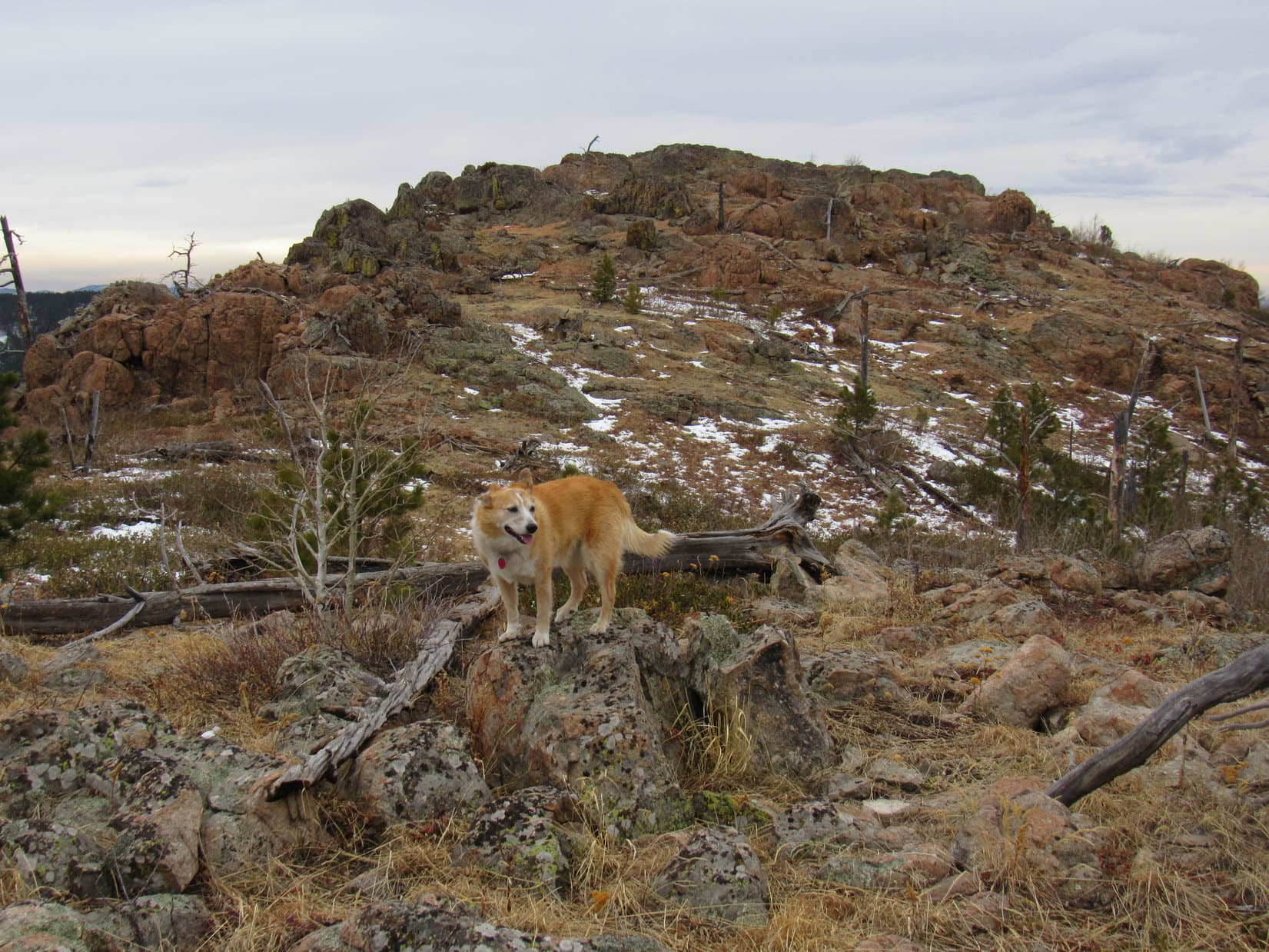
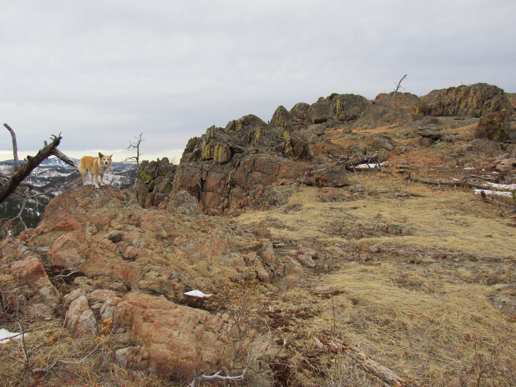
The Carolina Dog didn’t have to go very far into the forest before the terrain sloped sharply up to a long, narrow ridge of rock.  Reaching it near its WNW end, Lupe immediately discovered a loose collection of rocks piled against a much bigger rock perched at a sharp slant.  On the other side was a precipitous 20 foot drop.

Although several stones along the crest of this minor ridge appeared almost as high, it was pretty clear that the American Dingo had already found the true summit of Peak 5400.

This is it! The top of Peak 5400! Photo looks WNW.

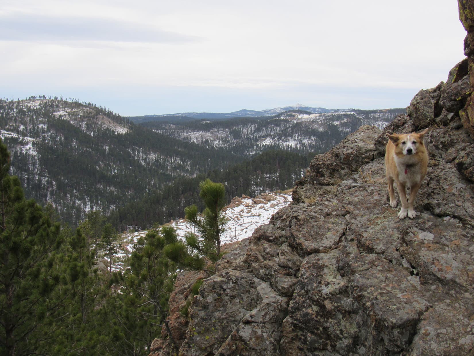
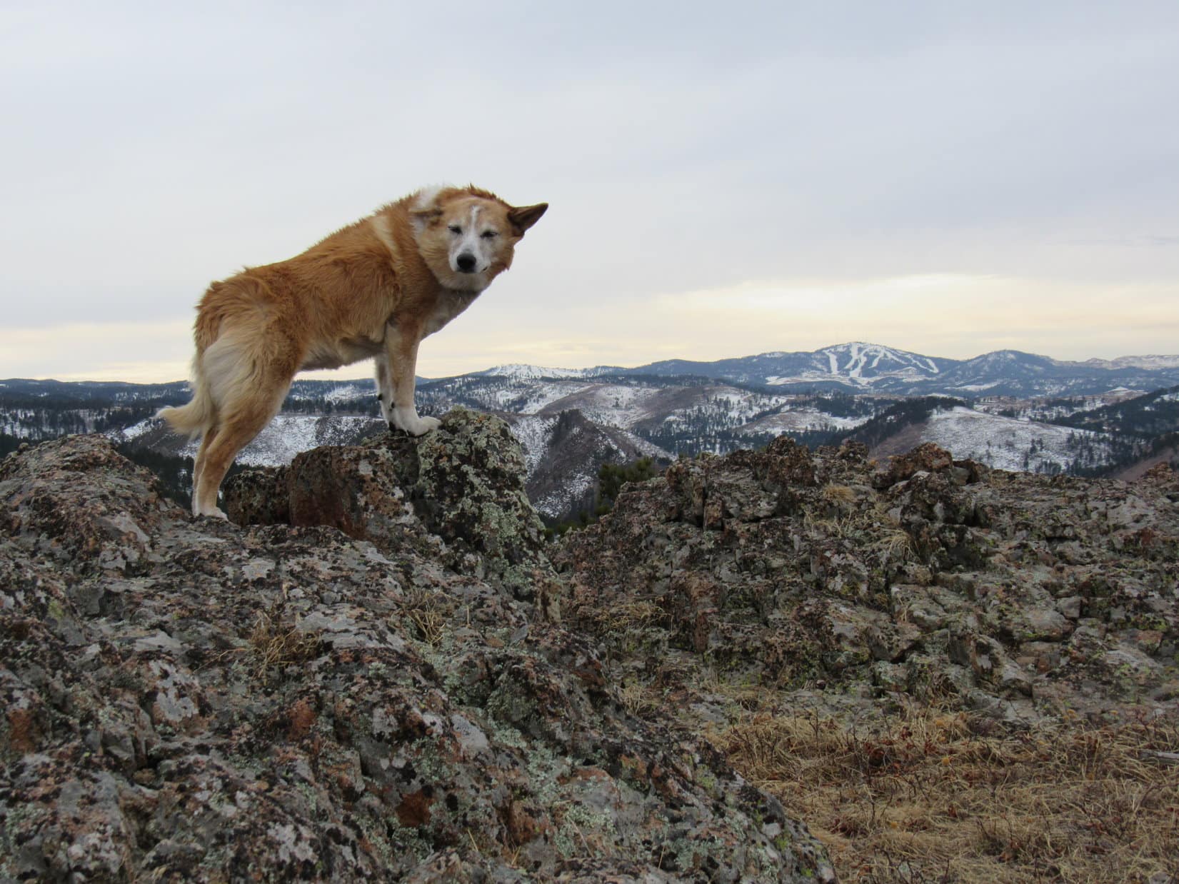
Not quite high enough to be above the treetops, the summit ridge did provide some protection from the wind, but it was still rather breezy.  Views were open to the N and W, but not to the S or E.  Nearby Pillar Peak and much more distant Terry Peak again stood out among many other hills and mountains in sight.

Finding a reasonably comfortable spot among the rocks, Lupe curled up on SPHP’s lap, enjoying a snack while taking it all in.

Pillar Peak (L) and in the foreground. Mount Theodore Roosevelt (5,680 ft.) (L of Center) in the distance. Photo looks WNW with help from the telephoto lens.
Terry Peak (Center). Photo looks WSW.
Peak 5400’s rocky summit ridge, which was roughly 200 feet long. Photo looks SE.

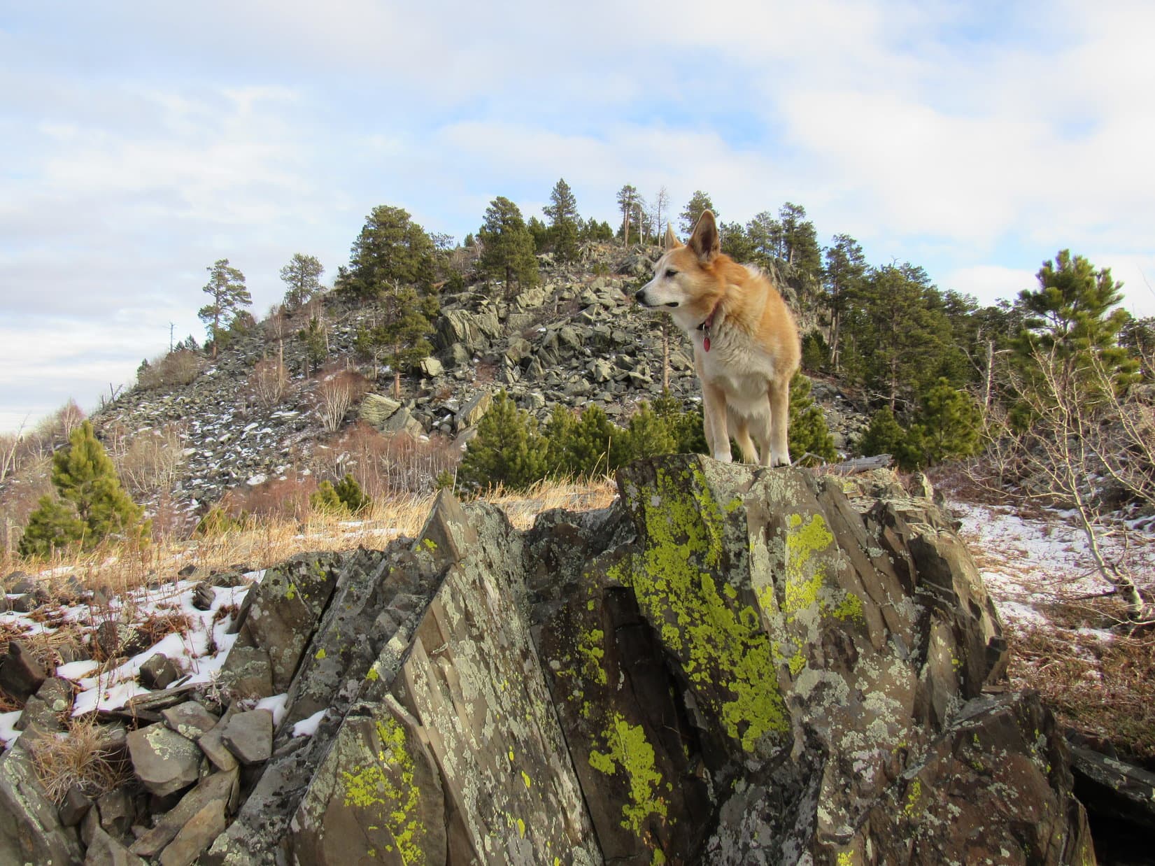
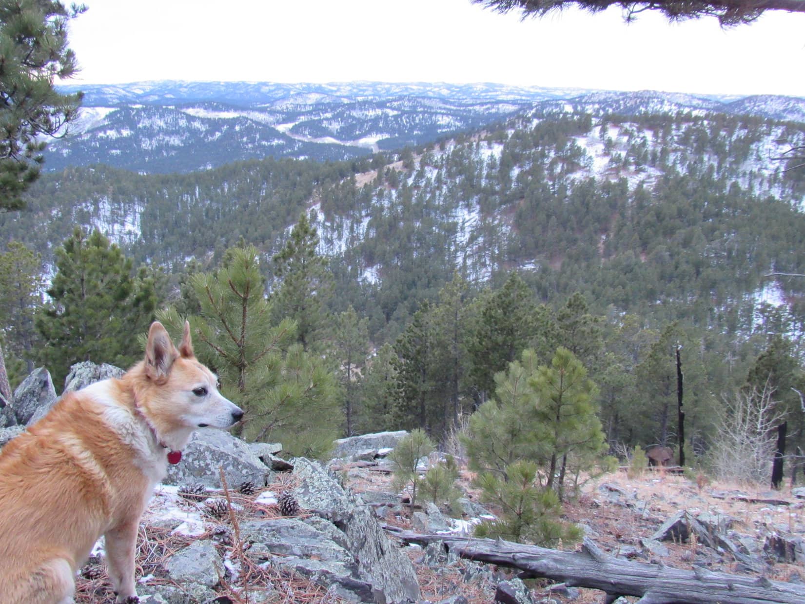
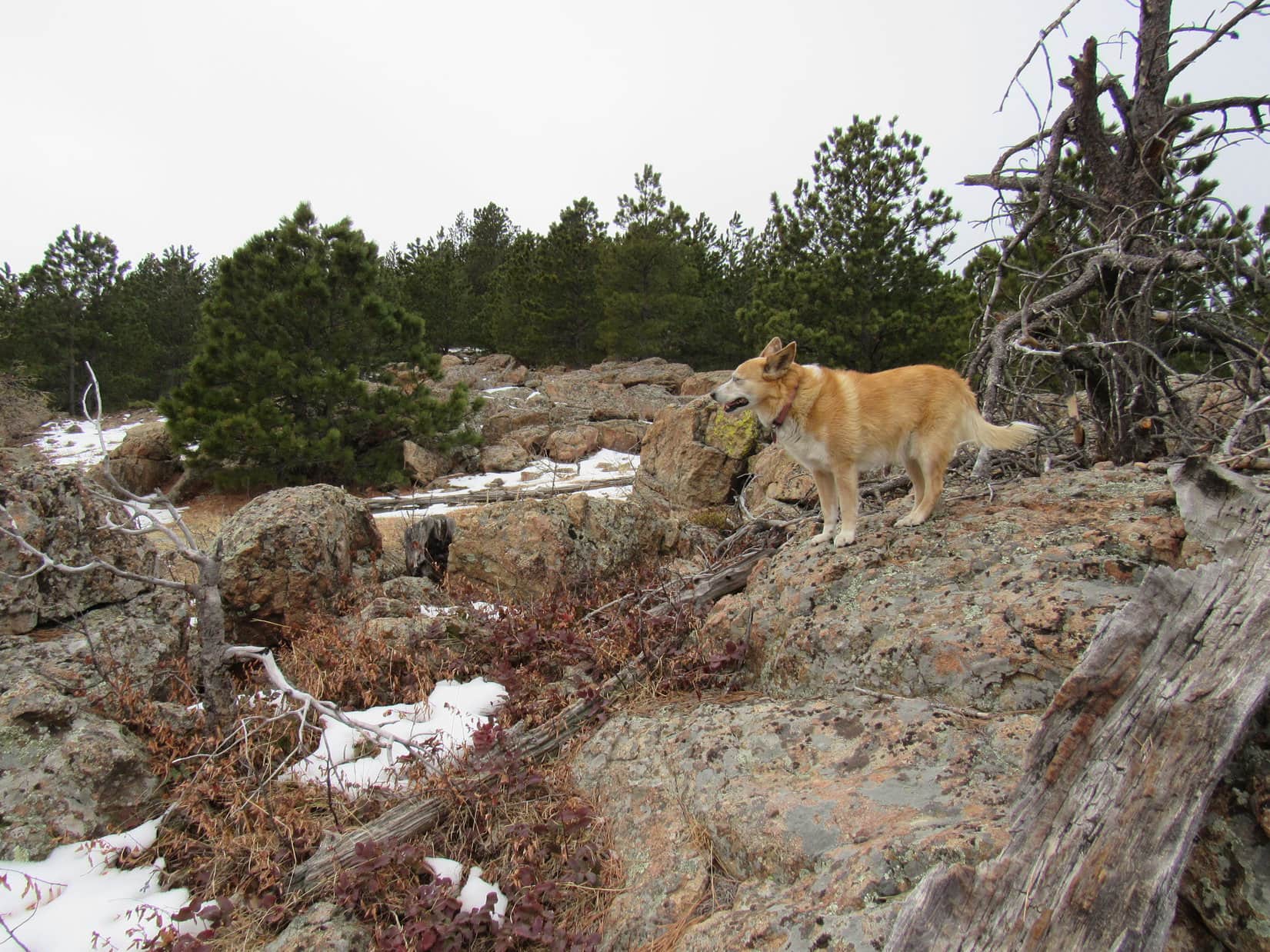
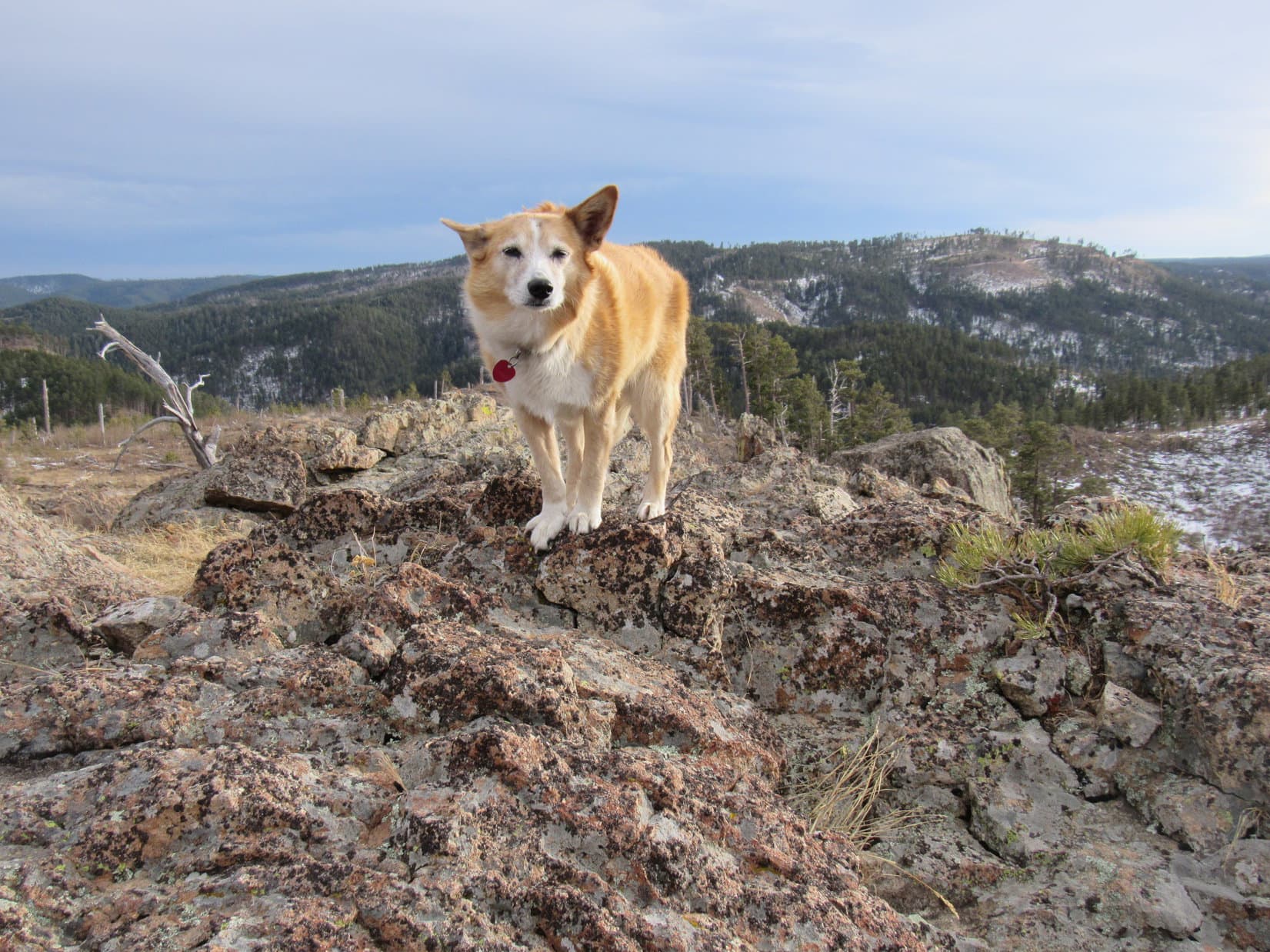
After nearly half an hour, Loopster was ready to move on.  There was more to Peak 5400 that she wanted to explore.  Traveling ESE along the summit ridge, she found a way down below the line of small cliffs, intent upon seeing what things looked like from down here.  Sniffing her way along the base of the cliffs, she discovered they were tallest toward the W and gradually petered out toward the E.

So this is what it’s like on the S side of the ridge! Photo looks WNW.

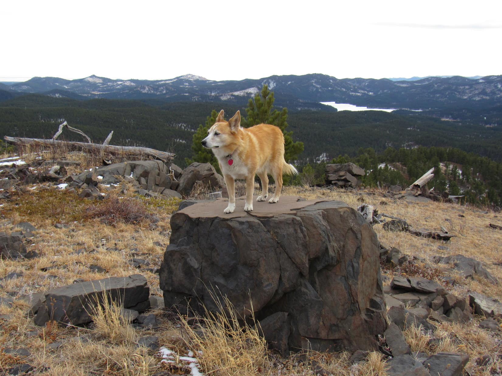
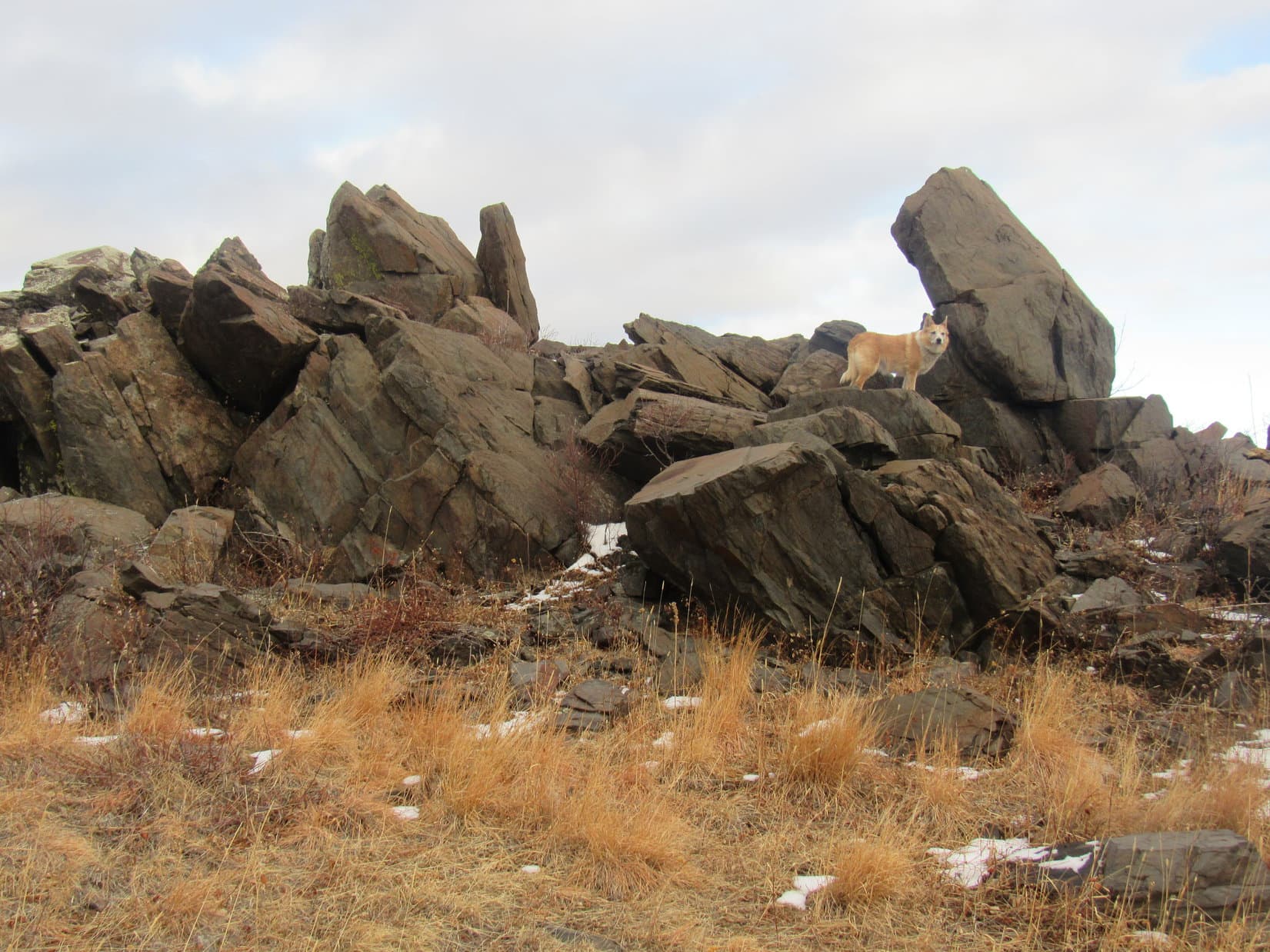
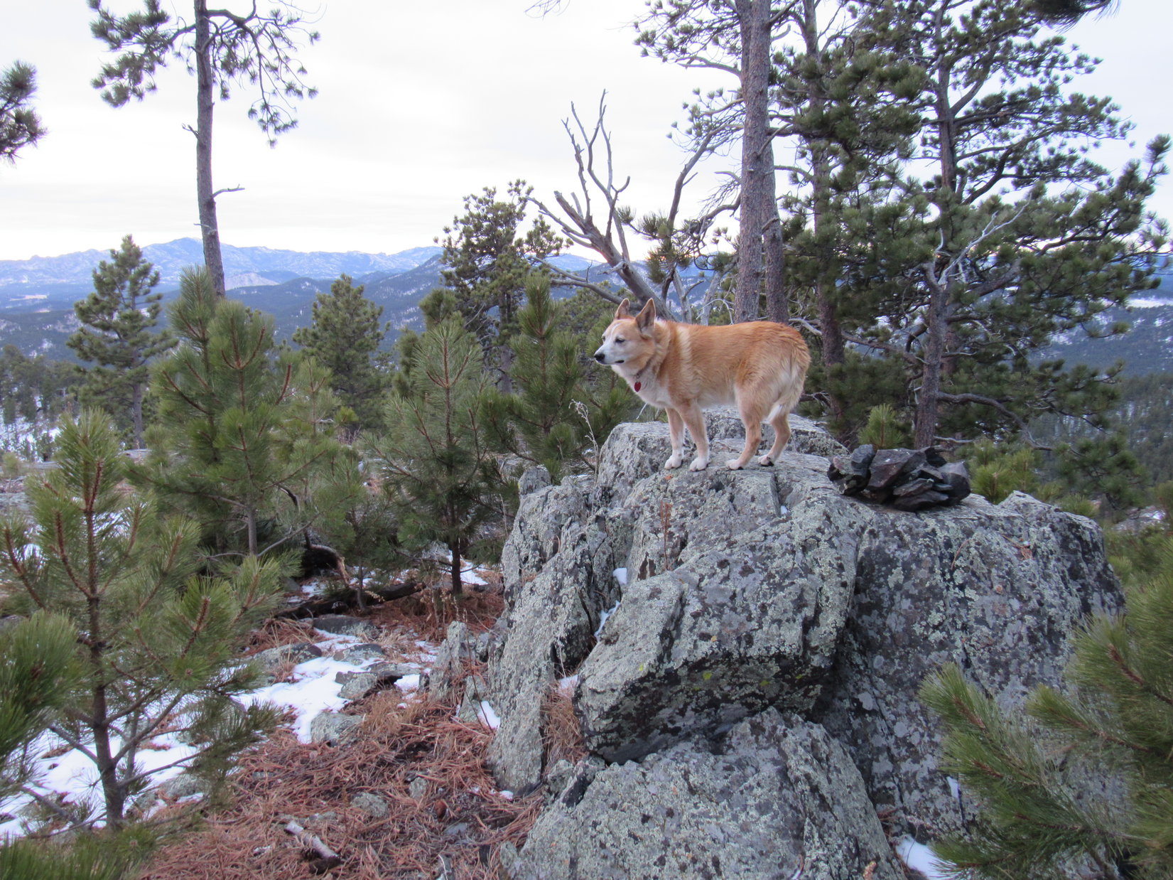
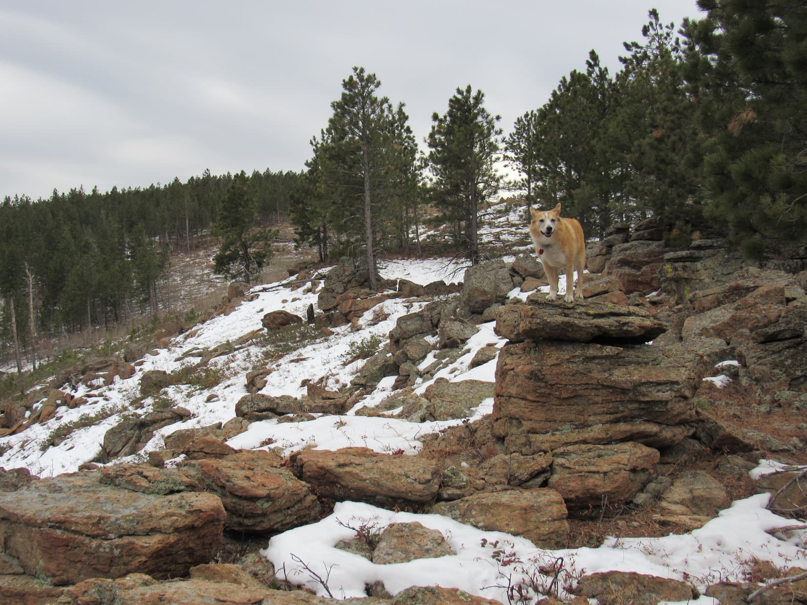
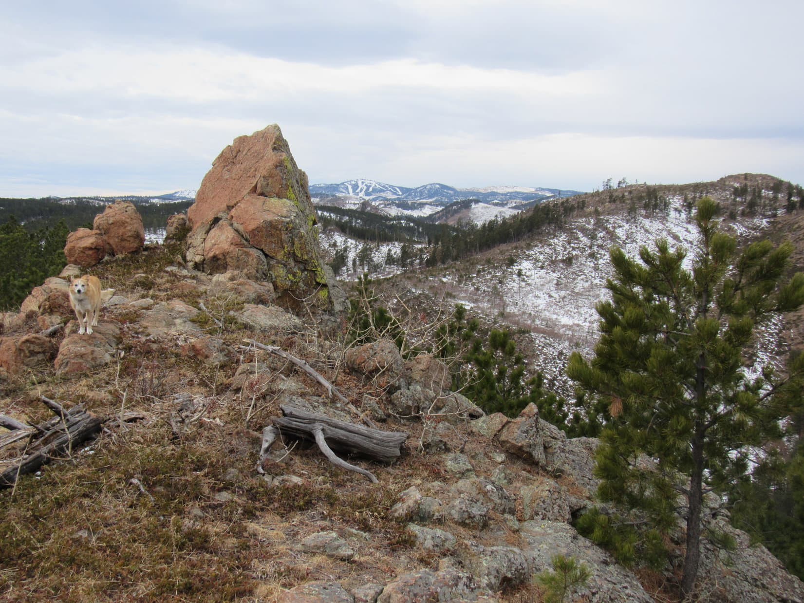
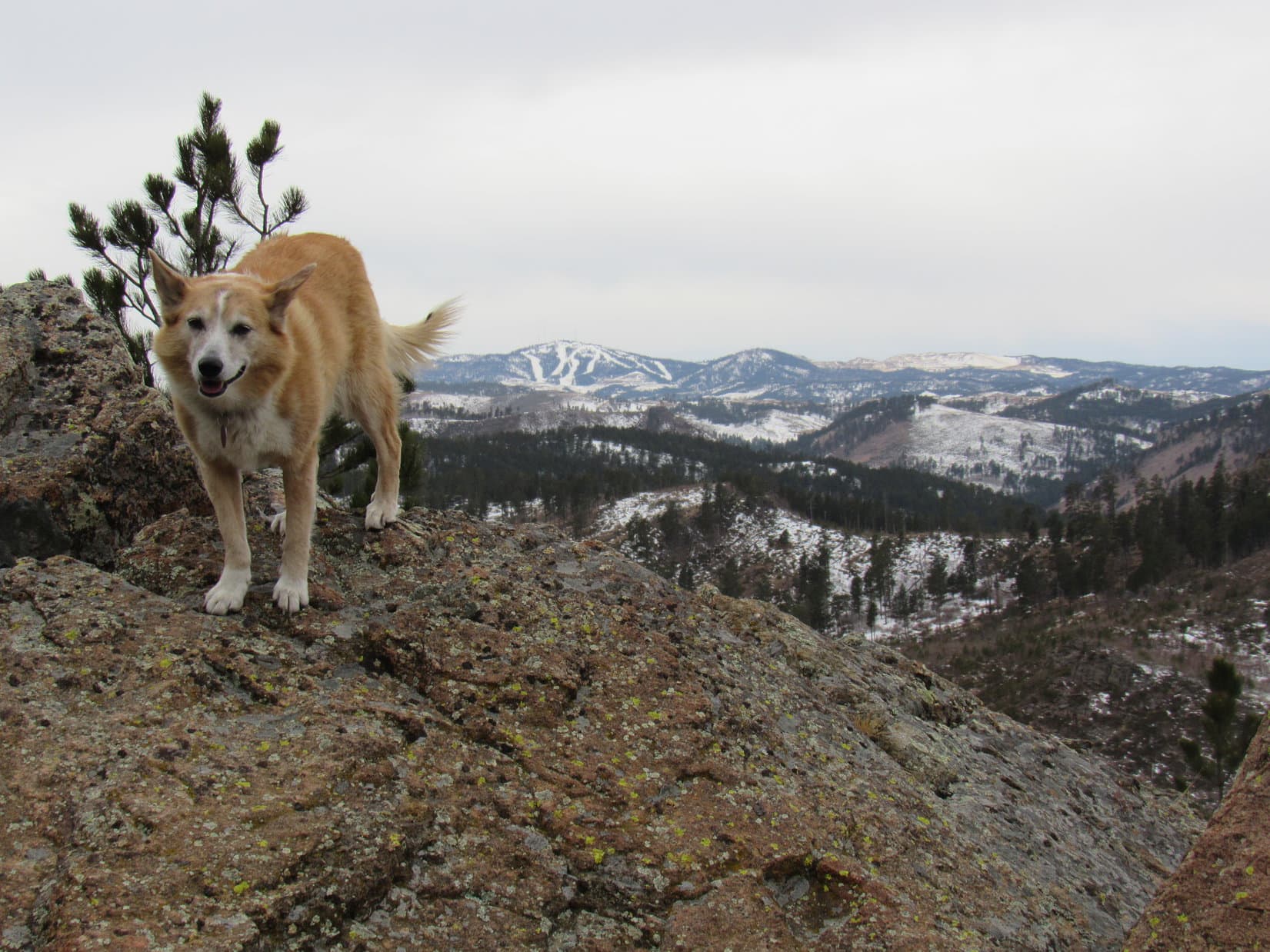
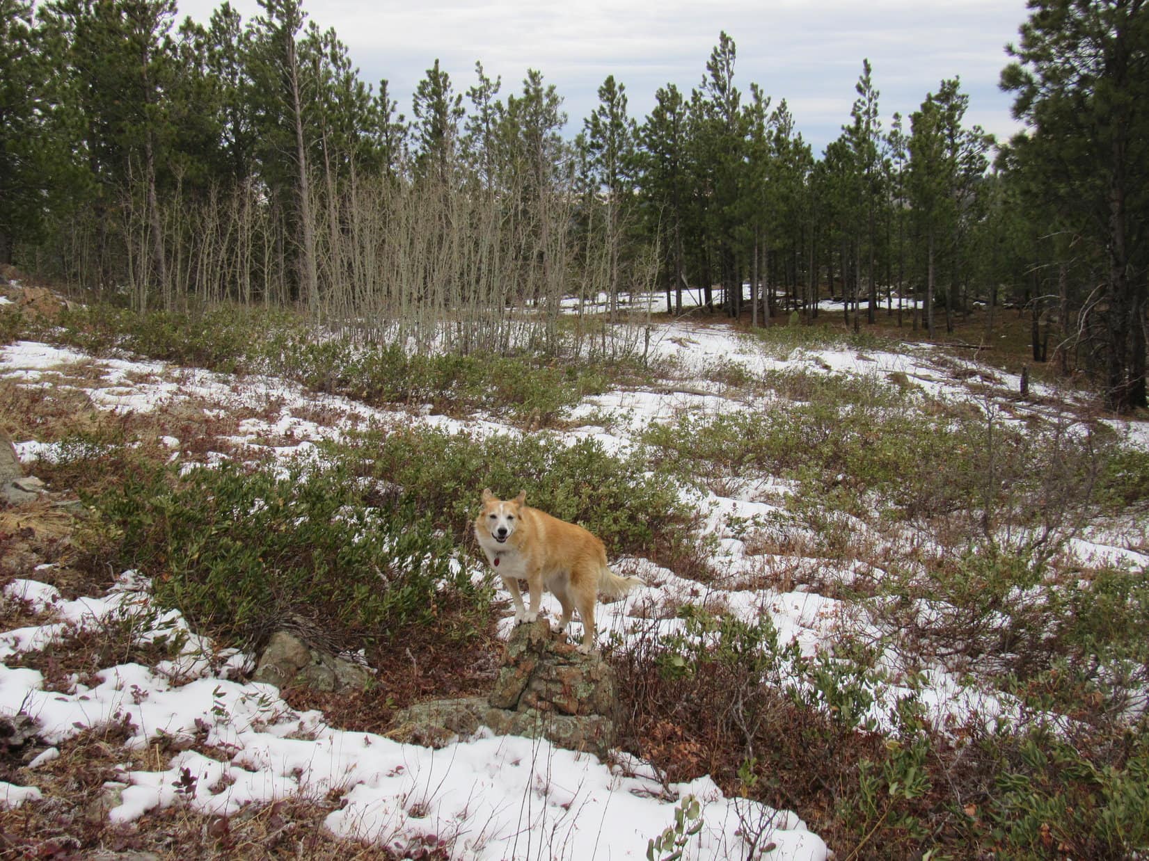
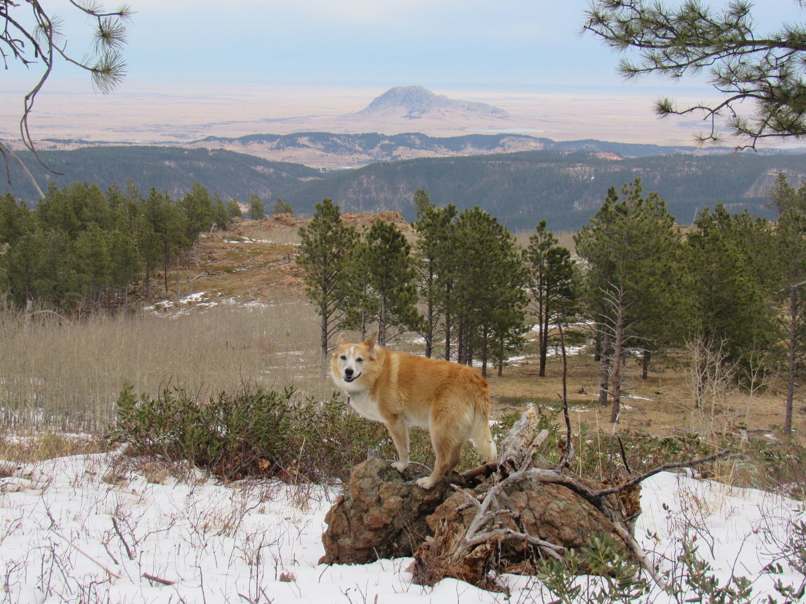
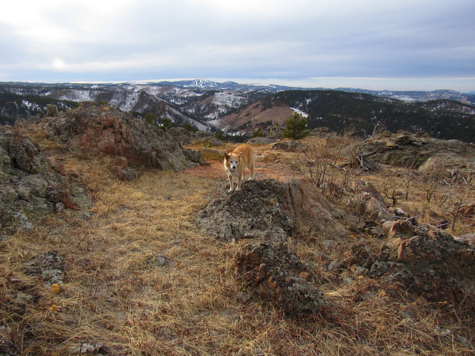
With the summit ridge more or less fully explored now, Lupe headed S across a snowy field full of bushes and young aspens.  Turning W, she quickly came to more rock formations.  Custer Peak (6,804 ft.) was visible on the horizon.

Fair amount of territory to explore up here on Peak 5400! Let’s check it out! Photo looks SE.
Custer Peak (Center) on the horizon. Bear Den Mountain (5,642 ft.) (L). Photo looks SW.
Zoomed in a little more.
Custer Peak (Center). Photo looks SW with lots of help from the telephoto lens.

A 15 foot scramble up onto the top of this rock formation revealed that Lupe was now perched along the upper rim of a line of much taller cliffs offering a slightly different perspective on Pillar Peak.

Pillar Peak (L of Center) from another line of cliffs. Photo looks WNW.

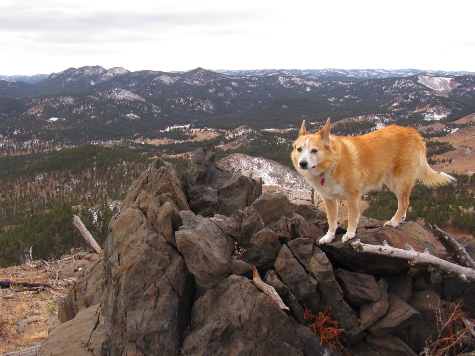
There was even more to see!  Exploring back to the E now, Lupe came to yet another sweet view of Bear Butte (4,422 ft.).

Mighty nice, aye? Bear Butte (Center). Photo looks NE.

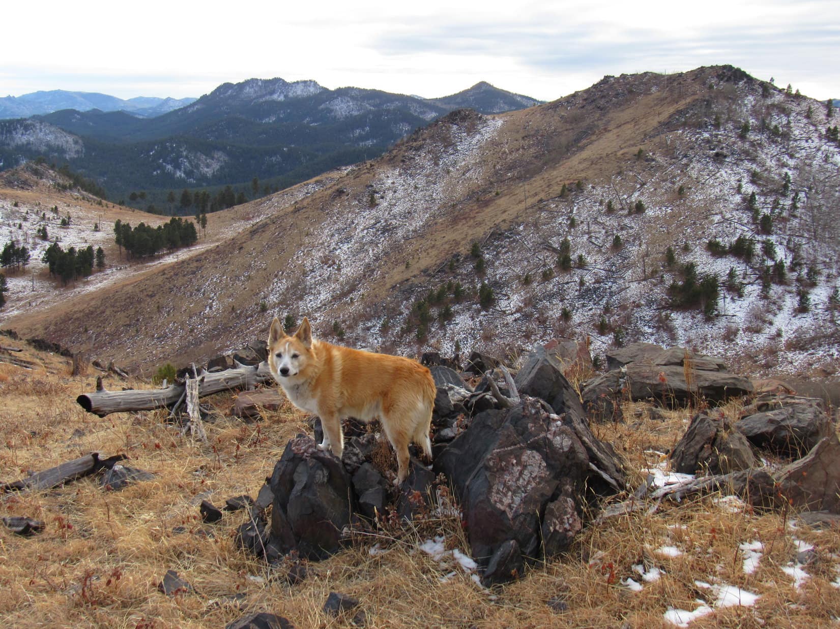
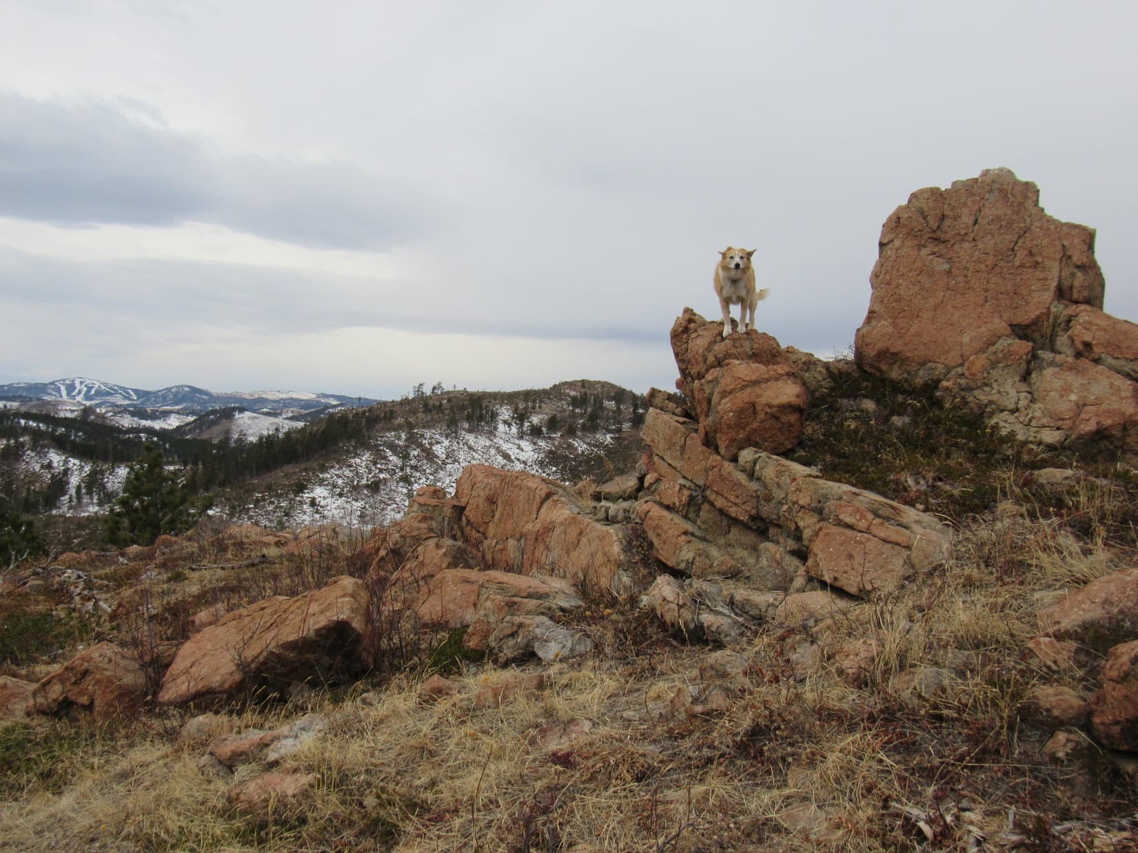
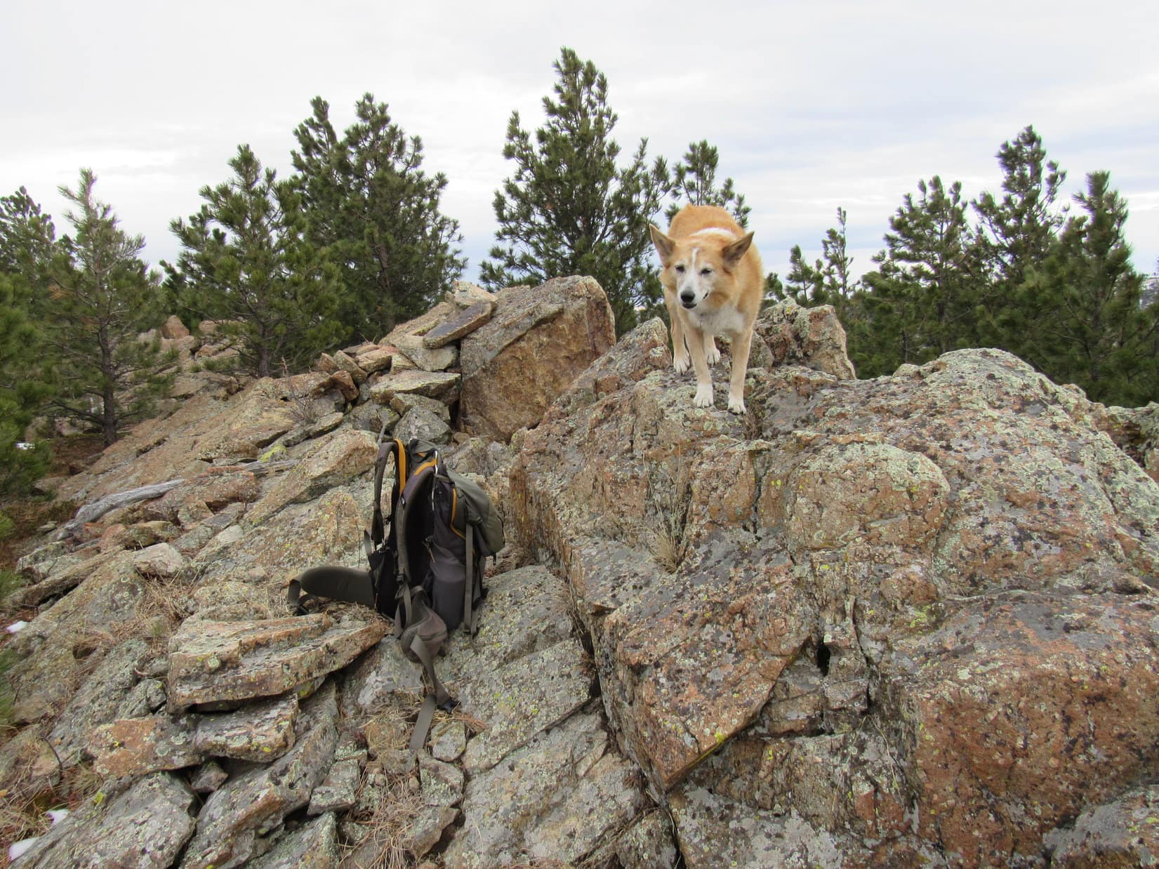
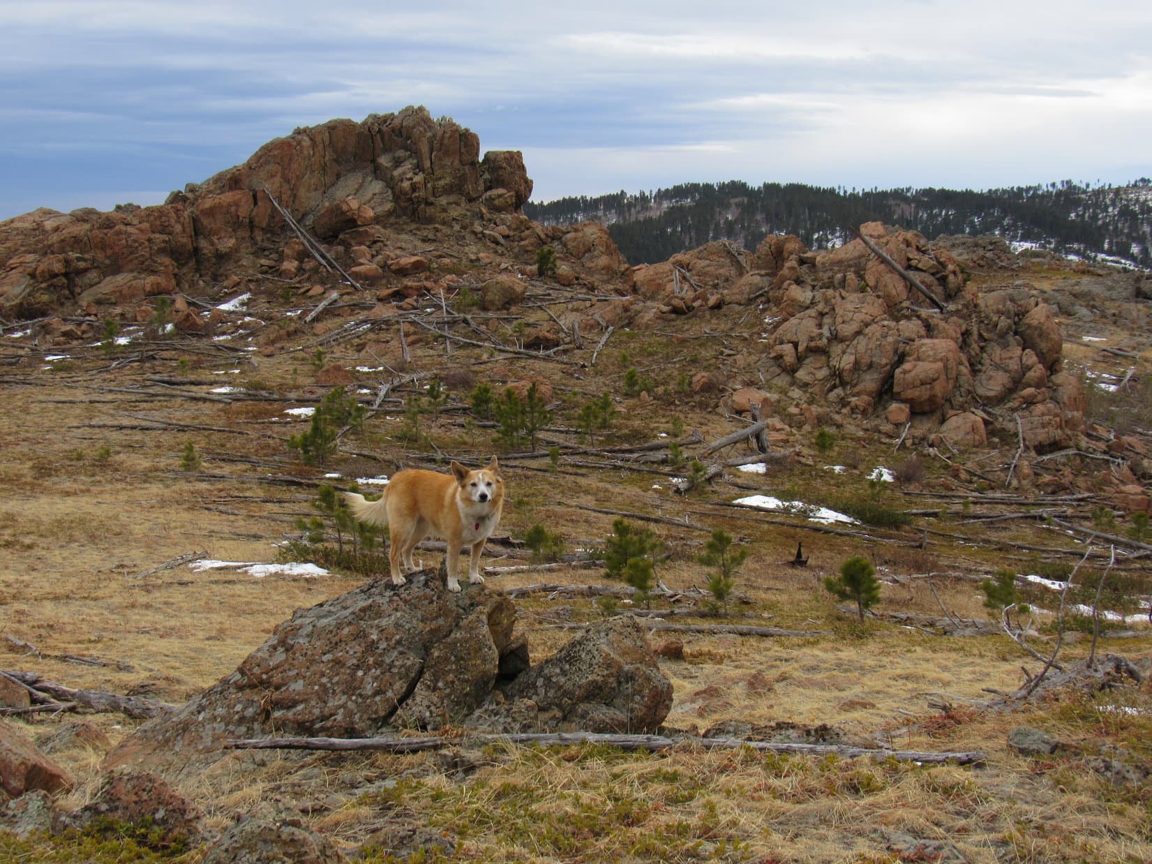
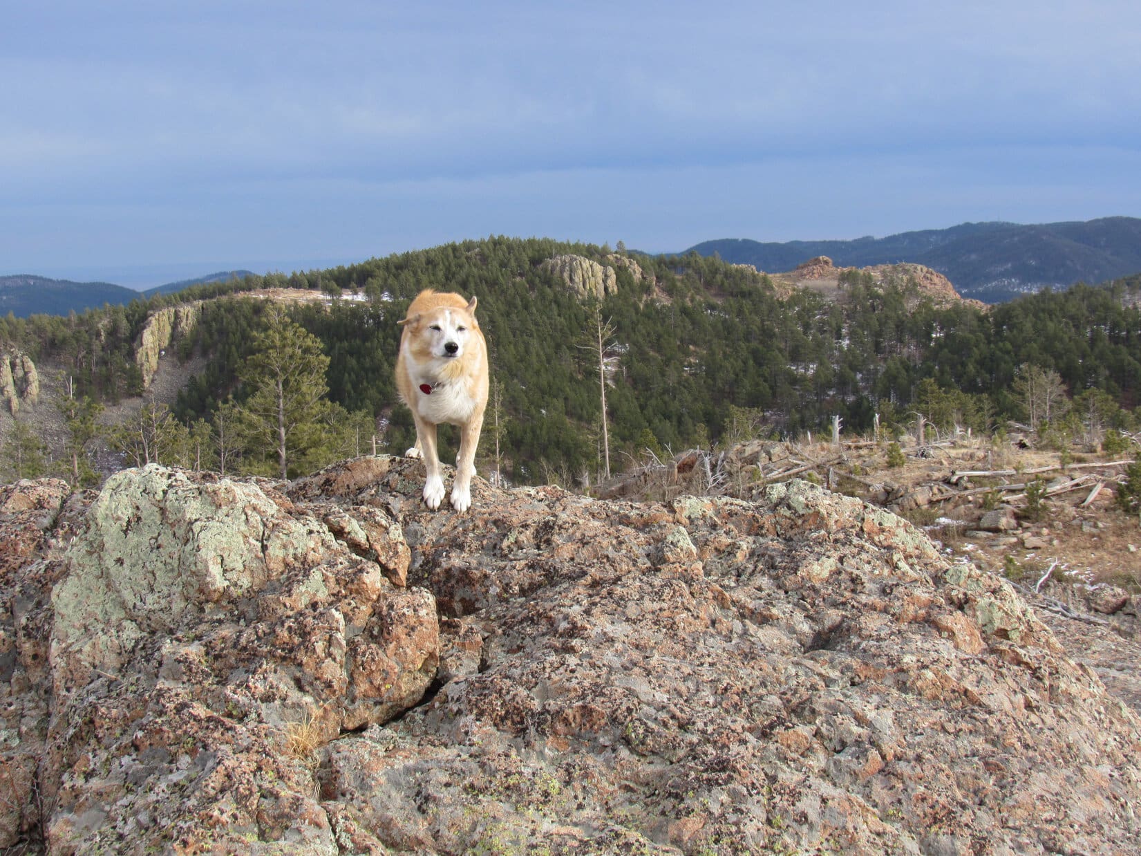
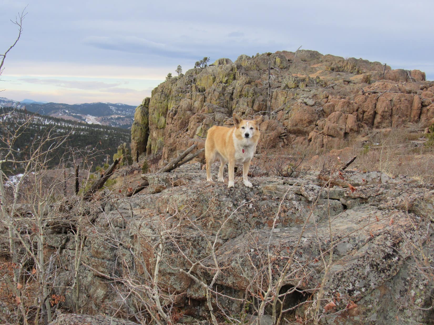
Peak 5400’s SW ridge would get Lupe over to Pillar Peak, so she decided to explore it, too.  Passing more nifty rock formations along the way, the Carolina Dog eventually made it to USFS Road No. 804, which went over the saddle leading to Pillar Peak.

Cool rock formations near the start of the SW ridge. Photo looks SSE.
At USFS Road No. 804 in the saddle leading to Pillar Peak. Photo looks NW.

Crossing the road, Lupe started up Pillar Peak’s SE ridge.  After reaching an initial high point, she paused for a look back at Peak 5400.

That’s where we were! Peak 5400 right behind me! Photo looks E.

Pillar Peak’s SE ridge was a lot different than Peak 5400’s SW ridge.  Instead of easily avoided rock formations and a trek through a snowy pine forest, Lupe had to force her way through dense stands of bushes, young aspens, rotting deadfall, and a jumble of medium-sized rocks.

The slope was easy enough at first, leveled out for a bit, then steepened.  Loop even had to do a bit of scrambling before she finally reached more open territory where things got easier again.  A cake walk stroll up a gentle slope of small bushes and minor deadfall got her to the top of a rocky knoll.  Pillar Peak’s summit was now in sight again just a few hundred feet away.

Approaching Pillar Peak’s summit. Photo looks NW.

Nearly 6 years after climbing Pillar Peak (5,469 ft.) for the first time, Lupe again stood at the true summit.  Nothing to block the views in any direction up here, but the Carolina Dog wasn’t having much fun.  Braced against a 20+ mph NW wind, she just wanted SPHP to hurry up and take that blasted photo!

Terry Peak (R) from the true summit of Pillar Peak. Photo looks SW.

Time for another break anyway.  After one quick shot, Loop and SPHP abandoned the top of the mountain, retreating 15 or 20 feet down the S side of the summit.  With a wall of granite to block the wind, conditions weren’t bad at all.  For a while, Lupe curled up on SPHP’s lap again, a couple of eagerly anticipated chocolate coconut bars making life sweet.

Out of the wind, thinking deep thoughts.
Wouldn’t happen to have any more chocolate coconut bars, would you, SPHP? Peak 5400 (L of Center). Photo looks ESE.

A pleasant break, but once supplies ran out, not much use in prolonging it.  The wind was only supposed to get worse, turning into a complete gale later this evening.  Pillar Peak was awesome, though!  The roomy summit region featured a maze of grassy lanes running between minor rock formations providing a variety of excellent vantage points.

So Looper wasn’t going to just cut and run.  Conditions would have to be worse than this for that to happen!  Instead, she returned to the summit, for at least one good look around.  The wind came in powerful sudden gusts, so she often really had to brace herself.

Looking NW.
The big view. Terry Peak (L of Center). Photo looks WSW.
Terry Peak (Center). Photo looks WSW with lots of help from the telephoto lens.
W end of Pillar Peak’s summit region. Terry Peak (Center) on the horizon. Photo looks WSW.

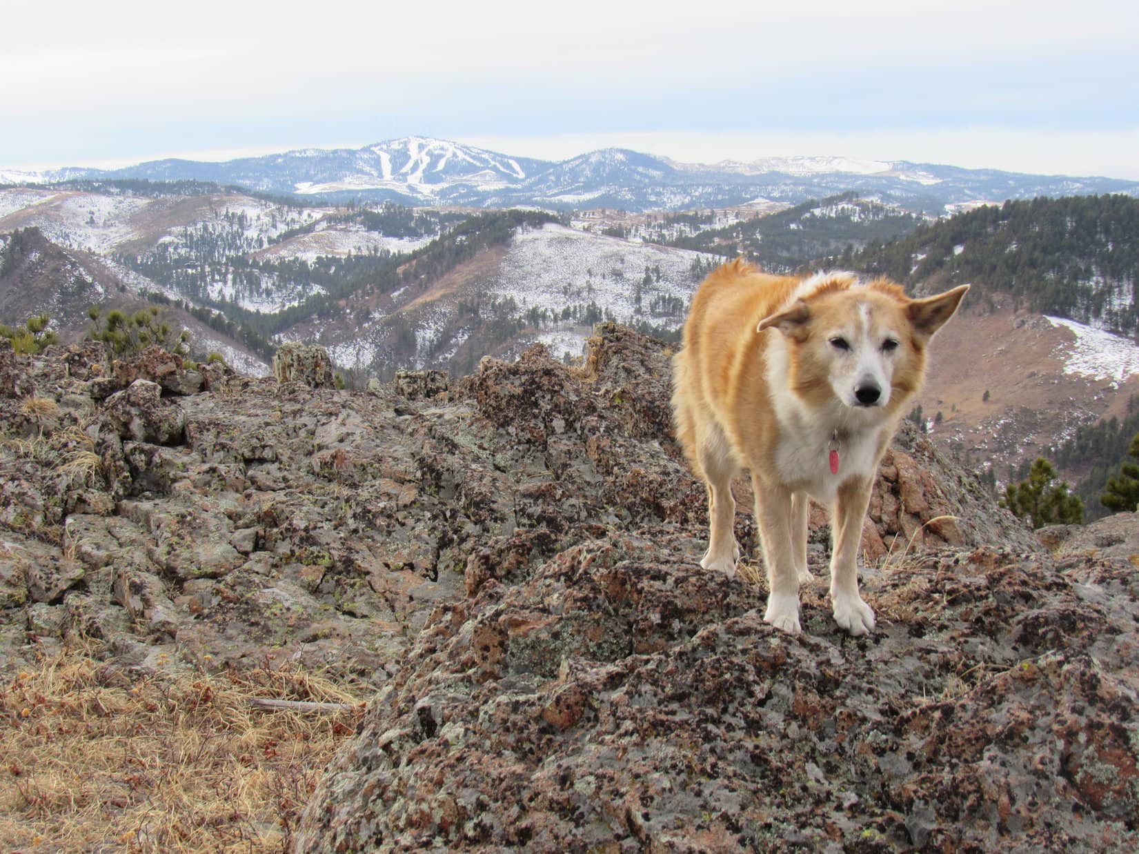
To the N, Whitewood Peak (5,120 ft.) and Crook Mountain (4,930 ft.) were easily identifiable.  Off to the NW was a less readily recognized peak.  Green Mountain (5,325 ft.)?  Probably, but SPHP wasn’t certain.

Whitewood Peak (far L) and Crook Mountain (R) behind Lupe. Photo looks N.
Green Mountain (?) (far L), and Whitewood Peak (R). Photo looks NNW.

In the opposite direction, Bear Den Mountain (5,642 ft.) was visible to the S.  And, of course, Peak 5400 was off to the E.

Bear Den Mountain (R). Photo looks S.
Peak 5400 (Center). Photo looks ESE.

And that was about all the wind Loopster was willing to put up with.  A brief, final return to the true summit rock, and she was on her way.

Final moments atop Pillar Peak.
Leaving Pillar Peak (R). Photo looks W.
Last glance back.

Instead of going down Pillar Peak’s messy SE ridge the way she’d come up, the Carolina Dog went S down a steeper slope to the first saddle leading to Dome Mountain (5,512 ft.).  From here, Lupe headed SE down a wide, snowy valley to pick up USFS Road No. 804.

Once on the road, the rest was easy.  Lupe followed No. 804 over the saddle between Pillar Peak and Peak 5400, and started down the other side.  No. 804 would eventually take her down Pillar Peak’s long NE ridge, before linking back up with Lost Gulch Road.

USFS Road No. 804.

Well, it seemed the American Dingo’s first Black Hills expedition of 2021 had been a success!  The wind was scarcely noticeable down here, and the return was a happy, peaceful time.  No. 804 was a quiet, secluded trek, with a few whitetail deer thrown in for a bit of excitement.

4:13 PM, 52ºF, Camp 5 Road trailhead – Back to the G6 before sunset!  Unusual this time of year.  Twilight hadn’t completely faded by the time Lupe got home.  Good thing the Carolina Dog had gotten out today!  An hour after arriving home, the Canadian cold front arrived full strength.

80 mph gusts!  All night long the world moaned.  The whole house shook, as Lupe lay twitching as she dreamed.  Dreaming, perhaps, of a mighty American Dingo astride a lonely summit forever battered by the breeze.

On Pillar Peak, Black Hills of South Dakota 1-13-21

Links:

Next Black Hills Expedition                  Prior Black Hills Expedition

Black Hills, SD Expedition No. 120 – Pillar Peak (2-20-15)

Black Hills, SD Expedition No. 122 – Bear Den Mountain, Anchor Hill, Dome Mountain & Pillar Peak (3-14-15)

Want more Lupe adventures?  Check out Lupe’s Black Hills, SD & WY Expeditions Adventure Index, Master Adventure Index, or subscribe free to new Lupe adventures!

Black Hills, SD Expedition No. 261 – Peak 5800 & New Year’s Eve Peak (12-31-20)

12:47 PM, 37ºF, junction of Hwy 385 & USFS Road No. 710 – A little late in the day to be starting out on a Black Hills expedition, but that was by design.  Lupe was excited, though, and SPHP was too!  As soon as SPHP was ready, the American Dingo headed SW into the forest.  A skiff of snow was on the ground, somewhat surprising since the weather had been extremely dry and unseasonably warm for 2 months.

Loopster heads into the forest. Photo looks SW.

The slope quickly increased into a steady, relatively steep climb.  Lupe was already most of the way up Peak 5800 when she began coming to minor rock outcroppings and shelves.  Pausing briefly at a particularly open spot, she could see the rolling grasslands of the Bald Hills.

Glancing out over the Bald Hills. Photo looks NE.

The climb got easier near the end.  Lupe reached Peak 5800’s big summit ridge near the SE high point.  Heading SE, she lost a bit of elevation on the way to a few big rocks for a look at the views in this direction.

Part of Sheridan Lake, which looked frozen over, was in sight.  Beyond the lake was Calumet Ridge (5,601 ft.)Boulder Hill (5,331 ft.) and Silver Mountain (5,405 ft.) were easily recognizable, too.

At the SE end of Peak 5800’s summit ridge. Sheridan Lake (R) with Calumet Ridge beyond it. Boulder Hill (L) and Silver Mountain (L of Center). Photo looks SE.

Five Points (6,221 ft.) and False North Point (6,130 ft.) stood out to the SW.

Five Points (L) and False North Point (L of Center). Photo looks SW.

Turning back, Lupe headed NW for Peak 5800’s true summit, stopping at both the SE high point, and for a look at Black Elk Peak (7,231 ft.) along the way.

On Peak 5800’s SE high point. True summit (Center). New Year’s Eve Peak (L). Photo looks NW.
Black Elk Peak (L of Center). Photo looks S.

Traversing the summit ridge was easy.  Lupe quickly reached the big gray rock formation near the NW end that constituted the true summit.  Light green and charcoal gray lichens decorated the stone.  Peak 5800 wasn’t as high as New Year’s Eve Peak (6,046 ft.), Loopster’s ultimate destination today, but the views here were actually better, since they were much more open.

At the true summit of Peak 5800. Photo looks NW.
Enjoying the open views from Peak 5800’s true summit. Bald Hills (L). Photo looks E.

Among other sights, New Year’s Eve Peak itself was visible nearly 2 miles NW as the crow flies.  Today’s late start had been driven by the intention of letting Loopster say good-bye to the Year of Perfect Vision over there.  A glorious sunset was hoped for, but the completely overcast sky was not encouraging.

New Year’s Eve Peak (Center) from Peak 5800. Photo looks NW.

However, all was not lost.  The cloud cover appeared to be rather thin.  Would take a while to get over to New Year’s Eve Peak, so maybe there was still a chance a decent sunset would materialize?  10 minutes at the true summit of Peak 5800, and the American Dingo continued on.

The NW face of Peak 5800 was quite steep and very rocky.  A little better more toward the W.  This was Lupe’s 3rd time on Peak 5800.  She’d come down this way each time, but the descent seemed trickier than SPHP remembered it.  Might have gotten a little off course somewhere along the line this time around.

Descending the W face. Scruton Mountain (5,922ft.) (L). Photo looks NNW.

Fortunately, Lupe didn’t have to lose an awful lot of elevation here.  Even so, the descent took longer than expected.  By the time Looper reached much easier terrain, she had some good news!  Patches of blue sky were appearing and seemed to be spreading.  Weak sunlight illuminated golden fields ahead.

Looking back at Peak 5800 after getting past the steep, rocky part of the descent. Photo looks E.
The golden trek ahead. Peak 5917 (Center) with forested New Year’s Eve Peak behind it and slightly to the L. Photo looks NW.
Blue skies over Peak 5800. Photo looks ESE.

The journey through the sunlit fields was as gorgeous and fun as it was easy.  This region was a longtime favorite.  Ever since Lupe first climbed New Year’s Eve Peak on the last day of 2012, she had been coming here near the end of every year.  Poor weather often prevented Loop from returning right on December 31st, but she had usually been able to get here within a day or two.

The American Dingo roamed freely, having a blast as SPHP pondered this tradition and the sad imminent demise of the Year of Perfect Vision.  Two years since Lupe had come this way!  In 2019, SPHP had been far too sick to make the journey.  Great to be back!  Lupe hated fireworks, and this annual trek to New Year’s Eve Peak was her much preferred method of celebrating New Year’s Eve.  Beauty, solitude, and freedom!

Along the way. Five Points (L) and False North Point (R of Center). Photo looks SW.

By the time Loop made it to Pistol Point, hopes for a glorious sunset were fading fast.  Obliterating all blue sky in its path, a thicker bank of clouds was sweeping in from the NW.  Still not darkly overcast, but the sun was already reduced to a mere bright spot in the clouds.

At Pistol Point. Photo looks ENE.
Peak 5917 (L) and Peak 5800 (R) from Pistol Point. Photo looks E.
New Year’s Eve Peak (Center) from Pistol Point. Photo looks NNW.

Only 0.5 mile to go!  Leaving Pistol Point, Lupe headed W across open ground, but was soon turning N along New Year’s Eve Peak’s S ridge.  The ridge was narrow, rocky, and thickly forested.  Some up and down along the way, but nothing major.  Before long, Loop was coming up the S slope.

3:56 PM – For the 8th time in her life, and 3rd time right on New Year’s Eve, Lupe stood atop the true summit boulder on New Year’s Eve Peak.  Perfect timing!

All to no avail.  Somewhere the sun was still up, but not for long.  Clearly, no sunset, whether grand and glorious or otherwise, was in the cards.  The sky was a uniform light gray, the mood merely a chilly, blah nothing.  Not a ray of sunshine anywhere.  Entirely out of character,  New Year’s Eve Peak (6,046 ft.) felt neither like the end, nor the beginning, of anything.

A disappointing end to 2020, the Year of Perfect Vision.

A few years ago, loggers had come and thinned out some of the pines to the S, both creating a mess and opening up the views, which used to be very limited.  Young pines were already growing all around the summit boulder.  A few more years, and the views would be vanishing again.

On the true summit boulder of New Year’s Eve Peak. Photo looks SW.

Before doing anything else, Lupe and SPHP performed a ritual task in keeping with tradition.  Sitting together, a short break was taken facing W.  Taste of the Wild, a couple of shared chocolate coconut bars, and an apple disappeared.  Quite a bit of territory was in sight, looking snowier and more wintery than seemed justified at the end of a December so warm and dry.

Taking a break. Photo looks SW.

In the past, Lupe had always arrived here earlier in the day.  In fact, she’d always completed her New Year’s Eve Peak tour well before the sun went down.  By sunset she was on her way back to the G6, out in open country where the final gleaming rays and dazzling colors of the dying year could be better appreciated.

Knowing that the sun was already on the horizon, but unable to glimpse it, simply felt wrong.  No moment of anticipation.  Nothing was going to happen.  What was the point?

None really, except to maintain the tradition, to be here together as whatever remaining light of the old year faded, to remember the year that had been.

Grandma finally moved this year.  Then months spent working on her house getting it ready to sell.  The sale itself, which went so fast.  The last of more than 1,000 trips to the cul-de-sac.  Then summer.  A late start to it, but Lupe had climbed some fabulous peaks, among them some of the highest she had ever been to.  An early end to those happy times, as the smoke of countless wildfires blanketed and obscured the W.  Through it all, the trials of Covid-19 which had prevented the Most High Exalted Dingo of the Arctic Sisterhood from returning to Canada and Alaska.

Each day is precious, unique, never to return.  Lupe and SPHP stirred.  A quick New Year’s Eve Peak summit tour was in order, even if other plans had been denied.

Black Elk Peak (L), Five Points (R) with Sylvan Hill (7,000 ft.) beyond it.
Silver Mountain (L) and Calumet Ridge beyond Sheridan Lake (R). Photo looks SE with help from the telephoto lens.
Peak 6070 (Center). Photo looks NW.

Done.  Mission complete.  Onward!  Puppy, ho!

Ironic.  By the time the flashlight had to come out, stars were twinkling above.  So where did all those infernal clouds go?  The Dingo didn’t care.  No brilliant sunset before 2020 vanished forever?  So what?  Peak 5800 and New Year’s Eve Peak!  She’d had a great time.  (End, 6:00 PM, 32ºF)

At home, dinner then early to bed, very early.  For hours, Lupe laid close to SPHP for protection while sporadic fireworks boomed in the night.  With each thud, the Carolina Dog glanced up in fear and wonder.  Near exhaustion and final collapse, the Year of Perfect Vision was still hanging on, still fending off the dread uncertainties of 2021.

Oh, don’t worry about it, Loopster!  Gonna be OK!  You’ll still be climbing mountains in 2021.  You might as well enjoy that Busy Rib Hide!

Stroking her soft fur, SPHP gave Lupe another kiss.  Reassured yet again, the American Dingo went back to chomping away.

On New Year’s Eve Peak, Black Hills of South Dakota 12-31-20

Links:

Next Black Hills Expedition                   Prior Black Hills Expedition

Black Hills, SD Expedition No. 242 – New Year’s Eve Peak, Peak 6070 & Peak 6043 (12-17-18)

Black Hills, SD Expedition No. 288 – New Year’s Eve Peak (1-3-22)

Want more Lupe adventures?  Check out Lupe’s Black Hills, SD & WY Expeditions Adventure Index, Master Adventure Index, or subscribe free to new Lupe adventures!