South Sawtooth Mountain, Laramie Range, Wyoming (6-10-17)

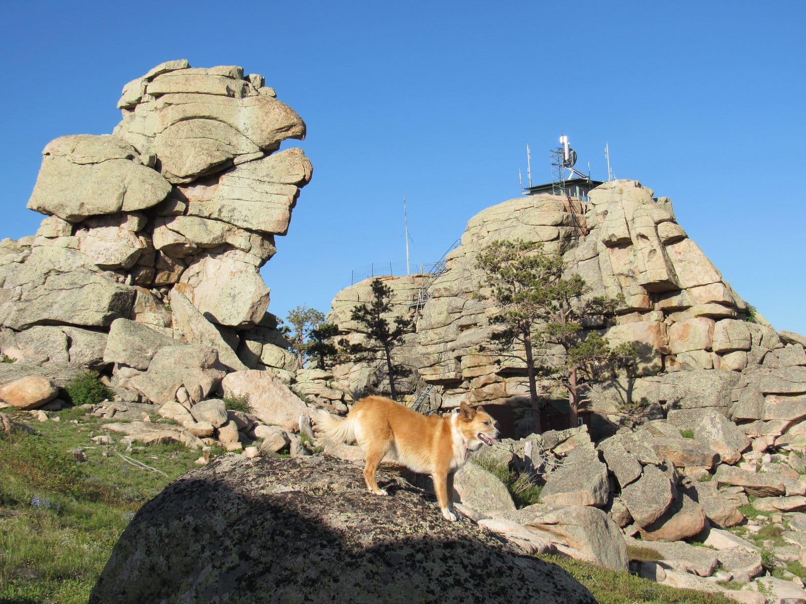
Day 3 of Lupe’s 2017 Dingo Vacation to the Laramie Range, Wyoming & Beyond!

SPHP drove slowly.  Ahead Eagle Peak (9,167 ft.) was lit up by the early morning sunshine.  The E face of the mountain looked tough.  Not that it mattered now.  Yesterday Lupe had come close to reaching the top of the mountain from the SE and SW sides.  She hadn’t quite made it, though, and there wasn’t going to be another attempt today.

Eagle Peak in the early morning sunshine. Yesterday Lupe had nearly reached the top of the mountain, but failed to find a way up the last few tens of feet. She wasn’t going to make another attempt today. Photo looks WNW.

I hope we have better luck today at South Sawtooth, Loop.

SPHP spoke without much conviction.  Those contours on the topo map were as tight near the top of South Sawtooth Mountain (8,723 ft.) as they were at Eagle Peak.  Success was far from guaranteed.

Success was guaranteed at Prairie Dog Hill (6,400 ft.) a mile N of Esterbrook.  County Road No. 5 went practically right over the top of it.  Lupe sniffed her way through a nearly flat field.  Elevation gain to what seemed to be as much the high point as anywhere else was trivial, less than 10 feet.  Whoop-de-doo!  At least there was a bit of a view.

Lupe on Prairie Dog Hill, a trivial peakbagging accomplishment. It was so flat it was hardly even a hill. At least she had a distant view of Laramie Peak (10,272 ft.) (L) and Eagle Peak (9,167 ft.) (R). Photo looks SW.

Although South Sawtooth Mountain is only 9 miles NNW of Eagle Peak as the crow flies, it was many times that far by road.  Lupe first had to go clear to Douglas, WY.  While in town, SPHP picked up a few supplies.  At very small Locomotive Park where the Douglas Railroad Interpretive Center is located, Lupe got to visit a very large Jackalope.

Lupe visits the giant Jackalope at Locomotive Park in Douglas, WY. Douglas is the Jackalope capital of the world!

Lupe was disappointed to find that the Jackalope was merely a statue, but as large as the Jackalope was, perhaps that was for the best.  In any case, the Carolina Dog was soon ready to move on.

The long drive out Hwy 91 SW of Douglas is one of SPHP’s favorites for gorgeous western scenery.  Lupe likes it for all the cows and horses to bark at along the way.  The highway eventually ends and turns to gravel.  Many more miles of dusty road eventually brought Lupe to the Curtis Gulch campground along La Bonte Creek.

SPHP parked the G6 near the campground entrance.  Lupe set out for South Sawtooth Mountain (10:36 AM, 68°F) heading SW on USFS Road No. 658.  On the way in, SPHP had seen a sign for Big Bear Canyon about 0.33 mile away.  Lupe soon reached this side road (USFS Road No. 657.01), which almost immediately led to a ford of La Bonte Creek.

Almost as soon as Lupe reached USFS Road No. 657.01 to Big Bear Canyon, the road led to this ford of La Bonte Creek. Photo looks SW.

The water was high this time of year.  Although the surface looked calm, La Bonte Creek was wide at the ford, and over Lupe’s head.  Upstream and downstream, the current was clearly strong.  American Dingoes like wading, not swimming, but SPHP knew Lupe could swim if necessary.  She ought to be able to manage this crossing.

Still, SPHP wasn’t thrilled to see the ford.  Only 3 days ago, SPHP had bought new boots for this Dingo Vacation, and they weren’t waterproof.  To keep from getting the new boots soaking wet, SPHP decided to take them off and wade the stream barefoot.  SPHP stuffed a sock inside each boot, laced them together, and draped a boot over the back of each shoulder with the knotted laces across the throat.

While Lupe watched from shore, SPHP waded into La Bonte Creek.  The current was fairly strong, and the water as much as thigh deep.  Rocks on the bottom were loose and sometimes slippery.  Concentration was required to maintain balance, but SPHP managed to get most of the way across uneventfully.

Was Lupe following?  Yes and no.  SPHP turned around to see the Carolina Dog still near the opposite shore.  She wanted to come, and had waded chest deep into La Bonte Creek, but was reluctant to go any deeper.

Lupe waded chest deep into La Bonte Creek, but was afraid to go any deeper.

Loopster was going to need some encouragement.  SPHP waded the rest of the way across, then turned around again to call to her.

Meanwhile, desperate not to be left behind, all on her own Lupe had decided to try crossing La Bonte Creek on the downstream side of the ford.  The water wasn’t as deep here, but the current was powerful.  SPHP was alarmed to see Lupe neck deep struggling to cross without being swept downstream.  Fortunately, her legs were just long enough for her paws to touch bottom.  Lupe clawed her way forward despite the current.

In a flash, Lupe was past the moment of danger.  She reached much shallower water, and came trotting across just fine.

Lupe trots the rest of the way across La Bonte Creek after clawing her way past a dangerous deeper part on the downstream side of the ford. Photo looks NE.

Glad that’s over with Loop!  Good girl!  You did great, but maybe we can find a safer way across on the way back?  Not looking forward to doing that again.

SPHP put socks and boots back on again.  The trek along USFS Road No. 657.01 resumed.  Lupe reached two more creek crossings in quick succession.

Lupe in lower Big Bear Canyon between creek crossings. The rocky mountain seen in the background is on the N side of La Bonte Canyon close to Curtis Gulch campground. Photo looks NE.

Fortunately, La Bonte Creek had already forked by the time these next stream crossings were reached.  Flow was less than half of what it had been at the first ford.  Lupe had no problems crossing now.  SPHP again crossed barefoot each time, the creek still being too large to leap over.

USFS Road No. 657.01 now went steadily SSE up Big Bear Canyon.  Lupe came to no more creek crossings for more than 0.5 mile.  When she did reach more crossings, the creek was considerably smaller than before.  SPHP could now leap across, avoiding the tedious necessity of removing the precious new boots each time.

The day was sunny and warm.  Lupe was now enjoying cooling off and getting drinks from the stream.

Lupe enjoys cooling off in the diminished stream on the way up Big Bear Canyon.

Big Bear Canyon was heavily forested most of the way.  Sometimes there were views of large rock formations hundreds of feet higher up along the E side of the canyon.  Farther on, high forested mountainsides were visible on the W side of the canyon, too.  Mostly though, the views were only of the forest along USFS Road No. 657.01.

Lupe on her way up Big Bear Canyon on USFS Road No. 657.01. Photo looks SSE.
About halfway up Big Bear Canyon, Lupe reached this pond. The creek flowed through it. Photo looks SW.

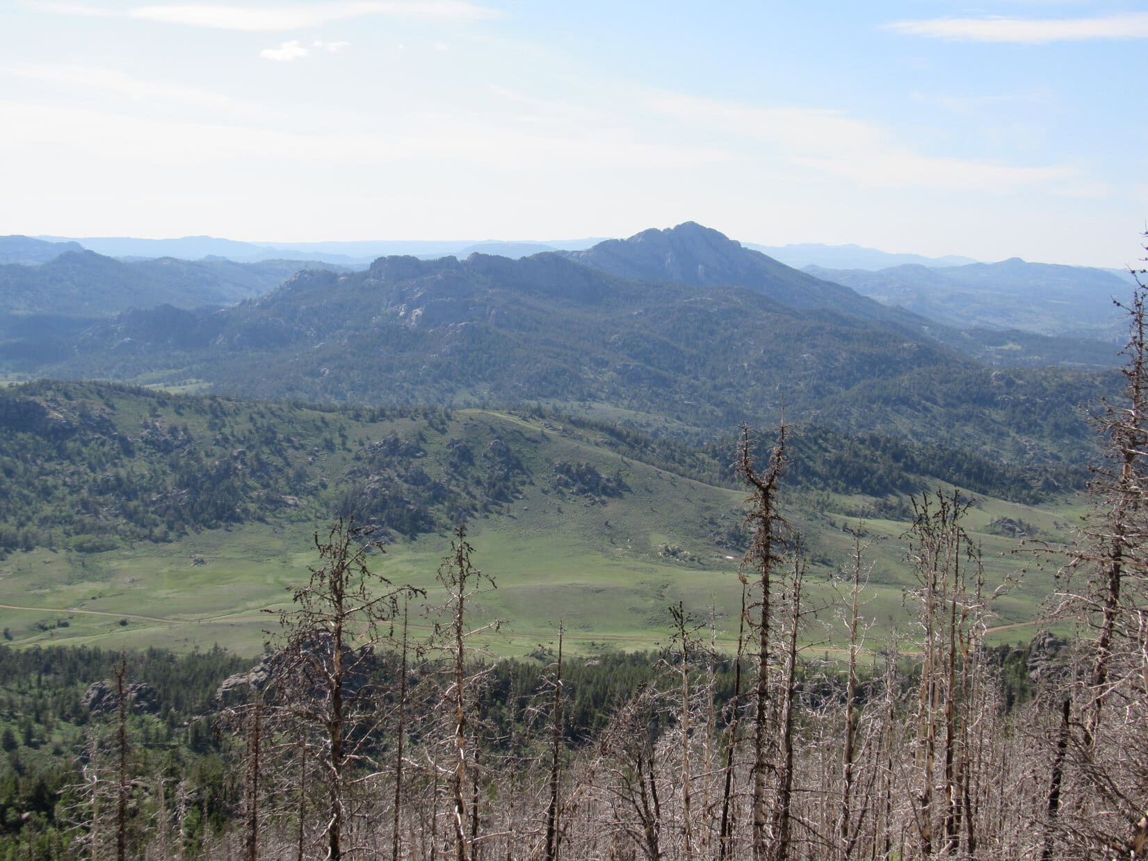
Lupe followed USFS Road No. 657.01 for more than 3 miles all the way up Big Bear Canyon.  The road gained elevation more quickly toward the end.  About the time the rate of climb began to diminish again, SPHP spotted a mountain off to the NE.  The view was partially obstructed by trees, but what could be seen was concerning.

Was that South Sawtooth Mountain?  If so, Lupe wasn’t likely to have much luck reaching the summit.  The rocky upper slopes looked nearly vertical.  Sigh.  Not another defeat!  Nothing to do, though, but carry on.  Maybe that wasn’t South Sawtooth, or there actually was a way up.  Hard to tell from here.  The mountain was still a couple miles away.

The terrain completely leveled out as the road left the upper end of Big Bear Canyon.  Lupe soon arrived at a 3 way junction.  A sign identified the road Lupe needed to take as Sawtooth Road.  On the topo map it was USFS Road No. 615, which started out heading ENE from here.

Lupe reaches a 3 way junction at the flat, forested saddle beyond the upper end of Big Bear Canyon. USFS Road No. 615, which Lupe would need to take partway to South Sawtooth, is seen winding away into the forest. Photo looks E.

Before taking No. 615 toward South Sawtooth, Lupe explored another road leading a short distance SW to USFS No. 610.  She passed a sunny meadow full of lupines along the way.

Lupe among the lupines.

Lupe went far enough to have some views of mountains off to the SW and NW before turning around.  She then returned to the first junction, and started along USFS Road No. 615.

Before long, No. 615 emerged from the forest.  The road began climbing steadily up a draw which was mostly meadow.  At the upper end of the draw, Lupe re-entered the forest.  The road wound around to the E and NE, but after a mile or so, turned N.  The topo map showed that right after reaching a crest, No. 615 would turn W and start losing elevation.  Ultimately it would dead end in a canyon.

Lupe reached the crest of USFS Road No. 615.  Time to leave the road!  Lupe and SPHP turned NE, and started climbing a heavily forested hillside.  Little could be seen except trees until Loop reached the top of a broad ridge.  Here there were big rocks and some open ground.  From one of the higher rocks, the American Dingo had a view of the mountain SPHP had seen earlier.

Yes, that was it.  That had to be South Sawtooth Mountain (8,723 ft.)!

From a rock on the broad ridge, Lupe catches sight of South Sawtooth Mountain! Photo looks N.
Lupe reaches the broad ridge at a perfect point! She had arrived up on the ridge just far enough NE to avoid having to go over High Point 8401, seen behind her. The open ground on the gently sloping ridge was easier to traverse than going through the forest. Photo looks SSW.

Up on the broad ridge, there was enough open ground to make travel much easier than in the dense forest Lupe had left behind.  Lupe and SPHP continued NE, skirting a series of rock formations along the NW side of the ridge.

Another large ridge could soon be seen.  It trended NW to join the ridge Lupe was on.  Beyond the junction, the combined ridge went N and narrowed somewhat.  Lupe came to a rock formation larger than any of the others she had passed to this point.  South Sawtooth Mountain was now less than a mile away.

Beyond the ridge junction, Lupe came to a larger rock formation (L of Center) than any of the others she’d been passing by. She got around the SW (L) side of this one. South Sawtooth Mountain is seen in the distance now less than a mile away. Photo looks N.

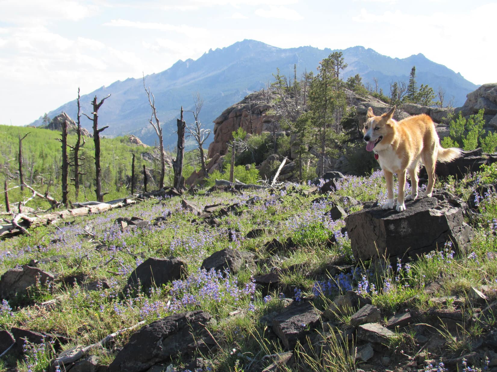
Beyond the first large rock formation, Lupe came to some beautiful open ground leading to a second, even grander rock formation.

Approaching the 2nd, even larger, rock formation (R). South Sawtooth Mountain is now on the L. Photo looks N.

From the W side of the second rock formation, Lupe had the best view of South Sawtooth Mountain she’d seen yet.  However, the sight caused SPHP to lose all hope that Lupe would succeed in reaching the top.  The mountain was simply too vertical and rough.  Most disappointing!

Maybe Lupe could still reach the top of the high point on the lower W ridge, though?  That looked easy enough.  At least the Carolina Dog had a new objective to pursue.  Who knew, maybe things would look different from up there?

At the second and largest rock formation Lupe reached on the ridge, she had her best view yet of South Sawtooth Mountain. The daunting S face crushed hopes that Lupe could reasonably expect to reach the top. The high point of the lower W ridge (L), became Lupe’s new reduced objective. Photo looks N.

Lupe and SPHP tried to get around the E side of the second rock formation, but a long wall of rock blocked the way.  Lupe was forced to retreat back to the W.  What could be seen of the rest of the ridge leading to South Sawtooth looked forbidding.  The ridge dropped sharply beyond this rock formation, before rising again and continuing N as an impossibly rough series of huge rock outcroppings.  No way!

A grassy opening was visible to the W down at the bottom of a valley about 150 feet lower than where Lupe was now.  Time to abandon the ridge.  Lupe and SPHP started W down a fairly steep forested slope.  As the ground began leveling out near the bottom, there was movement.  Instantly, Lupe dashed away in hot pursuit!

SPHP never had a clear view of what she was after.  Whatever it was had a huge lead, and bounded S through the forest at very high speed.  Loop never got anywhere close, and soon gave up.  SPHP got only tree-broken glimpses.  The creature was gray and bounded like a rabbit, but it was far, far larger than any rabbit.  Even Lupe was tiny by comparison.

A bear?  Are bears still found in the Laramie Mountains?  SPHP didn’t know.  Maybe.  Lupe returned with a huge grin on her face, panting hard.  That was fun!

So what was it, Loop?  A bear, or one of those giant jackalopes?

Lupe kept smiling, but didn’t say.  Hardly mattered now.  It was gone.  Puppy, ho!  Onward!

Lupe and SPHP reached the meadow at the bottom of the valley, crossed it to the W, and went over a small rise to another valley.  This valley was mostly forested, and looked like it would take Lupe up to the saddle between South Sawtooth Mountain and the high point on the ridge to the W.  Lupe turned N and began to climb.

Lupe on her way up the valley leading to the saddle between South Sawtooth Mountain (R) and the high point on the ridge to the W (L). Photo looks N.

Lupe made it up to the saddle with no problem at all.  The whole W face of South Sawtooth Mountain was now in view.  Unfortunately, no matter what route SPHP considered from here, there just didn’t appear to be a way for Lupe to reach the top.  She could have climbed somewhat higher, but every possible path to the summit looked blocked by boulders or vertical rock walls somewhere along the way.

Defeat again!  First at Eagle Peak, now here.  No use fretting about it.  The sky was clouding up.  Rain showers looked like a possibility in some directions.  If Lupe was going to reach the high point on the mountain’s W ridge, she had better get there before the weather deteriorated.

The W face of South Sawtooth Mountain. Although Lupe could have climbed partway up, SPHP couldn’t see any safe route to the top. There were too many large boulders and vertical rock walls. Photo looks E.

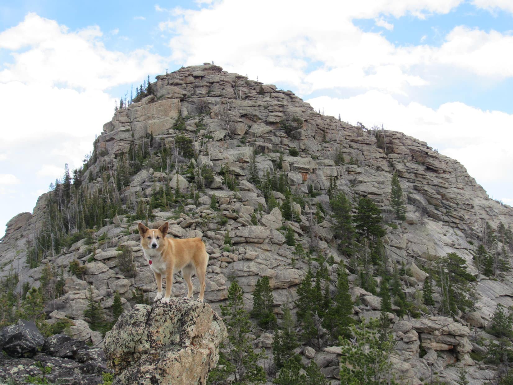
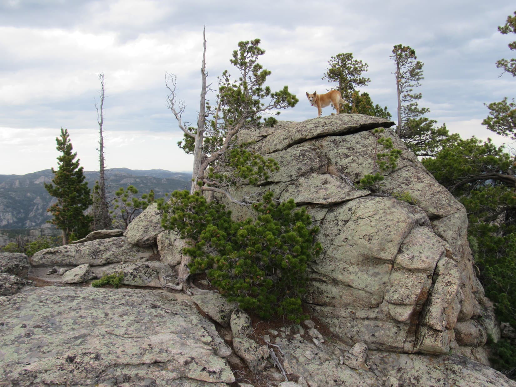
Piece of cake!  Lupe was soon up on the W shoulder of South Sawtooth Mountain.  A half acre of relatively flat ground contained two distinct high points.  They were so close to each other in elevation, Lupe would have to climb both to be certain she’d reached the highest one.

Before Lupe climbed up on either high point, she took a general look around at some of the views available from various other vantage points.

South Sawtooth Mountain from a rock on the W shoulder. Photo looks E.
Laramie Peak (10,272 ft.) is seen beyond Lupe. Photo looks SE from the same rock.
Blacktail Peak (8,675 ft.) is the highest mountain seen straight up from Lupe’s head. Photo looks WSW.
View to the NW. Warbonnet Peak (9,414 ft.) is the high point on the horizon L of Center. Also on the horizon straight up from Lupe are Squaw Mountain (9,313 ft.) (L) & Buffalo Peak (9,387 ft.) (R).

Although not as good as they would have been if Lupe had been able to reach the summit of South Sawtooth Mountain, the views from the W shoulder were really quite nice.  Lupe could see a lot of territory from up here.

After looking around some, Lupe got up on top of the N high point first, since it seemed easiest.

Loop climbed up on top of the N high point of South Sawtooth Mountain’s W ridge first. Photo looks NW.
South Sawtooth Mountain from the N high point. Photo looks ESE.

The best views of Middle and North Sawtooth Mountains were from rocks near the N high point.  Though equally rugged, neither mountain was as high as South Sawtooth.  Even here on South Sawtooth Mountain’s W shoulder, Lupe was higher than either Middle or North Sawtooth.

Lupe had a great view of Middle Sawtooth (R) and North Sawtooth (L). Neither of them looked like anything Lupe could climb, but she was already higher than either one right here. Photo looks NE.
Middle Sawtooth Mountain (8,502 ft.). Photo looks NE with help from the telephoto lens.
North Sawtooth Mountain (8,306 ft.) (R). Photo looks NNE.
South Sawtooth Mountain (8,723 ft.) is the highest of the 3 Sawtooths in the area. Photo looks E.

Shortly after visiting the N high point, Lupe went and climbed the S one.  Even after being up on both, it wasn’t clear which was the highest.

Lupe completes her peakbagging for the day up on the S high point. Photo looks SSW.
South Sawtooth Mountain from the W ridge’s S high point. Photo looks E.
Another look from the S high point.
American Dingoes can occasionally be spotted in the Laramie Mountains of Wyoming.

Lupe and SPHP lingered up on South Sawtooth Mountain’s W Ridge for 30 or 40 minutes before starting back.  The plan was to retrace the same route, except Lupe would try to cut through the forest and find USFS Road No. 615 again without getting up on the broad ridge S of South Sawtooth Mountain.


High Point 8401 on South Sawtooth Mountain’s long S ridge is seen straight up from Lupe. She had followed the broad ridge from there over to the meadows seen on the L on the way to the mountain. On the way back S, she would stay down in the forest on the near (W) side of the same ridge. Photo looks S.

Loop left the W ridge going down to the saddle next to South Sawtooth Mountain.  She then turned S traveling down the same valley she had originally come up.  This valley would turn and take her too far W before long, so she soon had to make a jog to the E over a minor ridge into the next valley over.

Lupe starts back down the same valley she had come up on the way to South Sawtooth Mountain. She had a great time exploring the forest again. Photo looks SSE.

After losing considerable elevation, Lupe gradually started regaining some as she traveled S through the forest.  She was somewhere not too far W of the broad ridge she had reached N of High Point 8401 on the way to South Sawtooth, but it was hard to tell exactly where she was, or how much farther it might be to the road.

After a while, the terrain became a little rougher and rose more steeply.  Some things looked vaguely familiar.  Lupe continued S and eventually reached a meadow up on the ridgeline again.  Now it was possible to see that Lupe was only a little SW of High Point 8401.  That was good news!  It meant that USFS Road No. 615 was close by.

Lupe headed SW down a forested slope.  She soon reached No. 615.  Now all she had to do was follow the road back to No. 657.01, which would take her back down Big Bear Canyon.

Lupe finds USFS Road No. 615 again SW of High Point 8401. All she had to do now was follow this road back to No. 657.01, which would take her back down Big Bear Canyon. Photo looks S.

The sun had set and light was fading by the time Lupe made it all the way back down Big Bear Canyon.  She was now approaching the last big creek ford across La Bonte Creek.  As promised earlier, SPHP searched upstream of the ford for an easier place for Lupe to cross, but found nothing.  Lupe was going to have to brave the ford one more time.

Once again, SPHP went barefoot with boots tied together and dangling behind the neck.  Lupe wanted to cross the same downstream side of the ford where she had made it across before.  SPHP went with her to keep a better eye on how she was doing.  The water wasn’t as deep here as in the main part of the ford, but the current was far stronger.

Once again, it was alarming to see how close the Carolina Dog came to being swept downstream.  As Lupe fought and clawed her way across La Bonte Creek, barely able to hang on against the swift current, SPHP started having problems, too.  The creek bottom was covered with larger, slippery rocks here.  They weren’t visible in the dim light.  One of the rocks moved unexpectedly.

SPHP gyrated wildly trying to maintain balance.  The American Dingo had made it!  She stood safely on the opposite shore.  SPHP recovered and avoided a fall, but out of the corner of an eye saw something hit the water.  The new boots were bobbing away downstream!  In seconds, they vanished from view.

Gone for good.  Sheesh!

It was a good thing there wasn’t more gravel on USFS Road No. 658.  The 0.33 mile barefoot trek back to the G6 was slow and painful enough as it was.  Lupe ran back and forth on the road wondering what was wrong with SPHP?  She was hungry!  C’mon, hurry it up!  Stars were shining by the time Alpo was served.  (9:43 PM)

Although Lupe initially seemed tired out from the long trek to South Sawtooth Mountain, the Alpo soon revived her.  She couldn’t sleep.  SPHP finally let her out of the G6.  She sniffed around in the night for a while, then laid down on the ground near the G6.

For a long time the Carolina Dog stayed out there alone, bathed in moonlight beneath the starry sky, watching the dim forest and listening to the soothing sound of the flowing waters of boot-eating La Bonte Creek.

Sometime after midnight, a tuckered out Dingo finally snoozes peacefully in the G6 after her South Sawtooth Mountain adventure.

Links:

Next Adventure                     Prior Adventure

Want more Lupe adventures?  Choose from Lupe’s 2017 Laramie Range, Wyoming & Beyond Adventure IndexDingo Vacations Adventure Index or Master Adventure Index.  Or subscribe free to new Lupe adventures.

Eagle Peak, Laramie Range, Wyoming (6-9-17)

Day 2 of Lupe’s 2017 Dingo Vacation to the Laramie Range, Wyoming & Beyond!

Lupe shot out into the night.  No telling what hour it was.  No doubt it was late, very late.  Following a road to the top of Black Mountain (7,960 ft.) yesterday hadn’t been hard enough to wear the Carolina Dog out.  She was all stirred up about being on a Dingo Vacation again, and had been staring out of the G6 watching the dark forest for hours.  SPHP wasn’t all that sleepy, either.  May as well join Looper out there.

The night air was pleasantly cool.  Only a few stars could be seen through high, thin clouds.  The nearly full moon was so bright, no other light was necessary.  SPHP strolled S along USFS Road No. 633, while Lupe explored small fields nearby.  The flowing waters of Horseshoe Creek and Lupe’s sniffing made the only sounds breaking the silence.

Forty minutes later, Lupe was back at the G6.  She helped devour the rest of the leftover roasted chicken, then was finally able to fall asleep.  By the time SPHP woke up again, the sun was shining.  A surprisingly strong, cool breeze was blowing down the Horseshoe Creek valley.  Lupe and SPHP spent a little time down by the stream.  The sky clouded up.

Lupe by Horseshoe Creek. A surprisingly strong, cool breeze was coming down the valley. Photo looks S.

The wind was strong enough so making breakfast was going to be a bother.  SPHP decided to skip it.  The roasted chicken in the night could serve as breakfast.  Lupe was raring to go, anyway.  Onward!

SPHP drove toward Lupe’s next peakbagging destination, following USFS Road No. 633 back to Esterbrook.  From there Lupe enjoyed a scenic ride SW on Country Road No. 5.  A huge herd of beautiful cows appeared ahead right on the road!  Another cattle drive, or perhaps it was the same one Lupe had passed yesterday back at Prairie Dog Hill (6,400 ft.), was going on.  In any case, another enthusiastic barkfest was in order.

Once safely a few miles beyond the cattle, SPHP stopped the G6 near a big rock outcropping providing a great view of Lupe’s next challenge.  Eagle Peak (9,167 ft.) loomed to the S.

Eagle Peak from a hillside near County Road No. 5. Photo looks S.
Eagle Peak was Lupe’s next peakbagging challenge. With no roads or trails to follow, it would prove to be much harder than Black Mountain had been yesterday.
N face of Eagle Peak. Eagle Peak is nearly 4 miles W of Laramie Peak, the highest mountain of the Laramie Range.

By 10:23 AM (67°F), the G6 was parked only a mile NW of Eagle Peak near the 3-way intersection of County Roads No. 5 & 71, and USFS Road No. 671.  Lupe started out on No. 671, but quickly left it to follow a steep side road up an open slope.  When the side road turned NE to rejoin No. 671, Lupe left it as well, climbing SE up into the forest.

The forest was full of cheerful yellow flowers.

Soon after Lupe departed for Eagle Peak, she found herself climbing through a forest full of pretty yellow flowers.

The climb through the forest was fairly steep.  Lupe soon reached a high point where she could not advance any farther toward Eagle Peak.  Gah!  She was going to have to lose some of her newly gained elevation.  From high rocks, a flowery open saddle could be seen below to the SE.

Lupe ultimately lost 100+ feet of elevation working her way NE through thick forest and boulders before she came to a point where she could reach the open ground safely.  She then had to head S back up to the flowery saddle.  Not very efficient.

Lupe reaches the flowery saddle. Photo looks S.

Great job of route finding, SPHP!

Pshaw!  A minor setback.  Puppy, ho!  Onward!

From the flowery saddle, Lupe went SSW, skirting around the W side of another minor high point.  She then turned SE, and quickly arrived at the edge of a small valley.  A thickly forested hillside rose from the valley, climbing steeply toward the rocky upper NW face of Eagle Peak.

It looked like it might be possible to simply climb the NW face straight to the top of the mountain.  Then again, maybe not.  The rocky summit ridge was a long way up, still too far off to see details well.  The topo map seemed to indicate it might be easier to approach the mountain from the SW.

High up on the mountain toward the S, an area of burnt forest was visible.  Maybe Lupe should head toward that?

Beyond the flowery saddle, Lupe arrives at the edge of the small valley seen directly ahead. A thick forest rose steeply from the valley up the NW face of the mountain. The topo map seemed to suggest the easiest route to the summit might be from the SW, not the NW. For that reason, SPHP led Lupe toward the burnt area seen high up on the R (S). Photo looks SE.

SPHP led Lupe across the small valley, entering the forest.  Loop traveled SSE gaining elevation steadily.  The immediate goal now was to reach the burnt forest high up on Eagle Peak’s SW slope.  The Carolina Dog had a good time exploring the living forest, which went on for quite a long way.  She stopped for water and to relax a few times when SPHP needed a break.

Enjoying the forest somewhere on the lower NW slopes of Eagle Peak.
The living forest went on for what seemed like quite a long way as Lupe headed SSE. It was too thick to permit any views of how much progress she was making.

The living forest was nice and cool, but the morning’s clouds had mostly dissipated by the time Lupe reached the start of the burnt area.  The day was sunny, bright, and getting warmer.  Lupe could now see more of the territory higher up.  The view improved as Lupe continued climbing.  The top of the mountain was still hundreds of feet higher.

Looper enters the burnt area on Eagle Peak’s upper SW slopes. She had a somewhat better view of things from here, but the top of the mountain was still at least several hundred feet higher up. Photo looks ENE.

At first the burnt area was quite easy to navigate through, but as Lupe got higher up, she started encountering more deadfall, larger boulders, and some living trees as well that made progress increasingly difficult.  Lupe and SPHP turned ESE to climb more aggressively, but the terrain grew worse.  Finally, it became clear that the Carolina Dog was rapidly approaching the base of a nearly vertical wall of solid rock.

By now, Lupe wasn’t too far from the S end of the mountain.  SPHP had her head that way, looking for a break in the rock wall that would let her get up on top.  No dice.  The vertical rock wall was continuous.  Lupe finally reached the S end of it.  She was now quite high on Eagle Peak, and had a good view of the 2 mile long ridge far below leading SSW to Jack Squirrel Peak (8,942 ft.).

SPHP had hoped Loop would be able to follow that SSW ridge to climb Jack Squirrel Peak after summiting Eagle Peak, but that clearly wasn’t in the cards.  The ridge was way too rough.  Nearly all of it had burned, and there would be a ton of deadfall down there, too.  No way would there be time enough to navigate through all that!

At the S end of Eagle Peak, Lupe had a great view of the 2 mile long SSW ridge leading to Jack Squirrel Peak (8,942 ft.), seen in the distance. SPHP had hoped Lupe might be able to follow this ridge to tag the summit of Jack Squirrel Peak after climbing Eagle Peak. However, it was completely clear from here that was way too ambitious, and simply out of the question. Photo looks SSW.

Of course, there wasn’t much use in worrying about Jack Squirrel Peak yet, anyway.  Lupe still hadn’t found a way to the top of Eagle Peak.  A quick check of the topo map suggested that maybe she could go around the S end of the vertical rock wall and find a way up along the E side?

The rock wall was only a few feet thick at the S end.  Lupe could now see spruce trees growing in a corridor to the E.  The initial view was encouraging.  May as well try it!

Looking NNE back up at the vertical rock wall at the S end of Eagle Peak. Lupe had worked her way S to this point along the W (L) side of it without finding a way up, but maybe she could find a way up from the E (R) side? It was worth a shot!

Lupe and SPHP circled around the S end of the vertical rock wall over to the E side.  It was slow going amidst large boulders, and a mix of living trees and deadfall.  However, Lupe and SPHP both made it, and found there was indeed a channel of forested land rising steadily to the N on the E side.

For a short distance, Lupe stayed right along the E base of the vertical rock wall as she climbed N.  However, the wall rose higher to the N, too.  Lupe wasn’t making any apparent progress toward being able to get up onto it.

The terrain immediately below the wall became increasingly difficult.  Tightly packed spruce trees and boulders forced Lupe E away from the wall in order to make any progress at all.  Even over here, the going was far from easy.  Lupe was often down in cave-like spaces between boulders, while SPHP worked up and around them.  Once SPHP was up, the crafty American Dingo always found a way to bound higher, too.

As Lupe climbed, she reached the W side of another, somewhat smaller rock wall along the E side of the corridor leading higher.  After following this wall N up a short distance, several breaks appeared revealing large cliffs only a few feet away, and big views to the SE.  SPHP was glad when those gaps ended a little higher up, and the unnerving cliff views were walled off again.

Looking back at Jack Squirrel Peak from the corridor Lupe was following higher on the E side of the S end of Eagle Peak. Photo looks SSW.

Lupe kept climbing N, but the rock wall to the W continued to get higher, too.  If only she could scramble 30 or 40 feet up the wall, she would be on top, but there didn’t seem to be a way to do it.  Finally, SPHP spotted a route that might work.  If Lupe could reach a small green tree a little more than halfway up, the rest should be easy.  It looked feasible.

After climbing N almost as far as she could, it looked like Lupe could reach the top of this rock wall and Eagle Peak, if she could get to the small green tree seen here 25 feet above her. A crack in the rocks visible from some angles went SW from the little tree up what appeared to be an easy route the rest of the way to the top. Photo looks NW.

By the time SPHP spotted this possible route via the small green tree, Lupe was nearing a pass only a little farther N.  Maybe a more certain and easier way up would be visible N of the pass?  Should probably check that out first!  Hopes soared as Lupe approached the pass.

The view N from the pass was a colossal disappointment.  All that could be seen was a line of enormous cliffs extending along the entire E side of the mountain.  The continuous rock wall to the W offered not the slightest encouragement.  Forget that!

Lupe reaches the pass on the E side of Eagle Peak. The view was a colossal disappointment! All that could be seen farther N was an unbroken line of huge cliffs. Lupe didn’t stand the slightest chance of scaling the mountain from anywhere along in here. Photo looks N.

The American Dingo retreated S from the pass back down to the potential route via the little green tree.  It was Lupe’s last hope of reaching the summit from anywhere along this SE side of the mountain.

Lupe and SPHP went closer to investigate.  The truth was plain within only a few minutes.  No, there wasn’t any way Looper could get to that little green tree.  It was all an illusion.  The whole foray around the SE side of the mountain had been a huge waste of time and energy.

Lupe and SPHP returned from disappointment at the N pass on the E side of Eagle Peak for a closer look at this last possible route to the top from the SE end of the mountain. SPHP quickly concluded this route wasn’t going to work either. Lupe had no hope of reaching the little green tree seen at the upper R, which success entirely depended upon. Photo looks NNW.

No hope remained over here.  Lupe had to return to the W side of the mountain.  Slowly, slowly, Loop and SPHP worked S back down the channel E of the vertical rock wall.  Time ticked by.  Lupe and SPHP made it back to the S end of the mountain, and around to the W side.

The plan once again was to stay near the base of the vertical rock wall, and follow it N until a way up could be found.  SPHP was still optimistic Lupe would succeed over here, if she went far enough N.

Looking up once again at the vertical rock wall at the S end of Eagle Peak, as Lupe returned to the W side of it. Photo looks NNE.

Looper seemed happy and optimistic, too, but the slog N was painfully slow going.  This high up, there were plenty of obstacles on the W side of the mountain, too.  More giant boulders, more deadfall, more live trees.

On and on, yet no matter how high Lupe got, the top of the vertical rock wall was always out of reach.  Sometimes not terribly far out of reach, only 40 or 50 feet in some places, but out of reach nevertheless.  Frustration began setting in.  Wasn’t there any way up?

As if it was needed, a new worry appeared.  Off to the N was another long section of Eagle Peak’s summit ridge.  It was separated by a saddle from the S end of the mountain where Lupe had been trying to get up.  SPHP had tried to lead Lupe up the S end, partly because that was where the topo map showed the 9,167 ft. survey benchmark.  However, another look at the map showed that both the N and S ends of the mountain had sizable areas enclosed by the 9,160 ft. contour.

Maybe the true summit of Eagle Peak was actually over at the N section of the summit ridge, instead of at or near the S section’s survey benchmark?  Entirely possible.  Lupe’s first view from this high up over at the N section revealed 3 vertical prongs of rock grouped close together.  They looked high.  Maybe higher than anything over here?

As Lupe worked her way N beneath the vertical rock wall on the W side of Eagle Peak, a new worry appeared. Even farther N, a group of 3 vertical prongs of rock came into view. They looked very high. Was the true summit of Eagle Peak actually over there? SPHP couldn’t tell, but it was certainly possible. Photo looks N.
Soooo, SPHP, let me get this straight! After we’ve spent hours circling uselessly around as much of this big wretched S end of the mountain as possible, you now think maybe the summit is actually way over there?
Oh, don’t mind me! Think I’ll just lay on this comfy moss in the sun and laugh for a while.

Fine, fine, Loop, just peachy fine!  Have your little laugh, or big one if you like, but here’s the deal.  If we can get to the top of either the S section or the N section of the summit ridge, we are going to call it good enough for Dingo work.  You can then claim a peakbagging success on Eagle Peak and we can get out of here.  Unless, of course, it’s completely clear from up on top that the true summit is definitely at the other section?  What do you think?

OK, but I really think there’s no need to keep consulting your silly, misleading, inconclusive maps.  Maybe it’s time to consult a psychiatrist, instead!  You might get to the bottom of all this, if not the top.

Ha, ha!  So hilarious!  Come on, let’s get on with it.  Either way, success or defeat, I’m about done with Eagle Peak.

Oh, maybe you still do have a marble or two left!

Lupe came close to making it.  Twice she got within 20 feet or so of reaching the top of the vertical rock wall.  One route looked possible, but too exposed.  SPHP wouldn’t chance it.  The other appeared effectively blocked by a single boulder.

Twice Lupe nearly made it to the top of the big S section of Eagle Peak’s summit ridge. Here she’s only about 20 vertical feet from being there. So close, yet so incredibly far, too!

If she could have gotten up on that wall, SPHP believed Lupe would have had an easy stroll with only minor additional elevation gain required to reach Eagle Peak’s summit.  It never happened.  All hope of reaching the top of the mountain’s S section of the summit ridge disappeared when the N end of it ended in big cliffs.

Attention shifted to trying to get to the top of the N section of the ridge.  Unfortunately, the clearer view of it that Lupe had now was even more daunting than before.

Lupe would be approaching the 3 vertical prongs from the S where the steep rock offered little encouragement.  Worse yet, what could be seen of the top of the ridge farther N looked like a narrow string of rock knobs difficult and dangerous to traverse, even if it was possible to get up there somehow.  Towering cliffs were seen to the E, and it looked like there must be cliffs of lesser, unknown height to the W.

Nevertheless, staying toward the W, Lupe and SPHP headed down to the saddle leading to the N section of the summit ridge.  Lupe crossed the saddle and succeeded in regaining some elevation, but as expected, there was no way to the top from here.

Lupe nears the N section of Eagle Peak’s long summit ridge. Photo looks N.

It was still entirely possible Lupe might be able to reach the top of the N section of the summit ridge from the NW.  She had seen that much earlier in the day.  From here, though, even trying it would mean a big down climb, and then another search for a route up working N along the W side of the long ridgeline.  No way.  Not today.  SPHP was done.

Let’s get some photos from here Loop, and call it good.

Lupe barked happily!  She was ready to call it a day, too.

Looking back at the rock wall along the S half of Eagle Peak where Lupe and SPHP had spent most of the day trying and failing to reach the top. Photo looks SE.
Laramie Peak from between Eagle Peak’s N & S summit ridges. Photo looks E.
Another look at Laramie Peak (10,272 ft.) from Eagle Peak (9,167 ft.). Photo looks E.
County Road No. 710 winds away to the SW.
Jack Squirrel Peak (8,942 ft.) with help from the telephoto lens. Photo looks SSW.

On the way back down, Lupe passed through the burnt forest again.

Lupe roaming in the burnt forest near the start of the return trip down off the mountain. Photo looks SW.
Windy Peak (R of Center) from the upper W slopes of Eagle Peak. Photo looks NW.

SPHP made the mistake of leading Lupe N too soon.  She should have lost more elevation first.  This way the burnt forest went on and on.  Maybe it was just the sense of defeat, but what should have been a relatively easy trek back, seemed much longer and steeper than the way up had been.  When Lupe finally reached the live forest, it also seemed to go on forever.  The American Dingo turned W, plunging relentlessly down the mountain.  SPHP became afraid she was going to cliff out, but she didn’t.

Somewhere near the end, Lupe’s routes up and down crossed.  At last, the Carolina Dog emerged from the forest, reaching relatively level open ground near County Road No. 710.  The NW slope of Eagle Peak didn’t look all that daunting from down here.

Lupe W of Eagle Peak at the end of the day not far from County Road No. 710. Eagle Peak didn’t look all that daunting from down here. Photo looks E.

Oh, well!  What was done was done.  Que sera.  It was over.  Next time Lupe would just go straight on up that NW slope!  If there ever was a next time.  Defeat bred pessimism.

Lupe reached the G6 again at 6:52 PM (72°F).  Denied, after 8.5 hours on a mountain only a mile away, with less than 1,500 feet of elevation gain required to summit!  How was that even possible?  SPHP felt sunburnt, battered, bruised, scraped, and worn out.  The plucky American Dingo looked fine, but you could bet even she wouldn’t be taking any long moonlit strolls tonight!

SPHP drove around the N end of Eagle Peak heading E on USFS Road No. 671.  Lupe would spend the evening at a dispersed camping site off USFS Road No. 681 leading to Friend Park near Laramie Peak.

What a gorgeous evening!  On the way to No. 681, SPHP stopped briefly NE of the mountain to let Lupe out for another look.  Eagle Peak stood high and wonderful, its crown surrounded by an intriguing variety of cliffs and spires.  Lupe had nearly reached the top.  Almost, but not quite.  The lofty summit remained the domain of eagles, not dingoes.

Sometimes that’s the way it goes.

Lupe NE of Eagle Peak on the beautiful evening of 6-9-17.

Links:

Next Adventure                    Prior Adventure

Jack Squirrel Peak, Laramie Range, Wyoming (6-19-17)

Want more Lupe adventures?  Choose from Lupe’s 2017 Laramie Range, Wyoming & Beyond Adventure IndexDingo Vacations Adventure Index or Master Adventure Index.  Or subscribe free to new Lupe adventures.

Black Mountain, Laramie Range, Wyoming (6-8-17)

Day 1 of Lupe’s 2017 Dingo Vacation to the Laramie Range, Wyoming & Beyond

Nine months gone.  Practically an eternity!  Late in the evening, Lupe laid sad-faced and bored on the even sadder-looking old couch clawed up by 4 cats who no longer lived here.  Did she ever even think anymore about those glorious days of her last and greatest 2016 Dingo Vacation when she’d gone all the way to the Canadian Rockies, Yukon & Alaska?

If so, you couldn’t tell it.  Of course, maybe she was thinking of those times, and how long ago and far away it all seemed was what was making her sad.  Loopster heaved a sigh, staring vacantly over the edge of the couch.  She looked like she had lost her last friend.

Forlorn Lupe.

She hadn’t, of course.  She’d been on lots of Black Hills expeditions full of adventures with SPHP over the last nine months.  Fun times, but not the same as hitting the open road for days on end spent exploring exciting, beautiful, distant lands.

While Loop moped on the couch, SPHP was not idle.  A warm, fragrant breeze stirred the air.  Late spring by the calendar.  Early summer by SPHP’s reckoning.

Better enjoy lounging around like that while you still can!

Lupe’s eyes shifted to watch SPHP busily checking equipment and supplies.  Her expression didn’t change.

You’ll see, soon enough!

Promises, promises.  Nothing fun happened.  Dullsville.

The next morning SPHP was up early.  Shower, breakfast, and then back and forth packing all this stuff into the G6.  Lupe began to realize something really was up.  A glimmer of hope in her eyes grew rapidly to increasing anticipation.

Mountain climbing season, Loopster!  It’s here!  You ready?

Was she ever!  Only a few hours later, Lupe was in Wyoming, whizzing along in the G6 headed for her first adventure of her first Dingo Vacation of 2017.  Had the mood ever changed from last night!  Looper was ready to let the good times roll!

Lupe returns to the great state of Wyoming at the start of her first Dingo Vacation of 2017. Oh yeah, this is gonna be good!

Lupe was headed for the Laramie Mountains in SE Wyoming.  Only 8 days into June, it was still weeks early to head up into some of the higher Wyoming ranges for mountain climbing, since there would still be too much snow on the peaks.  However, with the exception of Laramie Peak (10,272 ft.), the highest mountains of the Laramie Range top out only a little over 9,000 ft.  There might still be some snow around in early June, but not enough to be a problem.

By early afternoon, Lupe reached Douglas, Wyoming.  SPHP drove S from there on Hwy 94.  The highway eventually turned to gravel and became County Road No. 5.  A mile N of Esterbrook, SPHP had planned to let Lupe tag Prairie Dog Hill (6,400 ft.) as her first peak “climbed” in the Laramie Range this year.  It wasn’t even really a climb at all, since County Road No. 5 goes almost right over the high point.  Pathetically easy.

However, when Lupe arrived at Prairie Dog Hill, a cattle drive was in progress right on the road.  Lupe was almost out of her mind with delight!  She bounded from window to window of the G6 in a foaming-at-the-mouth barking frenzy.  She was eager to get out and help drive some cattle herself!  Not such a good idea.  The cowboys might have an issue with that.  SPHP drove on, turning E at Esterbrook on USFS Road No. 633.

No. 633 wound N & E for several miles.  Shortly after passing Esterbrook Campground, the road began to lose elevation and turned S.  Lupe’s first real peakbagging objective, Black Mountain (7,960 ft.), came into view.

Black Mountain (L) comes into view from USFS Road No. 633. Laramie Peak, the highest mountain of the Laramie Range is seen in the distance on the R. Photo looks SSW.
Black Mountain (Center) was Lupe’s first real peakbagging goal of her 2017 Dingo Vacation to the Laramie Range & Beyond. Photo looks SSW.

Black Mountain was still 9 or 10 miles SSW from where it first came into view.  On the way there, Lupe stopped by Horseshoe Creek, which flowed right along USFS Road No. 633 for a couple of miles.

Lupe stops by scenic Horseshoe Creek on the way to Black Mountain. She would later spend the night at the pullout off USFS Road No. 633 seen beyond her.

Looking for USFS Road No. 667, SPHP turned off No. 633 at Camp Laramie Peak, a Boy Scout camp at Harris Park.  Lupe and SPHP made inquiry at the main office on how to find No. 667 to Black Mountain.

Lupe stopped at Camp Laramie Peak to inquire about how to find USFS Road No. 667 to Black Mountain. She was a good deal more enthusiastic about how this day was going than the boy outside the Boy Scout camp’s main office.

Camp Laramie Peak was just opening up for the summer season.  Councilors were already here, but the first Boy Scouts were just beginning to arrive.  Fortunately, an official was available who told SPHP that USFS Road No. 667 (unmarked) to Laramie Peak went right through the camp.  He pointed out a road that went S down a little hill.

The road would quickly deteriorate to a high-clearance proposition – it wasn’t going to be G6 friendly at all.  This was known in advance from the topo map where No. 667 was marked 4WD.  The intention all along had been to ditch the G6 somewhere, and follow the road on paw and foot.  Fortunately, SPHP was free to park the G6 at Camp Laramie Peak at a small parking area near the main office.

It turned out that USFS Road No. 667 (a 4WD road) to Black Mountain goes right through Camp Laramie Peak. The officials at the camp said SPHP was free to park the G6 at a small lot not far from the main office, so Lupe’s trek up Black Mountain started right here.

At 3:08 PM (79°F), Lupe and SPHP set off.  There had been one caveat mentioned at the office about taking USFS Road No. 667.  The road went through Boy Scout property for the first half mile or so.  Leaving the road was not permitted.  No trespassing on Boy Scout land!  Seemed like an odd demand from an organization dedicated in part to promoting the outdoors, but another official reiterated this rule as Lupe and SPHP ambled along the road through the camp.

Whatever, no problem.  SPHP adhered rigidly to this restriction.  The American Dingo, having spent most of the day cooped up in the G6, was somewhat less diligent.  Lupe had a fun time roaming and exploring the forest not too far from the road.

After dipping down through camp, No. 667 crossed a small stream and then began to wind W climbing steadily.   Bluebells were growing in profusion in the forests and fields.  It was a pretty day, a bit warm, and Lupe was off to a good start.  She was beyond forbidden Boy Scout territory in a jiffy.  A mile from camp, she arrived at a minor saddle near large rock formations.

Loopster among the bluebells.

About a mile from Camp Laramie Peak, Lupe reached these large rock formations at a minor saddle. Photo looks NNE.

Still hidden from view more than a mile N of the minor saddle was Peak 7320, another mountain SPHP hoped Lupe would get a chance to climb.  First things first, though!  The road turned due S from the saddle and climbed more steeply than before.  Lupe followed it, continuing toward Black Mountain.

No. 667 soon turned SW and leveled out for a little way.  Peak 7320 now came into view back to the N.  The mountain was capped by a huge knob of solid rock.  Lupe might not be able to get to the top, even if there was time enough later on for an attempt.

Peak 7320 from USFS Road No. 667 on the way to Black Mountain. Photo looks N.

Off to the SW, the summit of Black Mountain had come into view, too.  It was a little hard to recognize at first, but got easier to discern as Lupe continued along the road.  A fire lookout tower was perched way up on the highest rocks.

The summit of Black Mountain (far L) came into view here, but it was still so far off, it was hard to recognize at first. Photo looks SW.
Getting closer! The fire lookout tower on the summit (Center) is now discernable. Photo looks SW.
The fire lookout tower at the summit (R of Center) with help from the telephoto lens. Photo looks SW.

No. 667 soon began to climb again fairly steeply.  Before long, it made one big jog to the NW before turning sharply S.  Once it made the turn, the road started leveling out.  Lupe was still gaining elevation, but at an easy pace.  The Carolina Dog now enjoyed a pleasant journey S to the summit along the big N ridge.

The views were increasingly beautiful!  Albany Peak (7720 ft.) could be seen to the SSE.  A little farther on, Laramie Peak (10,272 ft.) came into view to the SW.

Albany Peak is seen straight up from Lupe on the L. Photo looks SE.
Laramie Peak, the highest mountain of the entire Laramie Range, comes into view. Photo looks SW.
Lupe traveling the big N ridge. The summit is in view, still a little way off. Photo looks S.

Lupe continued S along No. 667 until it curled around a big rock formation, and suddenly ended at the base of the massive stone knob the fire lookout station was perched on.  A steep metal stairway was the only way up.

Lupe arrives at the end of USFS Road No. 667. She did not like the steep stairway leading to the fire lookout station. Photo looks ESE.

The American Dingo didn’t like the look of those stairs!  She stayed at the bottom, while SPHP climbed the first longest section.  SPHP had to plead with her to follow.  She finally did come up, but not until SPHP was about ready to go down and get her.

A metal platform turned 90°, and led in a few feet to a 2nd shorter flight of stairs.  SPHP climbed this 2nd set, only to turn around and see Lupe running back down the 1st flight all the way to the bottom again.  SPHP returned to the top of the 1st flight to resume pleading and coaxing.  Looper finally relented.  This time she made it all the way to the fire lookout station to claim her peakbagging success!

Despite the long, scary metal stairway, Lupe makes it to the fire lookout station on Black Mountain (7,960 ft.) to claim her peakbagging success! Photo looks S.

The day had been warm and the air calm all the way up the mountain.  Even down at the base of the metal stairway, there hadn’t been much of a breeze.  However, up at the fire lookout tower, it was considerably cooler.  An annoyingly strong gusty wind was blowing out of the SSE.  The last bit of elevation gain had made a surprising difference!

It was so windy, Loopster wanted to take shelter in the lookout tower.  She was most disappointed that it was padlocked shut, and no one was around to let her in.  The views were splendid in every direction.  Somewhat reluctantly, the Carolina Dog cooperated with taking photos.  She preferred to spend her time on the N side of the tower out of the wind.

Lupe and SPHP made several forays around the tower to check out the views, returning frequently to the N side for breaks from the wind.

Of course, the most impressive view from Black Mountain was toward Laramie Peak (10,272 ft.), the highest mountain in the entire Laramie Range. Photo looks SW with help from the telephoto lens.
Looper checks out the view of Laramie Peak. Photo looks SSW.
The view to the N.
Another look to the N.
Albany Peak (7,720 ft.) (L) from Black Mountain. County Road No. 71 down in the Cottonwood Creek valley is seen in the foreground. Photo looks SSE.
Another look at Albany Peak a little later on with help from the telephoto lens. Photo looks SE.
Haystack Peaks are seen in the foreground on the R. Beyond them in the distance is Bear Head Mountain (8,359 ft.). Photo looks SSW.
Another look SSW, this time with more help from the telephoto lens. Haystack Peaks are in the foreground. Bear Head Mountain in the distance.
Laramie Peak (R) dominates Haystack Peaks (L foreground) and Bear Head Mountain (L distant). Photo looks SW.
The view to the NW. USFS Road No. 667 is seen below.

Lupe spent a good 30 minutes up at the summit of Black Mountain (7,960 ft.).  Before leaving, the Carolina Dog and SPHP took a longer break out of the wind on the N side of the lookout tower.  Lupe had water and Taste of the Wild.  Then it was time for one last look at Laramie Peak from the top, and a final stroll around the lookout tower.

A last look at Laramie Peak from the Black Mountain fire lookout tower. Photo looks SW.
After half an hour up at the windy fire lookout tower on Black Mountain, Lupe waits on the sheltered N side of it for the signal from SPHP that it’s OK to start down and get out of the wind once and for all. Photo looks S.

In her eagerness to get out of the wind, Lupe showed no fear of the long metal stairway leading down to USFS Road No. 667.  She raced to the bottom in nothing flat.  It was still a little breezy back down at the road, but nothing compared to the gusty wind up at the tower.

SW of the lookout tower were some great viewpoints where Laramie Peak was on display.  Lupe took a little time to sniff around and explore this area.

Laramie Peak from SW of the lookout tower. Photo looks SW.
Looking NE back up at the fire lookout tower.

When Lupe was satisfied with her explorations of the summit area, she headed back N along USFS Road No. 667.  She would retrace her route up following the road all the way back to Camp Laramie Peak.

Bluebells on the way back.

Although SPHP had hoped Lupe would have time to take a crack at Peak 7320 on the way down, the sun was starting to get low.  Since it looked like there wouldn’t be sufficient daylight to summit and get back to the road before dark, Lupe never made the attempt.

Peak 7320 (Center) seen a little before sunset on the way down Black Mountain. Unfortunately, Lupe wouldn’t have enough daylight to climb it and find her way back to the road before dark. Photo looks N.

It was 9:11 PM (52 °F) when Lupe reached Camp Laramie Peak again.  In fading light, she was treated to a ride S in the G6 down the Cottonwood Creek valley on County Road No. 71.  SPHP wanted to check out potential access routes to Albany Peak.  Maybe Lupe could climb it tomorrow?

There proved to be numerous homes on private property along County Road No. 71.  “No Trespassing” signs were posted all over the place.  SPHP found one possible access point, but it wasn’t clear if this route went across private property or not.  From Black Mountain, Lupe had seen a very large rock formation at the top of Albany Peak.  Maybe she couldn’t even get to the top of the mountain, even if there was access?

Reluctantly, SPHP decided Lupe should skip Albany Peak, at least on this trip.  SPHP drove N again, as Lupe barked enthusiastically at antelope grazing in the fields at dusk.  It was dark by the time Lupe stopped at a pullout along USFS Road No. 633 near Horseshoe Creek for the night.

Sunset in the Laramie Range of Wyoming.

Only 24 hours ago, Lupe had been bored and despondent on the tattered old couch back home.  Yet today she’d had a blast traveling to Wyoming and climbing Black Mountain.  The lucky American Dingo’s summer of 2017 adventures had only just begun!

Laramie Peak from Black Mountain, 6-8-17

Links:

                         Next Adventure                       Prior Dingo Vacation

Laramie Peak, Wyoming (8-9-15)

2016 Laramie Mountains, Wyoming Adventure Index

Want more Lupe adventures?  Choose from Lupe’s 2017 Laramie Range, Wyoming & Beyond Adventure IndexDingo Vacations Adventure Index or Master Adventure Index.  Or subscribe free to new Lupe adventures.