Black Hills, SD Expedition No. 158 – Echo Peak, Tepee Peak & Eagle Mountain (2-28-16)

Even though it was a gorgeous day, within a minute of eagerly hopping out of the G6, Lupe hopped right back in.  She didn’t want to get back out either.  She’d heard gunfire.  It was distant, way off to the NW, but almost continuous.

If there is anything Lupe hates, it is the sound of gunfire.  As far as Lupe was concerned, she would rather forego her chance to roam the Black Hills than risk being shot.  Lupe felt safe curled up inside the G6.  SPHP could just go on without her.

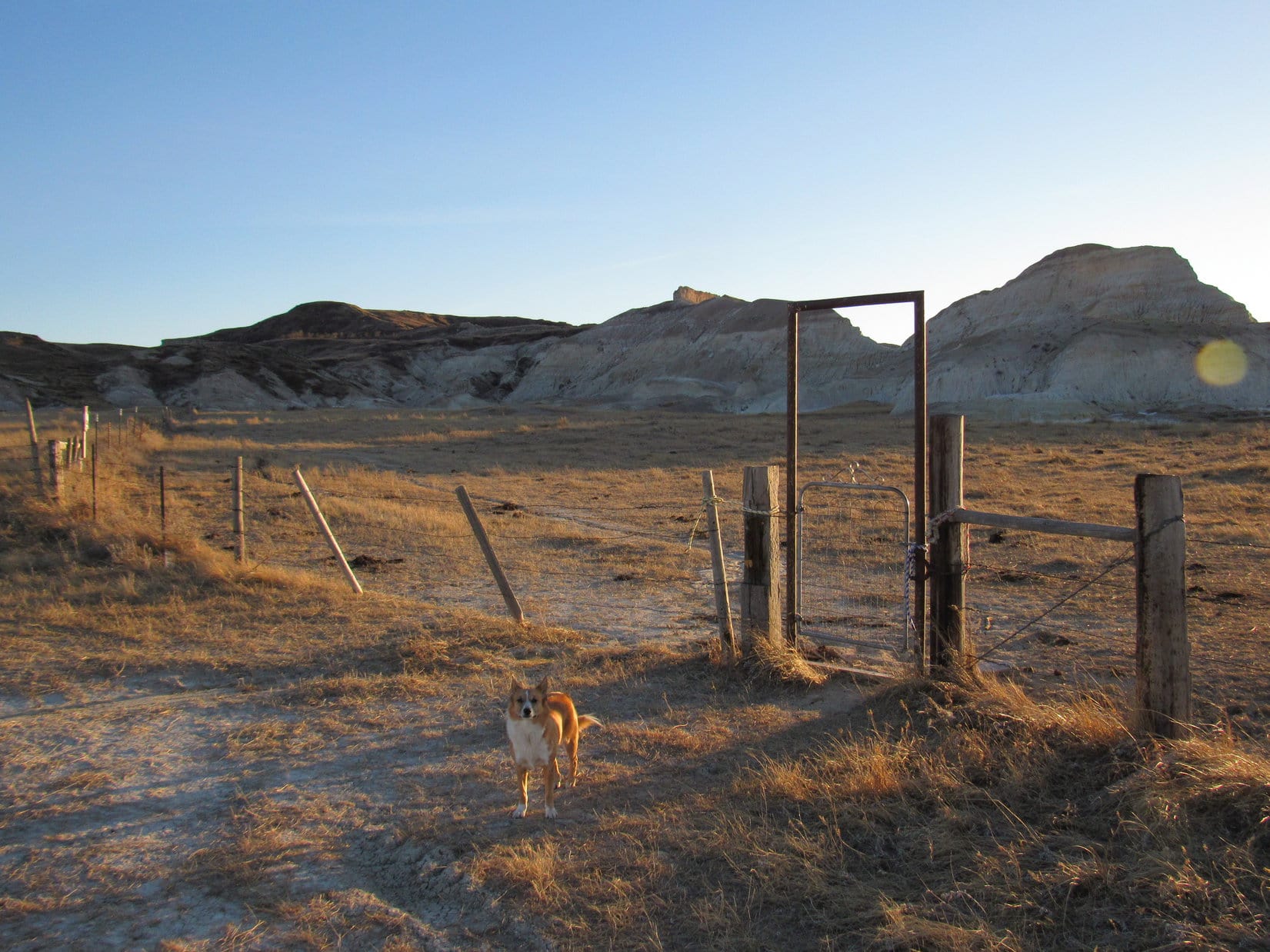
For a few minutes, SPHP let Lupe be.  The G6 was parked at the start of USFS Road No. 366.1 near its junction with South Rockerville Road (11:06 AM, 49°F).  While Lupe hid out, SPHP walked over to take a look at Battle Creek.  It wasn’t real big, but did have some flow.  Lupe would enjoy getting a drink out of it now and then, once she got going.

Battle Creek near the junction of USFS Road No. 366.1 and South Rockerville Road.

Even though it was only natural and sensible for Lupe to want to hide until the gunfire stopped, there wasn’t any real danger that she was going to get shot.  She was 3 miles SSE of an area where people often target practice.  It would go on all day, on a nice day like today.  Lupe would just have to get used to it.

SPHP returned to the G6, and opened a door hoping Lupe was ready to go by now.  No way!  She wasn’t leaving her G6 fortress, not even with SPHP’s encouragement.  For a few minutes, Lupe moved from seat to seat trying to stay as far away from SPHP circling the G6 as possible.  Finally, SPHP managed to get her out.

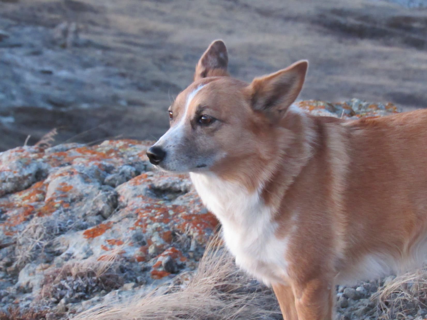
Lupe wanted to get back in, but the doors of the G6 were now shut.  SPHP started up the road.  Reluctantly, Lupe followed.  At least she felt a little safer close to SPHP.  All day long she was like SPHP’s shadow.  Hardly any running around or exploring on her own, she just stuck to SPHP like glue.  Now and then a squirrel managed to get her attention, but not very often.

Reluctantly or not, Lupe was on her way.  Lupe and SPHP followed No. 366.1 NW up Tepee Gulch.  The whole area was very pretty.  Battle Creek flowed down a forested valley hemmed in on both sides by big rock formations.  There were quite a few fords across the creek, but it was easy to just leap over it.

Lupe in Tepee Gulch.

Lupe’s first peakbagging goal of the day was Echo Peak (4,790 ft.).  Echo Peak was only about one mile NNW of the G6, so after Lupe had gone about 0.5 mile along USFS Road No. 366.1, it was time to start looking for it.  Down in Tepee Gulch, it was hard to tell which hill might be Echo Peak.  Lupe would have to start climbing.

Lupe and SPHP left USFS Road No. 366.1, crossed Battle Creek and headed N up a side road marked No. 6501.  This ATV trail was very rough and deeply rutted, but gained elevation as it left Tepee Gulch passing between two hills.  When the road looked like it was soon going to level out, Lupe turned NW up a side ravine.  She went only a little way up the ravine before turning N to climb up onto the SE end of a ridge.

The ridge was so heavily forested, it wasn’t possible to see anything except trees.  SPHP thought Echo Peak still had to be somewhere off to the NW, so Lupe started off in that direction.  Within just a few minutes, SPHP spotted a relative high point toward the W where there was a rock outcropping.  Lupe and SPHP went over to investigate.

Lupe reaches the big rock outcropping at the first high point. Echo Peak is seen on the R. Way in the distance on the L is a side view of Mt. Rushmore.

Off to the W was a somewhat higher forested hill.  It didn’t look terribly impressive, but SPHP was pretty certain it must be Echo Peak.  There was no direct route to it, but it appeared that Lupe could continue NW and then turn SW to get over there.

More interesting than Echo Peak, was the view to the SW.  Off in the distance was a side view of Mt. Rushmore (5,725 ft.).

Mt. Rushmore (R) from the high point E of Echo Peak. Photo looks SW using the telephoto lens.

Lupe and SPHP left the first high point continuing NW through the forest.  Pretty soon, Lupe reached another high point where there was another rock formation, but the views weren’t as good as from the first high point.  However, it did look pretty easy to traverse a little saddle to the SW to reach Echo Peak.

Lupe among the rocks at the 2nd high point NE of Echo Peak. Photo looks E.

This second high point also featured some more big rocks a bit farther NW.  Lupe went to check them out.  There were partial views off to the NW, but for a really clear view, Lupe would have to climb up on the scariest high rocks.  Lupe and SPHP decided to skip it, and just continue on to Echo Peak.

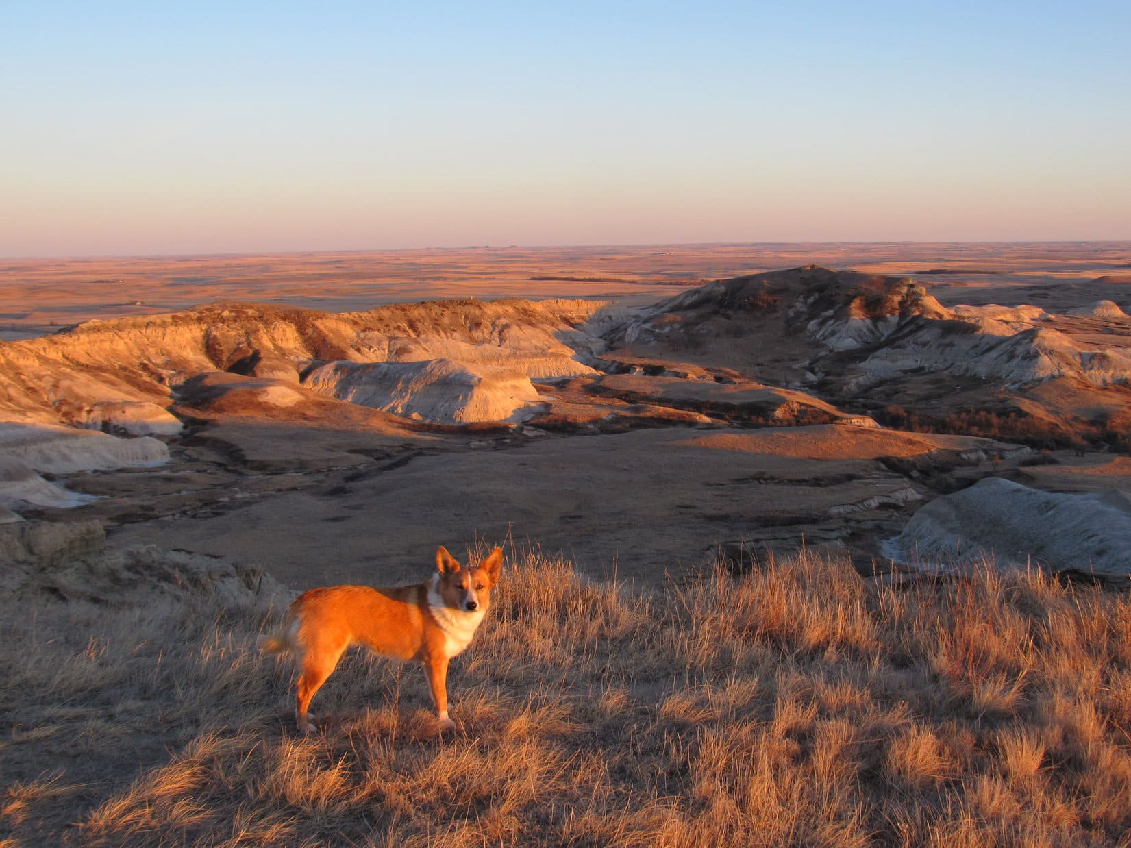
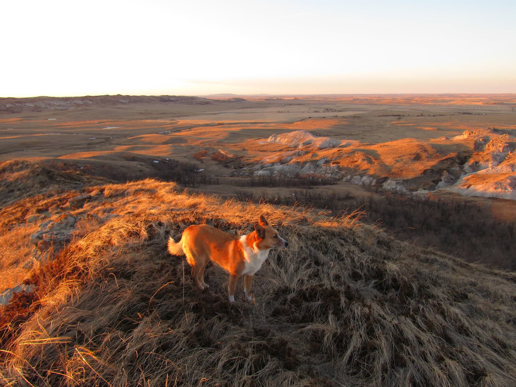
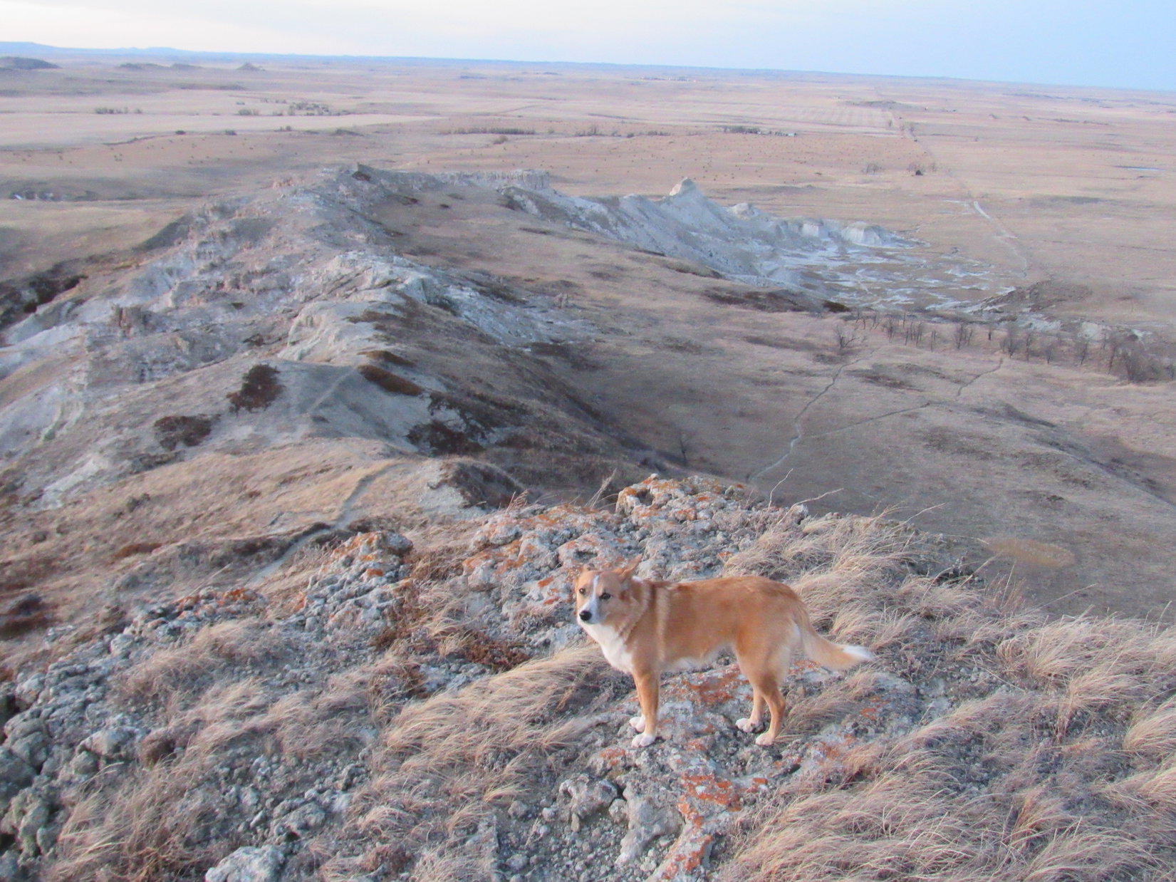
It didn’t take long for Lupe and SPHP to get there.  The mountain had looked so heavily forested from the first high point, SPHP wasn’t at all certain there would be any decent views from Echo Peak, but it turned out there were.

Lupe reaches the summit of Echo Peak! Echo Peak featured some nice views after all. This photo looks S.
Silver Mountain from Echo Peak. Photo looks NW.
A beautiful American Dingo surveys the situation from up on Echo Peak. Photo looks NE.
Silver Mountain (L) and Boulder Hill (R) from Echo Peak. Photo looks NW.
Silver Mountain (L) and Boulder Hill (R). Photo looks NW.

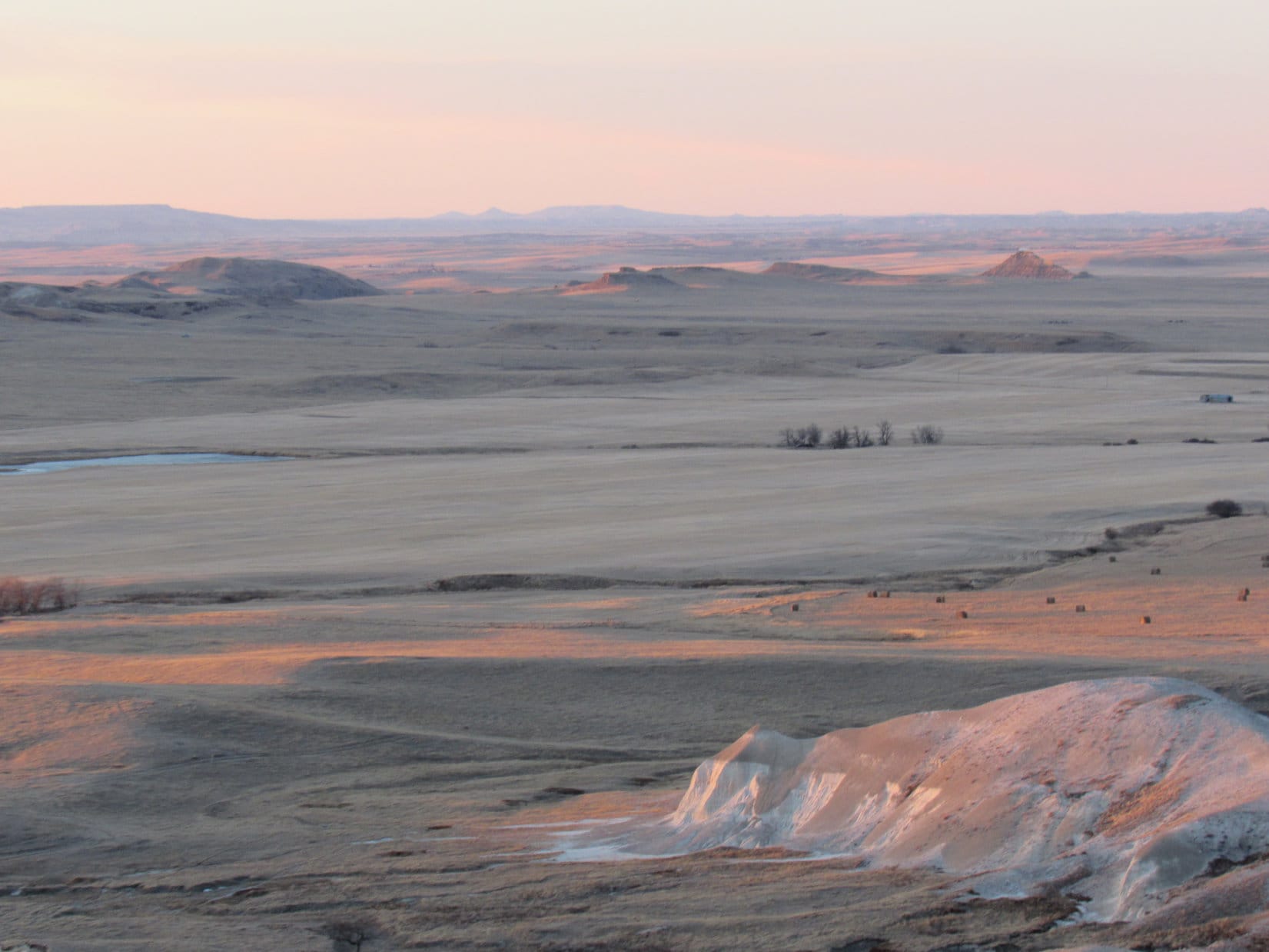
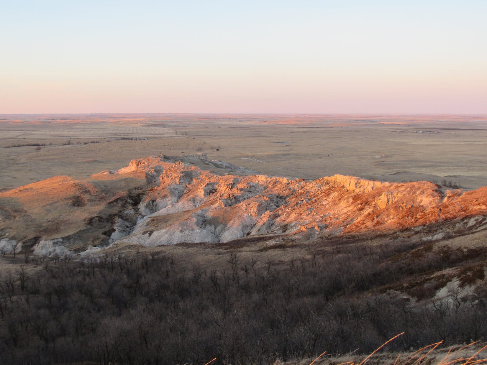
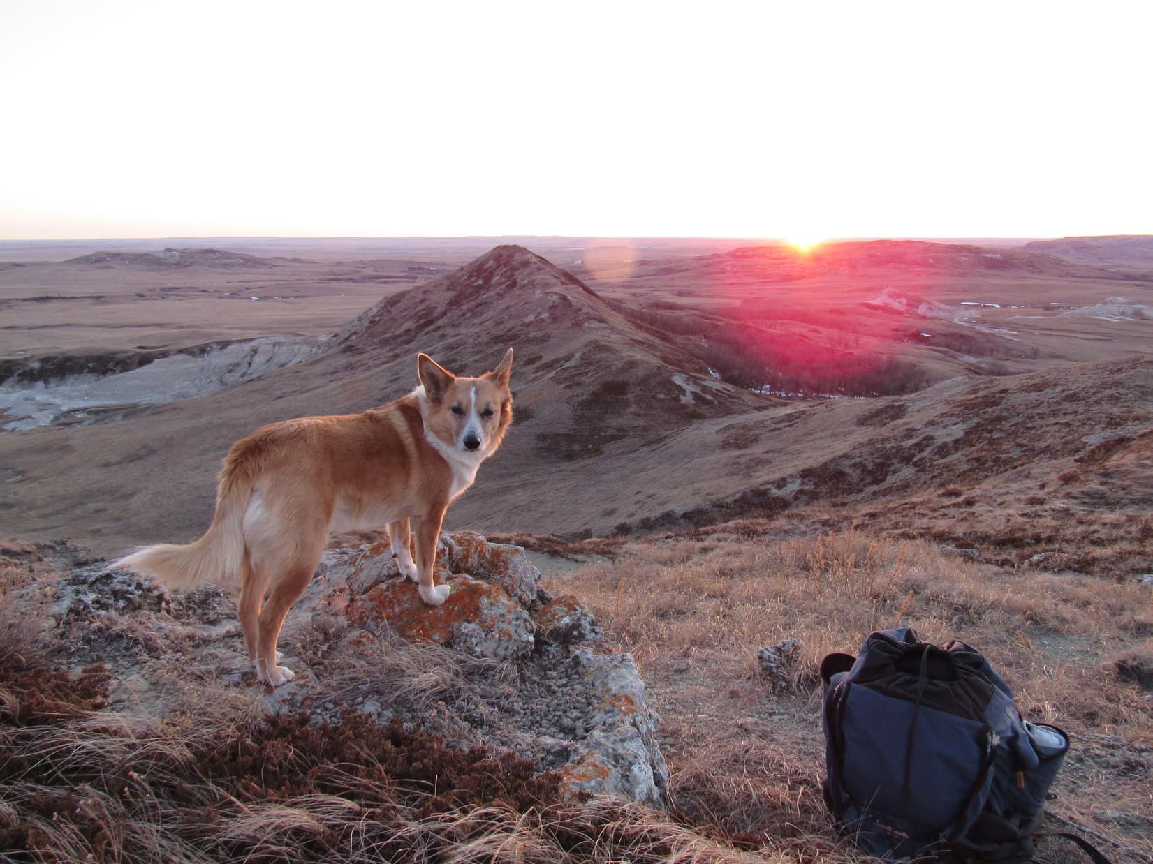
Lupe could see quite a long way to the S and SE from the top of Echo Peak.  There was another nice view of Silver Mountain (5,405 ft.) and Boulder Hill (5,331 ft.) off to the NW.  The most important view, though, was off to the W.  Lupe had two more peakbagging objectives in that direction.  Until SPHP saw the view to the W, it still wasn’t even certain yet that Lupe was actually on Echo Peak.

She was!  Off to the W were the two mountains SPHP had hoped to see – Tepee Peak (4,800 ft.) and Eagle Mountain (5,254 ft.).  There was no doubt now that Lupe was on Echo Peak.

Eagle Mountain (Center) and Tepee Peak (R) from Echo Peak. Photo looks W.
Tepee Peak is in the foreground on the R. Eagle Mountain dominates on the L. The view of Eagle Mountain was a bit concerning. Would Lupe be able to climb that big rock formation to the top? Photo taken with the telephoto lens looking W from Echo Peak.

Tepee Peak is almost the exact same elevation as Echo Peak, and looked like an easy climb.  Eagle Mountain, however, was 450 ft. higher.  The huge rock outcropping at the N end was concerning.  It didn’t look like anything Lupe could climb.  Maybe there was a way up, though.  Lupe and SPHP would just have to check it out when Lupe got there.

After a short break on Echo Peak, Lupe and SPHP started NW on the way to Tepee Peak, Lupe’s next peakbagging objective.

A final look at the summit area of Echo Peak before Lupe departed. Photo looks E.

Going NW down Echo Peak started out just fine, but as Lupe lost elevation, the mountain got steeper and steeper.  SPHP decided it looked easier going SW instead.  It was better, but still pretty steep for a while.  Lupe lost about 350 ft. of elevation going down Echo Peak before she reached Battle Creek again down in the valley.

Lupe hopped into Battle Creek right away for a good long drink.
Battle Creek in the valley between Echo and Tepee Peaks. Photo looks N.

After getting a good long drink out of Battle Creek, Lupe crossed it and started climbing Tepee Peak from the E.  Parts of Tepee Peak were not nearly as heavily forested as Echo Peak had been.  There were signs of fire on some of the trees.  Fewer trees meant better views.  The best view as Lupe climbed up the E slope was of Silver Mountain and Boulder Hill to the N.

Looking N at Silver Mountain (L) and Boulder Hill (R) from the upper E slopes of Tepee Peak.

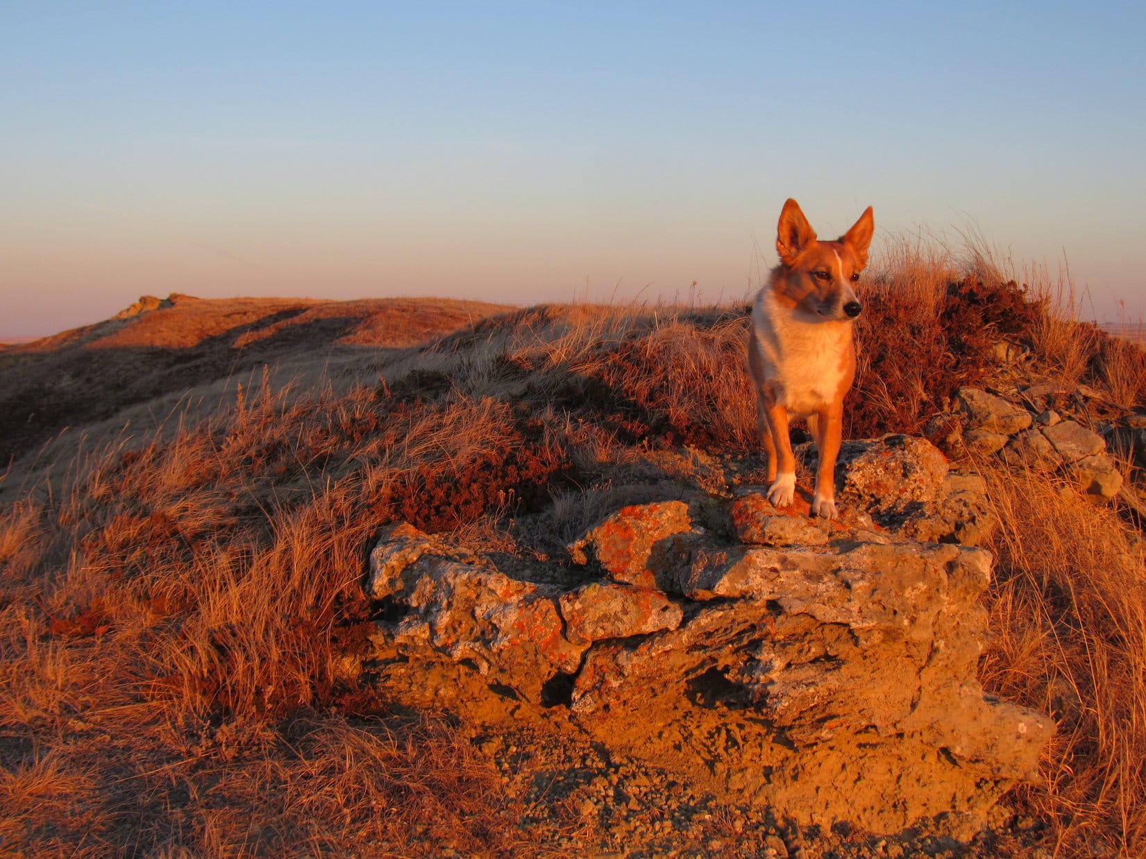
As anticipated, it was a pretty easy trek up to the top of Tepee Peak.  Lupe approached the summit from the NE.  The top of the mountain was forested to the N, but there were good views in other directions.

Lupe and SPHP shared a chocolate coconut granola bar, while enjoying the views.  The big rock formation at the summit of Eagle Mountain didn’t look any easier to climb from here than it had from Echo Peak.

Lupe on the summit of Tepee Peak. Harney Peak is seen in the distance to the SW.
Lupe on the summit of Tepee Peak. Harney Peak (7,242 ft.) (L) is seen in the distance to the SW.
Eagle Mountain from Tepee Peak. Photo looks W.

Echo Peak (L) from Tepee Peak. Photo looks E.
Echo Peak is in the foreground just R of center. Photo looks E.

Lupe had now completed 2 of her 3 peakbagging objectives for the day, Echo Peak and Tepee Peak.  Her most challenging objective, Eagle Mountain, was still ahead.  SPHP was really beginning to have doubts whether Lupe could actually reach the true summit of Eagle Mountain.  Even if she couldn’t, though, it was clear she could get pretty close easily enough.

There wasn’t an easy way down off Tepee Peak going W.  It was just too steep in that direction.  Lupe and SPHP went down heading SE.  Lupe had to lose quite a bit of elevation before reaching the valley to the S.  Once she got there, she turned NW and started following a faint road up to the saddle just W of Tepee Peak.

When Lupe reached the saddle, there were barbed wire fences.  A camper could be seen parked a short distance ahead among the trees.  Lupe was more interested in the 4 deer that scampered away up the barren hill to the W.  She had to stay and wait for SPHP, though.  SPHP was busy picking up beer cans and a couple of broken bottles.  Beer drinkers are the messiest and most adventurous people alive.

From the saddle just W of Tepee Peak, Lupe and SPHP climbed up along the mostly barren rocky ridge line.  SPHP lifted Lupe over one dangerous downed barbed wire fence.  There must have been a considerable amount of private property in this region.  Lupe and SPHP started seeing private homes and cabins down in the valley to the N, and later on to the W.

Lupe crossed two good gravel roads.  From the second and higher one, Eagle Mountain was now looming close to the NW.  It still didn’t look encouraging.

Near the 2nd and higher gravel road, Eagle Mountain loomed just to the NW.
That summit block just didn't look encouraging. Photo looks NW.
That summit block just didn’t look encouraging. Photo looks NW.

Lupe crossed the second good gravel road and followed a steep jeep trail up the SE slope of Eagle Mountain.  The jeep trail ended before reaching the top.  Lupe and SPHP continued climbing.  Lupe’s first objective was the high point at the S end of Eagle Mountain.  It clearly wasn’t going to be as high as the summit block at the N end, but it wasn’t all that much lower.  It might be as high as Lupe could get.

Lupe reaches the high point at the S end of the summit ridge on Eagle Mountain. Photo looks SSE.

When Lupe reached the high point at the S end of the summit ridge, the situation didn’t look any more encouraging.  The summit ridge wasn’t all that long, but it was quite rocky, and not very wide.  After spending a little time relaxing at the S end, it was time for Lupe to go N.  Lupe had often found that there were ways up rock formations that looked pretty imposing from most directions.

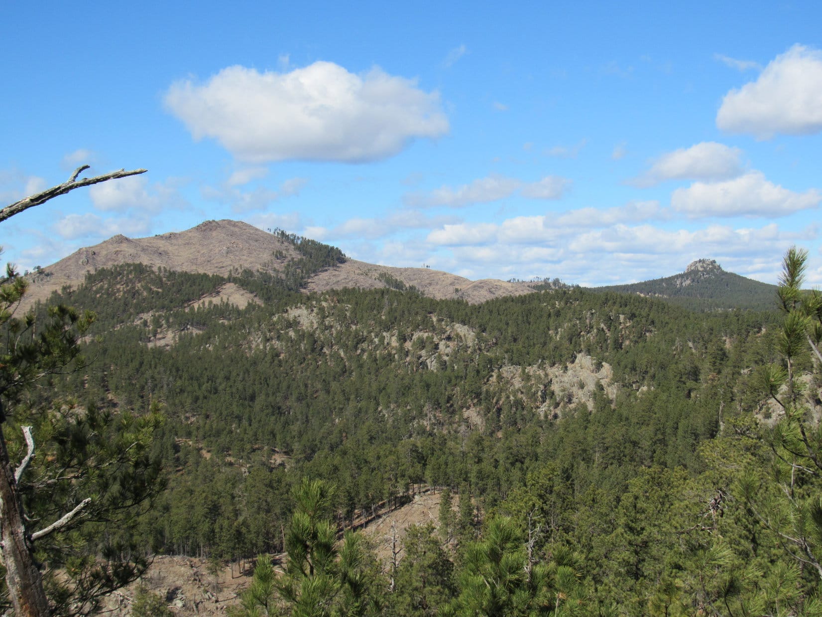
Lupe came to a place where there was a nice glimpse to the W toward Hardesty and Samelius Peaks, and Mount Warner.

Hardesty Peak (5,562 ft.) (L), Samelius Peak (5,856 ft.) (Center) and Mount Warner (5,889 ft.) (R) from Eagle Mountain. Photo looks W.

Lupe lost a little elevation as she followed the summit ridge N.  She came to a rocky spire that forced her around to the W.  When Lupe got around the rocky spire, she was confronted by Eagle Mountain’s N summit block.  It was probably 25-30 ft. higher than where Lupe had been at the S end of the mountain.

Lupe with a crazed look in her eyes as she nears the N summit block on Eagle Mountain. “You don’t seriously expect me to climb that thing, do you SPHP?” Photo looks N.

Lupe and SPHP reached the S end of the N summit block.  Any decent rock climber could probably go right on up, but it looked beyond anything Lupe and SPHP could tackle.  The E side of the summit block was even worse, a sheer drop that was completely out of the question.  However, it looked like there might possibly be a route up from the W.

Lupe and SPHP scrambled over to the W side of the summit block.  It turned out the possible route up was an illusion.  There was no way up.  A glance toward the N didn’t look the least bit promising either.  Lupe wasn’t going to get to the true summit of Eagle Mountain.  That success would have to await some adventurous rock climber on another day.

Eagle Mountain summit block from the SW.
From the W.
From the W.
From the S.

So, that was it.  No Eagle Mountain summit success for Lupe, although she probably got within 25 feet of the top.  Well, 2 out of 3 peakbagging goals accomplished wasn’t too bad.

Lupe seemed cheerful enough.  She was as bright-eyed and happy as ever.  Exploring Eagle Mountain had still been an adventure!  Lupe and SPHP returned to the S end of the summit ridge for a final look.  Then it was back down the SE slopes the way Lupe had come up.

Silver Mountain from along the Eagle Mountain summit ridge. Photo looks NNE.
Looking SE from the SE slopes of Eagle Mountain.

Lupe and SPHP followed the same route back until Lupe was getting close to the saddle area just W of Tepee Peak.  There, she left the ridgeline, and headed SE down into a little draw filled with young aspens.  SPHP lifted her over the dangerous downed barbed wire fence again.

Silver Mountain from the SE slopes of Eagle Mountain. Photo looks N.
Tepee Peak from the aspen-filled draw. Photo looks NE.

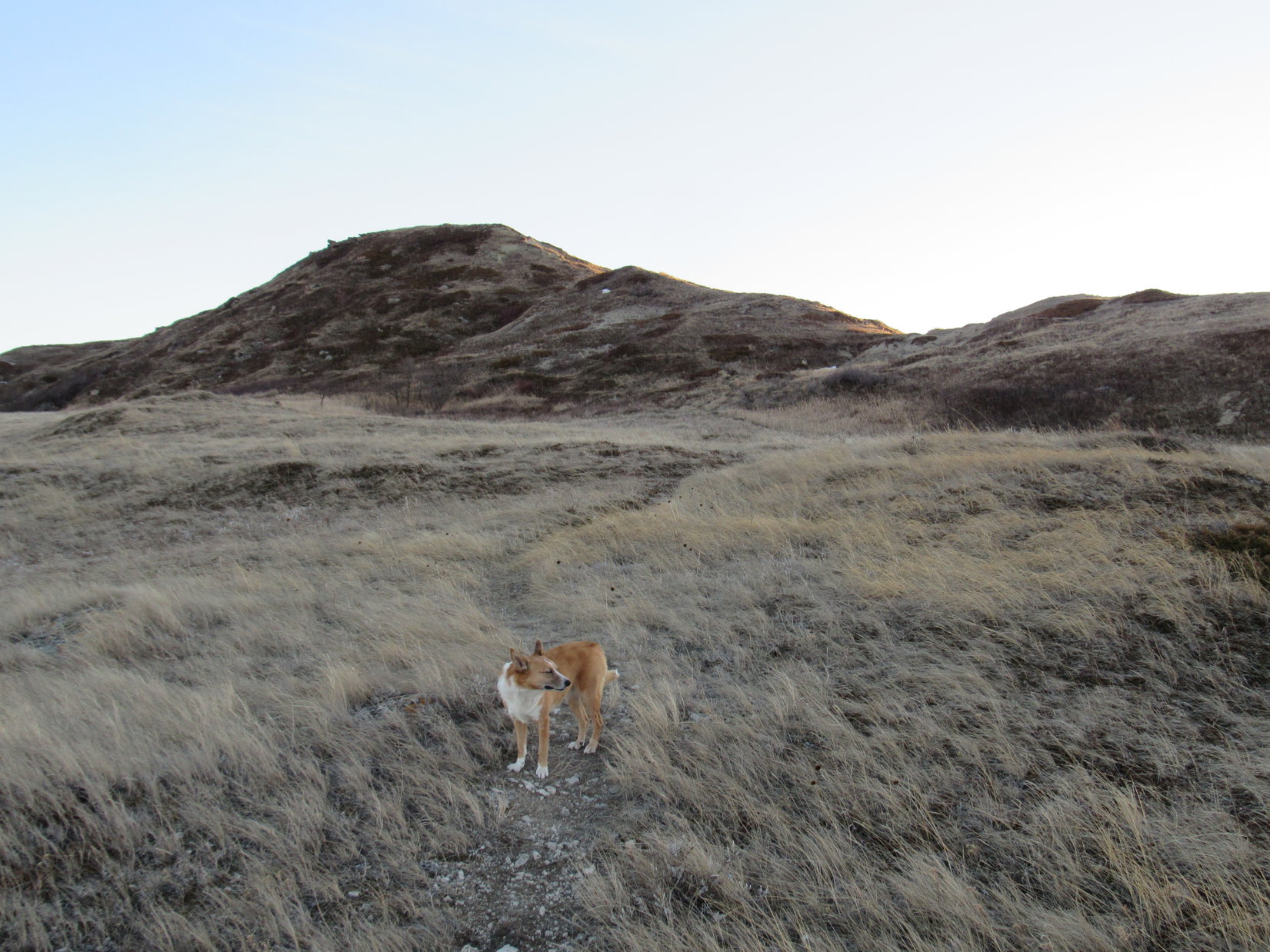
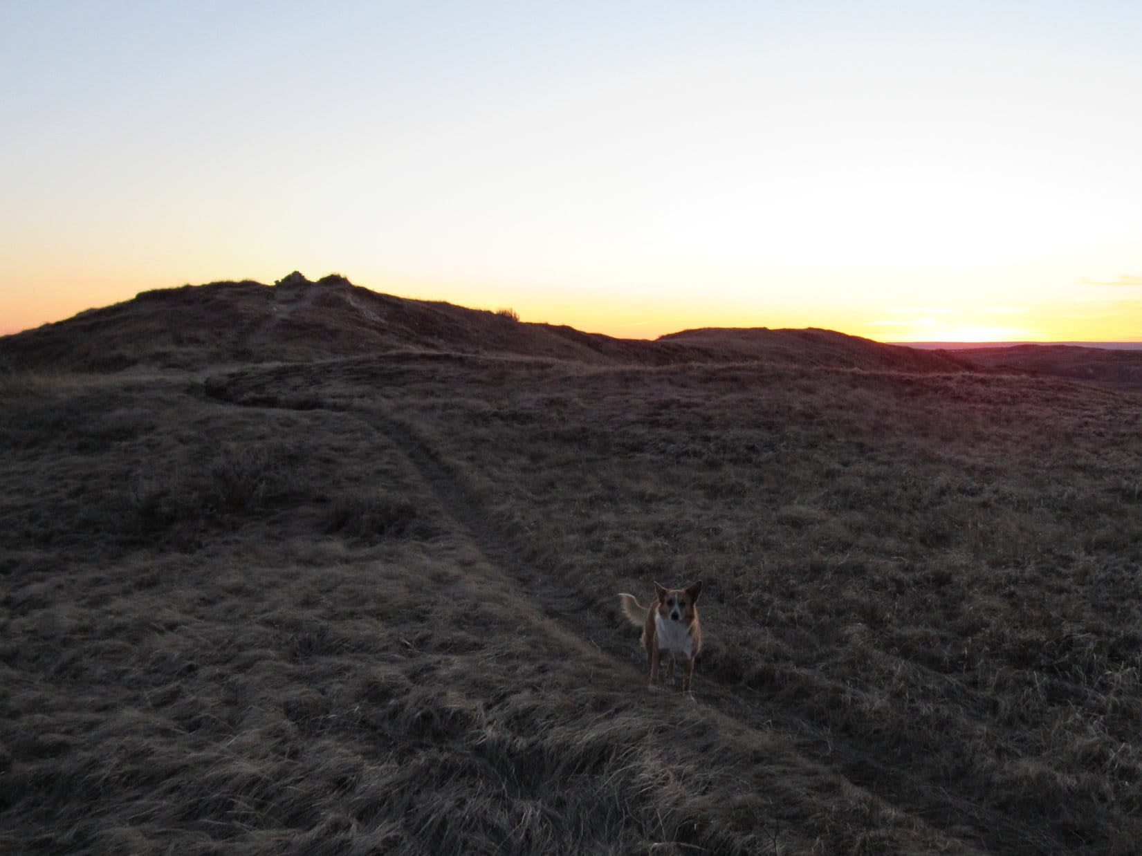
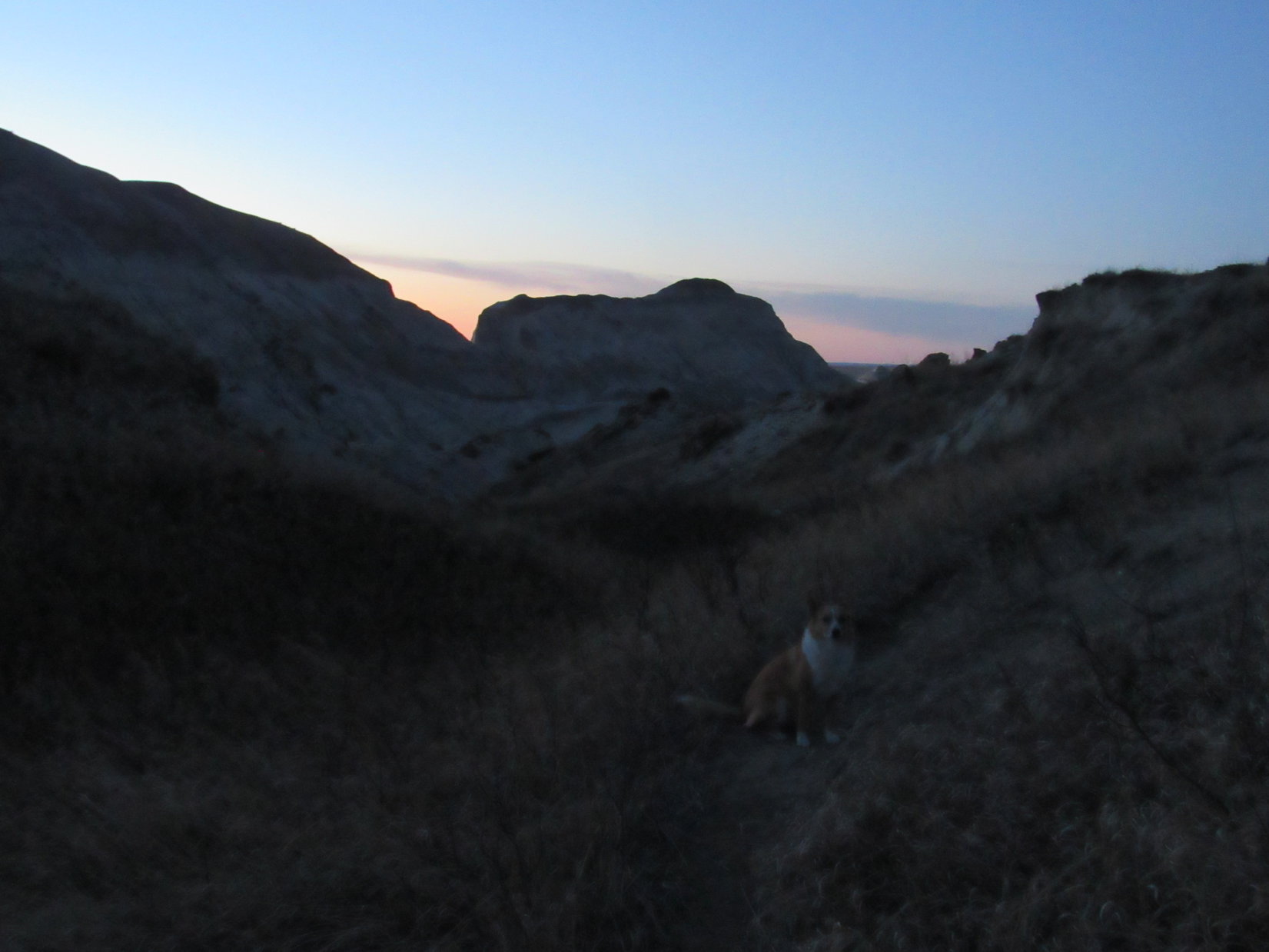
For Lupe the best part of the day was just beginning.  The sun was getting low, and the gunfire was finally starting to taper off.  She was now going away from it, and down where she couldn’t hear it as clearly.  Lupe resumed her normal behavior on a Black Hills expedition.  She ran through the forest, going up and down the hills, sniffing and checking for squirrels.

SE of Tepee Peak, Lupe and SPHP reached Battle Creek again.  As Lupe continued downstream, she came to a road which started as a rough trail, but gradually improved.  The quiet valley was beautiful in the fading light.  Lupe found several really nice dispersed camping sites along Battle Creek.  SPHP collected plenty of Lupe Treasures in the form of beer cans and other trash.

Battle Creek led Lupe back to USFS Road No. 366.1 again.  Now it was an easy stroll back to the G6 (5:34 PM, 41°F).  The reluctant American Dingo had made it to the top of Echo and Tepee Peaks, but Eagle Mountain still belongs to the eagles.

Links:

Next Black Hills Expedition               Prior Black Hills Expedition

Want more Lupe adventures?  Choose from Lupe’s Black Hills Expeditions Adventure Index or Master Adventure Index.  Or subscribe free to new Lupe adventures.

White Butte, North Dakota State High Point (2-26-16)

This time Lupe was going to climb White Butte (3,506 ft.), the highest point in North Dakota (3,506 ft.), for sure!  Back on June 25, 2014, Lupe and SPHP had come by on the way home from Lupe’s Dingo Vacation to the Kabekona Lake cabin in northern Minnesota, but SPHP had not been able to figure out how to gain access.  SPHP was better prepared now, after reading trip reports and printing out topo maps from Peakbagger.com.

White Butte is located 6.5 miles S and 1 mile E of the tiny town of Amidon (pop. 20 in the 2010 census) in Slope County, roughly 45 miles NE of the SW corner of North Dakota.  S of Amidon, Hwy 85 comes within 3 miles directly W of White Butte, but there is no easy access from the W.

To get to White Butte, Lupe and SPHP left Hwy 85 two miles E of Amidon turning S on a good, wide, gravel road.  (There is a green and white street sign on the N side of Hwy 85 identifying this as “140 Ave SW”.)  The road went straight S five miles to a crossroad marked at “69 ST SW”.  White Butte was visible from this intersection about 2 miles to the SW.

White Butte (R) is seen 2 miles off to the SW upon reaching gravel road "69 ST SW" five miles S of Hwy 85 along "140 AVE SW". Lupe and SPHP took "69 ST SW" one mile W to the start point for Lupe's journey up White Butte.
White Butte (R) is seen 2 miles off to the SW upon reaching gravel road “69 ST SW” five miles S of Hwy 85 along “140 AVE SW”. Lupe and SPHP took “69 ST SW” one mile W to the start point for Lupe’s journey up White Butte.

Lupe and SPHP turned W (R) on 69 ST SW which was a much narrower gravel road, but still in good condition.  69 ST SW went straight W one mile to another intersection.  There was a large old mailbox with crude fading lettering on it saying “White Butte turn here”, and a nice place for a couple of vehicles to park just beyond it.  SPHP parked the G6 here at 4:27 PM (56°F).

Lupe reaches the big old mailbox at the intersection 1 mile W of AVE 140 SW along 69 ST SW. This is where her journey up White Butte began. Trip reports on peakbagger.com mention a mailbox where a donation could be placed to thank the landowner for allowing high pointers access to White Butte. SPHP was prepared to leave a donation in the mailbox, too, but found it was padlocked shut. Photo looks SW.

From this intersection where the big old mailbox was, a gravel road curved SW toward a farmstead.  Another gravel road in similar condition to 69 ST SW went straight N.  Lupe, however, needed to go S another 1.5 miles to get to White Butte.

Fortunately, there was also a dirt road going straight S from the mailbox along the W side of a fence line.  This road was basically just an old pickup truck route through a pasture.  Not something SPHP thought it would be wise to take the G6 over, besides which there was an elaborately painted “Road Closed” sign.

Lupe about to head S on the road to White Butte. Those dark spots are hay bales, not cows, much to Lupe's disappointment.
Lupe about to head S on the road to White Butte. Those dark spots are hay bales, not cows, much to Lupe’s disappointment.

The weather was unbelievably beautiful for February in North Dakota, in the mid 50’s °F with a light W breeze, as Lupe set out heading S along the old pickup truck route through the pasture.  SPHP’s only concern was whether Lupe could get to the top of White Butte before sunset.

There was still some time before sundown, but not an awful lot.  SPHP tried to hurry along.  Lupe was unconcerned.  She enjoyed trotting along on and off the road, while sniffing around.  She liked being out of the G6, but was disappointed that there weren’t any cows around.  The prospects for finding any squirrels looked pretty bleak, too.

After going nearly a mile S, Lupe came to a stand of big old leafless cottonwood trees just W of the dirt road.  A short distance beyond the cottonwoods was a dilapidated old building.  Lupe was at least half way to White Butte as she went on by.

Lupe about 0.75 mile N of White Butte. Photo looks S.

A little S of the dilapidated old building, Lupe came to a very small hill where another fenced-off field started on the W side of the road.   From here on, the road continued S between barbed wire fences on both the E and W sides.

Lupe went over the small hill down into an area where the ground was pretty soft.  Just W of the dirt road, and at virtually the same level, the field looked just plain swampy.  Clearly, it wouldn’t take much rain or melting snow to turn the entire area into a sea of mud.

Lupe was getting really close to White Butte now.  The road S ended at another fenced field directly ahead.  There were “No Trespassing” signs on the fence.  However, there was a gate near the end of the road giving access to the field to the W.  Lupe and SPHP went through the gate.

Past the small hill there were fenced fields on both sides of the road. Looking S at White Butte.
Lupe and SPHP went through this gate. The single track trail to the top of White Butte started on the other side of the gate. Photo looks SSW.

On the W side of the gate, a fairly well-traveled single track trail went S along the W side of the remaining fence line.  By now, it wasn’t much farther to a hill where Lupe’s climb would begin.  As Lupe got close to the hillside, there were some interesting badlands type formations off to the W.

The trail left the fence line to go around the W side of this first hill.  There was a short section of trail that climbed fairly steeply up barren, crumbly badlands type terrain before reaching a small grassy area on top of the hill.  The trail angled back E close to the fence again, traversed a little ravine and then turned sharply W.  There was a dangerous downed barbed-wire fence following just S of the trail along here.

When the trail turned S again, SPHP picked Lupe up to get her over the dangerous barbed-wire fence.  Just ahead, the trail divided as it crossed a larger grassy area.  There was a small grove of trees mostly toward the left (E) track.  The two tracks met up again before climbing up onto the ridge extending down to the N from the E end of White Butte.

Lupe going up the W side of the first little hill. She is on a short section of steep trail. Photo looks SSE.
Lupe now past the dangerous downed barbed-wire fence. She climbed up to the ridge line at the low saddle shown on the R. This is a very easy route up White Butte. Photo looks SSW.
Here Lupe is already past the dangerous downed barbed-wire fence. She climbed up to the ridge line at the low saddle shown on the R. This is a very easy route up White Butte. Photo looks SSW.

There was a very short steep stretch of trail where there was some ice just before Lupe reached the crest of the ridge line, but Lupe and SPHP were soon past it without any problem.  Just N of where Lupe reached the top of the ridge, there was a little rise.  From the rise, there was a great view of the rest of the ridge extending off to the N.

Lupe’s route up along the trail was really quite easy.  Trying to get up on the ridge line farther N would have made for a trickier ascent.  Looking back to the S, the single track trail went up the W side of the next big hill onto the high ground NE of the summit.

Lupe on the little rise just N of where she gained the ridge line. The fence line Lupe followed to get here is seen way down on the prairie on the R.
Lupe on the little rise near where she gained the ridgeline. Photo looks S at the last hill up to the high ground near the summit. The trail went up along the W (R) side of the hill on the L.

Now on the N ridge, Lupe went S following the trail up the last big hill.  SPHP hadn’t really checked the maps carefully, and wasn’t sure how much farther the summit was to the SW.  It wasn’t far at all.  In just a few minutes, Lupe was standing on top of White Butte!

Lupe on top of White Butte, the highest point in North Dakota! Photo looks NE.
The USGS Benchmark on White Butte.

At the summit were a number of items of interest.  There was a cairn, a USGS Benchmark, a green metal box containing a red-covered notebook serving as a registry log and lots of pens, a long wooden box containing a hand trowel, and a metal marker for Lawrence P. Buzalsky (1935-1990).  SPHP entered Lupe’s name into the registry log.White Butte registry log, 2-26-16Grave marker on White Butte, ND 2-26-16Lupe had made it to the top of White Butte 20 minutes before sunset.  After entering her name in the registry log, there was time for Lupe and SPHP to wander around taking a good look at the splendid 360° views.

Looking NE. The path Lupe came up is seen on the right.
Looking N.
Looking N.
Looking SE.
Looking SE.
Looking S.

Lupe and SPHP left the absolute summit to explore the summit ridge to its western terminus, which wasn’t far off.  The views to the W were best from here.  Lupe and SPHP watched the sun sink slowly behind long desolate ridges.

Looking NW from the W end of the summit ridge.
Looking E back at the summit, which is seen on the L.
Looking SW at High Point 3484.
Looking NW using the telephoto lens.
The N ridge of White Butte in the last rays of sunlight. Looking NE from the W end of the summit ridge.
Looking W.
Looking W.
Looking SW again at High Point 3484 as the sun is on the horizon.
The sunset was unspectacular. There just weren't many clouds around to show off the colors. Use of the telephoto lens was necessary to even capture this little bit of orange glow.
The sunset was unspectacular. There just weren’t many clouds around to show off the colors. Use of the telephoto lens was necessary to even capture this little bit of orange glow.

Once the sun went down, it was time for Lupe to start back to the G6.  She returned briefly to the true summit along the way.  From there, Lupe and SPHP wandered over to the E end of the summit ridge for another look before leaving White Butte.

Looking SW back at the summit as Lupe starts the journey back to the G6.
Looking SE from the E end of White Butte.
Lupe on the very NE end of the summit ridge. Photo looks N. The divided part of the trail is seen clearly down on the grassy area to the R.
Lupe just before heading down.
A final look to the W before Lupe's descent.
A final look to the W before Lupe’s descent.

The dead tan of the grasslands in late February added to the sense of barren remoteness seen in every direction from White Butte.  White Butte felt desolate and forlorn.  Still, what Lupe had seen from the top was a beautiful, wild and largely unspoiled part of the world.

Lupe’s trip to White Butte had been a very enjoyable success!  If she had arrived a little bit earlier in the day, it would have been fun to go SW over to High Point 3484, and maybe spend some time poking around on the N ridge for a little while.

As it was, the light was fading quickly as Lupe headed back down the trail.  More ranch lights appeared scattered across the prairie than SPHP would have expected.  Stars twinkled faintly in the sky.  Lupe and SPHP enjoyed a beautiful trek back across the prairie following the fence line N.  Orion was shining in a dark night sky above White Butte when Lupe reached the G6 at 6:39 PM (43°F).

Just as SPHP was putting the backpack in the G6, Lupe heard the wild dogs.  Coyotes were singing off to the N.  Lupe listened very intently for the few minutes they called to her.  Then she hopped into the G6 for the long ride home.

Lupe on the trail down White Butte at twilight.
Lupe on the White Butte trail at twilight.

Access & Trail Notes:  SPHP found some of the trip reports on Peakbagger.com a bit confusing as to the best access route to White Butte.  There were also mentions in some reports of difficulties avoiding steep terrain.  Lupe and SPHP found the following route to and up White Butte to be very straightforward and easy:

The tiny town of Amidon is near the W end of a 9 mile stretch of Hwy 85 that goes E/W.  One mile E of Amidon is a road off Hwy 85 that goes straight S toward White Butte.  There is a cemetery here by the highway on the SE corner of the junction.  A sign says this road is closed, and the road to White Butte is one mile E.  The sign is correct.  Do not take the road going S from the cemetery.  (Some who reported a long rough drive to White Butte probably took this road despite the road closed sign.)

Go another mile E on Hwy 85 to the next road going S (2 miles E of Amidon).  There is a green and white street sign on the N side of Hwy 85 at this intersection saying this road is “140 Ave SW”.  This is a good, wide gravel road and the best access route to White Butte, even though there is no sign along Hwy 85 saying so.  Note your vehicle’s odometer reading as you turn S from Hwy 85.  Follow 140 Ave SW going straight S.

Five miles S of Hwy 85 is a much narrower gravel crossroad.  Again there is no sign saying anything about White Butte, but there is another green and white street sign on the SW corner of the intersection saying “69 ST SW”.  Turn W (R) on 69 ST SW and follow it 1 mile to the first intersection where the big old mailbox is on the left.  The roads were perfectly fine to this point.  No high clearance vehicle is needed.

Park just beyond the mailbox and hike the pickup truck route about 1 mile S along the fence line to the gate.  Go through the gate, and follow the obvious trail S and on up to the top of White Butte.  There only a couple of short steep sections on the trail the entire way, and they are pretty easily traversed.  There is nothing dangerous along the way except the downed barbed wire fence part way up that is laying across the trail.  (Perhaps rattlesnakes during warm weather.)

SPHP has no idea why the mailbox was padlocked shut.  Others reported leaving a donation to the landowners as a thank you for allowing access to White Butte, which is on private property.  SPHP intended to, but didn’t since the mailbox couldn’t be opened.

Lupe and SPHP met no one, and saw no activity or lights at the farmstead SW of where the G6 was parked.  Other trip reports which mention encounters with the landowners indicate that they are not opposed to high pointers crossing their property to reach White Butte.  Lupe and SPHP encountered no “No Trespassing” signs posted on any of the land Lupe crossed, although there were some on adjacent fields.

Those who choose to ignore the “Road Closed” sign to follow the pickup truck route S will find it in pretty good shape much of the way to the gate.  Even the G6 could have traversed much of it.  However, if the ground is at all wet, this entire route would be very soft.  Lupe doesn’t recommend trying to climb White Butte during wet weather, or any time when the ground is not either dry or frozen solid.  The whole route would be a miserable mucky mess.

White Butte was a pleasant, easy hike with views well worth the modest effort – a very nice state high point, especially for those who love remote unspoiled places.  Good luck!

Links:

Next Dingo Vacation                            Prior Dingo Vacation

Want more Lupe adventures?  Choose from Lupe’s Black Hills, SD & WY Expeditions Adventure IndexDingo Vacations Adventure Index or Master Adventure Index.  Or subscribe free to new Lupe adventures.