Day 5, Part 1, of Lupe’s 2017 Dingo Vacation to the Laramie Range in Wyoming & Beyond!
What a glorious day! Spirits were soaring as Lupe and SPHP left the Twin Peaks trailhead on Trail No. 618 (7:14 AM, 59°F). The lucky American Dingo was setting off on a 2-day trek to a couple of fabulous peaks she’d seen for the first time a year ago when she’d taken this same trail and climbed Twin Peaks (9,280 ft.).

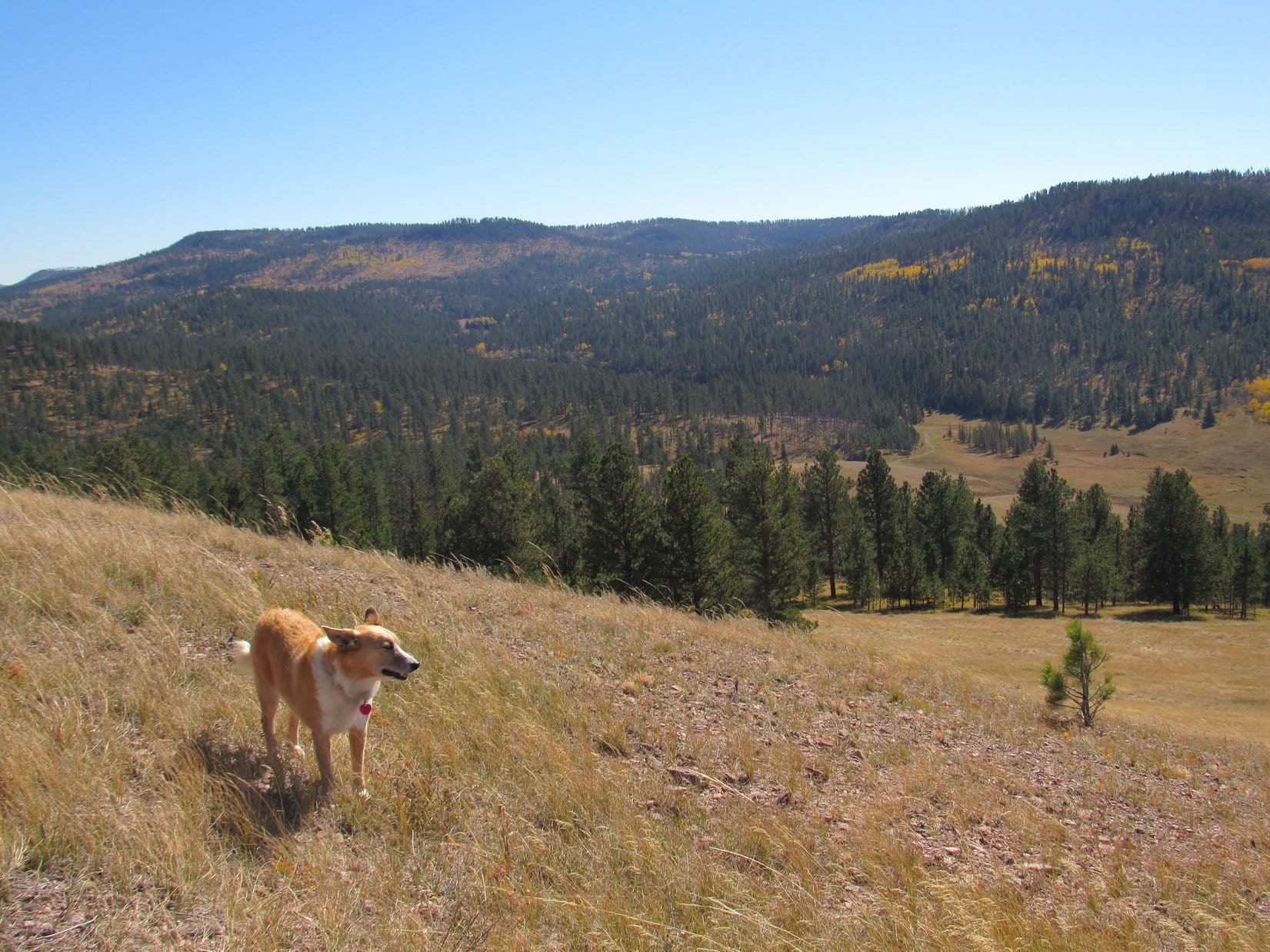
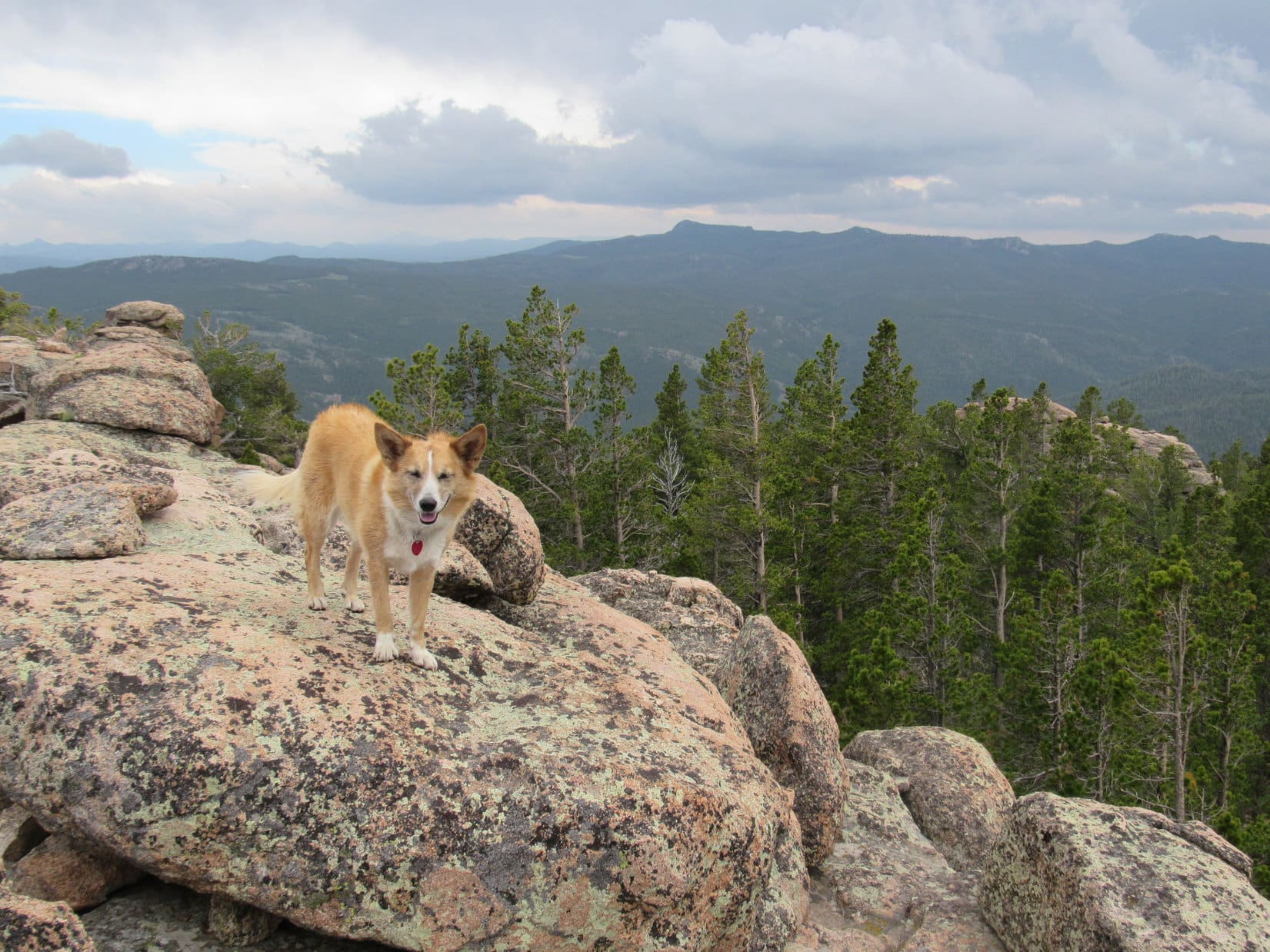
Trail No. 618 started off as an old jeep trail that headed W up a rise. The E end of Lupe’s first peakbagging goal, Squaw Mountain (9,313 ft.), was soon in sight ahead.

Even though the summit of Squaw Mountain was less than 2 miles WNW of the trailhead, Lupe was going to have to travel a lot farther than that to get there. According to the topo map, the easiest way up was from the NW. The plan was to circle more than halfway around the mountain to approach it from those NW slopes.
Loop wasn’t the least bit worried about how far it was to Squaw Mountain. She was just looking forward to a fun time exploring. On this long day in early June, the Carolina Dog would have plenty of time to get to the top of the mountain.
The jeep trail passed over the small rise, then dipped down close to Roaring Fork Creek. Lupe couldn’t resist going in for a cool drink.

Although there were a few muddy areas along Trail No. 618, it never did cross Roaring Fork Creek. Instead, the trail went W up a deep, forested valley staying a little S of the creek. After a mile or so, the jeep trail turned SW heading up a steep slope. At the base of the slope, Trail No. 618 veered off to the R, becoming a single track going down a much smaller slope almost to the edge of Roaring Fork Creek again.
Lupe stayed on Trail No. 618, continuing W up the valley. Now that the wider jeep trail had been left behind, it really did seem like Lupe was in a wilderness.

Lupe knew what to expect, though. She had been this far before. Lupe continued along No. 618, which stayed relatively close to Roaring Fork Creek.
Before long, Lupe arrived at a fence with a sign saying “Please! Close the Gate”. A year ago, SPHP hadn’t seen a gate to close, just the fence, which ended right over the trail next to some rocks. Puzzled, Lupe and SPHP had climbed up onto the rocks to get around the end of the fence.
Not a thing had changed, but this time SPHP had a hunch. Doh! Yes, the entire fence across the trail was a gate. It swung open without much effort.
How about that, Loop? Learn something new every day!
Having a year to think about it helped, aye? Glad you passed the intelligence test this time around, SPHP!
Just call me Einstein and keep going, smart-alecky Dingo.

Eventually, Trail No. 618 moved farther away from Roaring Fork Creek and began to fade. A few cairns helped show the way. Sometimes sticks had been placed across what otherwise might have looked like the route. The surest way of being certain Lupe was still on the trail was to watch for blazes on the trees. Generally there were two blazes, a small upper one with a larger blaze below.


About a mile after it became single track, Trail No. 618 angled SW leaving Roaring Fork Creek behind. SPHP expected it to continue SW to a minor pass about 0.6 mile farther on. A year ago, Lupe had followed this same trail to that pass.
However, after going SW for 0.25 mile, this time the trail turned SE and kept going that way. Something was wrong. SPHP kept expecting the trail to bend back around to the W, but it didn’t. Hmmm. SE was definitely the wrong way.
SPHP had been watching for, and caught a glimpse of, a tall rock formation that SPHP remembered was immediately N of the minor pass. May as well head straight for it. Lupe left whatever trail she was on, going W through the forest. She soon came across another trail, which must have been No. 618, because it went the right way.
Lupe made it to the minor pass.

A year ago, Lupe had gone S from here to climb Twin Peaks, the summit of which was only 0.5 mile away. After a successful ascent, Lupe had come back down to this pass, crossed over No. 618, and proceeded N around the E side of the tall rock formation. She’d gone quite a distance bushwhacking through forests and bogs, but had never made it to the W end of Squaw Mountain before she ran out of time and had to turn back.
Last year’s march through the forests and bogs had been intriguing, but maybe there was an easier way? From up on Twin Peaks, Lupe and SPHP had seen large meadows in the valley W of this pass. SPHP didn’t remember how far N they went, but looking for the meadows seemed like a good idea.
Lupe followed No. 618 going W over the minor pass. The topo map showed the trail continuing W, but Lupe needed to start turning N. Once she’d lost a little elevation, the Carolina Dog left No. 618 heading NW through the forest. From here on, she wouldn’t have any roads or trails to follow the rest of the way up Squaw Mountain.
That suited Looper just fine. American Dingoes love exploring off trail! Lupe raced through the forest sniffing like a Dingo possessed. She soon sniffed her way far enough NW to arrive at one of the big meadows she had seen a year ago from the top of Twin Peaks.

The big meadow meant easy traveling, much easier than going through the forest. SPHP had hoped the meadow would extend a long way N, but was disappointed to see it didn’t go much farther that way. A short stroll brought Loop to the NE corner of the meadow.
Squaw Mountain wasn’t even in sight, but there was no other choice. Without the slightest hesitation, Lupe plunged headlong back into the forest. She traveled N or NNE through rolling terrain slowly gaining elevation along the way.
For close to a mile, there was no sign of Squaw Mountain. Looper had never been here before, and it seemed like she had been wandering the forest for a long time. Presently, though, she saw a creek to the E at the base of an embankment. She scrambled down, leapt over the little creek, and found herself on the W side of another meadow of bright green grass.
To the ENE was another tall rock formation. That had to be the W end of Squaw Mountain! Lupe had just crossed Roaring Fork Creek, which was much smaller up here. Hah! Progress!

The meadow of bright green grass was only a few hundred feet wide, but extended NNE for a long way. Perfect! Just the direction Lupe needed to go from here.
Actually, it wasn’t so perfect. The bright green meadow quickly proved to be mostly bog. The ground was soft, wet and mucky. Standing water was here, there and everywhere. Not good!
SPHP led Lupe across the bog the shortest and driest way possible. Back into the forest! The forest on the E side of the bog was dense, but without much deadfall, so it wasn’t too bad to go through. Lupe had a blast! She thought this place was great. She explored this way and that. Whenever she felt like it, she wandered over into the bog for a drink.


The dense forest was nearly level near the bog, but Lupe eventually got far enough N to where she needed to start angling NE. Once she left the bog behind, the terrain started rising and became rougher. Lupe continued on until she was NW of Squaw Mountain.
This was supposed to be the easiest side of the mountain to go up. Lupe turned SE to begin her ascent, but soon faced a jumble of large boulders on a still densely forested and now much steeper slope. Deadfall timber was more abundant here, too, creating more obstacles. How tough was this going to get? For a while, progress was slow.
After gaining a couple hundred feet, Lupe found the terrain wasn’t as steep as before. Fewer large boulders were in the way. The forest wasn’t as dense, either. SPHP found it much easier to maneuver around.
The topo map showed there was no rush to reach Squaw Mountain’s main E/W ridgeline. Reaching the top of it too far W meant Lupe would have to go over a couple of potentially rough high points. The Carolina Dog would likely have an easier time angling gradually up the N side of the mountain traveling ESE. If she could reach the ridgeline about halfway to the E, that should be perfect. From there, it shouldn’t be too hard to get to the summit at the far E end.
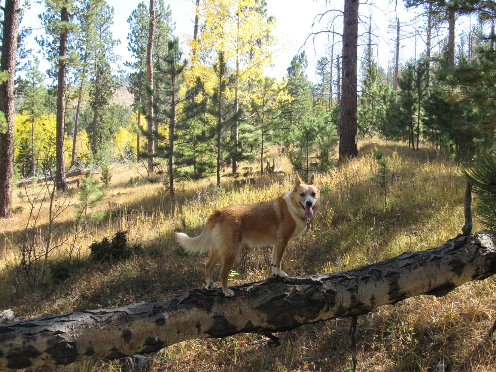
Lupe went E for a little while climbing more slowly, and unexpectedly arrived at the edge of the living forest. Ahead the entire forest had burned. The vast majority of the dead trees were still standing. The burnt forest wasn’t pretty, but it was certainly easier to see the terrain. Loop didn’t care for the dead forest nearly as much as the living one, but it made the trek easier for SPHP.

Lupe arrived at what seemed to be the ridgeline a little E of a tall rock formation. There were a few live trees here. The forest hadn’t burned at all on a nearby slope to the SE which rose steeply toward an unseen high point still far above where Lupe was.

A patch of ground E of the tall rock formation was level and not rocky. Lupe was going to have to camp somewhere tonight. Maybe this wasn’t such a bad place? After pondering for a couple minutes, SPHP decided against leaving the tent and sleeping bags here. It might be hard to find this place again, and it was still quite early in the day.
Lupe pushed on, continuing E or ESE through the burned forest. She did not climb through the living forest leading to the much higher point to the SE. Instead she stayed to the N until she was past it, trying to avoid gaining too much elevation too soon.
The American Dingo was still steadily gaining some elevation, though. After a while, Looper was clearly getting quite high on the mountain. Shortly before reaching the main summit ridge, Lupe found something that delighted her – snow!

Lupe did a little slipping, sliding and sledding on the soft, deliciously cold snowbanks. No doubt it was refreshing. Loop was clearly pleased with the experience and somewhat re-energized.
Squaw Mountain’s main E/W ridge wasn’t far off now. Beyond the snowbanks, Lupe turned SE climbing more aggressively. Reaching the ridge was easy, and she was soon there.
Lupe had reached the main ridge at a great point. She was well past the high point she had skirted to the N. It’s rocky summit was now in view a little off to the W. Lupe had saved some unnecessary elevation gain by going around it. Squaw Mountain’s true summit was still unseen somewhere off to the E, but the path to it looked open and easy.
The main ridge was level and several hundred feet wide here. Toward the N, the trees had burned. However, the S half of the ridge was all living forest. This was a good place to take a break. Lupe found a spot in the shade to lay down. She had her usual fare of Taste of the Wild and water. SPHP dropped the tent and sleeping bags. This place would be easy enough to find again. Maybe Lupe should camp here?

When her break was over, Lupe traveled E along the broad ridge staying near, but not in, the living forest. She soon came to a N/S running line of boulders. Up ahead a much larger rock formation was in sight. Was that the summit? Lupe pressed on toward it.
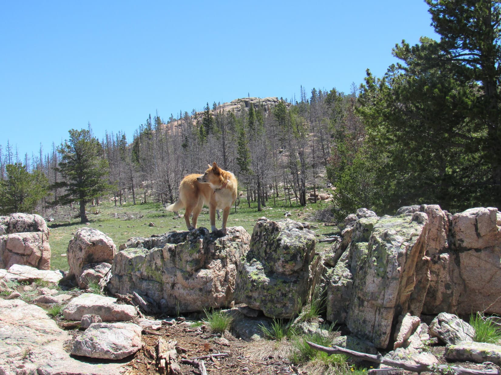
The Carolina Dog climbed a broad, thinly forested slope between the big rock formation and a smaller one to the S. The high point she had seen from the line of boulders wasn’t the summit, but part of a ridge of solid rock that went even higher. Lupe got up on the smaller rock formation for a better look.
A path led toward a wall of rock roughly 40 feet high. The wall appeared to extend NW/SE across the entire main ridge. The high point on the wall might well be Squaw Mountain’s summit, but was there even a way up onto it? Who knew?
No one yet, but Lupe was about to find out! She took the path leading to the wall of rock.

The path ended at the base of the rock wall. There was certainly no way up that Loop or SPHP could manage from here. Lupe headed SE along the wall, looking for some sort of a break providing a route to the top. She came to a place where a big knob of rock sat up on top of the wall. It looked like there was a place right next to it where Lupe could scramble up with a little help from SPHP.

Lupe climbed as high as she possibly could. SPHP then gave her a boost up the last few feet. She’d made it! Lupe was up on the rock wall. SPHP scrambled up after her. A quick look around revealed a couple of surprises.

First of all, SPHP had expected Lupe might be able to simply walk NW back along the top of the rock wall to the highest rocks to claim a peakbagging success. She could go that way, alright, but Squaw Mountain’s summit wasn’t over there. Lupe could now see the summit, but it was some distance away off to the ENE. She still had farther to go.

The second surprise was that if Loop had only gone a little farther SE along the base of this rock wall, there was an opening where she could have easily gotten past it without having to climb up on top. Oh, well! At least that was news she could use on the way back.
There didn’t seem to be any reason to dilly dally around on the rock wall. It was easy to get down off the NE side of it. Once down, Lupe trotted through the forest heading ENE toward the summit. She discovered a couple of fun things to do along the way.
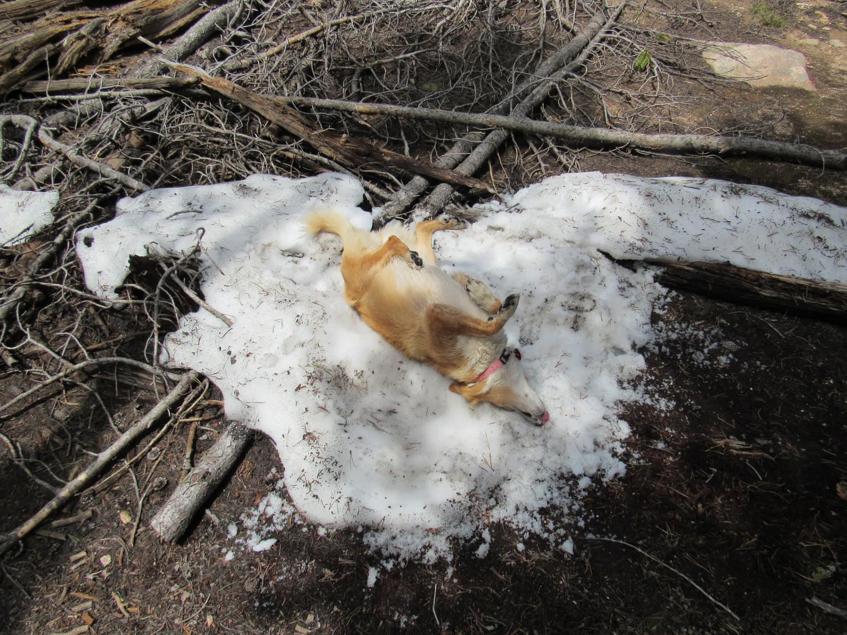
Lupe dug furiously at the base of a tree for several minutes. She didn’t turn up anything, but the American Dingo left the freshly undermined tree looking quite cheerful. Apparently, digging like that had been a good time. Loop also found a few more small patches of snow. They were melting fast, even in the shade. Lupe availed herself of these opportunities to cool off again.
It really wasn’t that far from the rock wall to the true summit, only a few hundred yards. A short, easy scramble up white rocks brought Lupe to the summit of Squaw Mountain (9,313 ft.). At the very top, a white rock about 3 feet high leaned at a steep angle. Loop bounded up in a single leap. Sweet success!

The trek up Squaw Mountain had been really fun! The views at the top were rewarding, too. A few trees existed around the summit area, but not enough to block the views. By moving around a bit, it was possible to get a clear view in any desired direction.


A small wooden structure a couple feet NW of the summit rock had collapsed long ago by the looks of it. There was some smooth wire around, too. However, the one man-made thing SPHP hoped to find up here was nowhere to be seen. A search for the Squaw Mountain survey benchmark yielded nothing. Where was it? The entire summit area was only 15′ x 10′. It should have been easy to find.
Nope, nada. SPHP eventually gave up the search.


After spending a little time gazing at the tremendous views, Lupe was ready for another break. Even up here, the day was getting kind of hot for wearing a fur coat. Loopster took shelter in the shade of a couple of small trees SE of the summit rock. SPHP gave her water and Taste of the Wild again. She would have preferred steak and ice cream, but at the top of a remote mountain in the Laramie Range, even an American Dingo has to take what she can get.
After dining, Lupe looked ready to doze off. However, some pesky flies arrived and wouldn’t leave her alone. She spent her time snapping instead of napping. Meanwhile, SPHP went back to looking around.
A large bird swooped by. No doubt some loyal reader of this blog will once again suggest the bird was both a vulture and an evil omen. Fortunately, with all the snapping at flies going on, and SPHP apparently still conscious, the evil omen did not yet feel confident enough about the situation to drop in for a meal.


A rare moment arrived. SPHP had an idea! Peering down among cracks between the rocks under the collapsed wooden structure, there it was! The Squaw Mountain survey benchmark. Hah! SPHP had to wait until the angle of the sun illuminated it better before taking a photo.

Lupe had been up at the summit of Squaw Mountain for half an hour now. Unfortunately, the weather to the SW seemed to be deteriorating. It looked like rain showers might move in from that direction. Maybe it was time to think about moving on?
Loop was fine with that. Snapping at flies had grown old. Before leaving, though, she returned briefly to both her Dingo Throne and the true summit for a last look around.


SPHP started down first. Lupe waited for the signal to follow.


From the summit, the rock wall Lupe had climbed up earlier had looked equally high. A quick check of the topo map revealed that the highest part of the wall was also enclosed by the 9,280 foot contour. So the rock wall was conceivably just as high or higher. SPHP didn’t really believe the rock wall was higher, but she may as well tag this “W summit” on her way back, too.
Even including time spent frolicking in the snow again, it only took Looper 10 or 12 minutes to get back to the rock wall.

Coming from the E, it wasn’t hard to get up on the highest rocks of the rock wall. In the short time it had taken to get here, though, clouds had spread across a large portion of the sky. A cool breeze blew out of the SW. Lupe better not stay up here long.


After a good look around from the top of the rock wall, Lupe circled down around to the SE, passing through the break in the wall she had discovered earlier. With the weather clearly deteriorating, she made a beeline W back to the place where SPHP had left the tent and sleeping bags on Squaw Mountain’s main ridge.
Too bad the weather was threatening. It would have been fun for Lupe to spend the night up here and get some sunset photos. However, considering the situation, it seemed better to get down off the mountain. SPHP grabbed all the gear. Lupe left the main E/W ridge going NW down Squaw Mountain’s N slope.
Looper lost elevation faster than she’d gained it coming up. She was somewhere N of where she’d been before, but she was still angling W, too. It seemed to take a long time to get through the burned forest. The sky became so threatening, it became prudent to look for a place to take shelter. Widely scattered big raindrops started falling. Lupe finally found a place to hide under a small overhanging rock formation.
The rain shower didn’t amount to anything. It was over only a couple of minutes after Lupe took cover. Figures. When nothing further happened for another 10 minutes, the Carolina Dog went on. Down, down, down, trying to go WNW now. Lupe was aiming for relatively level ground SW of Buffalo Peak and the Meadow Creek valley.
Lupe finally reached the living, unburned forest. She liked this better, but now it wasn’t possible to see much at all. SPHP was surprised when Lupe came across a logging trail or some kind of road not long after reaching the living forest. First she followed it SW, the direction where she ought to run into the bright green bog and Roaring Fork Creek again. Before long, though, the road simply dead-ended.
Oh, well. Other than to get re-oriented, there wasn’t much reason to return to the bog anyway. May as well turn around and see where this road came from. At first, it took Lupe NE, but soon began curving N, then NW, and finally clear around to the W. N was fine. NW was fine. W into unexplored territory was not. Lupe didn’t need to go any farther that way.

Even so, the road was a nice luxury. After all the bushwhacking, SPHP was reluctant to leave it. Maybe it would curve back N again? It did, but only for a short stretch, then it curved W again. Gah! Who knew where it went? SPHP was about to abandon the road to head N when it briefly curved SW. Ahead beyond a huge gnarled tree with 3 trunks was a sunlit meadow. A squirrel chattered. Lupe streaked over to bark at it.
An omen! A good one, too! To heck with buzzards and vultures! Lupe needed a place to camp tonight, and a beautiful green meadow next to a giant squirrel tree would be perfect!

The rain shower had passed on by. Clouds remained in the sky, but the meadow was sunny and bright. The sun was still high, looking like it would be up for another 5 or 6 hours. Twilight would linger for another hour after that. Buffalo Peak (9,387 ft.) couldn’t be much more than a mile away to the NE.
Why wait until tomorrow? Lupe had time. The tent and sleeping bags could be left here. In case it rained again, SPHP hung them up in the ancient squirrel tree. Less surface area would be exposed to the sky that way.
Lupe wanted to linger at the old tree and watch squirrels. For a few minutes, SPHP indulged her. Then it was time for the next big thing. Lupe and SPHP left the grand old squirrel tree heading N for Buffalo Peak.
(End of Part 1 of Day 5) Links:
Next Adventure Prior Adventure
Part 2: Buffalo Peak & Twin Peaks in the Laramie Mountains of Wyoming (6-12-17 & 6-13-17)
Twin Peaks, Laramie Mountains, Wyoming (6-1-16)
Want more Lupe adventures? Choose from Lupe’s 2017 Laramie Range, Wyoming & Beyond Adventure Index, Dingo Vacations Adventure Index or Master Adventure Index. Or subscribe free to new Lupe adventures.