Black Hills, SD Expedition No. 172 – Elk Mountain, Ragged Top Mountain & Twin Peaks (5-14-16)

A little downstream (N) of the sign for the cabin community of Elmore in Spearfish Canyon, SPHP stopped the G6 on a small pullout next to Hwy 14A.  USFS Road No. 215.1 was supposed to be around here somewhere.  Finding it was critical to Lupe being able to complete her peakbagging goals for the day.

SPHP checked the maps again.  Either No. 215.1 wasn’t much farther ahead, or SPHP had already missed it.  Let’s go a little farther Loop, if we don’t see it, we will have to turn around and make another pass.

The G6 had hardly gotten going back on Hwy 14A again, when a street sign saying Annie Creek Road appeared on the R next to a very rocky side road.  That was it!  Very carefully, SPHP crawled the G6 up the first little hill.  This wasn’t G6 territory!  As soon as the terrain flattened out, the G6 got parked along a wide spot in the dirt road (10:33 AM, 41°F).

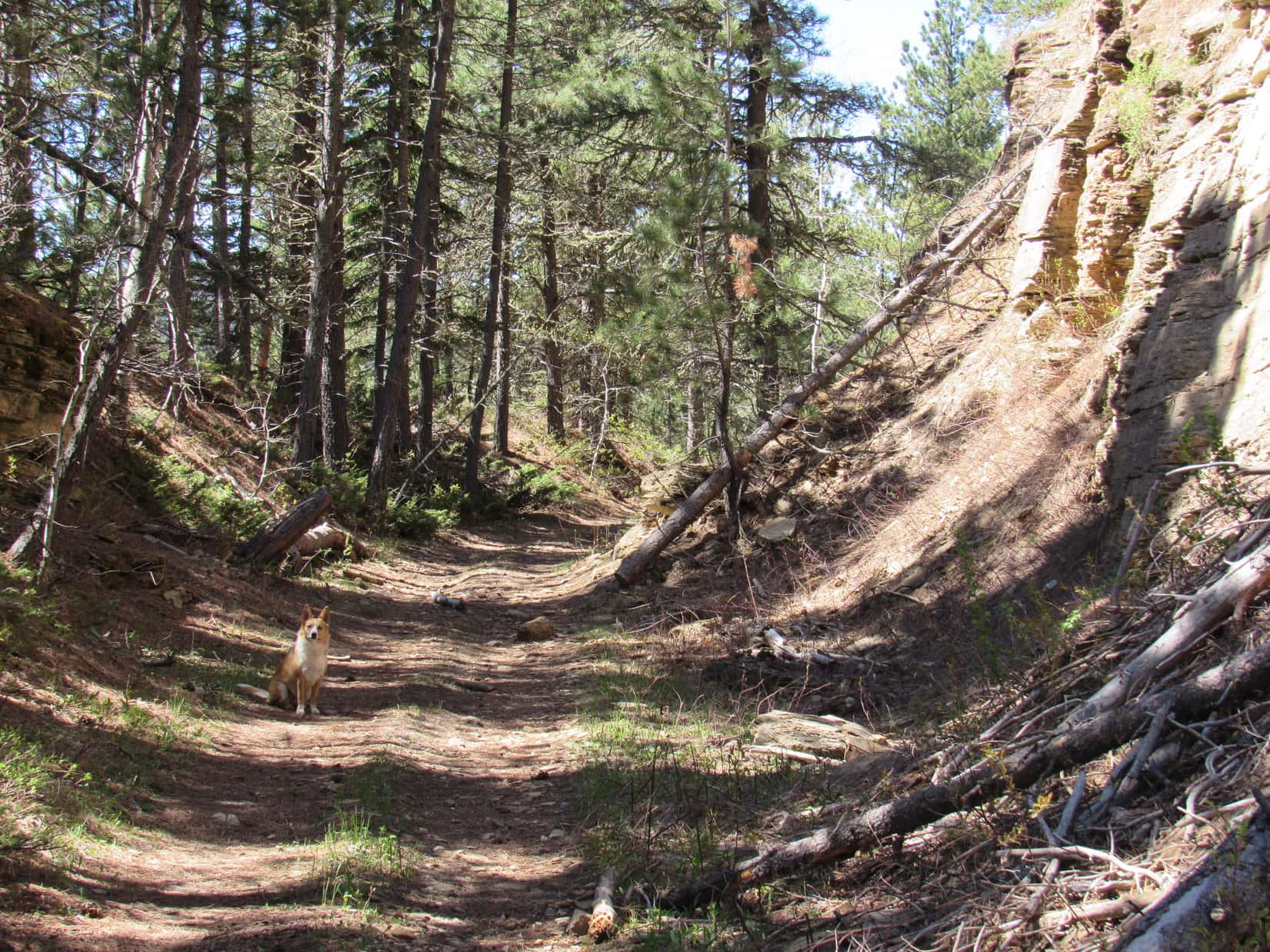
Lupe and SPHP started off heading N on Annie Creek Road.  It was narrow, kind of rocky, but almost level.  An easy hike to start the day!  Last weekend, Lupe had found a similar road leading out of Spearfish Canyon farther N on her way to Little Crow Peak (5,885 ft.).  That road had been steep for over a mile, though.  This was a piece of cake!

The thick haze that had persisted all day on Expedition No. 171 was gone.  The air was a crisp, crystalline blue.  Not a cloud was in the sky.  Lupe and SPHP were both in high spirits, making good progress along the road.  The first point of interest came as the road angled NE.  A cold, clear rivulet poured down the steep hillside SE of the road between mossy banks.

The mossy-banked rivulet next to Annie Creek Road. Lupe wasn’t thirsty yet.

Lupe wasn’t thirsty yet, so she just went on.  She was surprised when a big mud puddle covering most of the road turned out to have a thin coat of ice.  Lupe passed several big iced-over puddles.  Near one of them, SPHP spotted a Lupe Treasure.  The aluminum beer can turned out to be heavy.  It was full of ice, too.  SPHP decided to move it from the ditch into a sunnier spot where the ice would melt.  Lupe could claim her treasure on the way back to the G6 at the end of the day.

Annie Creek could now be heard down in the deep forested valley to the NW.  Lupe was more than 1.5 miles from the G6 by the time the road curved N, and went over a high embankment above Annie Creek.  Lupe saw Annie Creek, which had surprisingly good flow, but did not leave the road to run down to it.

The road divided on the NW side of the creek.  The main road went NE following Annie Creek upstream.  A lesser, but still good road went W.  The topo map showed that this road would gain elevation slowly while working around the W end of a big hill to the N.  Eventually, it would turn E, arriving after 2 miles at a point less than 0.5 mile S of Lupe’s first peakbagging goal, Elk Mountain (6,422 ft.).  Lupe and SPHP left the main road heading W on the lesser road.

Lupe on the lesser road after leaving Annie Creek Road. Photo looks W.

Everything was going great!  It was all so easy.  The lesser road started curving around to the NW.  Suddenly it ended.

Lupe reaches the sudden end of the lesser road. Photo looks NW.

Looking down into the steep ravine ahead, it was possible to see a couple of big old cement foundations and some collapsed timbers.  The road didn’t use to end here, there must have been some kind of trestle bridging the gap.  Trees kind of hid the other side, but it did look like the road still continued NW on the other side of the gap.

Going down the S end of the gap seemed easy enough, but climbing up the N end looked pretty steep.  It didn’t appear too bad, though.  Lupe and SPHP went down into the gap to get a closer look.

Lupe on one of the cement foundations down in the gap. Photo looks N up the steep slope Lupe would have to climb to get to where the road would continue NW.
Looking WNW from the bottom of the gap.

Lupe and SPHP climbed up the steep N side of the gap.  It wasn’t too bad going up, and less than a 50 foot climb, but SPHP hoped there weren’t any more gaps in the road ahead.  SPHP didn’t relish the prospect of going back down this way, if Lupe had to turn around.

The road did continue NW from the N side of the gap, but the view wasn’t entirely encouraging.  This part of the road was full of rocks and boulders that had fallen down the steep slope to the NE.  Trees were growing on the old roadbed.  It didn’t look like this part of the road got used at all any more.

The road continued on N of the gap, but didn't look very encouraging. Photo looks NW.
The road continued on N of the gap, but didn’t look very encouraging. Photo looks NW.

Lupe didn’t have to go very far N before SPHP’s fears were confirmed.  Another gap was dead ahead.  This one was even bigger, steeper, deeper and wider.  One look at it, and SPHP knew Lupe couldn’t continue on this way.

The 2nd, even bigger gap wasn’t far N of the 1st one. No way Lupe and SPHP could get across this one!

SPHP didn’t want to back down that N slope of the 1st gap, but crossing the 2nd gap wasn’t an option at all.  Lupe and SPHP had to turn around.  SPHP searched the steep slope to the NE.  Was there a way up there?  It was the only other possibility.

The NE slope was steepest down right next to the road where part of the hillside had been carved out during road construction.  About 50 feet up, the slope wasn’t quite as steep.  Only one spot offered a possible reasonable route up.  From the very top of the steepest part of the bank, a fallen tree slanted down at an angle for about 30 feet.  The upper end of the trunk was wedged against a big living pine.  The lower end was firmly wedged between big rocks.  This tree trunk looked very stable, and getting to the lower end of it appeared relatively easy.

So, Lupe and SPHP tried going up the steep NE slope using the fallen tree for support.  No problems!  It worked just fine.  SPHP still had to crawl up the higher slope for quite some distance.  Very gradually, it became less steep.  Near the top, SPHP was able to walk again.  After gaining 200-300 feet of elevation, the ground finally leveled out.  Whew!  Lupe and SPHP took a breather at a rock outcropping at the edge of the slope.

Lupe at the rest point after climbing up the long steep slope unseen just beyond the edge of the rocks behind her. SPHP was quite glad to reach this point. Photo looks WSW.

Lupe had some Taste of the Wild and water.  SPHP checked the topo map.  From here Lupe needed to keep climbing while following the sweep of the ridge.  However, it wouldn’t be nearly as steep from here on.

SPHP had not planned for Lupe to ever be on this ridge, but now she was.  Everything went fine, though.  At first Lupe went SE climbing the now gently sloping ridge.  Before long, the ridge turned NE.  Lupe continued gaining a little elevation.  Somewhere far below to the SE was Annie Creek.  Lupe was so high above it, SPHP couldn’t even hear the creek.

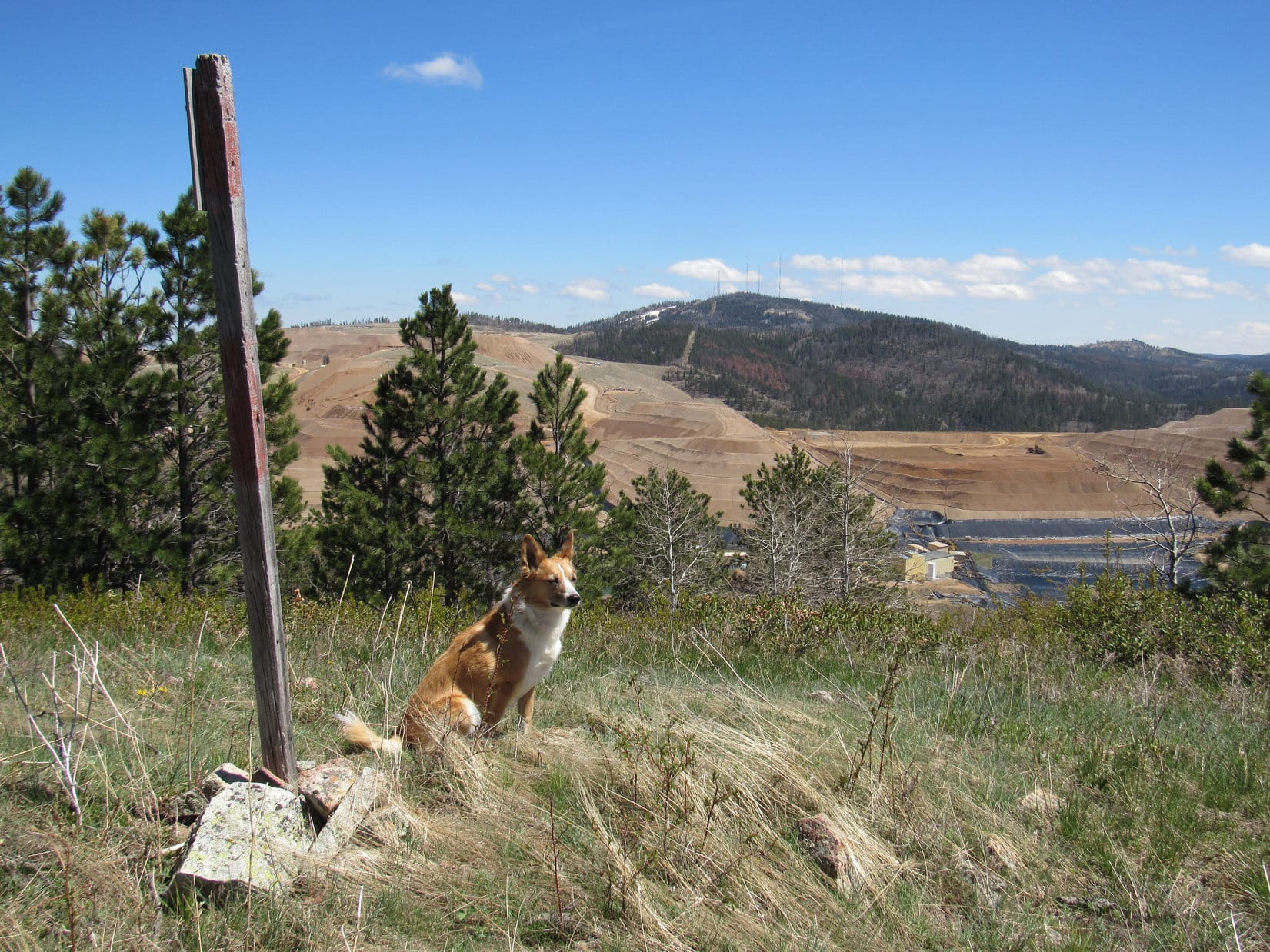
Close to a mile from where Lupe and SPHP had reached the top of the steep slope, Lupe could see a huge pile of mine tailings up ahead.  It looked like a completely barren mountain.

Lupe draws near a mountain of mine tailings up ahead. Photo looks NE.

Lupe reached a dirt road as she got closer to the mine tailings.  Lupe followed the dirt road N.  The top of Elk Mountain was now in view up ahead.

The top of Elk Mountain came into view. Photo looks N.

The dirt road quickly dead-ended.  Lupe continued NNE through the forest.  Elk Mountain looked like it would be easiest to climb from the E.  Lupe reached a fence at the edge of the mining property.  She stayed W of it, still trying to head NNE.  A constant sound of machinery in operation was getting louder and louder.

A big area covered with a black liner came into view.  A small pond of water was at the lower end.  Trucks could now be heard.  The mine was definitely in operation.  Lupe and SPHP stayed away from it in the forest.  Lupe had to cross a little valley to get to where she could start climbing Elk Mountain.  There were a few unmarked roads along in here, but Lupe didn’t follow any of them very far.  She climbed Elk Mountain (6,422 ft.) from the S and then E.

Lupe at the summit of Elk Mountain. Photo looks SE toward the mine and Terry Peak (7,064 ft.) in the distance.

Although SPHP’s old USFS map showed Elk Mountain to be in the Black Hills National Forest with private property nearby, there were plenty of signs of human habitation near the top.  At the summit, a tall post stuck up out of a small pile of rocks.  Nearby was a short building with windows.  The building was shaped like it might house a hot tub.  SPHP peered inside.

Lupe near the strange little building on Elk Mountain. SPHP thought it might contain a hot tub, but it didn’t. It appeared to be a child’s playhouse. Photo looks SSW.

There was no hot tub.  The strange little building appeared to be a child’s playhouse.  In a way, it was sort of a glorified tree fort with the lofty summit of Elk Mountain substituting in lieu of a treetop.  Sadly, it looked like no child had played here in a long time.

Lupe and SPHP took another rest break up on Elk Mountain.  SPHP had an apple.  Lupe had Taste of the Wild.  Water for all, of course.  Lupe shared a peanut butter granola bar with SPHP.  American Dingoes love granola bars!

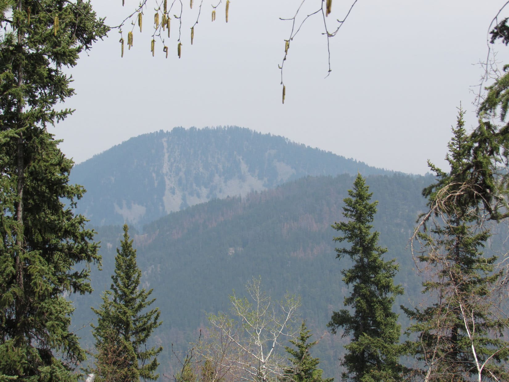
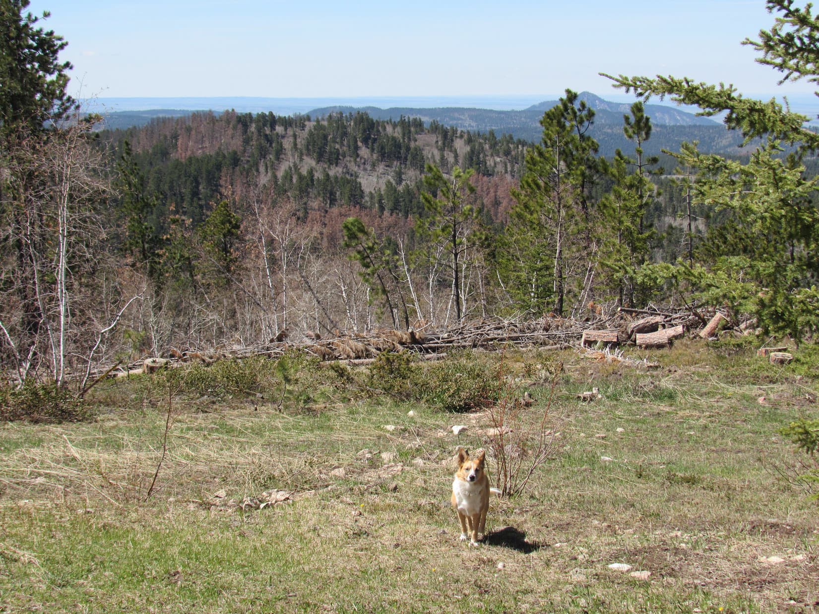
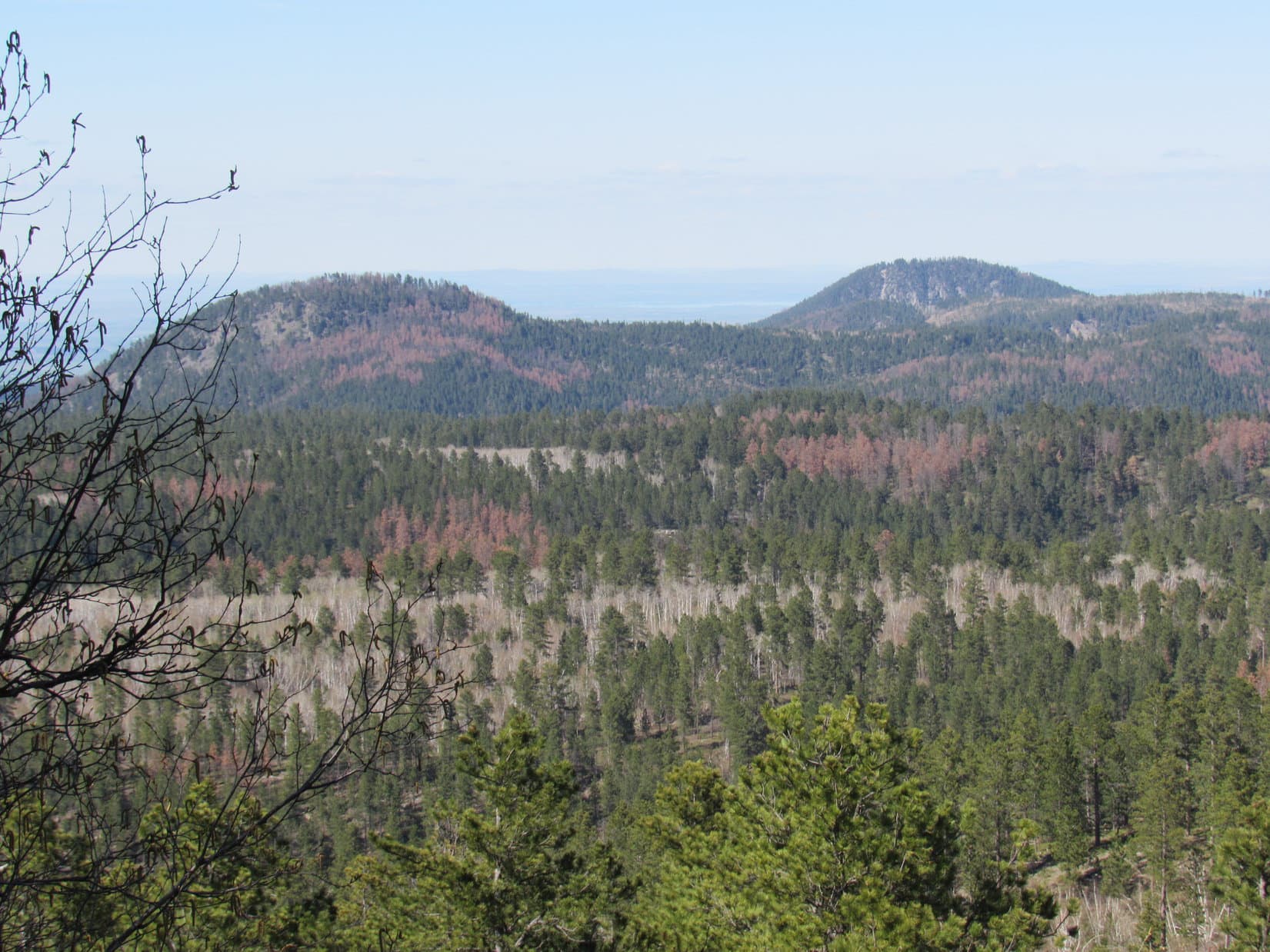
There were clear views toward the S.  The most impressive view was SE toward the nearby mine.  Terry Peak (7,064 ft.) and Deer Mountain (6,652 ft.) were both in view farther off in the same direction.  Trees blocked most of the views to the N and W, although it was possible to get a glimpse of Cement Ridge (6,674 ft.) in Wyoming to the W.

The mine was kind of pretty in a devastated human way from the top of Elk Mountain. Terry Peak (L) and Deer Mountain (6,652 ft.)(Center) were in clear view beyond it. Photo looks SE.
The mine was kind of pretty in a devastated by humans way from the top of Elk Mountain. Terry Peak (L) and Deer Mountain (6,652 ft.) (Center) were in clear view beyond it. Photo looks SE.

Lupe’s next peakbagging goal, Ragged Top Mountain, was about a mile away to the NW as the crow flies.  Lupe and SPHP had to go farther than that to get there.  Lupe went down the NE slope of Elk Mountain.  On the way she spotted the greatest hoard ever of Lupe Treasures!  It was a veritable aluminum mine!  SPHP left the vast glittering riches where they were.

Ragged Top Mountain (6,200 ft.) has two high points of nearly equal elevation. The E high point is seen here from Elk Mountain. Photo looks NW.
Ragged Top Mountain (6,200 ft.) (L) has two high points of nearly equal elevation. The E high point is seen here from Elk Mountain. Photo looks NW.

Farther down the mountain, Lupe came to a road.  She followed it NW down to Preston, where there were a couple of decaying buildings.  From Preston, Lupe and SPHP headed back into the forest, and up the SE ridge to the top of Ragged Top Mountain (6,200 ft.).

A forlorn old building at Preston, SE of Ragged Top Mountain. Photo looks N.

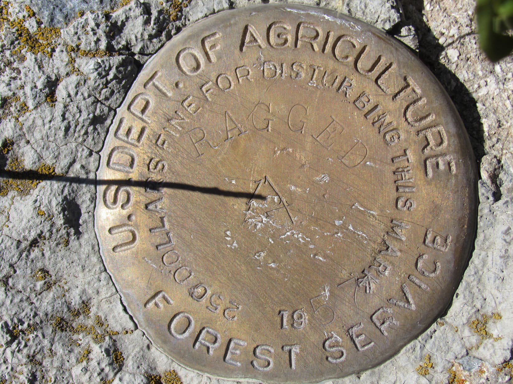
Ragged Top Mountain has two highpoints, both areas enclosed by the 6,200 foot contour.  The topo map showed the E high point had a much larger area enclosed by the contour.  SPHP consequently expected the true summit would probably be found here.  Lupe reached the E high point first.  She found a ridge of rock that dropped steeply off to the S.

Lupe on top of the E high point of Ragged Top Mountain. This might have been the true summit. Photo looks ESE.

Lupe on the E high point of Ragged Top Mountain, 5-14-16

Lupe on another high rock, though not the highest one, in the area of the E high point on Ragged Top Mountain. Photo looks WNW.

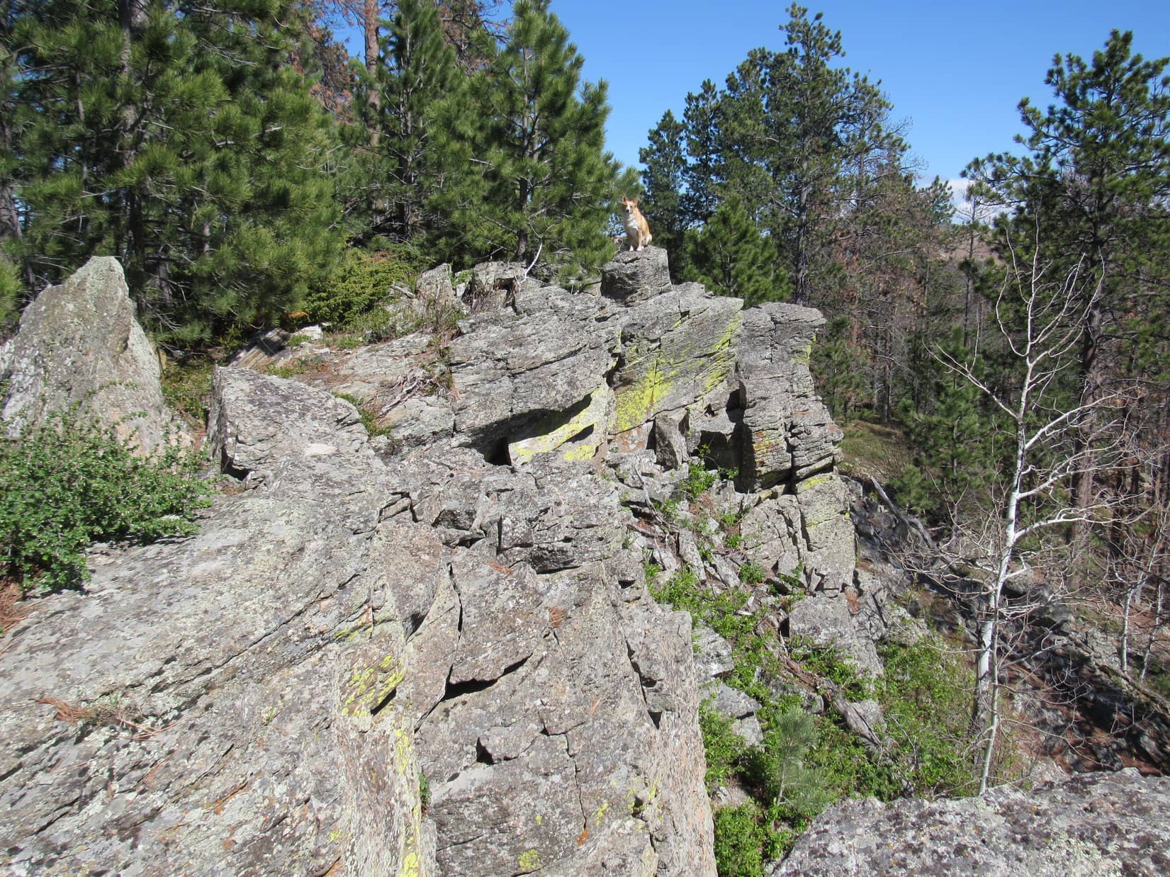
SPHP had caught a glimpse of the W high point from Elk Mountain.  It looked far more rugged, or perhaps “ragged” than the E part of Ragged Top Mountain.  After visiting the E high point, Lupe and SPHP enjoyed an easy stroll most of the way over to the W high point.

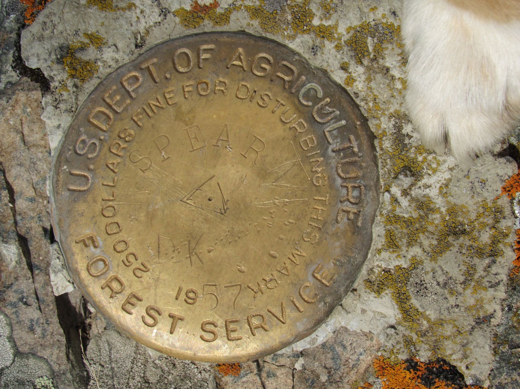
Actually getting to the top of the W high point involved a steeper, more peak-like climb.  It was still an easy scramble, but left both Lupe and SPHP more impressed with the W high point than the E one.  The W summit also featured a rock ledge dropping steeply off to the S.  However, the W high point had superior open views from the SE around to the W.  Right away, Lupe found a survey benchmark on a rock next to the very highest one.

This survey benchmark saying "Ragged" was located up on the W high point of Ragged Top Mountain. The W high point was certainly more impressive and a better viewpoint than the E one. However, even after Lupe visited both, SPHP remained uncertain which high point is actually the true summit.
This survey benchmark saying “Ragged” was located up on the W high point of Ragged Top Mountain. The W high point was certainly more impressive, and a better viewpoint than the E one. However, even after Lupe visited both, SPHP remained uncertain which high point is actually the true summit.
Lupe on the W high point of Ragged Top Mountain. The survey benchmark is underneath her just in front of her rear paws. Cement Ridge in Wyoming is seen in the distance on the L. Photo looks W.
Lupe on the W high point of Ragged Top Mountain. The survey benchmark is underneath her just in front of her rear paws. Cement Ridge (6,674 ft.)  in Wyoming is seen on the horizon on the L. Photo looks W.
Elk Mountain (Center) and more distant Terry Peak (L of Center) from the W high point of Ragged Top. Photo looks SE.
Forest generally hid the views to the N, but SPHP caught this glimpse between the trees of Crow Peak (5,787 ft.) (L) W of Spearfish, SD. Photo looks N.
Forest generally hid the views to the N, but SPHP caught this glimpse between the trees of Crow Peak (5,787 ft.) (L) W of Spearfish, SD. Photo looks N.  Taken with the telephoto lens.
Lupe tried to get comfortable here while taking a rest break up on the W high point. It was rather rocky, though, and not entirely suited to Lupe's purpose. Photo looks W.
Lupe tried to get comfortable here while taking a rest break up on the W high point. It was rather rocky, though, and not entirely suited to Lupe’s purpose. Photo looks W.

The views were so nice, the sky so clear, and the temperature so pleasant, that Lupe and SPHP spent quite a while relaxing up on the W high point.  Lupe had her Taste of the Wild, and part of another peanut butter granola bar.  SPHP polished off the orange.  Lupe tried to doze in the sun, but didn’t look too comfortable on the rocks.

Eventually, it was time to press on toward Twin Peaks (6,000 ft.), Lupe’s final peakbagging goal of the day.  On the way down the W high point of Ragged Top, there was a spot where SPHP could see the two peaks Lupe had climbed a week ago on Black Hills, SD Expedition No. 171 – Little Crow Peak (5,885 ft.) and Spearfish Peak (5,800 ft.).

Lupe lingers up on the W high point of Ragged Top Mountain. Photo looks WSW.
Little Crow Peak (5,885 ft.) (L) and Spearfish Peak (5,800 ft.) (R) from Ragged Top. Photo looks N using the telephoto lens.

Lupe and SPHP returned briefly to the E high point of Ragged Top Mountain.  From there, Lupe continued E to the edge of the high ground.  Twin Peaks is about 1.5 miles NE of Ragged Top as the crow flies.  SPHP wanted to get an idea what it looked like before leaving Ragged Top, but forest partially blocked the view.

Located at the N end of a ridge almost as high, Twin Peaks didn’t really stand out.  SPHP checked the topo map pretty carefully, comparing it to what could be seen of the view.  SPHP still wasn’t entirely certain which forested bump out there was Twin Peaks.  Well, Lupe, it isn’t that far away, and the intervening ground isn’t all that rugged.  We may as well just head NE.  We will find it!

After a little trek N along the E edge of Ragged Top, Lupe headed E down into the forest.  Reaching the valley floor, she crossed the road in the grassy field N of Preston.  Lupe went ENE up the next forested ridge and crossed it, too.  Down into another small valley, which had to have been Long Valley, and up the next ridge.  A road led E to a better dirt road where Lupe turned N.  Twin Peaks could now be seen up ahead.  Even this close, it wasn’t very impressive, just a comparatively small hill on the ridge.

Lupe came to the S peak first.  The top was covered with low bushes.

Lupe reaches the top of the S peak of Twin Peaks. Photo looks N.

There wasn’t much to see on the S peak.  Lupe paused there only long enough for her summit photo before continuing on to the N peak, which was only a few minutes hike away.  The N peak was more interesting, and definitely a little higher than the S peak.  This was the true summit of Twin Peaks (6,000 ft.).

The views would have been better from the N peak, but it was buried in a dense forest.  Once again, Lupe remained only long enough for her summit photo and a few minutes of sniffing around.  SPHP had seen a rather nice view back to the S toward Elk Mountain while walking up the S peak.  Lupe and SPHP went back there for another look.

Lupe on top of the N peak and true summit of Twin Peaks (6,000 ft.). Photo looks S.
Elk Mountain (R) from the upper slopes of the S peak of Twin Peaks. Photo looks S.

Lupe had now achieved all of her peakbagging goals for the day.  It was already early evening, but the sun would still be up for a while longer.  It was time for Lupe to start back toward the G6.  Lupe and SPHP went S from Twin Peaks, and got on the dirt road heading that direction.  Lupe started regaining elevation slowly, but steadily.

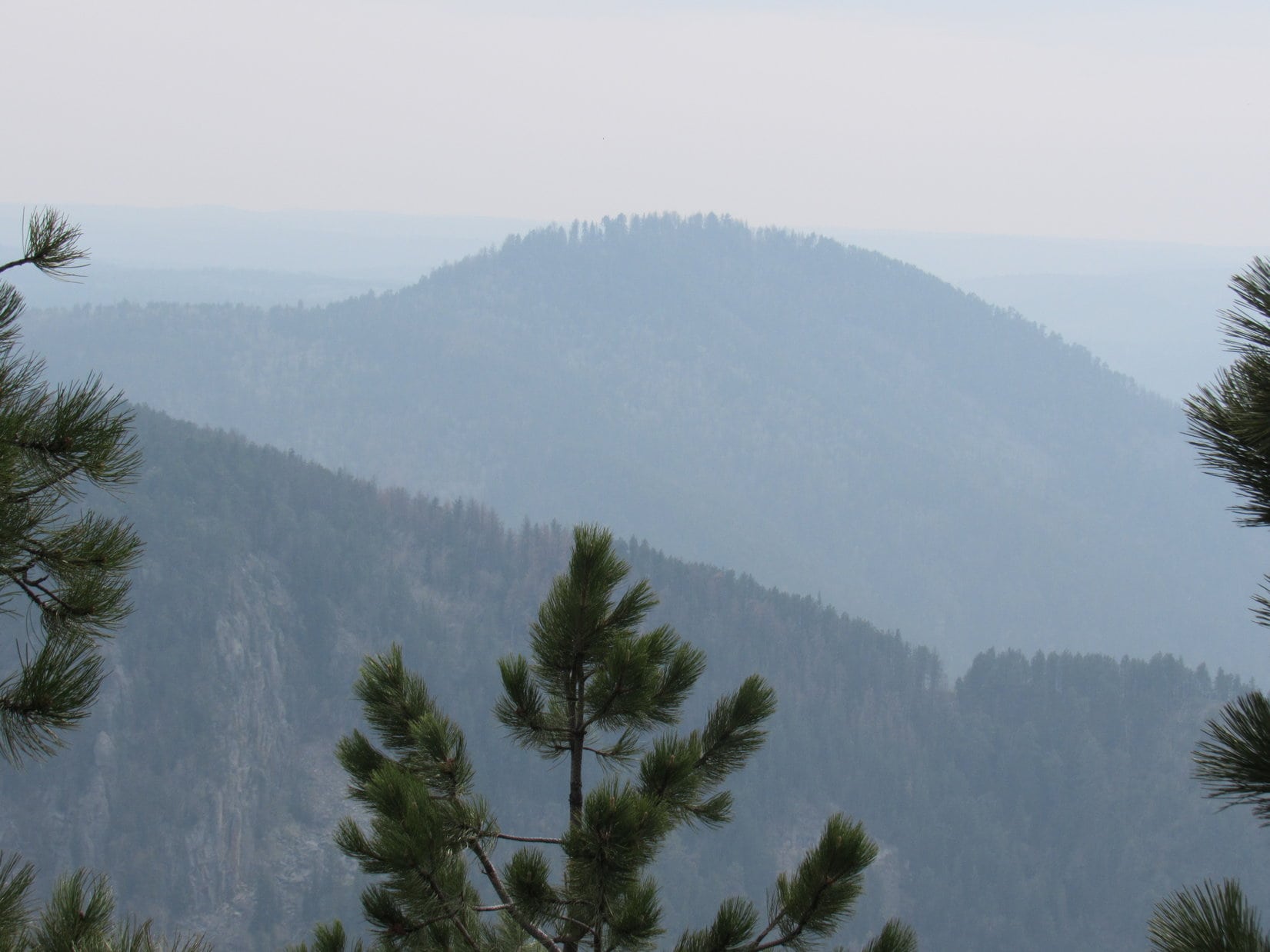
Off to the NE, there was a view of a big hill that SPHP had earlier thought might be Twin Peaks.  Now SPHP knew it wasn’t.  Lupe and SPHP stopped briefly to take a photo of it.  A check of the maps later revealed it had to be Richmond Hill (6,040 ft.).  Lupe had never been there.  Maybe she will some day!

Richmond Hill (6,040 ft.) from near the road S of Twin Peaks. Photo looks NE.

The sun was getting sort of low, but it looked like Lupe should have time to return to the top of Elk Mountain one more time.  SPHP hoped the road Lupe was on would eventually turn SW toward Elk Mountain, but it didn’t.  Instead the road came to a high point where it turned sharply E.

Well, E was no help at all.  Lupe and SPHP left the road going WSW toward Elk Mountain.  Lupe lost quite a bit of elevation again crossing a valley.  On the other side of the valley, she started regaining it.  Lupe and SPHP climbed up the ENE side of Elk Mountain, making it to the top for the 2nd time.  The views were even prettier in the evening light.

Lupe returns to the summit of Elk Mountain. The views were even prettier in the evening light. Photo looks SSW.
Lupe near day's end on Elk Mountain. Photo looks SSE at some of the nearby mine tailings, which resembled ancient pyramids.
Lupe near day’s end on Elk Mountain. Photo looks SSE at some of the nearby mine tailings, which resembled ancient pyramids.

Lupe and SPHP couldn’t stay very long.  The sun was getting low, and Lupe had to find a new route back to the G6!  There was no way she was going back by way of the steep terrain she had to climb on her way to Elk Mountain the first time.  There was one more thing to do, though, first.

On the way down Elk Mountain, Lupe and SPHP stopped by the big hoard of Lupe Treasures!  SPHP stuffed three plastic grocery bags full of them.  Five times the amount SPHP could carry had to be left behind, but there wasn’t any choice.  One of the bags got stuffed in the backpack.  SPHP found a stick to use as a handle for carrying the other two.

By the time Lupe was down in forest W of the big mining operation again, a fiery orange sun was glowing on the horizon.  Lupe reached the road N of the Annie Creek valley as twilight was already starting to fade.  SPHP hoped the road would take Lupe down into Annie Creek valley, but didn’t bother to check the maps when the road forked.

One branch of the road went E.  The other went S.  SPHP took the road S, since it was the most direct route to Annie Creek.  Wrong move!  After losing modest elevation, the road dead-ended at the edge of a steep slope.  Annie Creek could be heard, but not seen far below.

SPHP scouted around.  There was a glimpse of Annie Creek Road down below!  It wasn’t far away, but a lot of elevation had to be lost to get to it.  The forested slope was steep, but looked reasonable.  Lupe and SPHP started down, hoping cliffs weren’t hidden below.

The slope got steeper, but Lupe didn’t come to any cliffs.  SPHP did have to go ever more slowly and carefully.  Lupe wandered this way and that.  She had no problems traversing this kind of stuff.  She was having a good time sniffing around.  Meanwhile, twilight was fading fast.  With each step, SPHP sent little showers of rocks cascading down the mountain.  The terrain forced SPHP toward a steep ravine.

Suddenly, one of the sacks full of Lupe Treasures caught on something, ripping loose from the stick.  Lupe Treasures spilled out as the sack tumbled 20 feet down before coming to rest.  Just lovely!  SPHP went carefully down to the damaged sack, gathering the Lupe Treasures back up again.  The loose sack was too badly damaged to be used now.

SPHP pulled the sack in the backpack out, and attached it to the stick.  All the Lupe Treasures from the damaged sack went directly in the backpack.  By the time SPHP had gathered up all the scattered Lupe Treasures, it was dark enough to have to use a flashlight.  Lupe and SPHP resumed the steep trek down.  SPHP had to stay in the ravine navigating through loose rocks, juniper bushes, trees and occasional deadfall.

In the darkness, Lupe trotted easily back and forth across the ravine, her tail waving happily, as if to show SPHP how to do it.  SPHP couldn’t.  Advantage, Carolina Dog!  Finally, however, the ravine got a little less steep.  Looking down, SPHP saw Lupe standing on Annie Creek Road.  Sweet!  SPHP joined her in just a couple of minutes.

The rest of the way back was easy, or should have been.  All Lupe and SPHP had to do was follow nearly level Annie Creek Road the entire way.  However, carting all of the Lupe Treasures, while holding the flashlight, plus trying to keep the camera from swaying wildly on its strap with each step, took both of SPHP’s hands.

Thoughtlessly, SPHP rubbed an itchy right eye with a finger, cleverly placing three molecules of sunscreen in the eye.  The result was a stinging sensation, and subsequent release of a cascade of tears from the offended right eye which insisted on closing tight.  One-eyed SPHP lost all depth perception of the faintly lit road.  It didn’t help that the left eye wanted to close in sympathy with the right one, too.

Lupe trotted happily on ahead in the darkness.  SPHP trudged slowly along Annie Creek Road, weeping from the right eye and trying to avoid the big mud puddles, while still managing to hang on to everything.  When Lupe found the aluminum can that had been full of ice where SPHP had left it to melt in the morning, SPHP stopped to add it to Lupe’s Treasure collection.

Unfortunately, draining the water out of the can released a ghastly, putrid odor.  As Uncle Peanut used to say, it was “enough to gag a maggot”.  SPHP almost abandoned the can right then and there, but thought better of it and managed to stuff it in one of the sacks on the stick.  Yuck!  SPHP didn’t like the idea of putting it in the G6, even in the trunk.

Lupe and SPHP continued on in the darkness – Lupe sniffing along as happy as ever; SPHP carting a clanking collection of dreadfully stinking Lupe Treasures, weeping from one eye, and trying not to stumble on rocks on the road due to a lack of depth perception.

When Lupe raced ahead, SPHP knew it was finally over.  She had seen the G6 (10:02 PM, 32°F).  SPHP was busy loading all the gear into the G6, and Lupe’s stinking treasure hoard into the trunk, when suddenly an owl hooted close by.  Lupe reacted like she had seen (or heard) a ghost, immediately leaping into the safety of the G6.  To SPHP, though, the owl just seemed to be laughing.

Lupe on the W high point of Ragged Top Mountain.

Lupe Treasures collected: 2 glass bottles, 2 plastic bottles & 204 aluminum cans.

Links:

Next Black Hills Expedition                       Prior Black Hills Expedition

Want more Lupe adventures?  Choose from Lupe’s Black Hills Expeditions Adventure Index or Master Adventure Index.  Or subscribe free to new Lupe adventures.

Black Hills, SD Expedition No. 171 – Little Crow Peak & Spearfish Peak (5-7-16)

The patio was damp, but that was all.  It must have sprinkled overnight.  Plenty of clouds were still around.  Normally, even a little rain would help clear the air.  Not this time.  It was hazy.  Very, very hazy.  Otherwise it was a beautiful day in early May.  SPHP hoped the haze would burn off before too long.  Lupe didn’t care whether it did or not.  She was charged up and ready to roll!

A couple miles before reaching the starting place for her peakbagging efforts, Lupe and SPHP made a quick stop to see Bridal Veil Falls in Spearfish Canyon.  Later in the season Bridal Veil Falls often slows to a trickle, but the falls were beautiful this morning.

Bridal Veil Falls in Spearfish Canyon.

Bridal Veil Falls was looking great!  The falls were probably near maximum springtime flow, barring a thunderstorm.  Only 6 days ago on Black Hills, SD Expedition No. 170, Lupe had found several inches of snow up on Kirk Hill (5,345 ft.) and Tetro Rock (5,562 ft.).  The weather had really warmed up since then, especially the last 3 days which were near 80°F.  Lupe loves the snow, but she wasn’t likely to find any remaining today.  Bridal Veil Falls wasn’t going to get any more of a boost from melting snow, either.

After admiring the falls, Lupe and SPHP continued S on Hwy 14A going up Spearfish Canyon.  SPHP was looking for USFS Road No. 186.2A, but doubted it would be marked as such.  A little less than 2 miles from Bridal Veil Falls, there was a road to the E with a street sign that said Cleopatra.  Right away, SPHP knew this was it!  The little parking area close to Spearfish Creek was full, but SPHP found another place to park nearby (10:50 AM, 61°F).

SPHP knew this place.  Lupe was at the confluence of Spearfish and Squaw Creeks.  (“Maurice” on the Peakbagger.com topo map.)  A trail goes up Squaw Creek perhaps a mile from here to the Devil’s Bathtub, a pool of water fed by a small waterfall.  A hiking trail to the Devil’s Bathtub is popular with local residents, but is not marked and not well known to tourists.

Lupe wasn’t going to the Devil’s Bathtub today, however.  Instead she was heading for Little Crow Peak (5,885 ft.), a nearby peak along the E rim of Spearfish Canyon.  At least, that was the plan.  SPHP had to find USFS Road No. 186.2 first.  The Peakbagger.com topo map showed No. 186.2 winding E up out of Spearfish Canyon from somewhere above Squaw Creek.

Lupe and SPHP crossed the bridge below the confluence of Spearfish and Squaw Creeks. Lupe then started out on the low road leading to the Devil’s Bathtub trail.  After just a few hundred feet, the trail left the road to cross Squaw Creek for the first time.  Lupe didn’t cross the creek.  If USFS Road No. 186.2 was still in existence, it would be somewhere higher up on this side of the canyon.

SPHP scanned the forest above to the E.  It did look like there might be some terrain a short distance higher up that could be level enough for a road.  Lupe was just past the last private cabin near Squaw Creek.  Time to find out if USFS Road No. 186.2 was actually still up there somewhere or not, and if so, what kind of condition it was in.  Lupe and SPHP started climbing up the steep forested slope.

Lupe didn’t have to climb far at all!  She popped out of the forest onto a very nice little road.  The road was rocky and narrow.  Heading SE, it climbed steadily up the side of the canyon.  There was no marker, but that wasn’t surprising.  This almost had to be USFS Road No. 186.2.  Lupe and SPHP started following it up.

Lupe on USFS Road No. 186.2 on her way to Little Crow Peak.

No. 186.2 wound around some, but generally worked its way E for more than a mile.  It was a rather steep climb the entire way.  Lupe came to several grassy side roads, but she always stayed on the main road.  The rocky road went relentlessly up and up.  Lupe followed at SPHP’s heels much of the time.  Lupe found the road a bit dull.

The map showed a power line crossing the road, but Lupe didn’t come to one.  After Lupe had gone more than 0.75 mile, SPHP looked back down to the W.  A swath of the forest had been cut in a straight line leading to the road.  The old power line must have been here at one time.  By now, Lupe was high enough to see a high forested hill off to the NW.  That had to be Little Crow Peak (5,885 ft.)!

Lupe and SPHP stayed on No. 186.2 until it finally quit gaining elevation.  As soon as the road leveled out, Lupe left it heading N into the forest.  As Lupe reached the top of a broad forested ridge, she came to another road.  The road was faint, but its existence was good news.  It was going WNW toward Little Crow Peak.

The faint road didn’t go all the way up Little Crow Peak, but it did bring Lupe to a point just E of the final rise.  The climb through the forest was pretty easy.  As Lupe got higher up on the mountain, she encountered quite a bit of deadfall timber, but by then Lupe didn’t have much farther to go.

Fairly large rock outcroppings started appearing about the time the terrain began leveling out.  Lupe was getting close to the summit of Little Crow Peak.  Suddenly, SPHP spotted a cairn up on some high rocks a short distance ahead.  Lupe was almost there!

Lupe up on a rock outcropping on Little Crow Peak featuring a cairn. The true summit was still another 150 feet farther W. Photo looks S.

Lupe scrambled up onto the rocks next to the cairn.  Initially, SPHP thought this might well be the summit of Little Crow Peak.  Peering to the W through the forest, though, it looked like there might well be a higher point not too much farther away.

The true summit proved to be roughly 150 feet W of the cairn.  Lupe climbed up a larger rock formation there to claim her Little Crow Peak peakbagging success!

Lupe at the true summit of Little Crow Peak. Photo looks W.
Another look at Lupe on the summit. This photo looks N.
A Carolina Dog surveys the situation from her vantage point at the E end of the summit rock formation. Photo looks W.

Forest hid the views in almost every direction.  It hardly mattered.  The entire sky remained very hazy.  If the air had been clear, there was quite a nice view toward Terry Peak (7,064 ft.) to the SSE.  As it was, the camera could barely detect Terry Peak in the haze, although it was visible to the naked eye.  Lupe and SPHP took a rest break up on Little Crow Peak before continuing on.

When it was time to leave, Lupe went back E down the mountain, a little S of the way she had come up.  This route avoided some of the deadfall timber, and brought Lupe to more interesting rock formations.  It proved to be a somewhat easier way back to the faint road.

These plants with little yellow flowers were common on Little Crow Peak.
Forest blocked the views in most directions from Little Crow Peak. Lupe did find this one hazy glimpse of Spearfish Peak (5,800 ft.) on her way down the mountain. Spearfish Peak was Lupe's next peakbagging goal. Photo looks NE.
Forest blocked the views in most directions from Little Crow Peak. Lupe did find this one hazy glimpse of Spearfish Peak (5,800 ft.) on her way down the mountain. Spearfish Peak was Lupe’s next peakbagging goal. Photo looks NE.  Taken with the telephoto lens.
Near rock formations Lupe passed by on her way down the E side of Little Crow Peak. Photo looks S.

Lupe and SPHP followed the faint road ESE all the way until it reached USFS Road No. 186.2 some distance E of where Lupe had left it to climb Little Crow Peak.  At least SPHP thought Lupe was back at No. 186.2, but she really wasn’t.

Lupe’s next peakbagging goal was Spearfish Peak (5,800 ft.).  The original plan was to follow No. 186.2 E and then SE from Little Crow Peak.  The Peakbagger.com topo map showed that No. 186.2 would reach an intersection with another road that wound its way several miles N along the top of a long ridge.  That road would bring Lupe to a point close to Spearfish Peak where she should be able to climb it easily enough from the SE.

As Lupe and SPHP headed ENE along No. 186.2, it didn’t take too long for SPHP to realize something was wrong.  The road should have gone almost due E just S of a slightly higher ridge to the N, but it didn’t.  Lupe passed several side roads, but they didn’t look as well traveled as the road Lupe was on.  They didn’t seem right either, and SPHP was reluctant to take them.

Lupe reached an intersection with a grassy road that continued NE.  An ancient small bus was rusting away next to this side road.  The main road turned E and started climbing again.  SPHP pondered for only a moment.  Lupe took the main road E.

The ancient decaying bus about 0.67 mile ESE of Little Crow Peak. Lupe thought this was a stupendous Lupe Treasure, but SPHP was too weak to cart it back to the G6 to secure her prize. This photo was taken later in the day on Lupe's return from Spearfish Peak. Photo looks NW.
The ancient decaying bus about 0.67 mile ESE of Little Crow Peak. Lupe thought this was a stupendous Lupe Treasure, but SPHP was too weak to cart it back to the G6 to secure her prize. This photo was taken later in the day on Lupe’s return from Spearfish Peak. Photo looks NW.

The main road Lupe was following E led up onto some high ground.  SPHP soon realized Lupe was on the ridge N of USFS Road No. 186.2.  She was traveling the section line between Sections 10 & 15.  There was supposed to be a power line here, according to the map, but none was present.  The road was level at times, and at other times went up and down steep ravines.

As Lupe reached the E end of the high ground along the ridge, she came to a misspelled sign for the Carbonate Camp Cemetery.  Lupe found 5 old gravesites here.  Each grave was marked with a ring of small stones.  There were no headstones, only a wooden board sticking up at the head of each grave.  The boards were so old and weathered, any information that might have been on them about the deceased had long ago worn away.

This misspelled Carbonate Camp Cemetery sign was near 5 graves. Online research later revealed that these graves would all have dated back to the late 1800's.
This misspelled Carbonate Camp Cemetery sign was near 5 graves. Online research later revealed that these graves would all have dated back to the late 1800’s.
Lupe sits on the best preserved gravesite at the Carbonate Camp Cemetery. Originally there were at least 11 graves, but Lupe & SPHP only saw evidence of 5. Carbonate Camp was a mining camp back in the 1880's.
Lupe sits on the best preserved gravesite at the Carbonate Camp Cemetery. Originally there were at least 11 graves, but Lupe & SPHP only saw evidence of 5. Carbonate Camp was a mining camp back in the 1880’s.  Photo looks E.

E of Carbonate Camp Cemetery, the road soon wound steeply down into the upper reaches of Rubicon Gulch.  Continuing E, the road went up and down over several steep hills.  Lupe was delighted and SPHP was amazed, when she found several patches of snow still melting on the road.

Lupe found several patches of snow on the road in the upper reaches of Rubicon Gulch. This one was the largest of all. Photo looks E.

At the final low point on the E side of Rubicon Gulch, a small stream flowed out to the NW from a culvert under the road.  This stream eventually goes over Bridal Veil Falls, but it was much smaller up here.  On the S side of the road was a slough, which SPHP naturally dubbed Rubicon Slough.  The surface of Rubicon Slough was almost entirely thickly covered with gray-green duckweed.  The water’s surface was scarcely visible.

At Rubicon Slough. Photo looks SSW.

A little SE of Rubicon Slough was a metal building, and a fence with a No Trespassing sign.  The land to the S was likely part of the Richmond Hill mining operations.  It was now clear that if Lupe had actually returned to No. 186.2 after leaving Little Crow Peak, it would have taken her into that private property.  It was a good thing Lupe came the way she did.  This route was a shortcut, too!  Lupe had saved more than a mile coming via Carbonate Camp Cemetery and Rubicon Slough.

From Rubicon Slough, a very rocky road went NE up a ridge.  Lupe and SPHP followed it.  Near a power line at the top of the ridge, another road came in from the SSE.  This was the road that would wind N following the long ridge to Spearfish Peak.  It intersected the road from Rubicon Slough just S of a small private cabin.

Near the little cabin on the ridge NNE of Rubicon Slough. Photo looks E.

A couple of Private Property signs near the little cabin had been spray painted over with black paint for some reason.  Lupe continued N on the road, which SPHP now believed was USFS Road No. 220, although Lupe and SPHP never saw any marker for it.  The road went past some other private property.  At a fork in the road, Lupe stayed to the NW.  She passed by some land for sale.

From the land for sale, the road went downhill and passed beneath the power line again.  Spearfish Peak was now visible to the N.  Lupe had come clear around the upper end of Rubicon Gulch, and was finally getting closer.

Spearfish Peak is in view to the N. The power line really helped SPHP stay oriented so Lupe was able to remain on the correct road instead of wandering off on one of the possible side roads on the way to Spearfish Peak, which often was not in view until Lupe got close.
Spearfish Peak is in view to the N. The power line really helped SPHP stay oriented so Lupe was able to remain on the correct road instead of wandering off on one of the possible side roads on the way to Spearfish Peak, which often was not in view.

USFS Road No. 220 wound around to the W of the power line, but generally headed N toward Spearfish Peak.  The road stayed up on the ridge.  Sometimes Lupe could see Little Crow Peak to the SW.  Eventually Spearfish Peak came into view.  It wasn’t much farther N now!

Beautiful new light green aspen leaves were sprouting.

USFS Road No. 220 eventually crossed under to the E side of the power line again, but Lupe did not.  Instead, she followed a road going N beneath the power line for a little way.  When a side road turned NW toward Spearfish Peak, Lupe took that one.  It soon ended at the edge of the forest.  A faint single track trail went up the SE ridge of Spearfish Peak.  Lupe was able to follow it all the way to the top.

Lupe on the highest rock on Spearfish Peak. Photo looks WNW.
Lupe's paw next to the survey benchmark on Spearfish Peak.
Lupe’s paw next to the survey benchmark on Spearfish Peak.

The rock formation at the top of Spearfish Peak was only a few feet high.  Lupe immediately claimed her second peakbagging success of the day!  Lupe found a survey benchmark right next to the highest rock.

Like Little Crow Peak, Spearfish Peak was heavily forested.  Once again, the only open views were to the S.  Unfortunately, the haze hadn’t dissipated at all yet.

A very hazy view of Bald Mountain (6,617 ft.) and Terry Peak (7,064 ft.) from Spearfish Peak. Photo looks S.
A very hazy view of Bald Mountain (6,617 ft.) (L) and Terry Peak (7,064 ft.) (R) from Spearfish Peak. Photo looks S using the telephoto lens.
Little Crow Peak from Spearfish Peak. Photo looks SW.
Little Crow Peak from Spearfish Peak using the telephoto lens. Photo looks SW.

It seemed like it had taken a long time to get to Spearfish Peak from Little Crow Peak.  Lupe and SPHP were both ready for another break.  SPHP ate the last apple.  Lupe had Taste of the Wild.  Water was the only other available provision.  Lupe curled up to rest at SPHP’s feet.

Apparently, this haze was going to hang around all day.  Strange, and a little frustrating.  Approaching Spearfish Peak, there had been some big views evident off to the NE, but it had been impossible to actually see much.  It was too bad, but there was nothing to be done about it.

When the rest break was over, Lupe posed for a few more summit photos.  Then it was time to go.

Back on the summit rock. Photo looks E.

Sitting next to the survey benchmark.

On the way down again, the faint trail up the SE ridge was so faint that SPHP lost it entirely.  It turned out Lupe was coming down well to the N of the trail.  Lupe finally reached it again, not too far from the road.

The same type of flower common on Little Crow Peak was flourishing on Spearfish Peak, too.

Once Lupe was back on the road, all she had to do was retrace her earlier route back to Little Crow Peak.  The return trip seemed to go considerably faster.  SPHP didn’t have to keep stopping to check the maps anymore.

Lupe and SPHP were taking another break in the forest near the start of the faint road to Little Crow Peak when an ATV roared up the main road from the W.  Surprisingly, the ATV stopped at the intersection.  The driver spotted Lupe and SPHP right away and waved.  SPHP waved back.  Lupe growled.  Within a minute, another ATV roared up and stopped.  The two drivers got on their cell phones.

The first driver got off his ATV and came to talk to SPHP.  Did SPHP know where the road to the Cleopatra Mine was?  Not really, although the Cleopatra Mine was somewhere up Squaw Creek beyond the Devil’s Bathtub.  The ATV’s weren’t that close to it here.  The Cleopatra Mine was on a hillside, but a lot lower down than this.

SPHP mentioned how hazy it was.  The ATV driver said the haze was smoke from the huge wildfire going on up near Ft. McMurray in Canada.  SPHP was surprised, but it made some sense.  That would explain why the haze hadn’t dissipated all day long.  On the other hand, Ft. McMurray was an extremely long way N, way up in northern Alberta.

The ATV’s roared off.  Lupe smiled.  It was evening now.  American Dingoes like this time of day.  There was still time to go back up Little Crow Peak one more time.  So, Lupe did.  The cool evening air energized her.  She raced through the forest sniffing.  She found a few squirrels to bark at.  She heard wild turkeys gobble in the woods.  She climbed Little Crow Peak again.

Lupe returns to the summit of Little Crow Peak. Photo looks W.

Lupe and SPHP lingered on Little Crow Peak.  It was cooler out now, and getting a little chilly.  Finally, SPHP was ready.  Lupe headed back down the mountain.  SPHP had been collecting Lupe Treasures since leaving Spearfish Peak.  SPHP resumed collecting along No. 186.2 on the way back to the G6.  Lupe stayed on the alert for squirrels.

The way down seemed very long, steep, and rocky.  No wonder it had been tough going up in the morning!  Lupe stayed on No. 186.2 all the way down.  At the bottom, SPHP wanted to see where No. 186.2 joined Cleopatra Road.  It came out between private cabins just N (downstream) of the bridge over Spearfish Creek.

It had been a pretty long day.  The light was fading.  Someday Lupe would have to return to go see the Devil’s Bathtub.  It was way too late to do that now.  Time to go home (8:37 PM, 52°F).

For miles, Lupe rode in the G6 with her head out the window.  She was hoping to see a deer, but there weren’t any down in Spearfish Canyon.  Finally, Lupe gave up.  She pulled her head back inside, curled up on the seat, and heaved a great sigh before falling asleep.  At least there would be Alpo at home!

Crow Peak (5,787 ft.) in the evening as seen through the haze and branches of trees on Little Crow Peak. Photo looks NW.

Lupe Treasures collected: 4 glass bottles, 4 plastic bottles, 30 aluminum cans.

Links:

Next Black Hills Expedition                 Prior Black Hills Expedition

Black Hills, SD Expedition No. 258 – Spearfish Peak & Little Crow Peak (11-19-20)

Want more Lupe adventures?  Choose from Lupe’s Black Hills Expeditions Adventure Index or Master Adventure Index.  Or subscribe free to new Lupe adventures.