Start – 10:28 AM, 46°F, at the first pullout along West Deerfield Road near Castle Creek W of the intersection with Deerfield Road (County Road No. 306)
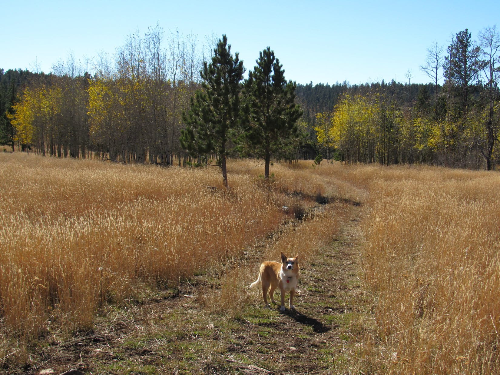
Fall colors were over and done with. Sad, but the glories of autumn fade quickly. Nothing new about that. Lupe was still enthused! This bright, comfortably cool day in late October was made to order for a continuation of the Carolina Dog’s recent tour of some of the highest peaks of the Black Hills along the E edge of the western limestone plateau.
Today, Lupe would visit 4 such peaks. She’d been to all of them before more than once, but it had been well over two years since her most recent visit and would be fun to see them again. Besides, SPHP had promised Loop she would get to explore a whole new canyon on the way back at the end of the day.
Something old, something new, that’s what we’re gonna do!
If that’s supposed to be poetry, SPHP, don’t quit the day job.
Hah, too late, I already have!
My, what a big deficit you’re running, SPHP!
Never mind that, the better to go adventuring with you, my dear Dingo!
Loopster was totally in favor of that. She started off with a quick look at pretty Castle Creek, which somehow always has good flow even during seasonally dry periods like this. Then the American Dingo crossed West Deerfield Road and began the climb toward her first peakbagging objective, South Castle Rock(6,840 ft.).
Expedition No. 212 begins with a quick look at Castle Creek. Photo looks NNW.Looking NW up the Castle Creek valley after crossing West Deerfield Road.
A short climb through a pine forest brought Loop to a grassy field. The upper S face of South Castle Rock was already in view. This was going to be a nice, easy stroll most of the way. Lupe headed N through the field, passed through another forested stretch, and was soon back out in the open again. The only short steepish part of the whole climb was up in the trees directly ahead.
After a short climb through a pine forest, Loop reaches a grassy field. The upper S face of South Castle Rock is already in view in the distance. Photo looks N.Getting closer! Lupe squints in the bright morning sunshine. Photo looks N.The only steep part of the climb up South Castle Rock is in the trees ahead. Photo looks NNW.
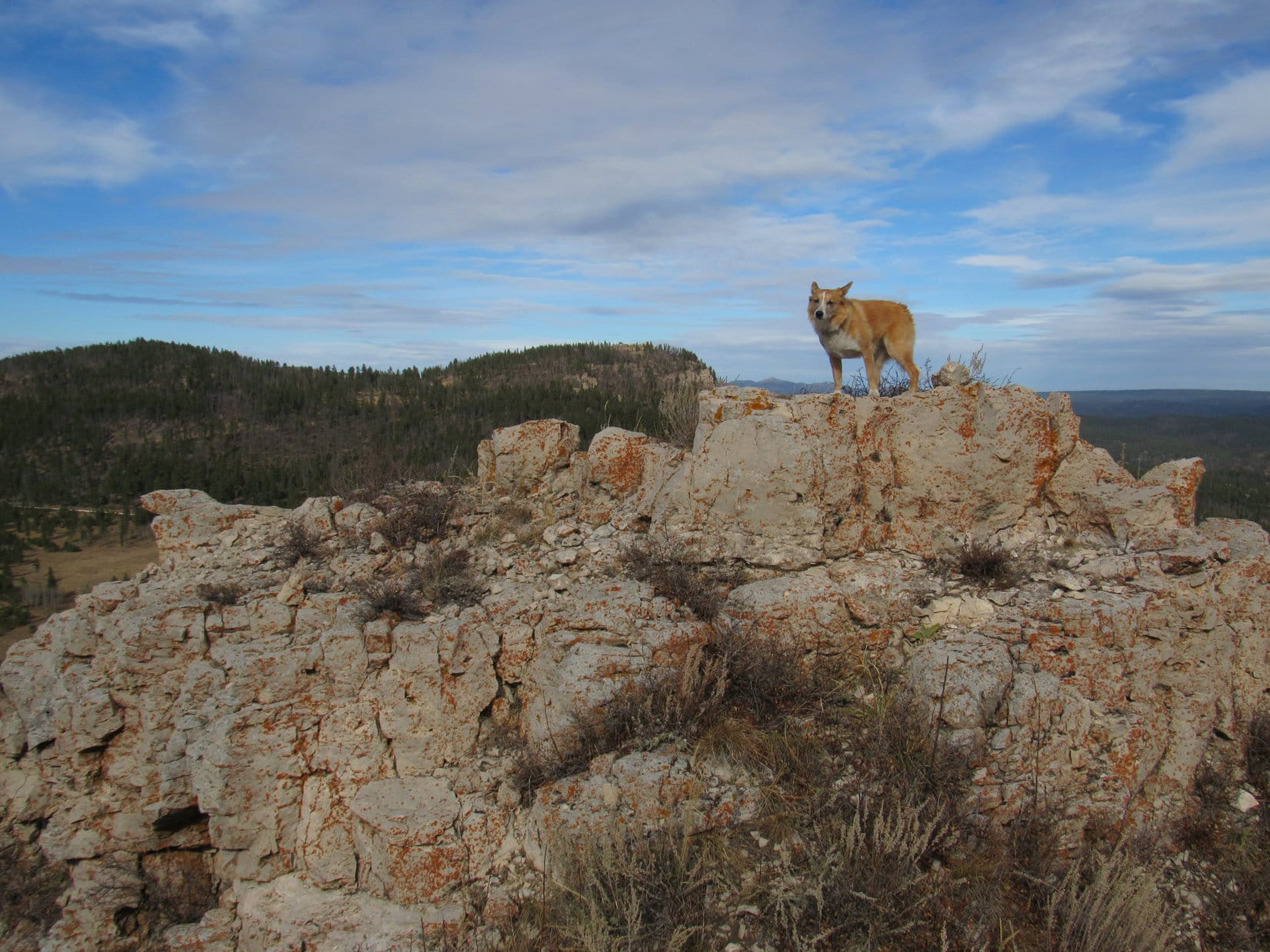
The best views from South Castle Rock aren’t from the summit, but from limestone cliffs high up on the far S ridge. That was right on Lupe’s way to the summit, so she went there first. She had a great panoramic view to the S and E from here. To the N, Loop could see the end of nearby Castle Rock’s E ridge.
From limestone cliffs along South Castle Rock’s far S ridge, Lupe had sweeping views to the S & E. Photo looks SE past Deerfield Reservoir.The end of Castle Rock’s E ridge is seen on the R. South Castle Rock and Castle Rock are different parts of the same mountain. Photo looks N.At the edge of South Castle Rock’s S ridge. Photo looks N.
South Castle Rock has two high points. Being slightly higher, the N high point is the actual summit. From the cliffs along the S ridge, Lupe circled well W of the S high point before turning N again.
The summit wasn’t far off, but the discouraging sight of all the deadfall timber Lupe had to traverse to get to there made SPHP realize the Komperdell trekking poles generously gifted by Jobe Wymore had been forgotten in the G6. Doh! SPHP had used them for the first time a week ago on Expedition No. 211. The poles had been quite useful for nagivating deadfall then, and would have been handy to have here. Oh, well!
After circling around the S high point, the sight of all the deadfall on the way to the true summit made SPHP realize the Komperdell trekking poles had been forgotten in the G6. They would have been mighty handy to have here! Photo looks N.
The true summit of South Castle Rock(6,840 ft.) sits at the N end of a fairly large limestone cap surrounded by low cliffs. Getting through the deadfall to reach the cap was the hard part. That done, Lupe circled to the SW where the cliffs were lowest. One mighty, unassisted, clawing leap, and she was on top!
At the highest point at the N end, someone had built a cairn since Lupe was last here. Trees hid the views in most directions, but Loop did have a tremendous view of Reynolds Prairie to the E. She also had a clear view of Castle Rock’s E ridge to the NE.
Lupe arrives at the S end of South Castle Rock’s limestone cap. She was able to leap on top from a point farther W (L). Photo looks NW.At the summit. Someone had built the small cairn next to her since the last time Lupe was here in June, 2015. Although forest hides the views in most directions, Lupe could see much of Reynolds Prairie to the E. Photo looks E.The slightly lower summit of Castle Rock(6,783 ft.) is on the ridge seen beyond Lupe. That’s where she was heading next. Photo looks NE.
After a short break near the cairn, Lupe left South Castle Rock’s limestone cap at the same SW point where she’d leapt up. Less than a 0.25 mile trek brought her to Castle Rock’s E ridge.
The E ridge was 200 feet wide and rounded, sloping down toward cliffs on both sides. The top was nearly level along most of its length. Lupe followed the ridge ESE all the way to where the ground started dropping toward the cliffs at the far end. The true summit seemed to be here near the ESE end, but it was hard to tell for certain. Having traveled the whole length of the ridge, Loop must have been at the actual high point somewhere along the way.
The apparent summit of Castle Rock(6,783 ft.) was forested and clogged with deadfall, but Lupe had great views from the cliffs along the edges of the ridge in every direction except back to the W.
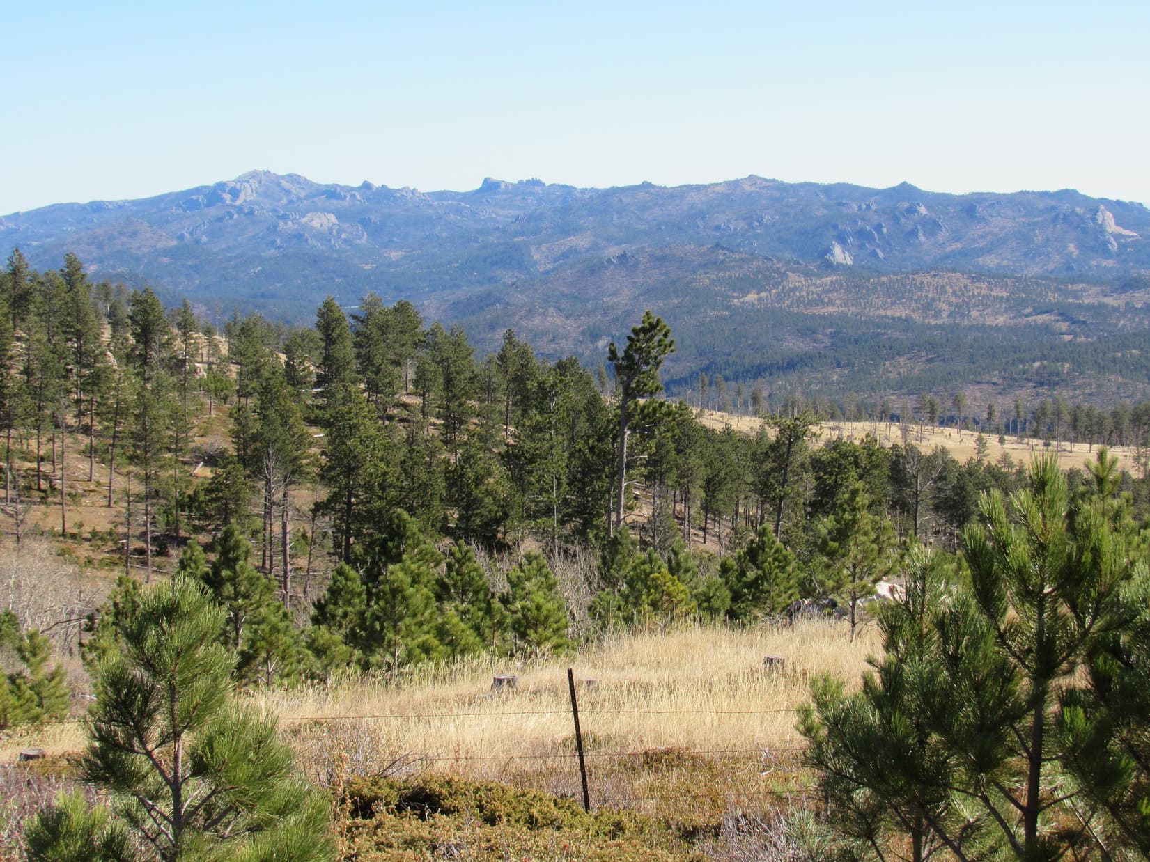
At the summit of Castle Rock as near as SPHP could determine. A glimpse of the N end of Reynolds Prairie is seen below. Photo looks NE.South Castle Rock as seen from Castle Rock. The summit is on the R. Photo looks SW.Looking SE from Castle Rock’s E ridge. Parts of Deerfield Reservoir are seen beyond Reynolds Prairie. The distant high ridge on the R is Green Mountain(7,166 ft.).Nipple Butte(6,810 ft.) (L) and Flag Mountain(6,937 ft.) (Center), Lupe’s 2 remaining peakbagging destinations for the day, from Castle Rock’s E ridge. Photo looks N.
After visiting Castle Rock’s summit on the E ridge, Lupe headed back W. Although the mountain’s long, skinny N ridge is somewhat lower, she went out onto it. A big, flat, barren area at the southern end of the N ridge provides good views to the W and NE. This area is Lupe and SPHP’s favorite part of Castle Mountain. Despite the openness, the whole place has a secluded, tucked-away feel.
Loop on the big barren area near the S end of Castle Peak’s long, skinny N ridge. This is a favorite spot! Flag Mountain is seen beyond Nipple Butte on the R. Photo looks N.An expansive view of the N end of Reynolds Prairie. Photo looks NE.Looking W from Castle Peak’s N ridge. SPHP promised Lupe she would get to explore this big canyon on the way back to the G6 later on.Flag Mountain is partially hidden by Nipple Butte on the L. Custer Peak(6,804 ft.) is the distant high point on the R. Photo looks N with help from the telephoto lens.
The easy way off Castle Rock’s N ridge is found on the E side almost at the S end. Lupe followed an animal trail down there. She lost elevation traveling N well below Castle Rock’s N ridge where the slope wasn’t too bad. This was a forested area full of long grass hiding an annoying amount of deadfall timber. SPHP was soon wishing for those Komperdell trekking poles again.
Nipple Butte(6,810 ft.), Lupe’s next destination, was 0.5 mile away. The deadfall didn’t let up until she reached the saddle leading to Nipple Butte from Castle Rock. Once she traversed the saddle, the climb steepened quickly. Lupe was approaching from the S, but the best way up is a chute on the WNW side of the mountain, so she circled around to the W as she went higher.
The top of Nipple Butte is a ragged, rugged chunk of limestone with lots of broken rock below on most of the surrounding slopes. Of all the peaks Lupe was visiting on Expedition No. 212, Nipple Butte was the only one that was at all scrambly. The Carolina Dog got a bit too high, too soon, reaching the rocky slopes while she was still SW of the summit.
Loop reaches the rocky zone while still SW of Nipple Butte’s summit. Photo looks NE.
It would have been faster, if Loop and SPHP had circled around farther to the W before getting so high, but it didn’t really matter. Lupe crossed a slope of broken limestone scree, and reached the chute on the WNW side of the mountain.
At the start of the steep chute up to the summit area. This chute is on the WNW side of Nipple Butte. Photo looks NE.
The chute was steep, but not long. Lupe was at the top in no time. Before going to Nipple Butte’s true summit, she got up on the high point N of the upper end of the chute.
On Nipple Butte’s N high point. Flag Mountain is in view at Center. Photo looks N.
From the top of the chute, a six foot high wall of limestone was all Lupe had to get up to reach the summit. The six feet were simply too high and vertical for her to manage on her own. However, there were a couple of rocks SPHP could stand on from which she could be boosted to the top.
Meekly, the American Dingo lifted one of her front paws. She needed help and was ready for assistance. SPHP picked her up, stepped into position, and lifted her to the small limestone platform at the top of Nipple Butte. SPHP then scrambled up after her.
A single chunk of limestone 1.5 feet higher than the rest of the summit platform is the true summit. It was large enough for Lupe to stand on. So easy, yet dramatic. She’d made it! There Lupe stood, on the tiny absolute top of Nipple Butte(6,810 ft.) with 360° views!
Oh, yeah! Nice work, Loop. Photo time!
Loop at the summit of Nipple Butte. Photo looks SW.Most of the summit platform is in view here. Photo looks SW.Oh, so beautiful, Looper! If your big soft Dingo ears were any larger, you look like you could use ’em to take off and fly away. Don’t try it, though!Looking SW. The summit rock is now in the foreground on the R.Next to the summit rock. Still looking SW.The N end of Reynolds Prairie. The N high point of Nipple Butte, which Lupe was on earlier is seen on the L. Photo looks NE.Flag Mountain(6,937 ft.) (R) from Nipple Butte. USFS Road No. 189 is in view. Photo looks N.The middle of Reynolds Prairie. Photo looks E.
Lupe and SPHP sat together up on Nipple Butte for a little while. The sense of space and airiness from the tiny platform is among the best on offer anywhere in the Black Hills.
When the time came to go, SPHP climbed down first. The American Dingo remained on top for one last photo atop the summit rock.
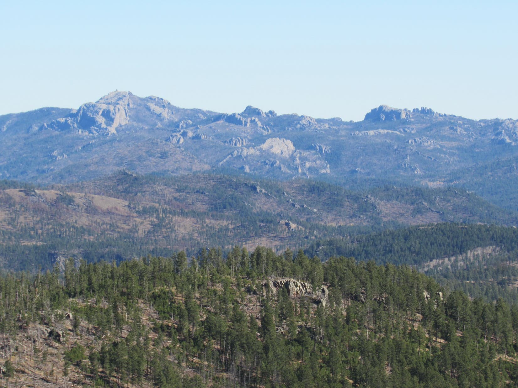
The summit as seen from Nipple Butte’s N high point. The 6′ high limestone wall SPHP boosted Loop up is at Center. The vegetated area below is the top of the chute Lupe climbed to get here. The forested ridge on the L is Castle Rock. Photo looks S.The S end of Reynolds Prairie, bits of Deerfield Reservoir, and the distant high ridge of Green Mountain (R) from Nipple Butte. Photo looks SSE.
One more peak to go! SPHP helped Loopster off the summit platform. Puppy, ho! Back down the steep WNW chute to broken limestone scree leading to scattered boulders, and finishing it all off with the usual deadfall infested trek in the forest.
Heading down the WNW slope. Photo looks W.
Lupe reached USFS Road No. 189 at the saddle leading to Flag Mountain. Half a mile NW of here a spur road leaves No. 189. The spur winds 0.75 mile NE almost to the top of Flag Mountain.
Nah, not that way! Instead, Loop crossed No. 189 heading N. Traveling directly up Flag Mountain’s S ridge would be shorter and more fun. An hour after leaving Nipple Butte, the Carolina Dog was standing in the remnant of the old fire lookout tower on Flag Mountain(6,937 ft.).
Lupe in the remnant of the old fire lookout tower on Flag Mountain. Photo looks E.Perched up on the wall, feeling good about her 4th successful ascent of the day!Looking S back where Lupe had come from. Nipple Butte is seen in front of Castle Rock (Center).Looking W along Flag Mountain’s summit ridge.Near the remnant of the fire lookout tower. Photo looks E.Another look from a bit farther W.
Flag Mountain was the highest of any of the peaks Lupe climbed today. The views were grand, though this much larger summit area did not give quite the same feeling of exposure and airiness she’d had up on Nipple Butte.
Early in the day, there had only been a light NW breeze. By the time Lupe reached Nipple Butte, the wind had switched to the SW and picked up to about 15 mph. The same SW wind was still blowing up here. With the sun now noticeably progressing toward the horizon, the breeze felt a bit chilly.
Lupe and SPHP lingered up on Flag Mountain anyway. This was warm compared to what would likely be coming before too long. Who knew how many more weeks it would be before cold and snow would take over up in this western high country?
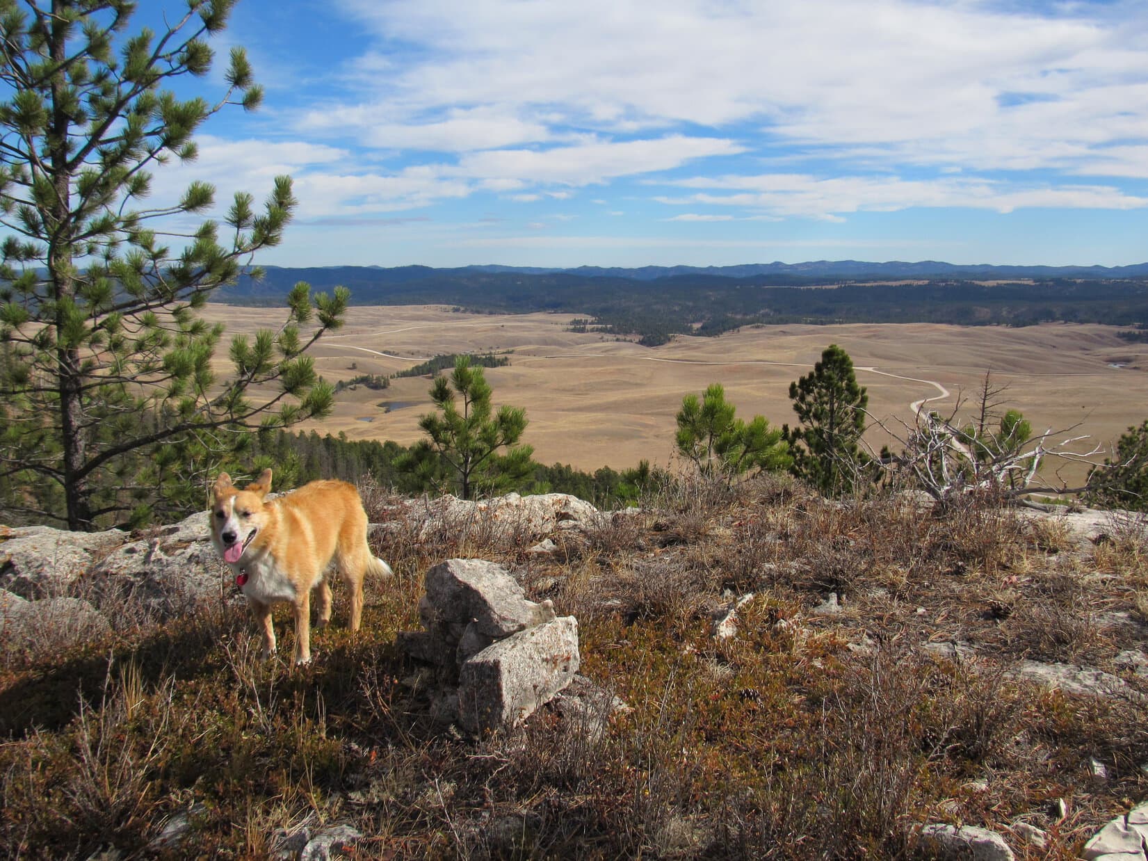
Lupe lingers on Flag Mountain. Who knew how much longer it would be until snow and cold would take over in this western Black Hills high country? Reynolds Prairie is on the L. Both Nipple Butte and Castle Rock are on the R. Photo looks SSE.White Tail Peak(6,962 ft.) is the long ridge at Center. Lupe had enjoyed some fabulous views from there only 3 weeks ago on Expedition No. 209. The more distant mountain on the R is Terry Peak(7,064 ft.). Photo looks N.From the wall of the old lookout tower, Peak6962 (Center) is in view. Photo looks NNW.Black Elk Peak(7,231 ft.) is the high point on the far horizon at Center. As the highest mountain in South Dakota and the Black Hills, many of Lupe’s expeditions feature a view of Black Elk Peak from one direction or another. Photo looks SE.
With 4 successful ascents, Lupe had completed all of her peakbagging objectives for Expedition No. 212. The time had come for SPHP to honor the promise to let her roam some never before explored territory in the big canyon W of South Castle Rock, Castle Rock and Nipple Butte.
Final moments up on Flag Mountain’s summit ridge before descent. Photo looks NE.
Lupe left Flag Mountain traveling W. She ultimately took a route down similar to her path up, following the S ridge much of the way. An early turn to the SW served as shortcut to USFS Road No. 189.
Once across No. 189, the American Dingo began her explorations of the big canyon traveling SSW. It was downhill from here all the way to West Deerfield Road.
NNW of Nipple Butte looking forward to starting the long trek down the big canyon. Photo looks SSE.
Lupe saw lots of deer. She got muddy paws and drank from a small stream, a tiny tributary of Horsethief Creek, itself no great torrent. Looper was one busy Carolina Dog the whole way, free to run and play.
In the upper part of the canyon W of Nipple Butte. This seldom, if ever, used road went most of the way down the canyon. Photo looks SSW.Miss Muddy Paws after a drink from the tiny stream. The road was reduced to a single track trail here. Photo looks S.Somewhere W of Castle Rock or South Castle Rock. The faint road is back. Looking S.Near Horsethief Creek in the lower end of the canyon, now more of a wide valley. Photo looks NNE.
The sun was close to setting by the time Lupe neared West Deerfield Road. The G6 was a only short walk SE along the road. Expedition No. 212’s adventures were almost complete. Behind Loop, the top of South Castle Peak still glowed in the last light of day.
South Castle Rock glows in the last light of another great day spent in Lupe’s Black Hills. Photo looks NNE.
That glow was gone before Lupe even got to the G6 (6:01 PM, 36°F). Expedition No. 212 might be officially over, but Lupe’s fun wasn’t. She was back early enough so twilight would last a long time.
For nearly an hour on the ride home, a frantic American Dingo watched for deer, cows and horses to bark at. Many decibels provided near constant earsplitting proof of the success of this project. No doubt a hugely satisfying encore to a splendid day!
Part 2 of Day 5, plus Day 6 of Lupe’s 2017 Dingo Vacation to the Laramie Range, Wyoming & Beyond!
Reluctantly, Lupe left the huge old squirrel tree at the edge of the beautiful green glade. She quickly forgot about squirrels, sniffing her way NNE. The Carolina Dog came to a burned forest, passed through it, and entered another section of live forest where she crossed a dirt road. By the time she reached the W side of the Meadow Creek valley, Loop was back in burned out forest again.
Lupe reaches the burned out forest in the Meadow Creek valley on her way to Buffalo Peak. Photo looks N.
After having a great time climbing nearby Squaw Mountain(9,313 ft.) earlier in the day, Loop was on her way to Buffalo Peak(9,387 ft.). The summit was now less than a mile to the NE. Unfortunately, the weather was deteriorating. Clouds were moving in. A sudden wind arose, and distant thunder could be heard. Better take cover, but where?
Glancing around, SPHP spotted a square recess in a big rock formation. The opening appeared to have a bit of an overhang. The recess was 70 feet higher up a moderately steep slope to the SW. Lupe could hide out there until this squall passed.
No other option was readily available. Loop and SPHP climbed the slope up to the square recess. The opening was large enough to accommodate both Lupe and SPHP, with sufficient overhanging rock to provide decent protection from rain or hail. Sweet!
Lupe at the square recess in the rock where she would take shelter from the storm. Photo looks W.
While the American Dingo watched from the safety of the square recess in the rock, storm clouds swept across the sky from the SE. Only a small patch of blue sky remained to the N. Lupe saw a single bolt of lightning miles to the E. An eerie, angry buzzing or humming sound filled the whole valley. The peculiar noise went on and on.
The wind blowing among the dead trees must be making that strange sound! From here, Lupe could see nothing but burnt forest in Meadow Creek valley. On the other side of the valley, the entire SW face of Buffalo Peak had burned, too.
Thunder rumbled constantly. While Lupe waited for the storm to hit, SPHP had plenty of time to check maps and study the SW face of Buffalo Peak. The plan had been to go N up the Meadow Creek valley, gradually turning NE. When Lupe got high enough she would turn SE, approaching the mountain from the NW. The topo map seemed to suggest this would be the easiest way up.
However, the SW face of Buffalo Peak didn’t look all that bad. It appeared Lupe might be able to go right on up a long, wide slope between two large rock ridges. Above this wide chute, she would need to turn E to reach the top of the mountain, but that looked feasible from down here, too.
From her square recess in the rocks, Lupe could see the whole SW face of Buffalo Peak. SPHP thought she could probably climb the mountain from this direction, instead of circling around to the NW as originally planned. Photo looks NE.
After a huge, suspenseful buildup, nothing happened. No hail, no rain – not even a drop. The distant thunder and the odd buzzing sound both faded away as storm clouds sailed off to the NW. Blue skies returned. Buffalo Peak was in sunshine. More than 40 minutes had gone by. This was her chance! Lupe had better get going!
The American Dingo headed NE down into the valley. She crossed Meadow Creek, which was only a small stream. Soon she reached the base of the long slope up the SW face of Buffalo Peak. Even from here, it didn’t look bad.
Lupe began climbing. The long chute was very wide, bordered by large rock formations on both sides. At first, Looper encountered quite a lot of deadfall timber. Higher up, less deadfall existed. The slope was steep, but not at all scary. Lupe traversed a mix of bare ground, scattered yellow flowers, and numerous small to medium-sized loose rocks.
The American Dingo made great progress, especially after SPHP got above the worst of the deadfall. Lupe made it up to the top of the long chute. She now needed to angle more to the E. What appeared to be Buffalo Peak’s summit was still a good 300 feet higher. Getting up there looked somewhat more complicated from here than it had appeared from below. However, Lupe was able to gain elevation traveling ENE below a high ridge of rock.
Lupe near the upper end of the long steep slope she climbed from the SW. From here, she gained elevation traveling ENE (R) through more complicated rocky terrain than expected. Photo looks N.
Shortly after reaching the upper end of the SW chute, it became clear another squall was on the way. More clouds were approaching rapidly, blown in on a strong SE breeze. No lightning was seen, but initially faint thunder grew steadily louder. Time to seek refuge again!
A great many large rocks were in the area, but places to hide beneath an overhang were scarce. Lupe and SPHP scouted out possibilities with increasing urgency. A couple of tight spots were all that could be found. SPHP stuffed the backpack beneath a small overhang. Loop and SPHP jammed together into a different barely large enough space under a big rock nearby.
As another squall approached, Lupe and SPHP searched for a place to take shelter. Lupe and SPHP wound up jammed together in the small space under the rock seen to the L of Lupe. Photo looks SSE.
Wind blew. Thunder rumbled, but no lighting was seen. A series of threatening clouds raced by. From the cramped space, SPHP had a glimpse of wild-looking clouds and blue sky far to the S.
Ho hum. Dullsville. Lupe had gotten used to this routine. She dozed on SPHP’s lap, waiting for the squall to pass.
In cramped quarters under a large rock, Lupe dozes on SPHP’s lap, while waiting for the storm to pass.
Eventually, the distant blue sky to the S appeared to be heading this way. Once again, not a drop of rain, despite all the sound and fury! When thunder could no longer be heard, and sunshine reached Squaw Mountain 1.5 miles away, Lupe and SPHP clambered out from under the boulder.
With skies starting to clear again, Lupe emerged from beneath the boulder she’s standing on to resume her ascent of Buffalo Peak. Photo looks NE.
Another 30 minutes had been lost. The summit of Buffalo Peak was still 200 feet higher. Lupe resumed her ascent.
Within 10 minutes, the American Dingo had scrambled up enough boulders to reach a large amphitheater where the ground sloped toward the NW. The amphitheater contained burnt trees, quite a few large low rocks, and a fair amount of bare earth with little vegetation. Around the perimeter were 3 large ridges of rock, with openings to the SW and NW.
Lupe reaches the amphitheater near the top of Buffalo Peak. The true summit is unseen a short distance beyond the high rocks on the L. Photo looks N.
Of the 3 high points on the rocky ridges around the amphitheater, the lowest was clearly the one to the SW. From below, the one to the SE had appeared to be the mountain’s summit. However, from the amphitheater it looked fairly certain the large ridge to the N was actually highest.
Lupe went to check out the SE ridge first, in case part of it was hidden from view. The possibility that the true summit was over here hadn’t been completely ruled out yet. As soon as Loop got up on top, though, it was clear this was not the true summit. Nevertheless, the views were awesome!
Loop reaches the top of Buffalo Peak’s SE high point. This turned out not to be the true summit. Photo looks NE.Retreating clouds make for a dramatic scene from Buffalo Peak’s SE high point. Photo looks NNE.Squaw Mountain(9,313 ft.) (Center) is the high burnt ridge to the R of Lupe. The much more distant high point seen above her rump is Warbonnet Peak(9,414 ft.). Photo looks SE.The lower SW ridge is in view on the R. The territory Lupe had come up through to reach the amphitheater from the SW is seen on the R. Photo looks SW.The summit of Buffalo Peak as seen from the SE high point. Photo looks NNW.
From the high point on the SE ridge, the true summit of Buffalo Peak was clearly seen off to the NNW. Lupe had to get over there to claim her peakbagging success. Off Lupe went. A scramble up from the SE was easily accomplished. The mighty Carolina Dog stood at the very top of Buffalo Peak(9,387 ft.)!
Loop stands on the true summit of Buffalo Peak. Photo looks NW.Lupe’s odd summit stance makes the situation look much more precarious than it actually was.Looking N from the true summit.Buffalo Peak’s SE high point is seen beyond Lupe. Squaw Mountain is the long, high burnt ridge even farther away. The plastic jar by the summit rock on the R contained a registry. Photo looks SSE.
A plastic jar tucked next to the two highest rocks on the mountain contained a registry. Six people ranging from 10 to 64 years old had made the trek up Buffalo Peak and started the registry on Memorial Day, 2013. Since then, only one other person had signed in on 7-12-16. Naturally, Lupe’s name got added.
The Buffalo Peak registry had gotten off to a good start on Memorial Day, 2013, but had seen little use since then.
It was a good thing Lupe made it to the top of Buffalo Peak when she did. Before long, the weather was deteriorating again. The entire sky grew dark. Distant peaks disappeared in a soft, gray haze. Nearby peaks could still be seen clearly, except when wisps of fog streamed by on the relentless SE breeze. Thunder roared threats from afar.
SPHP started down first. At the top of Buffalo Peak, Lupe stood alone in the wind waiting for the signal to come.
Alone on Buffalo Peak waiting for the signal to follow SPHP down. Photo looks NW.
The signal was given. Lupe bounded down. Now it was a race against the storm! She scrambled down to the amphitheater of dead trees, crossed it heading S, and started descending the mountain’s SW slope. Loop hadn’t lost much elevation before it was necessary to hide again.
Another overhanging rock was found to squeeze in beneath. This time there was room for the backpack, too. Lupe and SPHP waited. No blue sky could be seen, only a light band of weird yellow sky on the SW horizon. The wind picked up. Sprinkles of rain dashed against the rocks.
Under the rock, waiting out the latest storm threat on the descent.
Thunder echoed closer than before, but Lupe remained calm. She dozed while SPHP stroked her warm fur and soft ears. It rained harder. Water began dripping into Lupe’s refuge, ultimately becoming a steady stream. The Carolina Dog curled up on SPHP’s lap, comfortable and dry, while SPHP sat on increasingly muddy ground.
Half an hour passed with no changes. How long was this going to go on? The Carolina Dog might be fine here, but SPHP was not looking forward to a long night crammed under a rock. That was what it would come down to if the storm didn’t let up. Getting drenched didn’t seem like a good plan either. Better stay as dry as possible. No reasonable choice other than to wait it out.
An hour went by. It began to hail. Nothing major. Pea-sized hailstones ricocheted off nearby rocks. A few struck stinging glancing blows, but did no real damage. Fun, fun!
After 10 minutes, the hail let up. It had been the storm’s last hurrah. A SE breeze remained, but now the sky was clearing again. Not a moment too soon, either. The sun was getting low. Better make tracks. Lupe and SPHP set off down Buffalo Peak, retracing the Carolina Dog’s earlier route up.
A profusion of yellow wildflowers like these grew on the slopes of Buffalo Peak.
The sun was still up when Lupe reached the top of the long, wide SW chute leading down to the Meadow Creek valley. By the time she reached the worst of the deadfall timber at the lower end of the slope, sunlight remained only high up on Squaw Mountain.
The sun was still up as Lupe began her descent of the wide, SW chute leading to the Meadow Creek valley. Photo looks SW.
Puppy, ho! Onward! No time to lose. Lupe crossed Meadow Creek again, and turned S. As twilight weakened, she passed through the burnt forest and reached the live forest. A dark, shady gloom prevailed. Lupe kept going. Across the dirt road, out of the gloom, and into another burnt forest.
Little light remained by the time Lupe made it back to the gnarled old squirrel tree. The tent and sleeping bags hung in it were only slightly damp. At least that had worked. In almost total darkness, SPHP pitched Lupe’s “tiny house” beneath a starry sky. What a day it had been! Sweet success! Lupe had managed to climb both Squaw Mountain(9,313 ft.) and Buffalo Peak(9,387 ft.).
Once safely inside her “tiny house”, Lupe was ravenous. She gobbled down her Alpo, before curling up on her red sleeping bag. In no time, she was out like a light. (End of Day 5)
It was a cold night. The wind blew for hours, yet the American Dingo hardly stirred. When she did, SPHP kept wrapping the red sleeping bag over her for warmth. She must have snoozed well, much better than SPHP. When dawn arrived, Loopster was ready for action. She demanded to be let out!
No problem. Loop wouldn’t run off, not with a giant squirrel tree right outside. SPHP unzipped the tent door. Out she went. An excited yipping and yapping commenced immediately. The squirrel tree hadn’t failed her. An annoyed squirrel scolded the Carolina Dog for rudely breaking the early peace and tranquility of the new day. The scolding only egged her on.
The excitement finally died down and became an occasional thing. SPHP dozed fitfully for another 2 hours, checking on Looper every so often. She was always there, waiting and watching beneath the huge squirrel tree.
The sun was well up by the time SPHP managed to spring back to life. A stroll out in the sunny green glade to take off the morning chill was in order. The warm sunlight felt good.
Lupe next to her “tiny house” at the edge of the green glade. The huge squirrel tree is beyond her. Photo looks N.In the warm sunshine of the green glade. Photo looks S.
The original plan had been for Lupe to climb Buffalo Peak today, but she’d already done it. Fortunately, there was something else fun to do on the way back to the G6. Looper could climb Twin Peaks(9,280 ft.) again. Twin Peaks was the mountain Lupe had climbed a year ago where she’d first spotted Squaw Mountain and Buffalo Peak.
Lupe stood guard at the base of the squirrel tree while SPHP packed everything up. When all was ready, Loop had to leave the squirrels in peace. She didn’t mind. By now she was ready for more exploring. She crossed the green glade heading S and entered the forest.
Back in the forest.
It was 2 miles back to the minor pass S of the big rock formation close to where Lupe had left Twin Peaks Trail No. 618 yesterday. On the way, Loop stayed W of the route she had taken to Squaw Mountain. Much of the time she was in forest, but a brighter, more open forest than she’d been in before.
Loop made it back to the minor pass. SPHP ditched the tent and sleeping bags near some rocks. The Twin Peaks summit was only 0.5 mile S from here. Lupe crossed Twin Peaks Trail No. 618 and took off into the forest again, starting her ascent. At first, she had only the forest and deadfall timber to contend with. Higher up, she reached rock formations, much steeper ground, and even some snow.
On the way up Twin Peaks, Lupe reaches rockier territory and even some snow. Photo looks SSW.
The Carolina Dog came to a rocky high point SPHP recognized from last year. As she continued higher, the mountain seemed more and more familiar. For the most part, Lupe took a more direct route straight up from the N this time. She didn’t scramble up onto the same NW ridge she had approached from last year until very near the summit.
On the way up the N slope, the NW ridge protected Loopster from the weather. Upon attaining the summit, however, she was exposed to the full force of a gale blowing out of the SW. Puffy white clouds floated swiftly by. The sky was mostly blue, and the day sunny, but it wasn’t warm or relaxing up here.
Lupe detested the wind. She stood on the summit long enough for a short photo session. After that, SPHP could gaze at the views without her. Loop hid down in a grassy slot between some of the highest rocks where she was at least partly sheltered from the relentless, stiff breeze. The American Dingo had some sense, even if SPHP did not.
Lupe stands on the tip top rock on Twin Peaks(9,280 ft.) again for the first time in a year and 12 days. It was windy! Squaw Mountain(9,313 ft.), which Lupe had climbed yesterday is seen on the L. Photo looks NE.Part of Squaw Mountain (Center) is seen near Lupe’s forehead. Buffalo Peak(9,387 ft.) is the barren rounded peak a little to the L. Photo looks NE.Laramie Peak(10,272 ft.) (Center) is the most distant high point. Warbonnet Peak(9,414 ft.) is the highest point closer by on the R. Photo looks SE.A Carolina Dog leans into the stiff SW gale up on the summit of Twin Peaks. Photo looks E.Loopster takes shelter from the roaring SW wind in the slot between Twin Peak’s summit rocks. The open end of the slot faces W, so the protection wasn’t perfect, but it was a lot better than standing up on top of these same rocks. Photo looks E.
The views from Twin Peaks were fabulous! Seeing them again was great fun, especially looking over at Squaw Mountain and Buffalo Peak now that Lupe had been to both. While Lupe hid out, SPHP endured the gale a little longer.
Looking W. The very last part of Lupe’s ascent was from this direction.It was especially fun seeing Buffalo Peak (L) and Squaw Mountain (R) from Twin Peaks again now that Lupe had climbed both! Photo looks NE.The valley Lupe would travel through on her way back to the Twin Peaks trailhead is seen below. Squaw Mountain is on the L. Photo looks ENE.Buck Peak (9,061 ft.) is the conical mountain at Center. Photo looks NNW.
It was a shame it was so windy up on Twin Peaks, but SPHP was glad Lupe had returned. Still, 20 minutes of this gale, and even SPHP was ready to retreat. Lupe was more than happy to start the descent. She definitely preferred roaming the forest to the conditions at the top.
Heading down the N slope of Twin Peaks. Lupe much preferred the forest where she was sheltered from the wind. Finding hidden snowbanks like this one was an added bonus!
Looper returned to the minor pass N of Twin Peaks. SPHP retrieved the tent and sleeping bags. Together, Lupe and SPHP started E back down Twin Peaks Trail No. 618.
At 2:19 PM, Loop arrived back at the trailhead. After a bite to eat, both Lupe and SPHP were overcome with weariness. Adventuring can take it out of you! Nothing wrong with taking a nap, is there?
Naptime lasted nearly 3 hours. When she awoke, Lupe’s adventures in the Laramie Mountains were about over for now. During the last 6 days, she’d had peakbagging successes and failures, spent countless hours sniffing and exploring, seen many beautiful things, and even faced some dangers. As wonderful as it had all been, the moment had come to move on.
On the way back to Douglas, Lupe rode with her head out the window of the G6, barking vigorously and happily at everything she saw along the way. SPHP stopped at several scenic spots. The SW wind still blew hard, but that didn’t detract from the beautiful western scenery.
Near Bear Rock along Cold Springs Road, Lupe faces into the sun and SW wind. Photo looks NE.Lupe on her way back to Douglas, WY. She’s leaving behind adventures in some truly beautiful territory. Bear Rock (L), Squaw Mountain (Center) and Buffalo Peak (R). Photo looks SW.Bear Rock seen through the telephoto lens. Photo looks SW.A pronghorn antelope dashes away across the rolling high plains. Lupe loves watching antelope run!Lupe stopped by the fancy entrance to the gorgeous Powderhorn Ranch. Buffalo Peak (Center) is in the distance. Photo looks SW.The Powderhorn Ranch SW of Douglas, WY. Buffalo Peak (L) in the distance. Photo looks SW with help from the telephoto lens.
Upon reaching Douglas, WY, Lupe and SPHP headed W on I-25. A side trip S to Ayer’s Natural Bridge ended in disappointment. A sign said the park closes at 5 PM, and it was more than an hour later than that. Didn’t matter. The sign also said no pets allowed. Oh, well.
Lupe was happy anyway, barking at the buffalo she saw from the G6 in a big field along the gravel road.
Buffalo near the road to Ayer’s Natural Bridge.
Back at I-25, SPHP drove W. Bright-eyed Lupe rode up even with the dash, comfy on her pile of pillows and blankets. With the Laramie Mountains to the S, and high plains to the N, the sinking sun shone upon her eager face. Loop was on the road to adventure once more! Tomorrow she’d be in unexplored territory beyond the Laramie Range.
Wow, surprising! Snow on the road here. Only a dusting really, but it was the first snow Lupe had seen up in the Black Hills so far this fall. A harbinger of things to come, but probably not in quantity for another month yet. American Dingoes love snow, if there’s not too much of it. Lupe was in a cheerful mood as she began her trek up Bear Mountain along USFS Road No. 299.1C.
Bear Mountain(7,166 ft.) was only a couple miles SW, so it wouldn’t take her long to get there.
Lupe was excited to see snow on USFS Road No. 299.1C as she started up Bear Mountain. Photo looks W.
More than 0.5 mile from where she’d started, Lupe reached an intersection. USFS Road No. 299.1C turned N here. Loop took No. 299.1J heading W instead. Up until now, the road had been in the forest, but No. 299.1J soon curved SW entering more open territory.
USFS Road No. 299.1J curves SW as Lupe continues up Bear Mountain. Photo looks WSW.
Although Lupe came to no more intersections, by the time she reached a barbed wire fence practically at the top of the mountain, a marker said she was on No. 299.1K. Exactly where the transition occurred wasn’t clear. It hardly mattered. Lupe didn’t care. The important thing was she had made it to the top of Bear Mountain.
Lupe went over to the base of the fire lookout tower to claim her latest peakbagging success!
Lupe arrives at the base of the fire lookout tower on Bear Mountain. This was her 3rd ascent of the 3rd highest mountain in the Black Hills. Photo looks SW.
This was Lupe’s 3rd ascent of the 3rd highest mountain in the Black Hills. On one of her previous visits, Lupe had actually gone all the way to the top of the lookout tower. She and SPHP had paid a visit to the friendly forest ranger on active duty inside the ranger quarters.
No one was around today. With no opportunity for another social visit in the comfort of the ranger station, Lupe didn’t bother to climb the tower. A chilly 15 mph breeze blew out of the N. The cold wind would only be worse higher up.
Instead, Lupe went to a small limestone outcropping SE of the tower to check out the views.
Lupe up on the limestone SE of the ranger tower. Black Elk Peak(7,231 ft.) (Center) is the high point seen in the distance. Photo looks E.Looking back at the fire lookout tower. Photo looks NW.
The best views were off to the E where Black Elk Peak(7,231 ft.), the highest mountain in South Dakota, dominated the scene. Lupe also enjoyed a panoramic view to the S. The American Dingo could see much of the southern Black Hills from here.
Black Elk Peak (Center) is 11 miles due E of Bear Mountain.Looking ESE with a bit of help from the telephoto lens. Black Elk Peak is now on the L.From Bear Mountain, Lupe also had a sweeping view of much of the southern Black Hills. The highest point in the distance on the L is Northeast Cicero Peak(6,240 ft.). Photo looks S.
Climbing Bear Mountain was only the beginning for Lupe. The plan was to visit Odakota Mountain(7,200 ft.) nearly 4 miles to the N, too. Since Lupe and SPHP had gotten off to a rather late start, it was already past noon. With days getting short in mid-October, Lupe couldn’t linger on Bear Mountain too long.
After checking out the views, Loopster briefly dropped by the Bear Mountain fire lookout tower again before continuing on her way.
Lupe at the fire lookout tower on Bear Mountain again before leaving for Odakota Mountain. Photo looks E.Loop ready to depart Bear Mountain. Photo looks N, the direction she would be heading to get to Odakota Mountain.
Both Bear Mountain and Odakota Mountain lie along the E edge of the high limestone plateau country of the western Black Hills. The first part of Lupe’s journey N to Odakota Mountain would be along the E rim of the high country.
From the Bear Mountain fire lookout tower, Lupe took the same road she had come in on NE a short distance. When she got close to the E rim, she followed another road that angled N. This road eventually turned NW. Lupe left the road to continue N along the rim. Odakota Mountain was already in sight!
Lupe near the E rim of the high country of the limestone plateau. Her next objective, Odakota Mountain is the high ridge seen beyond her. Photo looks N.
The terrain along the E rim was hilly. The area was forested, but generally not too densely. However, a fair amount of deadfall timber existed in spots. In a couple of places, the deadfall was dreadfully thick.
Back this summer, Lupe’s mountaineering friend Jobe Wymore had given SPHP a free pair of excellent Komperdell trekking poles. SPHP had never used trekking poles before, and until today had done nothing with Jobe’s gift. SPHP quickly discovered that the poles really did help going through the deadfall!
For 1.5 miles, Lupe traveled N near the E rim of the limestone plateau country. When the American Dingo finally reached a road, SPHP knew she had arrived at an intermediate objective, the Boy Scout overlook.
Coming from the W, USFS Road No. 291.3K leads almost to the edge of the E rim here. A short path goes from the highest ground down to a large, flat limestone platform perched at the top of sheer cliffs. A pond a mile to the NE near the Medicine Mountain Boy Scout camp can be seen far below. The platform also provides sweeping views of the Black Hills to the E.
Lupe reaches the limestone platform known as the Boy Scout overlook. Photo looks ENE.The short path leading to the Boy Scout overlook is seen on the L. Photo looks ENE.
The Boy Scout overlook is a favorite spot. Lupe had been here before on other Black Hills expeditions. Before taking a Taste of the Wild and water break, Lupe took a look at the glorious views.
Lupe on the Boy Scout overlook, a large platform of limestone perched at the E edge of the high country of the western Black Hills. Bear Mountain, where Lupe had just come from, is the high ridge seen beyond her in the distance. Photo looks S.Looking E from the Boy Scout overlook. Black Elk Peak is on the horizon beyond Lupe.Black Elk Peak (L), Peak6920 (Center) and Little Devil’s Tower(6,960 ft.) (R) plus some of the Cathedral Spires(6,840 ft.) (R). Photo looks E with help from the telephoto lens.Looking NE now. Peak6720 is the rounded semi-barren hill on the L. Medicine Mountain(6,878 ft.) is the double humped hill with the high point straight up from Lupe’s back. Farther away a bit more to the R is Five Points(6,221 ft.).
Although Odakota Mountain was now only 2.5 miles away to the N as the crow flies, Lupe’s break at the Boy Scout overlook had to be kept short. To actually get to Odakota Mountain, she had to swing more than 1.5 miles W going down Grand Vista Draw. She would then have to go another 1.5 miles back E again on her way up Long Draw. All that extra mileage, plus the distance N!
Loop curled up next to SPHP on the limestone platform for a few minutes, but soon it was back to business. Lupe left the Boy Scout overlook heading W on USFS Road No. 291.3K.
In the upper end of Grand Vista Draw, Lupe reached an intersection. The Carolina Dog left No. 291.3K to take No. 291.3A down the wide, shallow canyon. Beautiful light brown grass lined the road. Lupe passed through a stand of aspens where a few colorful leaves still held on.
Beautiful light brown grass stood along USFS Road No. 291.3A on the way down into Grand Vista Draw. Photo looks WNW.Passing the aspens. A few colorful leaves still clung to the trees. Photo looks WNW.
The trek down Grand Vista Draw was easy. On the way, Lupe saw scattered limestone formations along the canyon sides, but they weren’t high or dramatic. Meadows dominating the upper end of the draw gave way to pine forests lower down. Finally, near the low point where Grand Vista Draw and Long Draw meet, Lupe reached a line of boulders placed across the road.
Lupe reaches a line of boulders across the road in the area where Grand Vista Draw and Long Draw meet. Photo looks N.
A few boulders couldn’t stop Lupe! She continued N on the road, but it ended abruptly in the forest. A short, shady trek brought Lupe to Spring Creek.
Lupe reaches Spring Creek at the start of Long Draw. Photo looks N.
Loop and SPHP crossed Spring Creek (those Komperdell trekking poles proving useful once again!), and climbed through a small meadow to reach a minor road. The minor road quickly brought Lupe to USFS Road No. 693, which she could follow all the way up Long Draw.
Long Draw did seem long. Along the way, Lupe saw deer. She found squirrels to bark at. She had a fun time, but at last the Carolina Dog reached the high point of No. 693 at the upper end of Long Draw where the road turned N.
Loopster in the upper end of Long Draw. Photo looks E.
At the high point, Lupe abandoned the road. The summit of Odakota Mountain was now only 0.25 mile ESE through the forest. SPHP was surprised when Lupe drew near the small, slightly higher ridge where the summit is located. A barbed wire fence crushed in many spots by collapsing trees killed by pine bark beetles had been repaired since Lupe was last here.
The repaired fence was good news! Lupe has been seriously injured by downed barbed wire several times in the past. This had been a dangerous place. It still was to some degree. Even though the fence was fixed, a tremendous amount of deadfall timber still infested the area. Lupe and SPHP cautiously picked a way through the mess.
Lupe found the small cairn near the E end of the relatively short summit ridge. She had made it to the top of Odakota Mountain(7,200 ft.), the 2nd highest mountain in South Dakota!
Lupe reaches the summit cairn on Odakota Mountain, the 2nd highest mountain in South Dakota. Photo looks WSW.The summit ridge on Odakota Mountain is a jungle of deadfall timber. Photo looks WSW.
Although Odakota Mountain is the 2nd highest in South Dakota, the summit doesn’t provide much in the way of views. Despite how many trees have died and fallen over, more still remain. A tree-broken view to the S was about all there was to see.
A tree-broken view to the S is all the summit of Odakota Mountain has to offer. Lupe could see Bear Mountain (the long high ridge in the distance) where she had come from, and the small pond near the Medicine Mountain Boy Scout camp (far L).
Cliffs at the far SE end of Odakota Mountain do offer unobstructed views. Lupe had seen them once, long ago. However, getting there from the summit requires a bushwhack through a significant stretch of bad deadfall timber. Lupe didn’t have time to go see those views today.
Lupe relaxed next to the summit cairn. Once again, a short break was all she could afford to take.
Lupe relaxes next to the summit cairn. Another short break was all she could take here. Photo looks NW.
Odakota Mountain is one of the mountains Lupe has visited most. This was her 8th time at the summit. The first time the Carolina Dog had come here nearly 3.5 years ago, there hadn’t even been a cairn. The last time she’d been here was over 1.5 years ago, when she had first met her friend Jobe Wymore and guided him to the mountain. Sadly, Jobe wasn’t here to share the mountain with her today.
Snap out of it, Loop! Enough reminiscing! We’ve got to get going. You still have to go all the way back to Bear Mountain and then back down to the G6!
The American Dingo sprang to her paws! Time for action? She was ready! Isn’t she always?
Leaving Odakota Mountain, Lupe got to do something she had never done before. For over 0.5 mile, she explored the high ground along the edge of the mountain’s SW ridge. SPHP wanted to see if she could find any unobstructed views from this area. She did, too!
Bear Mountain, the long high ridge on the R is where Lupe was heading back to from Odakota Mountain now. Part of the pond down at the Medicine Mountain Boy Scout camp is seen below on the L. Photo looks S.Lupe did find beautiful, unobstructed views from Odakota Mountain’s SW ridge. Black Elk Peak is on the horizon beyond Lupe’s face. Photo looks ESE.Exploring Odakota Mountain’s SW ridge. Photo looks WSW.
Lupe had a great time exploring Odakota Mountain’s SW ridge, but only got to go about halfway along it. Too much deadfall timber was slowing things down, and the American Dingo no longer had time to waste. She returned to Long Draw. Lupe traveled through the fields paralleling the road.
Day nears an end as Lupe travels back down Long Draw. Photo looks SW.
Hurry, hurry! Now it was a race against time. The sun sank ever lower, then disappeared. Lupe and SPHP made good time, but twilight was fading fast as Lupe came back up Grand Vista Draw.
Looper followed USFS Road No. 291.3A S beyond its junction with No. 291.3K. For a while she stuck with it, but when the road turned SW it was decision time. Staying on the road meant miles and miles of extra distance. The other option was to bushwhack SE to the E edge of the limestone plateau country on the most direct route to Bear Mountain.
SPHP led Lupe SE. Leaving the road was contrary to long-standing rules against trying to bushwhack after dark. On the other hand, Lupe had already traveled much of this same territory earlier in the day. SPHP felt confident that having the E rim to follow meant she wouldn’t get lost.
Faint twilight lingered only far to the W now. Stars shone above, but no moon. Black night took over. Somehow the Carolina Dog always seems able to navigate in the dark without any problem. Not SPHP, who was walking unseeing straight into waist-high pines.
SPHP ran into a barbed wire fence. No damage done. Lucky! SPHP was blind as a bat. Better bring out the flashlight. The fence was good news, actually, it meant Lupe was getting close to the E rim. Deadfall timber was bad here, though. The Komperdell trekking poles were enormously helpful! SPHP would have tripped and fallen a jillion times without them.
After getting past the worst of the deadfall, Lupe reached the E rim! She saw a great many lights glittering far to the NE. That was Rapid City! An amazing number of lights were also scattered toward the SE in the general direction of Custer, but the town was not in view. Guided by the lights of Rapid City, Lupe and SPHP worked S along the E rim. Sooner or later, Looper would come to Bear Mountain again.
Despite initial confusion over exactly where Lupe was upon reaching a road, she had made it! She was back at Bear Mountain. A cold N wind still blew up here. Despite the wind, Lupe returned to the fire lookout tower. So what if it was cold, windy and dark? She’s a peakbagging Dingo, and this was another successful ascent! (End – 9:10 PM, 30°F)


 The signal was given. Lupe bounded down. Now it was a race against the storm! She scrambled down to the amphitheater of dead trees, crossed it heading S, and started descending the mountain’s SW slope. Loop hadn’t lost much elevation before it was necessary to hide again.