Black Hills, SD Expedition No. 107 – Lowden Mountain & Union Hill (12-6-14)

A warmish forecast on a day in early December meant an opportunity for Lupe to go on one of her Black Hills Expeditions.  SPHP parked the G6 at Newton Lake (just a pond, really) along Deerfield Road a few miles NW of Hill City.  It was 9:46 AM, but still only 32°F.  The sky was all overcast.  It didn’t look threatening at all, but maybe things weren’t going to warm up as much as advertised.

Well, it didn’t really matter.  Conditions were good enough, and Lupe was already here.  There was no way the American Dingo was going to let SPHP back out now!  Lupe and SPHP crossed Deerfield Road, and got on the Mickelson Trail heading SE for Burnt Fork Road.  Almost immediately, though, SPHP decided it would be more fun to just cut through the forest instead.  Lupe and SPHP left the trail to plunge NE into the forest.

It wasn’t far at all to Burnt Fork Road, but Lupe came to a fence.  SPHP decided to just follow the fence N, staying on the W side of it.  Union Hill (6,120 ft.), Lupe’s first peakbagging goal of the day, was to the NE.  By heading N a little bit, maybe Lupe could find a route that avoided crossing the fence line.

Lupe wasn’t concerned about the route to Union Hill.  She was looking for a route to squirrels.  She soon found one, too!  A whole lot of barking commenced.  To Lupe’s surprise, her barking was answered – not by the squirrel, but by a couple of dogs who must have lived nearby.  One of them, a big black and white dog, made an appearance at the edge of a clearing to the E.

The black and white dog approached Lupe warily.  One can’t be too careful when dealing with a Carolina Dog, you know!  Lupe and the black and white dog had a good sniff.  The black and white dog seemed friendly, but was suspicious of SPHP.  When SPHP tried to get close, the black and white dog slunk off barking and growling.

Lupe had come to an old road on the W side of the clearing.  Lupe and SPHP followed it N, and soon came to an intersection.  A marker showed that Lupe had been on USFS Road No. 389.1Q.  The other road SPHP recognized as No. 389.1B, which ran E/W here just to the S of Lowden Mountain (6,055 ft.).  SPHP had intended for Lupe to climb Lowden Mountain, but only after climbing Union Hill first.

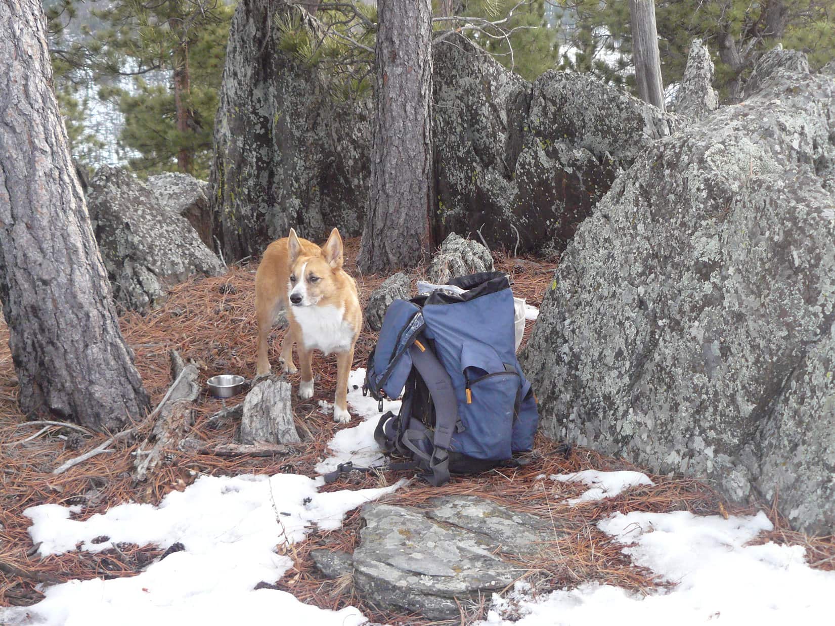
However, with Lowden Mountain so close already, the plan changed.  Union Hill could wait.  Lupe and SPHP started climbing up the S slope of Lowden Mountain.  The first half of the climb was steepest, but really not bad.  About halfway up, Lupe started coming to rock outcroppings, but they were pretty easily traversed or avoided.  The second half of the climb gained elevation more gradually.  Lupe had to go farther N than SPHP expected, but it wasn’t too long before Lupe was at the summit.

Lupe on the very summit of Lowden Mountain. Photo looks SW.

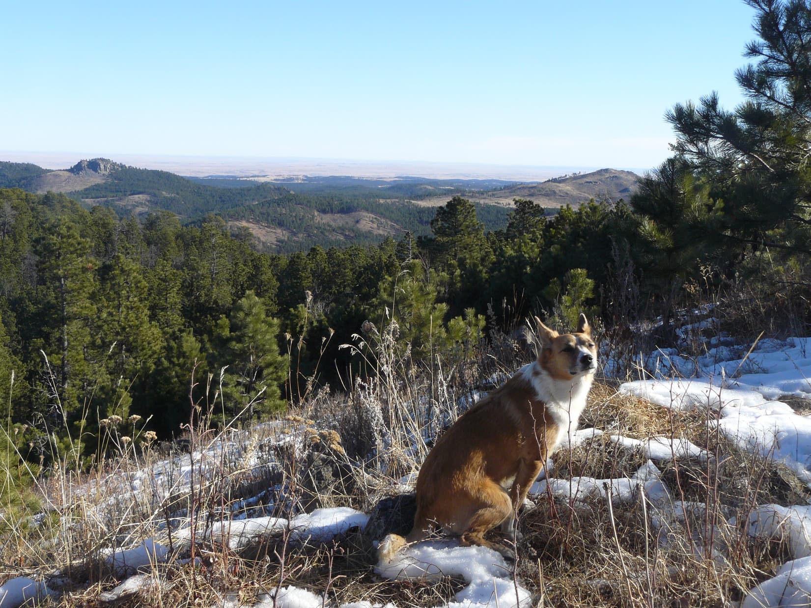
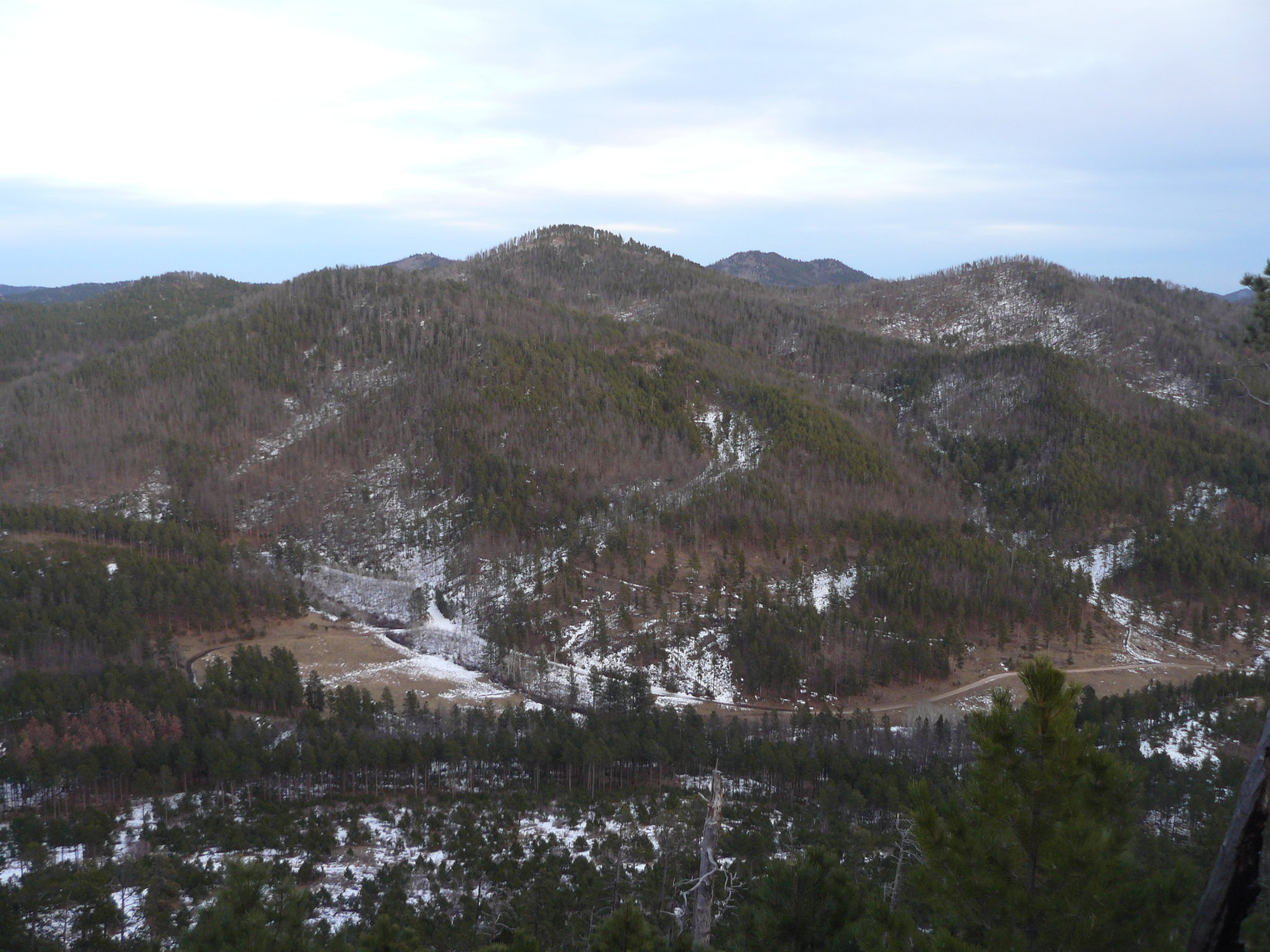
The very highest part of the mountain was in a relatively small area.  Pine trees blocked the view in most directions.  However, a little way to the E was a mostly bare ridge offering wide open views.  Union Hill was on display about 1.25 miles almost straight E.

My, oh my, Lupe! What a big pink tongue you have! "The better to lick you with, my dear!" Union Hill is the rounded hill seen just above Lupe's head. Photo looks E from Lowden Mountain.
My, oh my, Lupe! What a big pink tongue you have! “The better to lick you with, my dear!” Union Hill is the rounded hill seen just above Lupe’s ear. Photo looks E from Lowden Mountain.

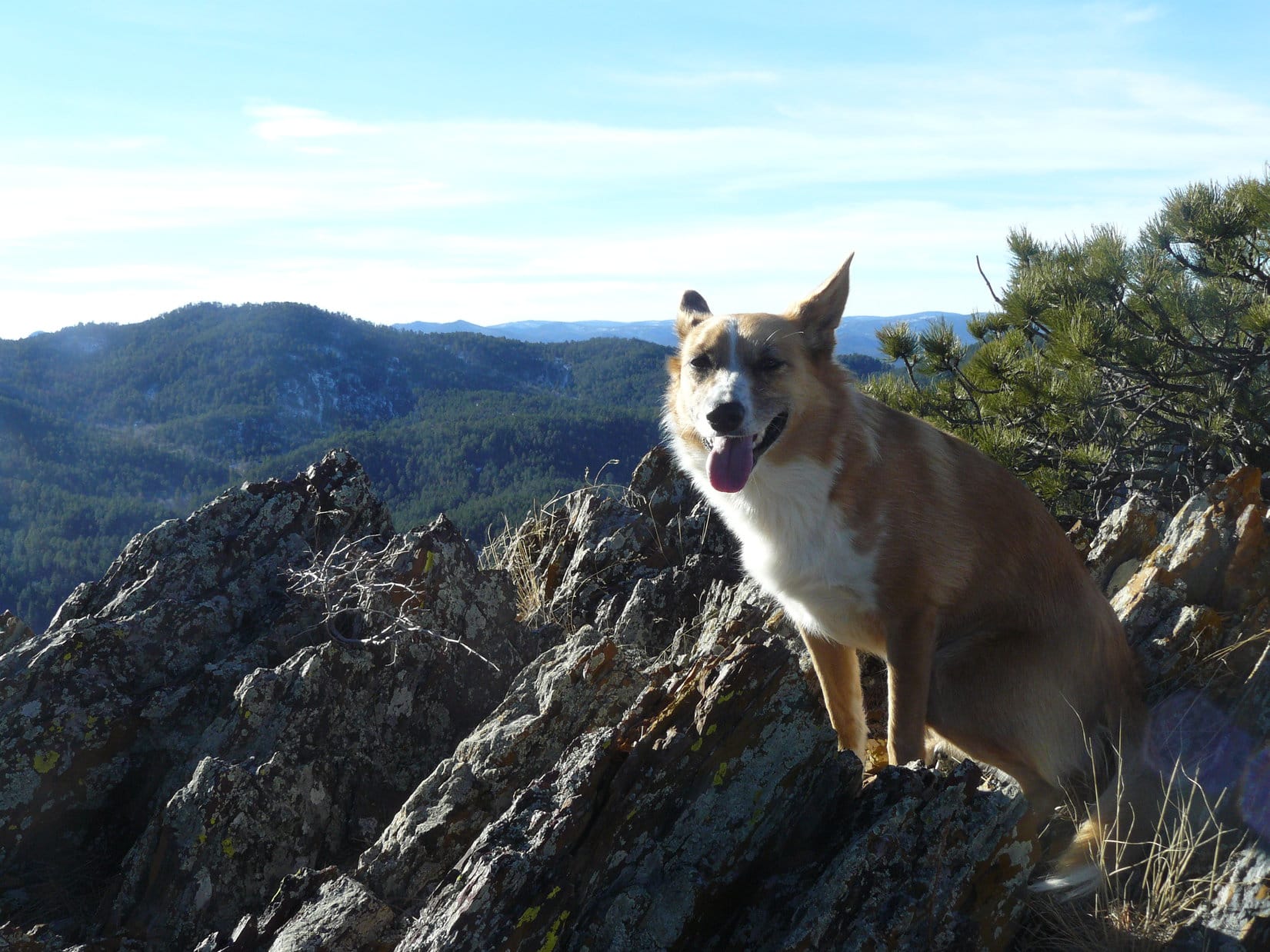
This was actually Lupe’s 3rd time at the summit of Lowden Mountain.  Way back on Black Hills, SD Expedition No. 54 on 4-6-13, Lupe had climbed Lowden Mountain twice on the same day.  SPHP remembered that by going down a bit to the NW of the summit, it was possible to reach a very rocky high ridge that extended out the W.  Lupe and SPHP left the summit to go over and check out the views from the rocky ridge.  The best views were to the WNW and S.

Lupe on the rocky ridge WNW of the summit of Lowden Mountain. The closest hill is Smith Mountain, which Lupe had climbed for the 1st time just 8 days earlier on Black Hills, SD Expedition No. 106. Photo looks S.
Lupe on the rocky ridge WNW of the summit of Lowden Mountain. The closest hill is Smith Mountain (5,897 ft.), which Lupe had climbed for the 1st time just 8 days earlier on Black Hills, SD Expedition No. 106. Photo looks S.

Lupe left Lowden Mountain going down the steep N slope.  For some reason there wasn’t any snow until Lupe had lost quite a bit of elevation.  Lupe and SPHP angled toward the NE as Lupe descended.  When she reached a forest of quite young pines, there was plenty of snow around.  The young Ponderosa pines were growing very tightly packed together, making the going a little difficult for SPHP.

By the time Lupe was out of the thick stand of young trees, she was so far down the mountain that the terrain was leveling out fast.  Lupe came to USFS Road No. 389.1K, which wound around, but generally made its way NNE.  No. 389.1K led Lupe to USFS Road No. 389.1A, where SPHP stopped to check the maps.  The maps showed a bewildering maze of roads in this area.  Lupe had gone so far N that Union Hill was now off to the SE.

The partially restored ruins of the old Gold Mountain mine weren’t too far away to the E.  Lupe had seen them once before back on Black Hills, SD Expedition No. 54, but it would be fun to see them again on the way to Union Hill.  As SPHP put the maps away, SPHP suddenly realized that one of the water bottles SPHP always carries was missing.  It must have fallen out of the pocket of the backpack somewhere along the way.

It was only a water bottle, but Lupe would go back to look for it.  Not until she climbed Union Hill first, though.  Sheesh!  It looked like Lupe was going to make a tradition out of climbing Lowden Mountain twice each time she came here.  Oh, well.  In the meantime, onward to Gold Mountain mine!

The roads were snowy and slippery.  It was actually easier just heading ENE through the forest.  Lupe lost elevation as she went, and soon came to a rather snowy little valley with a small creek flowing SE in it.  She stayed on the N side of the valley where the ground was snow-free due to the southern exposure.  The creek flowed down to a snow-filled meadow.  The ruins of the old Gold Mountain mine sat up on a hillside to the N of the meadow.

Lupe reaches the ruins of the old Gold Mountain mine. Photo looks N.

The Gold Mountain mine was first claimed in the late 1870’s, and actively worked until 1942.  It is one of the few old mines still standing in the Black Hills.  SPHP remembered that there was an old boiler or kiln up on the hill.  Lupe and SPHP went up the hill to see if it was still there.

It was.  So was a bunny!  The bunny saw Lupe coming, made a mad dash for the S end of the kiln, and hopped inside.  The kiln immediately became an item of great interest to Lupe.  She circled around it sniffing carefully, but the bunny was safe inside.  SPHP suddenly seemed to remember from Expedition No. 54 that there was broken glass scattered somewhere around this area.  Lupe had best just leave the kiln and bunny alone, before something tragic happened.

Lupe sniffs around the old furnace or kiln at Gold Mountain mine. She knows there is a bunny inside! This is going to be tough, even for an American Dingo! After all, how many bunnies have a stone and iron fortress to protect them?
Looking W at the Gold Mountain mine.

Lupe and SPHP left Gold Mountain mine.  A short road led SE down a hill, passed to the N of a little frozen pond, and met up with Burnt Fork Road (USFS Road No. 389).  Lupe turned S on Burnt Fork Road, following it less than 0.5 mile to a primitive road coming steeply down a side valley from the E.  Lupe turned E on this road and started gaining elevation.

A little stream flowed near the primitive road.  Lupe had a great time exploring the woods along the stream.  In some places, the stream had frozen, creating huge ice flows right on the road.  SPHP had a less great time trying to get up the slippery ice flows.  The primitive road led to a better road which came in from the N and turned ESE.  Lupe continued ESE on this better road up to a snowy saddle.

By the time the better road reached the snowy saddle, it wasn’t better any more.  In fact, it had almost disappeared.  However, on the other side of the saddle, it looked like it got better again.  It turned ENE down into a bigger snowy valley filled with aspens.  Lupe wasn’t going that way.  The saddle was due N of Union Hill.  After a short rest break, Lupe and SPHP climbed the N slope.  It was snowy and fairly steep, but soon Lupe was at the summit cairn.

Lupe at the summit cairn and post on Union Hill. Photo looks SSE toward Harney Peak (7,242 ft.), which can be seen between the trees.
Harney Peak from Union Hill with help from the telephoto lens.

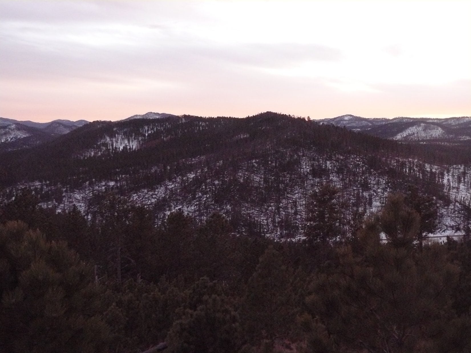
The top of Union Hill was a long, broad, gently sloping ridge.  It was mostly grassy and thinly forested.  Lupe and SPHP went over toward the W end of the ridge to see what kind of view there might be back toward Lowden Mountain.  The W end of Union Hill was more thickly forested, but there was one spot from which there was a relatively clear view of Lowden Mountain.

Lowden Mountain is the closest hill. Photo looks W from Union Hill.

Lupe and SPHP returned to the summit of Union Hill on the way to do a little exploring of the E end of the summit ridge.  Lupe agreed to pose for one more photo W of the summit, but she looked a bit stiff trying to hold her head up above the tall grass.

Just W of the summit cairn on Union Hill. Lupe seemed to be taking this photo rather seriously as she tries to hold her head above the tall grass. Photo looks E.

Lupe soon discovered that a road leads up near the top of Union Hill from the E.  Lupe and SPHP followed the road for a little while after it turned NE.  When it started bending SE, Lupe headed N into the forest.  She followed a forested ridge to a little high point.  Off to the W was the big snowy valley Lupe and SPHP had seen from the saddle N of Union Hill.  Lupe and SPHP turned W and went down into it.

Lupe in the snowy aspen-filled valley NNE of Union Hill. Photo looks SSW back toward the summit.

Down in the snowy valley, Lupe and SPHP went NW until Lupe found the road that had continued E over the saddle just N of Union Hill.  Lupe and SPHP followed it N until it reached an intersection.  SPHP was surprised.  Lupe had been here before!

Back on Black Hills, SD Expedition No. 82, Lupe and SPHP had come looking for Lowden Mountain from the Marshall Gulch area to the NE.  Lupe had reached this intersection, but SPHP had been a bit turned around, and gave up on finding the mountain.  Lupe had made it this far, though.  If SPHP had persisted in heading just a little farther SW, Lowden Mountain would have come into view.  Instead, Lupe and SPHP had gone N from this intersection, and eventually circled back E.

The roads at the intersection were variously marked with USFS Road No. 389 or 254.  The markers didn’t really make any sense when compared with SPHP’s maps, but SPHP knew which way to go without any markers.   Lupe and SPHP left the intersection heading N again, but this time looking for a road to the W.

Lupe soon found one.  The road going W went over a little rise, slowly curved SW and gradually lost elevation.  Lupe sniffed around in the forest, while SPHP enjoyed an easy hike.  The area seemed pretty remote and secluded.  Eventually, it dawned on SPHP that this road was going to come out back at the upper end of the primitive road with the frozen stream.

And it did!  Lupe had gone clear around High Point 5921 N of Union Hill.  Lupe and SPHP followed the primitive road W back down to Burnt Fork Road.  The Carolina Dog then turned N and followed Burnt Fork Road to the road to the old Gold Mountain mine.  Instead of returning to the mine, Lupe stayed on a lower branch of the road.  It went right past the frozen pond.

Lupe at the frozen pond SE of the Gold Mountain Mine. Photo looks SW.

It was time to start the search for the lost water bottle.  Lupe and SPHP returned to where SPHP had first noticed it was missing near USFS Road No. 389.1A.  The plan now was just to retrace Lupe’s route from earlier in the day until she came across the water bottle.  It seemed easy enough.

However, it was harder than SPHP anticipated.  Lupe and SPHP followed USFS Road No. 389.1K going SSW back toward Lowden Mountain.  At first, SPHP wasn’t finding any of SPHP’s old footprints or Lupe’s paw prints.  Lupe already had a good start on the climb up Lowden Mountain, by the time SPHP saw tracks in the snow.

Once the tracks were found, it was pretty easy to follow them up the N face of Lowden Mountain, at least until the snow ended.  By then, it wasn’t that much farther up to the rocky W ridge, so Lupe and SPHP went there first to look for the water bottle.  No luck.  Lupe climbed up to the top of Lowden Mountain, completing her second ascent of the day.  SPHP was really expecting to find the water bottle at the summit.  It was nowhere to be found.

Since it wasn’t at the summit, the chances of finding the water bottle were now not very good.  Lupe might still find it somewhere on the way back to the G6, but success seemed unlikely.  Well, too bad, but it wasn’t exactly the end of the world.  Lupe and SPHP stuck around at the top of Lowden Mountain for a little while enjoying the views again.

Looking E toward Union Hill. Lupe could now say she'd been there!
Looking E toward Union Hill. Lupe could now say she’d been there!
Looking W.
Looking W.
Lupe had some Taste of the Wild at the summit of Lowden Mountain. Her little silver bowl is next to her.
Harney Peak (7,242 ft.) from Lowden Mountain. Photo looks SSE.
Union Hill (Center). Burnt Fork Road can be seen in the valley. Photo looks E.

On the way back to the G6, Lupe and SPHP went back down the S side of Lowden Mountain again.  There wasn’t much snow on this side of the mountain.  Although SPHP saw tracks from earlier in the day a few times, most of the time there weren’t any tracks to follow.  Going down, the terrain looked different than it had coming up.  Unsurprisingly, SPHP did not find the lost water bottle.

The last chance to find it was along USFS Road No. 389.1Q S of Lowden Mountain, where Lupe had met the skittish black and white dog.  SPHP kept watching for the water bottle, but neither SPHP nor Lupe came across it.  Well, that was that.  No telling where it had been lost.

At 4:53 PM (38°F), Lupe and SPHP were back at the G6.  It was almost dark out.  A full moon would be rising soon.  Tonight, somewhere around Lowden Mountain, a water bottle bathed in moonlight was going to freeze and crack.  SPHP had a much better fate in store – a long comfy snooze with a warm, soft, Alpo-stuffed American Dingo!

Smith Mountain from the S slope of Lowden Mountain just after sunset.

Links:

Next Black Hills Adventure                      Prior Black Hills Adventure

Want more Lupe adventures?  Choose from Lupe’s Black Hills Expeditions Adventure Index or Master Adventure Index.  Or subscribe free to new Lupe adventures.

Dry Falls & Crossing the Columbia River, WA (8-19-12)

Day 12 of Lupe’s 2012 Dingo Vacation to the West Coast.

Lupe and SPHP went down to Howard Lake early in the morning before Lanis was up.  The lake was calm and quiet.  Even the fishermen weren’t up yet.  Perfect!  Lupe and SPHP took the single track trail heading S along the E shore.

Lupe saw ducks floating peacefully on the lake.  She crossed a tiny inlet stream.  Near the S end of the lake, the trail left the shoreline and went back into the cedar forest.  A large crane was spooked by SPHP’s approach, and flew away with a great flapping of wings.  Lupe found a few early-rising squirrels.  SPHP did as much as possible to discourage her from barking at this early hour.

Looking back to the N, it was possible to see some of the higher mountains to the NW Lupe had seen the evening before on the mysterious Great Northern Mountain Trail No. 117.  At the very S end of the lake, Lupe crossed another small inlet stream, shortly before reaching the broad cedar-lined trail on the W side of the lake.

By the time Lupe and SPHP had completed their circumnavigation of Howard Lake, Lanis was stirring.  It was time to break camp, and continue W.  Lupe was soon on her way.  NW of Libby, a huge beautiful river, the Kootenai, flowed NW paralleling Hwy 2.  Near Troy; Lanis, Lupe and SPHP turned S on Hwy 56 in order to go see the Ross Creek Scenic Area Giant Cedars.

The turn for the Giant Cedars off Hwy 56 was 0.5 mile S of Bull Lake.  The side road ended at a trailhead 4 miles from the highway.  Lupe, Lanis and SPHP all took the 1 mile loop trail through the towering forest.  A small creek meandered through the area, and the trail crossed it several times.  The ancient western red cedars had huge trunks.  Ferns and moss grew between the monstrous trees.  The forest felt prehistoric, like a dinosaur could come crashing along at any time.  Lupe hadn’t been allowed to go on the Trail of the Cedars in Glacier National Park, but the Ross Creek Scenic Area Giant Cedars had to be just as impressive.

Lupe’s travels continued.  Hwy 200 took her W into Idaho for the 1st time.  Idaho became the 4th Lupe state!  Soon huge Lake Pend Oreille was in view SW of the highway.  At the N end of Pend Oreille, 3 bears ran across the road, right in broad daylight.  They were gone in a flash.  At Sandpoint, Lupe got back on Hwy 2 again.  Washington became the 5th Lupe state.  The American Dingo’s empire was expanding rapidly!

Hwy 2 took Lupe through Spokane, and then out onto barren plains in eastern Washington state.  The area is probably quite pretty at other times of the year, but in late August it felt like a desert.  It had been 95°F back in Sandpoint, ID, and it wasn’t any less out here.  The sun beat down mercilessly.

The Element was air conditioned, of course.  Lupe rode in comfort past yellow wheat fields, and many black fields that had burned or been plowed under.  Dust devils whirled across the desolate landscape.  Far to the N, mountains were on the horizon.  To the S, there was nothing.

SPHP had bought a fried chicken at Safeway in Spokane.  The plan had been to eat it at a city park in one of the little towns along the way.  However, there didn’t seem to be any parks.  Lupe passed through Deep Creek, Reardon and Davenport, and found nothing.  On the way to Creston, there was a forlorn rest area with a couple of picnic tables.  Lupe, Lanis and SPHP devoured the chicken there, but there wasn’t a green blade of grass anywhere.  The place was like an oven.

Of course, at Creston there was a pretty nice little park, but with the chicken already gone, there was no longer a reason to stop.  Lupe continued W.  Past Coulee City, Lanis turned SW on Hwy 17.  Soon Lupe came to a most amazing sight – Dry Falls.  Lanis and SPHP had never even heard of Dry Falls before, but there was a parking area and a little visitor center right next to Hwy 17.  Lupe, Lanis and SPHP stopped to take in the scene.

Dry Falls is thought by some to have been the site of the mightiest waterfall ever known. At the end of the last ice age, it is estimated there were recurring floods here with a volume of water 10 times that of all the rivers in the world combined!

On the opposite side of a chain link fence were sheer 400 foot cliffs down to a broad canyon below.  As the name implies, there is no giant waterfall at Dry Falls now, but the huge canyon downstream is thought to have been carved by recurring flooding on a cataclysmic scale at the end of the last ice age.  A volume of water 10 times that of all the rivers now in the world combined plunged over a precipice 5 times as wide as Niagara Falls.

The canyon below Dry Falls.

Hwy 17 eventually sloped down into the canyon several miles downstream of Dry Falls, and went past a series of lakes.  At Sun Lakes State Park, lots of people were actively boating, swimming and camping.  Of all the lakes, Lenore Lake was the largest.  Hwy 17 went for miles along its E shore.

Lenore Lake is the largest lake in the Dry Falls canyon, but is miles downstream from the falls. This photo looks back upstream toward the N.
Lenore Lake in the canyon downstream of Dry Falls. Photo looks S (downstream).

The entire canyon below Dry Falls was close to 20 miles long.  Along the way, the canyon walls slowly became less impressive, gradually fading away completely before reaching Soap Lake.

From Soap Lake; Lupe, Lanis and SPHP took Hwy 283 SW to I-90.  Pretty soon, Lupe came to another river gorge, that of the mighty Columbia River.

Lupe crossed the Columbia River on this I-90 bridge.
The Columbia River.
The Columbia River.

The light started slowly fading as Lupe, Lanis and SPHP rolled on W of the Columbia River.  Suddenly it didn’t feel like it was too much farther to Puget Sound and Seattle.  Off to the N of I-90, an impressive mountain came into view in the distance.  SPHP figured it was probably Mt. Stuart.

The bright searing heat of eastern Washington state was gone.  Clouds hung over the Wenatchee mountains ahead.  It was much cooler and foggy as Lupe went over 3,022 ft. Snoqualmie Pass.  Darkness fell.  Near Lake Sammamish State Park; Lupe, Lanis and SPHP stopped for the night.  Lupe was almost to Seattle.  Tomorrow, Lupe would see the ocean!

Links:

Next Adventure                     Prior Adventure

Want more Lupe adventures?  Choose from Lupe’s 2012 West Coast Adventure IndexDingo Vacations Adventure Index or Master Adventure Index.  Or subscribe free to new Lupe adventures.

Black Hills, SD Expedition No. 108 – Calumet Ridge & Silver Mountain (12-11-14)

Record setting warmth in December in the Black Hills region meant it was expedition time for Lupe!  When it hit an unbelievable 70°F+, SPHP planned to take Lupe to Cicero Peak (6,166 ft.) the very next day.  Unfortunately, when morning came, SPHP got off to a late start – too late to justify the travel time.  It might be extraordinarily warm out, but that didn’t do a thing to boost the limited number of daylight hours.

Since Calumet Ridge (5,601 ft.) was closer, and Lupe had never been there before either, Calumet Ridge became Lupe’s primary peakbagging goal for the day.  Expedition No. 108 started at a little side road just off USFS Road No. 358 (Boulder Hill Road).  Lupe was less than 0.5 mile S of Boulder Hill (5,331 ft.) and a mile N of Hwy 16, as she left the G6 at 9:43 AM (57°F) following the little side road W.

There was still ice on the road, and snow in the shadier parts of the forest.  The road skirted to the N of Silver Mountain (5,405 ft.), which Lupe had climbed for the first time only a few weeks earlier on Expedition No. 105.  Years ago, the Ponderosa pine forest on Silver Mountain burned almost completely in a devastating wildfire.  In less than a mile, the road Lupe was following turned WSW and entered the burn area.

The road disappeared completely in the grass as Lupe headed up onto a barren ridge sweeping down to the NW from Silver Mountain.  Lupe followed the ridge a little way, and then turned W heading back into the forest.  She soon crossed USFS Road No. 366 at the saddle marking the high point on the road.  Lupe and SPHP continued W of No. 366, climbing two forested ridges separated by a snowy little valley that drained to the N.

From the second ridge, Lupe saw another larger valley to the W.  There was some open ground down there and a road.  Lupe and SPHP headed down into the valley, but as Lupe neared the road, a Jeep came along and parked in the open part of the valley a bit to the S.  A man with a rifle got out of the Jeep.  SPHP realized he intended to do some target practice.

Lupe has never liked gunfire, and she wasn’t going to like this.  SPHP hurried NW to reach the road and start heading N.  When the man opened fire, Lupe was greatly alarmed.  She instantly started begging SPHP to stop and hide.  It was all SPHP could do to persuade her to keep going.  Fortunately, it wasn’t far to a jeep trail that left the main road to climb NW up a little side valley.  Lupe relaxed a little, as the sound of gunfire became less distinct and more intermittent.

The jeep trail split after about 0.25 mile.  Lupe and SPHP took the branch that curved W.  It started climbing more quickly as it bent around to the S.  Lupe arrived up on a little ridge, where SPHP thought there might be some views, but all that could be seen were nearby low forested hills.  Lupe was now up on the E slopes of Calumet Ridge, still about 400 feet below and 0.5 mile SE of the summit.

Very conveniently, Lupe found another jeep trail nearby that went NW.  This jeep trail was icy, and gained elevation at a steady moderately steep pace.  Lupe and SPHP soon reached the top of the ridge at a broad, flat saddle area S of the summit.  The jeep trail continued on down the other side of Calumet Ridge.

Lupe and SPHP turned N.  Lupe found the summit of Calumet Ridge at a rock outcropping in a shady forested area.  She perched up on the highest boulder to claim her Calumet Ridge peakbagging success!

Lupe claims her peakbagging success on the summit boulder near the N end of Calumet Ridge!

There really weren’t any views from the forested summit, but a little exploring around revealed that there was a good viewpoint not too far to the E.  From there, Lupe enjoyed a wide open view off to the N and E.  She could see Boulder Hill and Silver Mountain, and far beyond them out onto the plains of western South Dakota.

Boulder Hill (L) and Silver Mountain (R) from Calumet Ridge. They are both about 2.5 miles away. Photo looks ESE.

There was another viewpoint, too.  This one was at some big rocks a very short distance NW of the summit.  From here, there was a narrow view to the NW toward Sheridan Lake and the central Black Hills.

A glimpse of Sheridan Lake to the NW from Calumet Ridge.
Sheridan Lake
Sheridan Lake

Lupe and SPHP took a little break at the summit.  That meant Taste of the Wild for Lupe, and an apple for SPHP.  Now what?  SPHP checked the maps.  The highest parts of Calumet Ridge extend for about 0.5 mile running NNW/SSE.  Lupe was near the N end where the 5,601 ft. summit was shown.  However, the topo map also showed a very small area enclosed by a 5,600 ft. contour toward the middle of the S end of the ridge.

Well, Lupe had better check that S summit out, too!  It was so close in elevation to the N summit, that it was even possible it might actually be a bit higher.  In any case, to be certain Lupe had really visited the true summit, she needed to visit the S one, too.  Lupe and SPHP headed S, and started following a dirt road that winds partway along the ridge.

S of the saddle where Lupe had first reached the ridgeline, the dirt road brought Lupe to a big open pit toward the E side of the ridge.  Lupe sniffed around exploring the pit.  Although the Black Hills are full of old dig sites from the gold rush days in the late 1800’s, this pit was too large and too new to date back anywhere close to that long ago.  SPHP could discern no particular reason why the pit was here, but there it was.

Lupe investigates the open pit on Calumet Ridge.

The dirt road eventually disappeared as Lupe and SPHP continued SSE along the ridge.  Lupe arrived at a high spot on the W side of the ridge where there was a rock outcropping with a clear view toward Mount Warner (5,889 ft.) to the SW.  Lupe could see Harney Peak (7,242 ft.), too.

Someone had left a white metal chair up here, positioned to take advantage of the view.  Sadly, Lupe also noticed an old dilapidated couch fallen down below the viewpoint.  It must have served the same purpose once upon a time.  People and their trash!  Although they like to claim everything is sacred – in practice, nothing really is.

Lupe at the viewpoint on the way to the S summit of Calumet Ridge. Photo looks SW toward Mt. Warner (R) in the foreground, and more distant Harney Peak (L) on the far horizon.

It wasn’t much farther to the S summit.  The S summit was comprised of a large rock formation, surrounded by cliffs on most sides.  However, at the N end from which Lupe approached, it was only 12-15 feet up to the top, and it wasn’t quite a cliff.  It looked possible to scramble up, without too much difficulty, using rocks and trees for support.

The S summit of Calumet Ridge. Photo looks S at the N end of the summit block where Lupe would scramble up to the top.

The short scramble up to the top of the S summit was scarier than the photo shows.  You sure wouldn’t want to have small children attempt it.  However, between the rocks and trees, there were plenty of good handholds and footholds.  There must have been adequate pawholds, too.  Lupe and SPHP were soon up on the S summit of Calumet Ridge.

The summit area was the size of a modest room in a house.  There were trees and grass growing up there, and enough room to walk around a bit.  The best views were off to the SE toward Silver Mountain, and the SW toward Mount Warner.

Lupe up on the S summit of Calumet Ridge. Silver Mountain is seen 2.5 miles to the SE.
Silver Mountain using the telephoto lens from the S summit of Calumet Ridge.
Looking SW toward Mount Warner (L).

Since the N and S summits of Calumet Ridge weren’t in view from one another due to the forest, it wasn’t possible to form any firm opinion on which might actually be higher.  In any case, Lupe had visited both.

Lupe and SPHP returned NNW to the broad saddle area where Lupe had first reached the ridgeline.  Instead of going SE back down the way she had come up, Lupe took the jeep trail down the W side of the mountain.  The road started off heading W, but soon made a sharp turn back to the SE.  Someone was using a chainsaw in the forest a little way below the road.  He didn’t see Lupe go by when she passed his truck parked in the middle of the road, but she saw him.

The road dropped rather steeply along much of its length.  Lupe and SPHP soon arrived down in a valley just W of a saddle area S of Calumet Ridge.  SPHP briefly considered having Lupe go on to make an attempt at climbing Samelius (5,856 ft.) and Hardesty (5,562 ft.) Peaks, located close to each other more than 2 miles to the SW.  Lupe could probably climb both of them before sunset, but then there would be a long trek back to the G6 in the dark.  Samelius and Hardesty would have to wait for another day.

Lupe turned E and went over the saddle.  Almost immediately, she started hearing gunfire again.  It was distant, but still made her nervous.  She made persistent efforts to persuade SPHP to stop and hide.  SPHP stopped to pet and console her.  SPHP assured Lupe she wasn’t going to get shot, if she stayed close.  Lupe wasn’t entirely convinced.  She stuck to SPHP like glue, but still campaigned for taking shelter.  SPHP had to stop several times to boost her spirits.

The area E of the saddle was a maze of little roads among low, mostly forested hills.  To stay as far as possible from the gunfire, Lupe and SPHP wandered in a generally SE direction, sometimes on the roads, and sometimes just in the forest.  Lupe came to a field where traffic noise from Hwy 16 could be heard not that far off to the S.  Part of the field extended up into a little valley to the NE.  Lupe and SPHP went that way, re-entering the forest at the end of the field.

Lupe passed a number of interesting plants like these while wandering the forests SE of Calumet Ridge.

Lupe reached USFS Road No. 366 again, a little S of the saddle where she had crossed it going W earlier in the day.  This time she crossed it heading E.  Although she hadn’t gone on to climb Samelius and Hardesty Peaks, she now headed for Silver Mountain.  This would be Lupe’s 2nd ascent of Silver Mountain in just a few weeks.  Lupe and SPHP hoped to see a dramatic sunset up there.

Lupe arrived at the top of Silver Mountain about half an hour before sunset.  With the forest completely burned off the top of Silver Mountain, Lupe and SPHP enjoyed 360° views.  Lupe wasn’t actually too interested in the views.  Target practice was still going on off to the NW toward Calumet Ridge.  She huddled under SPHP’s jacket, which made her feel safer.

Nervous Lupe up on Silver Mountain. Photo looks SW toward Harney Peak.

Together Lupe and SPHP watched the sunset, but it never really developed much color.  Once it became clear that the show was over, Lupe and SPHP started down the steep N slope of Silver Mountain.

Lupe ready to follow SPHP down off Silver Mountain.

There was a lot of dead timber on the N slope, and despite two days of very warm weather, there was still some snow, too.  It was slow going coming down the mountain.  Target practice continued off to the W until it was so dark stars were starting to come out.

By the time Lupe reached a road down below, twilight had faded to darkness.  The road was icy and slick.  SPHP didn’t recognize the place and turned the wrong direction.  After about 10 minutes, SPHP realized the error and turned around.  The road led Lupe all the way back to the G6.  Lupe arrived at 5:31 PM.  It was still a crazy 57°F out!

Lupe had a mostly fun day going to Calumet Ridge.  There was too much target practice going on in the area to the E of Calumet Ridge, though.  It had basically gone on all day long.  Lupe and SPHP both agree that more remote locations are more to their liking.

Lupe on Calumet Ridge, 12-11-14.

As for Cicero, Samelius and Hardesty Peaks, which Lupe never made it to this day – Lupe did go on to climb all three and more before the end of 2014.  But those Lupe adventures are the subjects of other posts.

Links:

Next Black Hills Expedition               Prior Black Hills Expedition

Want more Lupe adventures?  Choose from Lupe’s Black Hills Expeditions Adventure Index or Master Adventure Index.  Or subscribe free to new Lupe adventures.